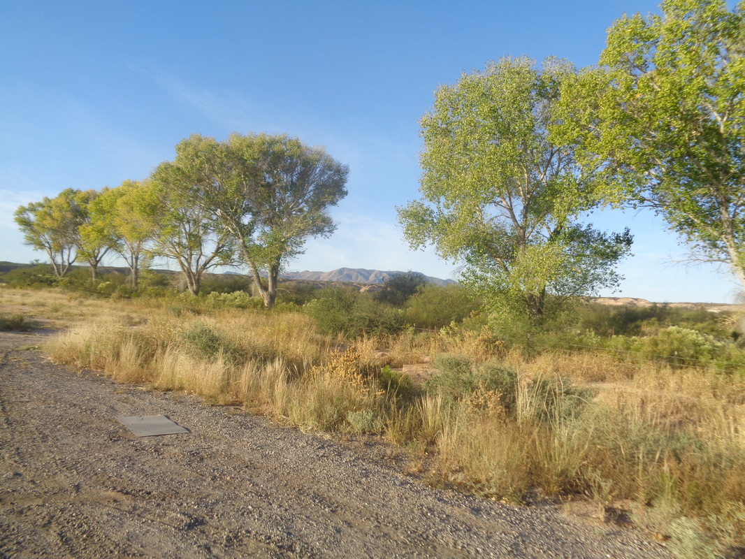
 I've been busy. I returned to Ohio to take care of things but will be back in AZ in a few days. I drove and while taking a different route, discovered the drive is just as boring but at least the first 10 hours is not, only the last 25 hours. More on that soon. I joined a group for a ride out of Benson to ride to..... 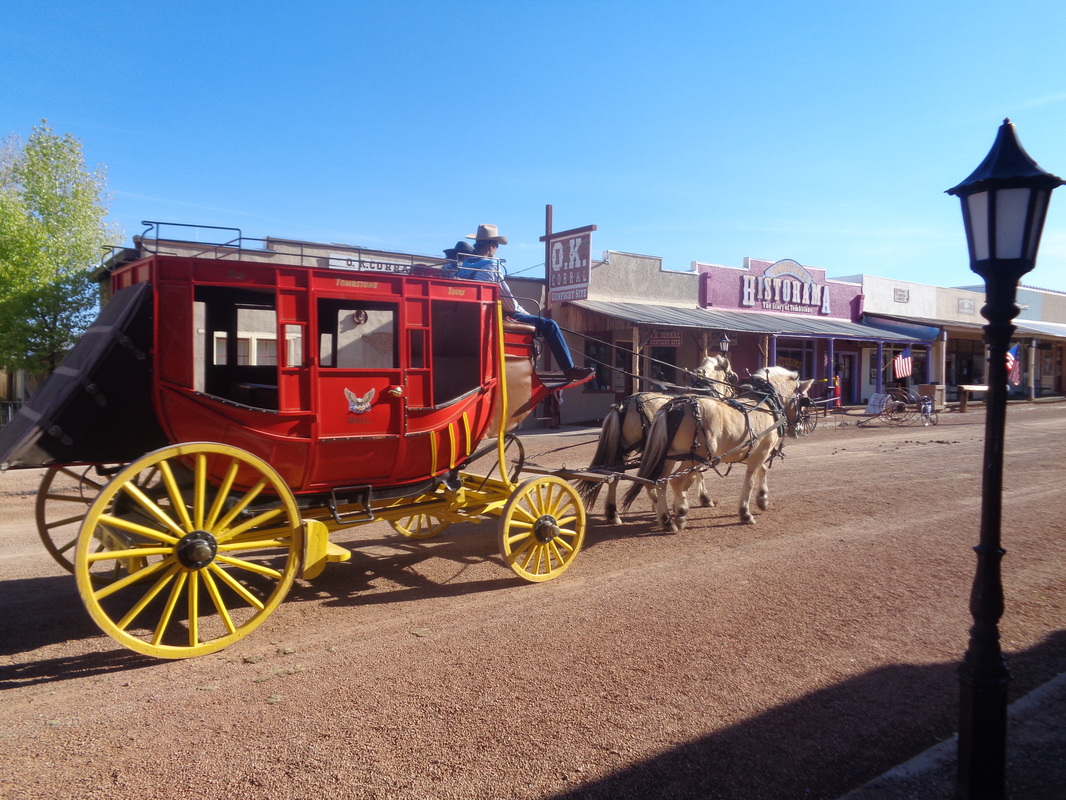 ....Tombstone! How bout that! 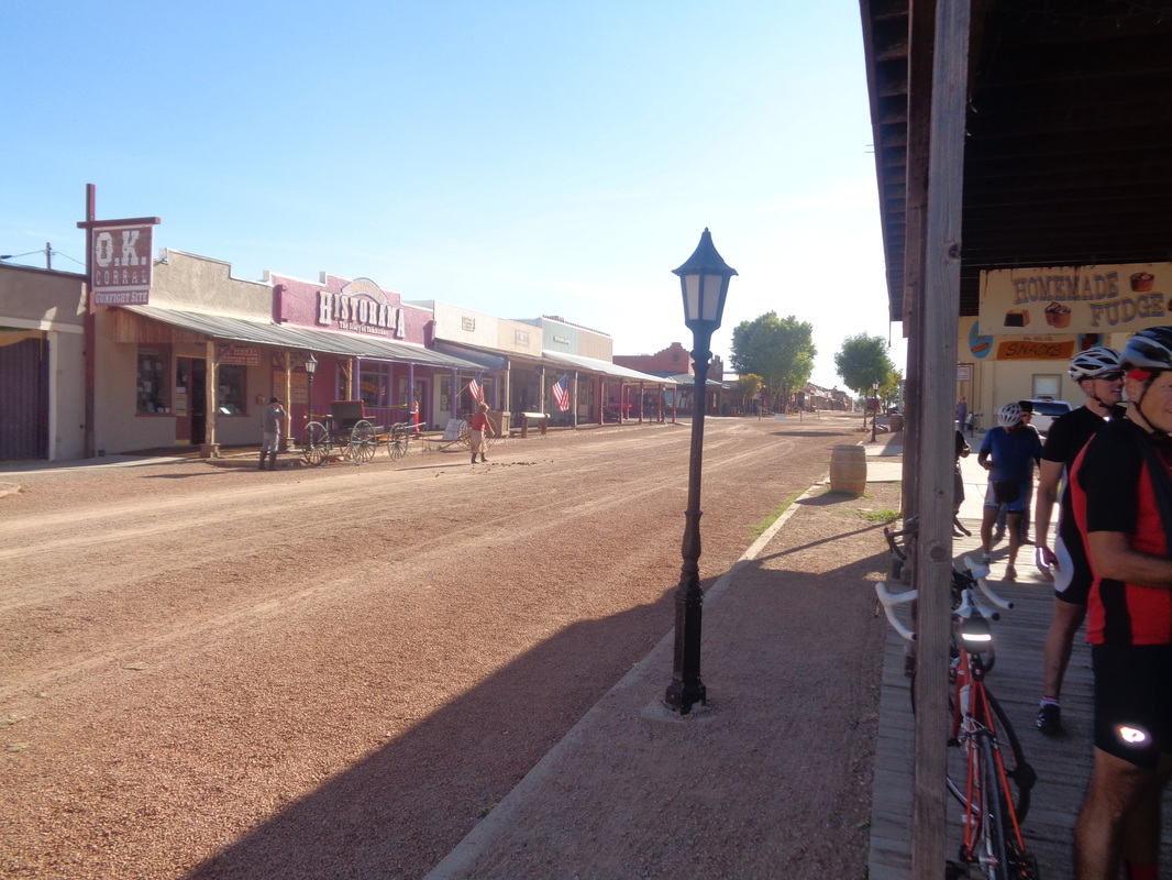 The streets were largely empty. Too early for the gunfighters, card sharks, ladies of the night, etc... 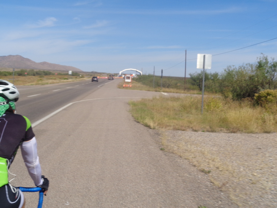 On the return, we passed through a border patrol check point. They waved us through without asking if we were US citizens. 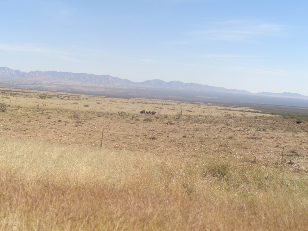 Nice views but noted a small herd of cows were staring at me. 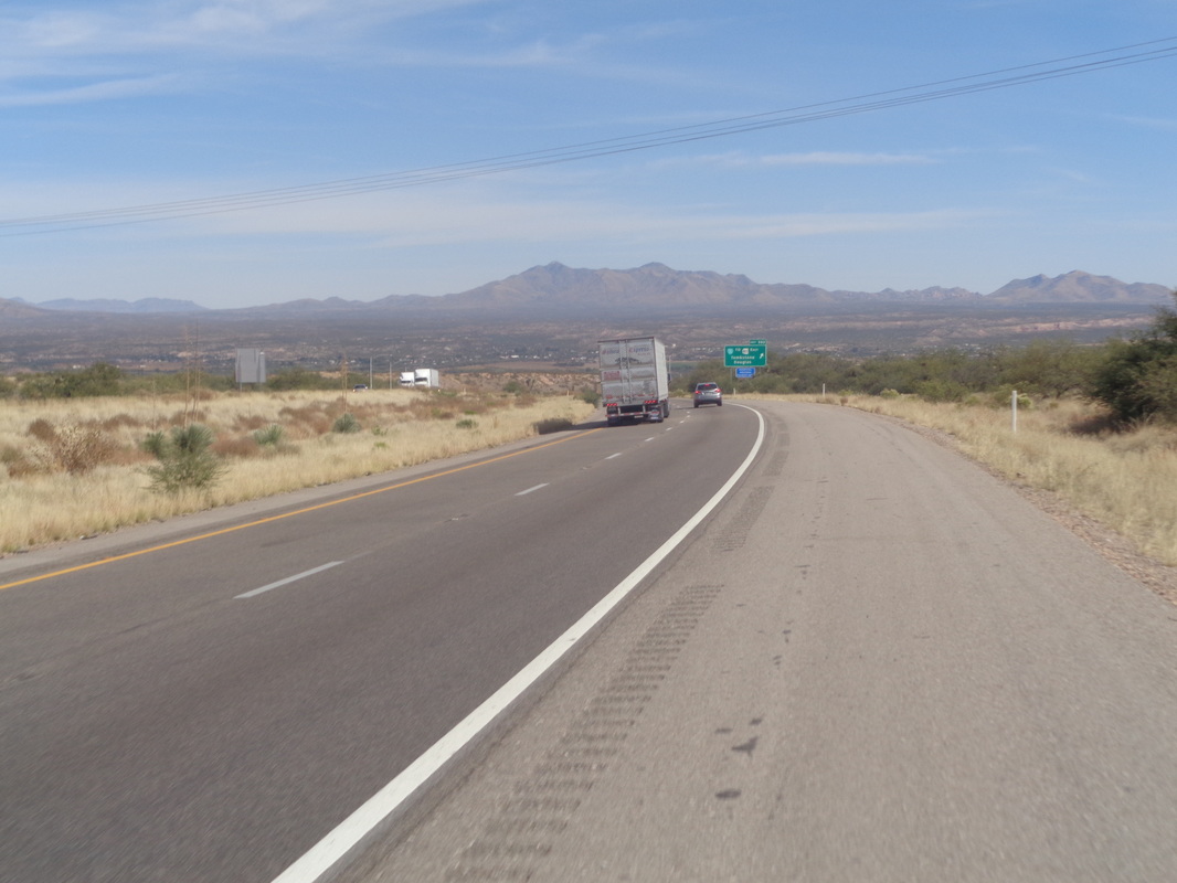 With a mile to go, the route put us on I-10 but it was all down hill so no problem. Finished with 66 miles.
0 Comments
 A moderately paced ride is promised by Mr. Sedluk and he is the rare Riveter who you can trust to rein in the cannibals or at least, release them to the wild while maintaining the promised pace for the others. With that said, it will be a mid B pace, at least. Come out and cut the route short if you want. Wheels rolling at 9:30am from in front of the New Albany Starbucks. https://ridewithgps.com/routes/17402601  A small group of 6 meet at the Pima Canyon trail head at the end of Magee Road to hike to the top of Mt Kimball, the 2nd highest peak in the front range of the Catalinas. We shove off just as the sun rises on a day with a forecast high of 93 degrees. 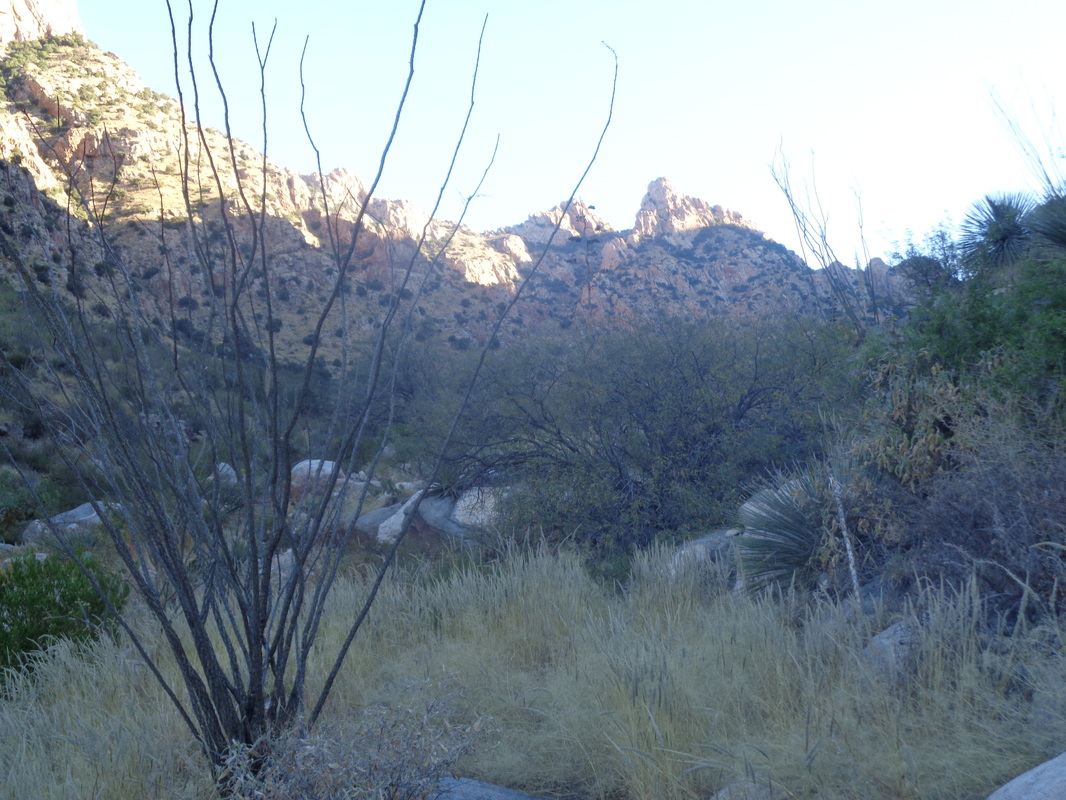 Like all trails in the area after monsoon season ends, the trail is overgrown with all kinds of pointy plants, including the dreaded "catclaw". All of our arms will bleed today despite wearing long sleeve shirts but at least the early start allows us to hike in the shade for much of the way up Pima Canyon. 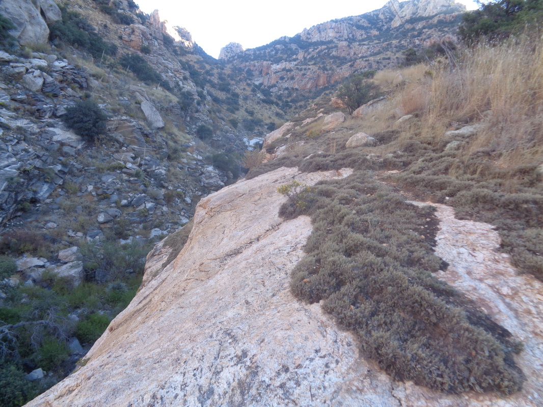 The trail crosses the canyon and its mostly dry stream bed many times but also rises above the canyon floor with brief sections of some exposure. I so much enjoy the wilderness experience with its sights and sounds but also prefer to hike in a group, I suppose for safety. 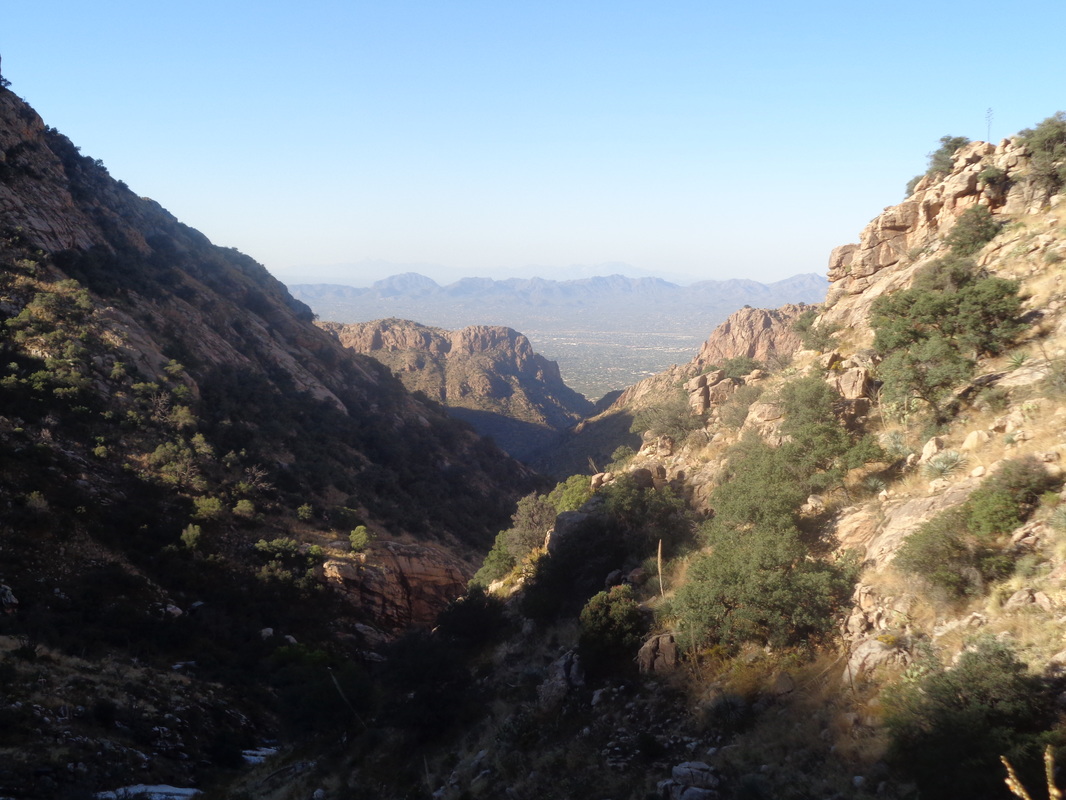 Looking down canyon, the views are magnificent, as always. 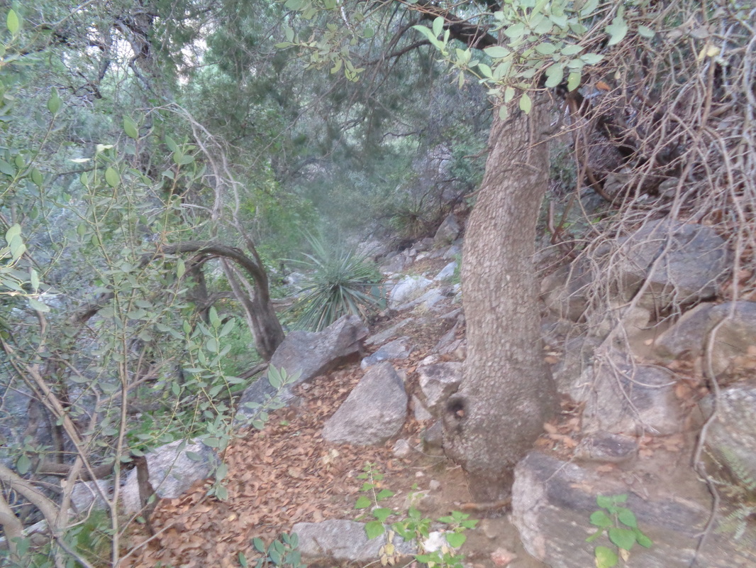 The trail, which is very difficult to follow at times, plunges back into the depths of the canyon and in there, the vegetation is thick but applying common sense route finding, one can work their way forward. 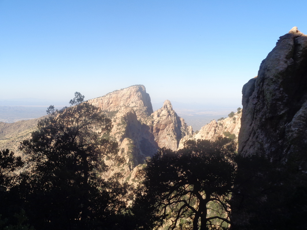 Looking to the west, I could see Table Mountain from a vantage point few have seen as most view it from the other side in Oro Valley. 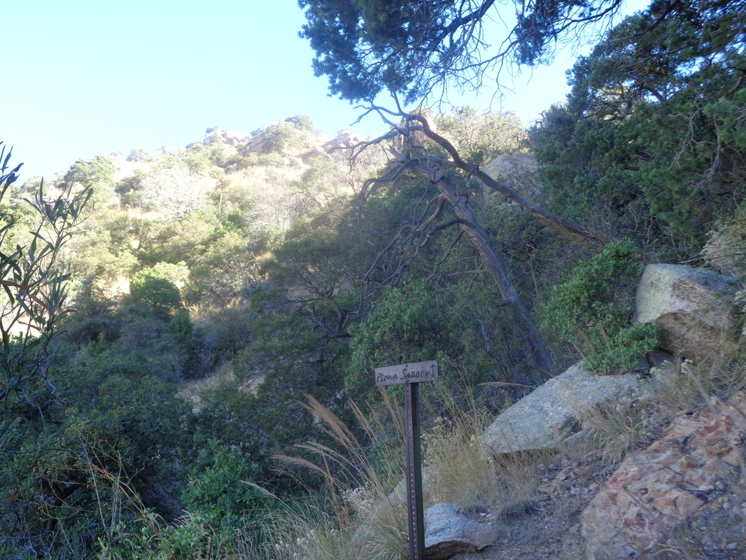 I reached the sign that indicates continuing straight ahead would take me to the Pima Canyon saddle but instead turned to the right to follow a trail that, rather than climb steadily up as the previous 6 miles had, traverses in and out of drainages on a horizontal trek. Of course, that did not last for long and once again the climbing continued as it took me.... 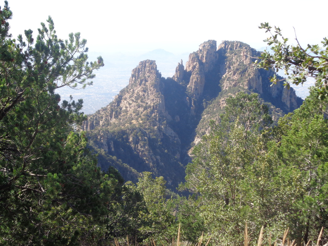 ...to the north side of Finger Rock. Very cool as I have never seen it from this angle. 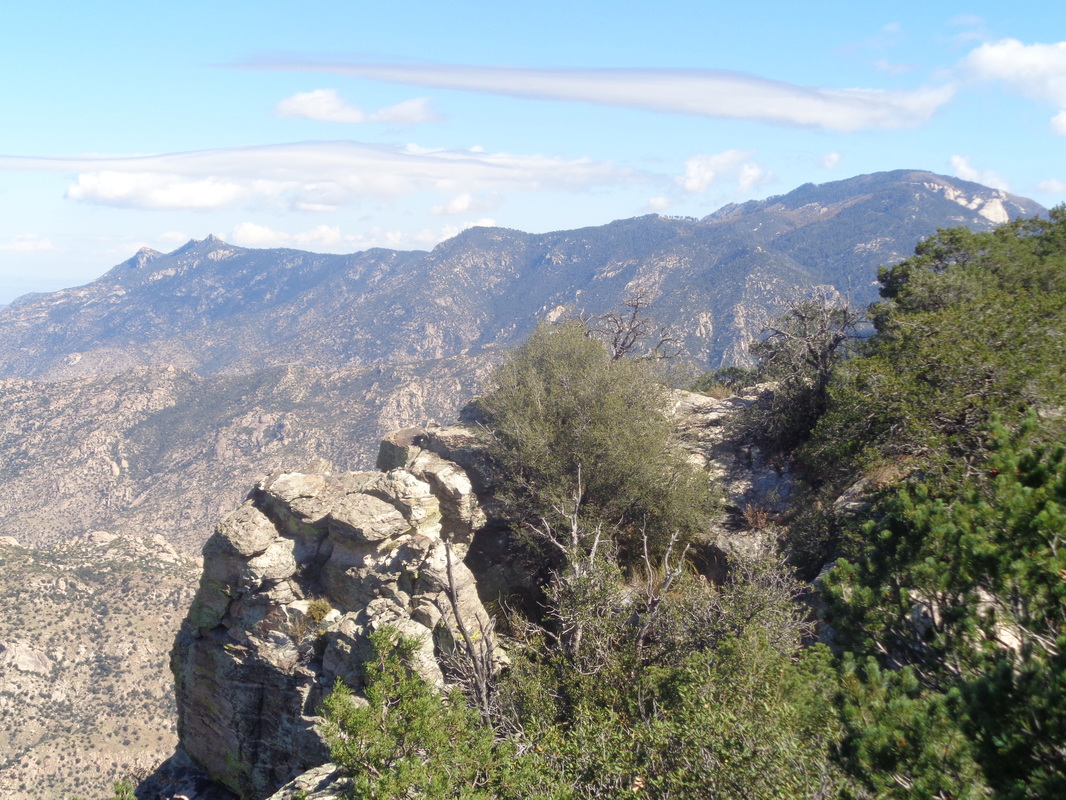 Later, I see the above image with a view of the top of Mount Lemmon and some interesting clouds around the peak. As high as I am now, near the summit at 7300', Lemmon is at 9300'. I look southwest and see..... 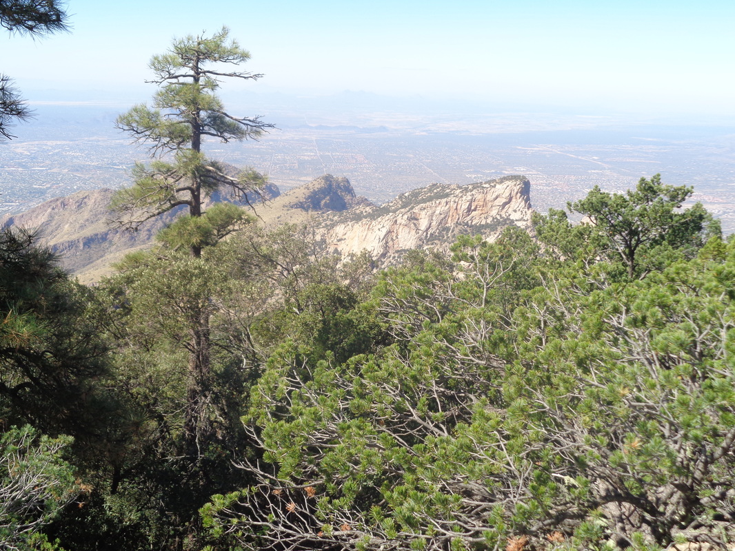 ....Table Mountain again but now well above its peak at 6300'. To its left is Bighorn Mountain and behind the truck of the pine is Pusch Peak. 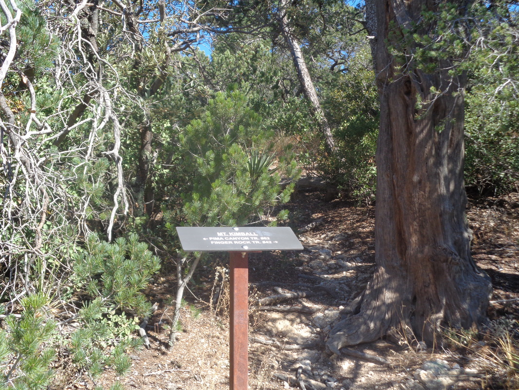 I reach this sign post that indicated a left takes me to where I have come and to the right I would eventually reach Finger Rock Trail. I plod forward to what is the most anticlimactic finishes in these mountains. 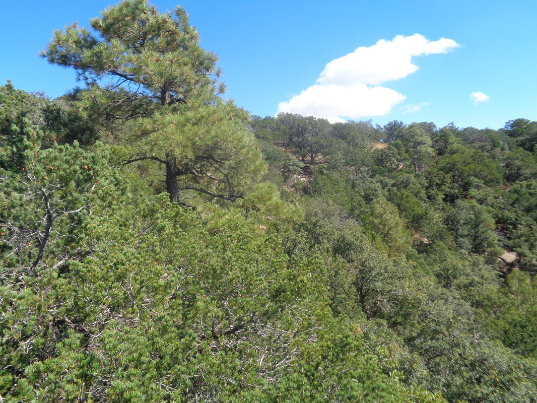 Usually the summits around here provide grand views but I climbed a boulder to take a pic of the Kimble summit to demonstrate, this is different. Putting in the effort to hike 7 miles while gaining 4500', underwhelming is the summit experience. My companions had decided to turn around prior to reaching the peak and upon discovering this, I picked up my pace to catch and overshot a turn in the trail. Ordinarily this would not be a problem except I found myself sliding down a slope to the bottom of the canyon. It was dark in there and I admit, a twinge of skairtness crept in. I thought about just continuing down the dry stream bed but frequently, you encounter a cliff or obstacle so I turned my attention back to the wall. Hmmmmm.... 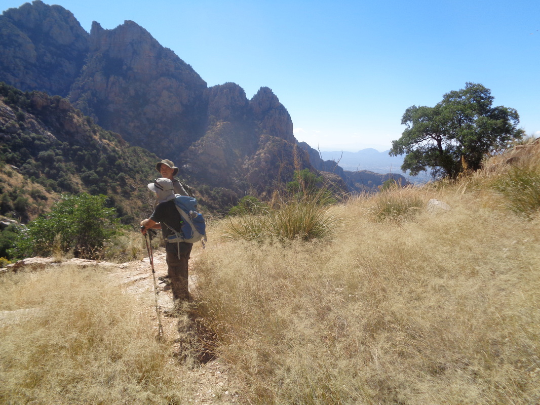 .....hey! I climbed out, encountered the trail and finally, caught the group. We continued following the trail and finished with approximately 14 miles. Long day but always fun and challenging. 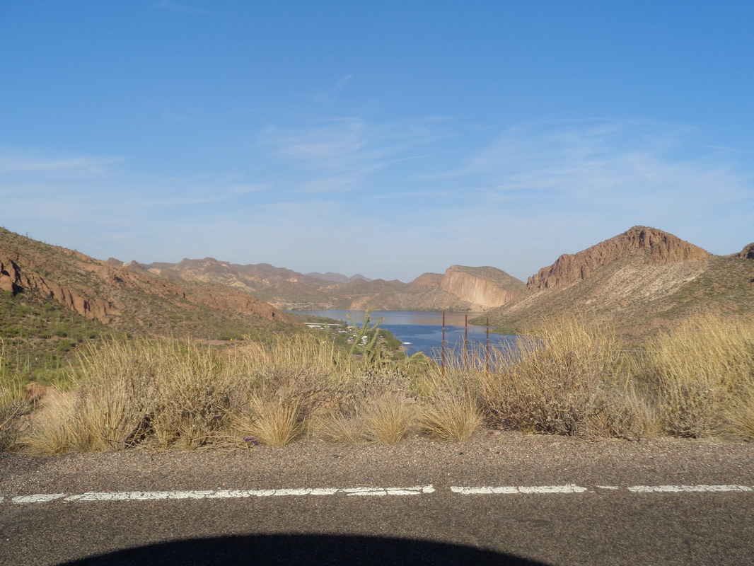 If ever you visit southern/central AZ, you must drive this route. St Rt. 88 originates in Apache Junction and is roughly 40 miles in length while passing Canyon Lake and then..... 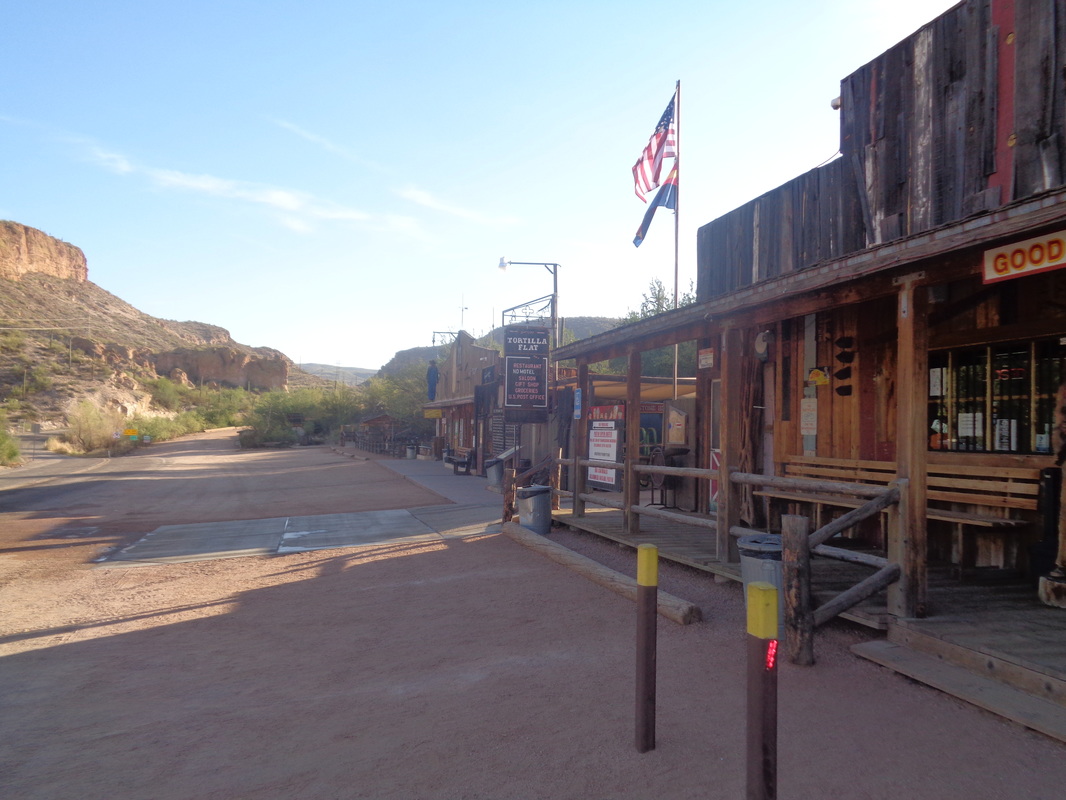 ....Tortilla Flat. There is a gift shop, restaurant/bar and be sure to stop for ice cream. The paved portion of the road continues for a couple more miles and then..... 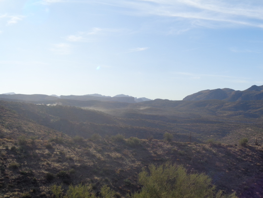 ....the cloud of dust above signals the start of the dirt portion of the road, about 25 miles of it. During the ensuing miles, you will pass Apache Lake and Roosevelt Lake, all fed by the Salt River, which passes through Phoenix but is long dry by the time it reaches that city. 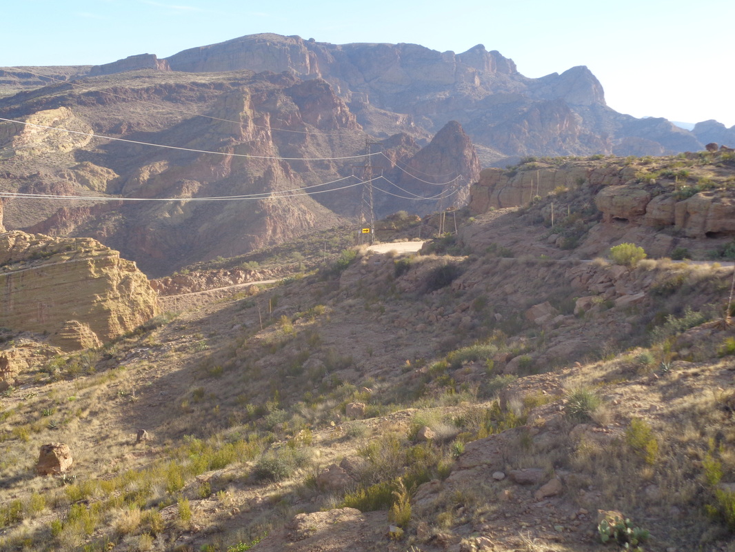 The views are magnificent, of course and you will pass a few parking spots where you can stop to walk a bit and take pics. 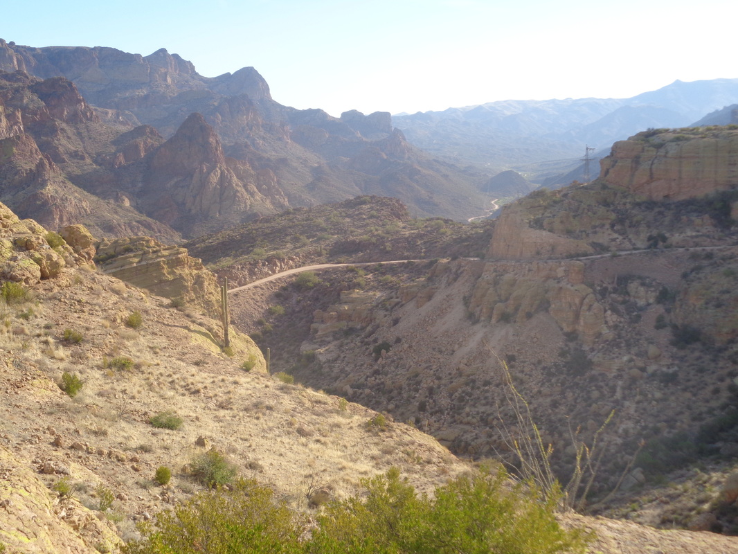 The dirt road is broad enough for two cars to pass in most, but not all places and then you hit the 1500' descent of Fish Creek Hill. The pucker factor is way up there as other than navigating the turns, you must be cognizant of oncoming traffic coming from on of the lakes because in many places, two cars can not pass. 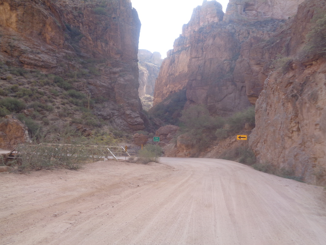 At last, I reach the bottom of Fish Creek Hill and cross a one lane bridge. Incredibly..... 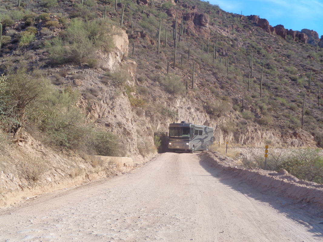 ....I see the above. Rental companies forbid RVs from driving this road for good reason but this is a bus! The driver waves for me to stop and asks how much farther to pavement. I tell him his bigger challenge is navigating that hill. Fortunately, 95% of the traffic is going with him as this is a Sunday but if a Friday,.......the chaos on that climb with all the incoming traffic would be impossible. I thought about turning around to watch but continued on. 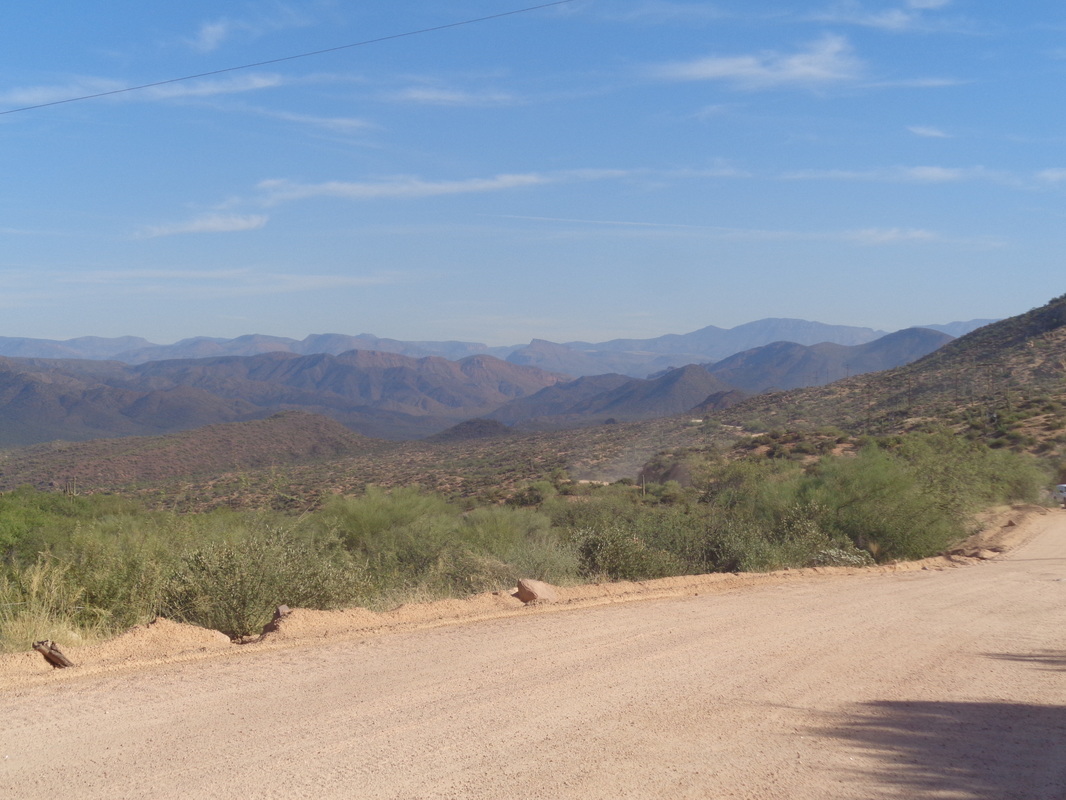 Oh my, mile after mile of long range views. 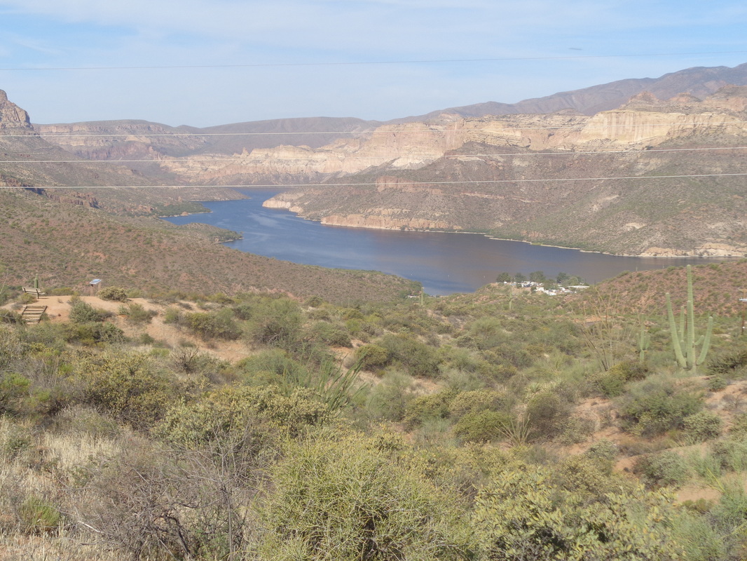 Apache Lake passes to my left and then, an unexpected sight.... 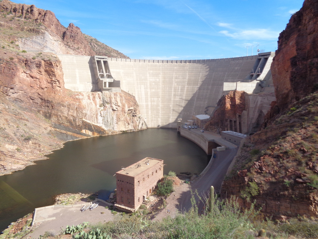 ....Roosevelt Dam. Here the road is paved and that is a good thing because I'm ready for smoothness. I don't know what was my average speed for the dirt portion but probably 20mph. 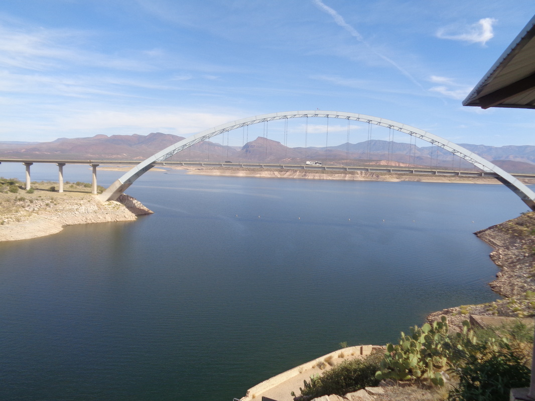 Another unexpected sight, a bridge that takes one across the lake via #188 but I continue south and almost immediately..... 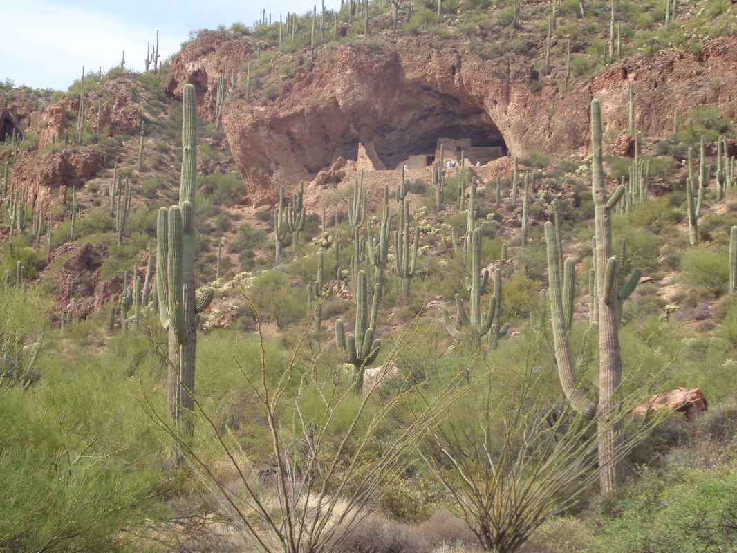 ....reach a park with a cliff dwelling. From Oro Valley/Tucson, it was a 7 hour drive but the scenery makes it worth the drive and with all my hiking/cycling, only about half of which I have presented here, I needed a day off. 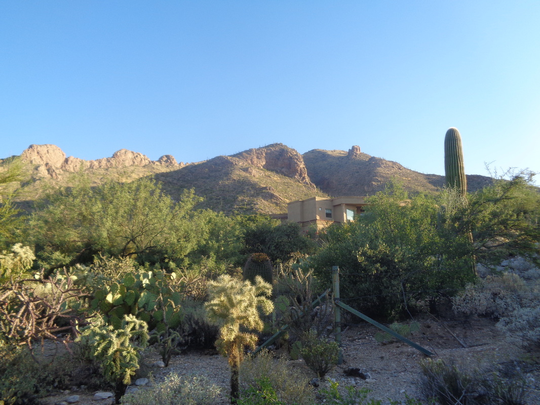 Another beautiful fall day with calm winds, sun and a forecast high of 92. Today's destination, slightly right of center that thimble shaped thing. This is also the way to reach Pusch Peak from the southeast but I did not want to go that far today. 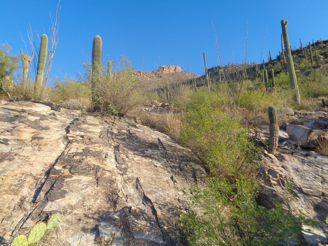 At about mile .55, following the Pima County Trail, I reach this slab and head toward a ridge to the right of the spine. This is off trail so I proceed slowly, always watching where I place my feet to avoid you know what. There are a few cairns but it is best to ignore them, just strike out for that ridge. 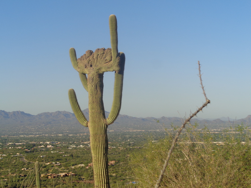 How about that? A rare crested saguaro. I have read they number about 1 for every 200,000 saguaros. Check out that blue sky and the Tucson mountain range in the distance. 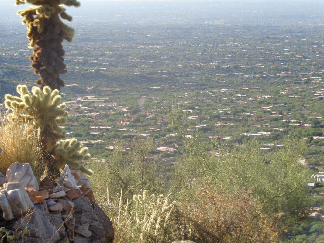 A large pile of quartz and other rocks I took to signal this meant to go straight up to the ridge and so I do. 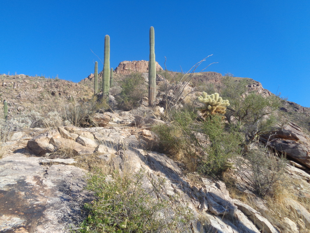 For those who find this page in search of info about this hike or the off trail way to Pusch Peak, just stay on the ridge. If you dip below it to the right you'll fall into Pima Canyon and to the left, it is very brushy. Now, true..... 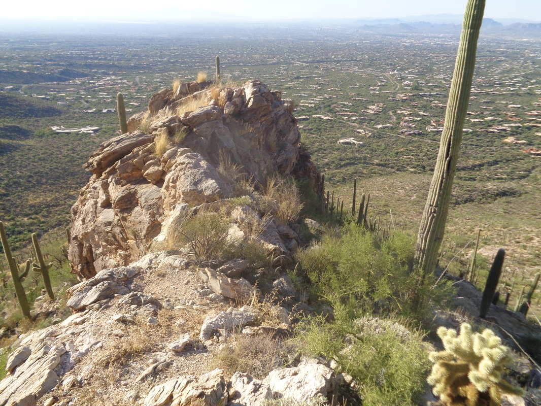 ....the ridge gets a bit narrow in places but nothing that can not be navigated unless you are a complete klutz. Being a borderline klutz, I am very careful. 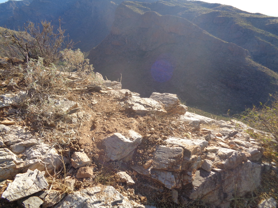 Whoaaaaaa. At this ledge, there are copious quantities of animal droppings, the type of which I have not previously seen. Must be bobcat or mountain lion. Oh great. As I rise, am I herding a herd of lions? Of course not but still, made me wonder. 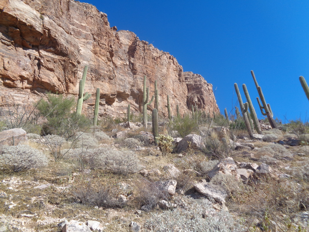 As I approach the right side of the spine, the scree is thick and with the steepness of the slope, difficult to climb. Note, there is no access to the spine or Pusch Peak by going to the left side, work your way to the right. As I reached the base of the spine I discovered...... 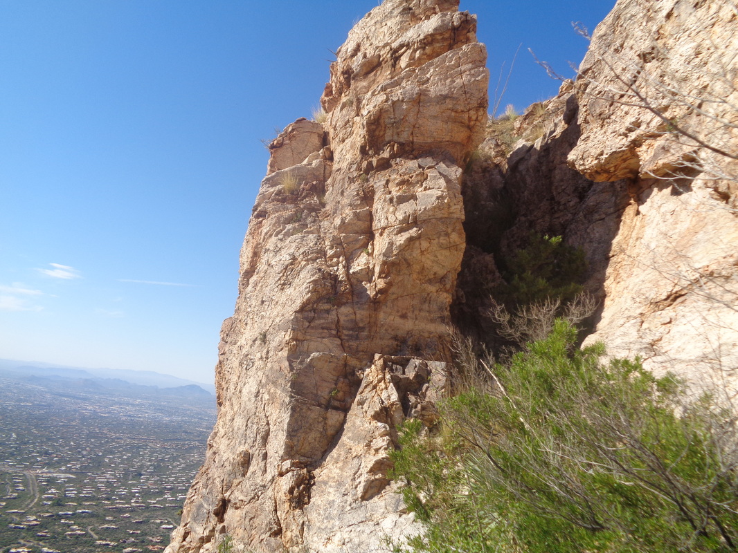 ....how about that, a chute that may provide access to the top of the spine. The image makes it look so easy but it was at least 40' and steep. Dare I climb that.....probably I have driven a herd of bobcats to the top of it so I proceed to the back of the spine and walk a bit farther..... 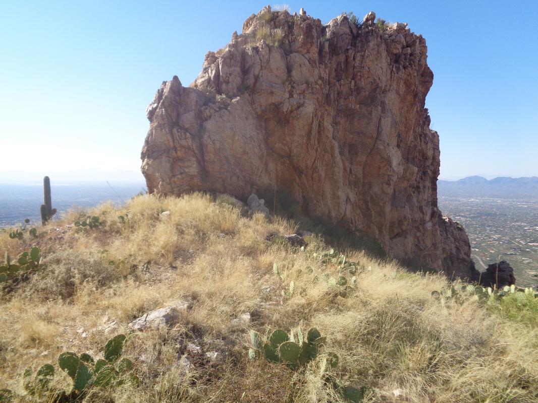 ....where looking back, the spine looks so insignificant. I hate that about images. I walk back to that chute and..... 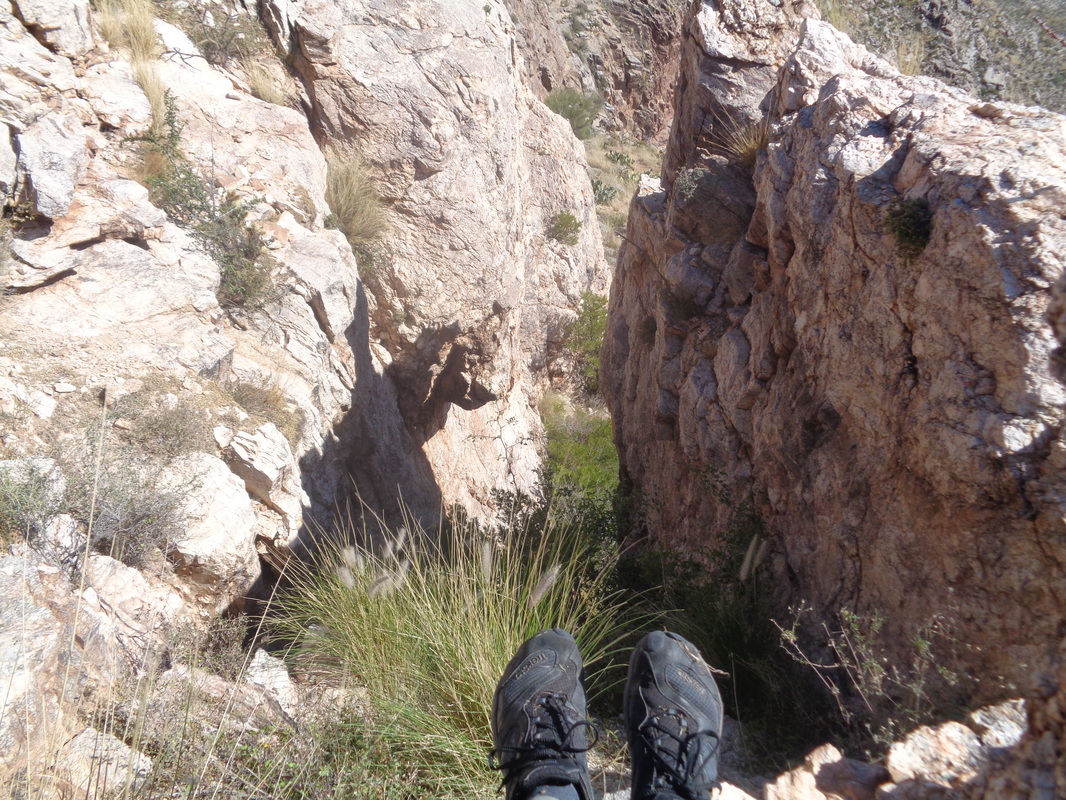 ....climb it to the top. Exciting to be honest. It's a long and kind of...... 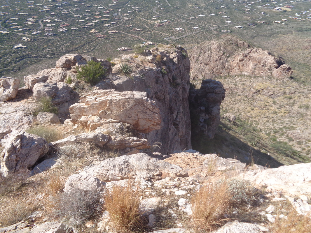 ....broad area but clearly, the other end provides no access. Also no critters. I hang around taking lot of pics, carefully descend the steep chute and.... 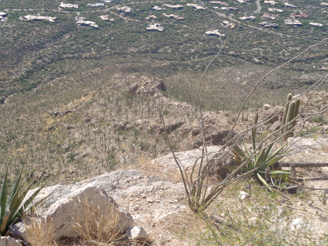 ....begin the descent via the ridge. The forecast called for the possibility of afternoon showers in the mountains and it did seem a lot more humid and sure enough..... 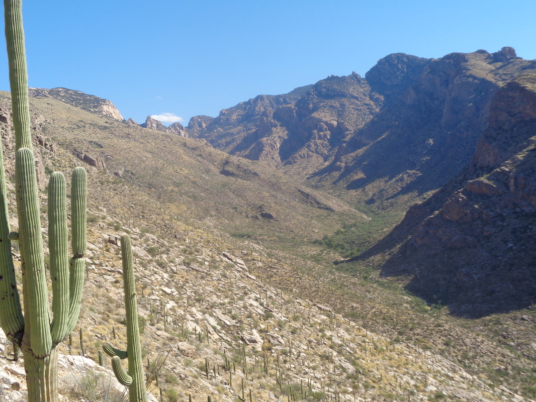 ....the cloud began to form but doesn't look like there is much precip in that lone white cloud. After departing the trailhead, there is that half mile to where you depart the trail and then one mile to the spine with a total elevation gain of 1200'. Fun hike.  It seems all my hikes start either standing at the edge of a canyon and plunging into an abyss before grinding out a return or standing at the bottom of a mountain and grinding up hill to a summit before plunging down the mountain. This would be different in a lot of ways as it turned out. The trail crosses a wash and takes a serpentine route past....  ......Dove Mountain Resort. 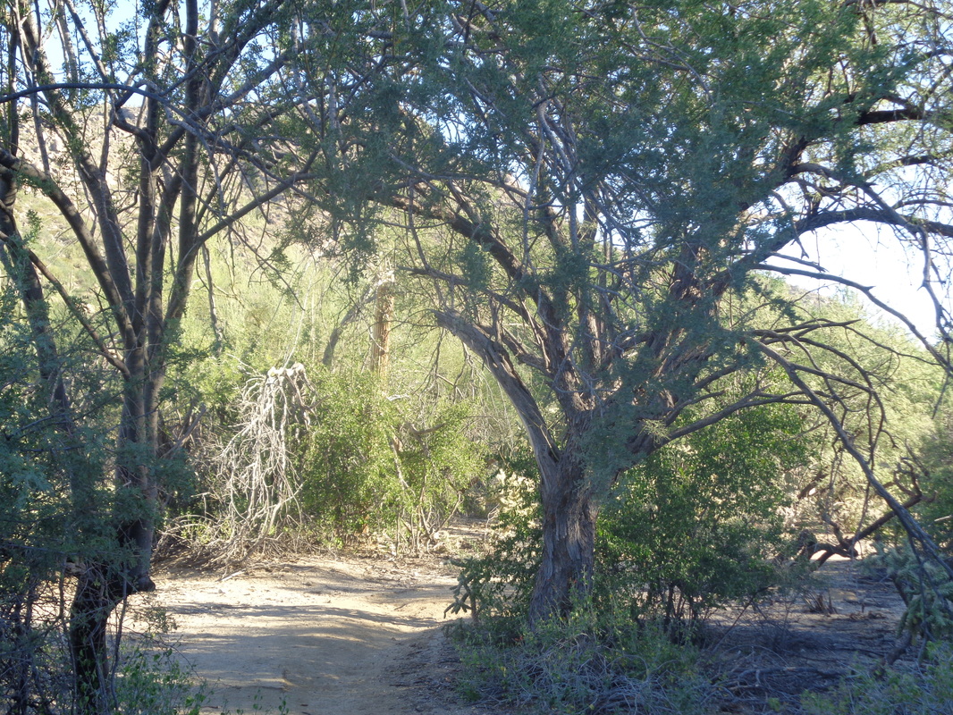 In or bordering the wash, the trail passes a variety of types of plants but always.... 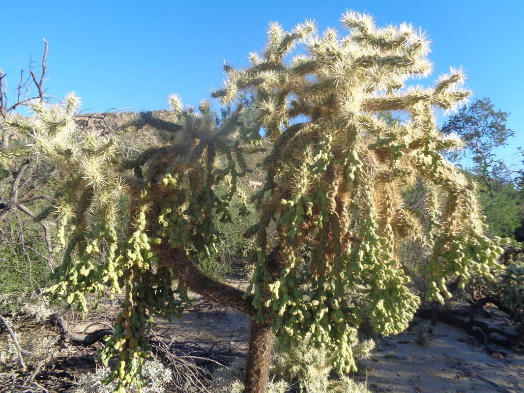 ....lots of varieties of cactus. 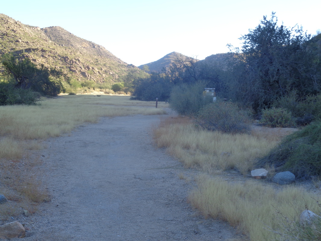 The trail stays flat until it begins a steepish climb to a plateau, follows another wash before a 2nd climb to another plateau. 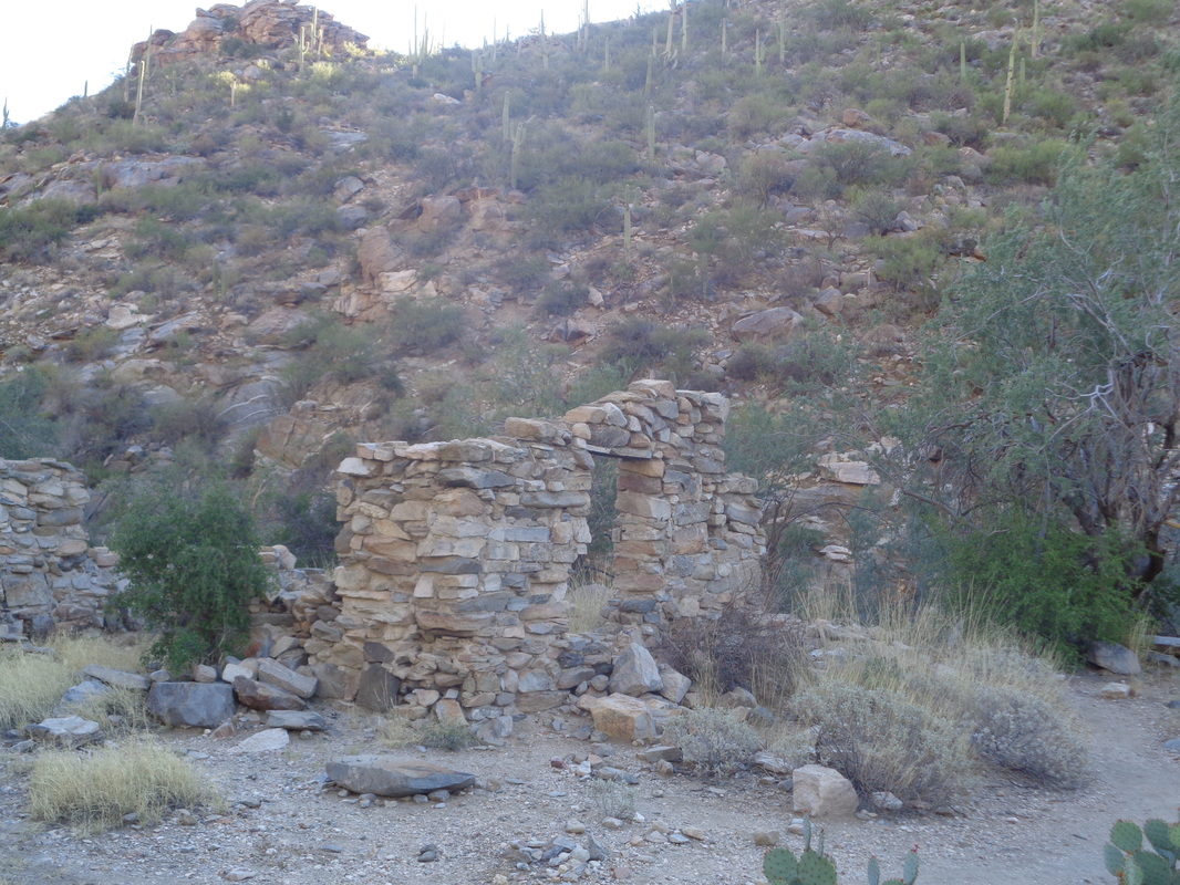 Prior to the first climb, the trail passes in front of an old building. 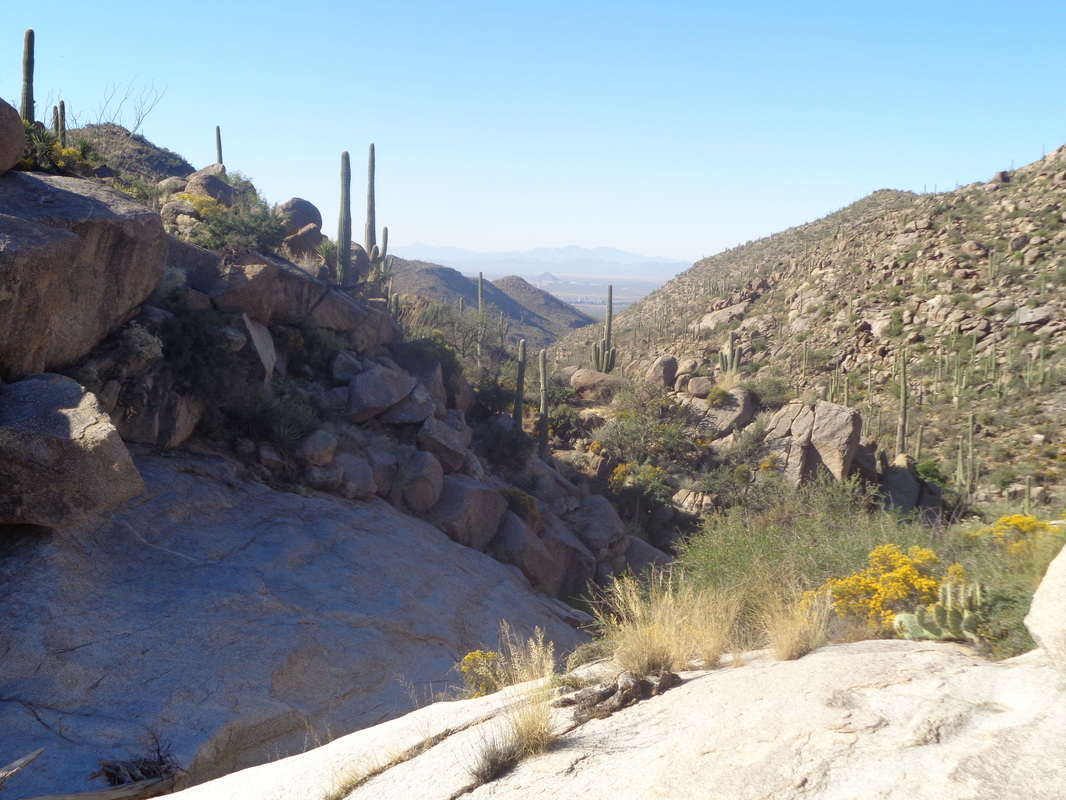 Arriving at the top of the 2nd climb, there is a bench but the stench of a half eaten animal makes it impossible to linger. Now the trail undulates in and out of side canyons while gaining some elevation. I hear something behind me and.... 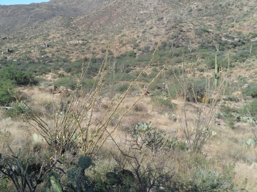 .....see two cowboys with 3 dogs. They eventually overtake me, sometimes walking on the trail, sometimes off. They locate a group of cows and drive them to a...... 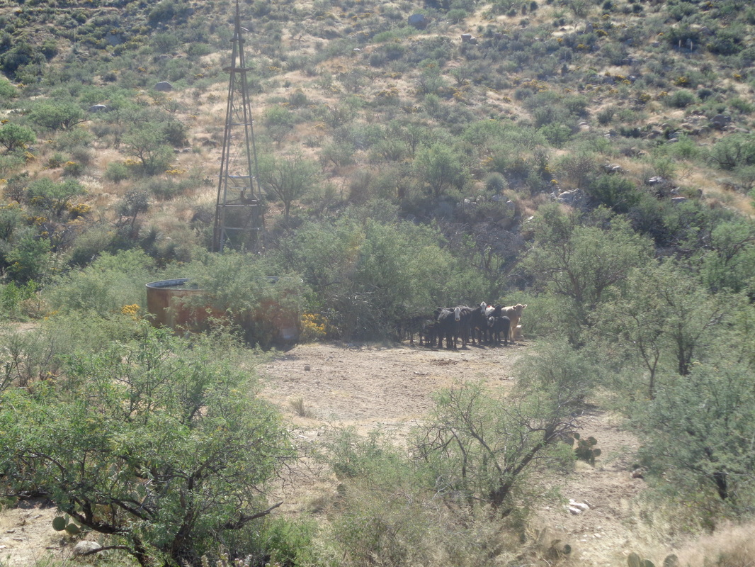 ....water tank. The trail crosses near the herd before climbing a small hill. I turn to watch as, with my passing, the herd is prodded at a 90 degree angle from me to my right. I note a huge cow leaves the group and follows the trail, toward me. I looked to see if the guys or dogs noticed the departure but they did not. The cow plodded toward me so I stepped off the trail to let it pass. I brought my camera up and waited for the cow to round a bush that was obstructing my view. The cow was at least as tall as me but it is a cow and I don't recall there being any reports of cows being man killers. I glanced to my right and now a cowboy noticed what had happened and he screamed, "Move!" while waving his arm at me..Uh oh. 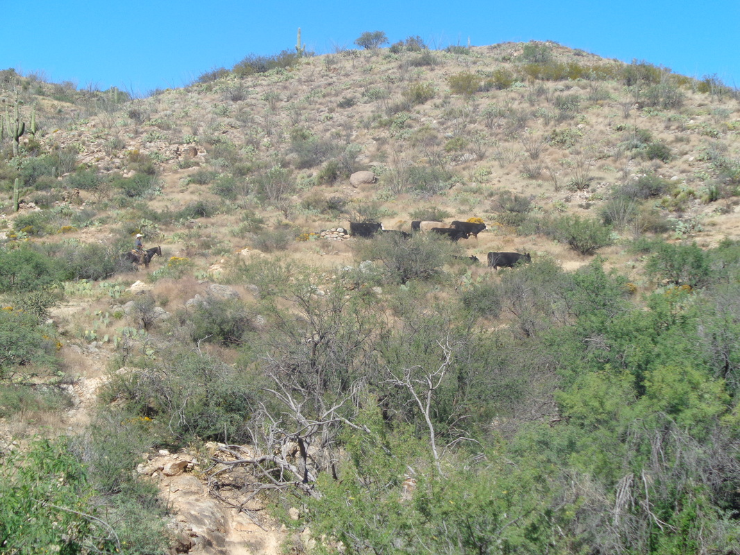 I began walking briskly and after a few steps, glanced back and the cow was matching my speed. I looked around for a tree or something to put between myself and it. I reached a broad grassy area and the thought of being mounted by a cow caused me to begin running....sprinting actually. Whew! The lumbering beast lost its interest in love or at least lacked the stamina to pursue. Now at the 6 mile point in the hike, I turned to watch and then tentatively retraced my path to the water tank. All clear. I then...... 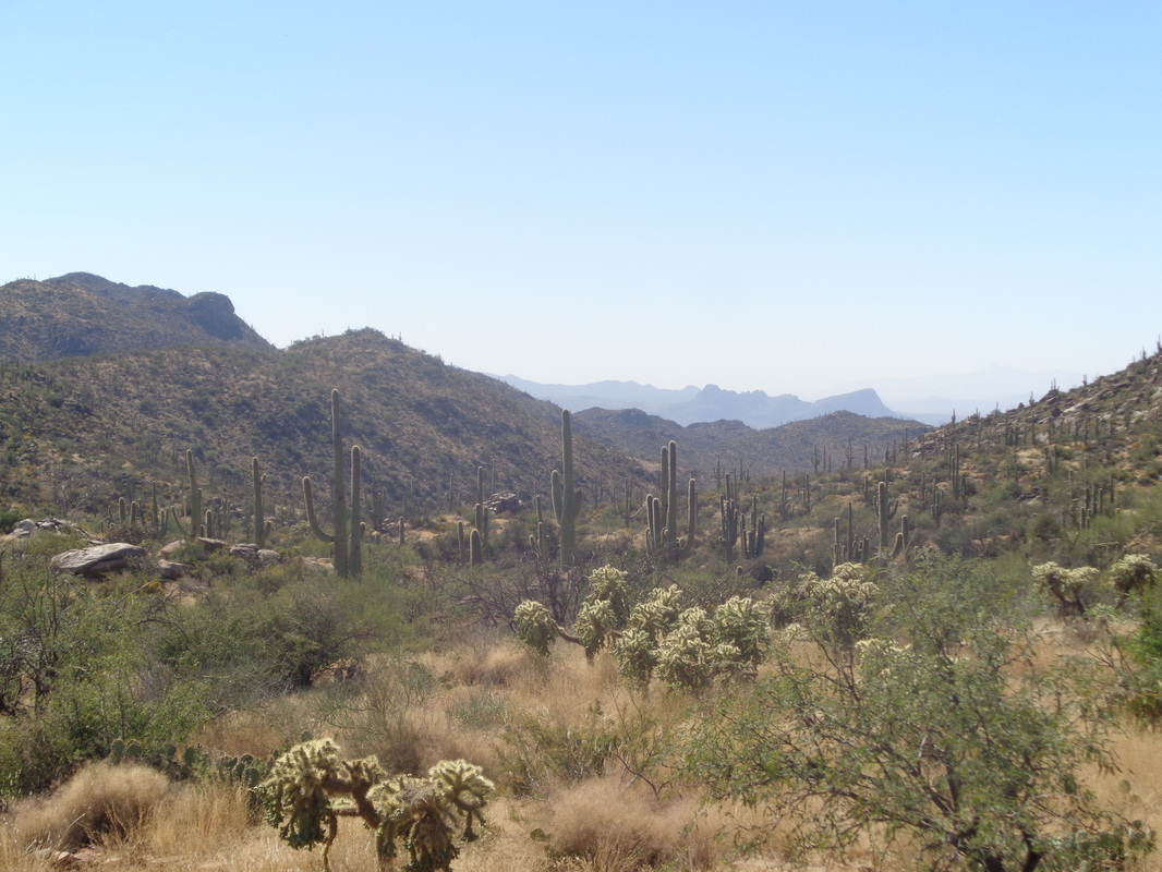 ....headed back. As if I don't have enough critters to worry about, now I have to add cows to the long list. The only ride so far but I suspect another will pop on screen soon. Pumpkin Show (Saturday Roving Ride) Saturday, October 22nd, 9 AM Class A,B,C 52, 58 or 68 miles (longer options are hilly) Don’t miss this fall classic to the 109th Circleville Pumpkin Show. See the Great Pumpkins and sample pumpkin pie, pumpkin chili, pumpkin cider, pumpkin fudge, the famous Lindsey’s pumpkin donuts and more. Bring a lock to secure your bike while visiting the festival. Meet at Cyclist Connection Bicycle Shop, 200 Cemetery Road, Canal Winchester. Follow Route 33 east and exit at Gender Road/Rt. 674. Turn right, then left at the traffic light onto Waterloo Road. Drive past the Wal-Mart and turn left onto Win-Cemetery Road. Maps provided - No fee. 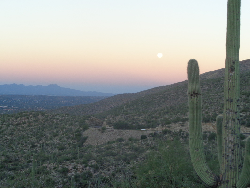 Some of you are searching for info about accessing Cathedral Rock via a trail other than Esperero out of Sabino Canyon. Nothing on the usually reliable site, "hikeAZ" or elsewhere. Looking at the map, it appears driving to the top of Mount Lemmon at 9157' and departing from the Mount Lemmon trail makes some sense as CR is at 7957' the high point in the front range of the Catalinas. I'm not dumb, I knew there would not be a gentle ridge trail that would take me from one peak to another but the idea had a lot going for it. At that elevation, vegetation would not be the huge issue it is at lower elevation after the monsoon. The temp? About 90 in the valley but up here, 47 at the start wiwth a high of 71. I decided to check it out, departing from our place at 5:45 which put me on the slopes of Lemmon for moon set and sun rise. Above from the parking lot at mile 2.5 up Catalina Highway. 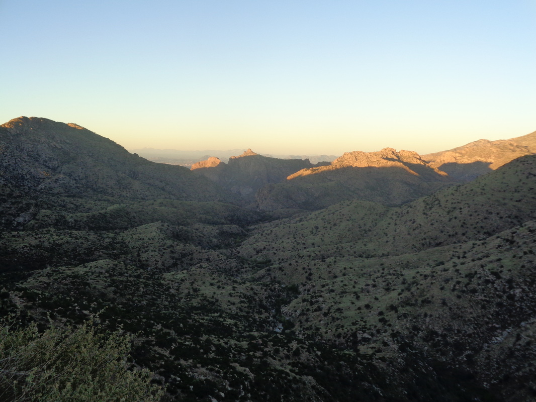 I was obligated to stop at several pull-outs as the view of the sun casting early light was spectacular. Eventually, I made it to the top of the mountain and was stunned to find the parking lot full and vehicles alongside the narrow road. At least 25 at 7:15am. Good, I like the idea I may meet people and exchange info. As it turns out, I saw only 1 person until my return. 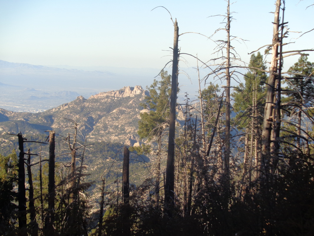 Soon after shoving off with the necessities and 4.5 liters of fluid, Cathedral Rock/Peak comes into view. Plenty of evidence still of the.... 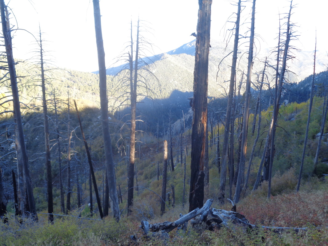 ......2003 Aspen Fire but lots of Aspen growing to take their place. Down, down I go. I set some limits; if I had not reached my destination in 4 hours, turn around. If I descended for more than 7 miles, turn around because the return would be brutal, similar to hiking from the Colorado River to the south rim of the GC. 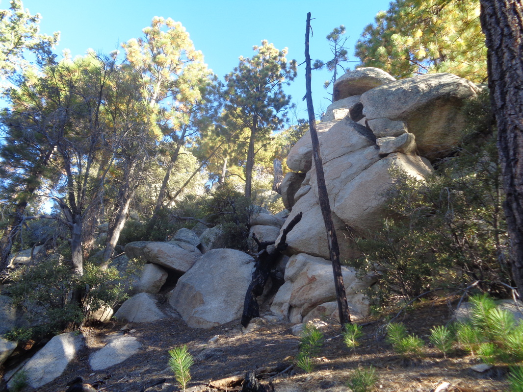 I hike through fairly steep slopes and enter a boulder area that appears to be a natural habitat for lions. I am now in the..... 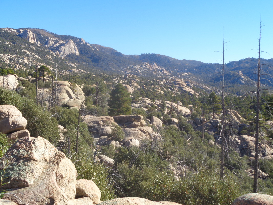 ....area know as the Wilderness of Rocks and eventually reach the junction having a trail by that name. I continue where a brief ascent brings me to this..... 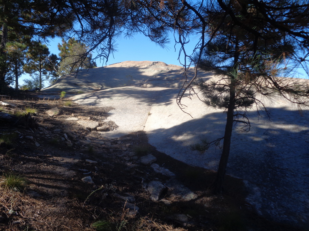 ....intriguing spot. Hmmmm, that expanse of slick rock could be a great vantage point to see what lies beyond and WOW.... 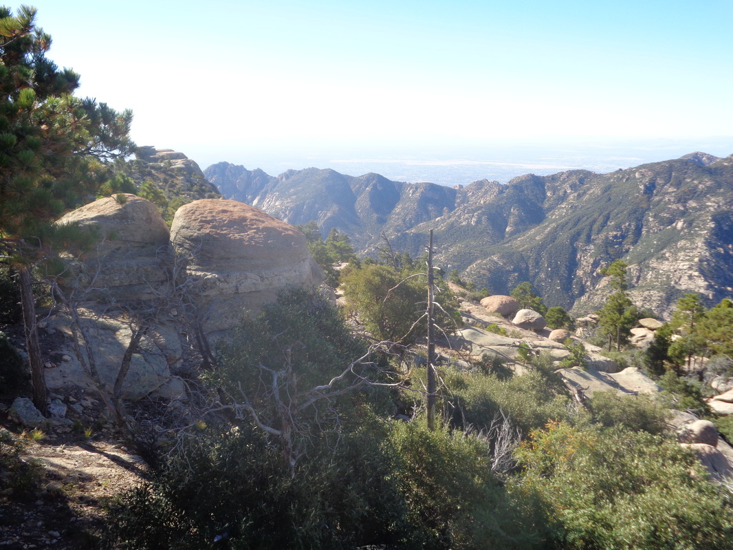 ....was it!!! Some of the best scenery I've seen with expansive views to the south and.... 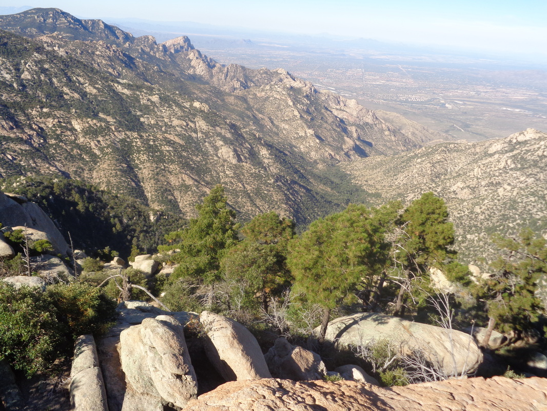 ....northwest down Romero Canyon and of course directly across was Cathedral Rock. Awesome. I continued down, another mile and about 1300' of drop to arrive at Romero Pass. 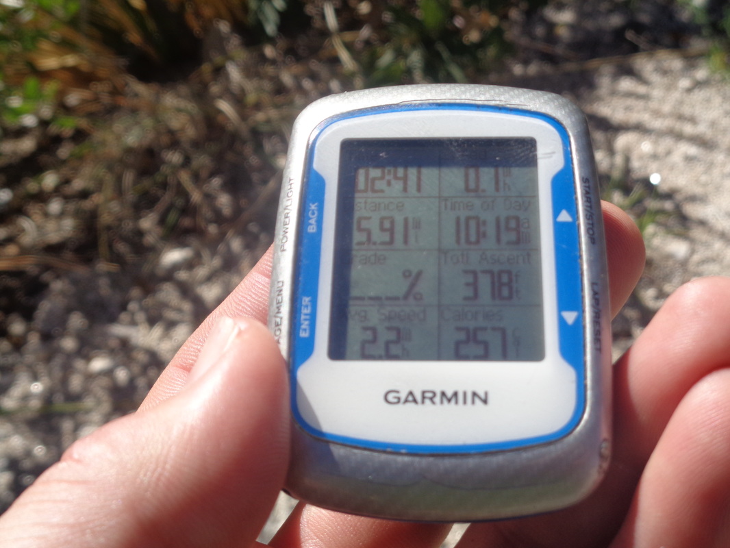 I had come almost 6 miles, practically every step going down other than 378' of climbing. I figured I had lost 3000+' and judging by the map, still had another 1500' of descending before ascending to Cathedral Rock. Clearly, while the trail was in good shape and easy to follow and the moderate temp welcome, the traditional route coming out of Sabino Canyon is "much" easier. In this case, there is about 1500' of extra climbing doing this route to CR and a mile longer then compared to starting from the other side of the mountain out of Sabino Canyon via the Esperero Trail. 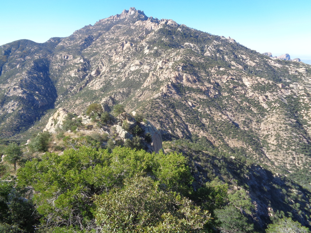 At Romero Pass, looking up to Cathedral Rock. The other point is, this network of trails is not intended to take you to the peak of CR. If it was, you'd start switch backing up this and be at the base of the peak in probably a mile. Staring at the slopes, there is no doubt from this point you could reach most of the way and then circle to the east side where there is access but of course, no time for that. 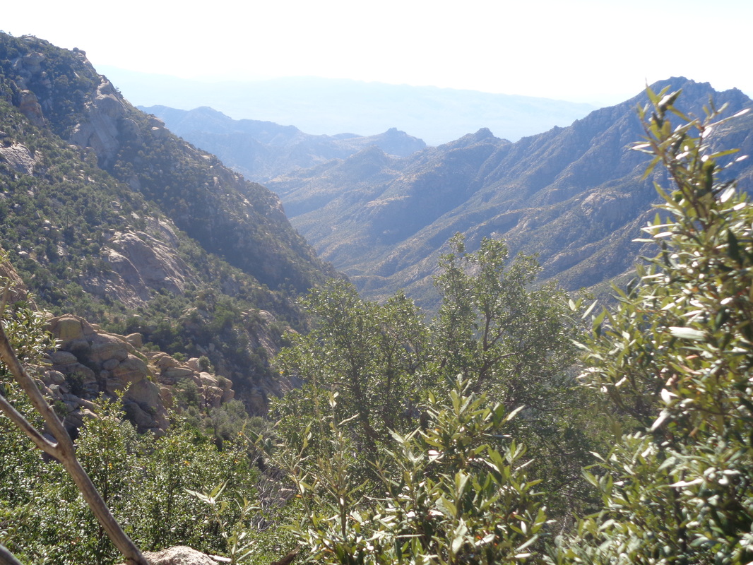 I took another look down canyon where the West Fork Trail descends and where, after about 1.5 miles you'd hang a right at Cathedral Rock trail and begin climbing but as noted earlier, the trail does not go to CR but passes it where at a saddle, you go off trail and ascend to the peak. 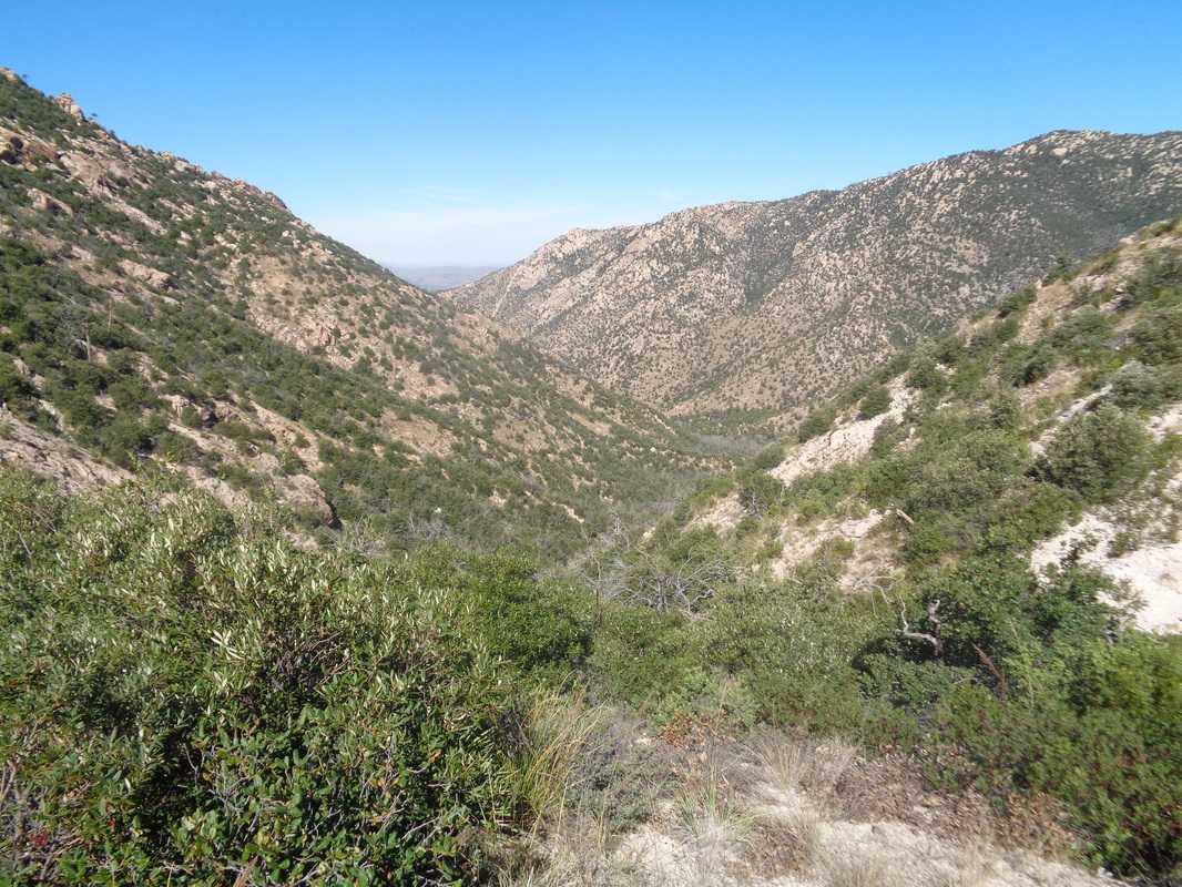 And of course, a last look down Romero Canyon and begin the long slog out. 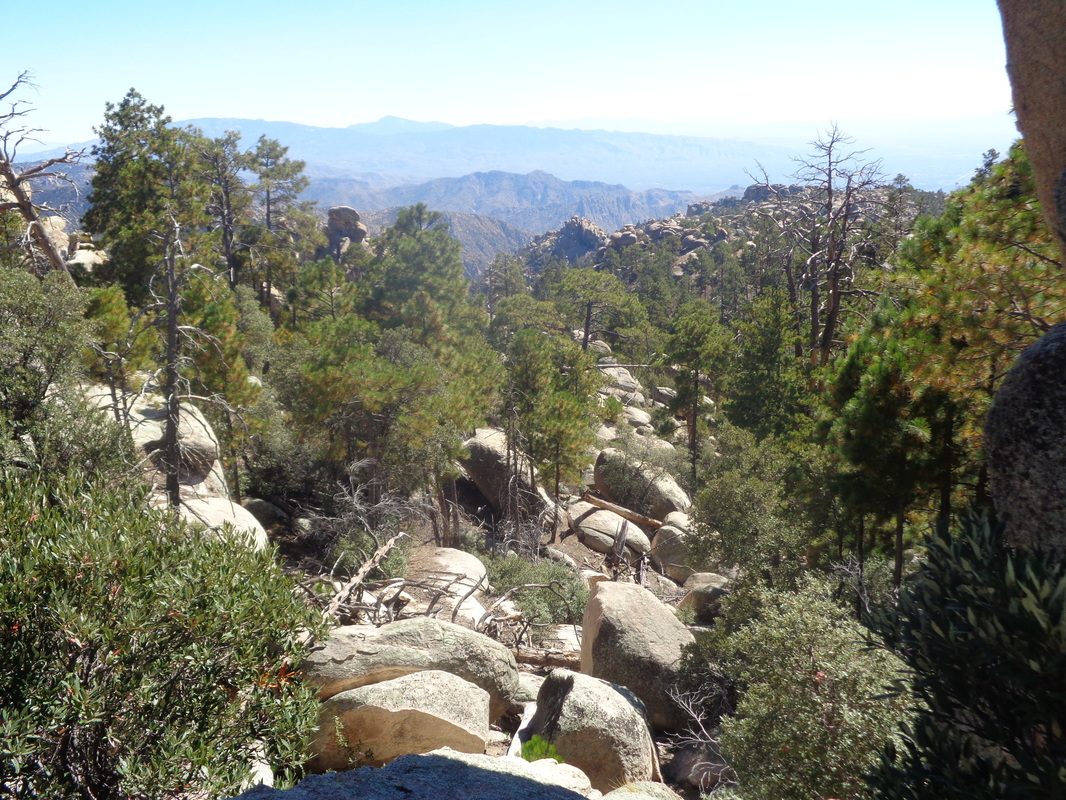 I take my time and enjoy the views, almost always trail side. 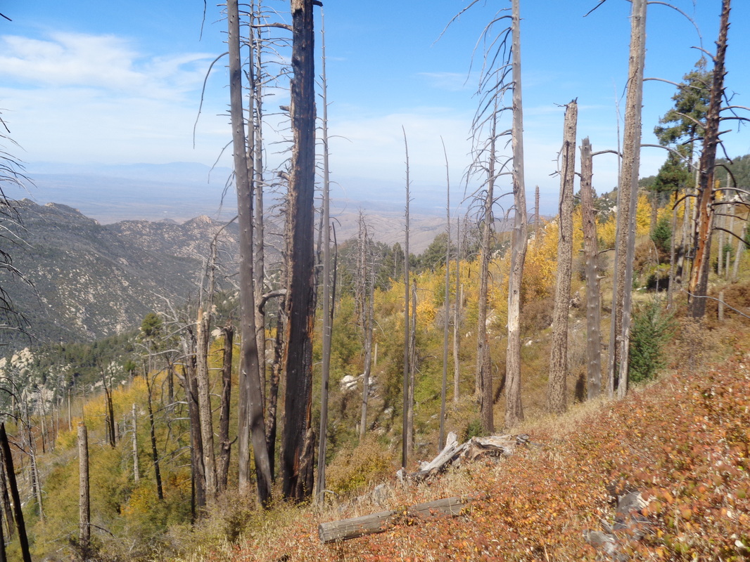 More burned out areas with Aspen coming back as I look to the northeast. 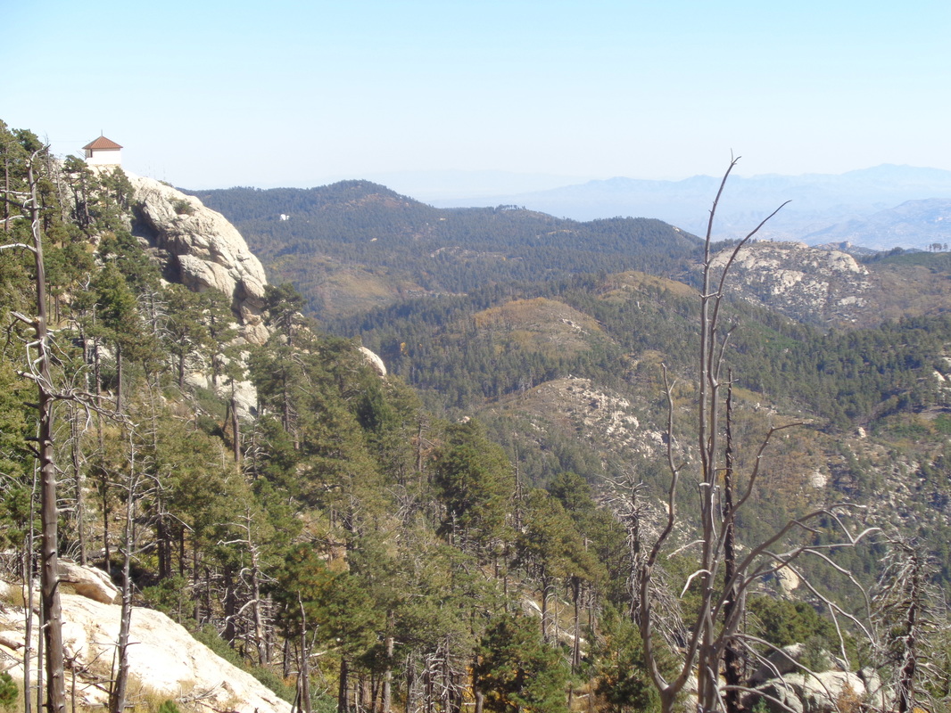 Nearing the parking lot, you can see a fire spotter's cabin on the left and more good views to the southeast. 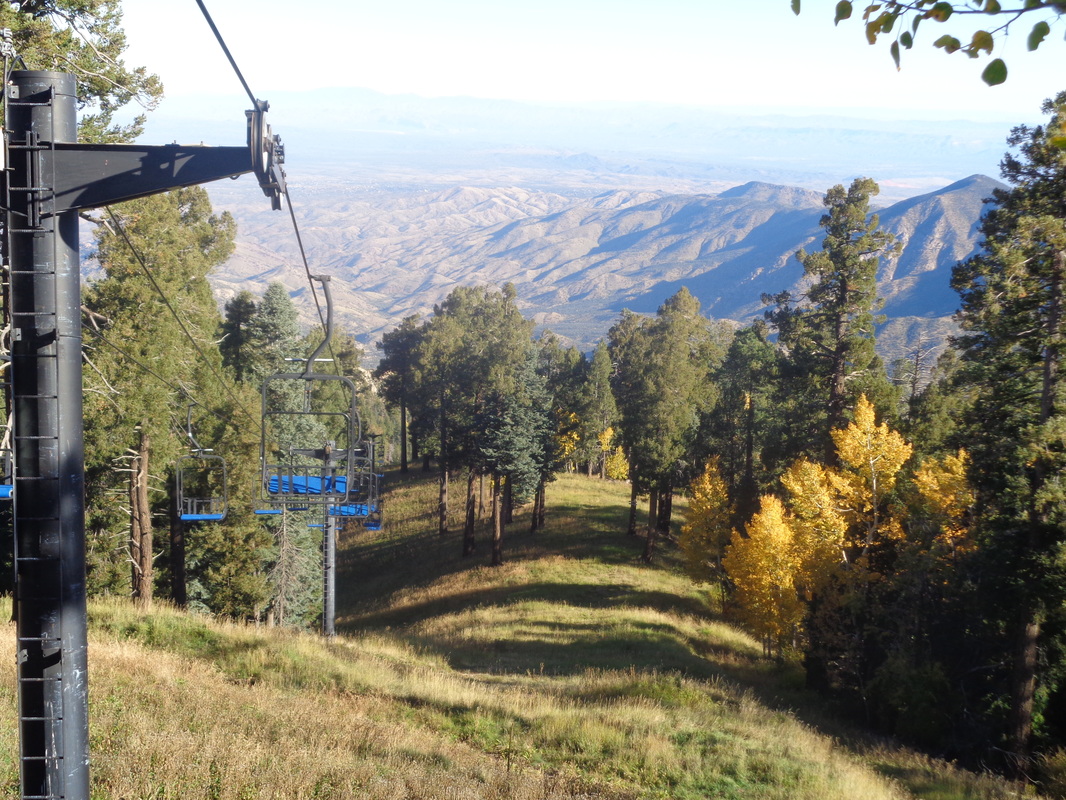 At the top, it won't be long before there will be snow and the lifts active...yes, in Tucson, AZ. Finished with 11.6 miles and 4000' of climbing. Great hike! 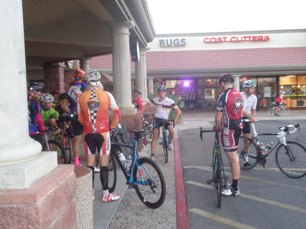 The crowd begins to gather in front of the bike shop. I figured if I did not ride with the group today, I'd probably not get another chance considering the rate at which my cycling fitness is diminishing. No doubt I'd get blown out the back but with the help of that 62 mile ride on Thursday, maybe I'd have enough to not just be the first to get blown out the back. 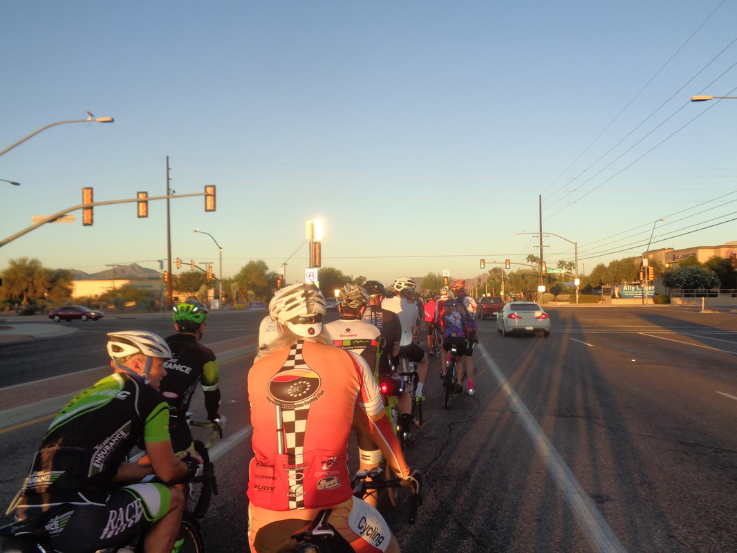 We rolled out at 6:30am so the sun had not yet risen above the mountains but when it did, it flooded the valley's peaks and was a beautiful sight. At first we had 45ish but others hopped in in the first mile so maybe 50 of us in total. Road construction has forced some rerouting so way too many traffic lights and with the first 10 miles being downhill-flat, I hung at the very back, nervous. Ride hard, stop, repeat and repeat but eventually we turned onto the long climb up Twin Peaks to Dove Mountain. Here, I got blown out the back, kind of early but not first, maybe tenth or even....eleventh? 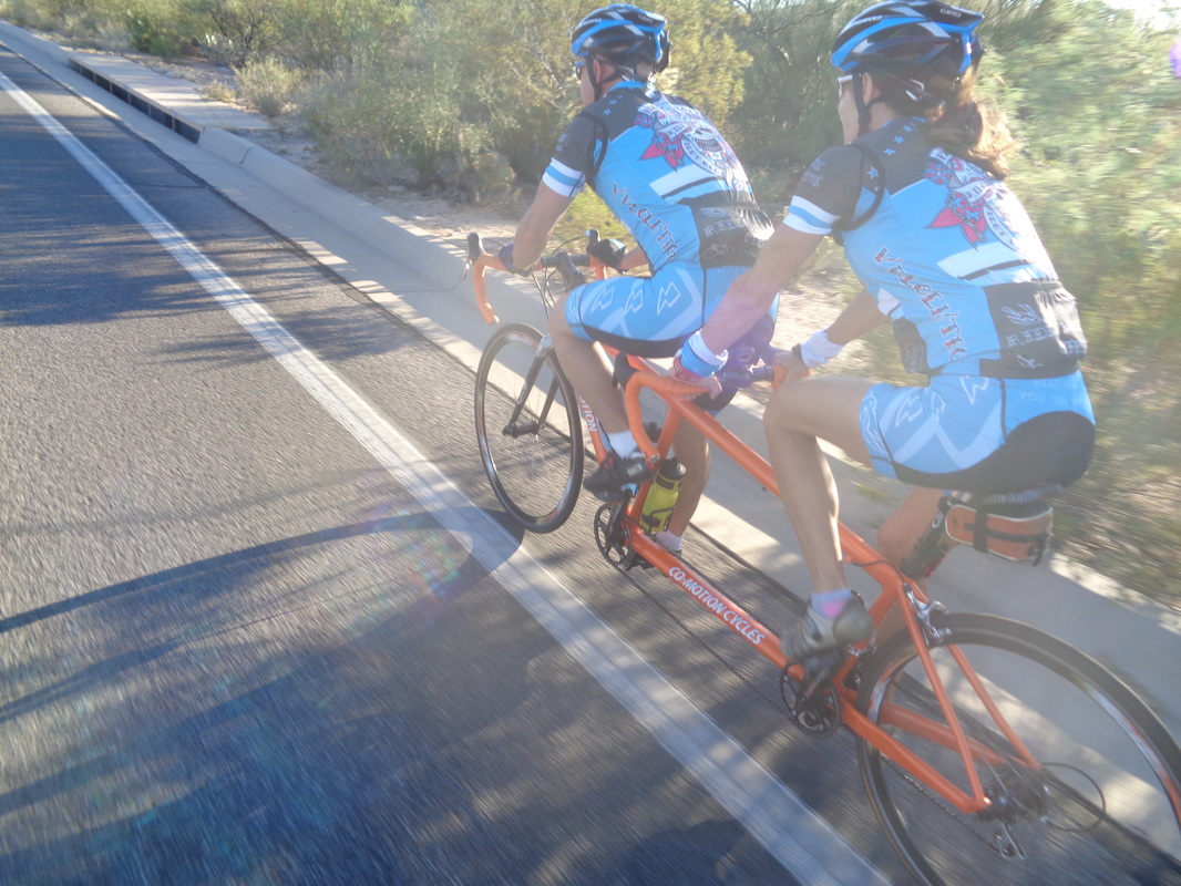 I drafted for quite awhile behind a tandem. It don't get much better than that. I noted it was a Co-Motion just like the Rossi's ride and belt driven too. The climb crosses Tangerine Road and keeps going for awhile but I bailed a bit above Moore Road cause..... 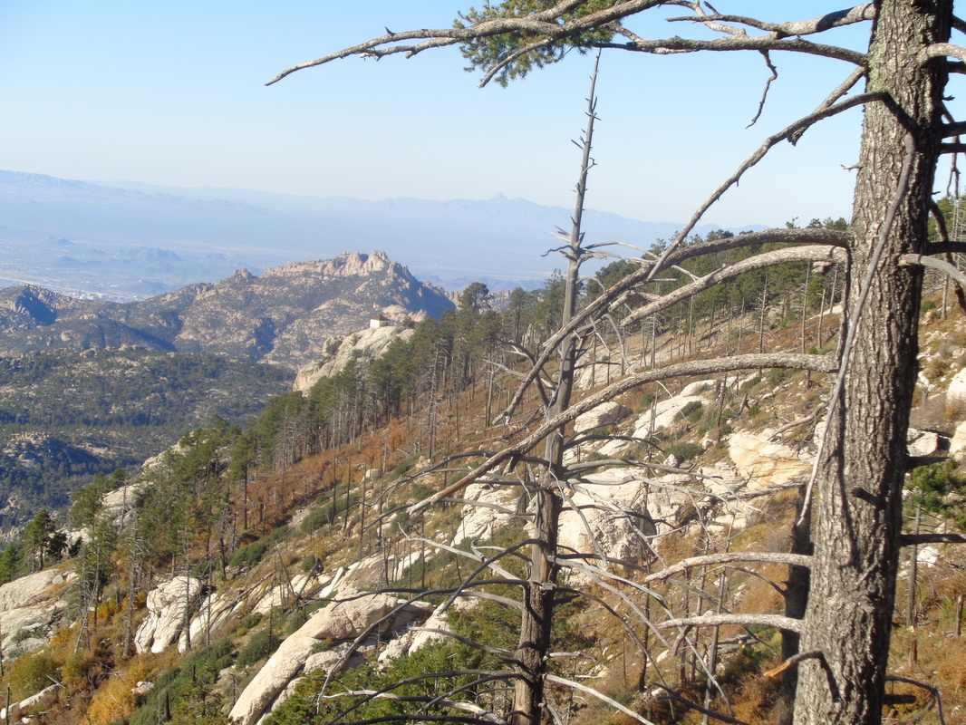 .....I hiking to that peak in the mid-ground tomorrow. Cathedral Rock and maybe my toughest hike ever. It is disconcerting that I can find no descriptions of a route or gpx file to down load of my intended route but I have a map and really, what else do ya need? I've got the route details with family and if I don't check in by dusk, send S&R. Anyway..... 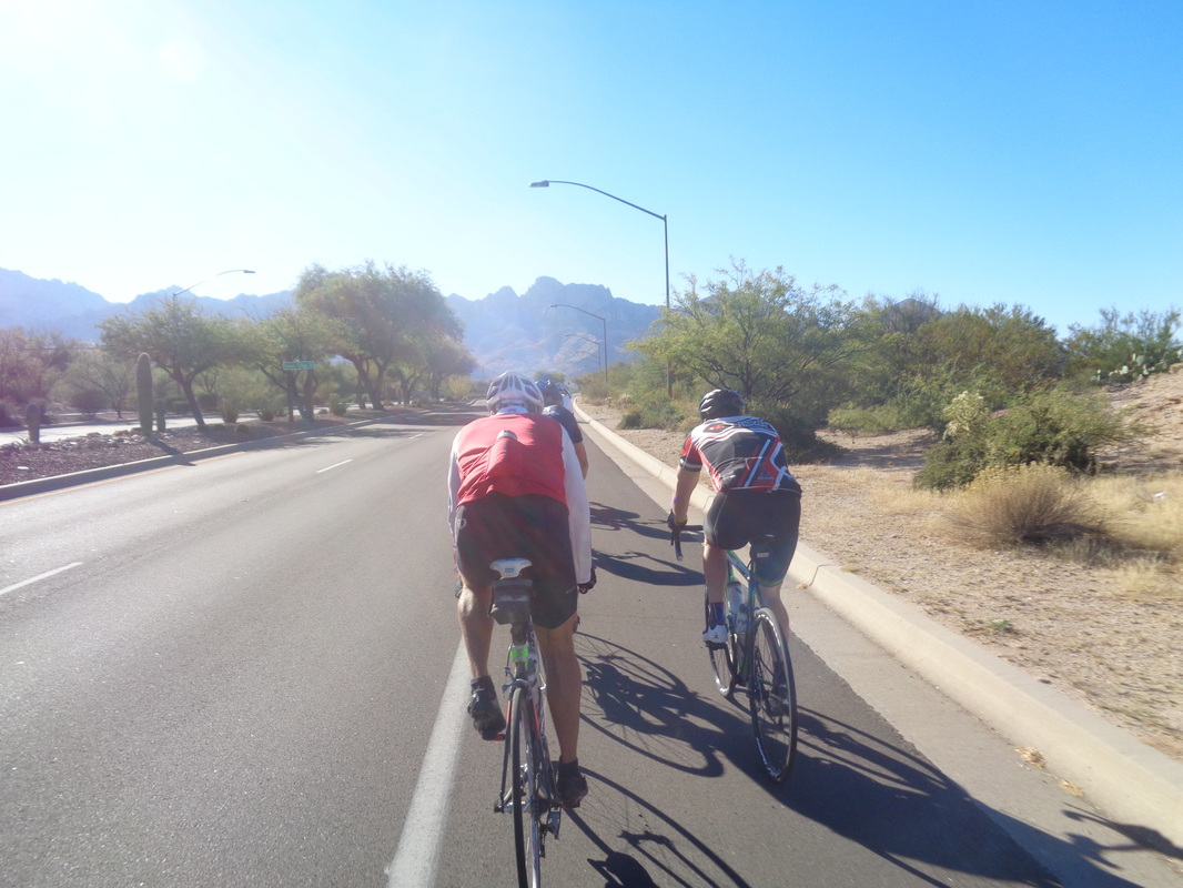 ....I ride to the gas station regroup point and wait. Soon the gang arrives and we head toward Moore Road where I again get popped but form up with 8 others. Good group of guys who worked together well and so finished with 46 miles and a 19.2 average. I have the Garmin set to not pause which is best for hiking so it kept running at all the stops. Here is one option for Saturday morning. Have not yet heard if there is a New Albany Starbucks option too but will post if I do. Happy Hilly Half Hundred', 50 miler. New meet location @ the main paved parking lot, top of hill @ Clear Creek Metro Park lot (5.21 miles from Rt. 33, off Co. Rd. 116 (Clear Creek Rd.)) before 7:45 AM, we roll @ 8:00 AM. Route is slightly revised from previous year. Class A & B riders. Brakes & drivetrain must work well, helmet required. Scenic hill ride with significant elevation changes. Plan to carry tubes, tools and a phone. Snacks, beverages (water & gatoraide) will be staged on route. Road markings and Maps provided. No SAG. Call ride leader Jeff Stevenson (614) 562-1945 @ 5:00 AM on ride day for a Go/No Go decision based on actual weather conditions. https://connect.garmin.com/modern/course/11996698  6:30am and we gather for the start of a 63 mile ride, going south to Sahusrita, departing from downtown Tucson. I don't understand why rides start so early. Not just during the spring, summer and fall but also during the winter. OK, the high today would be 90 but so what? In the humid Midwest, that is roughly equivalent to an 80 degree day. Thus, several guys are standing around shivering and talking about how cold it is. The start temp......60 degrees. 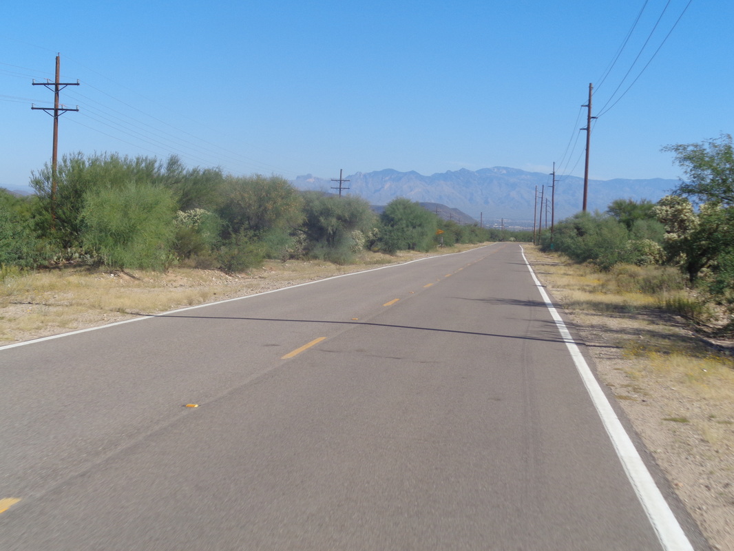 On the return, we head north on Mission Drive and begin a 10 mile descent toward Tucson. The miles were way longer than what I have ridden in several weeks so I was in some pain but glad I got out for a good ride. Time to return to hiking.  While I can't wield it as well as this guy..... 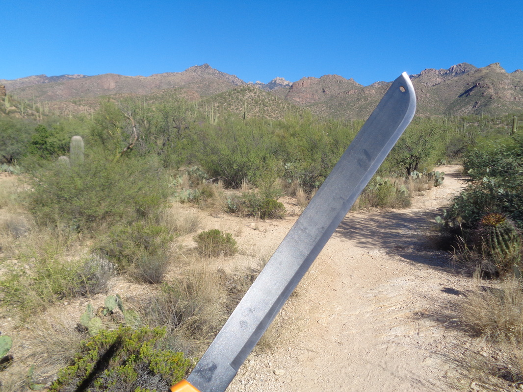 ....I hiked to Home Depot and bought this! No longer will I emerge bloody from having been bushwhacked by overgrown plants that have encroached on the trail. Now I am the Master of the Wilderness. First though....  ...I take a trail to "test drive" my new weapon. Of course, trails are generally clear in the beginning so I have to walk 2 miles before I get to a place where growth of sticky things have intruded on the trail. No indiscriminate hacking by me, no way, my hacking will be very discriminate with the sole purpose of making life easier for my fellow hikers. 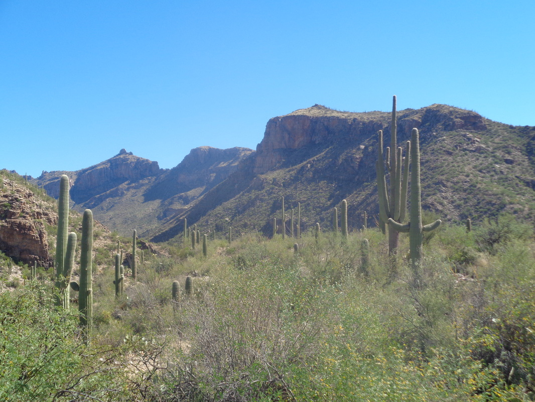 Hmmmm, not very effective against the grass that cuts the shins but that was to be expected. A weapon of this caliber would be useful on sterner stuff and so it was. PLUS!!!!! I realized for close combat with a mountain lion or bear, my machete, which I have nicknamed "Slasher", would be lethal, for one of us. There is a new Sheriff in the wilderness and his name is SLASHER. 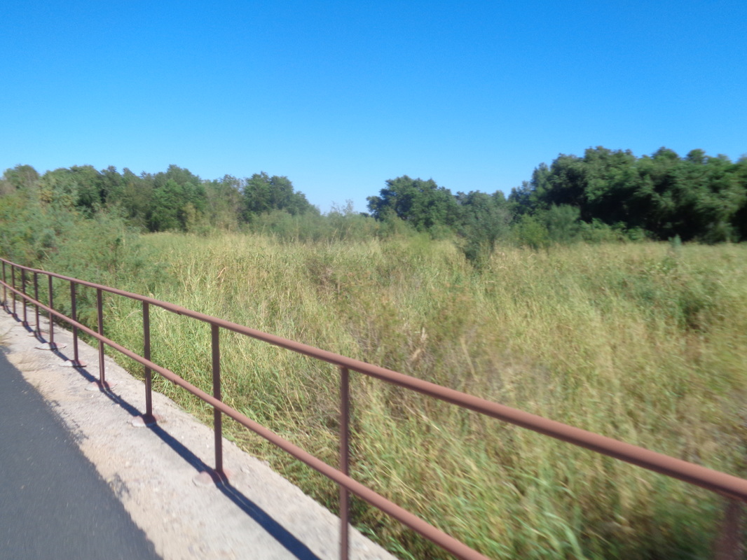 After Saturday's hike, I got out for an easy paced Sunday ride of around 30 miles with half on a bike path. I'm not a fan of bike paths but at least the ones out here are wide so you can ride two abreast going both ways and have much more clearance around slow movers. 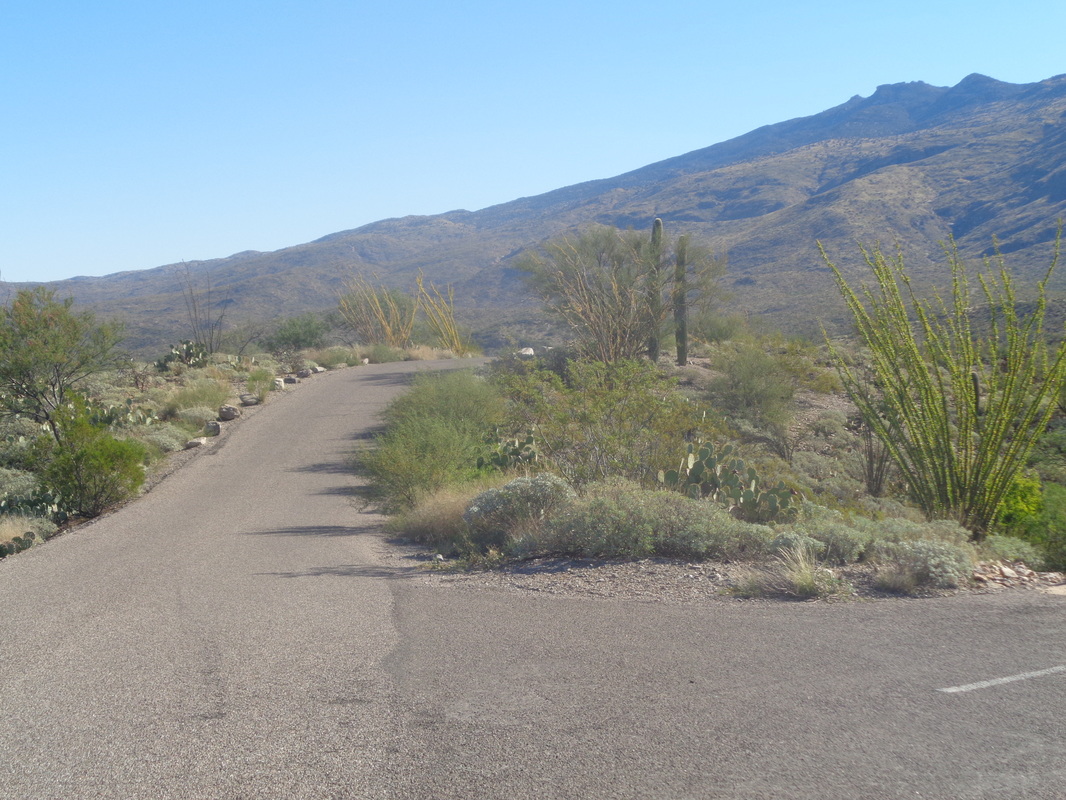 Monday was an off day so Tuesday I rode at Saguaro East National Park and around their 8 mile, nicely paved loop. Got some good hikes coming up and shopping for a machete. The trails in the upper reaches of the mountains are severely overgrown. Me swinging a machete, what could go wrong? 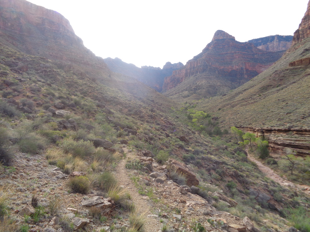 Descending the Grandview Trail, hanging a left at the sign for Cottonwood Creek, reaching the Tonto Trail intersection and bearing right, I am on my way toward the Tonto Plateau or Platform. The cliffs of the mesa are on my right. In the back of my mind, I knew that always keeping the mesa to my right, what now could possibly go wrong? Mentally, I w as doing a victory lap and planning my post-hike meal...... 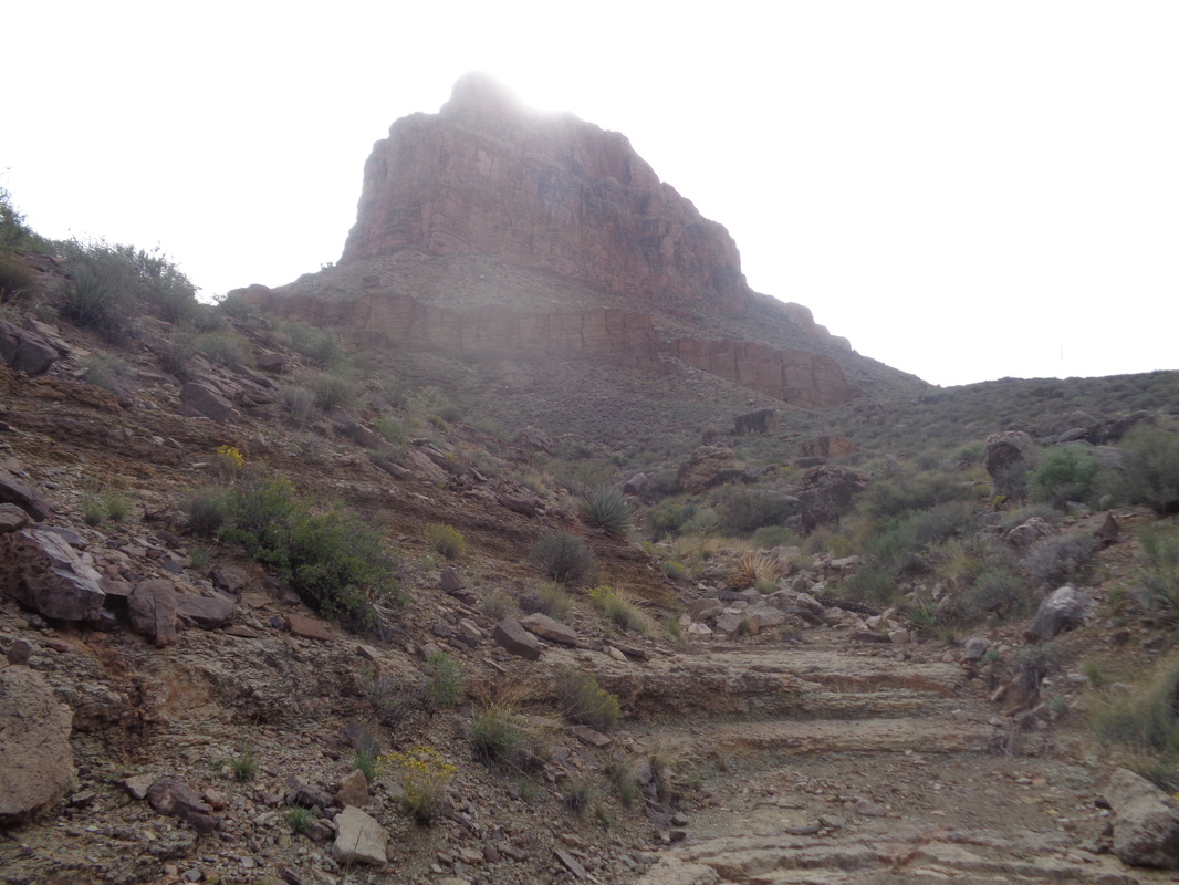 Soon after starting the Tonto Trail, I enter a minor drainage. A trail splits slightly to the right but there is also a distinct trail branching to the left. Hmmmm, I don't recall reading about this and keep walking to the right. Soon I stop, unload both packs, sit, drink, eat a snack and reread pages I had torn from the Falcon Guides, "Hiking Grand Canyon National Park" about this loop. Nothing about this "V" option. I consult my Garmin etrax and dang! It shows me off the route by a significant margin. Thus I became a bit panicky. I retraced my steps to the "V" but the Garmin showed no good progress toward the route displayed on the screen. I know there is a route coming off the middle of the horseshoe that intersects the Tonto and conclude I have reached that point (wrong). If I am wrong, worse case is I ascend the mesa up the middle and lose some distance but at least I am safe. Then, out of the blue..... 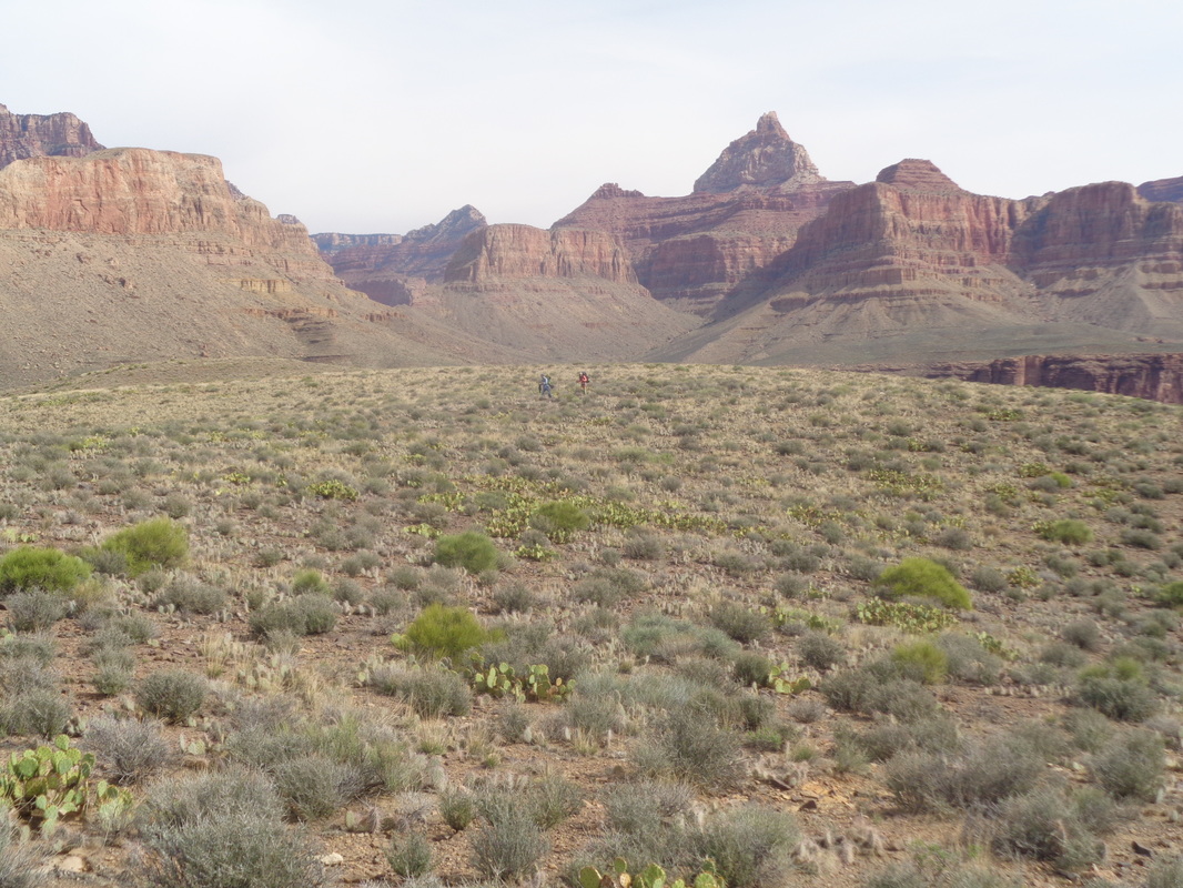 ....I spot two backpackers walking across the plateau toward me. Sweet relief if they can solve the mystery. They had walked to the rim of the plateau to see if they could see into the inner gorge and the Colorado River (you can). I asked if I was on the Tonto Trail. They confirmed that I was!!! All I can think is that left portion of the "V" is a way down to the river. As for being off the Garmin track, I was on the route so the person who had shared the route had been off route or there was a glitch of some sort. 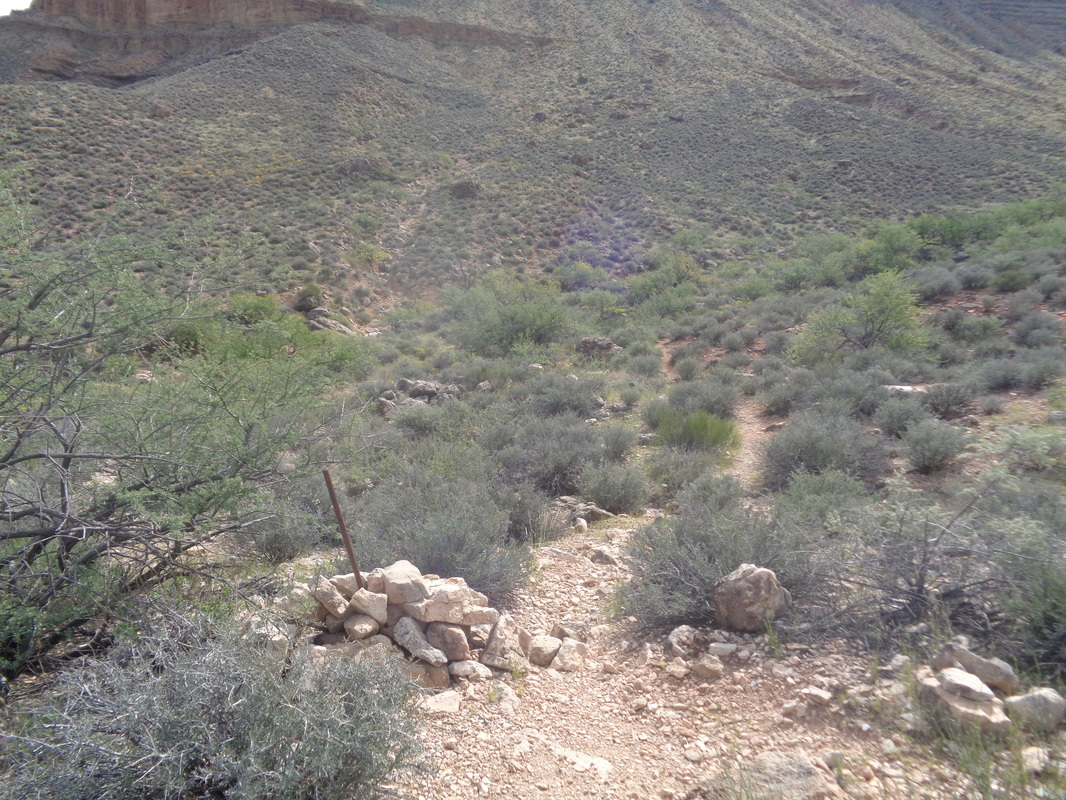 Soon, the final piece of the puzzle is solved, the piece of rebar or drill steel, extended from the pile of rocks indicates the junction where one can opt off the Tonto and gain the middle of the mesa in 1 mile and 1000' of vertical climbing. I'll admit, after my panicky moment, I was tempted but I plodded on, following the Tonto Trail. 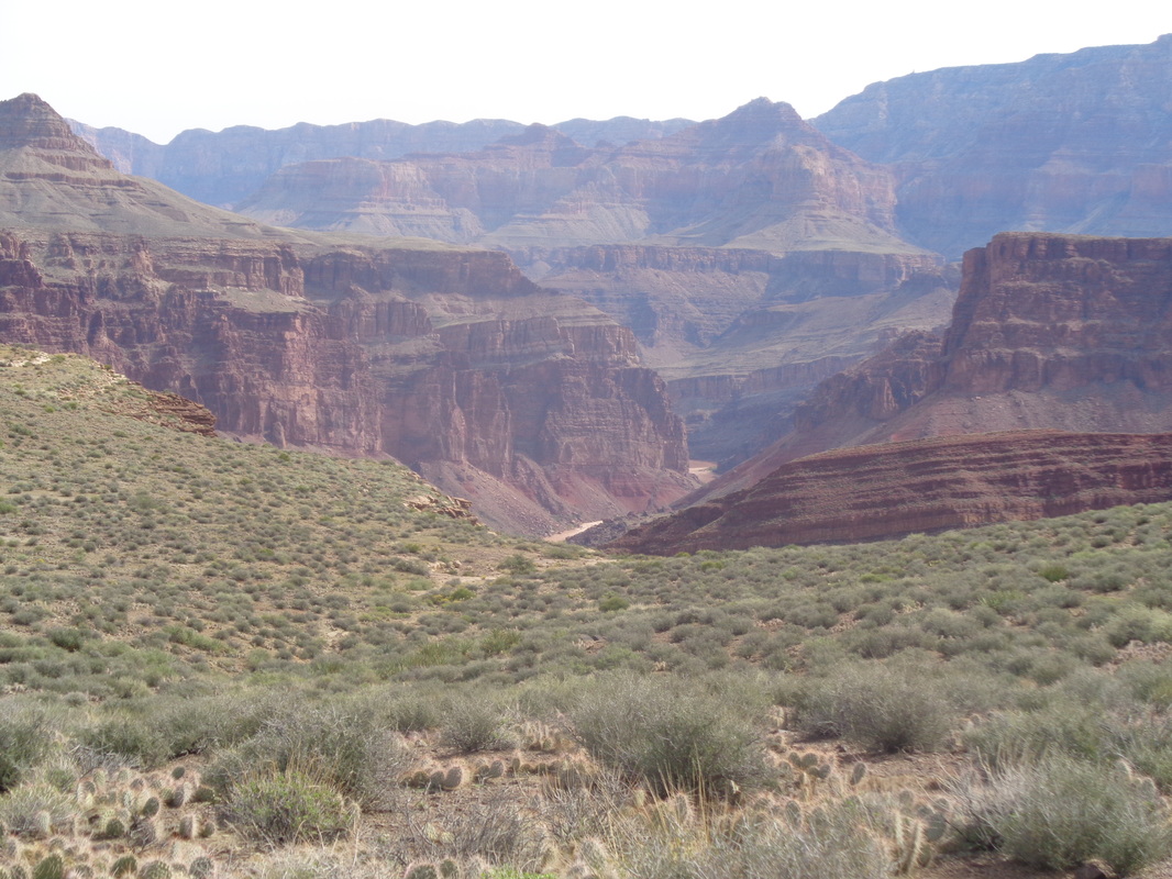 The Tonto Trail, this portion of it, is gently rolling with marvelous views. This is the only time I could see the Colorado River. Odd since every other hike I have done within the Canyon included a visit to the river. Eventually, the trail begins to bend to the south, skirting the.... 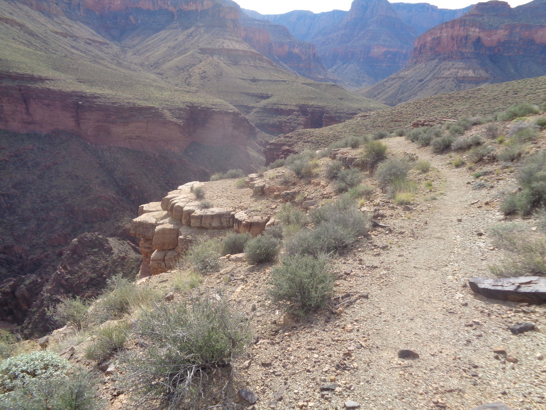 ...Hance Creek Canyon. If you are wondering, there was no exposure here either except when I walked to the rim in a couple of places. Beautiful. I came across something I see in my Ohio yard all the time, groups of black pellets which are deer droppings. They are fresh so I stop, look up and how about that..... 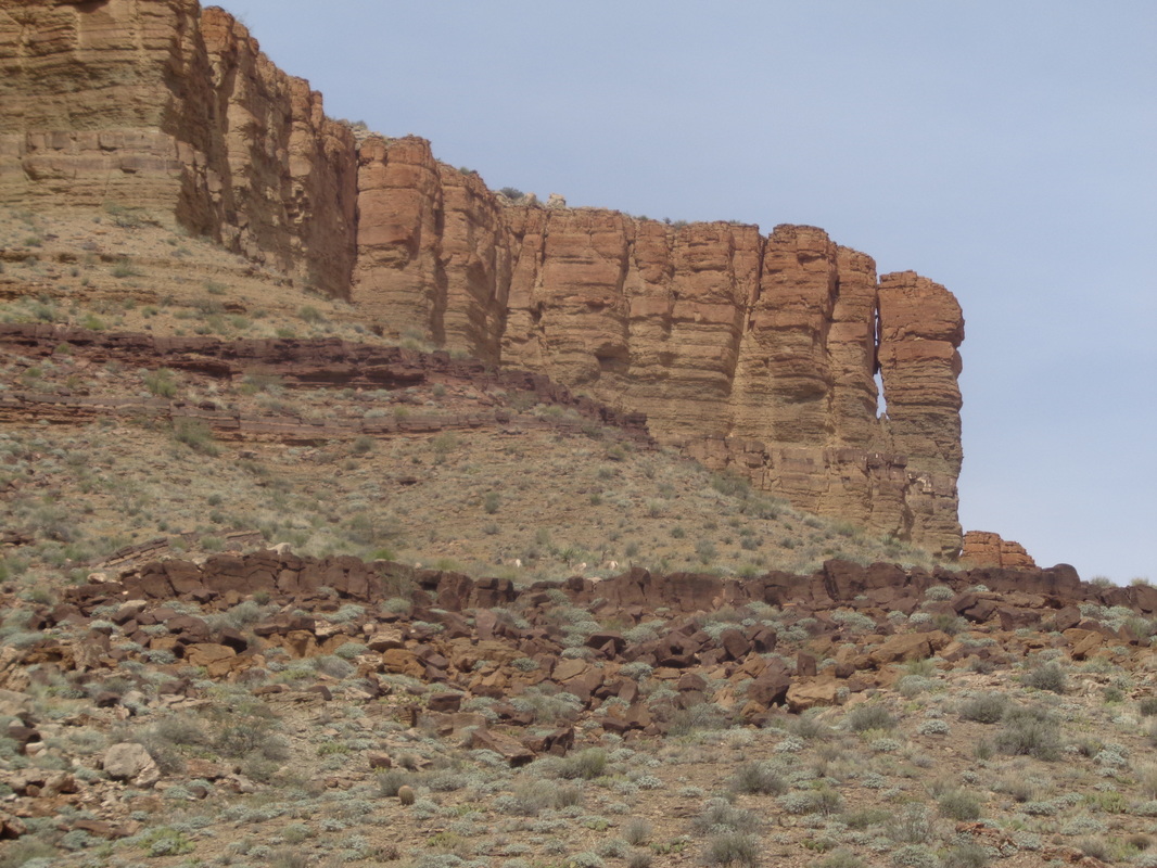 ....7 Bighorns running (they are just cresting that wall in the middle). Later I expanded the image and confirmed the sighting, rather than mule deer or something similar. They eventually reached the base of the orange outcropping and disappeared. 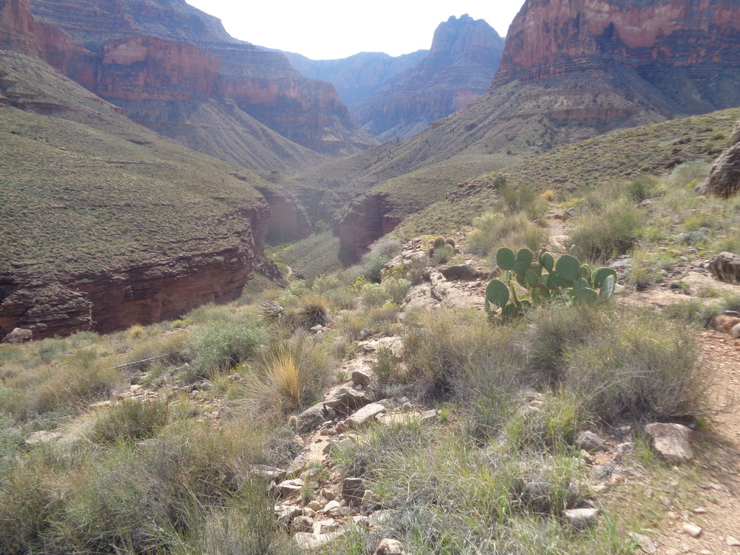 The trail continues to skirt Hance Creek Canyon and my next challenge is not to walk past the trail that takes one to the top of the mesa, completing my loop. Just as the trail begins to bend east and I think I have missed the trail option.... 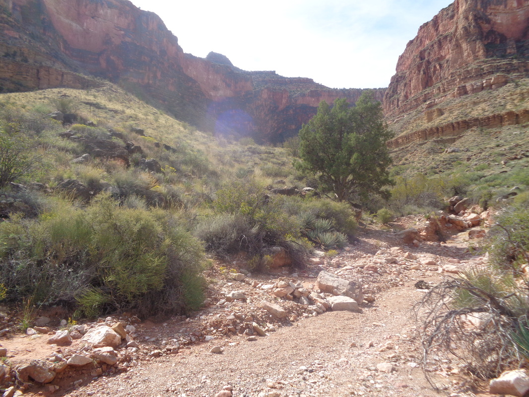 ....I enter this drainage and see a couple of cairns (piles of rocks) indicating a side trail. Plus, there is a rock with a splash of green paint. I am relieved so unload everything and really drink and eat because I am not going to wander eastward, as has been done, run out of fuel and expire. I check the Garmin...this is it!!!! I repack and head off but the trail is very faint and I find that curious. Within a few more steps I access a well worn trail and conclude the actual trail junction must have been a few yards farther east on the Tonto Trail but someone created a brief short cut. I am now on the East spur trail that leads me by.... 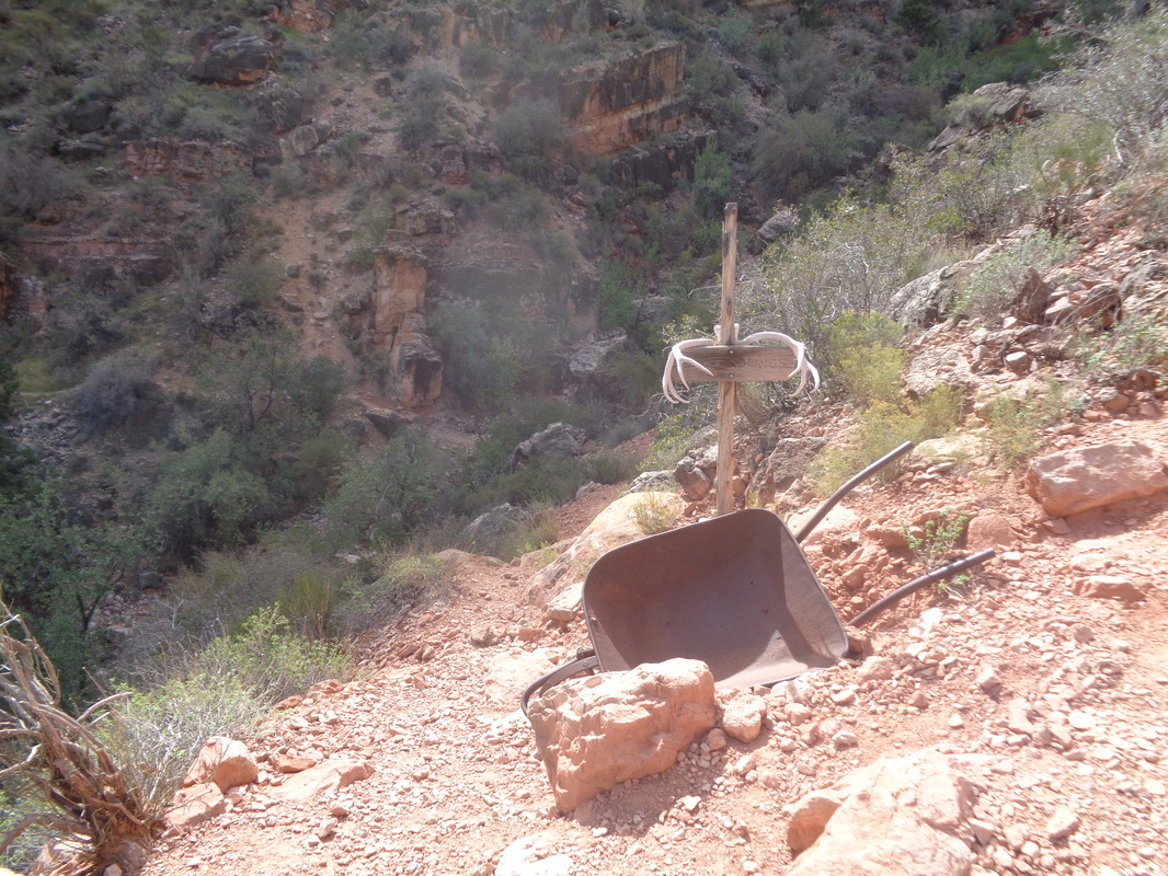 ...Miner's Spring or Page Spring as it is also known. A left turn here takes me quickly to.... 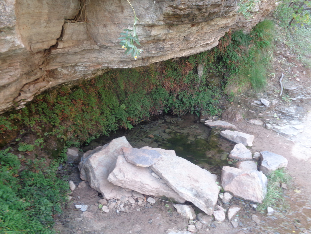 ....this alcove which I understand is a reliable source of water year round. While the dripping water would take forever to fill a bottle, there is a pool from which you could scoop plenty. I rejoin the main trail and continue up, passing... 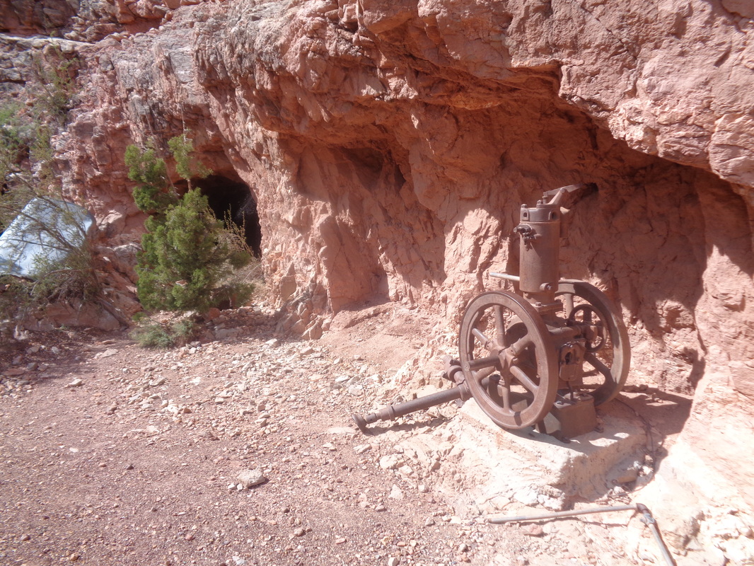 .....several old mines. Entrances are blocked which is probably a good idea. On I go, steeply usually as there is about a 1000' gain to the mesa rim. I reach.... 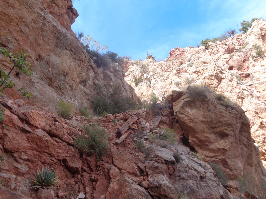 ...a couple of places where I lean toward the wall cause the trail is a bit narrow and some exposure but not too bad. The busy beavers of the Park service are active here too, improving the trail. I have mixed feelings about this. I top out on the mesa and discover I am quite a distance above the left branching Cottonwood Creek trail I previously descended. I had cached a couple of bottles of fluid here and it took awhile to find but eventually did. I was a happy camper and begin the ascent of Grandview Trail, a 3 mile slog of steepness. 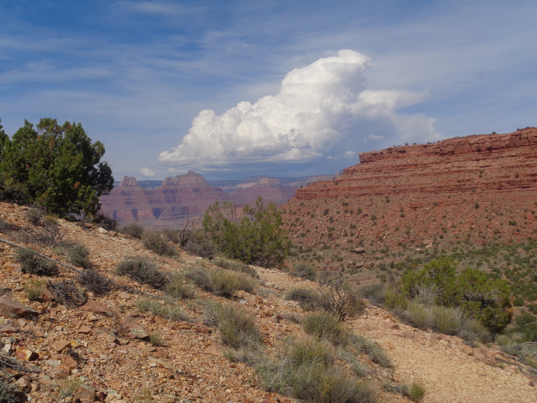 There were quite a few fellow hikers and thick clouds were moving in too. Having started at around 7:30, I emerge at around 2:30pm. My hiking/moving time for the entire 13.6 mile loop was 6:05 but a total time of 7:07 with all the time pondering my predicament on the plateau and refueling. Total climbing was 4100'. I uploaded the route to Strava and was surprised to discover there was a 1.5 mile timed segment for part of the Granview Trail and 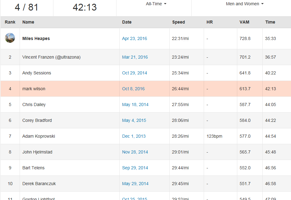 ... I came in 4th out of 81. Wish I had known there was a measured segment. Curious and so I checked, the 3 people above me hit the segment at around mile 4 of their hike while my legs were at mile 12. I paused at the rim, swarming with rim gawkers and their reaction is always enjoyable to watch. 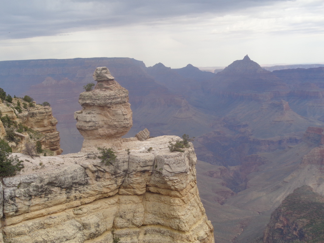 More clouds arrived overhead as I took a last long look. It began to rain and as I headed to Oro Valley, I....  ...passed Humphrey's Peak. Here, I was at 8000' and above me, snow had begun to accumulate around the peak. Well, thanks for reading and time to begin planning the next visit. The confluence of the little and big Colorado river is really calling to me. 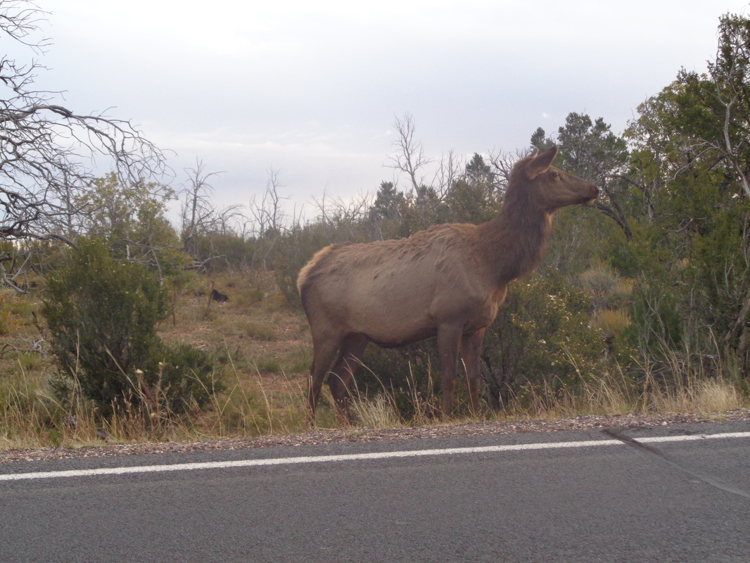 I arrived at dawn on an overcast day, south rim of the Grand Canyon. The overnight low was forecast in the mid 30's but the cloud cover kept temps in the mid 40's so I gleefully left the cold weather clothing in the car, which I parked in the ample parking area at Grandview Point, a well marked spur road off Desert View Drive.. The chance of rain was 20% so I included a leaf bag in my back pack just in case. Elk were present in large numbers as I drove. 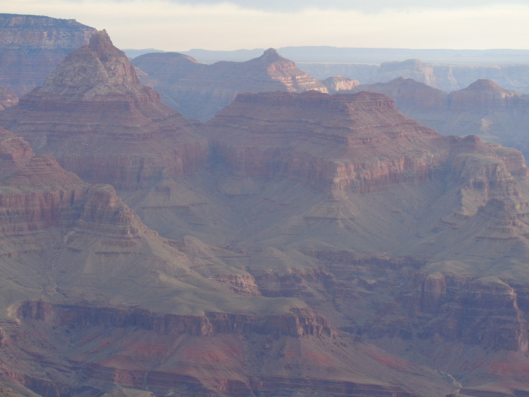 The usually grand colors were muted but still spectacular. Yes, as usual the quality of the image fails to capture just how spectacular. 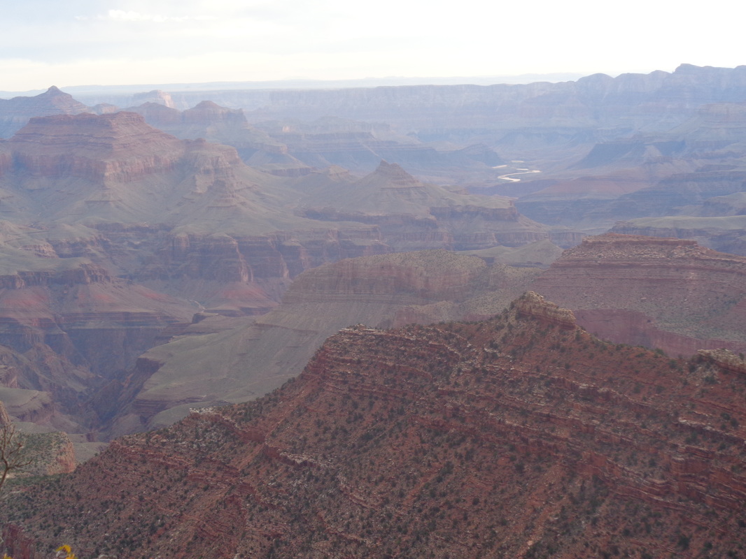 In the distance, the muddy waters of the Colorado River. Later, I took a pic from almost the exact angle but while standing on the Tonto Platform, about 4000' lower. A Note to Readers: I found blogs like this a valuable resource while planning this hike, along with the usual guide books. Despite all that I read, I was nevertheless "stumped" a couple of times and in this and the ensuing post about the ascent, I will try to add clarity to help those who find this report while looking for information.. 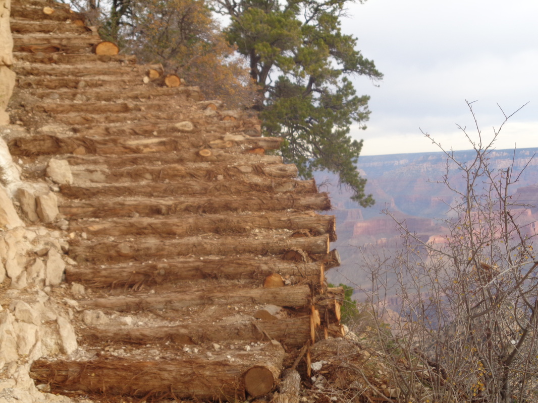 The Park service has been busy so other reports that describe rock slides and exposure are outdated. Doesn't mean a slide tomorrow won't create problems but as of this writing, the 3 mile descent to the Horseshoe Mesa is on a trail similar in quality to South Kaibab or Bright Angel, just a bit steeper. Note the Juniper logs recently installed and.... 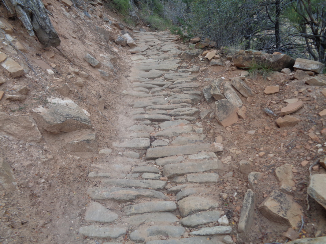 ....many looooong expanses of imbedded stone. Gravel on the surface makes footing problematic enough that you'll ant your eyes glued to foot placement rather than enjoy the views but for that, just pause and.... 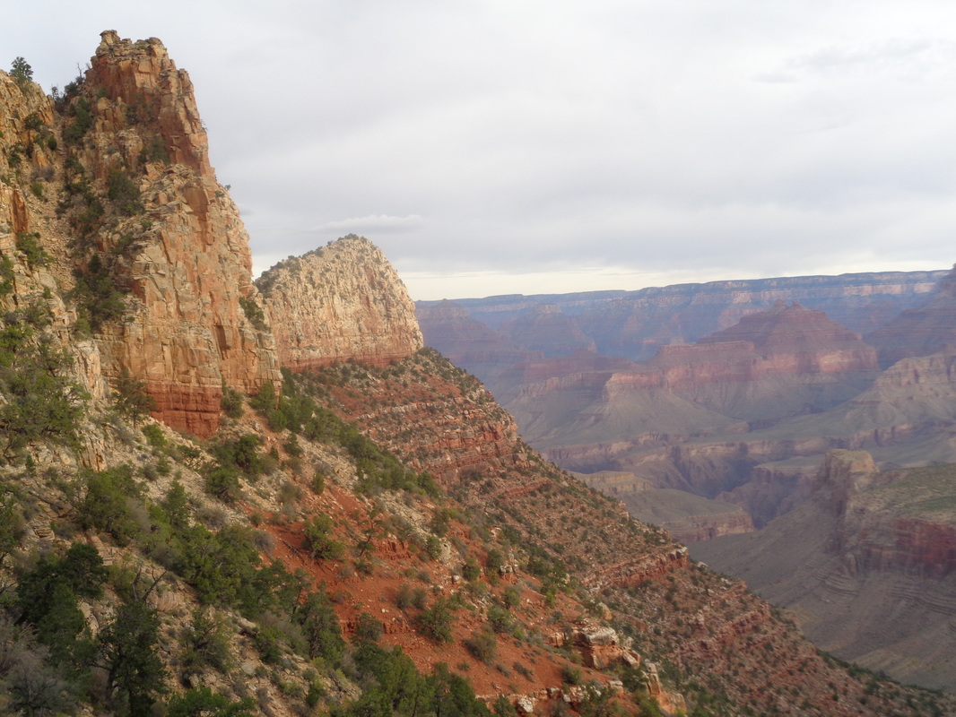 ....look. I descended very steeply until hitting the red rock formation where the knee buckling subsided for awhile and where I ran into.... 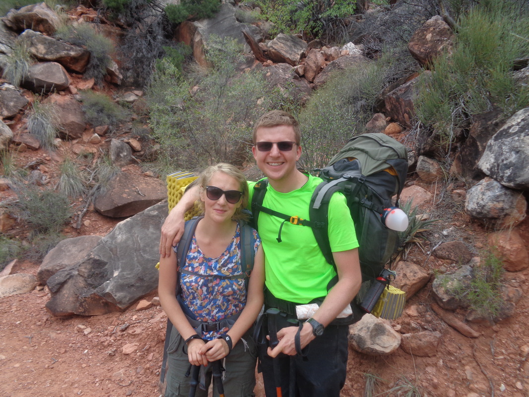 ....a nice couple from Poland. I get the biggest kick out of meeting people like this. Never visited the US but decided they wanted to travel to AZ and backpack a portion of the Grand Canyon. After 4 fun days, they are on their way out. 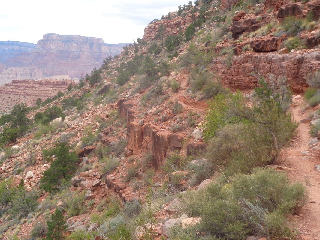 Ohhhh, the sweet relief of walking along gently rolling trail. About here a woman bent double with a huge pack stopped to ask me what were my plans. Oh, she wore the Park service uniform and since they respond to so many distressed hiker calls, it makes sense to question a guy who has only a waist pack and one of his child's old book bags on his back. Yeah a strange set-up but it works for me (note on this day of cloud cover and highs in the 60's, I was carrying about 5 liters of fluids). Had I ever done this loop previously? Nope. Had I done anything similar? Oh yeah and after I described my resume she smiled and told me, "Oh, ok you're good." 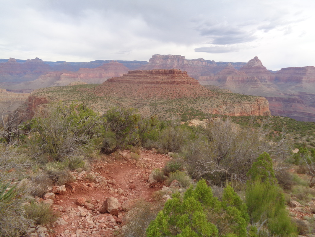 Elevation loss has taken the "horseshoe" shape out of the picture but there it is, the Horseshoe Mesa. I would descend the left edge, go around the back side and emerge from the right edge. After 3 miles, I came to a signed junction (see below) but continued on a few yards to visit.... 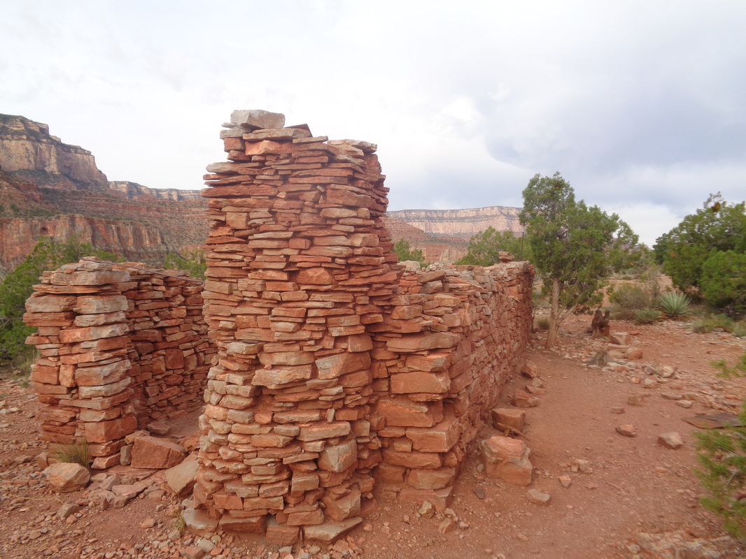 .....the remains of a cookhouse dating back to the late 1800's. You can read about it elsewhere but mining activity was plentiful in this area. Retracing my route a bit I came back to the..... 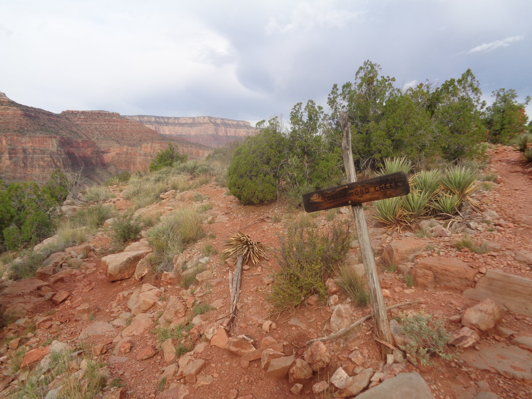 ....signed junction for Cottonwood Creek. I went left here, avoided a faint trail after a few steps going north/right and descended past dozens of rusting food cans that had been deposited here during the active mining stage. 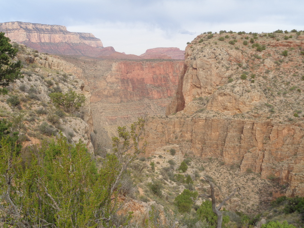 The trail soon crossed to the left side of the canyon and descends, once again, steeply with plenty of loose gravel. I found a single hiking pole very useful. I closed on a guy and had a brief chat with him as he was headed west at the next junction (see below). Following him made the multiple wet and soon dry stream crossings of Cottonwood Creek much easier. I found water only in the first two crossings, dry at all the others. 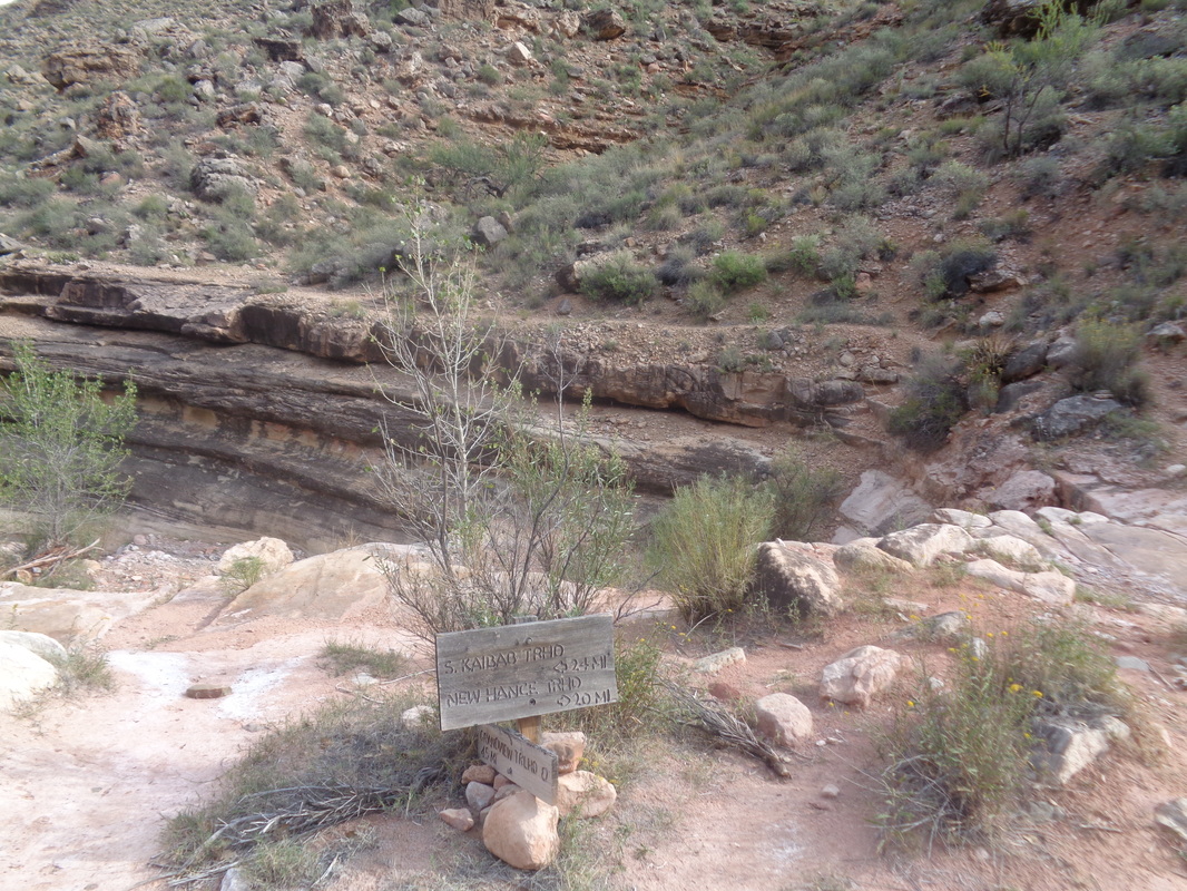 Now I arrived at this sign post. Going left here takes you west to South Kaibab and other trails/destinations so I went right. Maybe you can make out the Tonto Trail as it follows a cliff band. So far, I had experienced no exposure or bulging boulders that took space away from the trail. I am probably a medium when it comes to exposure to trail side drops and I found nothing that even caused me to shift my center of gravity away from exposure. Part 2, the walk along the Tonto Trail and the ascent to the Mesa and the canyon rim coming later. 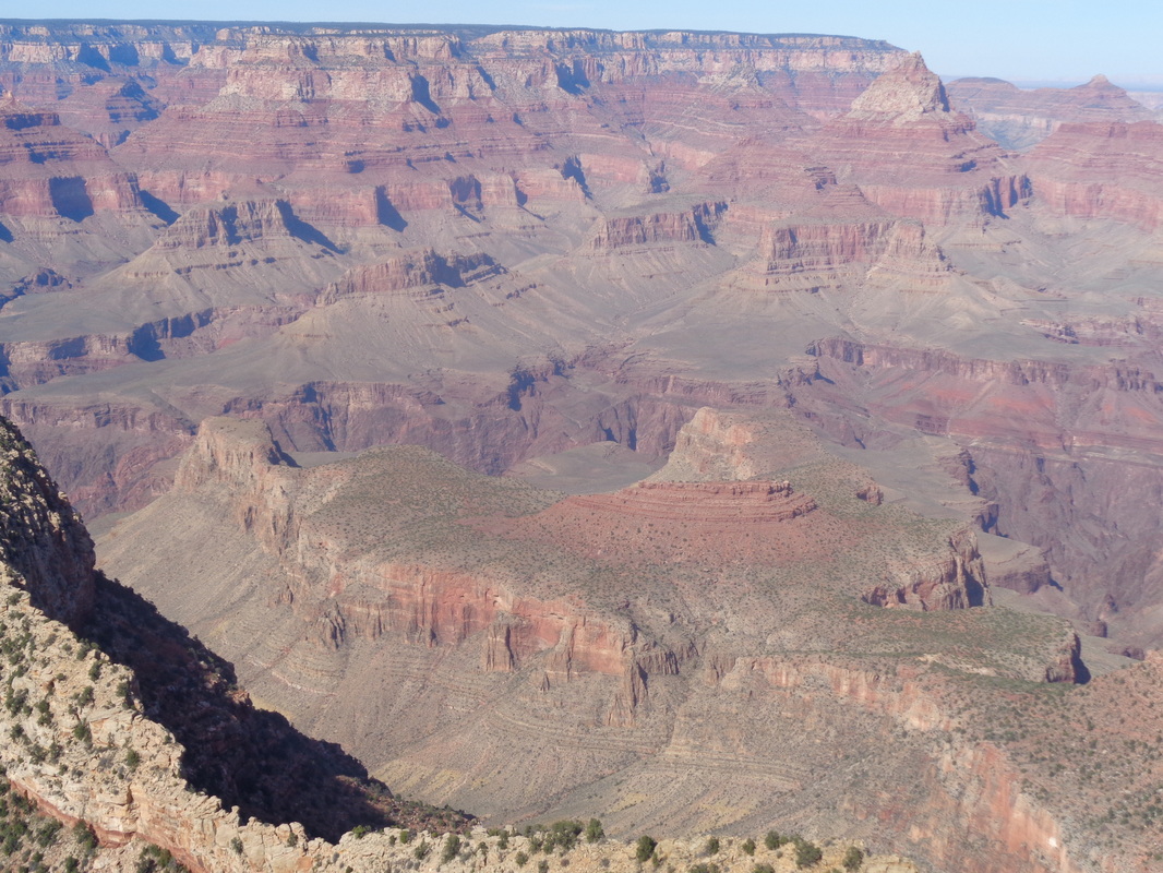 Saturday morning, I will drop into the Grand Canyon and hike clockwise around the Horseshoe Mesa. I have seen distances range between 13 and 17 miles which is surprising given gps but am taking plenty of fluids and food. Should finish in 6ish hours, depending on distance and trail conditions. Hope to report on this tomorrow. Gus Cook is organizing a Saturday ride with a long route of 65 miles and a short route of 45. Below are the details: - Meet behind the Starbucks in downtown New Albany (on Market Street) at 7:50am - Depart at 8am - 65 mile ride: very scenic route – Stopping in Granville for Fluids/Snack, rolling Northeast towards Utica and returning back through Alexandria (possible additional stop). - View the route here: https://ridewithgps.com/routes/16917424 - Expected average pace will be around 18-19MPH with Gather-Ups On Sunday is the Fall-N-Leaf ride out of Bellville, OH with rumors swirling that the Kendaites and Eva will be there among many others. Distances of 36, 50, 69 & 83 miles and a $25 day of ride registration. More can be found: http://www.midohiobikers.org/Docs_PDFs/MOB_FNL_2016.pdf 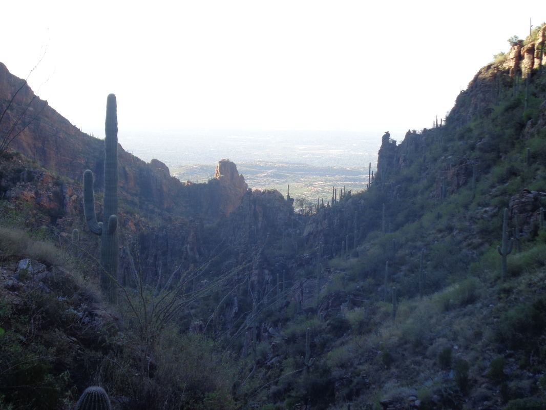 I had a dream Tuesday night. I was standing on concrete somewhere and there was a baby rattler on the floor. Somehow, the rattler got on my right shoulder but towards the back. I dared not try to grab it because it would bite me. Remember this is a dream so rational thoughts need not apply. Eventually, a guy driving a 4-wheeler stopped and took the snake off my shoulder. I don't believe in omens but I admit, that dream crossed my mind a few times as our group started up Ventana Canyon toward the Window. I was leading when.... 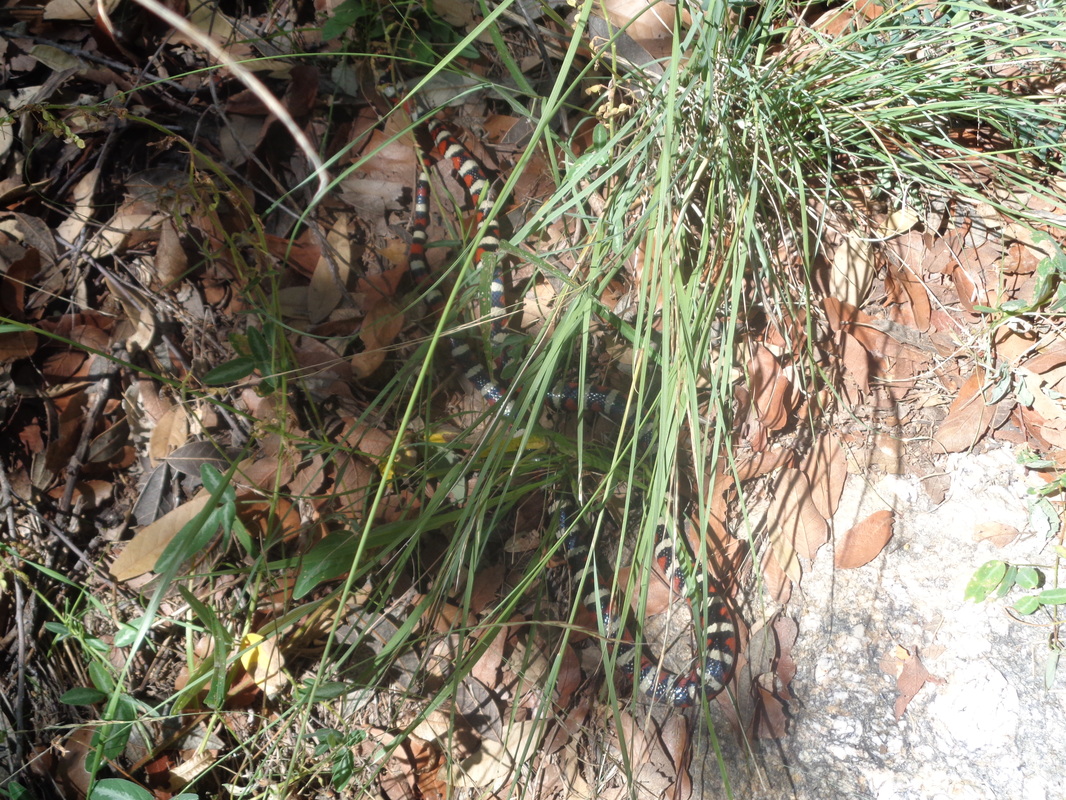 .....at some point, yelled, "snake" when I spotted this guy just ahead of me. Looks like a Coral snake but a harmless California King snake. The trail was...... 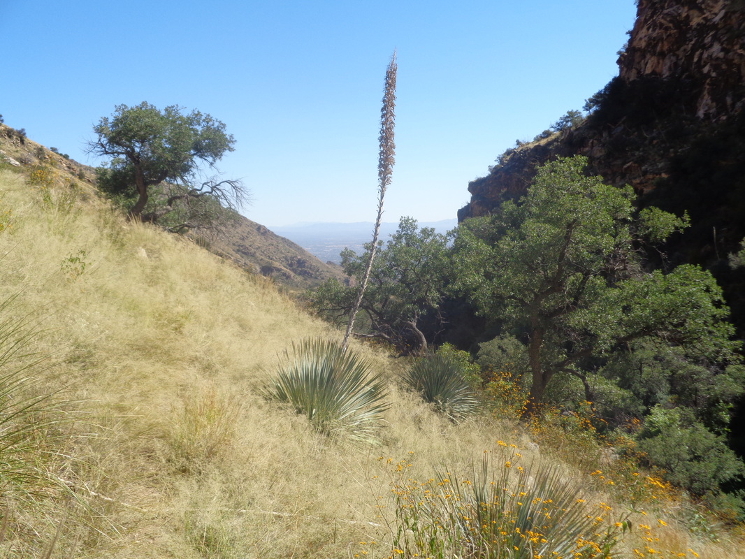 ....horrible. Mile after mile of overgrown nastiness with the trail obscured by long grass. I banged my hiking pole on the trail in front of me prior to taking a step (I was leading). Catclaw and every other pointy plant made our lives miserable. We lost the trail several times but kept finding it, unfortunately. I wished I had a flame thrower. 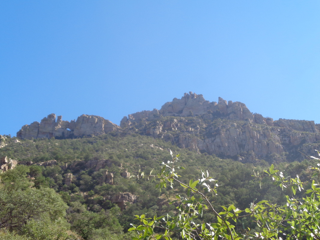 The canyon ends and then faced with a wall, we begin climbing. Hey, there's the arch, middle of the image left. Looks so close but still so far away. From having hiked this a couple of times, I know to watch for..... 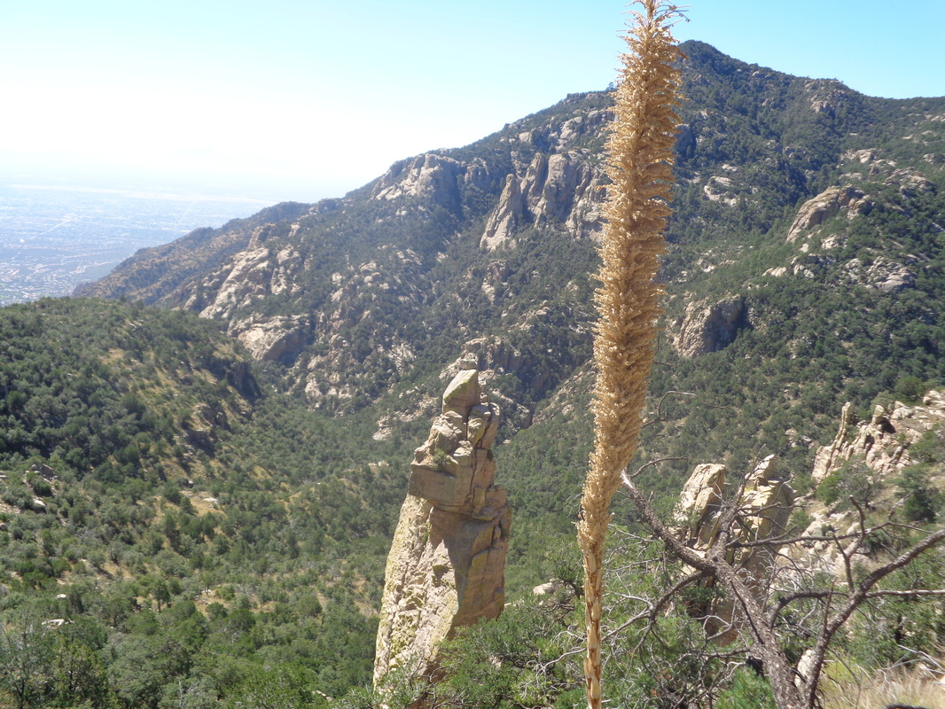 .... a rock spire, indicating we were close to the saddle and yes..... 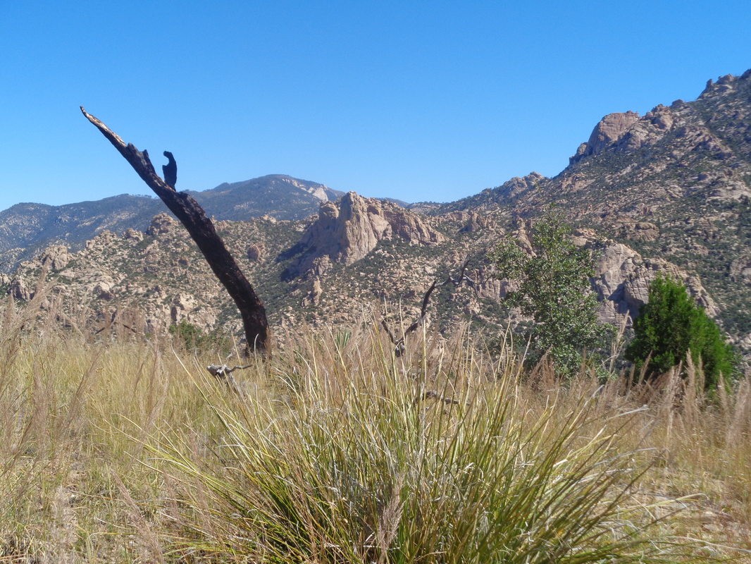 ....I arrived. Thank goodness but still more climbing until I reached..... 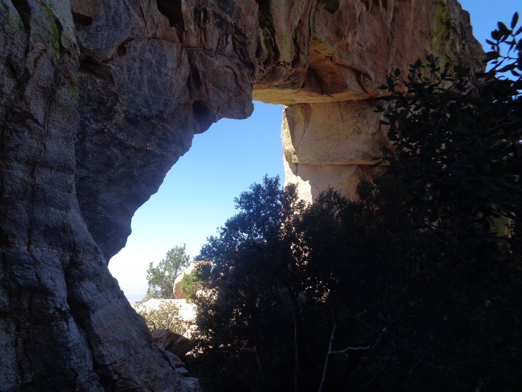 ....the famous Window, a huge arch at mile 7 and 3800' of climbing. 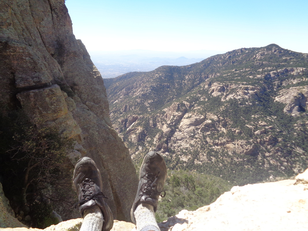 I sat at the edge and waited for the others to catch up. What a view! We snacked and after 15 minutes.... 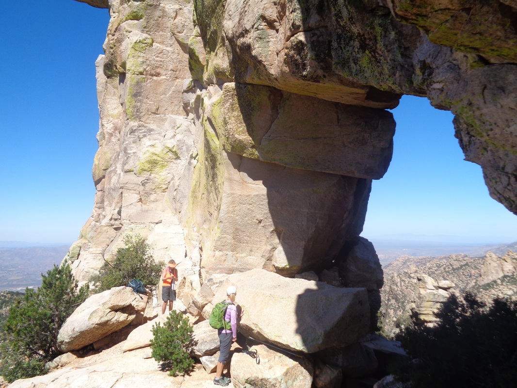 ....decided to head down. 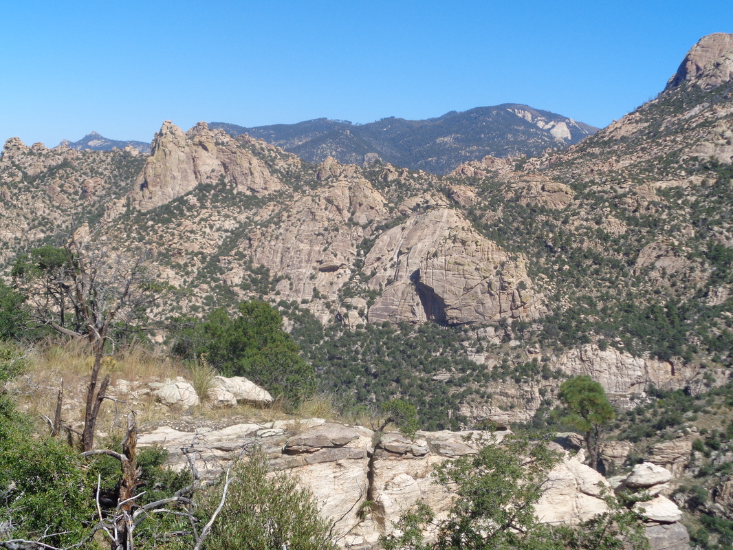 Wow, just a great hike of 14 miles and I'm ready for the Grand Canyon and the hike around the Horseshoe Mesa. Although I have a gpx track, I'm a little nervous because there is exposure, too many junctions/turns and too many hikers have wandered off trail never to be found until they had expired. But hey, this is me so...... 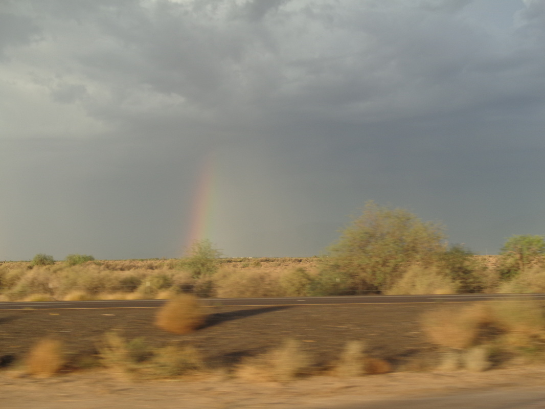 I drove my wife to the Phoenix airport where we passed yet another rainbow. Thus begins a couple of lonely weeks with way too much time on my hands. If only I could find something to do..... 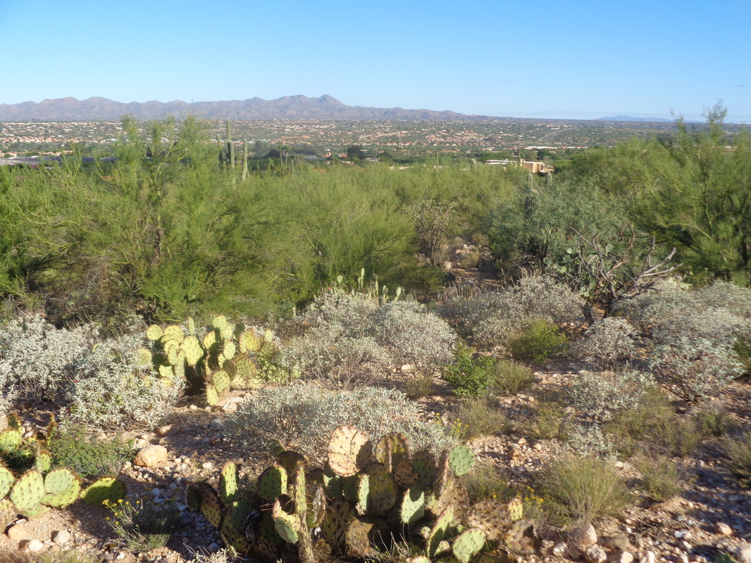 Within minutes of my return to Oro Valley, I lace on the hiking shoes and am off. About 2 minutes from our AZ home is the Linda Vista trail head which provides access, via a hard to follow trail to Pusch Peak. Note how green is my valley. 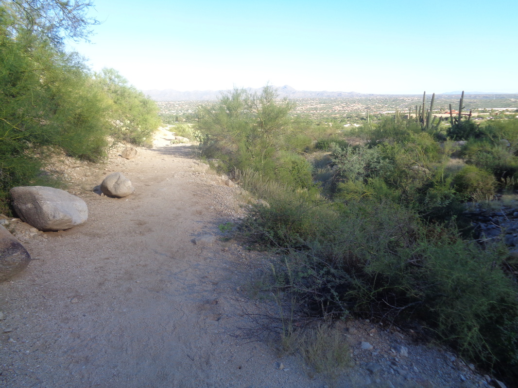 Ahhhh, the line where sun gives away to shade. 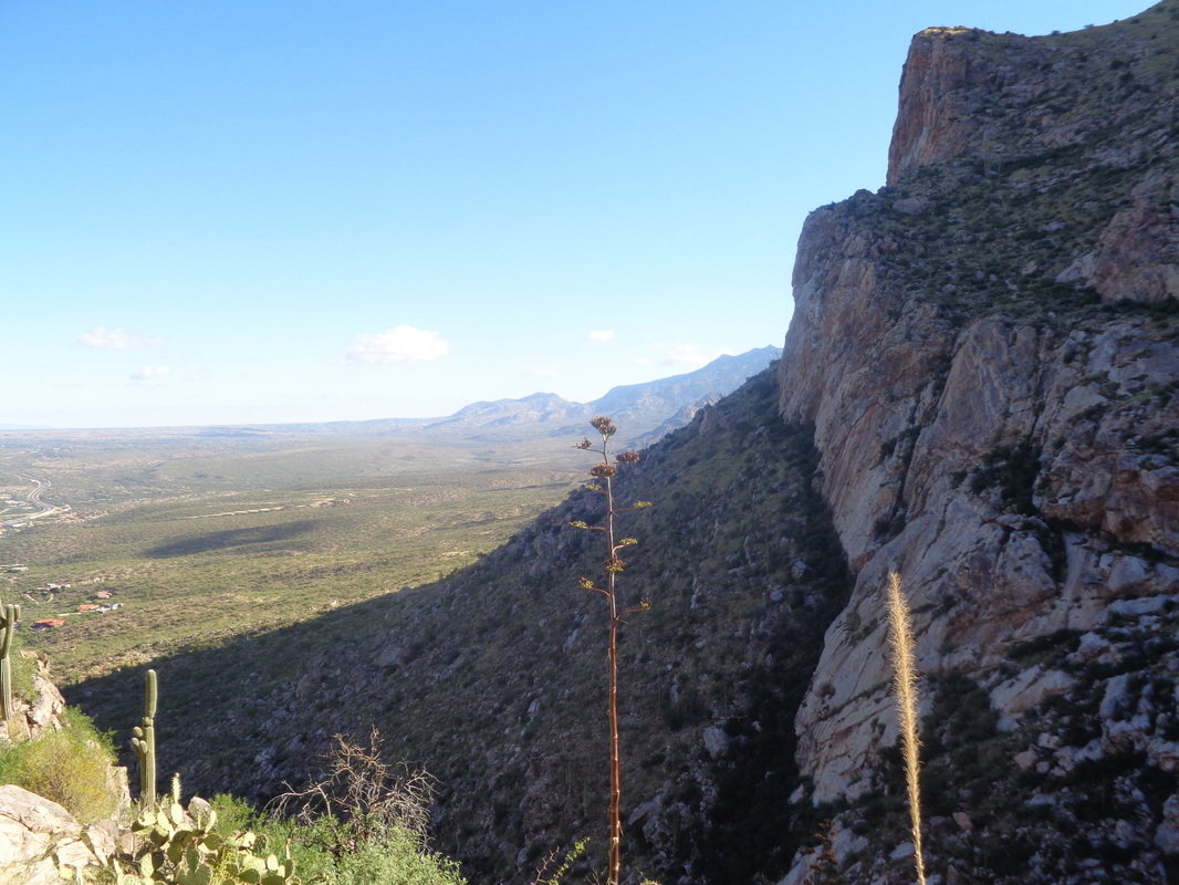 Good views to the north and the northwestern end of the Catalina Mountains. 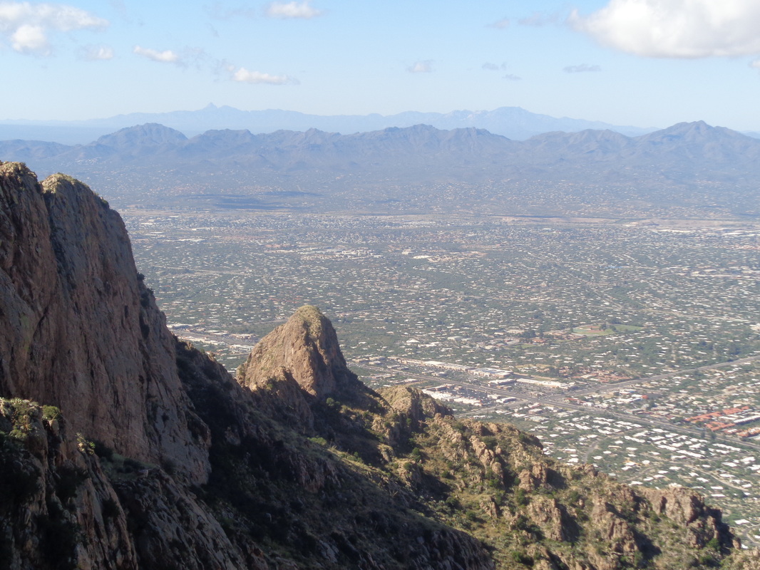 Higher I go and additional mountain ranges come into view. I pass a guy on the way up and then, after climbing a rock chute I look across a side canyon and see him. I got off the route and yell to him, "I must be off trail." He confirms it for me just as a deer jumps from the brush and scampers higher. 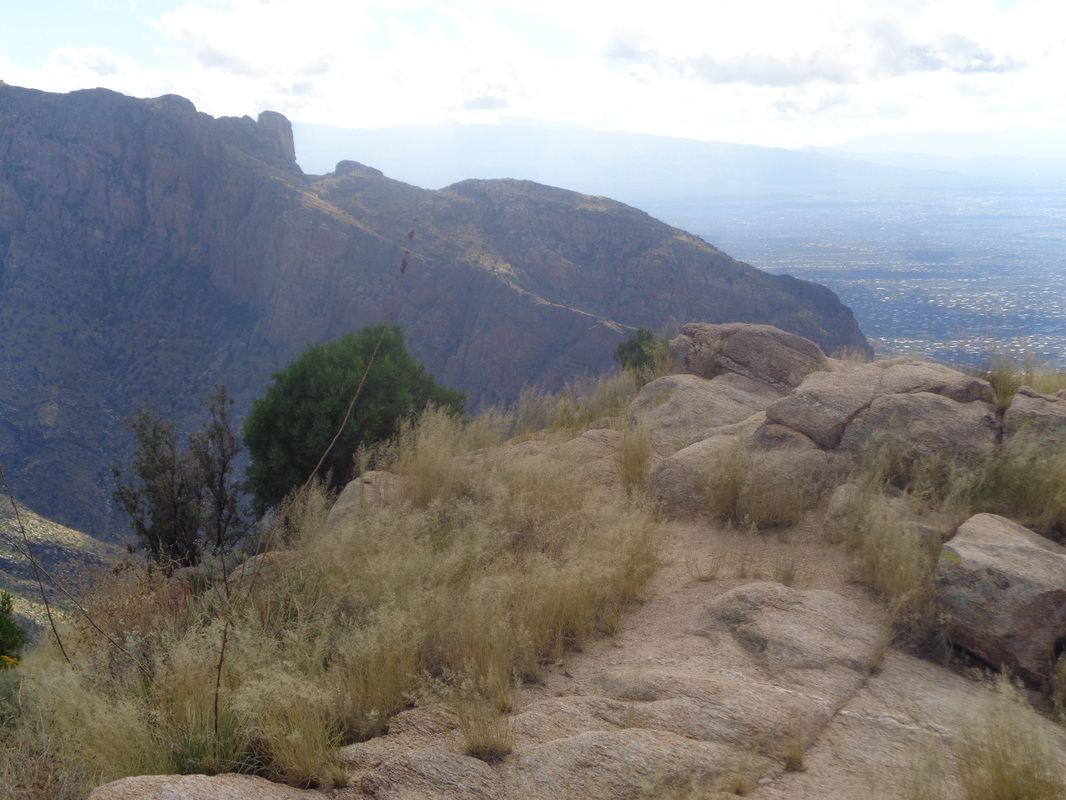 The top at about mile 2.7 with 2500' of elevation gain. Another steep one. 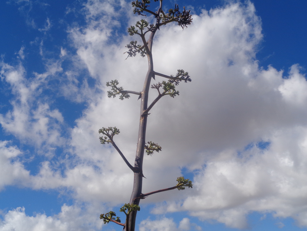 The stalk emerging from a plant is huge as I descend.... 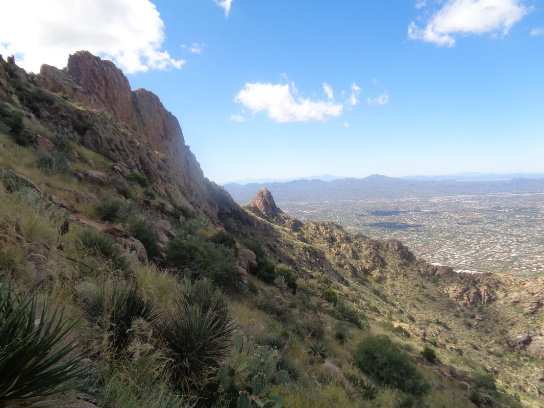 ....the knee buckling route. 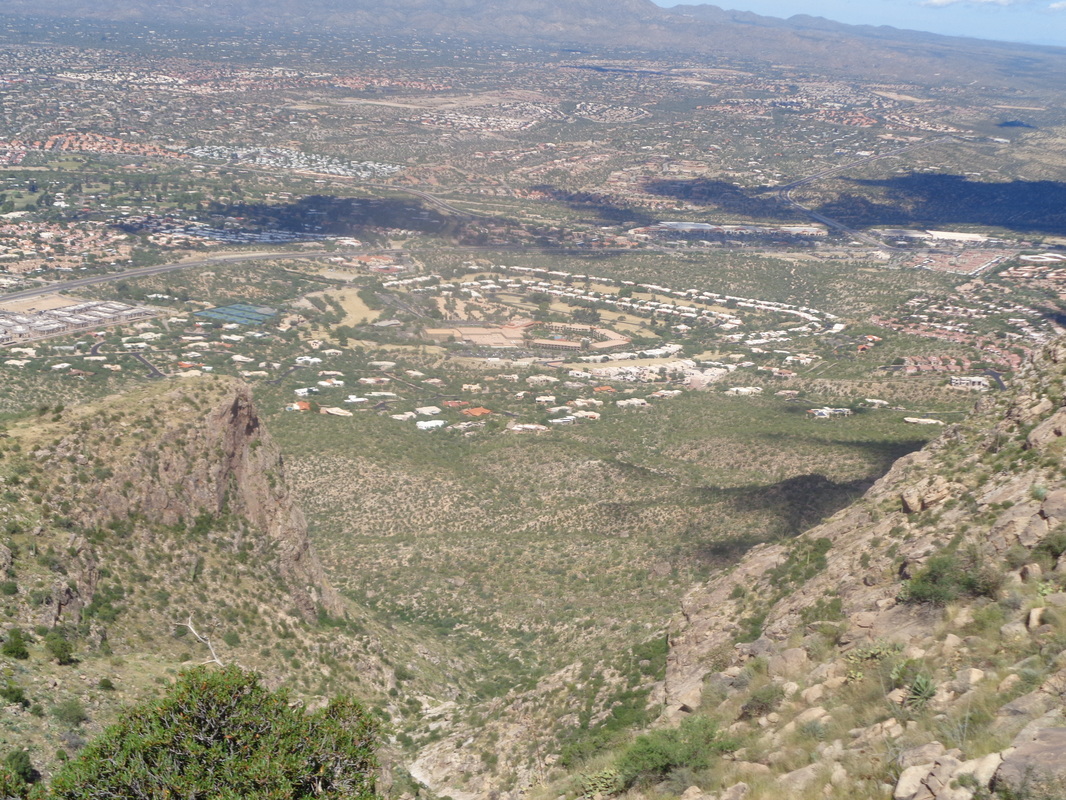 Fairways are looking kind of brown on the golf course. Must be time for overseeding with a winter rye grass. Well, I've made a reservation in Williams, AZ and intend to hike the Canyon this weekend. One more hike to go prior to that to get in some more distance.
From Rick Miller for an October 15, 8:00am ride: This will be a 108 mile route from Utica, OH thru the hills of Knox, Coshocton, Holmes, Tuscarawas and Harrison counties, ending with a nice descent into Tappan Lake Park, Deersville, OH. (Approx. 7k of climbing) Once at Tappan Lake, we will have food to refuel your engine and beverages to quench your thirst. This is a one-way ride, once at the lake and you're refueled, we will load you and the bikes up and return you to the start location at designated times. The cost is $125. Please Paypal me at [email protected] Or email me at the above address to set up a different payment method to secure you spot. Please only sign up if you know your capable to ride and be finished by 5 o'clock(9 hours)the goal is to have the LAST VAN/TRAILER leave at 6PM to be back in Utica by 8PM, and the FIRST VAN/TRAILER at 4PM to be back to Utica at 6PM. Each van trailer can hold 10 people. THERE IS A RIDER LIMIT OF 30 RIDERS (the extra van departure would be determined on how many riders finish early compared to late) If you have any question feel free to ask  On the road at 5:30am to make a 7:00am group hike from the Lost Goldman trailhead in the Superstition Wilderness. It's a long drive but worth it for the destination and enjoyment of hiking with David & Letlet, our co-leaders for today's adventure. The sun rises at about 6:10 and some clouds linger from an overnight rain, just above the Supes as I transit through the town of Florence. 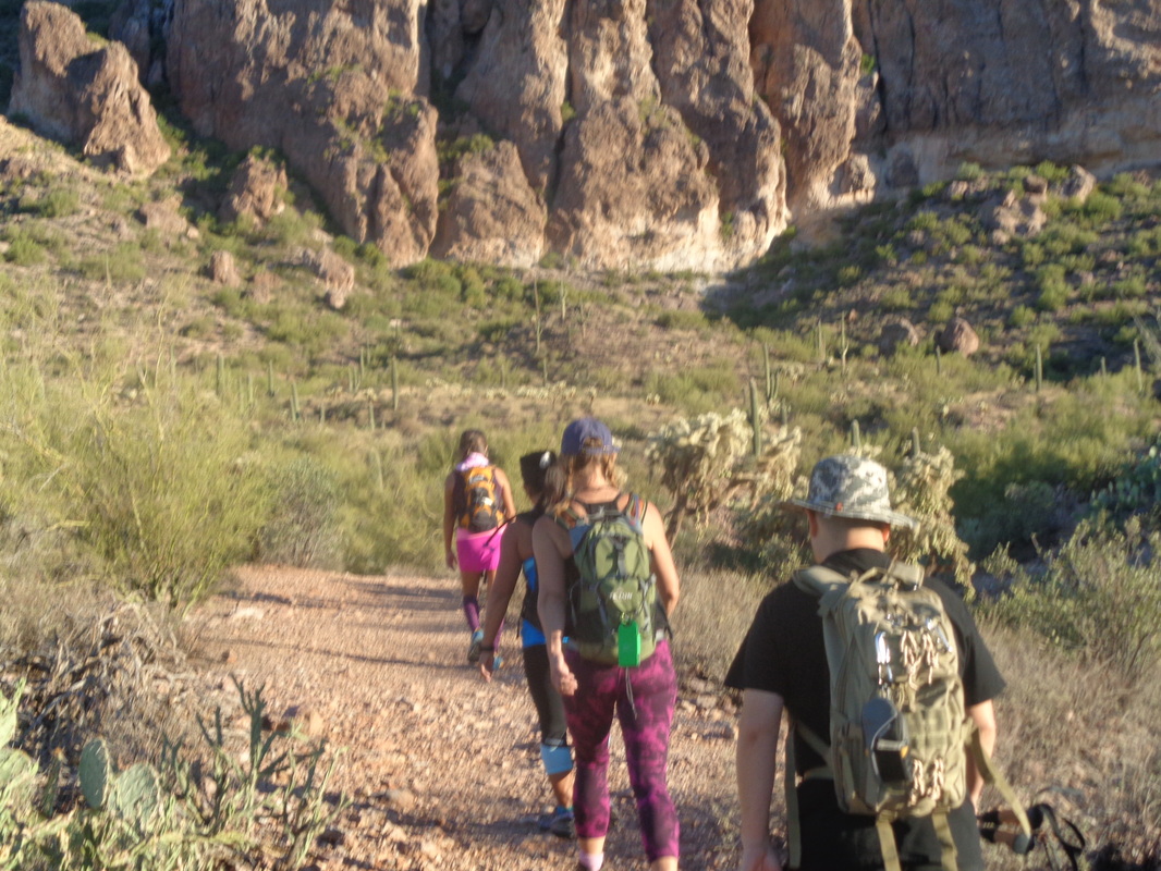 Typically, David & Letlet attract a full crowd but the hike description probably deterred a few so we left with something less than the 15 maximum quantity for organized hikes in the Supes. Those that did attend were fit and ready. We follow Letlet for a little over a mile along a rolling route and then.... 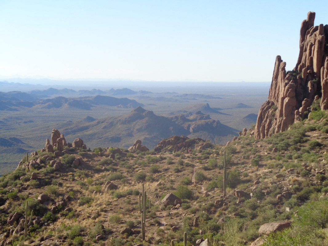 ....begin one of the steepest climbs in the area, up Carney Springs trail. After about 1.4 miles and 2500' of elevation gain, we reached the above flat area and then begin ascending another significant climb to a ridge where we regrouped and.... 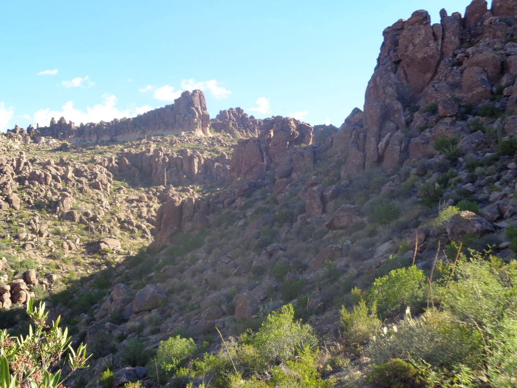 ....contemplated yet more climbing but not as steep or long as what we had previously covered. The ascent so far had a number of spots where the grade was 35-50%. My hiking legs are coming around but this climb really took it out of me. 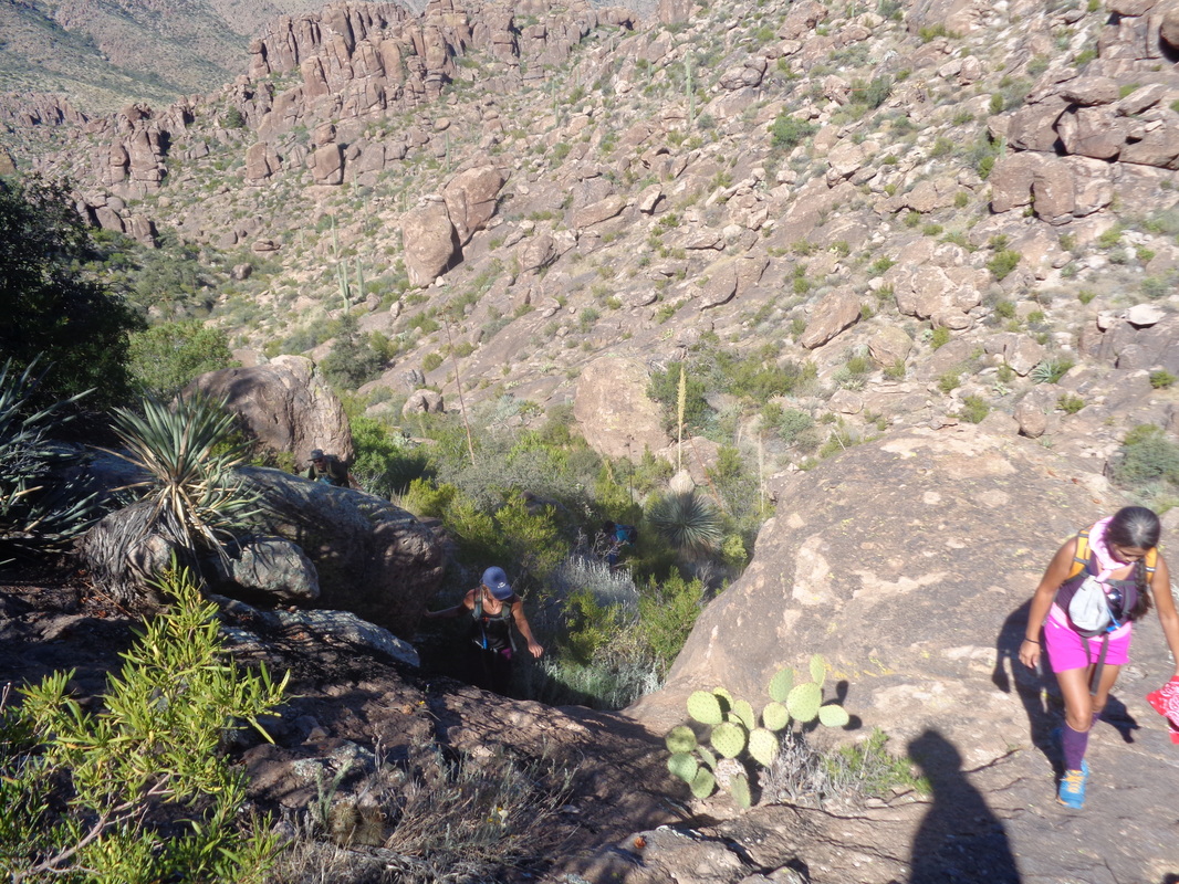 We don't really follow a trail but more a route with some route finding required but an abundance of cairns (piles of rocks placed by other hikers) lead the way. 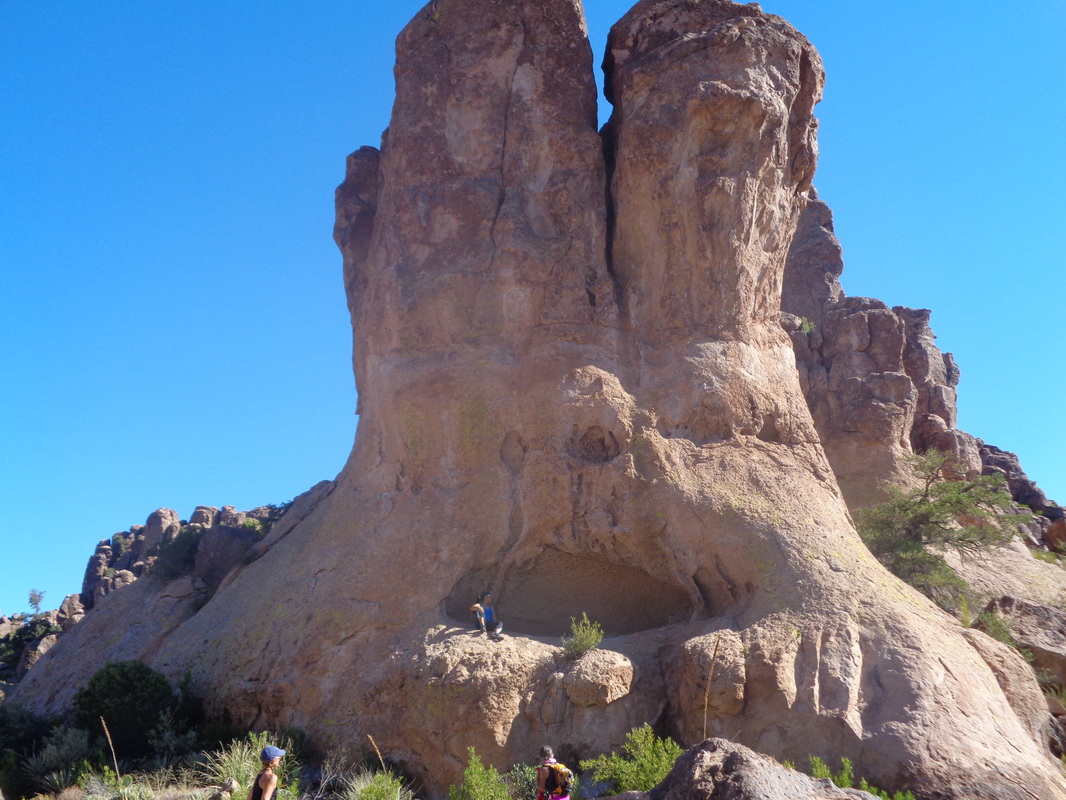 How about that....a feature known as "The Bunny" and it does not take much interpretation to see why. Some of our group scramble into the mouth and have the pic taken before we continue with..... 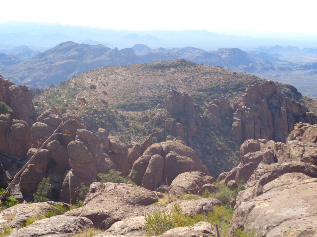 ...awesome views to the south. Now we begin looking for a pile of rocks that indicates we should head south toward the rim and.... 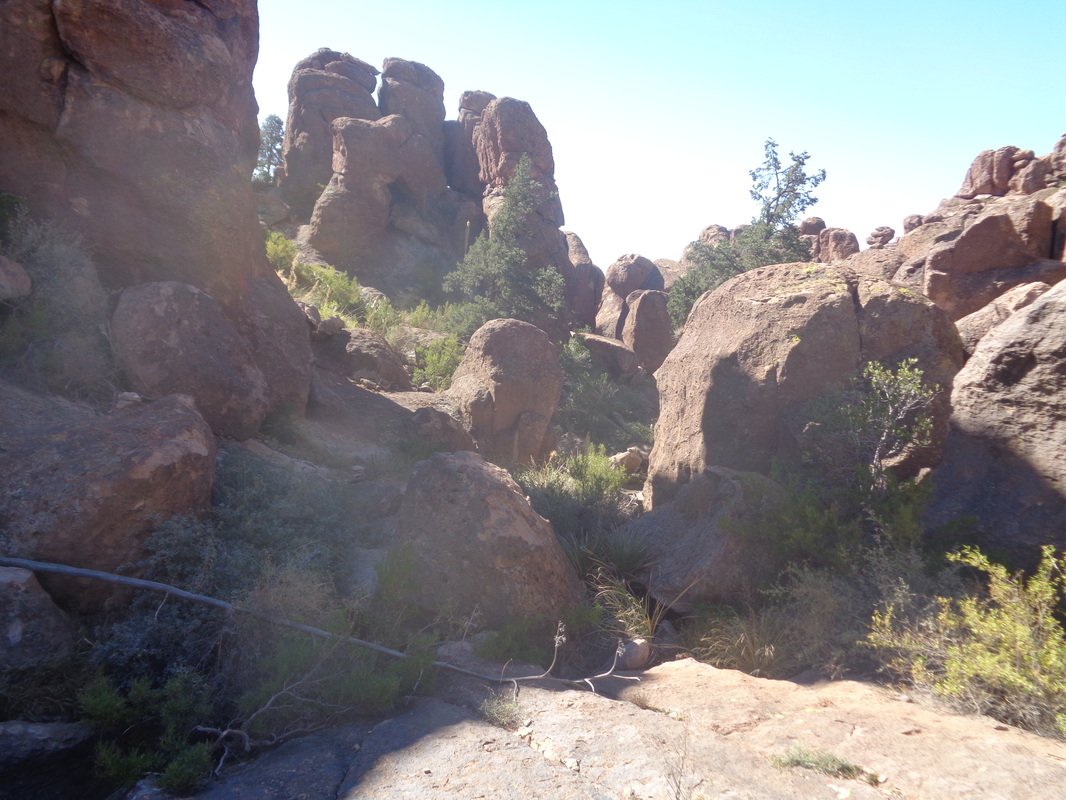 ...this jumble of rocks where we poke around a bit, going deeper and deeper until the..... 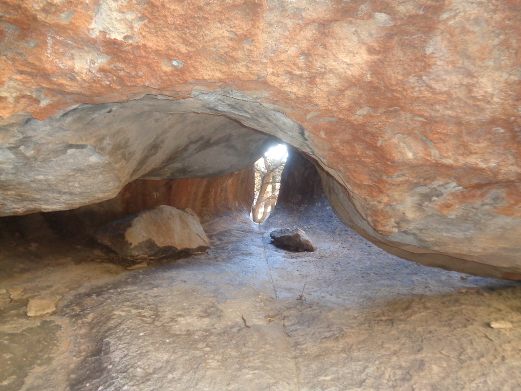 ...opening to the "Roost" is found. I don't think this, unlike other "Robber Roosts" elsewhere around the West, was ever used by thieves but it sure would have made a good one. Through the opening in the center is a drop to another level that requires ropes to explore and then beyond that, a drop to the base of the mountains. 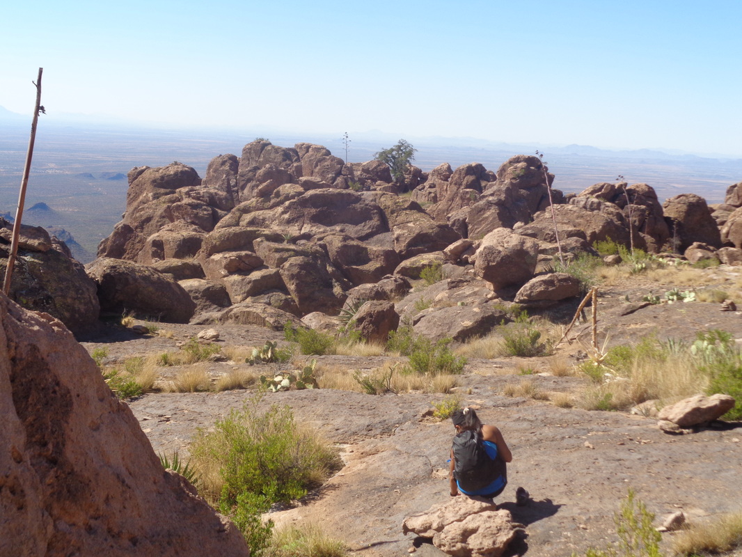 Some of us are anxious to return to watch football or have other plans so Sobha and I depart first. Here, she pauses to check if a cactus needle penetrated through her shoe. Fortunately no. We went off route so we could stand at an overlook and see..... 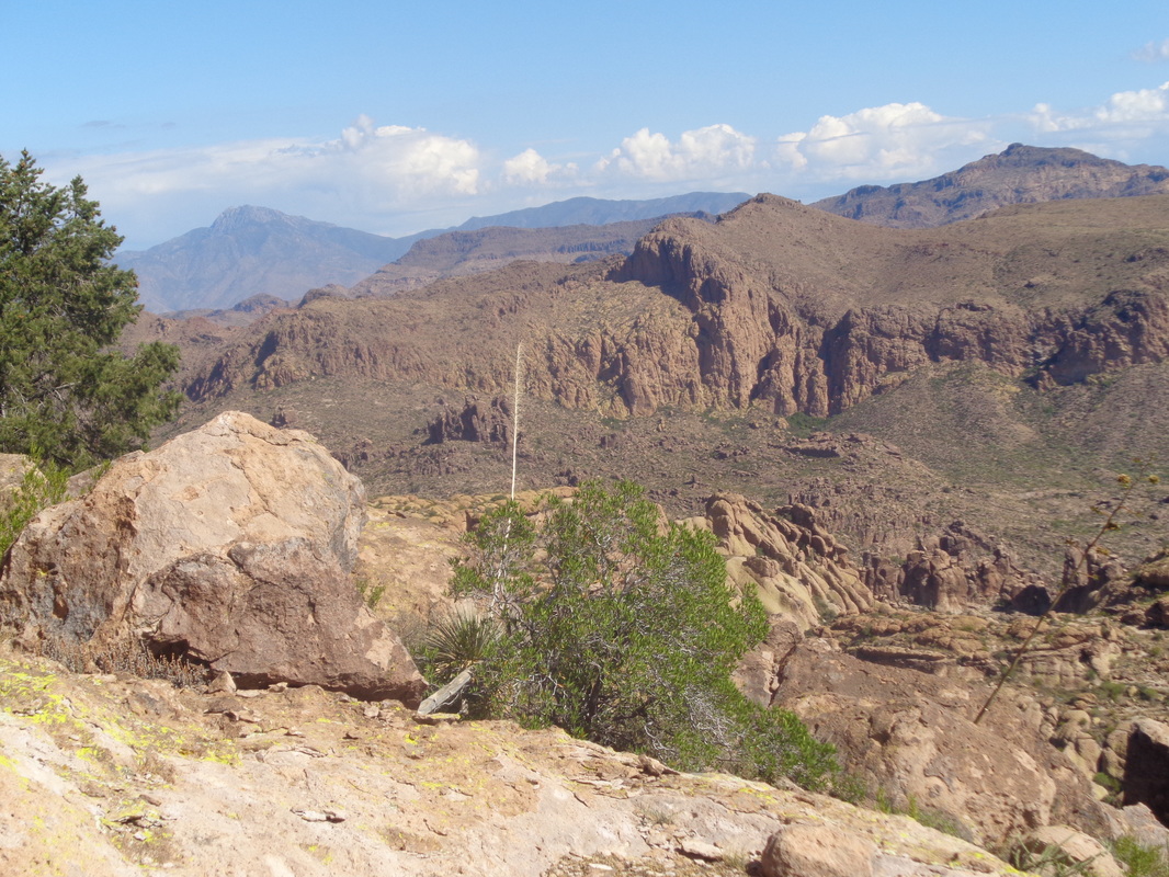 ....great views to the east and points left and right of that. We got back on the route, rounded a burn and .... 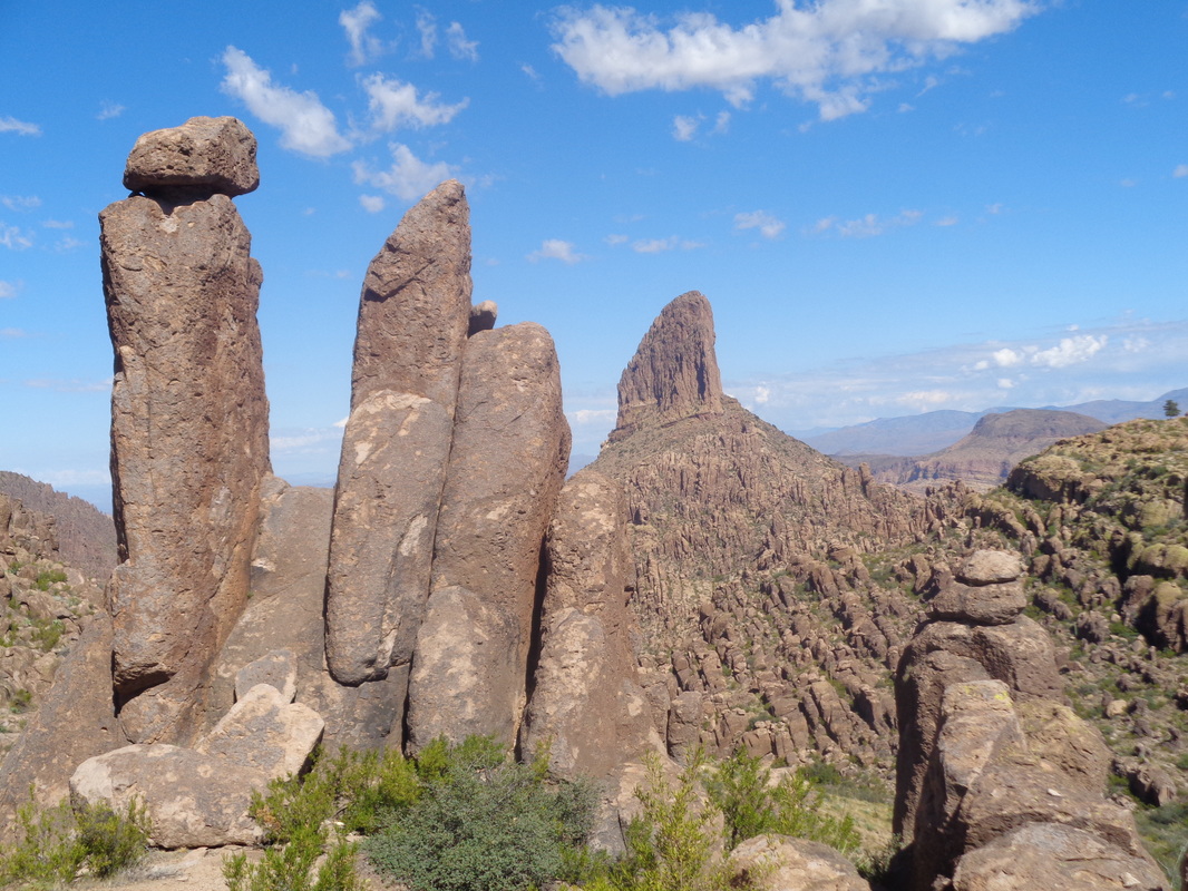 ....there was the awesome Weaver's Needle with hoodoos in the foreground. We reached the Peralta saddle and followed the Peralta trail for around 3 miles to the trail head where we were surprised to find.... 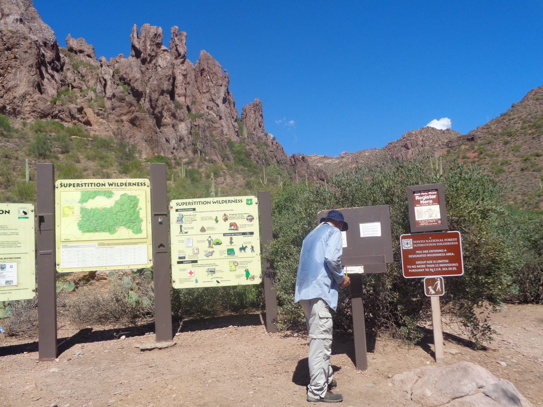 ....Superstition Wilderness' hiking legend, Phil Livingston. Dude has traveled every square inch of the western Supes and a regular at the group hikes. We still had about half a mile to reach the parking lot where we had left our cars and Phil was nice to offer us a ride in his car. WHAT A GUY!!!!! |
