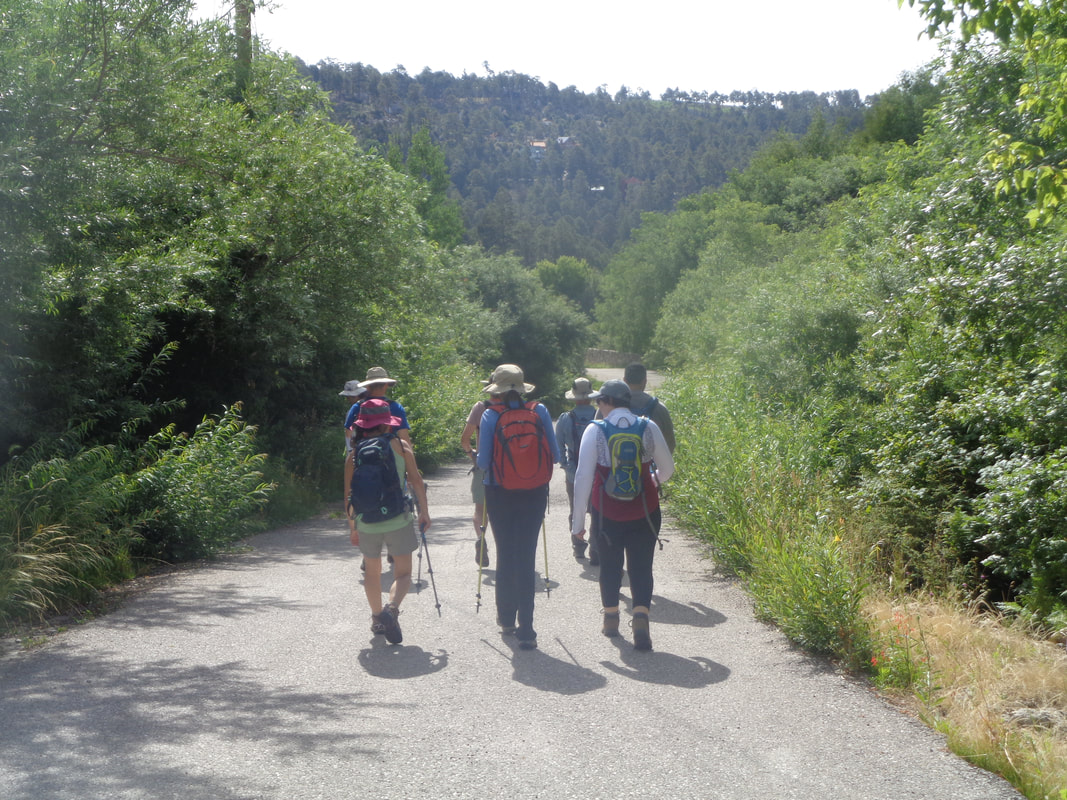
 I met 9 hikers in Oro Valley, we split into 2 vehicles, drove around the mountains and then up Catalina Highway to the village of Summerhaven. Just after passing the iconic "Cookie Cabin" at which I have visited way too few times, we took a right and proceeded to the Mint Spring trail head where we piled out and geared up for a 7 mile loop hike. Oddly, rather than beginning on a trail, we walked down the road on which we had just arrived, walked past the Cookie Cabin with the distinct smell of baking chocolate and then another left. Soon..... 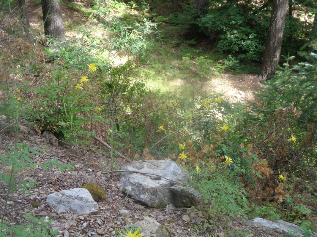 ….we were trail hiking and passed many Columbines in full bloom on what I think is the east side of the mountain. We were now on the Aspen Draw trail which was also very popular with..... 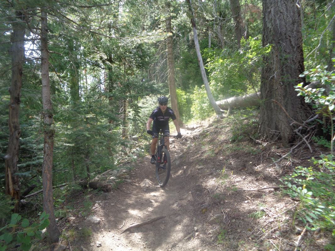 ….mountain bikers. I asked a guy if a gravel bike would be possible on the trails and he said no. We had to stay alert as sometimes a biker would suddenly arrive with little to no warning.  Arriving at the base of the ski lift at Ski Valley, we hung a left and continued up the wonderfully shaded trail. This side of the mountain avoided the devastating Aspen Fire of 2003. 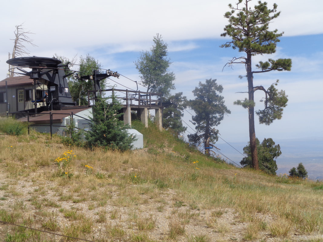 A tiring climb but as always, a rewarding view once we emerged from the forest. 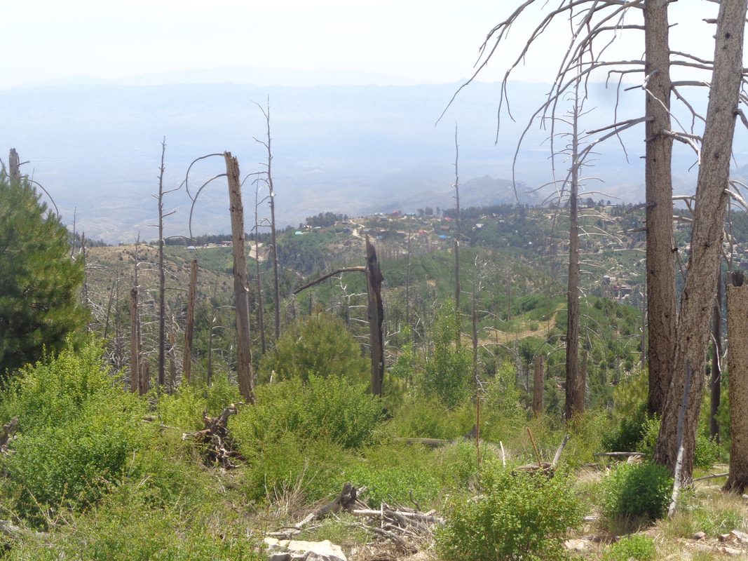 In the distance is Summerhaven and the difference in vegetation on this side of the mountain compared to the other is of course, stark. 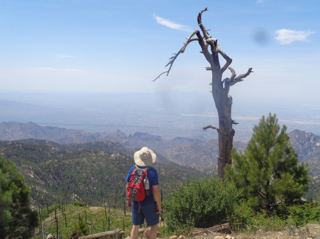 A member of our group, Zack, looks into the vastness to the southwest. It's fun to tick off the various features like Thimble Peak, Blackett's Ridge, the Santa Ritas, etc..... 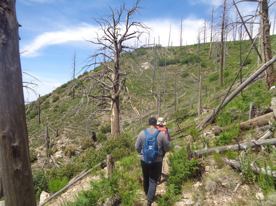 After a short break, we descend the Aspen Trail with Jo Anna leading the way. We encounter a few hikers ascending and always step aside as curiously, those going up hill in AZ have the right of way..... 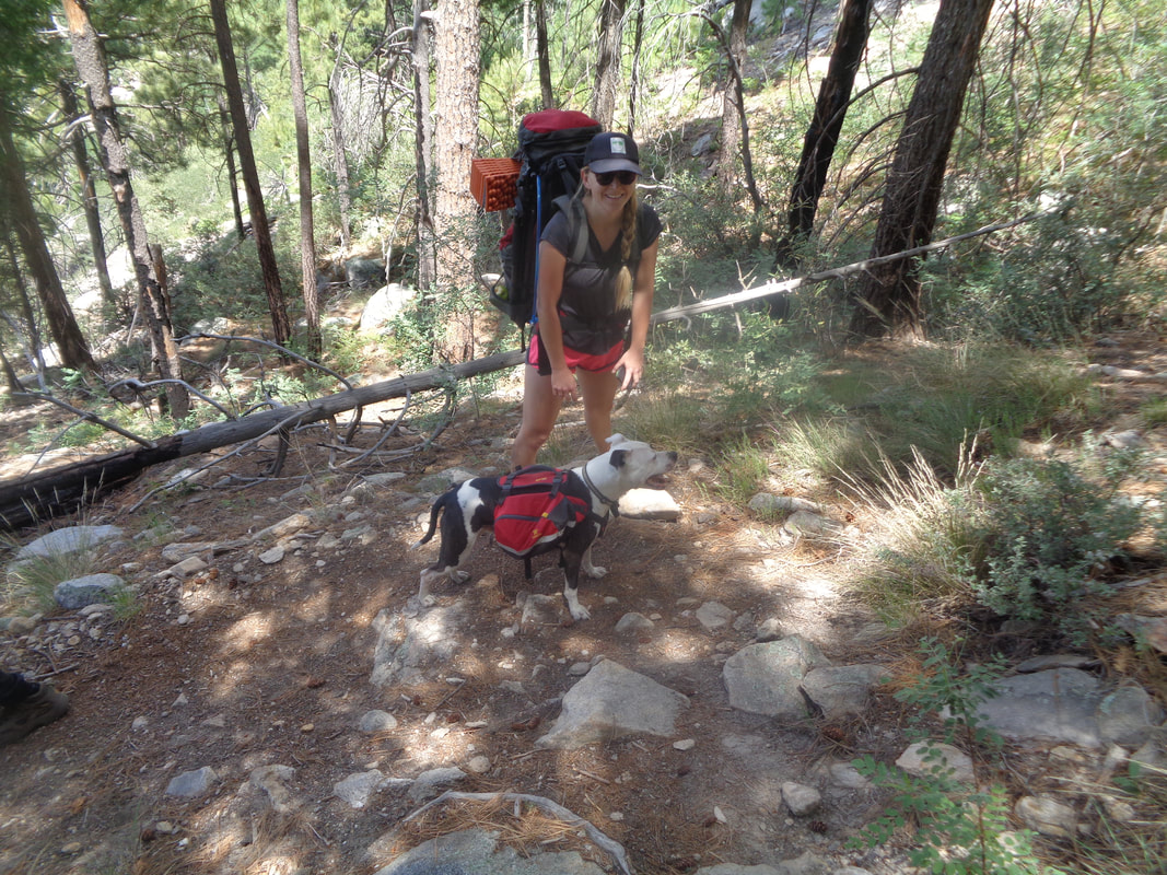 ….including dogs. 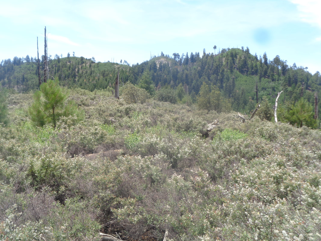 After a long descent, we regroup at Marshall Gulch saddle and then step on the Mint Spring trail. I had assumed this would mostly be down hill but dang was I wrong. Up, down, see a ridge and think, "No way we are going up to that." but sure enough, we would. 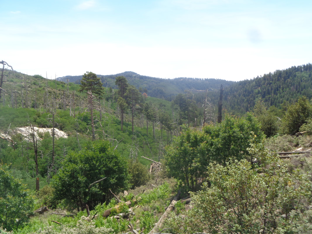 Always good views to accompany each painful step but at last we reach..... 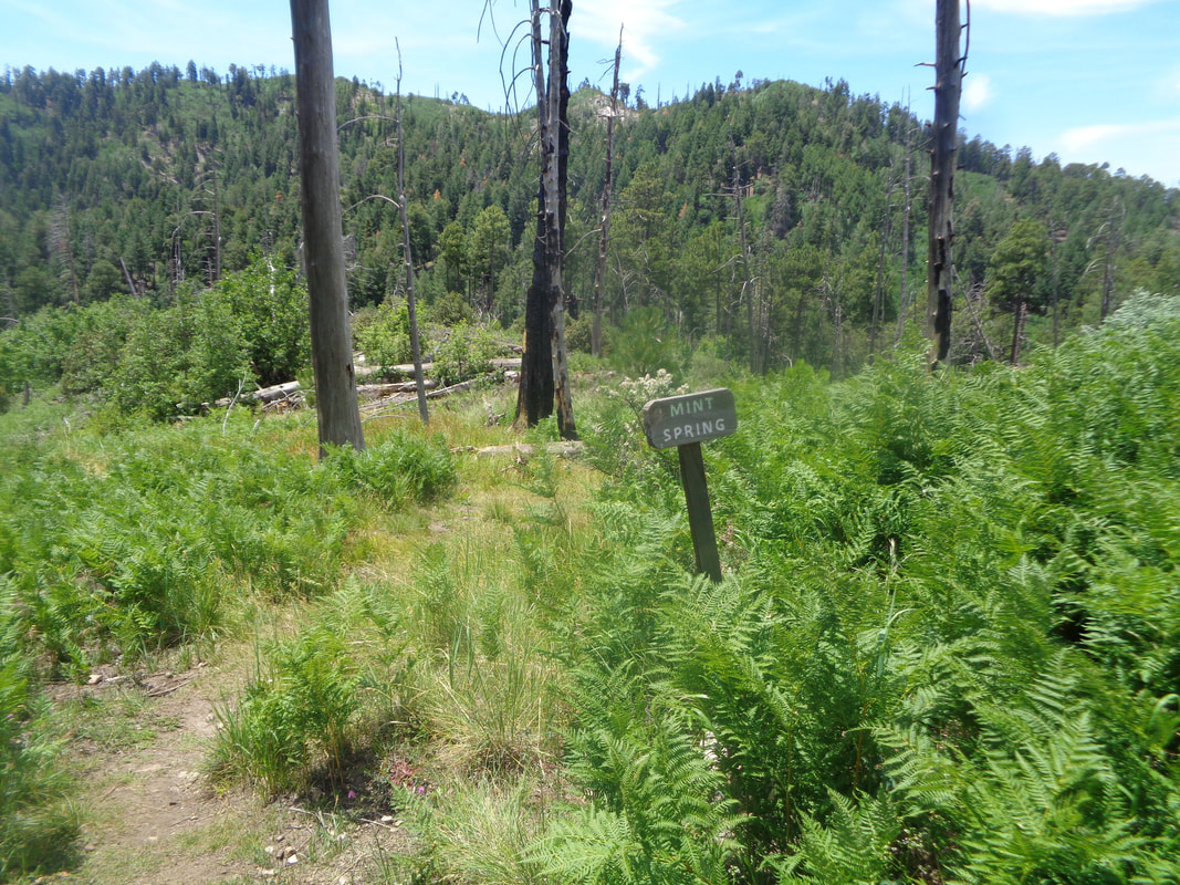 ….Mint Spring where there was a spring and mint plants (and lots of ferns)....how about that? But this was not the end, only the beginning of the end as our march continued until we reached the parking lot with a cumulative 7.2 miles and 1700' of elevation gain for our effort. I had intended to hang with the group but at the first climb, I began thinking about a likely Strava segment so picked up the pace and did so at some of the other climbs. Loading the route onto Strava I discovered.... 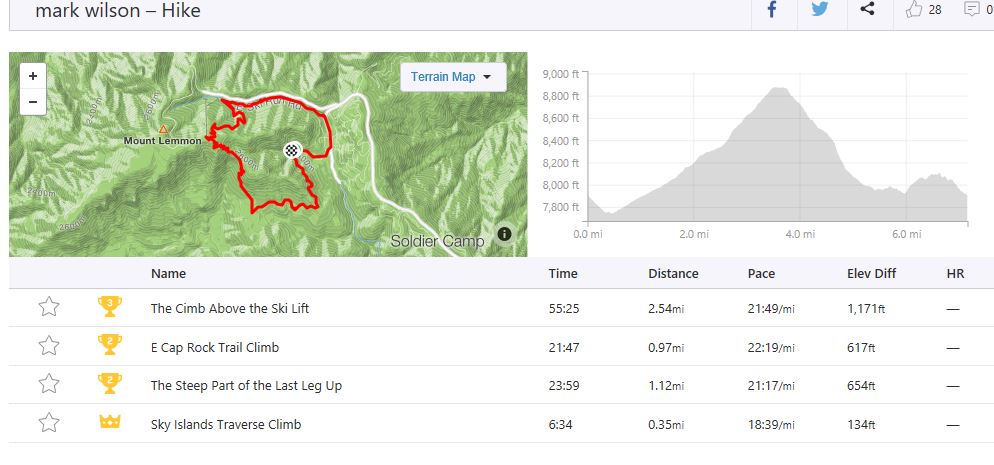 ….I set some good times comparable to the few people (80) who had completed the same effort and also uploaded their hikes to Strava. If you don't know about Strava, check it out. For me, it is a huge motivator to hike and compare my times to others.
0 Comments
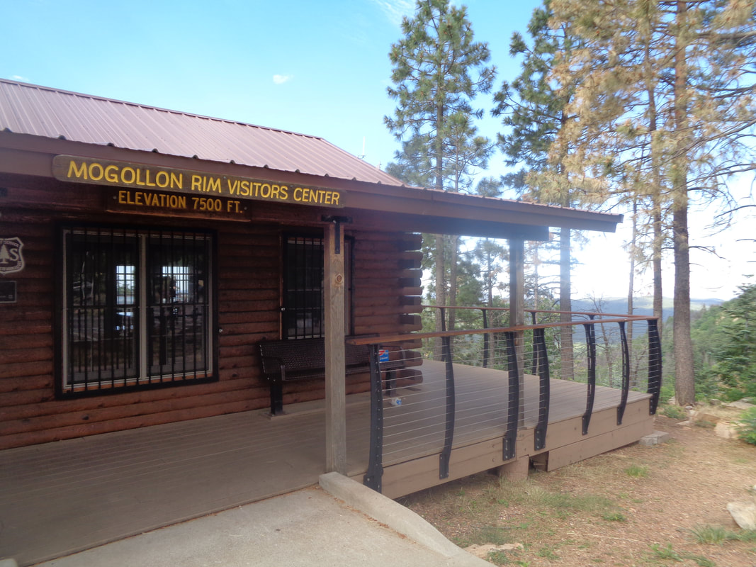 WARNING!!!!! Bring trail directions with you for any hiking in the Show Low/White Mountains. Ha, ha. Even a hiking guide I bought had some questionable directions.  One posted map at a different stop was hung sideways which I though appropriate. Anyway, after a fit and start or two, the hike began. The Mogollon (pronounced "Bogey" "yawn" I think) Rim is beautiful and looks over..... 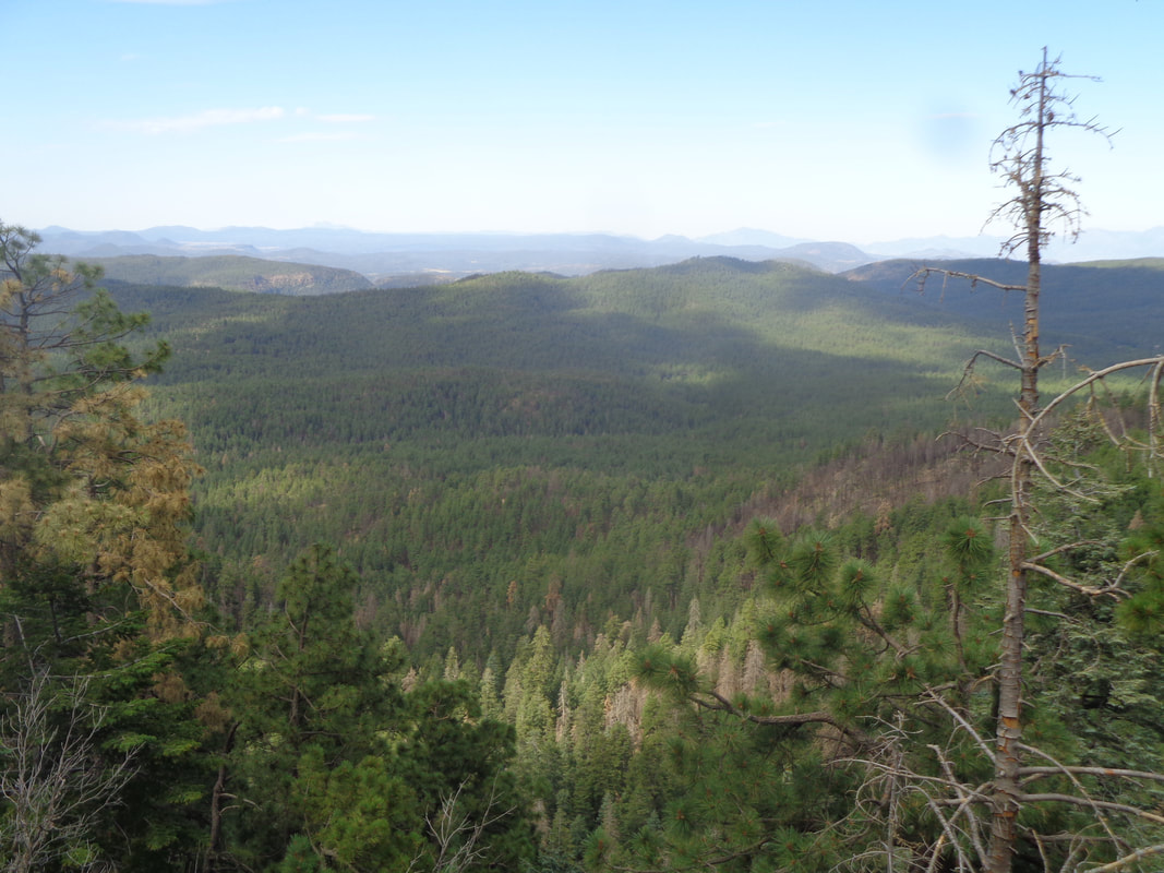 ….the largest stand of ponderosa pines in the world, stretching from Flagstaff to the White Mountains. 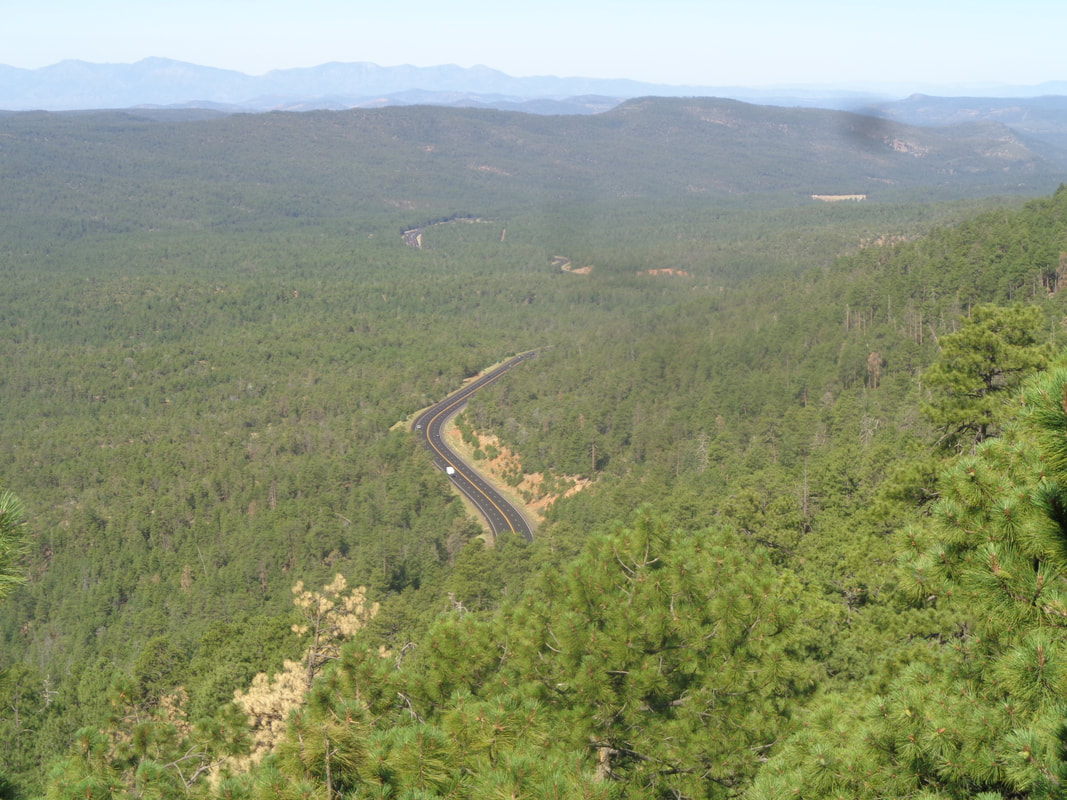 State Route 260 veers off the rim and plunges into the valley as we make our way along the Rim Lake Vista Trail. 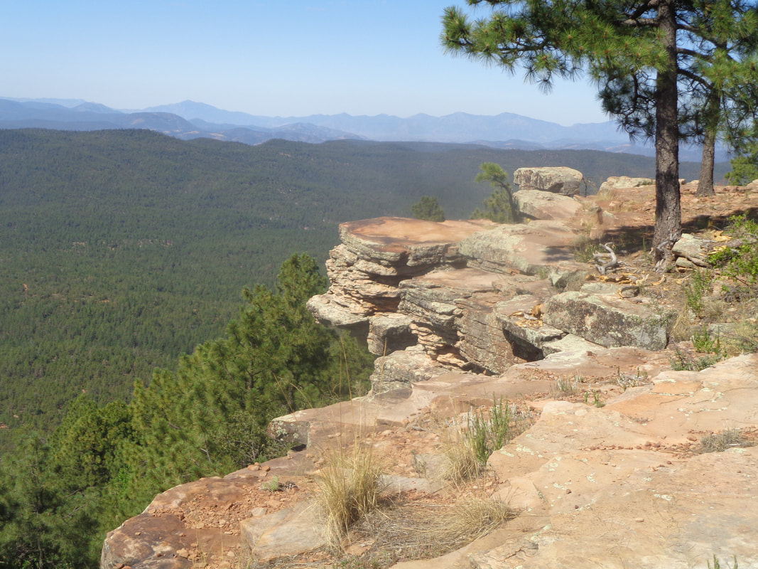 Plenty of rock formations where one can stand and check out where you step outside your comfort zone. For me, a few inches from the rim is it. We walk to the end of the trail, turn around and descend another..... 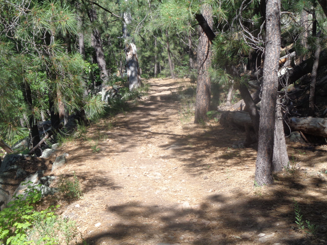 ….trail. We pass an enormous..... 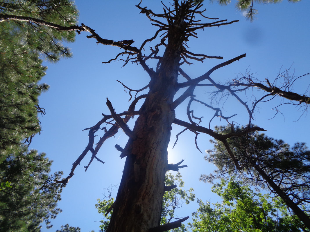 …...dead ponderosa, leaning at such an angle that one wonders what is keeping it upright. Soon.... 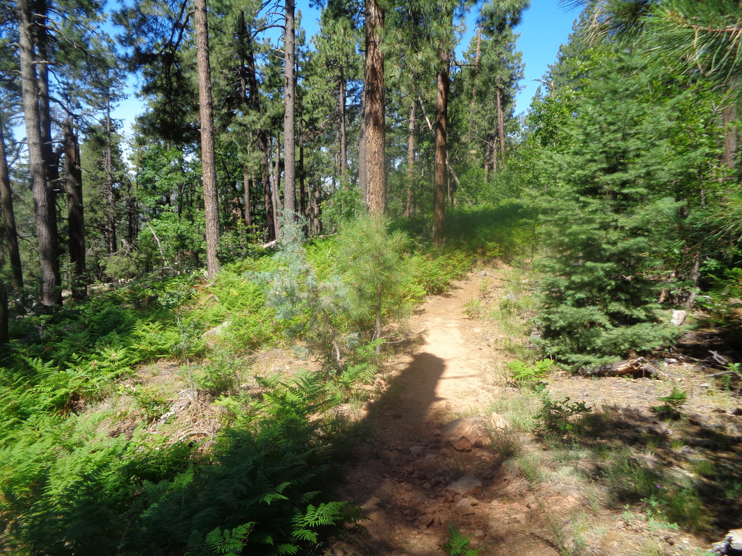 ….there is a break in the tree cover and a healthy field of ferns thrive. We turn around and head..... 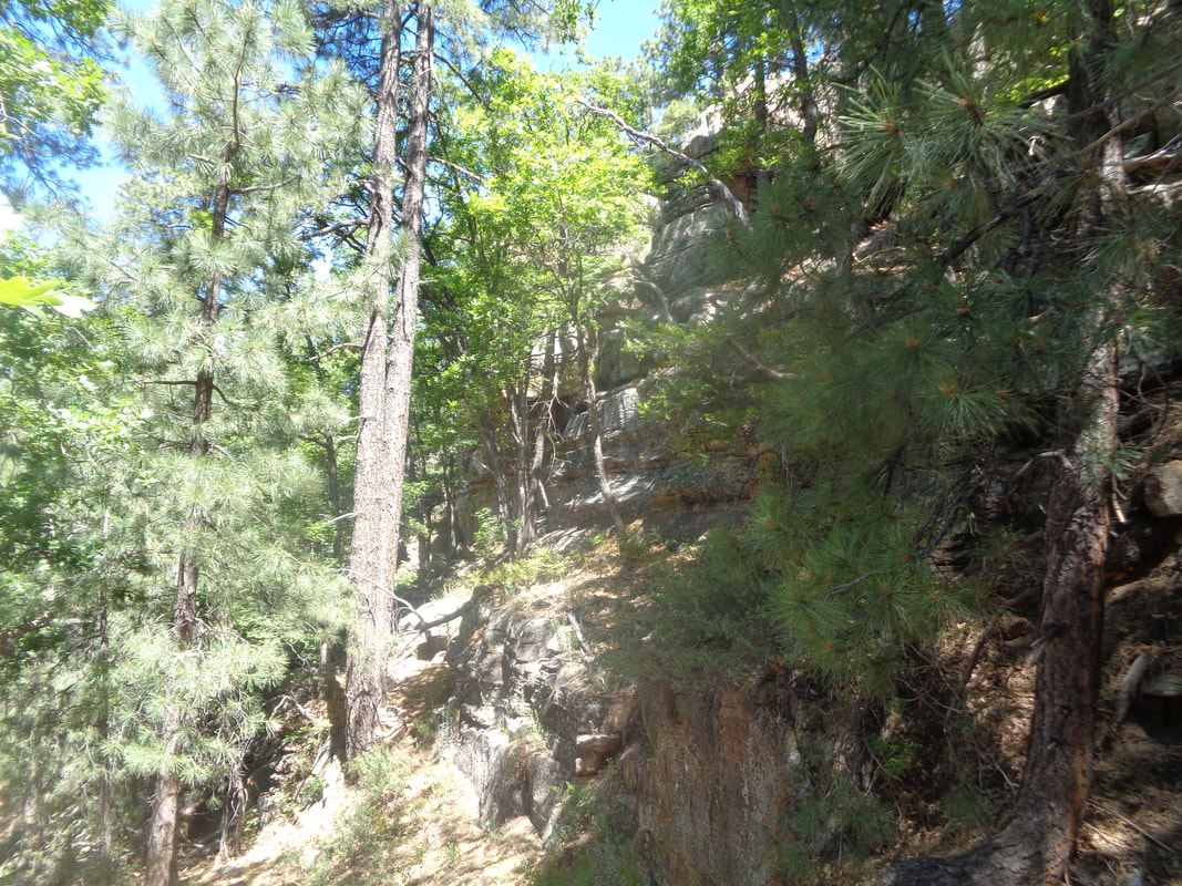 ….back up but I notice some movement to my right and there scampering away is what I guess is a medium sized black bear. My first sighting of a bear. By the time I got over the initial surprise and confirming it was headed away, it was too far for a good image. Maybe next time. The rim approaches and we head up, indicating the climb is over.
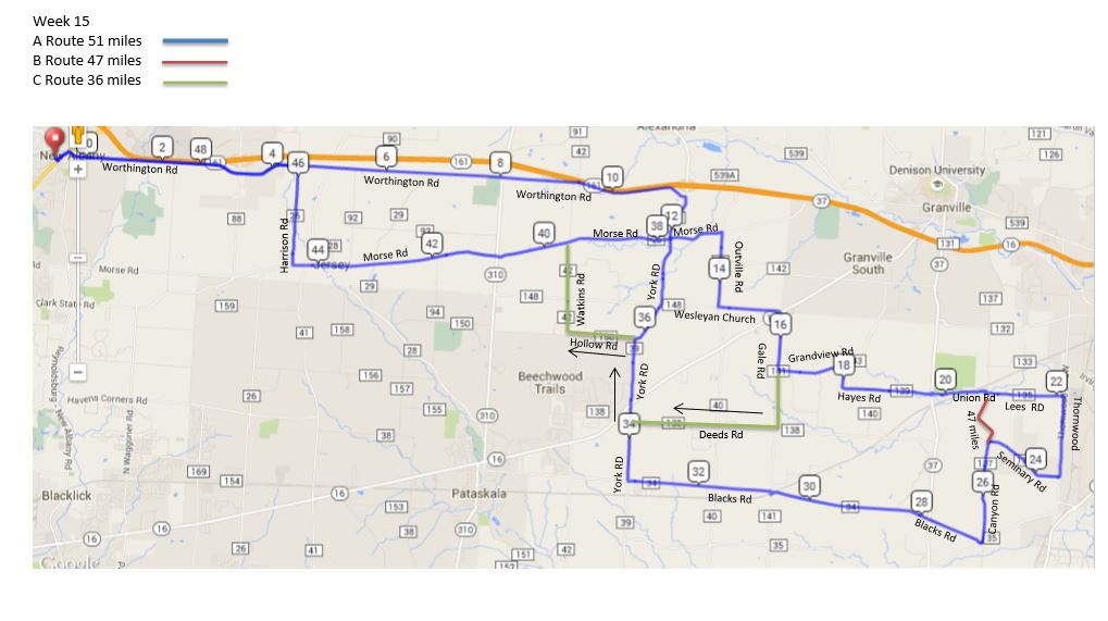
A short visit but worthwhile to check out a new part of the amazing state of AZ. 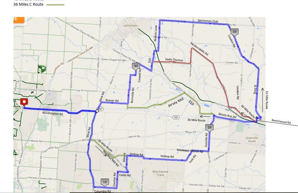 The average high for Thursday is 83 and the forecast high for Thursday is 83. Light winds, great day for a bike ride! The Rivet/A (whoa, still 50+ miles), B and C routes below:
https://ridewithgps.com/routes/19449128 https://ridewithgps.com/routes/19449174 https://ridewithgps.com/routes/19449217 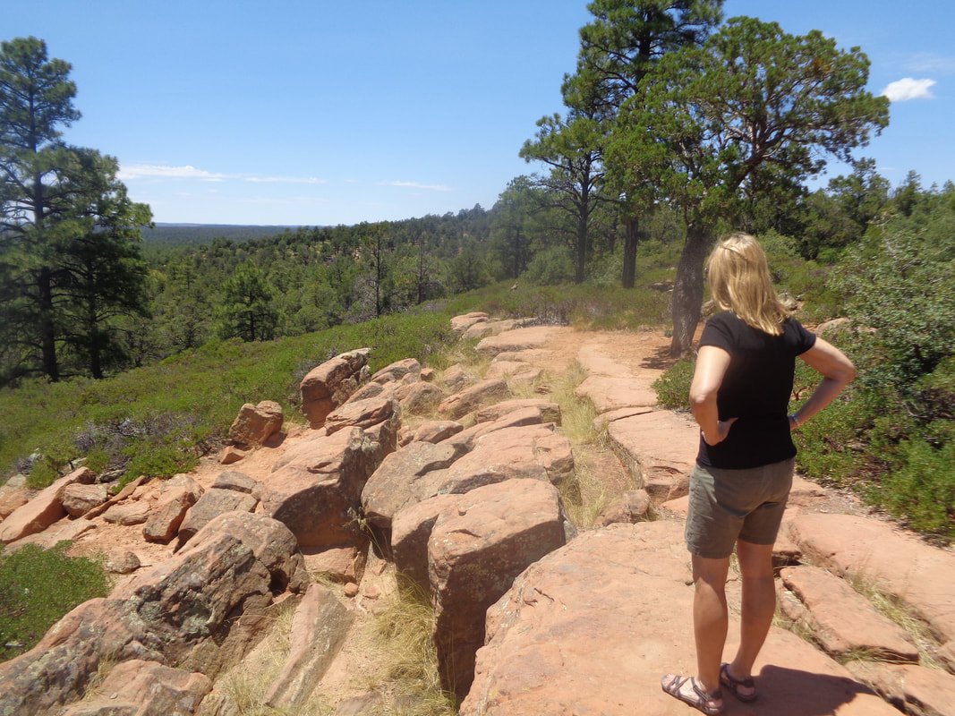 On Monday, I walk into Frys and stand in front of the fish/meat counter. Leslie, a charismatic employee approaches and I ask, what looks good, a question she probably receives dozens of times each day. She advises me of the salmon from Chile so I order it and while she is wrapping we start talking and turns out she owns a home in the Show Low/Pine Top area where I spent a couple of days this weekend. Seems like this is the place to be in the summer and I can see why although the temperature change is not all that dramatic from the valley. More to come on the hike along the rim and my first ever sighting of a real, live bear!
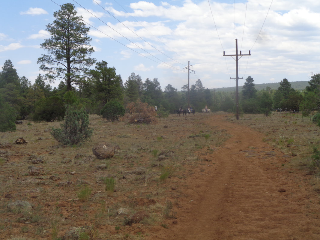 A friend wanted to escape the heat for a couple of days and while I have found I am comfortable with the summer temps, may as well be a good friend and go too. Following a 3 hour drive, we arrived above the Mogollon (pronounced I think "Mogey" like Bogey and "yawn") Rim in the Show Low/Pine Top area. Thousands of folks from Phoenix have a summer home here and it is a beautiful area. Today's hike destination was Ice Cave. 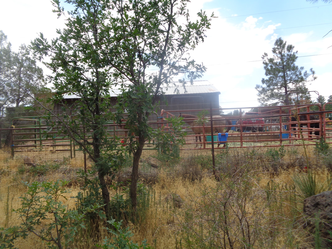 OK, full disclosure, know the route before you start. Ran into a woman from Poland who never found the cave. No reliable signage and many trail intersections further complicate the activity. We followed diamond shaped markings nailed to trees and that works but if you reach one that says. "IC10" you have gone too far. 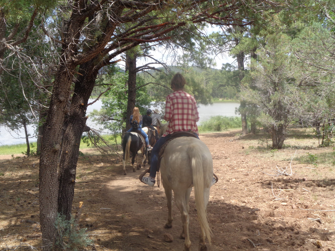 Quite a few groups of horseback riders out too and the leader of one group provided some needed directional help. He told us when we reach the teepee, make a right. 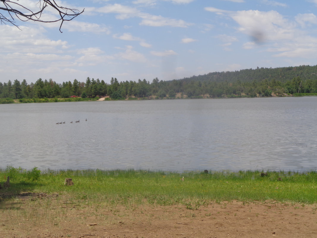 We hike along the shores of Scott Reservoir for a bit before breaking off. 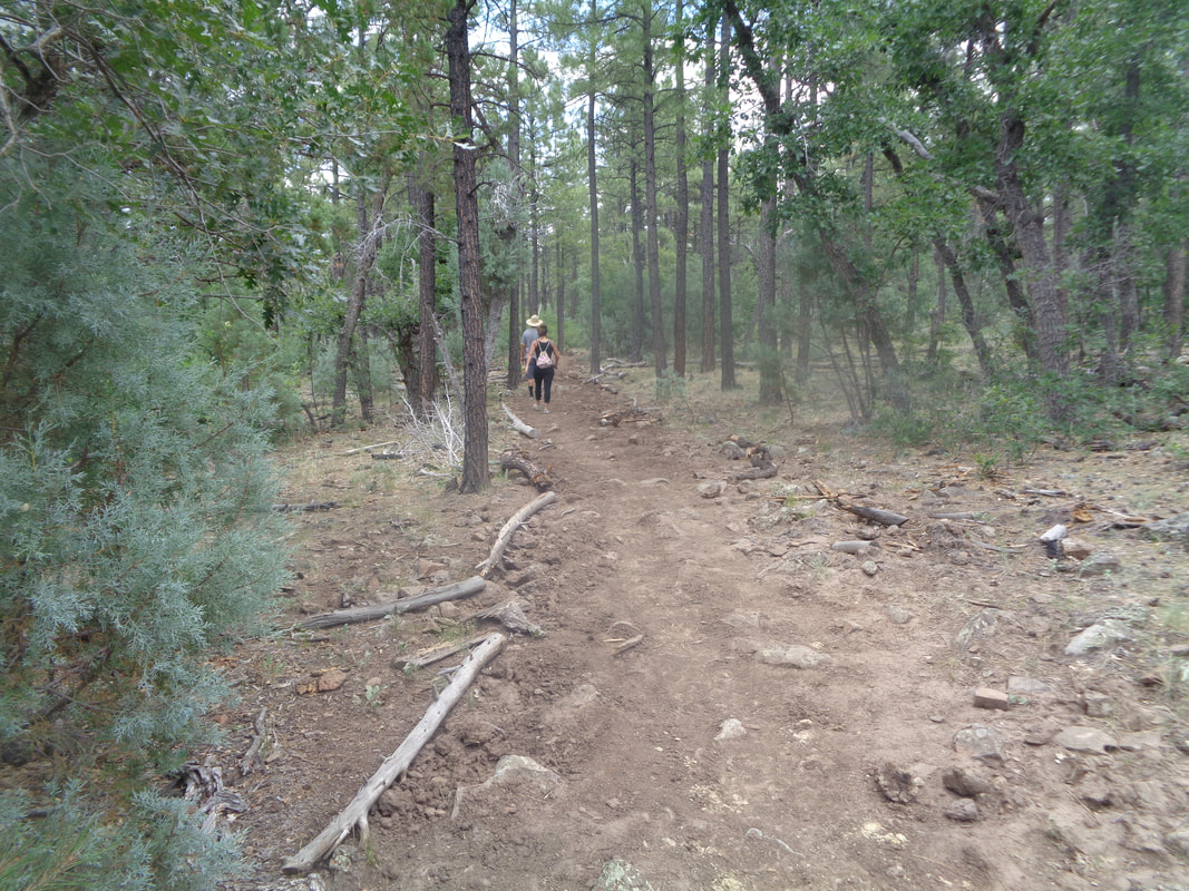 There is an abundance of volcanic rock in and along the trail which makes sense since the area is part of a volcanic field. There are around 405 volcanic vents in the area and we were to visit one today. 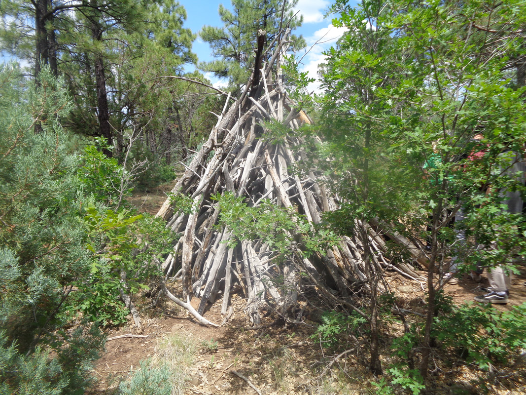 After about 2 miles, we reach the teepee and make a right. We arrive at a fork and go right....wrong so we back track and quickly find..... 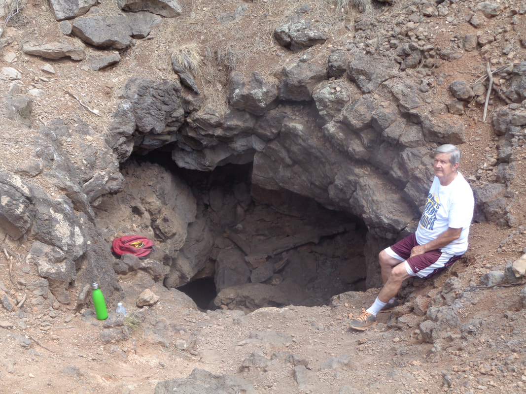 ….the Ice Cave, sometimes known as the Blue Cave and also known as a lava tube. It Is surrounded by a fence but many have gone through and today, a large family of 12 arrived just ahead of us and are now inside. Would I have ventured into the inky blackness were I alone....no friggin way but in.....  ….we go. There is a room large enough in which to stand and of course, the air is a cool 52 degrees. I bonk my head against the ceiling and since there is little to see, even with a few cell phone lights on, we..... 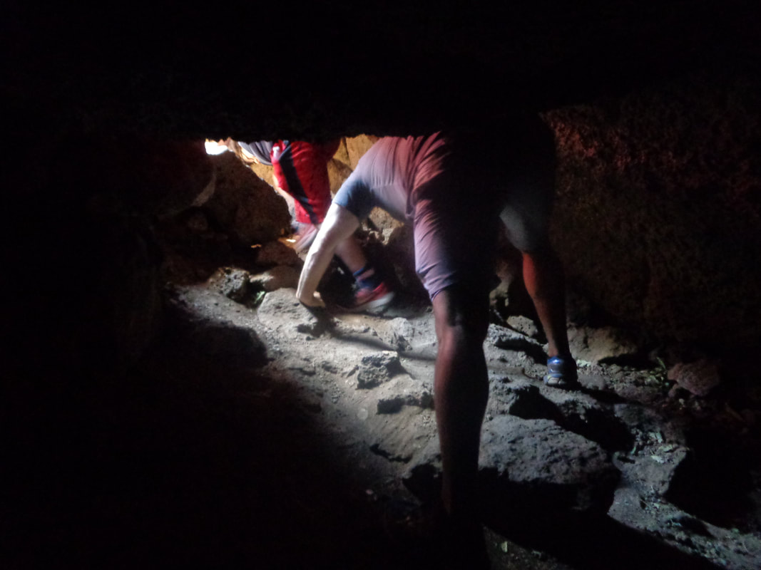 ….climb out. 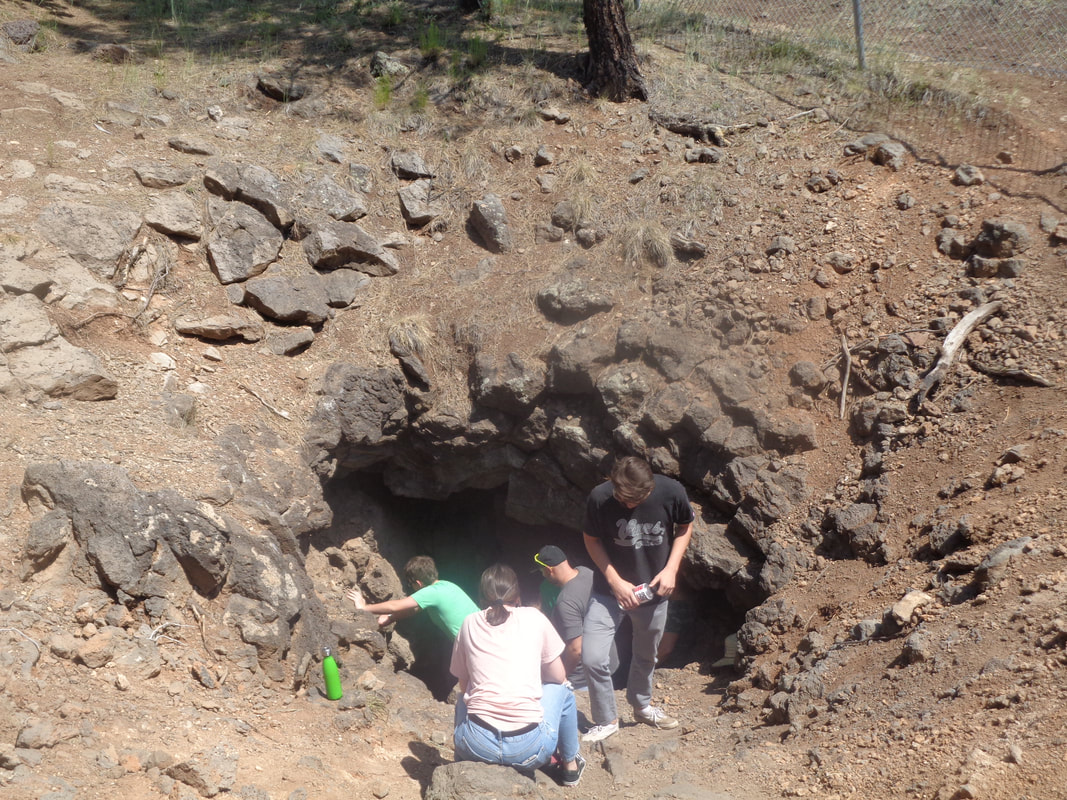 Such an unusual feeling to stand in the sun with 91 degree temperature while the air escaping from the tube is so much cooler. We leave the family behind and head back, finishing with about 5 miles and not much climbing.
 Imagine forgetting to close your screen door completely, going out for awhile and coming home to discover a Javelina (large pig but ornery) sleeping in your living room? Not sure how they got the beast out the door but they did. Also imagine wanting to enjoy an AZ monsoon season and discovering....  ….this being a rare year where they refer to it as "Nonsoon"? In the winter, I like to highlight a day in late January, in Ohio, when the average day time high creeps from 37 to 38 degrees. Out here, I should identify 7/12 as the day the average day time high DROPPED from 103 to 102, then 101. Don't cry for me Argentina. It is very livable and the mornings wonderful. But, if the every day sun and dry heat starts to get to you, 3 hours away is the Mongollon Rim country (pronounced "Mogey" "yawn") and I went there this weekend for hiking. 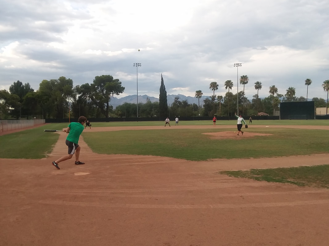 Oh, I should not forget that this pony added another trick to his stable,....softball! I had a grand time playing shortstop with the kids and fielded 6-7 ground balls without an error although winging the ball to 1st base is more like a parabolic shaped flight with a bounce to the glove of the person playing first. I think 2nd base is in my future. We "teed off" at 6pm and again, that dry heat isn't a big deal. Now if I could just enjoy a gully washer that would be grand. Got some great images coming of the hikes up in north country.
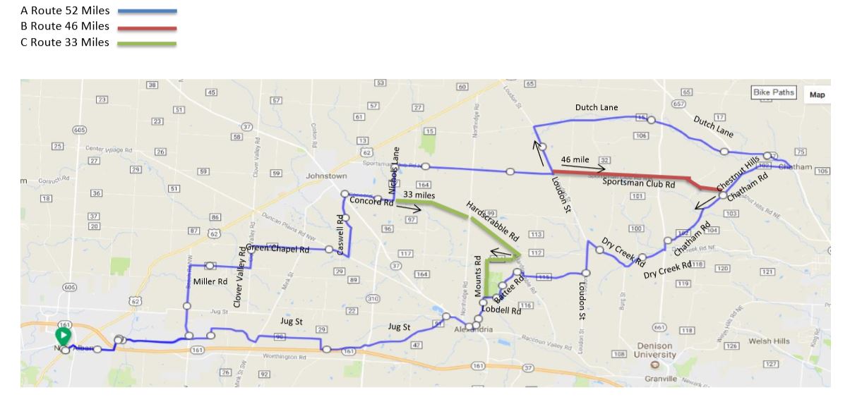 I would be the last person to state anything the least bit depressing but with 16 rides to our season so far, there are only 12 to go prior to the onset of undesirable weather but hey, it could be worse, it could be MI or MN rather than the great state of OHIO. Anyway, Thursday routes:
https://ridewithgps.com/routes/19222885 https://ridewithgps.com/routes/19779892 https://ridewithgps.com/routes/19449217 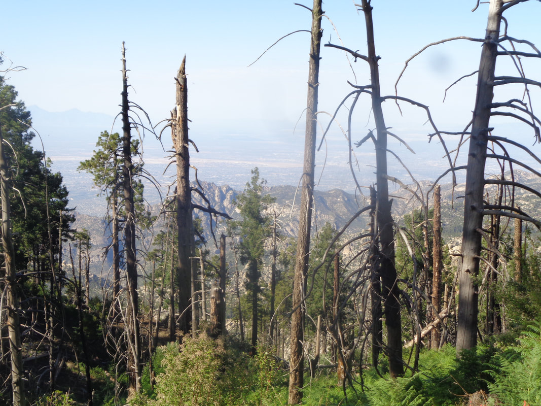 The remains of the 2003 "Aspen Fire" are plentiful and it is a surprise that after 16 years, so many dead trees still stand. I organized a group hike for those who wanted a hike and escape from the valley temperature. It was a wonderful 67 degrees at the start as we begin our hike from in front of the observatory at 9000' . 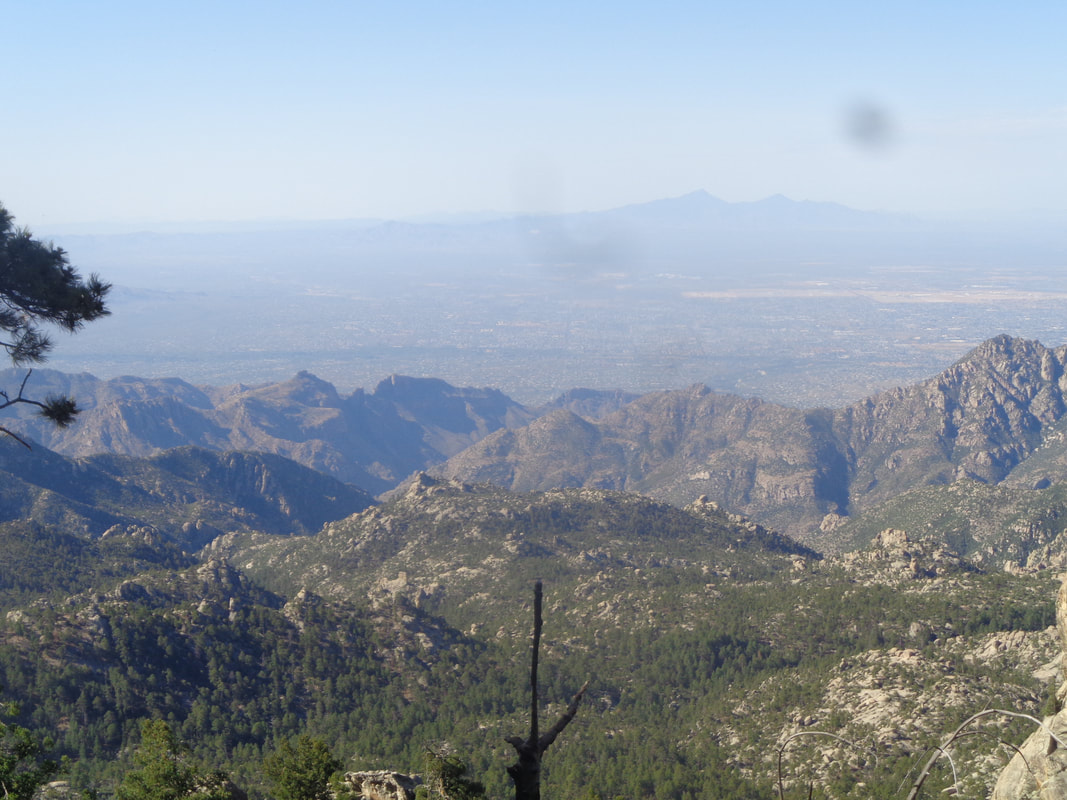 I promised the group there would be awesome views at the start and so good were the views that I walked by the Lemmon Rock trail, the 2nd leg of our route. Nice work hike leader! Thus we added an unnecessary mile to the hike. 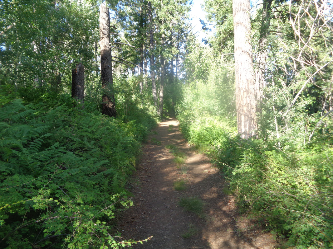 At times, the trail leads into the forest but soon comes back out for more great rim views. 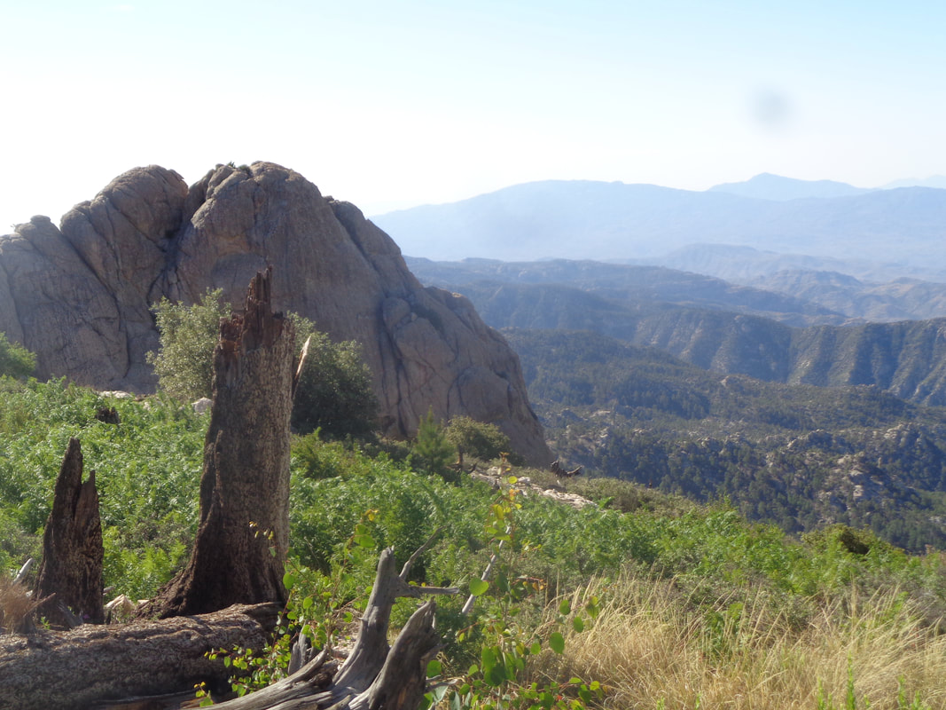 Once I figured out my error, we turned around and headed back but..... 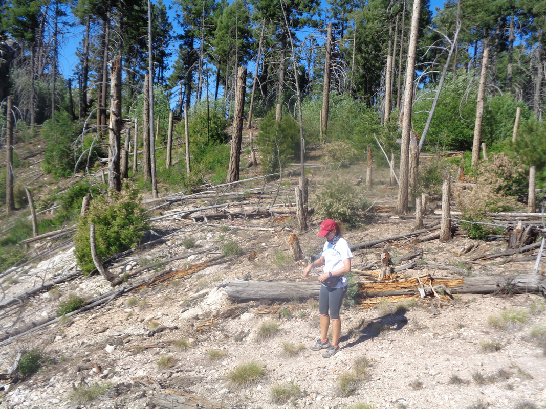 ….new group hiker Christie pushed me and we got ahead of the others so waited and could see..... 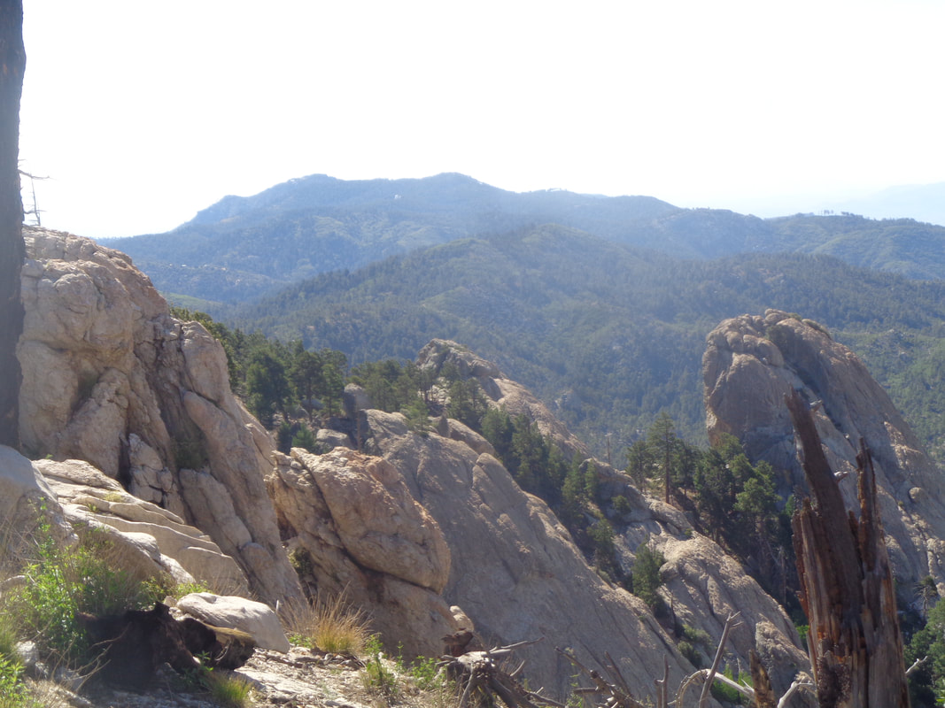 ….another observatory across the way, a white dot set against the mountains. So many observatories in the region, Kitt Peak, Mount Graham, Mount Hopkins and atop Mount Lemmon. I understand they are oblivious to each others work but gather once every 2 years for a conference. 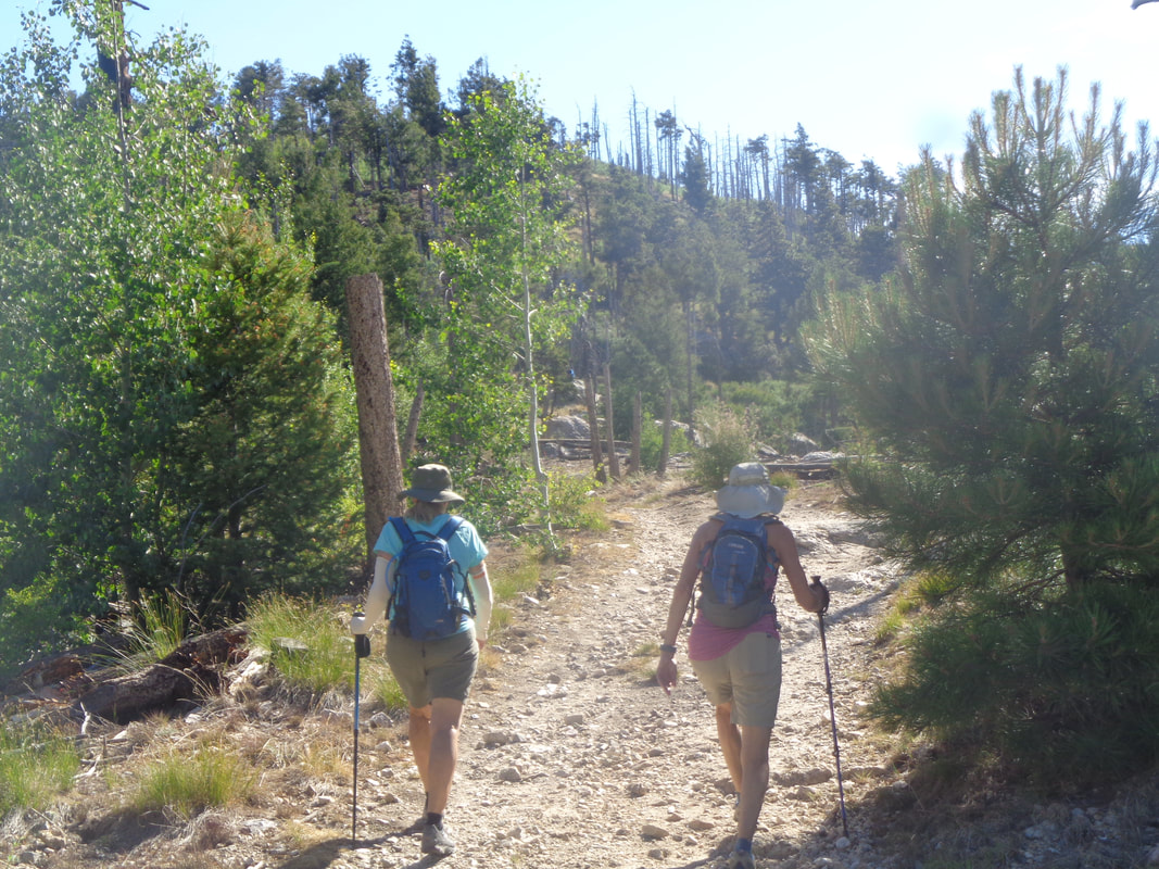 We regroup and there is some minor grumbling because most of the return to the route is up hill. Very minor grumbling. We begin a fairly steep descent on the Lemmon Rock trail and as I walk, I pass a brushy area and then hear behind me..... 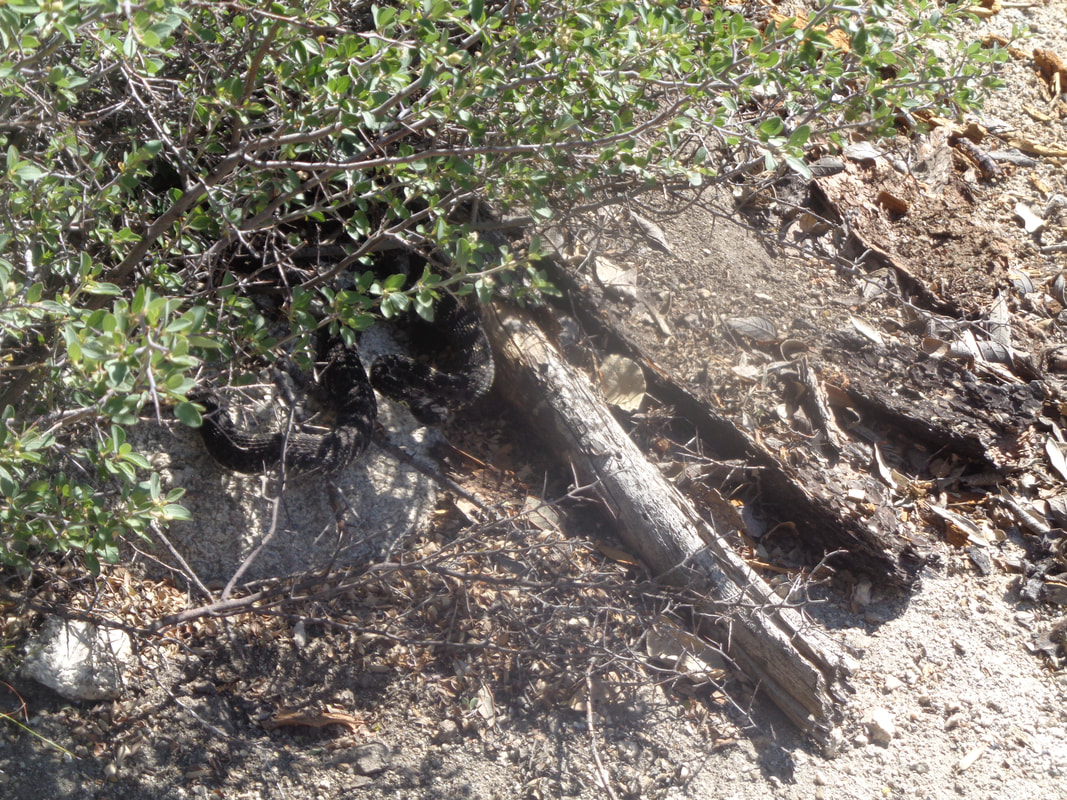 ...that distinctive sound of a rattlesnake. Yikes, I had walked by it and perhaps it was napping and I woke it. I took my hiking pole and fished a black rattlesnake out of the brush but it was not keen to stay in the trail and quickly slithered back. I assured my hiking friends they were out of the strike range and they quickly skipped by. This produced a story about a hiking friend who was struck not once but twice by the same snake, 3 weeks ago and is still in the hospital. The damage is so great that he may lose a leg. This being my 15th encounter, stories like this ensure I remain vigilant to the extent that is possible as they are sneaky creatures. 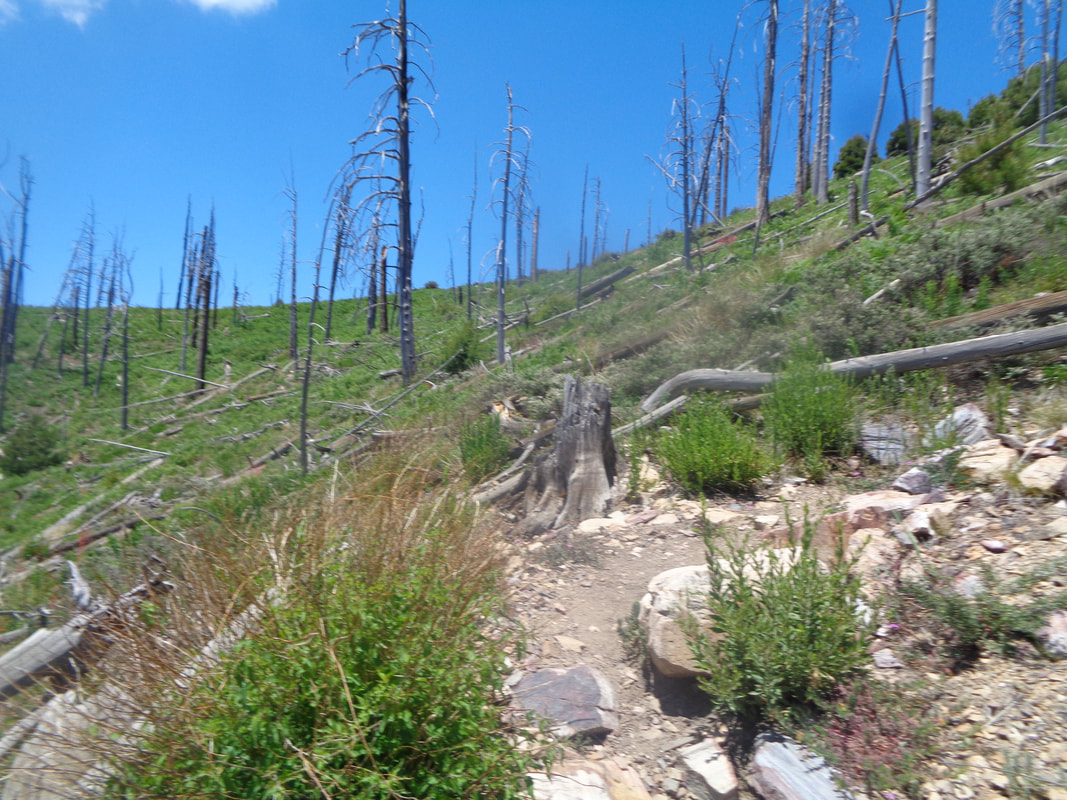 Reaching the Wilderness of Rocks trail we pause for a break and then continue on it to Marshall Gulch saddle. The climb took its toll, along with my unplanned additional distance so two of us bugged out, taking a down hill option to the Marshall Gulch trail head where later they would be picked up. The rest of us proceeded up the Aspen Trail, rather exposed to the sun and way steep. Trees have been slow to regain the slopes here. 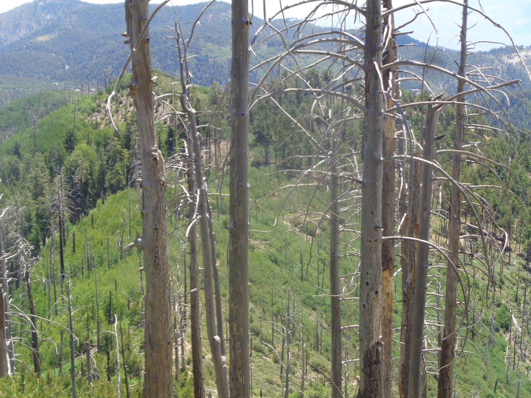 Nearing the top, I look back over a portion of where I had come, finish the ascent and walk to..... 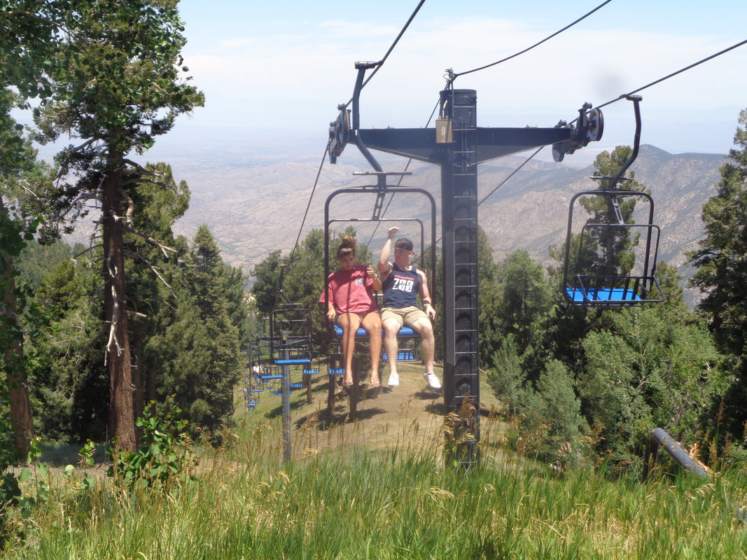 ….the top of the ski lift where people are arriving so they too can enjoy the views. We regrouped and made the short hike to the car. I finished with 8.3 miles, exactly what I had the previous day hiking Mount Hopkins. Weird how that works some time. Oh and 2100' of climbing.
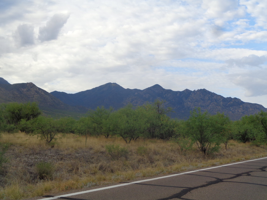 I headed south again to Madera Canyon to complete Monday's intended route to Mount Hopkins. The trailheads are at approximately 5000' so the day's high will only be in the mid to upper 80's. It's early, 7am, when I shove off but it has been light since 5:30am. It's not as important to get a super early start as it would be if hiking elsewhere. 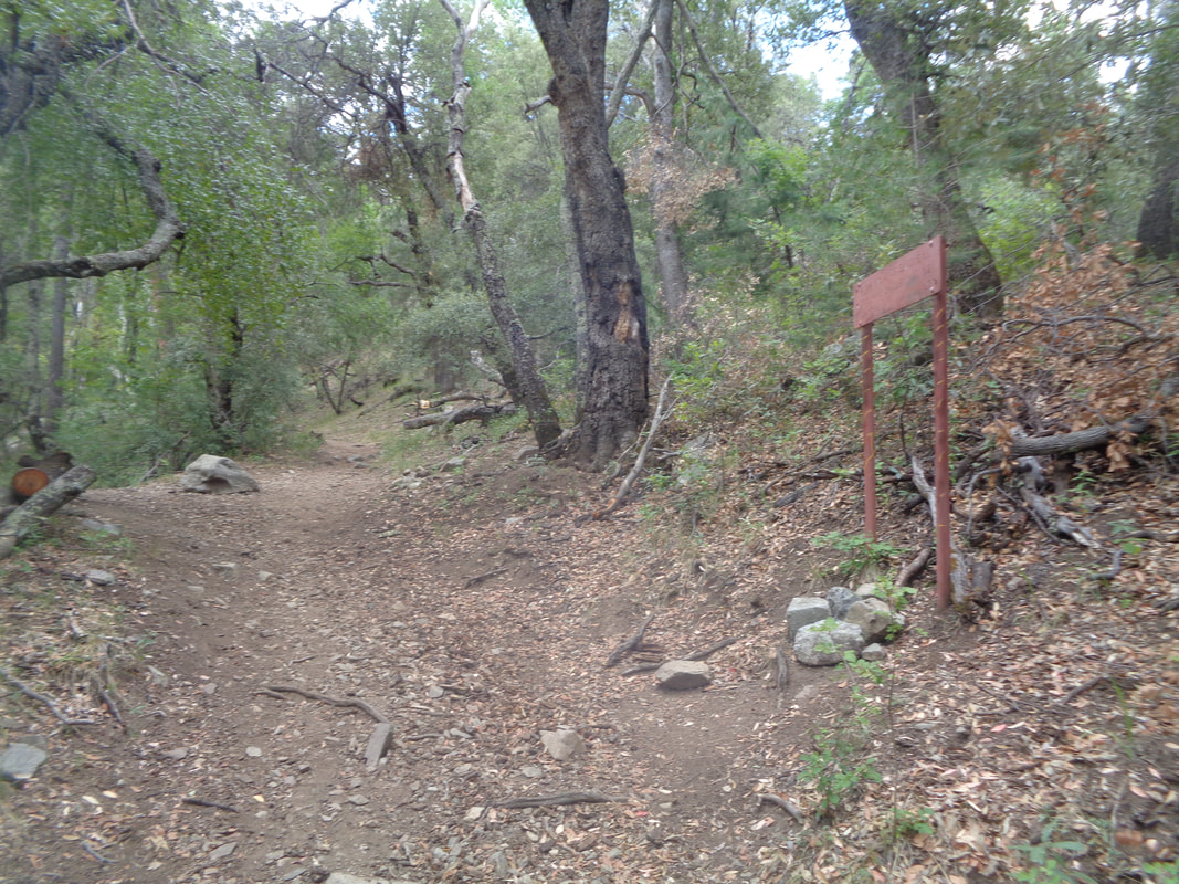 From a parking lot filled with cars I begin ascending. I pass Old Baldy trail on my left, walk past the wickedly steep Vault Mine trail on my right (which I had taken last Monday) and continue on the Carrie Nation trail. As I climb higher, well above 6000', I find an..... 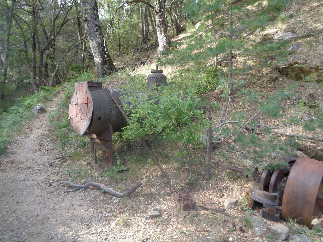 ….old boiler and soon thereafter.... 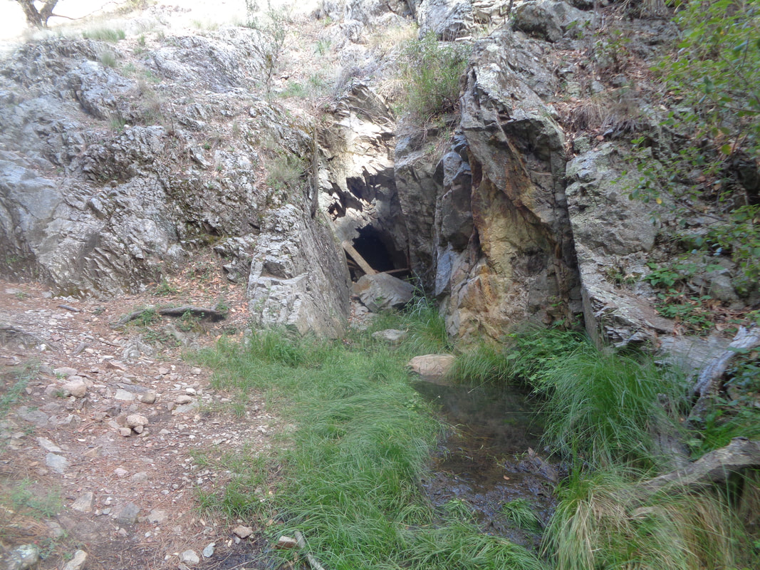 ….walk by the entrance to the Carrie Nation mine which dates back to the early 1900s. I have read the mine was mostly used to extract copper. There is a pool of water in front of it. I walked to the entrance and peered into the blackness but that is as far as I would go. I continued up as the trail transitioned from rocks and boulders to..... 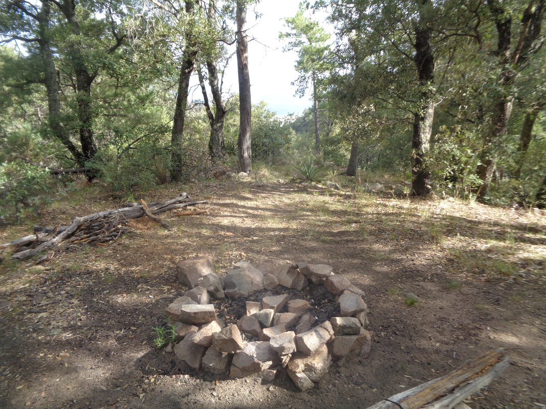 …..smooth dirt covered with pine needles and even found a nice campsite. Other hike reports state there is an "End of Trail" sign either down at the mine or around here but it is long gone. What follows is a well worn route and easy to follow. There are enough..... 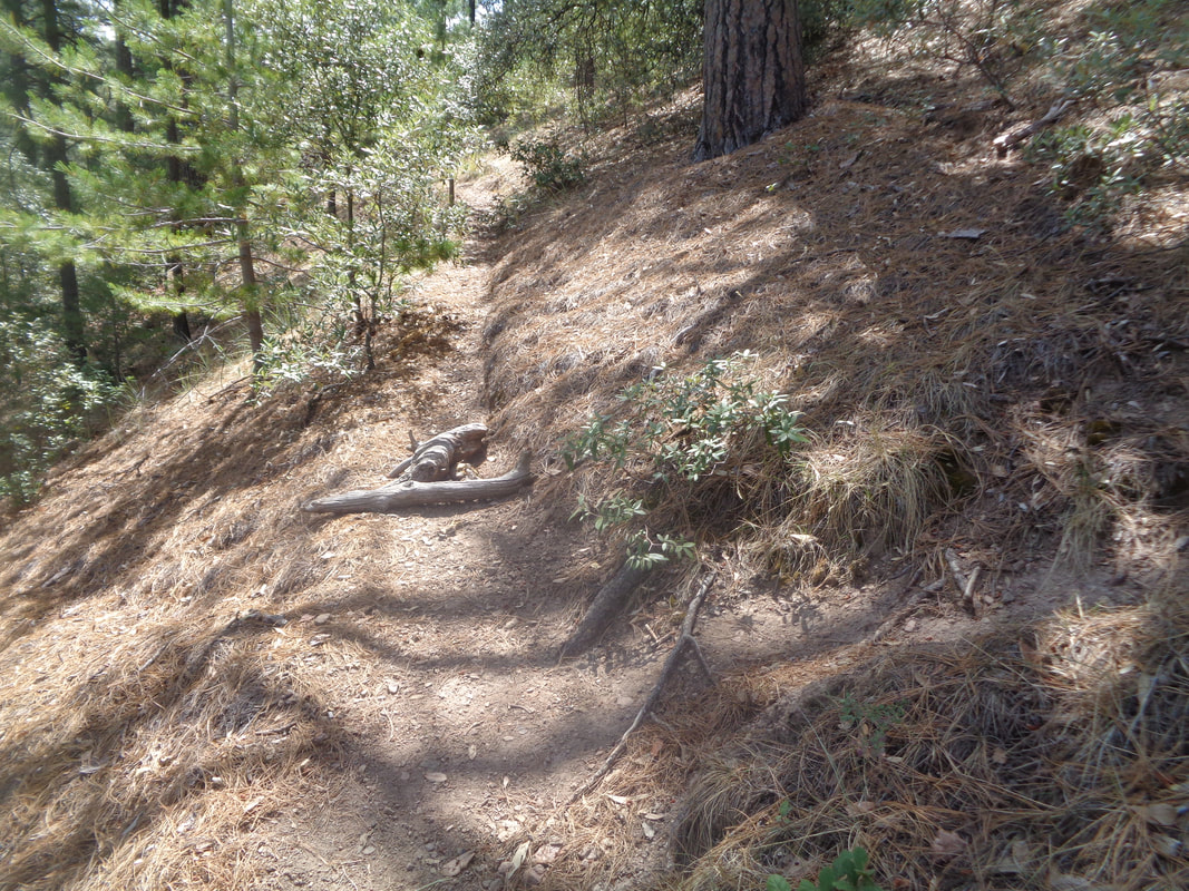 ….side routes that you ought to have a gps track to follow. I went right at the above intersection interpreting the logs laying across the trail (sometimes people use large rocks) as an obvious sign that right is the way to go. At another intersection, a trail went left but down hill so I went right and continued a steep slog up to the Aqua Caliente trail. By steep I mean an average of 24% for about half a mile. 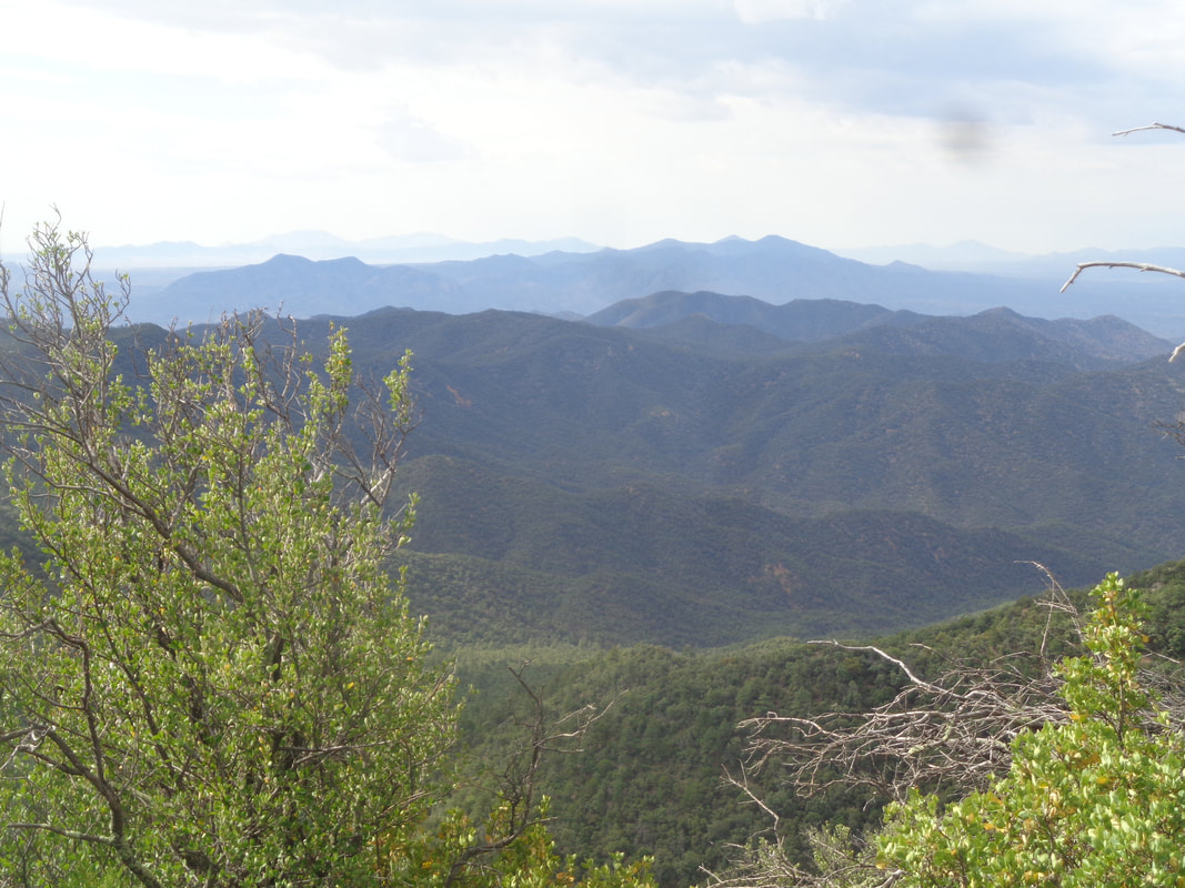 I make a right at the Aqua Caliente trail and enjoy a flat walk of .02 miles until I come to a rock cairn indicating this is where I make a left and climb .06 to Mount Hopkins Road. Along the way the views open up of mostly forested hills. It reminds me of the drives in WV, VA and PA when on my way to obscure towns where crazy 100 mile/10,000' biking events are held. Crazy too is knowing today I will walk 8 miles and gain 3100' of climbing. Makes one think a 100 mile ride with "only" 10,000' of climbing would be easy but of course it's not. 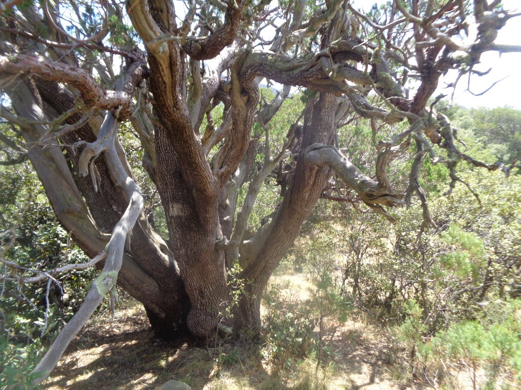 I pass an impressive stand of Juniper trees and this one is one of the largest I have encountered. While it doesn't appear too healthy, it is and doing well. 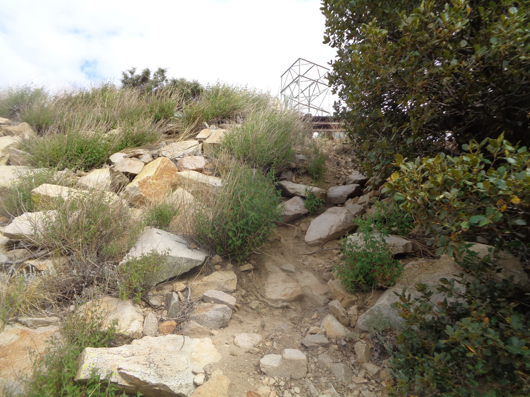 The unnamed trail from AC to the road is also steep and seems longer than .06 but at last, the final slope to the road. 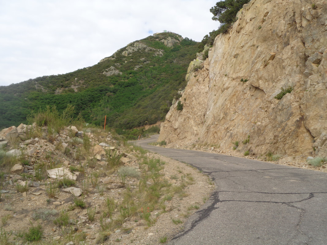 An abrupt change as I now walk about 1.5 miles to the peak and the observatory. Don't have to watch for rattlers or cars as it is Saturday and the pavement is wide. In the distance, the peak and observatory. 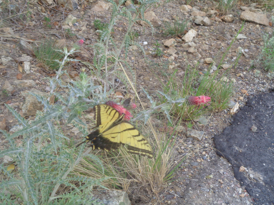 Plenty of butterflies visit plenty of flowers along the road and at last.... 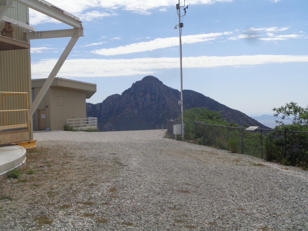 …..I reach the peak. It takes me exactly 1:59:59. The average grade for the entire hike is 14%. In the distance is Mount Wrightson. 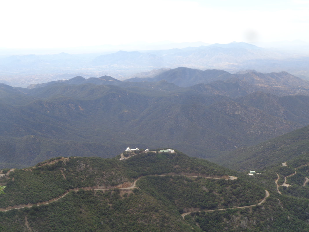 There are three signs that identify the various mountain ranges, some at a distance of 97 miles and they are easily seen. I also am watching the horizon for a sign of storms approaching from the southwest as monsoon season is upon us. It is becoming dark in that direction so I begin the descent and see.... 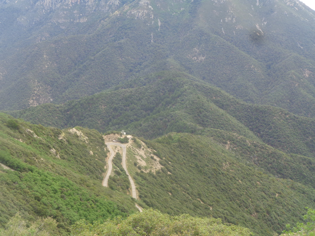 ….the bend in the road where I will exit and start the series of trails, which I manage to negotiate, to find my car. A good day without incident but tomorrow....I see my first ever black rattlesnake!
 My friend Decent Dan, a cyclist of some very modest repute in central Ohio, sent me a link to an article listing the top 100 cycling blogs from around the world. There in the 80th place on the list was this silly blog. How about that!?! That mine could be above something called "Cycling Galicia Blog" is quite the honor:) 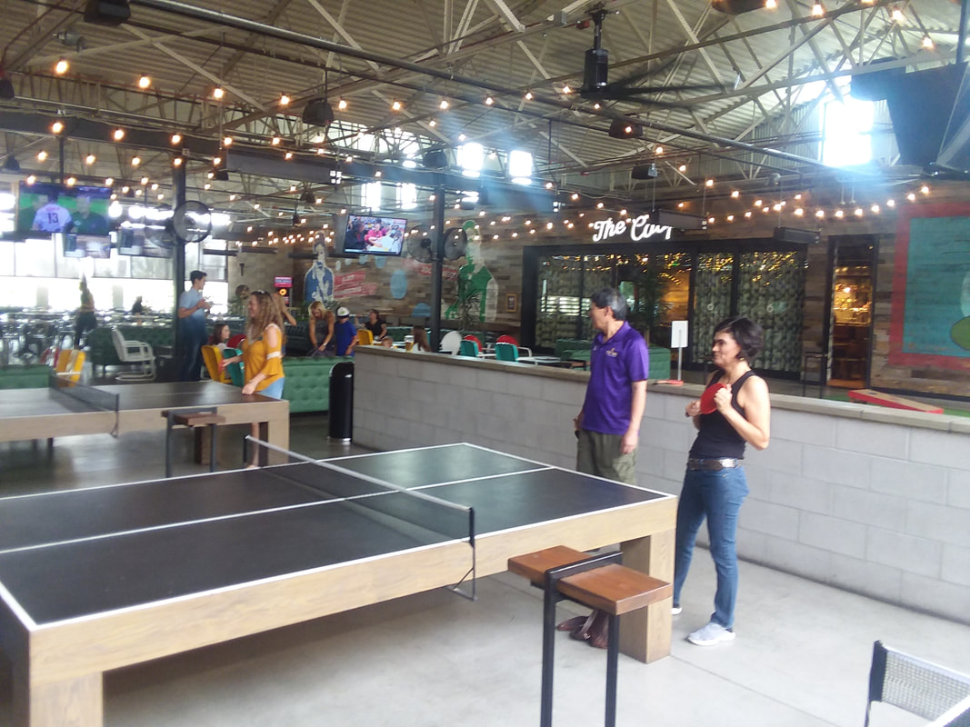 Recently, I presented evidence that I was more than just a cyclist and hiker but also a kick baller. To that I can add a ping ponger too. This is approximately the 6th such event I have hosted at a place called the Culinary Dropout which has 3 tables. 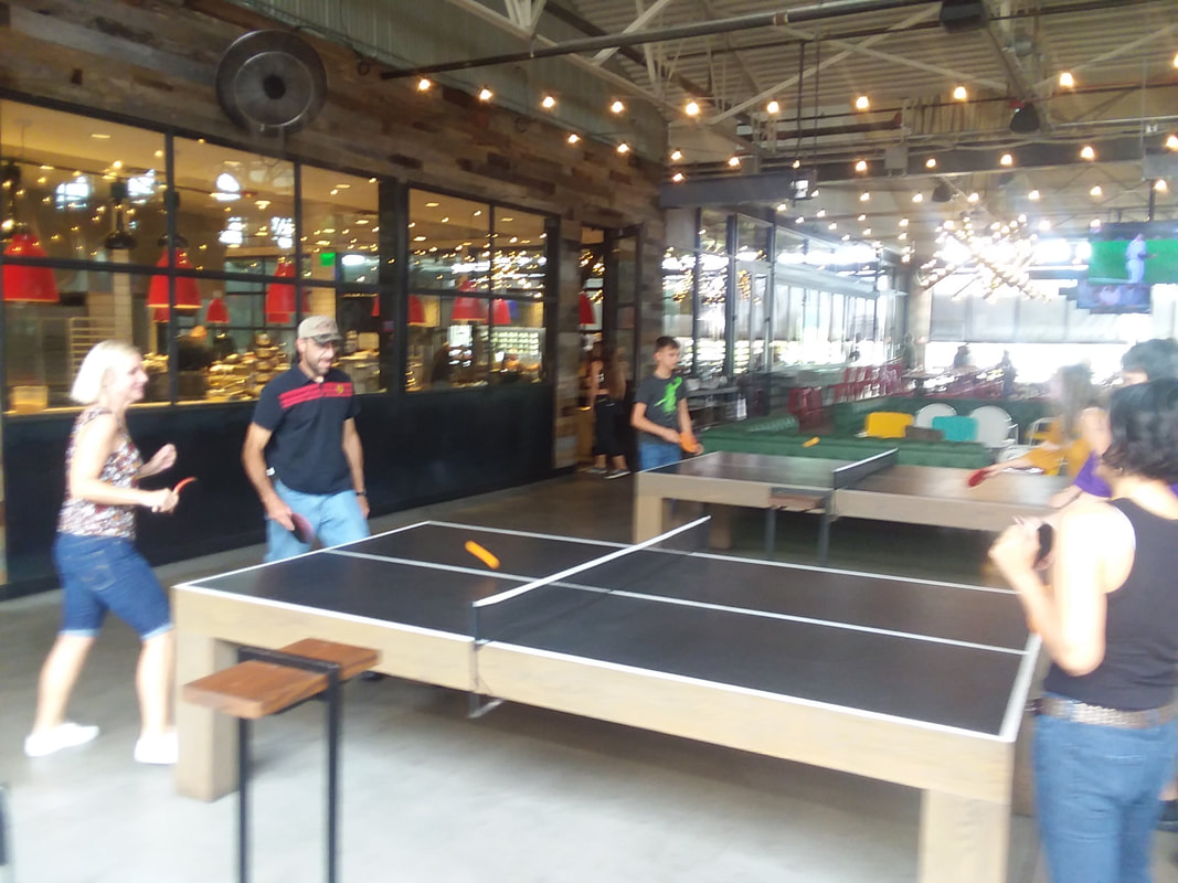 The common thread among us all is that we haven't played since we were kids but it doesn't take long before everyone becomes at least competent at it. I've had groups ranging from 15 to 30 attend and some people are content to simply eat, drink and watch. If you are wondering, I'm about as good at this as I am a cyclist so pretty average:)
 Well gang, life goes on. I took a short ride this morning but back to hiking soon including giving Mount Hopkins another effort while sticking to the trails this time. On to your routes and ride from the church in New Albany. Whoa, only a 3 mile difference between the Rivet/A and B routes? Ride hard Baristas! Below the Rivet/A, B and C routes.
https://ridewithgps.com/routes/19222885 https://ridewithgps.com/routes/19222950 https://ridewithgps.com/routes/19222970 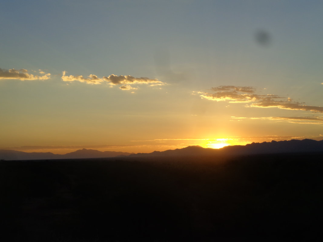 The sun rises over the beautiful Arizona landscape once again. I hardly slept for a variety of reasons, the unique opportunity to help solve a missing hiker case, worry about retracing my route back to the scene, the possibility of letting down the SAR team and their many associates who had been notified of the find, etc... At 4am, I did not need the alarm to wake me and was glad to start the day. 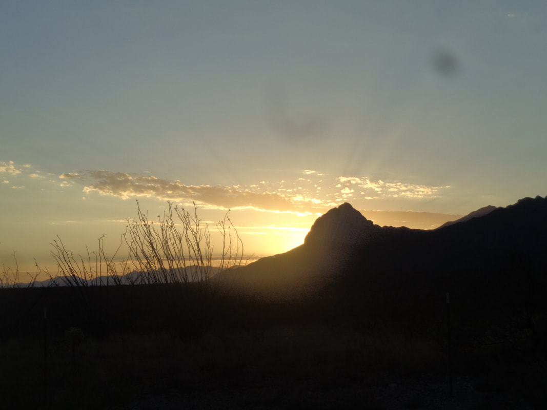 The sun briefly hides behind the iconic Elephant Head, a feature at the western end of the Santa Ritas. The ascent up the right side is exciting with some mild exposure. I arrive a little before 6am and soon.... 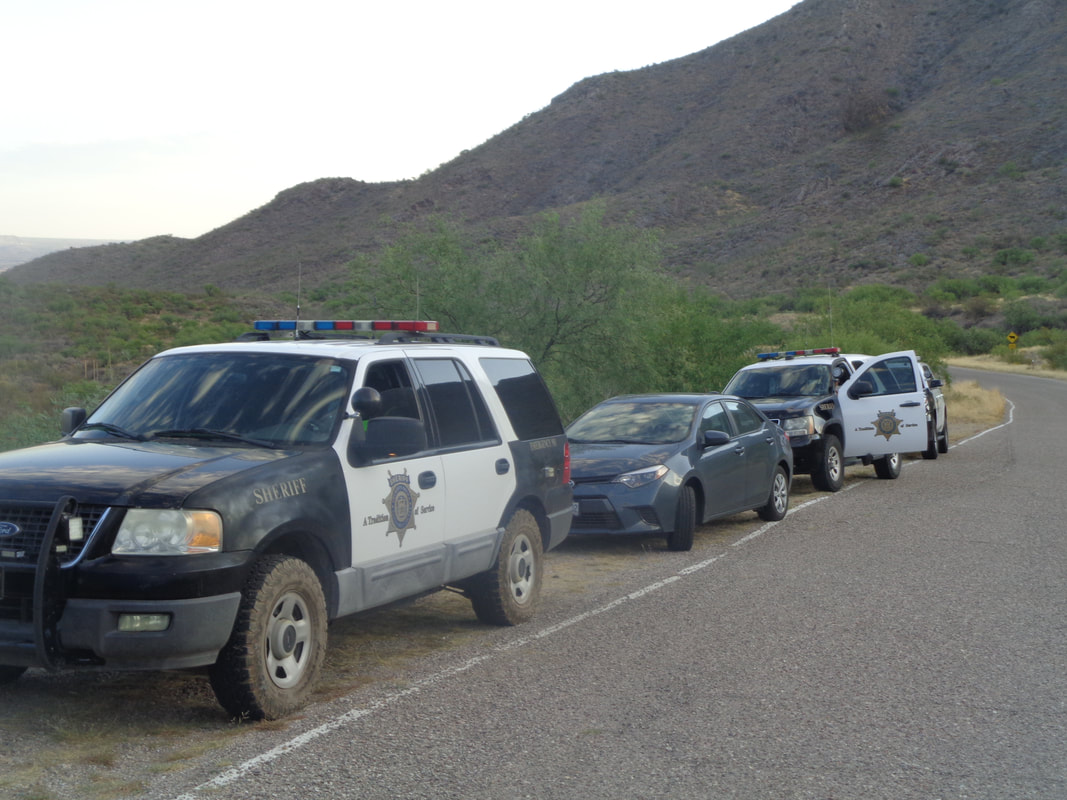 …..sheriff SUV's come rolling up. The last time I had 2 of them parked behind me was when fleeing the scene of a crime. Ok, just kidding but the deputies got a kick out of my comment. It was a great group of search team members, totaling 11 and one very small..... 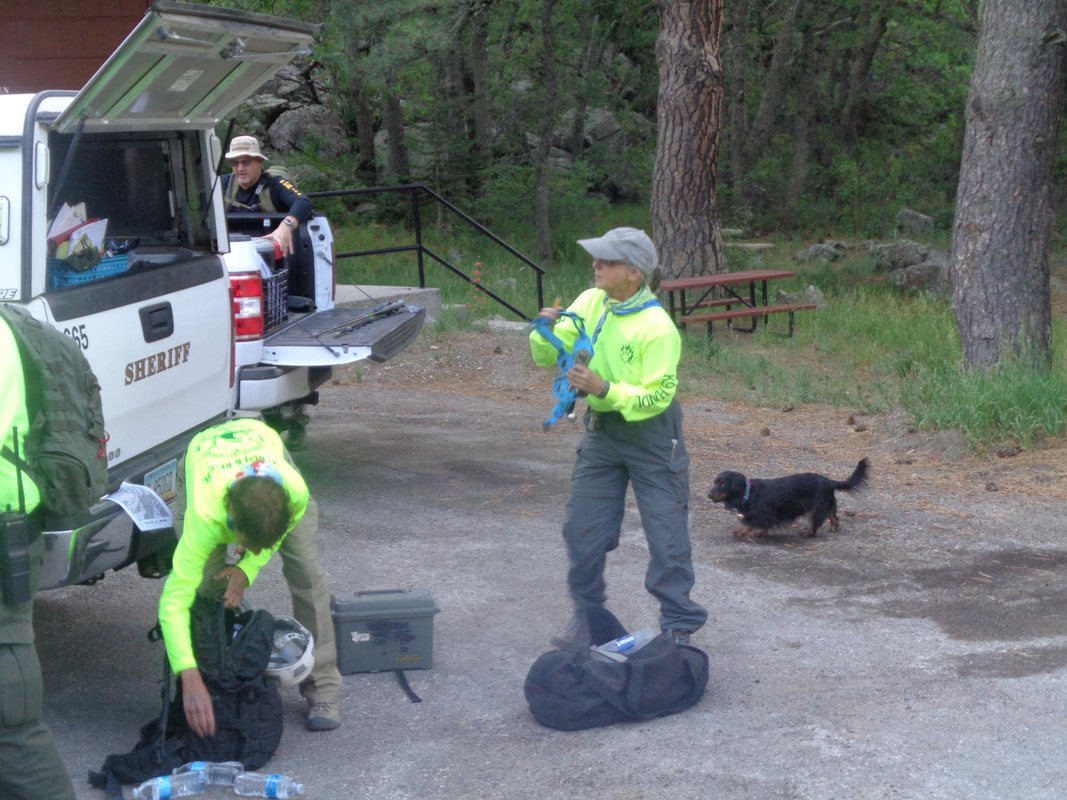 ….dog who had been trained to search for what we were hoping to find. I assumed a dog with this skill would be a Lab or similar dog but nope, this little guy was very capable if not especially fast when walking through the woods. 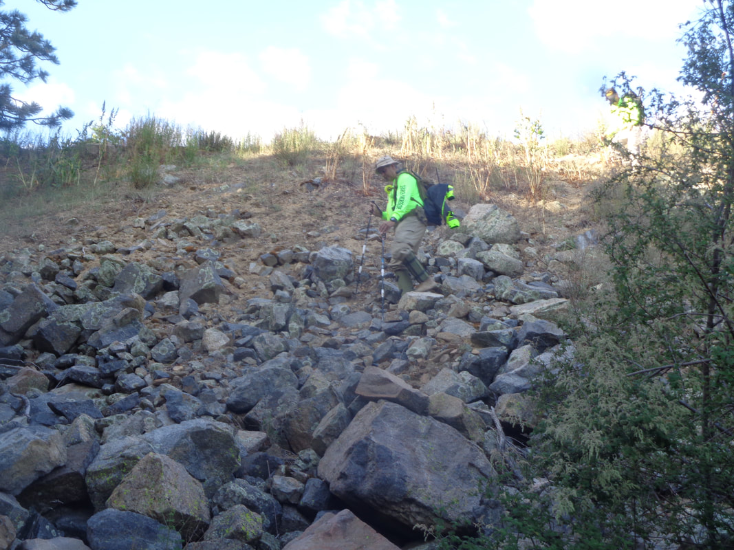 Everyone gears up and begins the steep descent from the road. 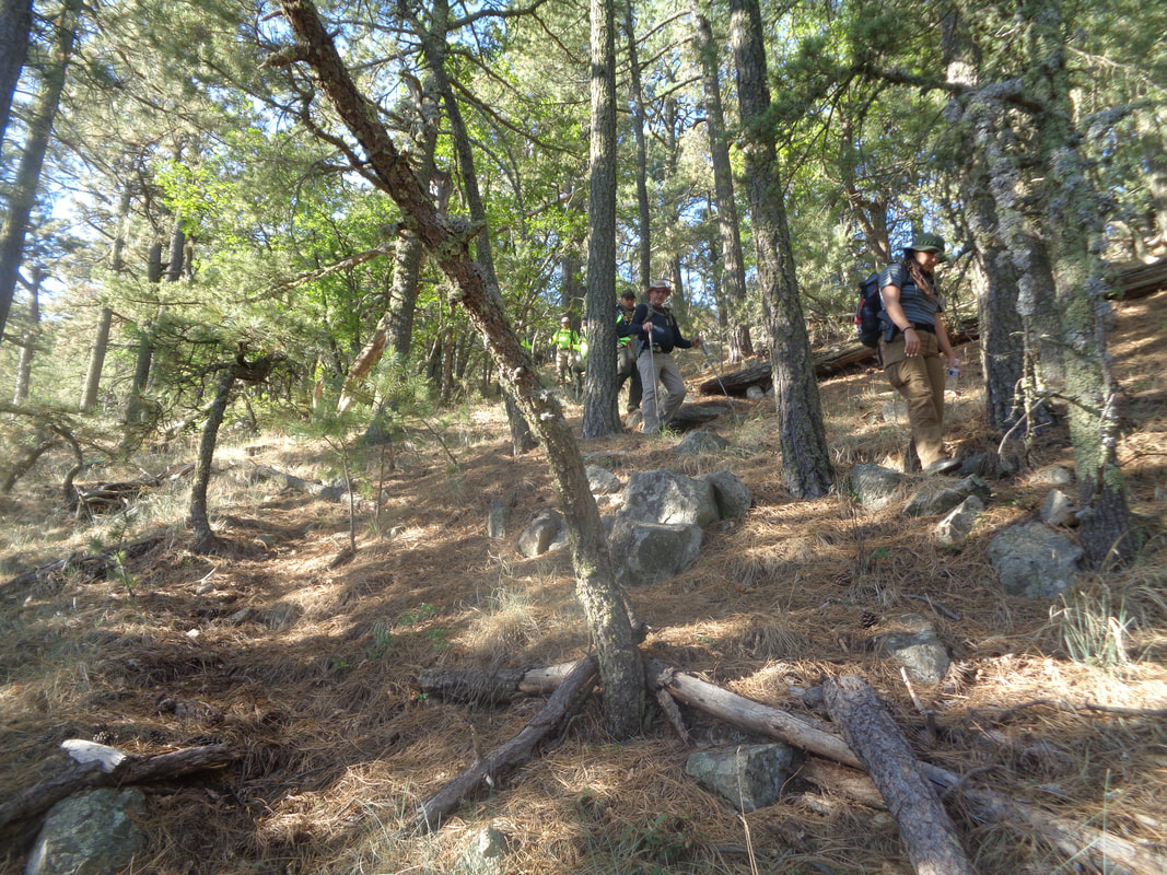 I led the group down and down while one of them would periodically tie green tape to mark our return. Noting each of them carried a sidearm, I stated I had never felt so safe during a hike. Later, while opening their packs, numerous snacks could be found and they confirmed not only was I safe but if we became lost, I'd be well fed too. 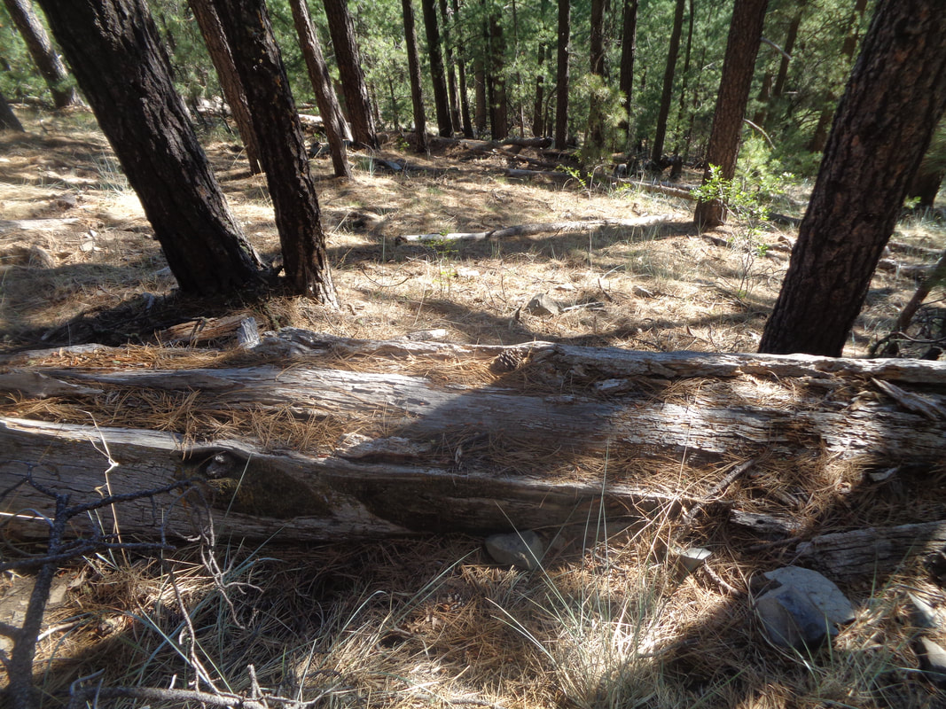 Yes, steep was the hill side and the bed of pine needles made the slope slippery but we all navigated it just fine. We were about .5 of a mile into the descent when it appeared I had reached an area similar to where I made my discovery on Monday. I notified the group and we fanned out into a line. Soon, a guy announced he had found the log with the hiking poles. I turned to walk towards him..... 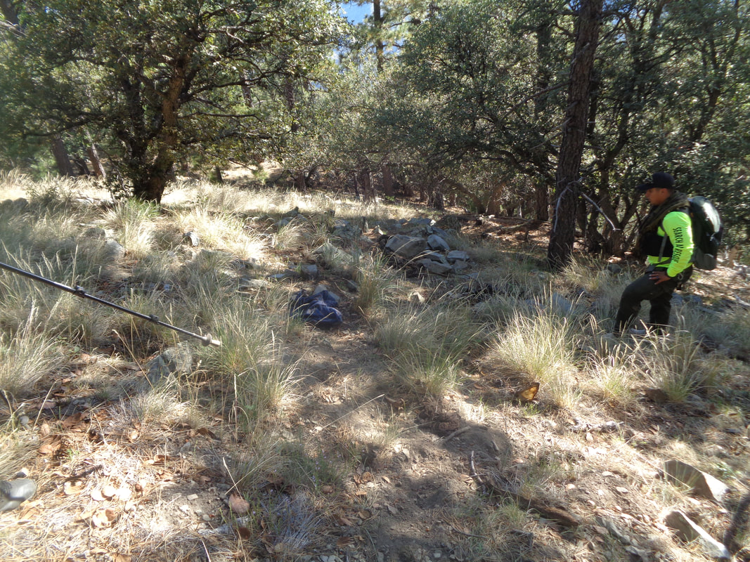 ….almost immediately saw a bone and a couple of steps later, I found a group of clothing. I was briefly overcome with emotion for realizing I had successfully navigated the group to the correct spot, which was not certain, and that human remains were there too. What a relief and of course knowing the hiker's family would finally have closure. 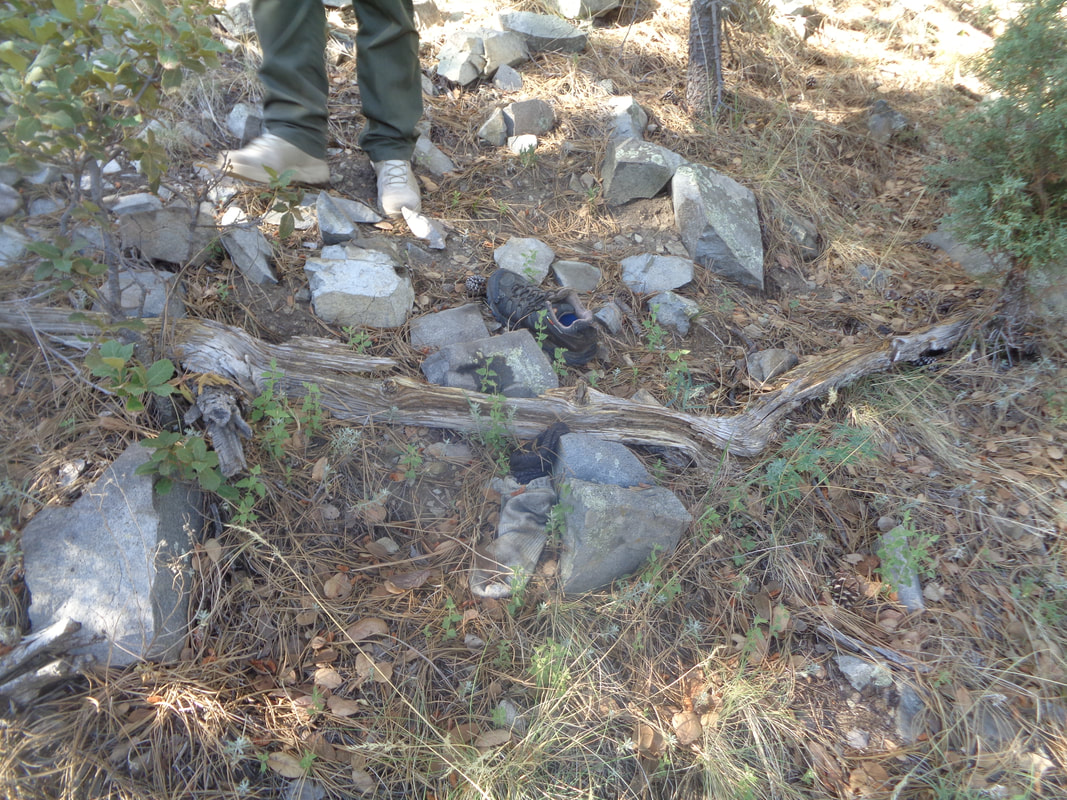 Both hiking shoes were close together and I am certain that on Monday, one had been close to the hiking poles a little higher on the slope but I could be wrong. The leader of the group called us all together and announced this was now a crime scene. I asked if I should return to my car but he said no so I participated in the search for more remains. 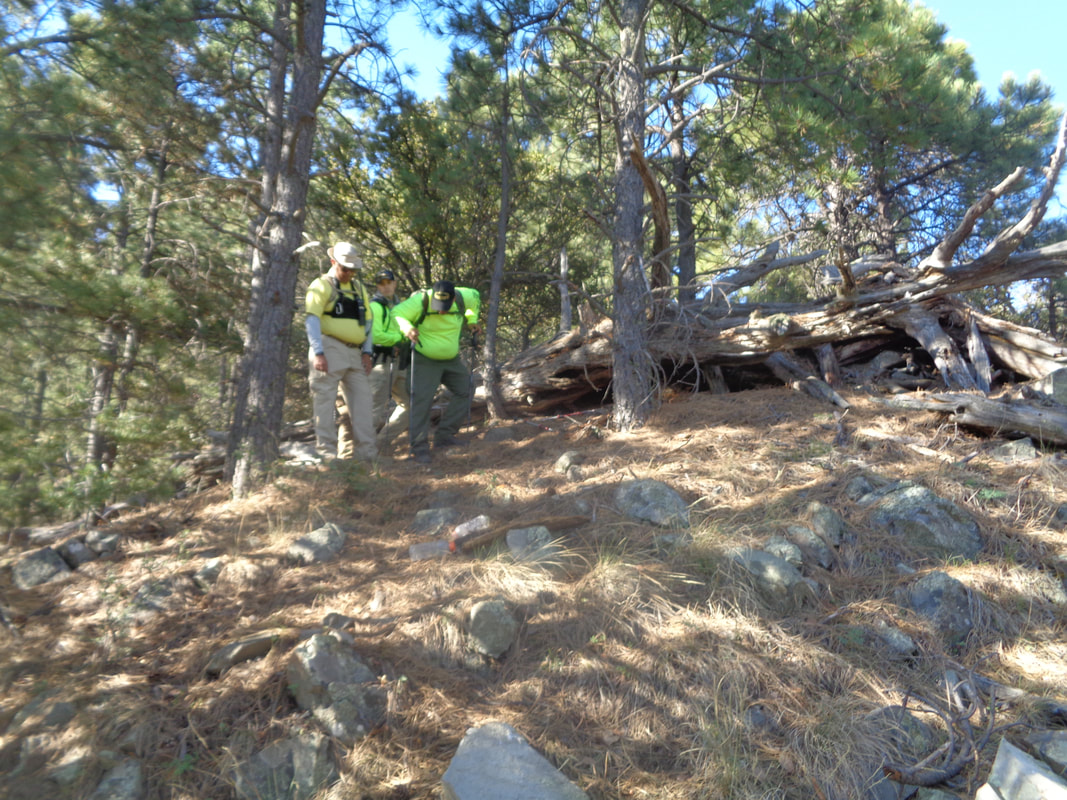 Nature's predators had done what they do so the remains were spread over a broad area. As remains were found, green tape was fixed to the location. Communication was made to the Sheriff's department giving updates and soon word got out to the media. I was told the interest was high and all the local media outlets created updates.  The forest was relatively open beneath the canopy so walking is not difficult other than the steepness of the slopes and occasional boulder fields that prevent direct walking up the ridge. 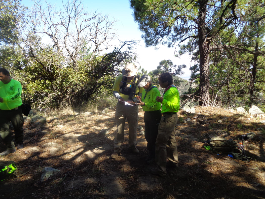 Everything that could be recovered was recovered. GPS devices were consulted to compare past search segments with where we were now. I heard conflicting distance comparisons but the 120 people who contributed to the February effort and done a comprehensive job given the evidence they had. The hiker, once a 911 call had been made, should have stayed in place and he would have been found but given the conditions on the ground and an unknown mental state, it made sense to him to continue to walk. 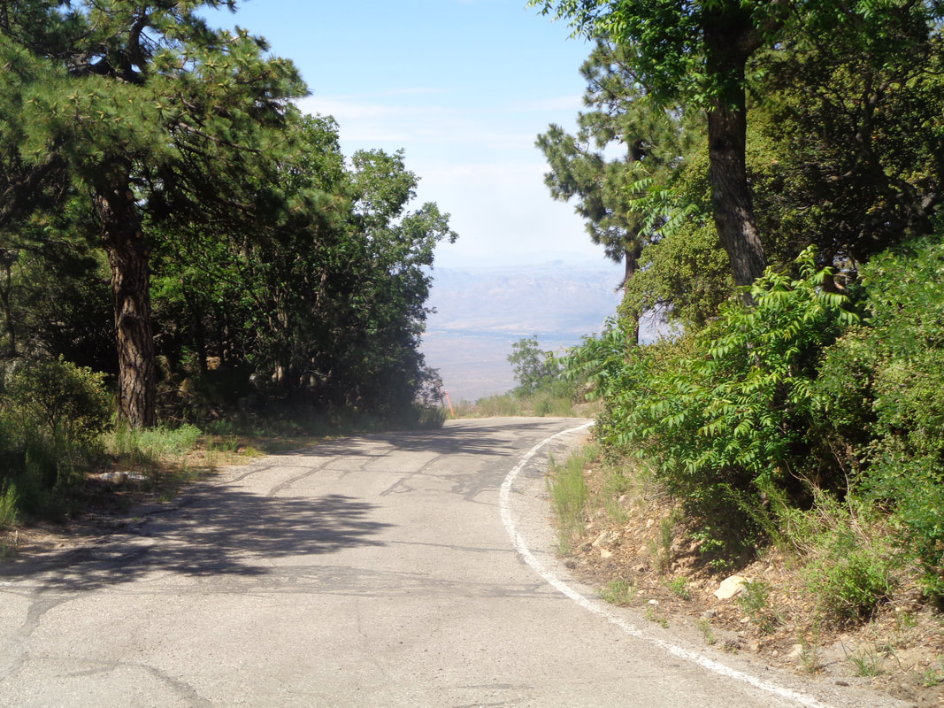 I was given permission to hike out but they insisted I have an escort. It is a steep ascent out of there. I reached my car, thanked my 3 escorts and was told I would receive a certificate of appreciation from the Sheriff's department which I will value. 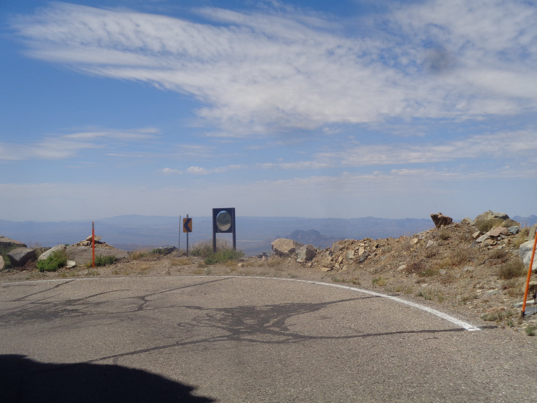 I began the long drive from the peak, a combination of pavement and scraped dirt. It has been an interesting 3 days and I am glad I have this blog to record the experience. I have purposely excluded some images and content and maybe some of what I did post was borderline suitable given the audience. If so, I apologize.
I am pretty excited to be part of a group effort that hopefully will result in the discovery of the remains of the lost hiker described below. It would thrill me to help bring closure for the family but first things first, I have to find the site which I am pretty sure I will be able to do. I'm prepared for a long day of searching but hopeful for a short day. A local paper, the Green Valley news, ran a story this evening if you would like an update. The family of the hiker has been notified so that's good. https://www.gvnews.com/news/items-belonging-to-missing-hiker-discovered-in-santa-ritas/article_e499e36a-a2be-11e9-9f95-4b6ceaffd293.html
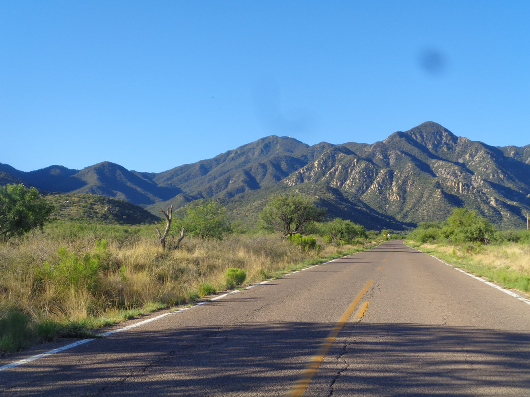 Out the door by 5am and driving to Madera Canyon which is within the Santa Rita Mountains which is within the Coronado National Forest. Running north/south the area is 23 miles in length and somewhere merges with the Patagonia Mountains. A rugged, mostly forested area. 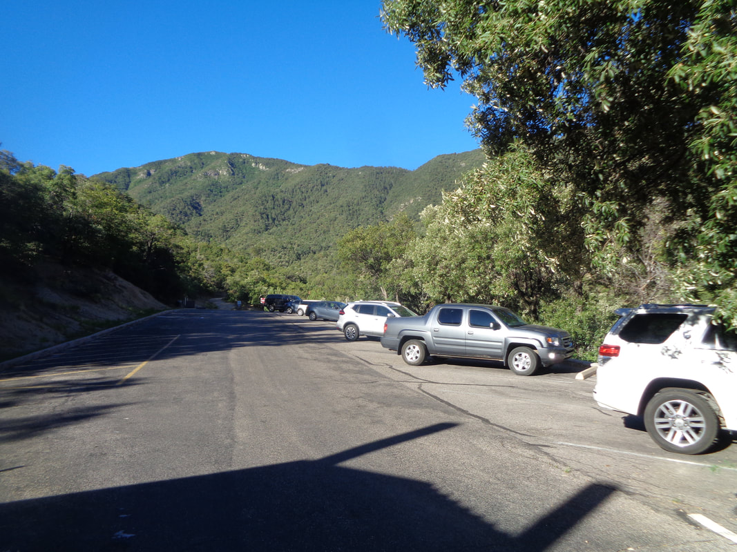 I arrive at the end of the road and park in the circle parking lot at the base of Old Baldy and Super trails. This is Monday. In February, a car belonging to an Ohioian was towed from this lot because he had become lost on 2/5, called 911 to report he was lost and apparently kept hiking. Search crews were organized and several days spent at first looking for the hiker prior to transitioning to body recovery. Until today, no evidence of him was ever discovered. Yes my friends, it was quite a day of hiking for me. 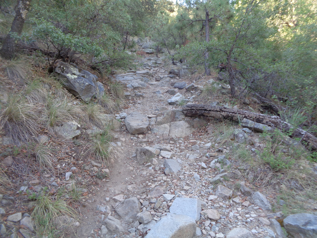 I start on Old Baldy but where it breaks sharply left, I continue straight on the Carrie Nation trail. Pretty rugged to start and then I made a mistake. I misread a hike report that stated I was to stay on this trail but instead I made a right at the Vault Mine trail. By doing so, I had left the far simpler route for a much more difficult one. Checking the gps track on my cell phone, I was still on the loop route but now going counterclockwise rather than clockwise. The difference is huge. Going clockwise I would have ascended an obvious series of trails to the peak and returned the same way. Now though, geesh was I going to be in for it. 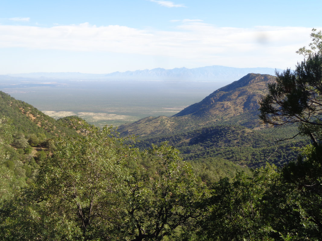 Occasionally there were breaks in the trees but mostly fairly thick forest. 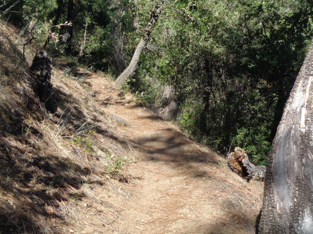 This Vault Mine trail was designed by a sadist. Almost a mile in length, 27% average grade. 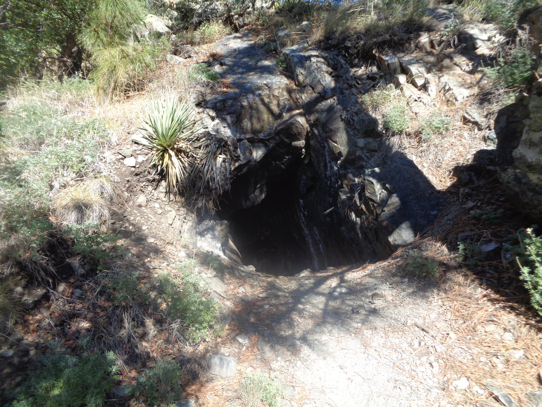 I pass an abandoned mine and do not venture into it. I have seen a lot of bear and lion scat so..... I reached the Aqua Caliente trail where I make a right. Had I stayed on the intended route, I also would have made a right on the same trail but farther west so still, I am oblivious that I am not on my intended route. 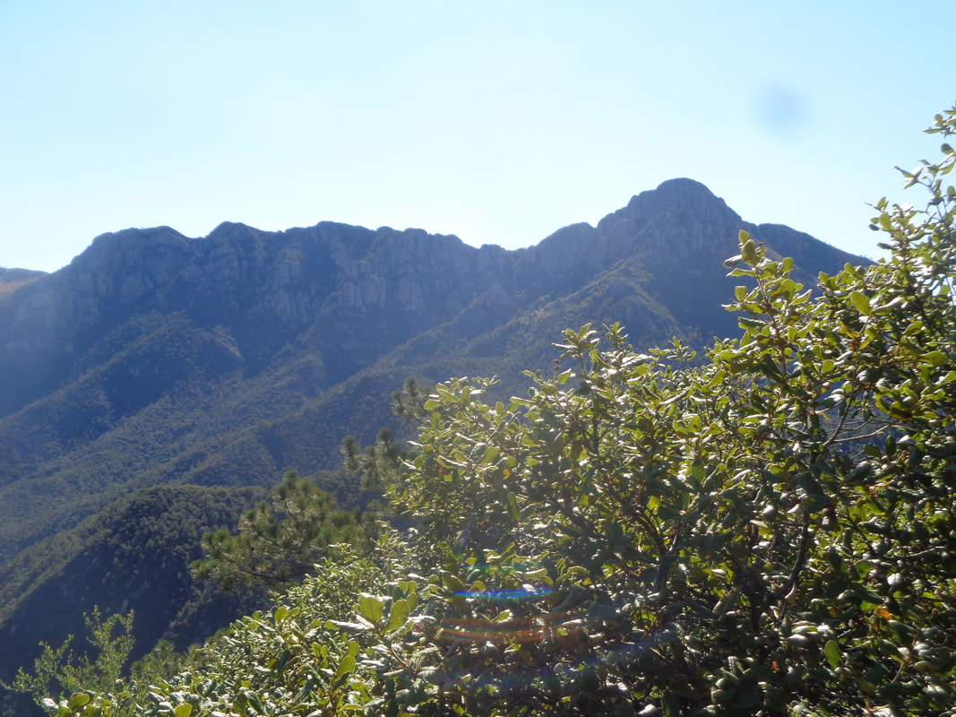 In the distance on the right is Mt Wrightson and to its left is Old Baldy saddle. 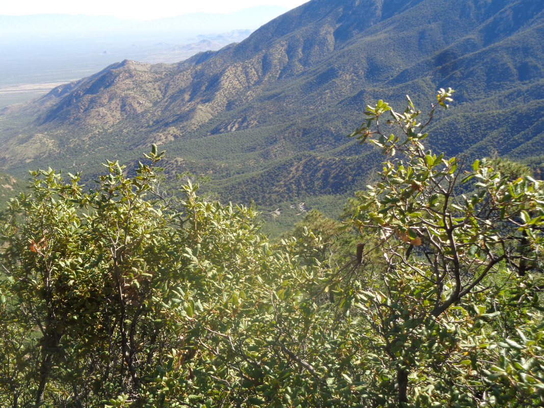 Walking the Aqua Caliente trail I can see far below the parking lot. It is always comforting to be able to see that for some reason. 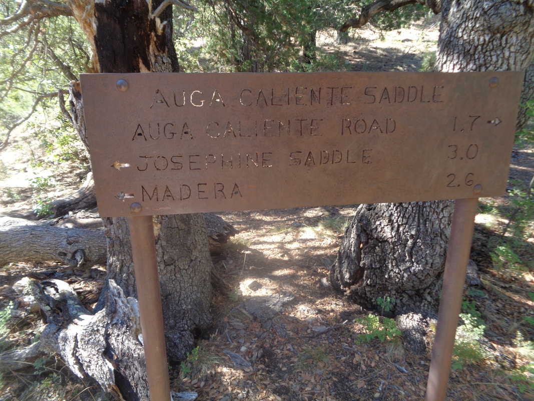 I reach Aqua Caliente saddle where I am to pick up an obvious trail raising steeply to the left. Hmmmmm, looking at the route, I am right on it but again not the part of the route I should have been on. I scout around, can't find a trail to the left but start following the gps track and ascend a ridge and it is steep, to the left just no trail. I have a hiking pole and bang it on everything to alert the critters that I am to be avoided. 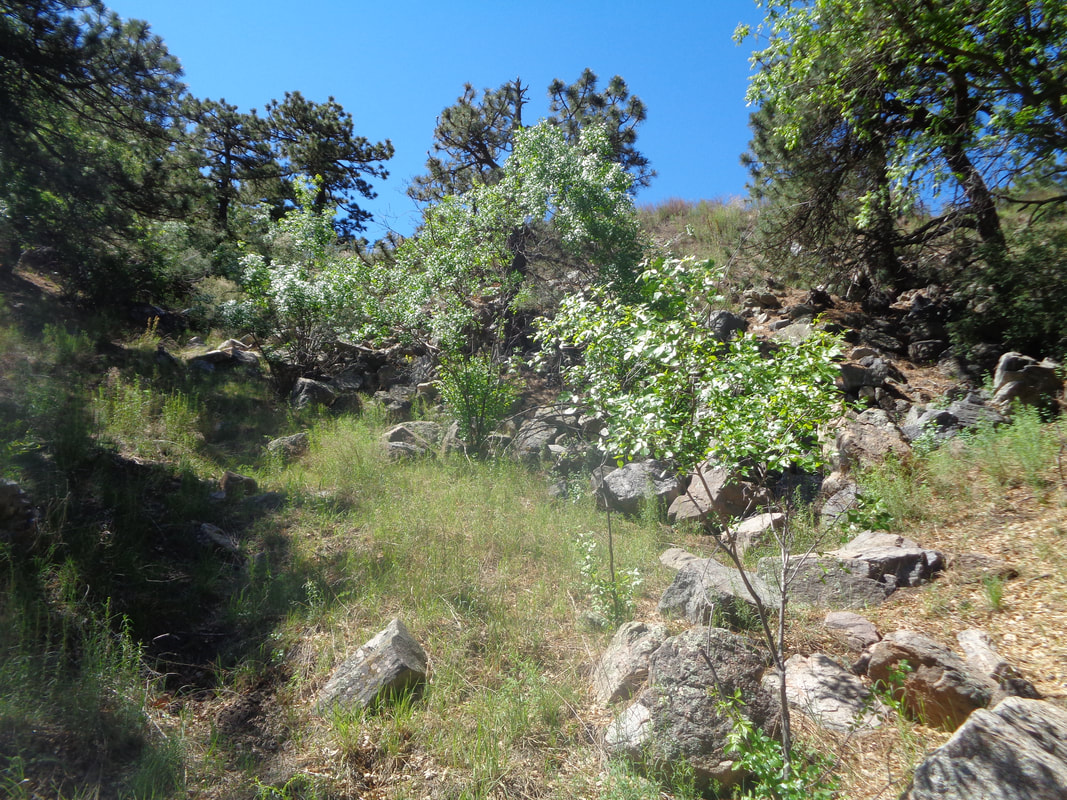 I was supposed to be on a trail for about .6 miles before emerging on Mt. Hopkins Road for a 1.5 mile road walk to the peak. By now, I have figured out, after hiking in the wilderness for at least a mile, I am on the wrong part of the route but the destination is the same so at last, I spot an embankment and sure enough..... 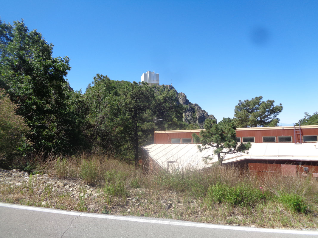 ….yahoo! I emerge across from living quarters for observatory employees. The views are..... 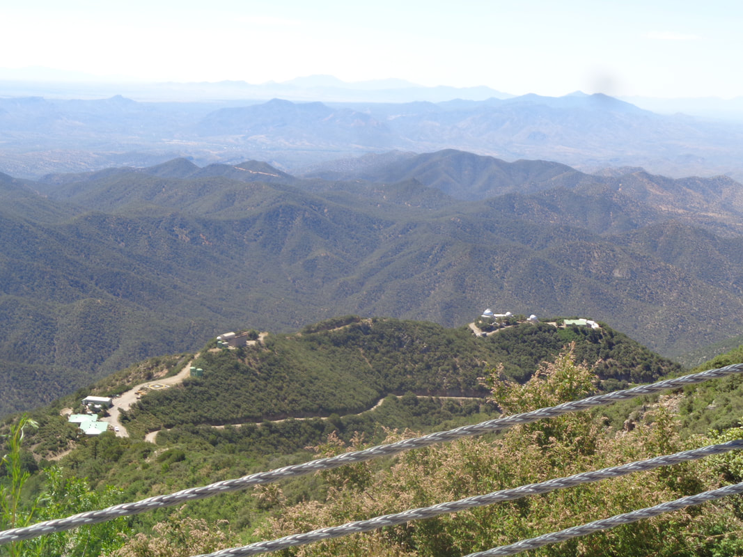 ….awesome. Additional facilities are seen below. Instead of a 1.5 mile road walk I only have..... 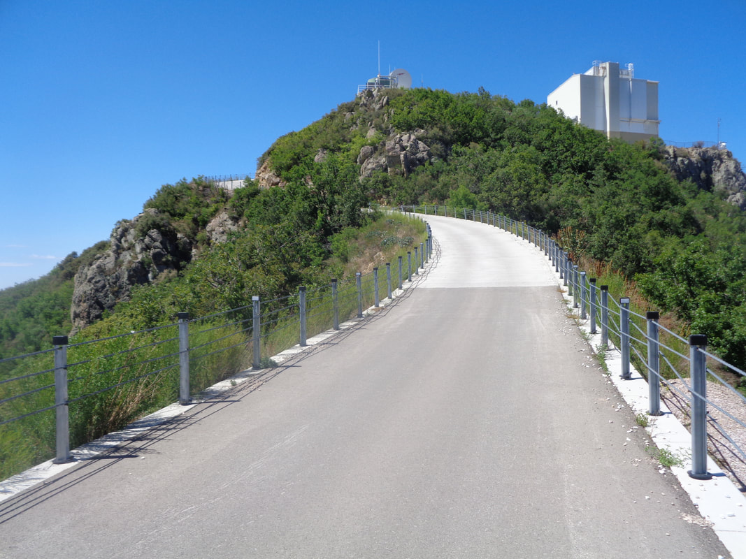 ….about 500 yards and dang that too is steep. 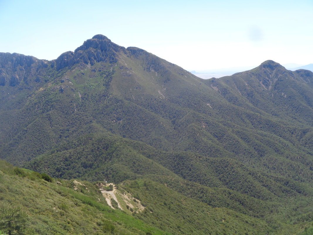 Beautiful and there is Wrightson again on the left. Somewhere over there is Josephine Saddle and the place from where the lost hiker called 911. Most search efforts were directed over there and although they had cell phone coordinates, the lost hiker must have departed the area with a battery that had lost its charge. I had hiked 4.5 miles with 3500' of climbing. 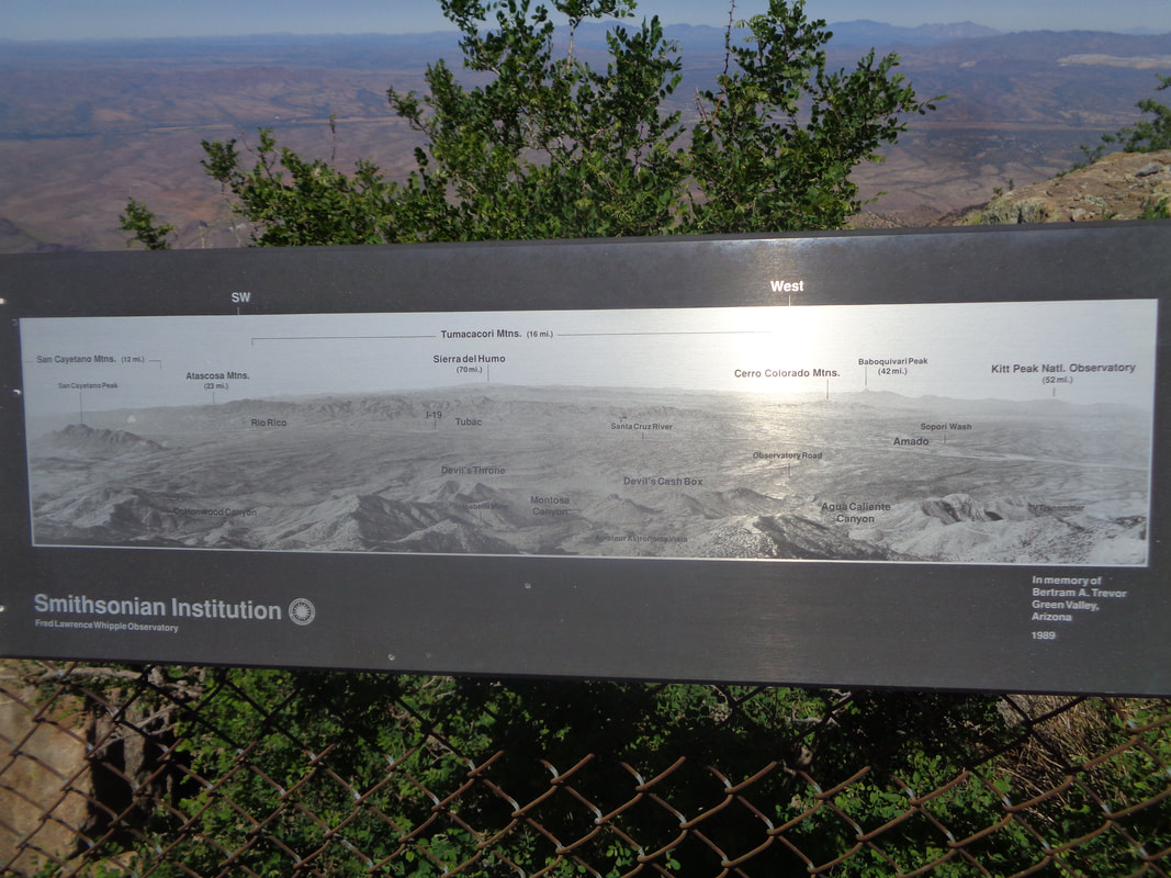 Speaking of lost battery charge, I look at my cell phone screen and I'm down to 12%!!! Apparently since cell service is spotty in the mountains, my phone was always looking for a signal. Note to self: Use Airplane Mode next time. I shut off my phone to preserve what life I still had. I turned it back on a few minutes later to alert a friend that I would be late for an event and yikes! I have no power. 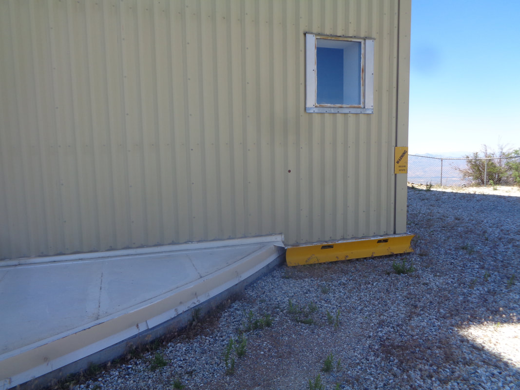 I sat on the base of the observatory and think things through. It rotates and has a small plow to clear snow. No map, no gps track but also, I was pretty confident I could march back down the ridge I had ascended and find the Aqua Caliente saddle and subsequent trails. So I..... 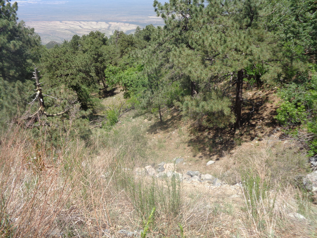 ….walked the short distance to the point I had emerged from the wild and plunged back in. I discovered a couple of cairns and followed them but they petered out but came to a faint trail and began following it but it was taking me off the ridge and down an east side before petering out. I kept going down and at times I sat on my rear and scooted down as it was that steep. I began to see hills closing in on my right and a new ravine. I concluded I was lost because I was. I never panicked nor despaired but I recognized the predicament I had placed myself. I climbed to the ridge, found a rocky point, looked out and said to no one in particular, "Mark, the only way out of this mess is to turn around and climb back up the mountain." So, I turned around and began ascending the beast. At some point..... 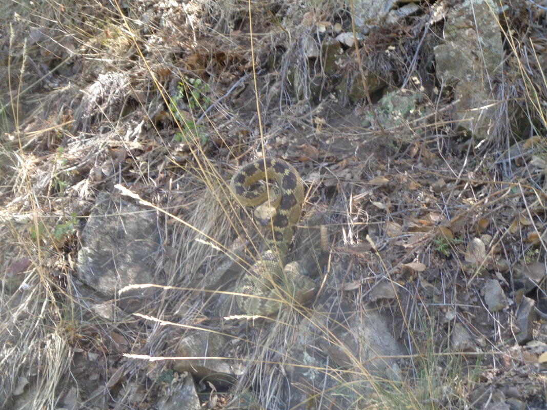 ….I heard a rattlesnake and there to my right it was ready for action. Geesh. I was always on guard not to do something stupid such as slip and crack my head or impale myself on a broken limb or....yes, get bit by a rattlesnake. I kept working my way up and then..... 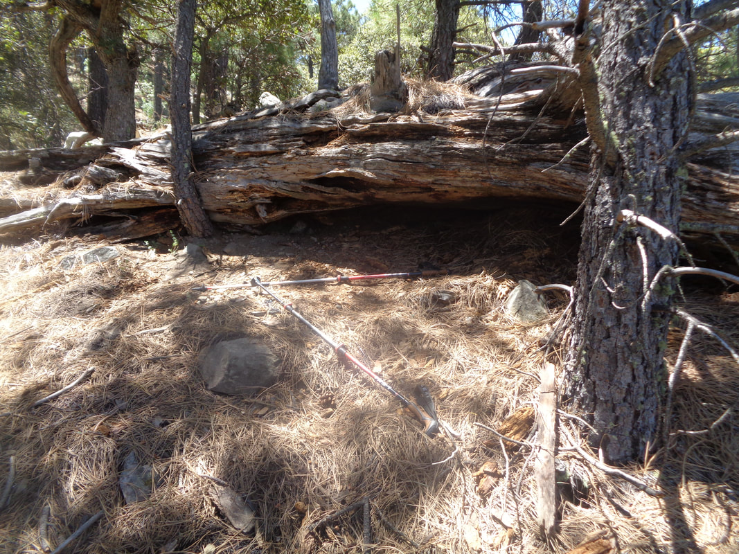 …..I discovered this scene and I immediately understood the implication. The lost Ohio hiker had sought shelter beneath that log and in front of it was a pair of hiking poles, a waist pack having a set of car keys and other items and one, hiking shoe. I of course also realized another hiker had been here, searched for hours and died. I did not see any human remains but I also didn't look. I had my own issue to solve. I took the waist pack and put it in my back pack but left the other items. I continued up and probably 1/2 mile later..... 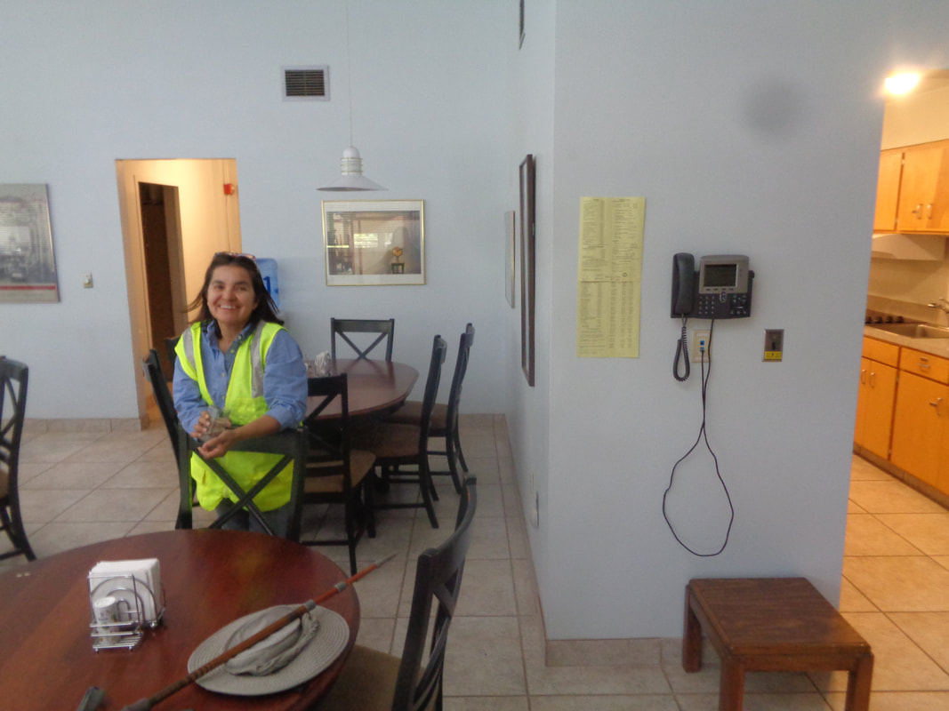 ….I found the ravine that led to the road...Eureka…. walked into the building shown in an image way above, yelled, "Hello" and this woman emerged from a room. I explained my predicament, she called John from the observatory, a mechanical engineer who brought a battery charger for me. John had been part of one of the SAR crews back in February and all of them were nagged by the question of what had happened to the lost hiker. He examined the contents of the waist pack and confirmed it was Mr. Smallwood's. John called the region's SAR administrators and the sheriff department. I could have hiked back to my car but the cell phone was charging slowly and I wasn't keen about retrying the down climb so John gave me a ride down from the observatory to the base camp at the visitor center for the Whipple Observatory and then around the mountain to Madera Canyon where..... 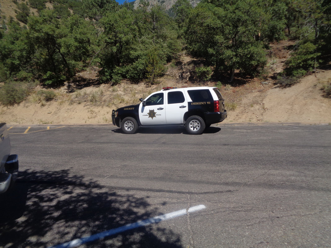 ...I met a couple of deputies and retold my story. Today, Tuesday, I took a call from the Sheriff's department and so tomorrow morning, 6am, I am meeting a crew and will attempt to locate the site. It would thrill me to help an effort that recovered the body and bring closure to the Ohio family. I'm not sure the family even knows what is happening but I hope to have another story to tell tomorrow, assuming the crew and I do not get lost, of course.
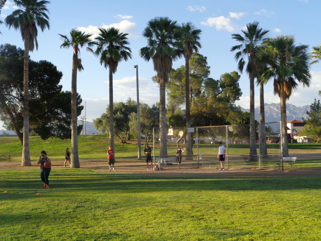 I did a 2 mile group hike in the morning and had a nagging sense that just wasn't enough (it isn't) so saw a Meetup group was playing kickball at 5:30pm. Hmmmm, that could be a decent workout so drove south into Tucson and was prepared to turn around, as who would come out in this heat (104)? Well, 10 of us did and was told typically they have at least 20 but the holiday weekend must have kept some away. OK, full disclosure, I was the oldest by at least 20 years and have not had a kickball kicked my way in at least 45 years.
I stroll out to the field and the shortstop position is vacant!!! Nooooo. The only thought is, "please don't kick it towards me.". 2nd kicker, fly ball, wind blowing in, I jog forward and.....CATCH IT!!! I am stunned and try to be nonchalant about it. Next inning, 3 consecutive balls are kicked in the air toward me and I catch each of them....how bout that?!?! Our team wins 11-5 and the "kids" were a lot of fun. Well, back to hiking and a big one coming tomorrow. 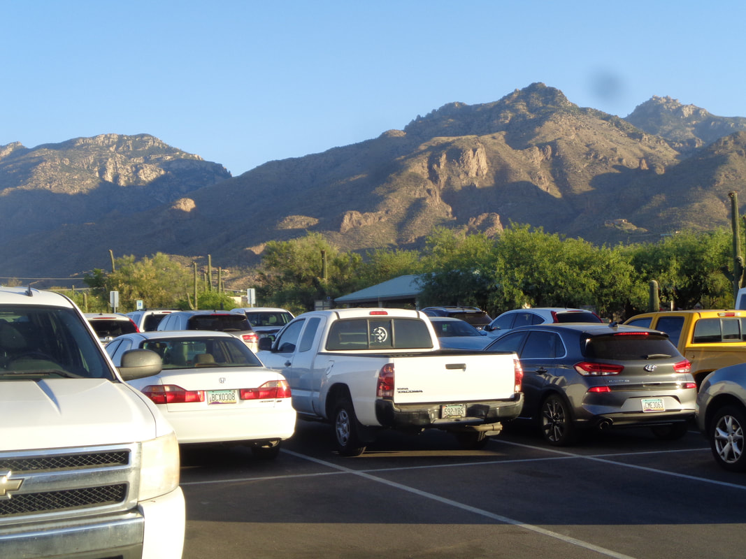 6:15am and the parking lot at Sabino Canyon is rather full, for a summer morning. When I left my place at the crack of dawn it was already mid 70's and warming rapidly. The morning outdoor window is open for about 4 hours and during that time the humidity is very low, the sky is clear and it is beautiful. 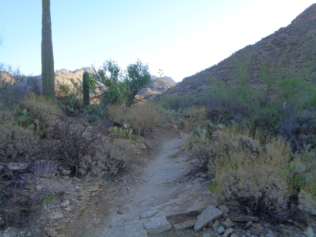 Headed towards Blackett's Ridge, 3 miles distant. The first mile is flat and then the ascent begins, 2 miles having an average grade of 17%. In the distance, the sun shines on the canyon but for much of my ascent, I thankfully hike in the shade. 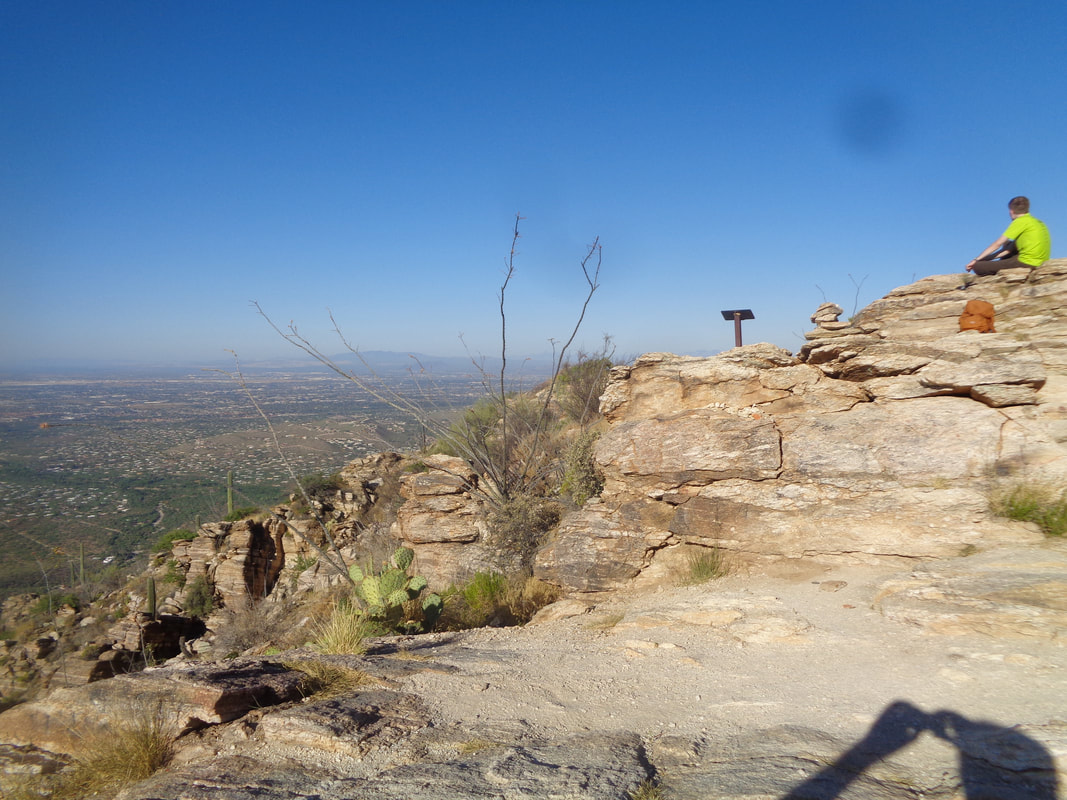 From the parking lot to the top, my best time is 51 minutes (5th out of 448 for we Strava users) but any time under an hour is good for me. I reach the top in 1:01 so kind of disappointed as I was going as fast as I could for the duration of the route. My fitness just isn't great right now but that will change, probably for the worse, ha, ha. 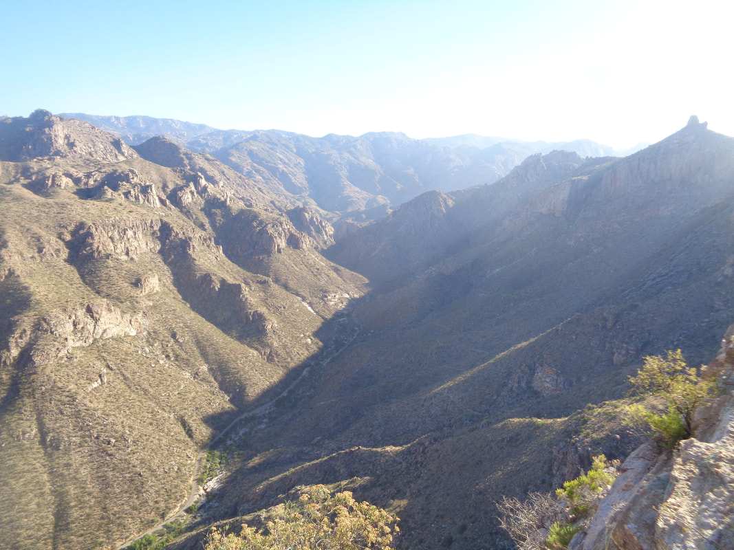 Sabino Canyon 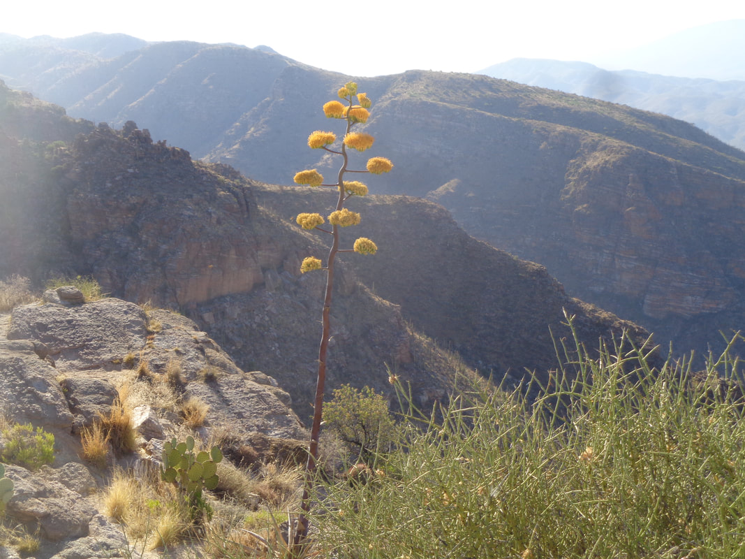 Looking to the southeast. Many wasps were buzzing around the flowers. 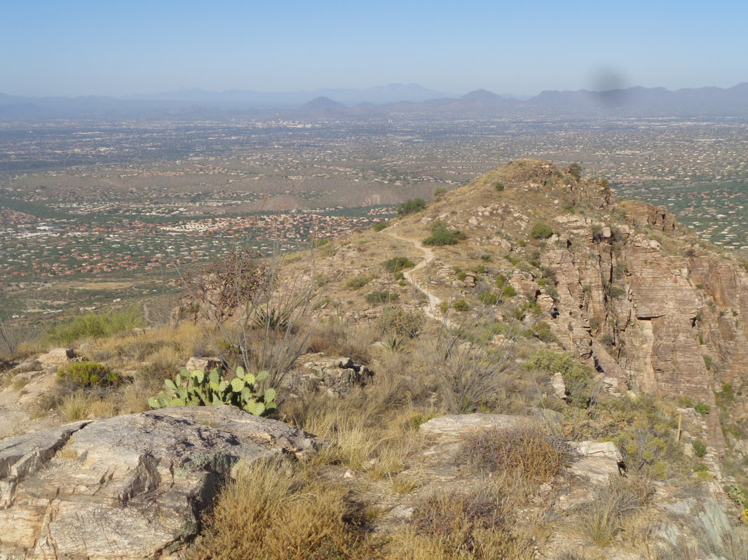 After about 15 minutes, I headed back down. Not nearly as green as it was a month ago but monsoons should begin any day now and will dramatically change the color. 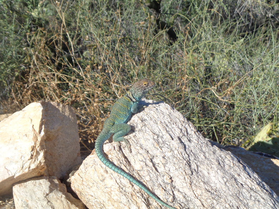 How about that!? 99% of the time they skitter away too fast for me to get a shot but this guy or gal posed for a long time and what a long tail and beautiful colors. Hope he doesn't end up inside a rattler. Finished with 6 miles and 1776' of climbing. I kid you not, on July 4th, I hiked 1776 feet.
|
