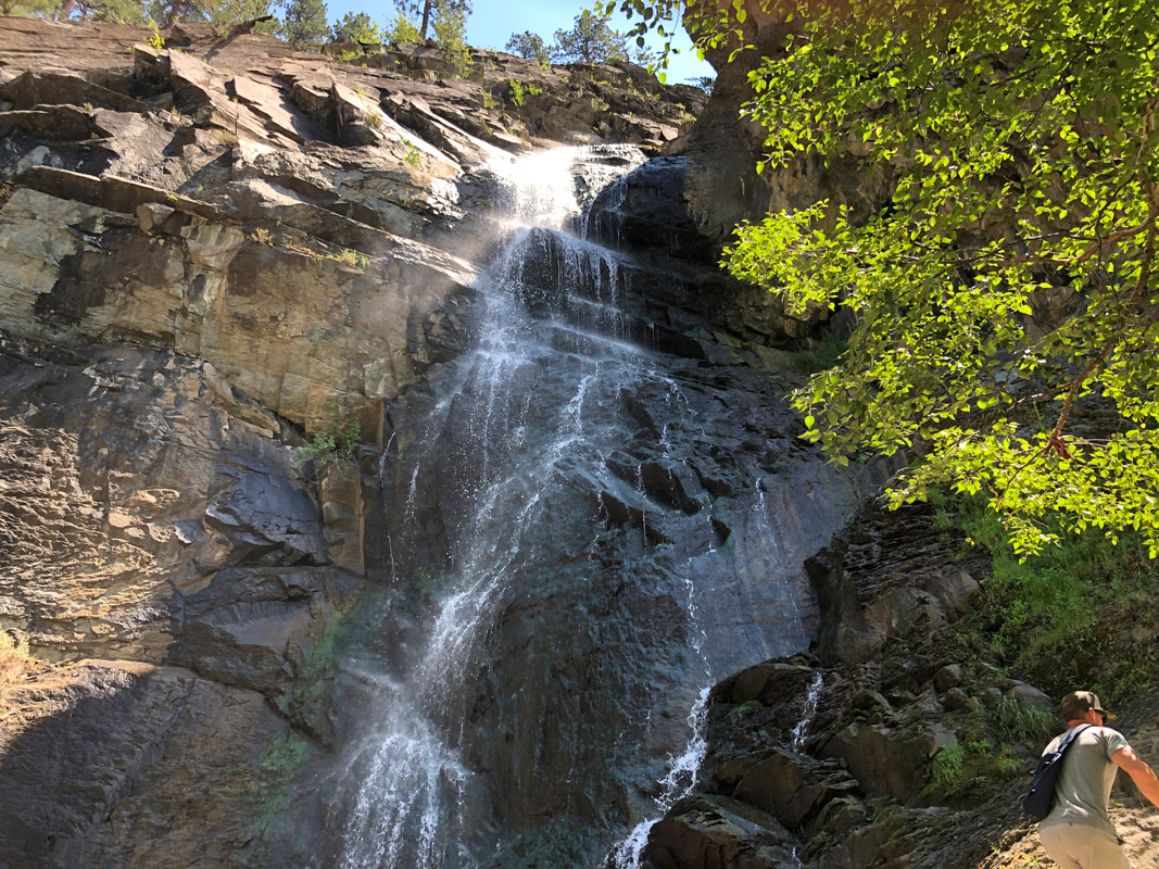
 We drove east about 30 miles to the town of Spearafish and then to the Bridal Veil Falls in Spearfish Canyon. We drove a bit farther to check out.... 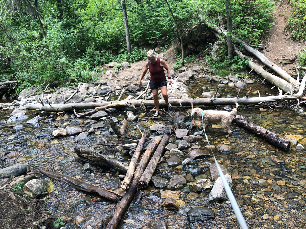 ...something called the "Devil's Bathtub". It required multiple stream crossings and soon.... 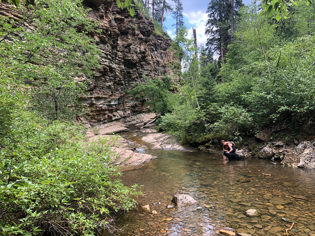 ...the canyon walls steepened and then.... 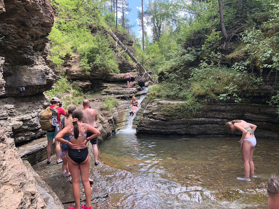 ....we reached it. People were having a great time watching and.... 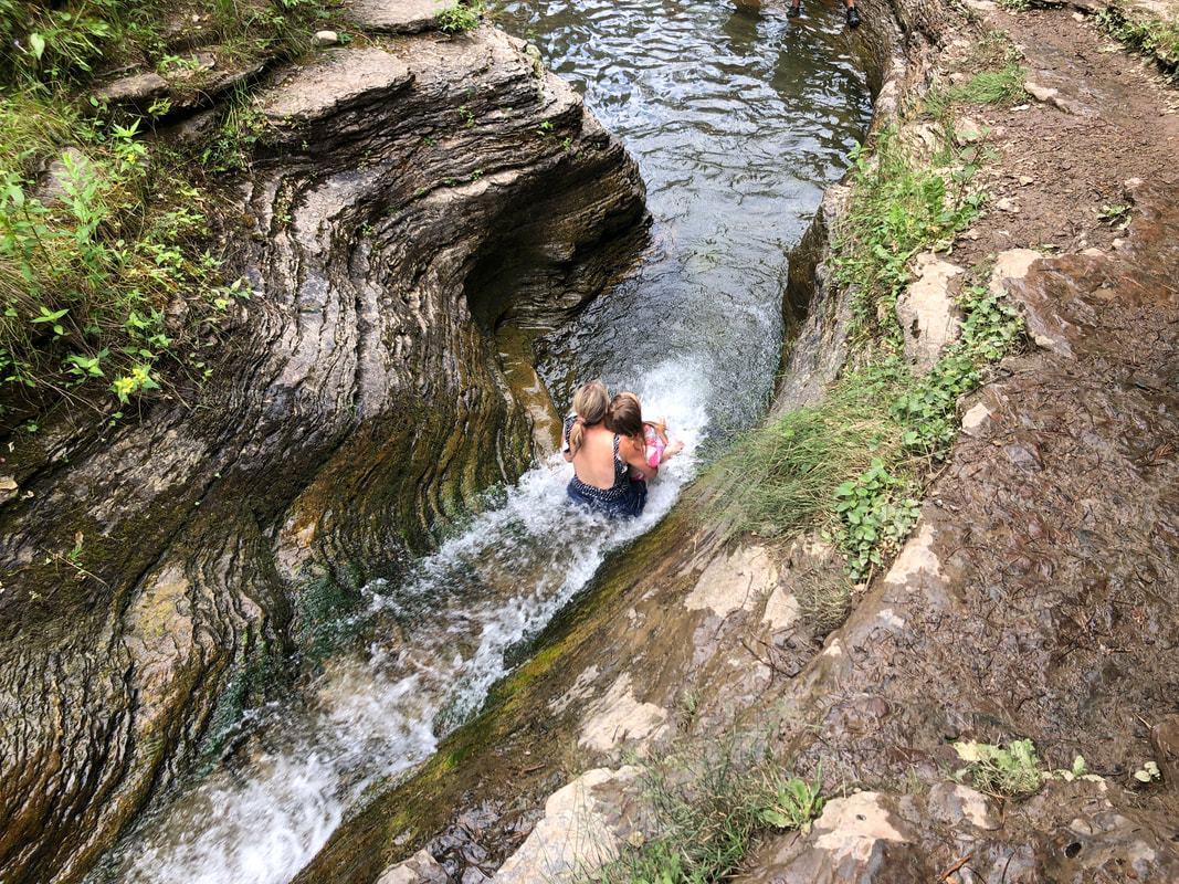 ....sliding into a deep pool of water at the base of the slide. 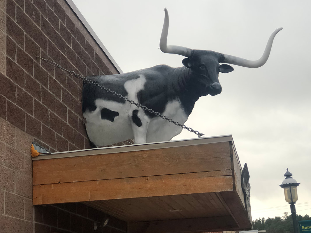 Where we are staying is Sundance, WY. Really small town with no traffic light but a couple of restaurants and we've had fun talking with the locals and playing a few games of pool. 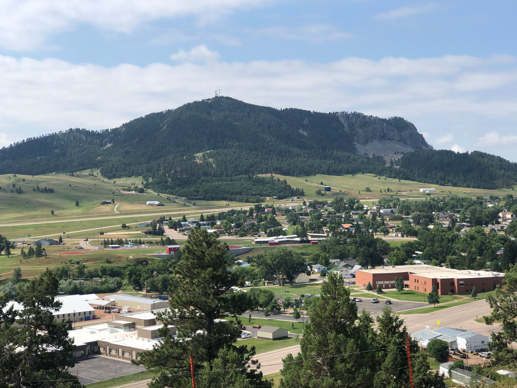 In the distance is Sundance Mountain. Unfortunately, we were unable to climb it as the land around and maybe the mountain too is privately owned.  We also toured a fish hatchery in Spearfish.
0 Comments
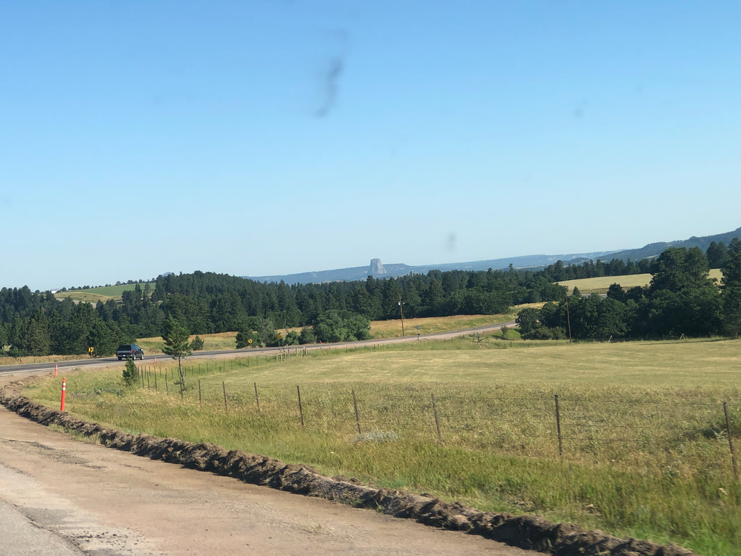 The movie "Close Encounters of the Third Kind" put Devil's Tower on my radar and I have wanted to visit ever since. From where we are staying, it's about a half hour drive and there it popped up on the horizon. It's such an incongruous sight considering the surroundings. 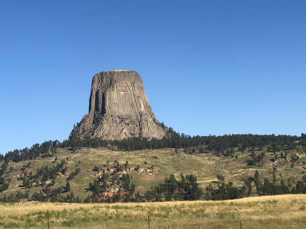 What a sight! Also, another national park at which traffic is light. 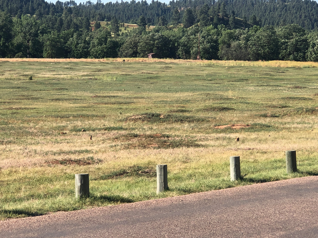 Passing through the entrance, we pass "Prairie Dog Park" with dozens of the critters scrambling into and out of their homes. 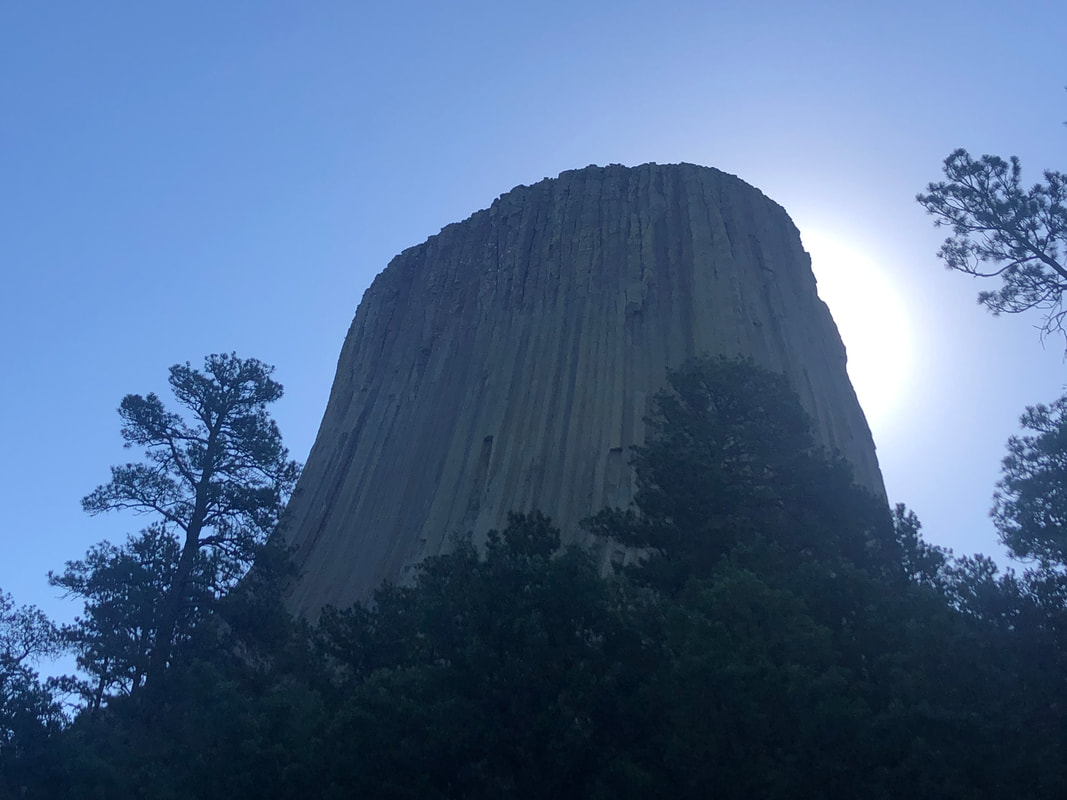 We park and begin our hike on one of the two trails that go around the Tower. The inner trail is paved and 1.3 miles long, the outer trail is dirt and almost 3 miles. 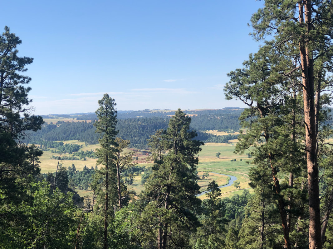 Great views which include the Belle Fourche River, which had a hand in creating the Tower. 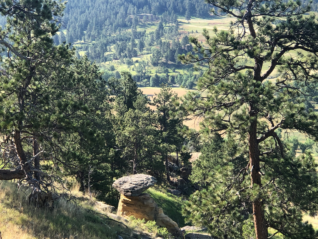 A rock balancing on another. We deemed in "Northern Mexican Hat". 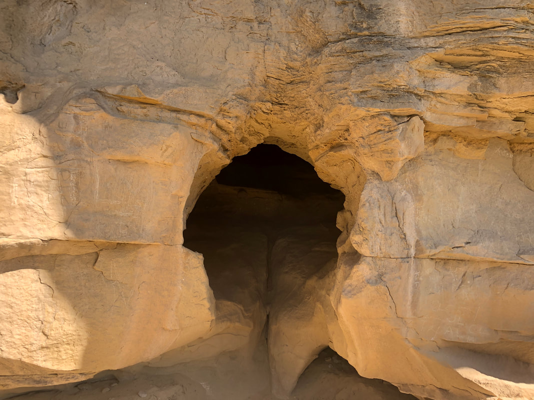 The trail included a visit to a decent cave. I stuck my head in but it appeared to peter out. 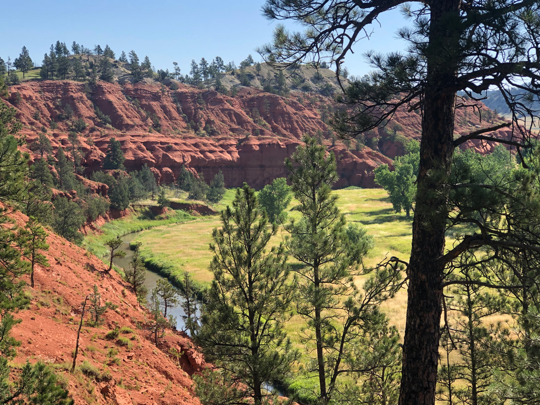 The stone and dirt are a light brown on one side of the Tower and then red on the other. 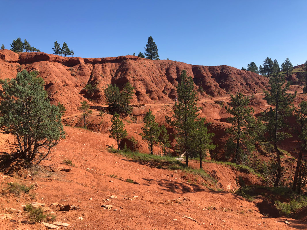 The trail continues but eventually, a pretty good climb of 1.22 miles having an average grade of 5.5% takes us back to the parking lot. Amy wanted to do the route again so we decided to go separate directions. This suited me as I thought that final climb would have a Strava segment and so I planned to put in a good effort.  The only way to the top is via multiple climbing routes. The first documented climb was in 1893. Note, upper right, someone standing on top of a stone column. I reached the bottom of the climb, walked as fast as I could and.... 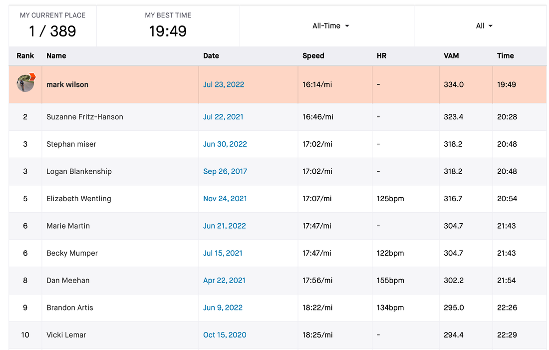 ....captured the KOM on this climb. I was happy about that. Then, having hiked the outer trail twice, we.... 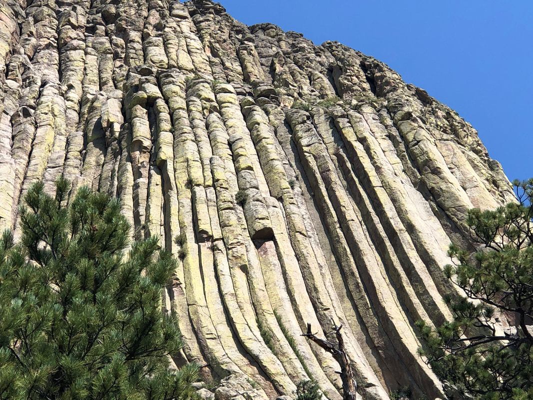 ....hiked the inner, paved trail, finishing the day with 7.5 miles and a little over 1000' of climbing. While hiking the inner trail, we reached a spot where one of the wooden ladders, used in the first known ascent, could be seen in a crevice. It's up there but don't bother trying to find it. Fun day.
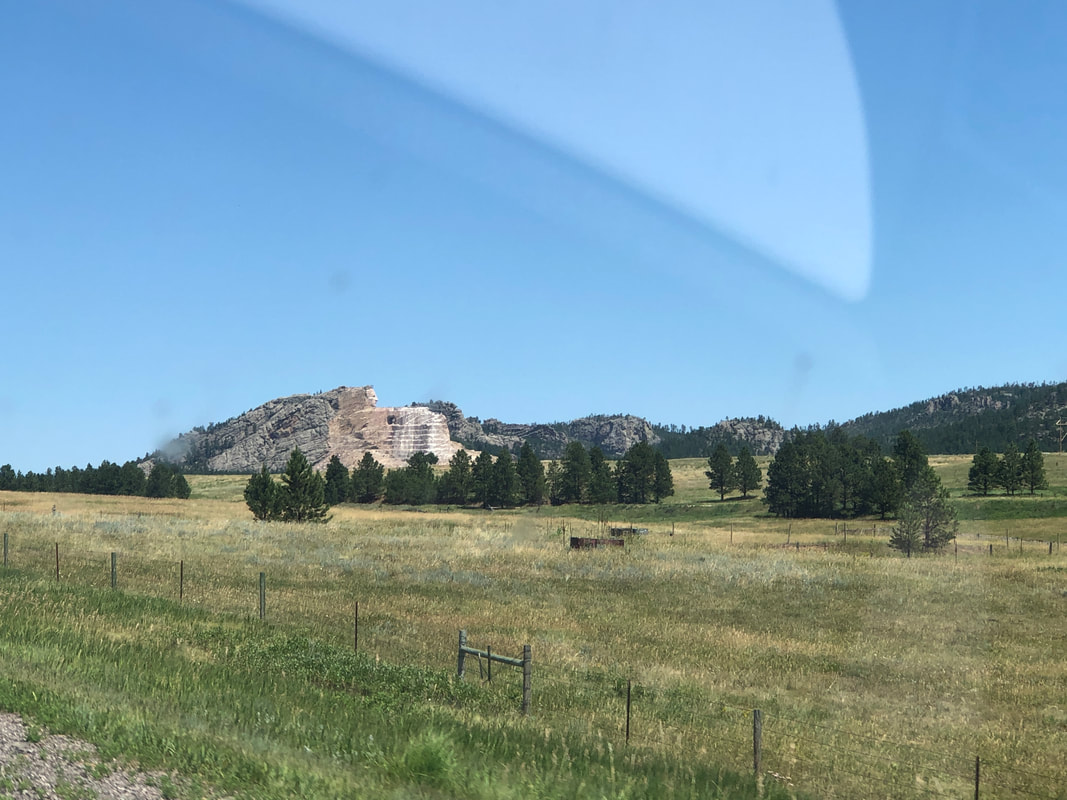 We drove through the Black Hills in SD and because we were so close to Mount Rushmore, decided to stop there. Above, note the head, which I thought was a first glimpse of Rushmore but no, it's an ongoing construction of Crazy Horse mounted on a horse. 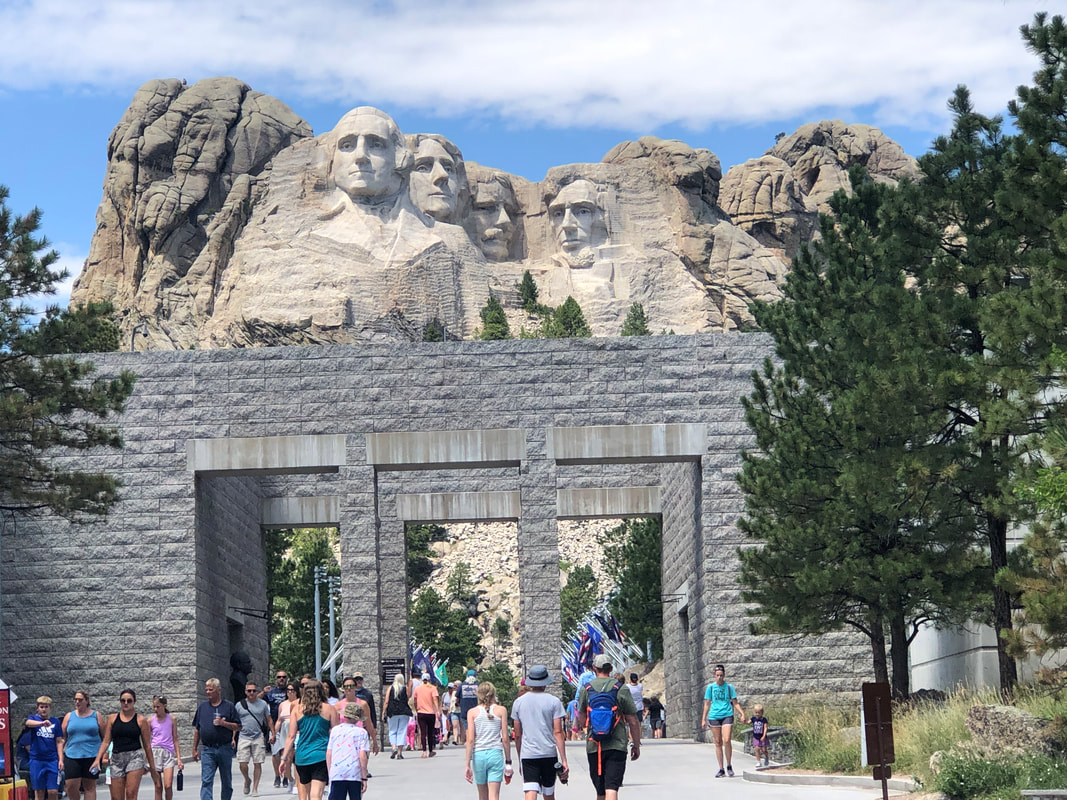 Mount Rushmore is impressive. Although the image above doesn't show it, crowds at all our stops have been light. 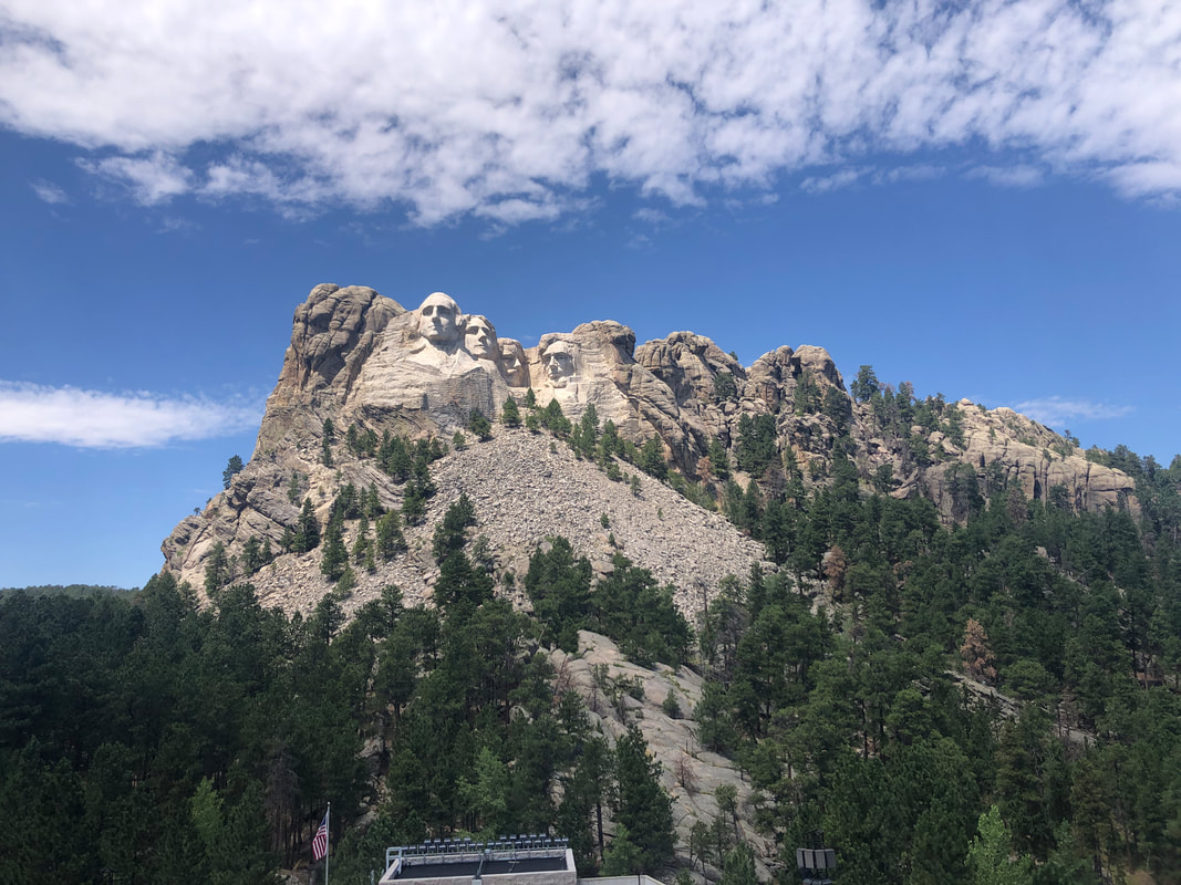 Too bad there isn't a trail that permits access to the ridge. We then headed west, arriving in.... 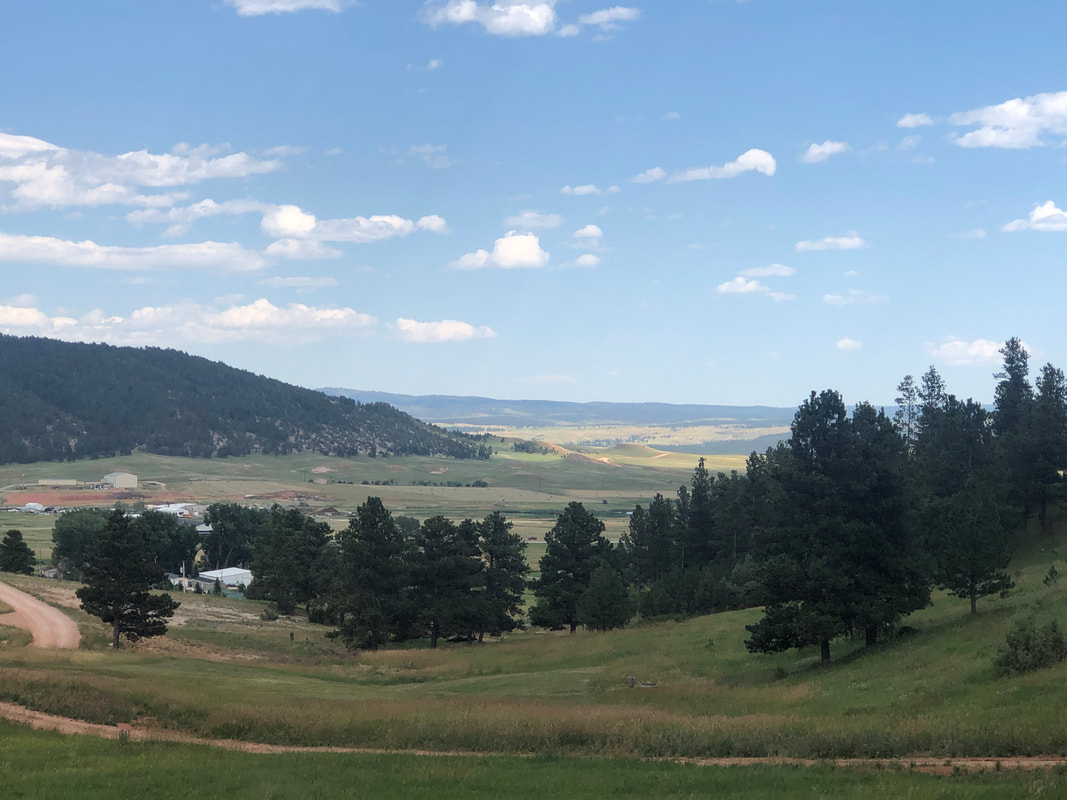 .....Sundance, WY. We're staying in a too small cabin although it does have a great view from the front porch. 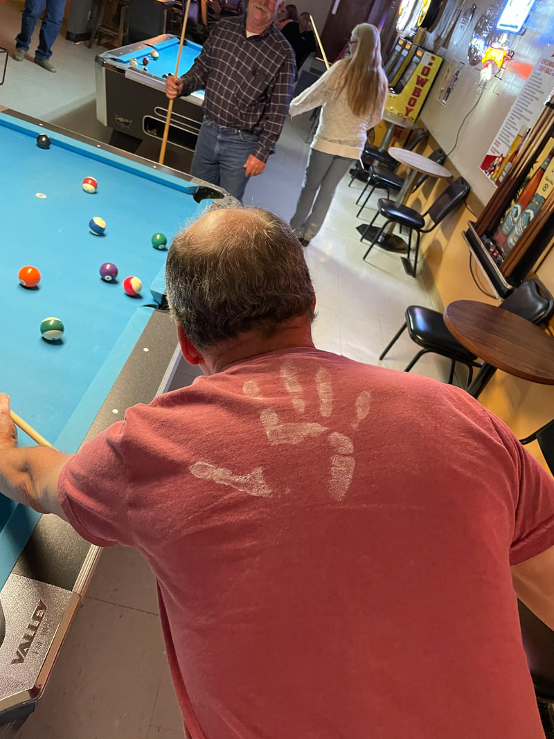 We visited a local restaurant/bar and played pool. Amy's displeasure with losing a close game caused her to leave the above print on my back.
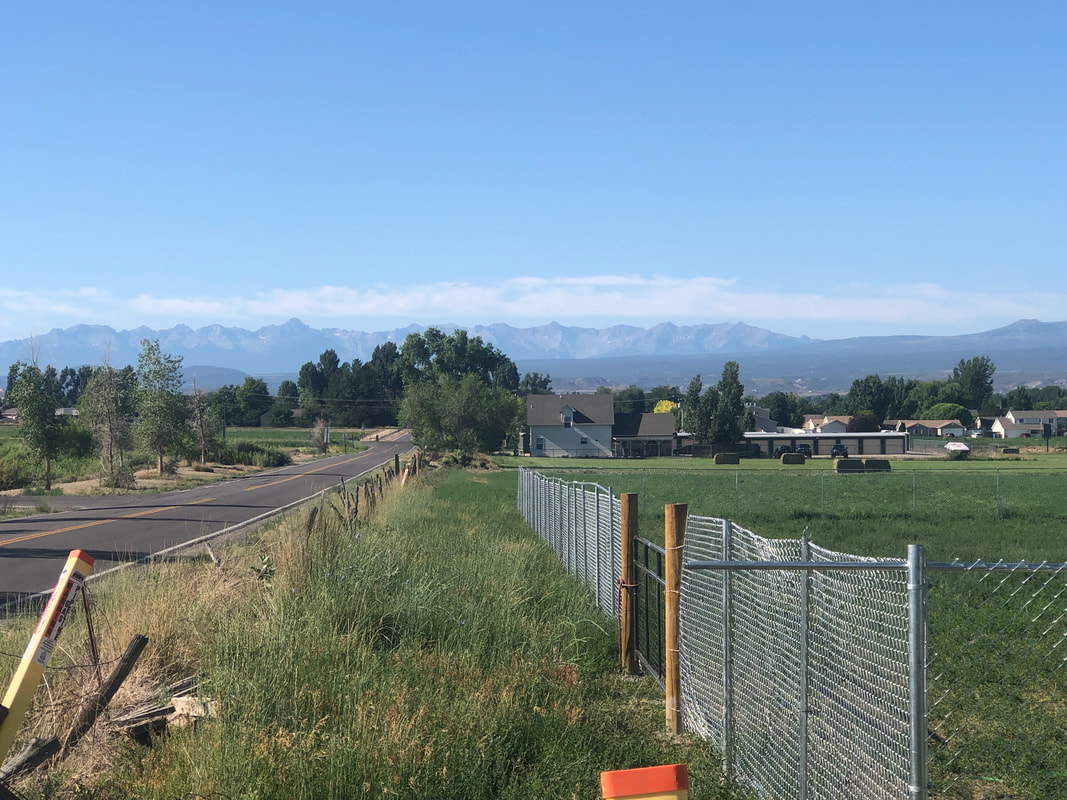
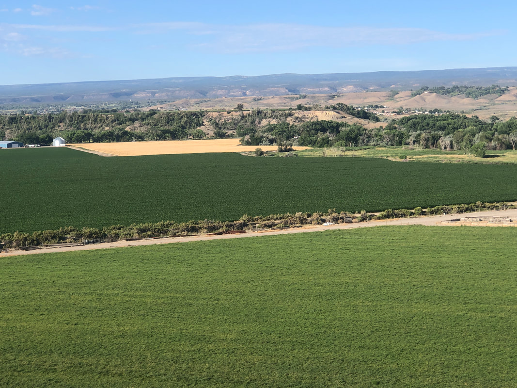 The morning of our drive to WY, I got in a quick gravel ride. The route reminded me a lot of north central Ohio with lots of farms, a tree nursery, a horse farm, a lumber mill, etc... 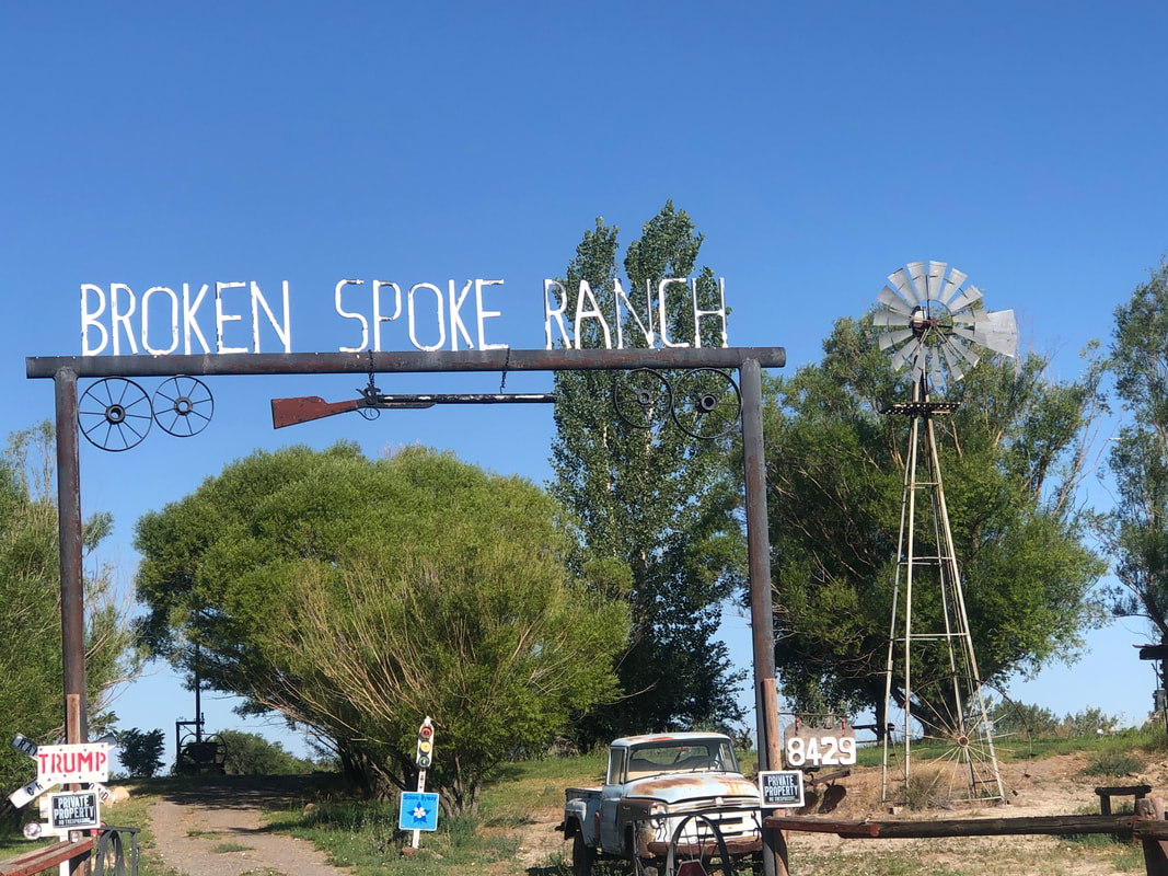 I passed this unusual ranch gate and then entered.... 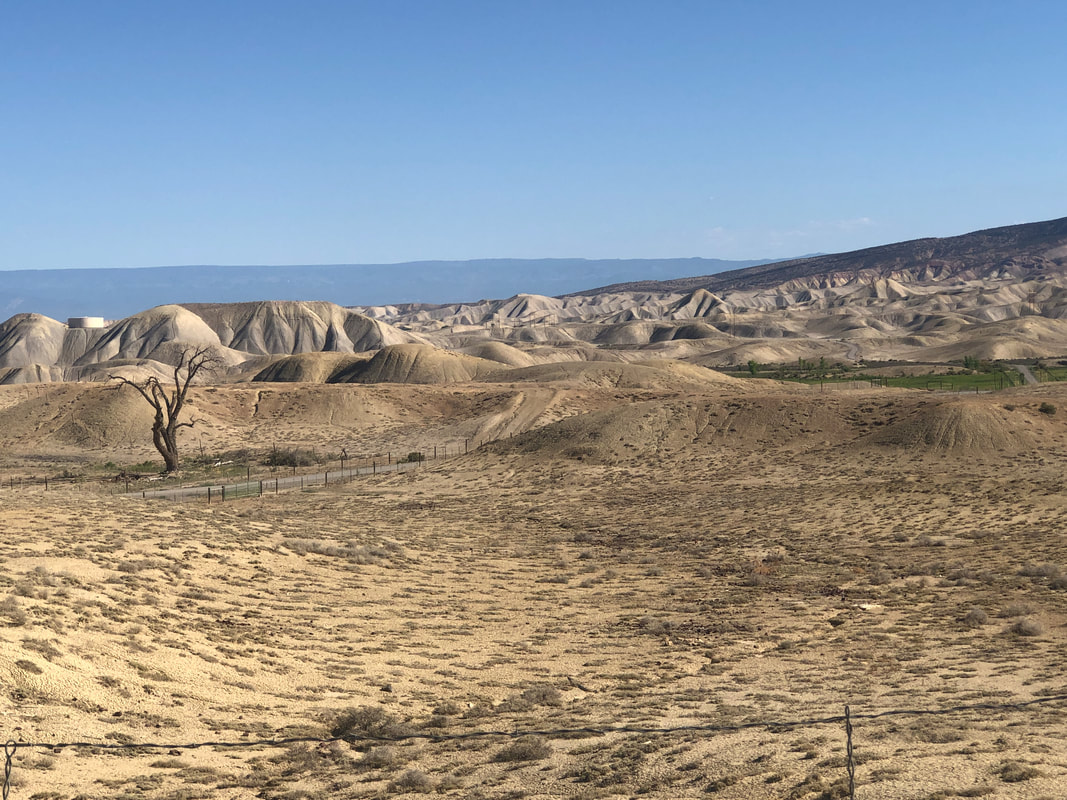 .....the unusual Adobe Hills area. I just skirted it and returned to the farm scenery. Returning to the house, we packed and headed north. 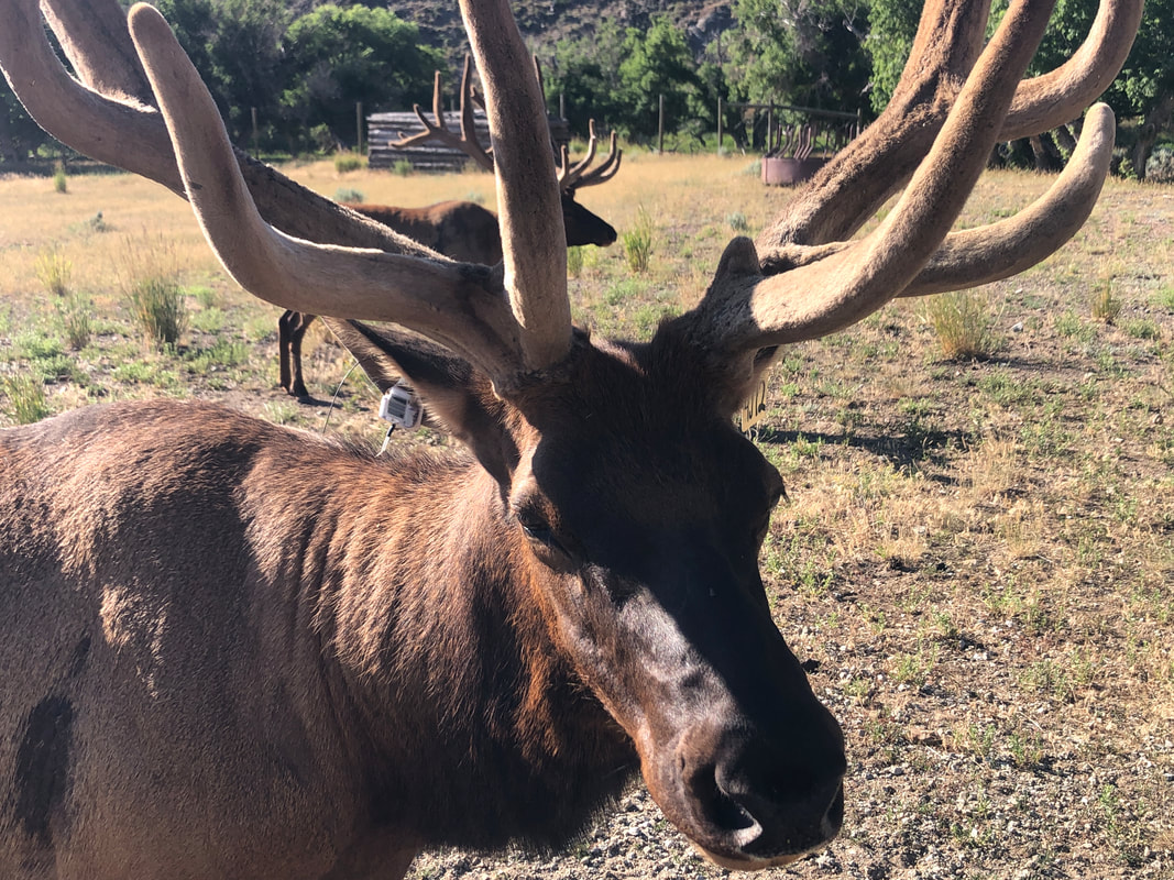 We passed what must be some kind of sanctuary for elk. The terrain changed many times during our drive where we stopped in Cheyenne for a night.....  .....before back on the road, stopping to get gas and then entering the Black Hills and checking out Mount Rushmore and then, Devils' Tower. More on that coming soon.
 A road that connects Ouray with Silverton, known as the "Million Dollar Highway" is a fun diversion with great views. 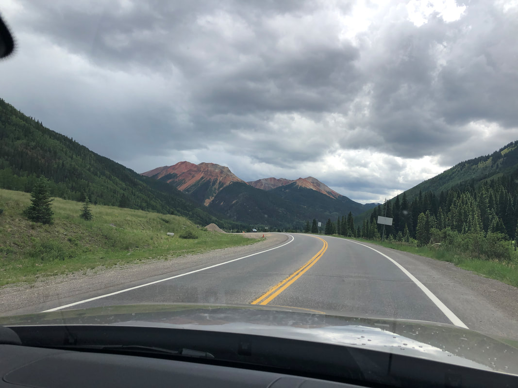 We didn't drive the entire distance to Silverton, instead stopping at about the half way point and... 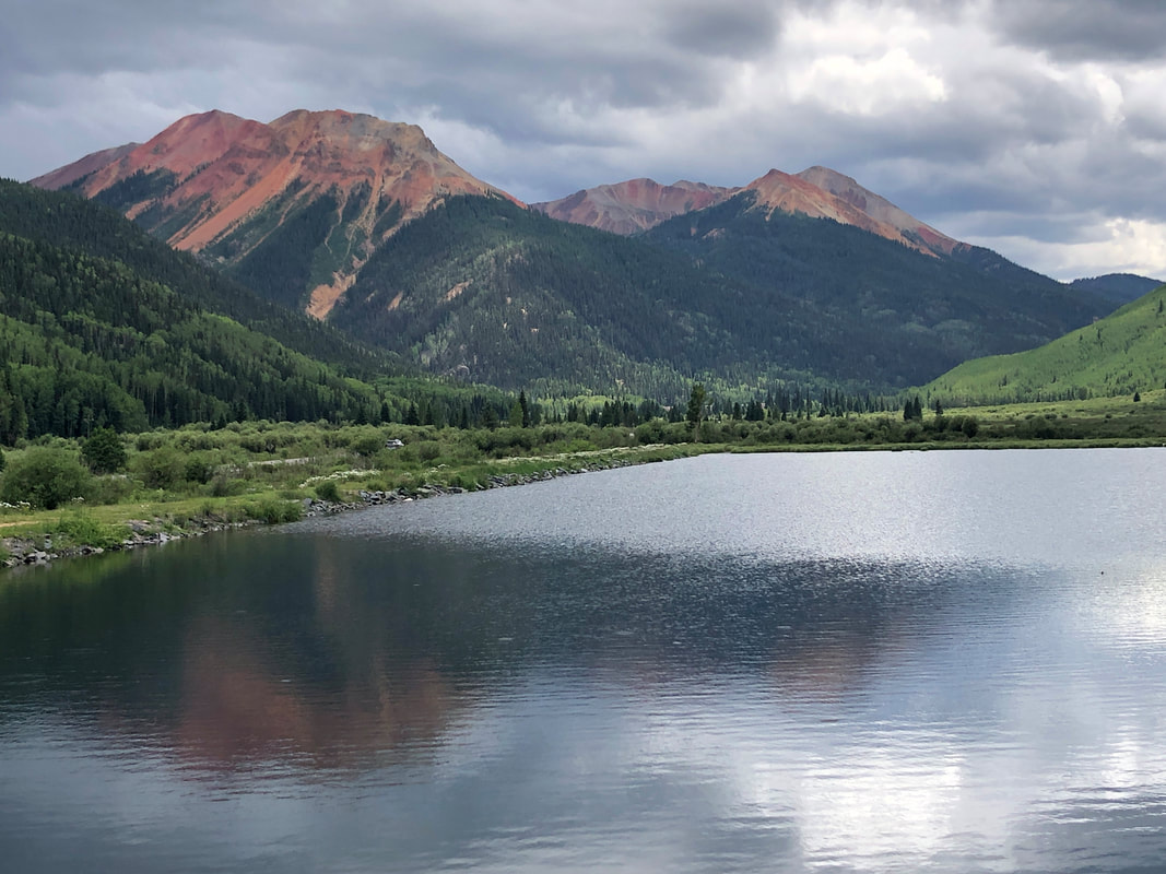 ...taking the above beautiful image. The clouds.... 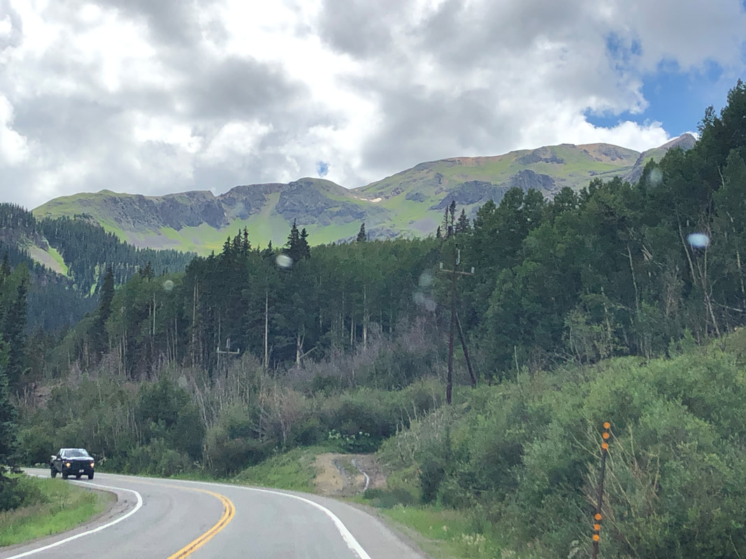 ...had been thickening which seems normal in the afternoons and we heard some thunder.... 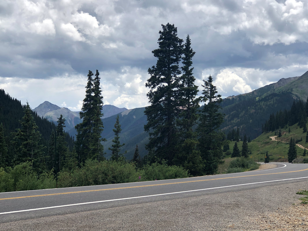 ....and had a few drops of rain hit the windshield. 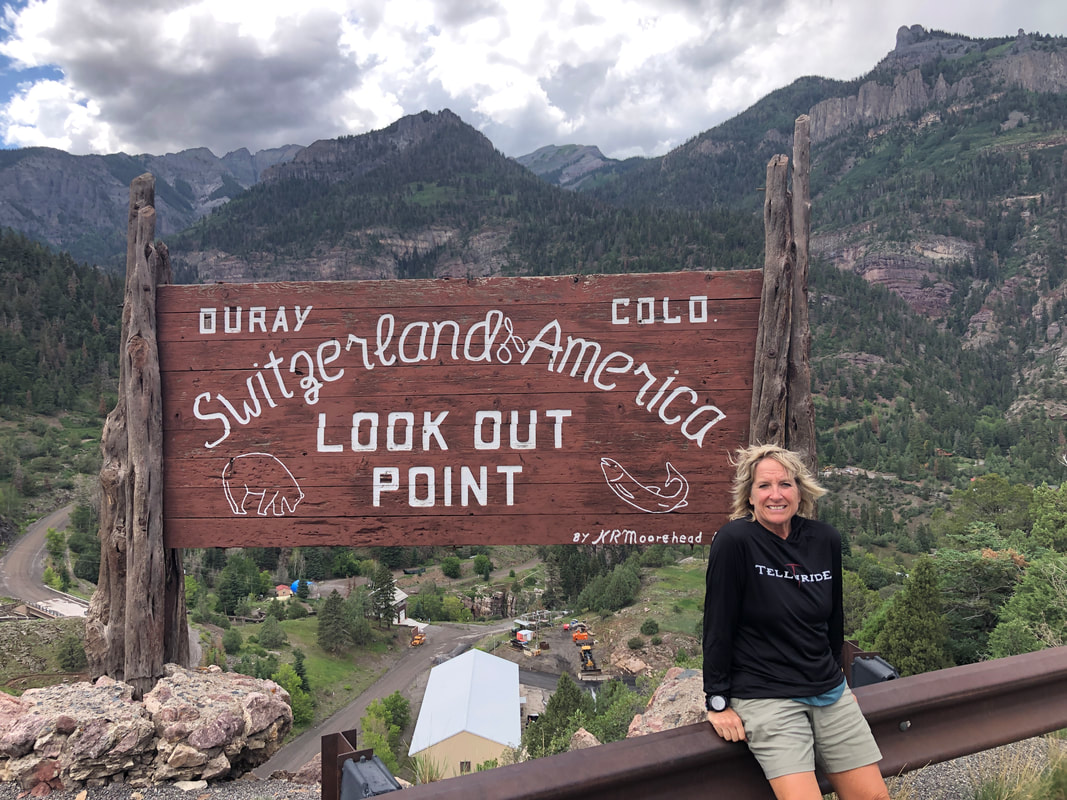 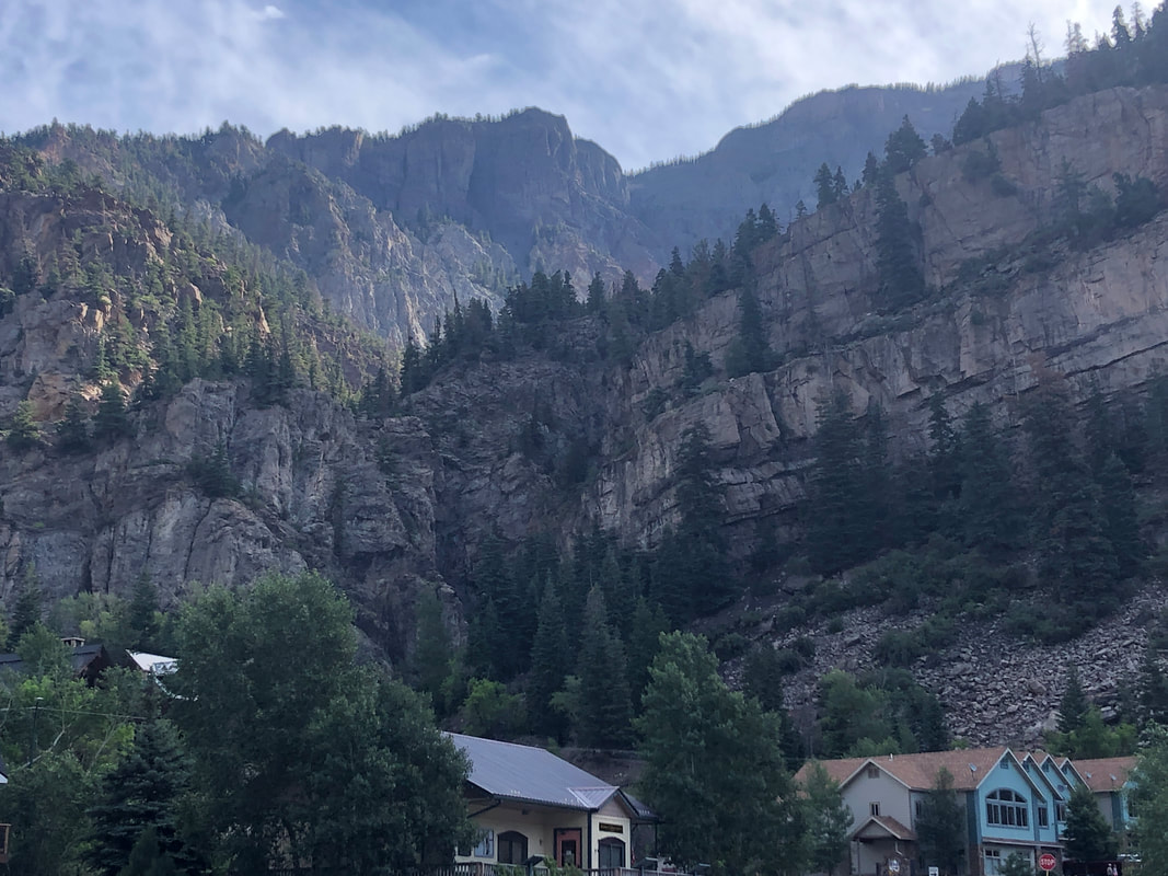 Ouray, CO is only a 30 minute drive from where we are staying and I regret not discovering it sooner. Known as the "Switzerland of America", but having never been to Switzerland, I can't say if that is an accurate title but it seems to be. Oh, the original "True Grit" movie was filmed in this area. 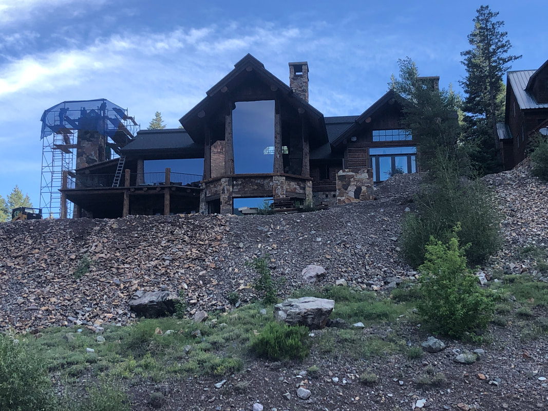 We are here to check out the scenery of course but also to hike the 6 mile, Perimeter Trail which circles the town. Check out the size of that window in this new build, bordering the start of the trail. 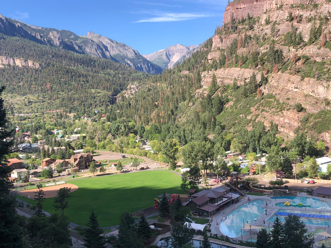 We ascend a series of steep stairs and the valley and town open to us.  We walk in the shade for the majority of the first 20% of the hike with large pine trees towering over us and then..... 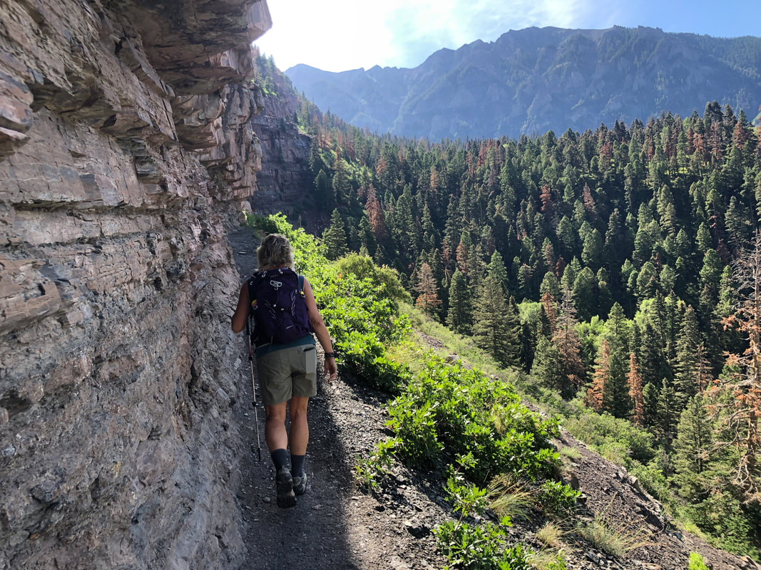 ....emerge into the sun. We trade shade for sun frequently throughout the hike. The route is dotted with many features such as.... 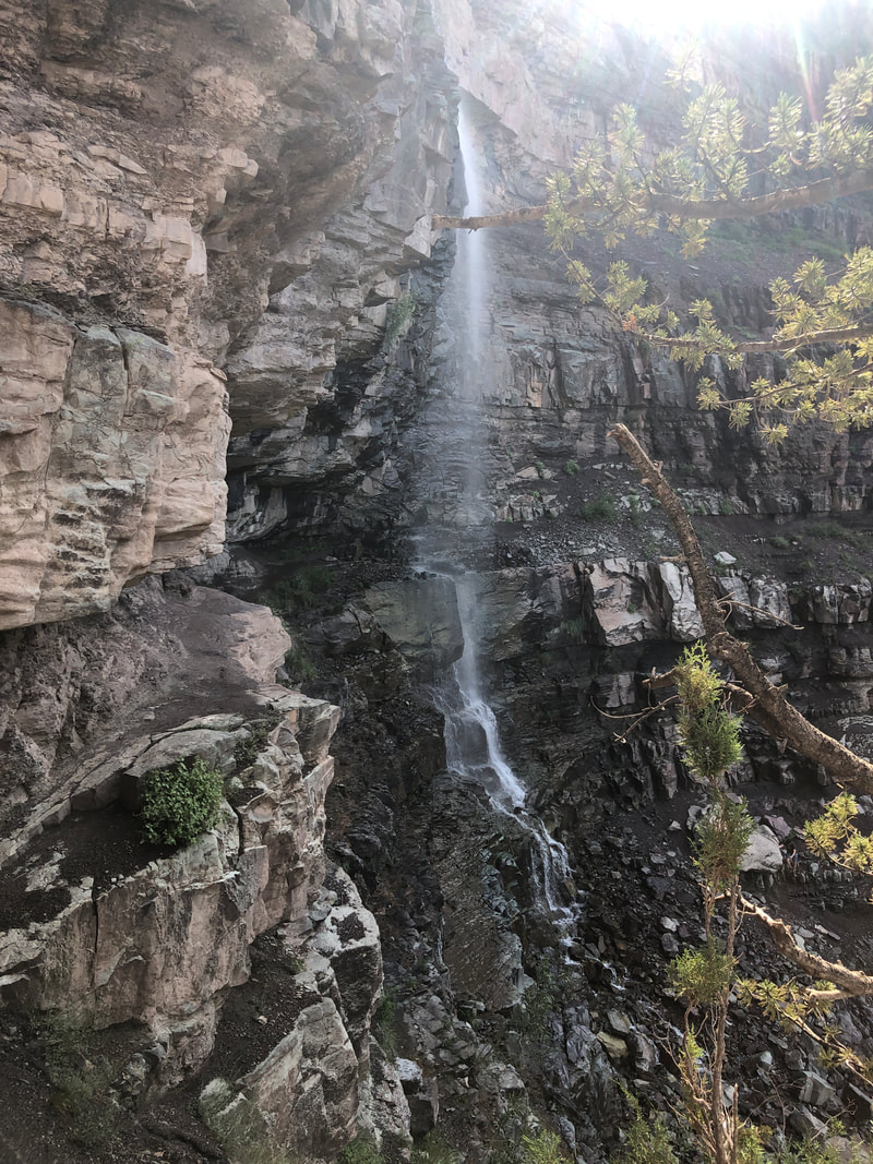 ....Cascade Falls. In several places along the trail, there are bailout options to the town that also serve as entry points for people climbing from the town to take in specific features like the falls. 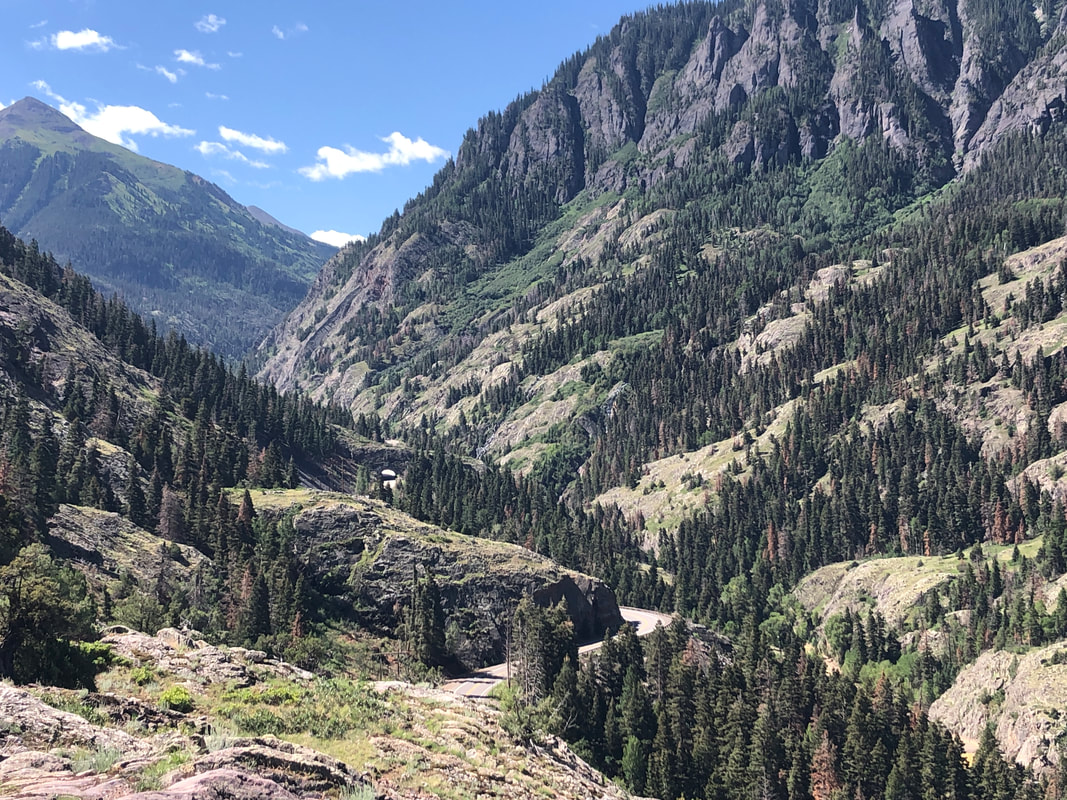 We emerge from the woods and enjoy awesome view to the west that include a portion of the "Million Dollar Highway" that winds its way to Silverton. 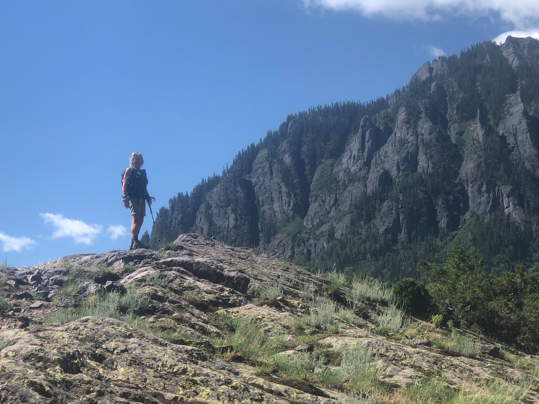 Amy poses as we meet a family from Denmark. Then, the trail descends and soon..... 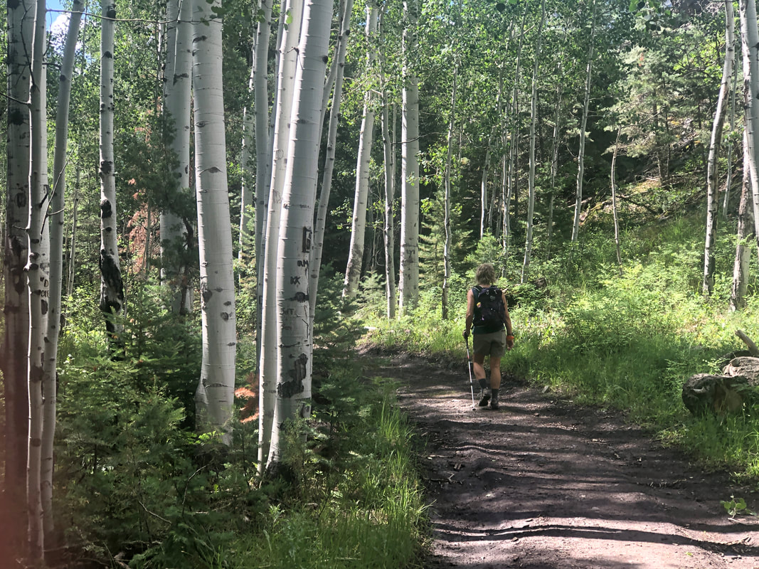 ....we are walking through a grove of aspens. 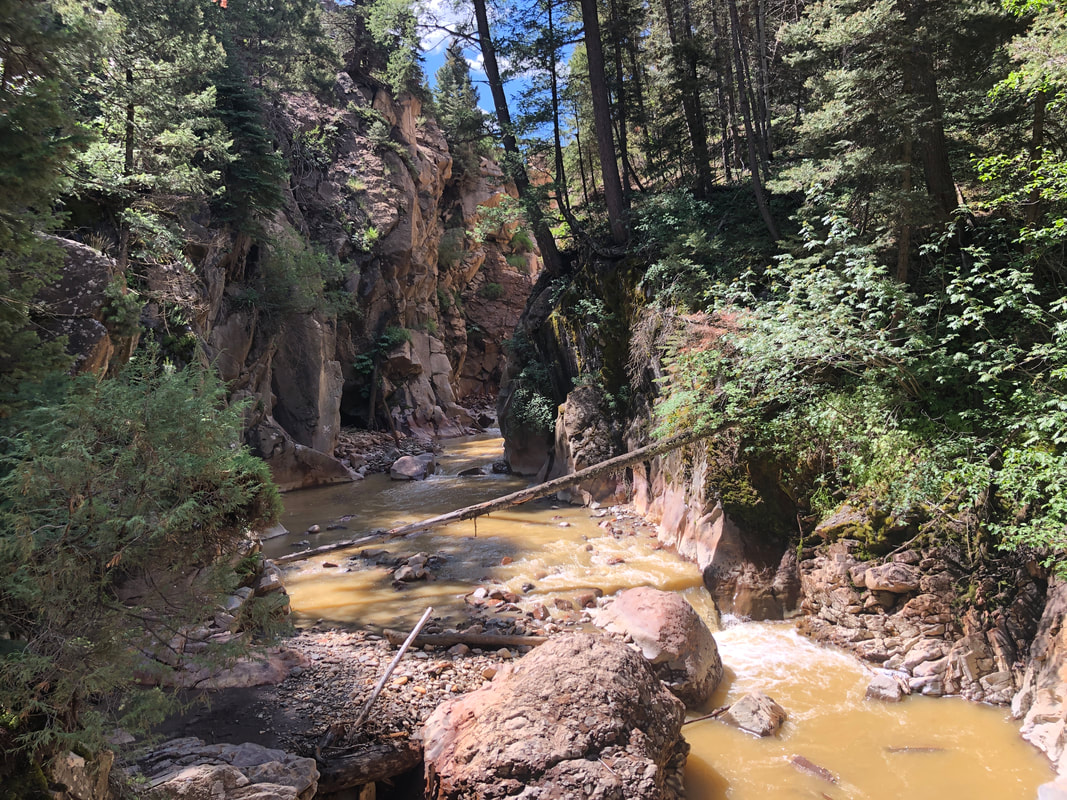 We reach a bridge and enjoy a look into a gorge with a strong flow of water. It had rained 6" the prior two days so a lot of runoff. 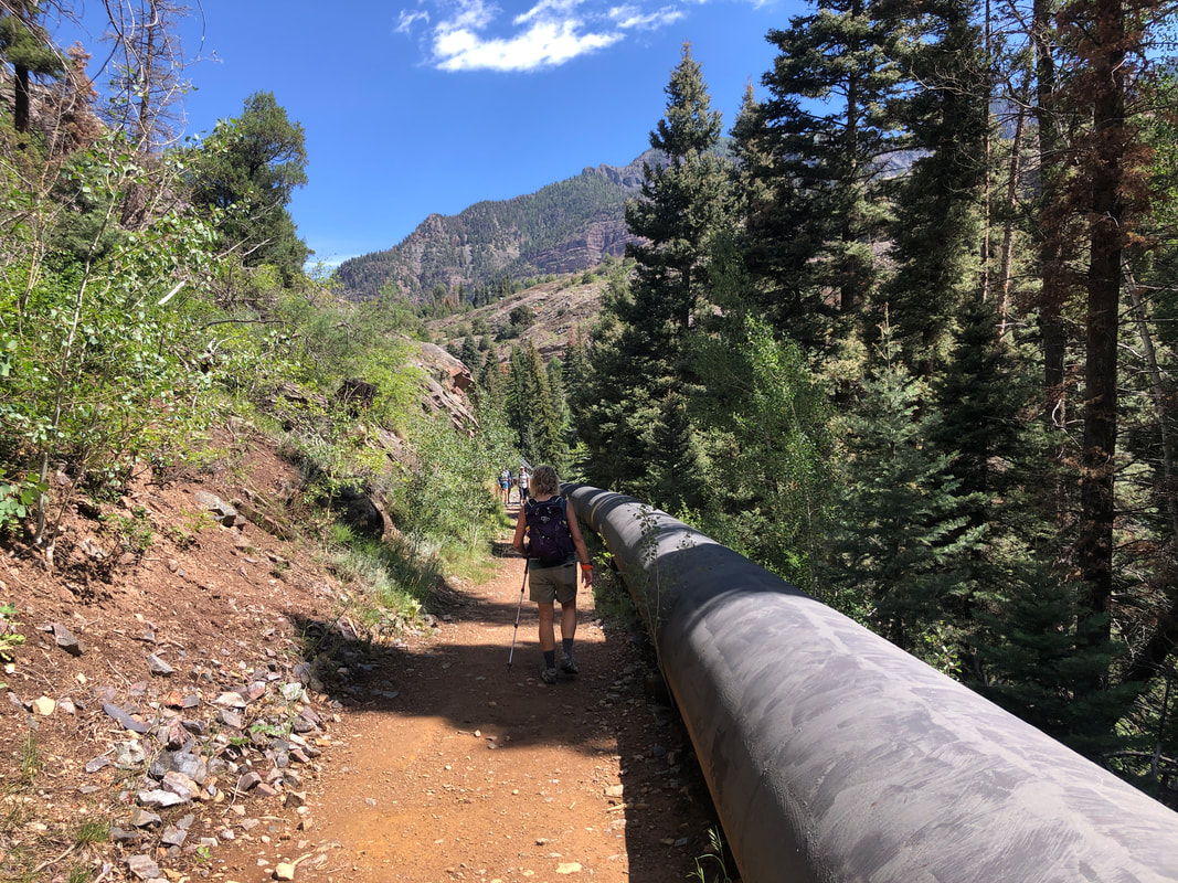 A pipe that transports water between towns borders the trail for a short distance. 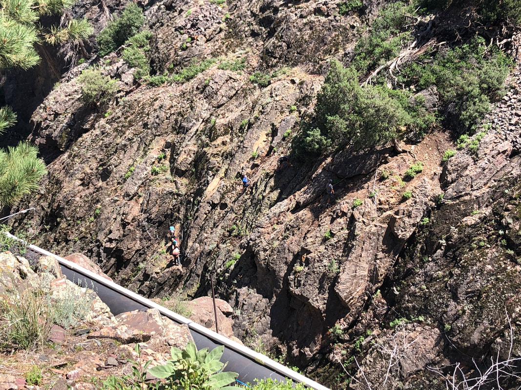 We are walking alongside the Uncompahgre River when we spot several people (look closely) tethered to steel cables, working their way up, down and sideways a route. 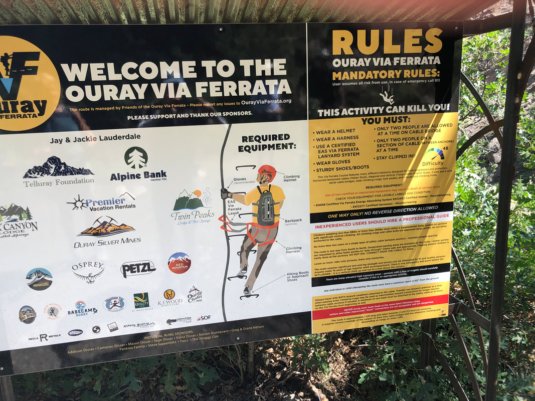 A Via Ferrata is a climbing path and becoming popular in the US. It looks like a lot of fun and I wish we had the time and equipment to experience it. 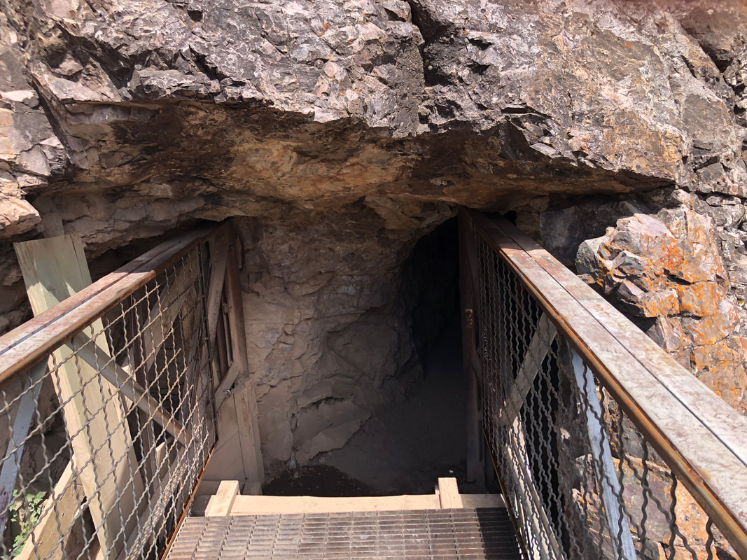 We arrive at another bridge with water gushing in the below gorge then enter a tunnel that used to house an old water pipe. 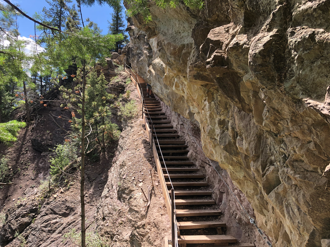 Emerging from the tunnel, we descend a long flight of stairs. This trail has it all. 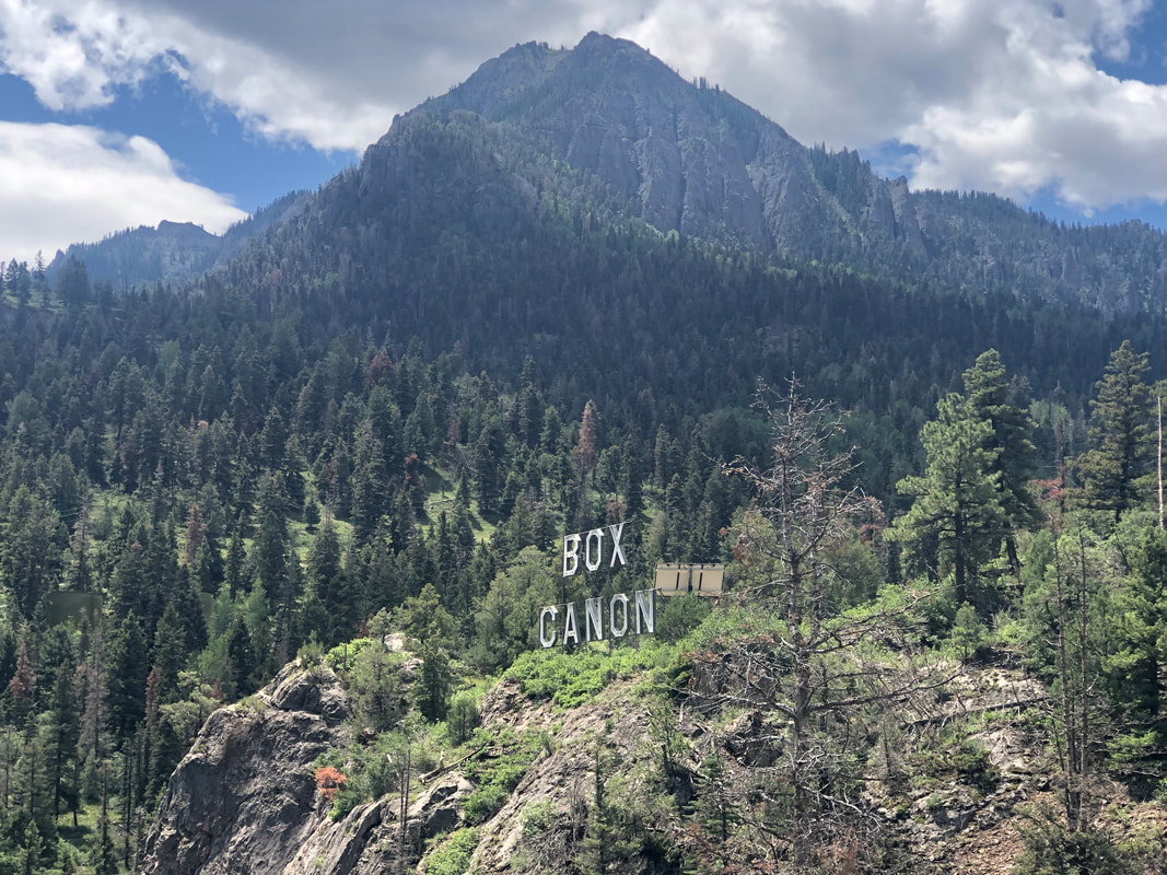 We ascend for about 0.02 miles and reach an overlook. 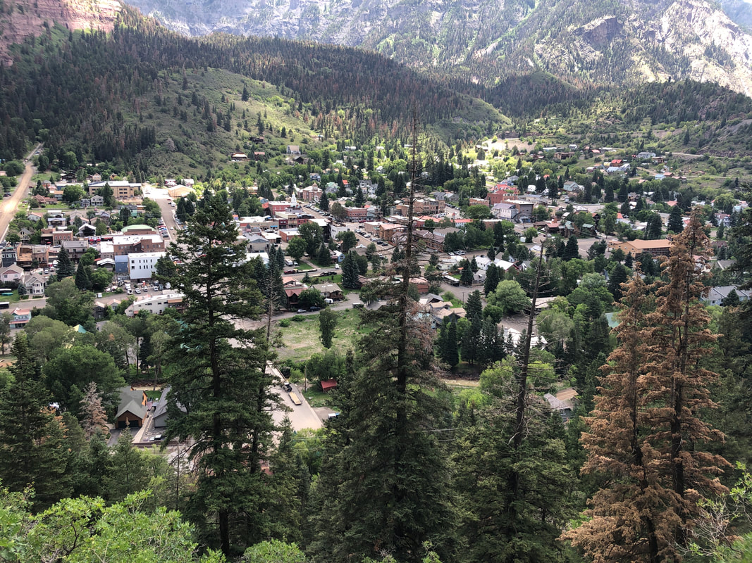 Now we are nearing the end of our hike and get a good look at Ouray (pronounced U-ray). 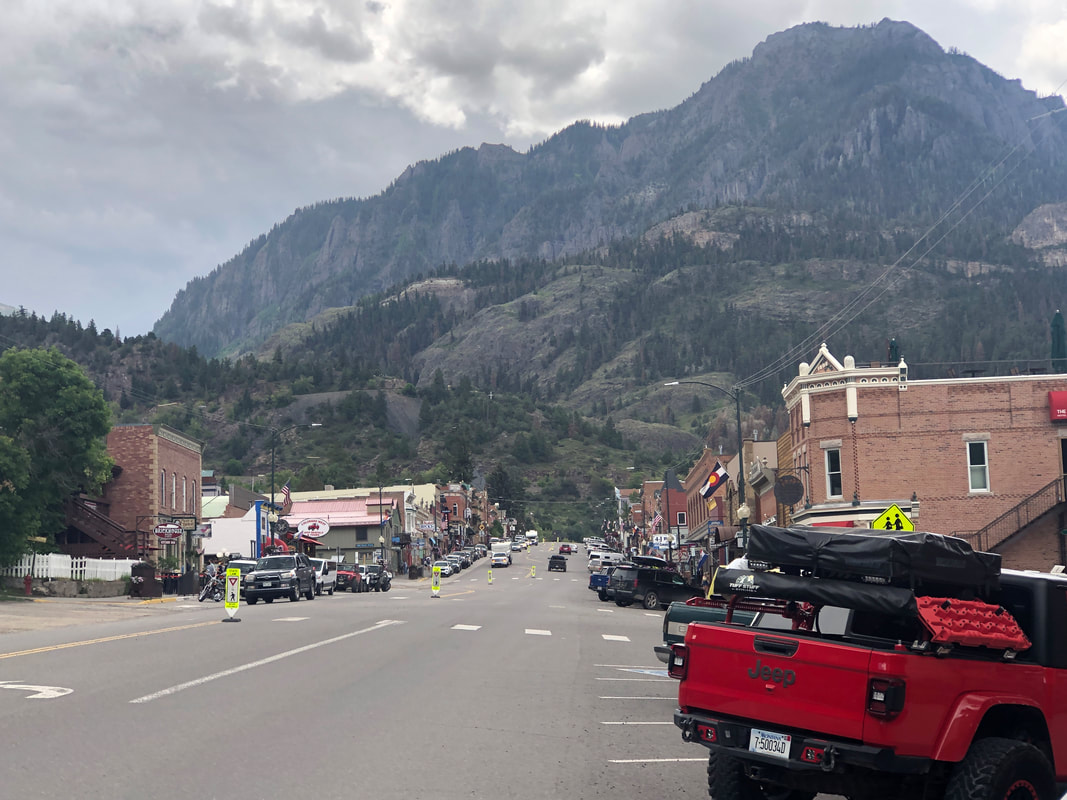 Completing our hike, we check out the town, first enjoying lunch and a cold beer and then doing some shopping. 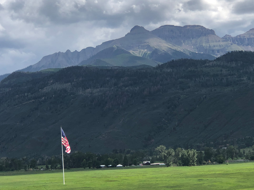 Driving home, we pass a large American flag with a great background. Our stay in Montrose is winding down and within a couple of days, will head to Sundance, WY where we'll explore the Black Hills, Devil's Tower and do the touristy thing of Mount Rushmore. The distances we hiked and biked were far less than what I had hoped, for a variety of reasons so hoping to correct that at the next stop.
 A rest day so we head for our first visit to Telluride, CO. It's about a 90 minute drive but well worth the time. 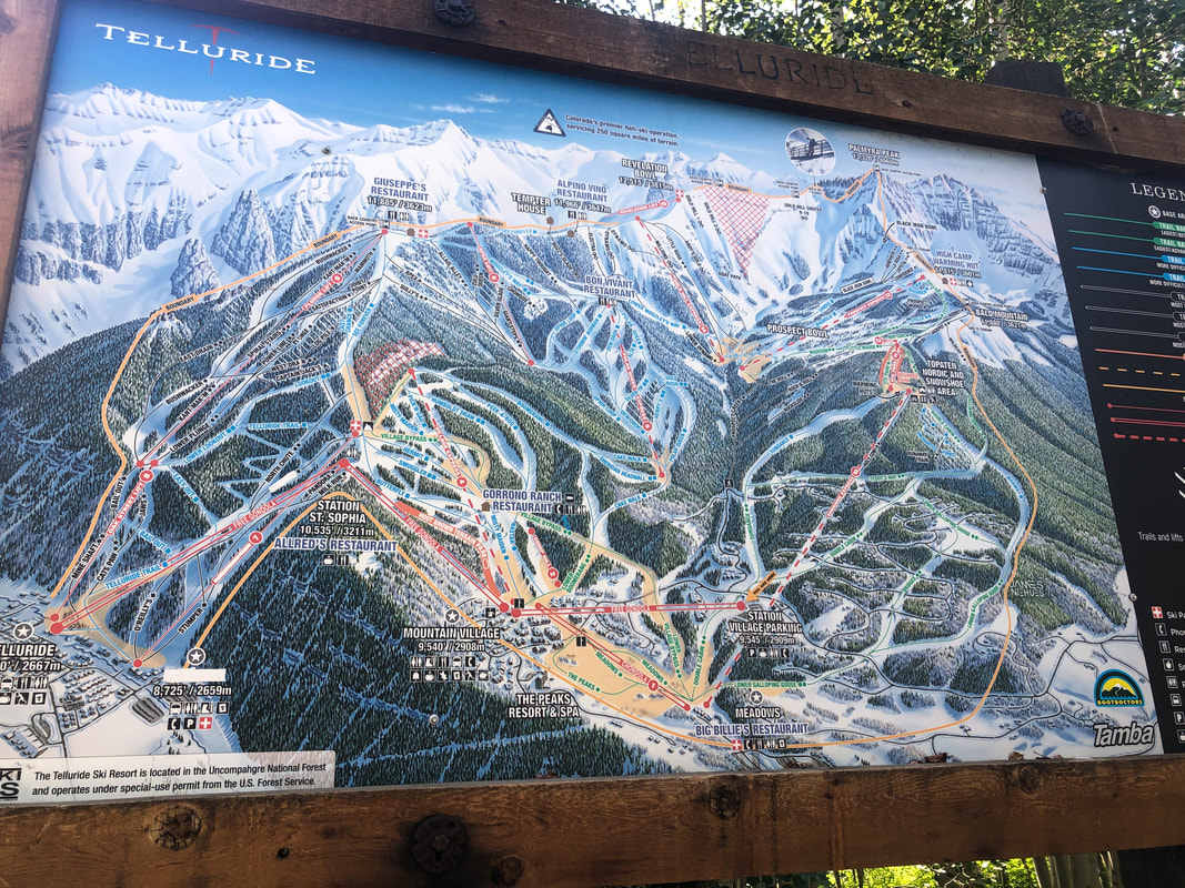 We park in Mountain Village and check out the network of ski slopes. Then take a free.... 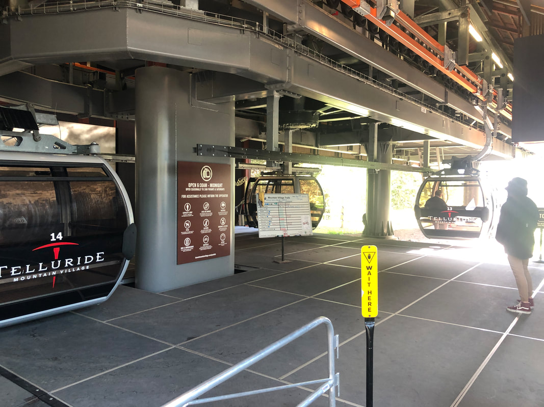 ....gondola ride to a ridge that overlooks Telluride. Here we hop out and... 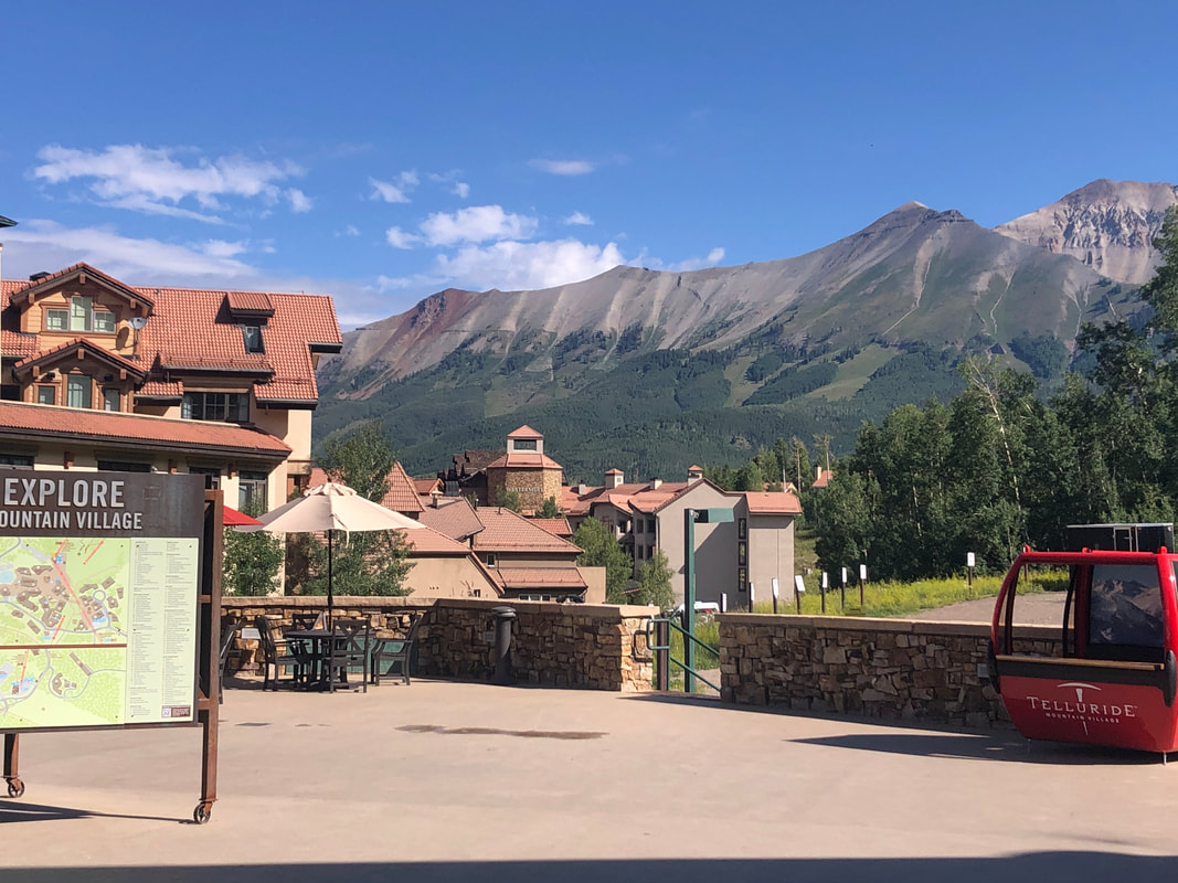 ....admire the.... 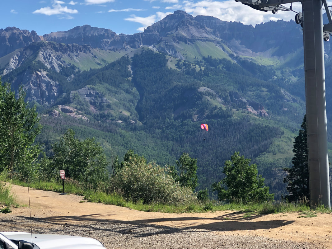 ....awesome views. Rather than continue to Telluride via the gondola, we take a 3 mile hike which was rather steep in places. 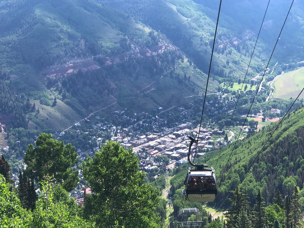 There are several 14ers in the area and I'd like to say I've climbed one but probably not on this visit. One peak, Ajax, requires only a 10.5 mile, round trip hike with less than 4000' of elevation gain but nearly daily afternoon storms would be an issue. 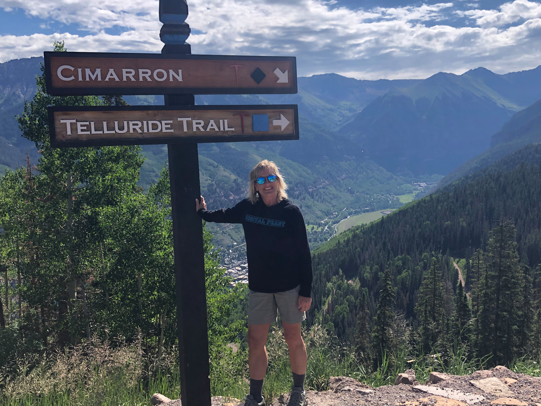 Some of the slopes are double black diamond, which brought back good memories for Amy from when she once skied slopes of this difficulty. 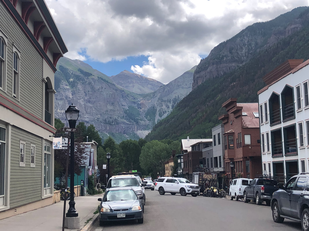 Reaching the town, we walked around, had lunch, shopped and enjoyed the scenery. 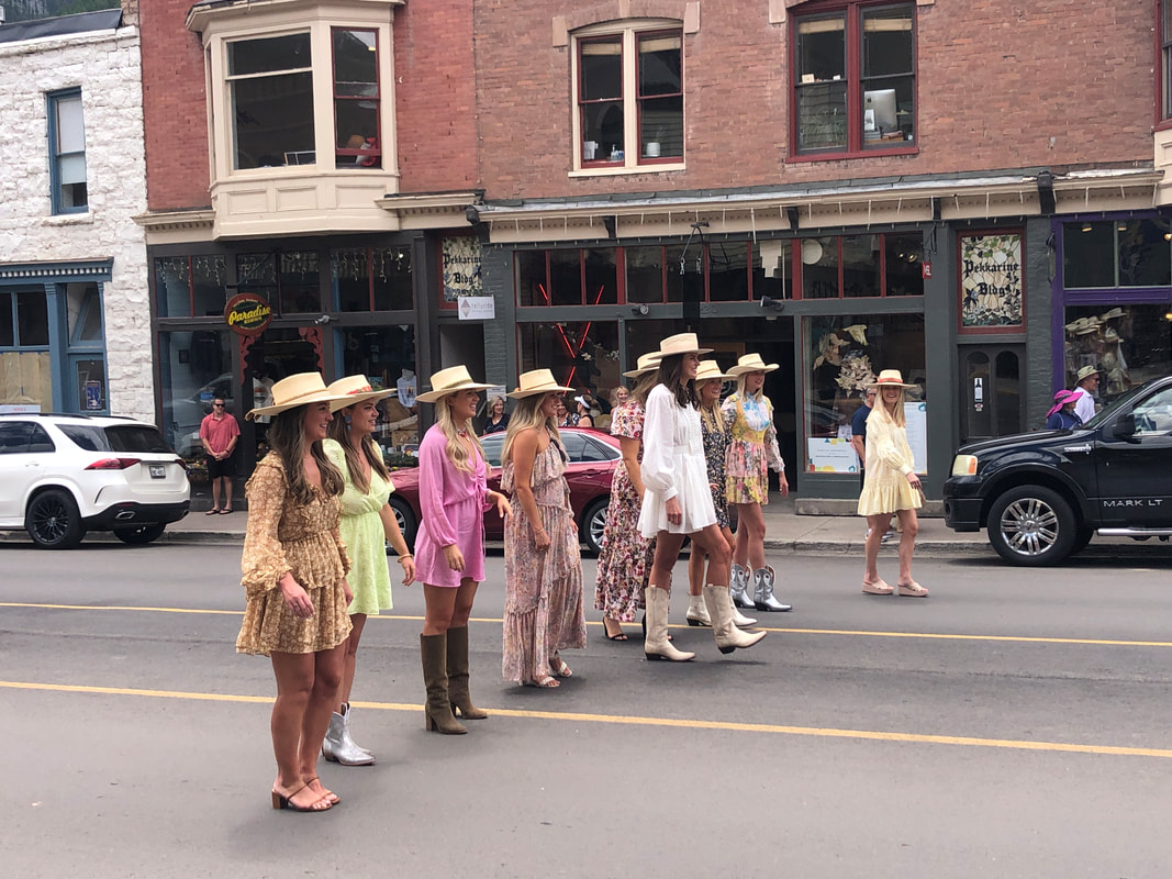 A wedding party had taken over a restaurant and then emerged for pictures. We enjoyed some more rides on the gondola and then returned to Montrose where....  ....Jack was patiently waiting. Fun day and soon we'll visit Ouray, which is known as the "Switzerland of America".
 We head out for our first gravel route. Early pavement with great views of the San Juan Mountains, lush greenery, then.... 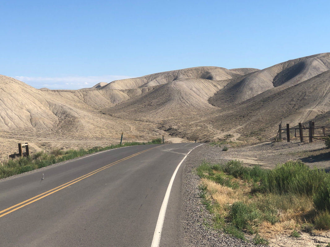 .....we turn into the Adobe Clay hills. So different. Eventually we turned onto a dirt road and began a modest climb then.... 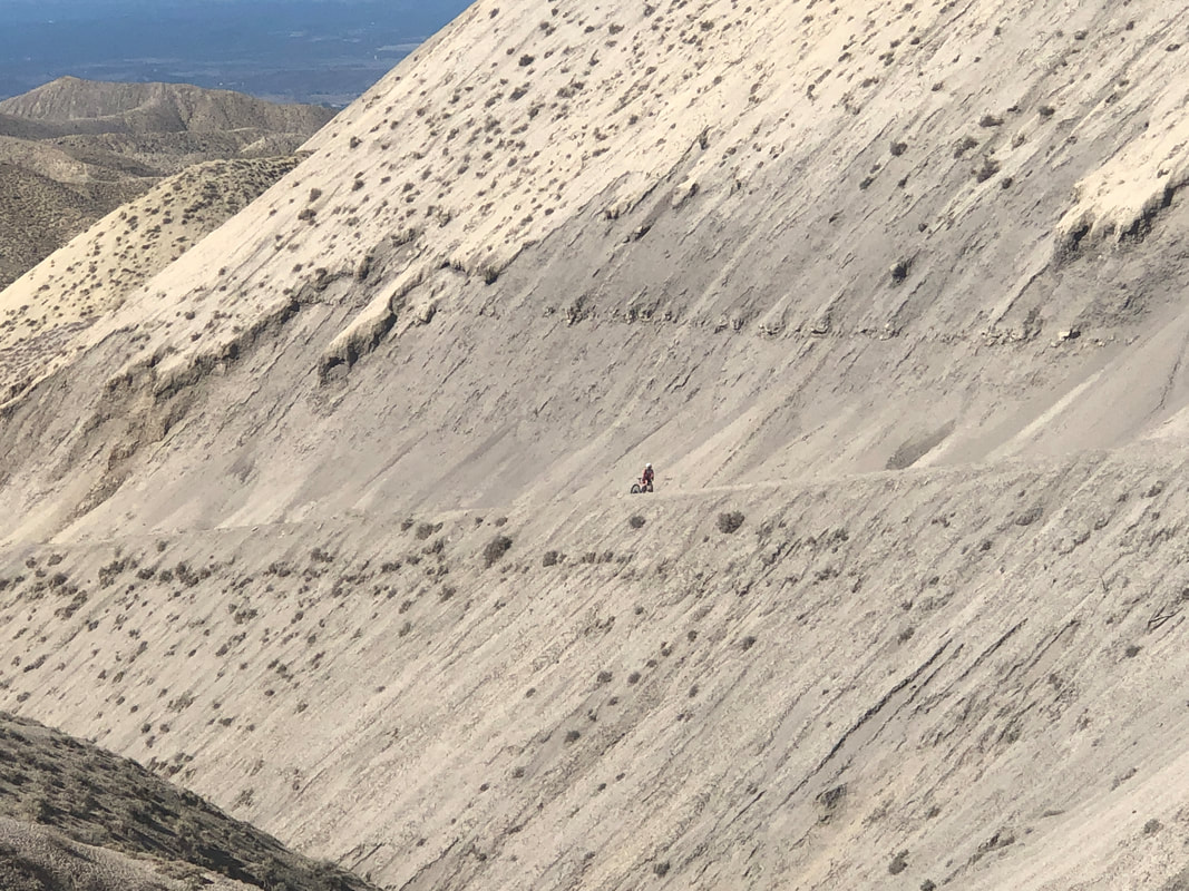 ....the climb steepened, with sustained grades of 16% along the 5 mile climb. Eventually, we both dismounted and had to push our bikes. I had to go back to the Brasstown Bald century ride of many years ago since last I pushed my bike. At mile 97 on the final climb I encountered "the Wall" and unclipped and began to push. ha, ha. 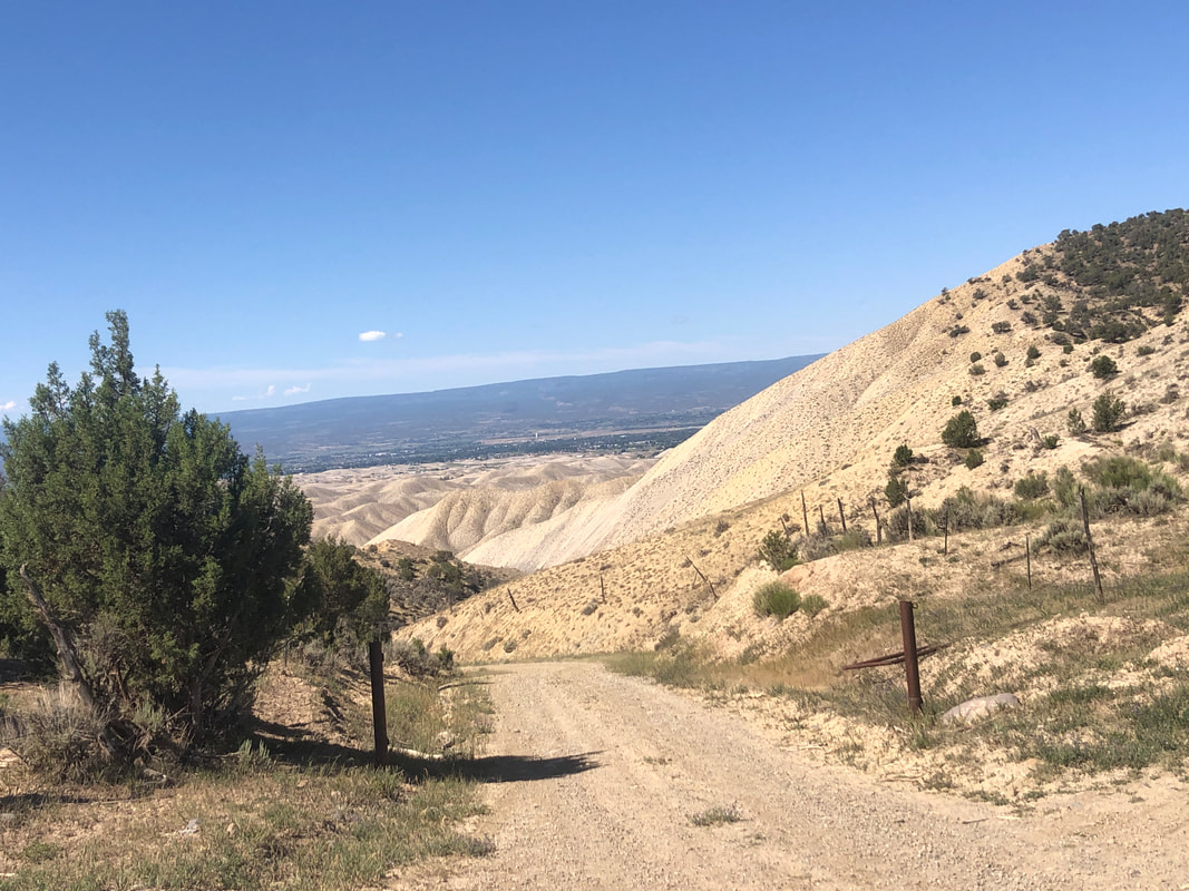 We reached the top of the climb and then began a flat to gently rolling descent. 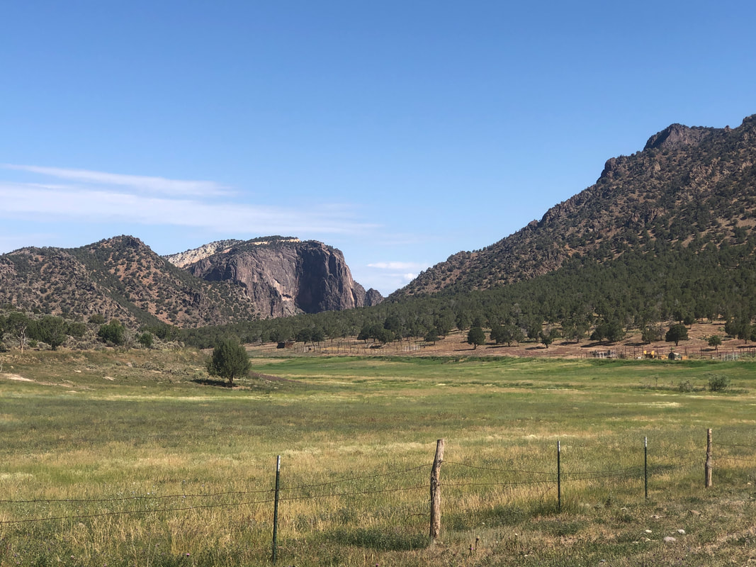 On this plateau, there were many farms, grassy meadows, grazing cows, etc... 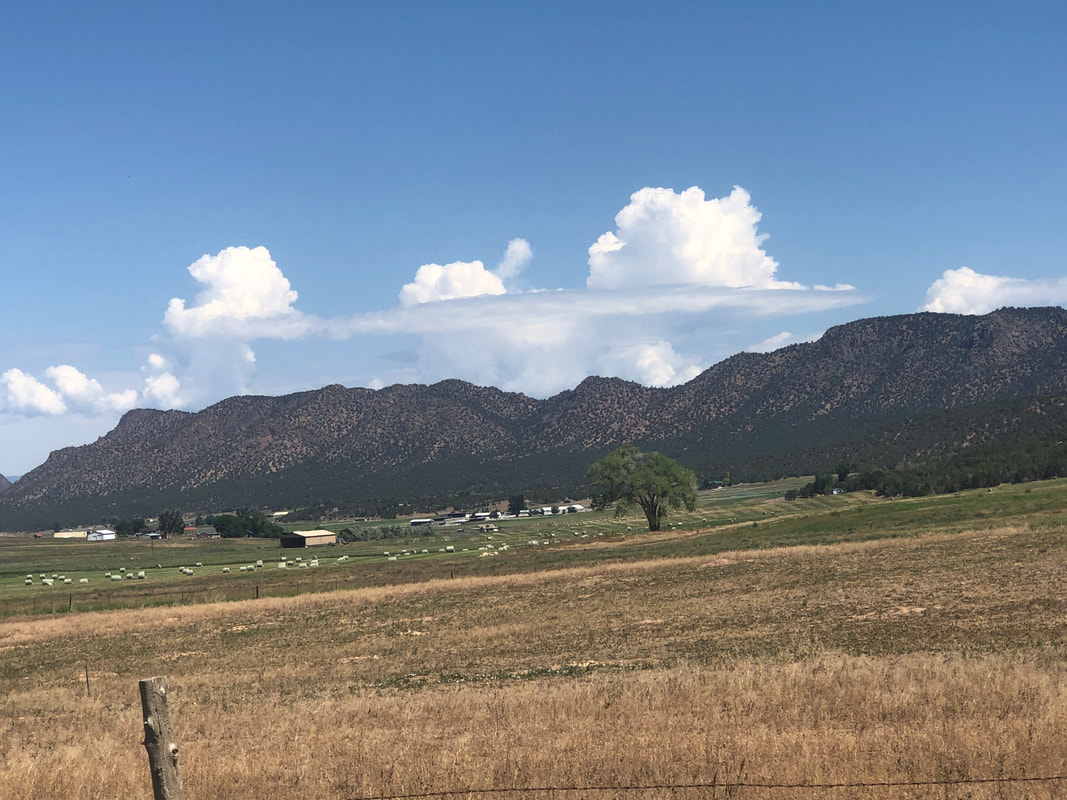 We were running low on water and Amy happened to have a friend who lived on this road so we stopped and refilled our bottles. Also by coincidence, we were scheduled to...  ...return that same evening for dinner. The friends own 8 mules so we were introduced to them before entering the home where I finally was able to pet a.... 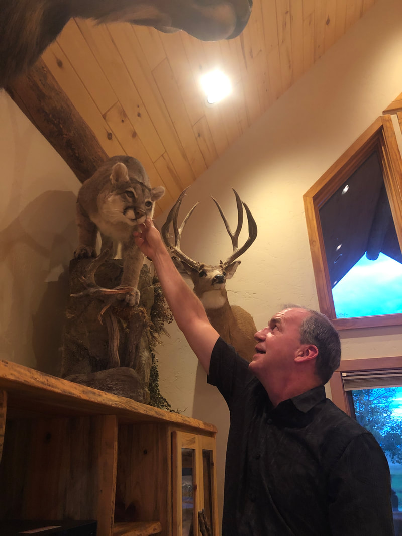 ....mountain lion. 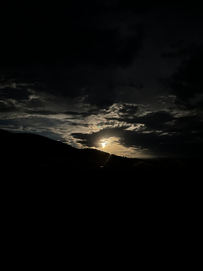 Fun day, beautiful evening as we returned to our quirky VRBO.
 I arrive at the visitor center at 7:30, 30 minutes before opening. I'm first in line for the few remaining wilderness permits and am soon joined by a couple from Spain and 3 guys from Kansas City. Soon, a woman opened the door and gave us information about the inner canyon hikes, of which there are three. 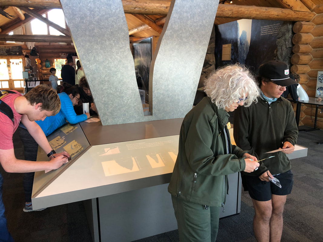 At 8am, the doors opened and I filled out a card with all relevant info, then given an orientation speech which was helpful and advised to take images from a book.... 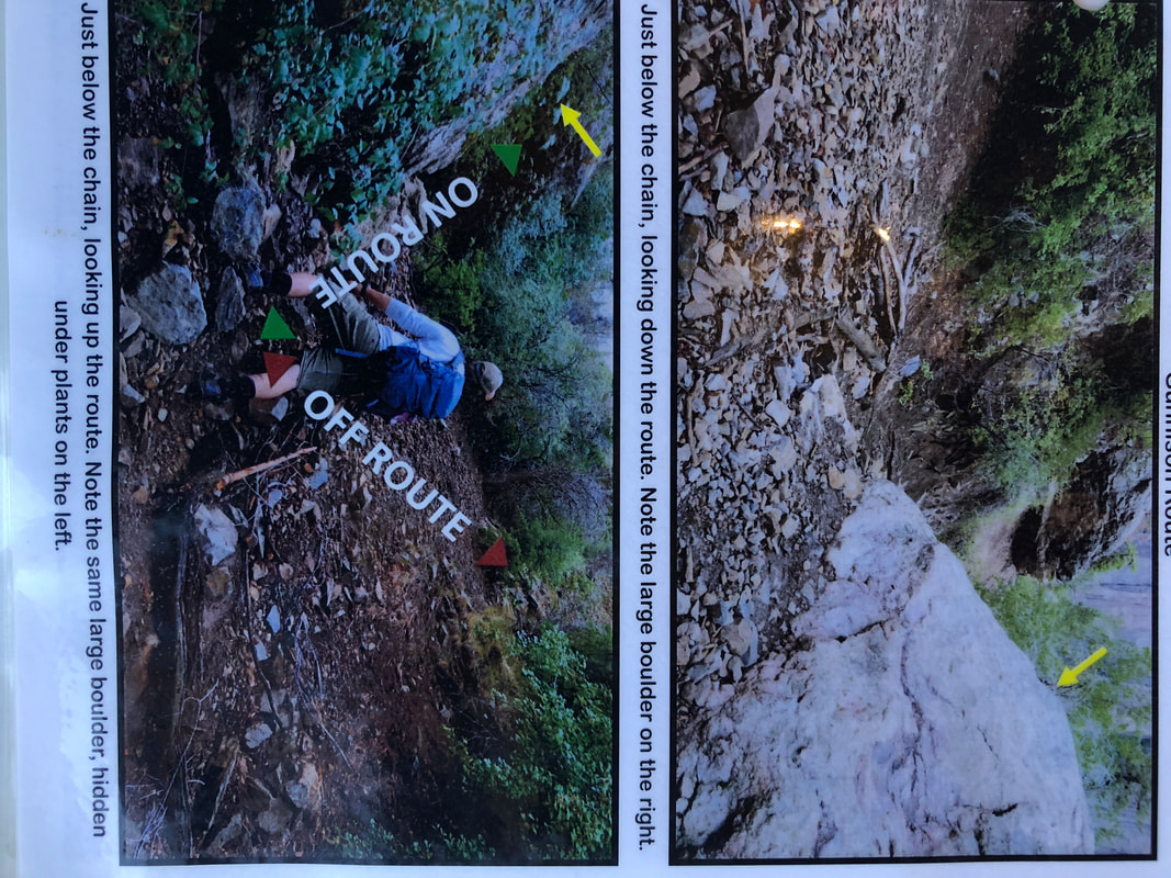 ...which I did as they showed a couple of tricky parts of the route where it would be easy to get off route. The ranger repeatedly stated there are no trail markings, nothing to guide you but I suspected, if there are as many as 15 people a day hiking the route, it wouldn't be all that difficult to follow. 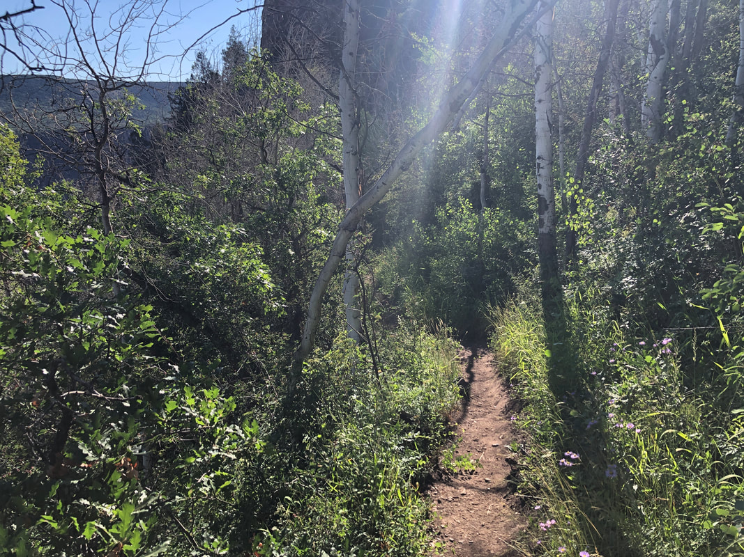 I begin with a pleasant walk among trees. The temperature is in the low 60's at this 8200' elevation. I'll drop almost 2000' in a little over a mile. 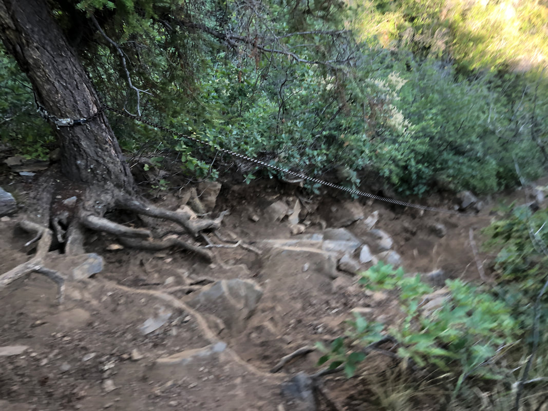 I had read about this section, having a very, very long chain to assist. 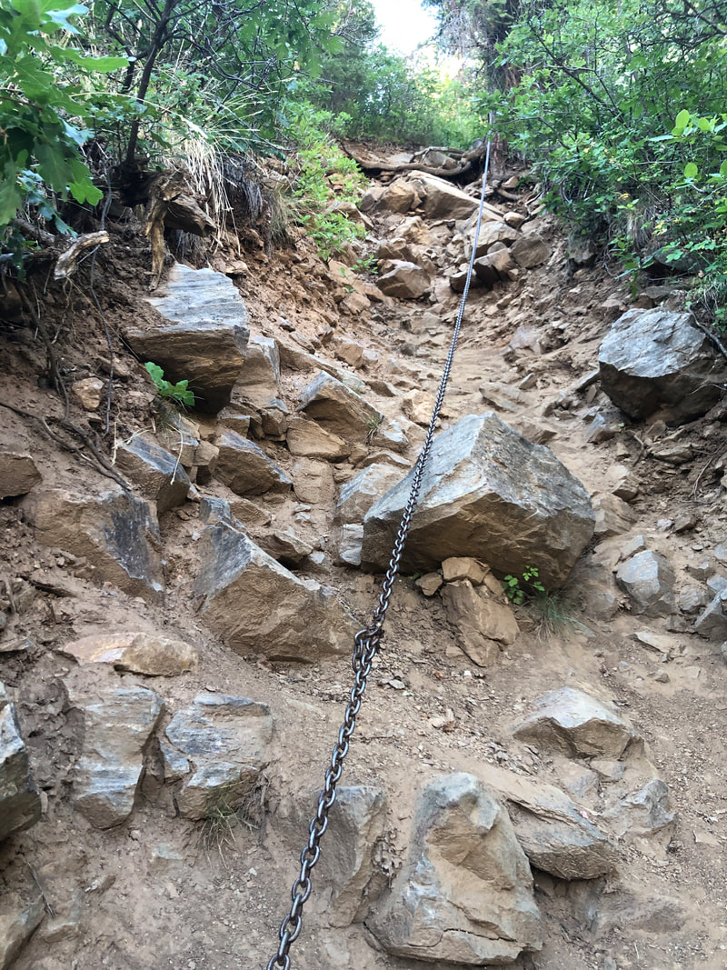 Yikes, is this steep. It had plenty of foot holds so wasn't all that bad. 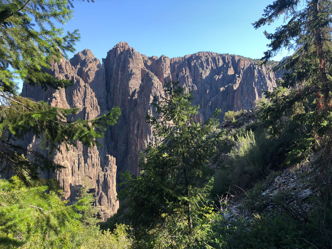 Some great views as I descend. I wished I had taken more images but frankly, with the slope being so steep and the footing horrible, there weren't many places I could balance to take an image. 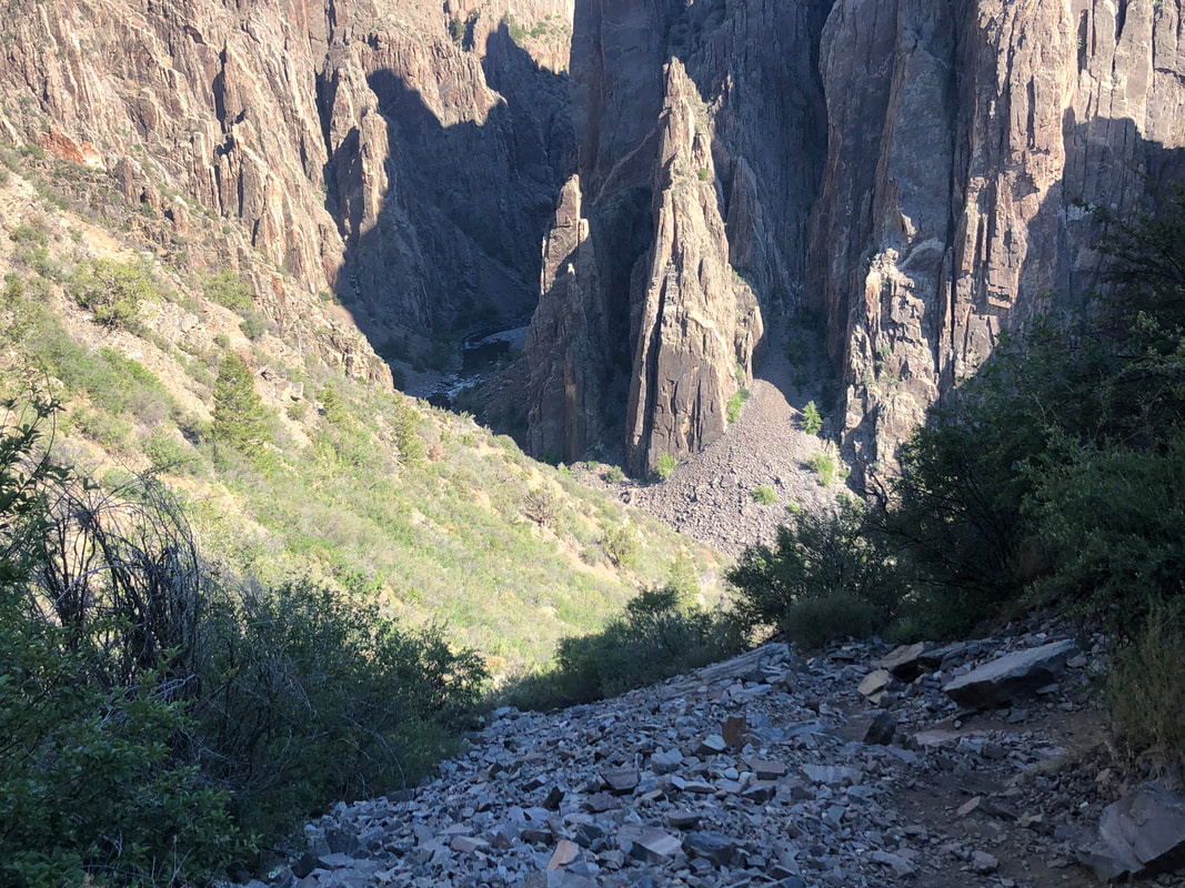 Note the scree and rock filled slope. Most of the trail was precarious with very, very loose footing. Several times I simply dropped on my rear and scooted down or crab walked. The average grade is 33.4% and when you add in the surface challenge, it's a brutal hike. However, while I slipped at times, I never fell. 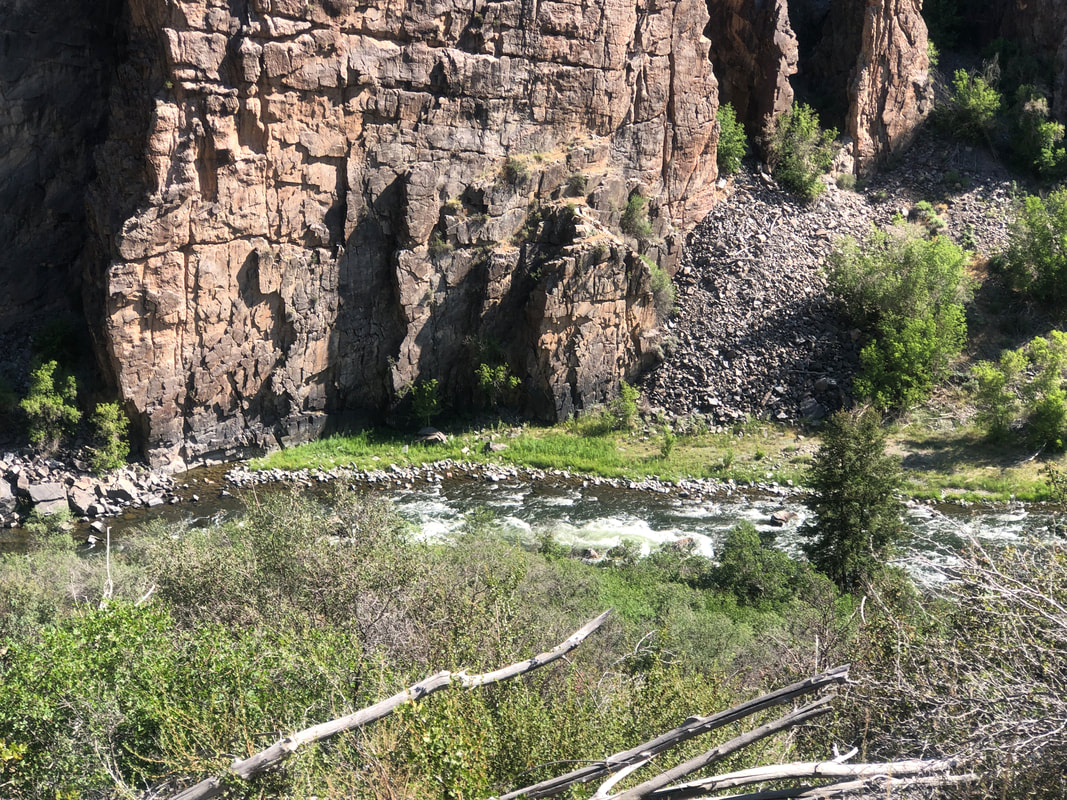 Nearing the bottom, I get a good look at the bottom of the canyon 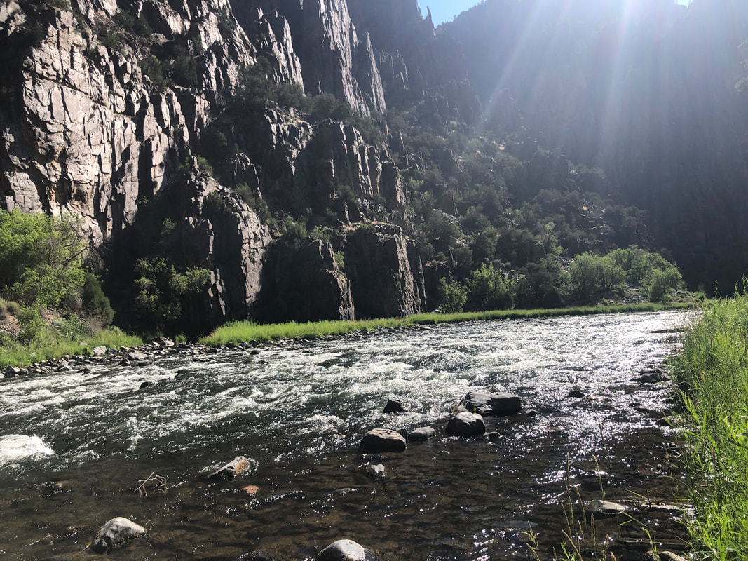 It's a beautiful location with a trail going up and down the river. Fishing is allowed. 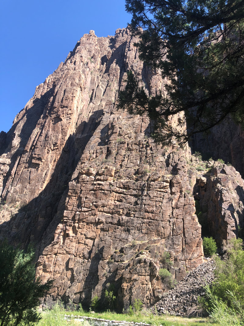 I always enjoy looking up while so many never have the experience as they look down from the rim overlooks.  There was even a pit toilet and.... 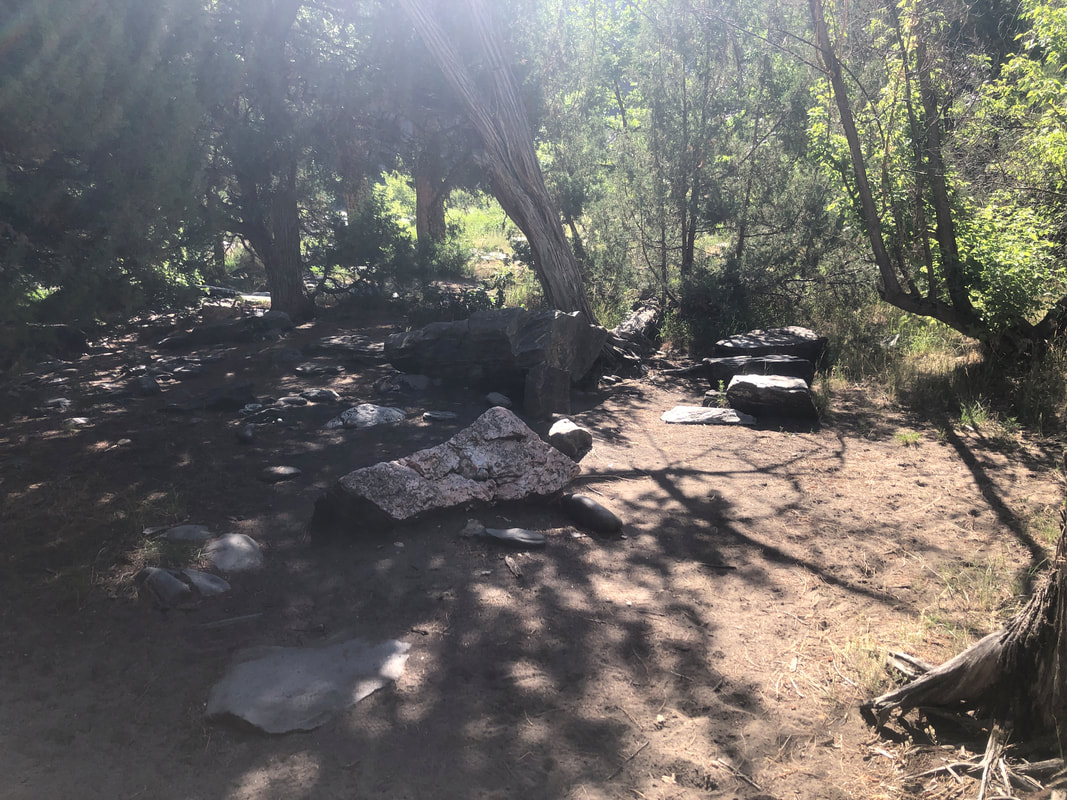 ...a couple of camps sites. But, this is the rare hike where it's not the destination that brings people, it's to test oneself on the rim to river route. I did not spend much time at the bottom and began.... 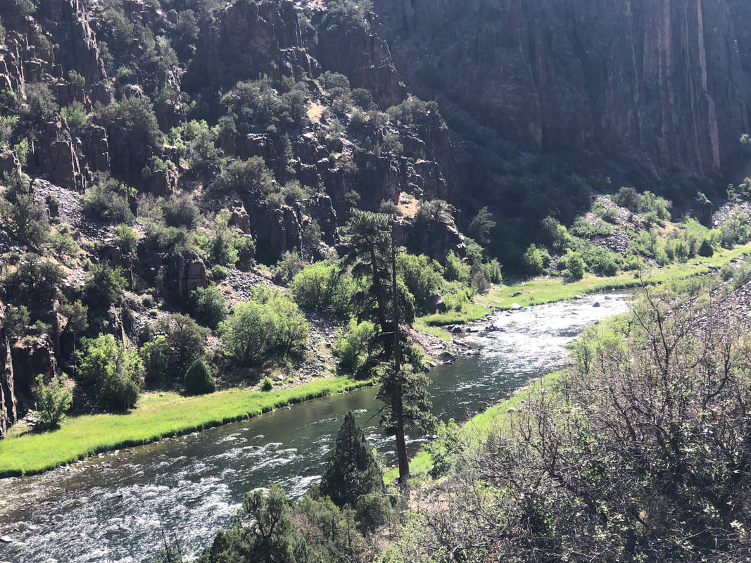 ....the slippery and steep ascent. It took me a 1:15 to go down and a little over an hour to go up. Glad I did it but I'd never do it gain, lol. On the drive out, Amy.... 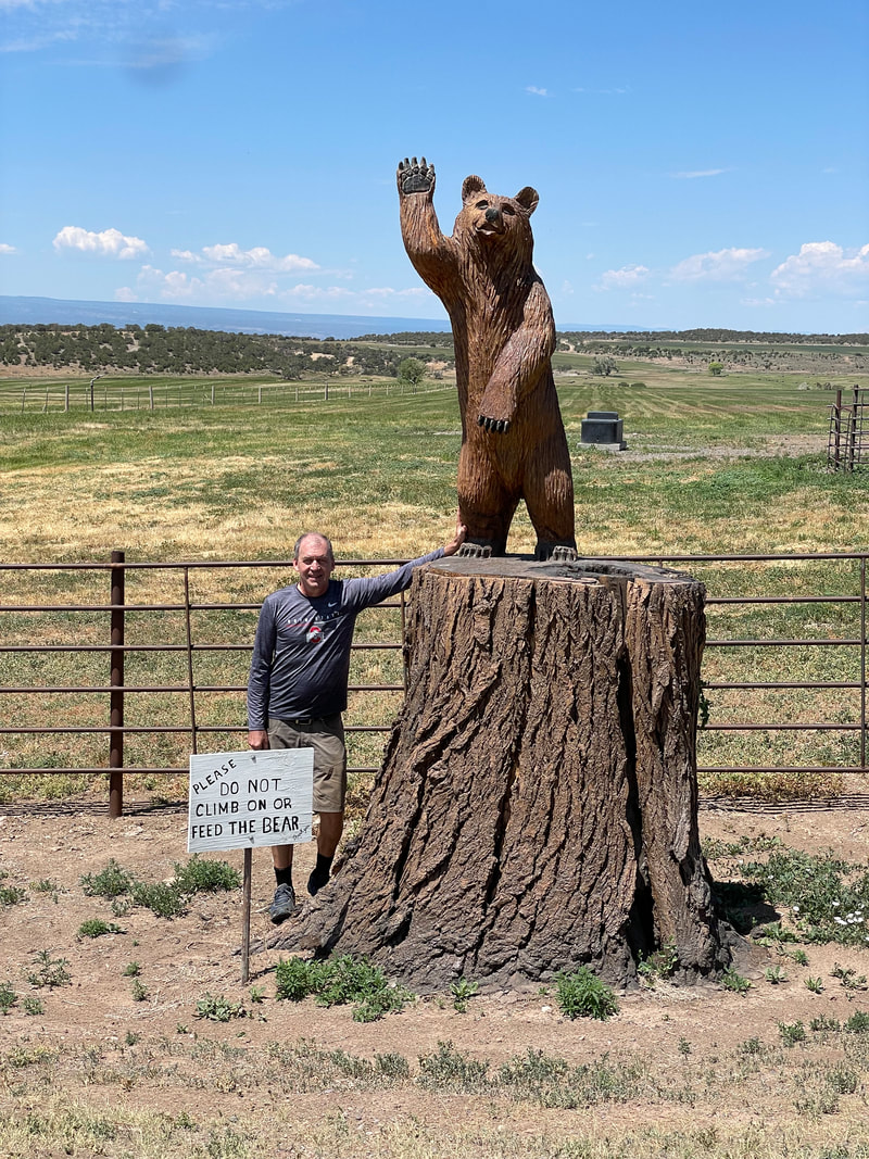 ...took a picture of this fine wood carving.
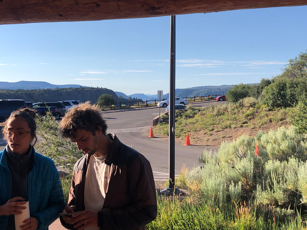
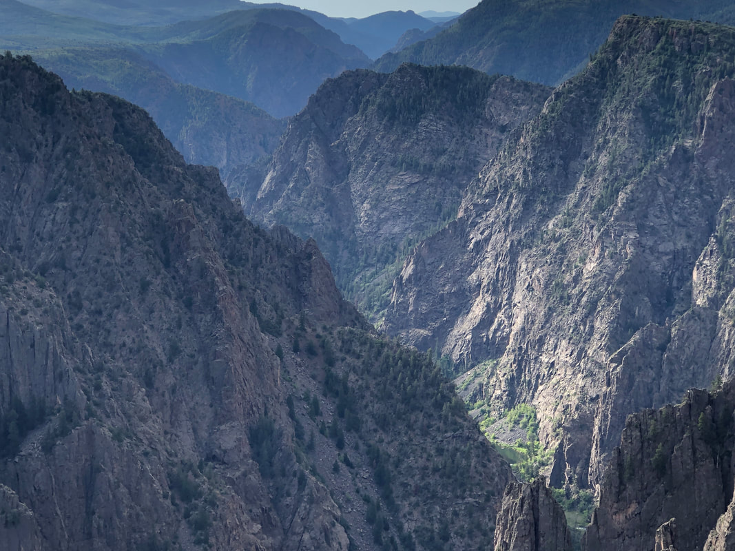 Driving into Montrose, I was a little disappointed as it appeared we had left the mountains far behind. But less than 30 minutes from our VRBO is Black Canyon at the Gunnison NP. Very little traffic as we enter the park and stop at the first lookout. 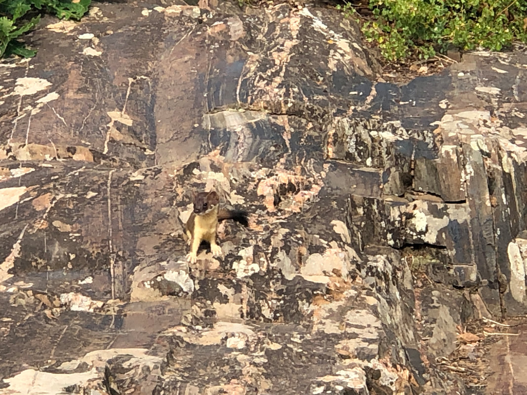 We walked a little ways on a rim trail and I saw a very unusual squirrel-like creature, center left in the above image. 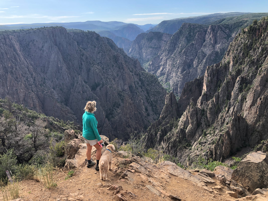 Very dramatic setting as we stopped at other pullouts. We are at an elevation of 8200', 2000' above the canyon bottom. 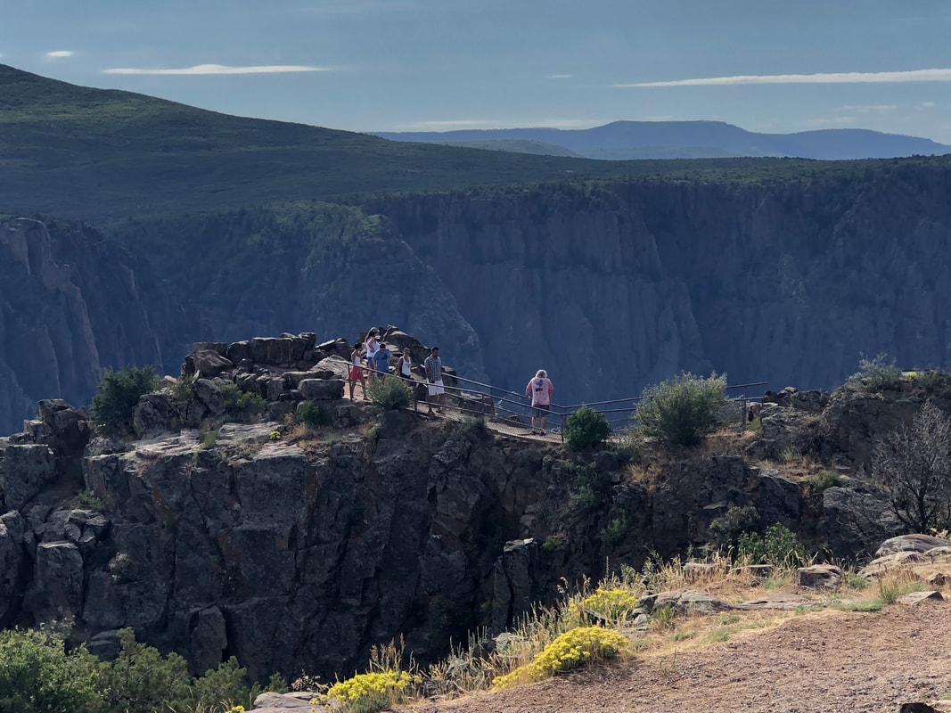 Some pullouts required a short walk to the best points from which to see the inner gorge. 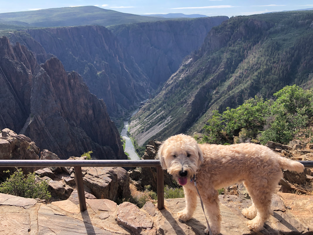 Jack the Dog was enjoying himself as we also got a look at the Gunnison River. 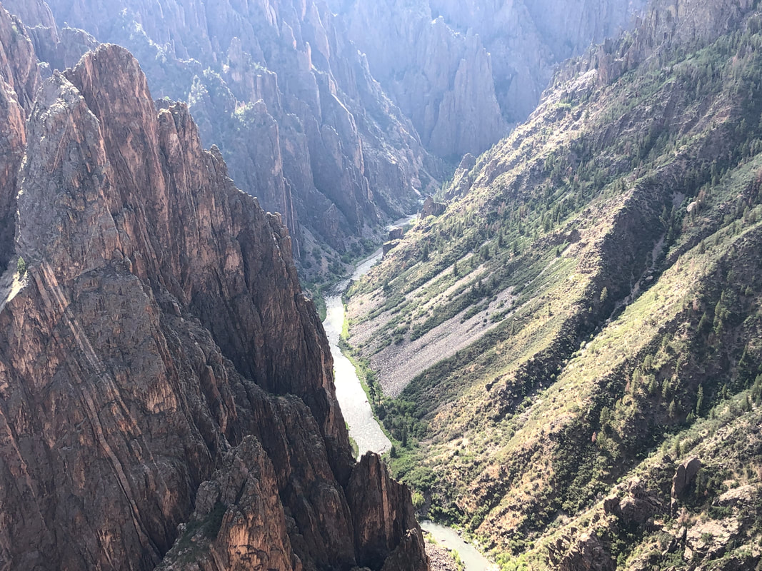 Check out the differences in the angles between the North side on the right and the south side of the canyon. That's due to differences in erosion, over time, from snow melt between the south facing side (north rim) and the north facing side. I hoped there would be a rim to river trail from the south rim but it looked so steep, I doubted its availability (I was so wrong). 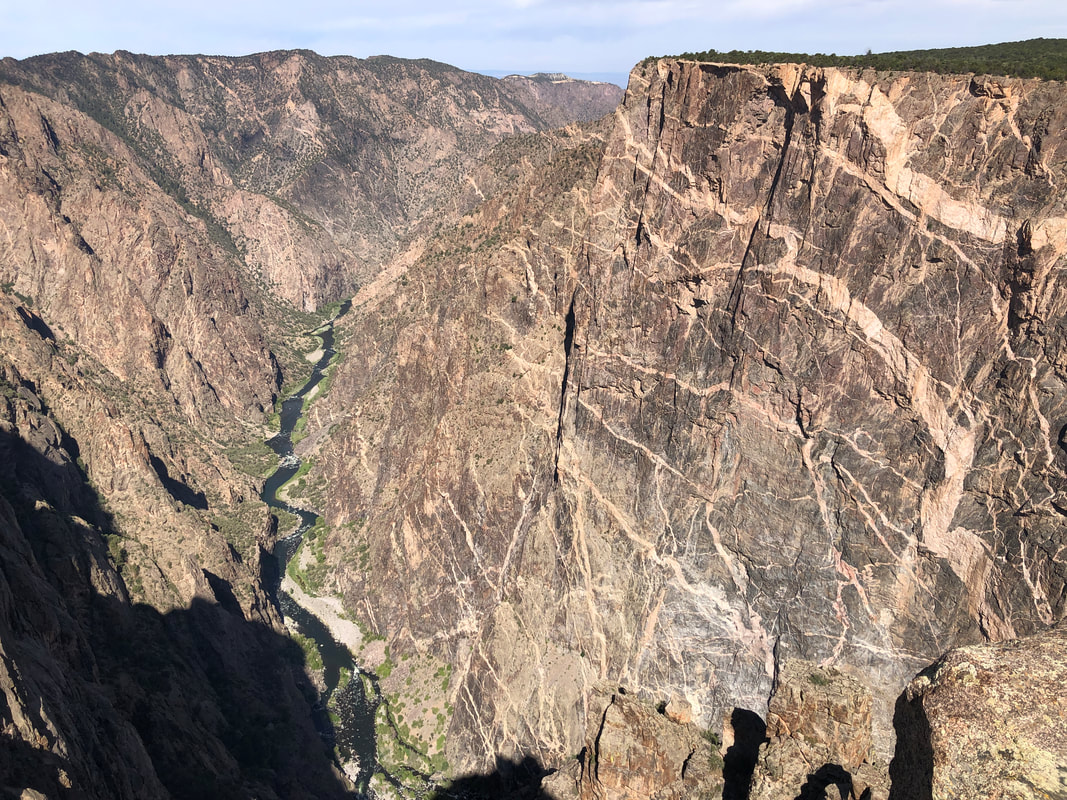 As we proceed along the south rim drive, we can see the Painted Wall as we make our way to the end at Walter Point. There....  .....we follow a trail for about 3/4 mile to.... 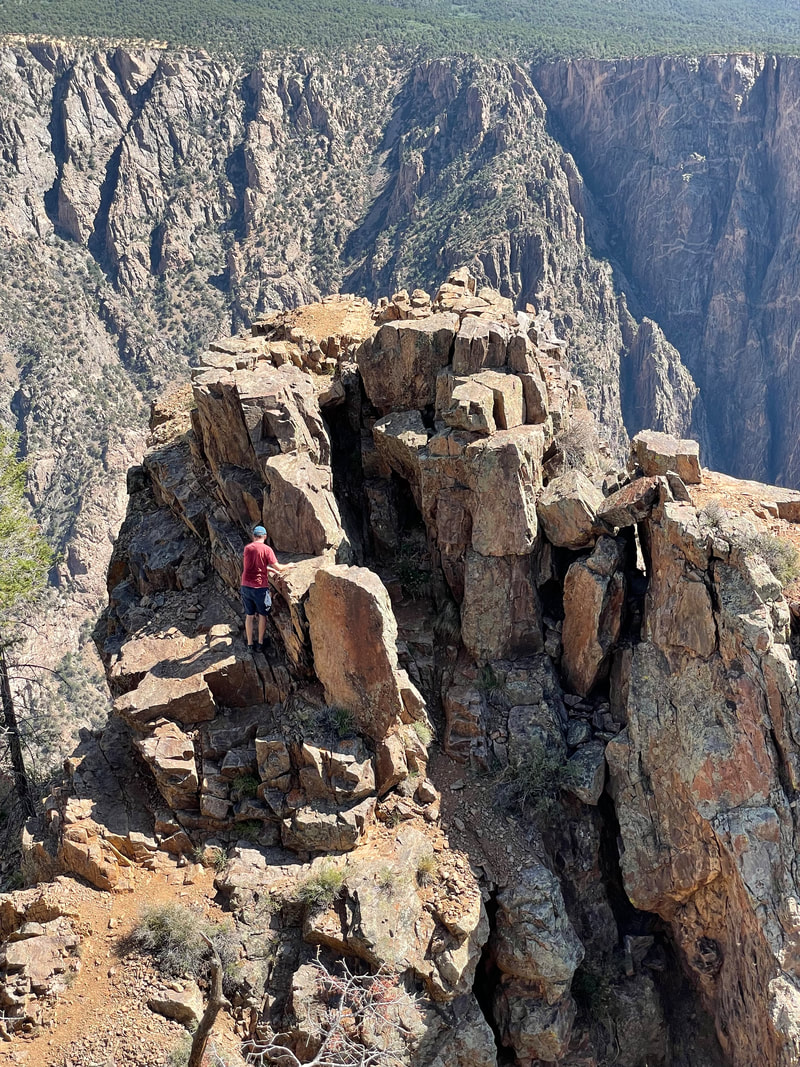 ....Walter Point but then we notice there is an off trail way to a rocky point, farther out that looked like fun so I descend a bit then ascend to.... 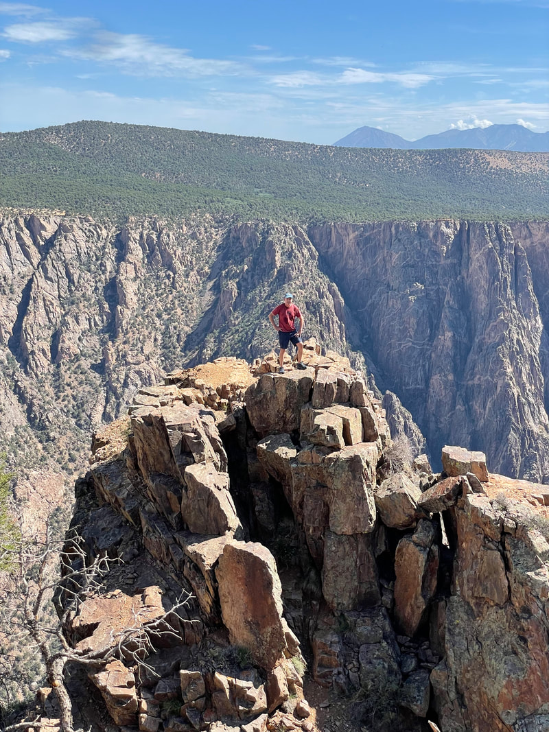 ....the above perch. Beautiful spot. OK, so I found the park gives 15 wilderness permits each day for the Gunnison Route, an unmarked route from the rim to the river. Permits are handed out each day, before the visitor center closes and then any leftover permits, handed out the following morning. I'm going to take a chance and try to snag a remaining permit, tomorrow morning.
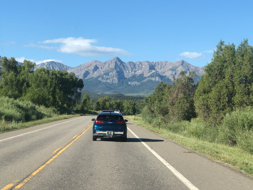
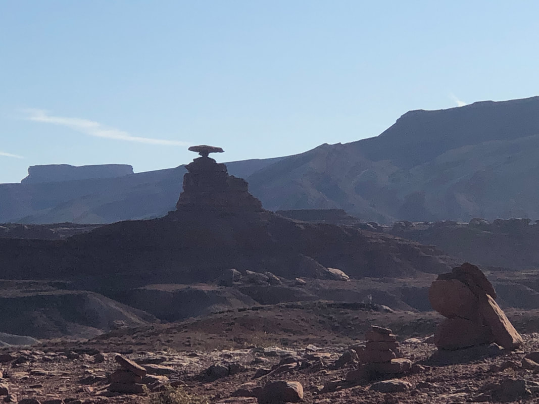 The Mexican Hat, which we pass on our way out of the town. 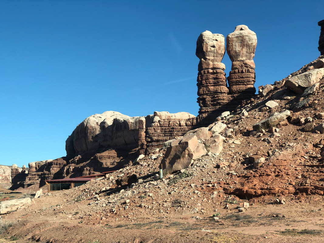 Columns of rock abound, each different from the preceding one and..... 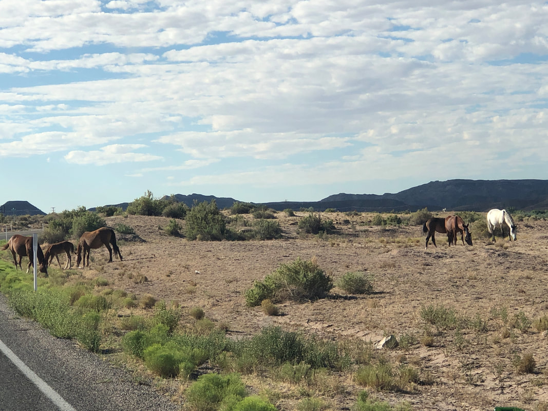 ....we even have to slow to allow horses to cross the road. Continuing north into CO the scenery.... 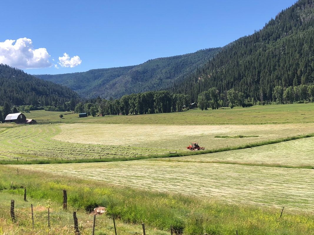 ....changes again. As we near Telluride.... 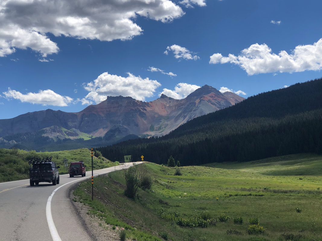 ....the mountains grow larger on the horizon and at one point..... 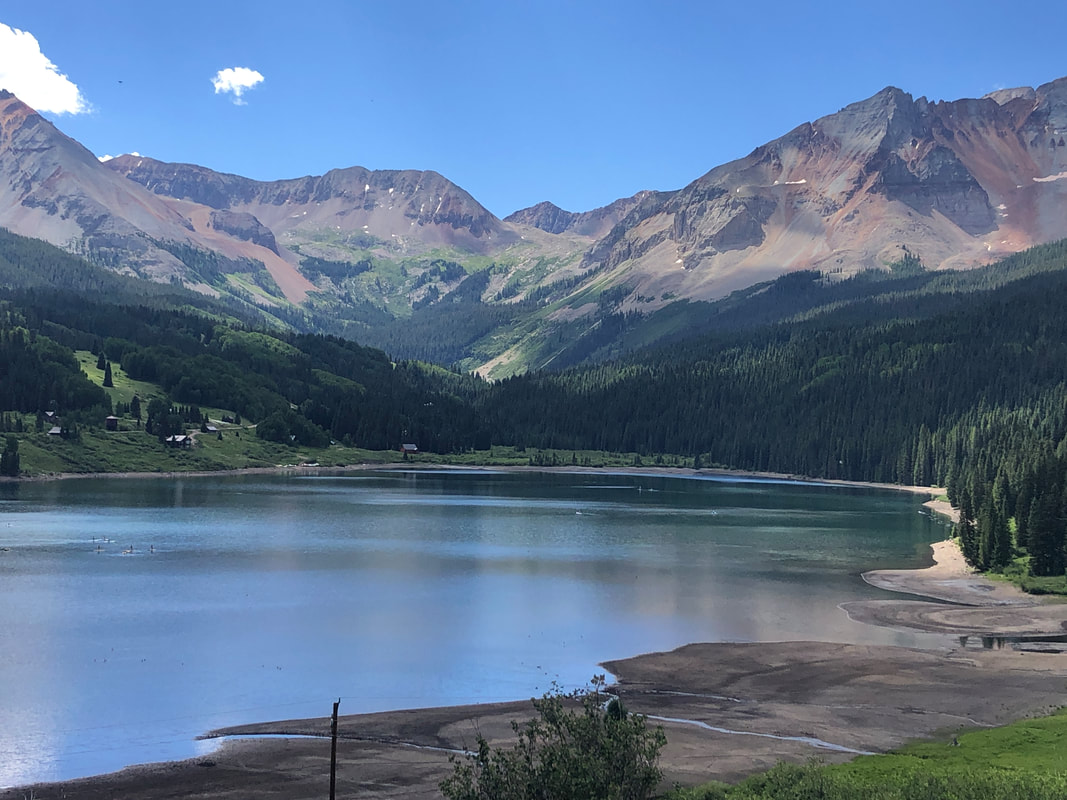 ....we had to stop to admire this jaw dropping scene (and to give Jack some exercise). Looked like great cycling opportunities as we saw many on the road this Saturday, grinding up long climbs. After a few more miles, we enter our stay for the next two weeks, Montrose.
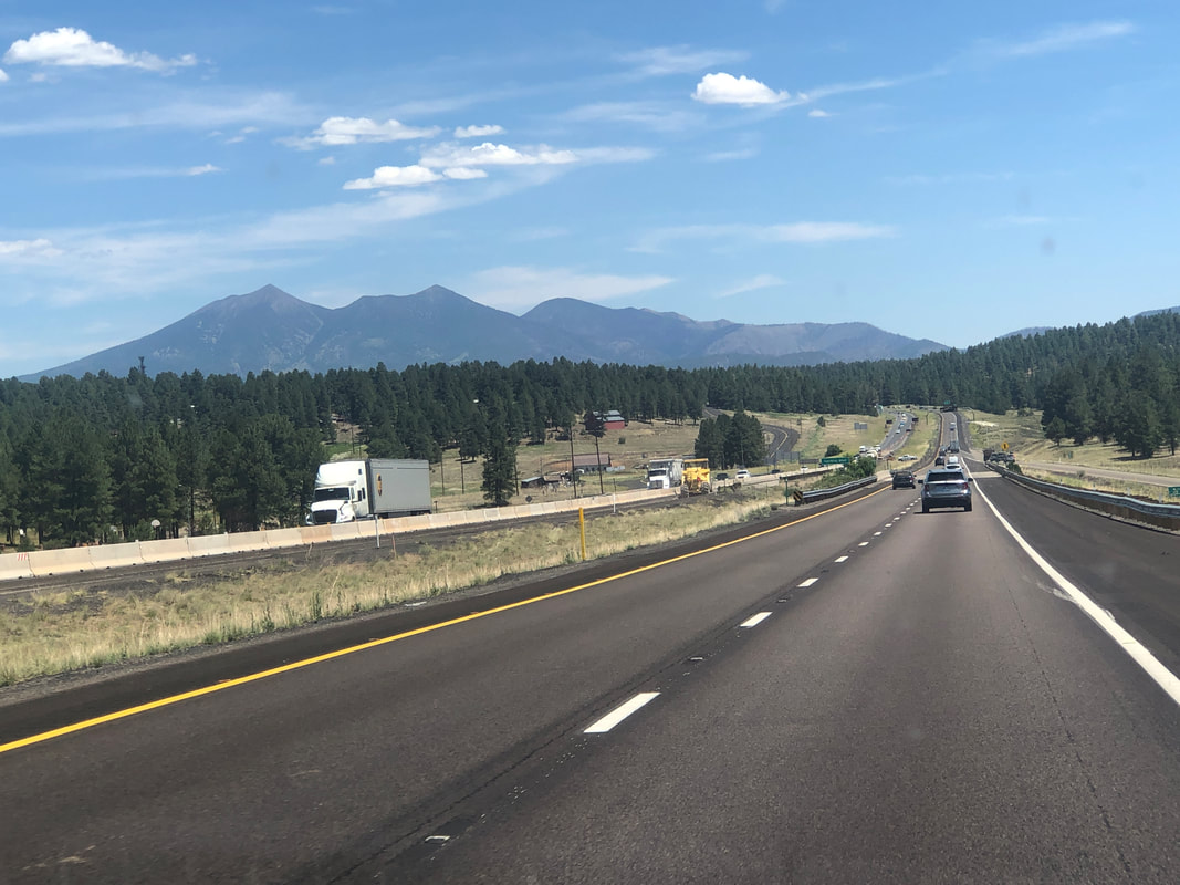 Emerging from the valley, the change in vegetation is dramatic and of course, in the distance, Humphrey's Peak, the high point in AZ at 11,600'. Then, circling the mountains and headed toward Utah.... 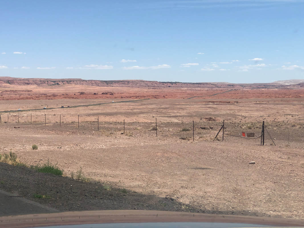 ...the scenery changes again as we cross the Painted Dessert. 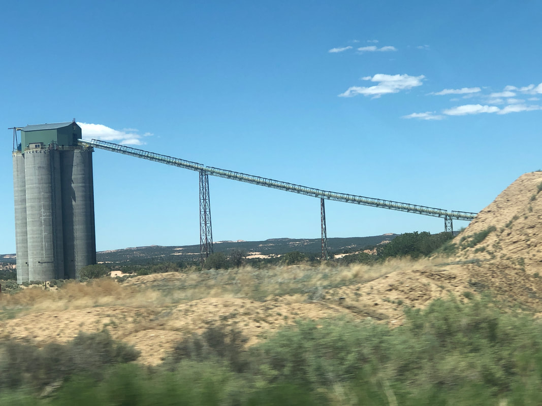 Later we saw the above, enormous mining structure and then the highlight of today's drive..... 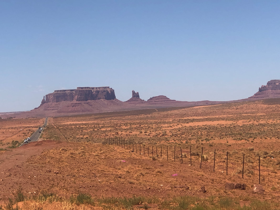 ....enter Monument Valley. 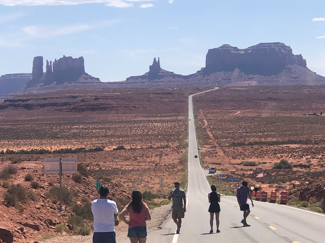 On the northern end, taking a last look back with other tourists. Traffic was surprisingly light during our entire drive. 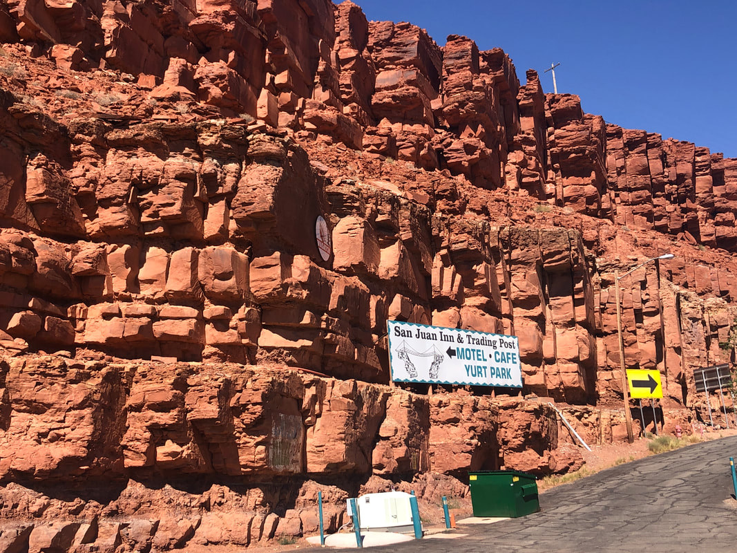 We entered Mexican Hat where we had made reservations at the quaint San Juan Inn. The area has apparently lost 1-2 other motels along with a restaurant which is too bad. We dined at..... 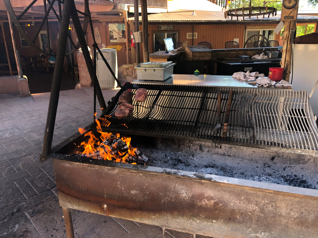 ...a restaurant called the "Swinging Steak" because meat is placed on a grill that swings across a fire. Kind of a novel idea but I doubt it does much for the flavor although our steak did taste very good! While leaving, we noticed.... 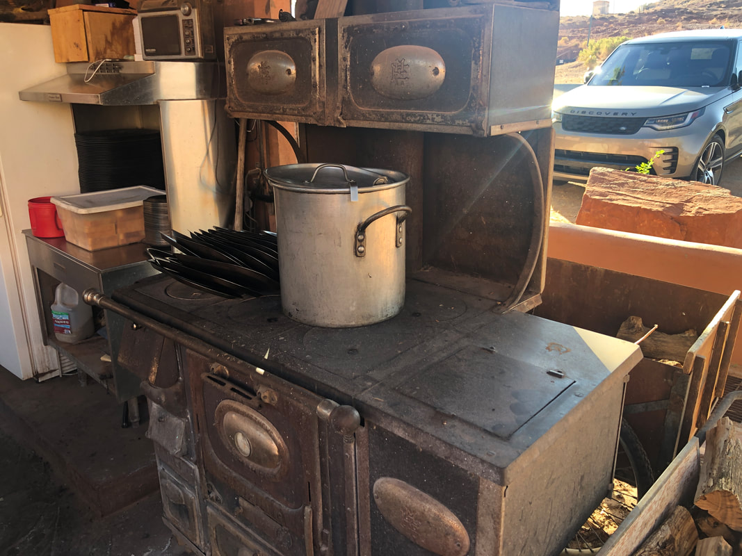 ...a very old stove. Get this, it was used in John Wayne's movie, "The Shootist". The stove top is heated by mesquite fed fire. 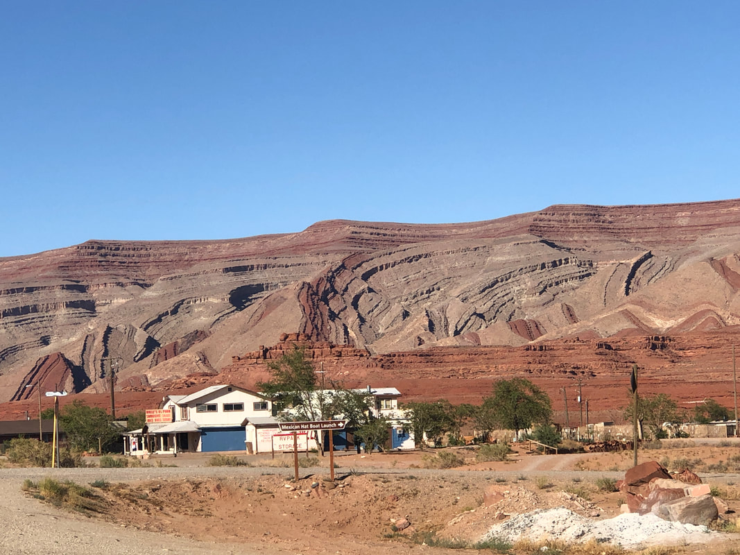 The nearby hills are beautiful. On our way out the next morning, we passed the Mexican hat and I'll show it next.
We are headed to CO and then on to WY. We plan lots of hiking and gravel grinding days. Our first day takes us, driving, through Monument Valley which the Amster has never previously visited. Then an overnight at little known Mexican Hat before hitting Montrose, CO and the Black Canyon. The exciting thing about WY is we are a short distance from Devil's Tower (think Close Encounters of the Third Kind) and other cool destinations. More to come!
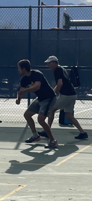 I wish I had an image to prove the claim of the above title so you'll have to accept my word. Amy and I were attending a party on the 3rd when the home owner announced a rattlesnake had just gone under a grill cover. Of course, I was all over that and when a snake stick was prepared, I pulled the cover up and sure enough, a decent sized rattlesnake. The snake was placed outside the yard and then laid there in a straight line rather than coiled. I reached my hand through a fence, quickly stroked the back end of the snake and even more quickly yanked my hand away. I'm not sure why, but I always wanted to do that. I've also never petted a grizzly and maybe when we're in WY, I can mark that off the list too, ha, ha. Above, I'm playing pickle ball, which I kind of enjoy on recovery days from hiking and cycling. 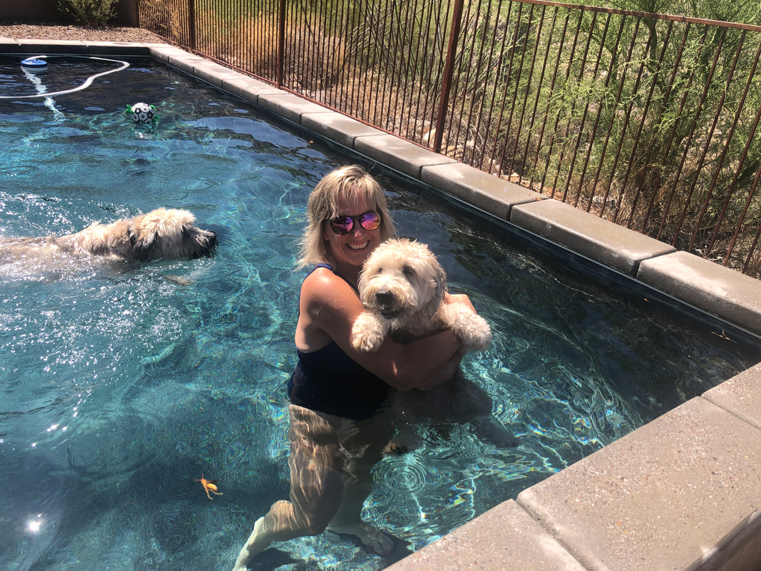 We visited friend Kathryn's house so Jack could go for a swim with his buddy, Sam. Happy Independence Day everyone!!!
|
