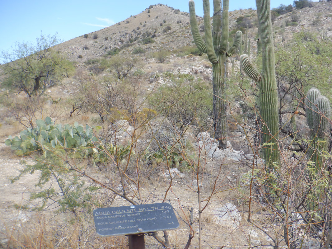
 Situated between the Catalina and Rincon mountains is Aqua Caliente Hill, on the Far East side of Tucson. The trail is easy to follow and a heck of a good workout. At mile 2.7, I reach the above intersection 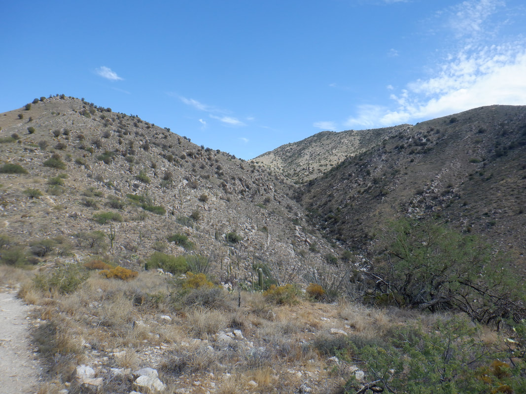 The peak on the right is not the final destination although the trail climbs steadily toward it but at the last moment, shifts right and heads to Aqua Caliente, there on the far right. 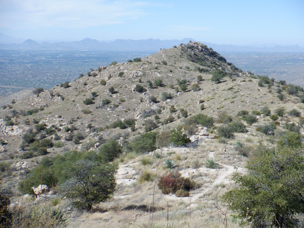 I look back and can see how the trail abruptly departed from its inexorable climb to the false summit. 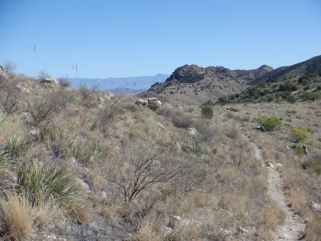 Soon after bypassing the false summit, the views really..... 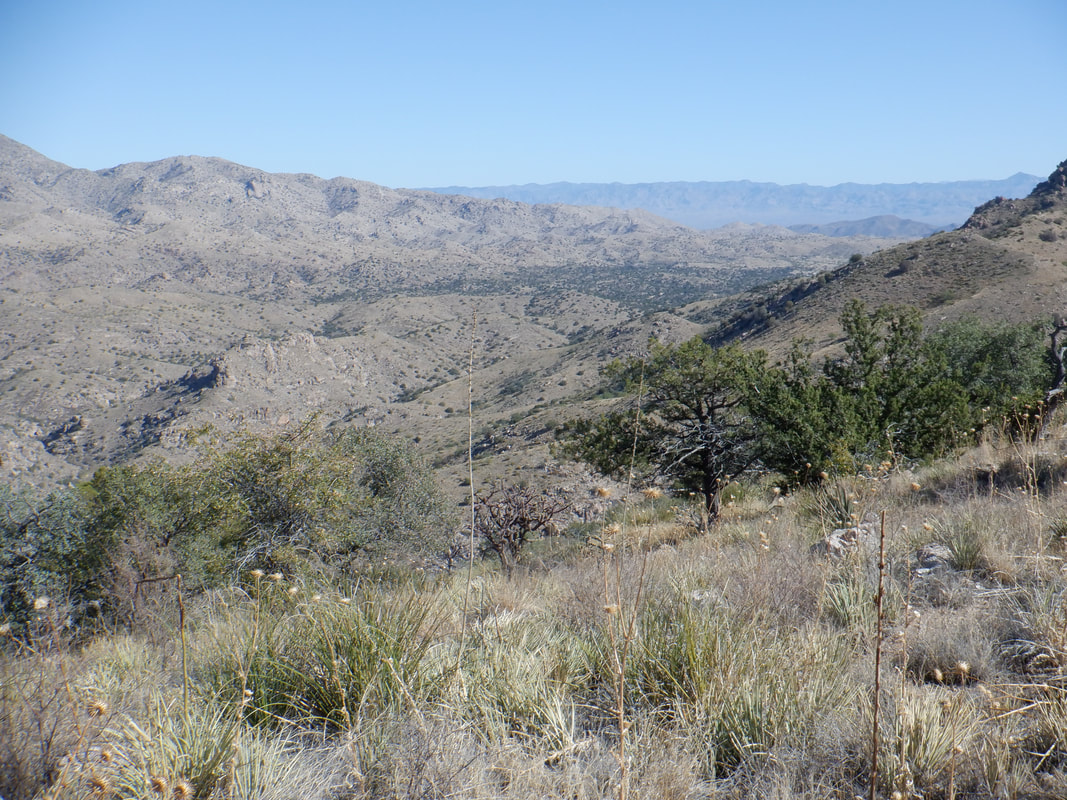 ....open up to the east/northeast. Walking this flat piece is a treat but it doesn't last for long since.... 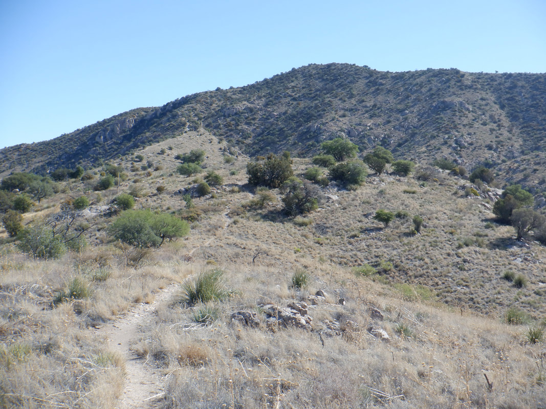 ....this beast must be climbed. This is the steepest part of the hike and.... 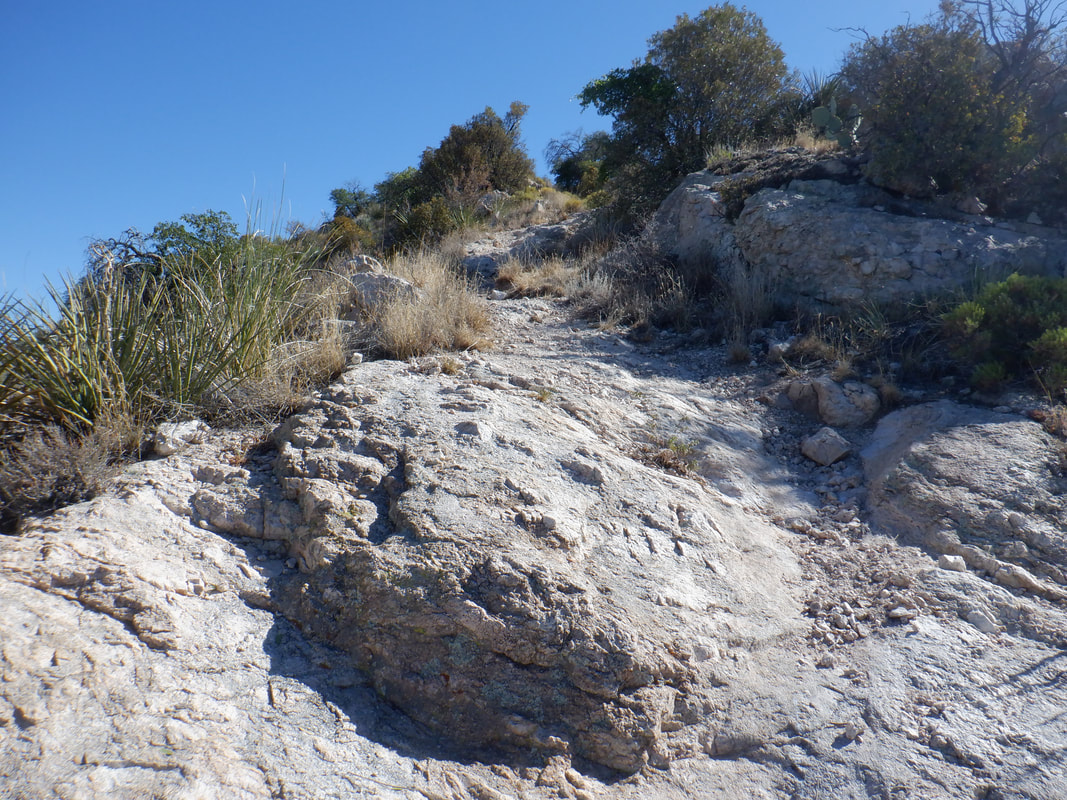 ....some of the ramps are formidable. Eventually.... 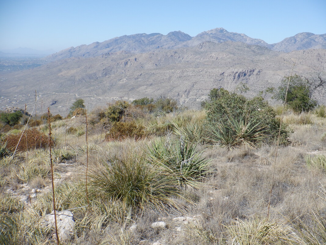 ....I reach the peak and thus rewarded with grand views of the Catalinas to the north and the Rincon to the south. 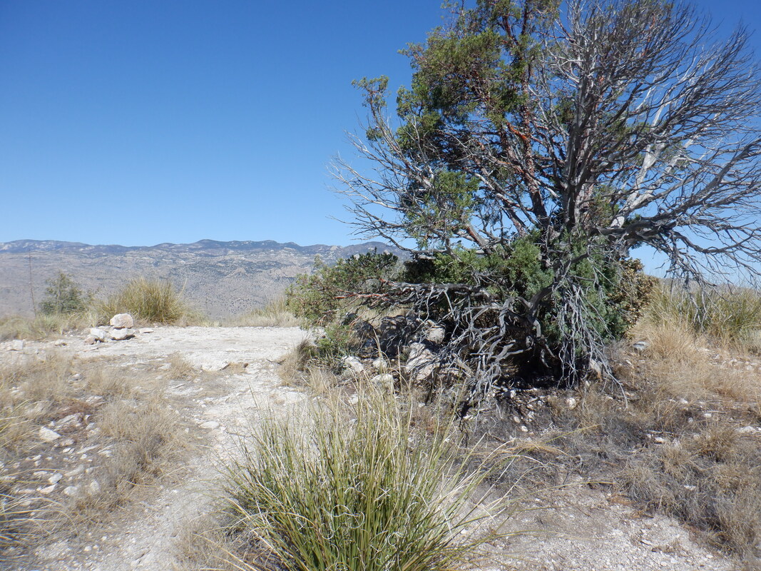 There is a Juniper tree that provides some shade as I tank up with fluids. I begin my descent and while walking by a bush, the distinct sound of a rattlesnake alerts me. Actually, alarms me. I did not observe it so walked next to it when it decided to let me know. It slithered into a rocky area where.... 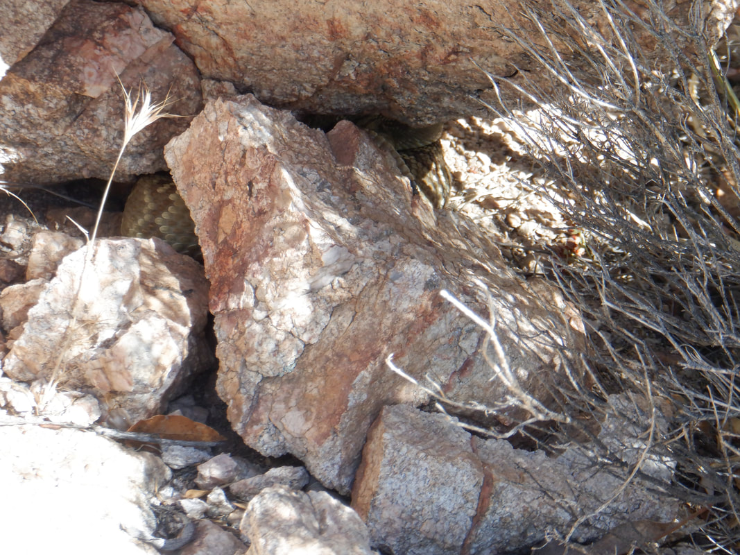 ....I was unable to get a good picture of it. Too bad. Finished with 9.3 miles and 2900' of climbing. It seemed like a lot more climbing then that. Hard hike for sure.
0 Comments
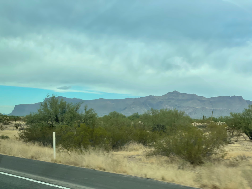 Driving through Florence, the Superstition Wilderness begin to fill the horizon. There, right of center, is the high point of the Supes, Superstition Peak, today's destination.  The parking lot is ample but the Hieroglyphic trailhead is one of the more popular ones so we had to loiter briefly for a parking spot to open. The trail is crowded but 99% of the people are going to and stopping at.... 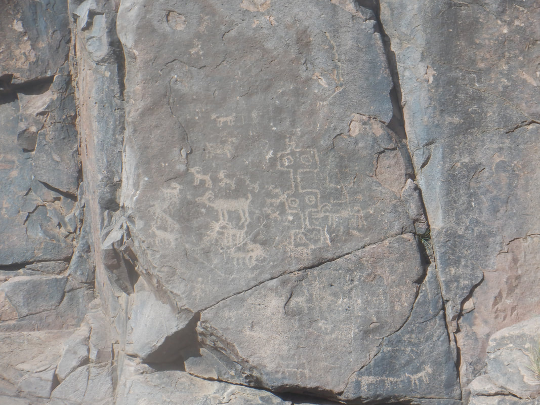 ....the petroglyphs of which there are many, fine examples. 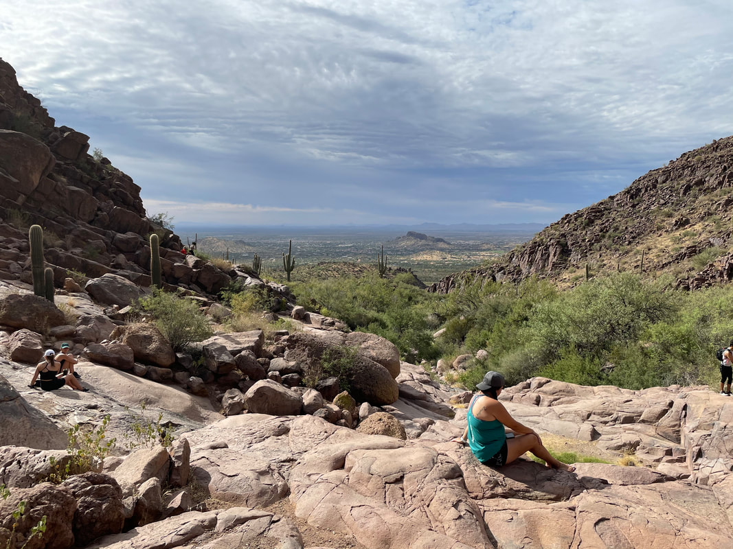 Looking to the southwest, we've gained a few hundred feet, following a wide trail but everything changes as we now duck beneath an over hang and head up canyon. 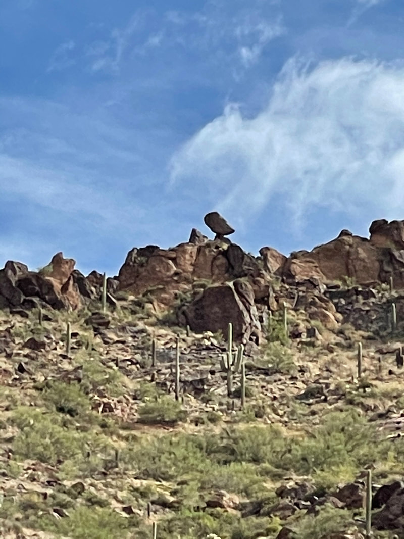 A balancing rock in the distance. How do those things stay that way? 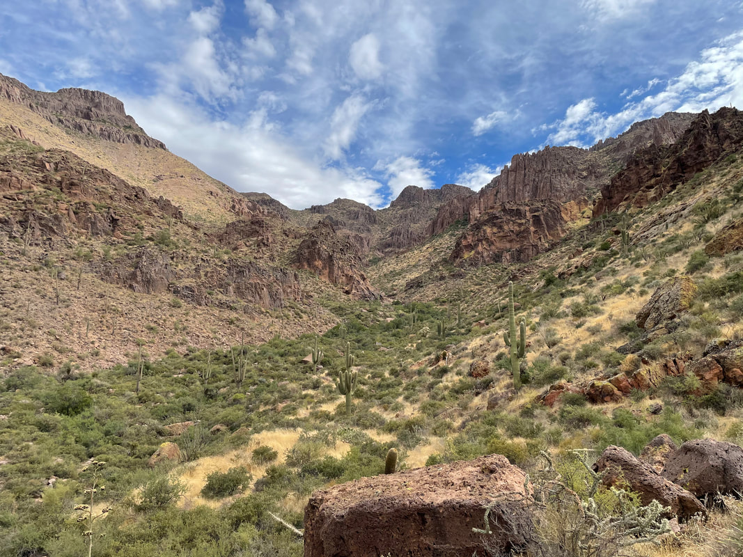 The trail mostly stays above the canyon, on the right side but sometimes dips..... 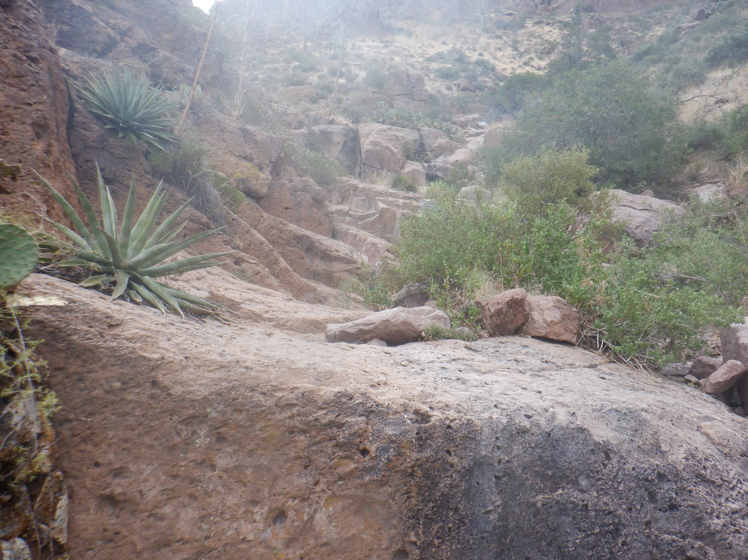 ....into the bottom where there are multiple fun obstacles to navigate. 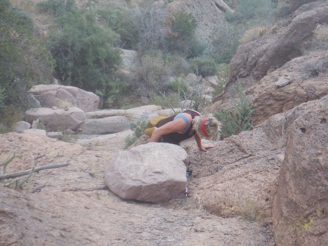 Climbing a few walls requires the use of hands and knees. 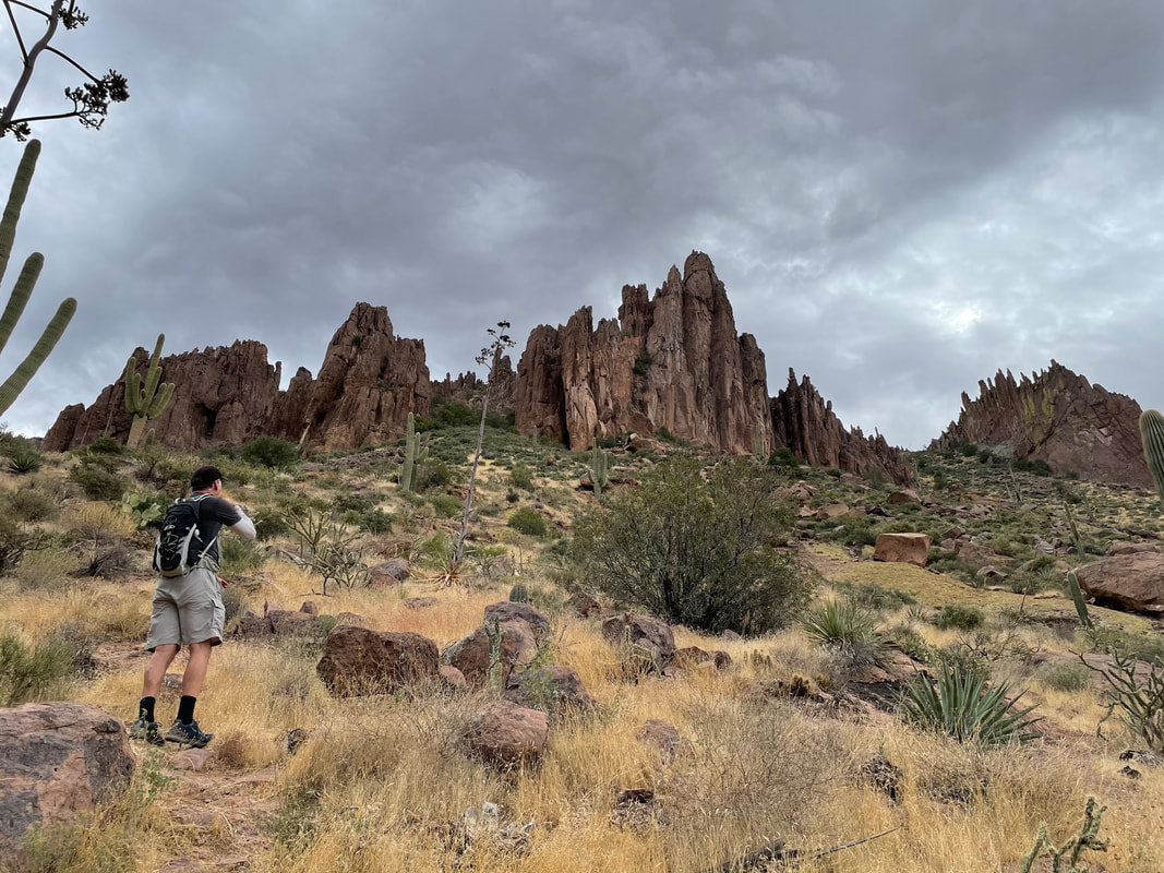 It's a dramatic scene, enhanced by building clouds. It rained, lightly and briefly. 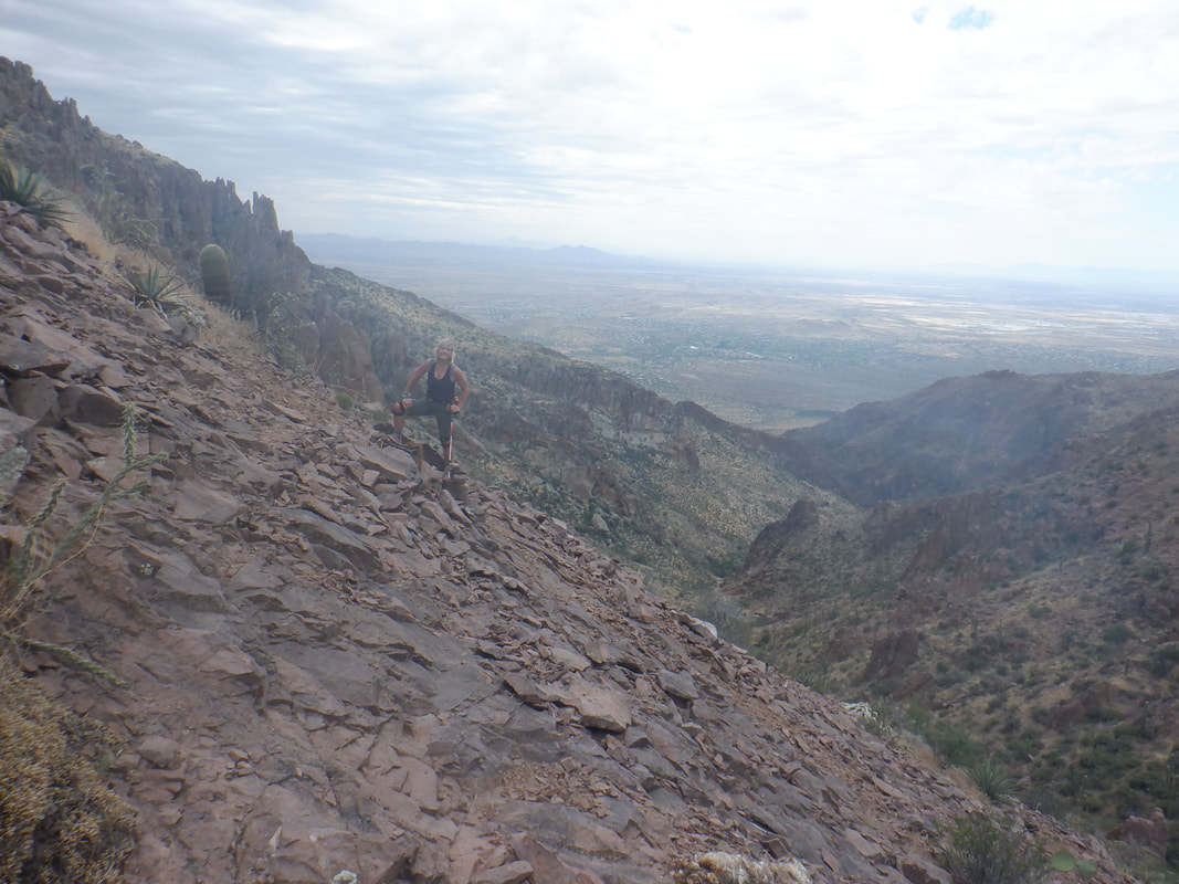 Especially fun was hiking along a slope with a lot of loose shale. Had to be very careful in here. 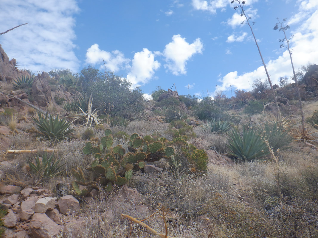 At last! We close on a ridge and beyond is..... 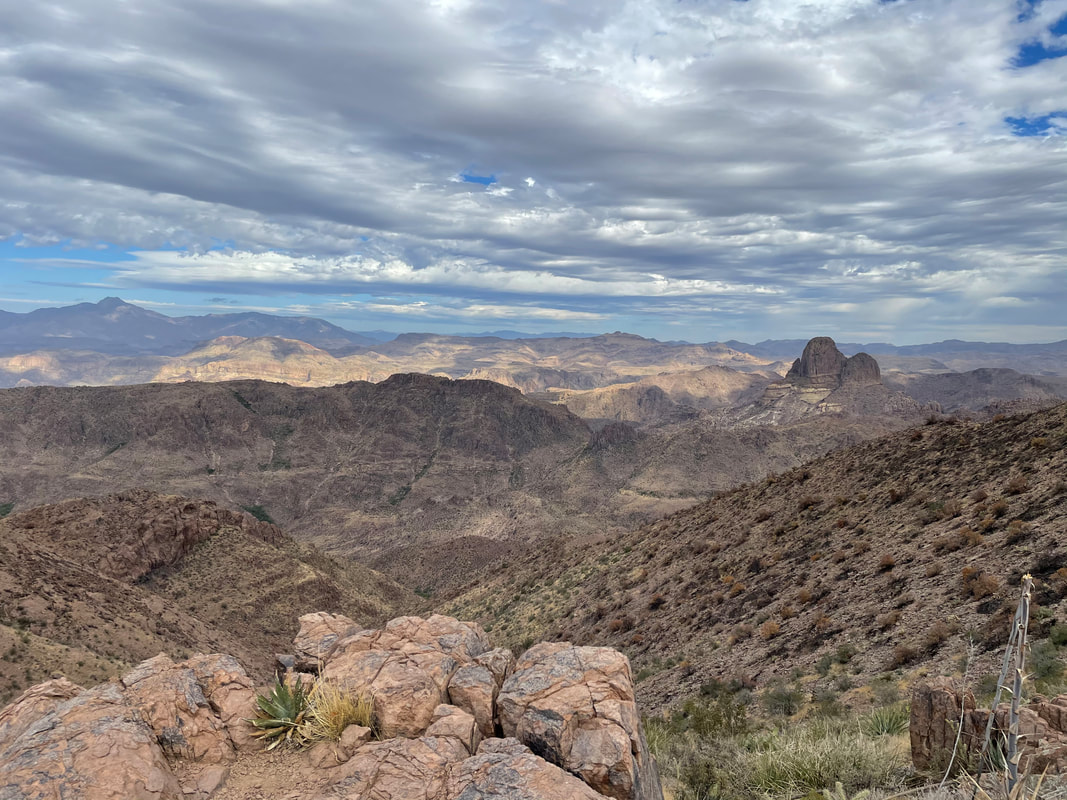 ....a fabulous scene with Weaver's Needle on the right. Note the hill on the right that burned this summer during a major fire. 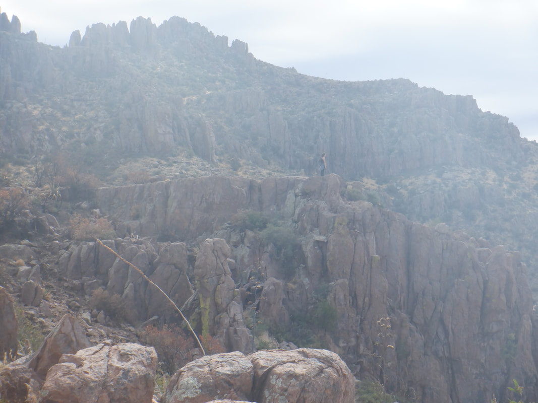 From this point, we would follow the Ridgeline Trail to the Peak. Note the woman standing on an outcropping, to the right. 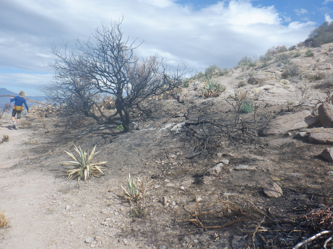 Alas, we started too late to actually reach the peak so we explored a bit and then.... 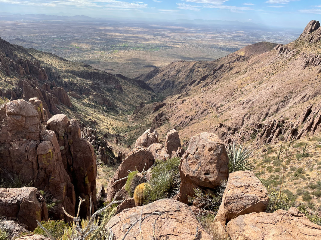 ...retraced our route. I've visited the peak a few times so it didn't bother me to have to pull the plug but regretted that Amy did not experience the exciting hike to the peak. 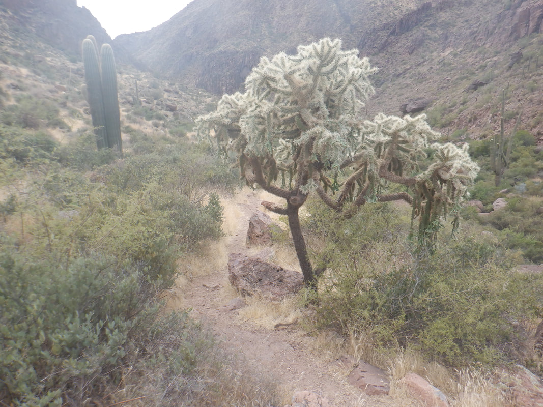 Carefully we descend, watching for obstacles both below and at head high. Finished with 6.3 miles and 2300' of climbing.
 My first visit to the burn area via Pima Canyon. There was no signage at the trail head warning not to venture beyond a certain distance so I was hopeful I could go the 3 miles on the trail where I could access a ravine that would lead me to Table Mountain. Thats it, upper left in the above image. Last time I hiked it, I thought the ravine needed a good burn as it had become densely vegetated. 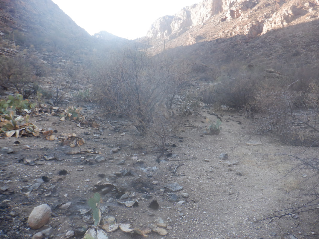 At mile 2, I came to the burn area and a sign stating the trail was closed. A volunteer ranger had also warned me of the trail closure during my hike. He claimed the ask was 3-4" deep in places. 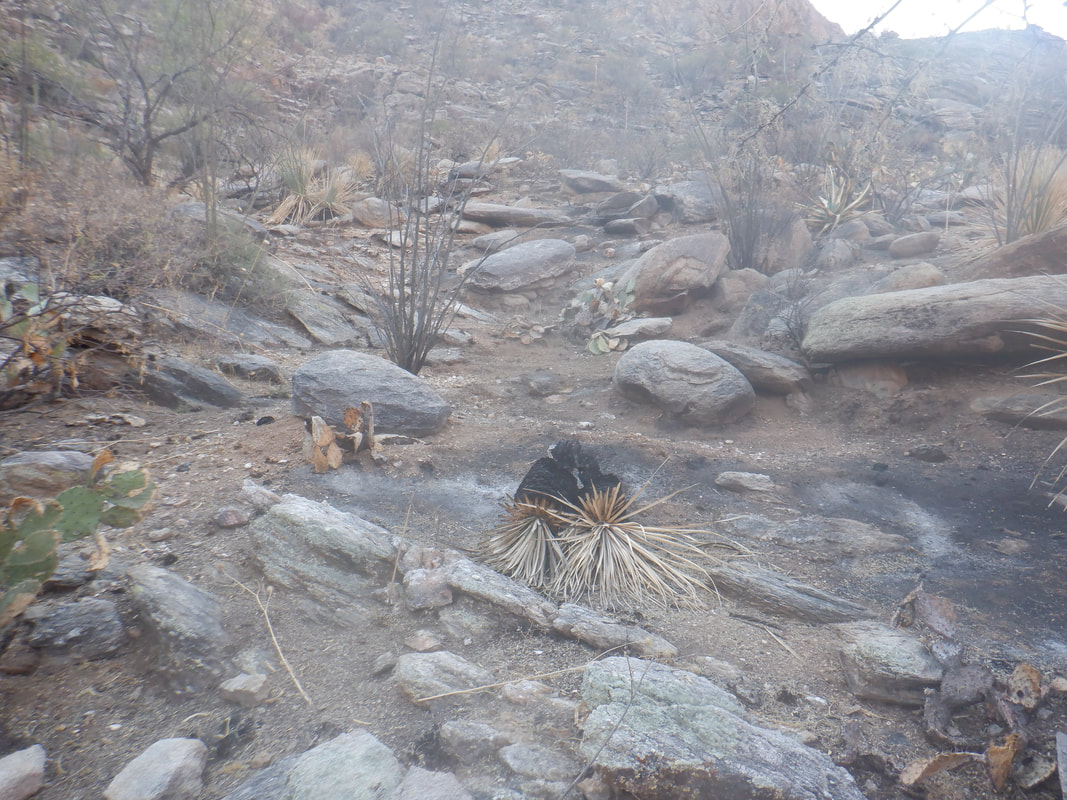 You don't realize how rock laden is the landscape when all the brush and trees are present but once they have burned, it gives a clear impression. I decided not to proceed farther so did not make it to the ravine leading up to Table.  I turned back and headed instead.....  ....up the ridge that leads to the Cleaver. It was outside the burn area and good for hiking. Looking back to the floor of Pima Canyon. Alas....  ....I was wearing shorts and did not want to push through a variety of nastiness so headed back to the trail head, finishing with about 4 miles. Well, headed to the Super for a big hike.
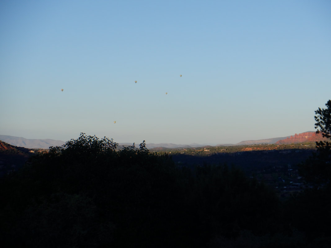 Driving through Sedona, we find Schnebly Hill Road where just before the pavement ends, reach a large parking lot to hook up with the "Arizona Strong Hikers" group. We were lucky to snag two of the ten available spots for one of the premiere hiking loops in Sedona. The sun is rising as are many hot air balloons, all up to enjoy the brilliant dawn show. 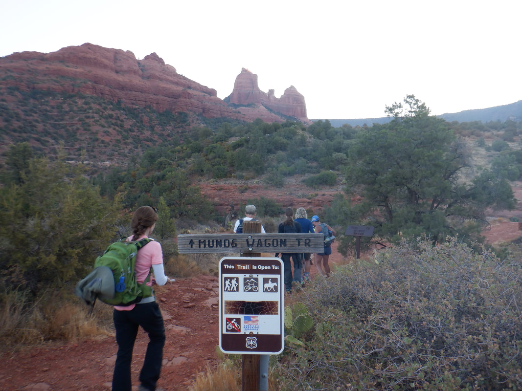 The organizer of our group, Wade, gathers us for the introductions and then we leave, promptly at the designated start time of 7am. Of the many things I enjoy about Wade's hikes, always departing on time is high on the list. Today's trek begins on the "Munds Wagon Trail". 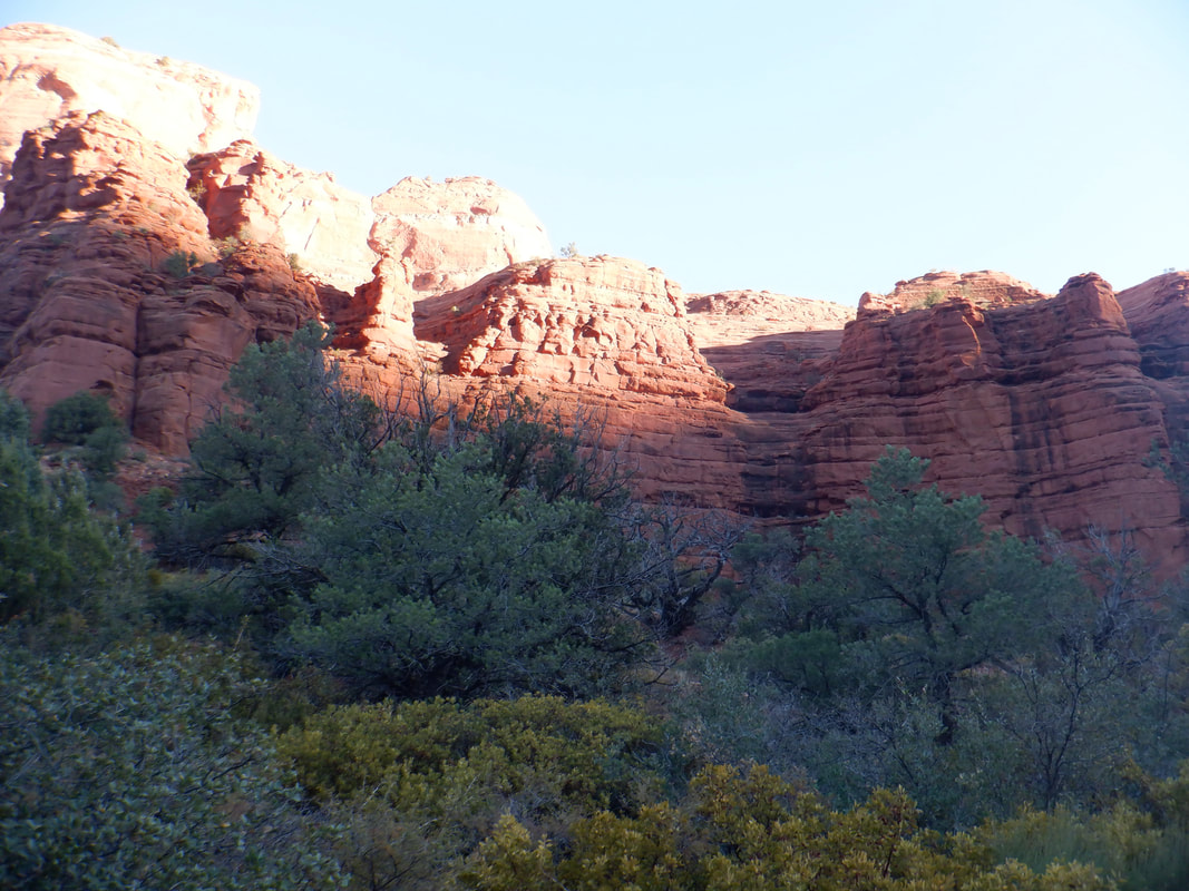 To describe the hiking pace as brisk would be a gross understatement so rather than hold people up, I drifted to the back of the line to take an image or two. Then, to close the gap I'd scamper to the end of the line. Considering our surroundings, I'd have enjoyed a pause now and then to take more pictures BUT....since Wade will be reading this, IN NO WAY IS THIS CRITICISM!! To get on Wade's bad side means never finding oneself getting off the "Waitlist". lol. 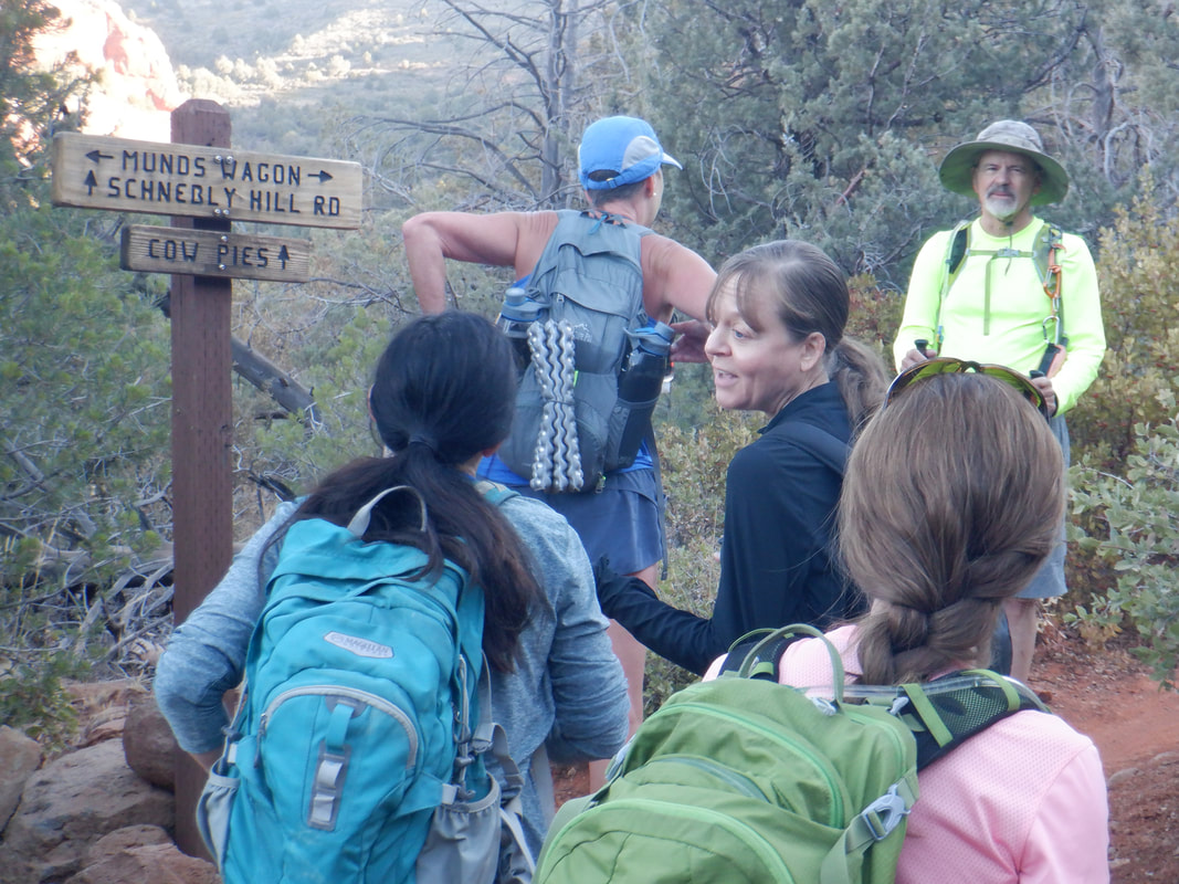 At trail junctions, we would always pause to regroup but all of us managed to maintain the pace, averaging over 3mph, not counting stops or rest breaks. There are some very fit hikers, actually, better said, there are no unfit hikers in the group. The name of the group, Arizona Strong Hikers, is apt. The trail rises modestly but is almost always rising so soon.... 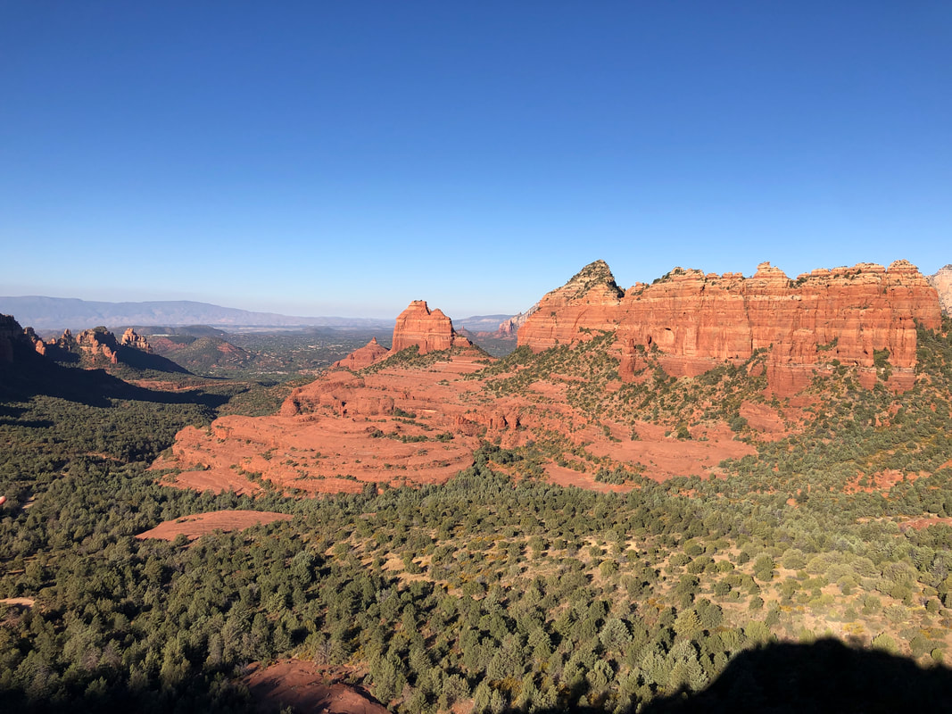 .....with the sun up, the scenery is brilliant. We reach a knob or butte called the "Merry-Go-Round and decide to scramble up. 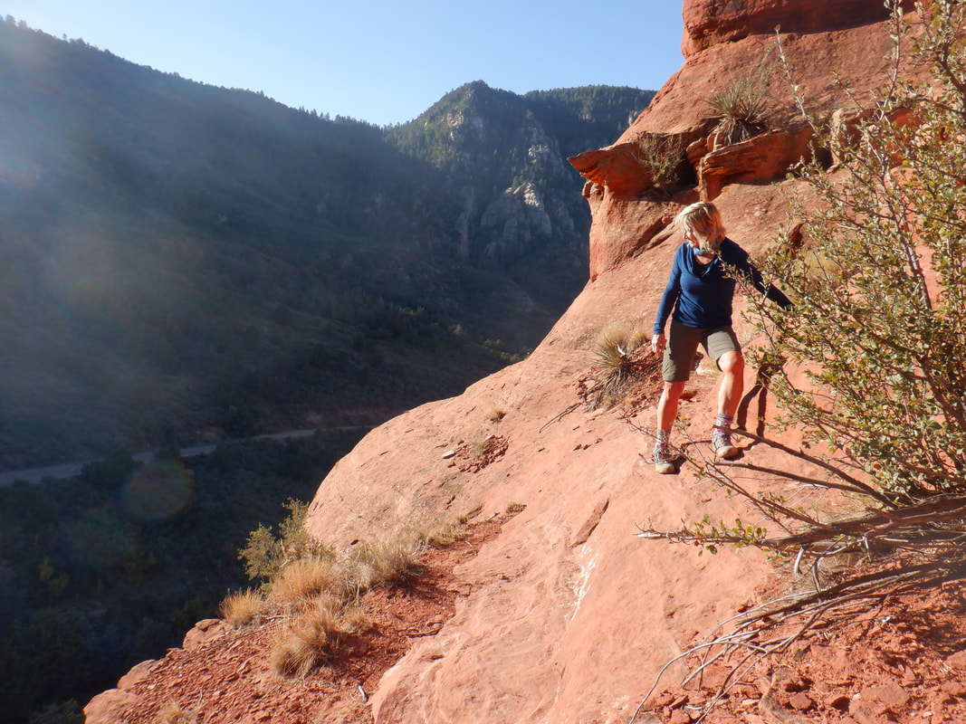 The slopes of the feature are steep but manageable and we all enjoy our time at the top. Amy especially enjoys the scrambling and on this hike, there is plenty of it. 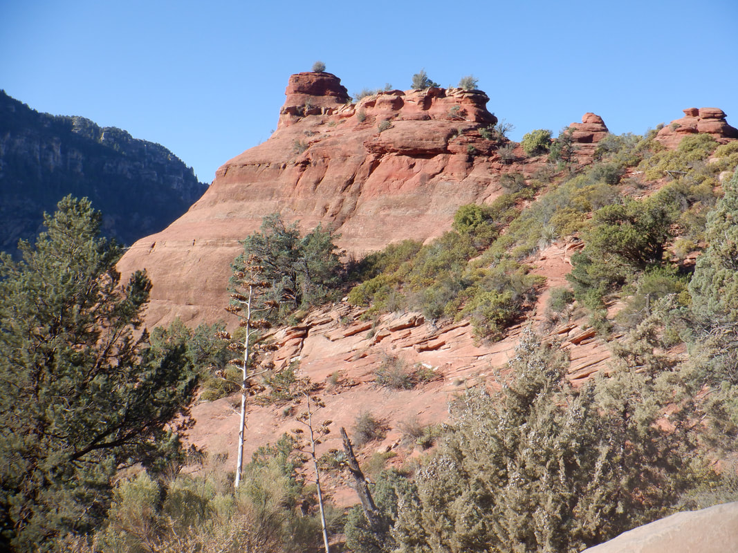 We resume our hike and soon, looking back, get a good look at the Merry-Go-Round. From a distance, it's hard to believe that we scrambled, clockwise, around and up it as the slope looks impossible to manage. 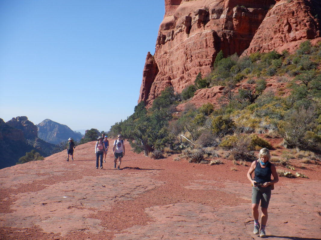 Occasionally we would emerge on flat, red rock and enjoy the change while always.... 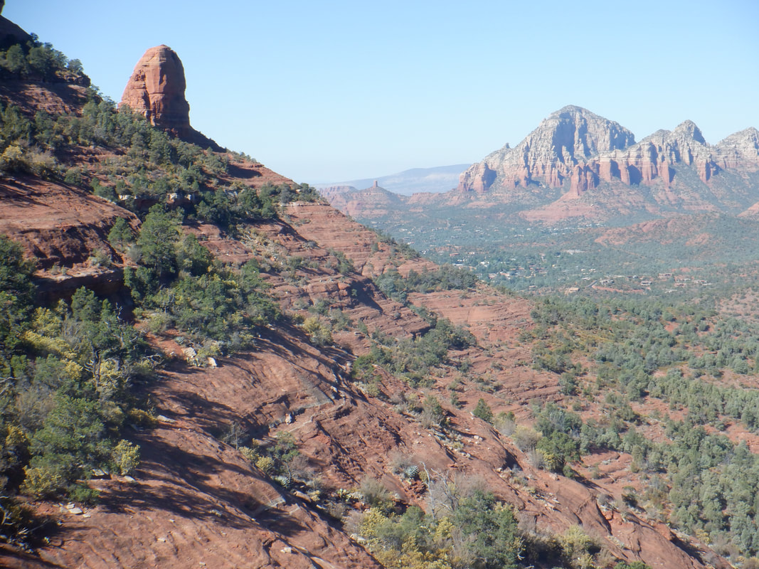 ....admiring the views. Just awesome. At about mile 7, Wade signals we.... 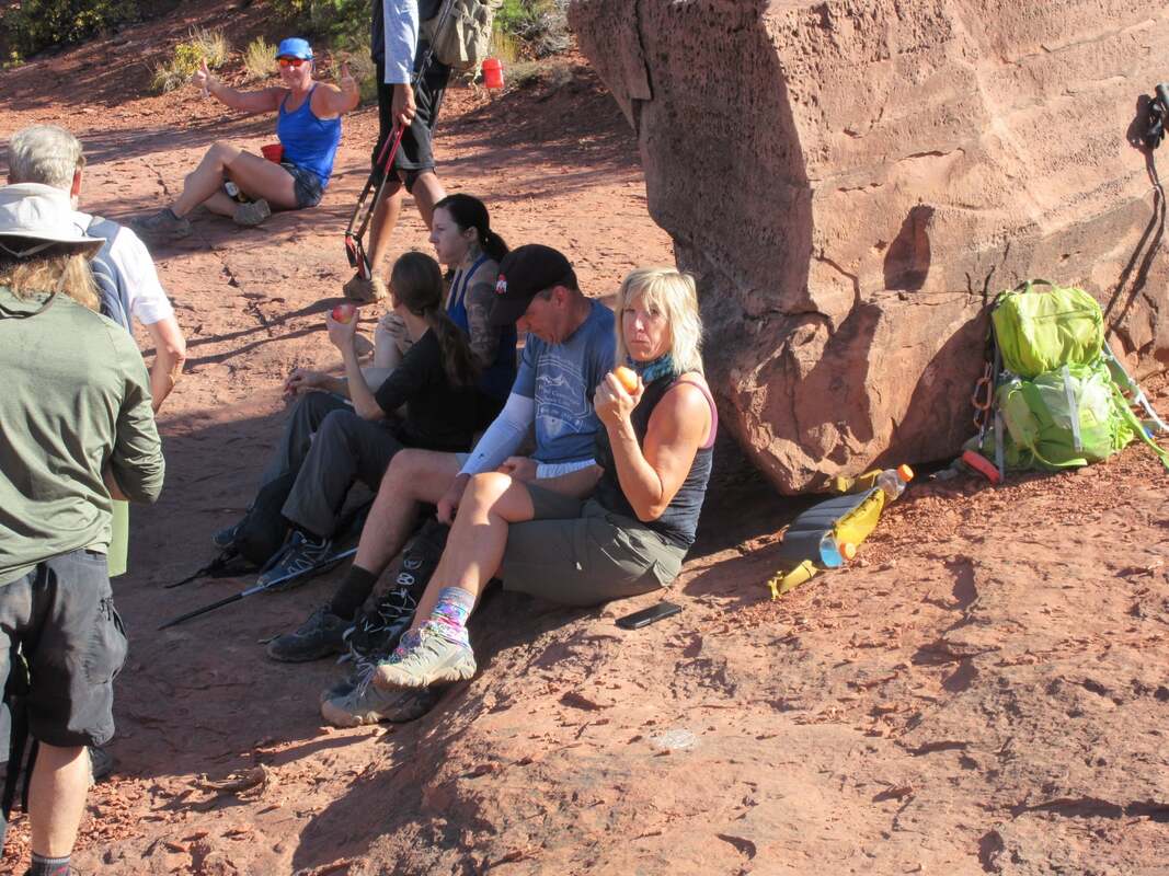 ....can take a lunch break. A large boulder provides ample shade as we look across the valley, soaking in the scenery. Eventually, we gear up to resume our hike but not before....  ....the happy couple have an image taken with a brilliant background. Hmmmm, I'm looking kind of paunchy:(. The hike begins anew on the.... 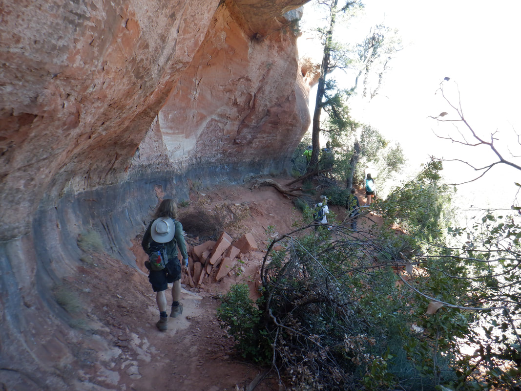 ....Hangover Trail. The trail encircles, or nearly so, a large butte. Note the cliffs that hang over the trail and do so for a great distance. Soon, our effort brings us within site of our next destination.... 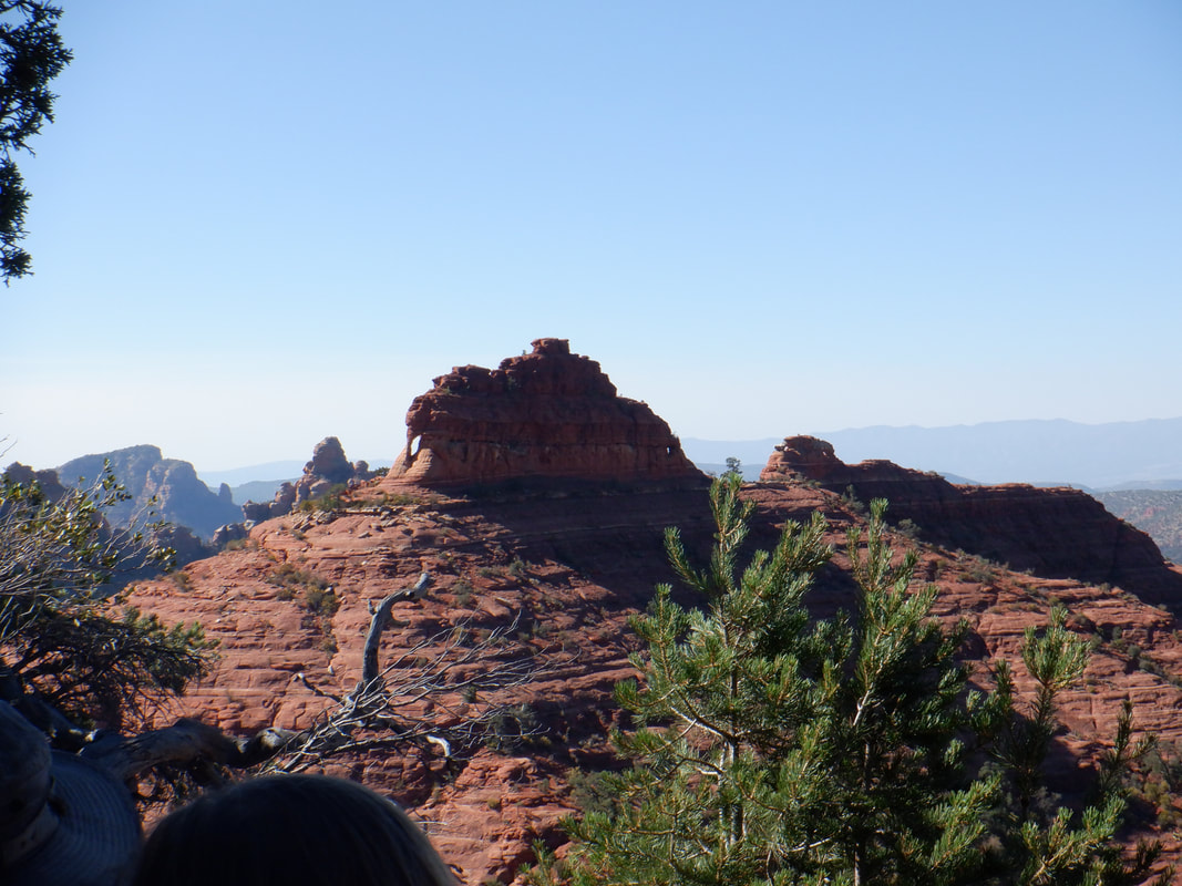 ....Elephant Arch (note the arch on the left side). The scramble up that is great fun and once inside the arch.... 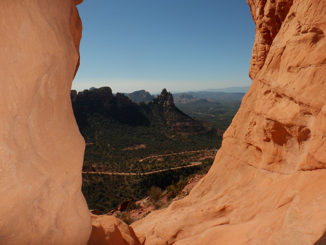 ....WOW. Only 1 or 2 people can fit in it at a time so after taking my image, I slide down the other side, work my way back around and able to take an image of.... 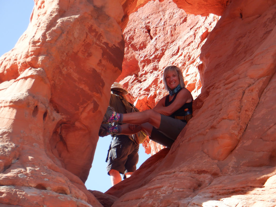 ....Amy, posing inside. Once we finish that visit, we climb down a band or two of rock and.... 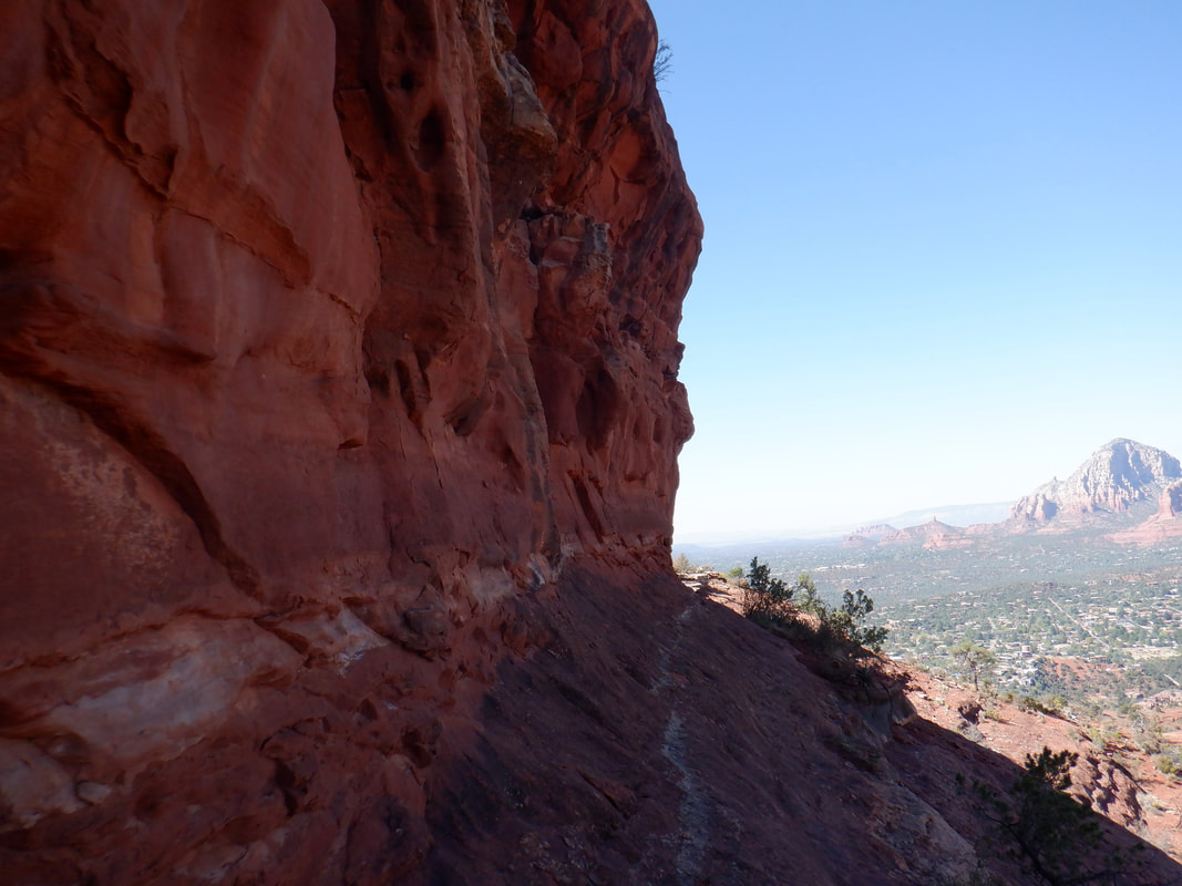 ....hike to the other side and.... 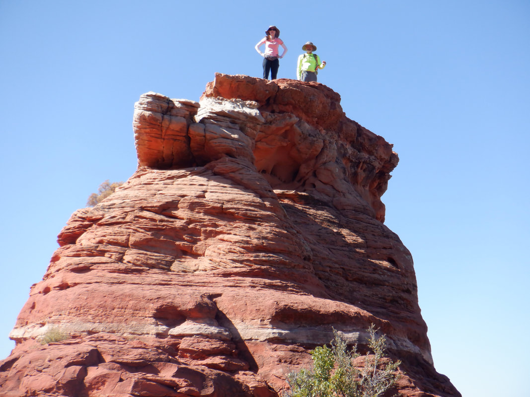 ...scramble to another arch and above it, the top. Wade and Karyn successfully having summited it. I think I set a new personal record for amount of time "butt hiking" as several times I was more comfortable sliding then standing. We resumed our hike..... 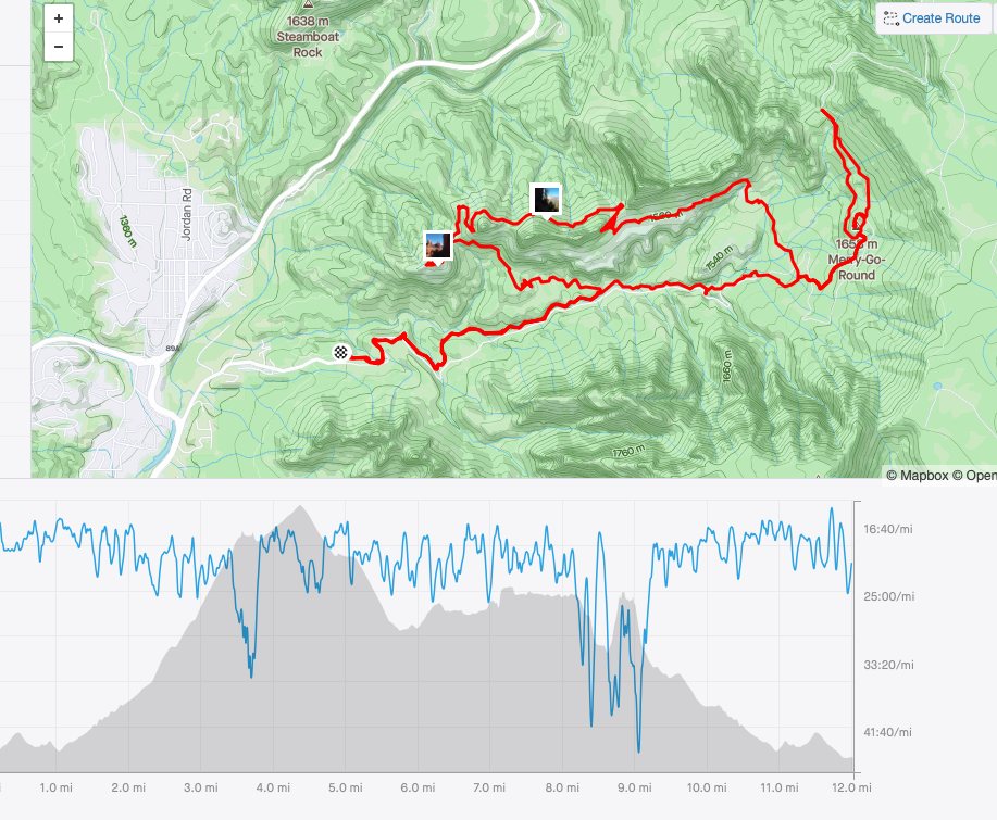 ....the track of which is seen above. We finished the hike with 12 miles and a little over 2000' of elevation gain. Our reward was to drive to the nearby town of Cottonwood where.... 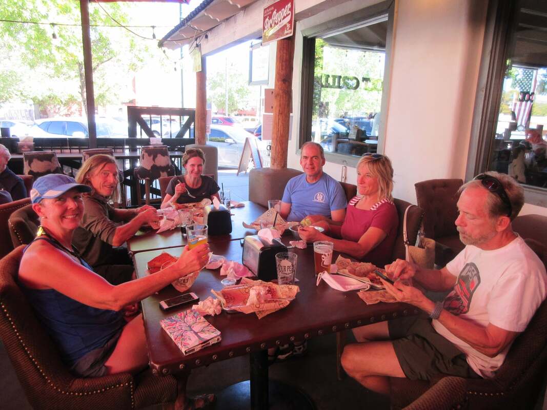 ....most of us gathered at "Colt 804 Grill" for good food, a beer by the name of "That" and shaded eating. Left to right, Kimberly, Tom, Karyn, me, Amy and Michael. Thanks to Wade for use of this image.
 About 30 minutes from me and about 2000' higher is the small town of Oracle. With summer highs being what they were, that additional elevation isn't enough to offset the heat. Now, even though our temps remain unusually warm, it's a great place to start a hike and so I started on the Oracle Ridge Trail. It is believed that a couple by the name Sara and John Lemmon, hiked this route in the 1880's to the summit of the prominent mountain. Soon thereafter, John named the mountain in honor of his wife, thus Mount Lemmon acquired its name. 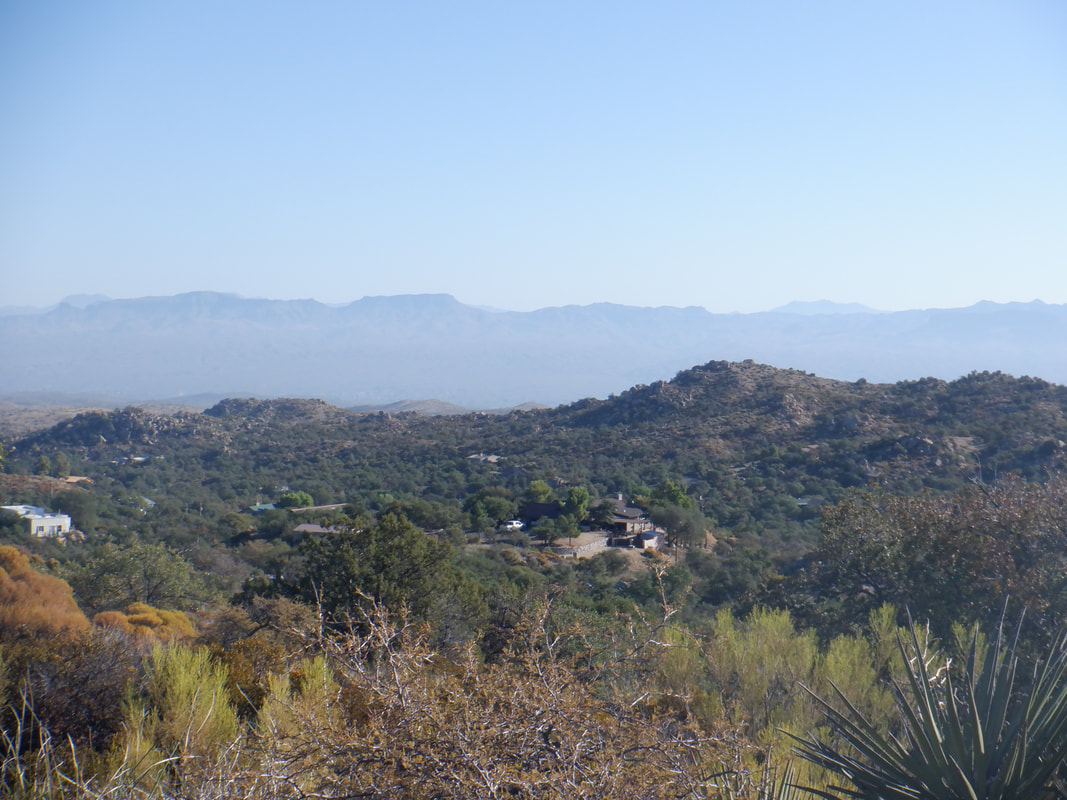 There are multiple steep ramps during the first mile and elevation is quickly gained, delivering great views 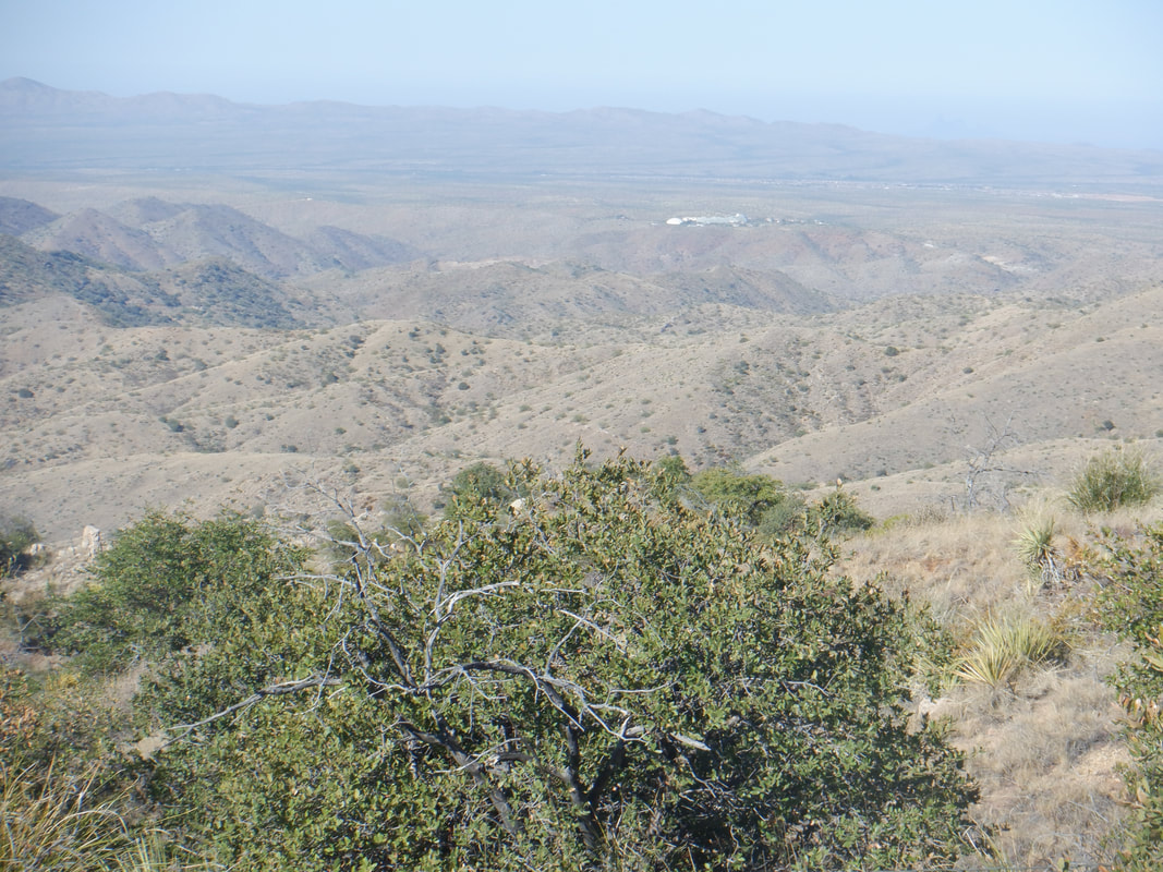 Hey! There's the Biosphere II in the distance. 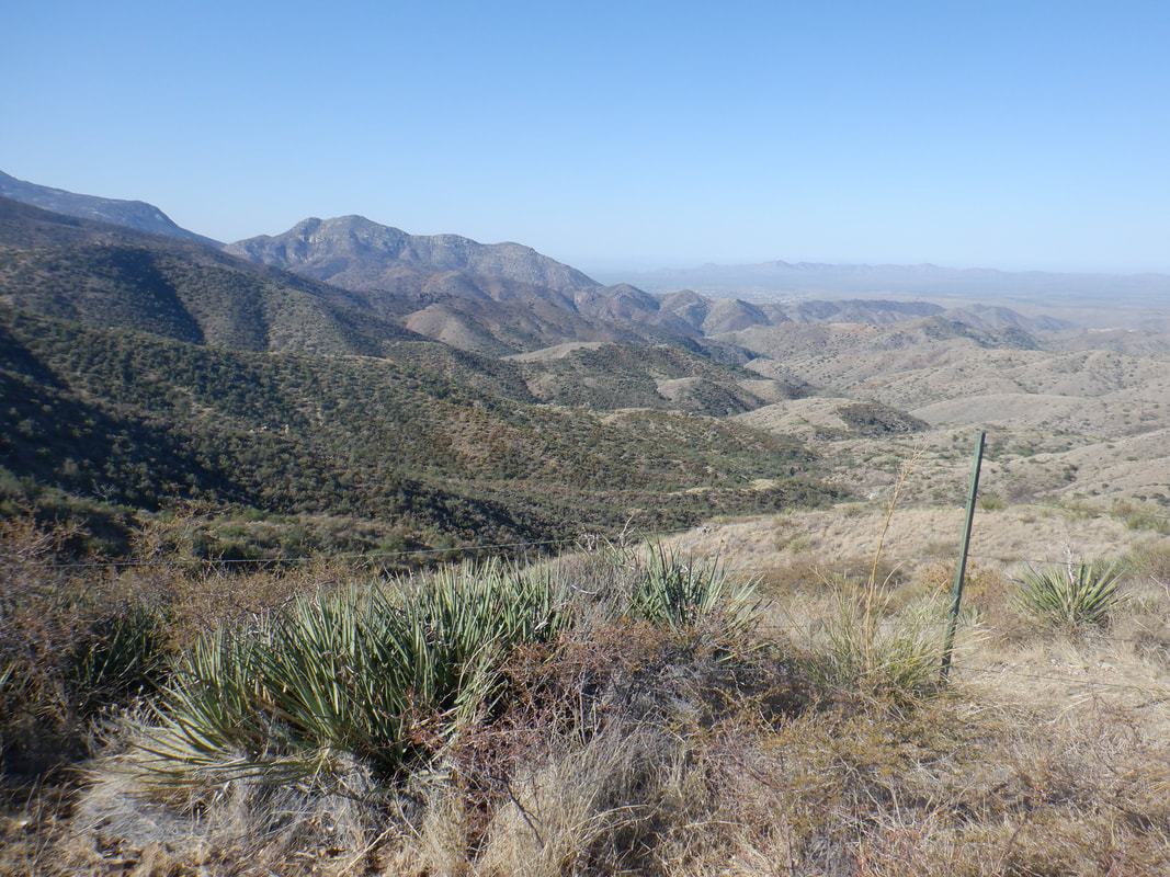 Oh gee. I stopped several times to admire the views and took many images. 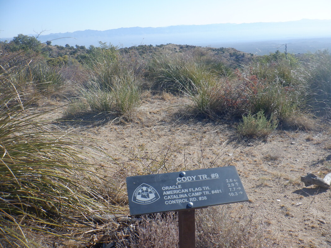 Previously, there had been no trail signage but at mile 2.6 came to this one. Ran into a group of 9 hikers who were doing a loop and had a nice chat with them. One guy said I was brave to be out here alone. Soon after they departed, I removed my M&P .380, as planned as the area is very remote. It makes a nice noise maker and I have practiced enough that I probably won't shoot myself. 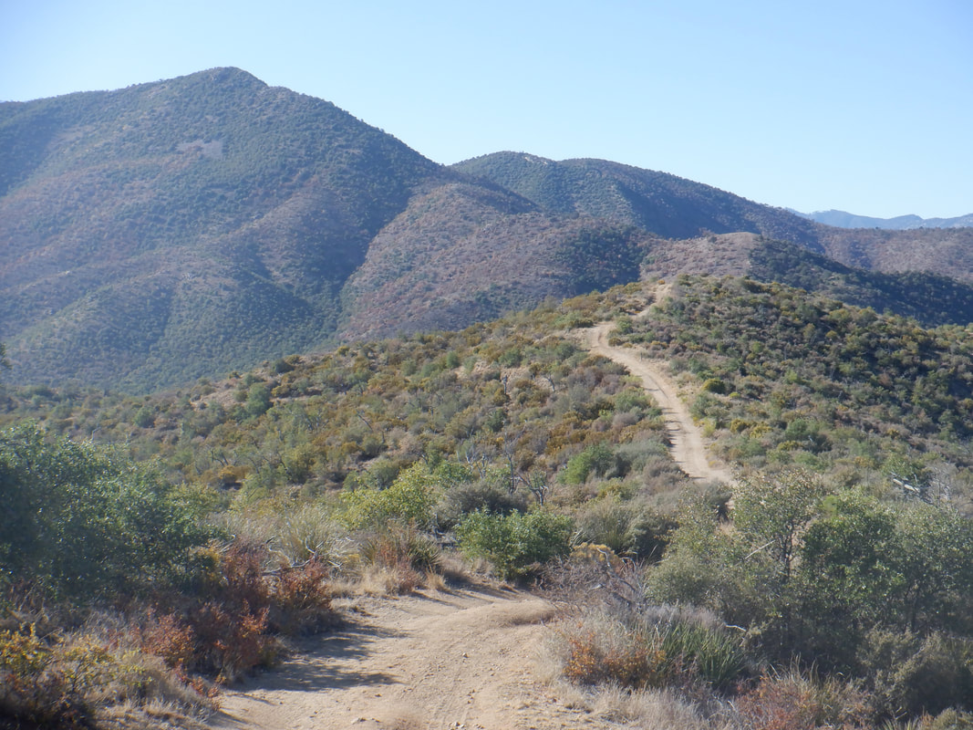 At times, the trail is a dirt road and other times a trail but always easy to follow. I had a gps on my phone as a backup should I need it but I never had to reference it. In the distance, Apache Peak. The trail would climb much of it before going counterclockwise around it. 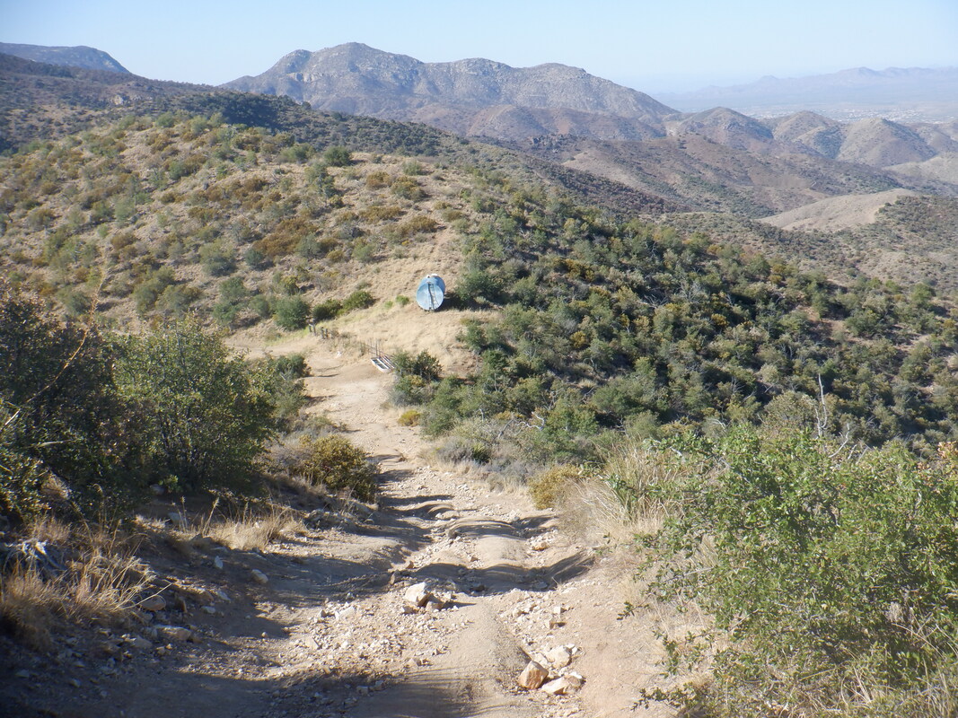 There was a very nice water tank that had so much water some of it was seeping down hill. I thought that odd considering the lack of rain this year. Would be great to have a wildlife camera here to see all that come for a drink. 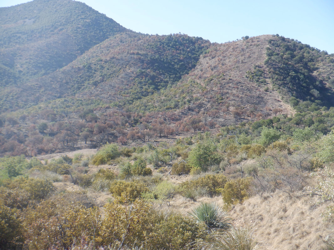 Soon thereafter, I arrived at the beginning of the burn area, clearly shown in the above image. When watching the Bighorn fire blaze from a distance, this summer, it appeared all was engulfed in flames but there are many areas that were spared, apparently there not being sufficient fuel for the fire. 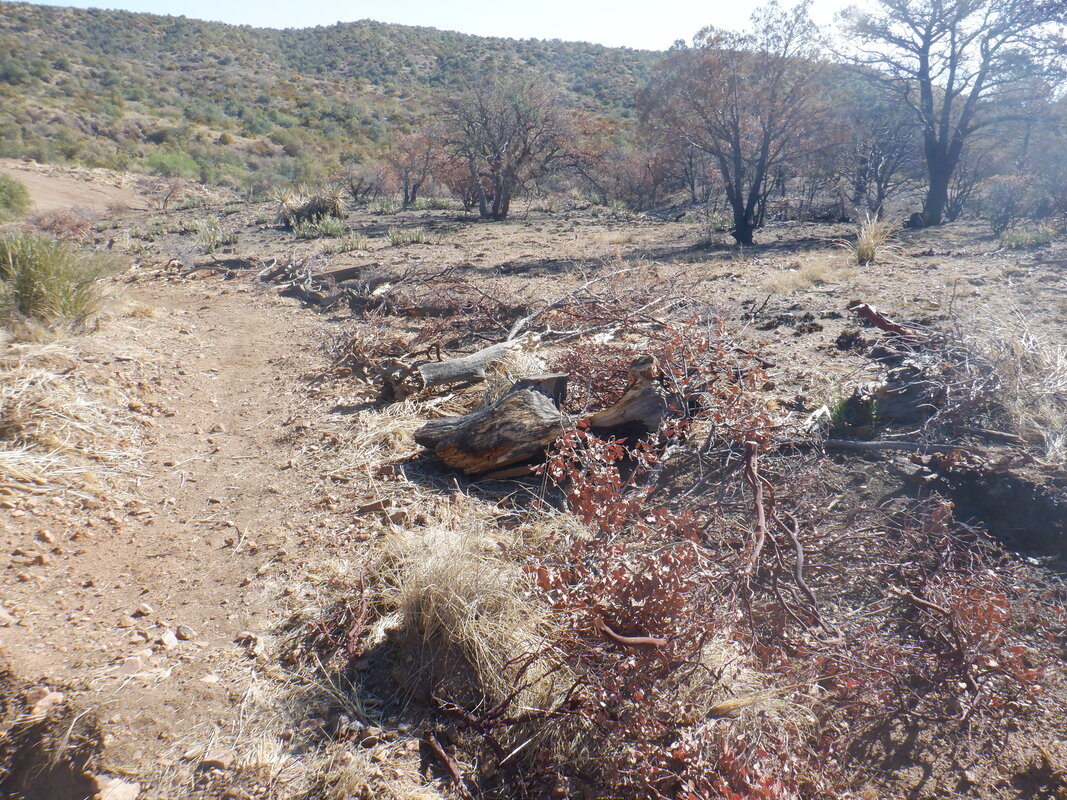 Brush had been cleared in places to create a fire break. 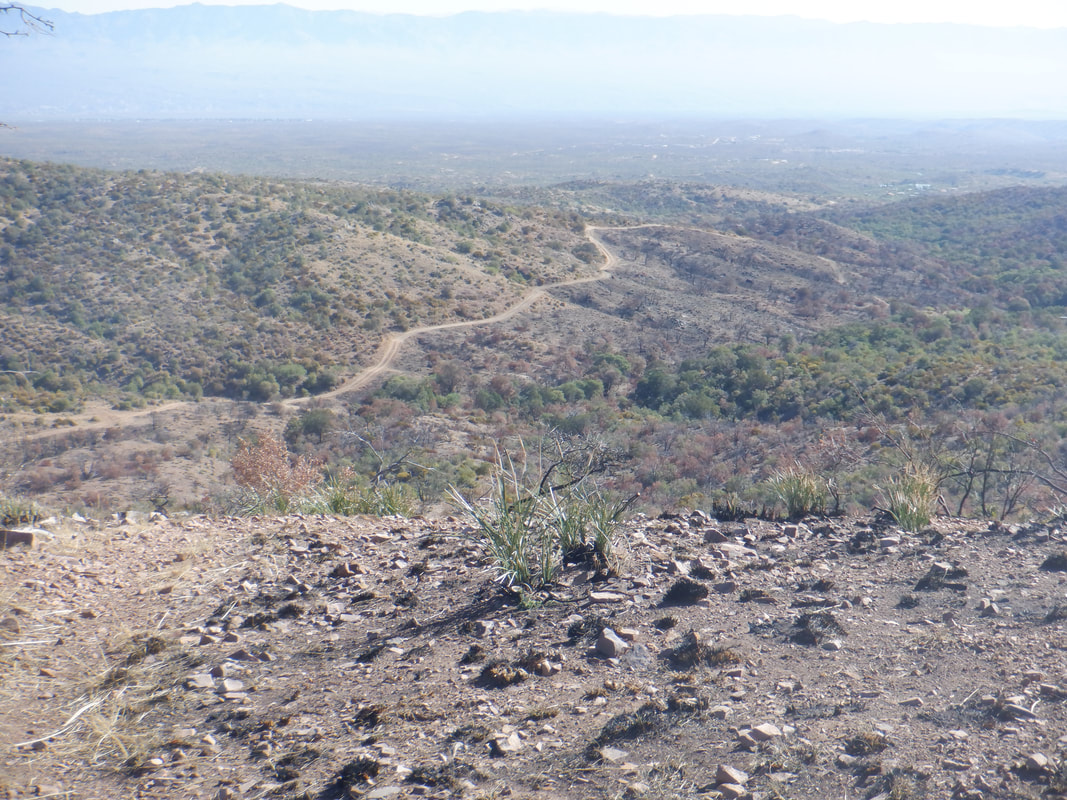 A couple of times, forest service roads merged with the trail but to me, it was always obvious how to proceed. 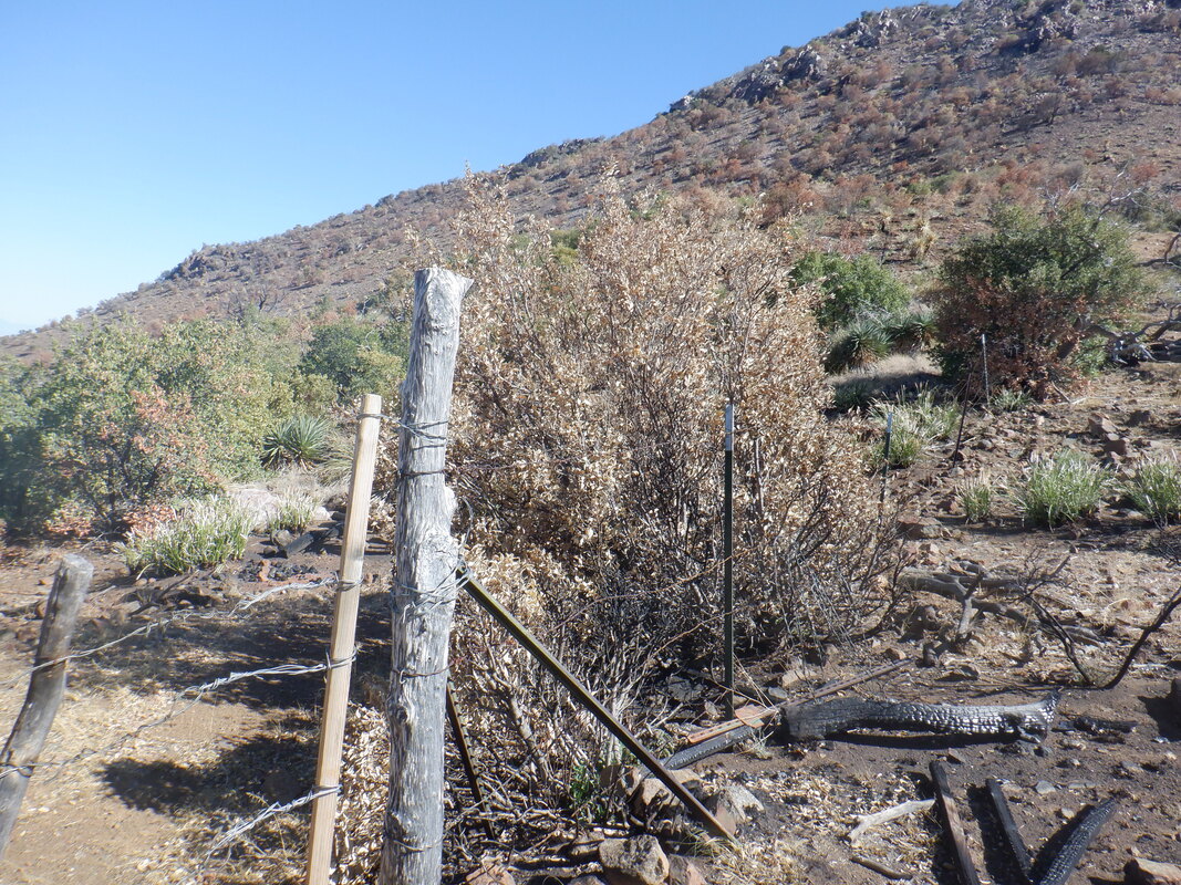 I worked my way around Apache Peak and tossed through a couple of gates, being careful to always close them behind me. There was evidence of cattle grazing and would not want them to exploit an open gate. 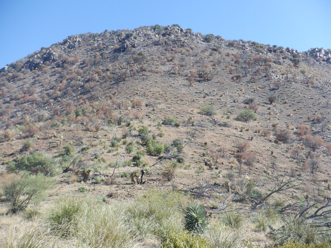 I looked carefully for a cairn or something to mark a route to Apache Peak but did not find one. Being in the burn area, I should turn around and soon did as I was not going to make it to my original destination of Rice Peak. 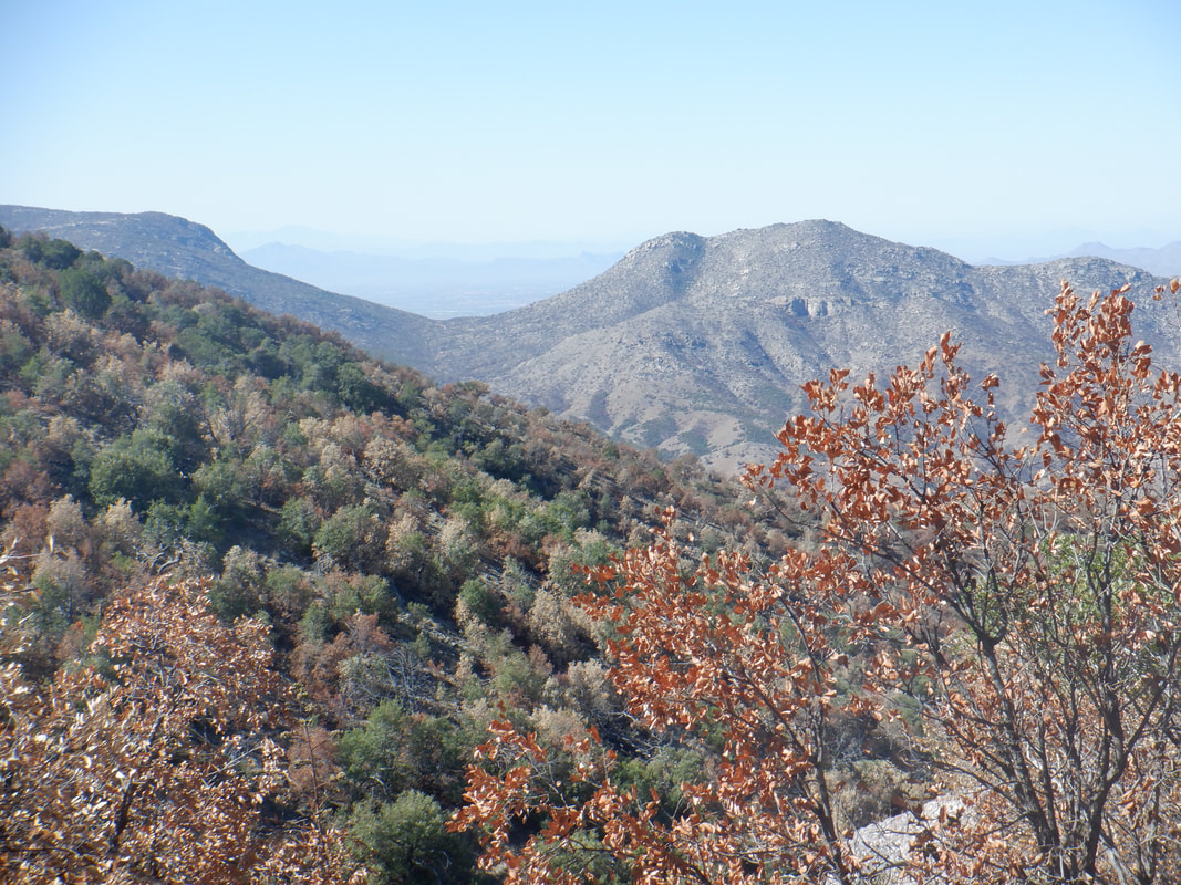 I was kind of mesmerized by the views and kept wanting to see what was around the next turn or rise. 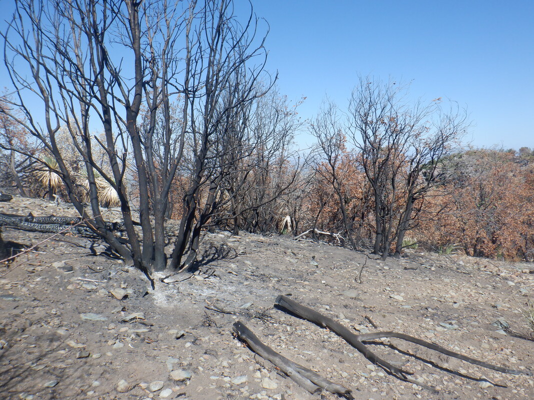 The burn damage wasn't all that bad and it appears this area will quickly recover although the above image suggests otherwise. 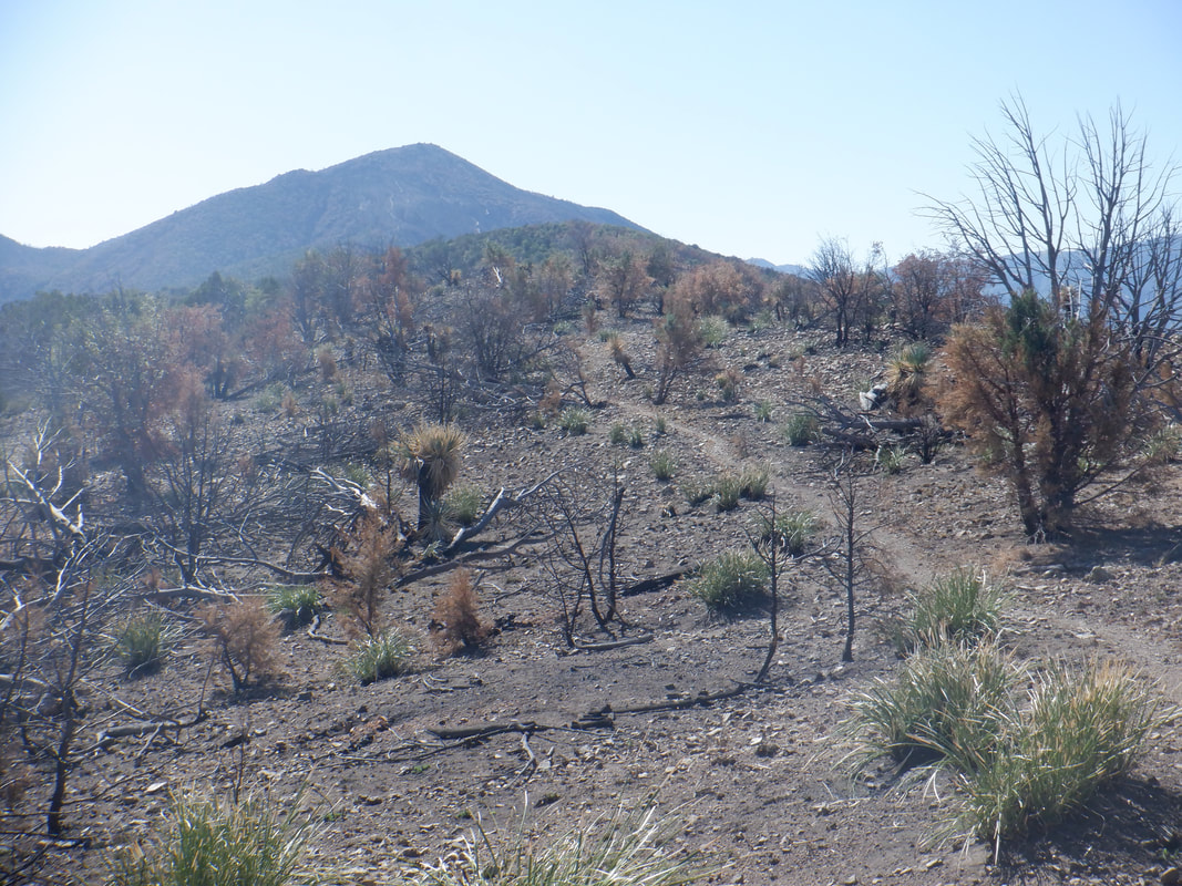 Rice Peak in the distance but I had turned around, spitting the bit on today's destination. 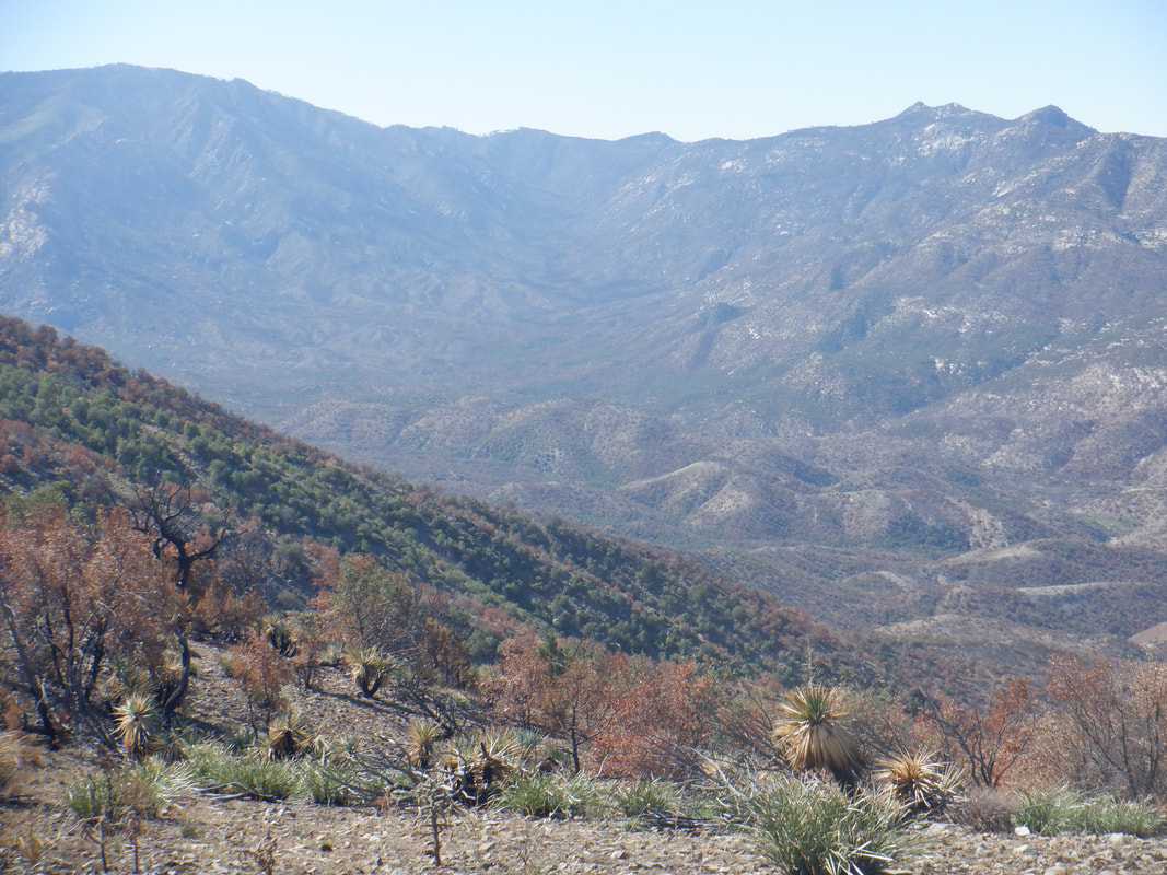 Wow. Mount Lemmon in the distance. 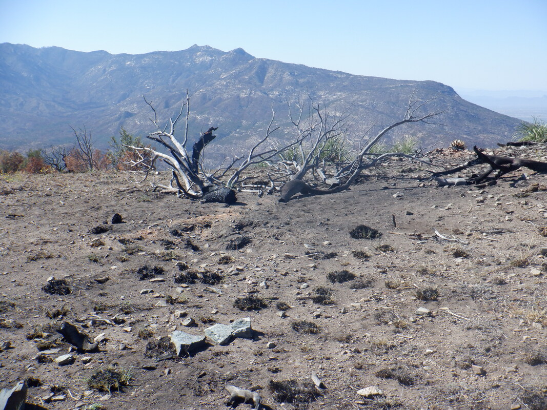 Another. 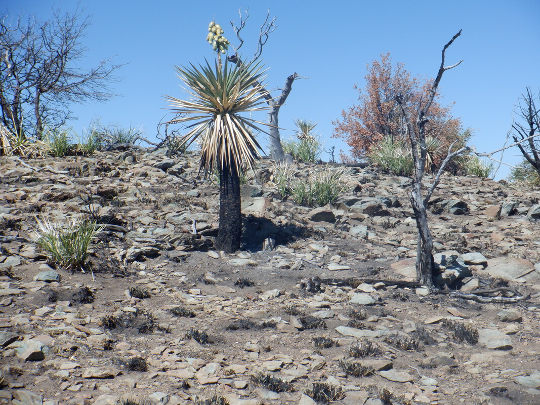 Note the seed pods on the above plant. Rain, great fertilizer and seeds. Next year it will look much different. 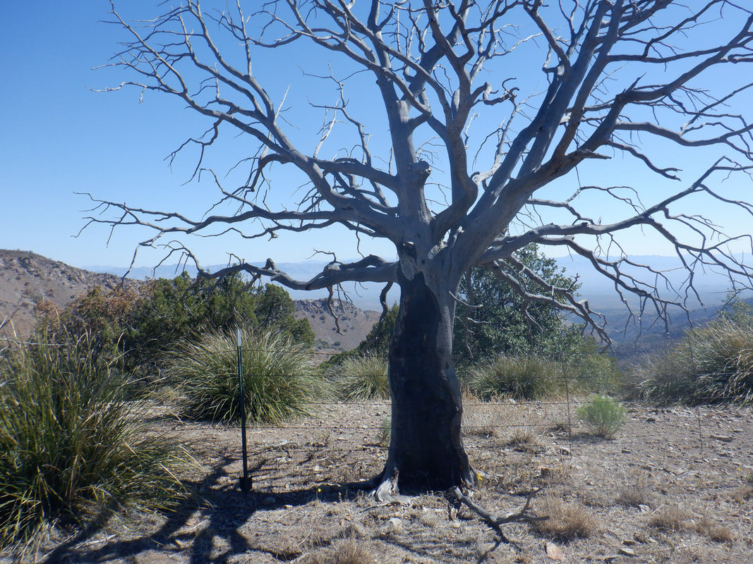 A long dead tree stands beside the trail has I return, finishing with 10 miles and 2400' of climbing. Great hike, great views. And now it's to Sedona for an epic. More to come, soon.
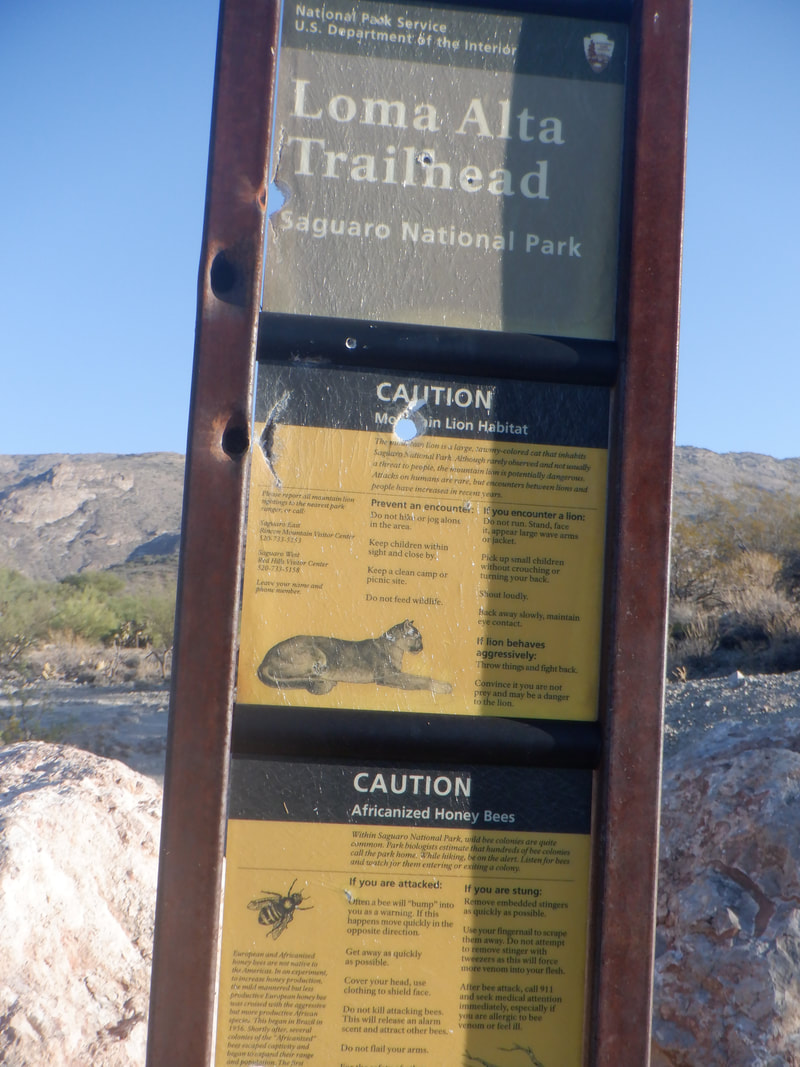 I drove about an hour to the Loma Alta trail head on the western side of Saguaro East NP and at the base of the Rincons. I was headed to the Quilter's Trail but first had to hike 2.2 miles on the LA Trail. 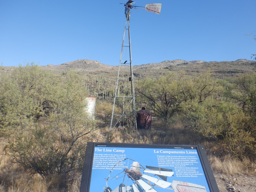 The trail is actually a fairly wide dirt road and mostly flat to slightly rolling. I wanted to get in a longer hike or 2 before a truly epic next week in Sedona. Along the way was an old windmill and a few.... 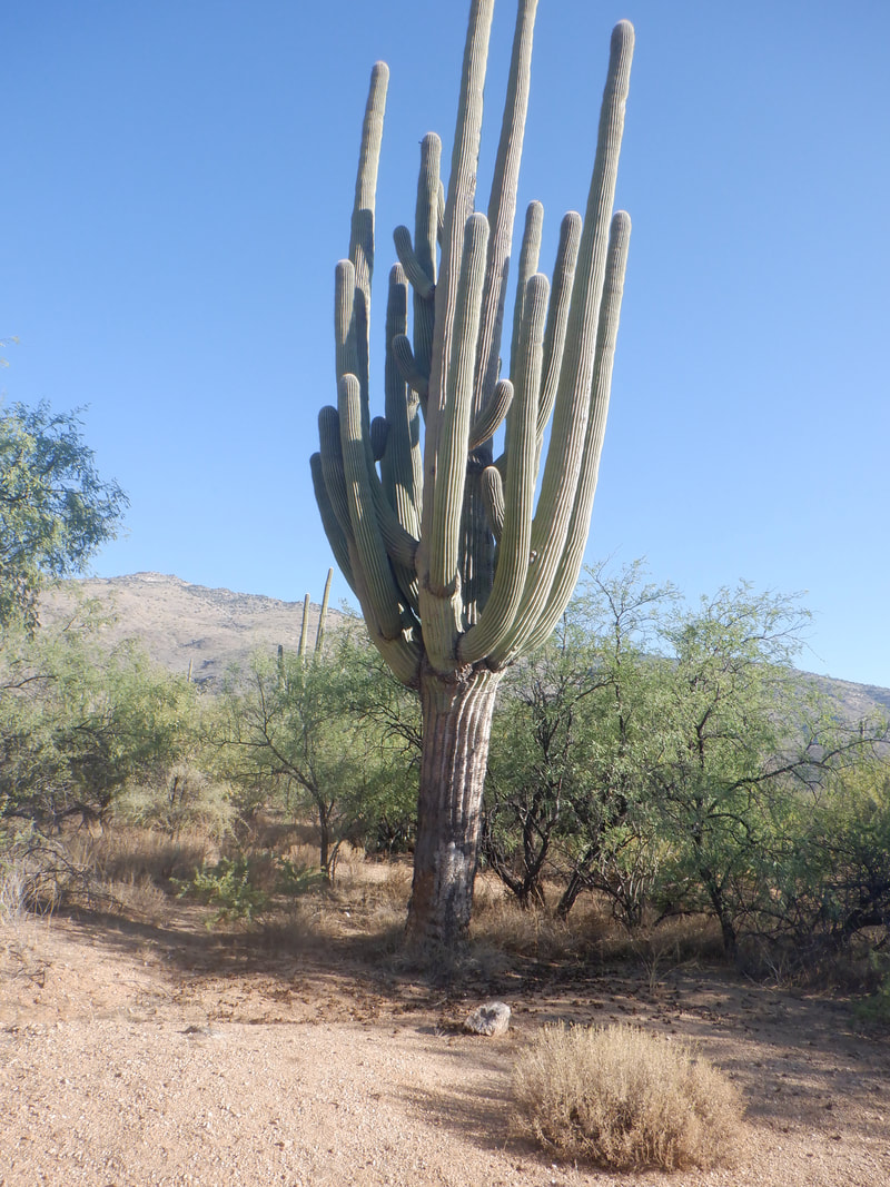 ....examples of some magnificent saguaros. I was at a Home Depot and saw a couple of saguaros for sale, about 3' high....$500+. Wow. 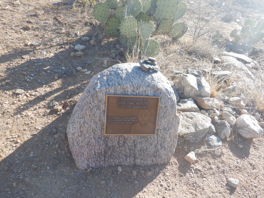 I reached the Quilter's Trail and turned to the east. This begins a mostly gentle, rolling rise into the Rincon foothills. Nothing too steep but it's a fairly long climb until at mile 5..... 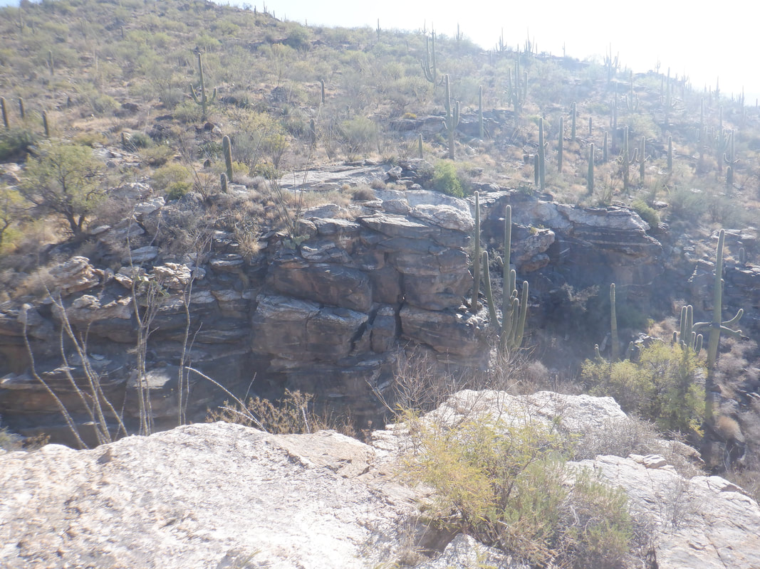 ....I reached the head of a ravine and decided to that was enough for today. Had I continued I would have reached the Manning Camp Trail. Most of the climbing to this point is in the final mile, having an average grade of 12.5%. 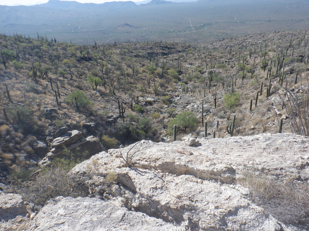 Nice but far from awesome views. Typical Sonoran desert appearance. 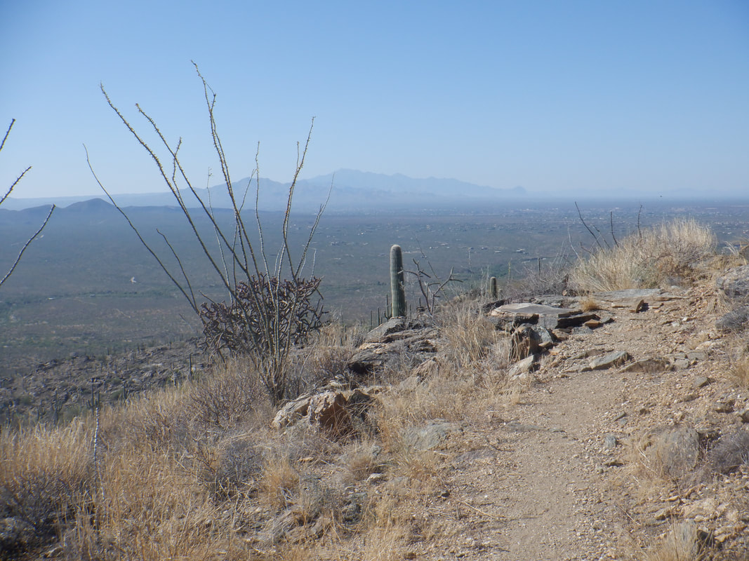 After a brief break, I head back, finishing with 10 miles and 1400' of climbing. Don't think I'd do this again unless there is a better way to reach the start of Quilter's. That 2.2 miles on Loma Alta is rather boring.
 My first full day back in the ghetto and so I curiously decided to hike the beast, Pusch Peak. While I did hike a couple of times in Ohio, those hikes were really mild compared to this peak. I concluded my legs were out of shape so do a really steep hike followed by a longer one and maybe I'd be back, or not. 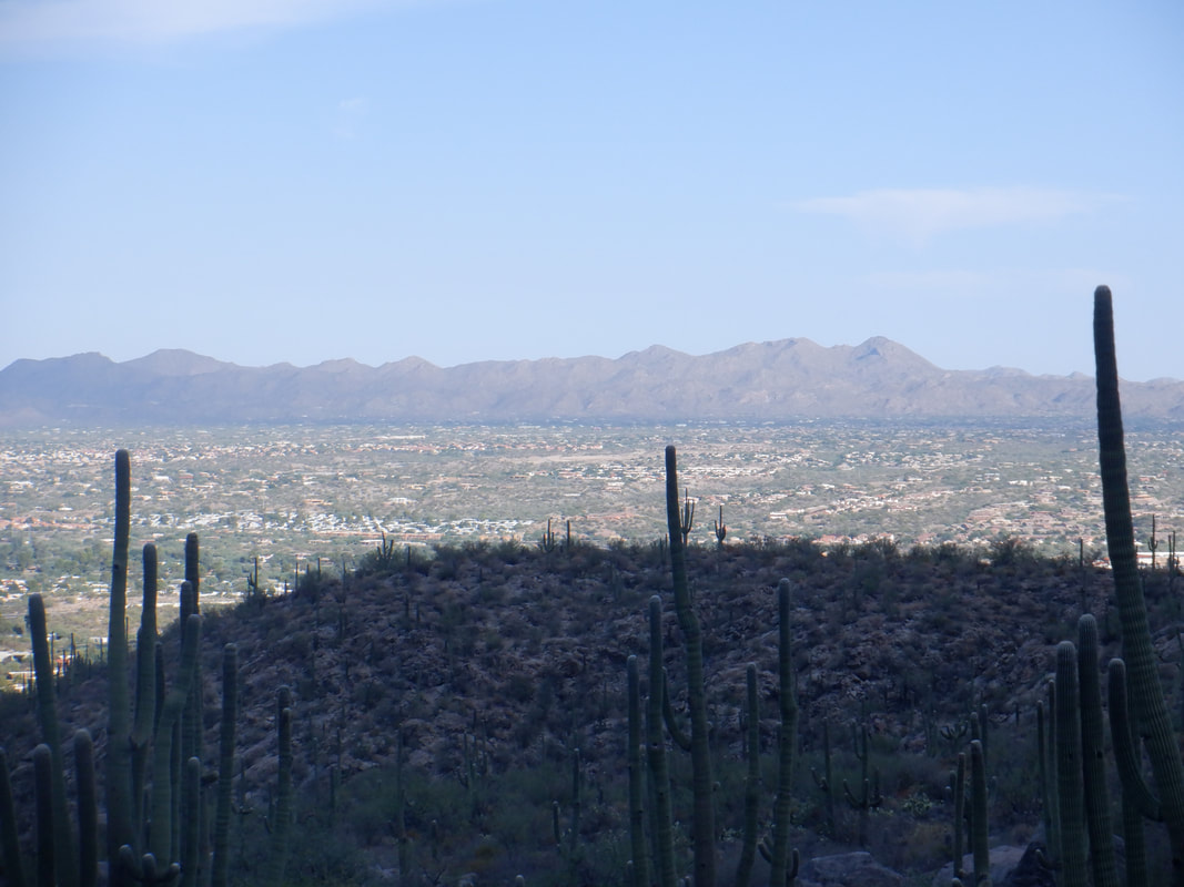 The west facing Pusch Ridge provided shade almost for the entirety of my hike. The Tortolita Mountains in the distance. 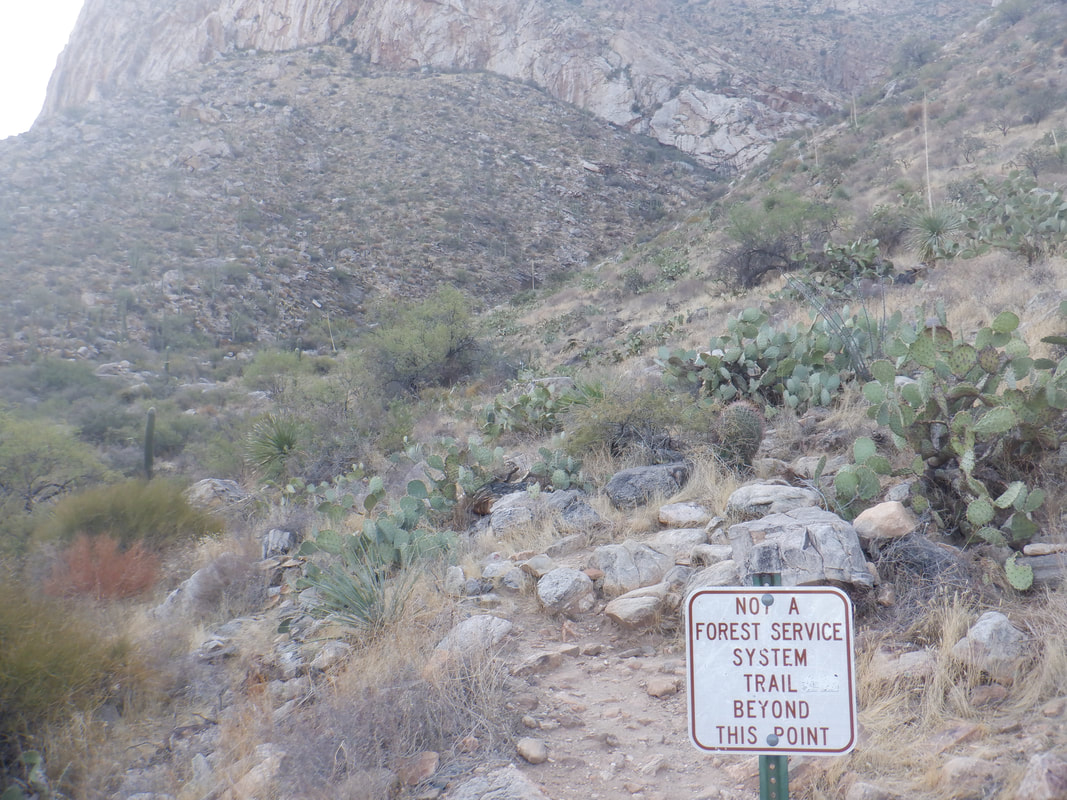 I start at the Linda Vista trail head, hike .8 of a mile to the above sign. This section has an average grade of 15%, the balance of the hike averages 30%. It's a knee buckler for sure. 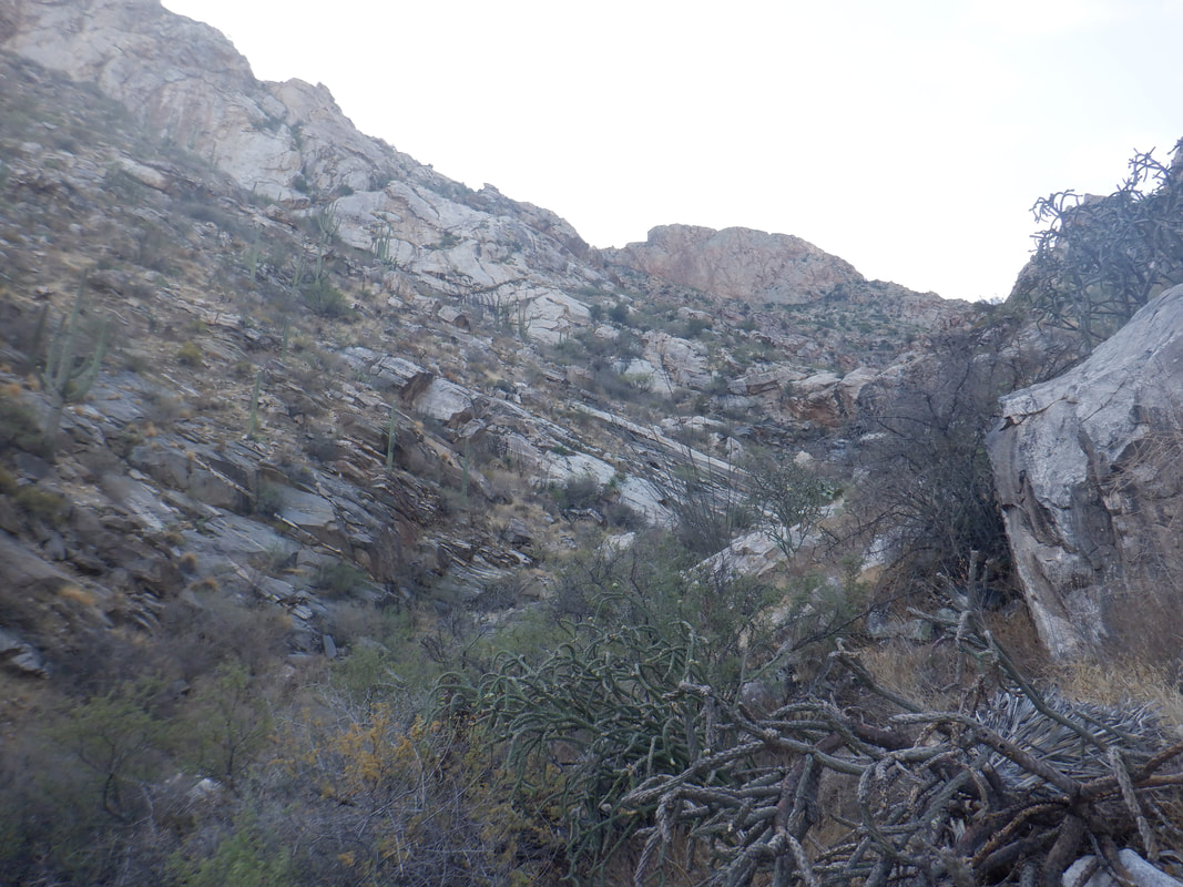 The social trail is easy to follow in most places as it parallels the above divine, then crosses in front of the stone wall, at the top of the image. 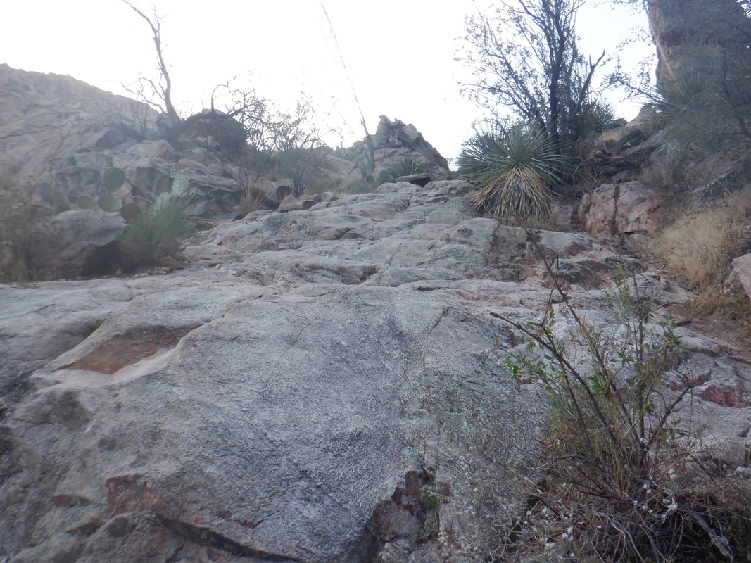 Soon, I encounter the "wall" which is fun to scramble up. 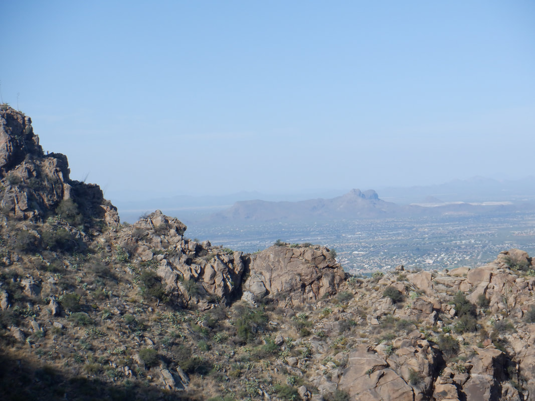 Views to the southwest appear as I struggle higher. Damn, I have lost some fitness. 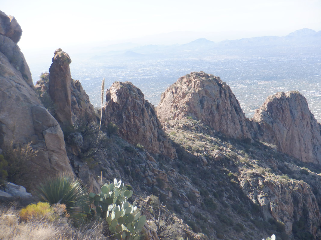 Higher I go and I have always found this particular view to be spectacular and distinctive. I think this is around my 8th time to do this hike. I get bored easily with trails so rarely do any trail more then once a year (ok, this summer I did hike in the Santa Ritas frequently because fire closed the Catalinas and Superstitions) and am glad the region has so many options. 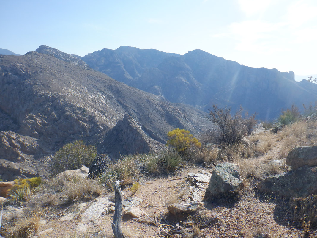 Just before reaching the peak, I get a good look to the northeast where the fire raged this summer. 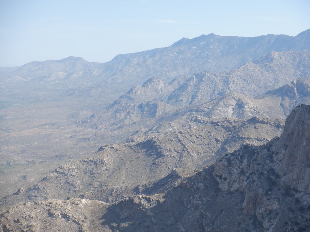 Awesome to the north. 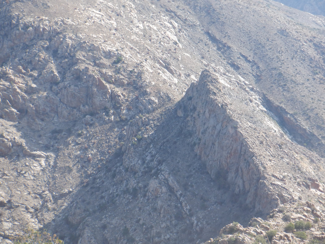 Looking down on "The Cleaver" as it casts a shadow. Its southeast side was consumed by the Bighorn Fire as were the areas around it. The damage is pretty obvious. 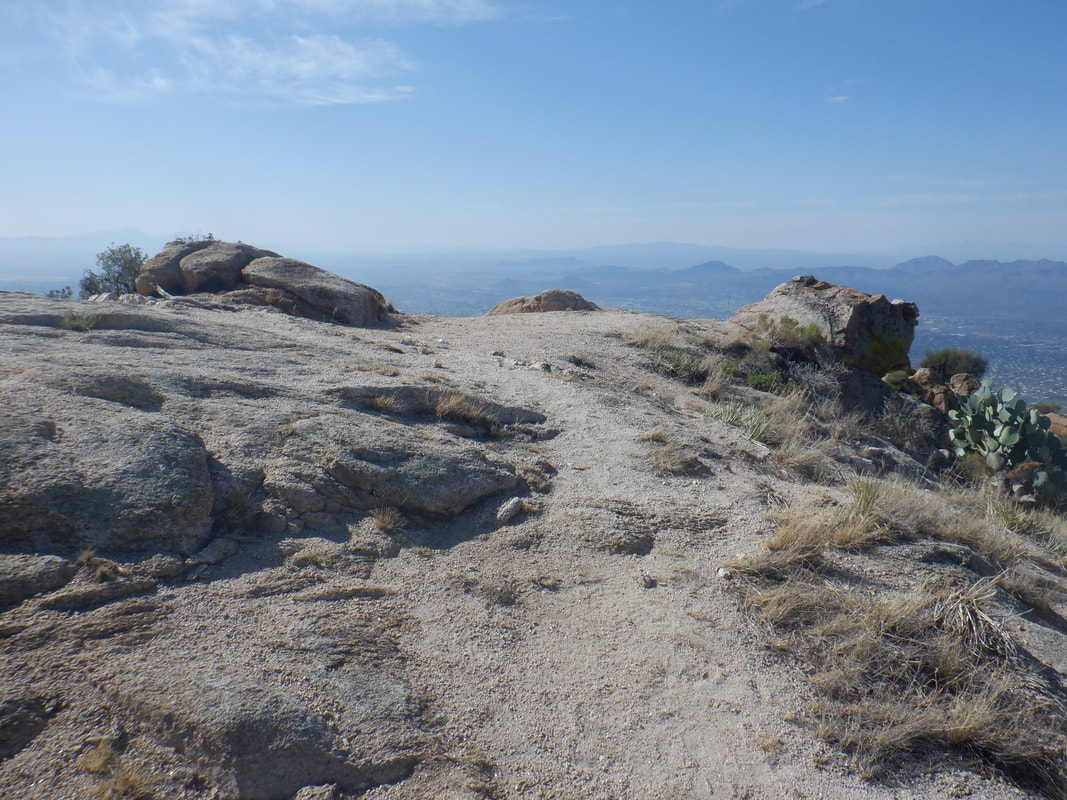 After just over 2 miles, I've gained 2700'. The summit register, found in an ammo box, is missing so was not able to sign in. I suppose someone removed it thinking this peak too would be consumed but it was spared. I bade farewell and began a descent that takes longer then the ascent, finishing with 4.3 miles.
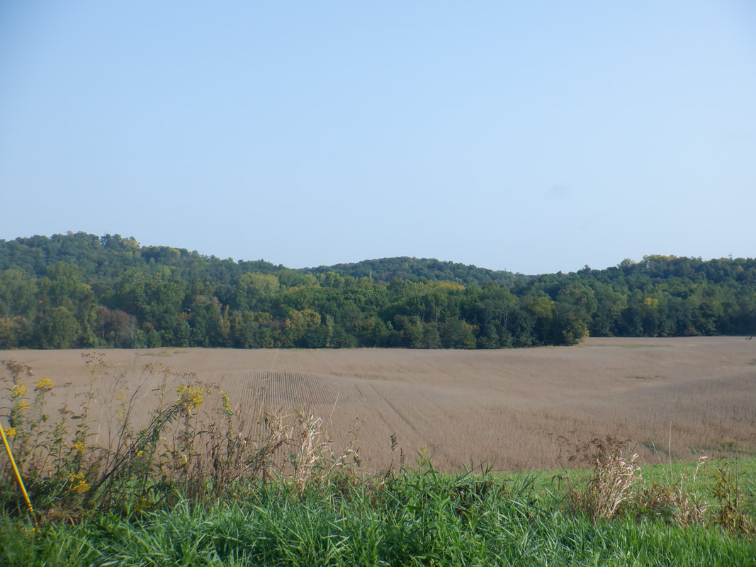 My visit to central Ohio included hiking around the Dennison University Biological Reserve. What a gem of acreage with some good climbs. Thanks to Ohio friend Eva, who set aside virus concerns to hike with me. Some of the most mature Beech, Red Oak and Maple trees I have ever seen populate the BR. After visiting family I spent many hours in 3 acres of woods I own. I planted over 500 trees many years ago and take something akin to parental pride when I walk among them. I split a bunch of wood, cleared brush and throughly enjoyed myself. 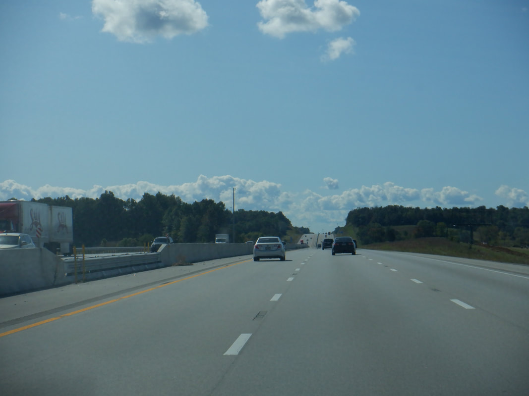 But, it was rather cold with overnight lows in the 40's, rain several days with lots of clouds and wind and so, I was ready to head to the southwest. I began my drive..... 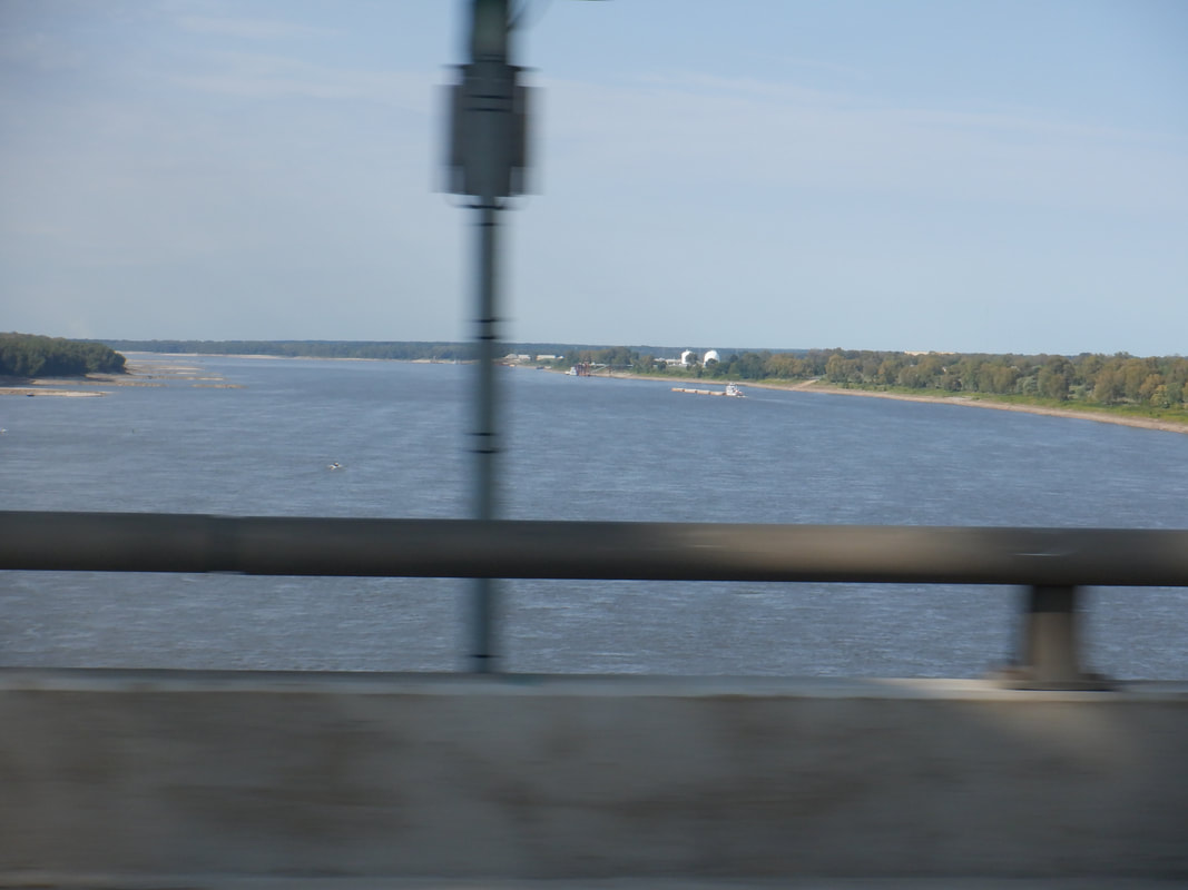 ...took the southern route through Cincinnati, Memphis, Little Rock, Dallas, etc... 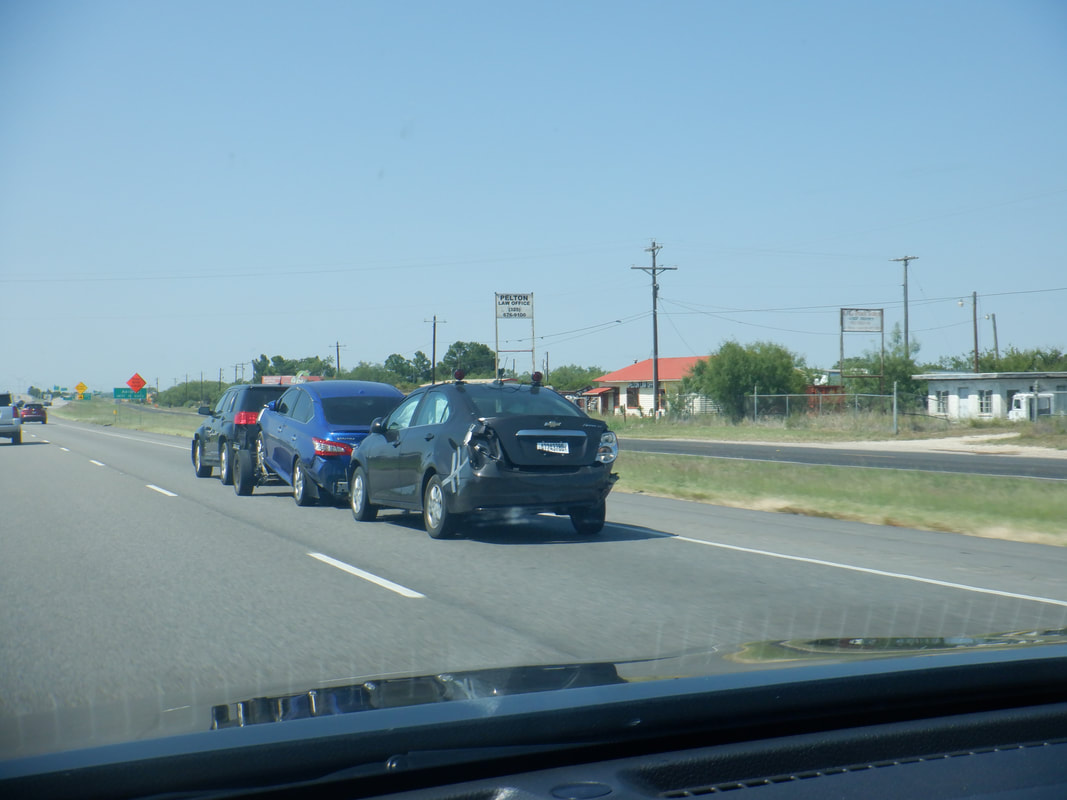 I think in AR or TX, I noticed a few examples of the above. A car pulling a car pulling a car. Passing through.... 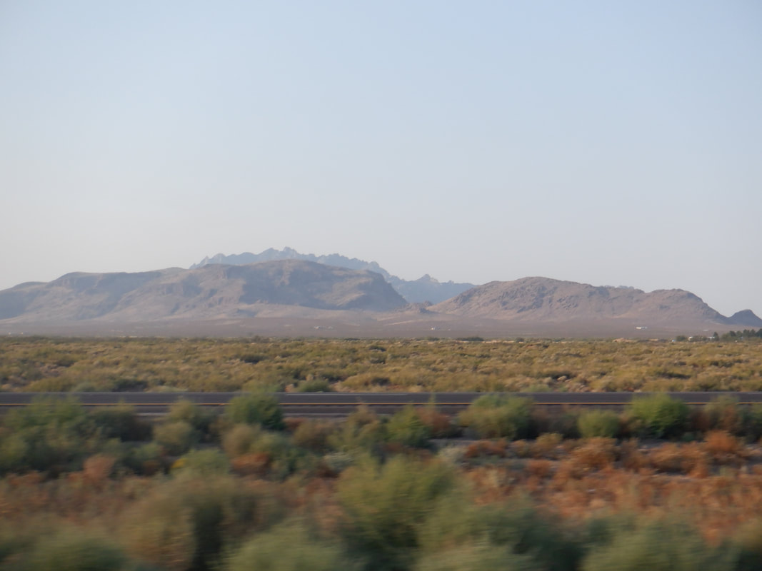 ....western NM and eastern AZ, I spotted distant mountain ranges and wondered if there were trails that led to the peaks but above all else, very glad to be back in Arizona. What a hot summer where the average number of days above 100 is 62 but this year, well over 100 days. The first 4 days of October, the high has been 13 degrees above normal and still hitting 100. But 100 degrees, in our low humidity, isn't bad. Well, sorry for my absence but lots of hikes coming up.
|
