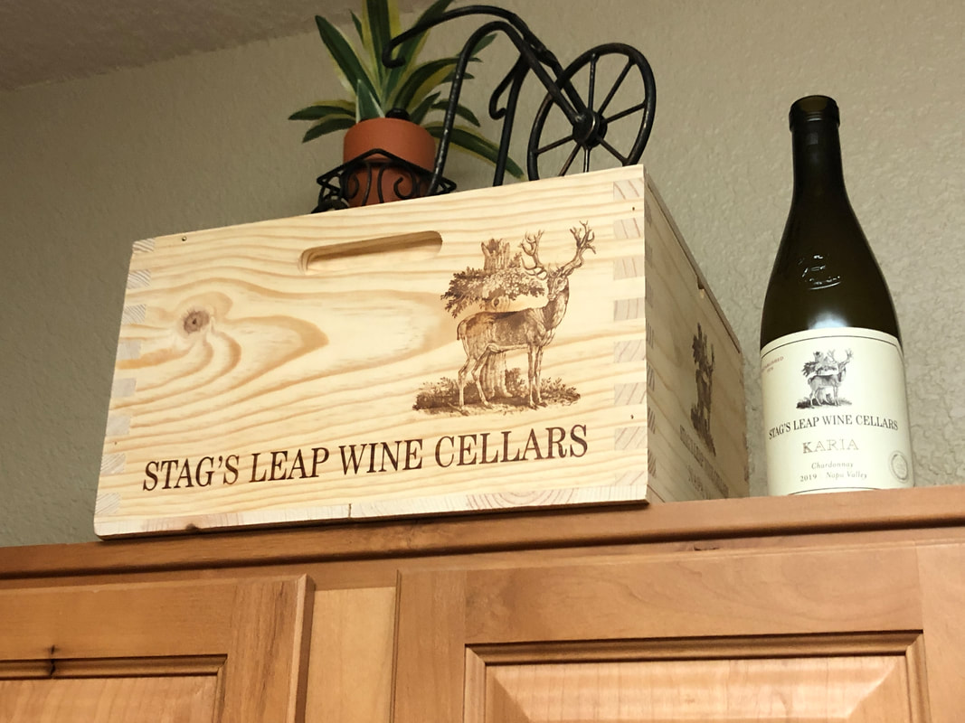
 My daughter, Olivia, assured me she sent a Christmas gift and so it finally arrived. Not just the wine but a nice wood package. Awesome! 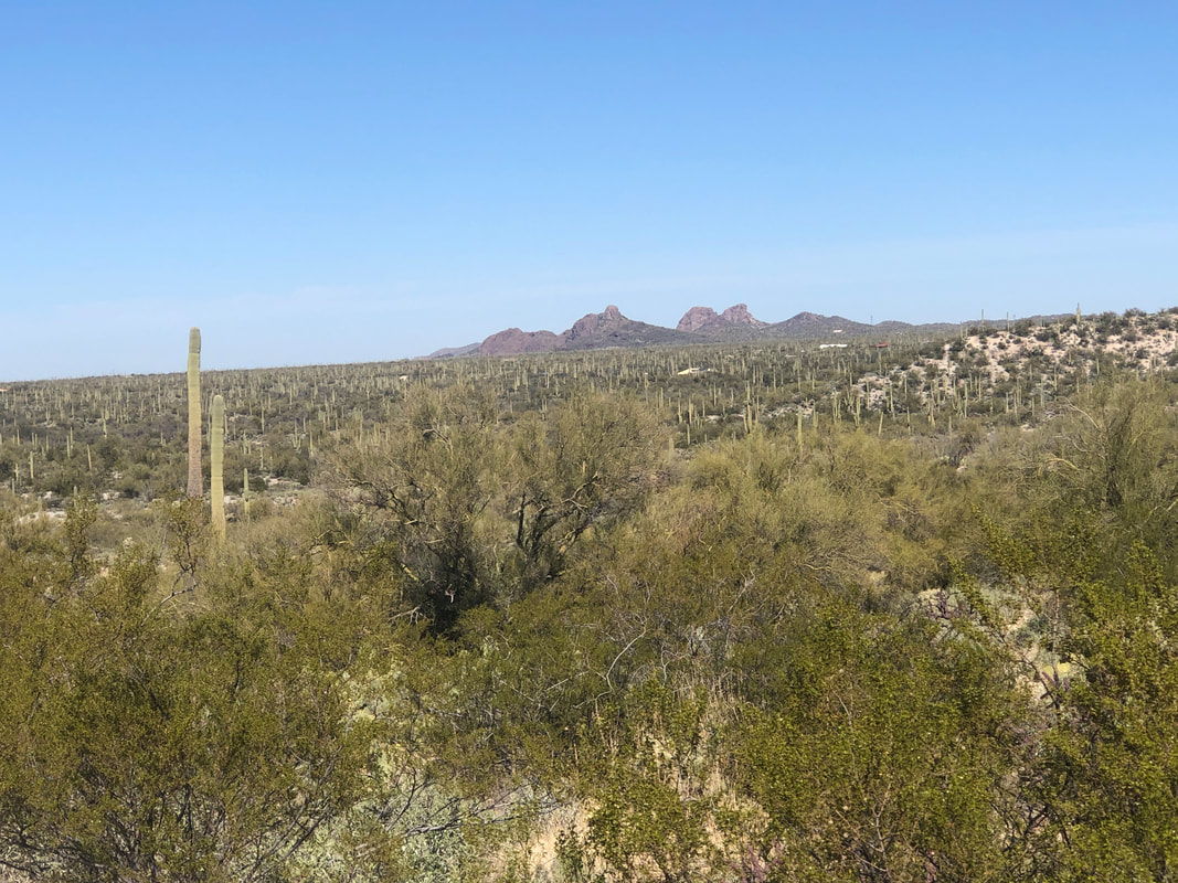 Amy bought a gravel bike and wanted to try it out so we headed to Marana and began a ride to Owl Head Butte. That's it in the distance. 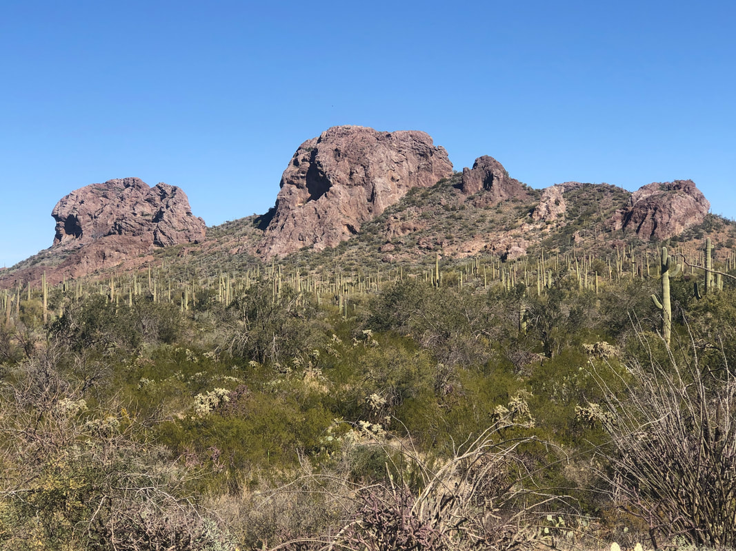 At mile 15, we arrive and enjoy the scenery. 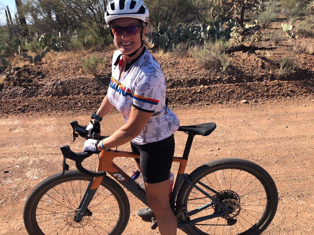 Amy on her new 3T gravel bike. She's happy with it other than the water bottle holders are so tight, it's really hard to withdraw a bottle from the holders. 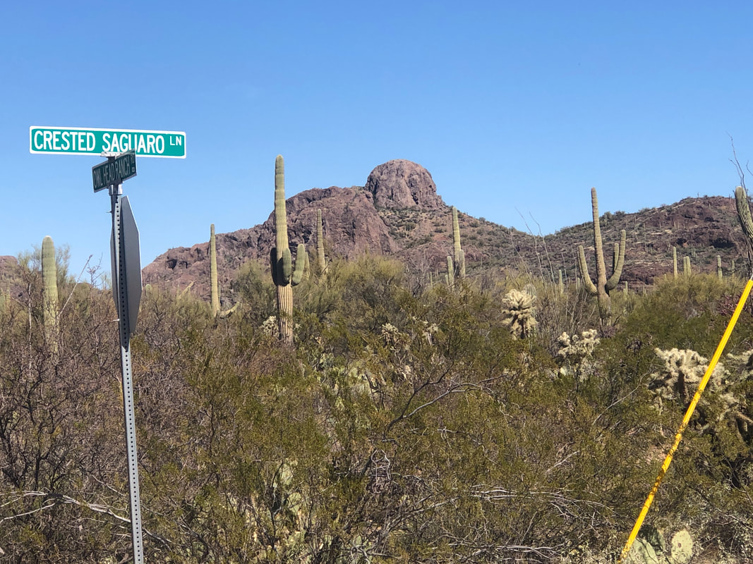 We reversed course and headed back while seeing a better view of the Owl's Head. Intrigued by the name of the dirt road, we looked for a crested saguaro but did not see one. 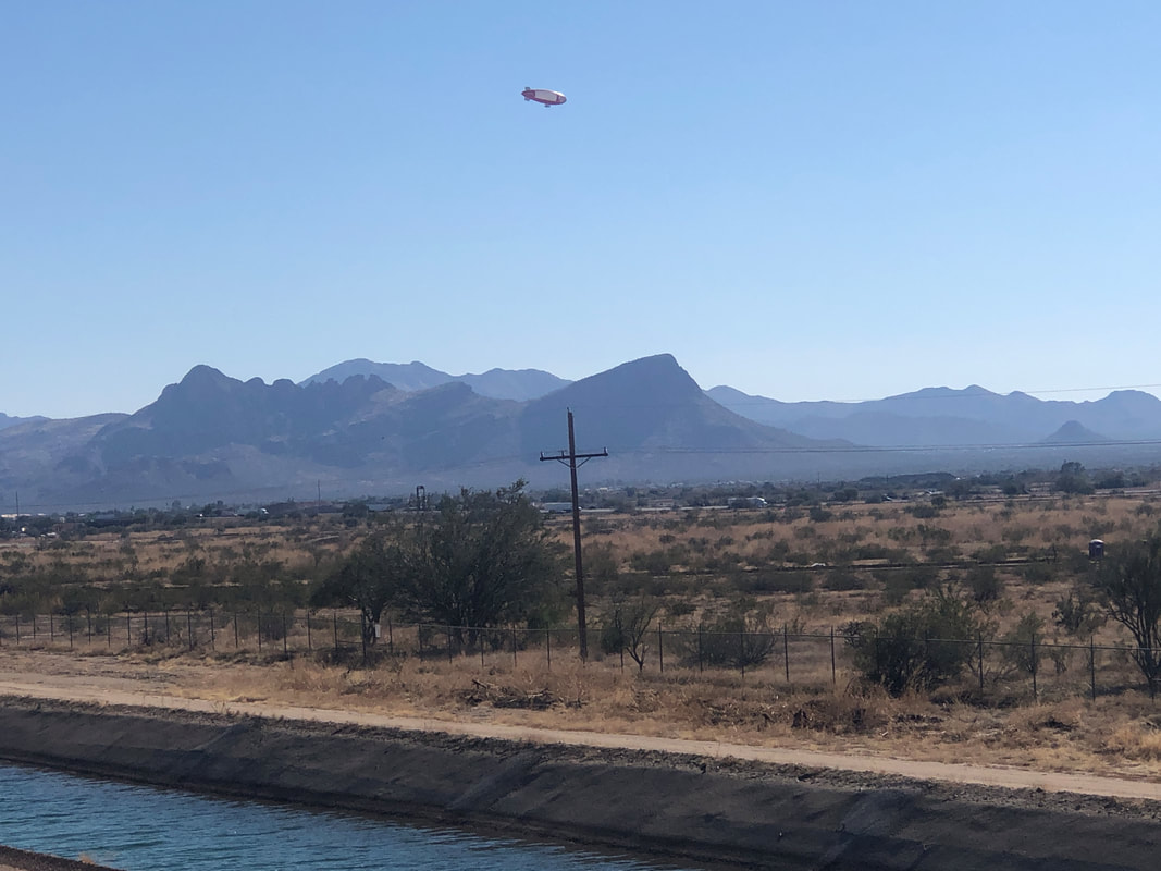 We reach the CAP canal and catch a blimp, heading west into a fairly strong head wind. Finished with 30 miles and a fun, first ride on Amy's new bike. 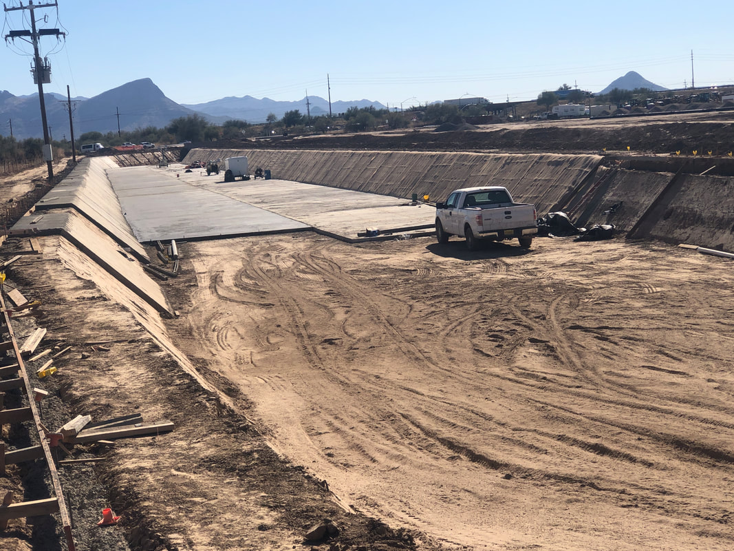 Looks like an extension is being added to the CAP canal.
0 Comments
 The gang of 11, gather 4 miles from the end of the pavement on Reddington Road. Amy and I were a bit late....well....we arrived prior to our 9am start but not early enough to gear up and begin walking at 9am. This makes me look stupid when I insist others be ready. I'll blame this on Amy, just because, ha, ha. 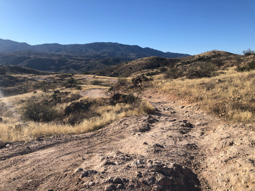 This is an unusual hike in that rather than follow trails, we mostly follow unmaintained, roads. The off-road crowd loves this area but for hikers, the path is kind of rugged and in places..... 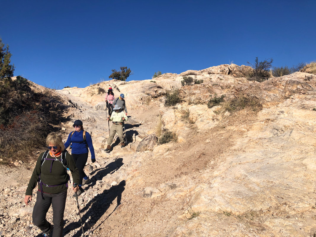 ....steep! 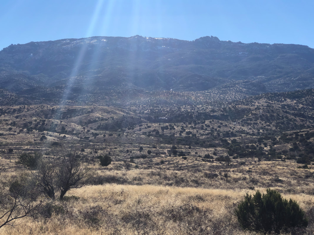 Mica Mountain in the distance but is that mica glowing in the early morning sun or snow? Had to be snow to feed the streams/washes by which we hiked. 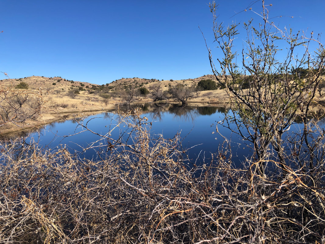 At mile 2, we reached a pond and then took a short foot path to another road while passing under..... 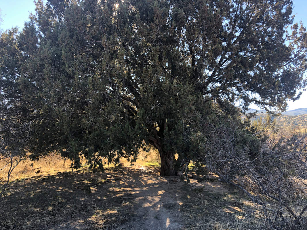 ....a huge juniper tree. Upon reaching a junction or two, Mark and I checked our gpx routes, debated how to proceed and settled on the correct direction. We crossed.... 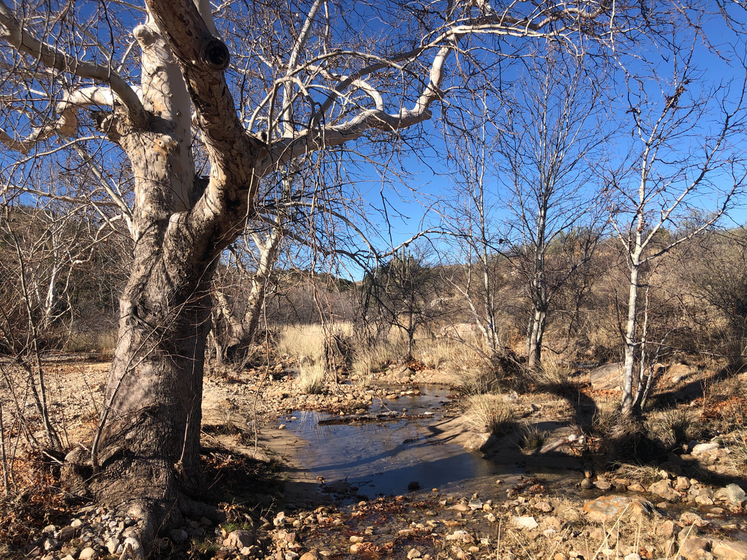 ....Tanque Verde Canyon. Nice flow of water..... 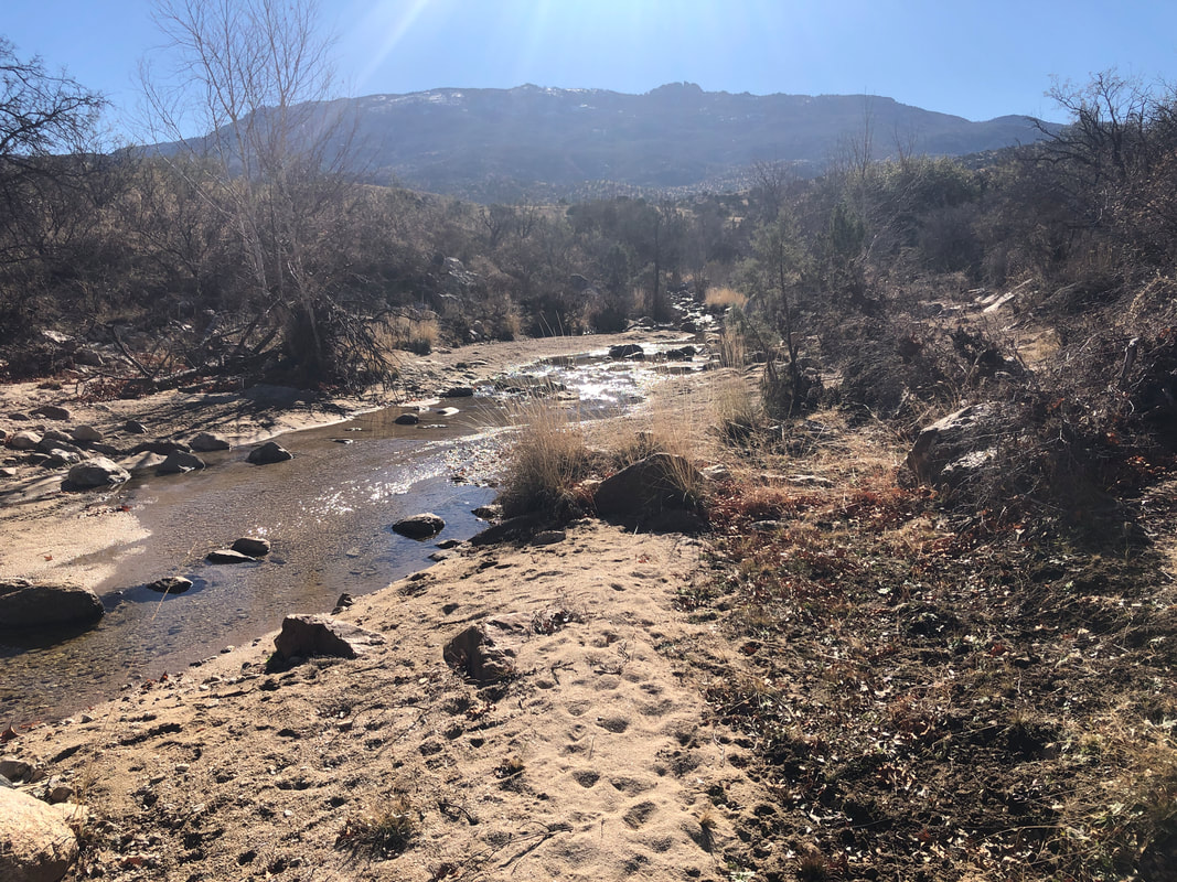 .....through here. After about 4 miles of kind of boring dirt road walking, we round a turn and.... 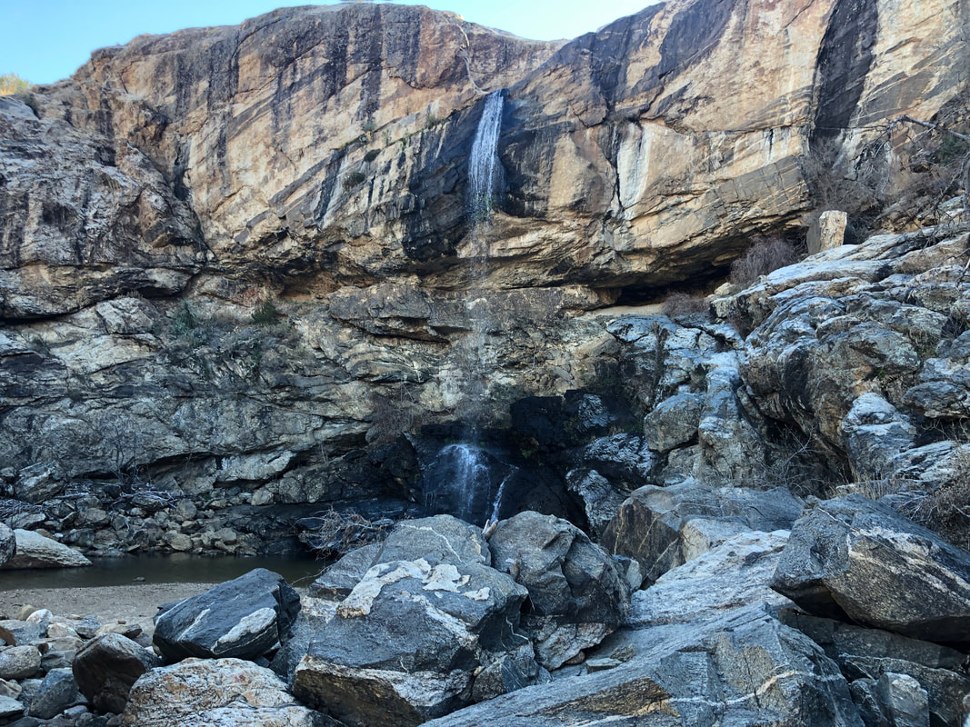 ....whoa, ok, this makes the road hiking more than worthwhile. Spectacular! The final 100 yards of our hike is mostly.... 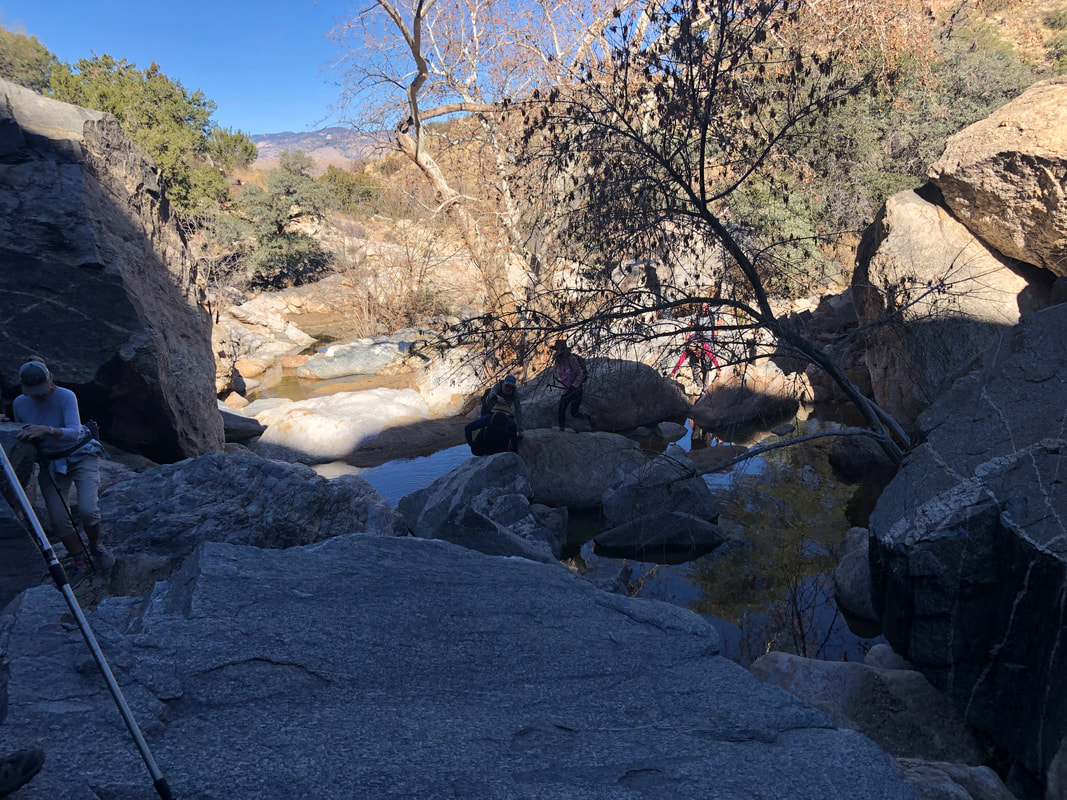 ....boulder hopping as I look back and see how the others are progressing. 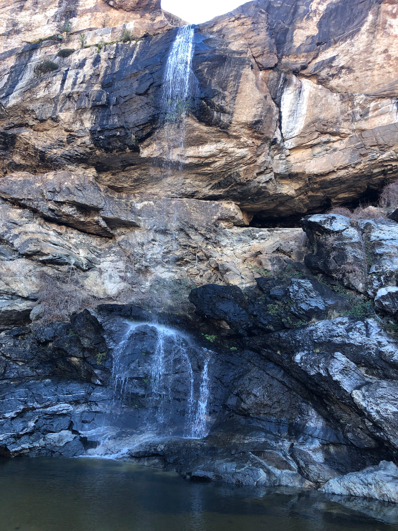 There is a shallow pool at the base of the falls and what a good place to luxuriate if only the temps were warmer. In the shade at about 60 degrees, too cold for today. In the image above, right of center, a cave! 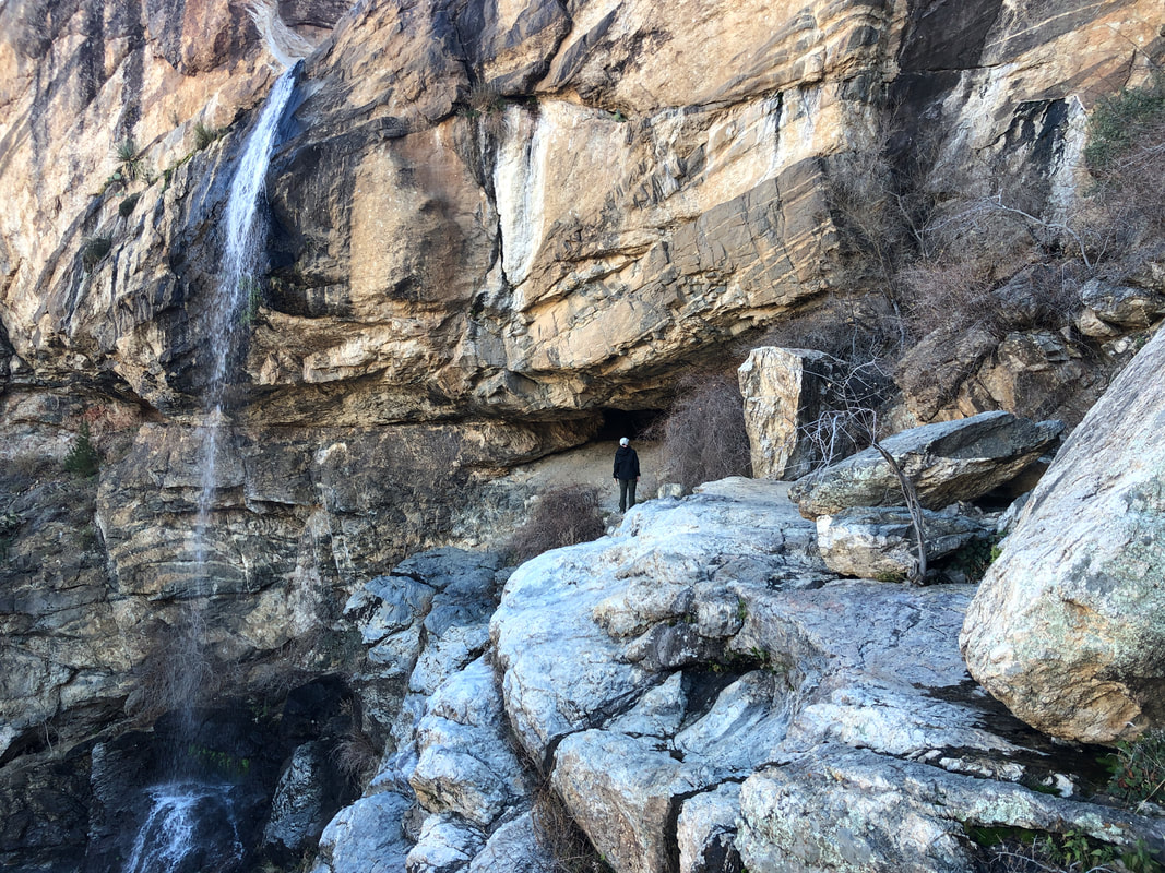 Most of us climbed to it and got a close-up of..... 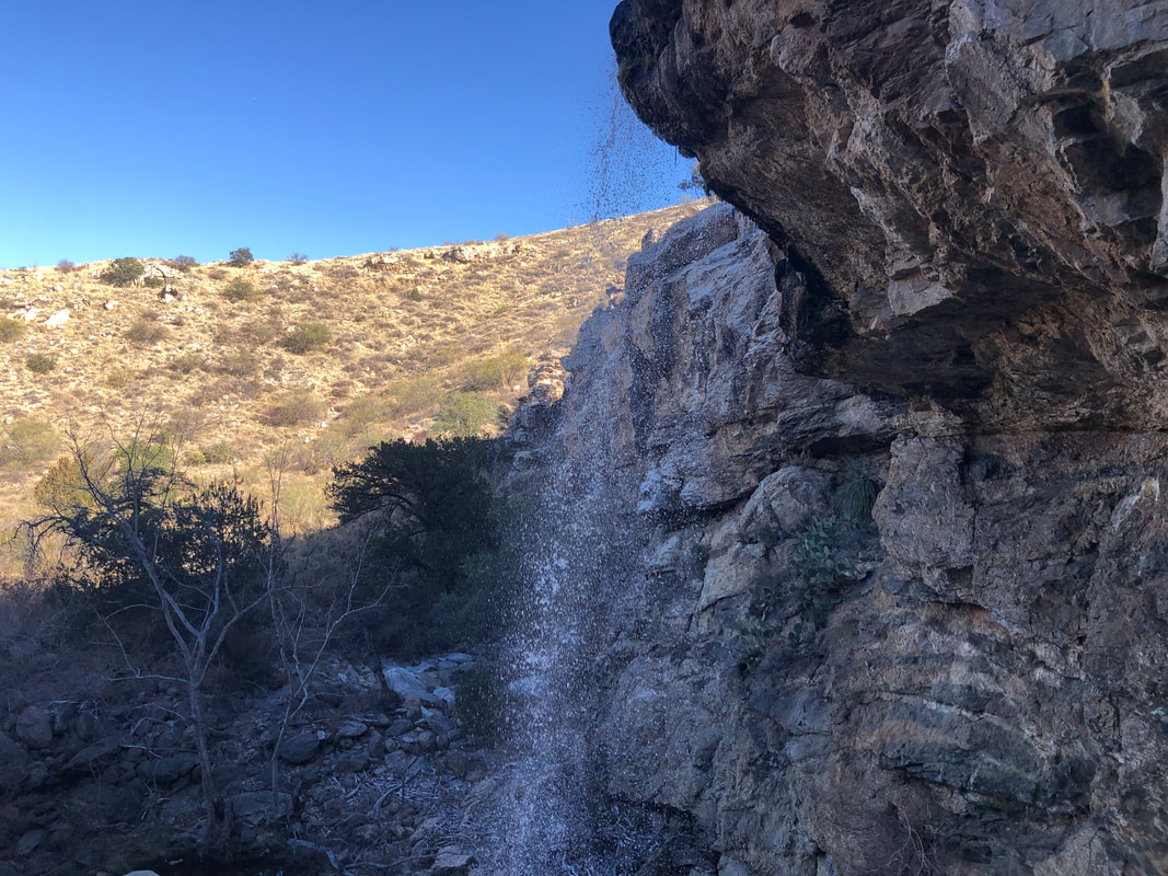 ....the top of the falls as it tumbled off a ledge. Then, some of us found a nearby slope, scrambled up it and emerged.... 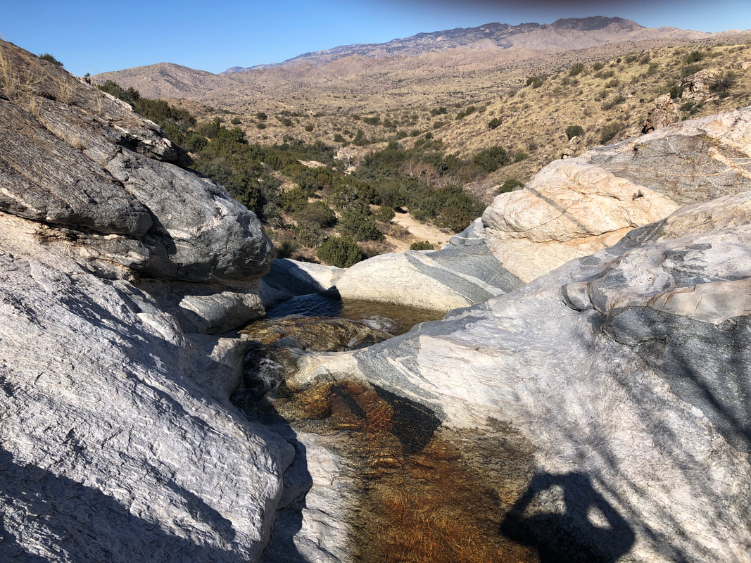 ....above the falls. Poking around a bit, there was no place where you could stand directly above the falls and look down but.... 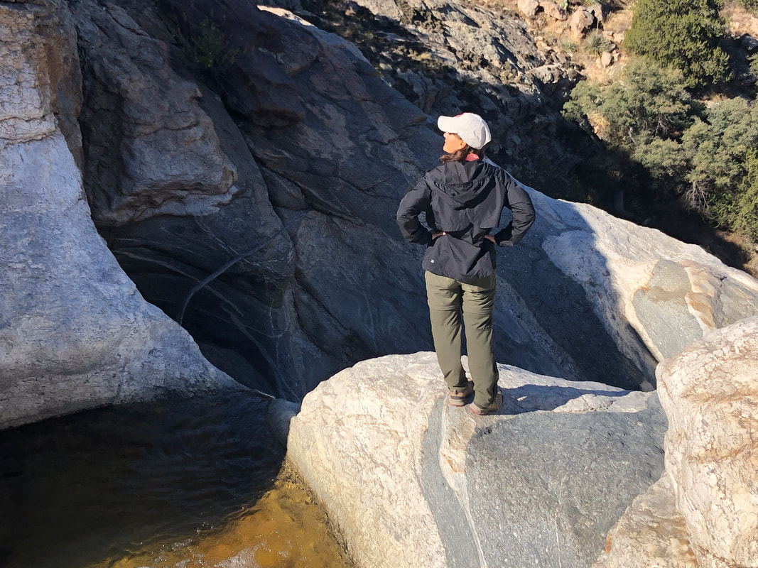 ....Lorna, aka, Spider Monkey, got about as close as anyone, along with Hilary. We worked our way back down, took a quick snack and headed back. 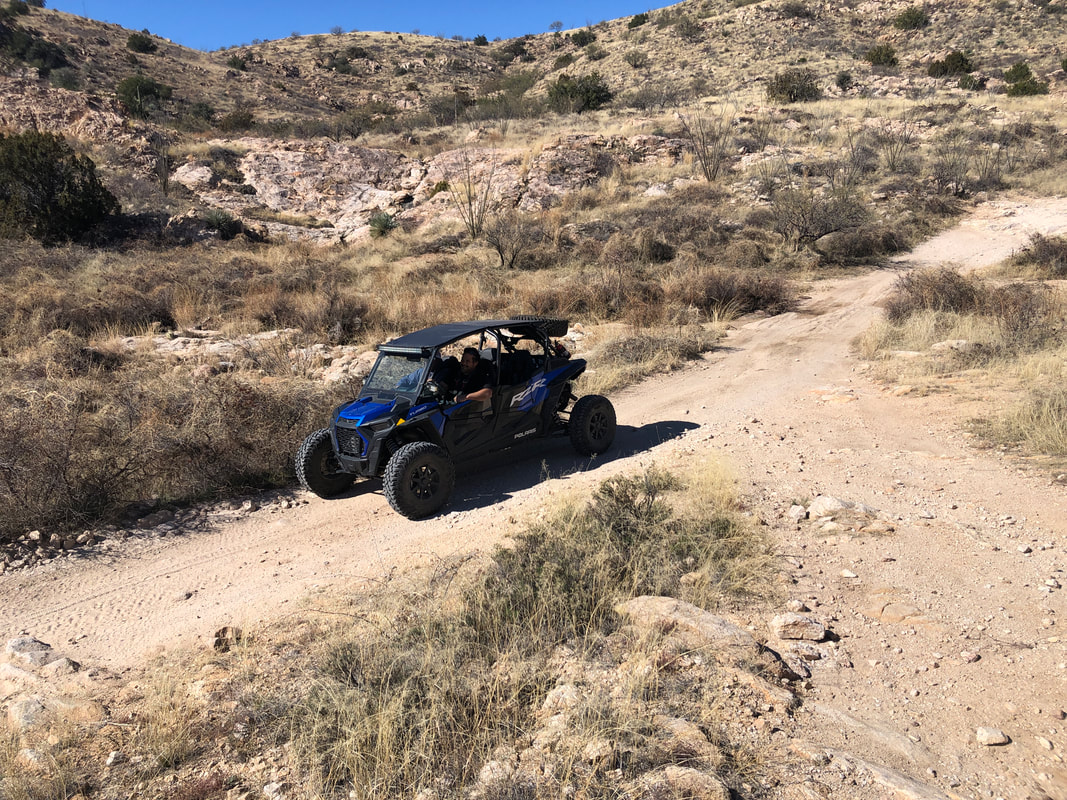 A RAZAR passed us but it was the only vehicle of its type that we encountered today. I understand the weekends are particularly busy with that traffic. We finished with 9 miles and 1100' of climbing.
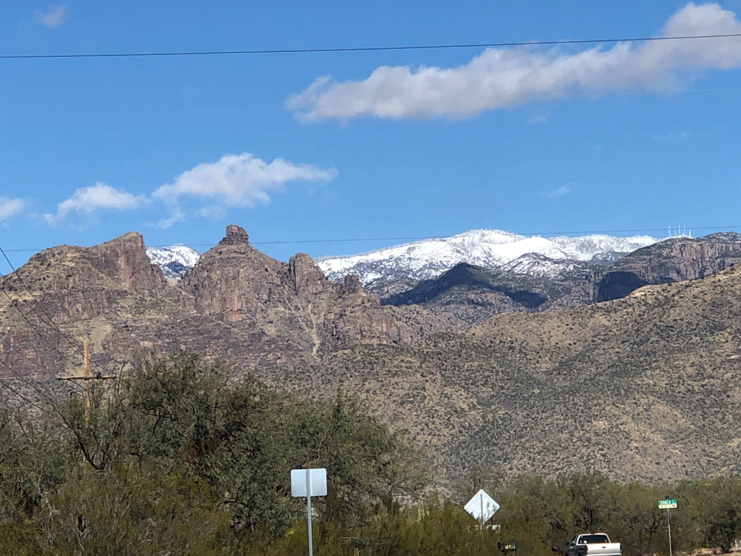
 The day prior to our Saturday hike, I considered canceling due to a 20% chance of rain. OK, in the midwest, a 20% rain chance means there is a 100% certainty it will rain. Out here, 20% is 20% but the closer one is to the mountains, the chances increase. And so it would be true today. Amy and I drive to the trailhead where the rising sun illuminates peaks. Our destination on the left and In that mass of rock is the Window. 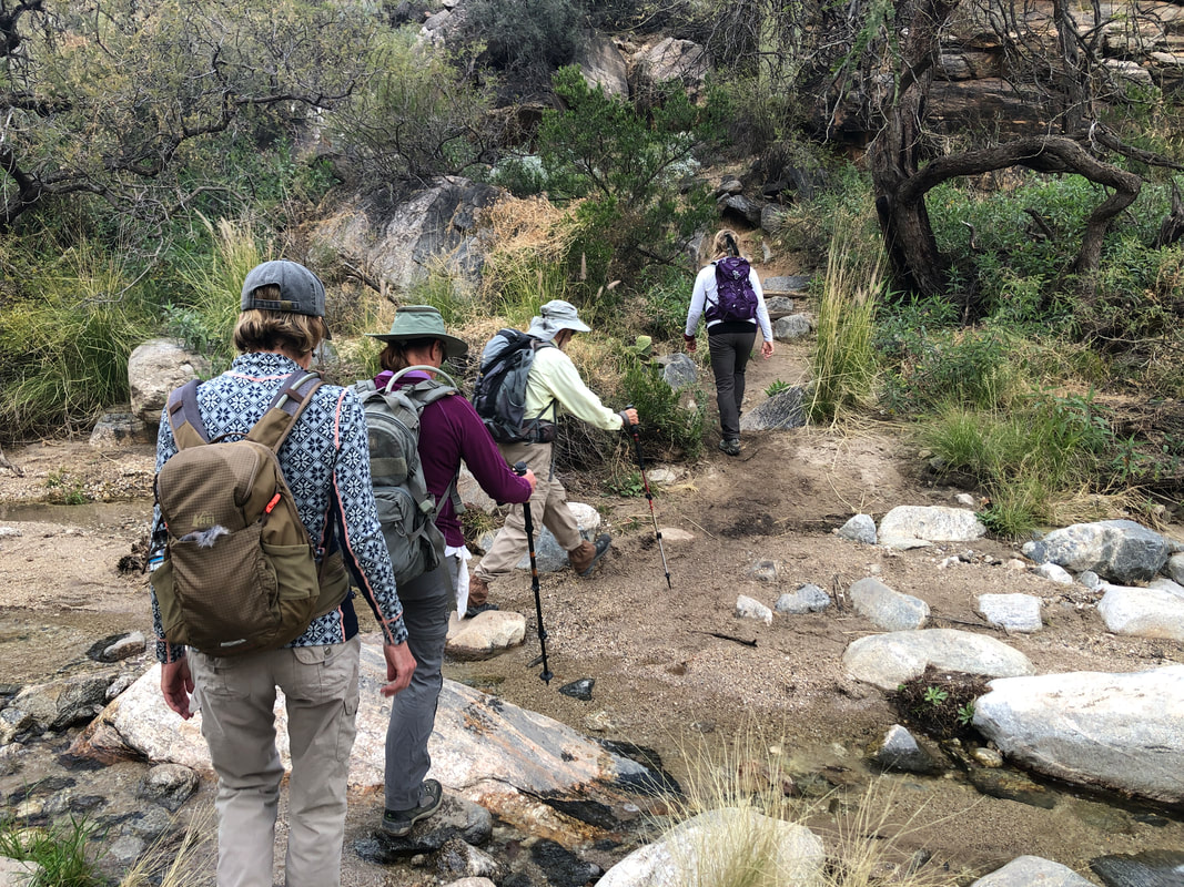 Our group of 10 arrives, gears up and starts a little late, entirely my fault as I mispositioned the "map pin". on the hiking site I use to announce hikes. We begin our hike on the Ventana Canyon trail which requires several stream crossings as we make our way up canyon. 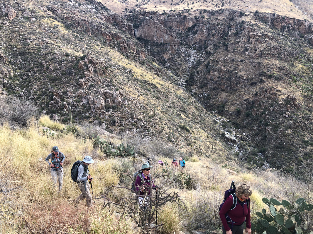 Then the climb steepens, significantly. We eventually reach a saddle, drop down a bit and pass the Maiden Pools. This 2.5 mile distance to the pools is a popular destination so the trail is well worn. The trail above the pools.... 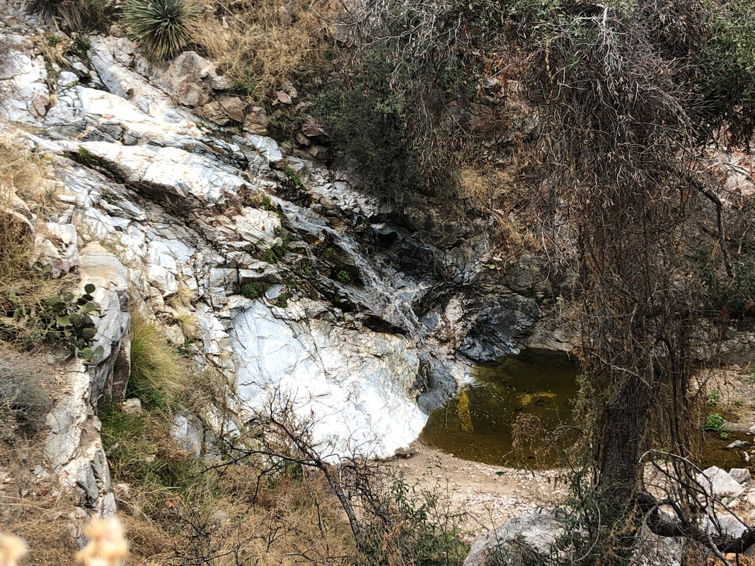 ....was surprisingly easy to follow given the Bighorn Fire and heavy monsoon of last summer that inspired thick new growth of vegetation. While the Maiden Pools is the most popular spot, there are many other waterfalls and pools that would be fun to visit....on a warmer day. Today's high in the valley would "only" be 64 while higher up, where we were headed, the temperature would be much cooler. 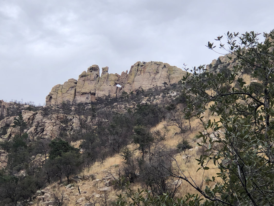 At about mile 4.2, we get a good look at the Window! Looks kind of small but the opening is huge when once inside. 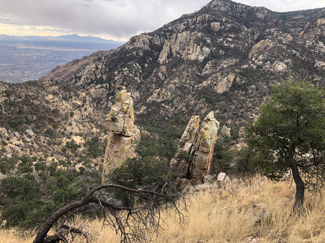 I had told the group that once we are even with the top of a spire (shown above), we are almost at the top of Ventana Canyon. And so we were which had.... 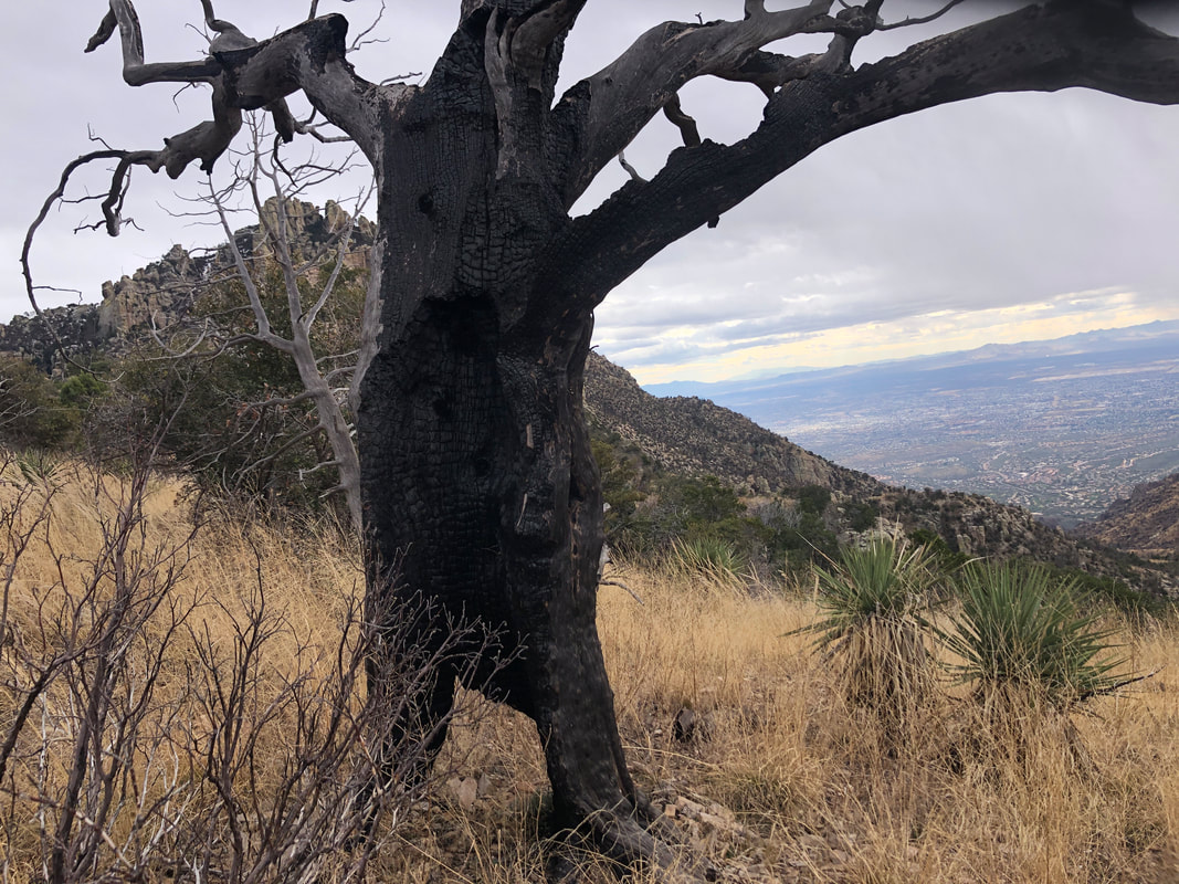 ....lots of examples of the remains of the fire of 2020. 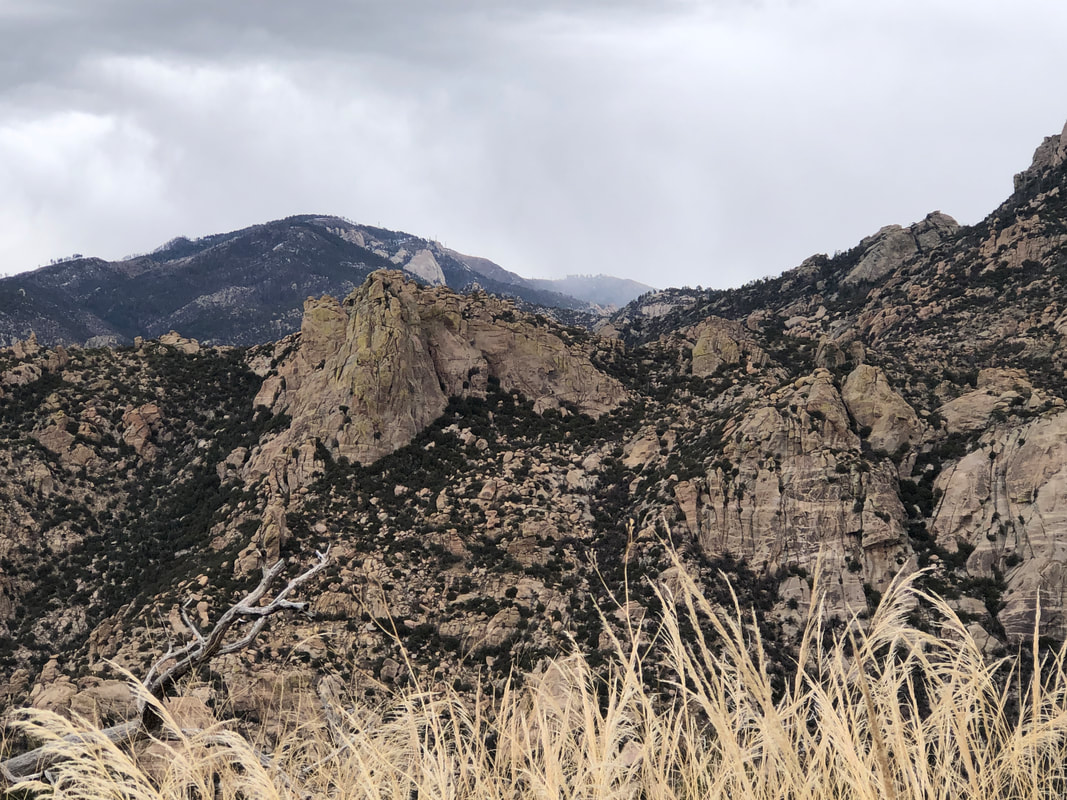 In the distance, it appeared it was snowing around Mount Lemmon. Clouds had gathered, thickly, around us too, so it was only a matter of time before we would become wet from snow or rain. 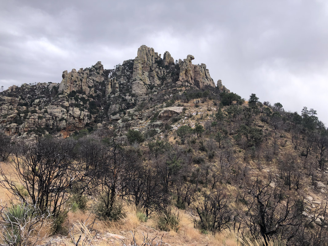 Reaching the saddle, even with the cloud cover, we had grand views as we are now on the Esperero Trail, following a ridge toward a rock formation that houses the Window. The "nose" of rock, pointing right, slightly right of center in the above image, is just above the Window. So, a little more climbing required. 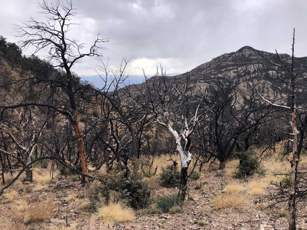 So many trees blackened and dead from the fire. Mount Kimball in the distance. At last.... 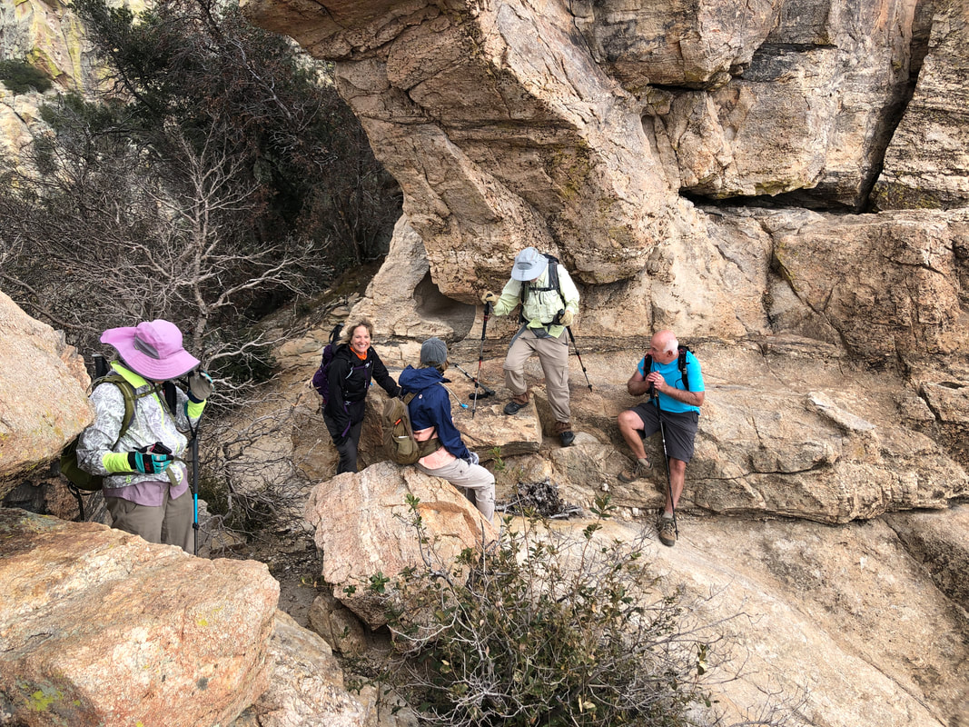 ....we reach the Window. The wind was blowing, the temperature was in the low 30's or upper 20's so many of us retreated to seek shelter behind a wall. The exception was Marc G., on the right, who is impervious to the cold as the rest of us wore gloves, hats, jackets, etc... 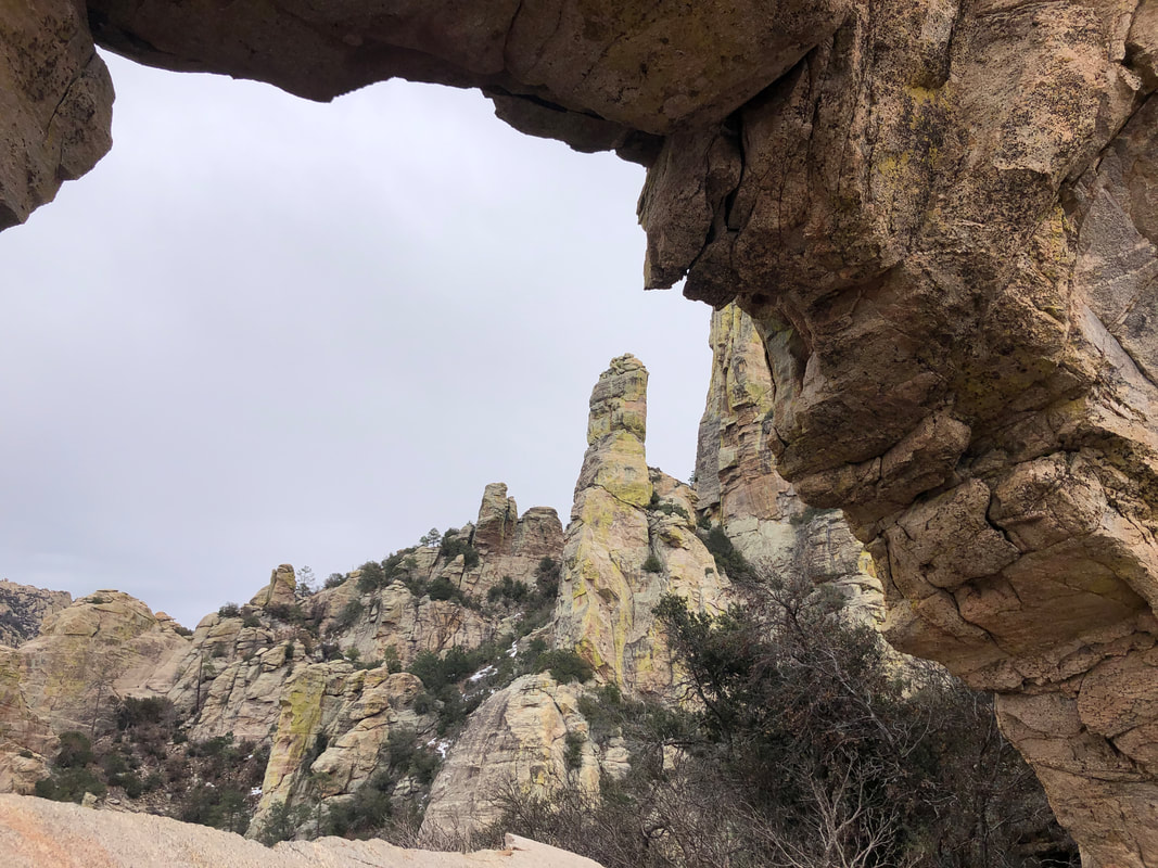 Through the opening I could see Window Peak but none of us had the appetite to continue on to that as a secondary destination. I've been there only once and it is kind of tricky navigating to the top. 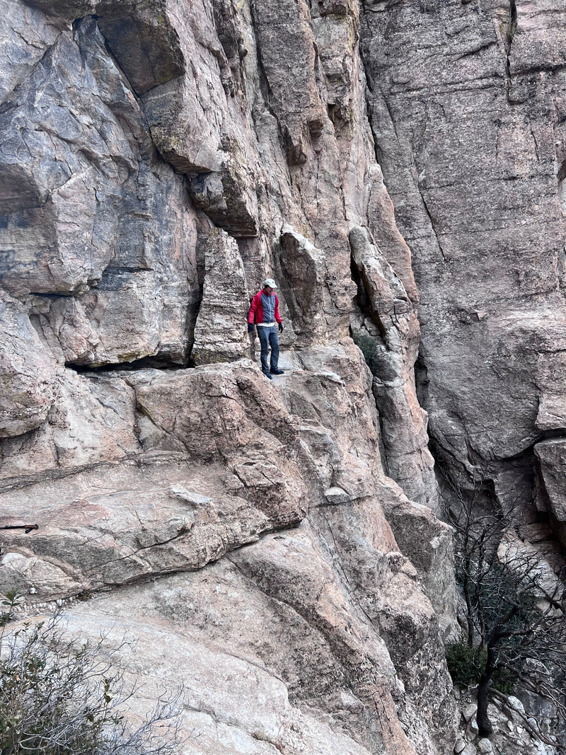 Marc took the above image of me. I ventured as far from the opening as I thought was safe. The exposure is not as bad as it appears although I like the fact that it appears "scary". Maybe I should send this image to my mother. 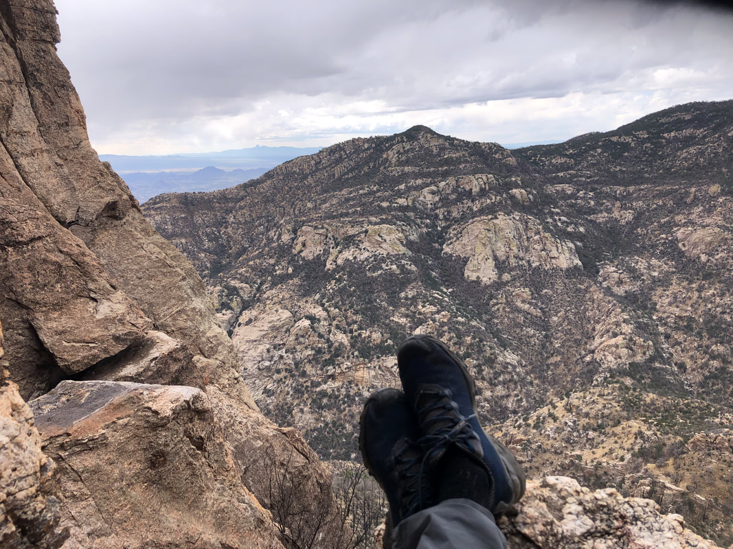 I sat, legs extended, enjoying one of those, "it's good to be alive" moments. For most of us, it was too cold to enjoy the opening of the Window so we did not linger for long and began.... 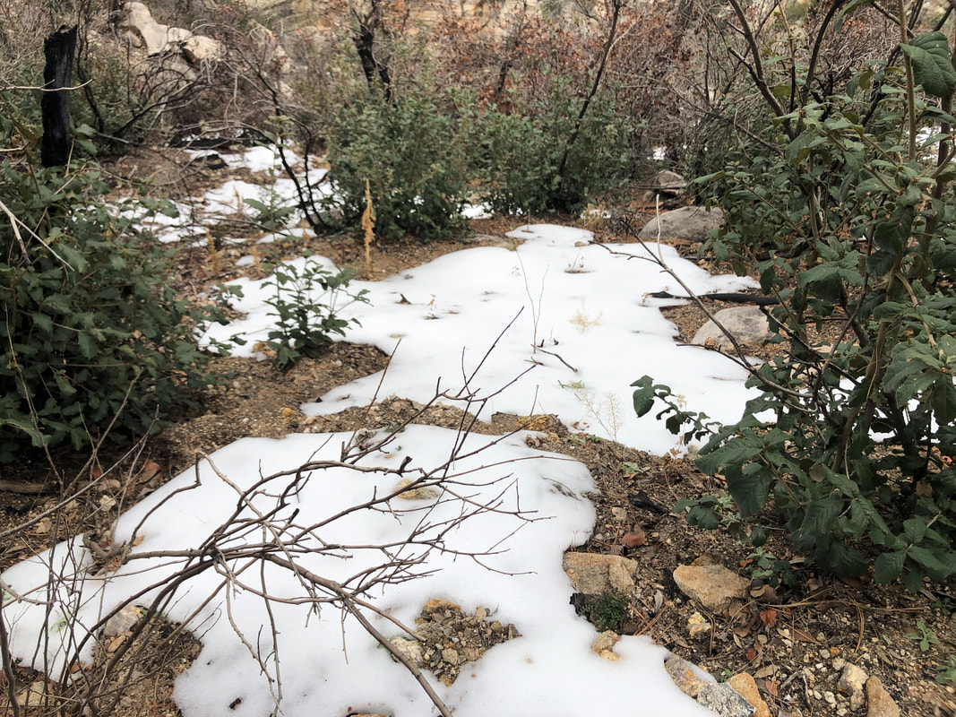 ....the descent which included passing a few patches of snow. The elevation of the Window is about 7000' which is almost 3000' below Mount Lemmon where there is much more snow and 4-6" forecast for today and tonight. 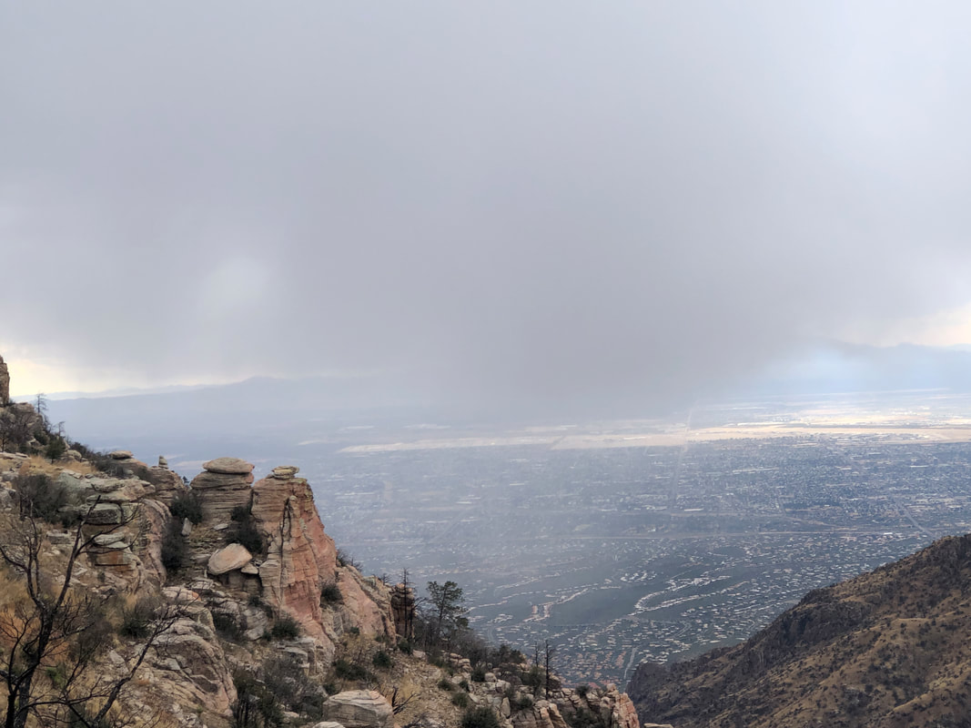 To the south, we could see precipitation approaching and wondered, would it be snow or rain....  ....the wind roared through the pass as it brought in snow. Later, Amy and Katherine dubbed it the "Blizzard of 2022"! We were glad it was snow rather than rain. Once we got off the ridge, the wind abated as we.... 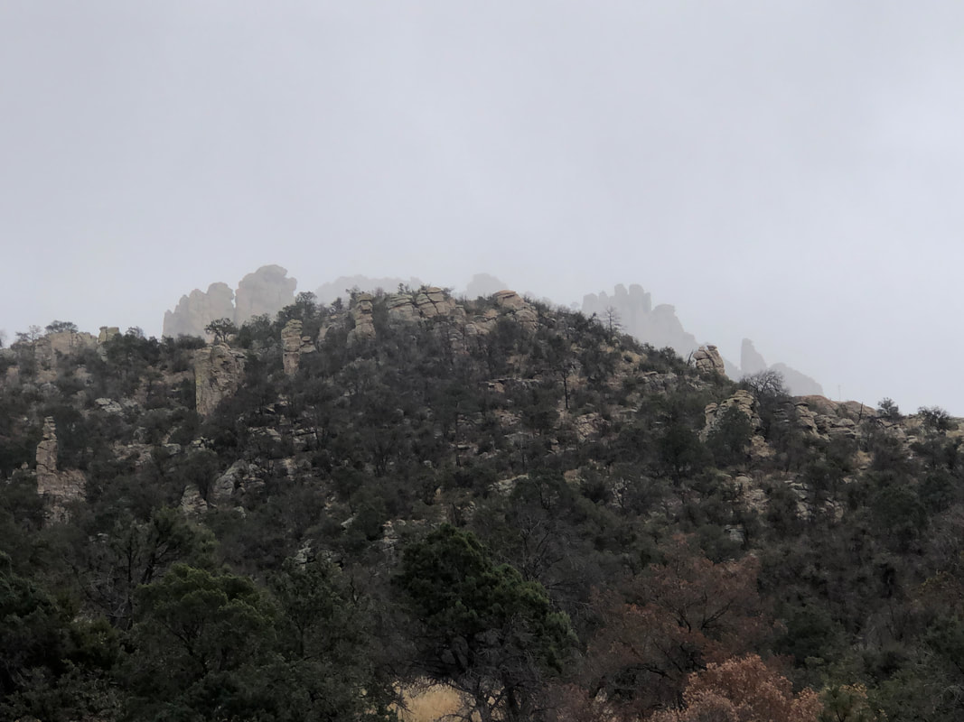 ....continued down canyon with the rock formation we had left, barely visible through the snow. So, there we are, descending when we begin to hear screams. I was skeptical, attributing it to kids climbing on the other side of the canyon but in fact, it was a hiker in distress. He was yelling, "Help me!" over and over and even after we shouted our replies, he continued to scream. Given his distance and surroundings, it was difficult to see where he was so we repeatedly asked him to stand and wave. Marc immediately descended to the bottom of the ravine, well up canyon of the hiker and then traversed the slope toward the him. I descended via the trail until I was below the hiker, found a crossing and headed up. 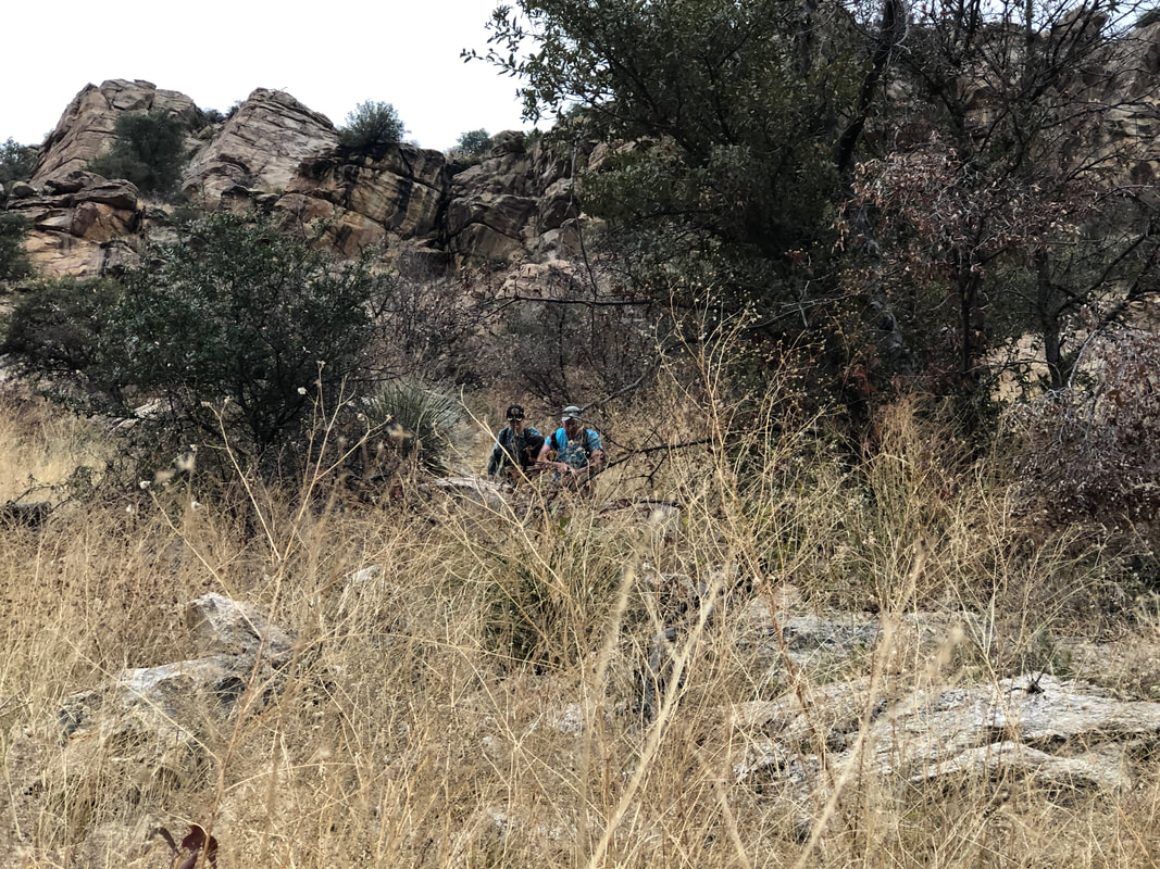 Members of our group asked if the hiker was hurt and he replied "a little". Marc reached him first and found the hiker, uninjured, just, well, terrified may not be an overstatement. It's a story too long for this format to tell about why he was, where he was but we led him down to the bottom of the ravine and then up to the trail where our hiking buddies were waiting. We had called 911 and before his cell phone died, the hiker had texted his mother stating he was lost and she too had called. As we hiked back with the hiker, his parents arrived and soon thereafter, a team of 3 from SAR, then a team of 5 then a team of 2 more. He was well cared for so.... 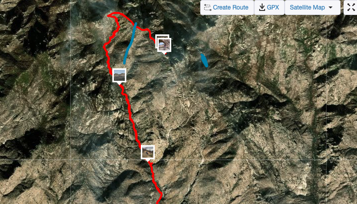 ....we resumed our merry descent. Above is our track to and from the Window, shown in red. The longer blue line is how I think the lost hiker reached where we found him. He had gotten off trail and kept hiking but at least stayed to the left of a ridge and within sight of the bottom of Ventana Canyon.  Another hike, another adventure. We finished with a little over 13 miles and 4000'+ of climbing. Tough hike.
 I belong to a gravel riding site where someone posted a 30 mile route that included a visit to petroglyphs on the east side of the Tortolitas. That sounded like fun so I drove to Catalina and jumped on my gravel bike on East Edwin Road. 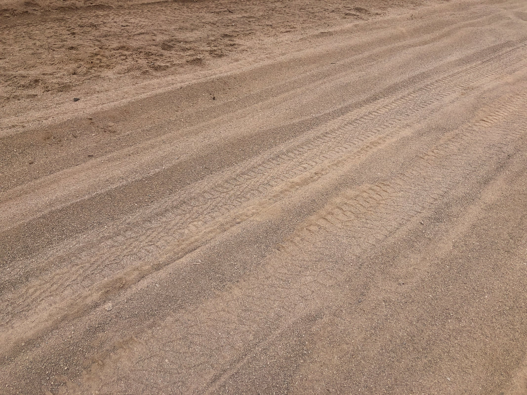 Soon I encounter a deep, sandy section. My tires are not wide enough to plow over this surface, sinking in instead so I have to walk. 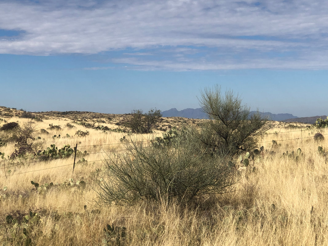 I head north, circle a power station off St. Rt. 79 and get a good view of Newman Peak. 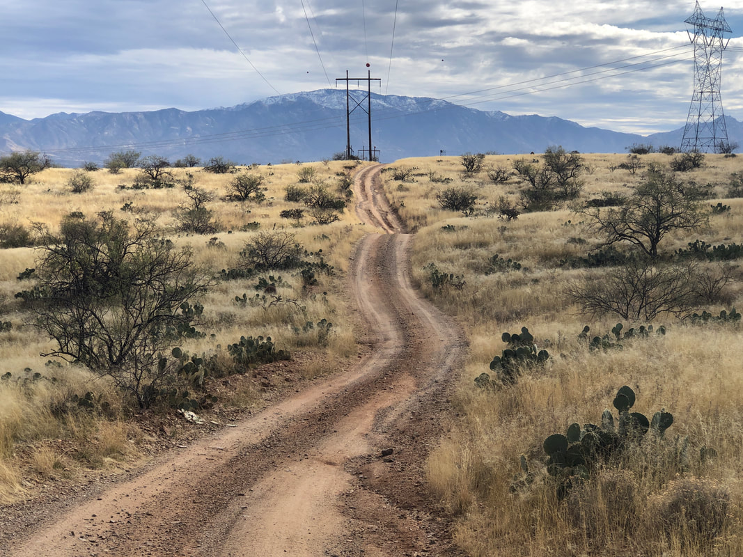 I retrace my route following a good section of road with Mount Lemmon in the distance. Beautiful. I hang a right on Cochise Springs Rd and follow it for 3 miles. Way too many sandy sections so am forced to walk, a bunch, which sucks. Then my Garmin starts barking at me that I am off the route, then I got back on route but if the remainder of the loop I am following is similar to the 3 miles I have covered.....  ....so I turn around. Later, I realized where I happened to turn around is exactly where the rock art is and I missed it!!! Oh well. Did a couple of rides this week with the Cyclefit gang, which was fun as I ease into the start of an epic hike to the Window on Saturday
 Upon leaving the "paved" portion of Silverbell Road, we drive about 4 miles on good dirt before making a left turn onto a very narrow road. I should have designated how far onto the road we were to park and meet because when we arrived, our group's cars were lined up, stuck. It wasn't long before we got it sorted, cars pulled to the side and were good to go. 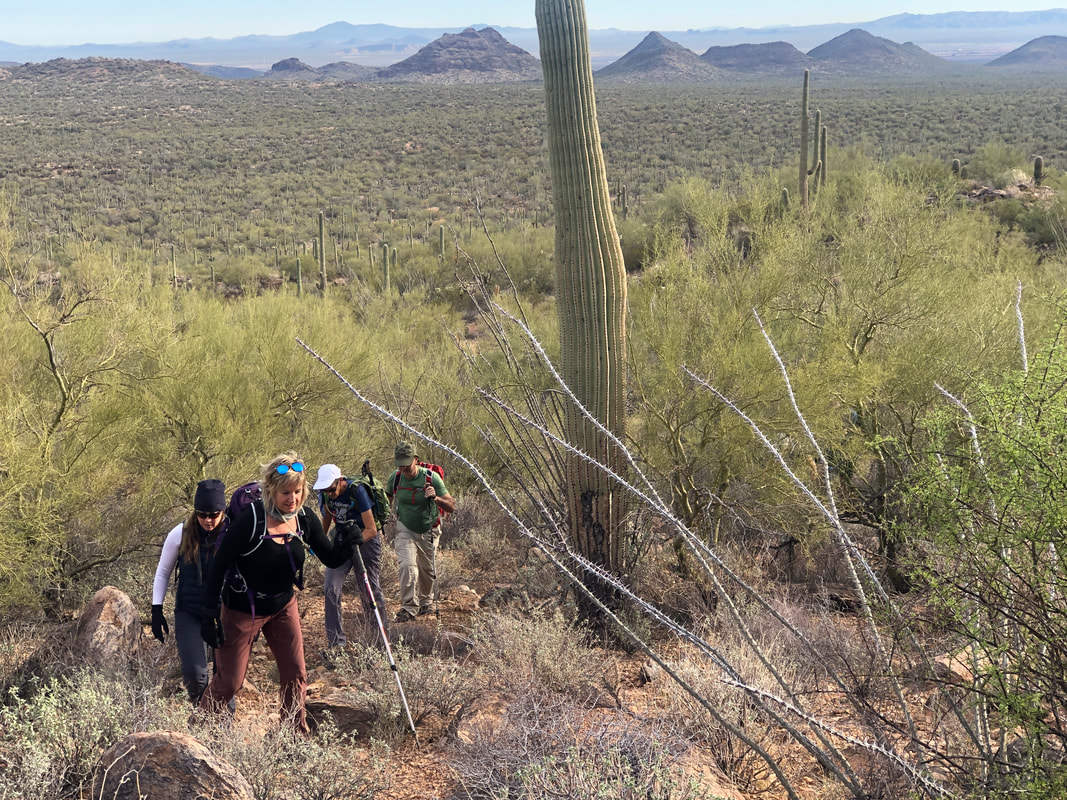 The first mile is a mild bushwhack across the slopes of the Silverbell Mountains on our way to Ragged Top peak. There is no trail through here, just spot the north gully, which provides access to the base of the peak and wind our way through the obstacles. Then..... 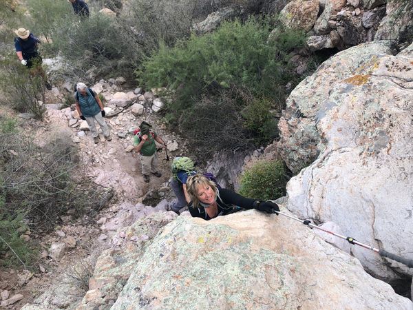 ....it becomes steep, really steep in places. A hiking pole is both a help and a hinderance. We are following a social trail which means it's not maintained, just enough people have hiked through to establish a faint, foot worn path. Well, where foot traffic could create a path. 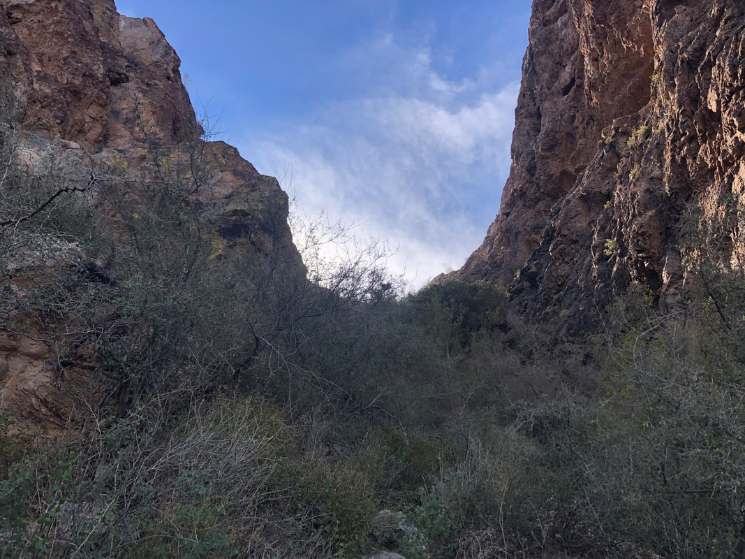 We slog our way upwards and everyone seemed to enjoy surmounting the many challenges. At last, our destination comes into view. Was it worth it?..... 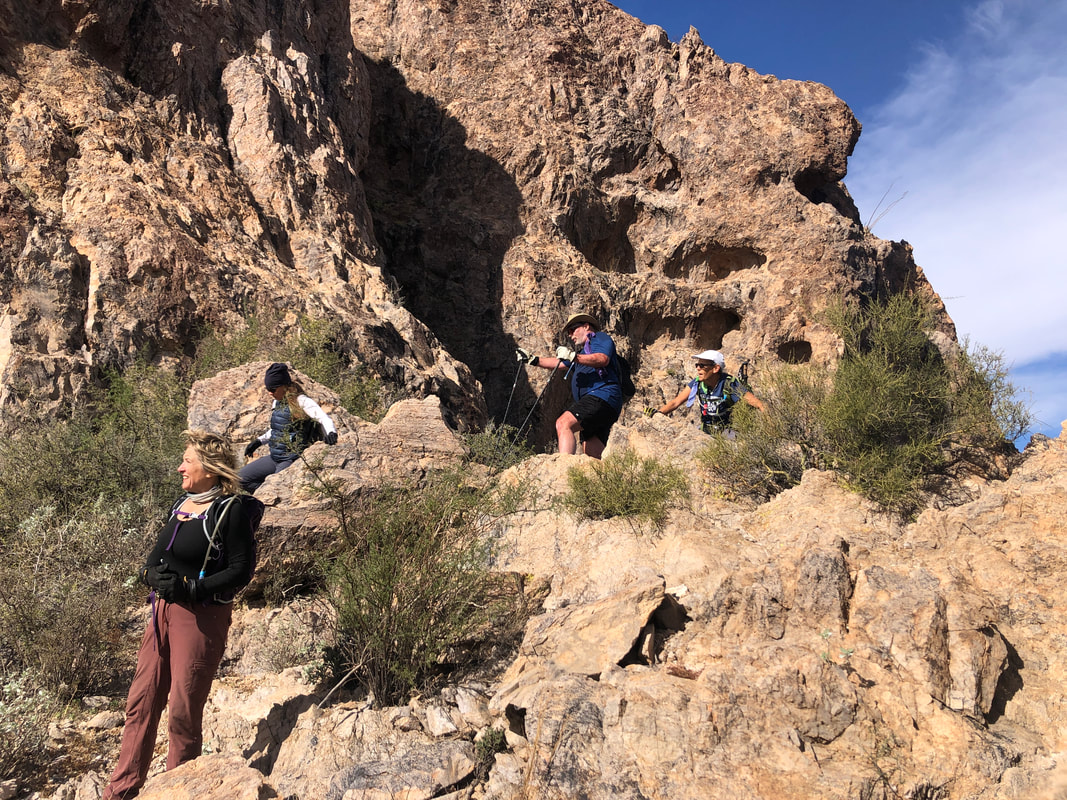 .....yes! Jaws drop, cameras are pulled and we all take images of what we see. 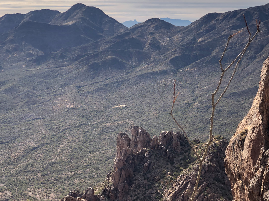 Beautiful but our work is not yet done. We make a left and climb steeply until..... 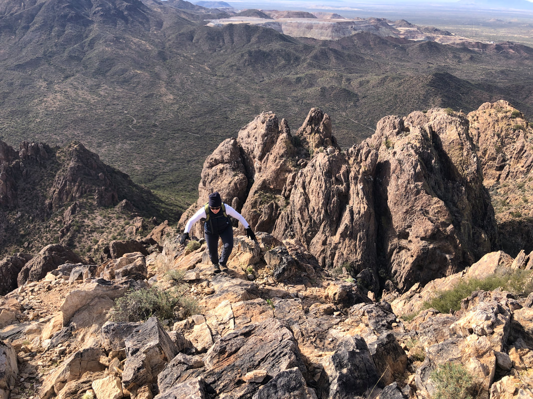 ....we reach the peak. Catherine balances herself over the final pitch with Silverbell Mine in the distance. Previously, I stated the mine was no longer a working mine but it was restarted a few years ago. In addition to copper, the yields of gold, silver, zinc, lead and molybdenum, over time, is impressive. 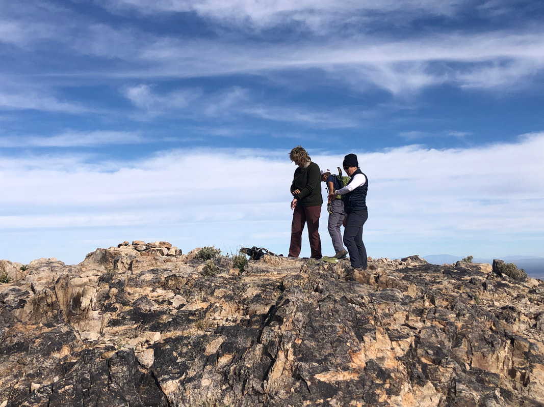 We arrive at the barren peak, drop our packs and celebrate our accomplishment as..... 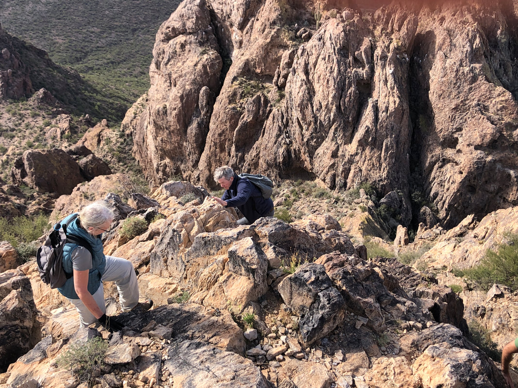 ....Nancy and Peter, two new members to our hikes, arrive. 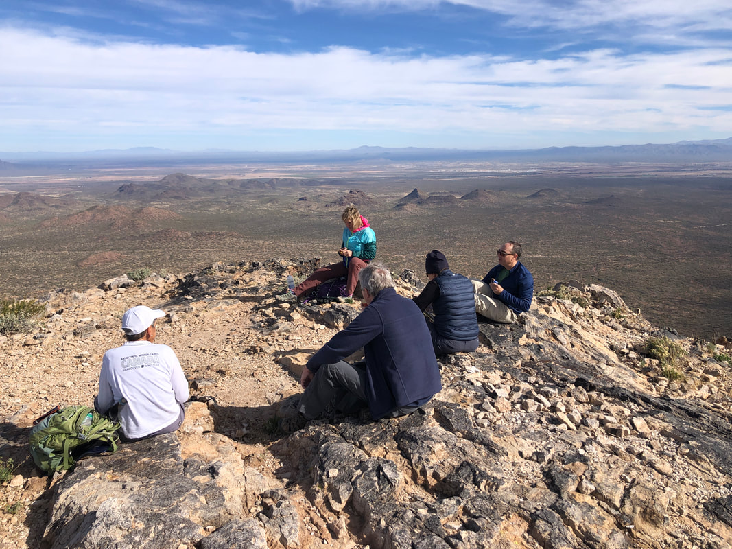 We sign the peak register, eat snacks, hydrate and.... 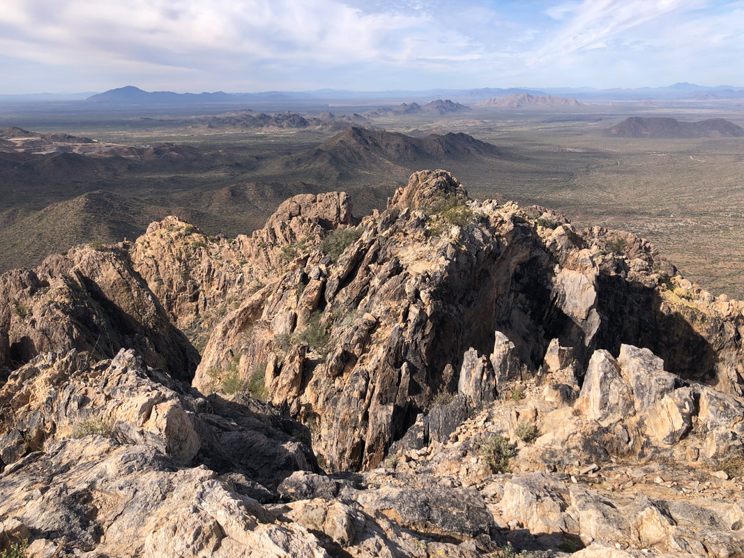 ....enjoy the magnificent views. The comfort of the break must eventually end so.... 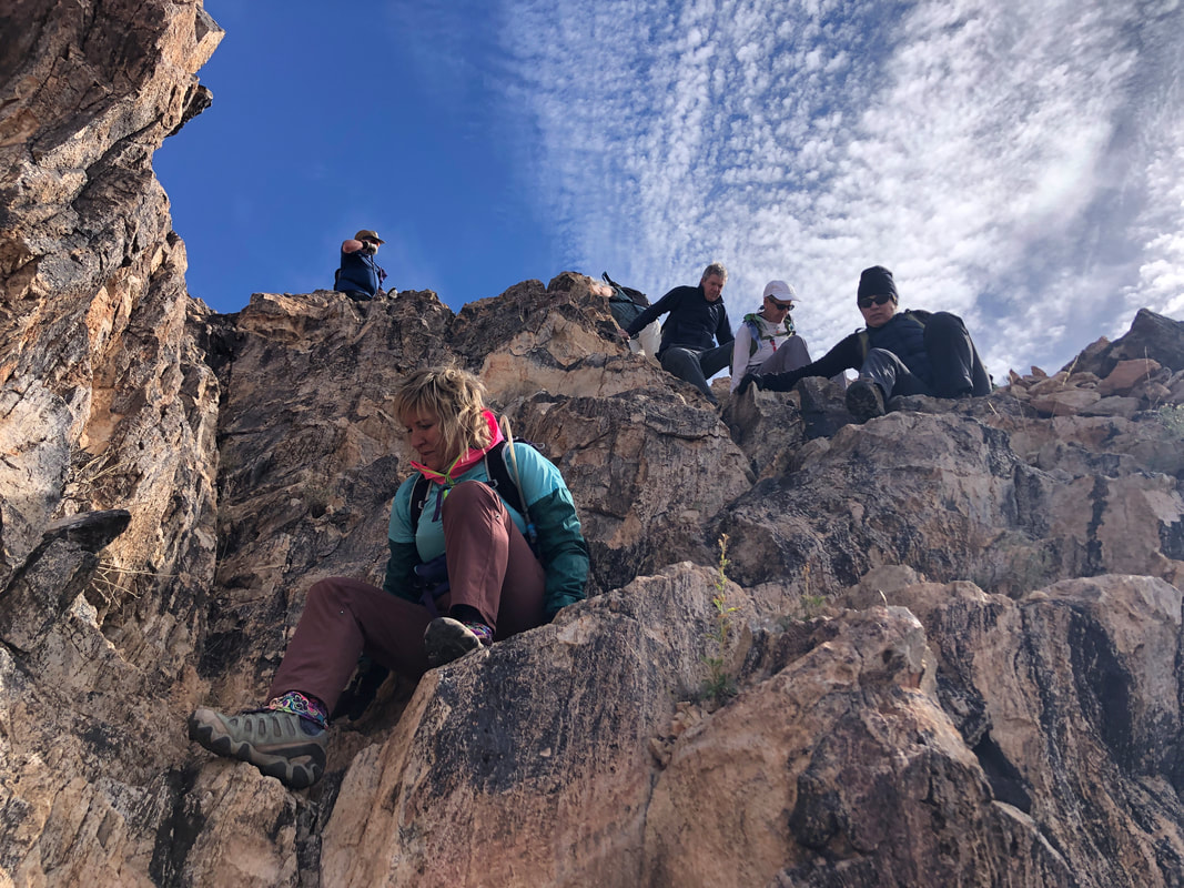 ......Amy demonstrates the down climb technique, referred to as "5 Point Hiking". 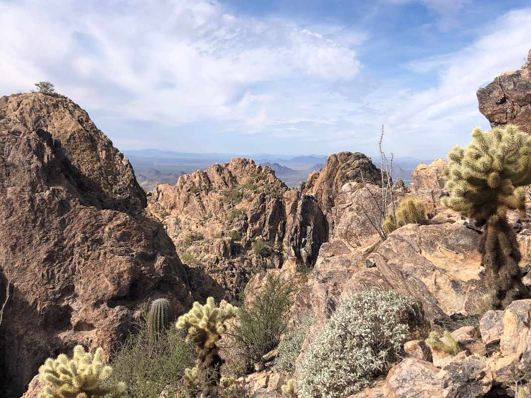 There is a large population of bighorn sheep in these mountains and I frequently scanned the adjoining peaks and crags but no luck spotting any. 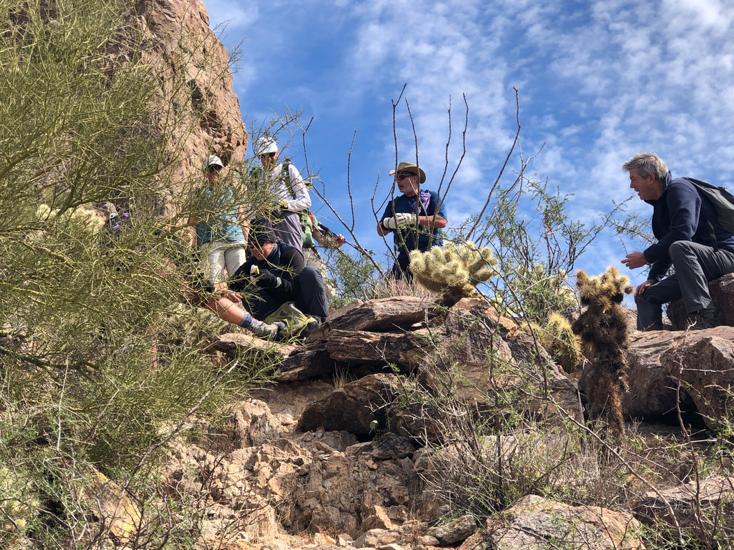 I was leading the way down, heard a yelp or two and watched as everyone gathers around Amy to watch or assist in the removal of cactus needles from her leg. The jumping cholla had snagged yet another victim. After a brief pause, we got going again and renew our descent, which is necessarily slow. We reach the bottom of the gully with relief and....  ....march across the slopes where we find a good example of a rare, crested saguaro. Our hike ends with around 2000' of climbing and 4 miles.
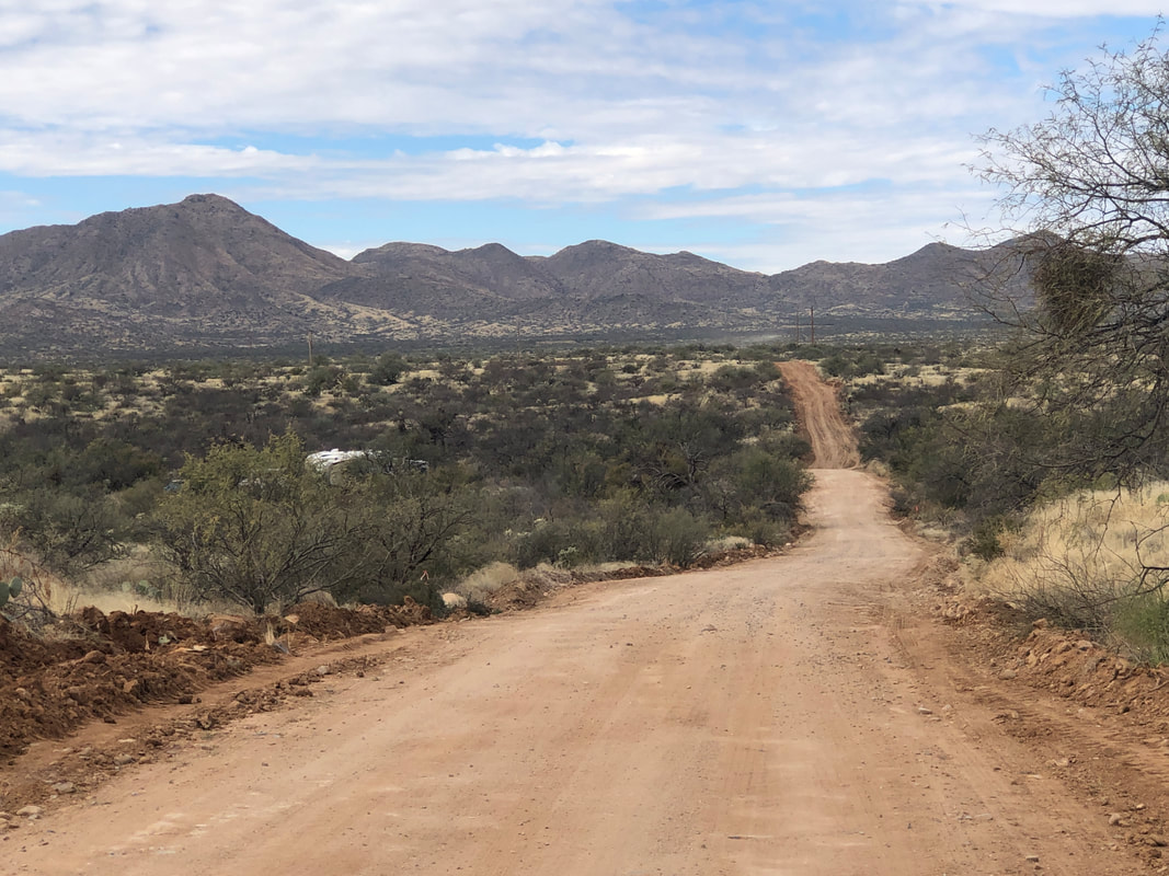
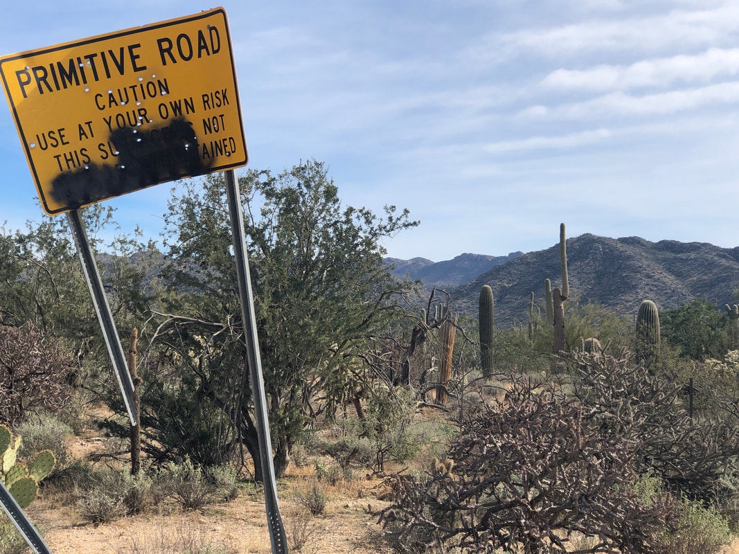 Back to Marana to do the entire, 33 mile loop. Early, I passed a sign, long disrespected and only stating the obvious.  The route extends northwest of the Tortolita Mountains and is..... 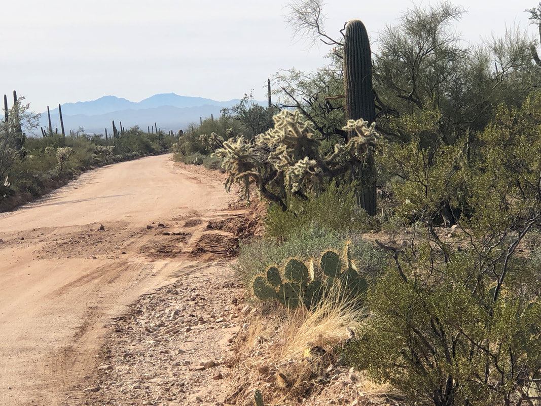 .....very remote in long stretches. 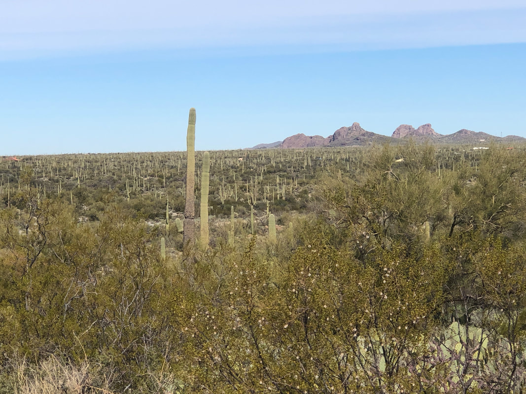 The first 10 or so miles is a gradual uphill until reaching this point with a good first view of the buttes. 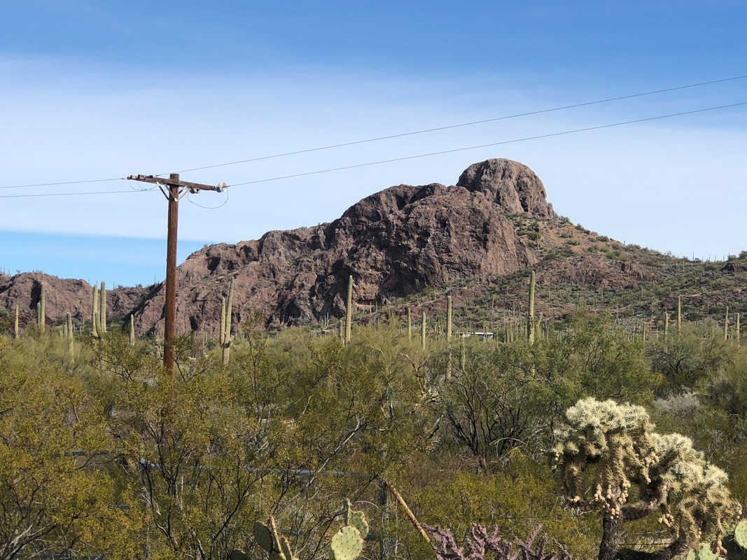 I passed Owl Head and..... 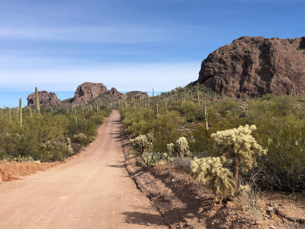 Other prominent points. Note the recently graded road. Very nice. 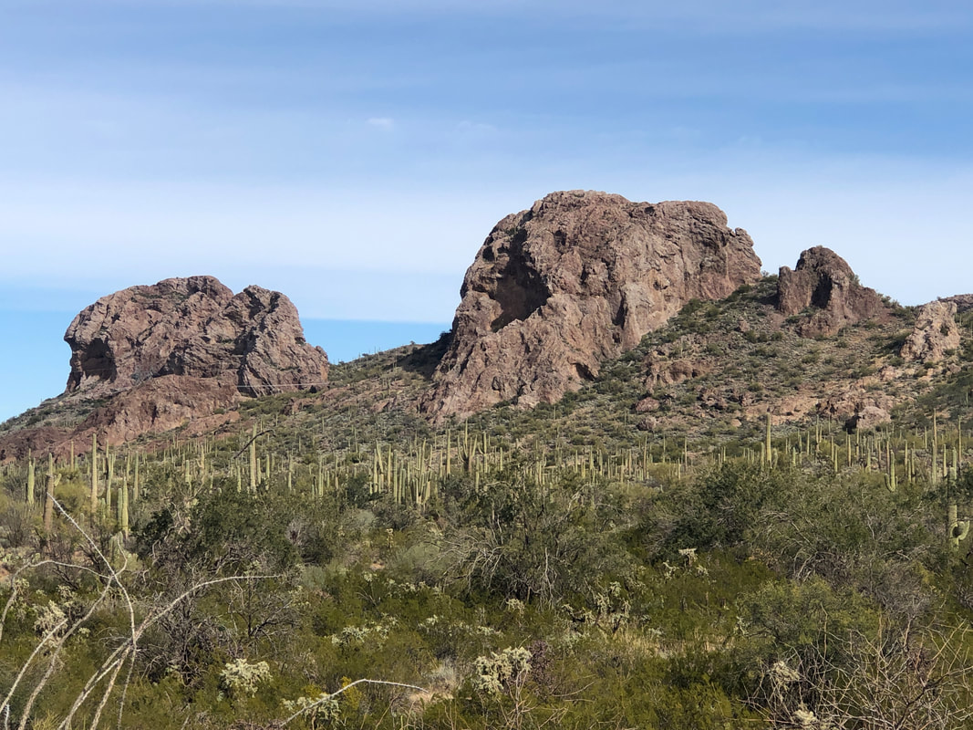 The saguaros were thick and of course the area is beautiful. There is a route up these buttes that I should check out some day. 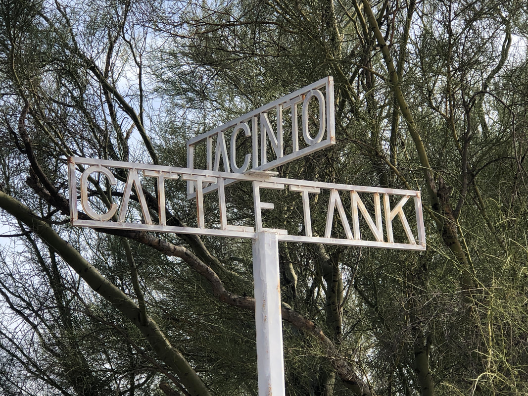 I can't say I've ever seen street signs like this, all in white. 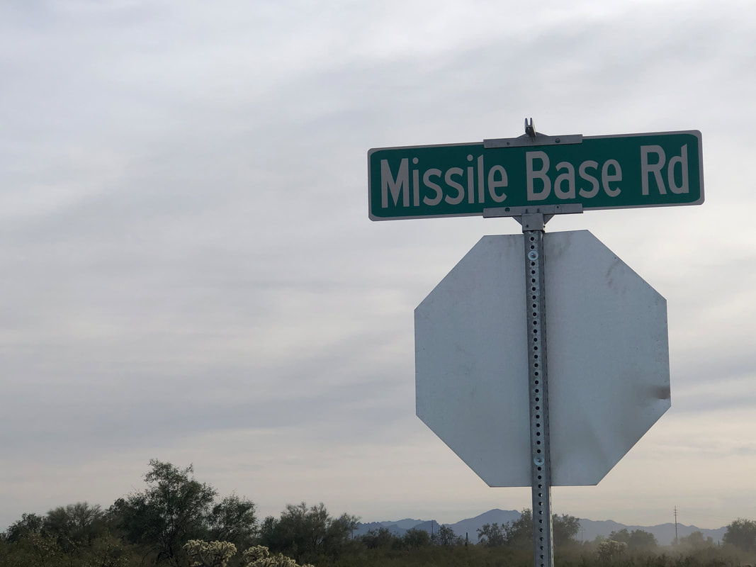 Then I arrive at this intersection. Not that long ago, a Titan missile was stored in a 10 story silo near here. 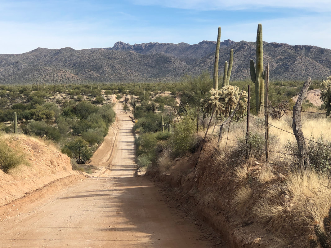 At the bottom of this ravine, there is a turn onto the final 2 miles of the route. The road is comprised of deep sand. My tires, too narrow for the conditions, sink. It would be a long, 2 mile walk but then I noticed....  ....the raised area above the road could be ridden, like hiking cross country. A fun route which I will do again.
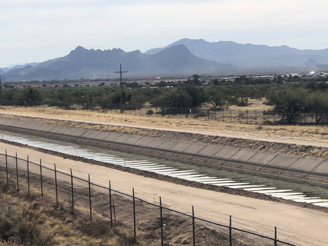 I drove to the bottom of Tangerine Road, just before I-10, parked and hopped on the gravel bike. The first 4 miles of the route parallels a canal. 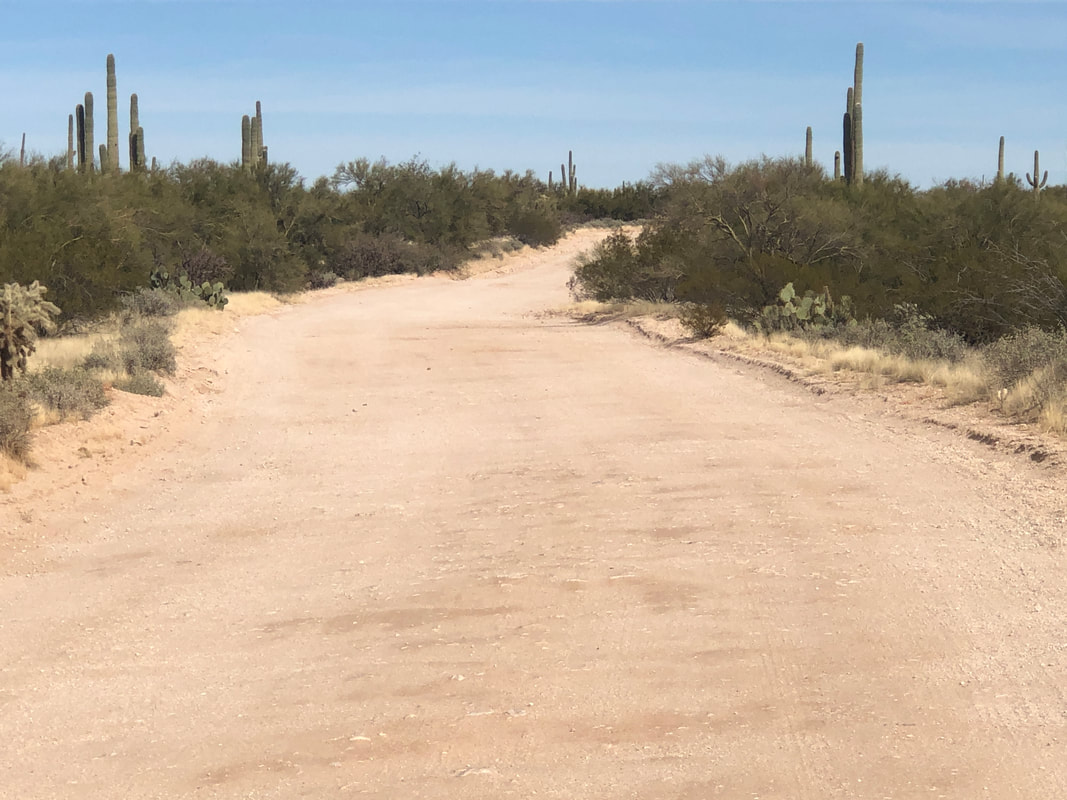 The first 2.5 miles of the route was a road (not the above which is good) that basically was a wash with deep sand. I need wider tires for that so turned around and continued the route in the other direction which had a nice, scraped dirt road. 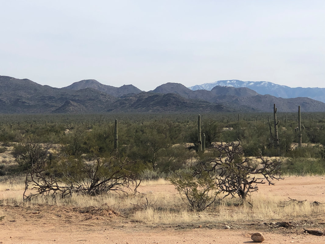 After confirming the start of the counterclockwise loop was on an acceptable surface, I turned around, returning to my car with only 12 miles. I'll go back tomorrow and do the entire, 30 mile loop.
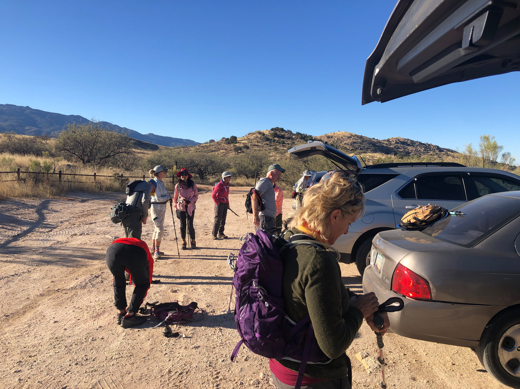
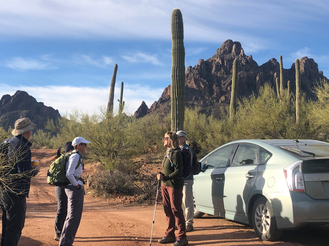
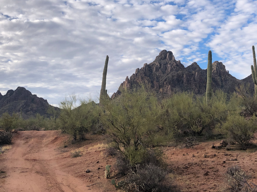 I received the Golden Ticket invite from Lorna and Marc to attend a hike to Ragged Top. I've been there once, several years ago but as an out and back hike while today's would be a loop. We drove in two SUVs but the one I was in, bottomed out on the knoll to the left while Lorna's made it. We parked, gathered our gear and began trudging. Soon, Lorna came back and picked us up, delivering us to the trail head. Sadly, Amy was absent with a case of food poisoning. 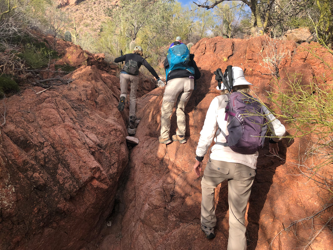 We enter Ironwood National Monument and begin our hike, first via a wash. 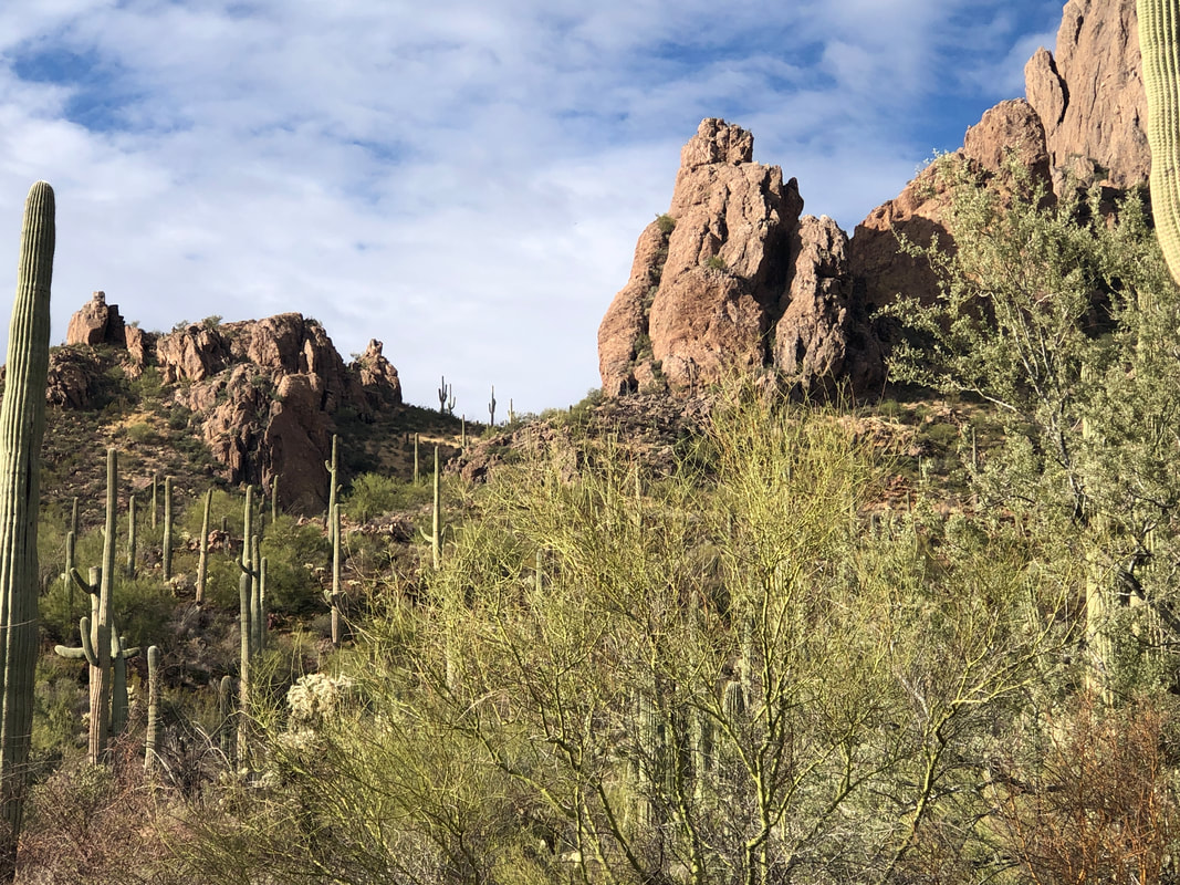 There was some debate about which saddle was our intermediate goal and we agree on the one having the saguaros. We strike out, bushwhacking..... 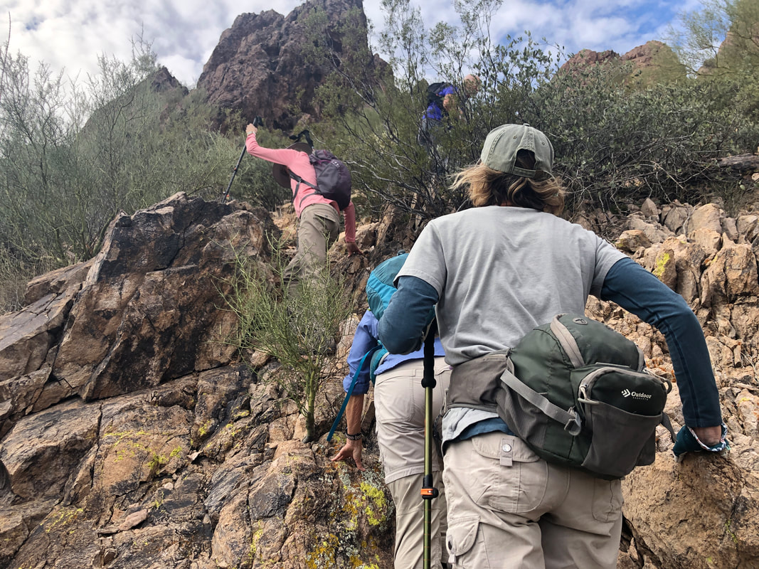 ....up a steep slope, really steep. Finally, we.... 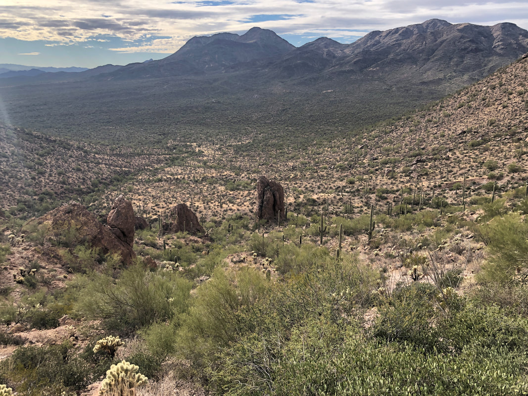 ....reach the saddle and enjoy views to the other side. The day was a little windy, mid 50's start with some cloud cover. Now we discuss which saddle in the distance is our next goal, agree on one and shove off. 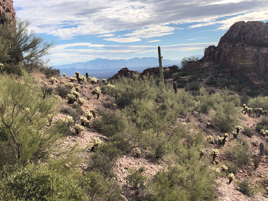 Marc and Lorna check out a nearby cave. I was going to see it too but only if they discovered a wild animal to make the climb worthwhile. I look back to the saddle from which we came and note all the Jumping Cholla plants. They would become a real pain over the course of our hike, literally. 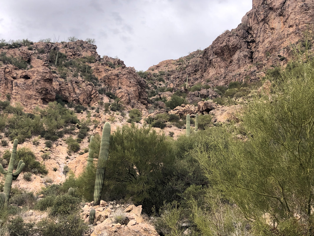 The 2nd saddle was so much higher than where we were. That looks steep!!! It was. I had downloaded a GPX track and was checking it occasionally to make sure we were on the correct route. Since doing so drains my battery at an alarming rate. I'd turn it on, check and then turn it off. 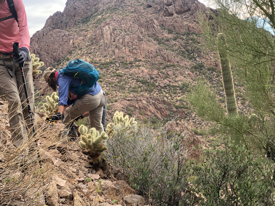 Lorna must swerve when she walks as she was frequently bumping into the Cholla. I had one encounter with a clump that attached itself to my left calf. Lorna had a pair of pliers, counted down from three and gave it a hard pull, OUCH! I think she gave it an unnecessary twist while extracting, to add to the pain. 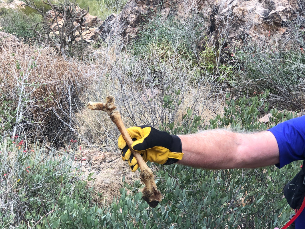 Marc discovered a recently stripped leg bone of either a deer or bighorn sheep. Mountain lions are around, watching us but never to be seen. 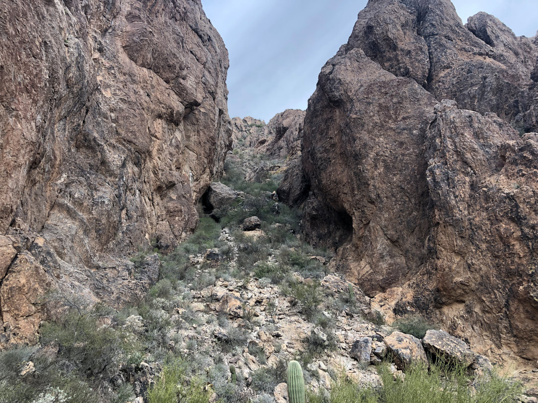 The climb to the saddle had an average grade of 41% so mostly it was 4-point hiking/climbing. Checking GPX, we were right where we needed to be and concluded, the above chute was what next needed to be climbed. Lorna led the way and I was surprised it was not as nasty an experience as it appeared. There is a distinct, social trail that was pretty easy to follow. 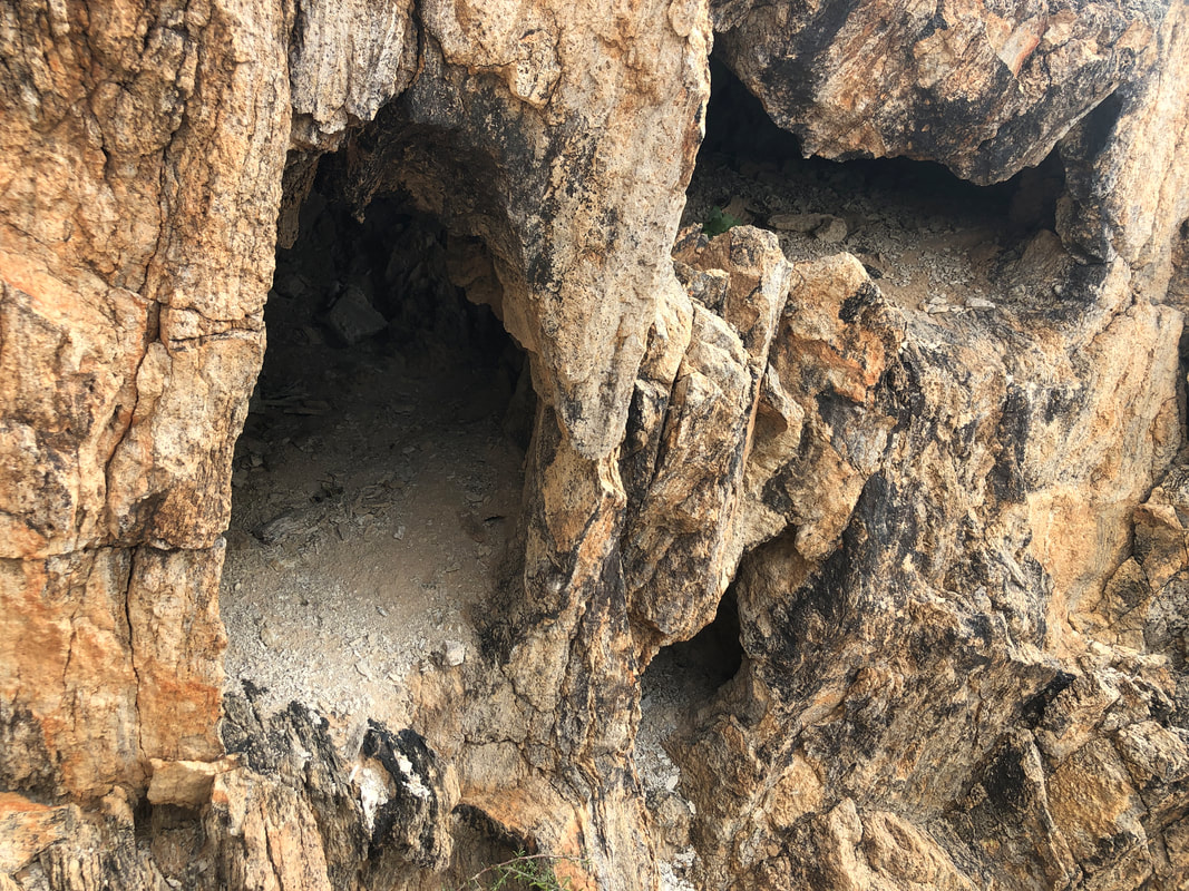 We passed these small caves but saw no evidence of any animal activity. No sane animal would make a den in such close proximity to a trail. 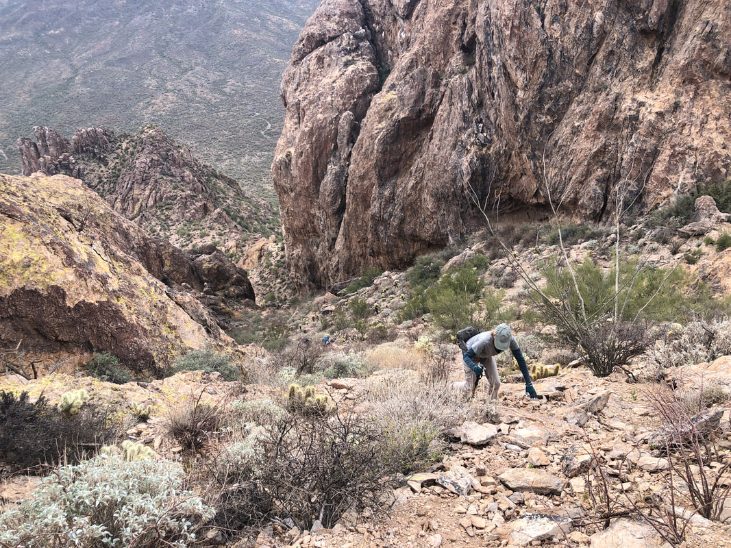 Our route continues to be steep and over loose rocks. I dreaded the down climb. 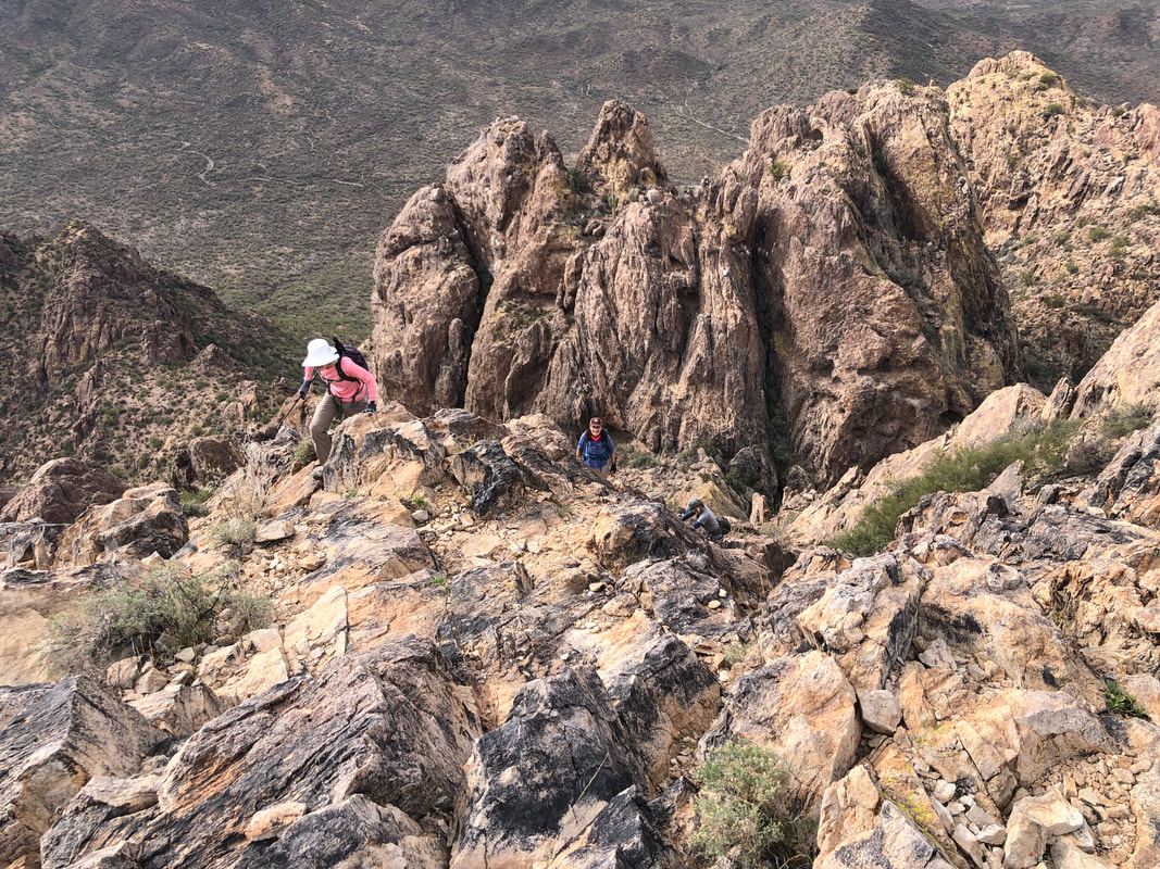 While we regrouped momentarily, I scouted around, found a faint trail and began climbing. Such a rugged landscape. At last.... 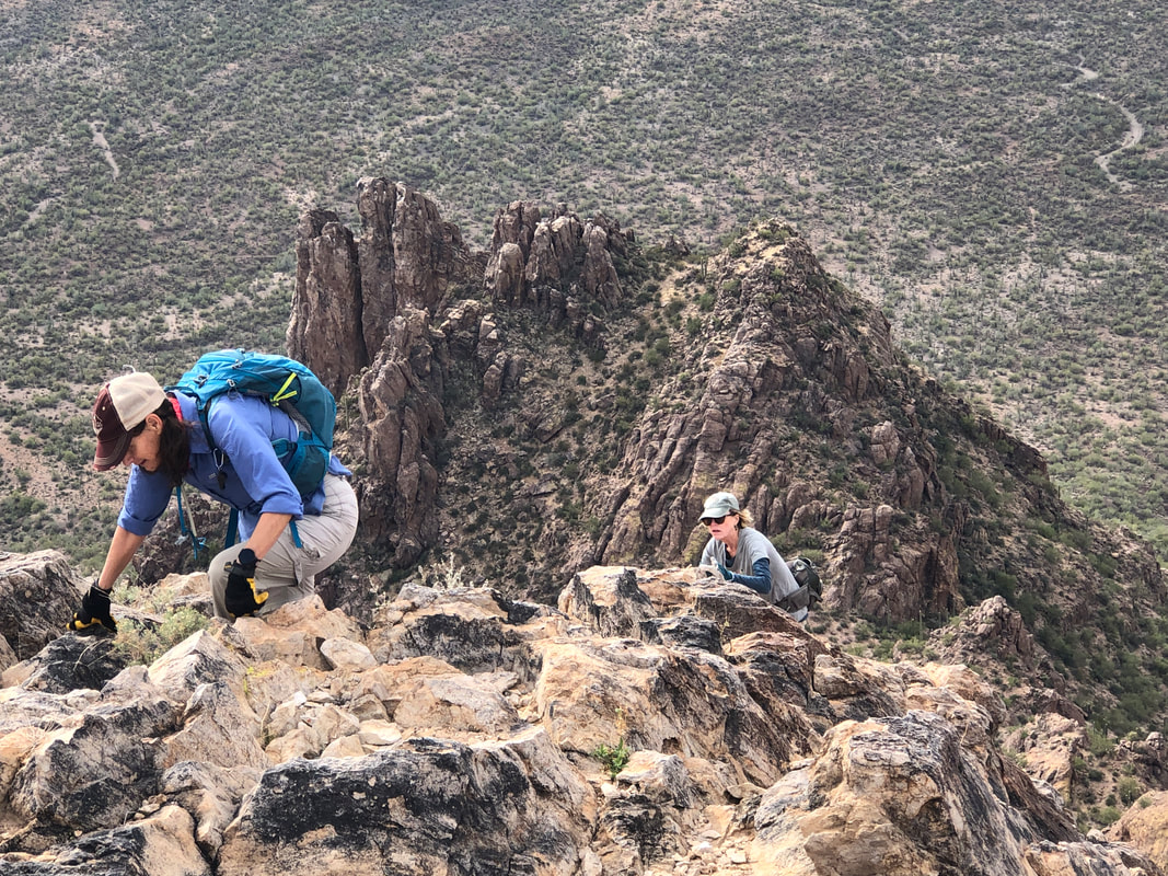 ....we scramble a bit of a wall that had some serious exposure (meaning a fall would be injurious to your health or death) and reach.... 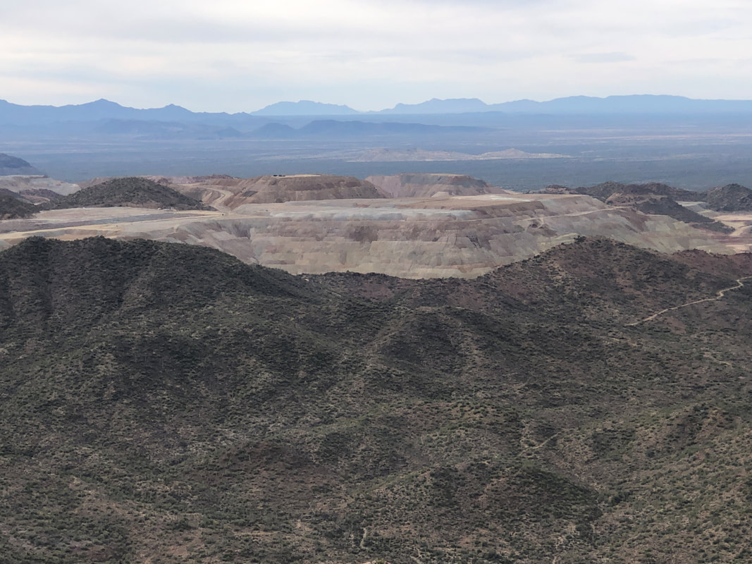 ....a small and barren peak. We had a good view of the Silverbell Mine which is now closed, as well as.... 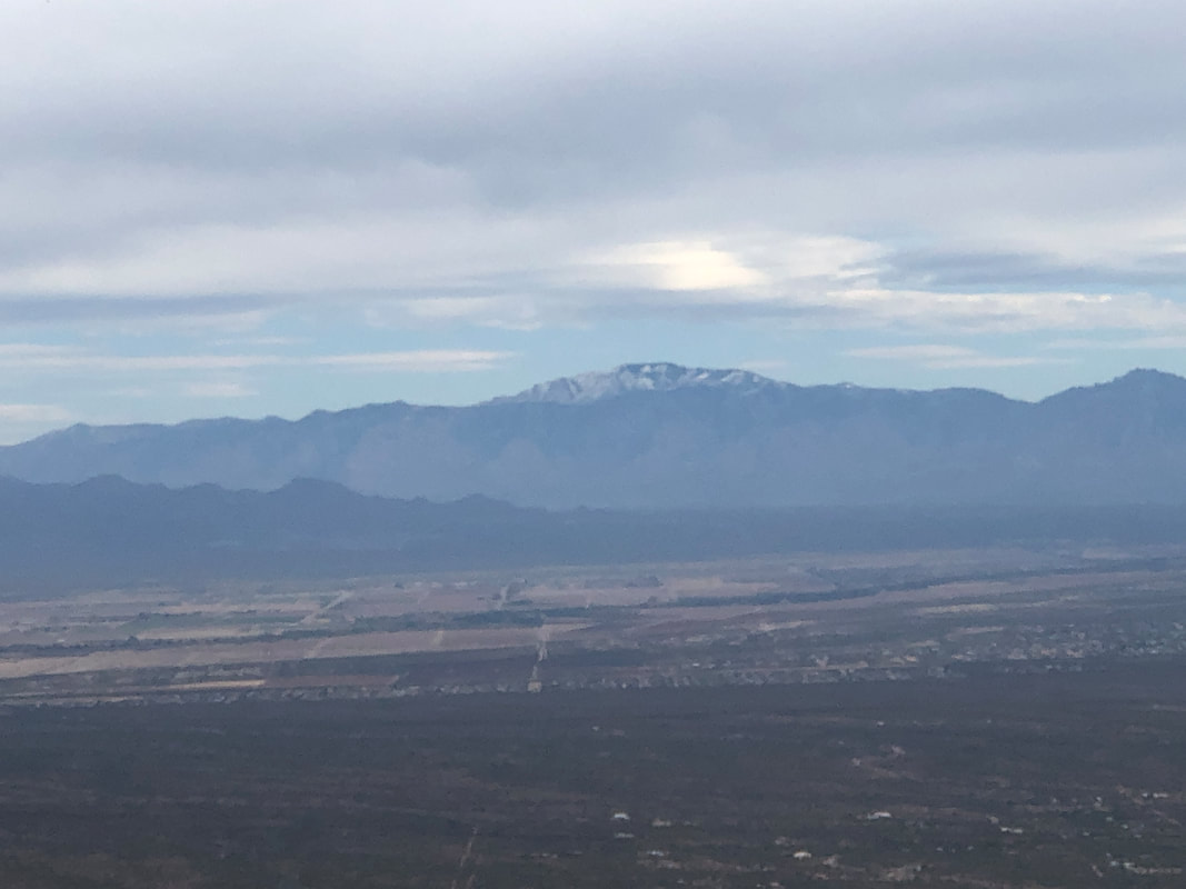 ....the Catalinas and many other mountain ranges. What a thrill for us all to reach this seldom visited peak. We eat, drink and gear up for the down climb. 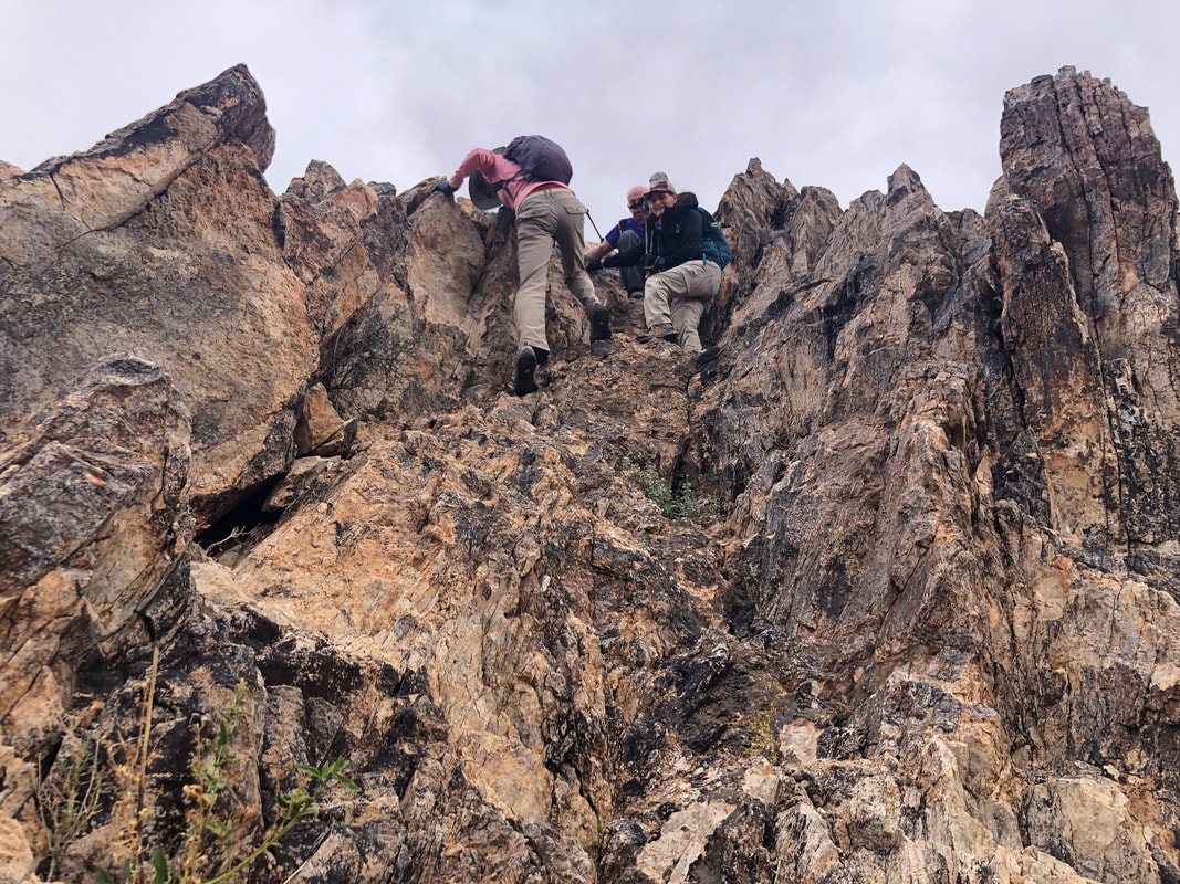 Ugh, all hands and feet are required and an occasional butt slide. 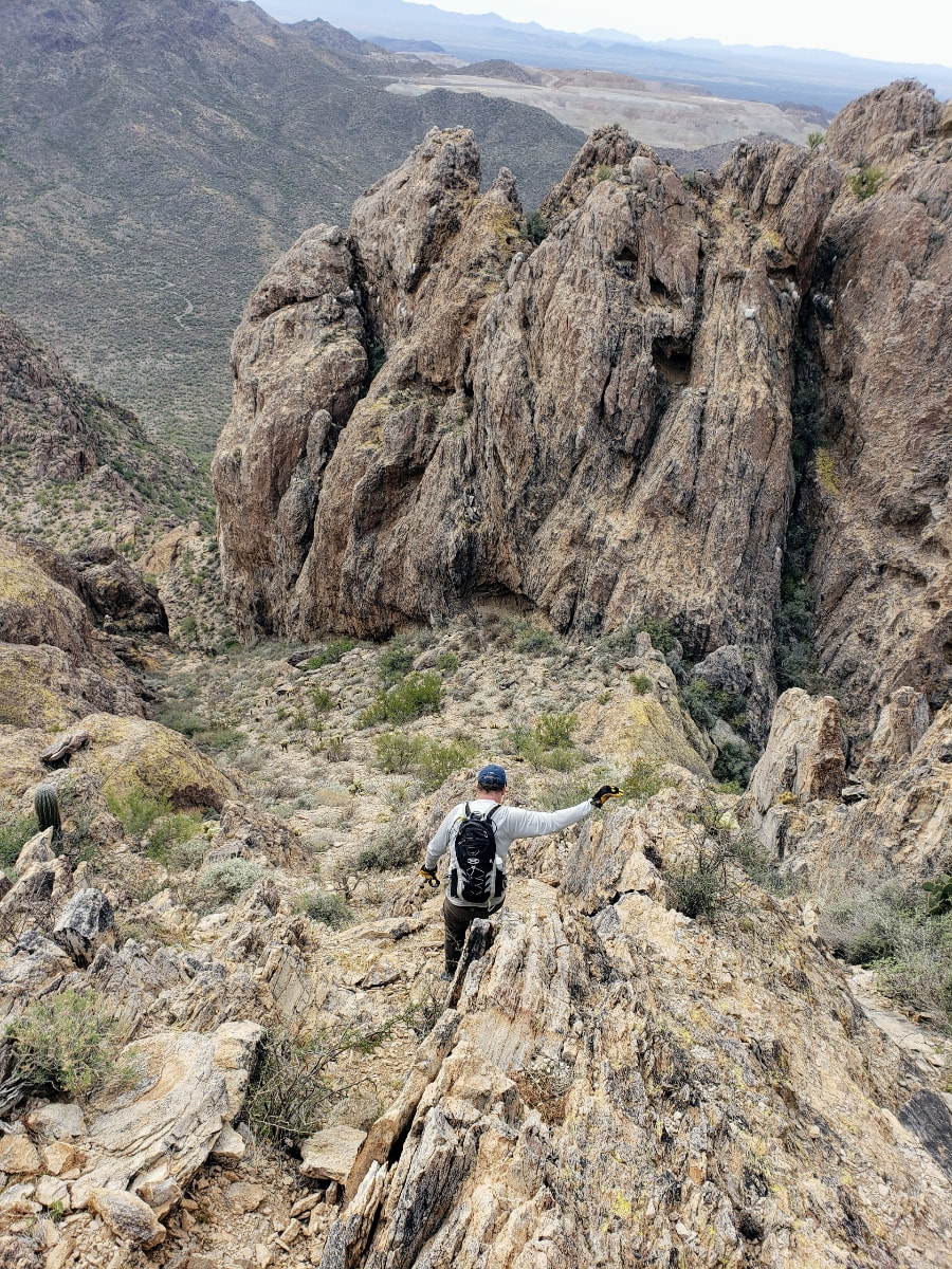 Lorna takes the above image of me as we descend to a saddle from where we make a right, to continue our clockwise loop. The ravine that we follow is very steep but there is a social trail that is usually easy to follow. I took few images because my hands were constantly in use and grateful that Marc had loaned me a pair of durable gloves. 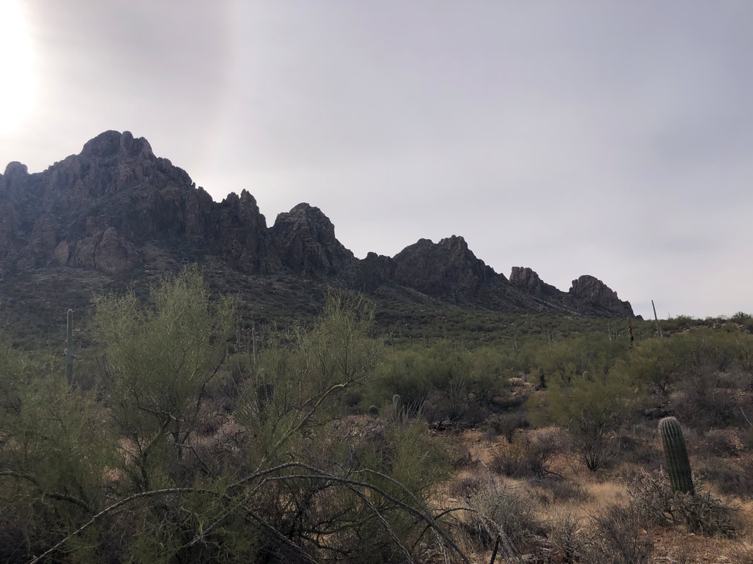 Upon leaving the ravine, we begin a long walk across the desert to the trail head. Looking back, I can see why the name "Ragged Top" was given to this portion of the Silverbell Mountains. We finished with 4.8 miles (actually, if you can start from the trail head rather than farther out where our vehicle parked, it's about 3.3 miles) and a healthy 1975' of climbing. We celebrated with a beer or water.
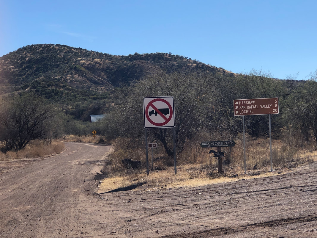 Amy decided to try the gravel riding experience so rented a bike from a local bike shop and off we went to Patagonia. After 3 miles of pavement, we reached Harshaw Creek Road and began riding on dirt.  The ranchers mostly don't bother with lining the roads with fencing to keep the cows from wandering. The cows seem to stay close to their food source although you do see an occasional cow pie on the road. 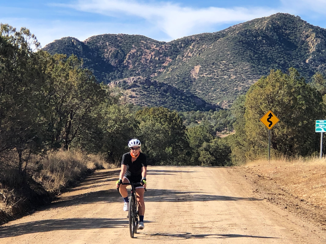 After climbing for 13.5 miles, we reach American Peak. Rather than continue on a loop route that would take us over some nasty wash boarding, we turned around and enjoyed a long coast. 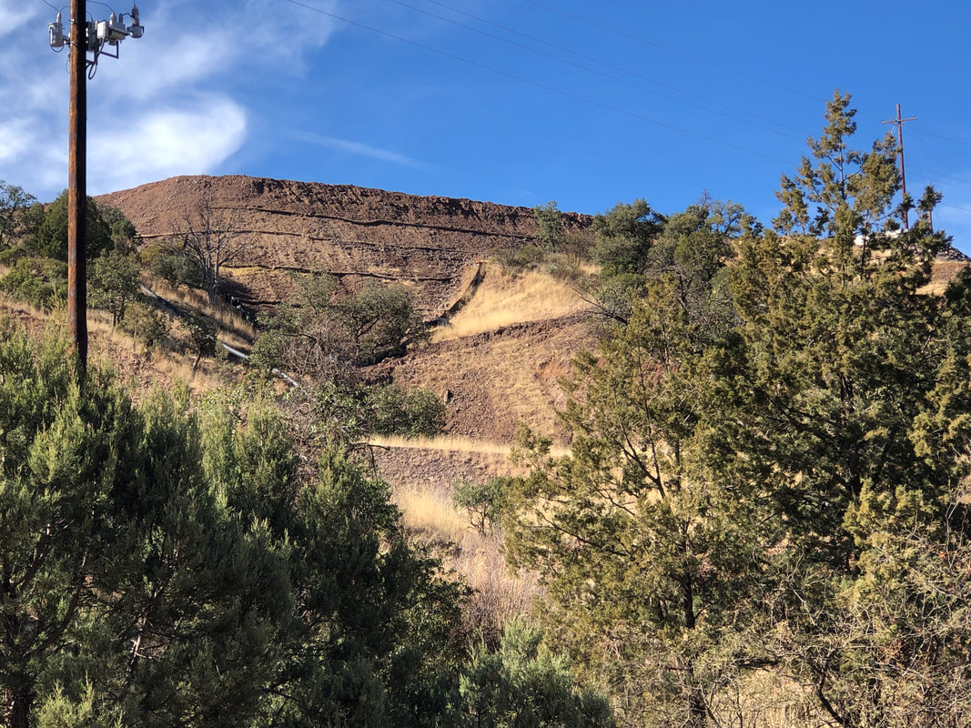 We passed an active mine, likely copper. I could hear the movement of machinery but they've done a good job of keeping it largely invisible. 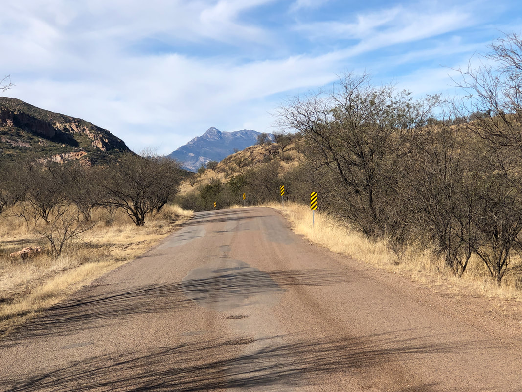 We reached an intersection where we had the option of continuing on a dirt road or take the paved option. I chose paved as I didn't want Amy to get too beaten up from the vibrations during her first ride. Mount Wrightson in the distance. 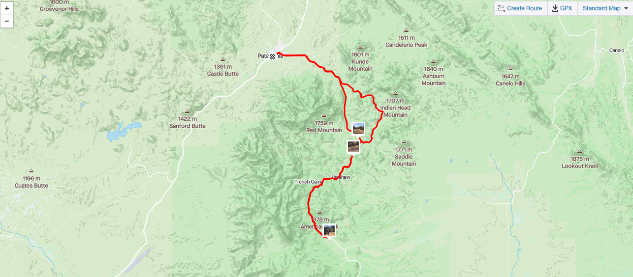 We finished with 25 miles which, after yesterday's hike, was enough.
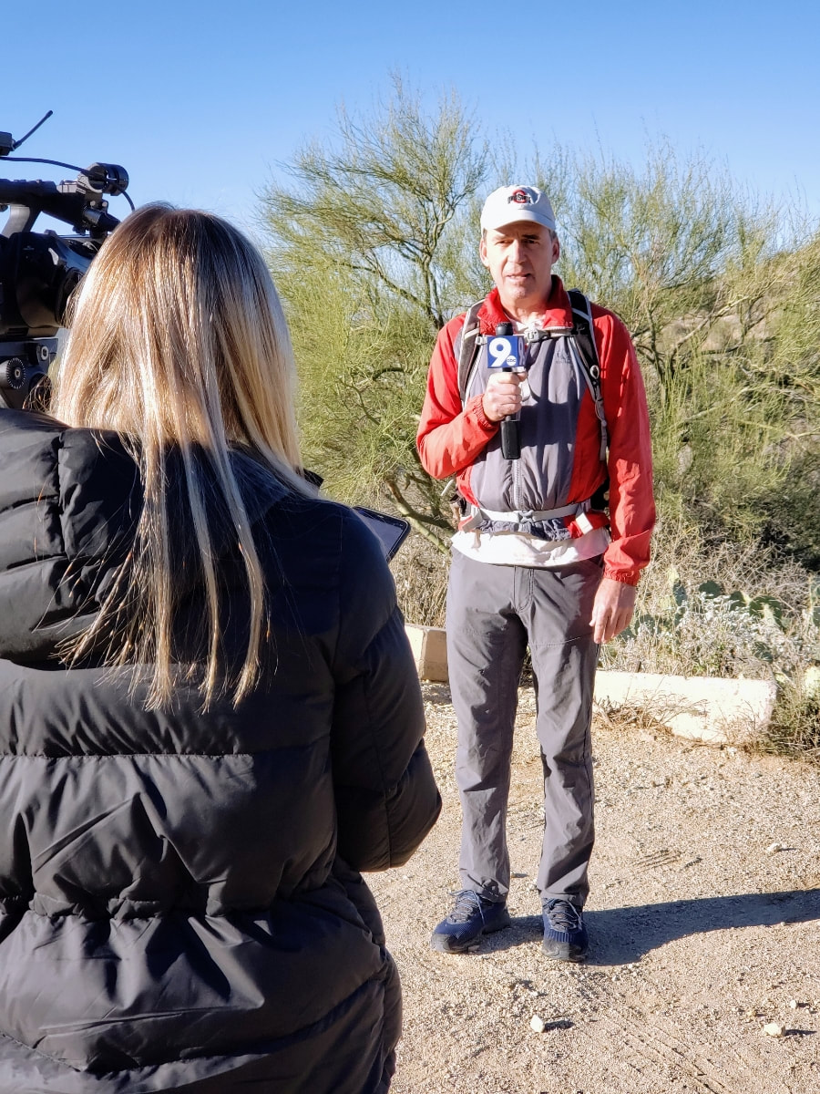 A couple of weeks ago, local station KGUN, an ABC affiliate, contacted me about doing a story on group hiking in our region. I have no idea how they found me but over time, an arrangement was made for a station rep to visit us at the start of our hike to Tanque Verde Falls. I think each of our 11 member group got some time on camera and here is a link to the short video that aired on Wednesday morning: https://www.kgun9.com/news/local-news/strength-in-numbers-group-hikes-gain-popularity-in-southern-arizona?fbclid=IwAR1FzOTpkBsgXK0AydyWLOAoyZil7jUxL-zHEh6UiiqieBTIxFJ58CTJB0A 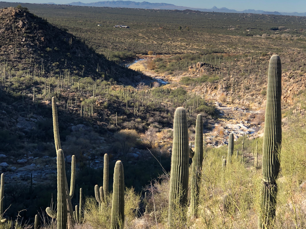 We descend to the canyon floor. To the west, the canyon broadens as it becomes a wash to move excess rain or snow melt through Tucson. But to the east.... 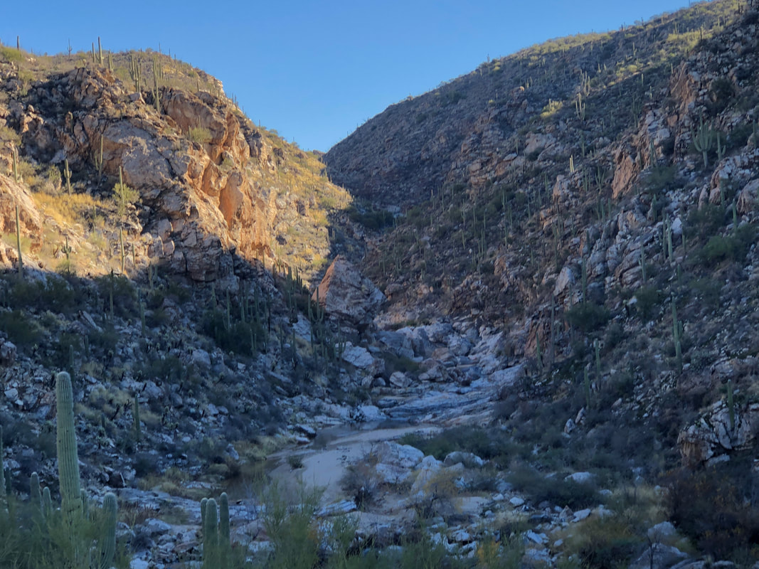 ....oh what a wondrous boulder hopping, canyon crawling, slick rock walking experience it becomes. This is my 5th visit to the segment of the canyon that leads to the falls (another segment starts above the falls and leads to an honest to gosh, nude beach). Yet, it's such a jumble of boulders, turns and bewildering obstacles, prior experience doesn't count for much. 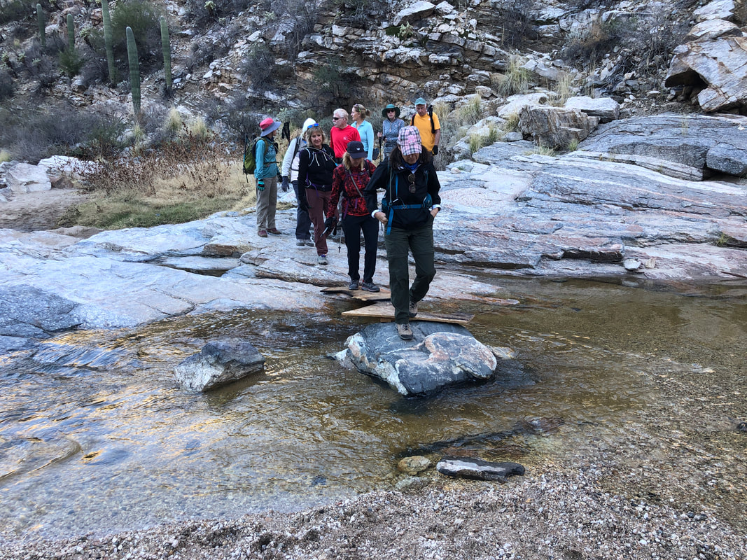 The first of many stream crossings is reached and How Bout That!?! Someone has left a couple of pieces of plywood to assist our crossing. Hiking buddy, Lorna, leads the way. 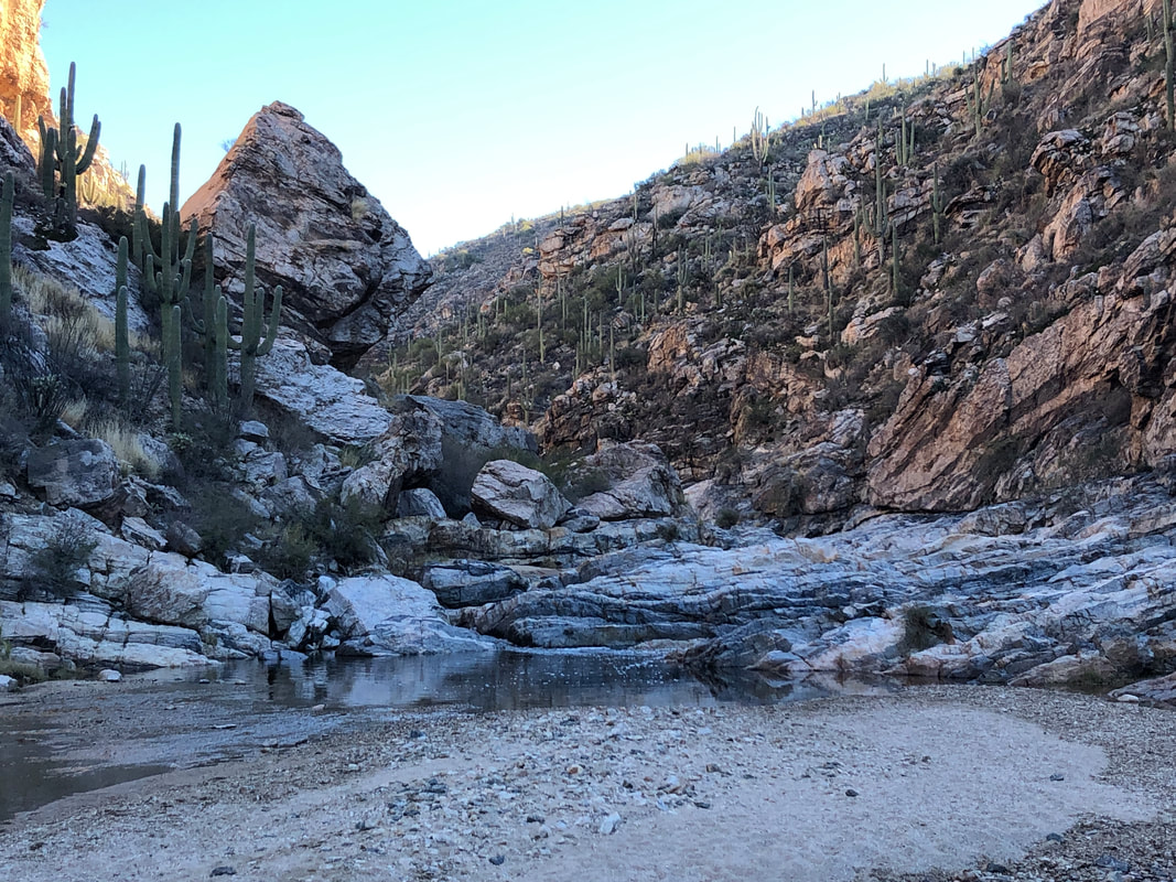 I think one of the reasons it appears somewhat unfamiliar to me is I've hiked it when the canyon is dry and one can walk straight up the middle with no problem. Other times. like today, the water flow is healthy and alternative route finding is required. Whatever, it's a very fun hike with wondrous views. 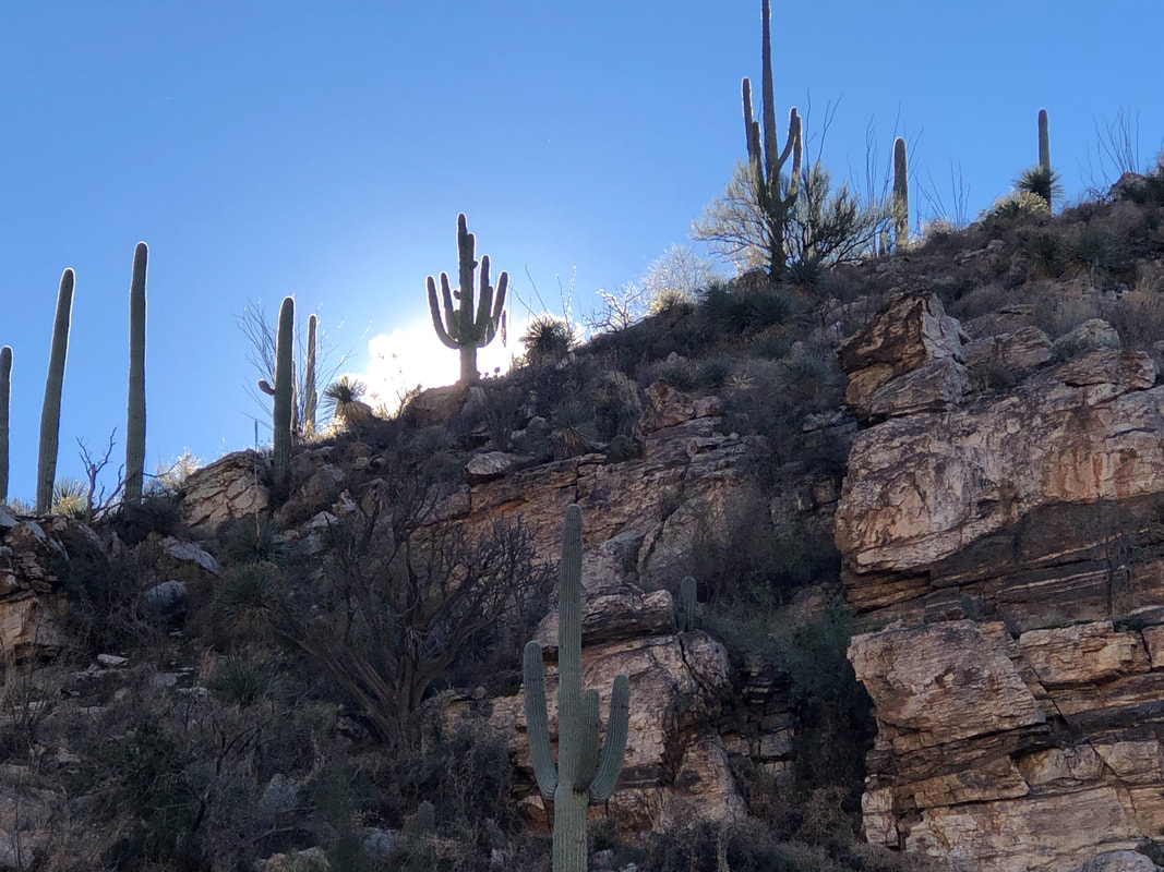 The sun begins to peak over a nearby ridge. 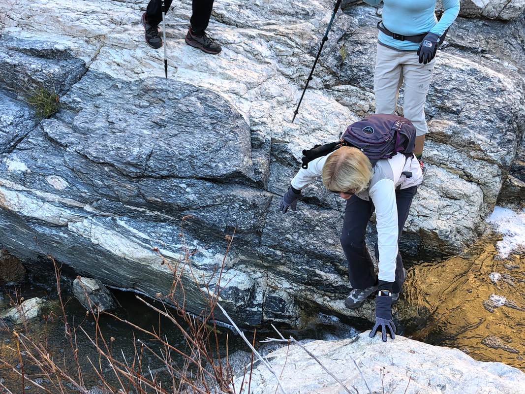 This is a full body workout rather than a typical hike as we reach and cross the stream, many times. 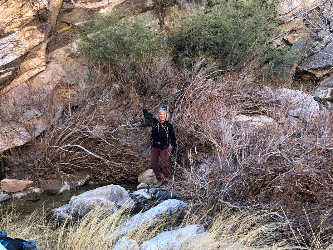 Amy decided to pioneer a new route and hoisted a boot as her reward. 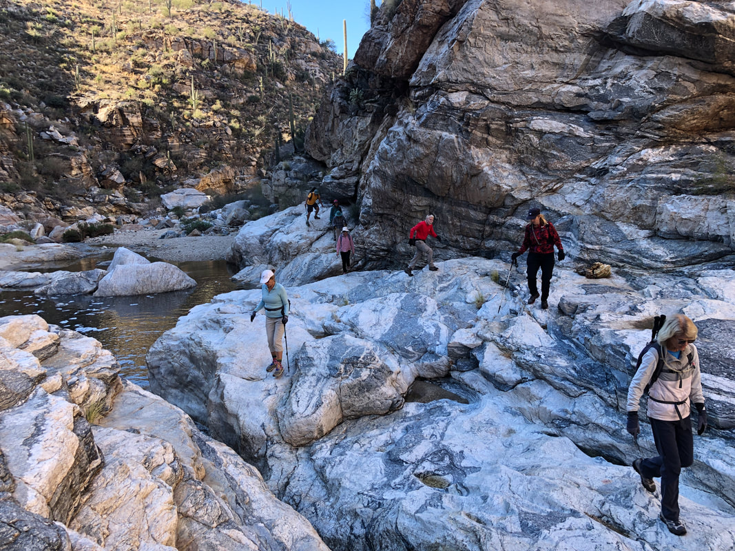 So, so atypical of what we normally encounter during our hikes. 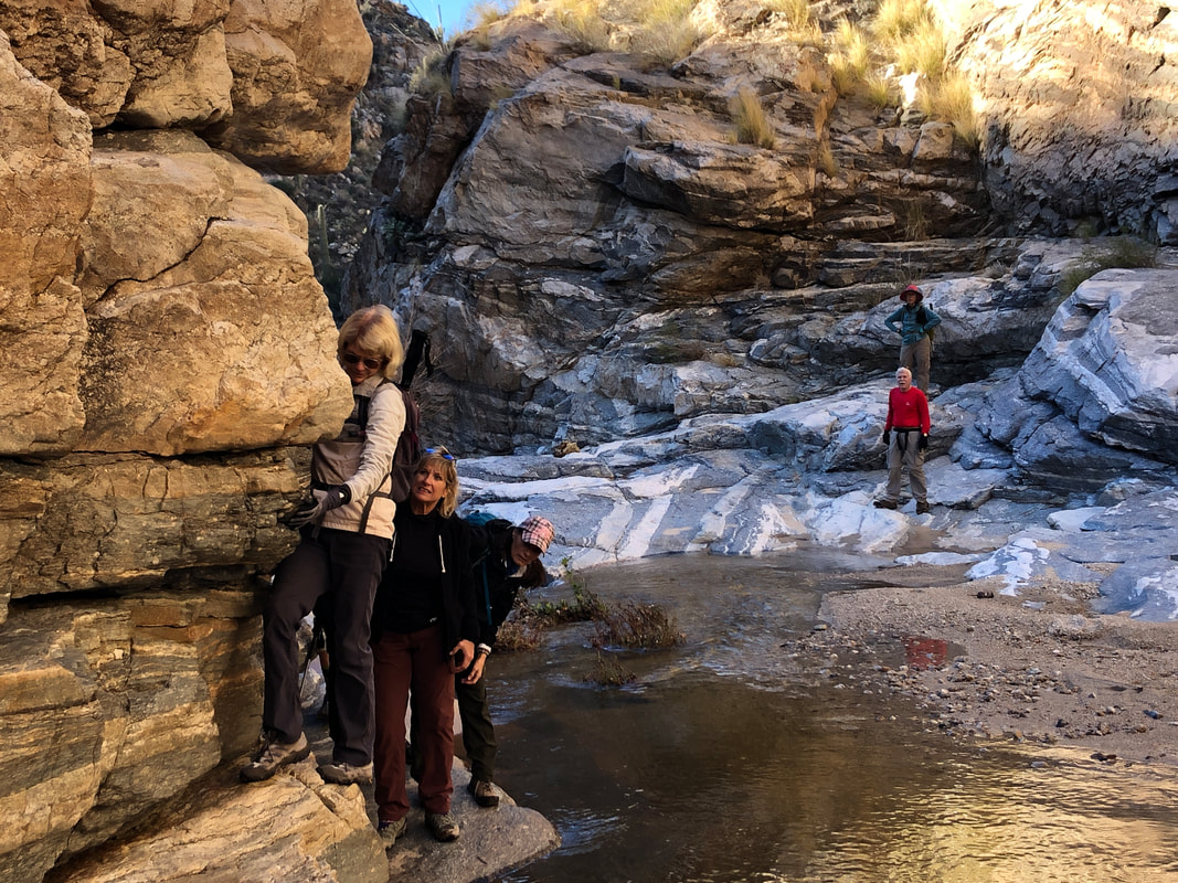 And then we reached this spot. The rock extended too far out to allow passage as Marcia gives it a good try. I stuck a foot into the water and crawling out, as did Marcia and Amy. Meantime, Marc and Lorna did some alternative exploring behind and above us and found a much better route. OK, I've filed that for next time! 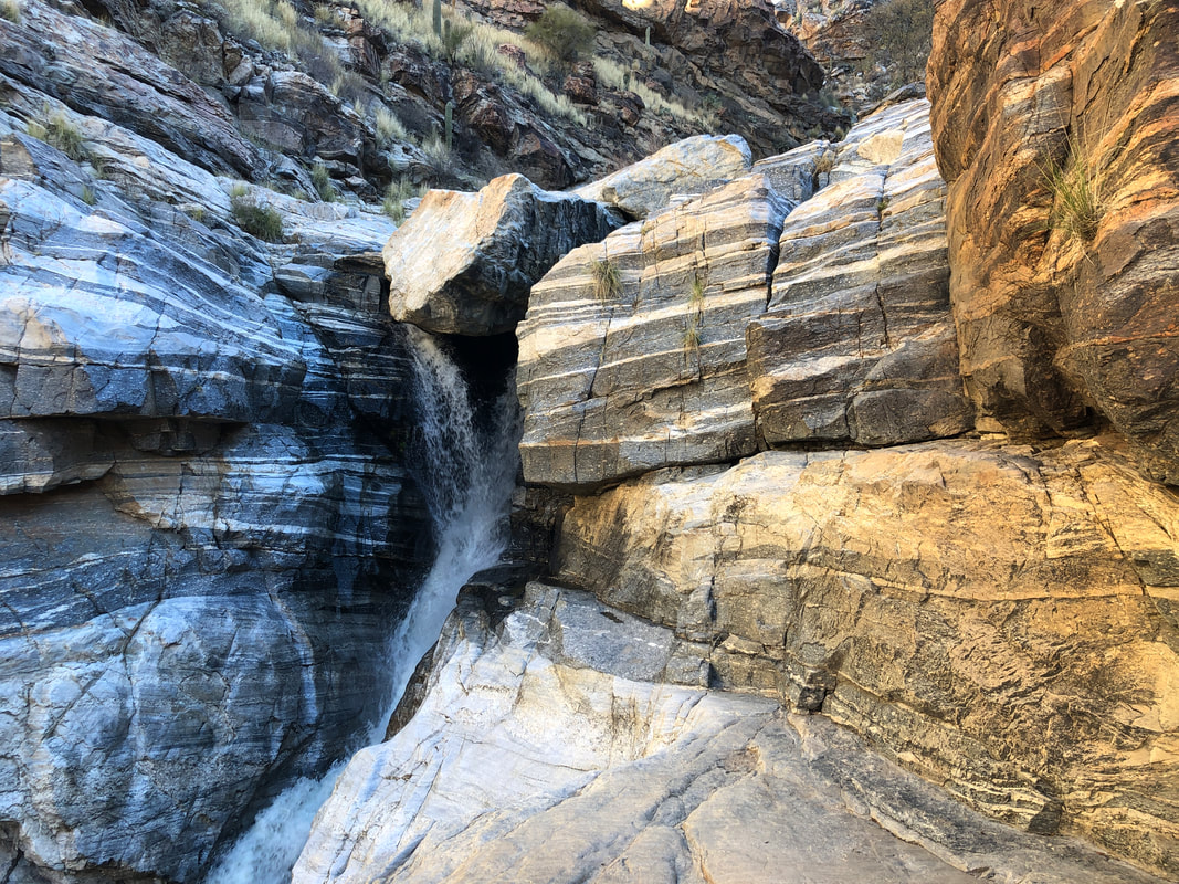 Our 3, having waded through the water, were committed now to climbing this wall, on the right, where we would be reunited with the others who wisely took the workaround. The problem though, since our shoes are now wet, the rock surface becomes very slippery. Being the first one up, I benefited from dry rocks but of course my passing left behind wet rock. Amy.... 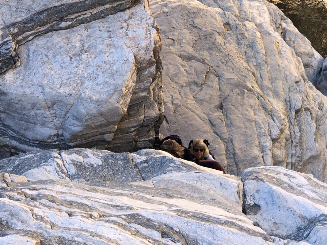 ....was next and began to have a problem as both her hands and feet were sliding. Having an obligation to this report, I took a couple of pics before leaping into action and saving her. And then.... 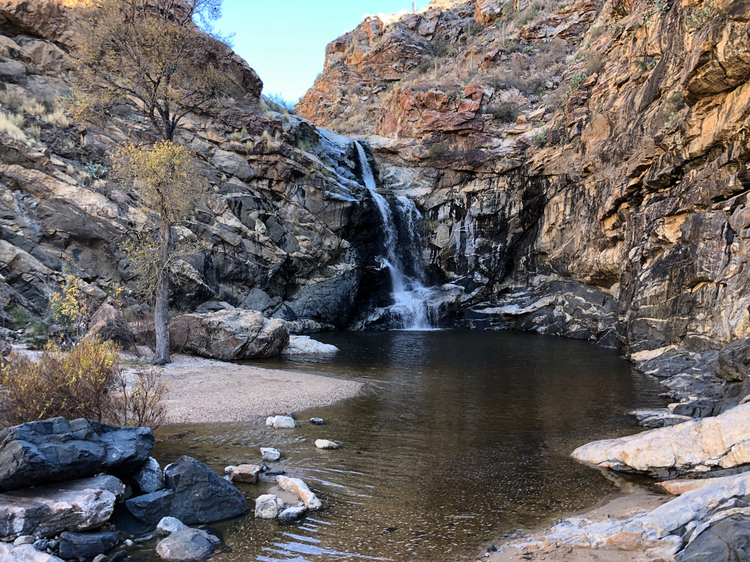 ...after 2 hours of hiking but having covered only 1.5 miles, we reach the falls. An amazing place to spend some time, soaking it all in. After awhile, we geared up and began the hike down canyon. 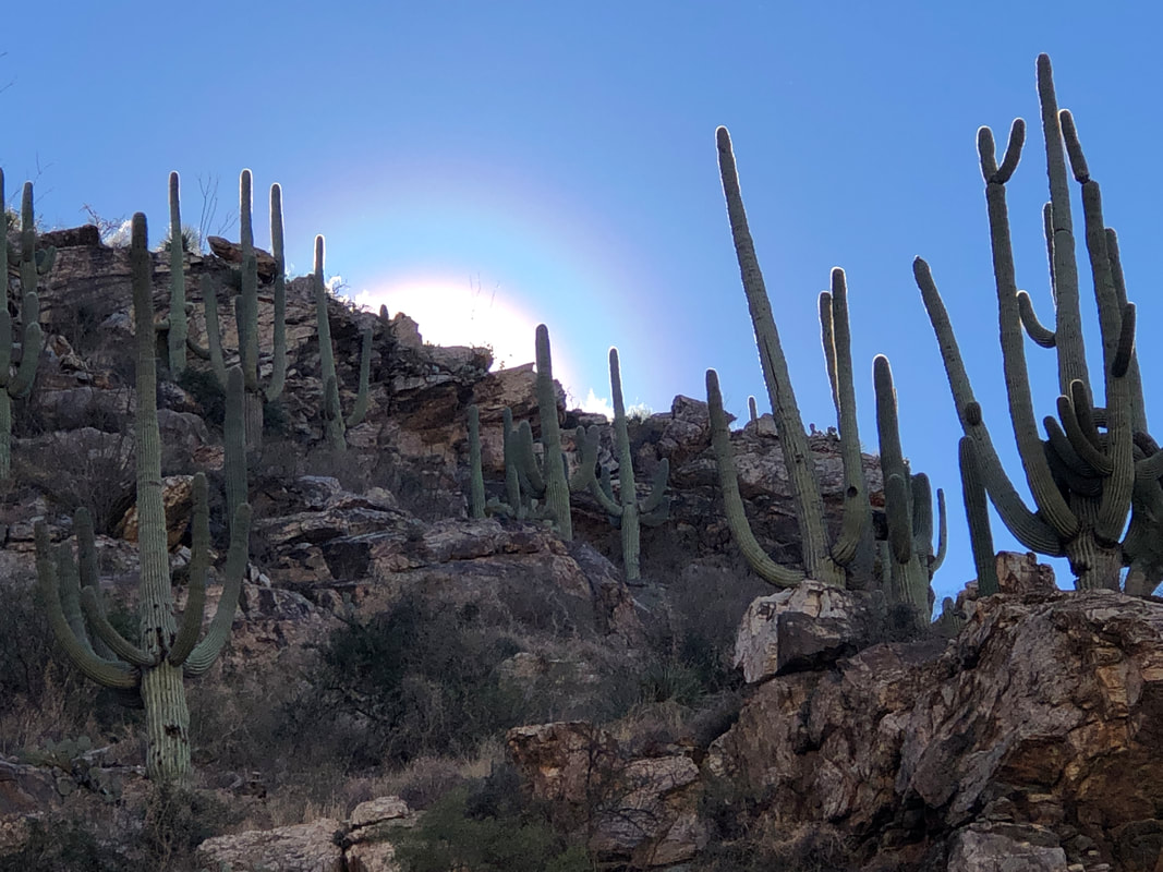 As we continued our descent, we observed an awesome sun halo!!! Note the rainbow around the perimeter of the sun. 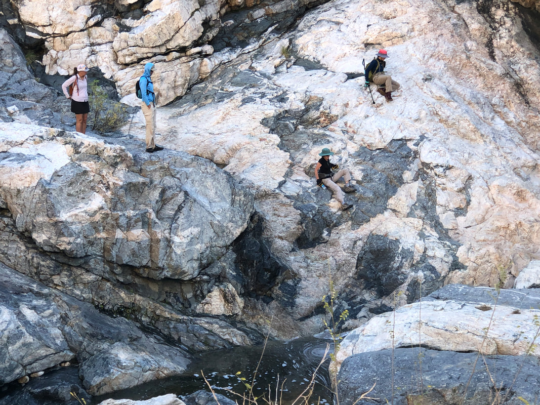 At some point we became too spread out and had three different groups, looking for a different way down canyon. Lorna led one group on the opposite bank where she made it through. The others too made it but not before one, Marianne, slid about 15' but managed to catch herself before tumbling into the water. Ummm, did I already say that the majority of rescue missions and deaths in our region are sourced in this canyon? 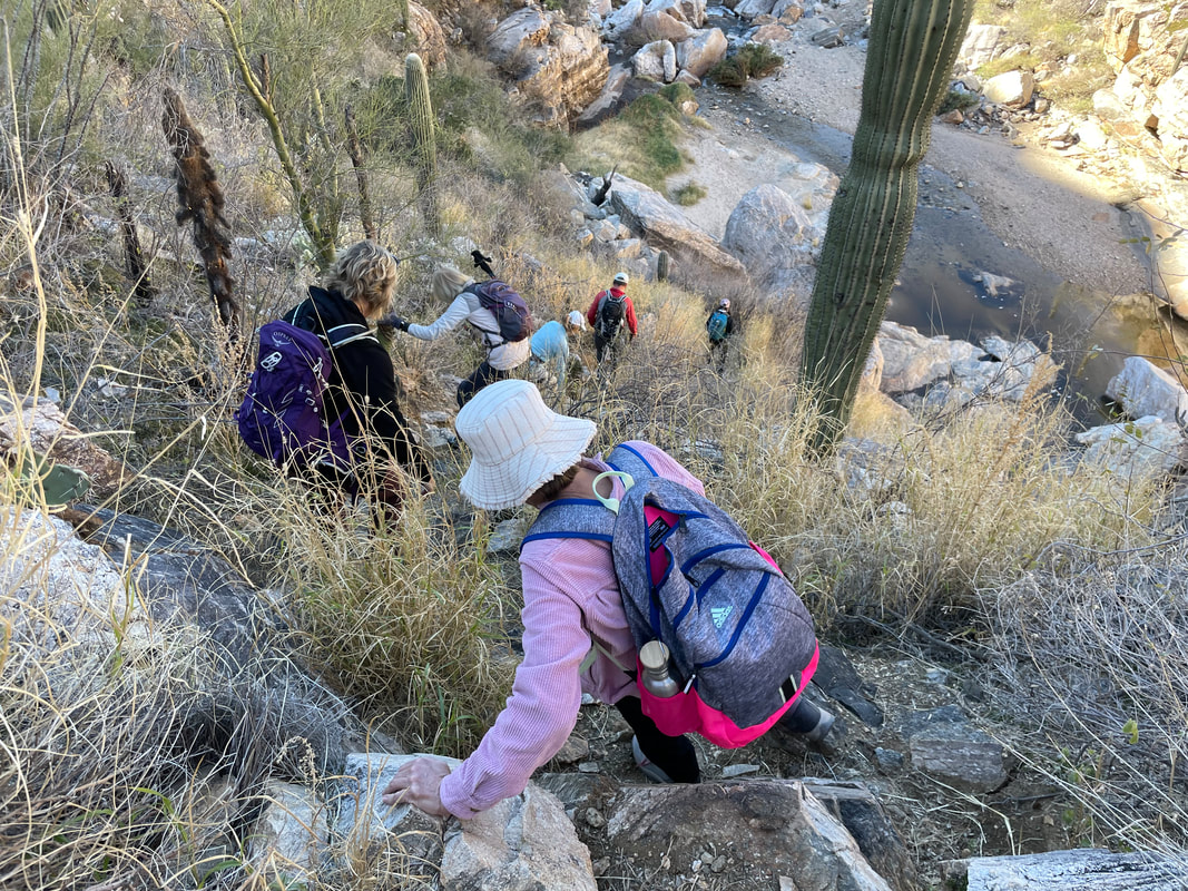 It wasn't all walking over, under and around boulders, ha, ha. We all made it out and then, Amy invited the group for pizza and drinks.....  All but one of our group made the short drive where we ate, drank a little and enjoyed the company.
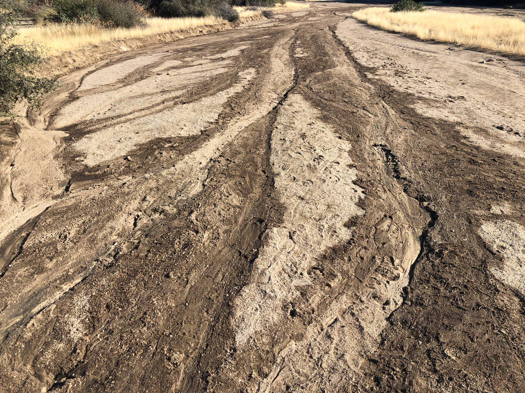 I enter Wild Borrow Canyon in Dove Mountain. Recently, the wash had flowing rain runoff and I enjoyed following the wash up canyon, watching the pattern change. 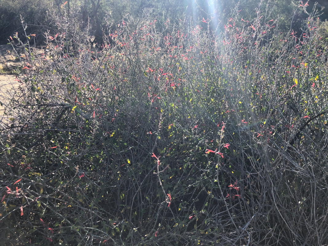 Surely all the rain we had during the last week will produce bountiful wild flowers this spring. This plant was already blooming with pink and yellow flowers.  The Wild Burrow trail follows the wash then bypasses a boulder filled ravine to a 2nd level of sandy wash, then bypasses another obstacle laden ravine before reaching....  ....this beautiful spot where there is a bench if one wants to take a break. After 3 miles, I depart WB trail for the Wild Mustang trail. What caused me to do this hike is eventually, surrounding hills fall away to..... 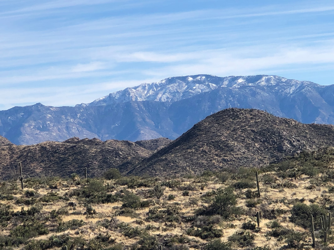 ....see grand views of Mount Lemmon, recipient of 20" of snow from the weekend. 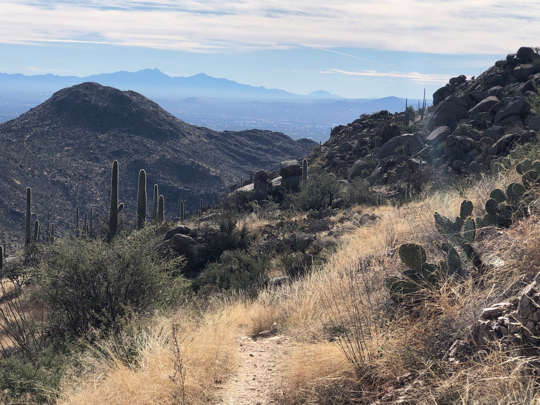 Beautiful views on a beautiful day for any outdoor activity. 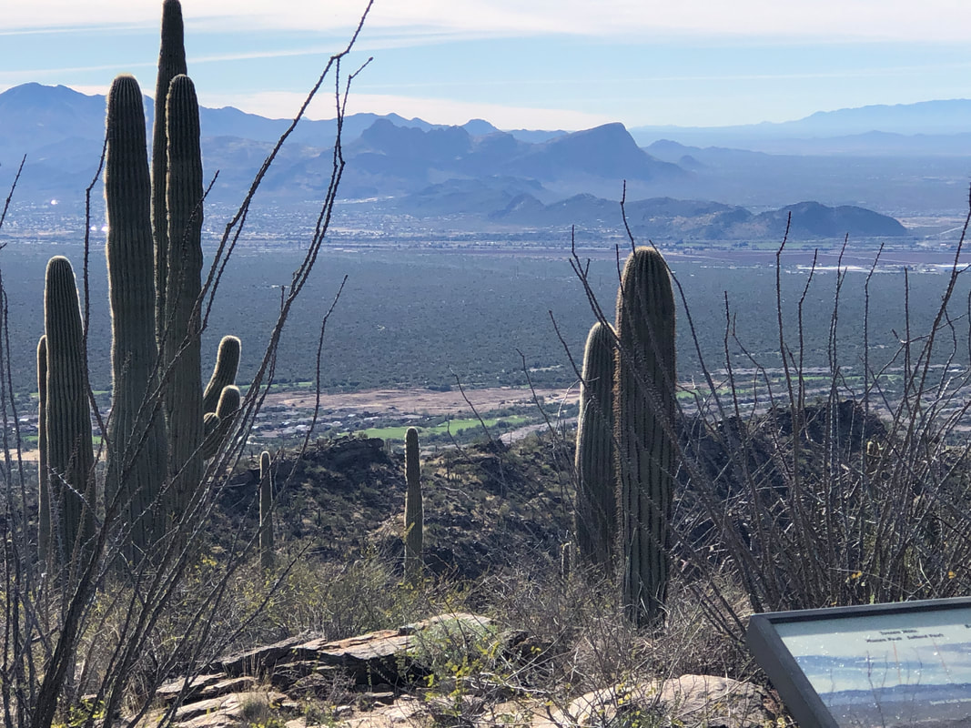 The trail reaches a well known location above the Ritz Carlton resort where signage illustrates the region's mountain ranges. Reaching the Upper Javelina trail I take that and soon find the Hotel Spur trail and a return to the parking lot. Fun hike, not too challenging, finishing with 7.8 miles and 1500' of climbing. Now, get this, a local TV station, KGUN contacted me a few weeks ago. After an exchange of emails, they are sending a reporter and camera crew to where we are starting our Wednesday hike, off Reddington Pass Road. They're doing a story on hiking in Tucson and hiking groups. I have no idea how they found me but hope to get some of my hiking buddies some camera time.
 Wow, Friday night and early Saturday and the rain came as forecast. Higher up, so too did the snow. Blackett's Ridge on the left and Thimble Peak to its right with snow covered Mount Lemmon in the distance. 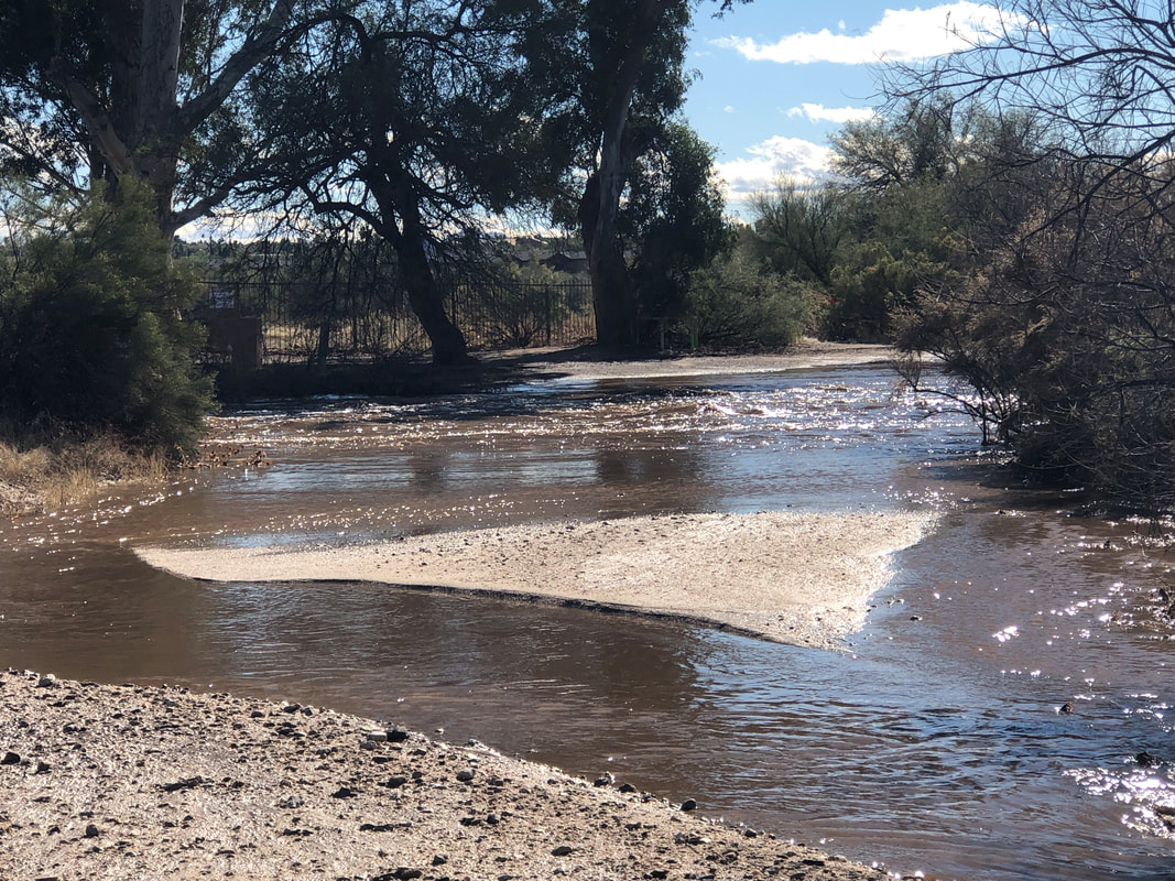 Aqua Caliente wash had a healthy flow while Tanque Verde wash did not. I saw Reddington Pass received almost 2" of rain so maybe that feeds into the former rather than the latter wash. Anyway, I have a hike organized up Tanque Verde Canyon on Wednesday so there certainly will be a healthy flow of water either from rain run-off or from snow melt. Should be spectacular. 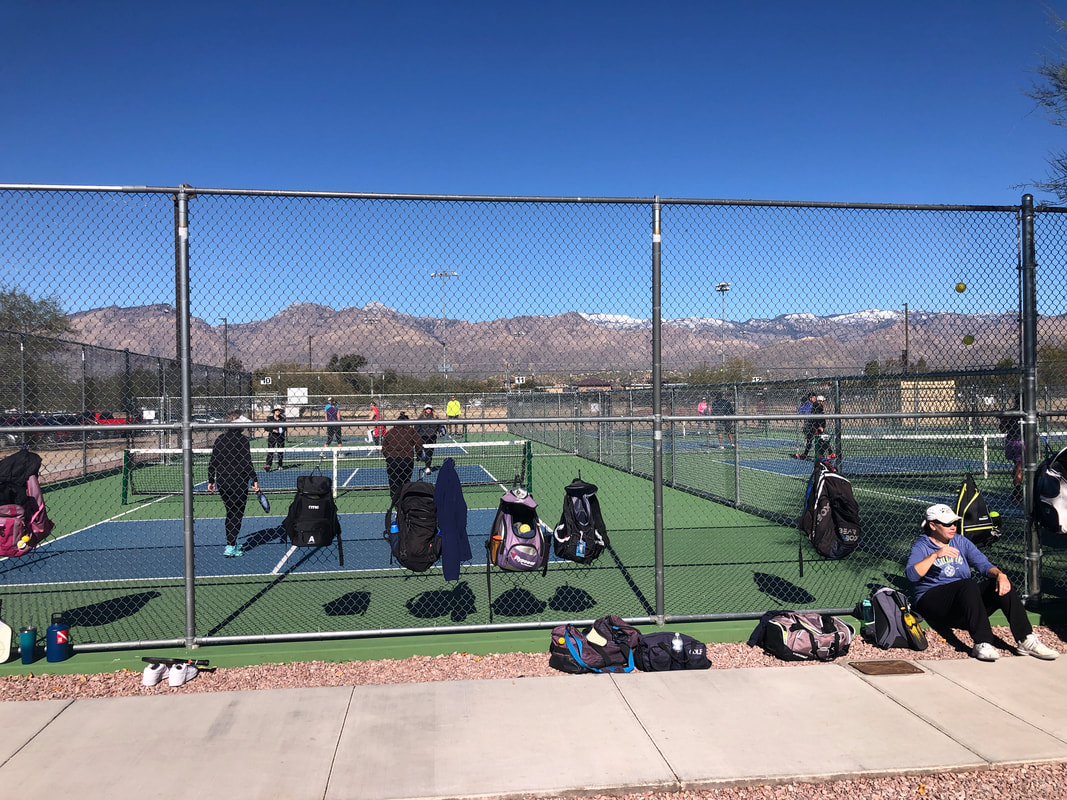 Amy and I hooked up with hikers and friends Lorna and Katheryn and had a very fun time playing pickle ball. There are 16 courts where we usually play, all full and lots of people waiting for their turn to play. I'm surprised at how many young people play. I always assumed it was a game for the oldsters.
|
