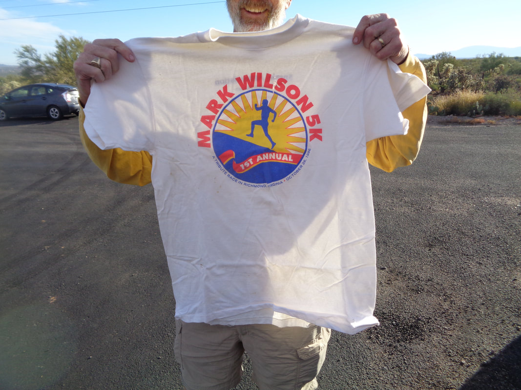
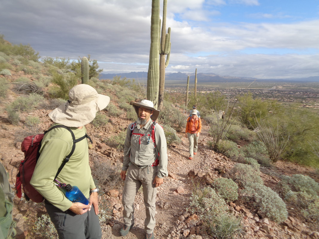
 New Year's Eve, parked at the trailhead for an annual hike organized by "Vagabond Jeff". I am approached by I think Peter, someone whom I had never met. He stated he had wanted to meet me which prompted my perplexed response, "Why?" Turns out, he had participated in a 5k race back in the 90's and then every time he saw my name signed up for a group hike, he thought it would be funny to give me the shirt he earned for participating in the race. It was a funny moment and yes, I kept the shirt. 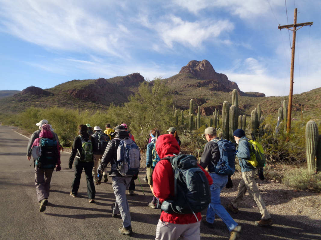 Nineteen of us head for Safford Peak, in the distance on the right. It was very windy and still cold, mid 40's. Of course, around here, everyone dresses like it is in the 20's. 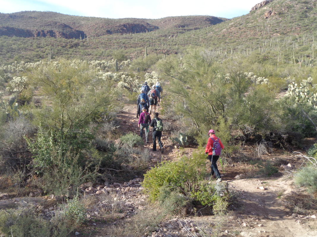 We cover some rolling terrain under sunny skies but the clouds soon roll in, signaling yet another approaching cold front. I keep telling myself this unusual cold weather can't continue and then I look at an updated 10 day forecast and discover, why yes it can. 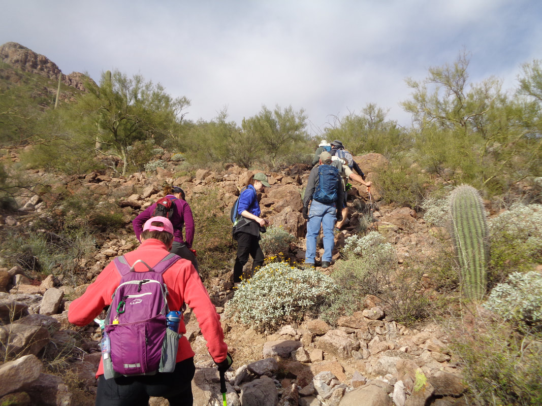 A rare trail finding mistake my Jeff has us off trail in the brush but we soon find our way back on track. At a ridge we..... 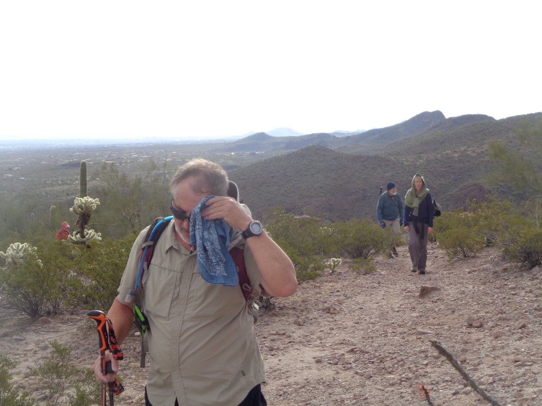 ….regroup as the line of hikers has become strung out. 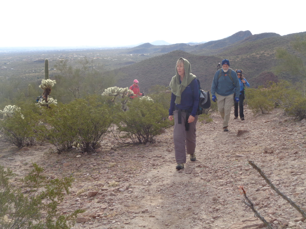 Interesting use of a sweater to turn it into a scarf. 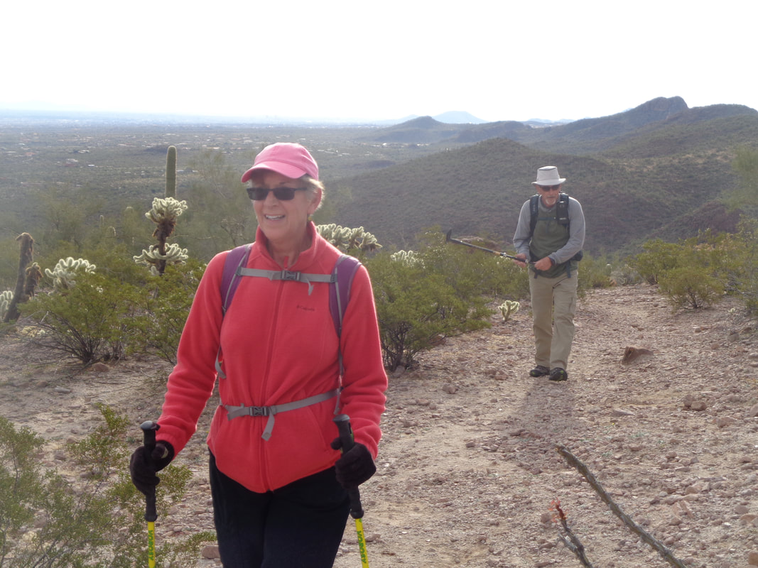 Smiles abound as we have got one of four good climbs out of the way. As we wait, my plans changed though and I decide I don't want to visit the peak as it may jeopardize my participation in an event a bit later in the day.  The group embarks on climb #2 as I had for the barn. The approaching front brought another round of mountain snow and I'll have some neat images soon.
2 Comments
All the times I have sat in my car, low 30's, cloudy, windy or calm, in cycling gear, reluctant to get out and join a group for an Ohio winter ride. I was always glad I did get out and do the ride and for the first time, I experienced that in AZ but not in cycling gear, hiking gear. I drove to the trailhead on the far east side of Tucson. Temperature was 39, wind was howling as it often does on this side of the mountains. I was motivated to hike so got out and began a solo effort to Aqua Caliente Hill.  Nestled between the Catalinas and Rincons, this "hill" is a fun climb and I was eager to see if I could bag a Strava KOM. 4.5 miles to the peak and along the way following an easy to follow trail you encounter a great false summit fake-outs. The trail zig-zags up the face of the above but..... 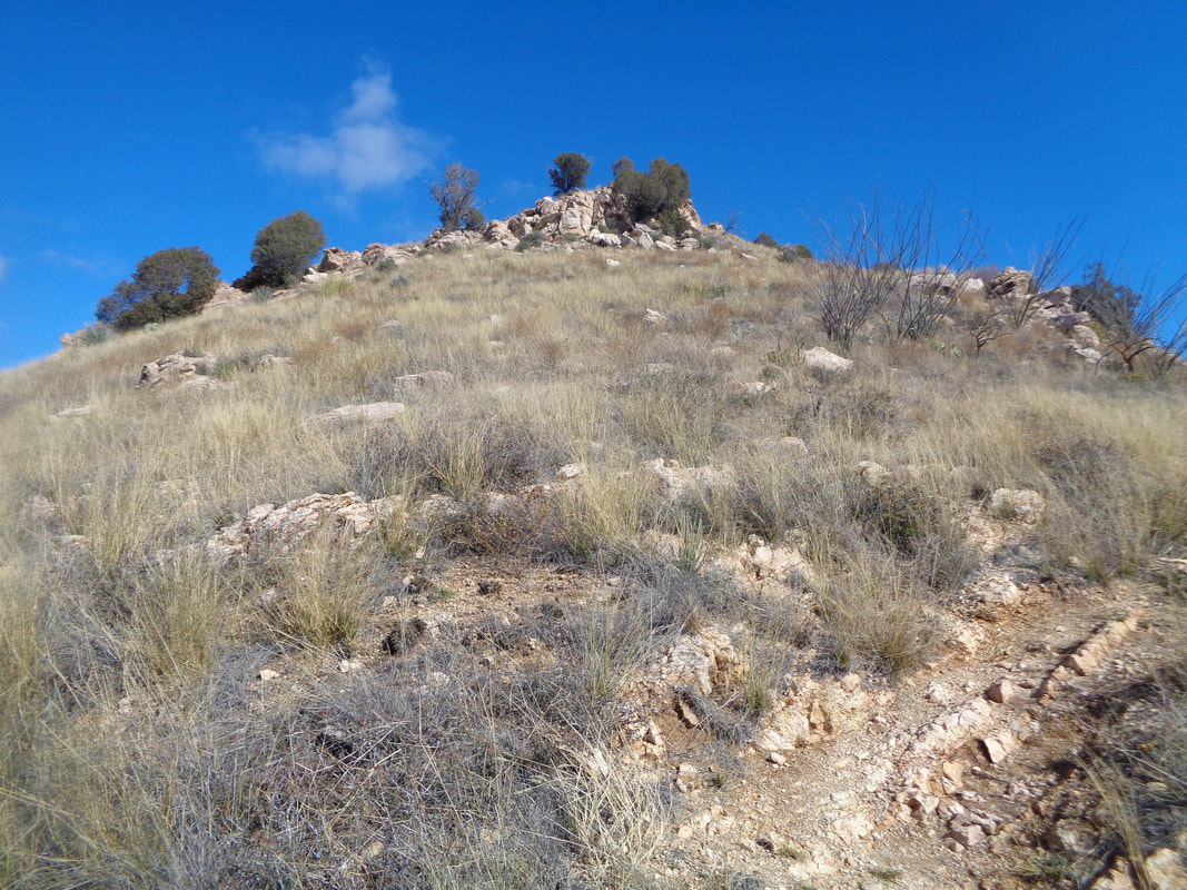 ….just prior to the peak, the trail veers right and you pass the peak and then see.... 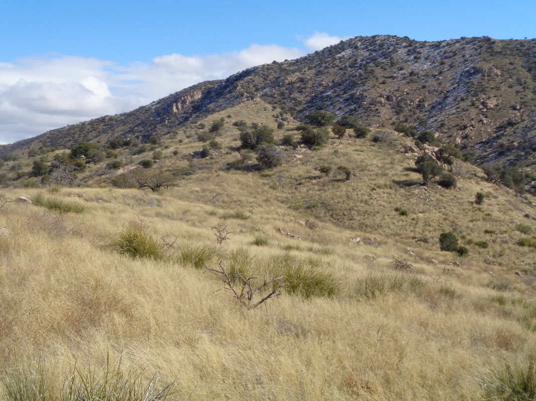 ….ugh and is that snow up there? The high today was forecast to be 50 and a full 17 degrees below normal, again. It was 71 degrees on Monday and much lower every day since, including of course today, Saturday. It will be another 4 days of this and then a return to normal. 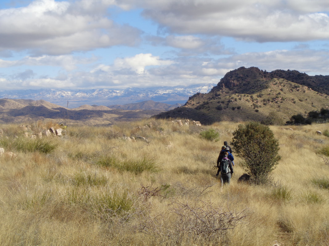 What an awesome view as I catch a group and look to the east at a vast expanse of mountains with snow on them. 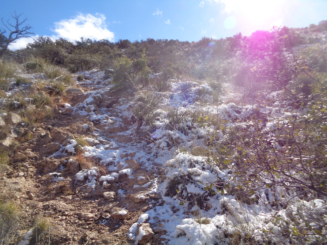 The group waves me through and about half way up a very steep final climb, I encounter the snow. Nothing serious at first but then with about 200 yards from the summit.... 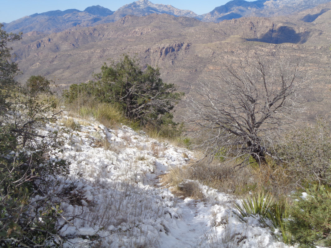 ….ok, still not deep, maybe 1" but it is packed and icy in places so that slows me as I pick my foot steps carefully but eventually make it.... 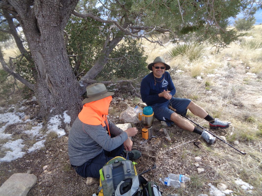 ….to the peak and there find a couple of guys sheltering in front of a tree. The wind was howling and my gloved hands were numb. They offered me a seat on one of the rocks but I did not want to linger. They had a very interesting stove that is fed by twigs and it put off decent heat too. Note one guy was wearing shorts! The temperature or maybe wind chill would have been under 30 up here. 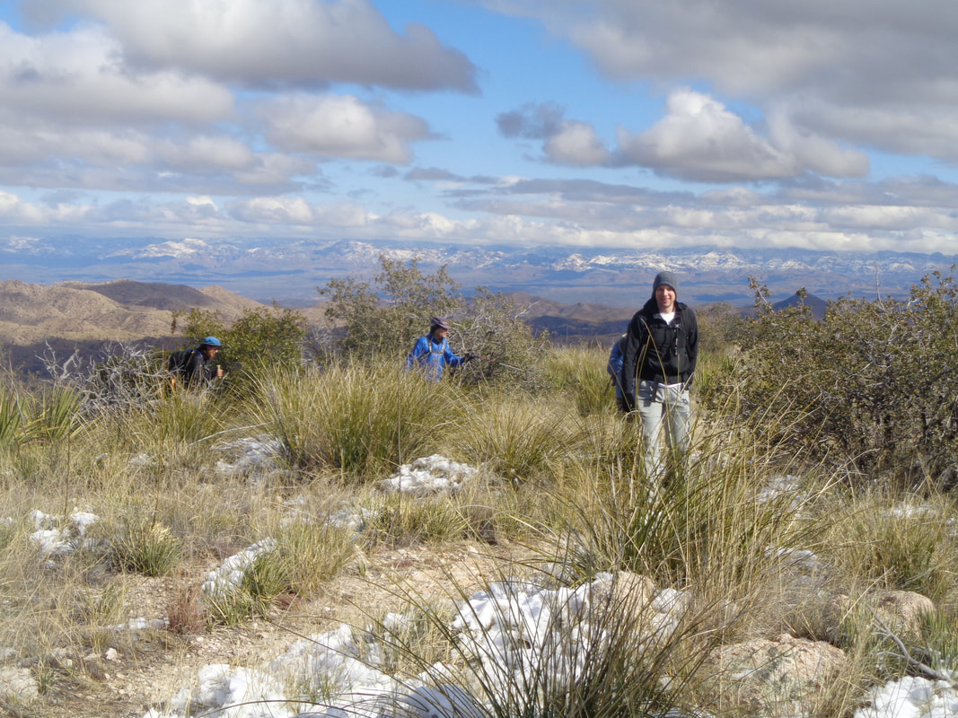 The group arrives and after signing the summit register, I snapped..... 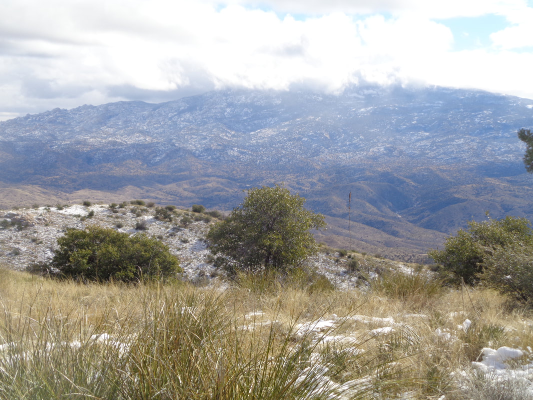 ….a few images and..... 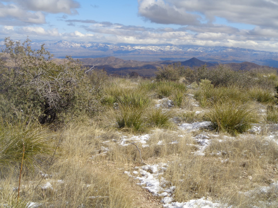 ….headed down. 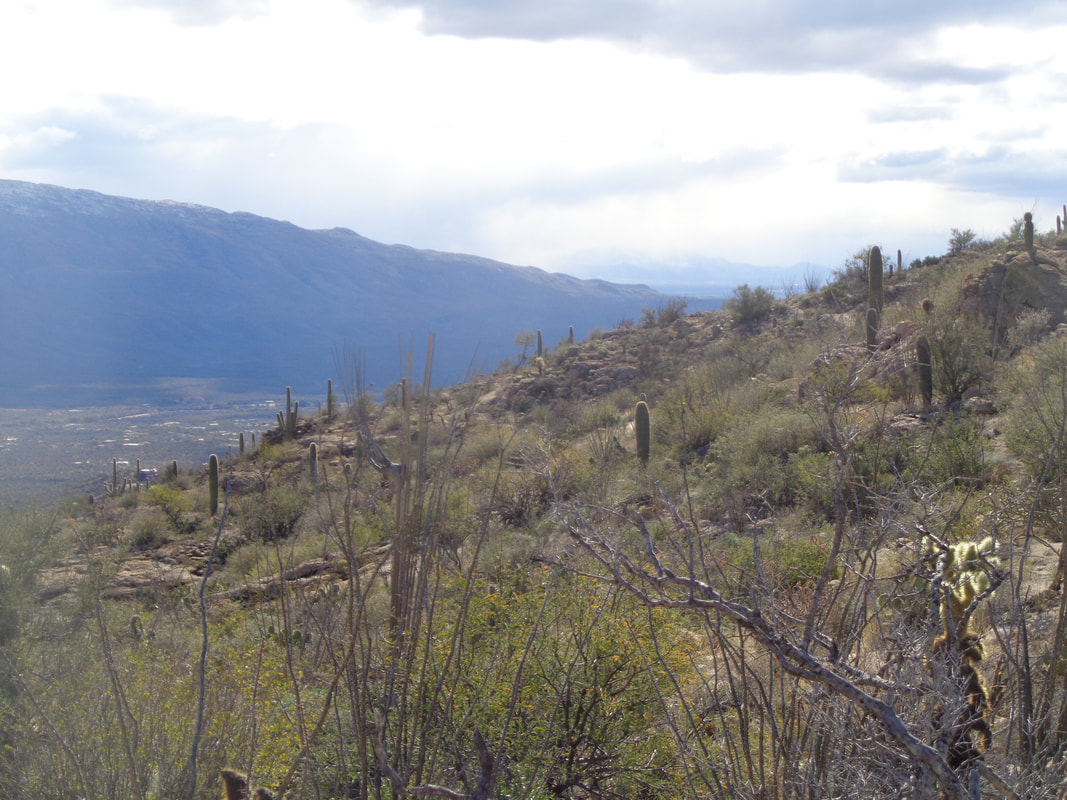 That portion covered with snow was treacherous but once through there, I hustled down and close to the bottom, could see precip falling in the distance. The temperature warmed and I was able to take my gloves off and unzip my jacket. I finished with 9.5 miles and 3000' of climbing. As for Strava…... 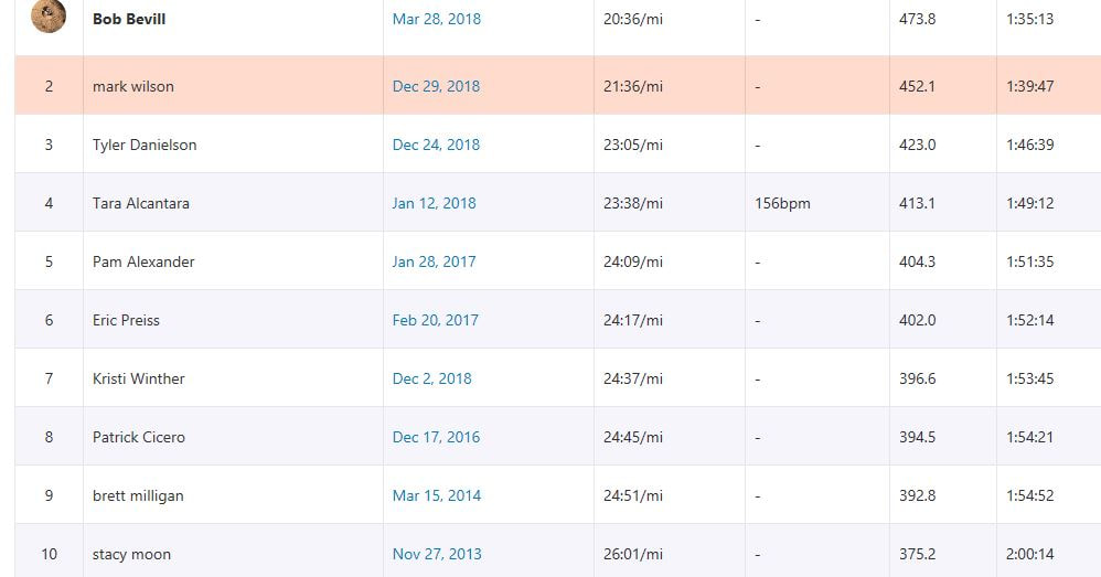 ….I must be the king of 2nd place. I did get the KOM for the top half of the climb so was happy with that. Well, onward and upward.
 Not one but two cold fronts swept through the region and in their wake we were left witj high temps 18 degrees below the normal high of 67 and snow down to 4000'. Like, what the......
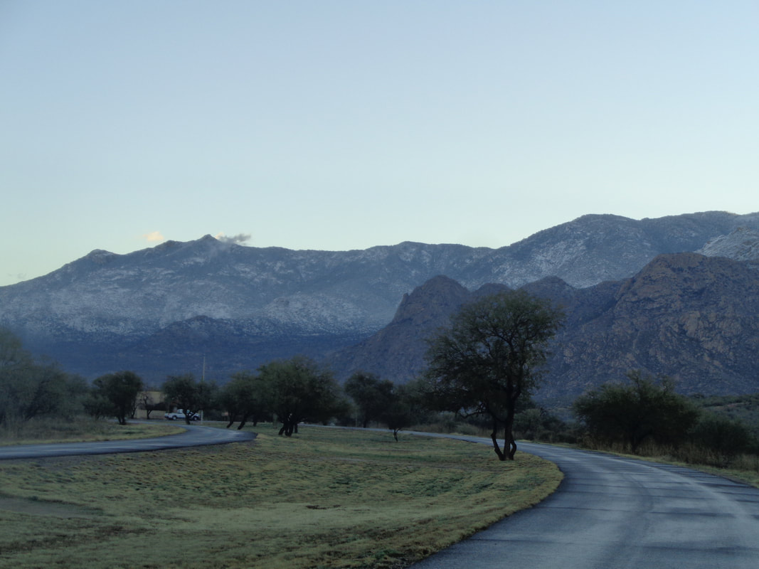
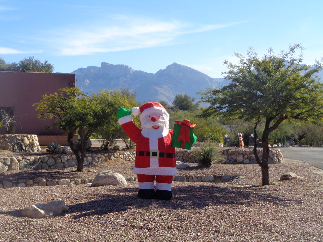
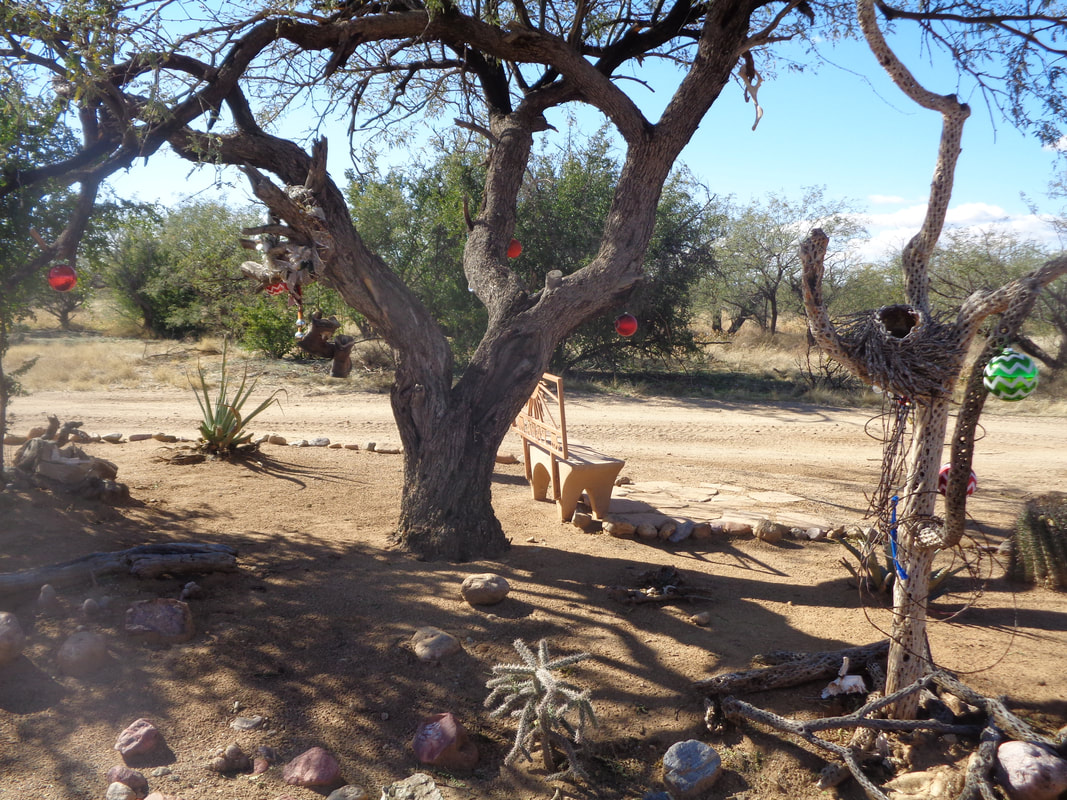 Following directions I found while searching info about hiking to the top of Elephant Head via the north approach, I get as far along a dirt road as I think my car will go. There, I find an interesting presentation, dressed up with a Christmas motif. 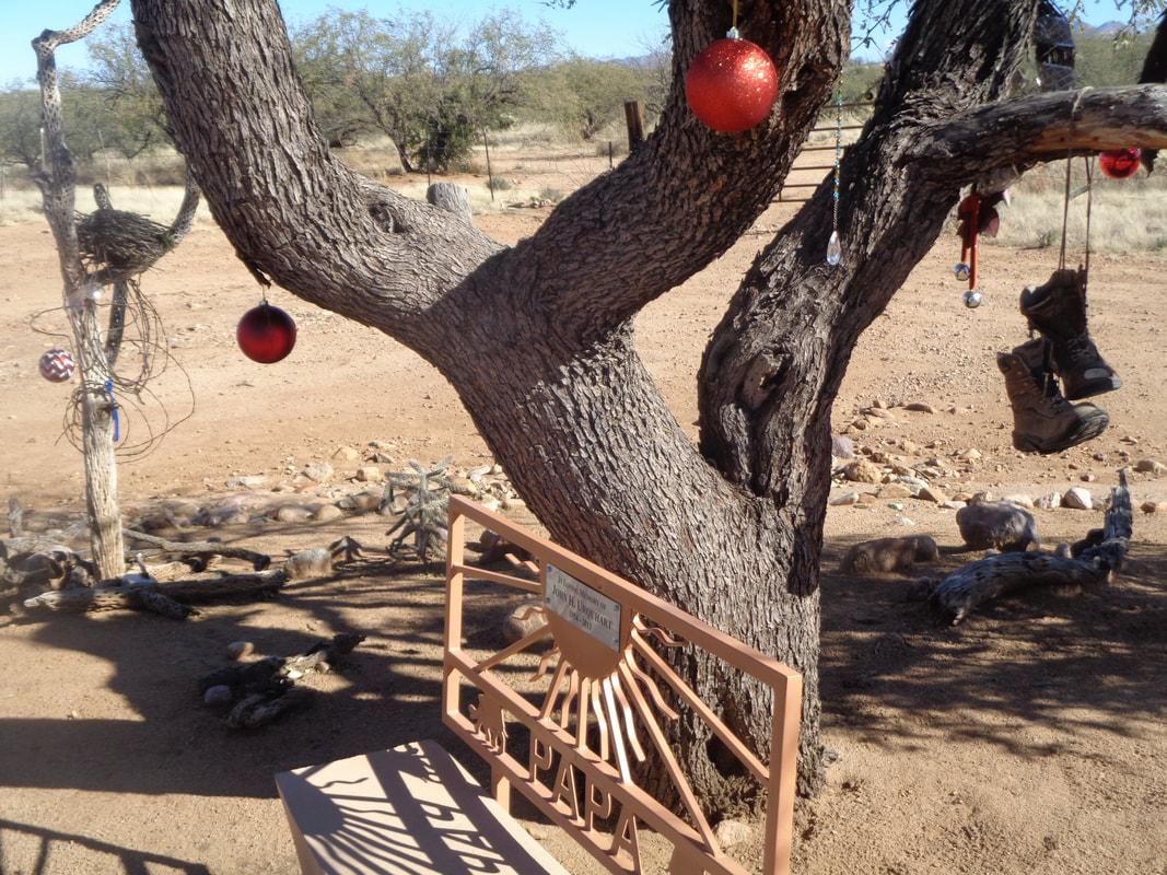 I was intrigued by the effort.  From an overnight rain, snow was produced on the peaks. Two cold fronts have come through and the high today would be well below the average daytime high, only 53 degrees.  One of my first jobs was to write instruction sheets and manuals for operating machines, tools and gauges. I learned that you can't take anything for granted about the reader's knowledge of things I had taken for granted. Anyway, the driving directions to reach the trailhead assumed you knew, when reaching multiple junctions, you would know which of 2 or 3 choices to take. After walking 3 miles I reached..... 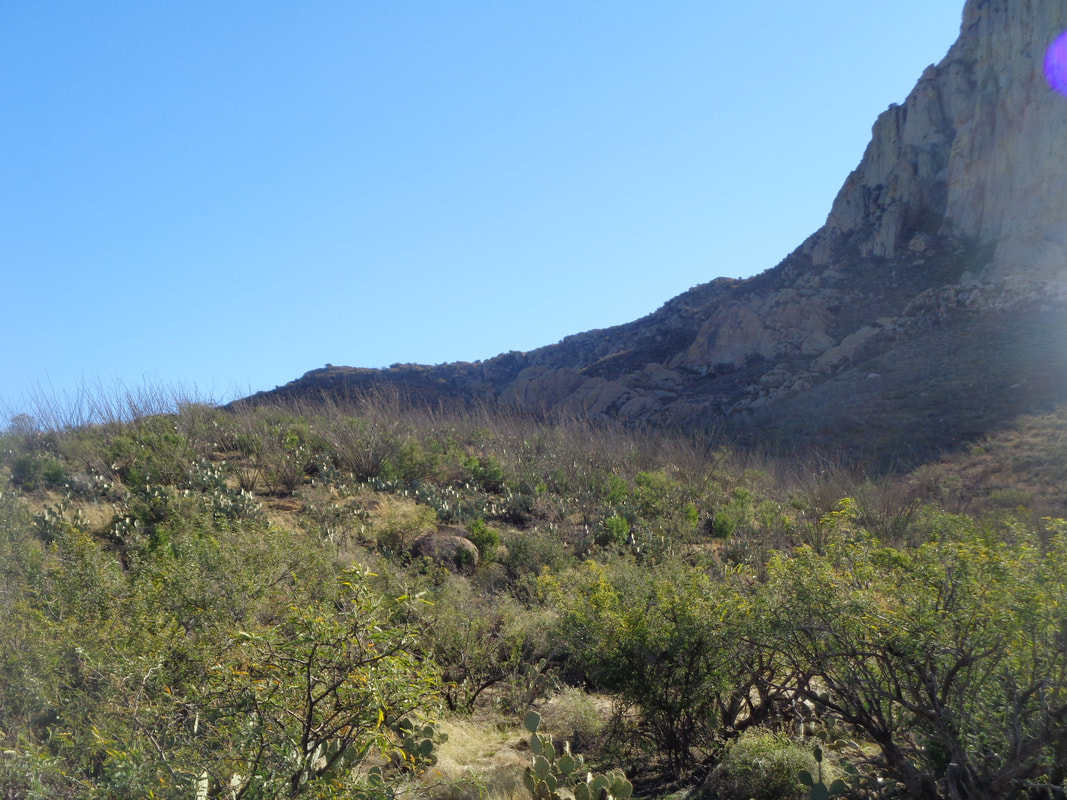 ….not a trailhead but a point on a map. No trail, no evidence that anyone had ever been here before. I did have a gps route to follow but it was useless because really, it's simply a matter of seeing the obvious saddle and winding my way through the obstacles. 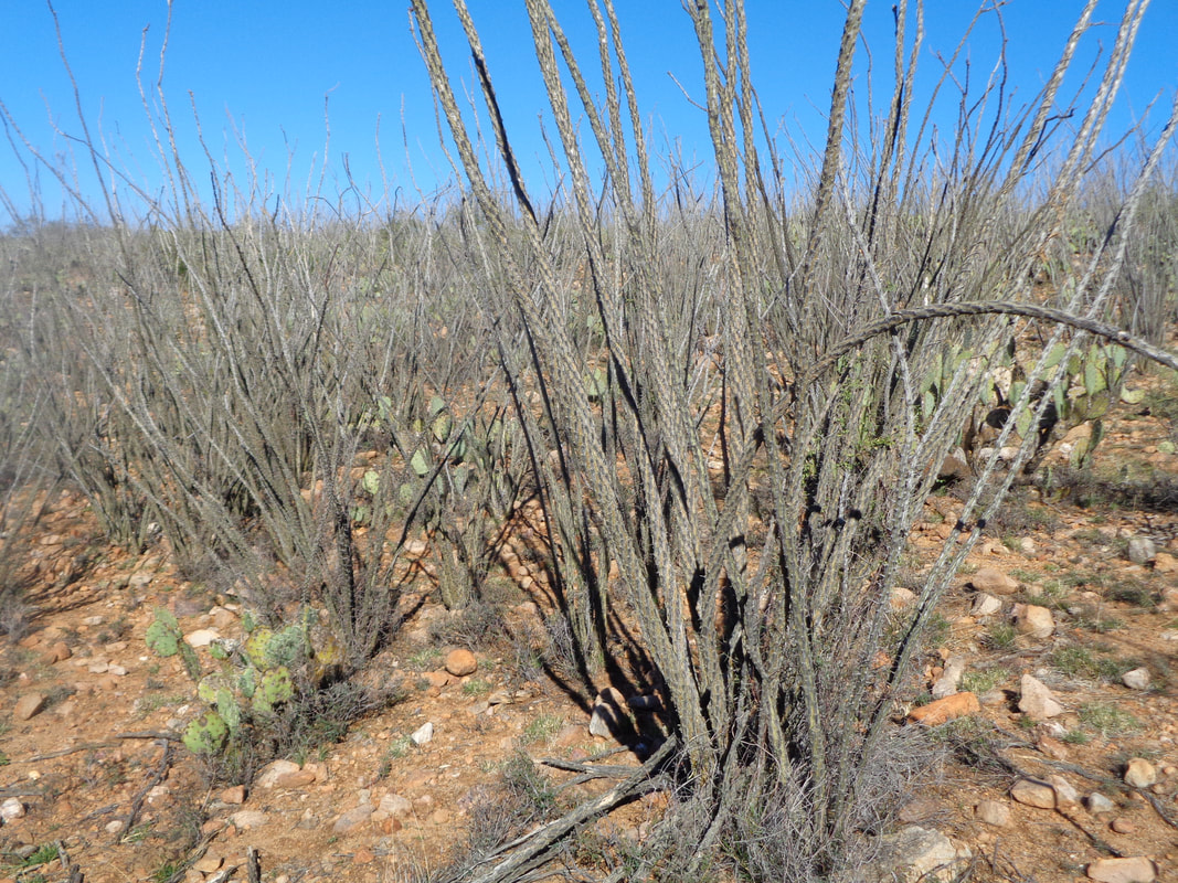 To my left was an extended grove of ocotillos. The thickest growth I have ever seen. I skirted this by staying just left of the grove and while keeping a wash to my right. 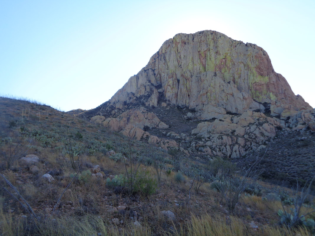 I reached a ridge and scoped things. There are two routes. Head to the saddle and then make a right to the summit or much more interesting, head left of center and exploit a chute that ascends left to right up the rock face. There is some serious exposure with class 3 and 4 scrambling. I had seen enough and will organize a group to try one or maybe both approaches. 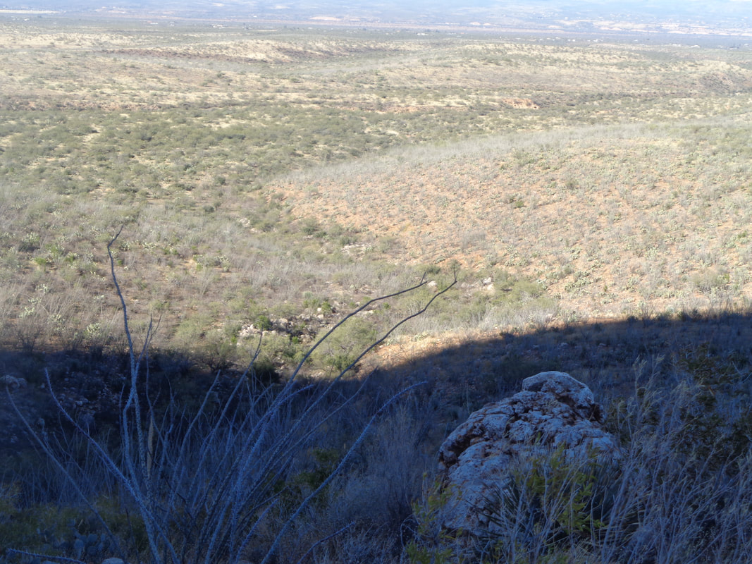 On my return, the "S" shaped wash I again kept to my south side while skirting the grove of ocotillo to the north. The footing was loose but not too bad. 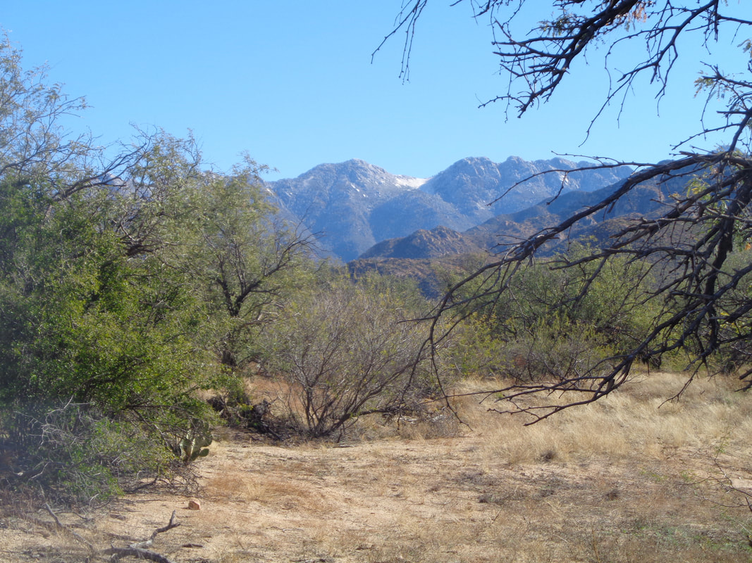 During the return hike to my car, I looked back several times and enjoyed the views of snow at the highest elevations. 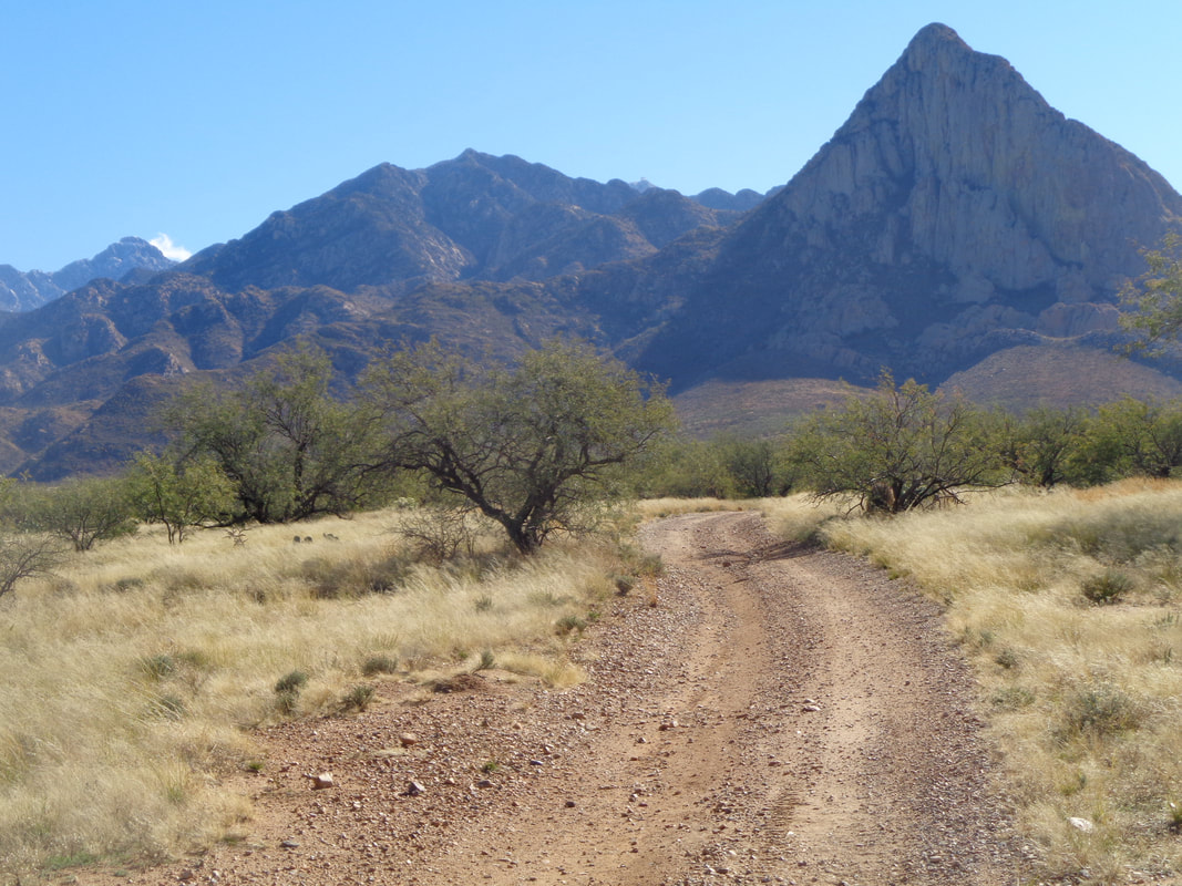 The peak of Mount Wrightson on the left, Mount Hopkins with Observatory peeking over a ridge in the center and then Elephant Head on the right. Be back soon for the entire effort. Finished with 6.4 miles and not much climbing.
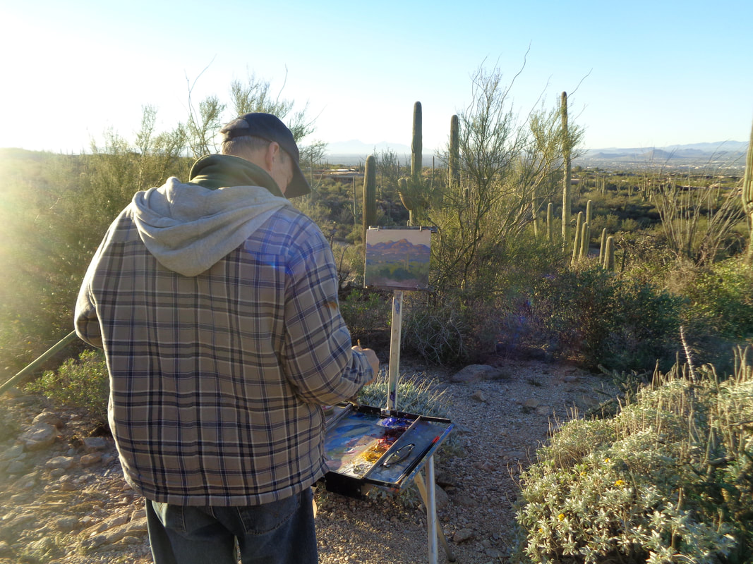 I was talking to a fellow hiker who asked if I had ever hiked to Table Mountain and if so, would I be willing to show the way. Doing that particular route would be easier if you have someone who has been up there so sure, I eagerly accepted. Dan, Vickie and me begin the hike from Pima Canyon trail head and soon encounter a local artist. Quality work and his paintings are sold in a local art gallery. 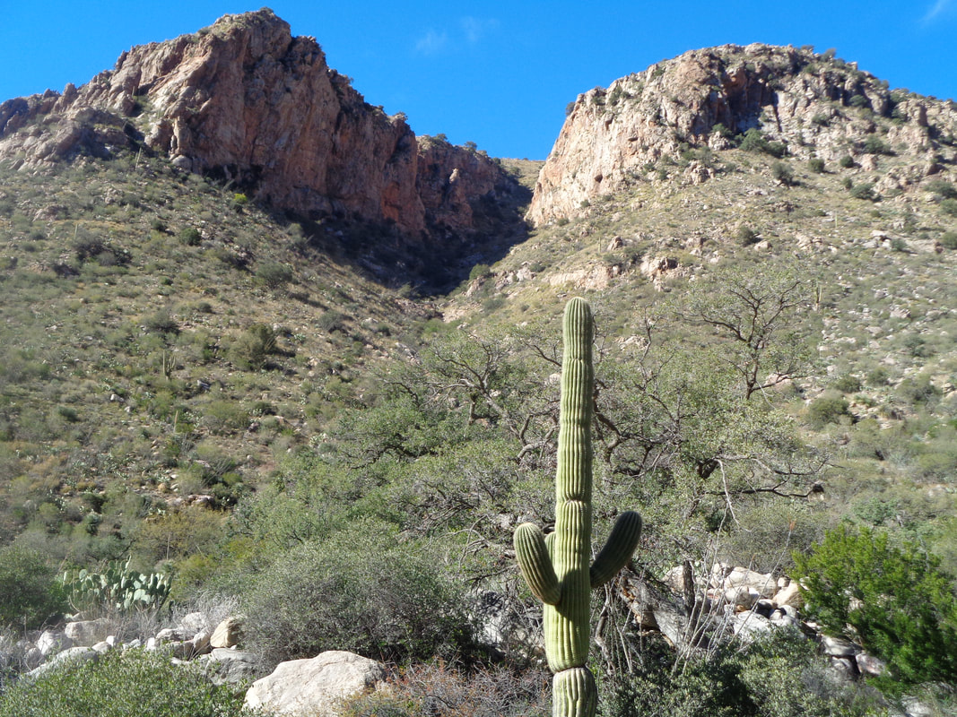 Three miles into the hike along the Pima Canyon trail, I spot the point from which we launch our bushwhacking effort. The midpoint destination is the grassy looking slope between the canyon walls. The slope always looks grassy because it is usually covered with Schott Agave, better known as the dreaded Shindagger. However..... 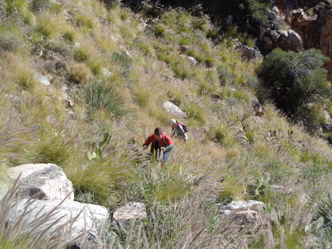 ….an invasive grass has taken over (don't worry, the shindaggers are still in there) as we slowly work our way up canyon. This grass, which grows waist high, hides everything around it. Going up it is a pain but coming down, really dangerous as I explain later. One thing is certain, during snake season, no way would I venture into this environment. The buzzing of a rattler could be coming from any direction and you'd have no way of knowing where it is. 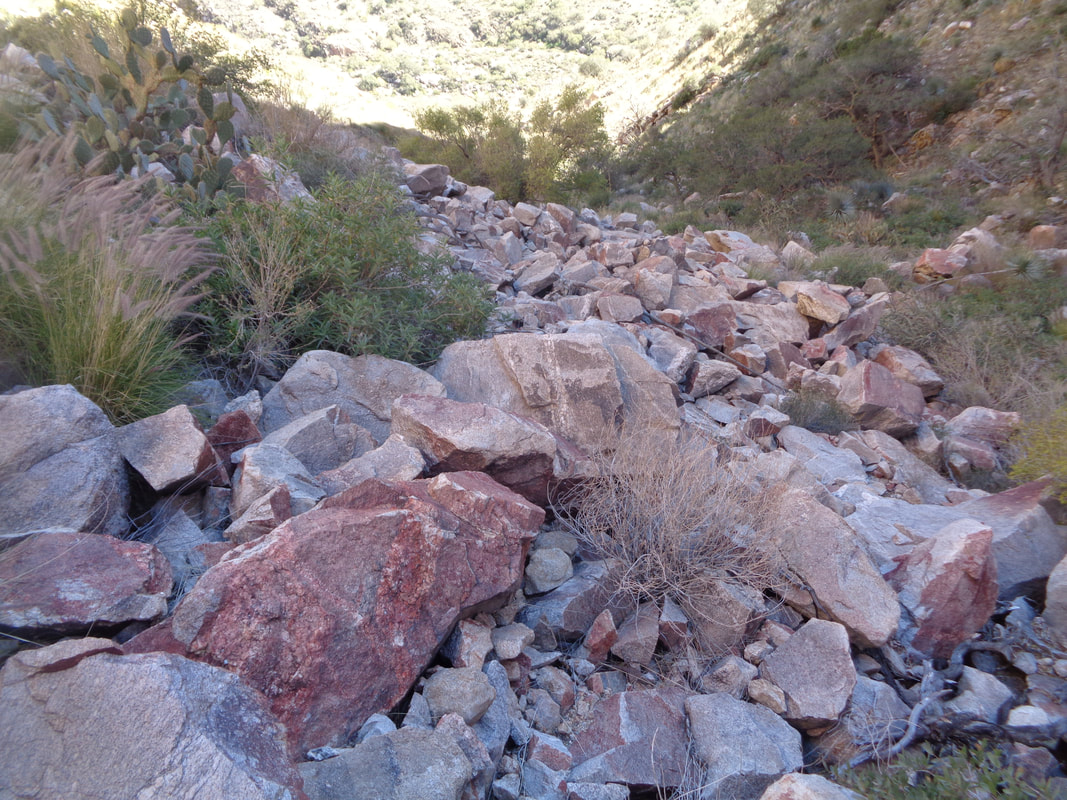 About half way up, we gleefully enter this boulder field. A fall in here would at least be painful but what a relief to get out of the brush. These boulders are scattered all over the canyon, for the most part hidden by the grass.  A final steep slope until we mount the bottom of the table. The climb from the trail to the saddle is .75 miles with an average grade of 30%. Throw in the brush, cactus, grass, shindaggers….well, it wasn't a lot of fun. Last time I did this route the grass was largely absent and made the going much easier. 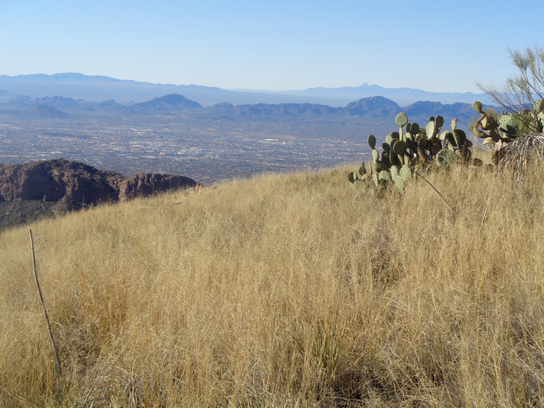 Emerging from the canyon, the views are magnificent to the southwest. I know my mention of the grass is becoming tedious but look at that stuff! 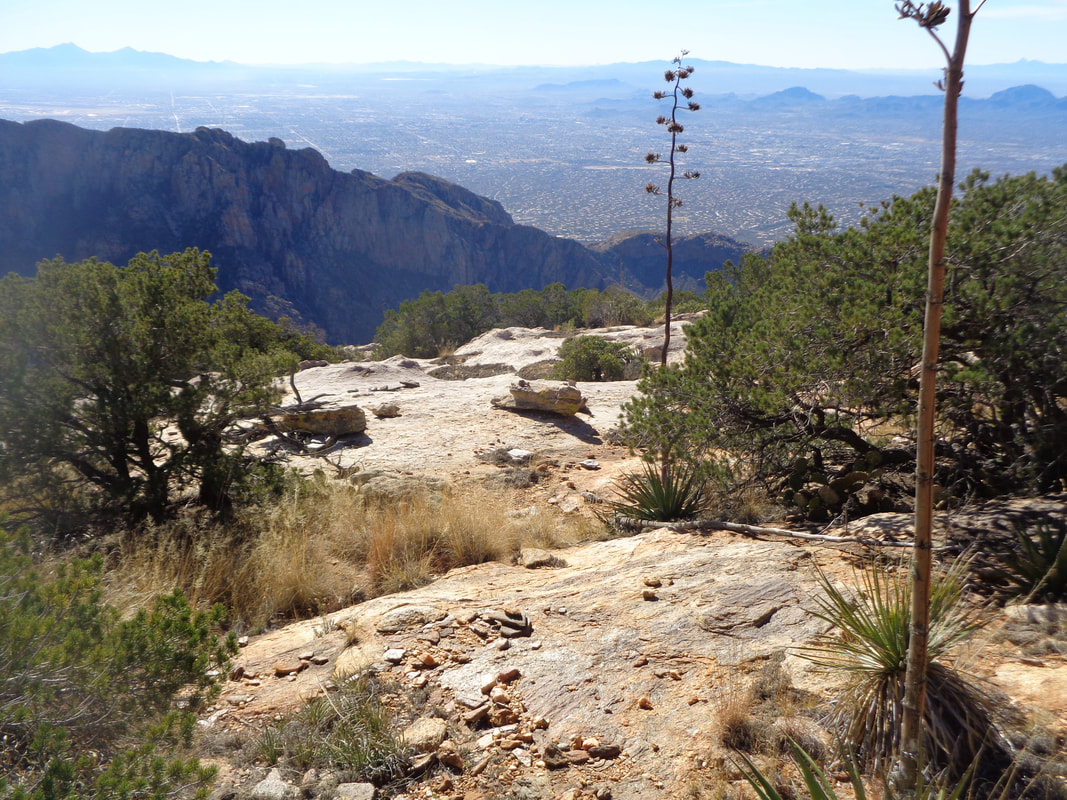 The final roughly 1 mile is still steep but nothing like what we experienced. The sloped plateau has some slick rock that is welcome. I got out front a ways from Dan and Vickie so I could poke around and find the best approach. Stupidly, I had relied solely on my memory from 2 previous visits and had not downloaded the route so I could follow it on my phone. 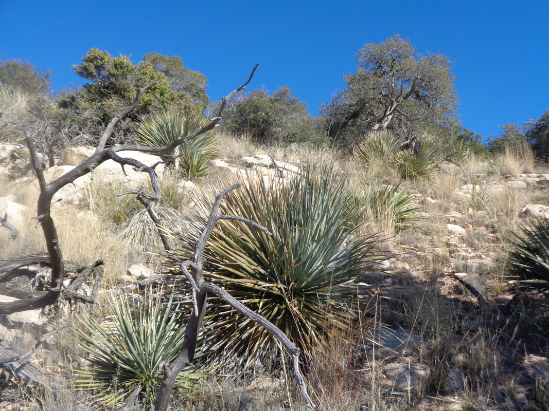 My hiking companions were good sports as I roamed ahead and slowly picked our way through the obstacles. At long last.... 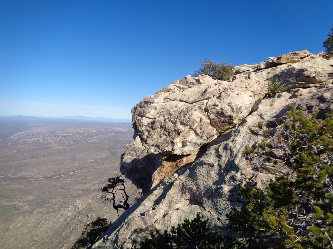 ….I emerged from the thicket but slightly below the top so circled around and first.... 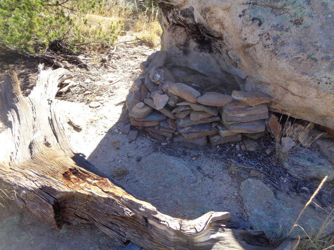 ….found a very cool camp site and then..... 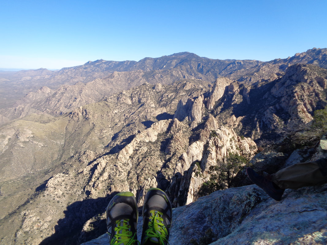 …..sat and took a couple of images. I retraced my route and shouted so the others could use my voice to hone in on.... 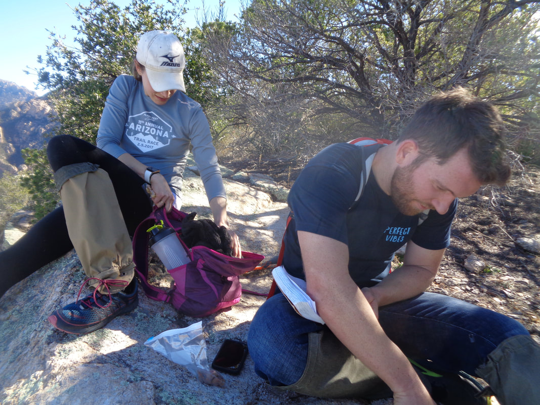 ….the overlook. Dan signs the summit register and it appears this mountain receives an average visit of 1-2 a month. Note the gaiters worn by Vickie. Good idea for a hike like this one. 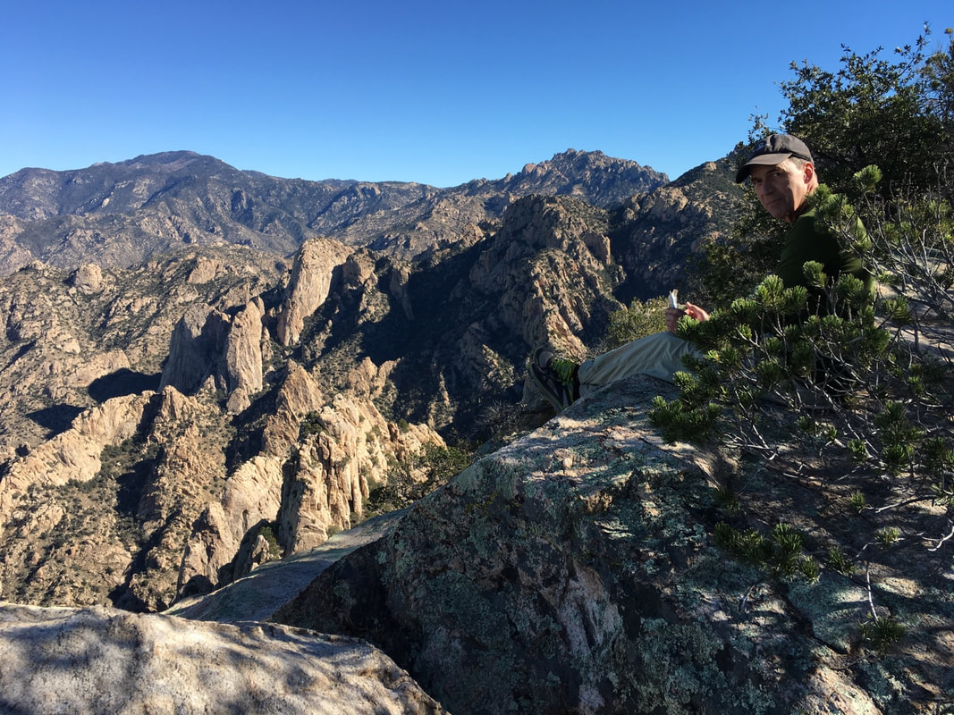 Do I look worn out? I kind of was and not looking forward to the descent. Should have put another day of rest between the hike of Saturday and this one on Monday. Yep, Christmas Eve and what a way to spend part of the day. There were a lot of people on the maintained trail enjoying the sun and warmth. After awhile, we begin our journey back. 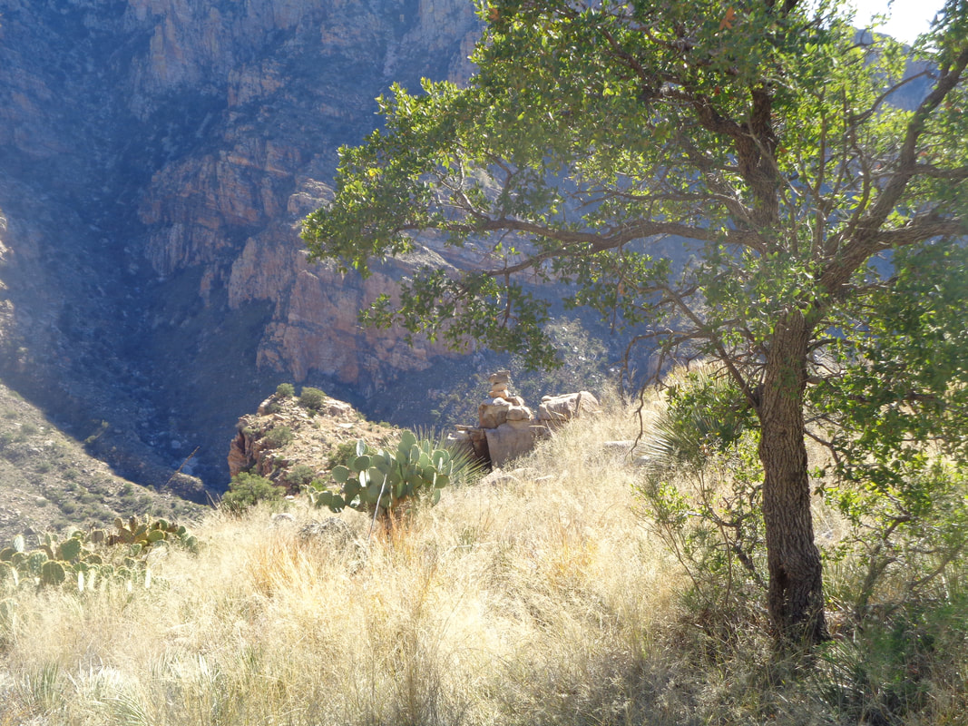 The main problem with the grass is when you step on a sloped rock and the grass is caught between the rock and your foot, it is slick as ice. Dan fell a few times but each time sprang up with a "I'm good!" I fell twice but both times my slide was broken by the sharp edge of a boulder. Both on my left calf! When the pain goes away it will feel awesome. The above image captures the steepness well. 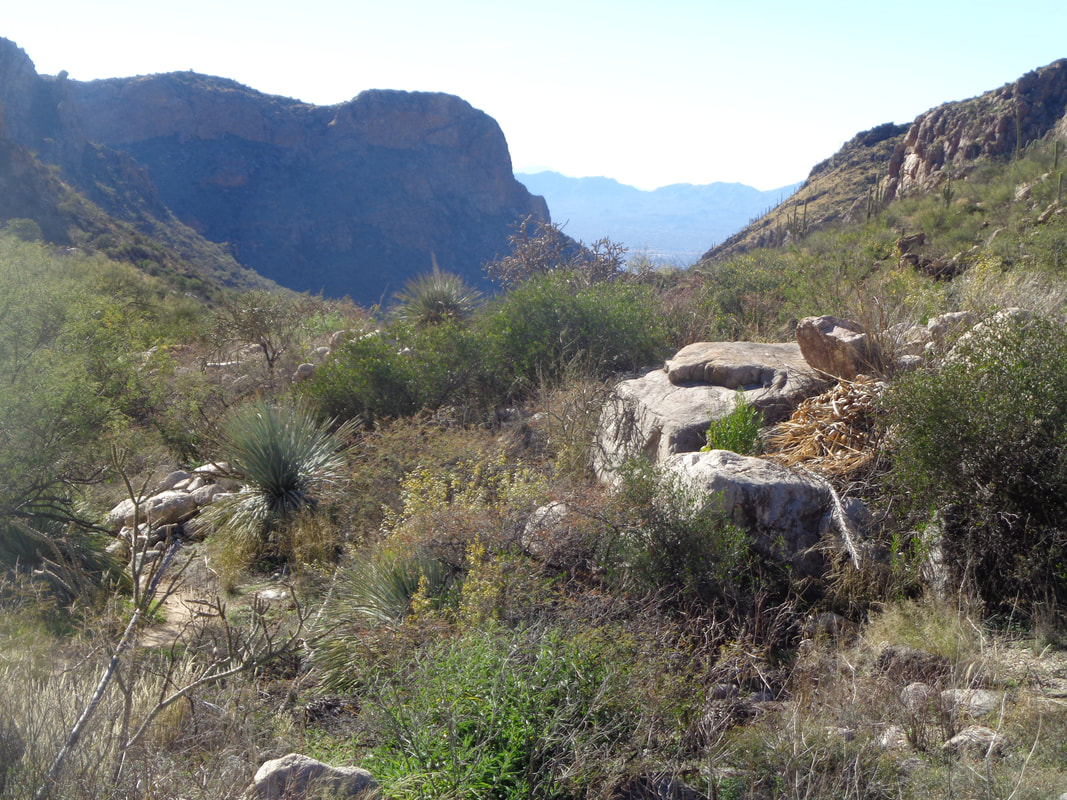 I emerge first on the Pima Canyon trail and am thrilled. I fought an urge to bend over and kiss the dirt. The next 3 miles is obvious so I keep going as I was anxious to get this experience behind me. It is a "long" 3 miles because of all the rocks jutting out of the trail, kind of creating an obstacle course. 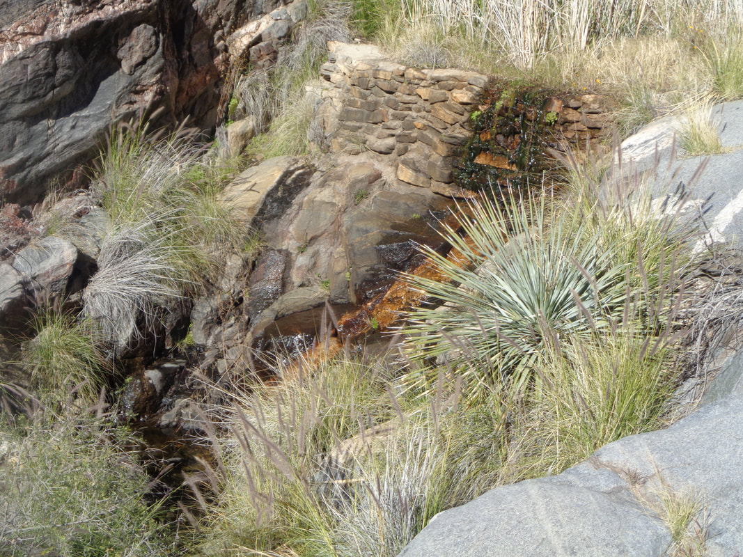 I pass a damn with water trickling from it. Finished with 10+ miles, 3500' of climbing and the usual aches and pains.
 I drive across the desert, through Florence and on to Apache Junction to meet a group at the Peralta trailhead. A brilliant full moon to the west accompanies me as I contemplate why these "winter" hikes must start so early! I have thought of starting a group called, "Mid Morning Hikers" to appeal to those who would prefer a slightly later start in slightly warmer temps:) Even so, the high today would be mid 70's so..... 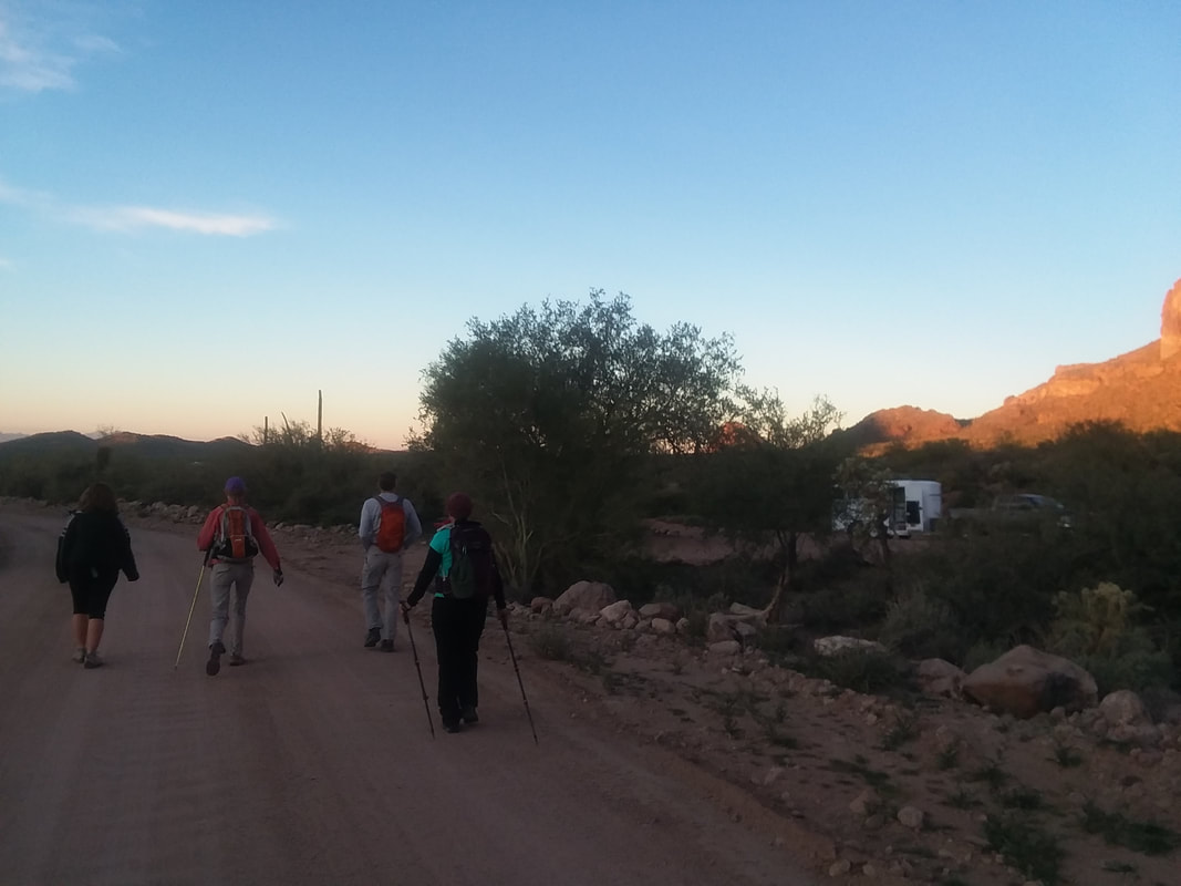 There were several last minute cancellations so only 5 of us, Don, Elaine, Barbara and Tracie headed down a dirt road to the Lost Goldmine Trail. 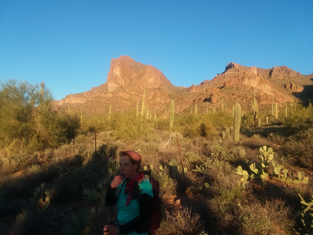 Tracie takes in some water. For hiking, everyone has some kind of Camelback system to make hydrating efficient. The sun illuminates the rocks as a combination of the pace, elevation gain and warming temperature causes me to take a quick break to change out of a jacket. Noooo, I left my hiking pole at the spot and some how discovered the loss too late. Lost one last year and now another this year. Maybe I should have someone ship me a batch of oak branches from Ohio that I can turn into hiking poles.  We leave the Goldmine trail and pick up the Carney Springs trail. Gawd, what a brute of a trail and what you see above is only the first of two major climbs. The first section is .28 miles with an average grade of 35%. Having been off the trails for about 10 days and having a big hike coming in two days, I intended to stay with the group but they set such a torrid pace, that idea went out the door. 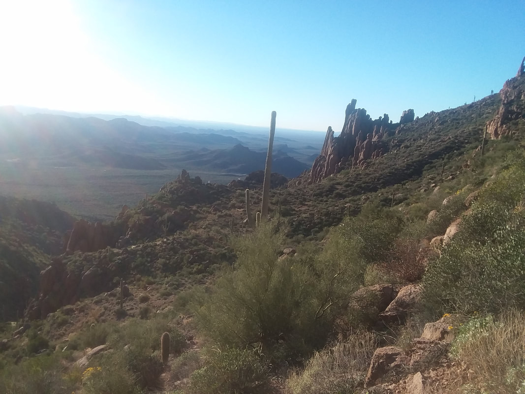 The views as always are spectacular! Reaching the saddle that separate the two climbs, I looked at the next section (.25 mile, 31% grade) and assumed that had to be a segment on Strava so picked up the pace and was happy with the result when later I uploaded the hike.  What laid before us was a pleasant hike through another canyon that curved to the right. Some climbing but nothing like the aforementioned punishment. We were now on the Ridgeline trail. 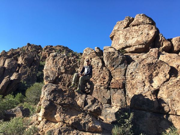 Elaine took this image of me as I rested but briefly cause there is virtually no pausing/break taking with this group, which I prefer so it's good. 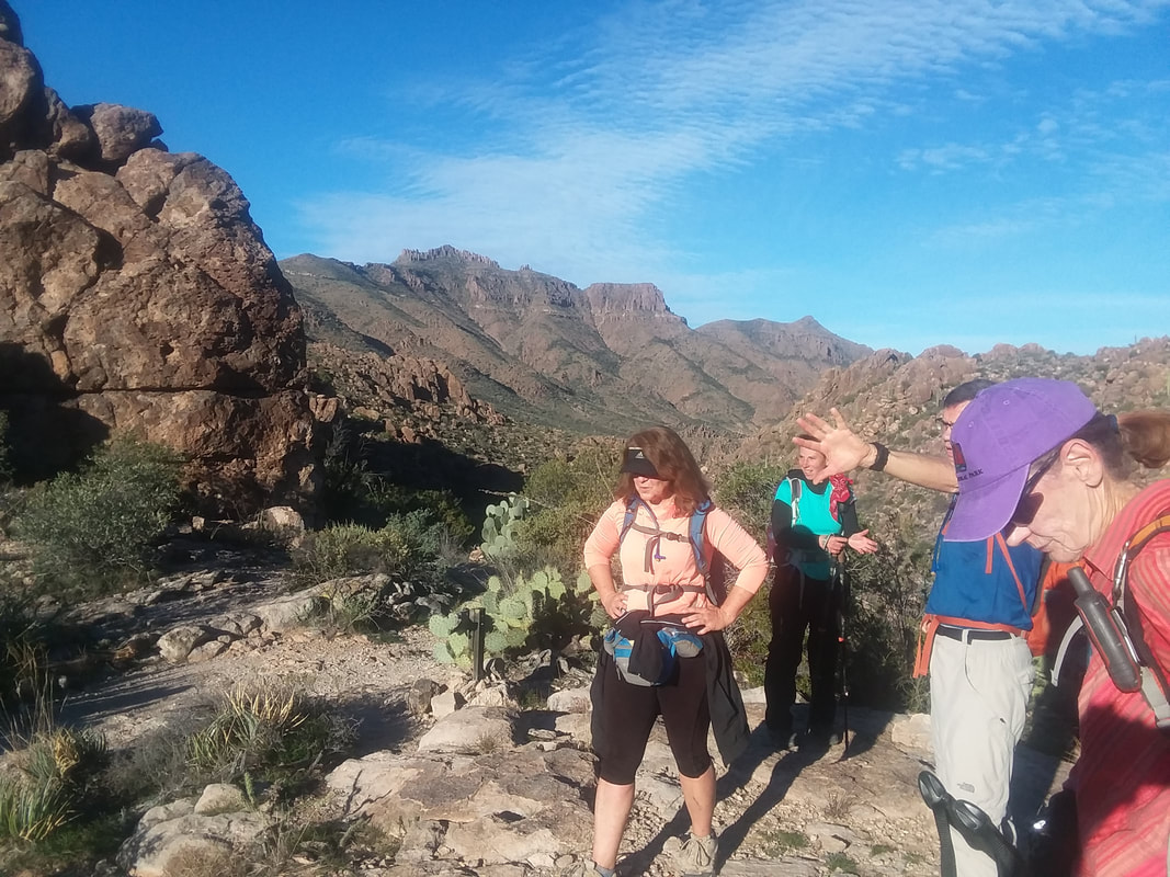 Our hike leader, Don explains what lies ahead as beautiful Superstition Peak sits in the background. 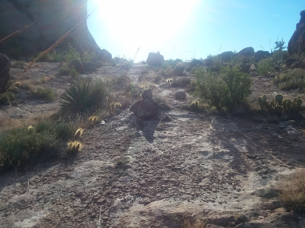 There is some route finding as we follow the trail and eventually reach another saddle where we find..... 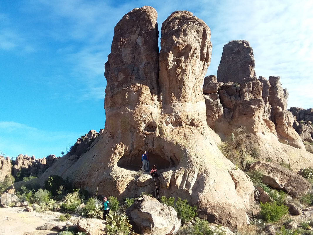 ….the rabbit formation to our left. I hung back to take the group image as each climbed into the "mouth" for a group photo. However, I used Barbara's camera for the group image and made the unforgivable mistake of the dangling finger photo bombing what would have been a good image. Barbara, in the strongest terms possible, expressed her agitation. So, above is the best I can provide. 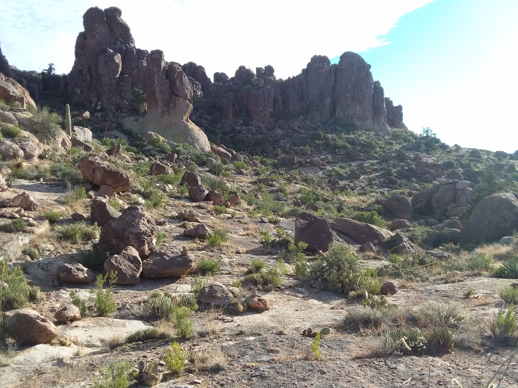 We descended gently from the saddle on an alien landscape. We were looking for a cairn that would indicate when we should depart the trail and head for Robber's Roost. There was some humorous discussion about what makes one cairn significant over another but the one we found left little doubt, this is where we go off the trail. Winding through a labyrinth of huge boulders we find and enter...... 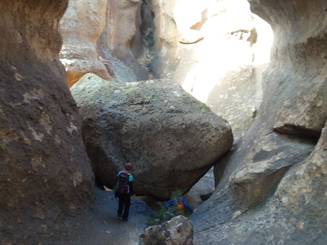 ….the Roost. What an awesome place. Not sure it was ever actually used by bandits to hide from their pursuers but it could have been! 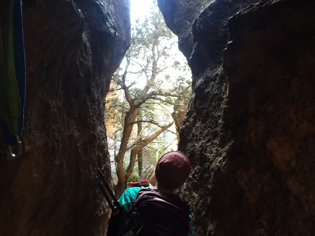 Tracie looks through a crevice that leads to a lower level that is accessed only with rope. Kind of neat to see a tree growing from that level and beyond it a Saguaro cactus. 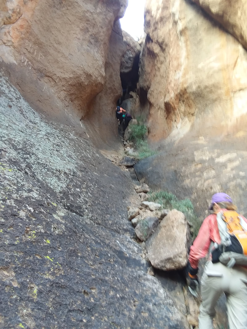 Don and Tracie ascended to the base of a chimney that is a way out of the roost. I soon followed but I lack their rock climbing skills and gave up my effort at shimming up the chimney, unseen in the above image. What is shown is a kind of steep slope to get to the chimney. They poked around but were unable to find a route back to the Ridgeline trail and reentered the roost. Soon, we..... 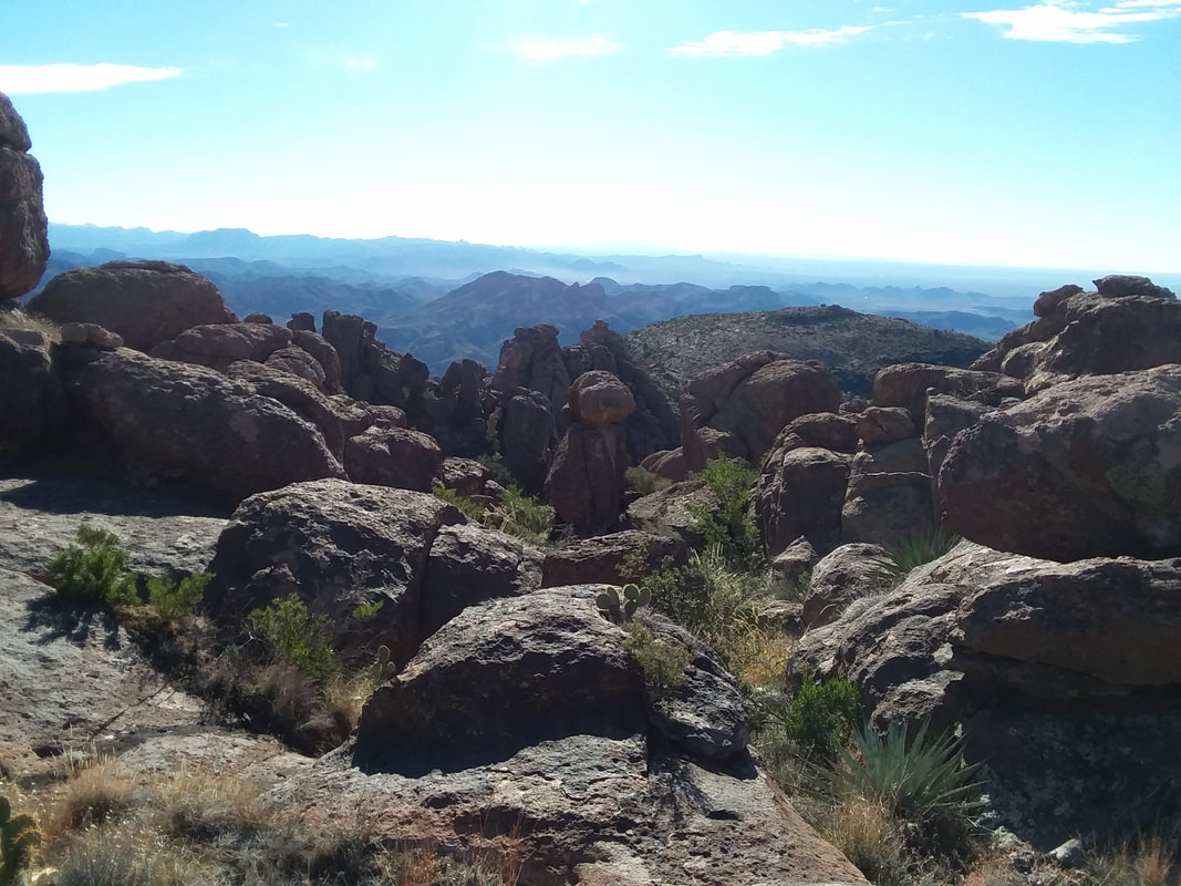 ….departed the way in which we entered and continued our hike. 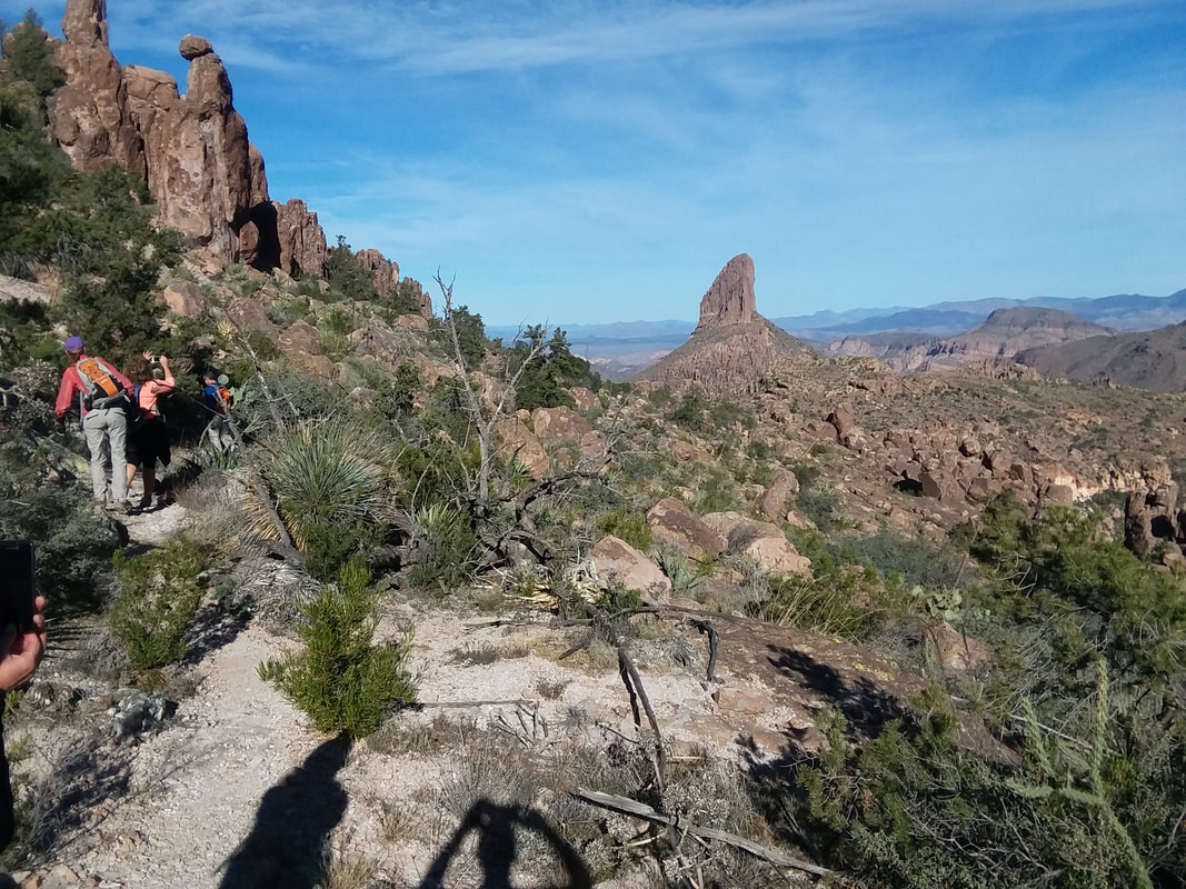 With Peralta Canyon to our right, we parallel that from above and soon are rewarded with grand views of Weaver's Needle. We cross Peralta Trail and continue on an unsigned trail toward Geronimo Cave. 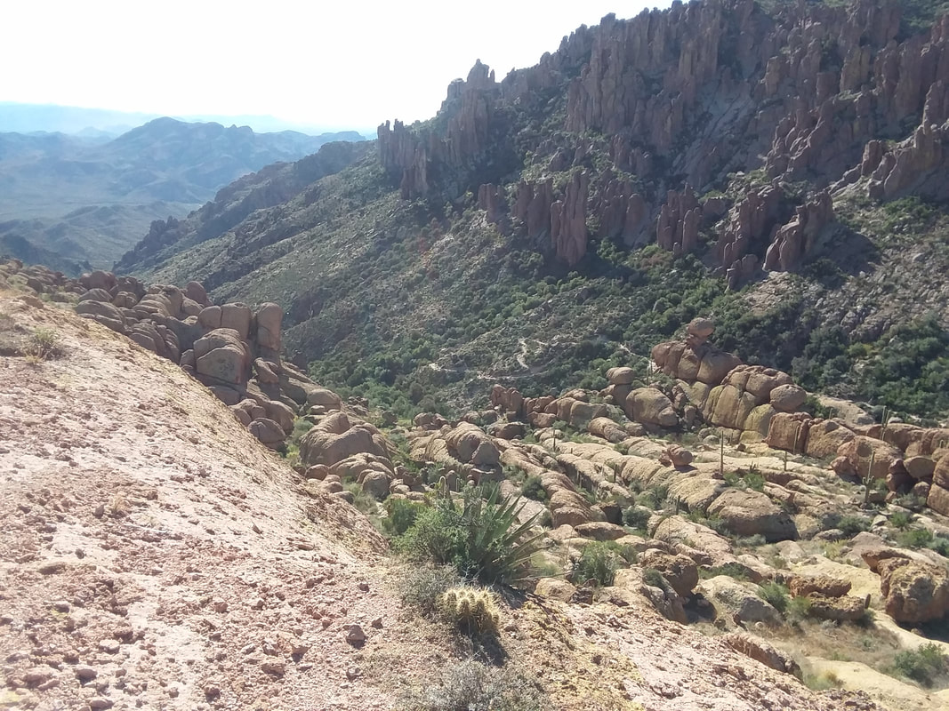 Looking into the canyon, we can see the heavily traveled Peralta trail, far below us. Soon.... 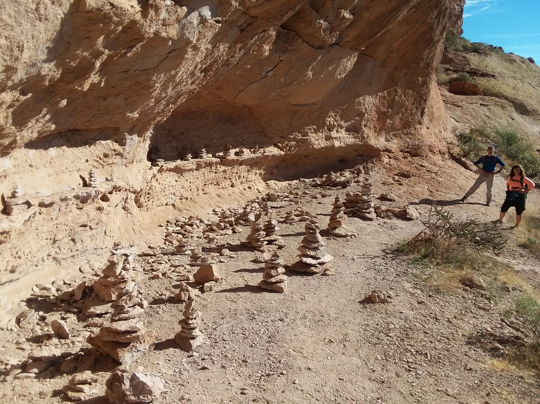 ….we find Geronimo Cave where over time, visitors have built many rock piles. Not really much of a cave, more like an indentation in the rock wall. Still, a neat place to visit. Soon, we continue and 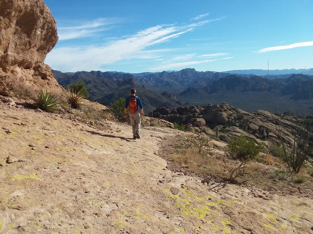 ….Don continues to lead us on route with a couple of hiccups in route finding which is normal in the Superstitions. 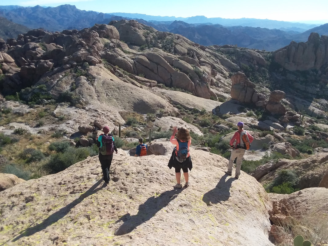 We descend steeply on slick rock and continue to follow a route but eventually discover we are headed back toward the cave. Not sure how that happened. We retraced our route trying to find a way into the next canyon where we would find the Bluff Springs trail. At some point I volunteered to look around and how about that..... 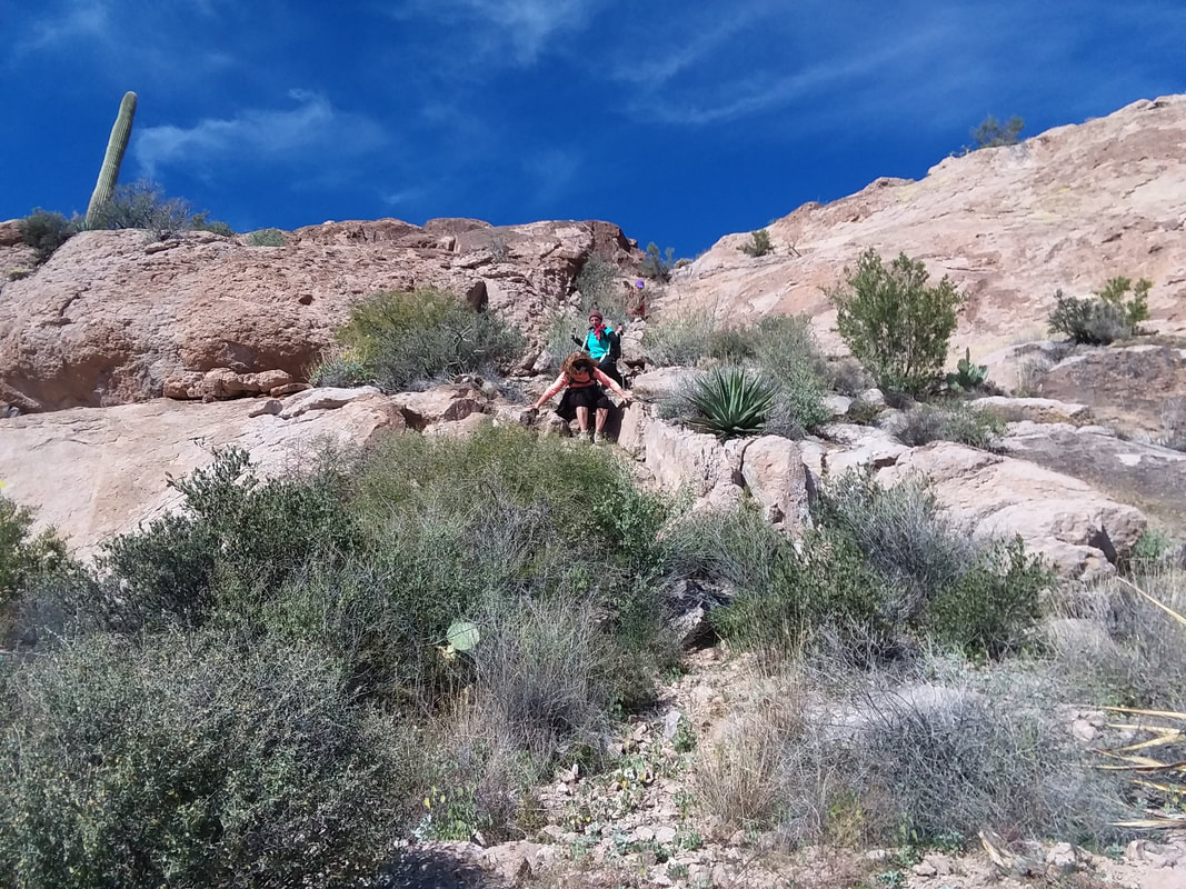 ….found a sketchy way over a saddle and down the other side. No one was actually injured during this descent:) It is great fun and we all enjoyed it. 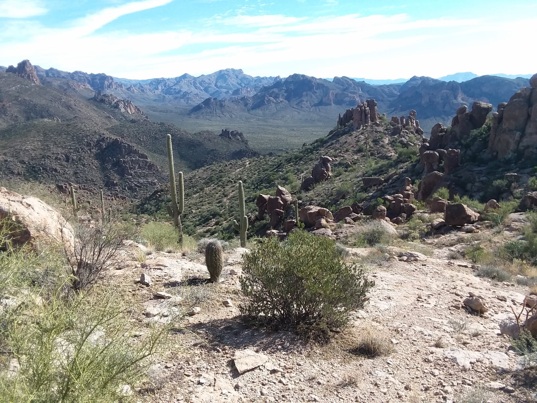 We found the trail and descended to the parking lot. Finished with 8.25 miles, 2500' of climbing, the usual blood letting and sore feet, as usual. It is rare for me to enjoy a group hike for a variety of reasons but this was a really good, fun group with whom to spend time in the outdoors.
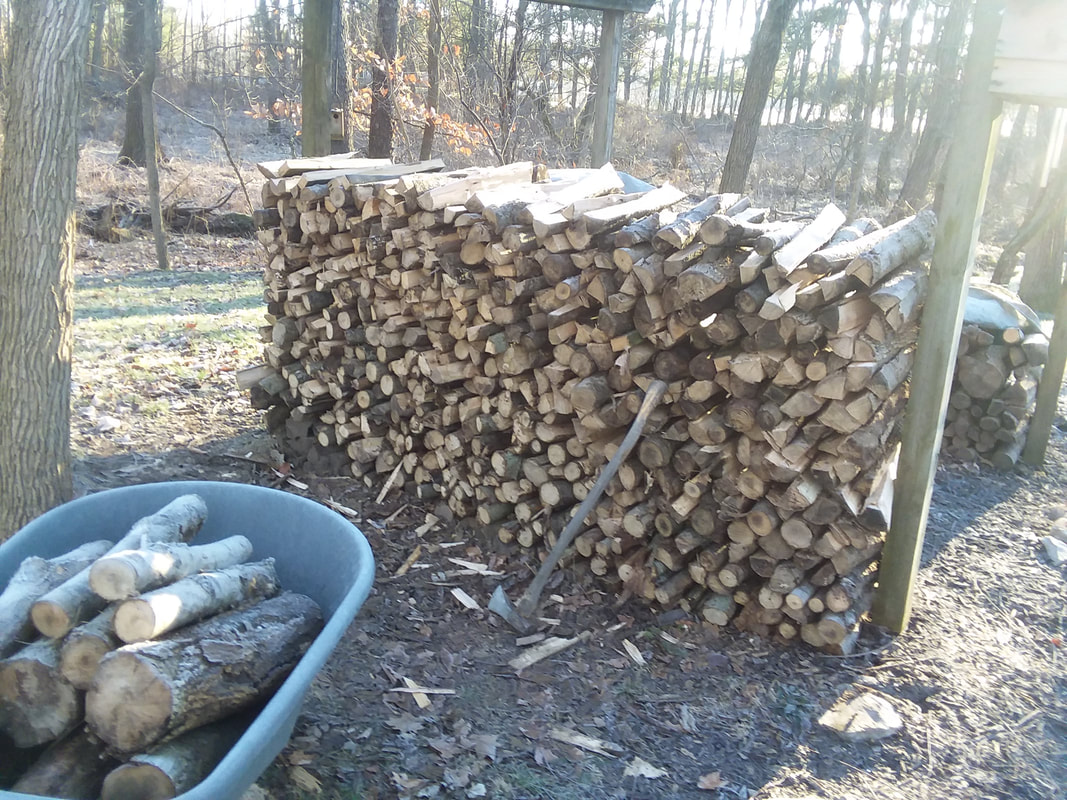 I arrived in AZ Thursday afternoon. In addition to repairing the bridge, I stacked and split a bunch of wood, cleaned up some things but had to return to the sun, warmth and activity. It is good to be back. Went on a shortish, 30 mile ride on Friday and slotted to do a group hike on Saturday so the reports will begin anew. Sorry for the delay.
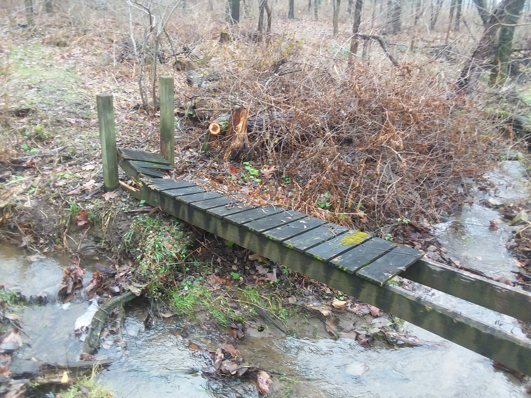 I arrived in Ohio to find a tree had crushed a portion of a bridge I had built but me, being a fumble finger carpenter went to.....  ….cut the tree and remove the 12' foot spans and then, a quick trip to Home Depot and.... 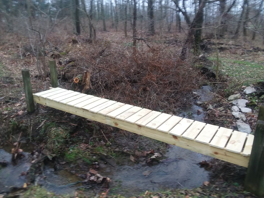 ...home about that!!! Today. Wednesday, I am in Texas and tomorrow, I will be in my beloved AZ. Already got a big hike set up so much more to come. Sorry for the interruption in service but nothing in Ohio, this time of year, is worth reporting but soon, lots to come. Stay faithful my 3 followers:)
I had to return to Ohio for a few days. My mother, 98, fell a couple of times so I wanted to check in with her and it appears recovery is going well so we hope she can return to living an independent life as she has, in her own condo. I drove to Ohio, rather than fly, mostly so I could bring a Civic I have used in AZ and sell it. It has been a good car but I have a better one in Ohio and will bring it to AZ. This allows me to bring more stuff to AZ. I have lots of items in the basement that ought to see the light of day and bring some personality to the condo in AZ. I am not going to rent one of two any longer so I don't have to worry about a guest stealing these possessions! From the basement I brought up a..... 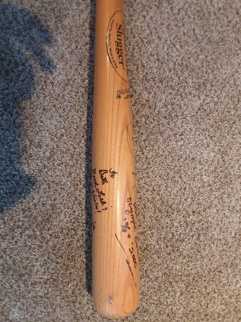 …..Louisville Slugger baseball bat signed by Olympian Dot Richardson and St Louis Cardinal Ozzie Smith and..... 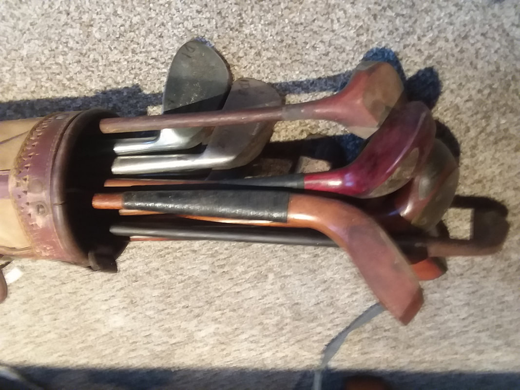 ….antique golf clubs, some dating way into the 1800's like the long nose driving club with a ram's horn slip to protect the bottom (yeah, who knew, using a piece of a ram's horn to protect the sole of a golf club) and.... 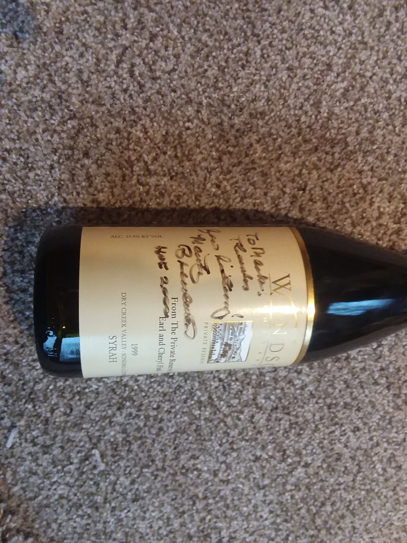 ….some bottles of alcohol signed by somewhat famous people like Red's baseball announcer Marty Brennaman! How about that!!! 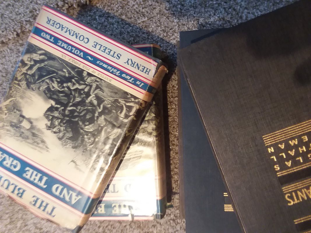 And I have lots of books about the Civil War that my grandfather gave me. I mean lots but will only bring a few. Anyway, leaving these things in the basement didn't make sense so they will instead move to AZ. I also have a few copies of a national magazine that published an article of mine, a few books that I authored or co-authored (golf books so don't look for them on any best seller lists) and similar items. As for when I return and begin posting AZ hikes and rides? Soon, very soon. During my drive, it rained the final two days and today, it is raining. I can't take this anymore and the sun is calling me.
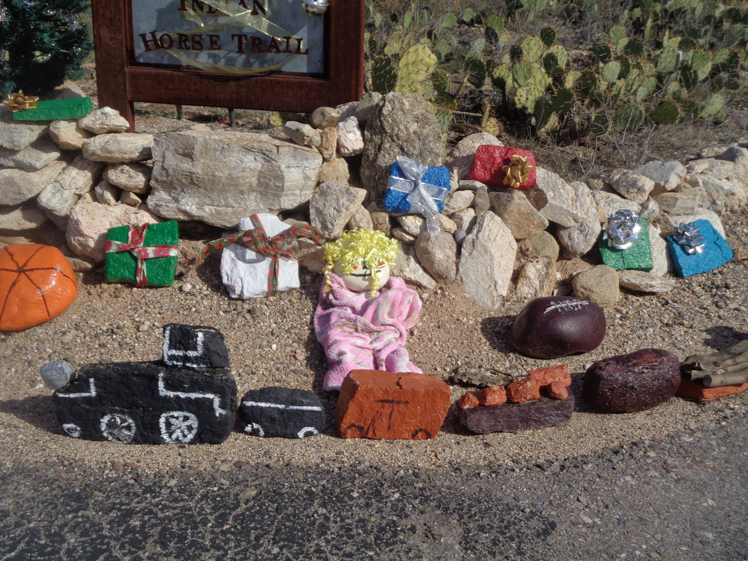 A friend asked me to lead a hike up Milagrosa Canyon and then back via Aqua Caliente Canyon. I read a couple of reports about the hike and references to class 3 and 4 scrambling and thought better not do that one alone but also decided to check it out. The hike begins on Horsehead Road where residents have come up with....  ….creative Christmas displays. 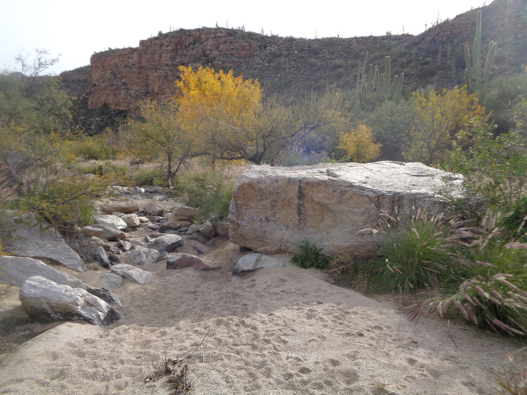 I follow an old jeep road and when it descends into a stream bed, I enter Aqua Caliente Canyon. However, rather than walk up canyon where there are many significant obstacles, I catch a trail that heads out of the canyon, to the left of the large boulder shown above. The trail rises and soon.... 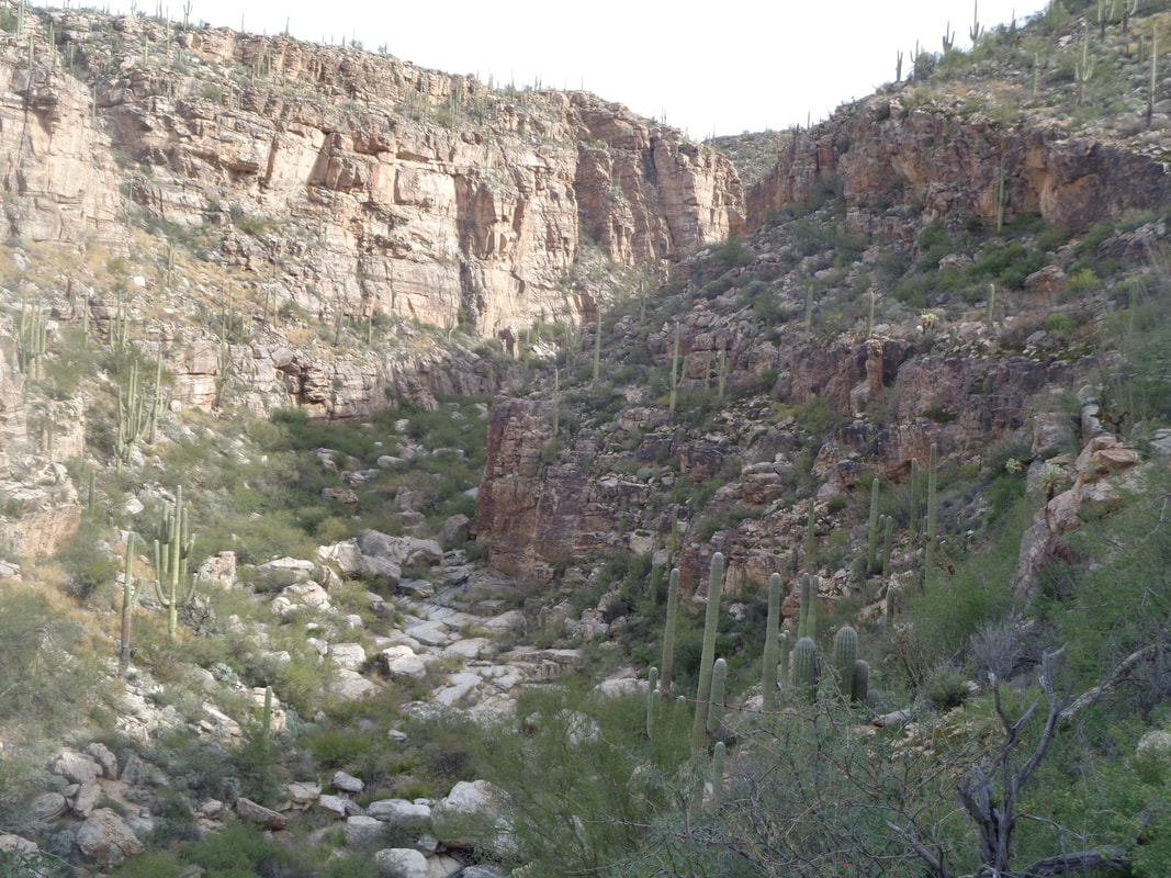 ….I am looking down at Milagrosa Canyon to my left. There is a ridge that splits the two canyons and I am climbing on the left side of that ridge. 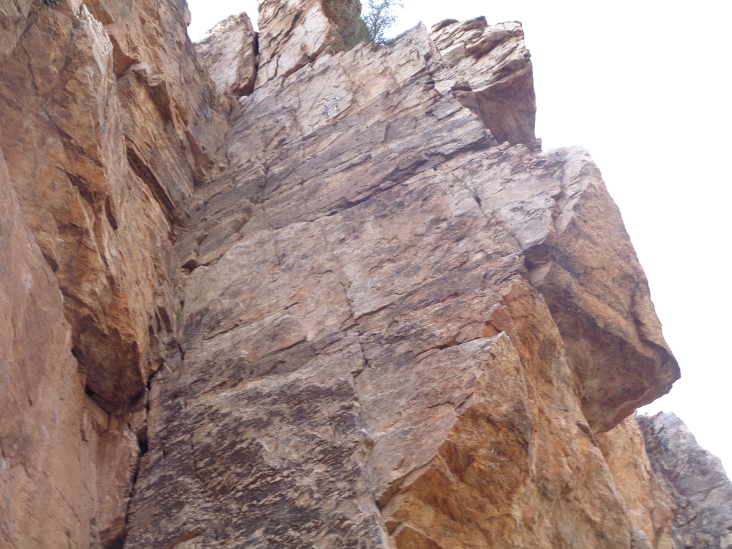 The canyon narrows and the walls are tall and steep. The rock climbers refer to this canyon as "5.11 Heaven" and I spot bolt anchors and chains at the top of this climb. 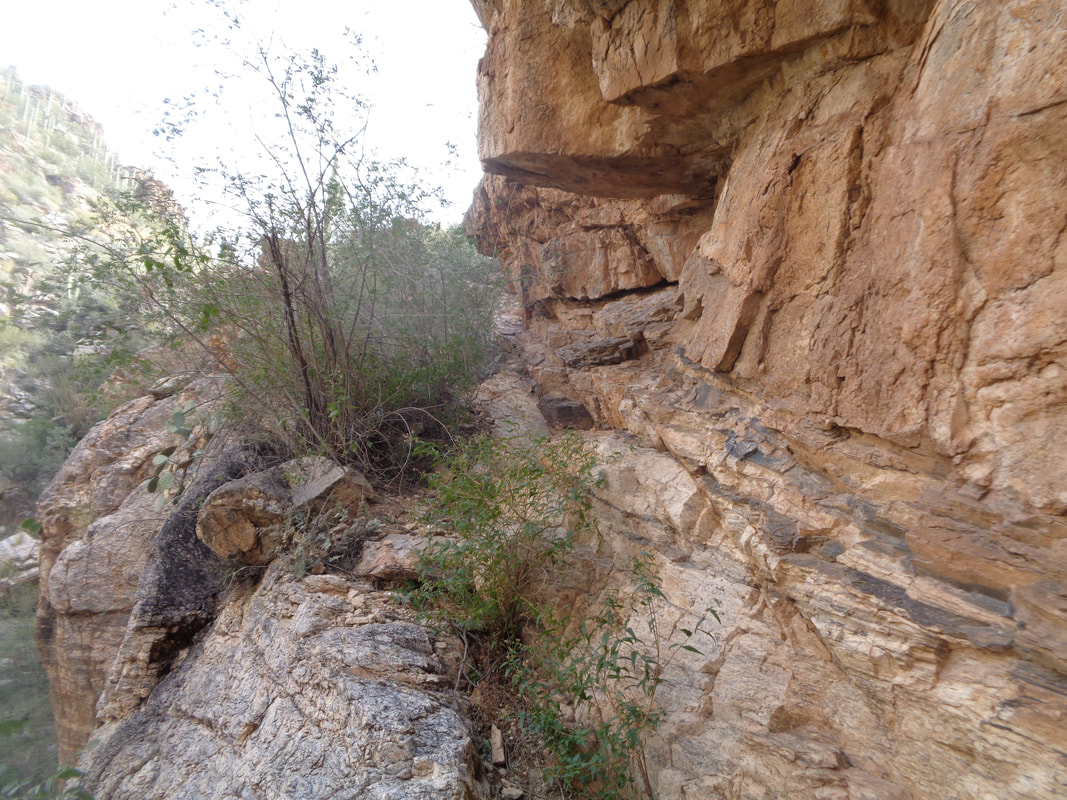 Curiously, the trail then descends into the left canyon, above a significant obstacle that from what I have ready, is difficult to get through. Hmmmm. I poke around a bit and studying the wall on my right, find a fault in it, shown above and begin climbing. Yeah..... 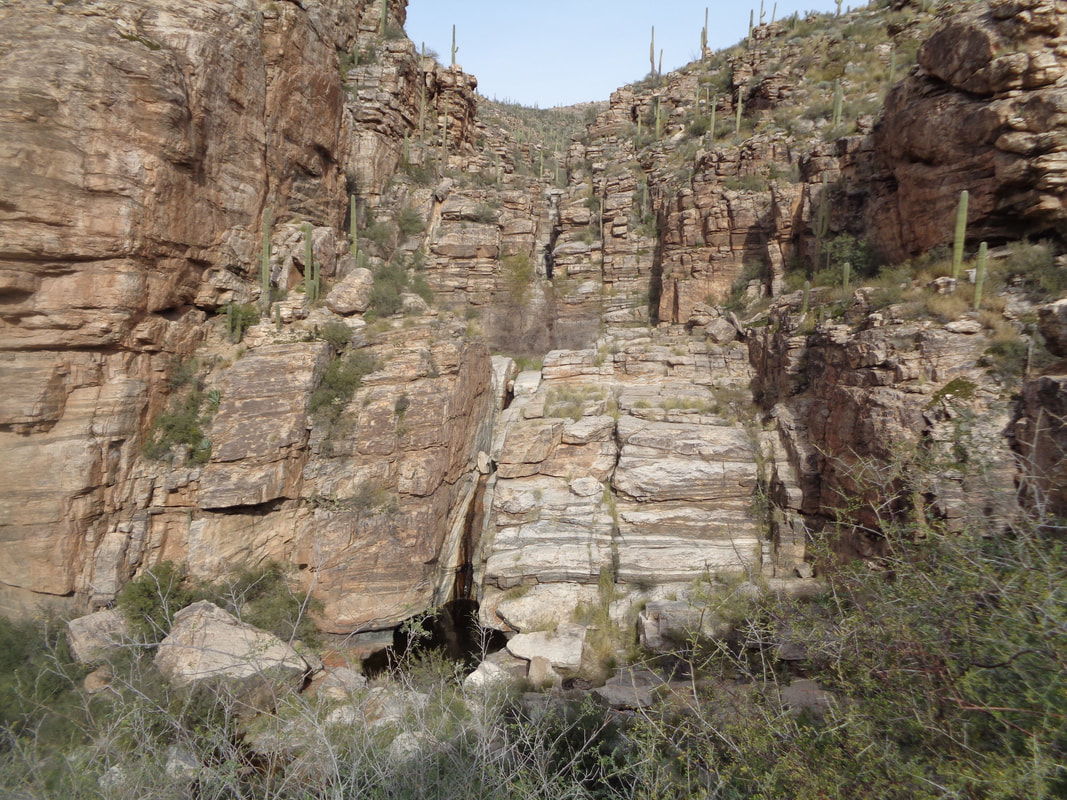 ….I arrive onto a narrow ridge and get a good look at the next obstacle in the canyon from which I departed. Yikes, that is going to be a challenge when I bring a group here. 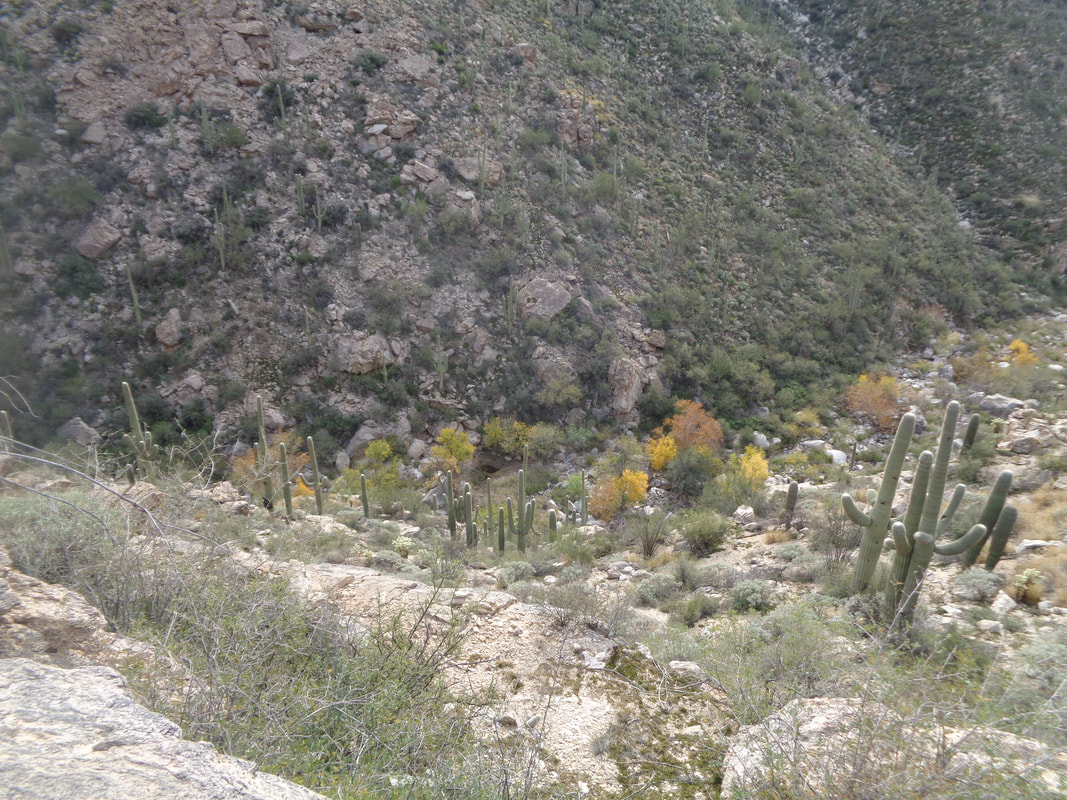 A few steps takes me to a spot where I can look down into the other canyon. Way cool but now what? I look..... 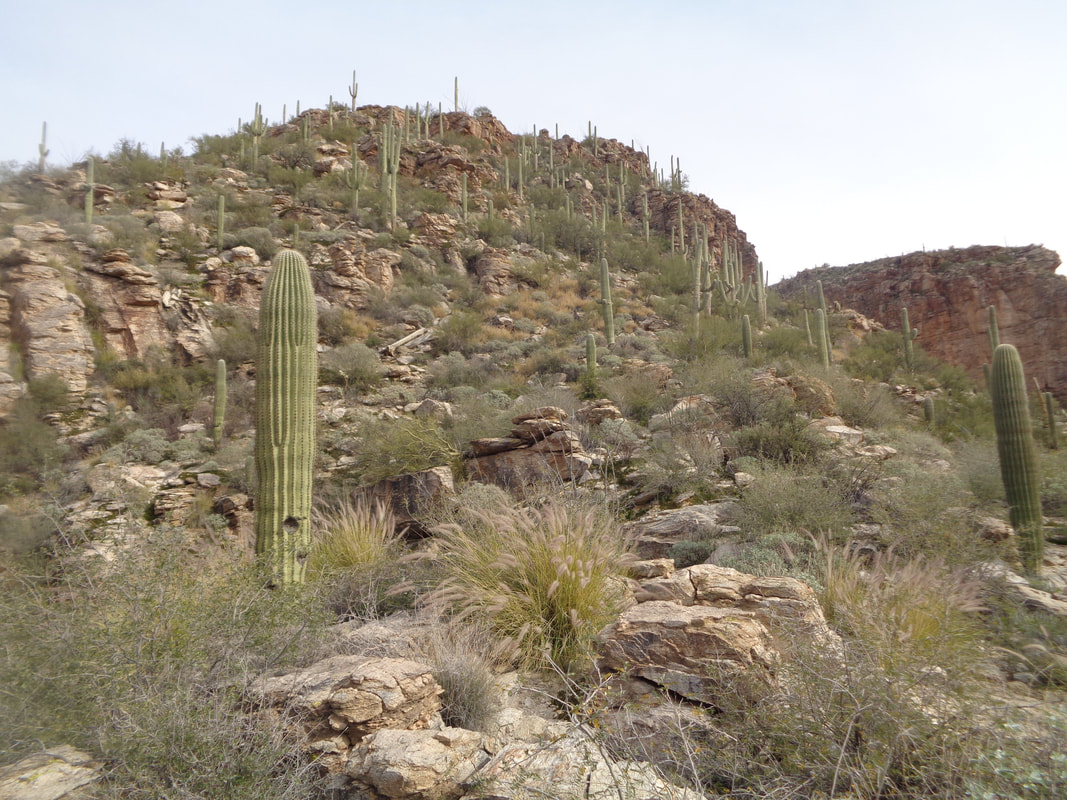 ….ahead and the terrain looks passable so I bush whack up and through. Kind of steep in there and as always when alone, it gets a little creepy out here. 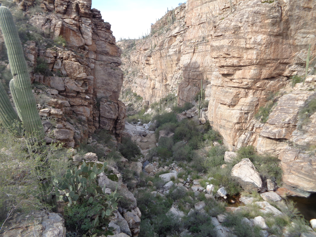 I take a look back to make sure I can identify my surroundings and be able to return to this point and head up. 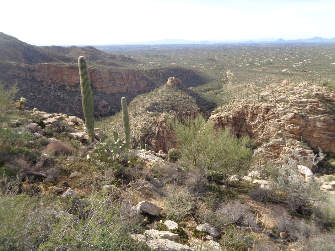 Way on the right side is the ridge where I exited the canyon.  I kept going and the ridge between the canyons kept rising up moderately now. I assumed at some point the ridge would end with a cliff so.... 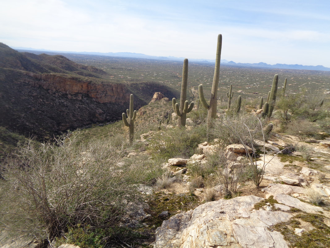 ...I explored a bit to see if there was a way down into either canyon from here but did not appear to be....maybe but don't try it alone.  I head back, reenter the canyon, find the original trail and about half way back spot a spur trail heading back up to the top of the ridge so away I go. 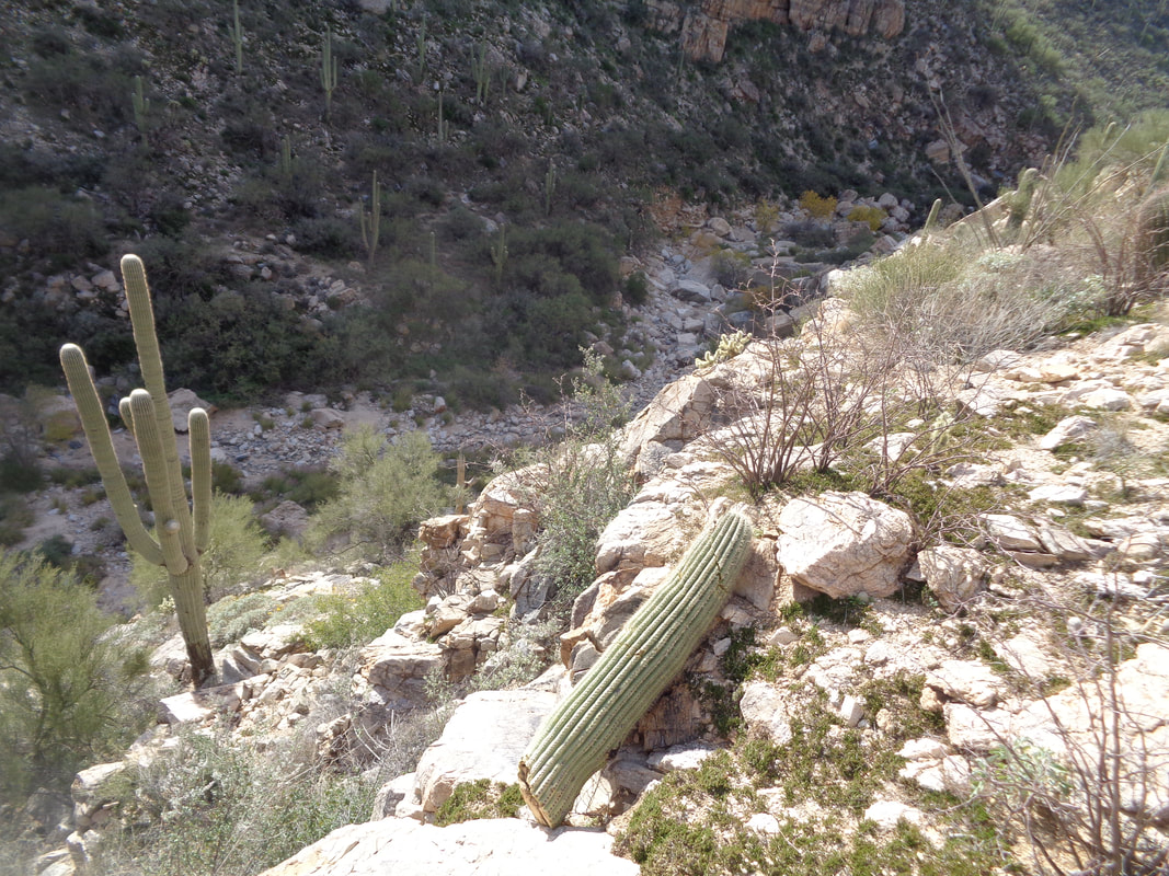 I reach the ridge and start down the other side but while the canyon bottom is close, it looks like I'll be cliffed out so I again retrace my steps, get back on the original trail, exit the canyon and.....  ….Aqua Caliente canyon on the right and barely visible is La Milagrosa on the left. That will be an exciting hike when I return with reinforcements!
 Merry Christmas from Oro Valley, AZ! Took a short ride today, sunny but still cool with the high in the low 60's. Eric the Dispatch photographer from Columbus is here for a few days with his wife and while it rained their first day, weather is good for the balance of their stay. Well, back to the hiking trail.
 A group was to head up Finger Rock trail and rather than ascend to Kimball Peak, there right of center, was going to veer off and make the Linda Vista Saddle their destination. I planned to start with them and then break towards Finger Rock Guard, the rock formation just to the right of the obvious thin rock spire known as Finger Rock. By the way, to the left of Finger Rock is Prominent Point, a spot I have yet to visit but probably will soon.  We follow a trail as it crisscrosses a dry creek bed for about a mile. ascending at a moderate rate and then....  ….the climbing begins in earnest. As usual, I left the group to chase what I thought would be a "Strava" segment. I caught a guy who is serving at a nearby air base and later learned he had recently climbed Mount Fuji! How cool is that. 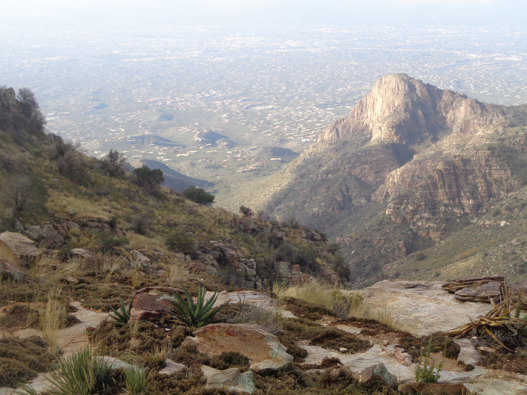 Rising higher, the usually fabulous views are obscured by incoming clouds from the southwest. Nothing thick just streaming in and where once Finger Rock was bathed in sun, it was now enveloped in clouds as shown later. 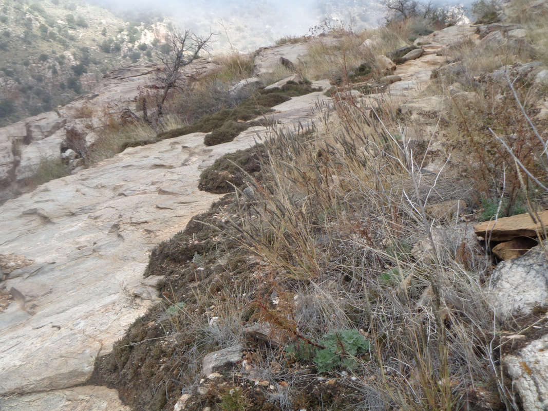 Images rarely demonstrate the steepness but this comes close. The 1.5 mile segment once the climbing became serious averages 19% which surprised me. It seemed steeper. 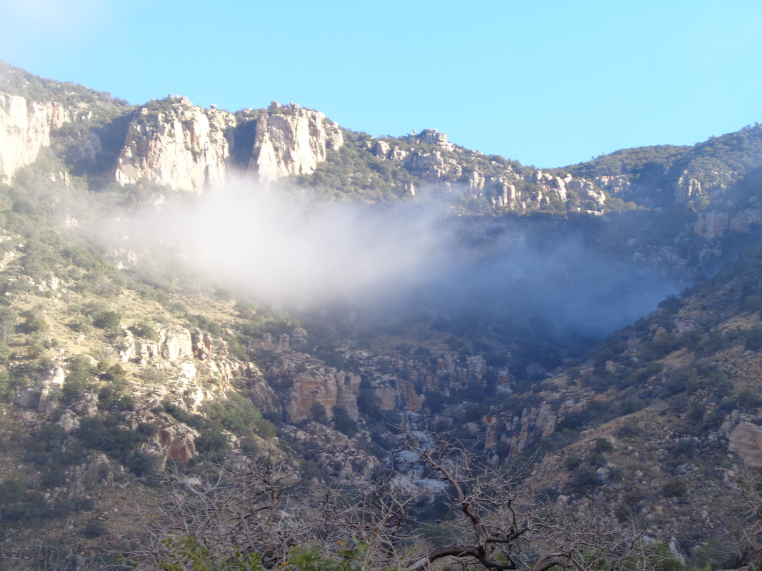 I reached a junction where continuing right takes one either to the aforementioned saddle or on to Kimball Mountain. The not so obvious left fork dives into a canyon prior to climbing very steeply toward Finger Rock Guard. The above image of clouds lingering in the canyon was neat. 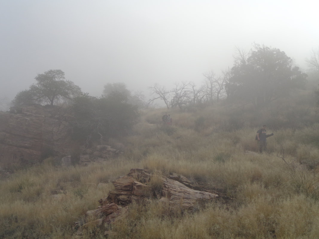 Just like that, the clouds thickened and not only could I no longer see Finger Rock, I couldn't see much of anything. My shirt was soaked with perspiration so I donned a jacket and gloves to wait for.... 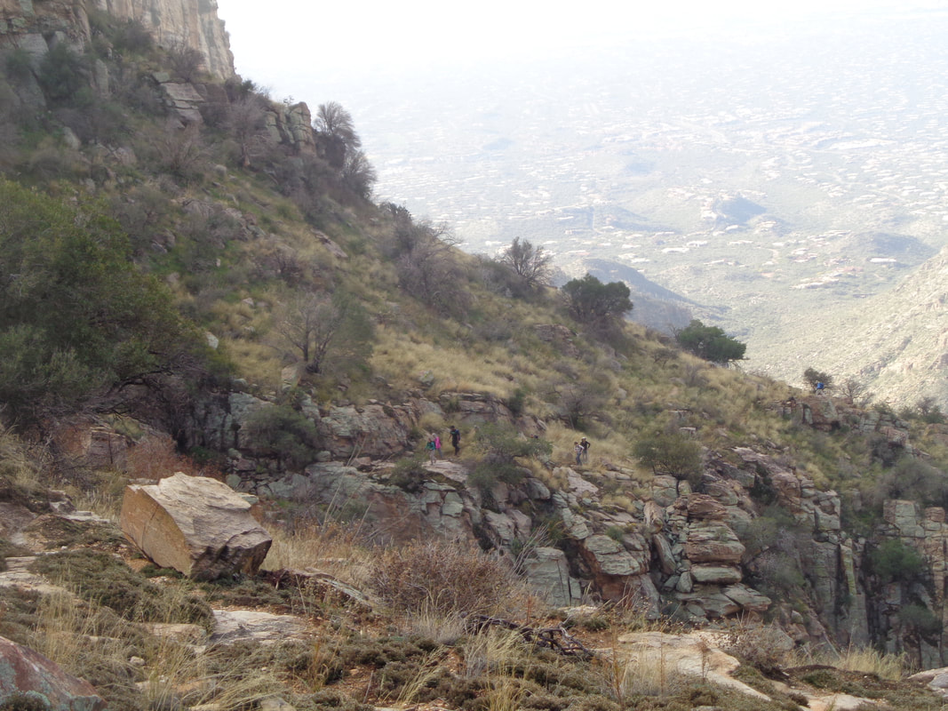 ….the group as they approach. The slickrock found frequently along the ascent was kind of slippery given the moist conditions and the scree that was present. 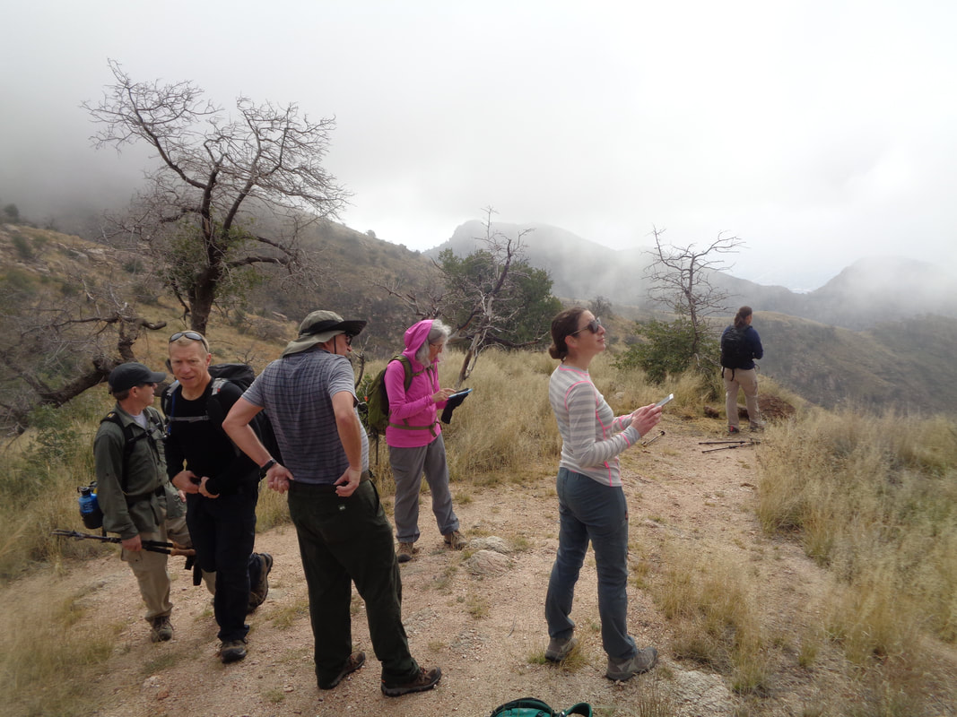 The group arrives but I abandon my plan for a couple of reasons, climbing to the top of the Guard and being surrounded in dense clouds kind of defeats the purpose and there is a labyrinth of boulders and a wall that have to be navigated. Doing so on wet rock surface is a bad idea. So.... 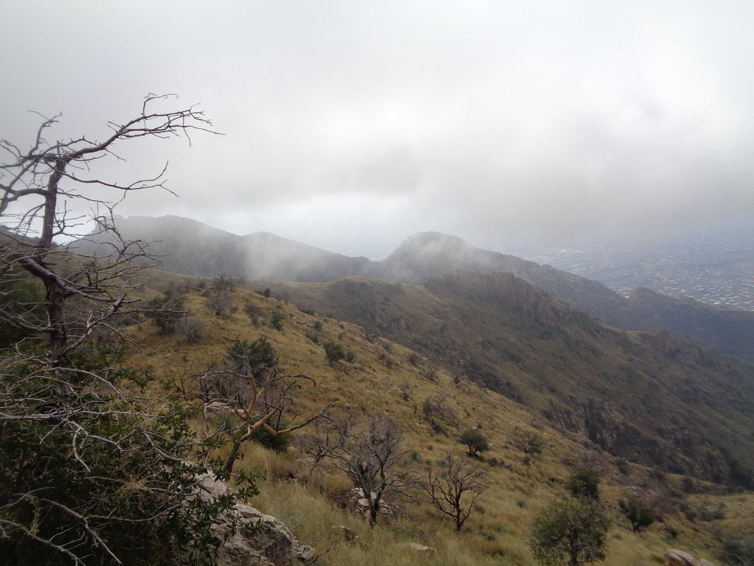 ….onto the Linda Vista Saddle where we enjoyed ok views to the south. Clouds continued to stream in and somewhat obscure the view.  But, Kathleen and Marianne had brought treats and gosh, were they good! Big thanks to them. After about 15 minutes we....  ….headed down and what I saw across the canyon reinforced the decision I made to abandon the trek to Finger Rock Guard. Finished with 6.75 miles and 2700' of climbing.
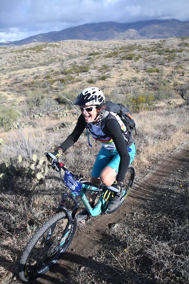 Hey! Sorry for no posts but I have been riding and getting ready for a big hike on Saturday. The Tucson area has some great road riding opportunities but they are kind of limited. On the other hand, there are many miles of forest service roads and trails for gravel/mountain biking. At the urging of a cycling friend, Cathy above, who kicked my ass on a road ride this week, I have decided to join that side of the aisle too. First was it a gravel or mountain bike? OK, did the due diligence and decided it had to be a mountain bike. Then, which one, still doing research on that but a decision is coming soon. Back to the hiking trail tomorrow.
 Monday was a recovery/rest day so I headed up Catalina Highway via the car to check out the snow that had fallen a couple of days previously. At "7 Cataracts Vista" at roughly mile 9 of the 26 mile drive, all seemed normal. 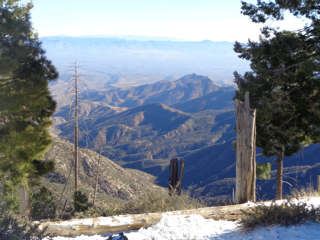 Moving up through the various ecological zones is always interesting. It has been likened to driving from southern AZ to Canada in what you will see. At around 7000', the snow was on the ground and breaking through 9000' the snow was of course deeper. 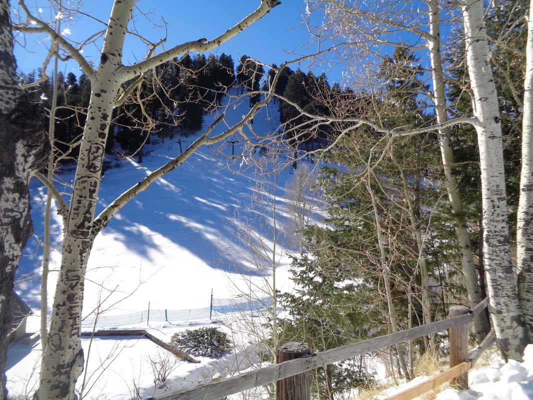 I reached Ski Valley, just above the village of Summerhaven. 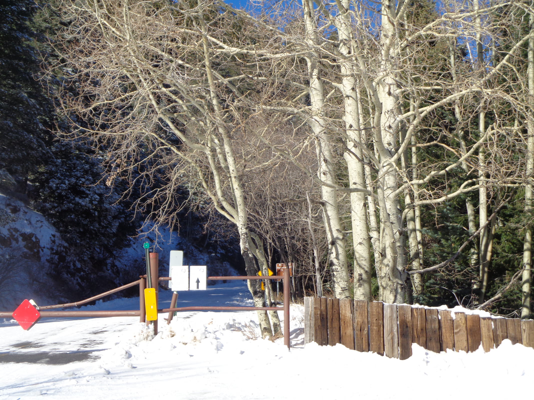 The 1.5 mile strip above Ski Valley, to the observatory is now closed for the season. 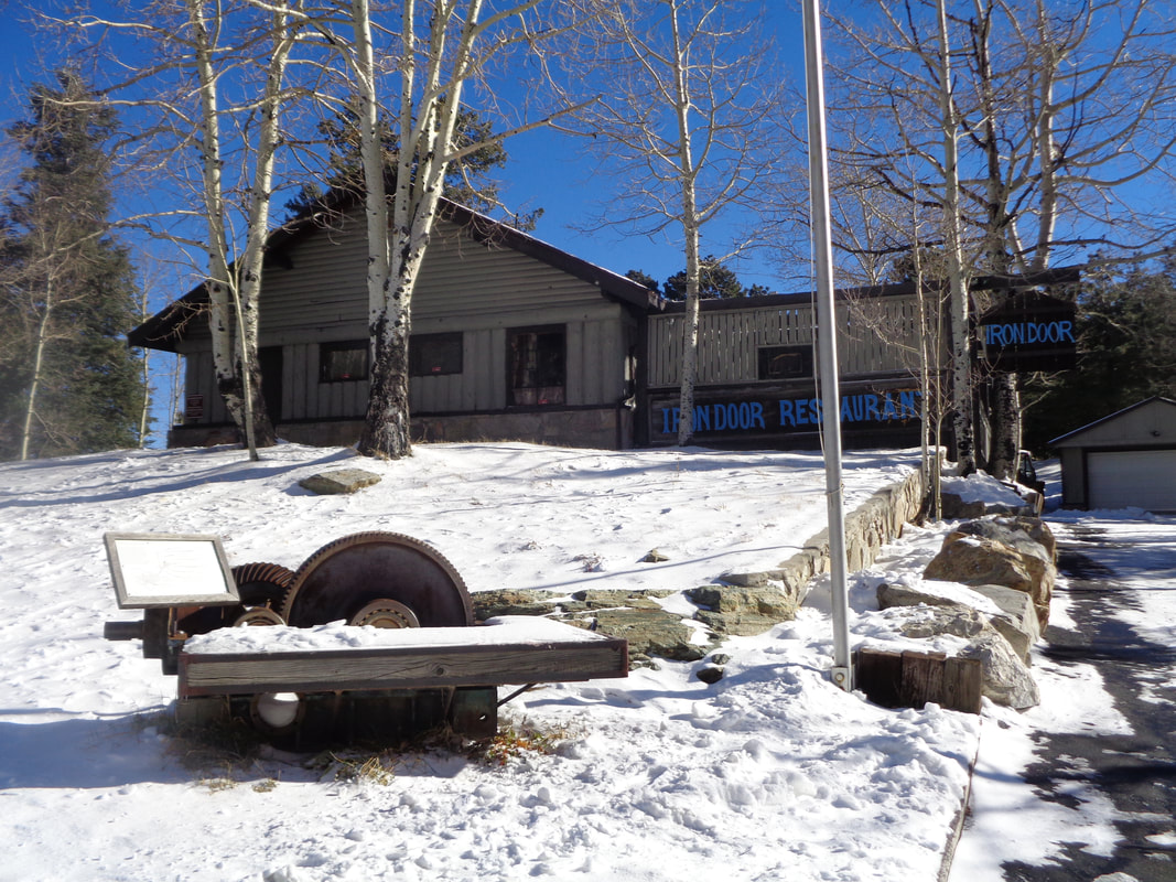 The Iron Door restaurant is open for business. 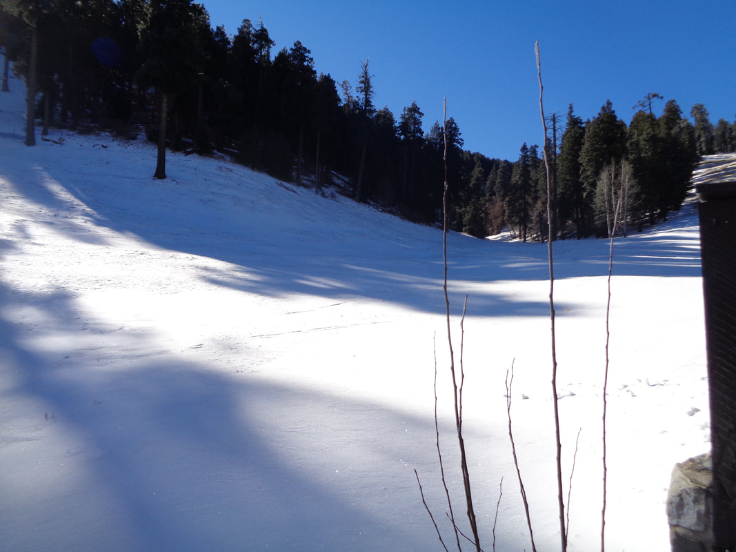 There are a couple of neat shops where gifts can be purchased and ski equipment can be rented. Maybe with more snow forecast for this weekend, enough of a base will be built and the skiing can begin. I enjoyed the quick visit but enjoyed descending back to the much warmer temperatures, 6500'+ below me.
 Our small group parks at Sanctuary Cove and takes a trail to a saddle where we then.... 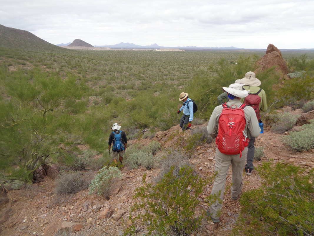 ...head off trail into the valley below. A pleasant day for a hike with a few lingering clouds front a front that moved through a couple of days ago but no chance of rain, just perhaps thickening clouds later. 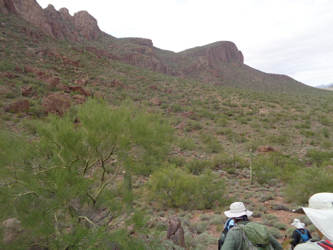 Reaching the floor, we skirt the mountains to our left while heading toward Panther Peak in the distance on the right. At the bottom of the slope is a ridge we eventually reach. 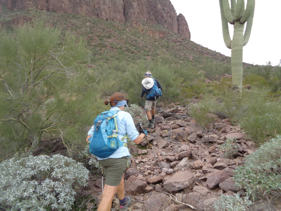 Vagabond Jeff leads the way with Donna second in line. Unbeknownst to us at the time, there was a faint trail to our left that some of us discovered later. 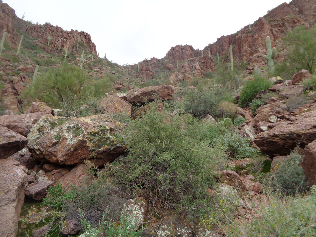 How about that!? We stumbled on the trail and that is good except for the remainder of the climb to the ridge, it is no longer a trail, just a route guided by the placement of cairns to indicate which way to go. Kind of rugged but lots of fun. At some point in time, someone took the time to collect rocks along the route and create dozens of small piles that now guide us. Thank you to whomever! 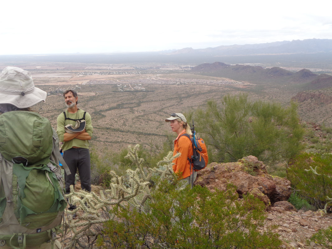 We have reached the ridge or saddle, regroup and swing right and up the slope to Panther Peak. For this section, there is a faint trail. Reaching the top..... 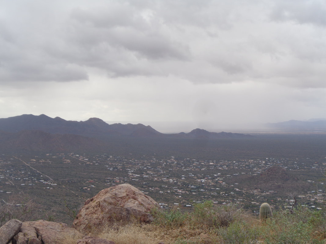 …..Noooooo. Rain just southwest of us. All I wore was a long sleeve T shirt so with the temp in the 50's, getting soaked would suck. We descended the slope and arrived back at the saddle. There, three of us decided to return the way we came while five decided to follow the ridge line up and over as originally planned. 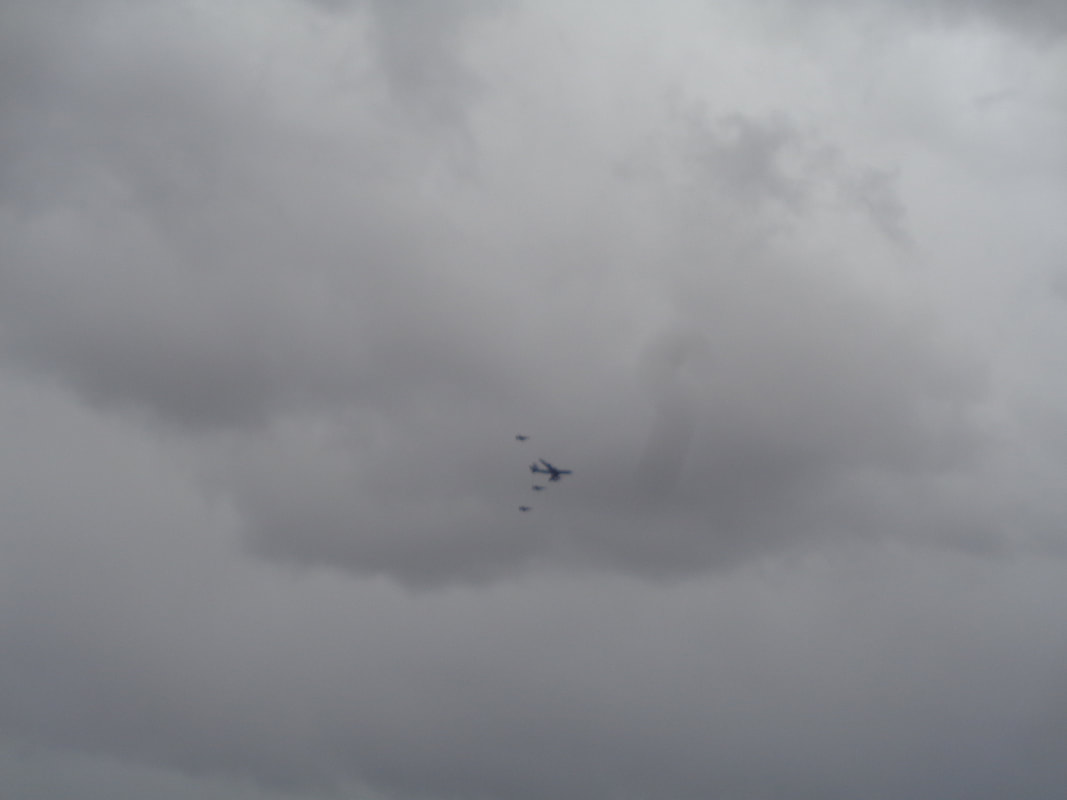 Three F18s fly maneuvers above us while escorting a large plane. Probably practicing for the next time Air Force One is in the area. I heard they flew out of Yuma and went as far north as Phoenix. Pretty cool. 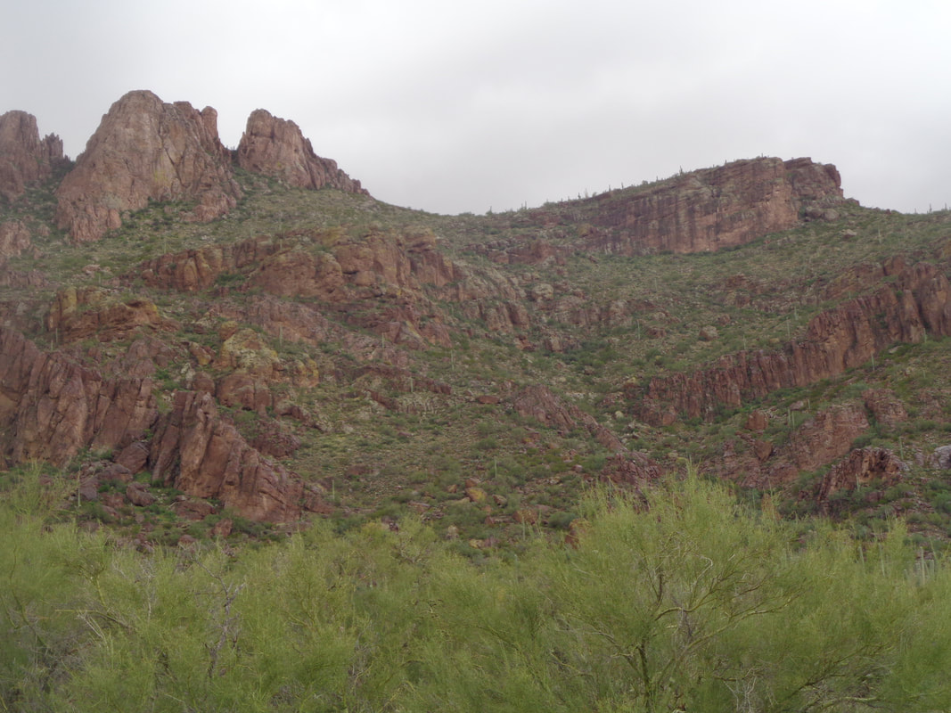 We returned to the valley floor and occasionally would look to our right at the ridge line and wonder if the other group was receiving rain. At times, yes, it looked pretty socked in up there and since we had some light sprinkles a couple of times.... Later, I talked to our hike leader Jeff and they had to hunker under some cliffs to wait out a brief shower. We decided our group had made the correct choice.  A fallen Saguaro cactus. If one of those falls on you, you are a goner. So heavy and then the spines! Finished with 5.6 miles and 1900' of climbing. Meantime, the other group that followed the ridgeline finished with 5.7 miles, about 90 minutes after us and of course wetter:)
 A 90 minute drive to the trail head with the group, "Arizona Strong Hikers". The start of the hike was 7am but too early for the drive across the Sonoran desert in pitch black so I depart later, thinking I can catch the group somewhere up range. Beautiful sunrise as a front moved through and left cooler temps, only 45 at the start. 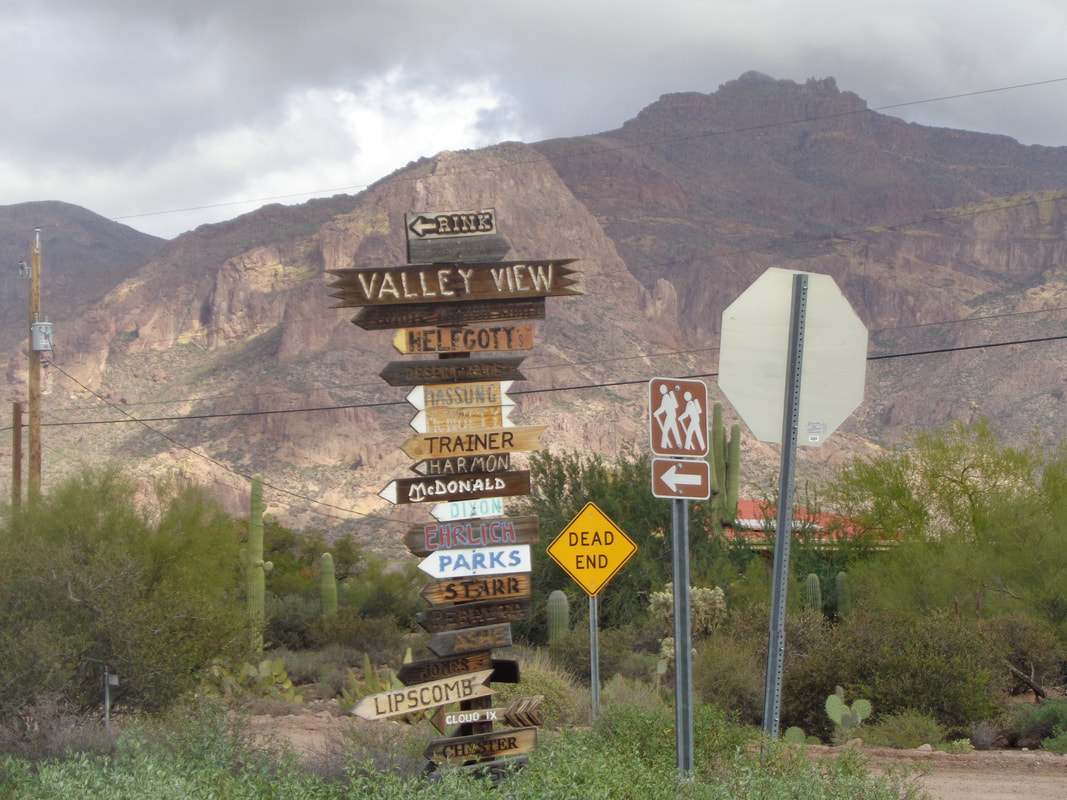 In the distance, the destination of Superstition Peak, the high point in the front range of the Supes. The drive through a neighborhood is interesting as several signposts exist to show the way to residences, as well as our trail. 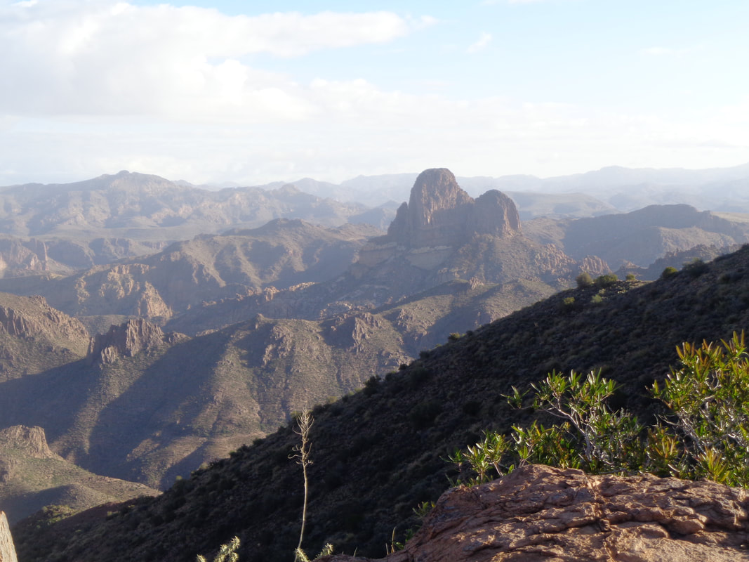 I was 45 minutes late so headed up the Hieroglyphics Trail and then eventually reached a ridge where I found the group resting as they prepared for the next stage, an undulating walk but also.... 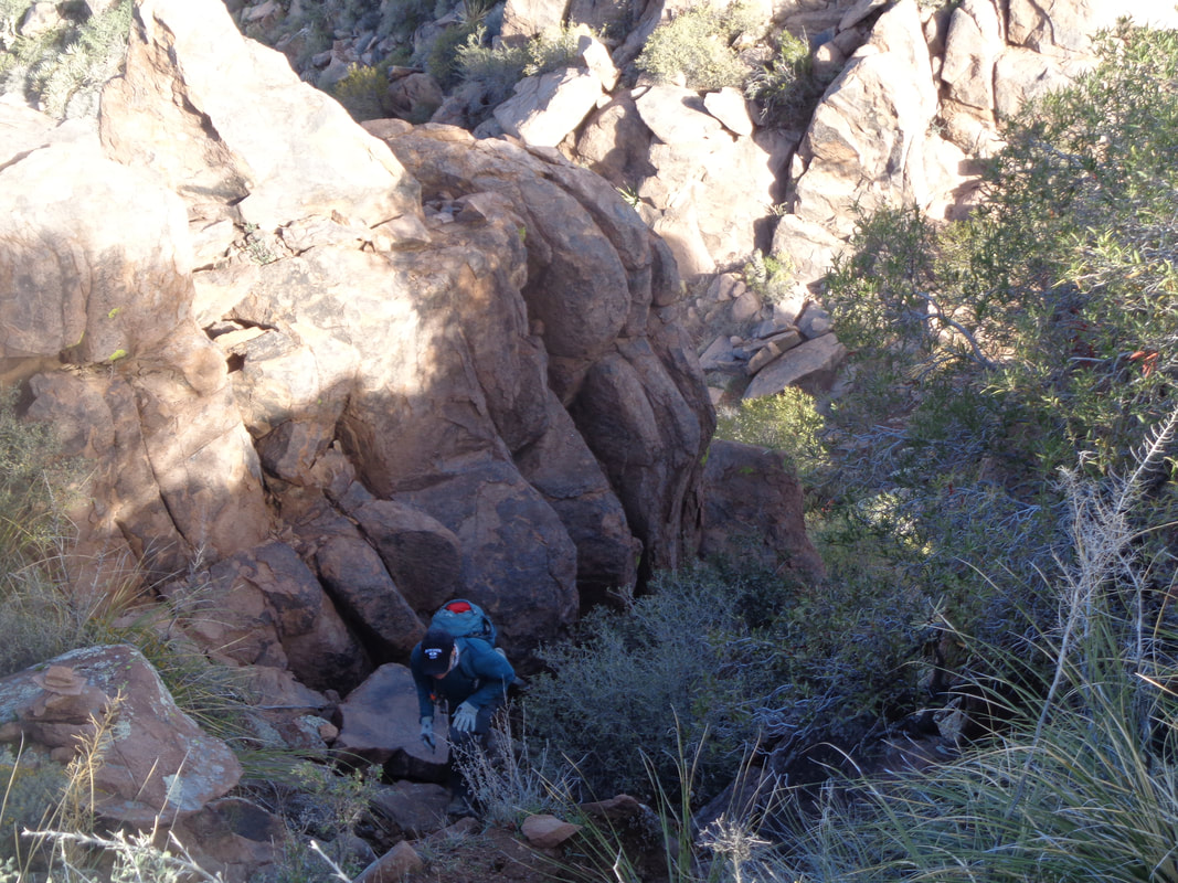 ….a few obstacles that presented a challenge for us all. Hikes here are seldom just walking. 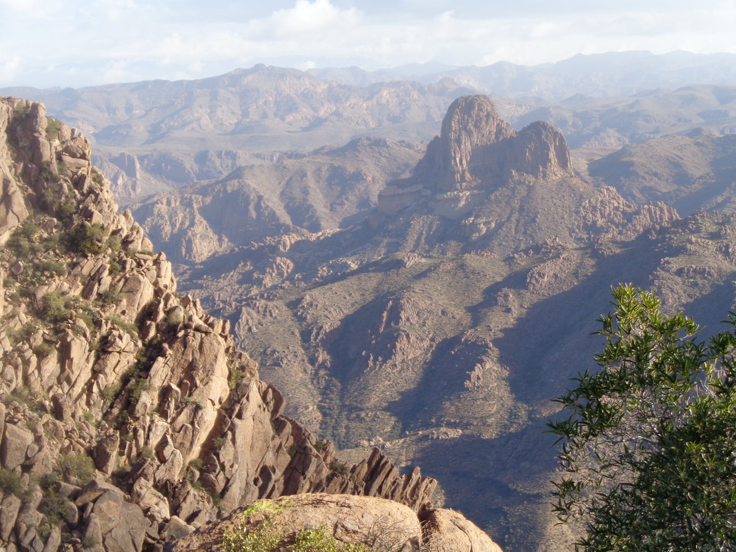 Weaver's Needle is frequently in view as we progress toward our destination but in so doing.... 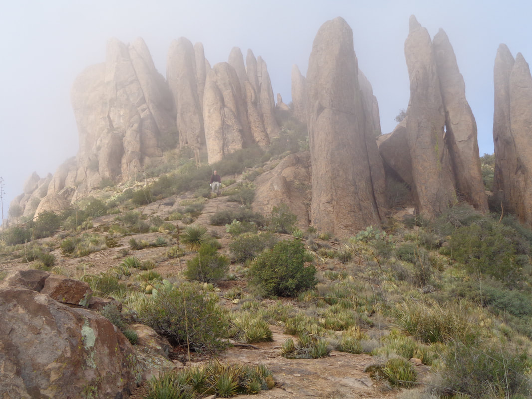 ...we climb into the clouds. So cool and yeah, it was cool too. Hoodoos are prevalent. 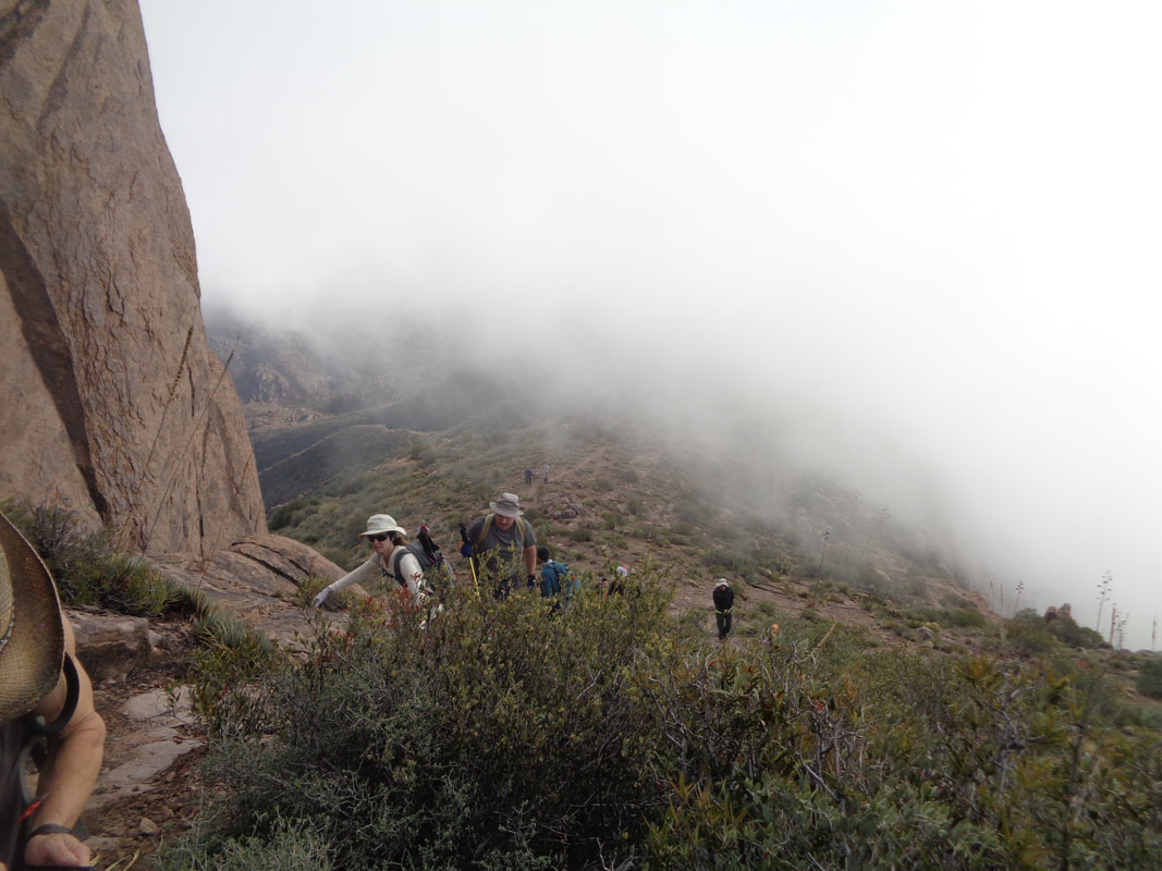 ...We continue to climb toward our destination and it is steep here as the clouds roar through the gaps. 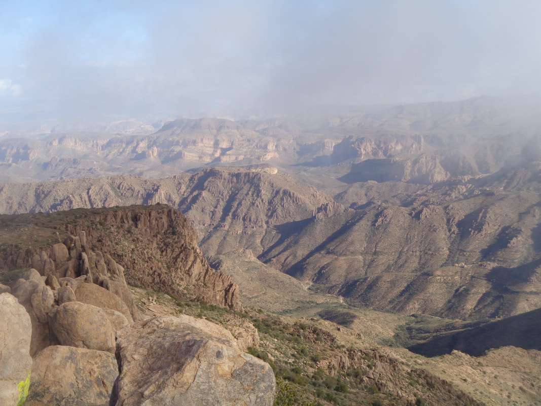 The usual brilliant, clear views are somewhat obscured by the clouds but that is ok as the change is welcome. Very dramatic. 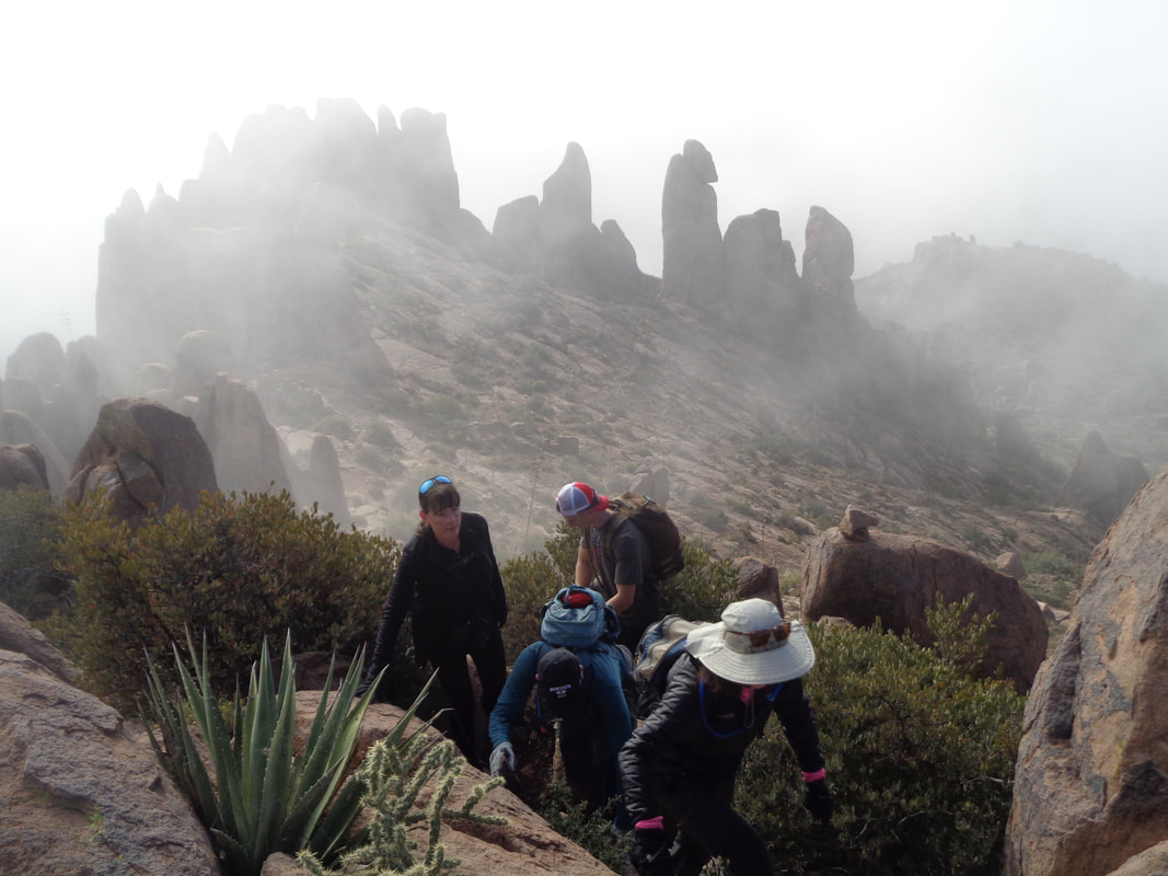 We have arrived!!! After a brief stop to refuel, we..... 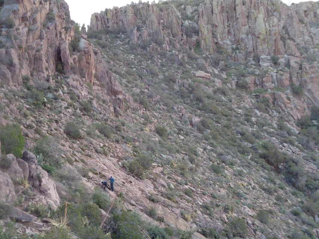 ….began the descent. 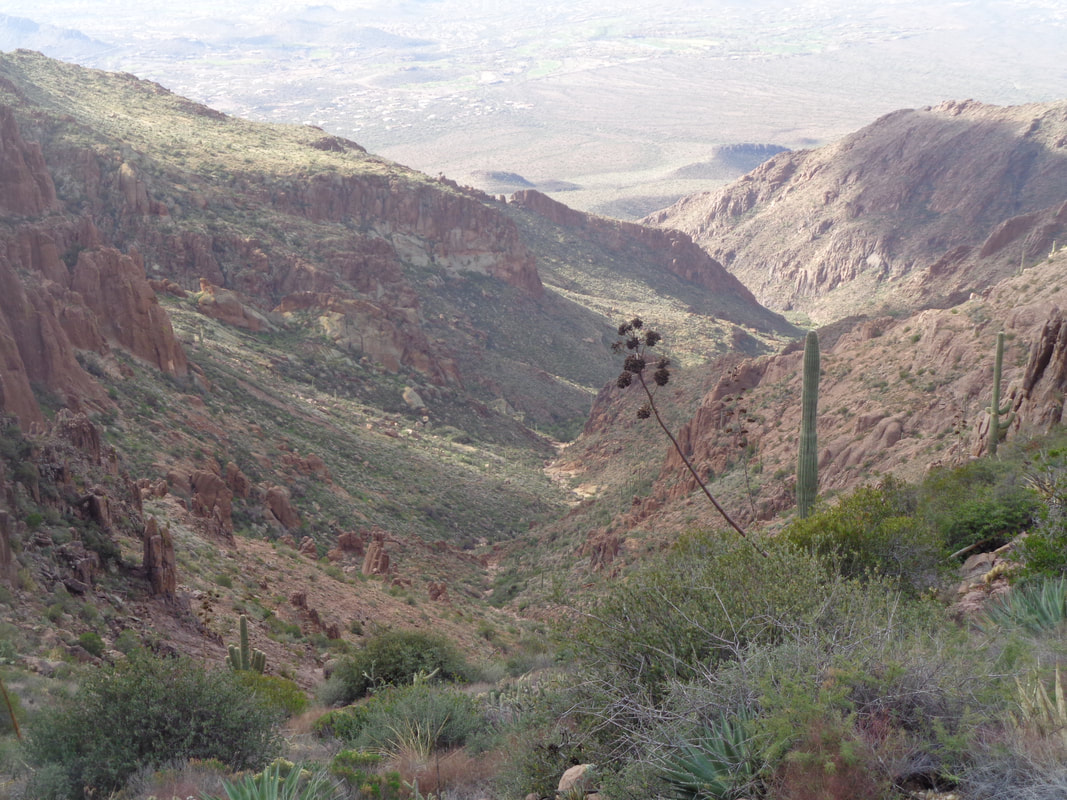 We reach the ridge from where we exited the canyon and began the trek toward the peak and now see the long descent in front of us. 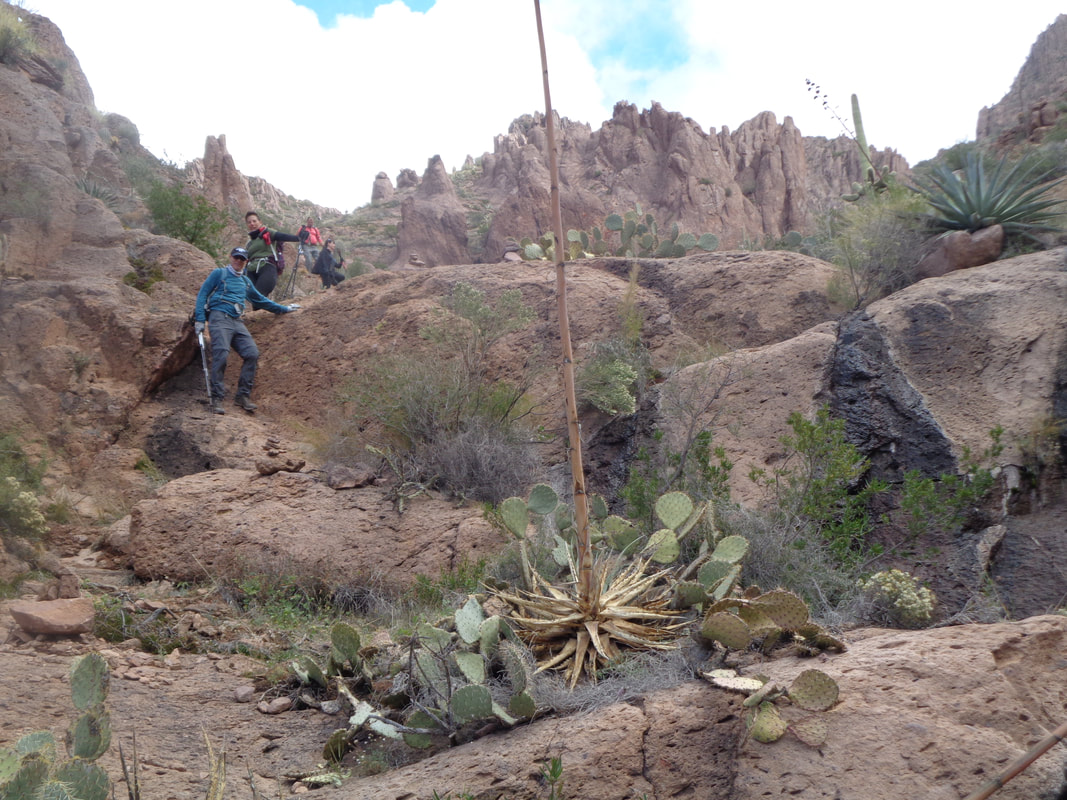 The above is typical. So many obstructions. walls, boulders around which to work but also so much fun! Of course, despite all the great views, we must be vigilant and pay attention because always lurking are.....  ….Jumping Chollas! Yikes. Brian has a comb and is able to remove the offending objects. 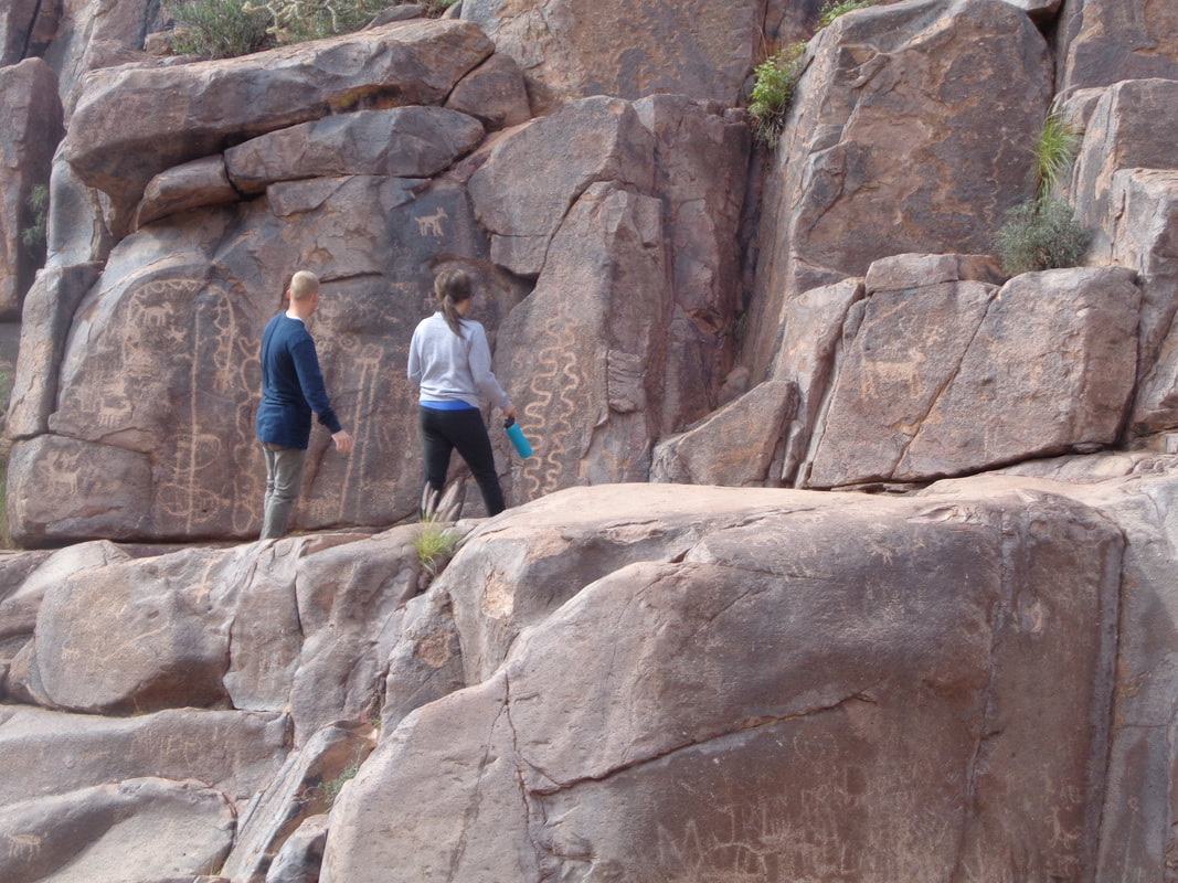 Toward the end of our hike, we pass through the area where we can see the hieroglyphics. Ended with 8 miles and 3300' of climbing.
|
