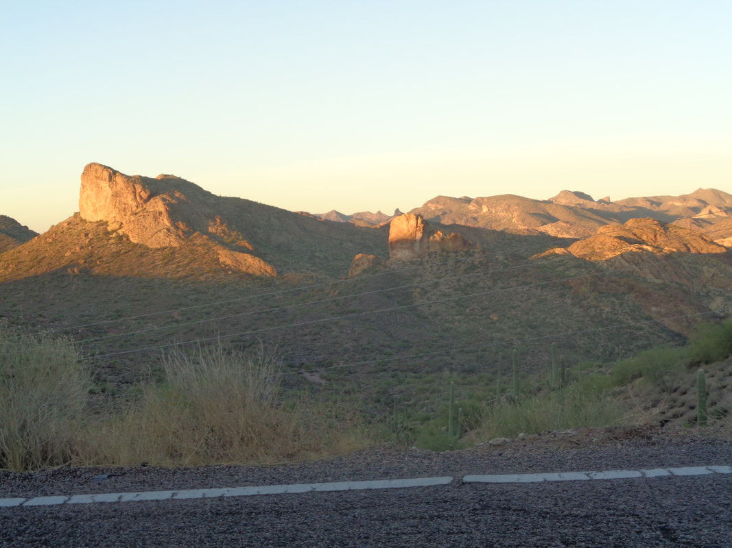
 Groan, a pre-dawn ride north, passing to the east of the Goldfield Mountains as the sun rises. So beautiful. Yet, I was 15 minutes late, which is fine cause I kind of enjoy starting late and tracking down the group, this time 14 other hikers. 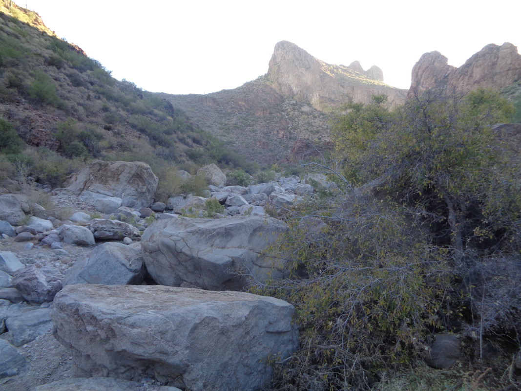 Hiking out here can often be, well, not straight forward. When I arrived at the parking area t Tortilla Flats, I saw the last of the group disappearing over a ridge so at least I had that reference point. I threw on the pack, tightened the straps, made sure I had my camera and all other stuff secured and I went cross country. I found either a game trail or the faint route, ran a bit, listened...silence...ran some more, listened...heard voices and finally.... 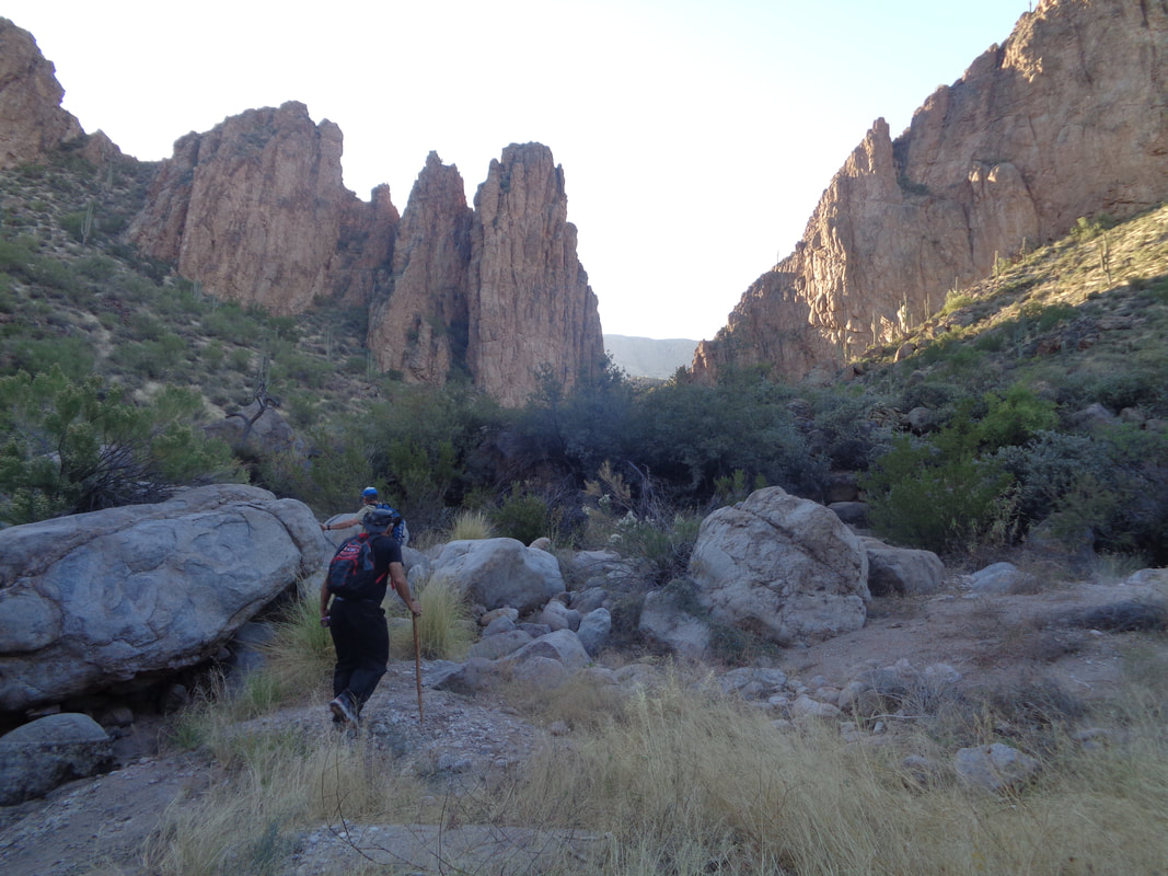 ...tracked down the back of the line. I worked my way through the group and found the..... 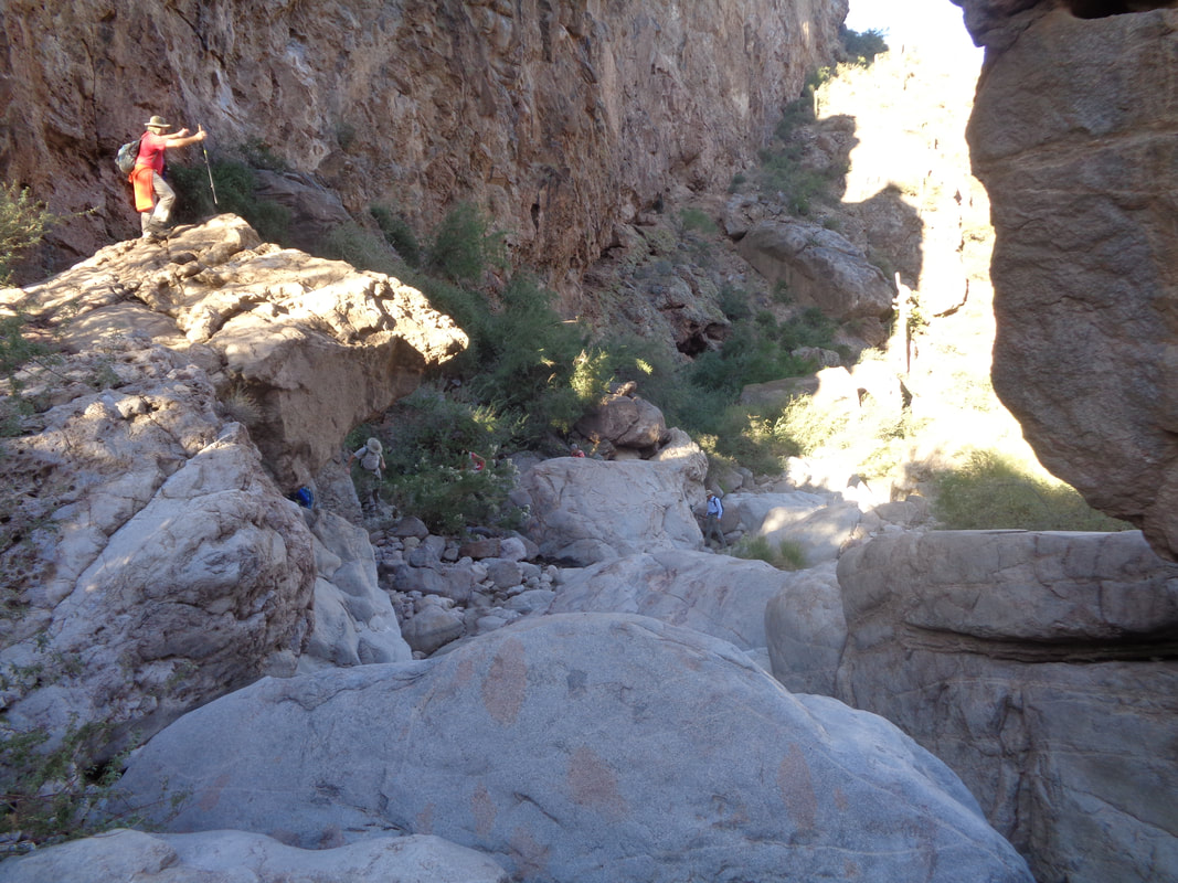 ...hike leader, Mark on the rock, urging others to keep going. Today was to be a boulder hopping kind of day. It's not the distance, maybe 7 miles round trip but the jumping from rock to rock gets to the bottom of your feet.e 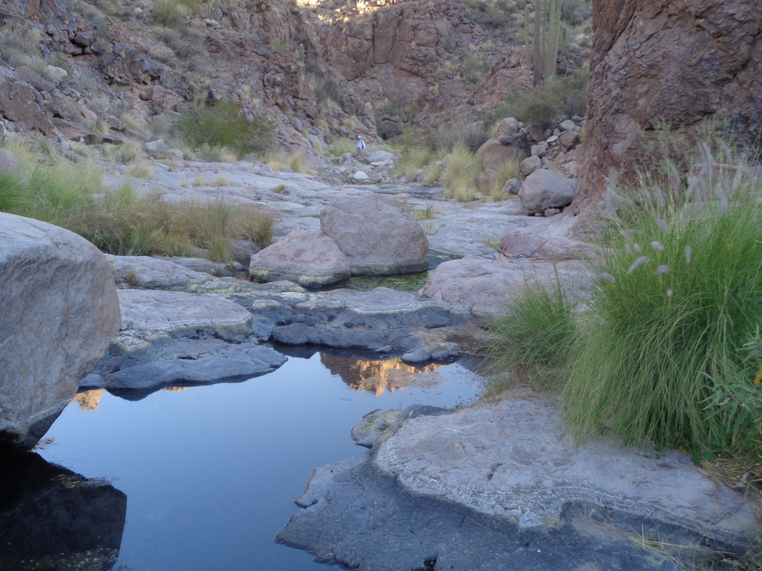 I got out front and reached a very cool slick rock area that still had pools of water despite rain only once in 60 days.Beautiful spot. 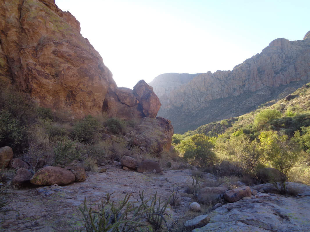 So far, the hike had been in the shade but around this corner, no more shade but that was ok. We started with temps around 60 and it was very comfortable hiking weather. 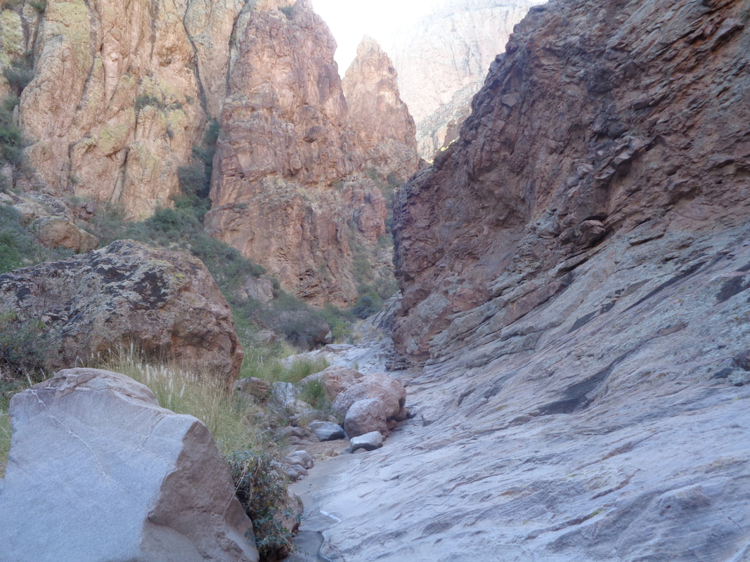 At times, the canyon got rather narrow but there was always a way through and then... 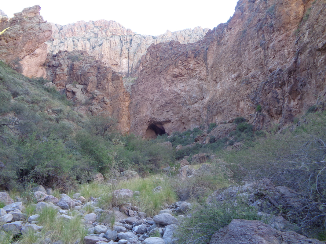 ,,,,how bout that; Peter's Cave. It was a short but steep climb to the entrance. 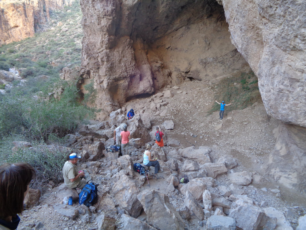 The rest of the gang arrived soon and took turns posing in front of the opening. It was promoted as a hike for only fit people and it did attract a very fit group. They did linger too long for me so I thanked Mark, the hike leader for organizing and struck out for the parking lot. 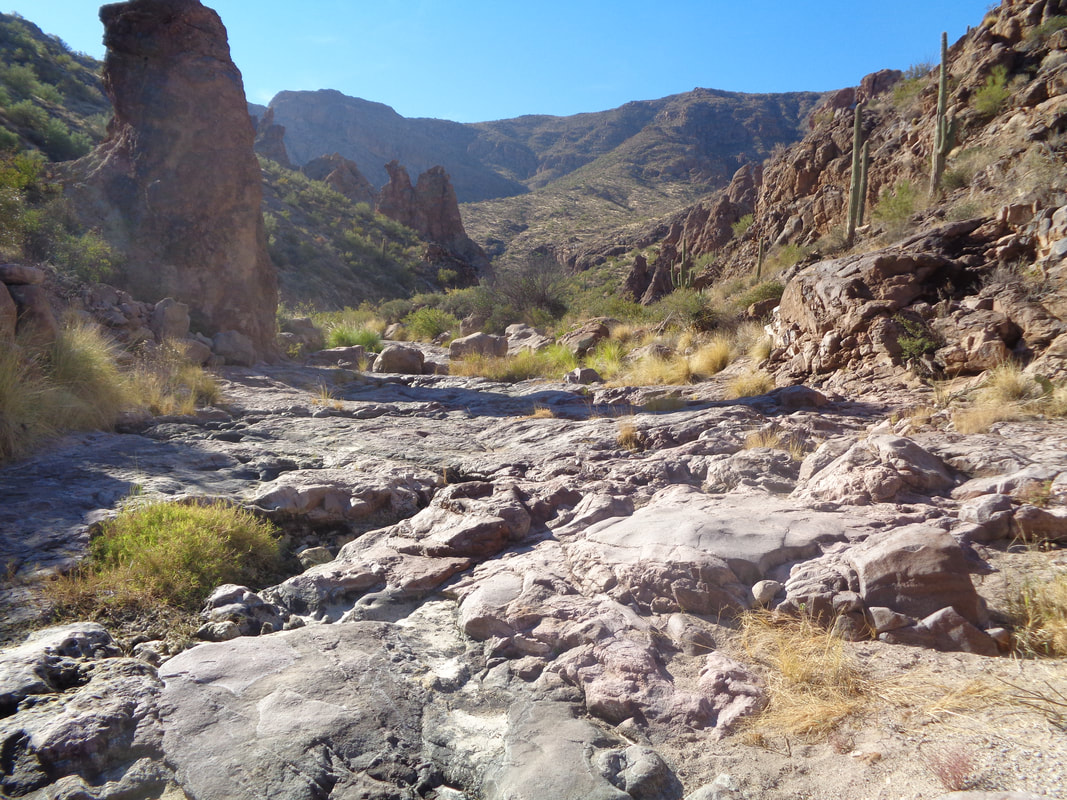 The bottom of my feet were aching from the jumping from rock/boulder to rock/boulder and when I found relatively flat areas, I was relieved. Very scenic and another adventure, with more to come. Especially an epic one on the 6th.
1 Comment
 Although only an average grade of 2%, the climb from Oro Valley, thru Catalina and on to Oracle is 25 miles so when the above point is reached, a glimpse of the road finally turning down with a distant mountain range and....  ....a 6 mile drop into San Manuel. Rare to see a vehicle as this is a back way into the town, staying off the far busier #79. Finished with 71 miles and 3600' of climbing. Fun and new hike coming tomorrow. 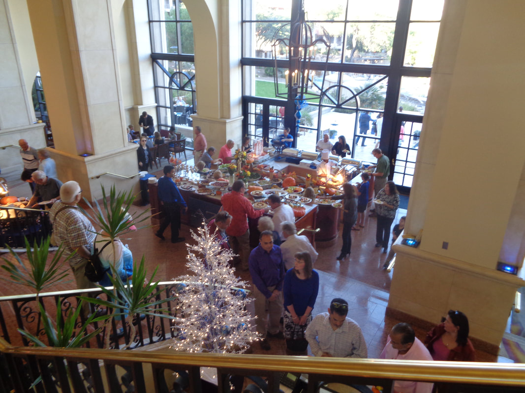 Usually when out here for Thanksgiving, I end up eating at a Chiii's or the YWCA but not this time. This time it is at the Westin La Paloma, guest of my daughter. Today's temp was an unusually warm 85 so since I elected to sit outside, I thought I would bake in long pants but not to worry, the patio was shaded and it was very comfortable. I grabbed a plate, elbowed my way to the head of the line and soon..... 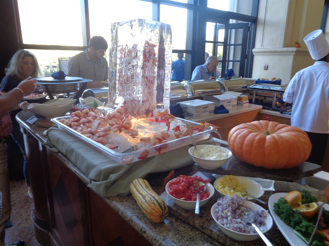 ....was standing in front of this. I tried not to be conspicuous by my frenzied grabbing of shrimp, salmon, oyster shooters, smoked salmon, etc... I returned to my table and began to eat what would merely be the first helping. 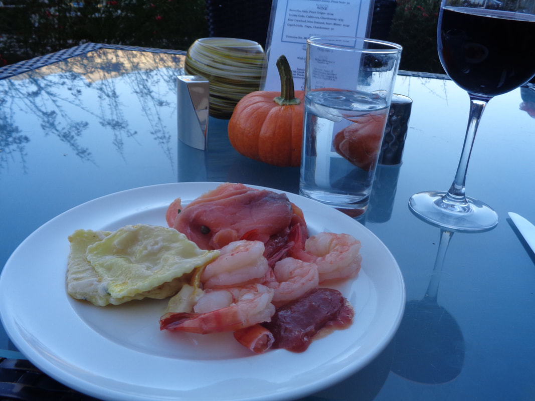 Then I came back with a 2nd plate of food, with a 2nd glass of cab. 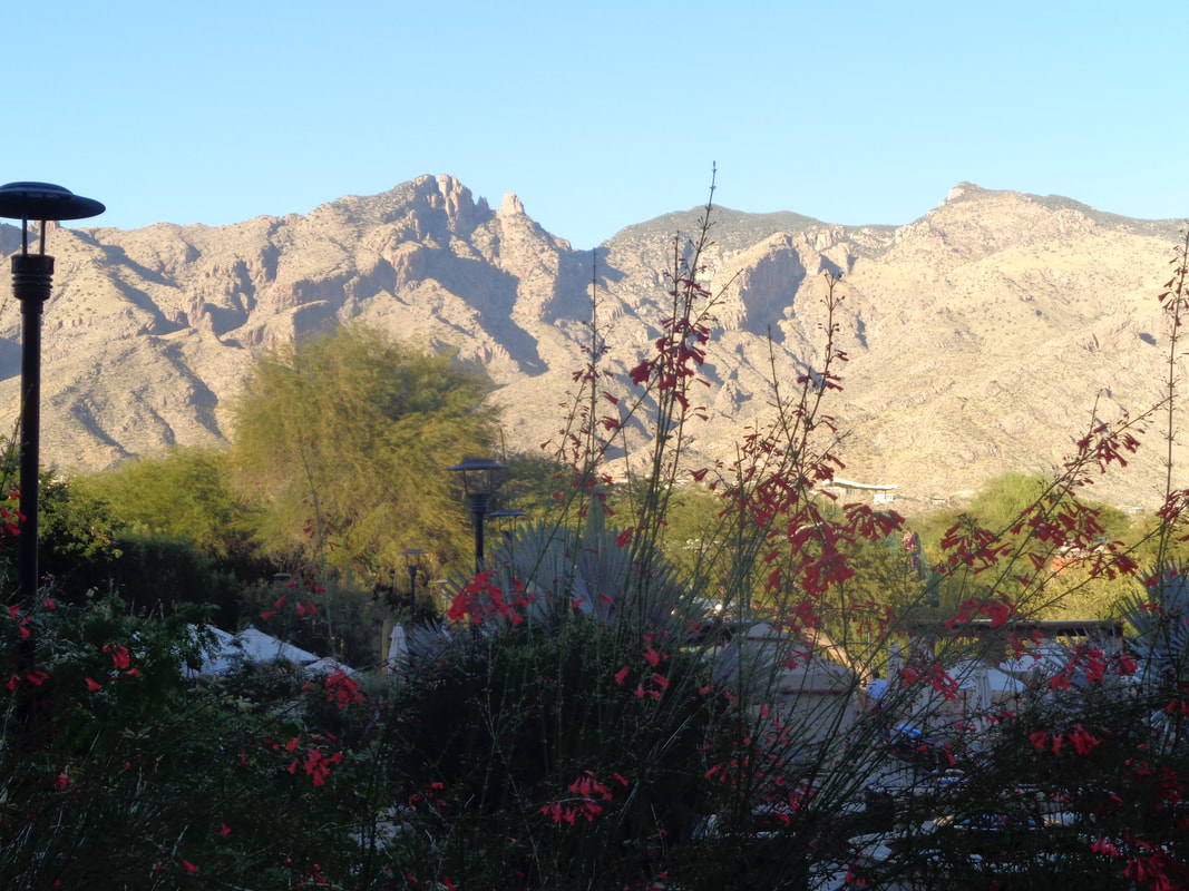 It was nice to sit in the warmth with grand views of the Catalinas. Burp. Well, that was embarrassing. I got up and stumbled toward.....  ....the dessert table!!! The portions were small so I.... 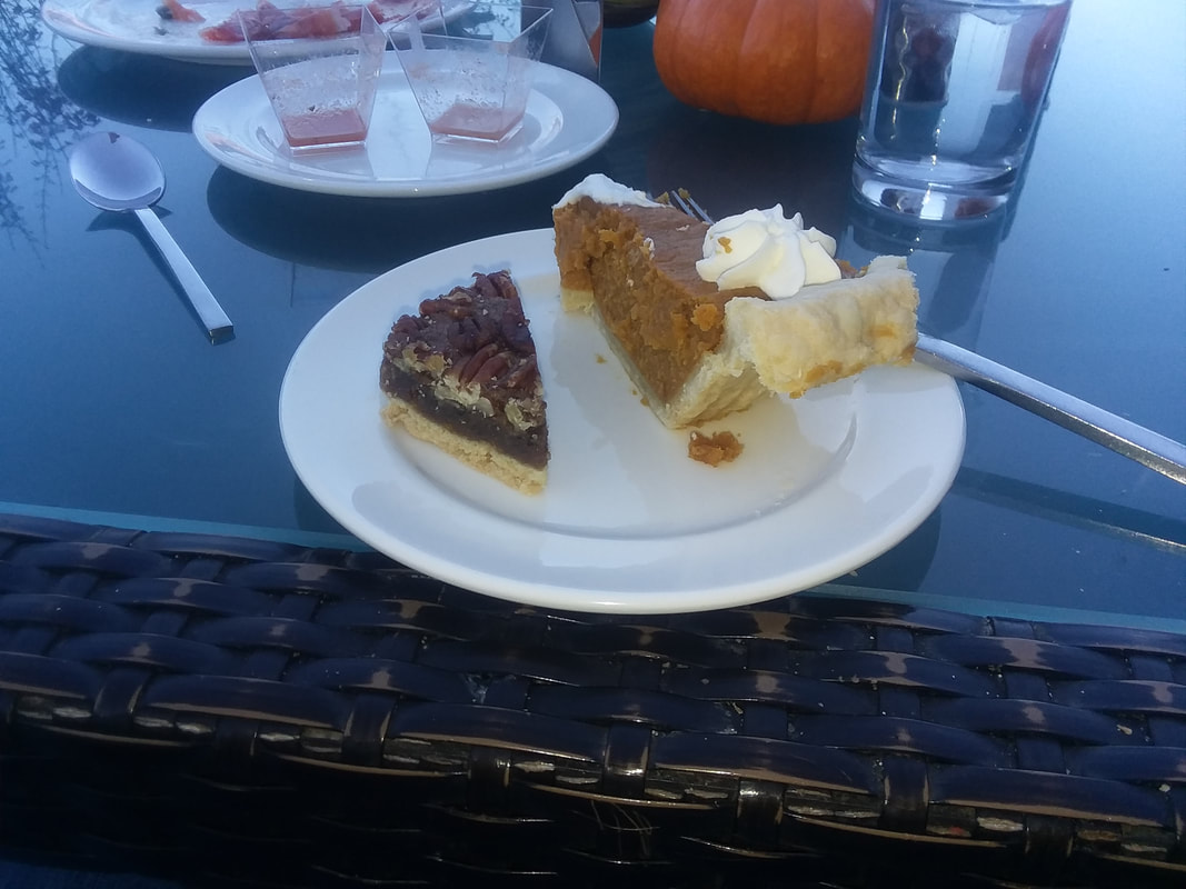 .....took two small pieces of pumpkin and pecan pie. It was all very good. I did not visit the "hot table" so missed the turkey, roast beef, etc... Oh well, maybe next year. I soon....  ....exited the facility. Well, back to hiking and cycling. 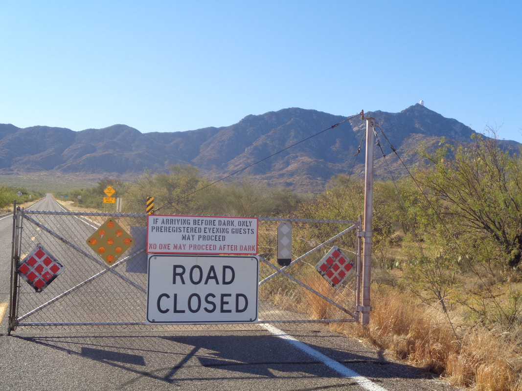 Sooooo, I've been surprised that I am bettering my times on practically every climb this month compared to spring efforts so while I usually hike a bunch and cycle little in the fall visits, let's drive to the base of Kitt Peak and try that climb!!!! Thanksgiving morning and the gate is closed...bummer but the other side is open so I begin. 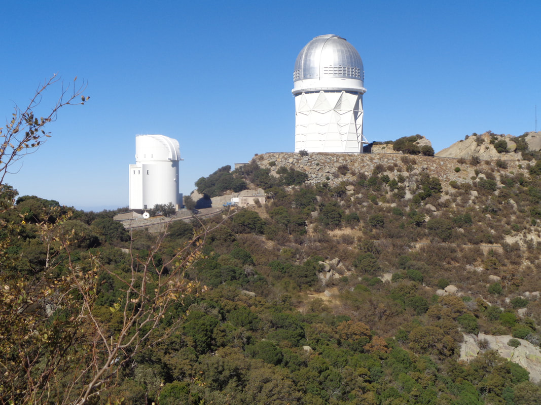 12.5 miles, averaging around 6% and finally, I am closing in. Actually, all these pics were taken on the descent cause on the ascent, I was working too hard to take images! 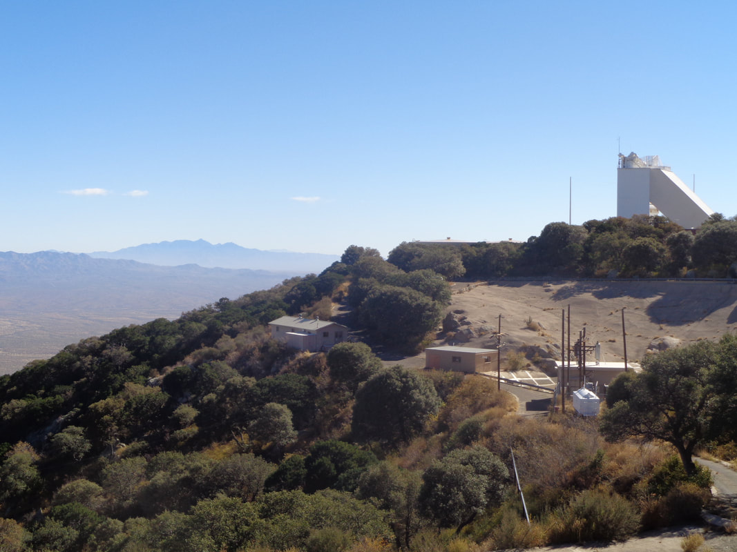 No cars passed me on the way up and 2 going down while I was going up. For the heck of it I weaved across the road sometimes. I set a new personal best time and after checking Strava, finished 3 seconds behind Chris Carmichael, the cycling coach...I should have sprinted at the end or brought out my beloved "bh" bike. Yeah, that would have secured me at least 3 seconds. 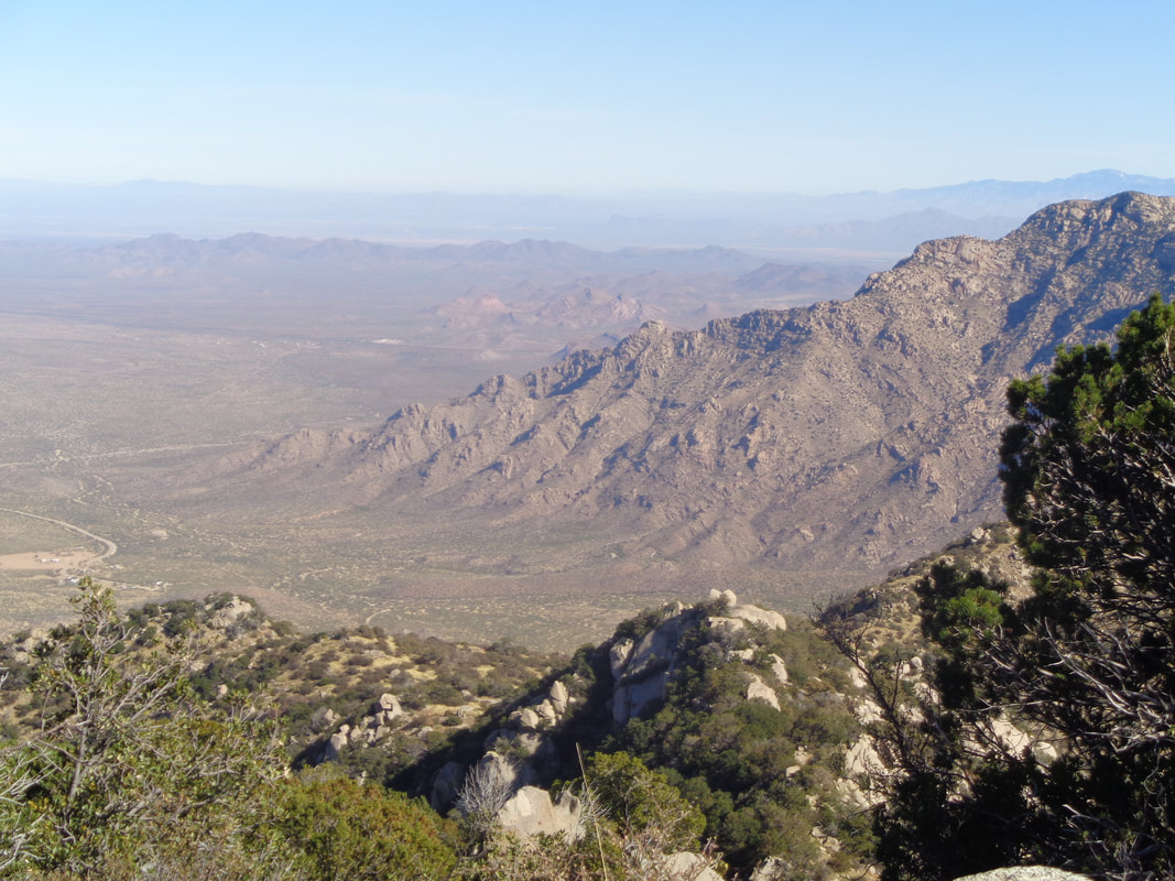 I sometimes get a little emotional at these peaks, be it from hiking or riding. If I could bring all of you to share this, I would,,ok a couple of you more then the others. 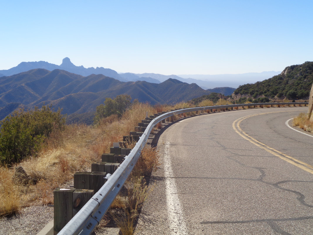 Geesh. Descending with all the sights..... 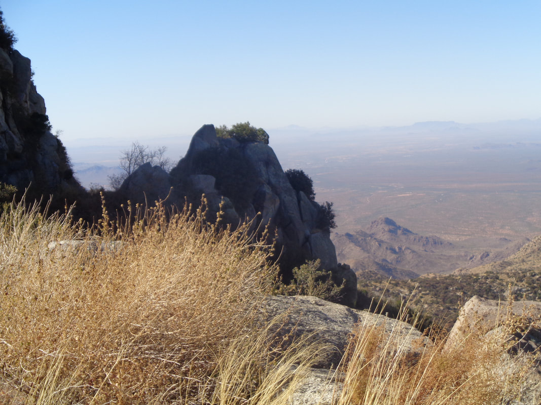 ....and more sights and then.... 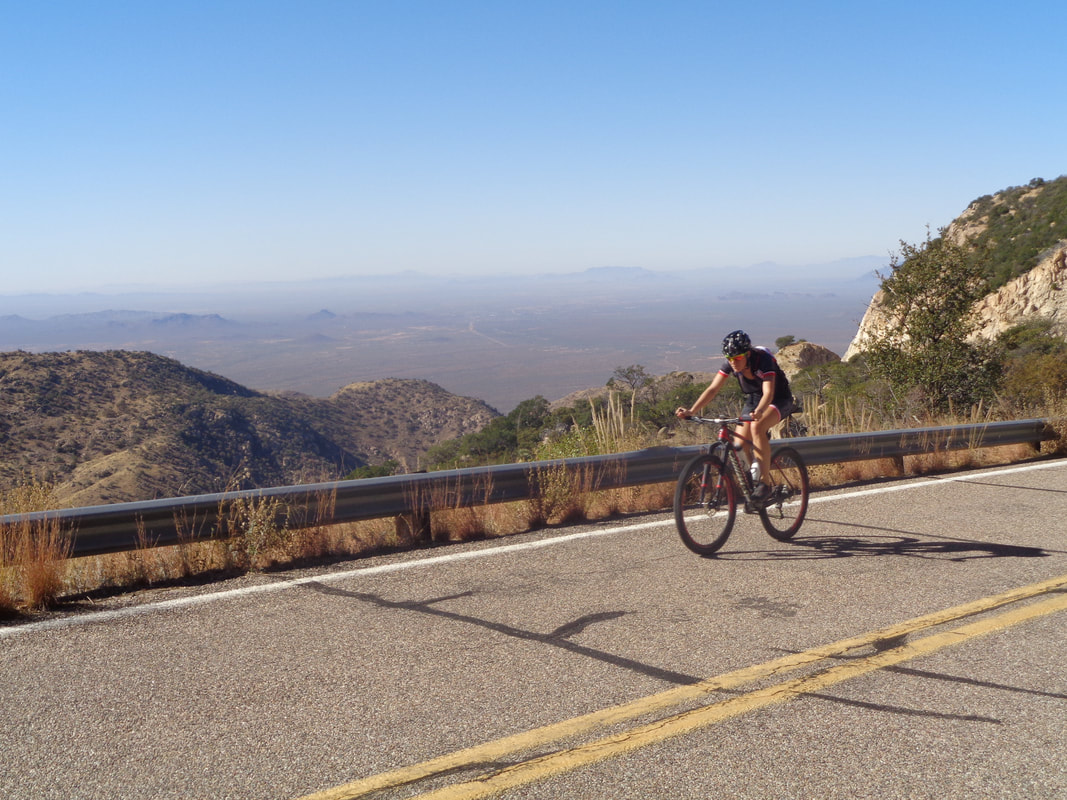 ...how bout that??? I did not expect to see another cyclist but a man and woman were churning up and a but later, I saw a guy on a road bike. I gave him a thumbs up, he returned the gesture, we smiled at each other and probably had a similar though; late November, Thanksgiving day, riding in shorts and jersey, up a great climb, sunny, light wind, temp in the 80's, it is good to be alive and in AZ. OK, Hawaii or CA would be ok too. 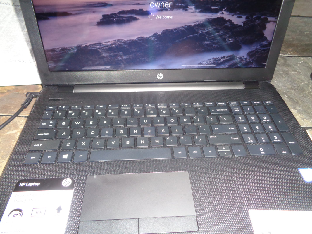 Tis a sad, sad tale to tell. Prior to my arrival in AZ, I had an issue with my laptop, got it fixed but it was about 5 years old and was warned, it wasn't going to work much longer. Upon arriving here, it crashed but I took it to "Fast Rhino" a computer repair place and had all data removed from the hard drive, bought a new laptop and was good to go, Then, Sunday evening, it being a laptop, it was on my lap. In my left hand was a glass of wine....I fell asleep. I woke up, found nothing amiss and went to bed. The next morning, I started up the computer, noted the keys were kind of sticky so I had spilled a mere splash of wine on the keyboard. Then the computer shut down. Back to Fast Rhino and the circuit board had shorted!!! A minor $300 mistake. This afternoon, I retrieved the laptop and upon advice of a friend, must drink wine from a sippy cup from now on. The good news, I am back in action!!! I regret the paltry quantity of posts but like Mount Vesuvius, will come gushing forth with content very soon. I apologize. 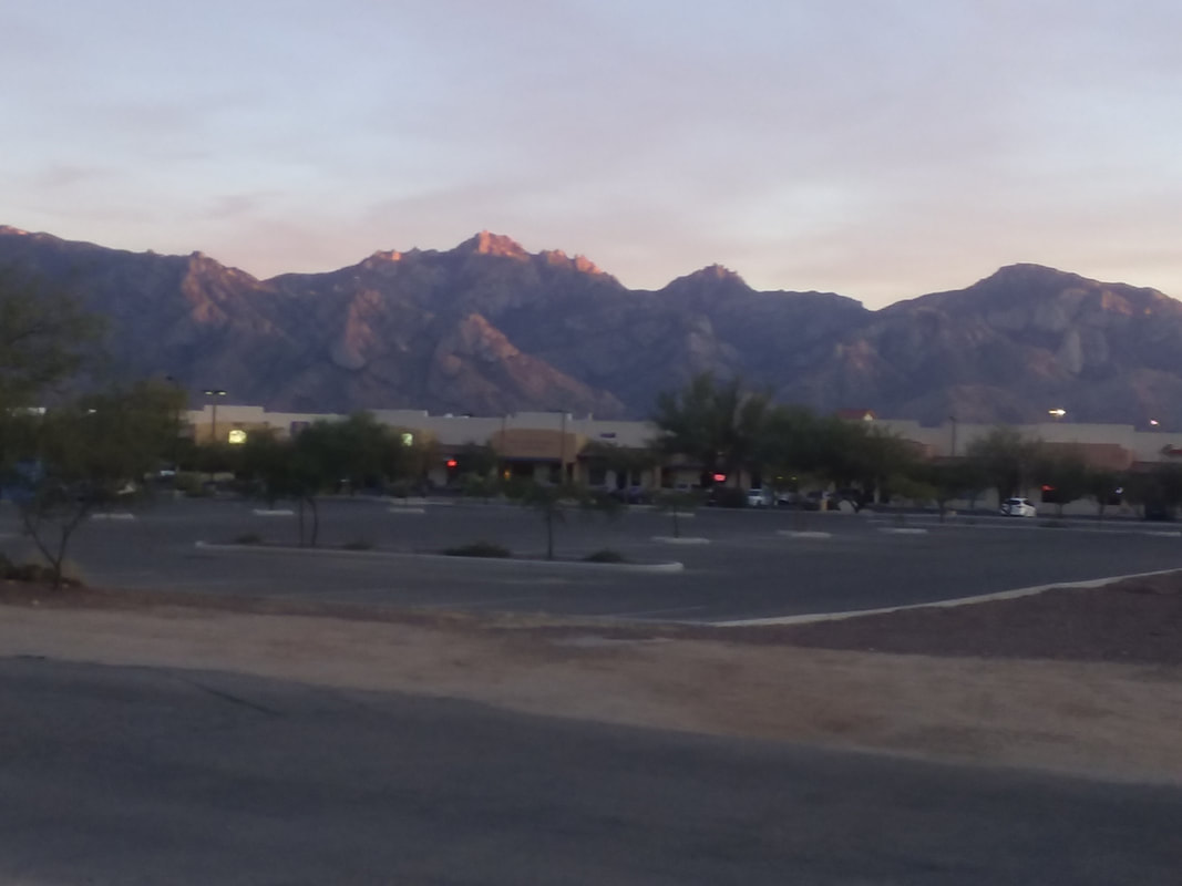 The sun casts light on the highest peak prior to disappearing below the horizon. 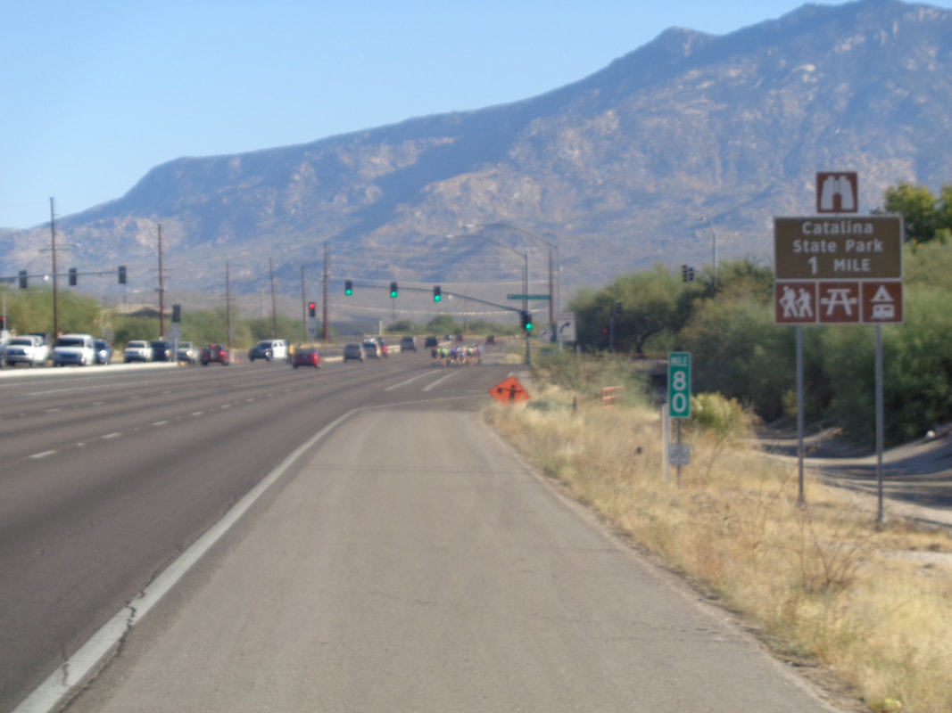 Roughly 9000 cyclists participated in this year's El Tour de Tucson. I calculated the first group would arrive in front of our place at 9:30am so rode out and dang, there they went, around 30 of them. I warmed up and soon.... 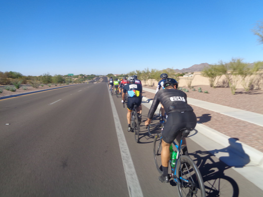 ....a second group came by having about 25 cyclists. My intent was only to ride with them long enough to get through Moore Road. I asked a guy what was his average speed to that point and he said 24mph. I hung with them for about 12 miles and upon reaching the turn south on Twin Peaks Road, bugged out. I coasted down Twin Peaks and.... 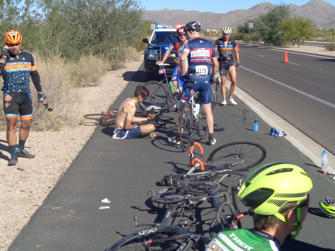 ....ouch! A touch of tires in the front group and 9 cyclists either went down or stopped to render help. Police were quick to respond and soon a EMS truck arrived. I cruised into Marana and stopped at.... 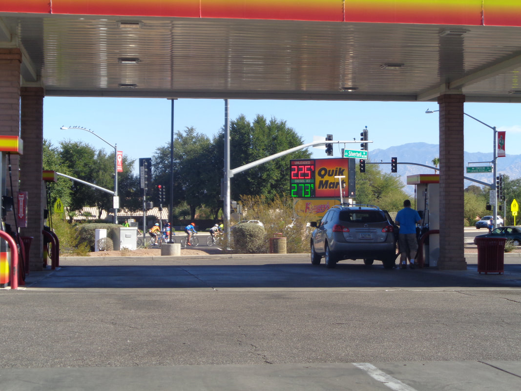 ....a gas station for a snack. Groups of cyclists continued to ride by and check out the gas price!!! It has been consistently at or a few cents around $2.25. Not sure why it is not susceptible to the price swings in Ohio, maybe distribution cost difference? 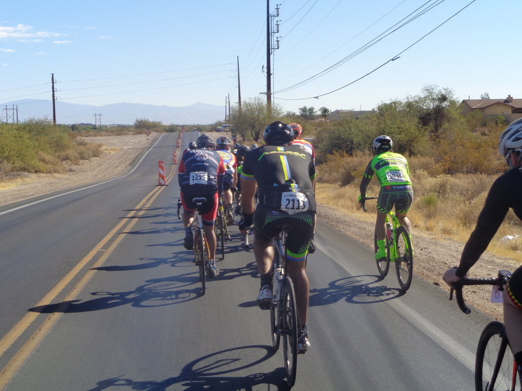 I headed south on Silverbell Road and quickly was swept up by another group. We were ushered through all intersections with a heavy presence of police and we always thanked them for being there. After a few miles I bugged out again and.... 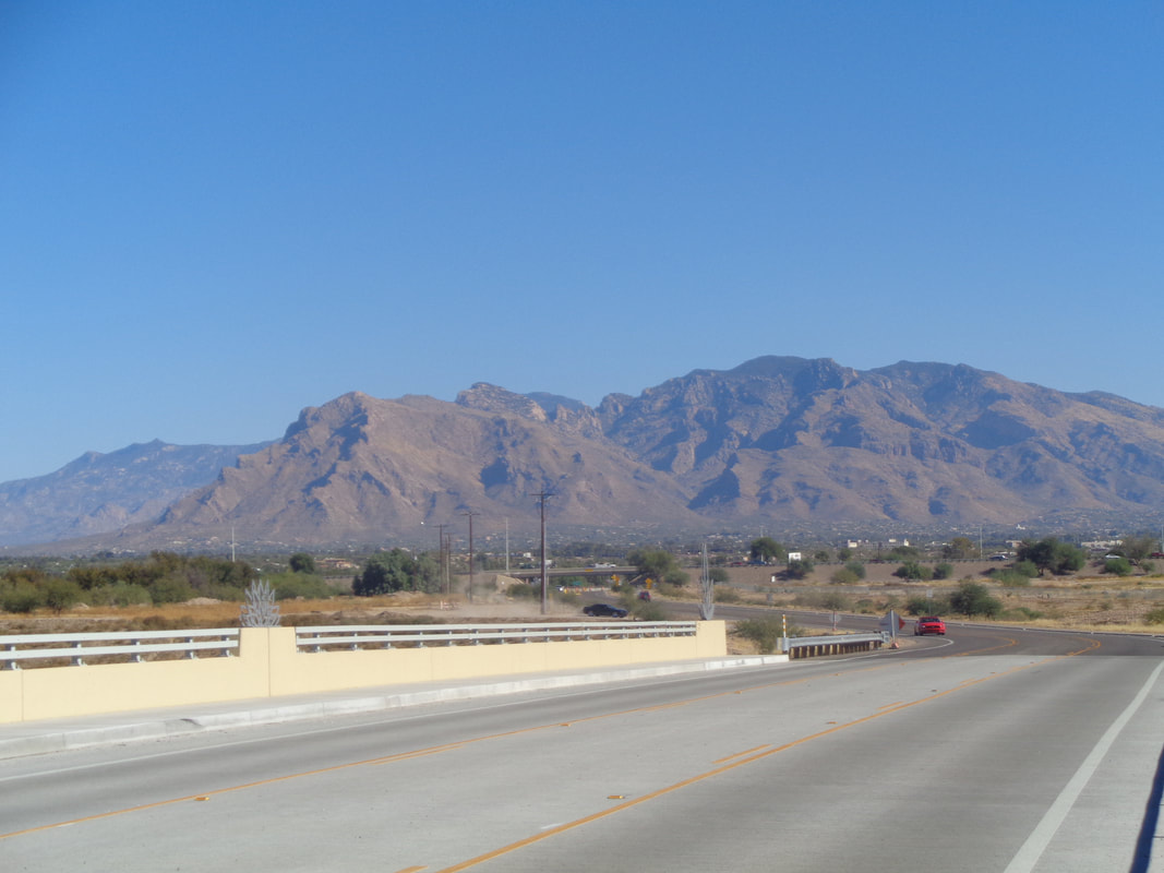 ....headed northeast toward Oro Valley and home. Finished with 41 miles. 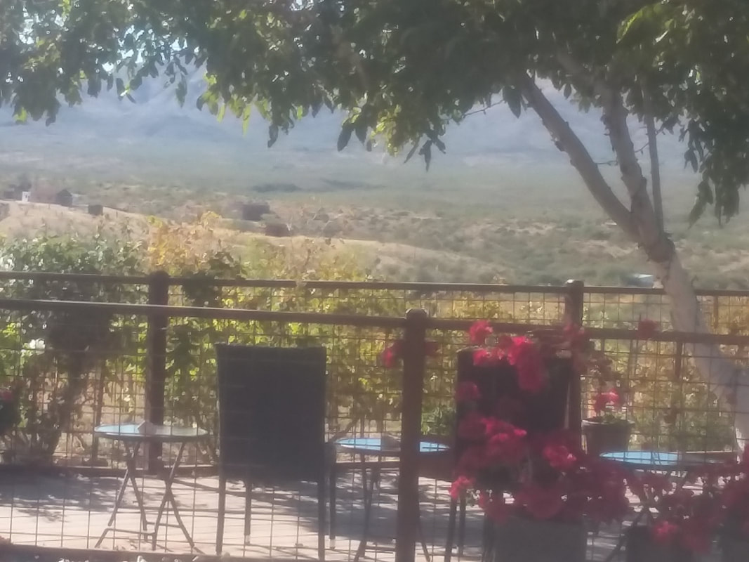 The first of many stops, after driving east on I-10 and then south on #83. The entrance to AZ's "Wine Country." 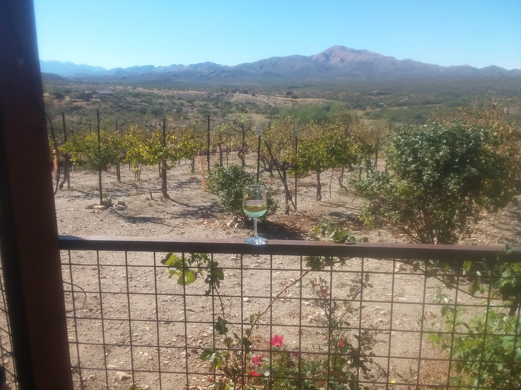 Got to place a glass of wine in the image just because. 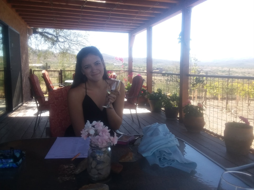 Our daughter Oliva shares my passion for wine if not my ability to consume vast quantities of it. 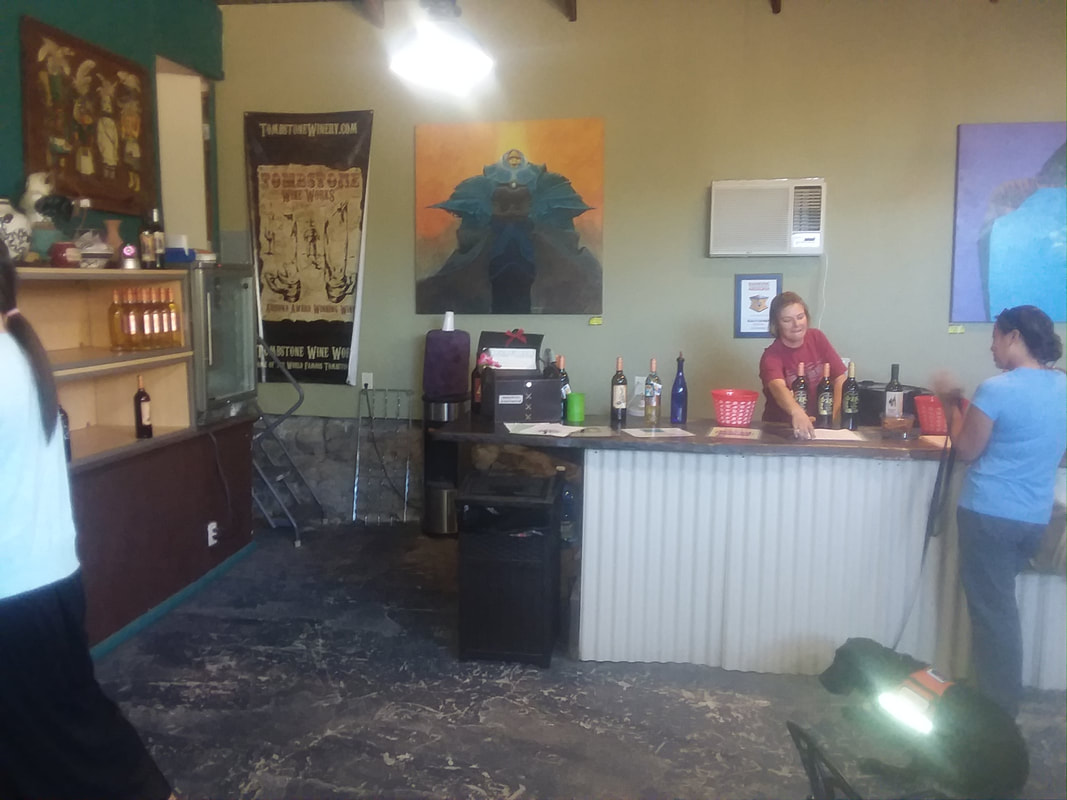 Being a Thursday, with light traffic, the B team of wine servers was out to pour. They were borderline rude, I guess being the owner's daughter or relative was not motivating enough to be pleasant. 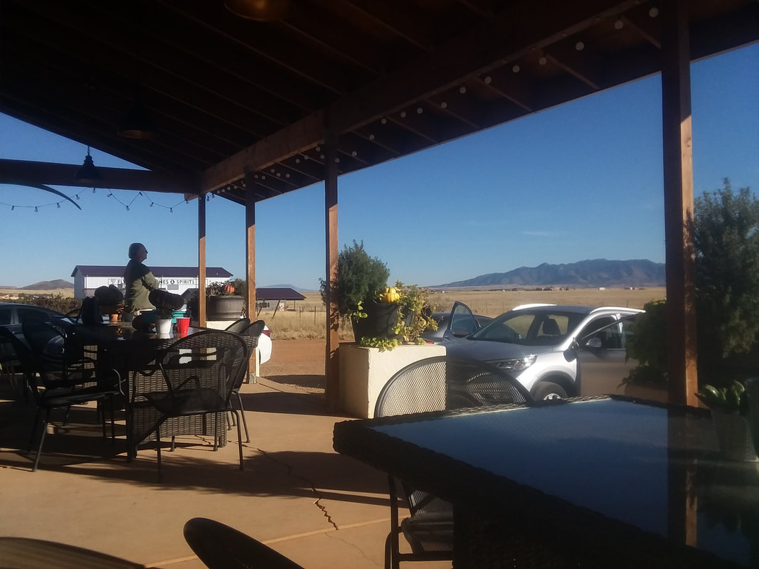 The area around Elgin has vast open space and plenty of mountain ranges to view in the distance. The tasting rooms and wineries are on a par with Ohio wineries. It is nice to have a glass and sit on the porch and sip or guzzle as the case may be, a glass of wine. 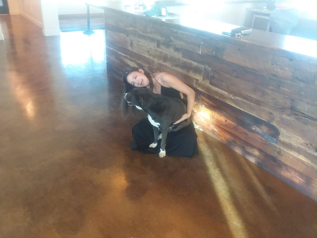 A friendly dog approached so Olivia hugged it. 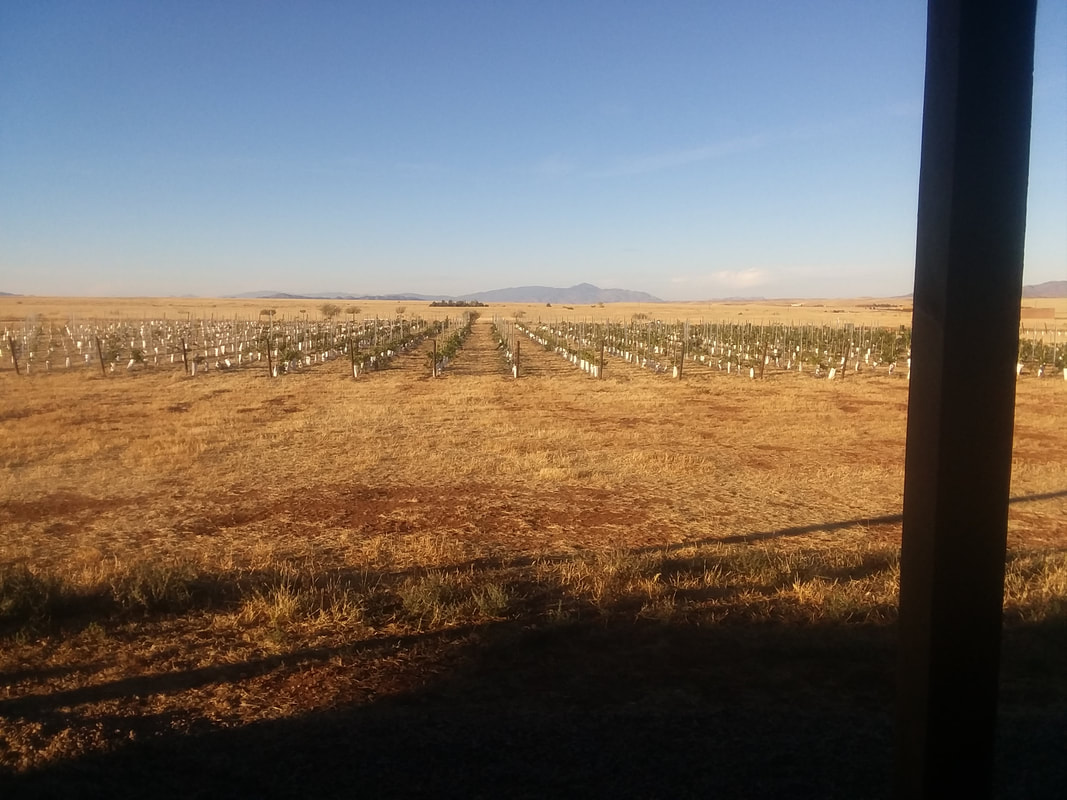 As I said, vast open spaces. It has rained once in 2 months so the grass is brown. 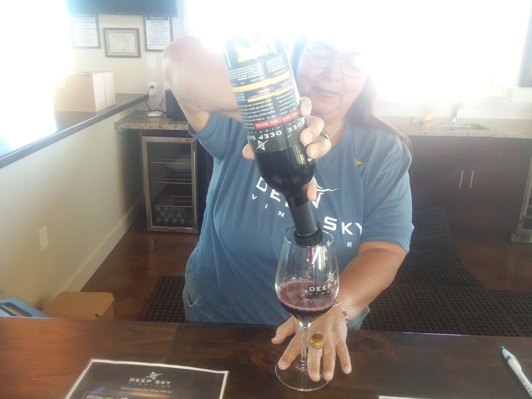 The pourer at "Deep Sky" winery was nice and gave a very generous pour. I generously drank it all. 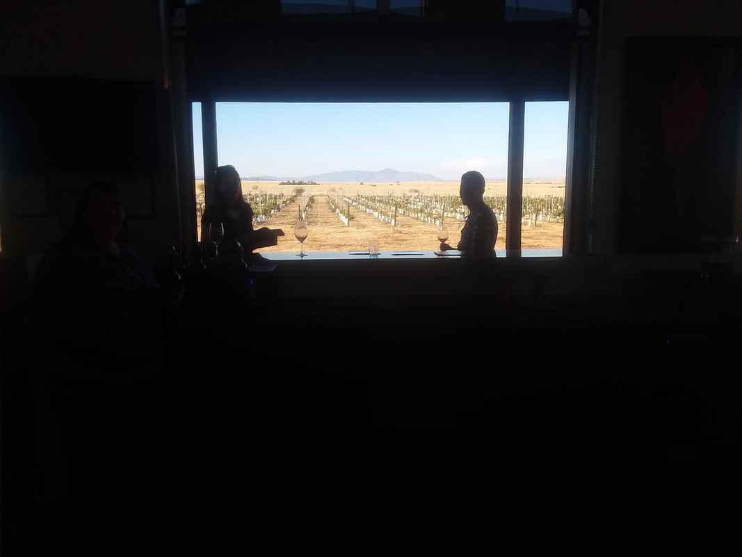 This was our 6th and final stop. Good time but now, on to cycling and hiking!!! 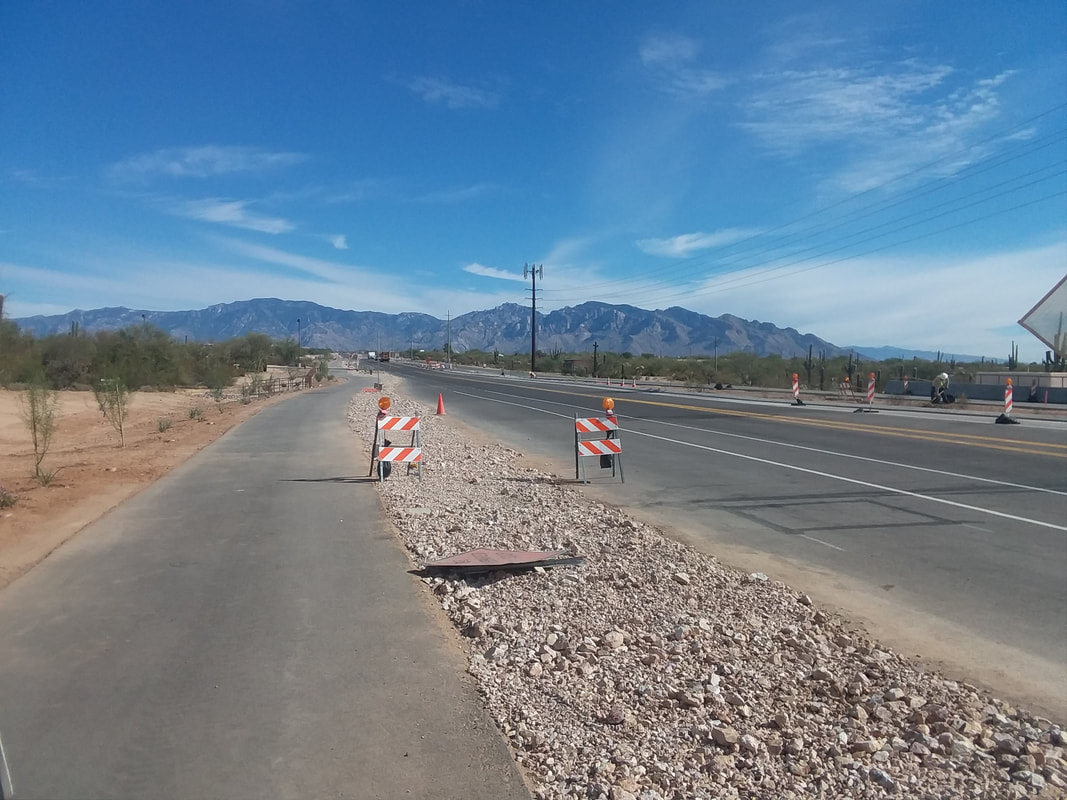 Typically, when out here in the fall, I hike a bunch and don't ride very often. It has been an odd year and still, I am motivated to ride. Not a lot of miles, 30 here, 40 there but to be frank, I am within striking distance of my cycling buddy on Strava, a mere 500 miles distant. 500 miles is a lot but not when I am in sunny and warm AZ and she is in cloudy and cold OH. I could close that gap in a couple of weeks so... Above, a major reconstruction project is taking the dips out of the northern approach to Oro Valley via Tangerine Road while also widening it and adding a bike lane. Still a ways to go.  Wow, in the suburb of Marana, a Top Golf is going in. A 3 tiered driving range but the focus is not on hitting golf balls, instead on a high end bar and restaurant and these things have become very popular around the US. 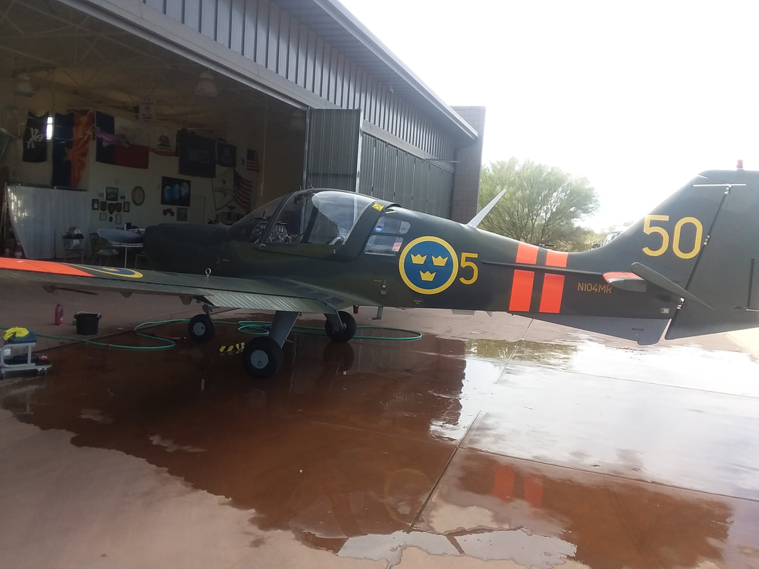 Then, while riding through a community having an airport and many hangers in which residents keep their planes on their property, I found a guy washing his plane. This is a WWII trainer used by the Swedish air force. The owner puts in 100 hours a year flying it and can put his mountain bike in there. 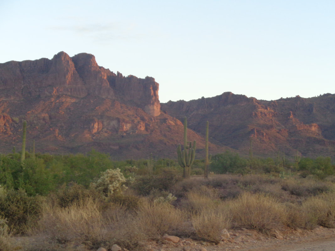 Wow, had to wake at 5:00am and arrived at my destination just as the sun was rising, casting its first light on the Superstitions. I passed a guy standing on a ladder perched in the bed of his truck, waiting for the sun to rise. Quite a show. 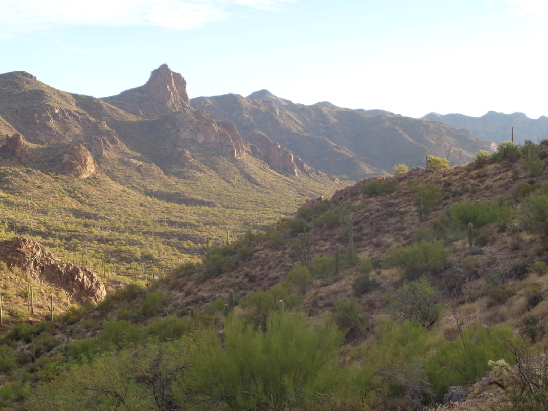 This hike popped on the schedule only the day before so only 4 of us signed up and began yet another eye popping experience starting on the Dutchman trail. 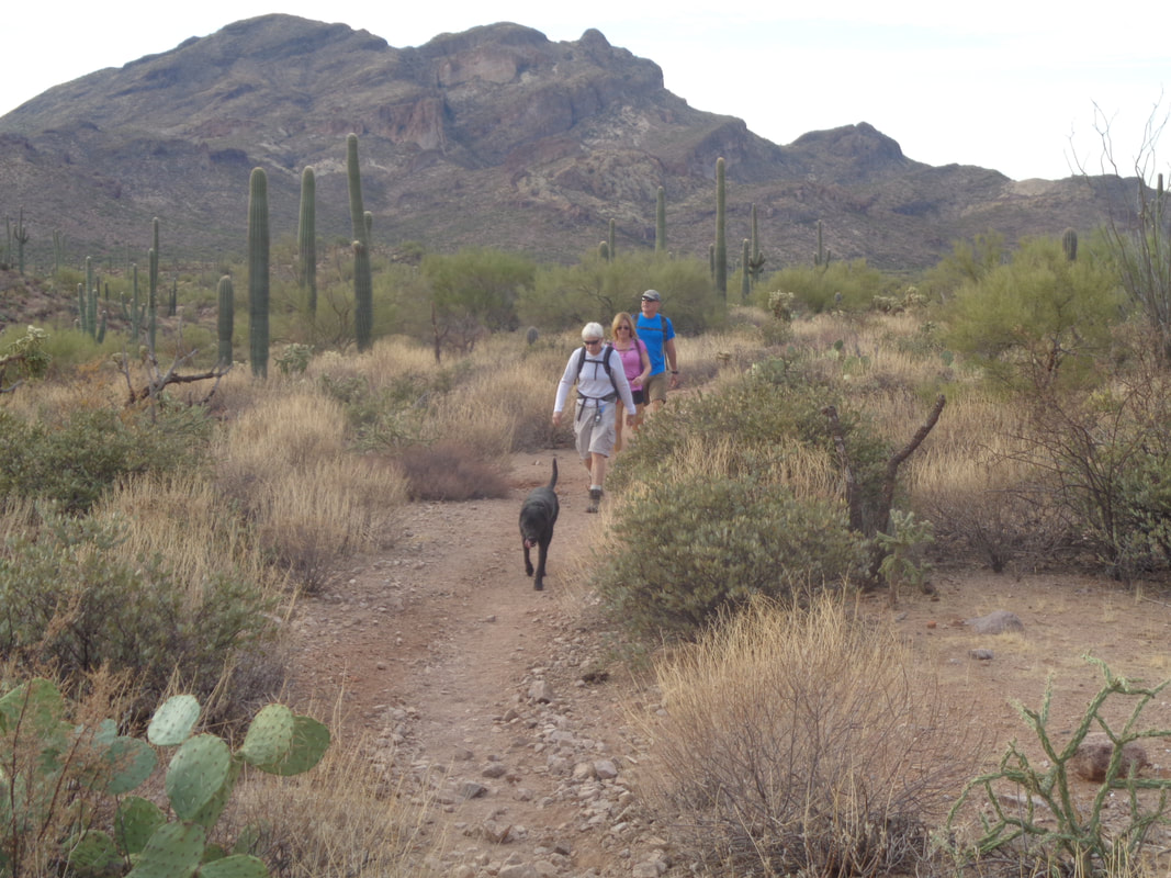 Ok, actually there were 5 of us counting the black lab. 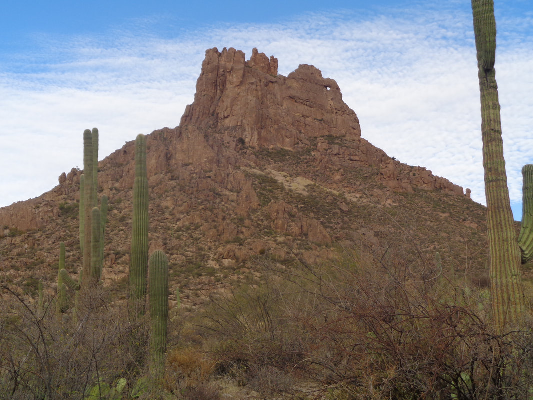 Today's destination and note the little window on the right. When the sun hits it just right, it throws off a narrow shaft of light, hence the "needle" in the title. As for "Miners", I have no idea. It would be nice to approach the object from here but alas..... 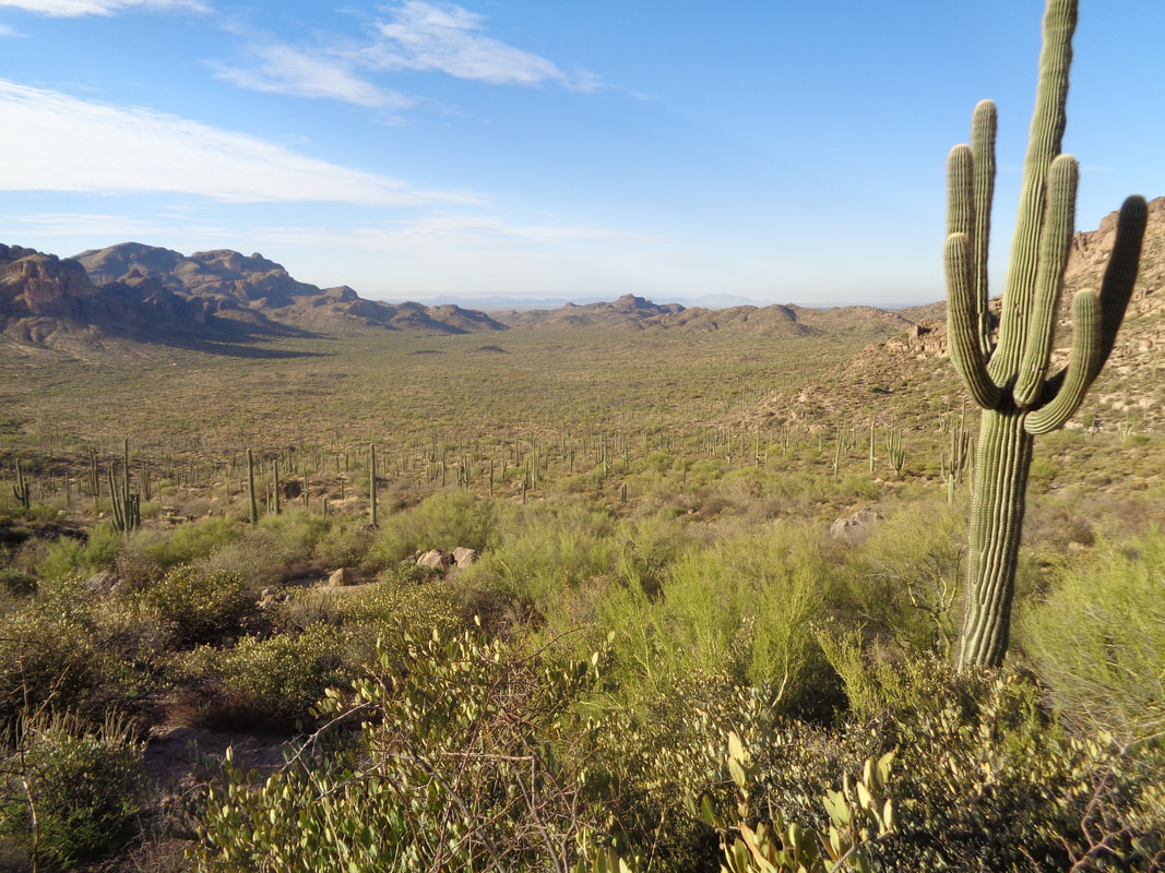 .....we have to go all the way to the back side prior to going off trail and up. It was almost 4 miles to the base of the Needle and then... 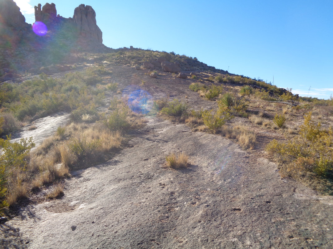 ....and long expanse of slick rock. I enjoy hoofing it up these steep slopes and then.... 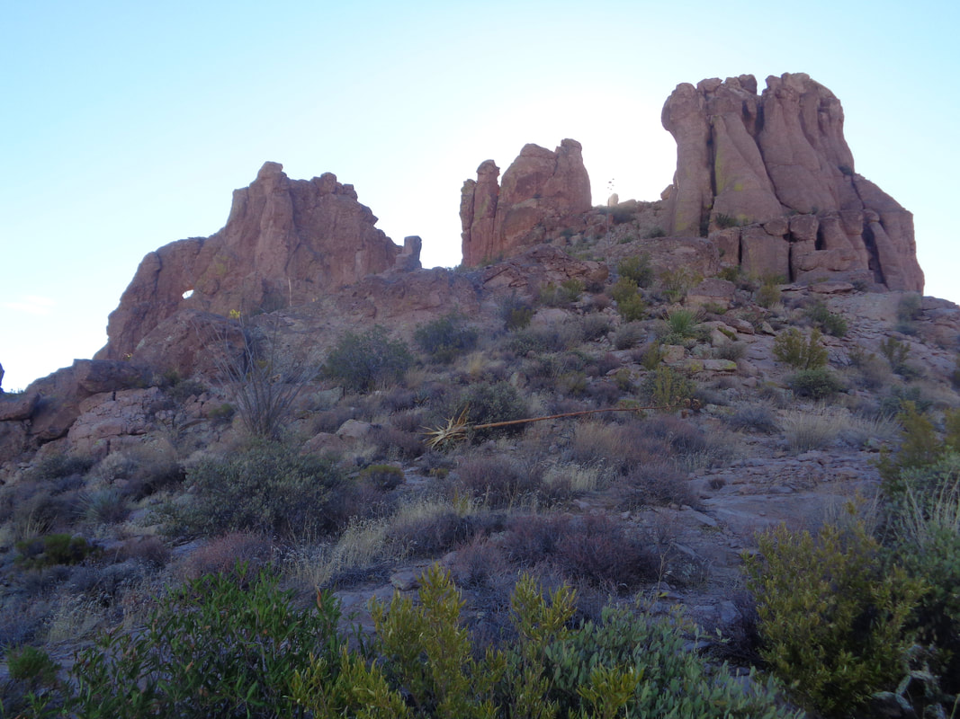 ....I'm getting closer, headed toward the ridge, center right. 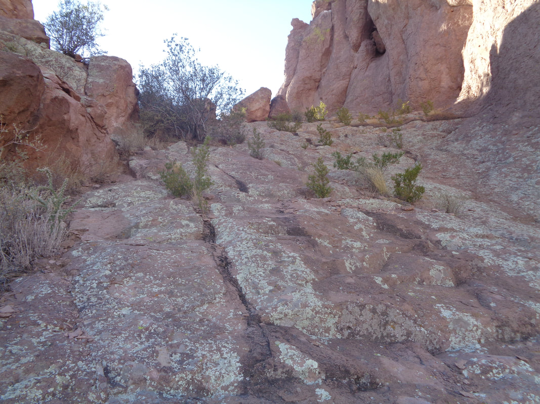 I know it does not look like it but really steep. I should have waited for someone to be on the wall to give it scale but behind me, two of the group bailed on the climb and heck, I like to be first so.... 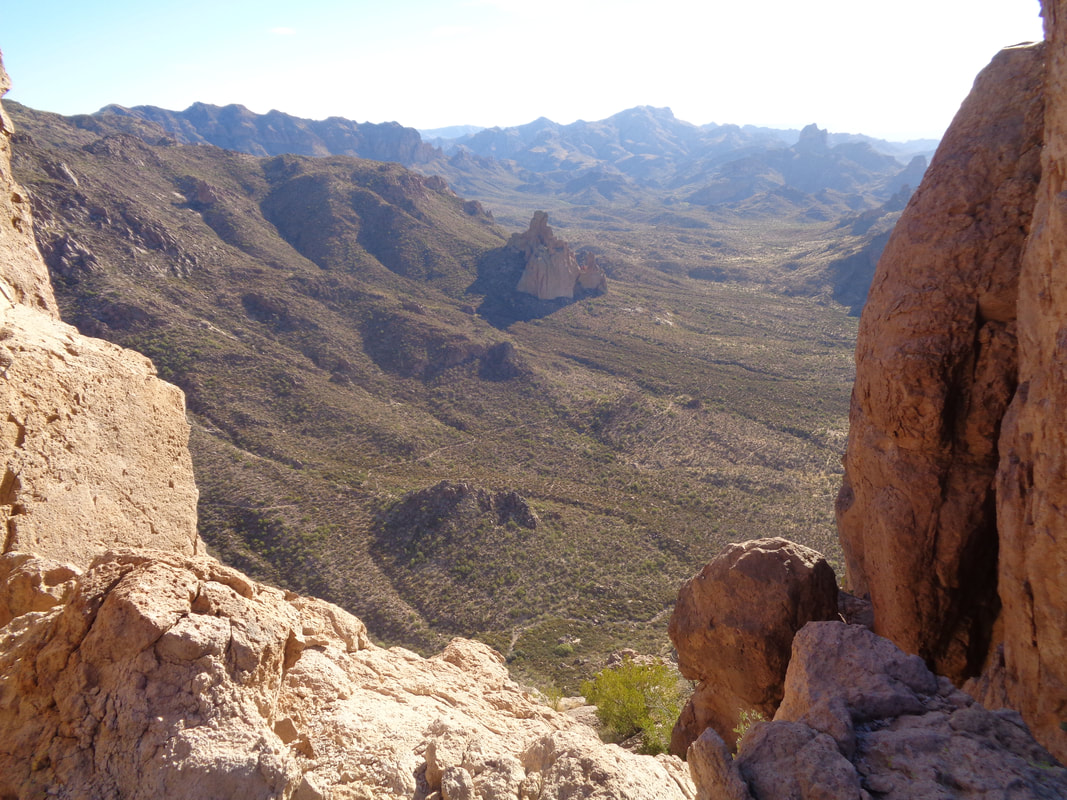 ....wow, how about that. 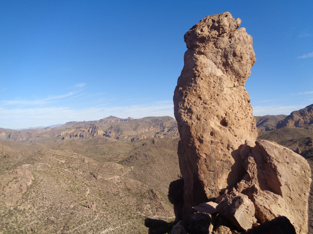 Ok, didn't make it to the actual top since that would require technical climbing gear and I would not trust my body weight on that structure. Not how I want to end my fun. 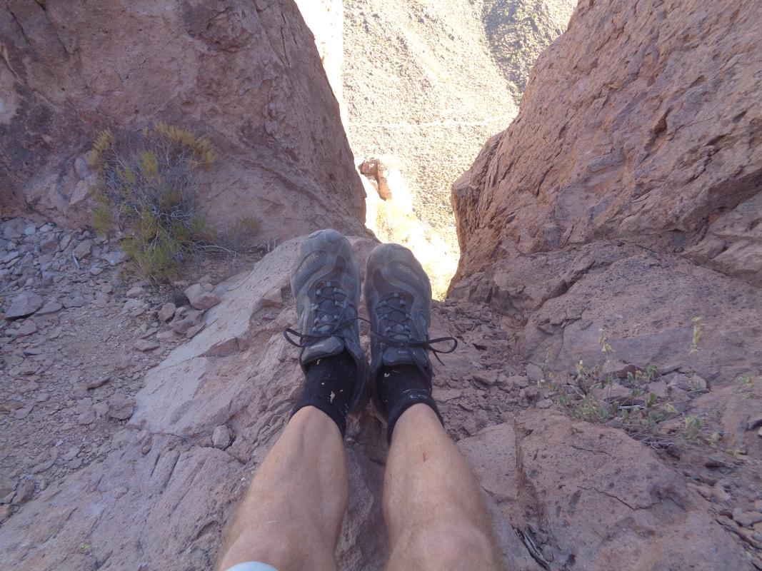 Between the notch, I can make out a segment of the trail we followed. I couldn't make myself walk too close on the slope with loose gravel. I'm dumb but not stupid! 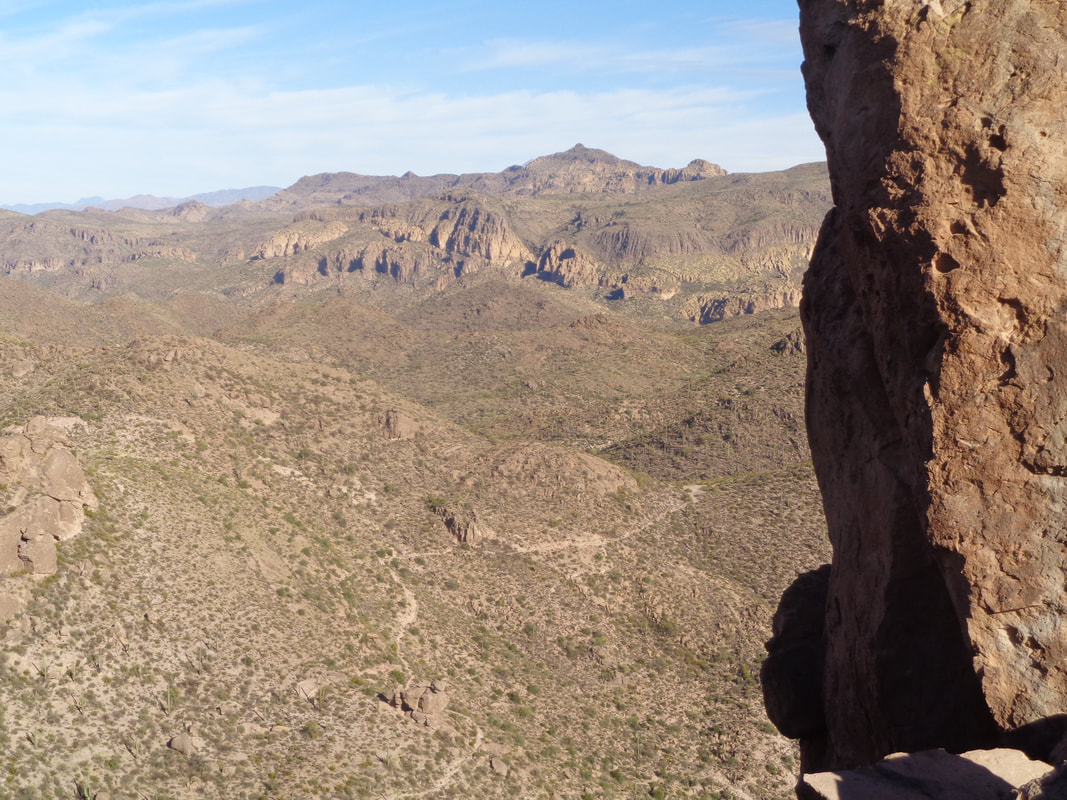 More with the trail running to the lower left. Soon, I am.... 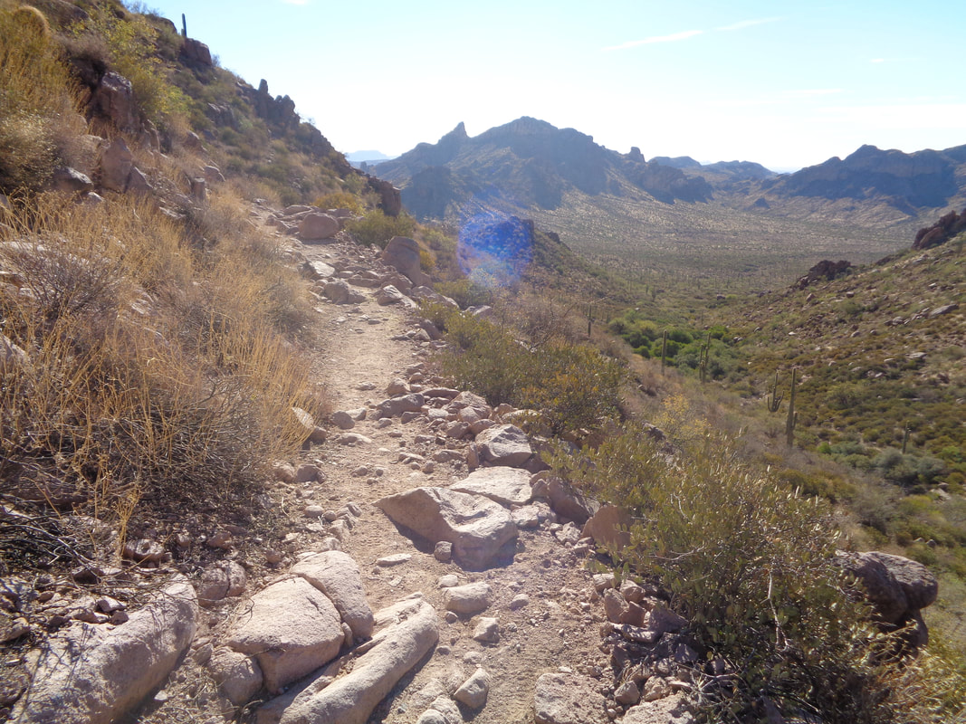 ...back on it, returning to the trail head and notching another fun hike of 8 miles.  A long but fun day. I committed to this hike a few weeks ago. It is said to be the best leaf watching hike in AZ but a hard one and it was. So Mr. Nice Guy saw a student from UofA wanted to do the hike but did not have a car so could someone pick her up in Tucson. I waited and watched and no one committed so I did. Let's not delve into that cause it is a side issue. I drive as far as my Civic can go on a 15 mile dirt road, 1 mile shy of the trail head. Then, a guy in a SUV comes along and offers to take us the remaining mile to the trail head. What luck and what a bouncy drive and yeah, high clearance vehicles need only apply. This is 34 miles north of Wilcox, AZ. 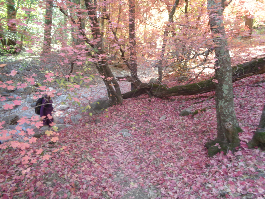 The student I picked up in downtown Tucson is from northern Iran, here on a student visa. Nice person, quiet and somewhat reserved. Good traveling companion and she solved the mystery of why the interior of the windshield is clouded, as if a smoker drove the car. It has to do with the polymers used for manufacturing the dashboard, how that interacts with summer heat, throwing off molecules that then cloud the windshield. Smart young lady with a bright future, here entering the tunnel of color. 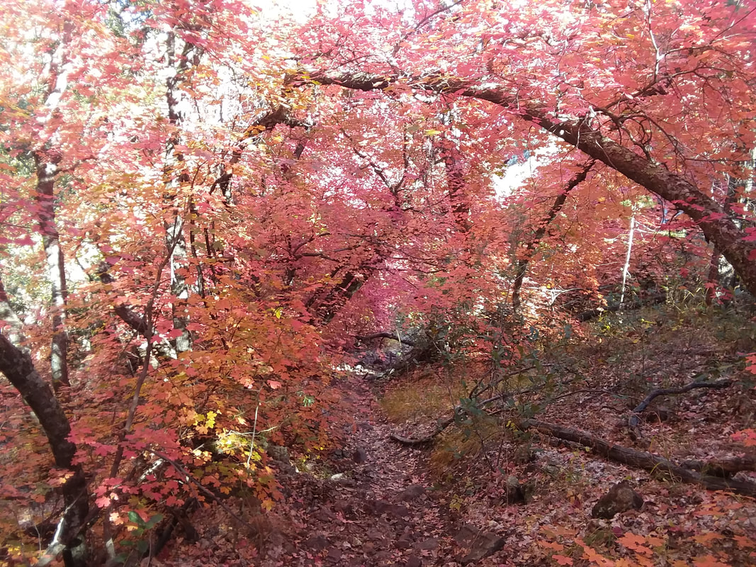 Wait, what??? This is AZ. The people who prefer Florida are crazy, so flat and boring while in AZ, you have this and so much more! 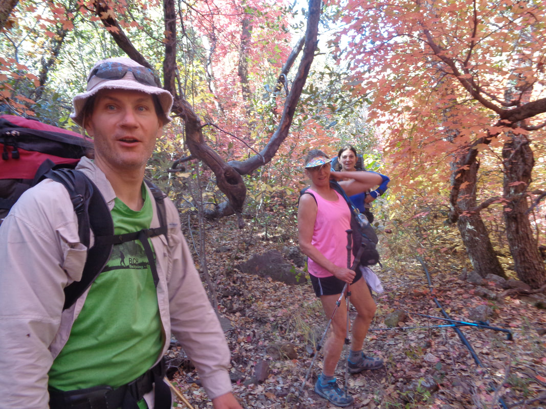 Our group was 15 and a long story but my Iranian buddy and I hiked alone for awhile. Here, we ran into a threesome who had spent the night at the peak and were on their way down. They had some good info for the trail....when you reach sections that are overgrown, just shove yourself forward. Ok! Everyone who ventures up this difficult trail is so fit. No fatties need apply. 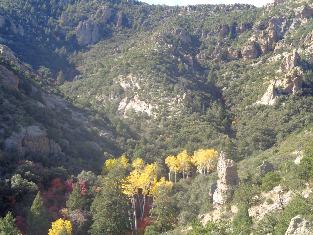 Kept hiking up the trail out of Ash Canyon and despite all the beauty, it began to get monotonous and then....the trail broke toward a wall and I rose above Ash Canyon. However, you can see the magnificent colors through which I hiked. Wow. 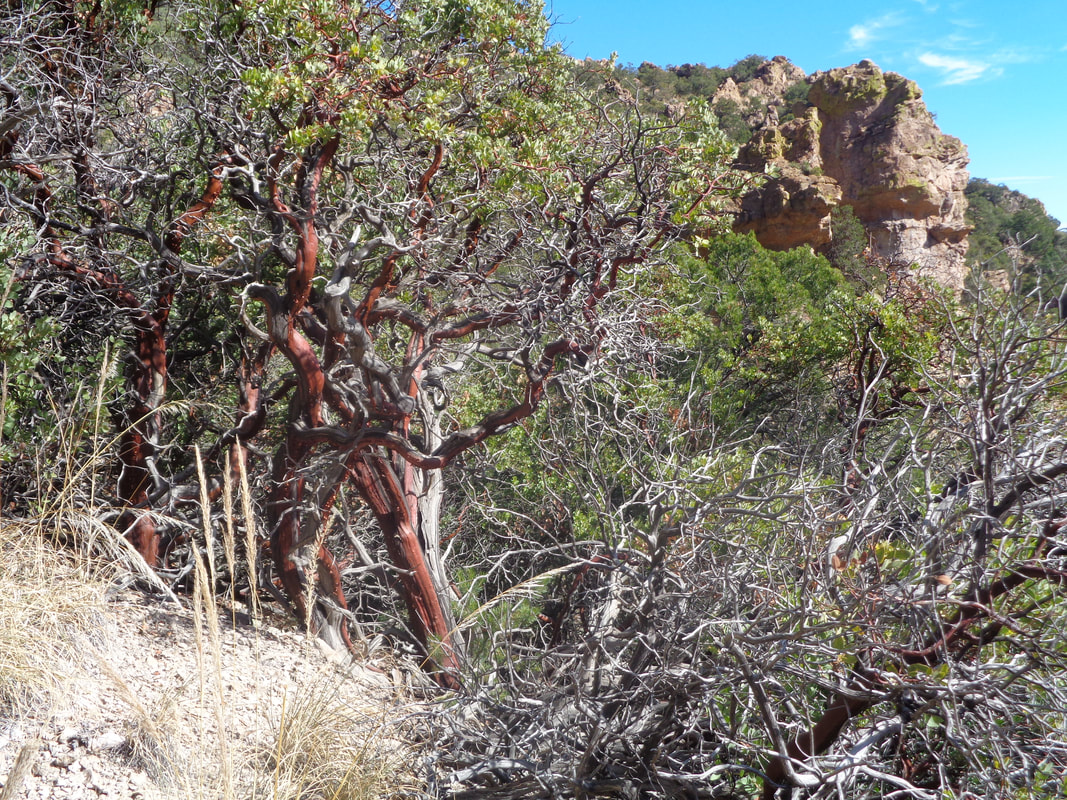 I began to encounter Manzanita bushes, notable for their scarlet colored branches. I was hiking alone now, having provided some guidance through multiple stream crossings. From this point on, the trail is mostly obvious. I wondered, where is the peak and then..... 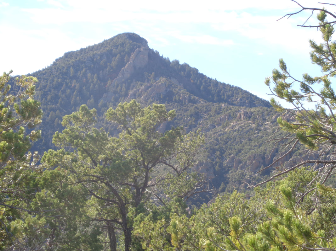 ....close to reaching a ridge, to the south, ugh, there it is. So far yet to go. That looks steep at the top and so it was. 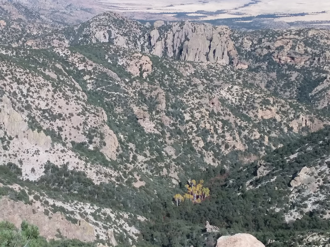 Cool, there is the canyon through which I hiked, the end of it populated by Aspen trees with yellow leaves. 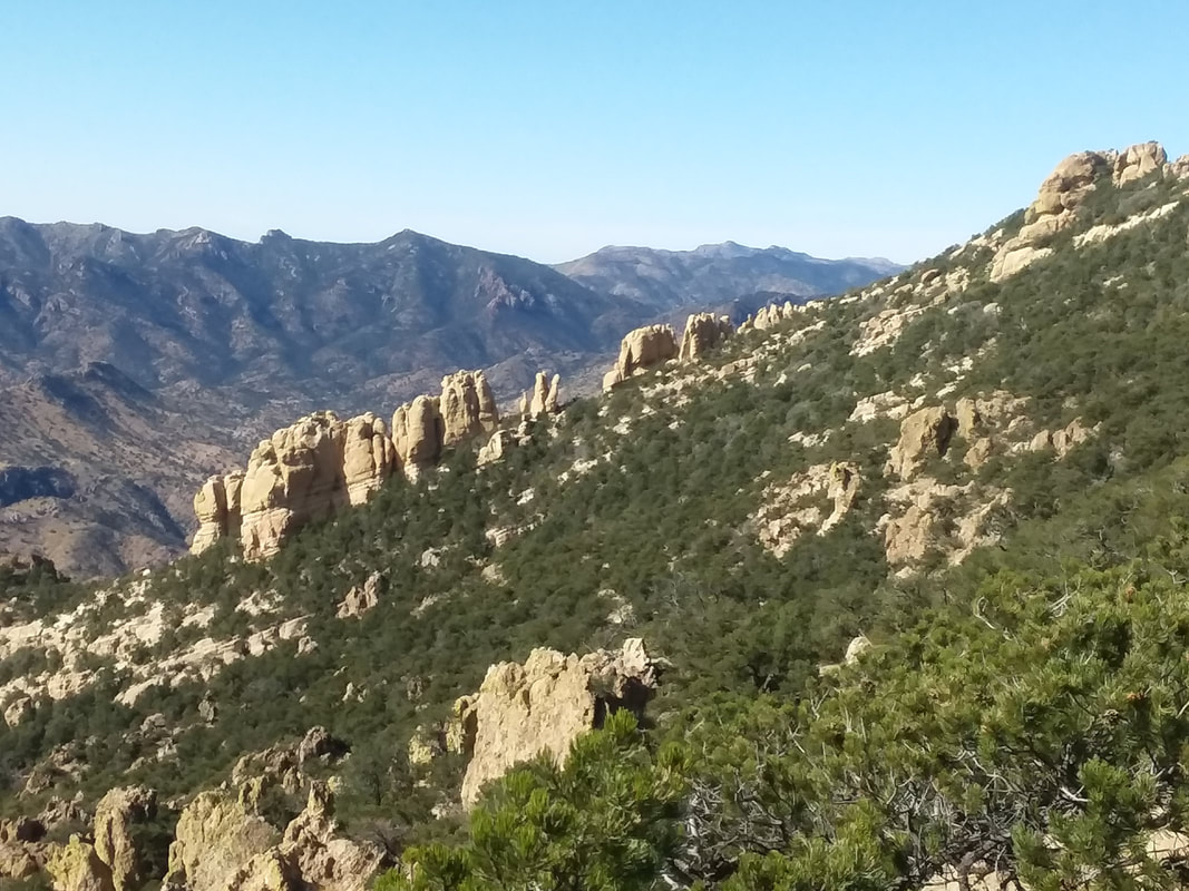 Now, multiple mountain ranges began to emerge as I slogged higher. I began to think about a Strava segment, yeah crazy but as it turns out, none existed on this remote route. 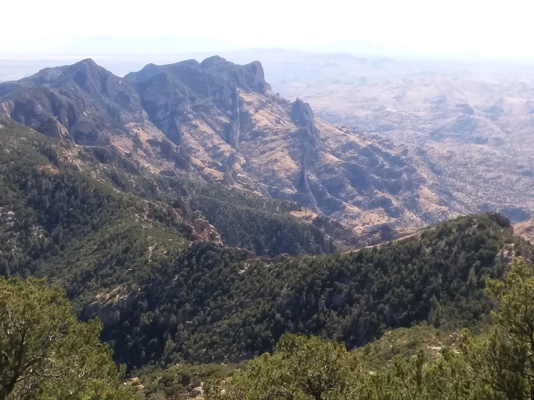 WOW!!!!! 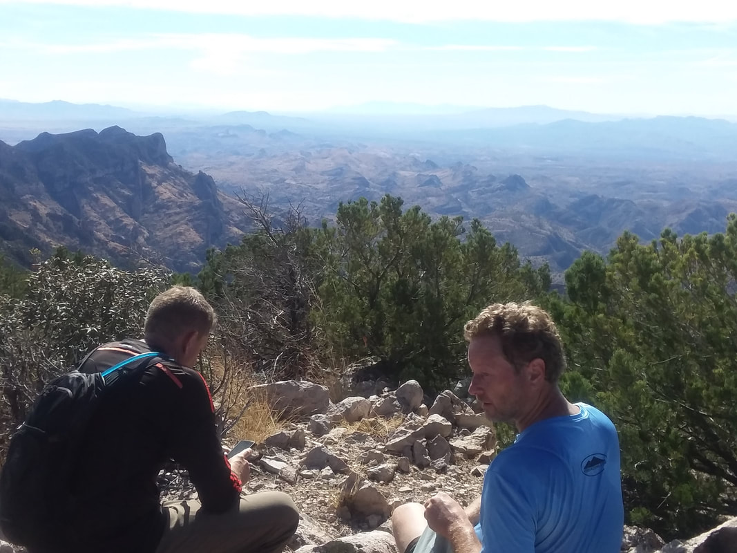 I reached the peak and a few minutes later, so too did the guy who gave me a lift at the bottom. There were three of them and they all are prominent members of "hikearizona.com" a popular destination for hikers seeking routes and info on hikes around the US. Actually, the originator of the site was there, healing from a 20' fall a month ago. 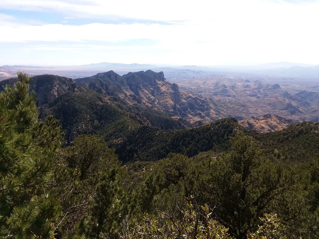 Yeah, similar to an image I already posted but this was awesome. 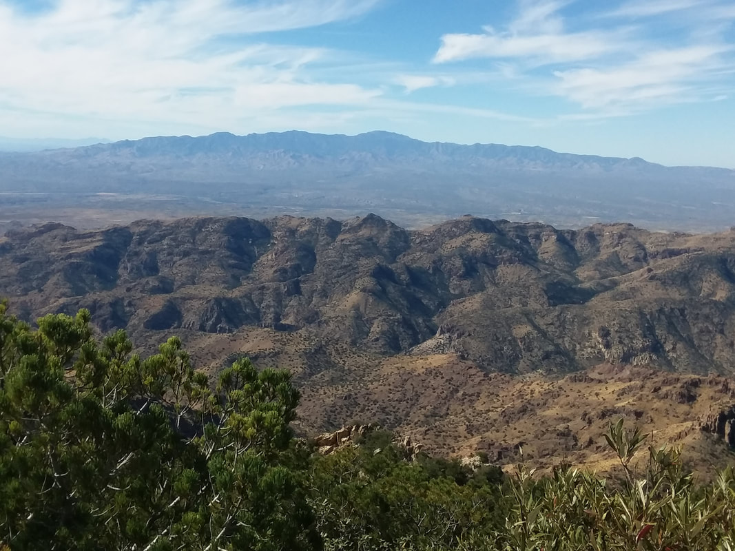 Although it was a 2+ hour drive from Oro Valley, Mount Lemmon and the surrounding Catalina Mountains were prominent in the background, appearing to be closer than they are. Many other ranges were also observed. Fantastic. 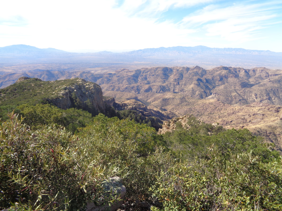 I had been waiting for an hour prior to any members of the group arriving and that is too long so I began a solo effort, got lost as the trail is overgrown and faint, ended up left of that plateau on the left of the image, heard some voices, did some bush whacking and finally found the real trail. 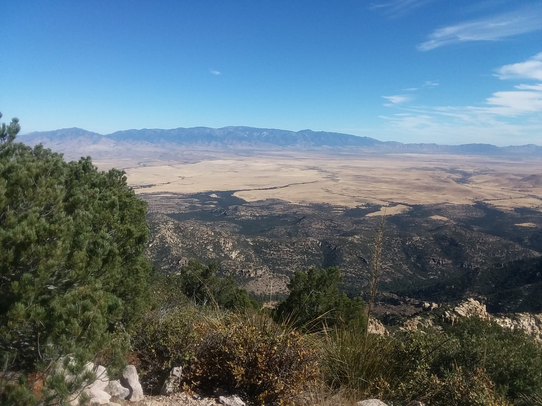 To the east, Mount Graham with an observatory barely visible. 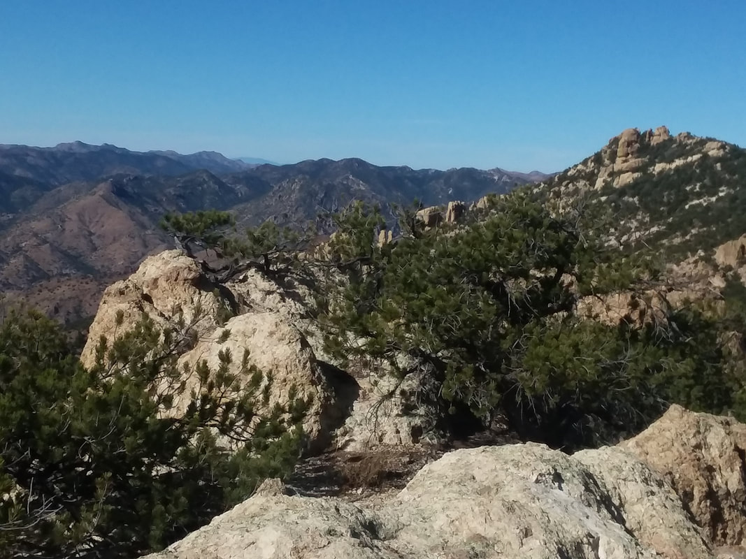 From this point, the trail heads to the ridge then down into Ash Canyon. With the hike and subsequent unplanned walking to the car, got in 13+ miles and 3000'+ feet of hard climbing. Well, got another good one coming after a couple of days of cycling. 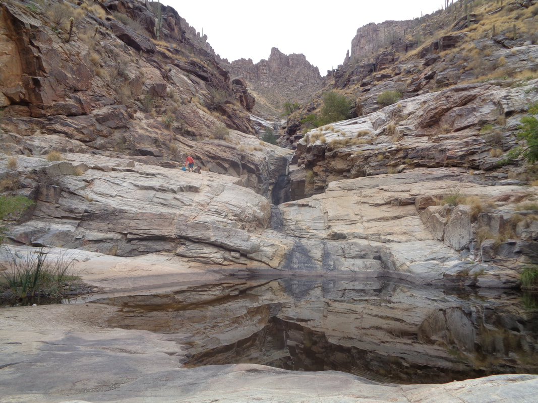 Hiked to 7 falls and have never seen it so dry. No flow, just a couple of pools. Rain the following day may have started the water again though. On Wednesday, I signed up for a group ride out of....  ....Sonoita, just southeast of Tucson and at the entrance to "wine country." Around 15 cyclists came out and prior to the ride I had been encouraged by seeing a couple of names that ride at an A or B pace. The ride was supported by a van, driven by a cyclist who crashed and out of commission for awhile. The van would be available during the ride to shed clothing and then at the lake for lunch. 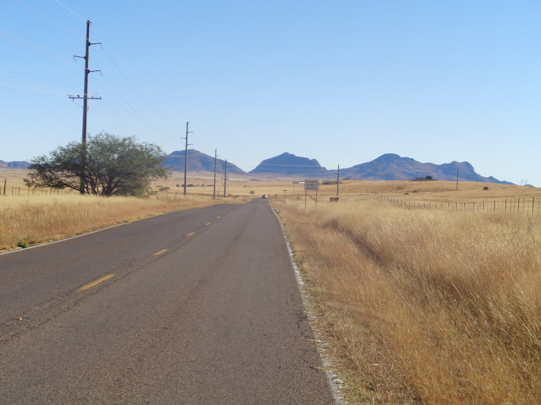 Alas, it had been promoted as a C pace and the two who can ride faster needed to do a recovery ride so at mile 0.05, I got away. The area received quite a bit of rain last night, the first in almost 2 months. The monsoon season really fizzled after a strong start. A match thrown in the grass would quickly escalate. 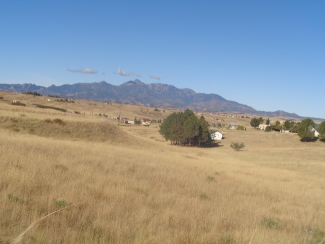 The Rincon Mountains with Mount Wrightson to the west. 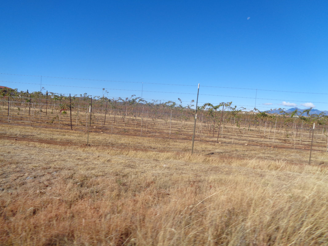 I passed a couple of wineries. Kind of sad looking but the area's 7-9 wineries are on a par with Ohio's in terms of grape production and tasting room quality. Not Napa or the Central Coast but worth a visit. 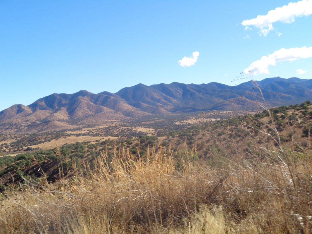 The routes to the lake gains around 1500' of elevation so the vegetation begins to change and soon.... 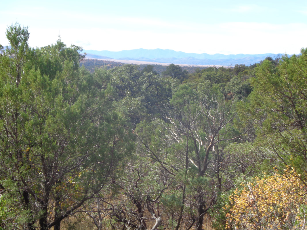 ....I'm in thick forest of mostly pine. At mile 29, drop into Parker Canyon and there..... 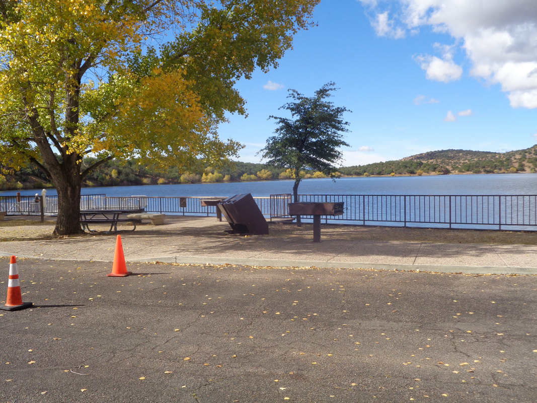 ....find the lake. Very nice spot at around 5500 elevation. There is a well stocked.... 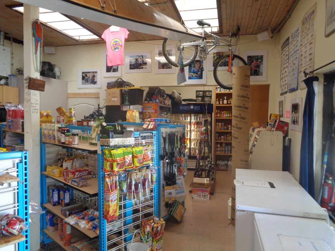 ....general store too so I buy a Coke and wait 30 minutes for the others to arrive. 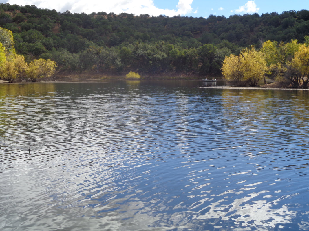 I was told the fishing is very good and there were several boats on the water. I join the others for lunch but now I am in the super, ultra linger time of around 50 minutes so I thank everyone and head off for another solo effort that takes..... 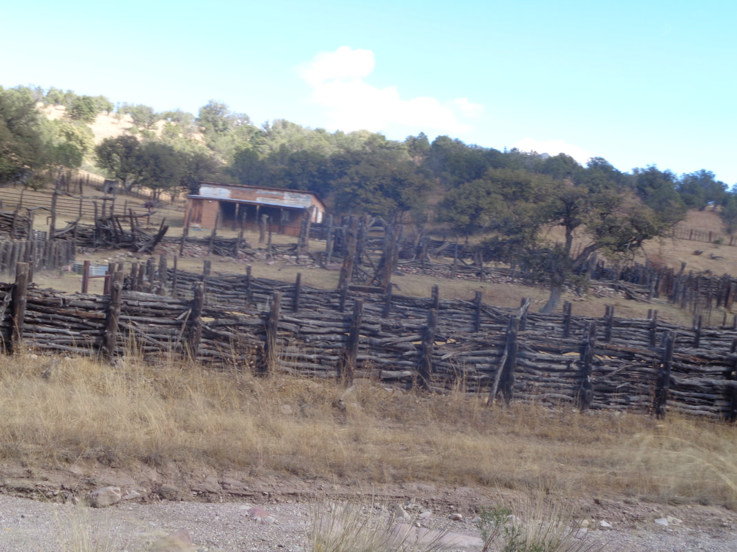 ....me past this neat ranch where there is an extensive network of fencing made from tree limbs. 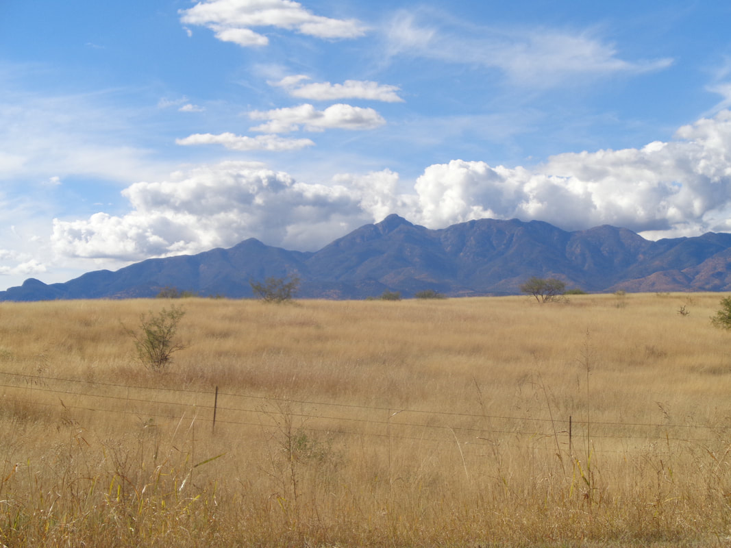 A system had rolled through out of Baja and so some lingering clouds are on the horizon. Finished with 58 miles and 3200' of climbing. The pavement was fantastic with a nice rolling route and a couple of good climbs. Would do it again. Also traffic was very light. 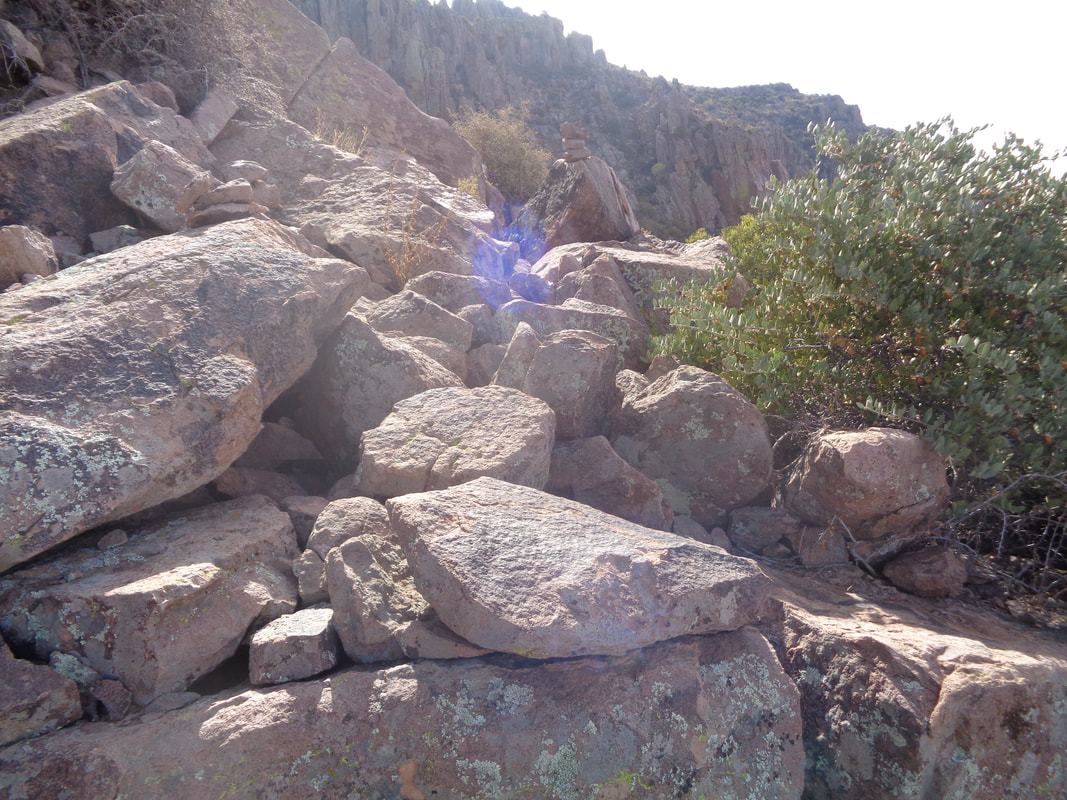 Below I describe the ascent to the ridge that is west of Superstition Peak. After pausing at the ridge to take in the magnificence that is the interior of the Supes, I headed toward the peak. First, you go up and over a hill or go around it following a very faint trail. I did the latter, got off trail several times, cliffed out and decided, up and over is best. The next section is navigating a boulder field. A guy could disappear into some of the crevices. Next.... 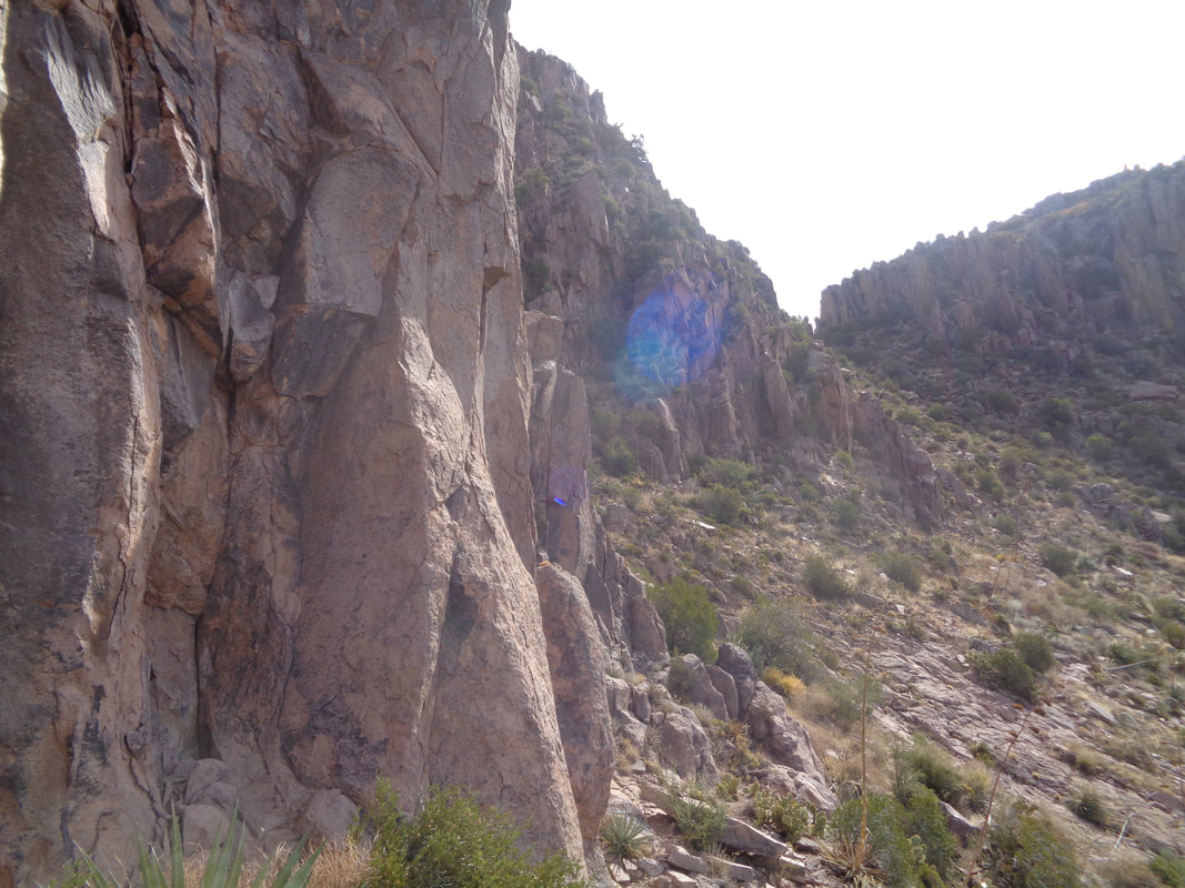 .....you bear right around this and.... 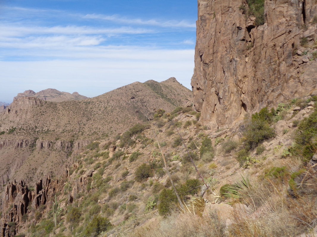 ....looking back, wow. 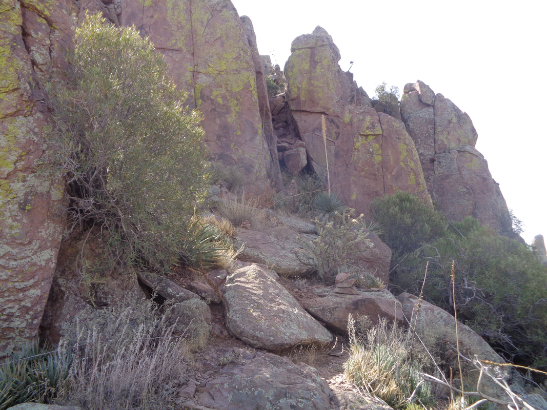 Then this interesting feature. Yeah, doesn't look like much but if I was standing in there you could barely see me. Up.... 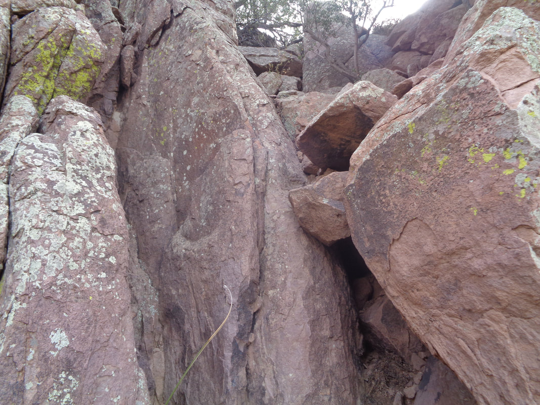 .....the left, about half way grab a cleft of stone and then jump. For the uncoordinated like me, I stood there for a moment calculating prior to making the leap of faith. I figured I'd have a problem coming back down but hey, that would be later so onward. 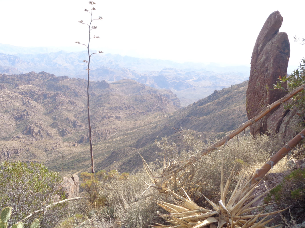 Then I go to the left of the peak to it's..... 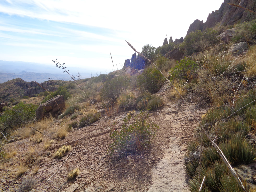 .....right side (as seen from Apache Junction) and begin to ascend. 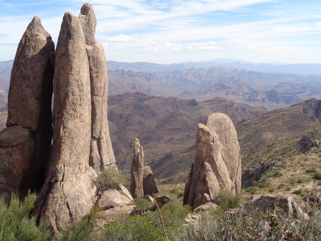 It's hard to focus with such compelling views all around. These hoodoos are huge and much taller than me. 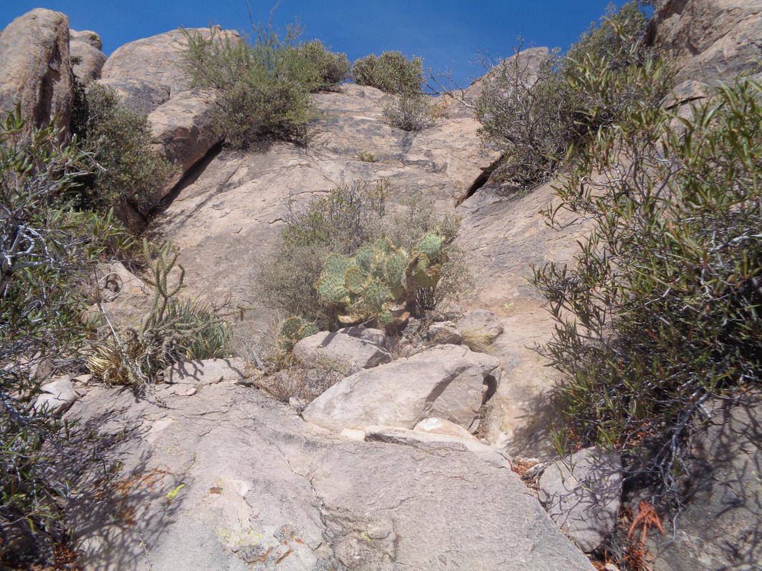 Ahhhh, the final obstacle and maybe the most challenging. It's kind of work right to left, then up, then left to right, up and up and.... 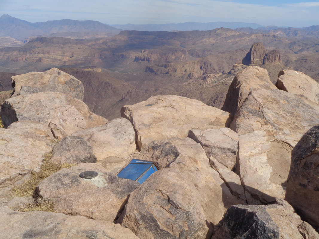 ....onto the peak I scamper. The old ammo box with the registry is inside so I proudly sign my name, for about the 3rd time. It's a small area so after eating an apple and of course enjoying the views after the roughly 4 mile hike with almost 3000' of elevation gain I..... 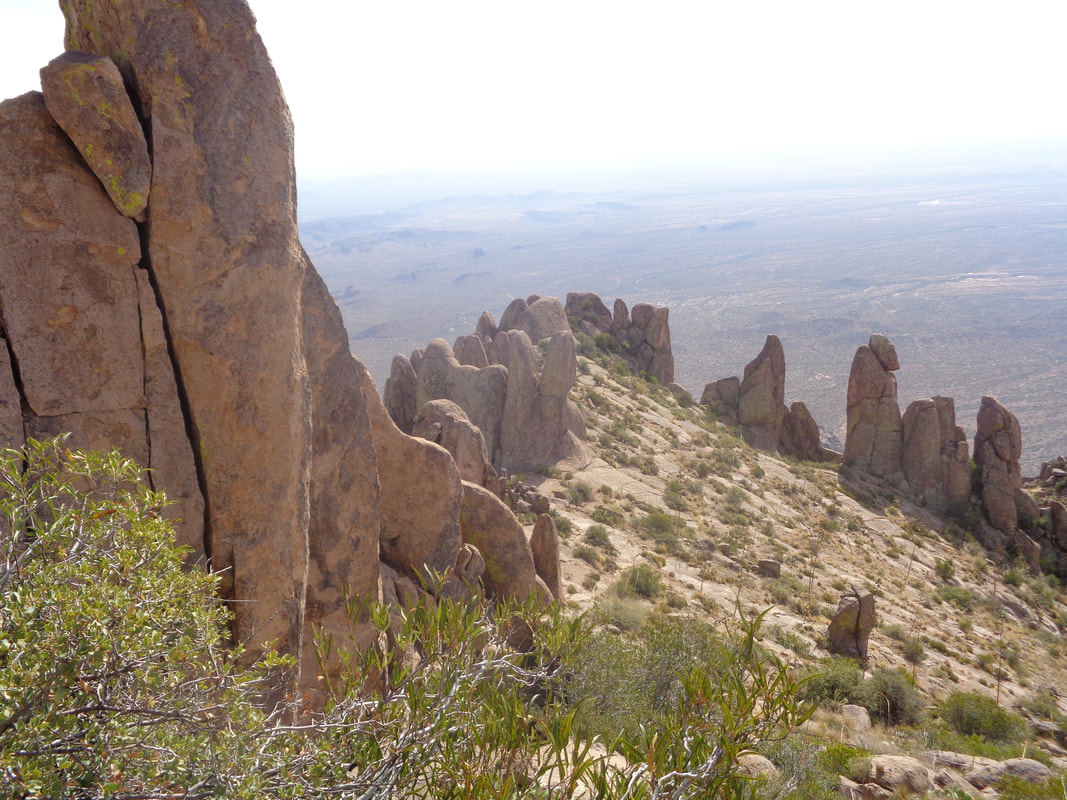 ....begin the long descent. 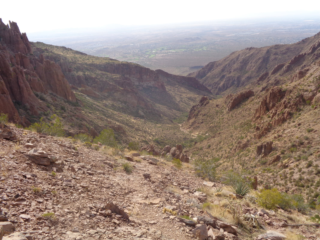 At the ridge, I look at the canyon before me. OK, here is where it got really strange and just when I think I have seen it all....I reach the Hieroglyphic pools and there is one guy there with a bunch of photographic equipment. Of course I walk over and below him in the dry river bed, which is a beautiful area, is a woman with no clothes on. Yep, I kid you not I say, "Whoa, I had no idea, sorry." The guy tells me no problem as the woman puts a bathing suit back on. I swear, I did not watch. He says it is a public area so they expected this could happen but they were expecting visitors from the other direction not from the peak. I quickly turn and walk away but the blog mentality kicks in and I begin to think, this could be a..... 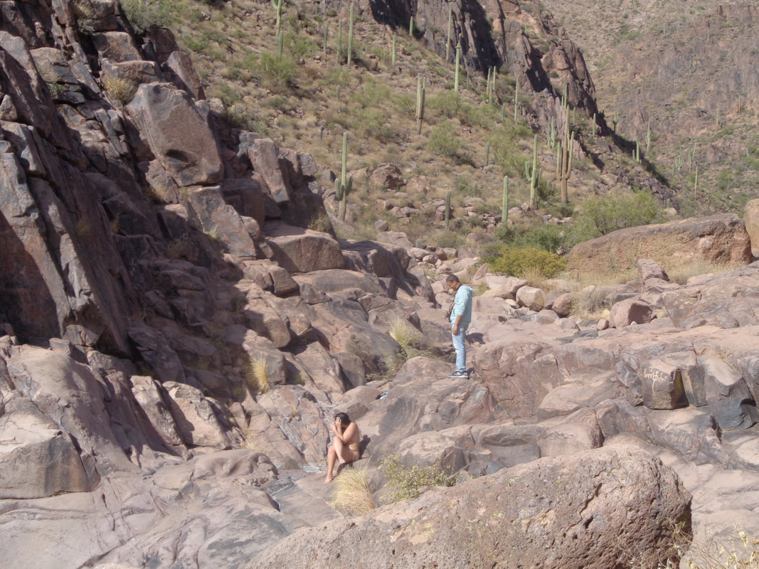 ....content worthy image and besides, no one would believe me so from a great distance, I yell if it is ok if I take a pic for my blog, They say ok but wait for her to cover so there it is, the proof. Well, back to the dull life of a cyclist as I took Saturday off and did a 49 mile ride with a group called "The Cactus Club" on Sunday. Much more to come on other activities. 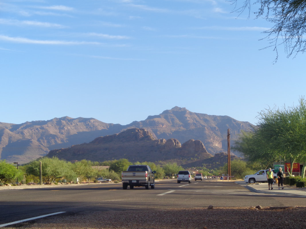 To the north I drive to the Superstition Wilderness and while driving through Apache Junction, spot today's destination, hike to that low point in the ridge, hang a right and proceed to Superstition Peak. 8 mile round trip with 3000'+ climbing. A challenging hike and quasi adventure. 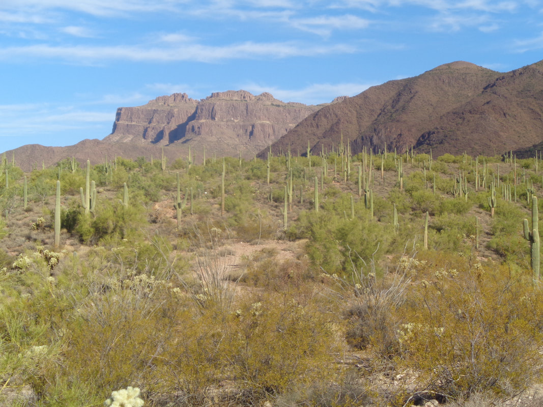 I head out on a heavily traveled Hieroglyphics Trail as dozens of day hikers head to the pools to look at the rock engravings. On the way, I spot the Flat Iron and other prominent features. In the spring, the slope above is covered in yellow flowers.  At mile 1.5, I reach the pools and engravings. Very cool. I had passed around 40 people but from this point forward, would see no one. Above the pools, the trail becomes overgrown and at times, difficult to follow so I find myself off trail a couple of times but usually, it is not too hard to follow. 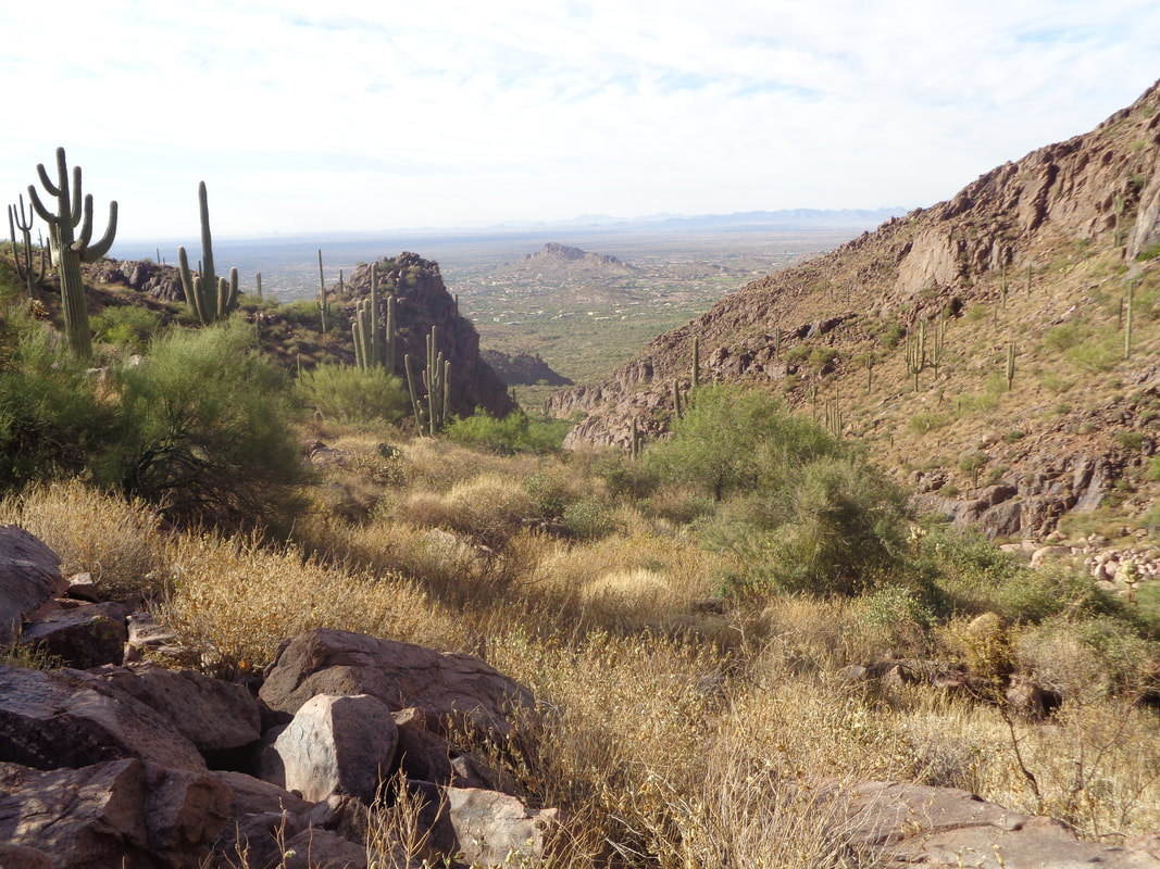 Looking back from where I had come, wow. Then I enter.... 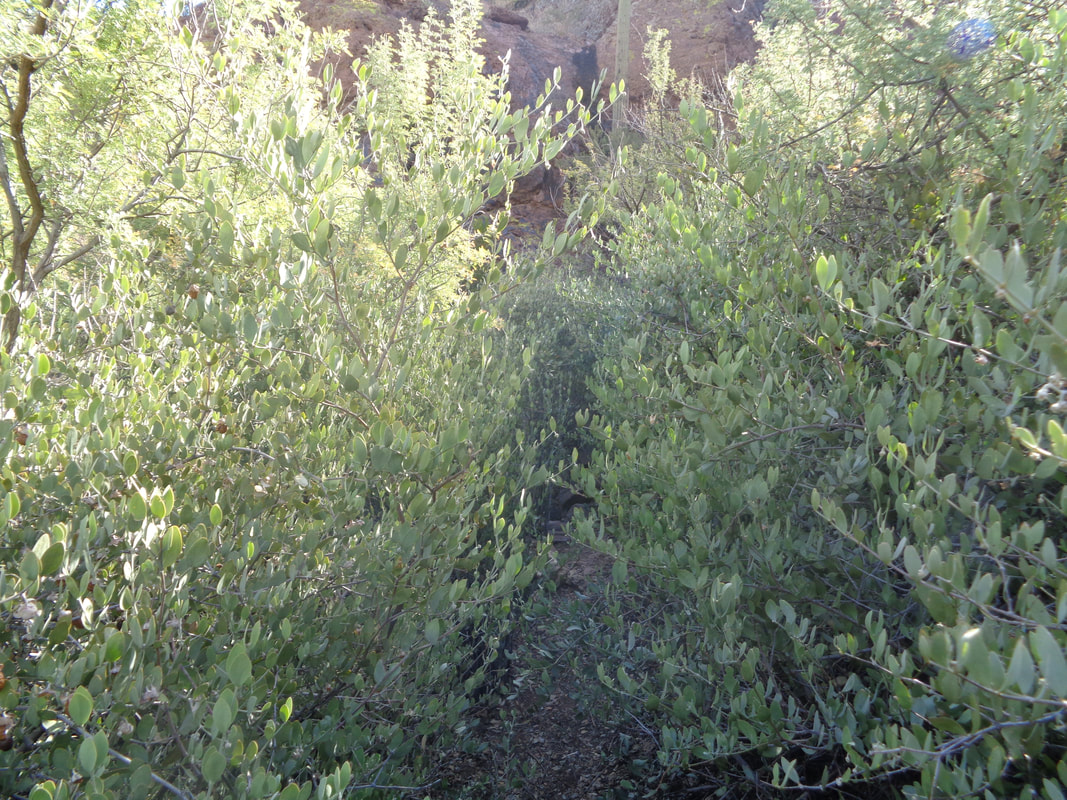 ....ugh, a brushy section but shove myself through it and then confronted with.... 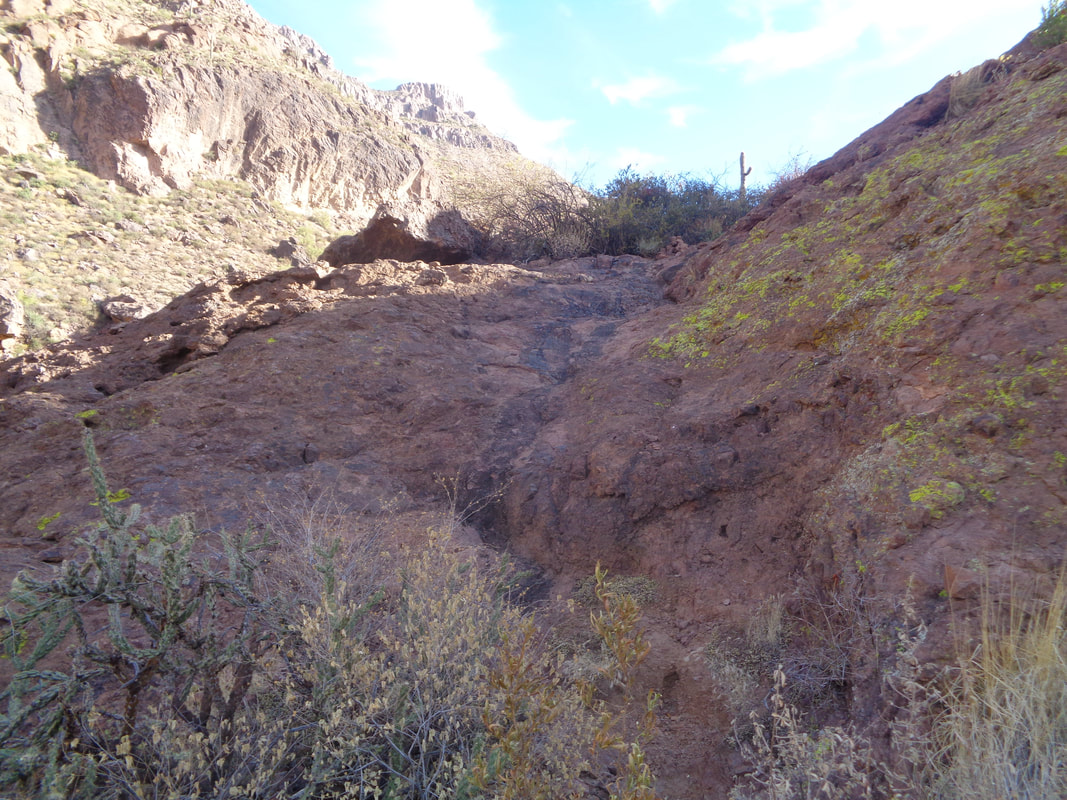 ....one of several "walls". Obstacles like this add to the fun of course. 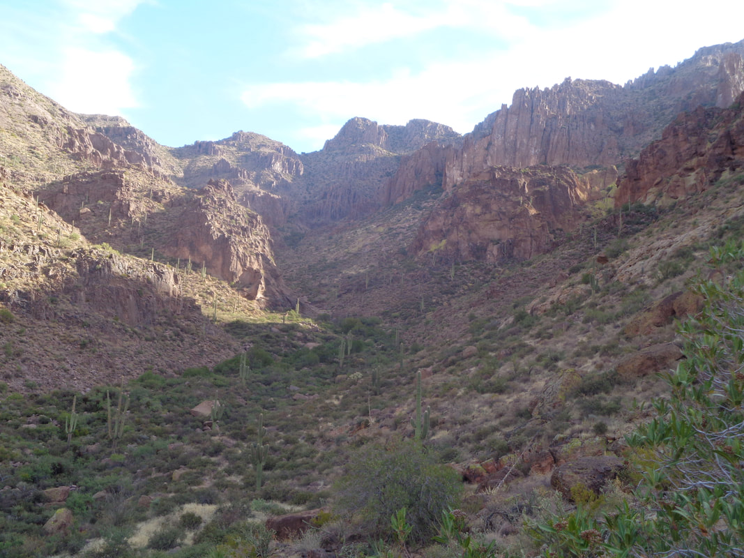 Oh wow, way too far still to go and so rugged looking. Was "Lord of the Rings" filmed here? 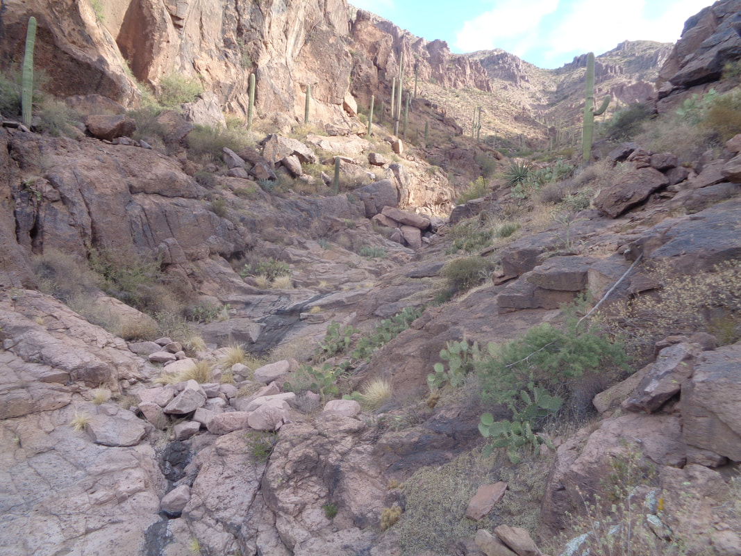 I enter the bottom of the canyon and follow this for awhile. Lots of fun running into dry waterfalls and trying to figure out how to ascend. Sometimes it is scrambling up the center but usually there is a workaround to the right or left. 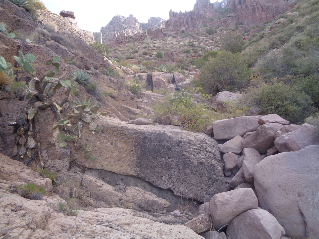 Yeah, looks like just take a step up and this can be overcome up way too high for that. Instead I crawl through the boulders on the right. 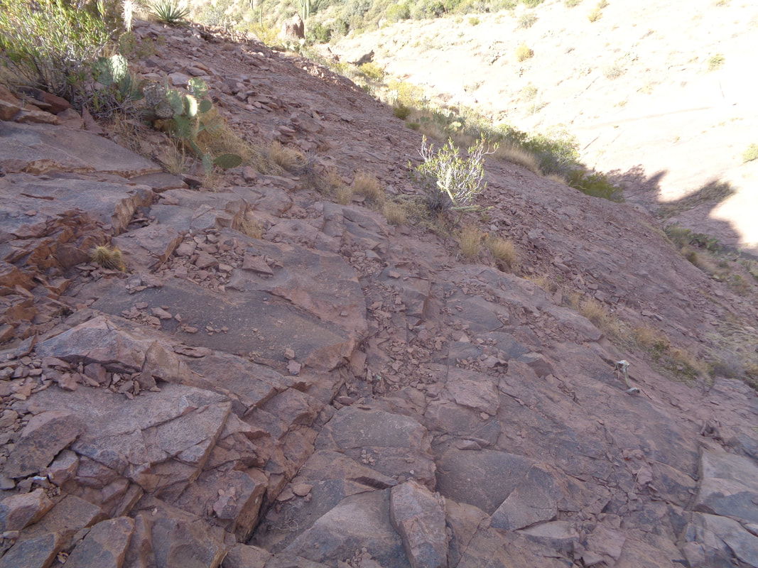 Ok, this had a pucker factor associated with it, near to the top. Steep with lots of loose gravel and stones. I navigate my way through, reach the ridge and..... 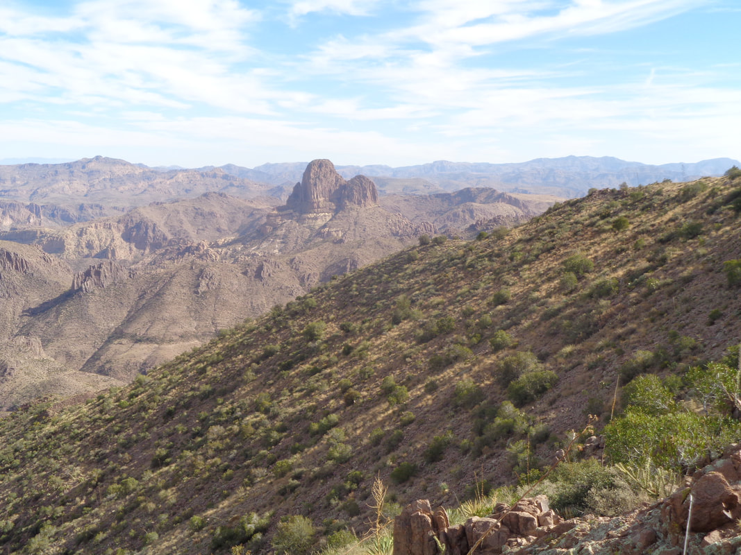 ....I can't even begin to describe it. It takes my breath away, gazing into the interior of the Supes. I take my pack off and eat an apple and just look at the many features including.... 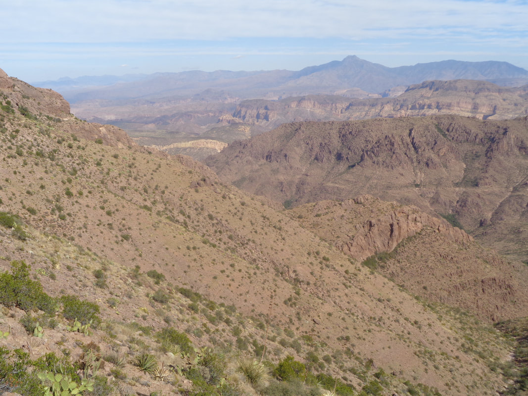 ....Battleship Mountain which is that insignificant yellow colored feature in the middle, Geronimo Head, Four Peaks, etc... A wealth of cool destinations. Well, next comes the balance of the hike.  Each visit to the area begins with (well ok, I hiked once already) the Blackett's Ridge hike out of Sabino Canyon. It begins at the edge of the parking lot and 2.8 miles later, ends at the top of the ridge. The first .75 miles is....  ....flat to slightly rolling. Reaching this paved road, I hang a right and trams full of people headed to Bear Canyon pass me. 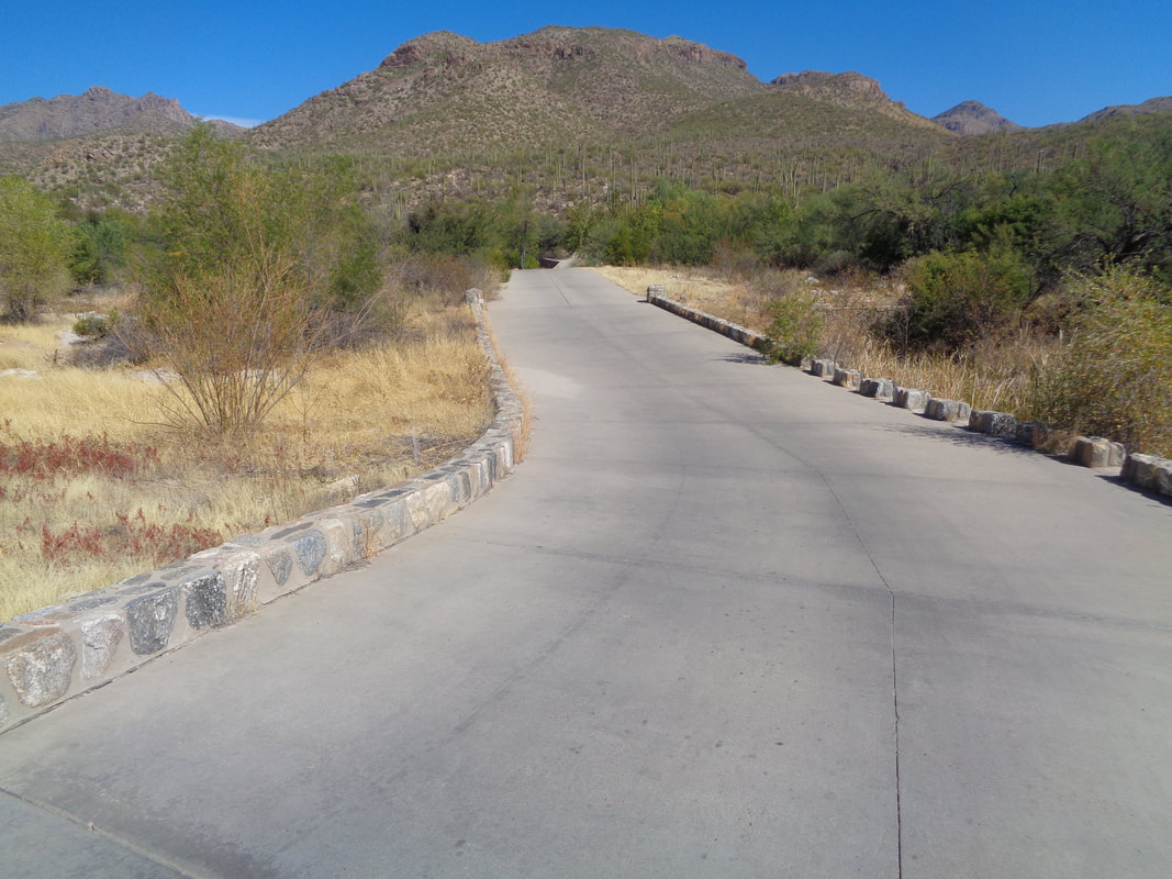 The road drops into a ravine that has two bridge crossings. At times, water flows across the pavement but while the monsoon season began strongly, it kind of fizzled so the river was dry. 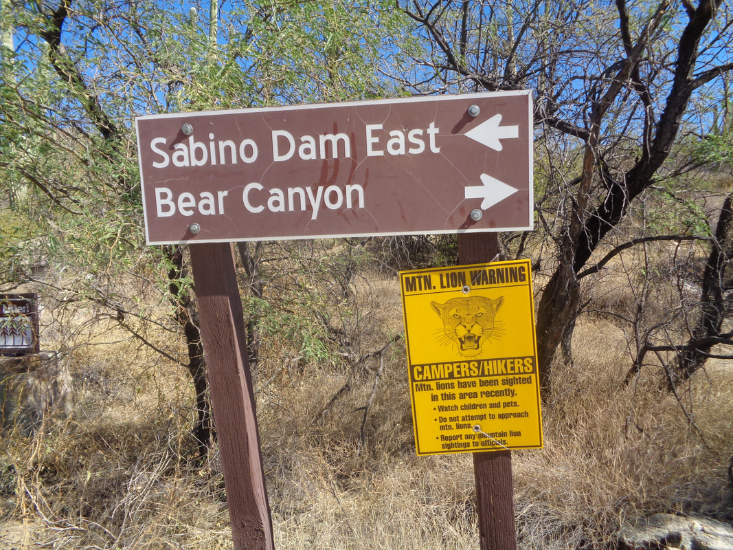 Mountain Lions have been spotted recently so the signs are out. Then I find..... 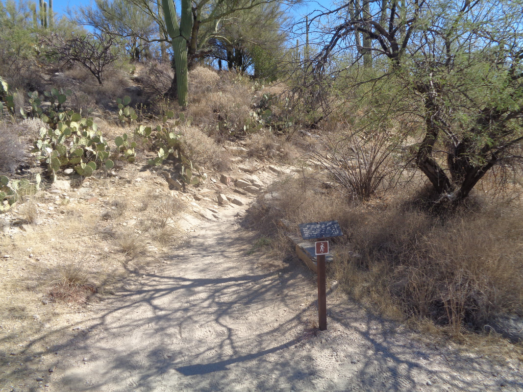 ....a signed junction signaling the start of the trail and the start of.... 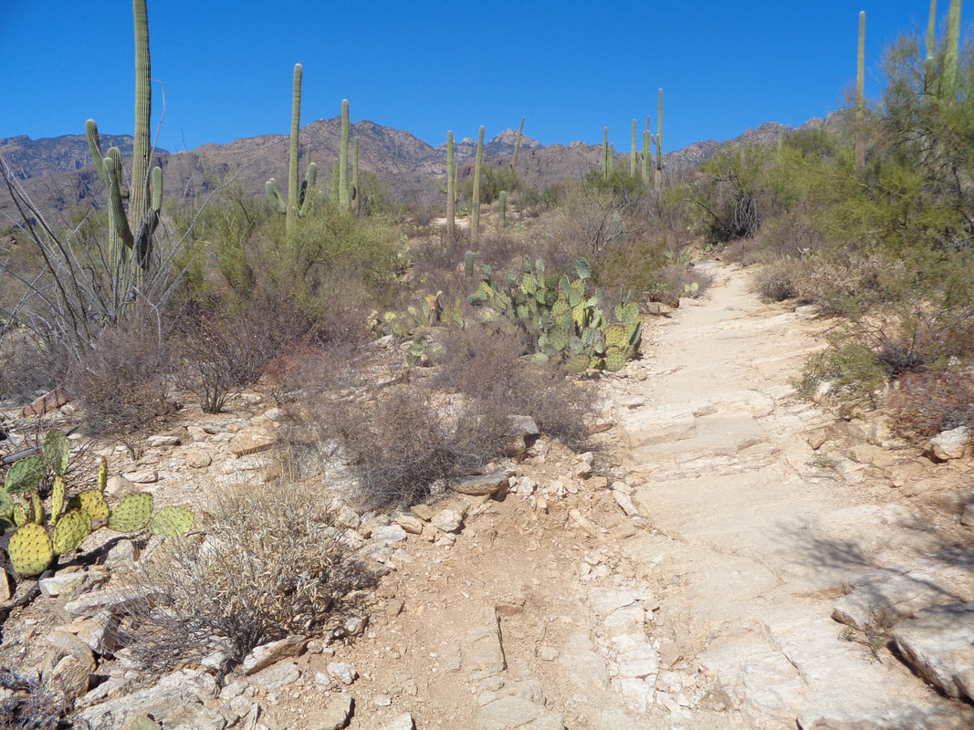 ....the real climb. For the next 2 miles, the average grade is 16% but tops out at 48% in places. If I complete the hike from parking lot to top in under 60 minutes it's a good sign of my overall fitness. More than 60 minutes, a worrying indicator. 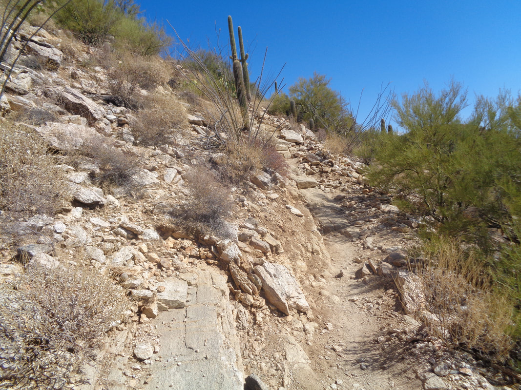 The trail turns up and steeper. I go as hard as I can with my chest heaving. 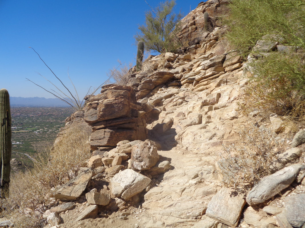 Oh geesh, a really steep section. My legs are still felling good so I'm beginning to think I have a good time going and maintain the pace. 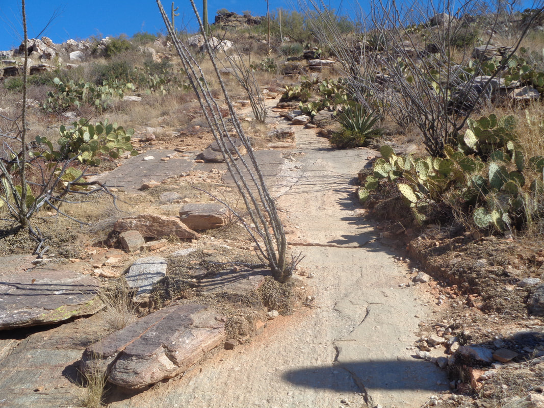 A long slick rock section but steep. 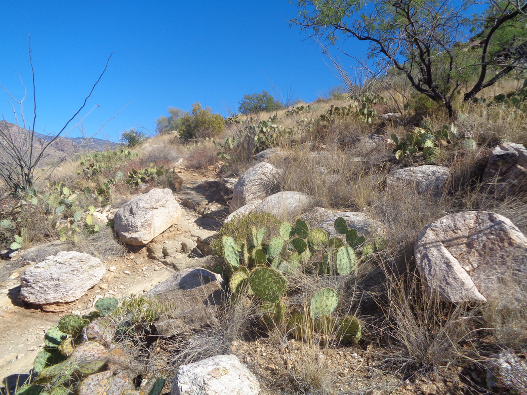 I've seen rattlers here but can't slow down now. 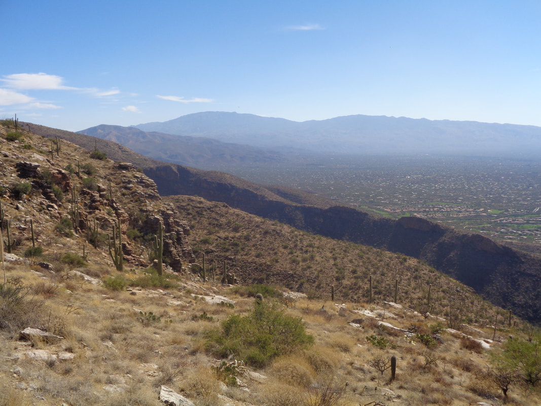 Almost to the top with nice views of the Rincon Mountains to the southeast. 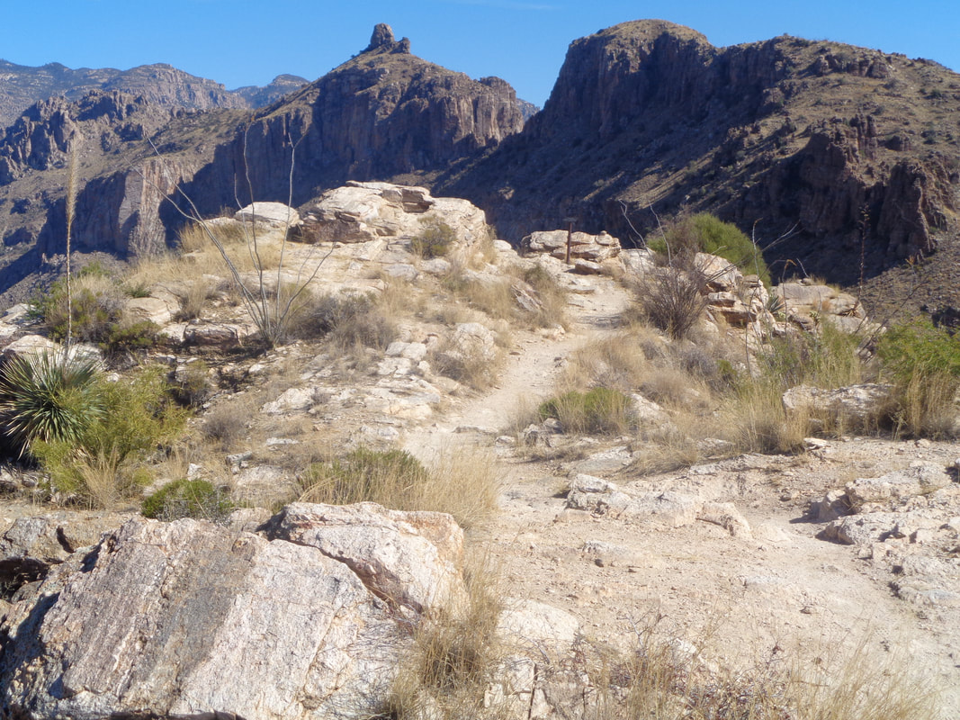 And there it is, a sign post indicating the top. 53:26 was my time, a personal best. Later, checking Strava I am 4th of 262 for the 2 mile climbing section so that made me happy too. Soon, I was joined by..... 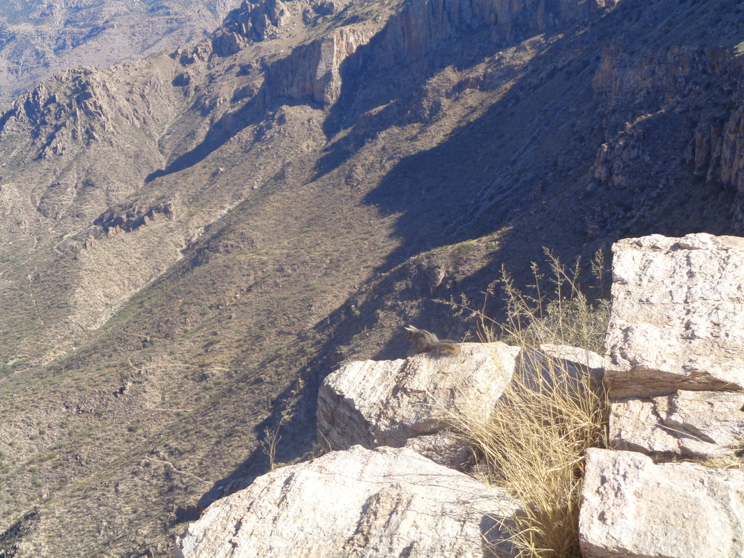 ....3 squirrels. The one above peers into Sabino Canyon but soon begins pestering me so I leave a chunk of apple and it.... 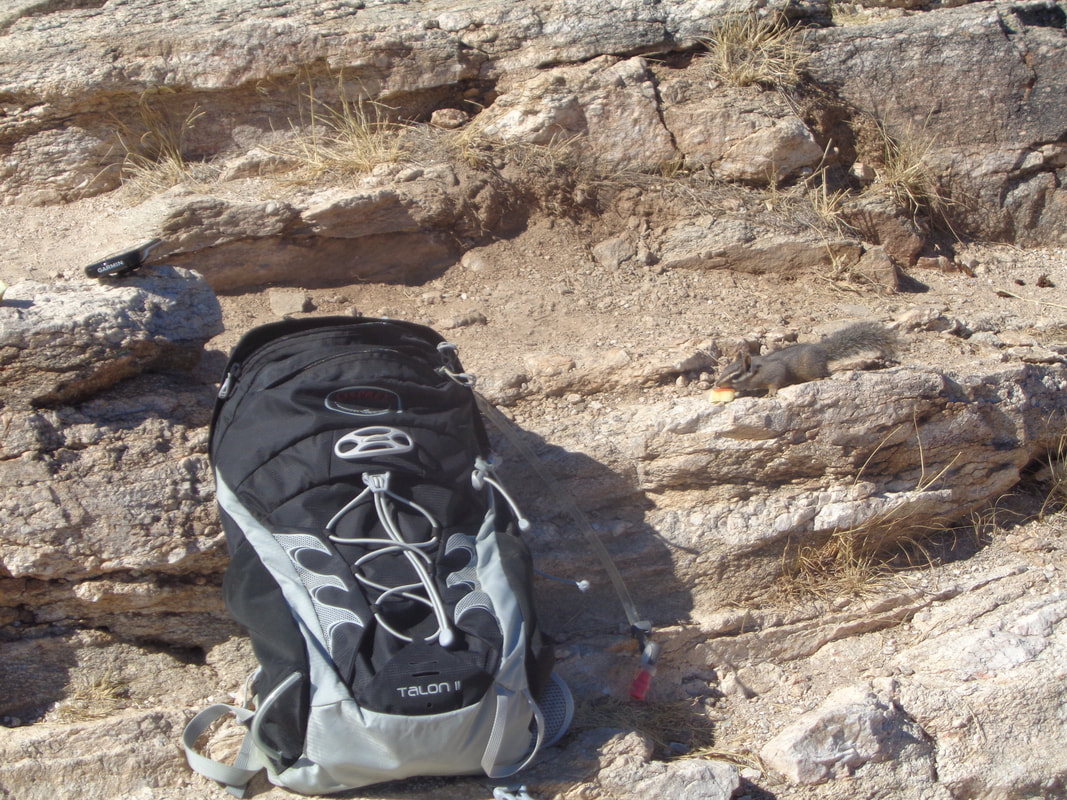 ....rushes in and grabs it. Well, got my bike fixed from Sunday's crash and will head out for a ride. |
