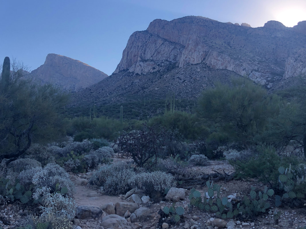
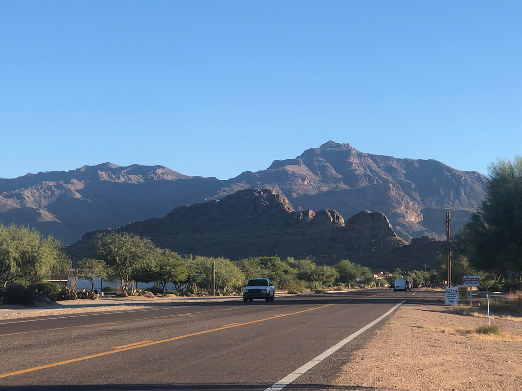
 I decided to take my anxiety filled stomach on a short hike, prior to the Buckeye game. Was not feeling good about the outcome for reasons I will not bore you with, here. The Linda Vista trail is around the corner from me so here I am, looking at Pusch Peak, Bighorn in the distance. 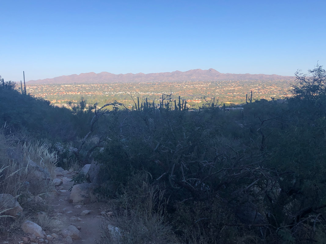 Looking west, the sun illuminates the Tortolitas. 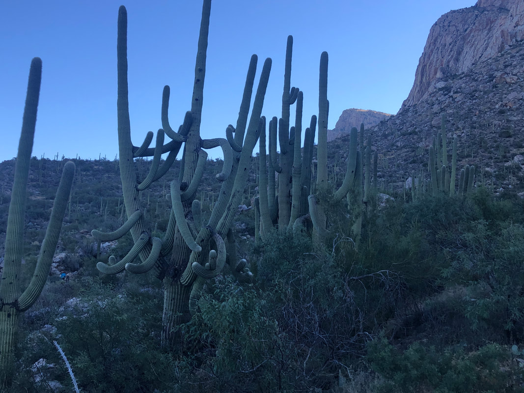 I pass a tangled network of saguaro limbs. 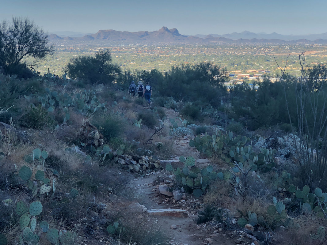 It being a holiday weekend, there are many families with members from out of town, being shown our beautiful area. Twin Peaks (Sombrero and Panther) in the distance. 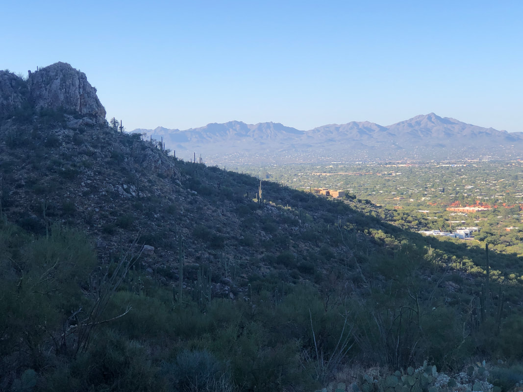 The Tucson Mountains with the high point, Wasson Peak on the right. It was great to get out, it was agonizing to watch the game. But, the sun did come up on Sunday so..... 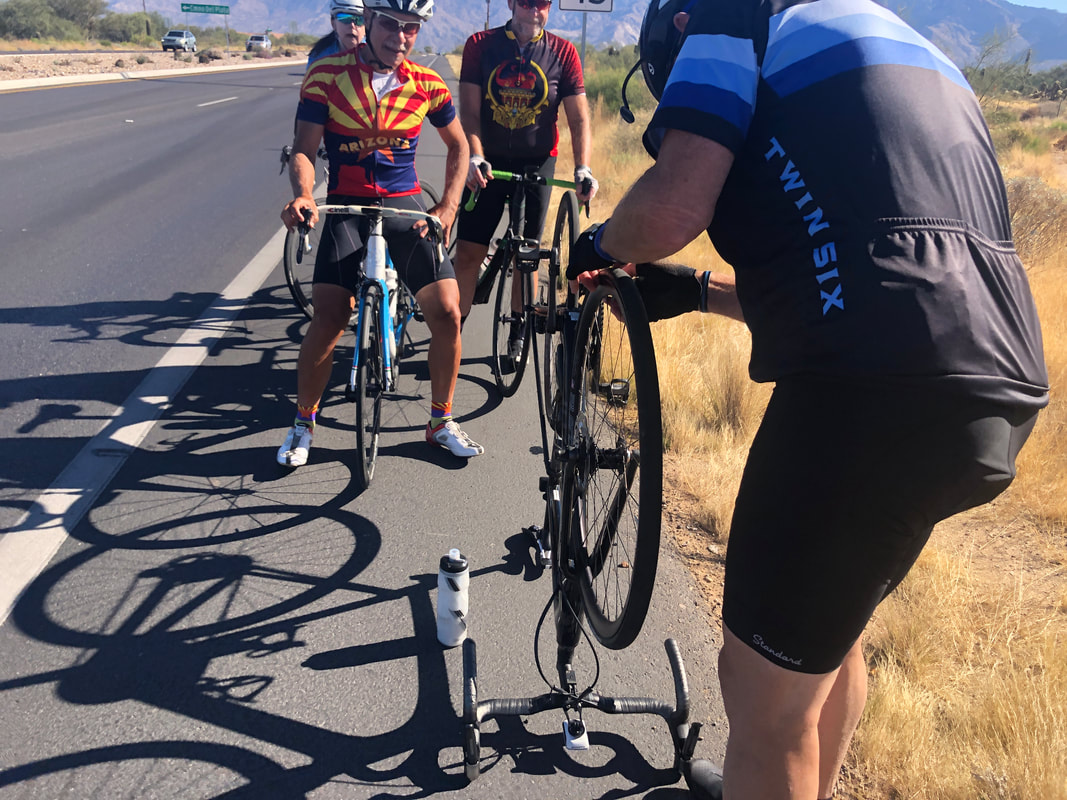 ....I joined a group of eleven for a ride around Oro Valley. I've decided to ride more because if I'm in good cycling shape then I'm in good hiking shape but the reverse is not true. Plus, I'm enjoying group riding, hanging on barely with the groups.
0 Comments
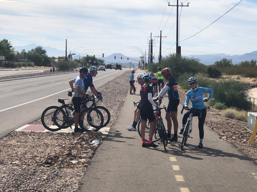
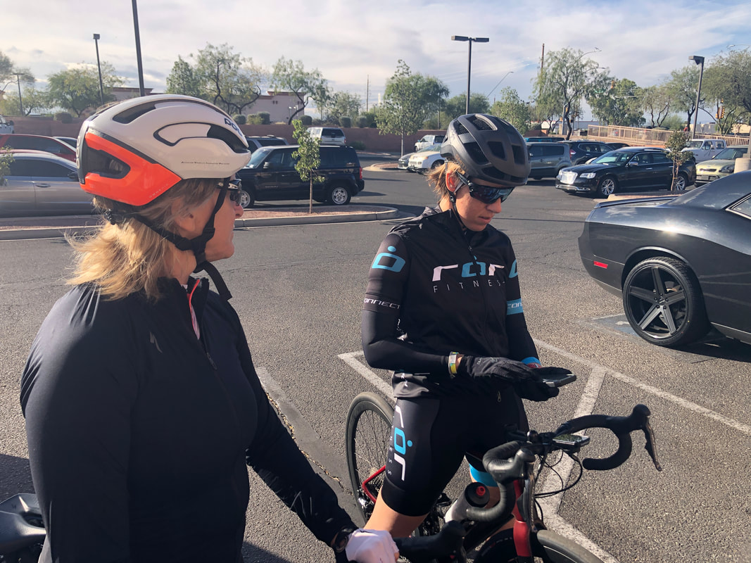 Amy and I joined her sister Tracey for a mellow paced ride with ror Fitness group. I liked that the start time was 9:30am but unfortunately, an overnight front came through with a little rain and behind it, ferocious winds. The wind was already 17mph at the start and would become stronger. 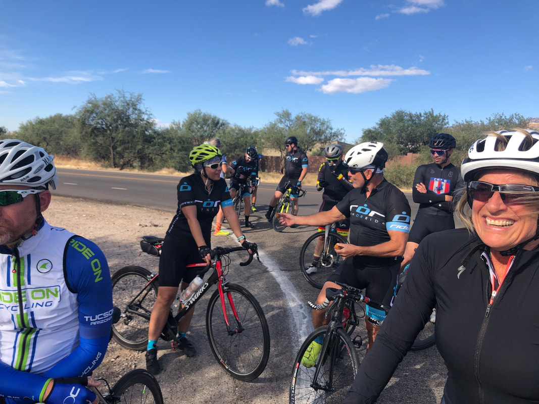 We regrouped several times and at one stop, a member of ror happened to be driving by, stopped and passed out cookies. We rode through the 49er neighborhood and emerged on Tanque Verde Road. I noticed the building wind was directly behind us and assumed there would be a Strava segment available so I....  ....put in a good effort and zoomed up the standings for a mile segment. If only I always had a tailwind like that whenever I rode, ha, ha. And now, it's Saturday morning and I am an anxiety filled Buckeye fan. Although we are 15-1 in our last 16 games against the team up north (who shall remained unnamed) and have a distinct talent advantage.....  ....ours is a very young team, the game is in Ann Arbor, the temp is in the low 30's with some snow. I'm not all that confident. Maybe I should go for a hike.
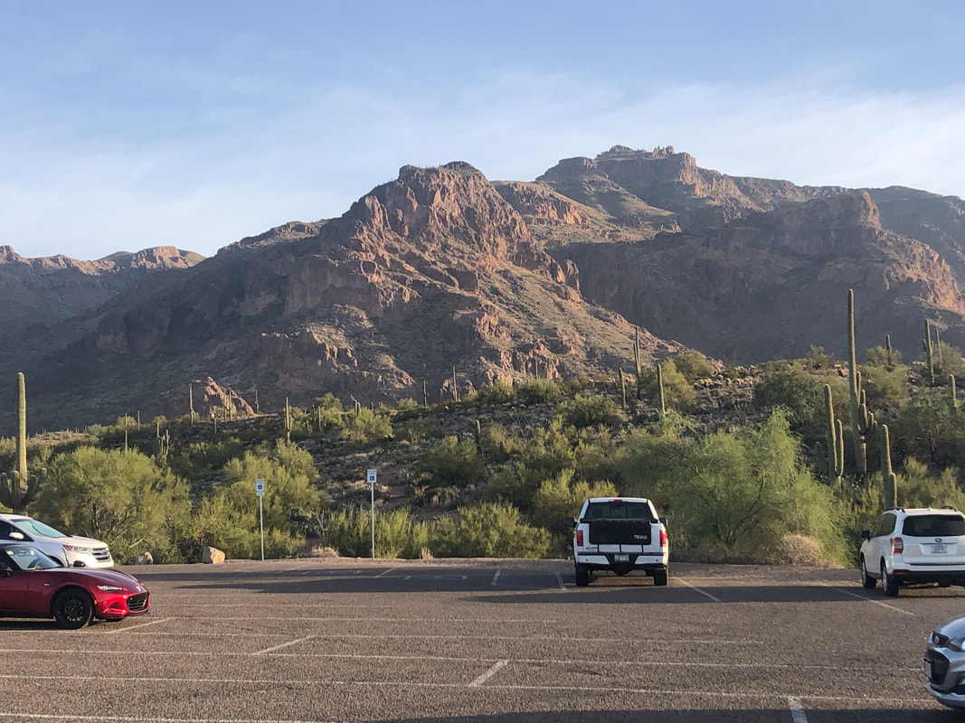 I organize hikes on behalf of a group that numbers almost 3900 members. My hikes tend to be on the difficult/adventurous side of the ledger so only about 1% of the members sign up which is really too bad. For the one percenters who participate, we have had some awesome hiking experiences. Today was not an exception as we gathered at the trail head and looked at Superstition Peak, the high point in the distance. 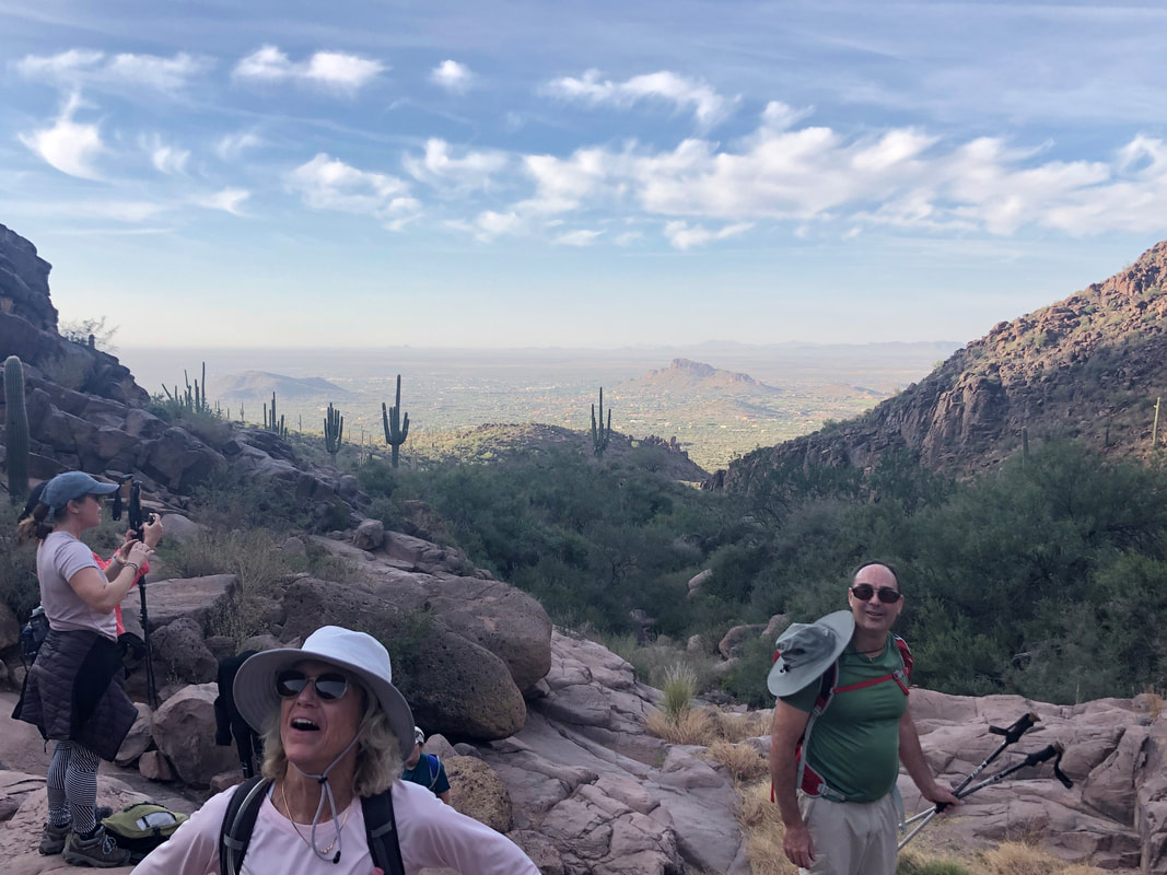 The first 1.5 miles has an average grade of only 7% and brings us to prominent hieroglyphics etched into the canyon walls. While way interesting, after viewing them most of us swiveled our heads to look at our destination, the peak.  We had a good look at the Balancing Rock as we made our way, up canyon. The average grade from where we paused to view the rock art to Superstition Ridge would be 21%. It seemed much steeper. 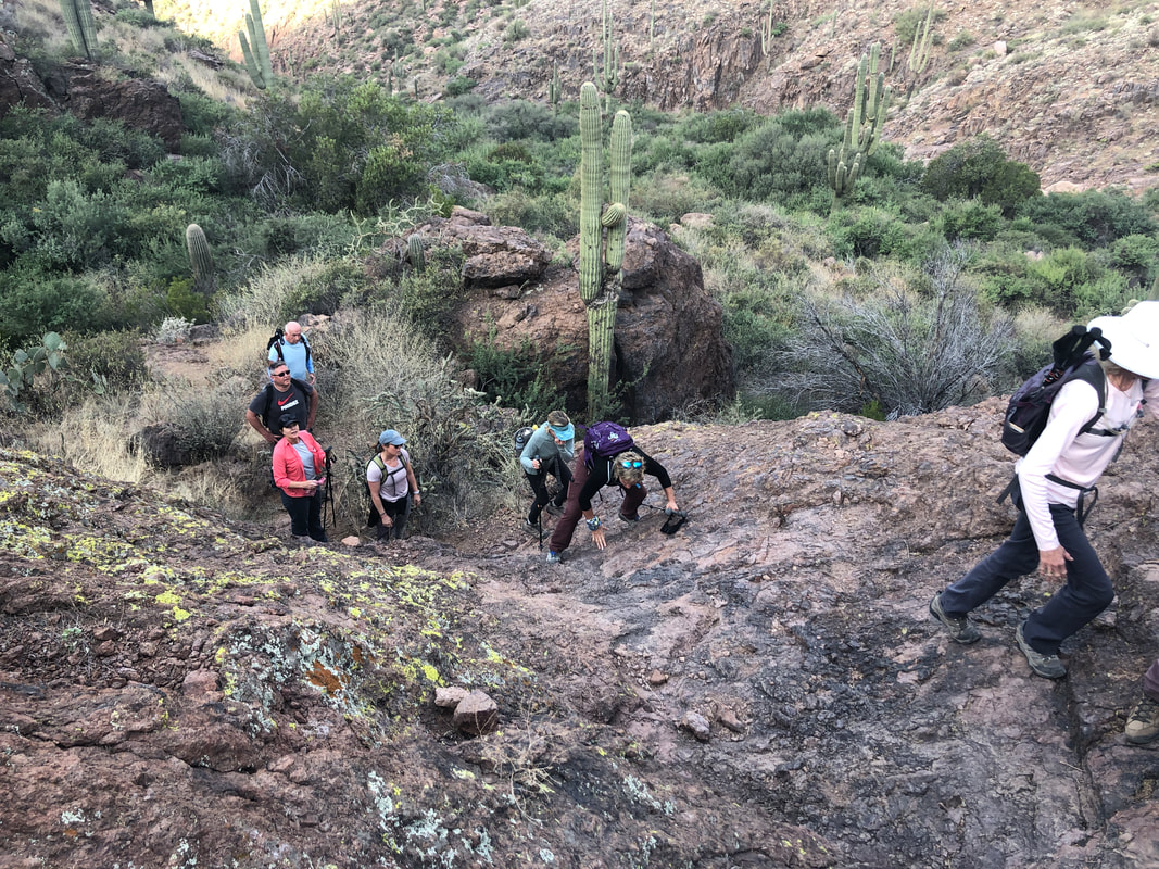 There were several "walls" that were climbed and throughout.... 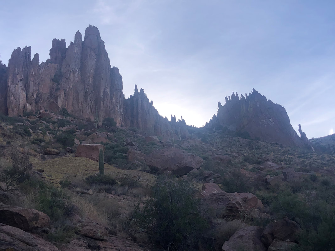 ....amazing views. One was the jagged edge of the formations to our east. It's just a surreal landscape and so beautiful. 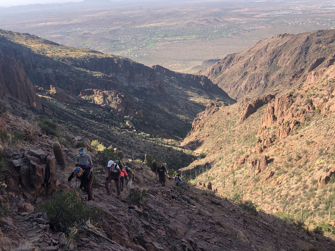 As we close to the ridge, we pass through another steep section that had a lot of loose, shale-like pieces that made the footing treacherous. It was worth the effort as once we gained the ridge..... 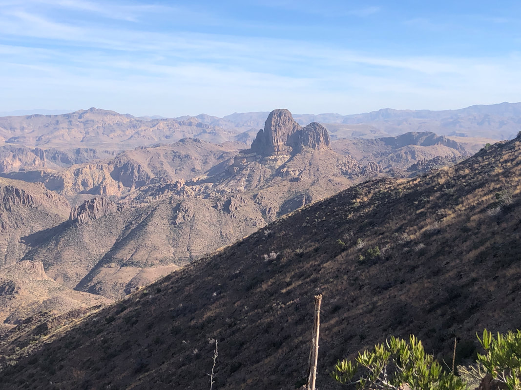 ....we had views into the interior of the Superstitions, including the magnificent, Weaver's Needle. Looking just a little to the left... 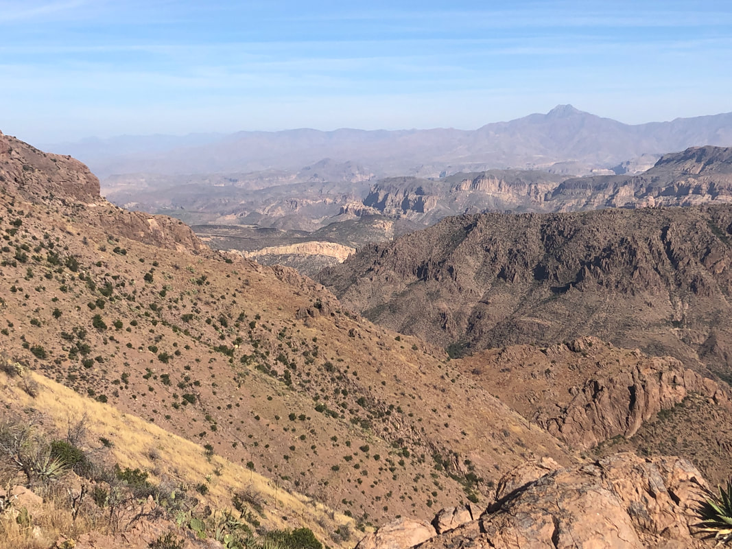 ....we saw a narrow, yellow band of rock, Battleship Mountain. It looks so insignificant from this distance. Above it to the right is Geronimo Head and farther to the right is Malapais Mountain than farther in the distance is the Four Peaks Wilderness. Dang what a great region in which to live and hike! 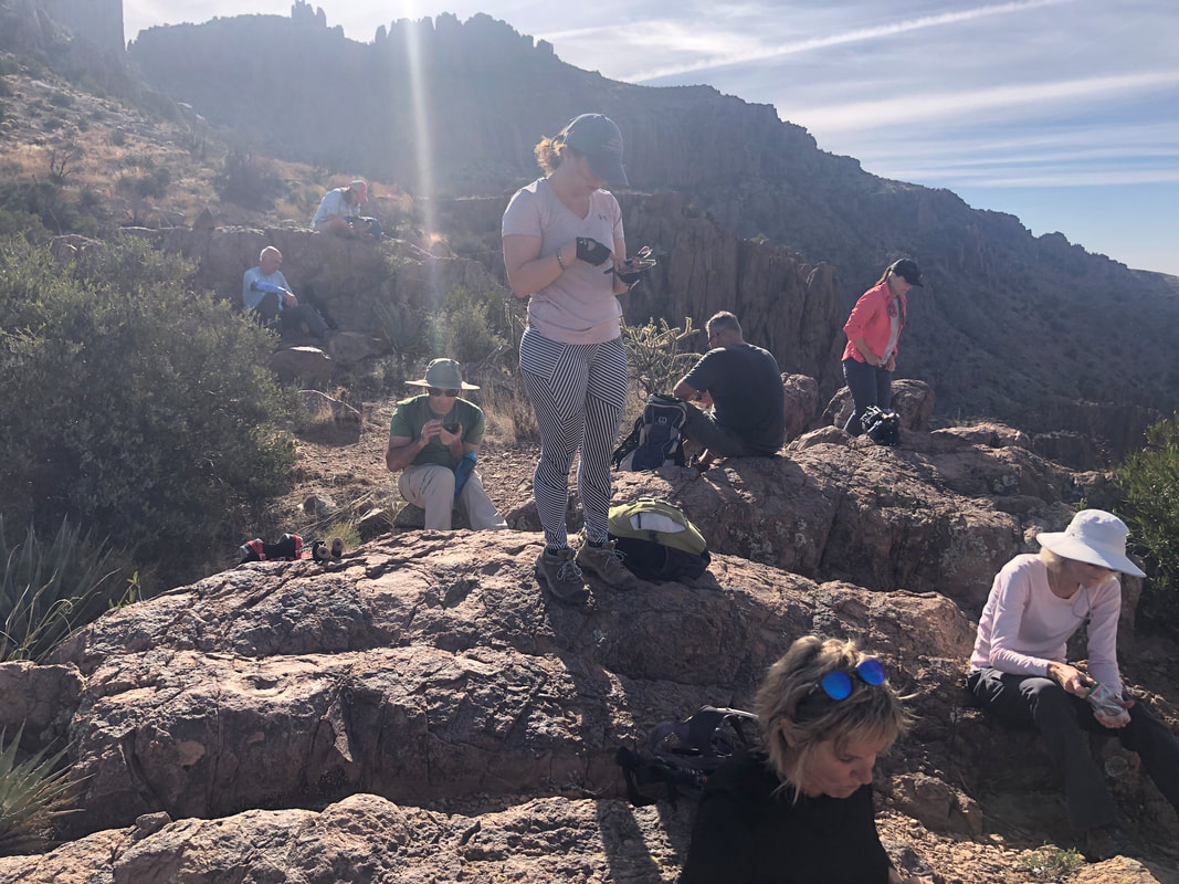 Surprisingly, we discovered we had cell service so there was some checking of emails, lol. Mostly my fellow hikers admired the views. After a break to refuel, we now had to follow the ridge to Superstition Peak. Hardly a straightforward walk though. 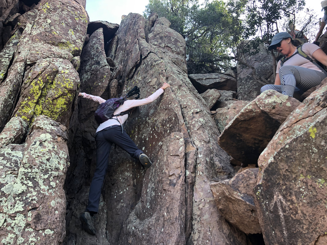 There were several obstacles that had to be climbed or.... 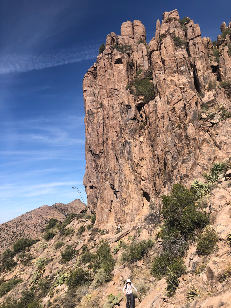 .....hiked around. 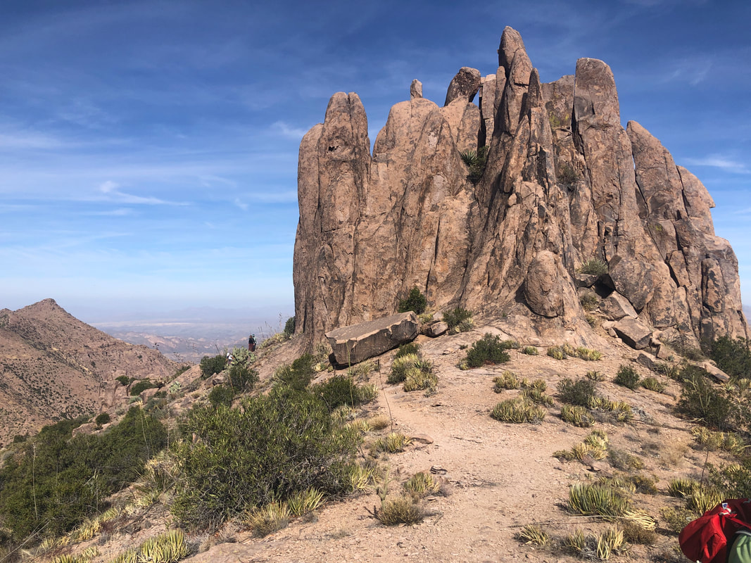 A large gap had developed in our line. Marc G, a very generous and giving member of our group who looks after those at the back of the line, notified us that a new hiker, Marcia, had been stuck by a spine and was bleeding profusely. Fortunately, a bandage was applied and she was good to go. 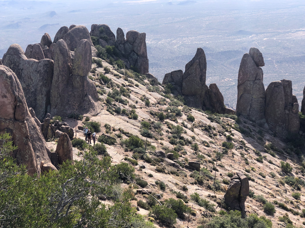 We had been following the Ridgeline Trail until we reached a cairn that indicated it was time to break from the trail for the final ascent to the peak. In the above image, to the right is part of the rock formation known as the "Three Sisters". The hoodoos were numerous and fabulous. 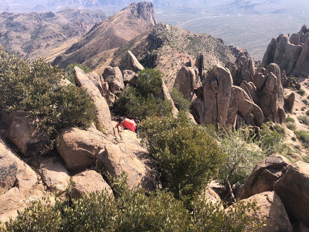 One last wall to navigate and..... 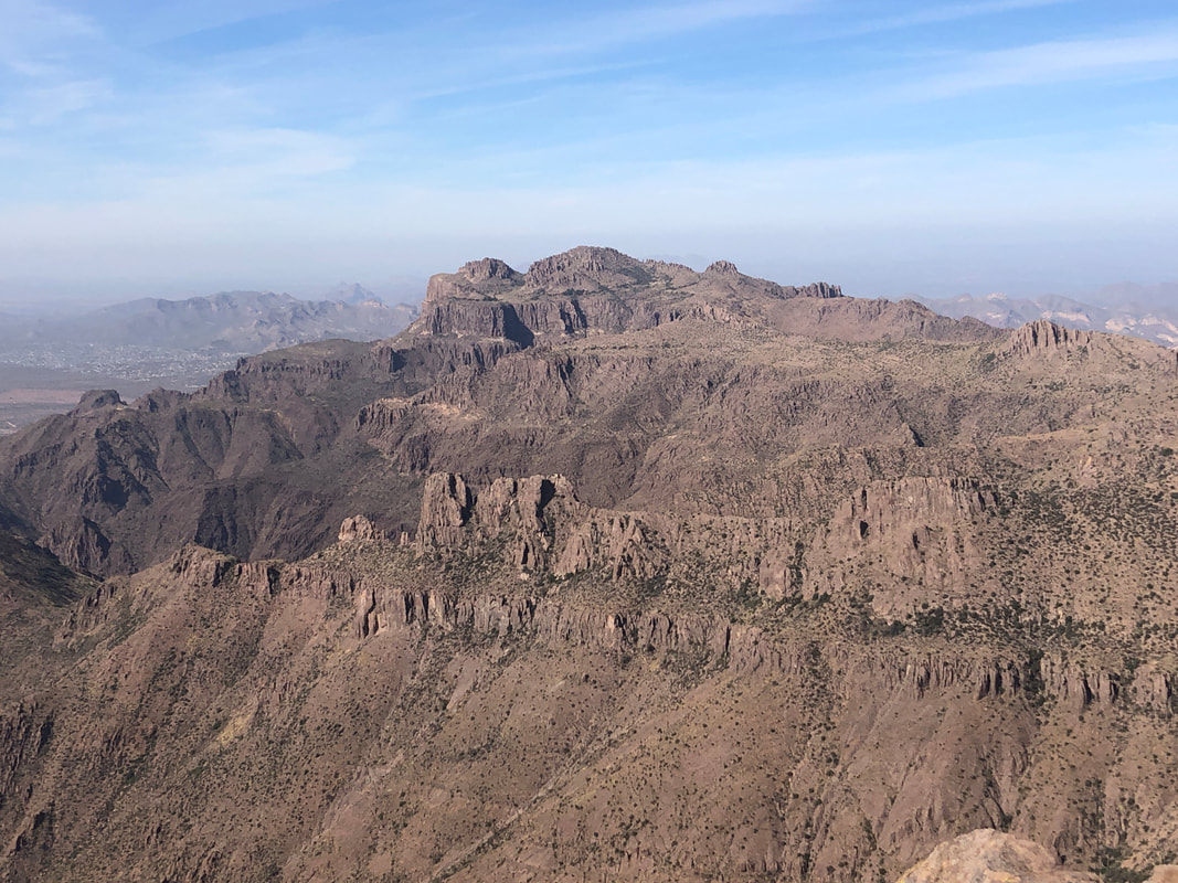 ....we made it!!! All were in high spirits but unfortunately, one member of the group had a problem with one of the walls because of the exposure so had to stop and wait for our return. Not the first time that has happened but I was sorry that he was denied this exhilarating experience. 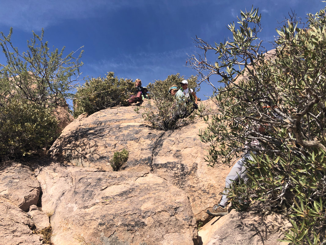 Soon, we began the descent. 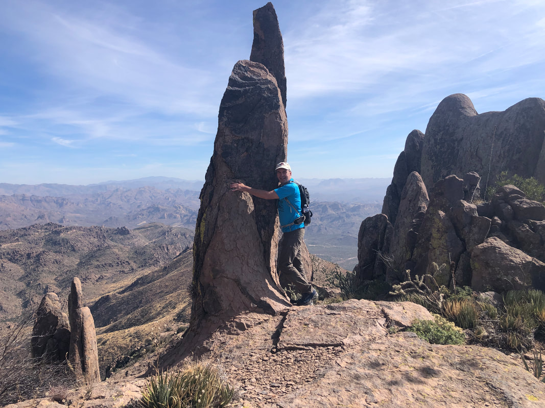 While pausing for a regroup, I asked to have my picture taken, hugging a hoodoo. This was one of the smaller ones as others soar well above us. 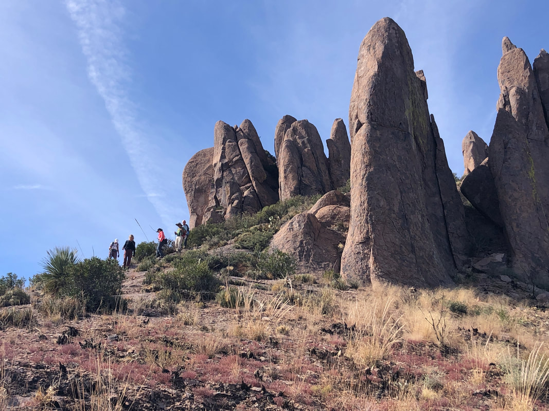 During the descent, many of us fell. Not doing cart wheels into an abyss but losing our footing and then encountering cactus or rocks to break our fall. I'm sure I've never had so many people fall during any previous hike. Even.... 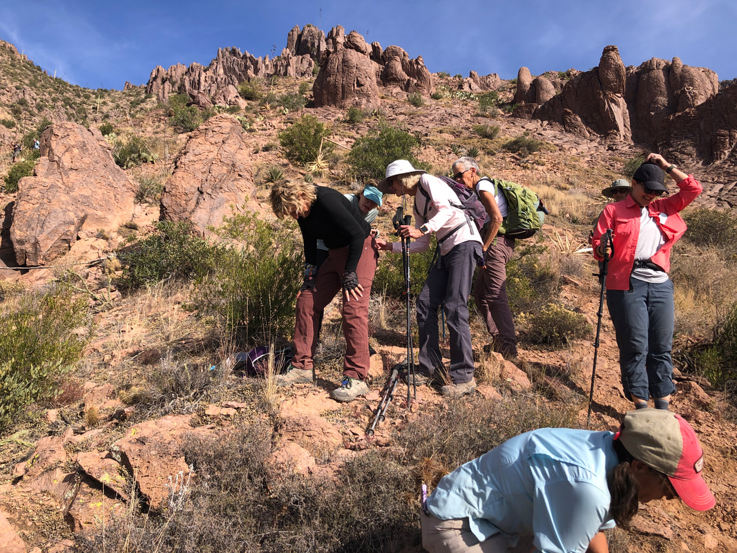 ....Amy slipped and had to bend over to have a couple of spines removed from her rear, ha, ha. Tweezers came in very handy today. We all made it back to the parking lot having hiked 8 miles with 3000' elevation gain. A very difficult but enjoyable hike.
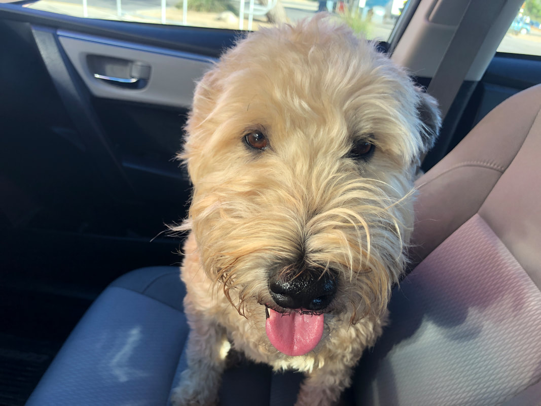 Jack, a Wheaten Terrier, is the unusual case of a dog who really dislikes a drive in the car. He seems fine when the car is at rest but once moving, he'll stare into the seat rather than look outside. Oh well, he has so many fine attributes otherwise. 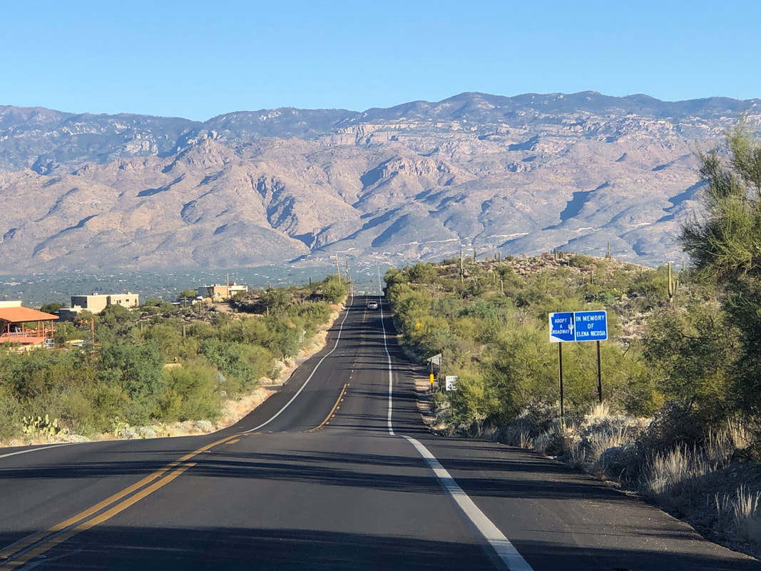 The Cyclefit group planned a 76 mile ride but my cycling endurance wasn't up for that so I drove to Saguaro East NP and waited for them at the top of Freeman Road. Great view from here. We did the long climb up Spanish Trail Rd, made a right onto Pistol Hill Rd..... 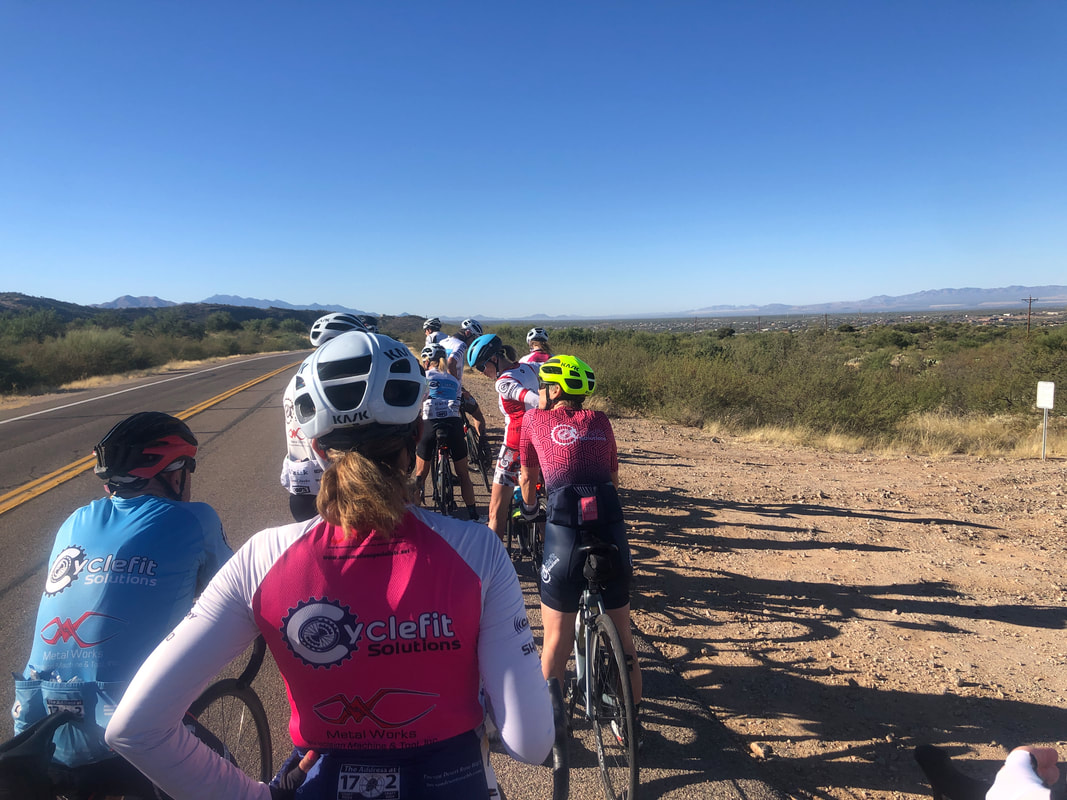 ....and regrouped at the top. I managed to hang with the group to the regroup point my lack of cycling fitness was telling so I spit the bit at the 20 mile mark and soloed back, finishing with 37 miles and a 17.2 avg. Really need more saddle time. Big, big hike coming later this week.
 I'm in Apache Junction and driving to the Hieroglyphics trail parking lot. I've read about an alternative "route" to Superstition Peak (high point in the distance) and want to check it out. 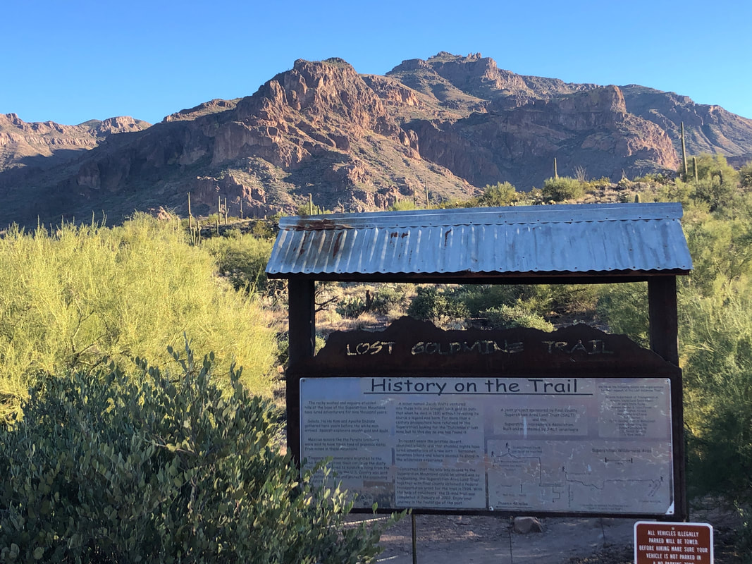 At the trail head, there is good information about some of the early prospectors and the story behind the "Lost Dutchman Golf Mine". There are many cars in the parking lot but 99.9% of the hikers are making their way to the fabulous Hieroglyphics Canyon and along the way..... 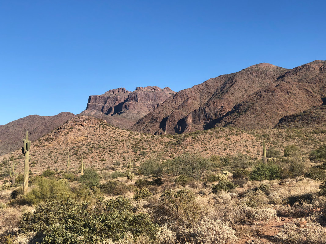 ....we get a good look at the Flat Iron and higher peaks. After 1.5 miles and a 600' elevation gain, the artwork..... 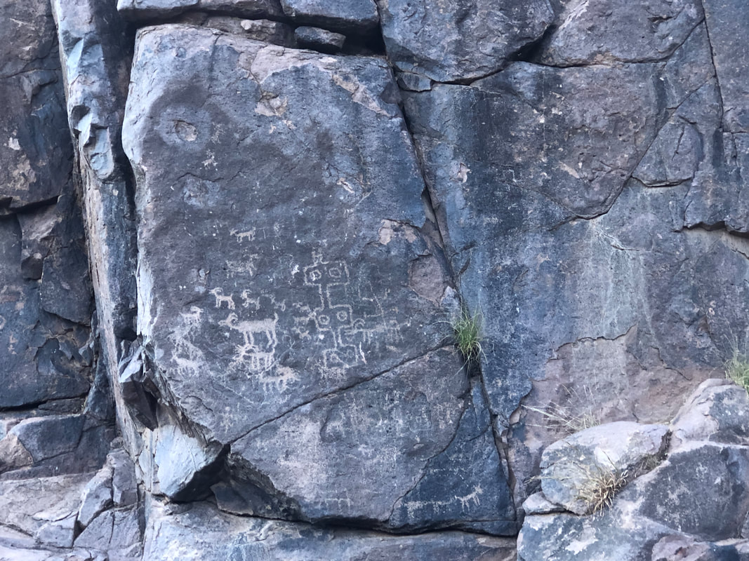 ....appears and is plentiful. I managed to walk by the departure point for the "route" so backtracked and activated the GPS route on my cell phone. 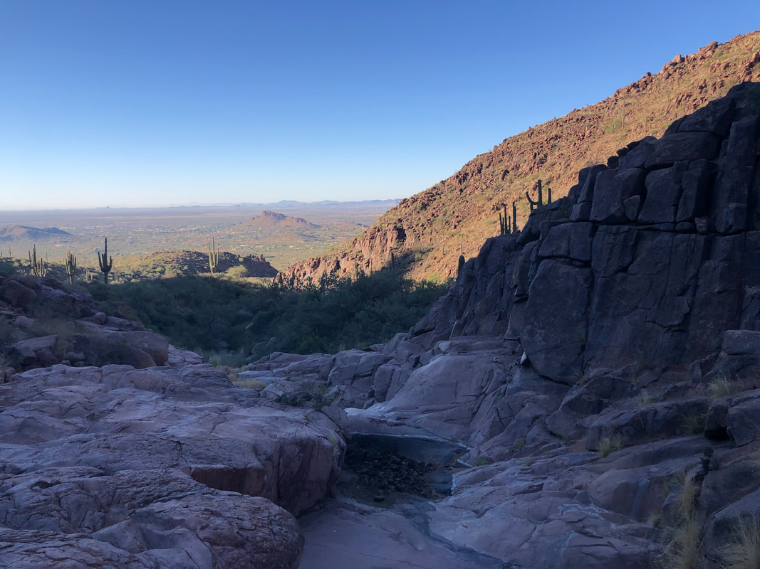 Looking down canyon, just beautiful. 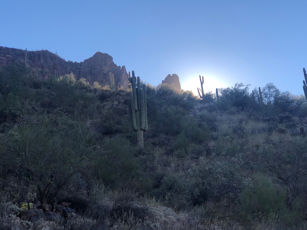 I reached the point on the trail where I should have departed. The sun was rising above a nearby ridge. I had read two hike reports, both of which stated that the route had plenty of cairns and easy to follow in most places. Ahhhhhh...... 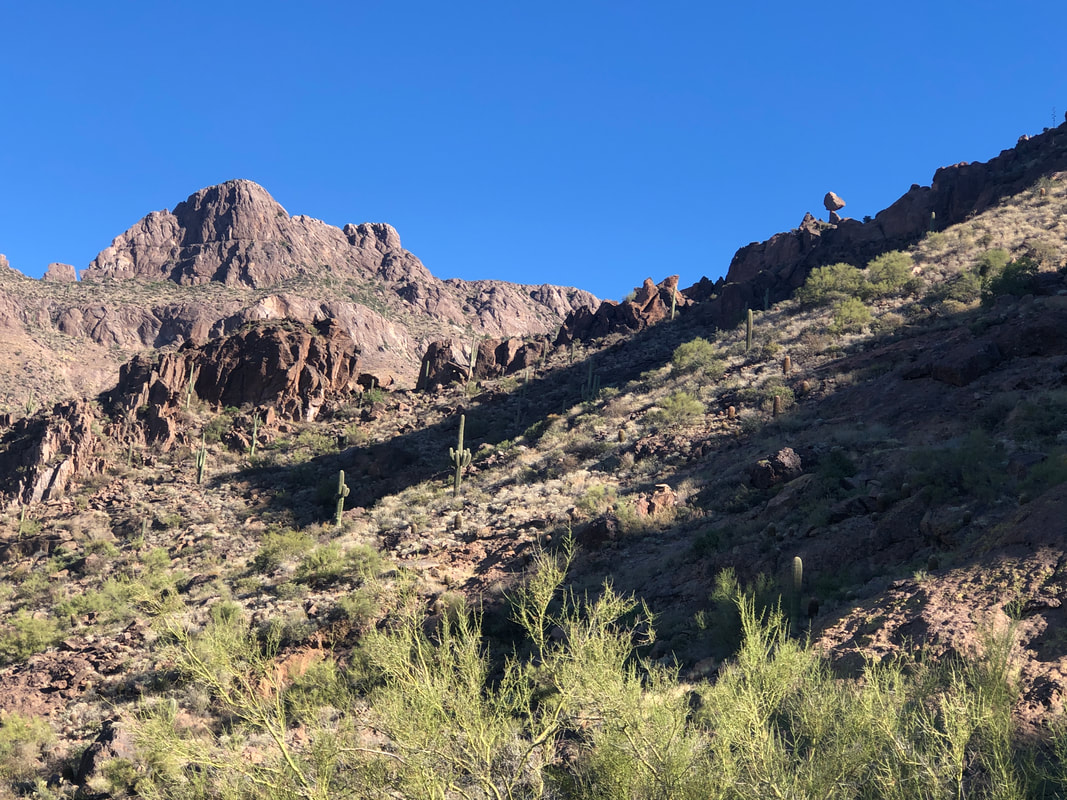 ......no! I found 0 cairns and so, at some point, someone came through and swept them away. I could see the balanced rock (upper right in image). Assuming there were cliff-outs or other obstacles, I checked my phone frequently to see if I was on the route. That of course, drained the battery and soon I was down to 30%. I reached another ridge and.... 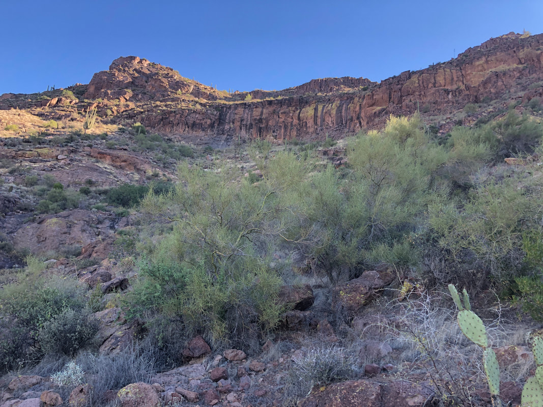 ....saw, ok, the route parallels the above wall and ends up around the balanced rock which is just left of the above image. Upon reaching that, maybe the cairns pop up but if I have to use the GPS route, I'd be out of power. It's not unusual for me to attempt a route a time or two before finishing it and now I know how to reach the balanced rock, I'll be back and finish it. I turned and.... 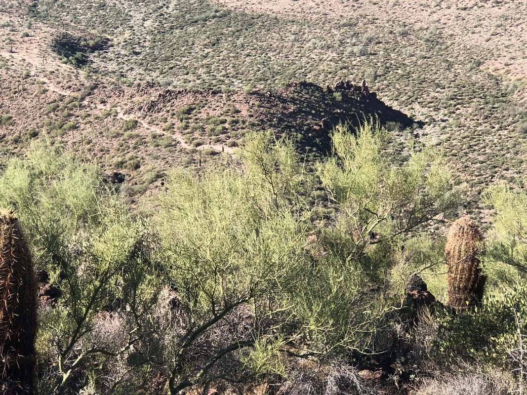 ....looked at the Hiero trail to which I eventually returned. Lot of people traveling the trail and I ...... 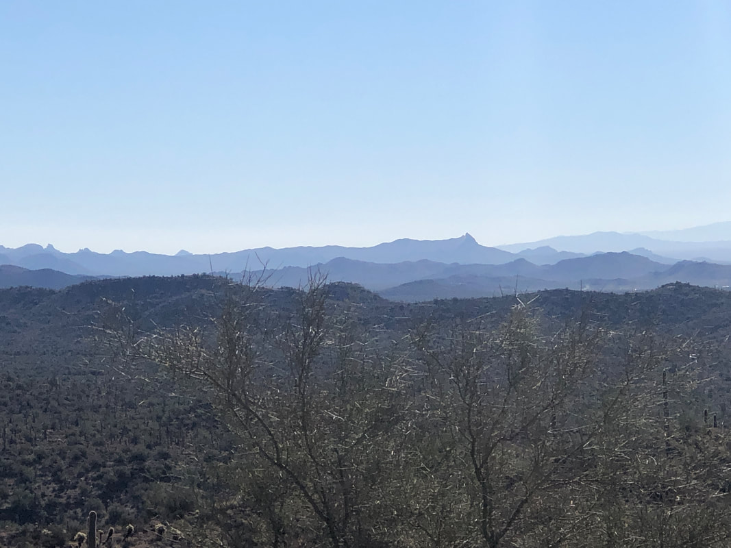 ....enjoyed the views to the southeast which included Picketpost Mt, center right with the prominent peak. Finished with 3.6 miles and 1000'+ of climbing.
 Slotted in with the Cyclefit group, 15 of us for a 35 mile ride around Oro Valley and one stop to fix a flat. The quality of the pavement in OV and the adjoining Marana is great. Finished with a 17.6 average. And then..... 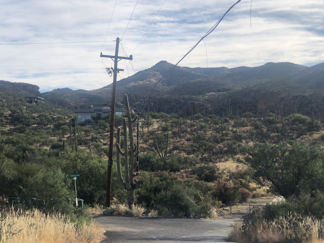 ....hooked up with Amy and hiking friends Katheryn and Brenda to do a 6.5 mile loop hike on the east side of Tucson. 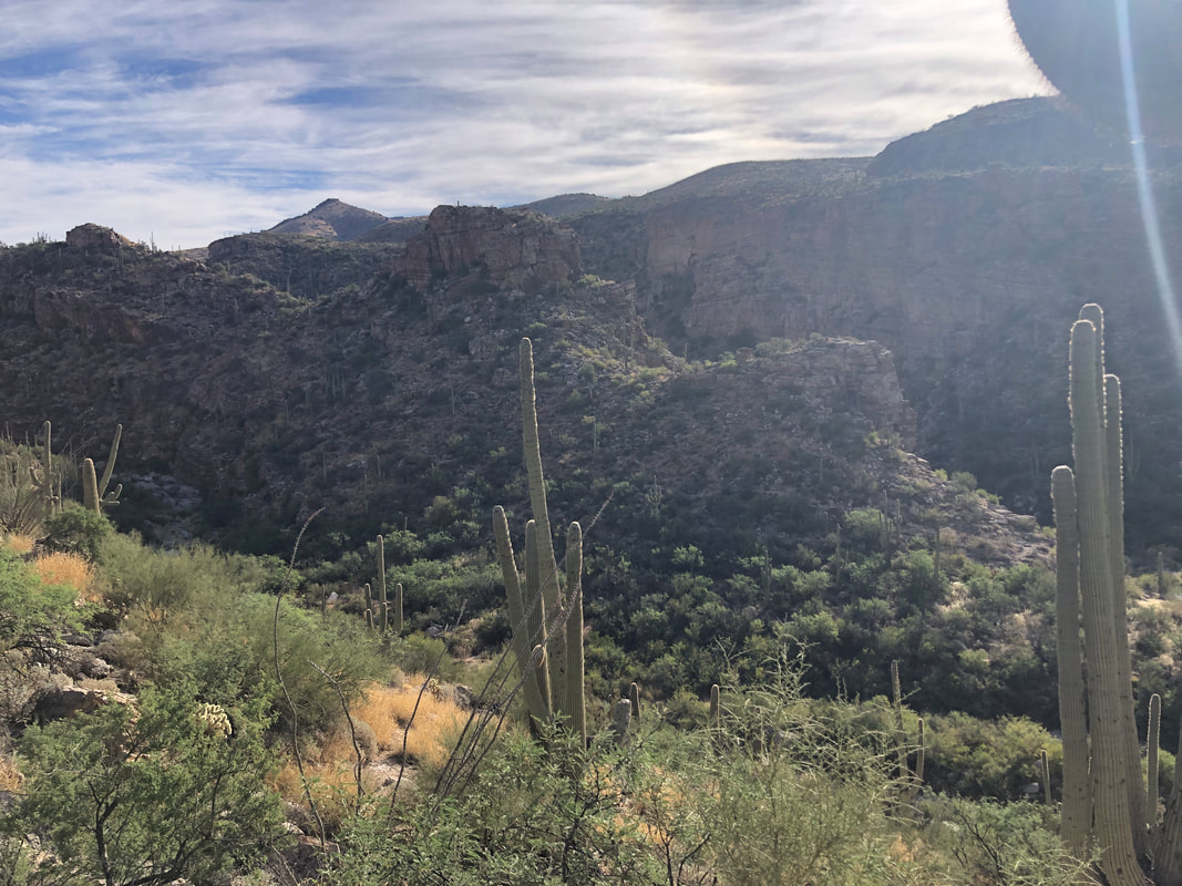 Our route would take us up the left side of the canyon in the foreground via the La Milagrosa Trail, cut into a canyon, climb out of it and return via the canyon in the background. 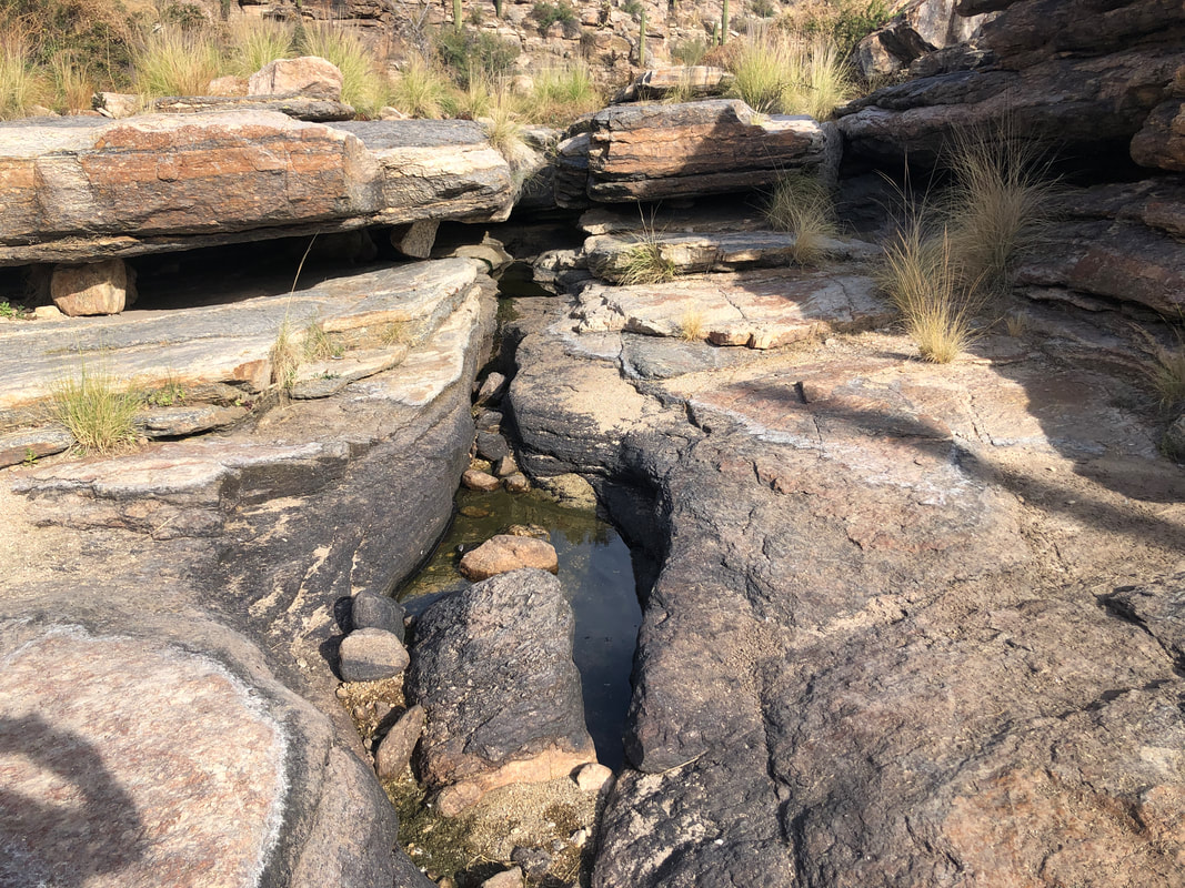 It's a pretty good climb before a descent into the above canyon that still held some water in spots. Interesting rock formations. 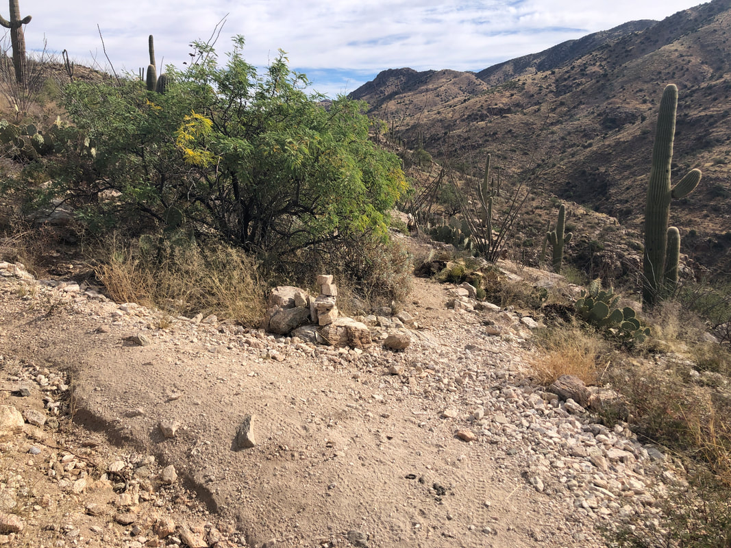 At about the 2.5 mile point, I located the above cairn that indicated where we depart the trail and get on an unnamed social trail where we had good views of.... 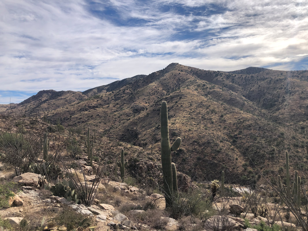 ....Aqua Caliente Hill or maybe that is the false summit and the real one is just beyond. Tough hike either way. We continue to descend and soon.... 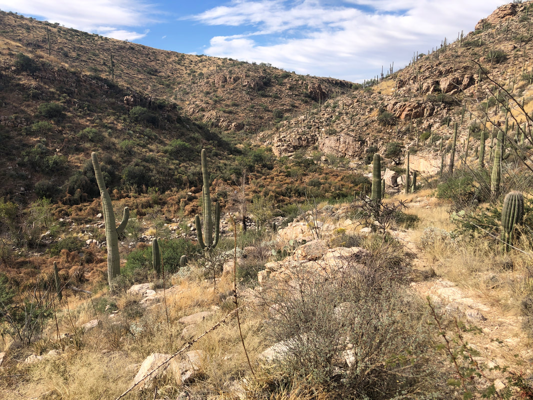 ....have a good view of a canyon bottom that is covered in monsoon inspired growth. There has been enough traffic that the trail was not difficult to follow. We hiked down canyon for a little while before ascending.... 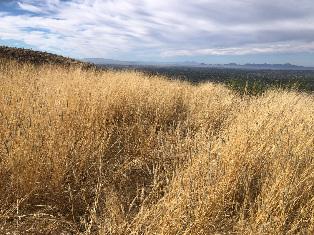 .... the trail and having good views to the southwest. Simply amazing growth of grass and other vegetation. 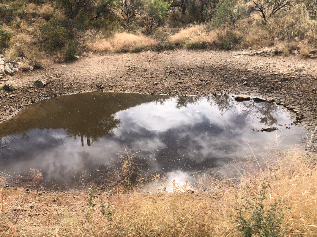 We begin our final descent and pass a water tank made for wild life although there is not much water collected. 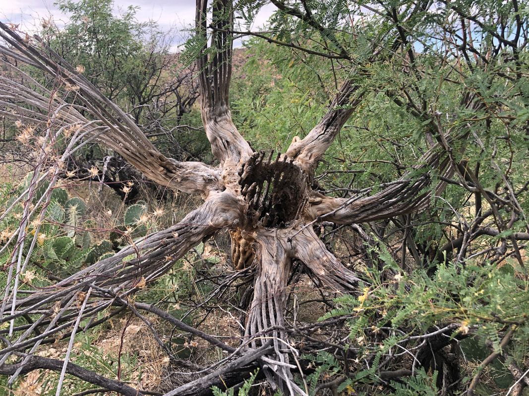 A long dead saguaro is tilted toward us and allowed a good look inside. 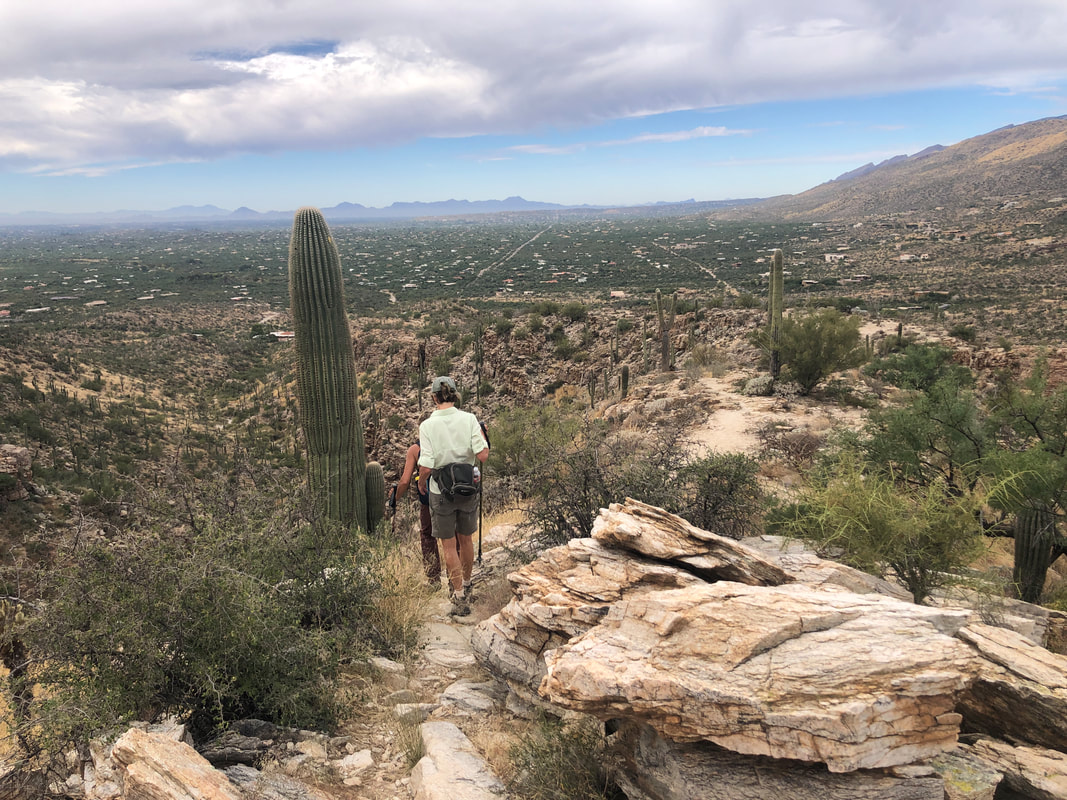 The gang continues downward and soon finishes our loop hike. Next week I'm guiding a group to Superstition Peak, a truly epic hike but traditionally it is an out/back route kind of shaped like the number 7 except if it was reversed. I've read about a route that essentially finds the missing side of the triangle so I can turn the route into a loop. I'm going to check that out tomorrow!
It was suggested that I take a ride through an east side neighborhood to see an impressive array of Halloween displays. It's fitting that as I begin my ride, I encounter a "good witch" (Amy) who is sweeping glass from a road that caused her a flat tire earlier in the week. 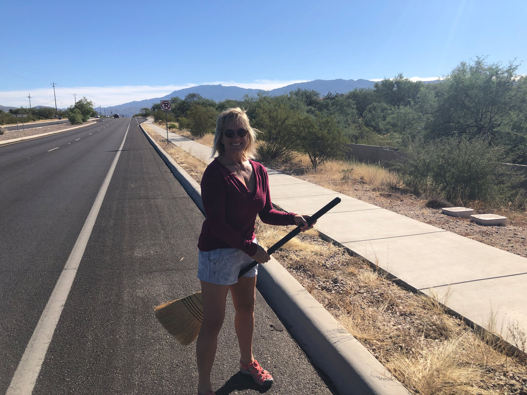 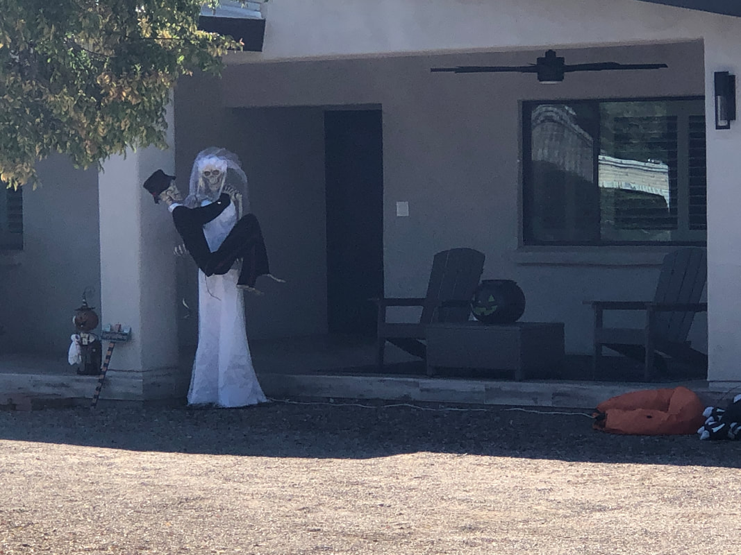 The early morning light was not ideal for taking today's images and some details were washed out but good enough. I thought the above scene was funny. 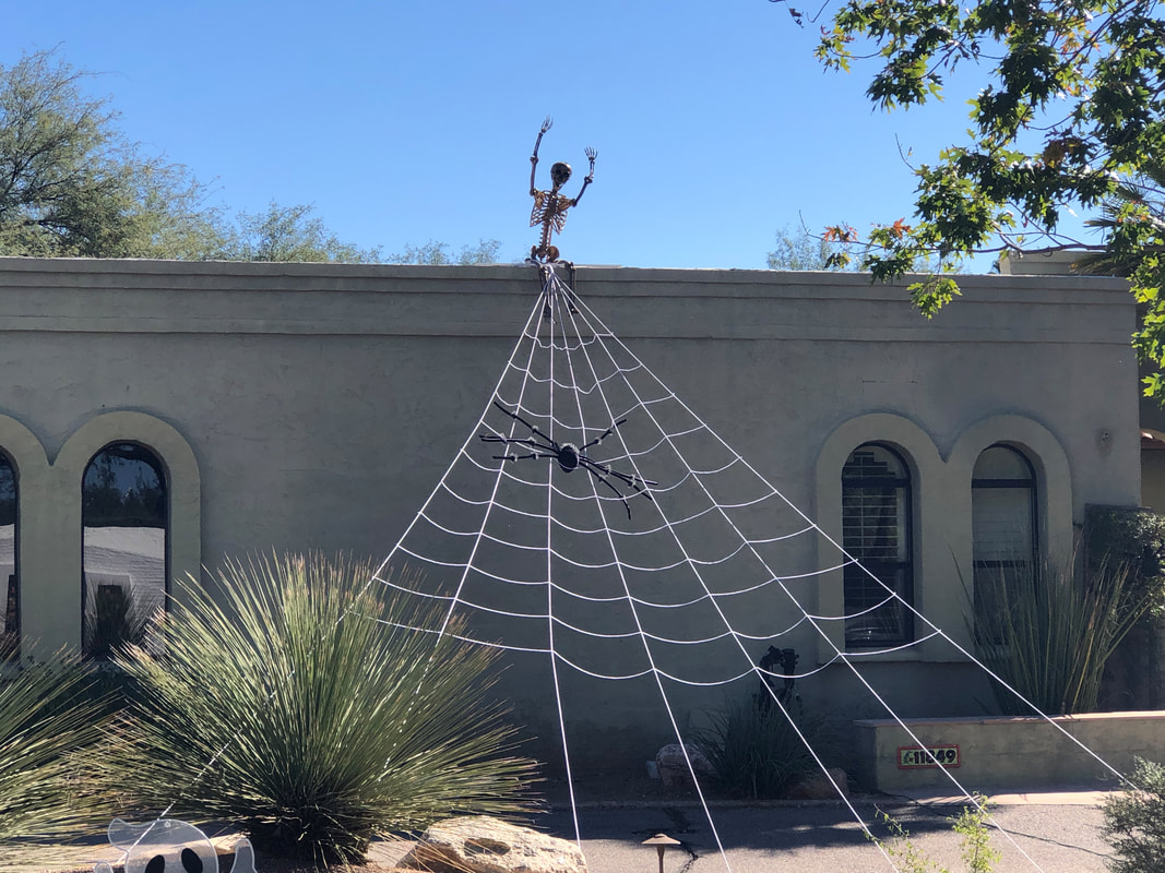 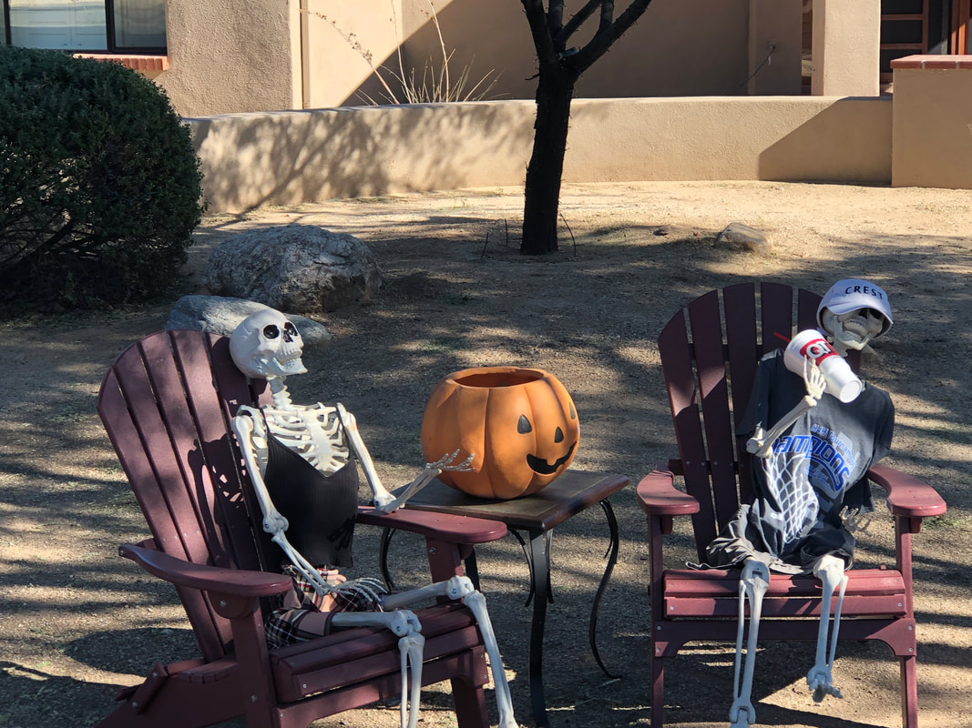 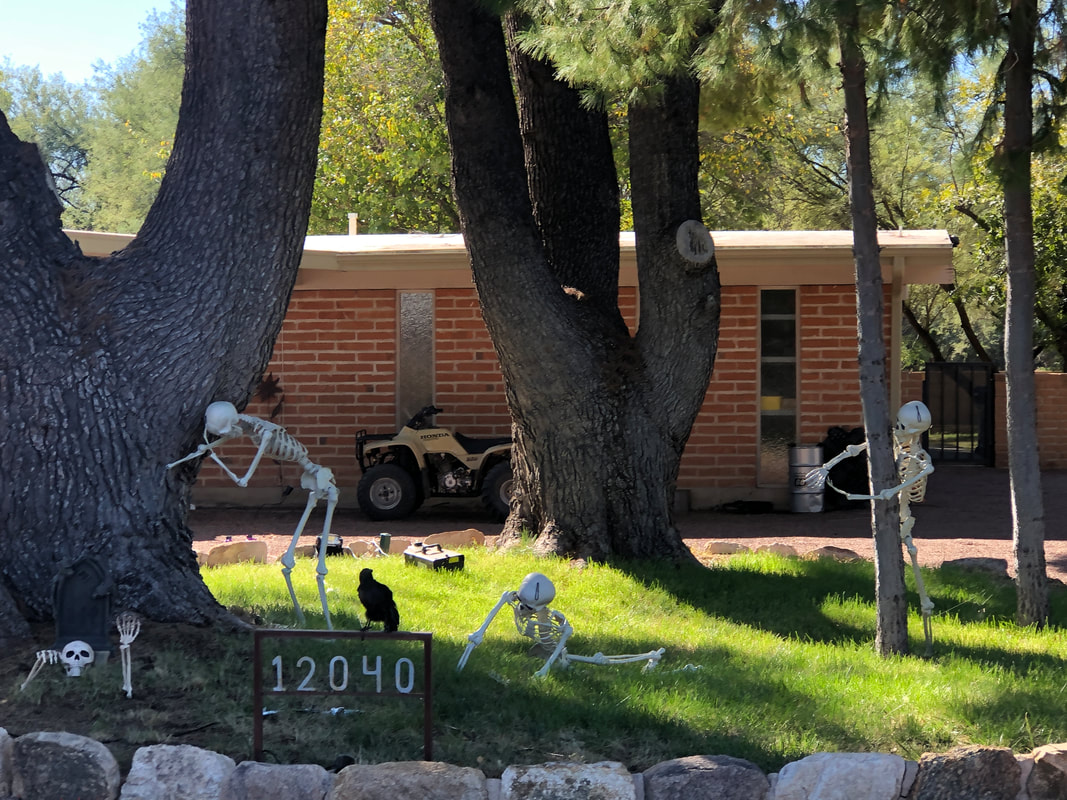 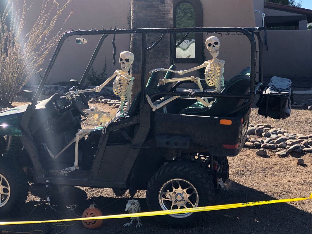 Another creative display. There was a lot of yellow tape in front of the yards and a local explained it was to herd the people to where candy was given and away from yards. Without the tape, people just swarm from home to home, trampling plants. 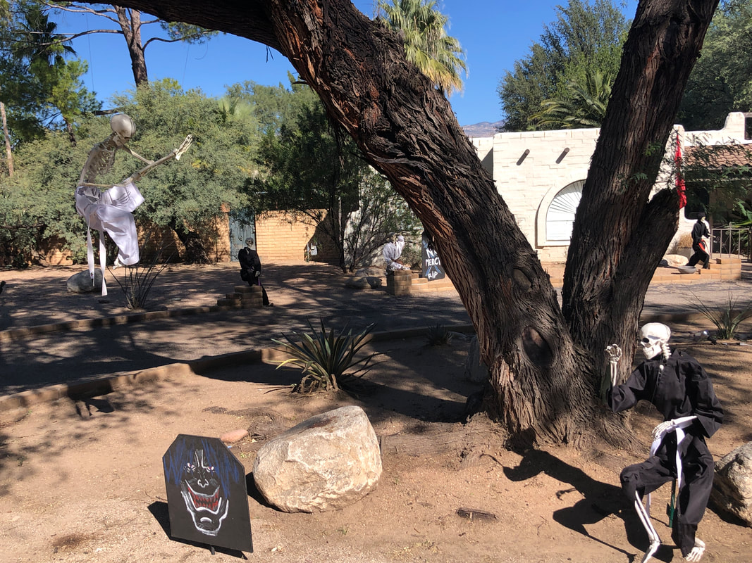 Another funny display with a skeleton dressed in black, dancing to the music of the skeleton sitting in a swing. 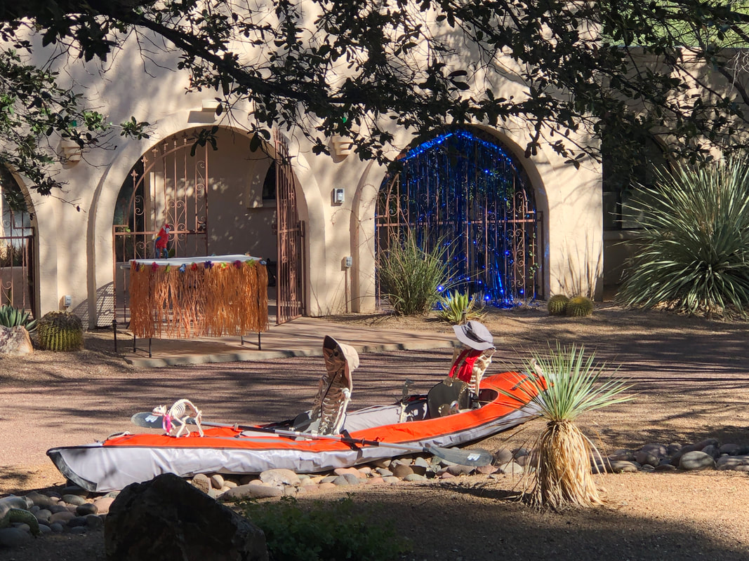 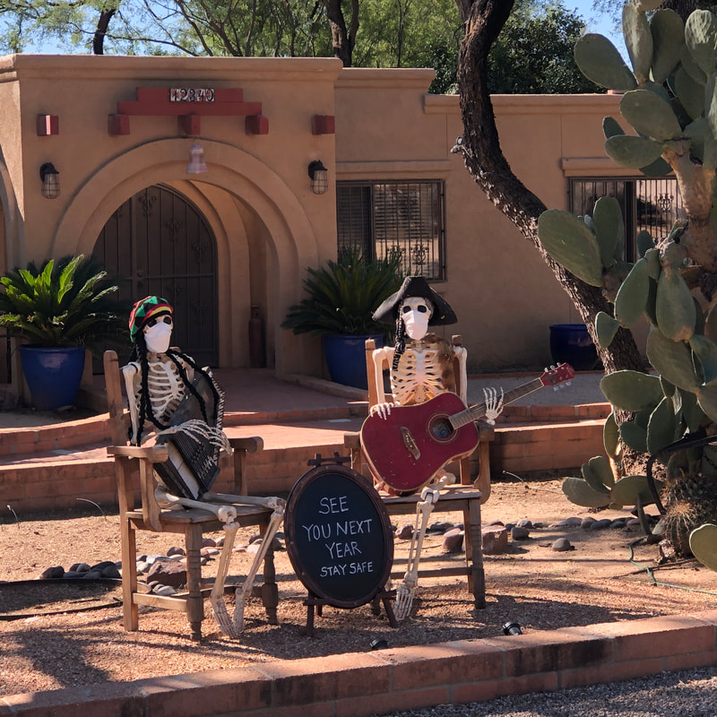 I talked to 3 residents and the overwhelming sentiment is the scene is insane once people arrive for Begger's Night. One guy said two years ago he gave away 1300 pieces of candy in the first 90 minutes. He had 1500 for tonight and that was likely to be exhausted. One couple used the excuse of the virus to avoid trick or treaters when in reality, they just needed a break from the chaos. 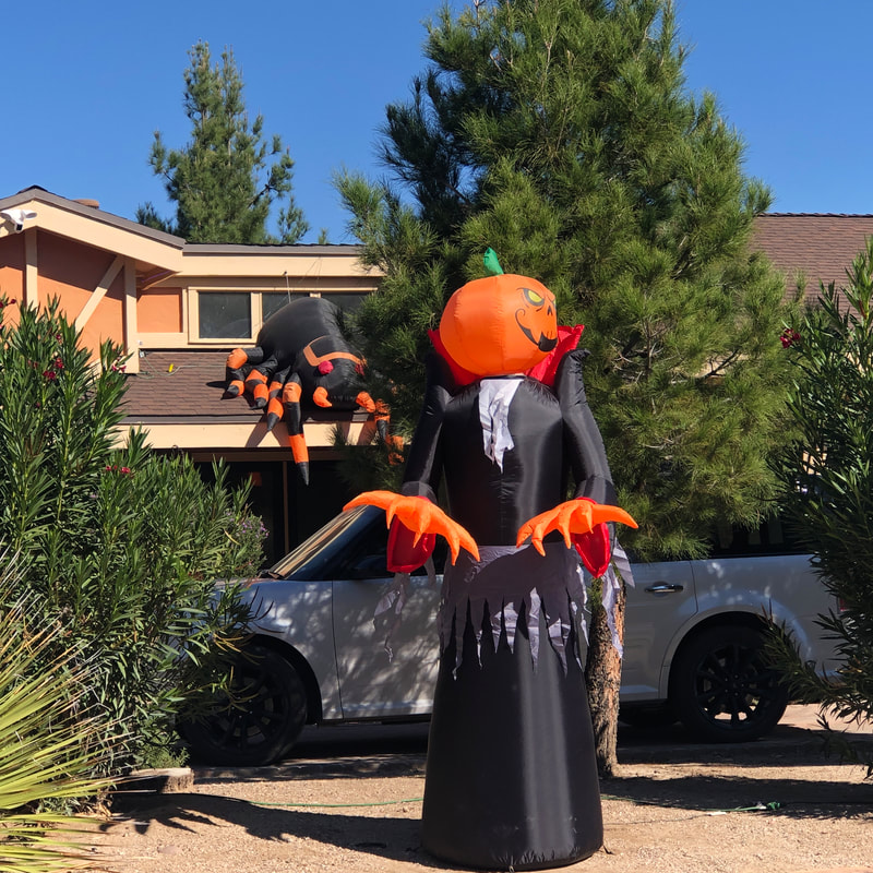 It being early in the day, a lot of blow-up displays were not yet in full bloom but a few were. 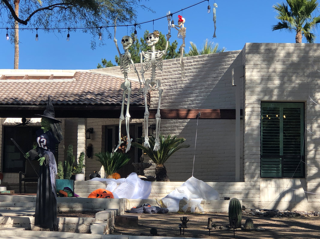 The neighborhood is in the 49er golf club development of Tanque Verde Road. Well worth a visit.
 I scheduled our group hike for a Friday to avoid the overcrowding typically found on the weekend and glad I did. Plenty of spaces available today at the Peralta trail head. We are on the Peralta Trail for only a few steps before ascending the Dutchman Trail and soon..... 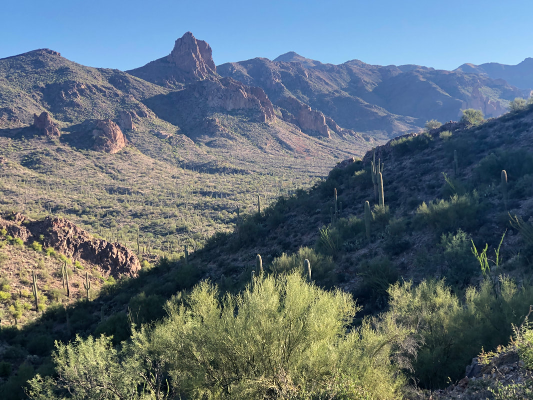 .....stand at the rim of Barkley Basin. The prominent feature in the distance issue Miner's Needle, our midpoint destination. 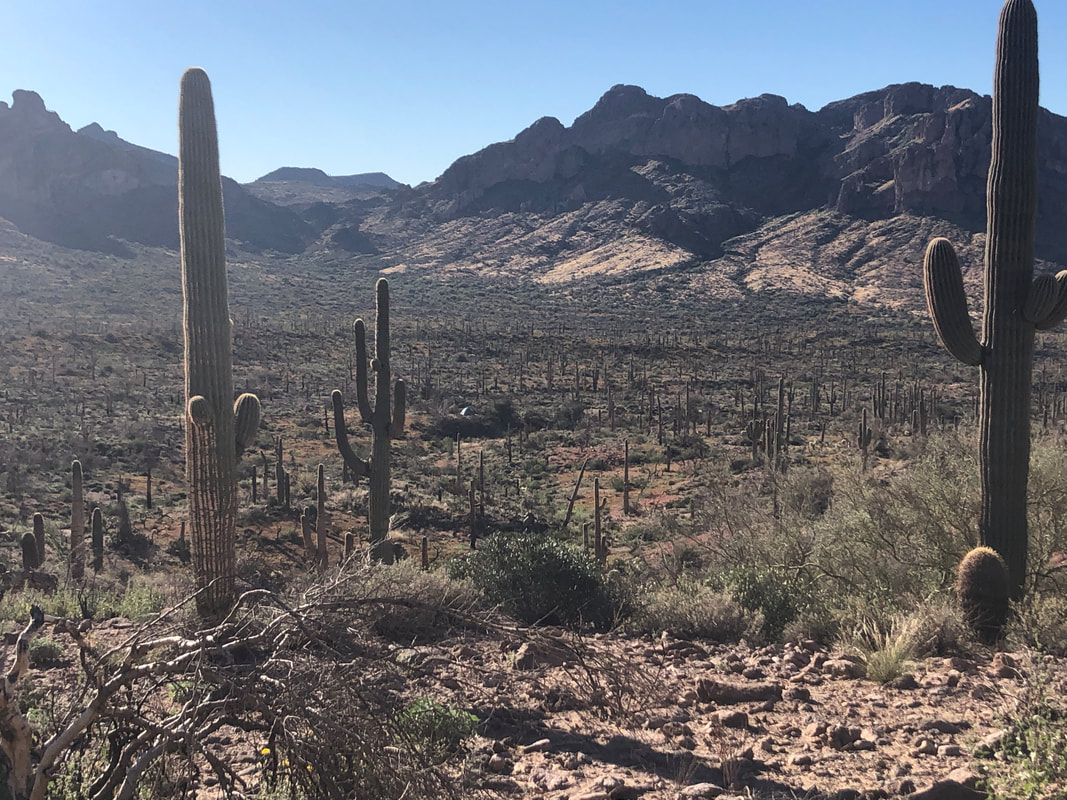 It's a beautiful hike although the damage left from a fire that swept through here last summer is still obvious. The summer monsoon caused lots of regrowth but we noted there are many saguaros, standing with fire damaged bases. Some of those have yet to topple. 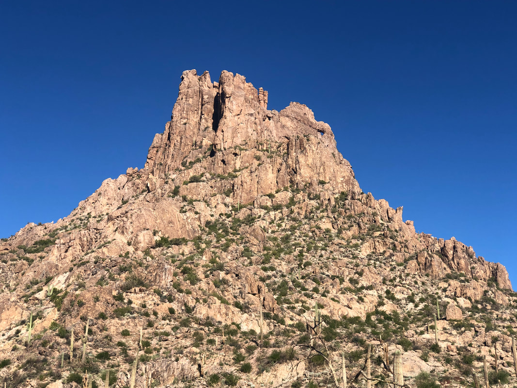 We spend 2.8 miles on a mostly gradual climb which affords good views of the "eye" of the needle and its surrounding structure. OK, my image doesn't do a good job capturing the eye but it is that tiny blue dot, upper right. 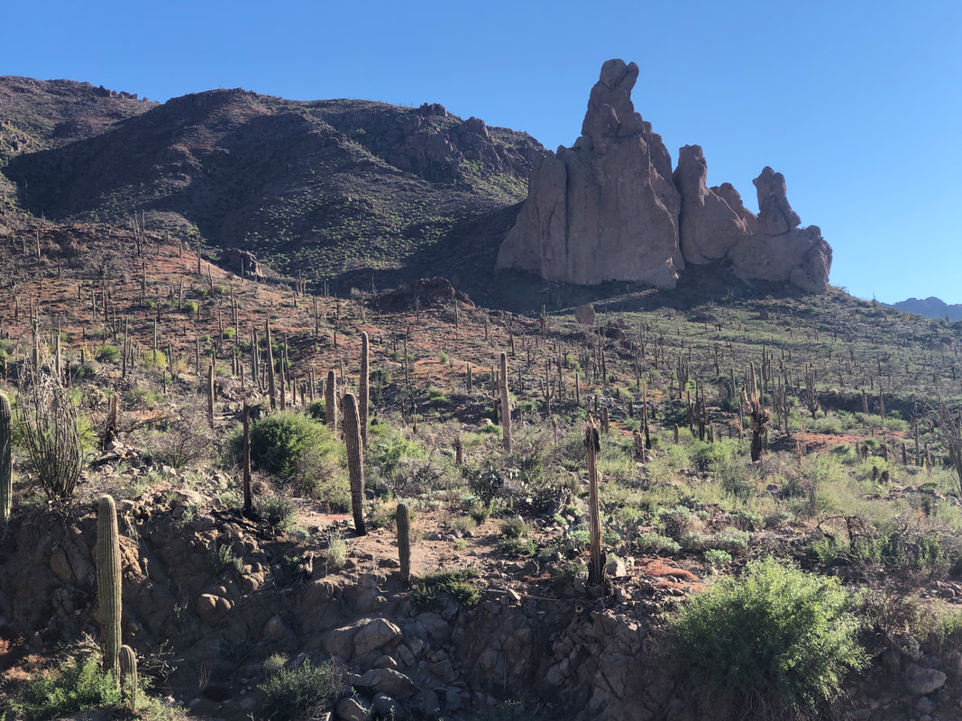 Of course, there are other, fascinating shapes to see including.... 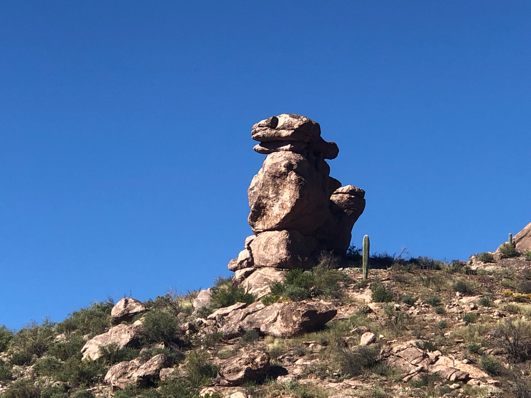 ....the above. Looks like a snake's head on top. We've been paralleling Miner's Canyon on our left before reaching the head of that and then.... 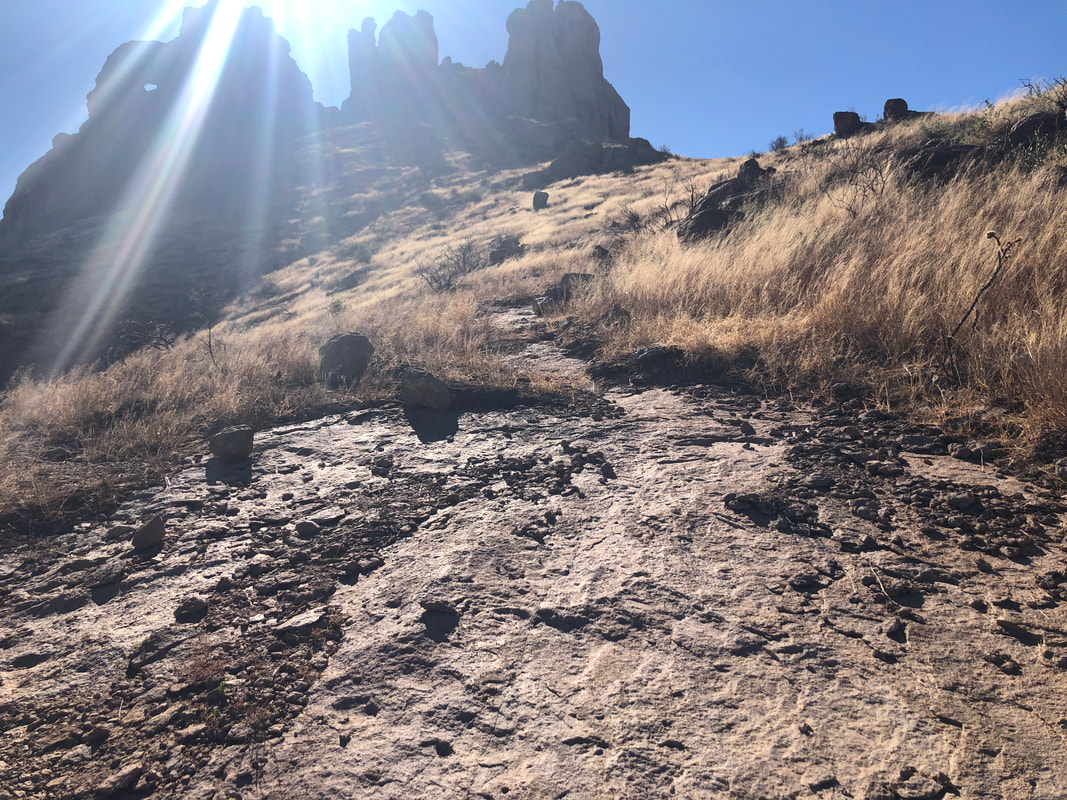 ....the base of Miner's Needle. Small blue dot on the left is once again the eye. And yes, the legend is the sun or moon, shine through the eye and illuminate a spot on a slope, showing where gold is buried. Good luck as it does so one day a year, briefly at some point during that day. Our group of nine now depart the Dutchman Trail, work our way to the saddle on the right and then.... 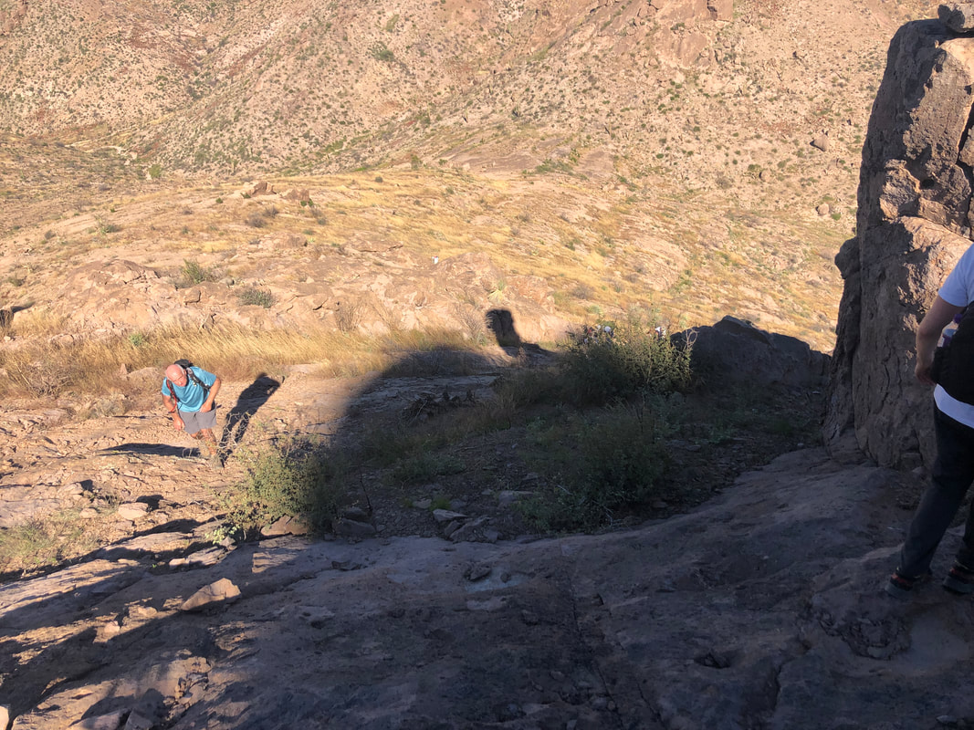 ....ascend a very steep, rock slope where we eventually reach.... 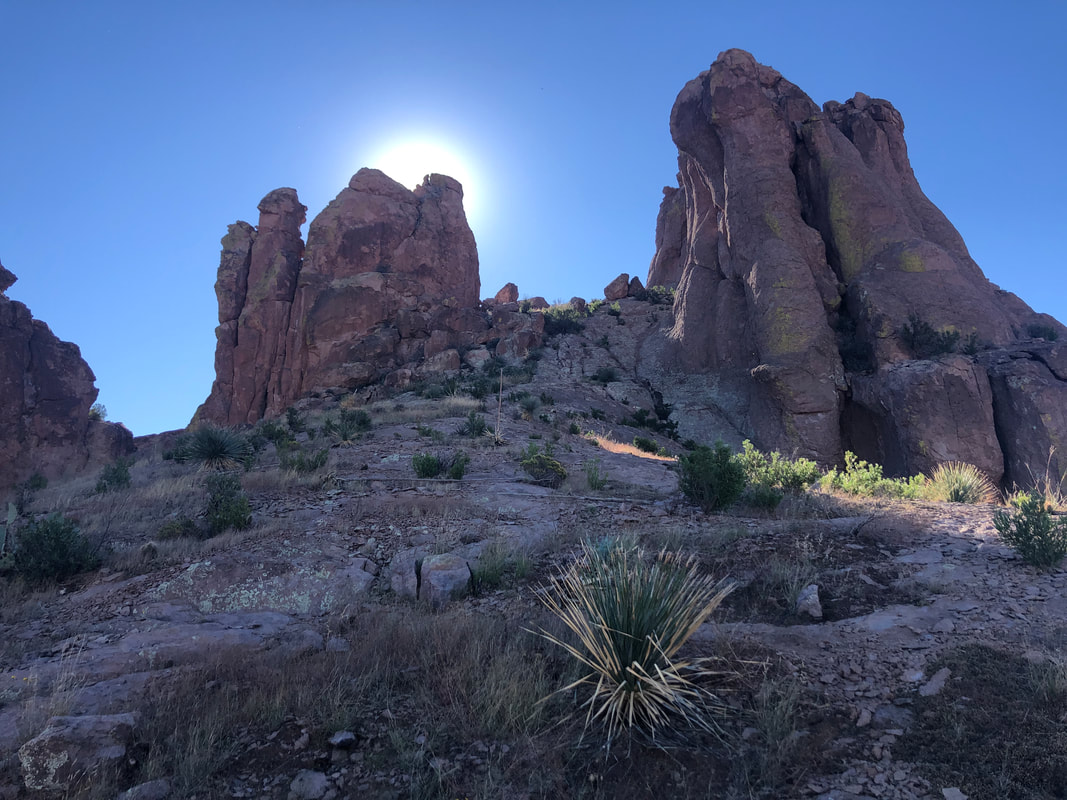 ....shade! The eye can not be reached by foot but the prominent notch above can and to my surprise, everyone makes it including..... 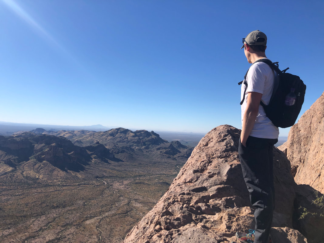 ....a traveler from Australia, Jake. He was a fun and interesting addition to the group, traveling the US and getting in quality hikes. 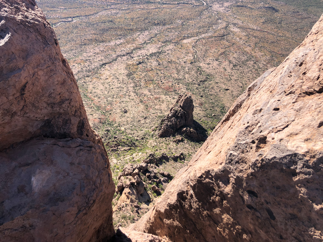 I crept to the edge and looked down. I have an irrational fear of a wind gust or a push from a fellow hiker so I rarely stand at the edge, instead stretching my arms out and taking the image. 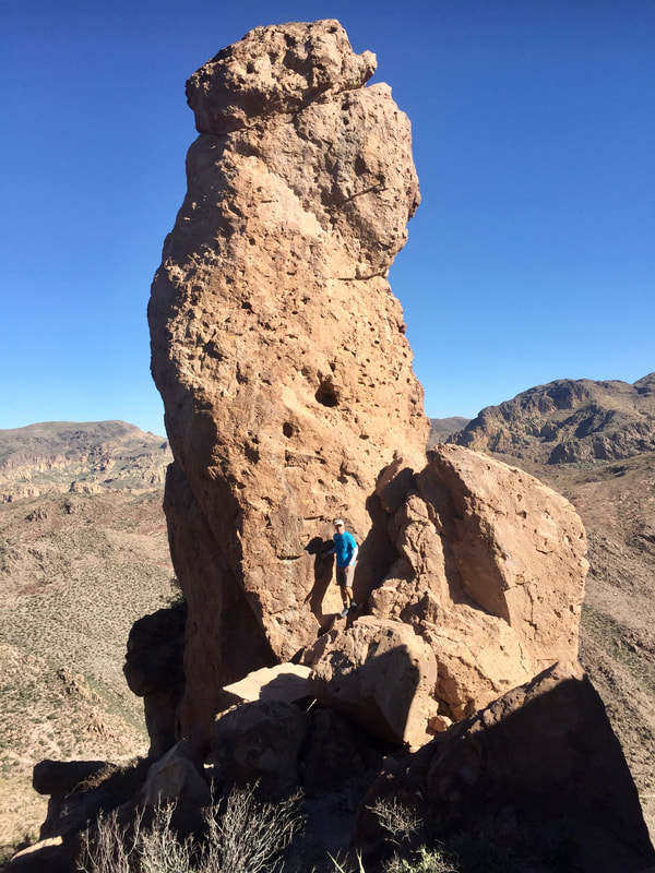 Marc G took the above image of me standing at the base of a formation that some in our group likened to a body part. We rested, refueled and began.... 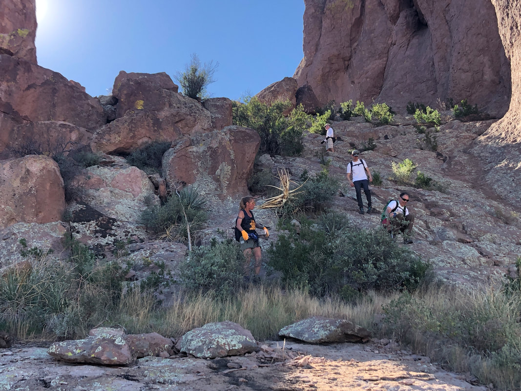 ....the steep descent, eventually getting back on the Dutchman. We passed Whiskey Spring Trail on our right and descended into a broad wash. All evidence of the trail had been washed away by flooding so I kept heading up stream, looking for evidence of a trail, leaving the wash. Meantime, certain group members enjoyed calling me the name of a well known hiker who frequently becomes lost when he hikes. One has to have a thick skin to hike with these folks. Anyway, I got lucky, found the trail and eventually..... 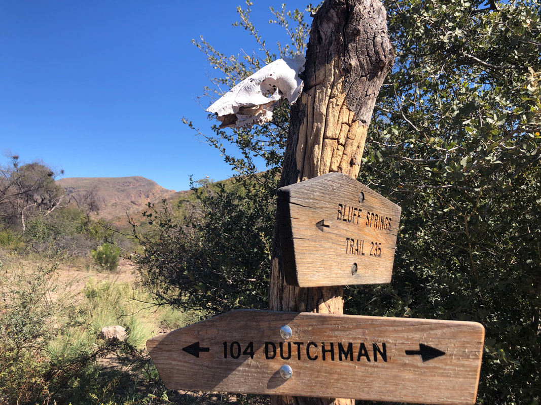 ....we left the Dutchman and got on the Bluff Springs where we found an animal skull attached to the sign post. 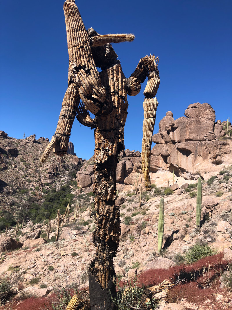 Hard to believe this saguaro is still standing, another victim of the fire. 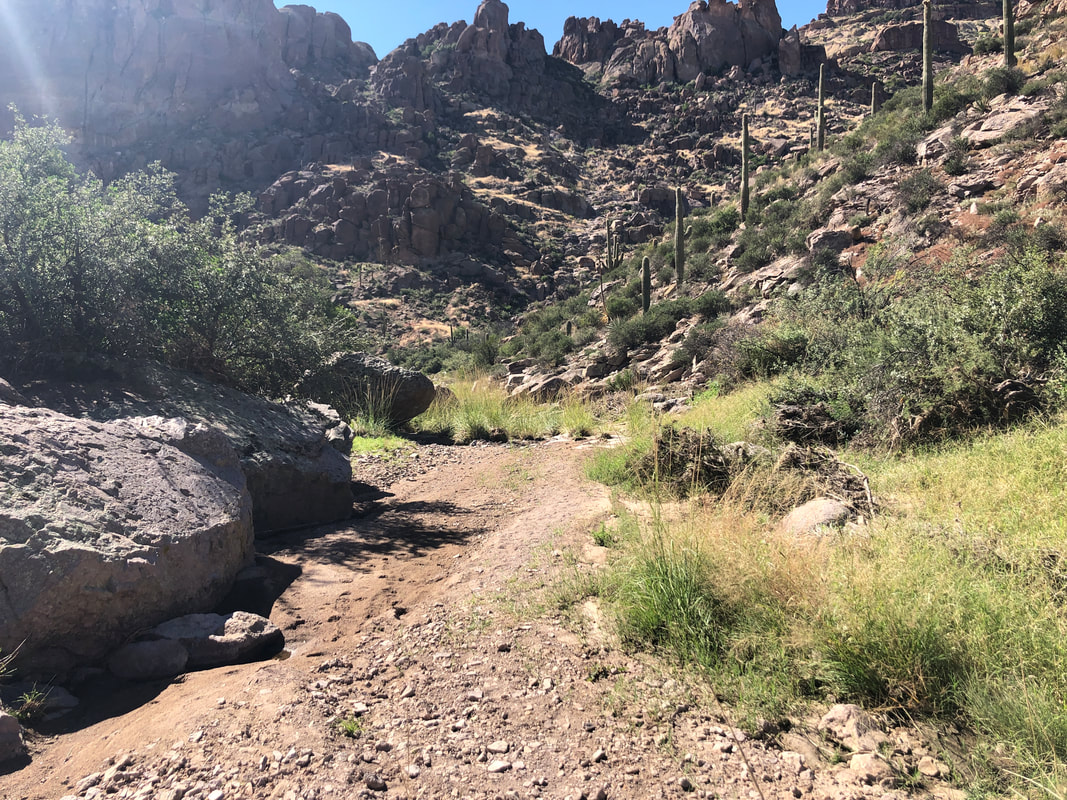 We entered the above wash that still has some pockets of water, then hung a sharp left and climbed out of Bark's Canyon. 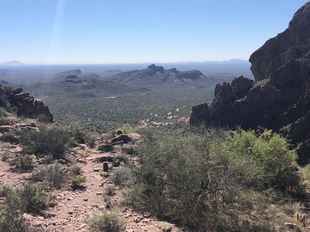 It's all down hill from here as we finished our 10+ mile hike with 2200' of elevation gain. Another fun day in the Supes.
|
