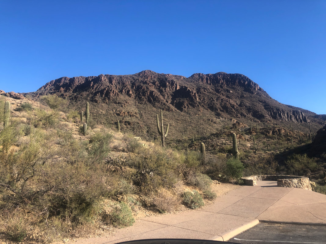
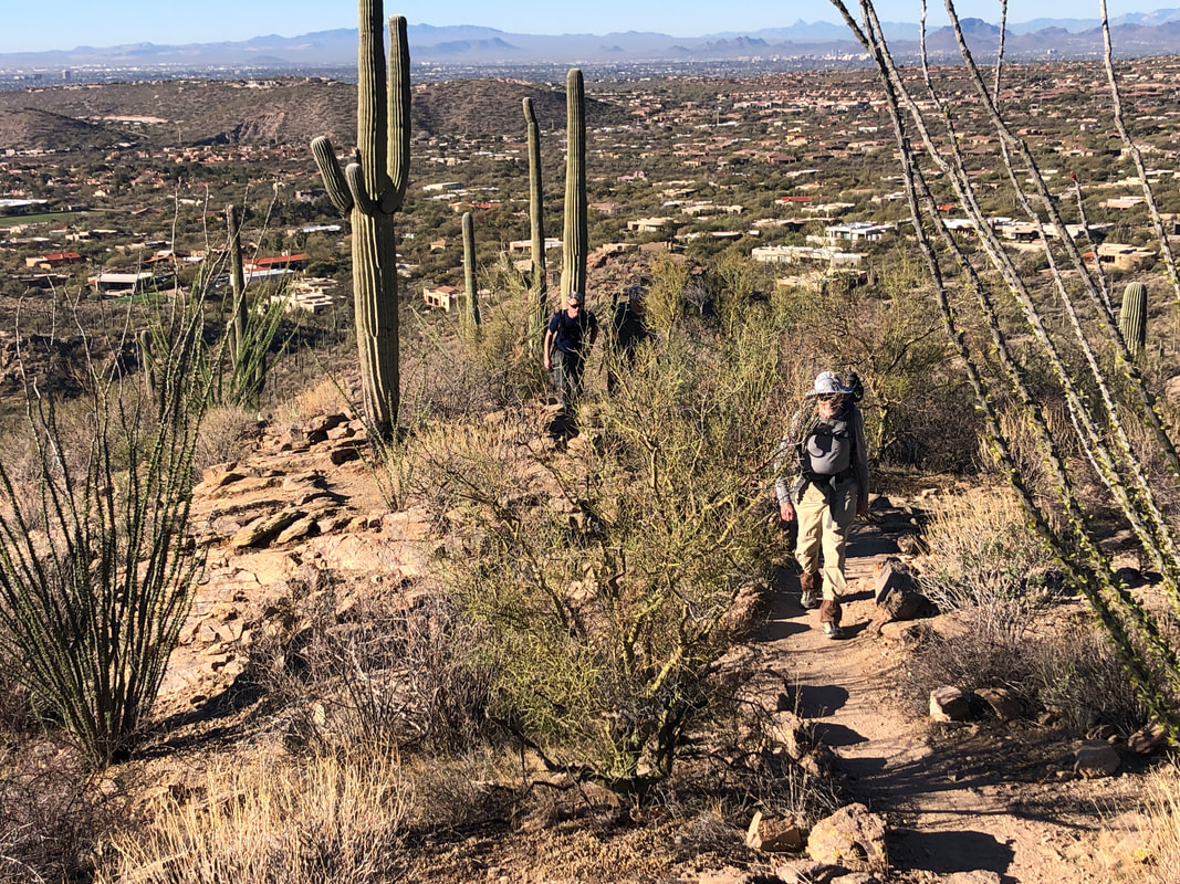
 Our group of nine, park at the scenic overlook at the top of Gates Pass Road on this beautiful, sunny morning. We'll hike clockwise around the formidable Bushmaster ridge before ascending to the peak. Thereafter, some ridge hopping, prior to a nasty, bushwhacking descent to complete our loop. 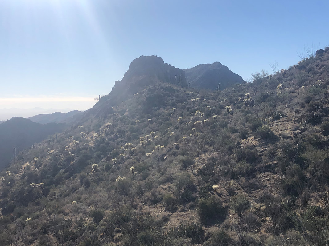 The initial ascent, following a faint trail, winds through many patches of the dreaded Jumping Cholla. Most of us collected at least one cone on our clothing with a few of us having to remove spines that had penetrated. 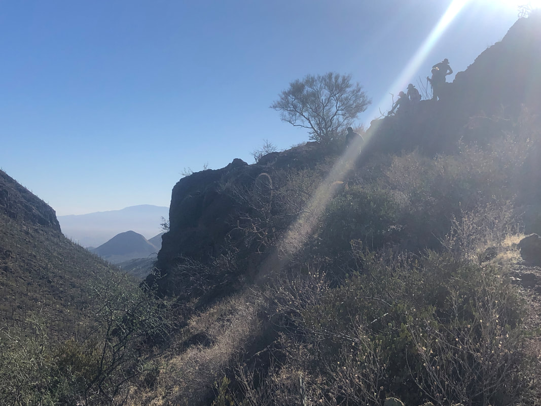 The route has a few steep but short descents that require some care while navigating. Above, top right, members of our group have stacked up a little but quickly clear through and we continue.  There are multiple peaks in the vicinity, each beckoning to be visited. 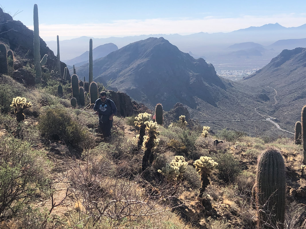 Matt emerges from a fairly steep climb with lots of loose footing. I always hike this route clockwise as the reverse direction would require a treacherous descent. In the distance, Gates Pass Road and branching from it, the Yetman Trail. 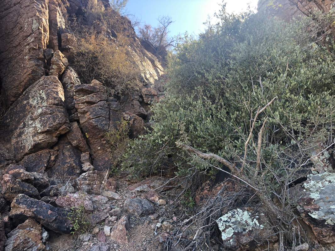 Working our way behind the ridge, we ascend a very steep, brushy section and reach..... 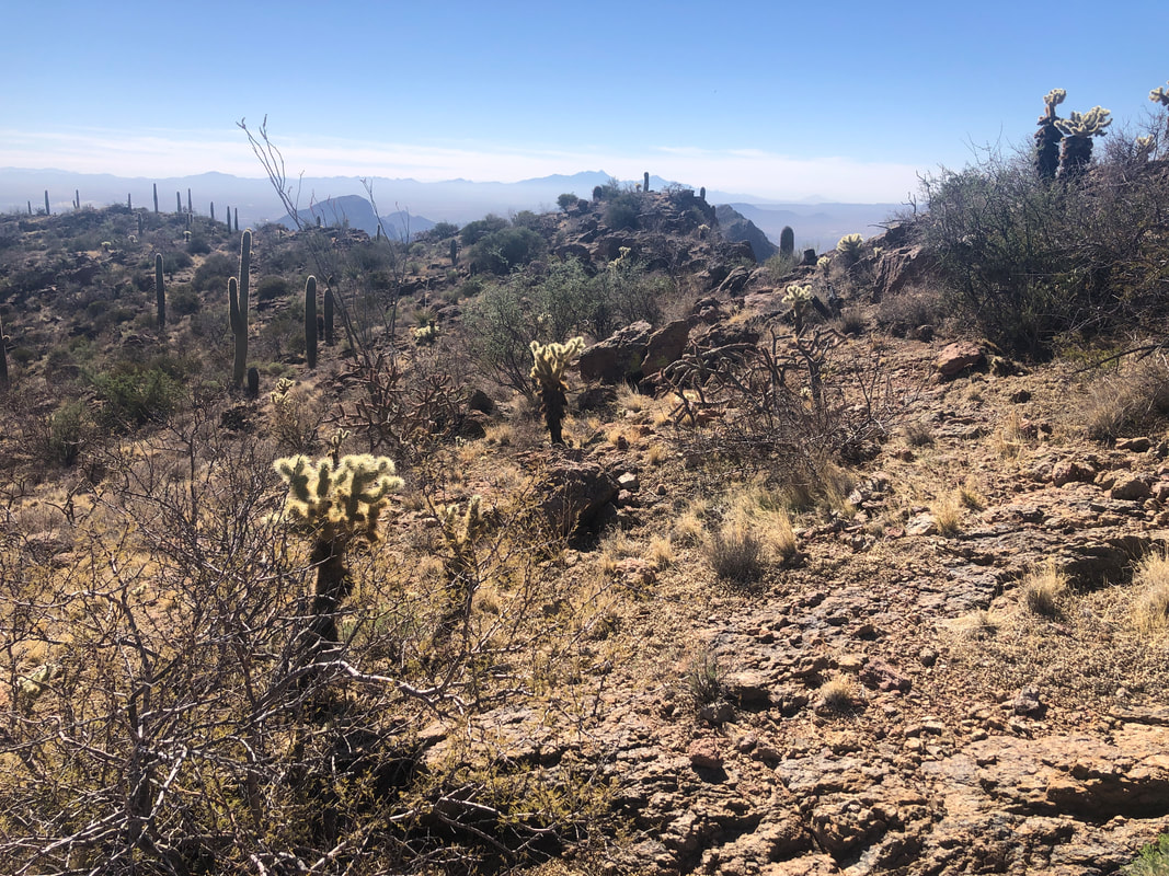 .....the ridge that we viewed while in the parking lot. There is some easy hiking along this until..... 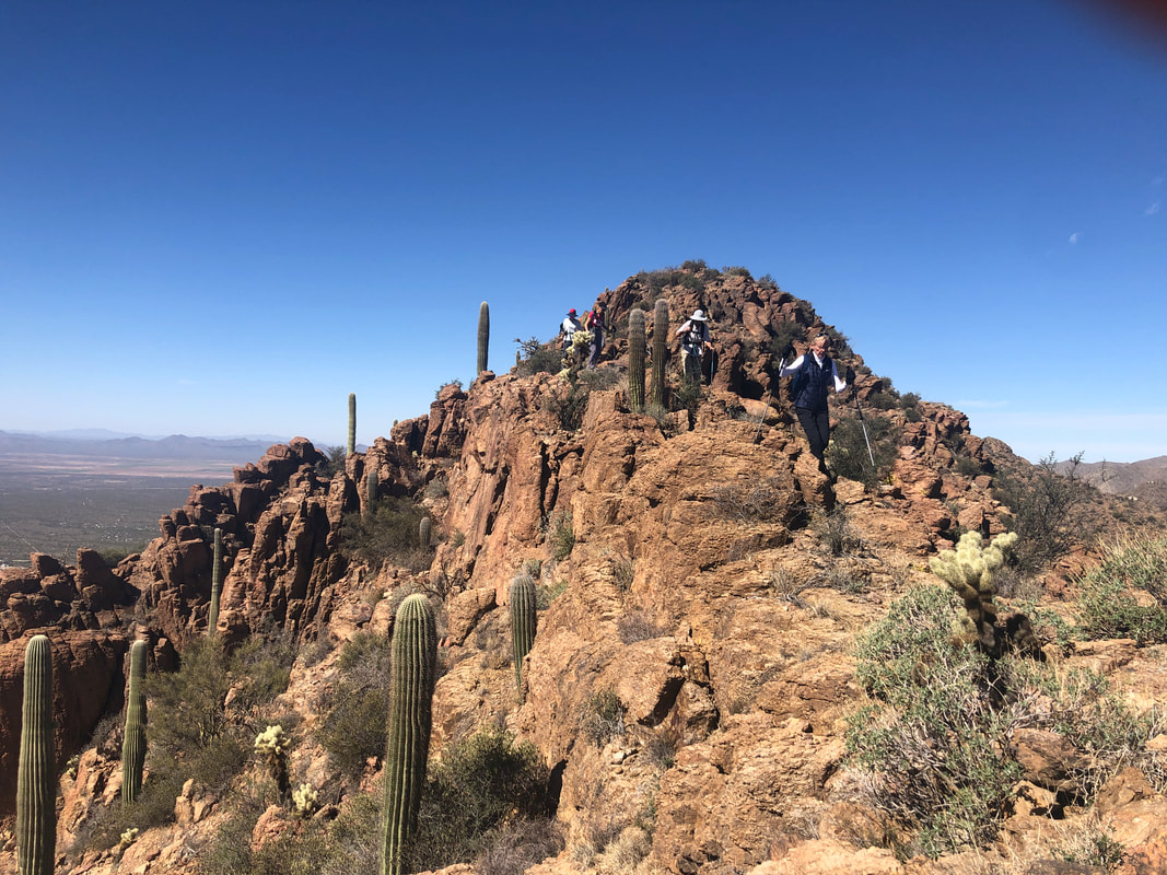 ....the ridge narrows. A hiking pole or two is very handy through this section. 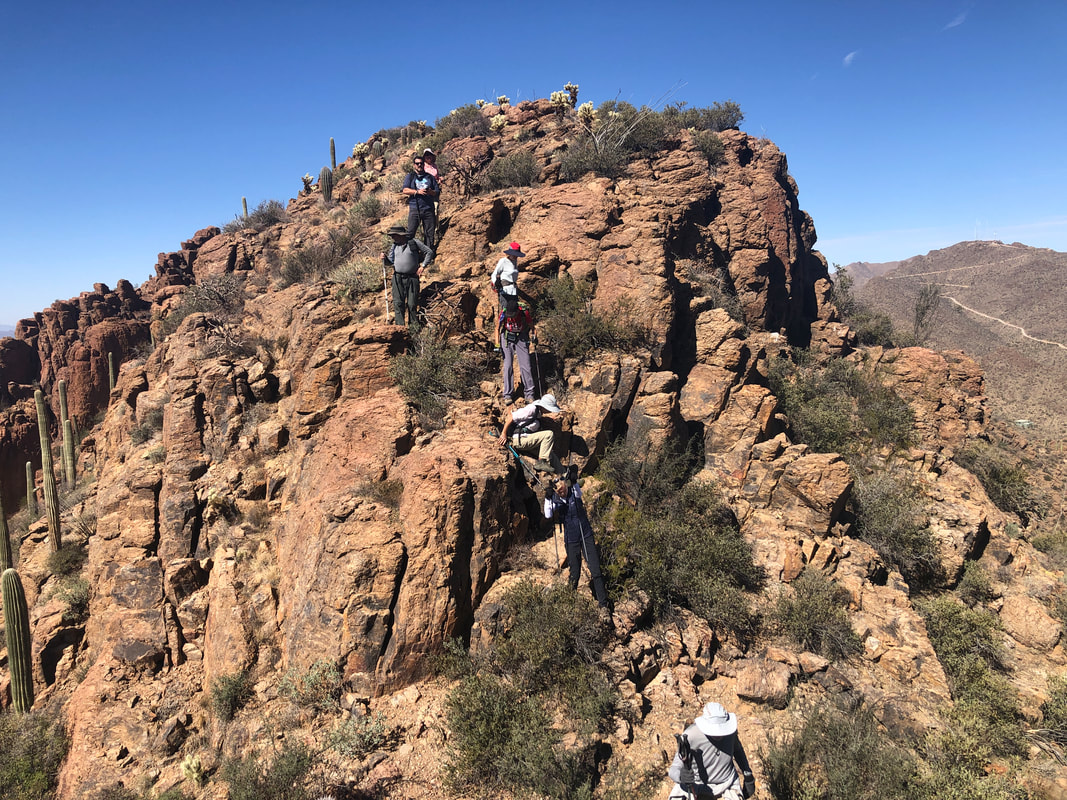 Gloves too come in handy as we pick our way up and down several peaks until we break at the high point. We find the summit registry and sign in before some additional ridge hopping and then.... 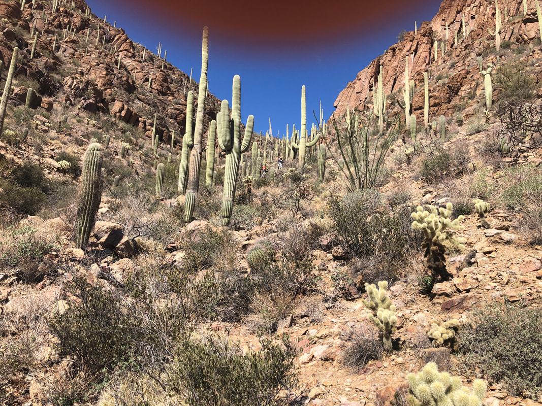 ....descend steeply off the ridge, reach a saddle and then descend a ravine. Once the descent eases, we make our way through one last obstacle..... 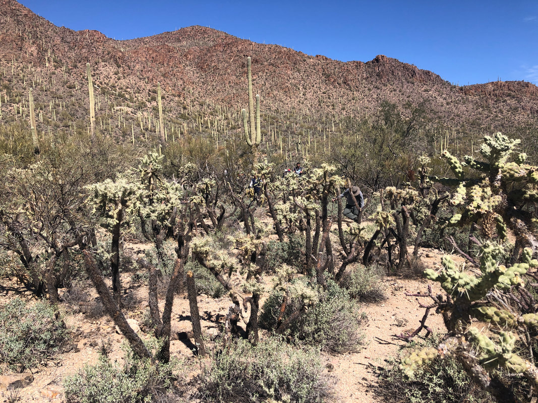 ....a thicket of a variety of nasty cactus. I managed to lead us on a serpentine route until we reached Gates Pass Road and followed it a short distance to the parking lot, finishing our 3.4 mile, 1800' adventure.
0 Comments
 The recovery from the Rattlesnake hike took a couple of days but back on the bike for a 40 mile ride on Monday and a..... 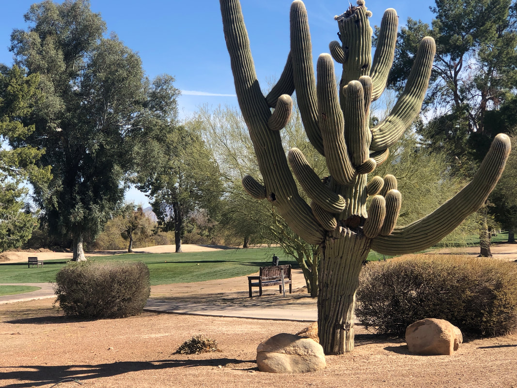 ....40 mile ride on Tuesday. I have a ways to go to get ready for the Planet Ultra, Solvang Spring Tour. The itinerary is below and I know, I know, you're thinking.....  ....Mark, ain't no way you can do that much riding and climbing in a week. I share your misgivings but I've done it a few times. I'll probably skip the climb up Figueroa Mountain in favor of climbing Gibraltar out of Santa Barbara. A classic that one.
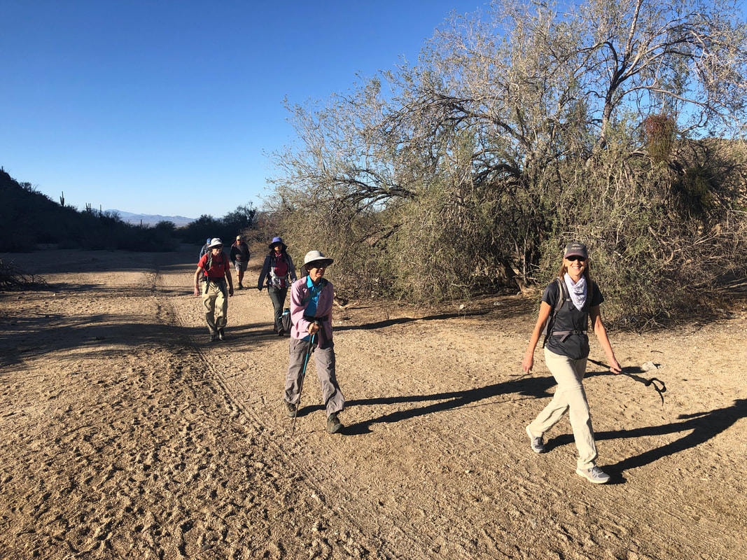
 Our group of twelve gather at the Sabino Canyon over flow parking lot. I had scouted about 3/4 of our hike to Rattlesnake Peak, a few weeks ago and lamented all the time I spent wandering around the slopes. Today, despite the thick vegetation, we got through in much faster time than my earlier solo effort. 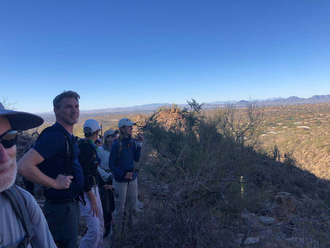 Happy hikers all, at least at this early part of our hike as we enjoy the views. The start temp was around 45 degrees but once the climbing began in earnest, layers of clothing were peeled. 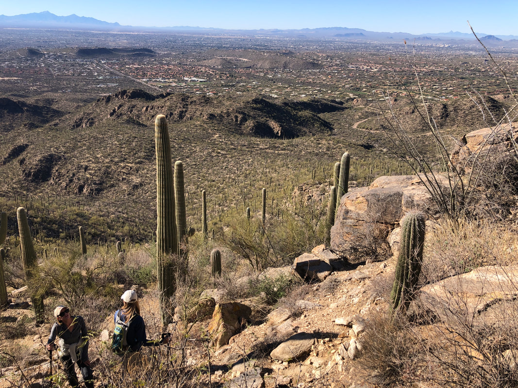 The hike has many steep sections....really steep but all that climbing creates the usual, visual reward. 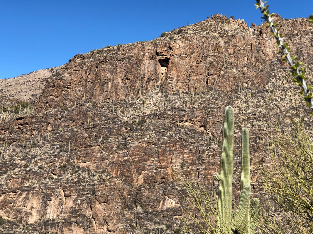 We spot a cave in a distant wall. I claim it is a well known lion's lair. Of course, I have no idea, ha, ha. 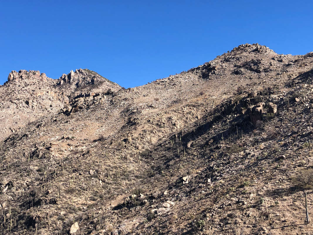 How to differentiate one peak from another? Hike buddy Marc produces his cell phone which has an app that identifies all significant peaks. Rattlesnake is the middle one. At some point, noting a couple of the hikers were lagging a bit, I suggested we climb the lower peak to the right, name if "Rattlesnake Junior" and call it a day. Nope, the hard core participants looked at me like I am an imbecile. 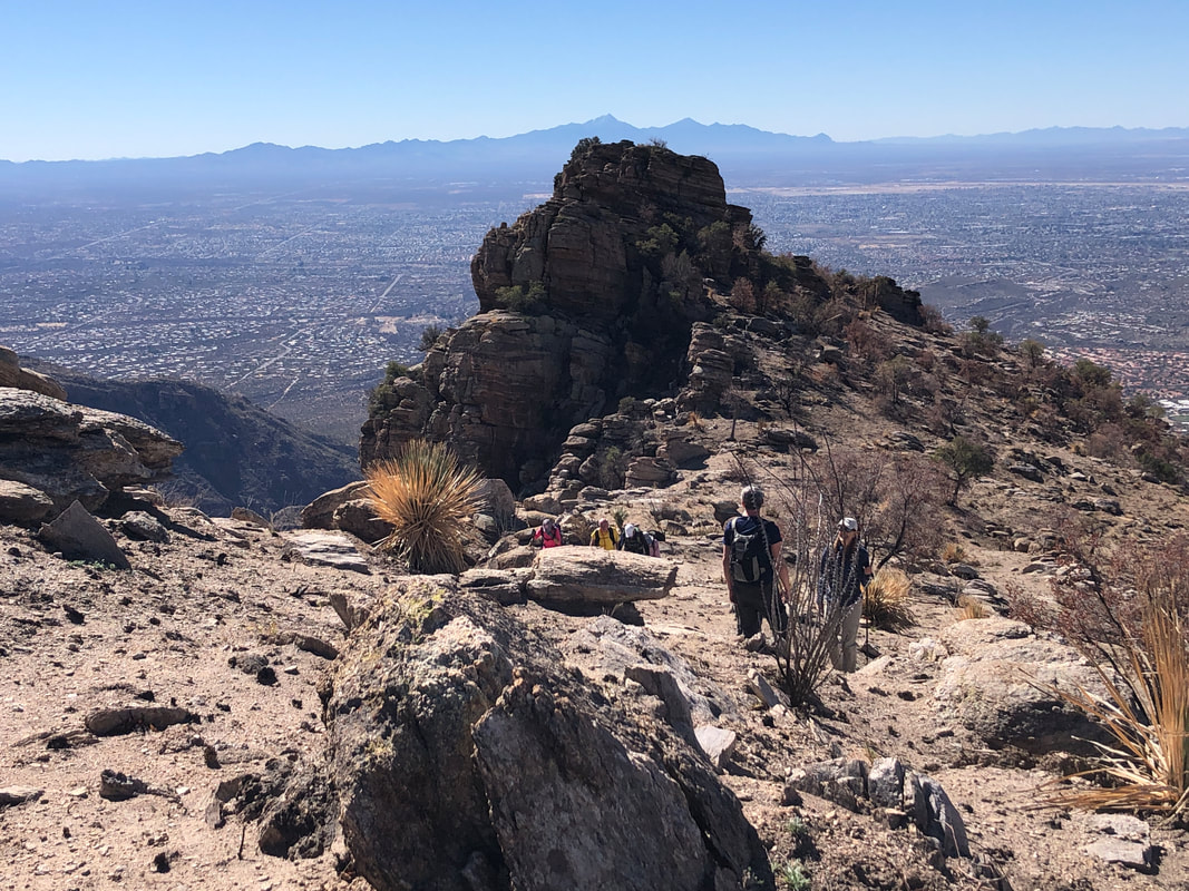 At last, we enter the burn area. While it creates a stark appearance, the hiking is so much easier. 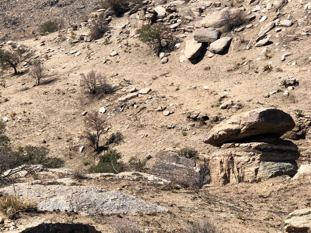 In a canyon to our left, we detect movement and spot a deer. Since the vegetation has burned, it is easy to spot game trails, represented by the slightly lighter brown color strips, criss crossing the slopes.  There are some great rock spires as we ascend. In the distance, Mica Mountain which, rather than snow, is showing the sparkling mica around the peak. 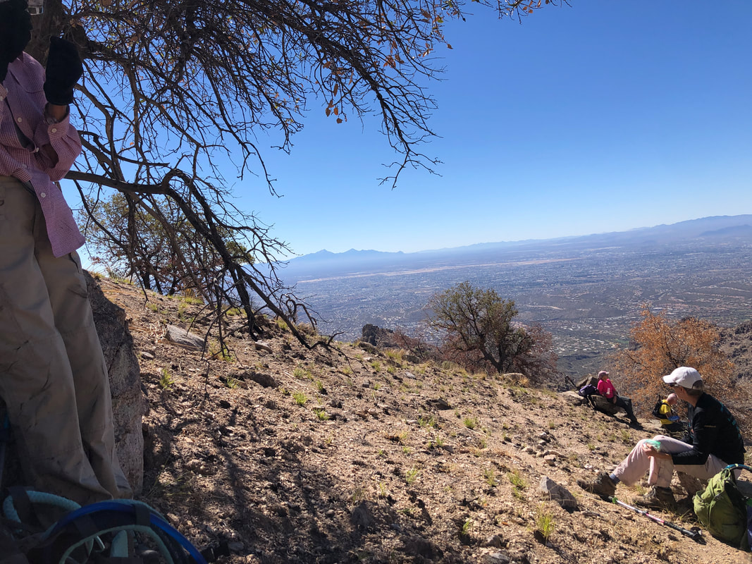 We had become separated from 3 of our group. We decided to take a break and see if they could catch. As we waited, one of them, David, emerged from a ridge above us. Really good thing he had not followed our route exactly because he discovered a hiker, not of our group, out of water and without a cell phone. David gave him a bottle, sent him to hook up with 2 of our group and they all hiked out together although there was some drama during the descent, arguing about which route to follow. All made it back and on the spot, I declared David the winner of the group's "Humanitarian of the Year" award winner. Of course, the incident provoked much conversation during and the day after our hike. Being unprepared will, and it's no exaggeration, get you killed in these mountains. 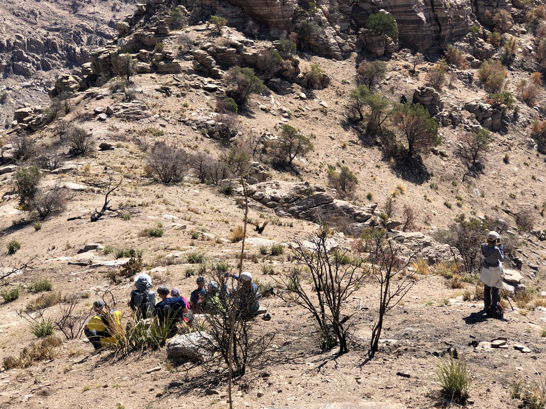 Then, we turned our attention to the reminder of what is a very difficult hike. If we were not ascending slopes having an average grade of 30%, we were traversing them. Above, our group takes a short break as I poke around slightly above. 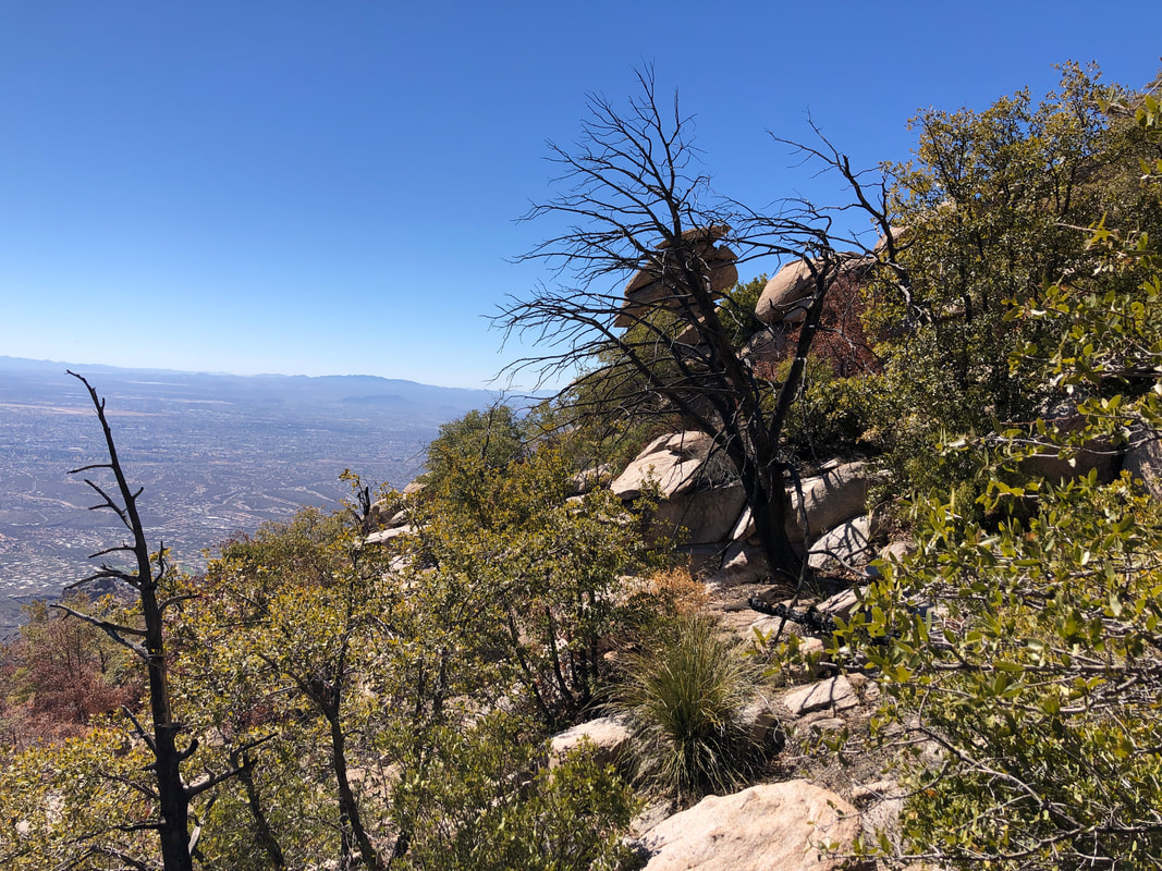 Then the difficulty meter, ratcheted up some more. Same steep slopes but now brush and boulders crowded in amongst us. No trail, just shoving through, backing up, probing elsewhere, over and over. At last..... 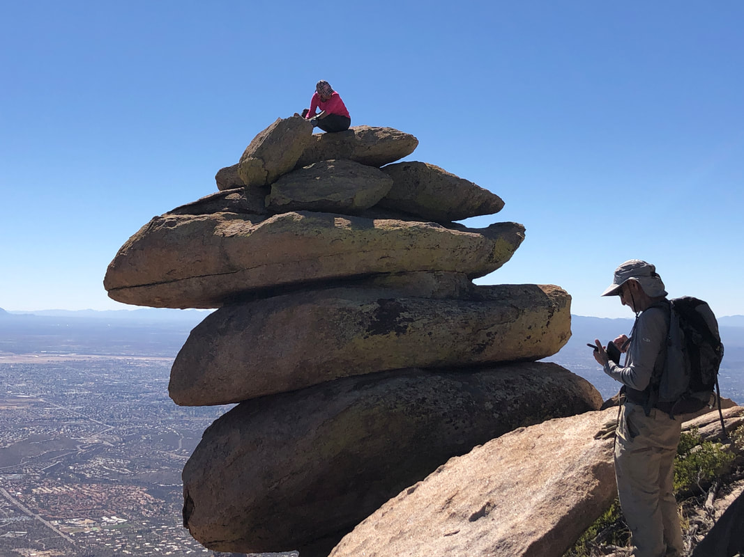 ....we reached what David aptly named, "The Rattlesnake's Tail". Lorna climbed it and being the camera hog that she is, posed like a Hollywood star at the Oscars. ha, ha. She is a wonderful hiking buddy. 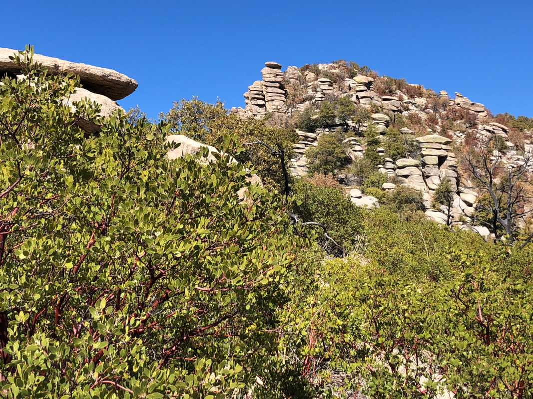 The reason David named it the Tail is because, while not much farther is the peak, the effort to shove our way through the remaining 1/4 mile to the peak (head), would have taken too long. We declared victory and stopped for a short break. 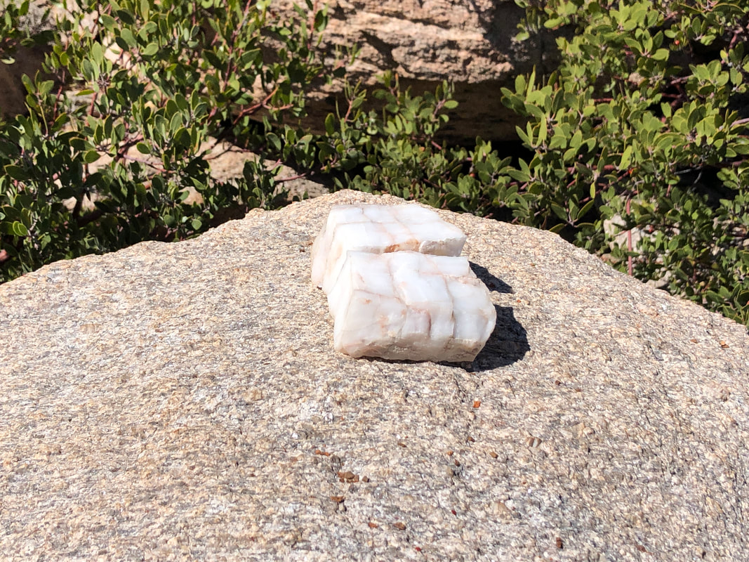 A couple of quartz pieces left on a boulder. 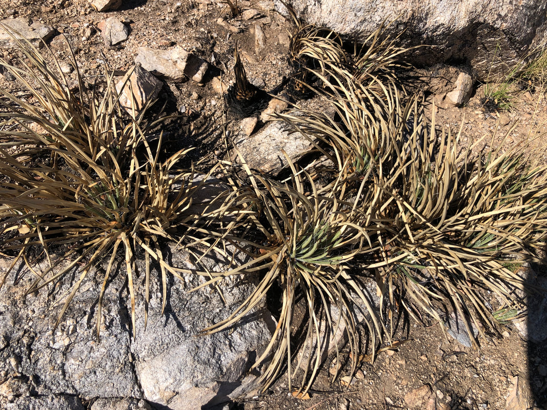 We descended and reentered the burn area. It is with some satisfaction that I observed Shin Daggers, burned. Nasty plants. 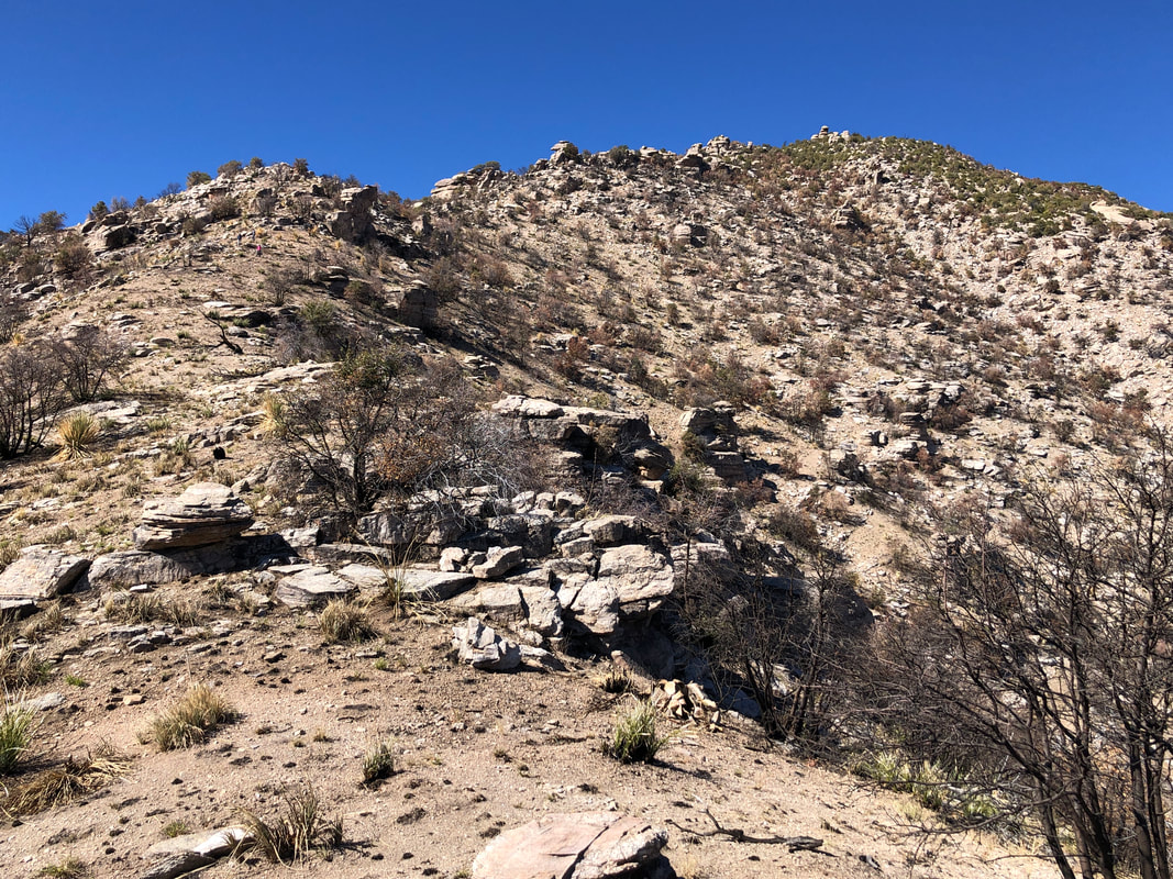 Exiting the brush, it was easy route finding down to a saddle. While you can't identify them, there are 9 hikers in the above image. 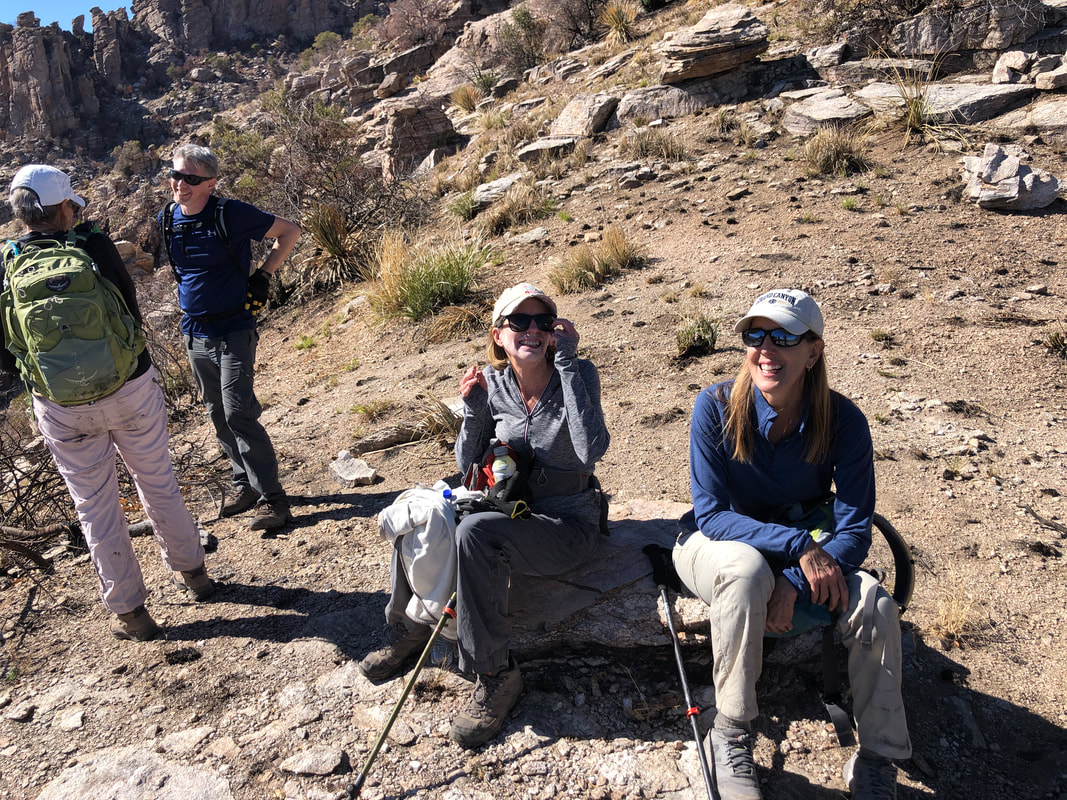 While I was a little concerned about our amount of daylight, I needn't have worried. We took a break but rarely for long as we headed down. 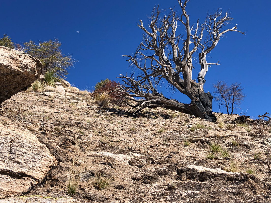 So much evidence of last summer's burn. No one will be impressed with our distance of 8.3 miles but couple that with 4600' of climbing and the bushwhacking....that was a really hard hike. I've been to Cathedral Rock which is the high point in the front range of the Catalinas and judge Rattlesnake, at only 40' lower elevation, to be more difficult. After checking Strava, I saw my hike time was 4:44 but total elapsed time was 8:19. Lol, the life of a part time guide requires some waiting but that is ok. I enjoy providing a few people the chance to visit sights they otherwise would not see.
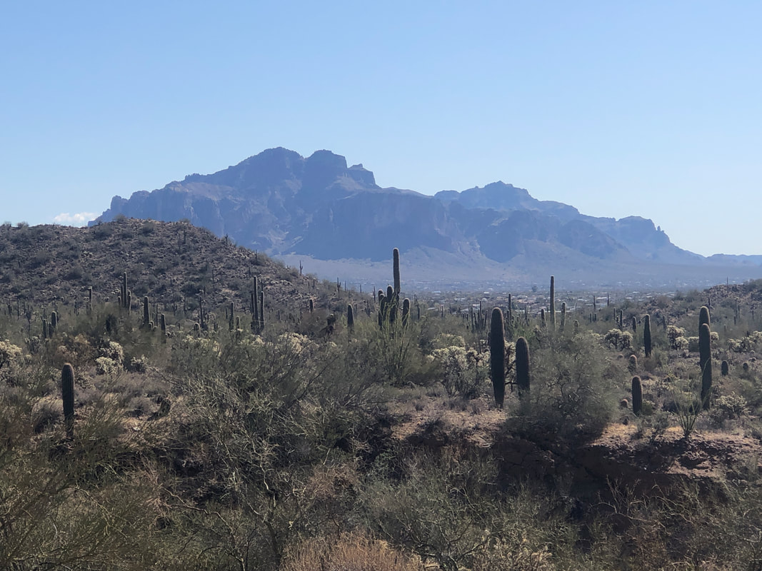 Pass Mountain sits slightly southwest of the Superstitions in the Usery Mountain Park. I drove to one of several trail heads, this one at the top of Meridian Road in Apache Junction. I've read the Pass Mountain ridge line route is a good one but not to do it on a windy day so I decided to try the Pass Mountain Loop trail. 8 miles with 1000' of climbing so given what I have scheduled for this Friday, not too strenuous. In the distance, the western end of the Supes. 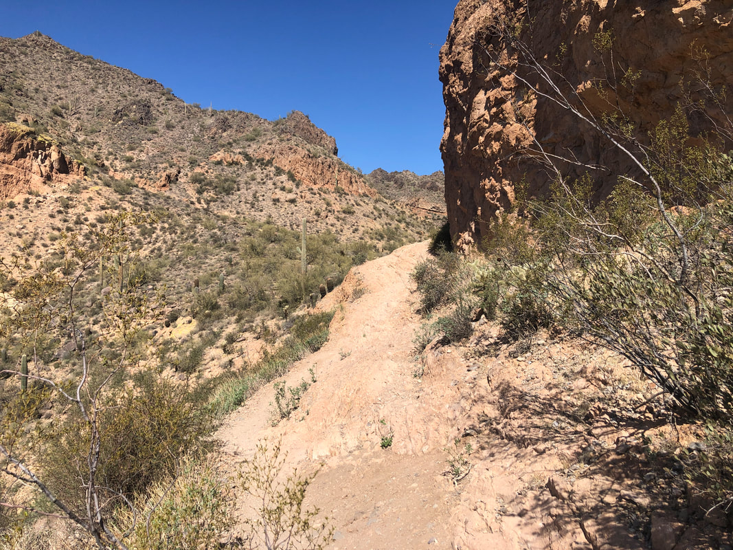 From the Meridian trail head, there is no signage nor did I encounter any for over half of the hike so have a gps track for reference. You'll discover several trail intersections that will leave you confused at times. The trail climbs almost 2 miles to a pass from where.... 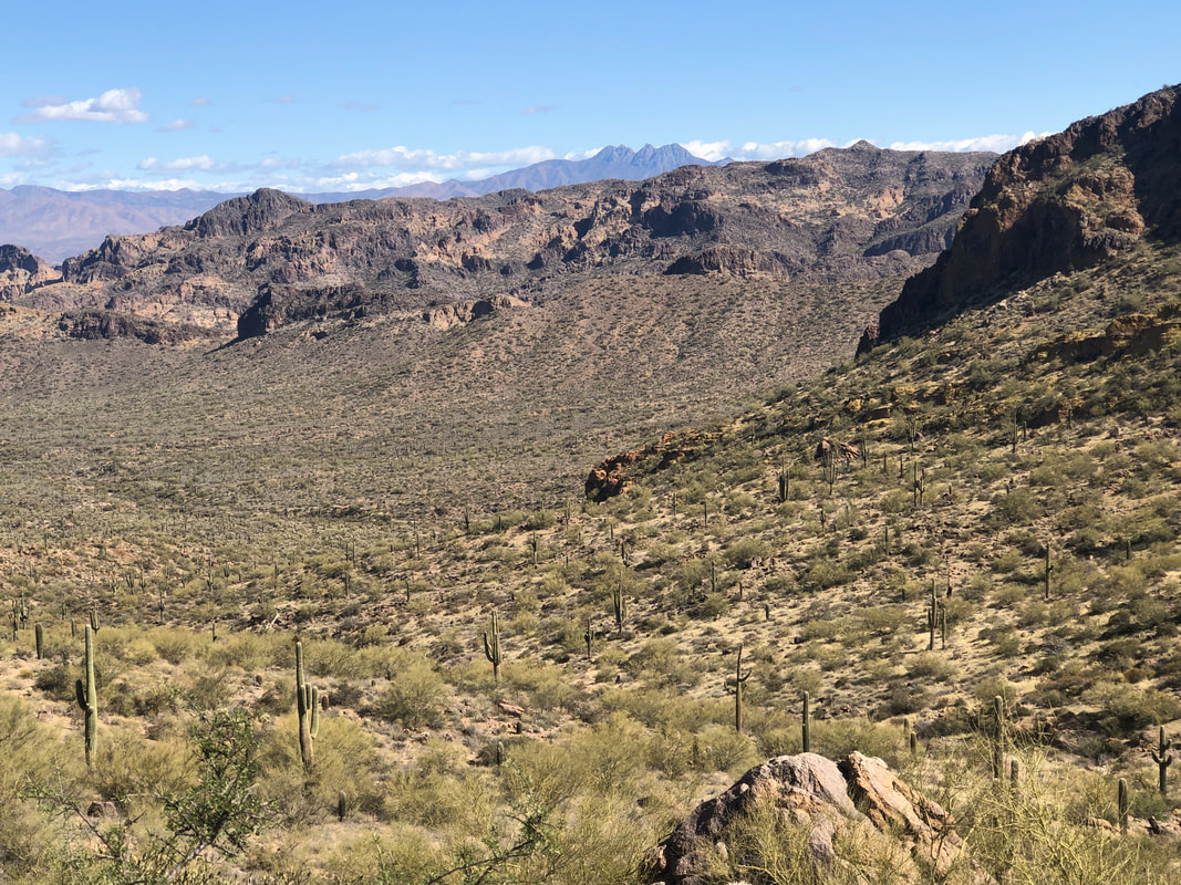 ....the views are great, including the Four Peaks. 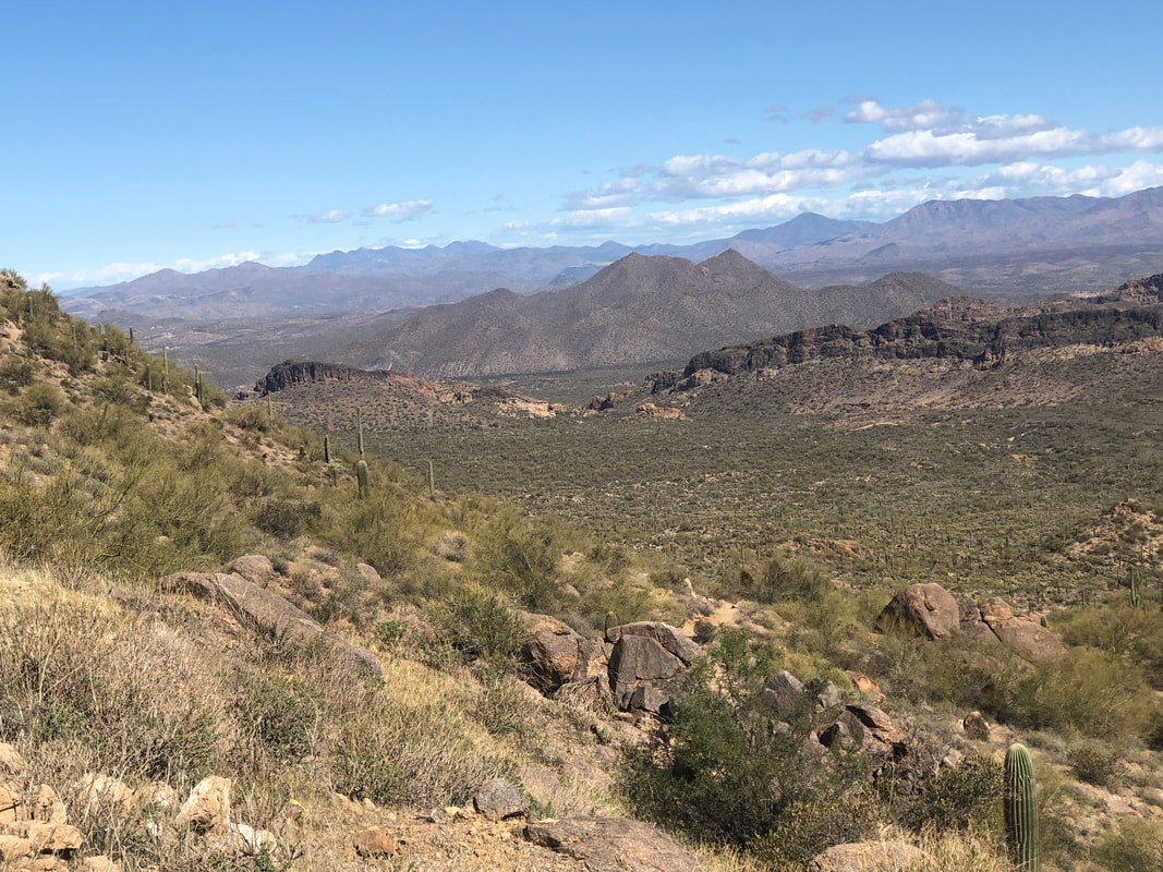 From the pass, rather than dropping down, the trail.... 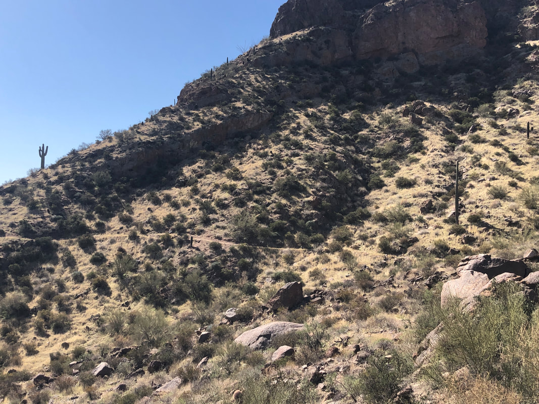 ....stays high and traverses the slopes. 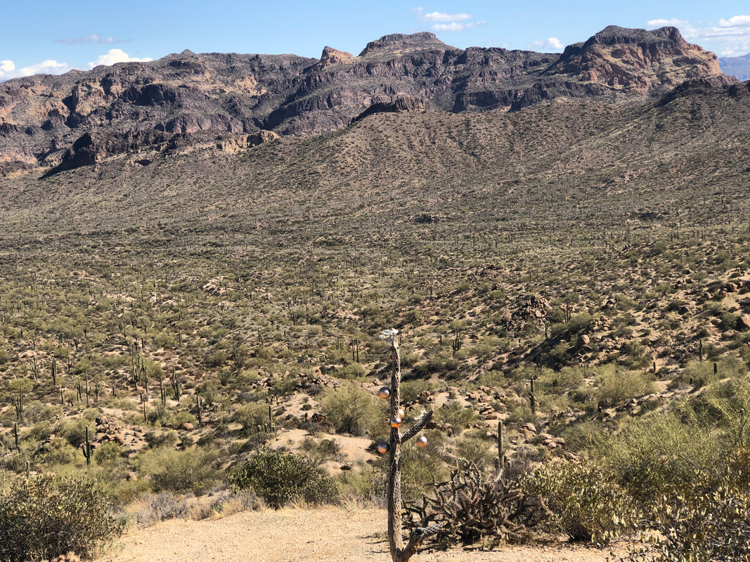 Someone hung Christmas ornaments on a cactus in the foreground. 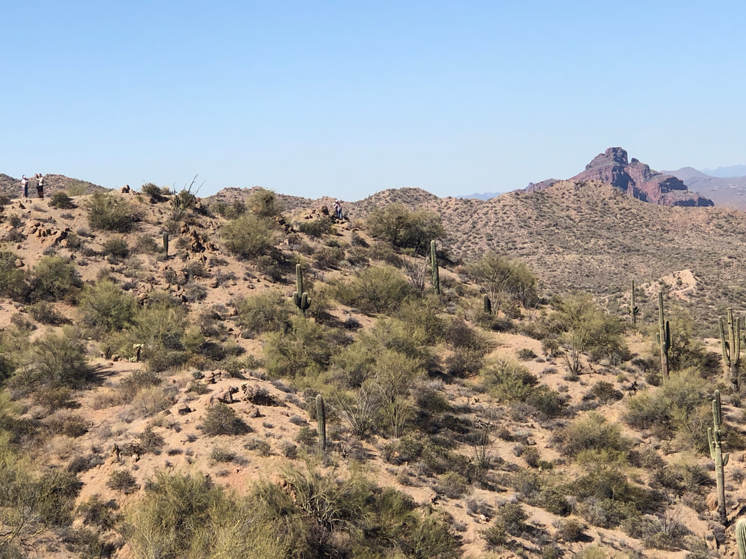 The trail descends slightly and eventually I reach a broad area with more good views where I talk to a couple of hikers. 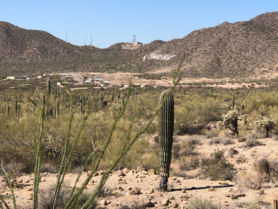 The trail descends in earnest and rounding a corner I can see the "PHOENIX" directional sign on a nearby hill side. 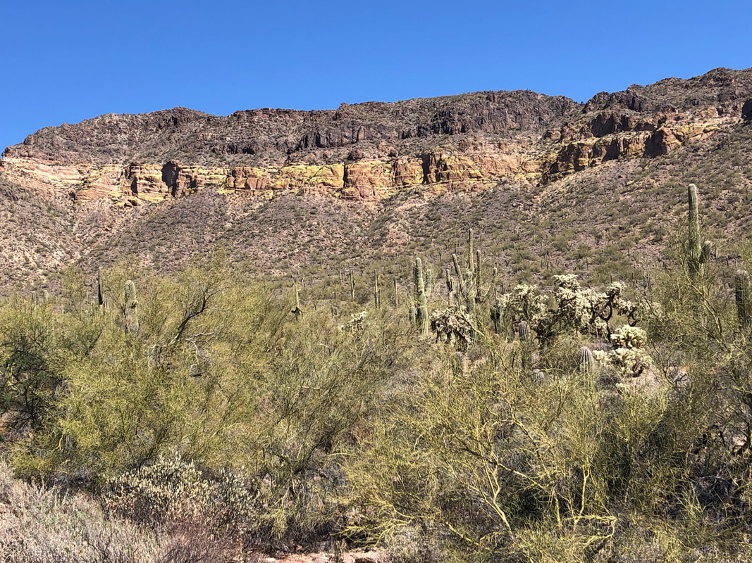 Continuing, I reach the Wind Cave trail head where there is a steady stream of people making the 1.5 mile mile climb. The cave is somewhere at the bottom of the cliff band. 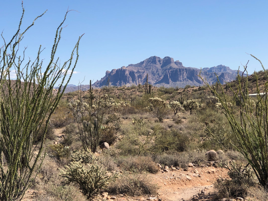 Nearing the end of the hike, the sun has changed the appearance of the Supes from how it looked 2.5 hours earlier. This is a good hike and worth doing but probably not again. Portions of the trail are runnable so you can motor around it faster than your normal pace should you want to.
 Since I began organizing group hikes a couple of months ago, the hikes tend to be on the adventure side of the equation, with distances in the 8-10 mile range. With 3300 members in the group I thought I'd organize a shorter, slower hike to see if that appealed to a different crew. Ahhh, no. Only 3 of us showed up and as I was walking, I realized I wasn't getting much cardio benefit so not to be selfish but that's the end of that little experiment. 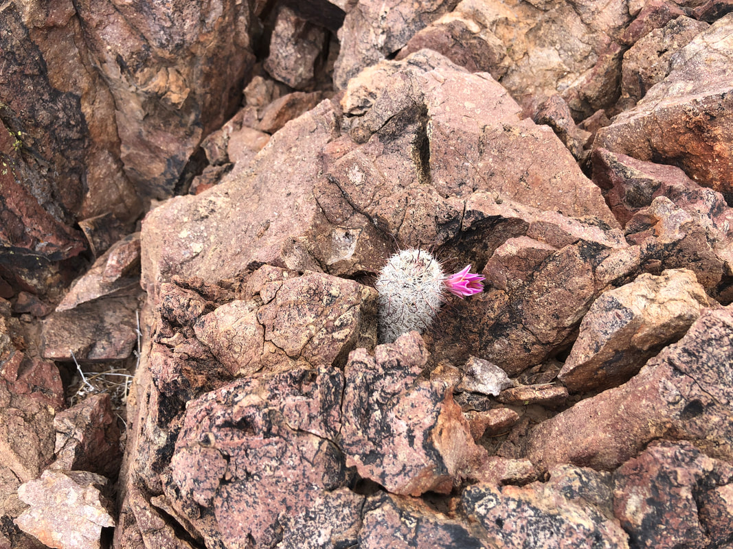 Today's hike was around and over Brown Mountain. I had time if not to stop and smell the roses, to stop and take pics. Well gang, it's been a good winter for hiking but the upper 70's and low 80's are right around the corner. I've signed up for a cycling camp in So Cal for March so I need to put in a bunch of bike miles before then. Don't worry, will still hike, just amping up the saddle time.
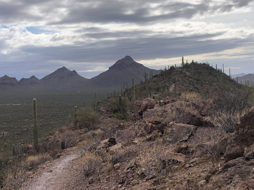
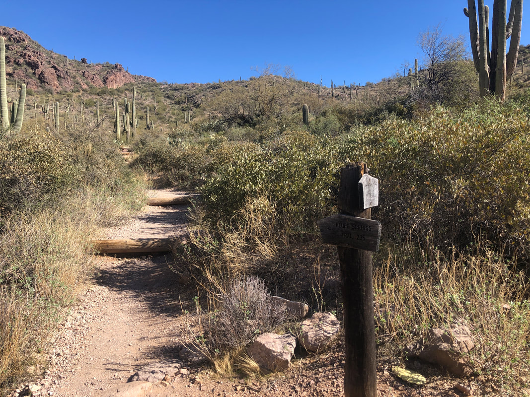
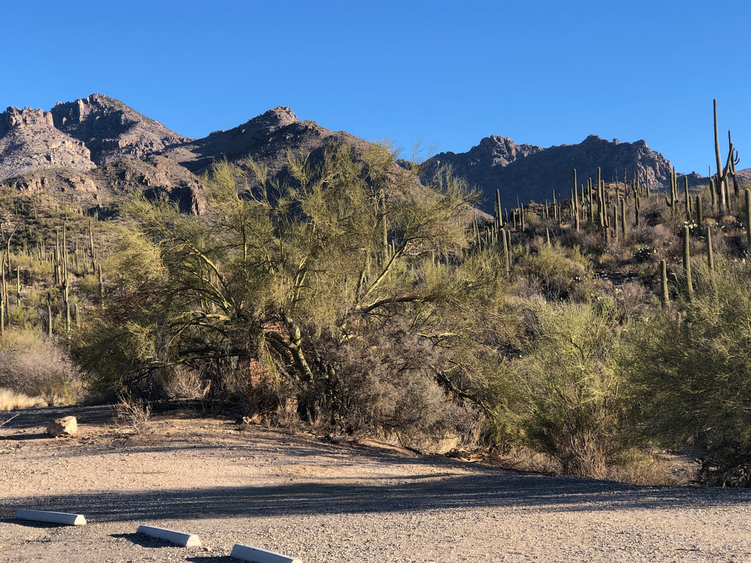
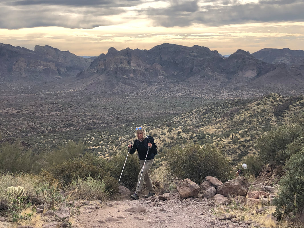 Wow, clouds? Our group of nine, ascend the Bluff Springs trail. At mile one, I show the group a faint trail coming in from the left, the Cave Trail. So named because there are several caves along its 1.5 mile length. I should have never mentioned that as throughout the hike, while not on the Cave Trail, I was asked, "Where are the caves?" or "Is this where the caves are?" ha, ha. 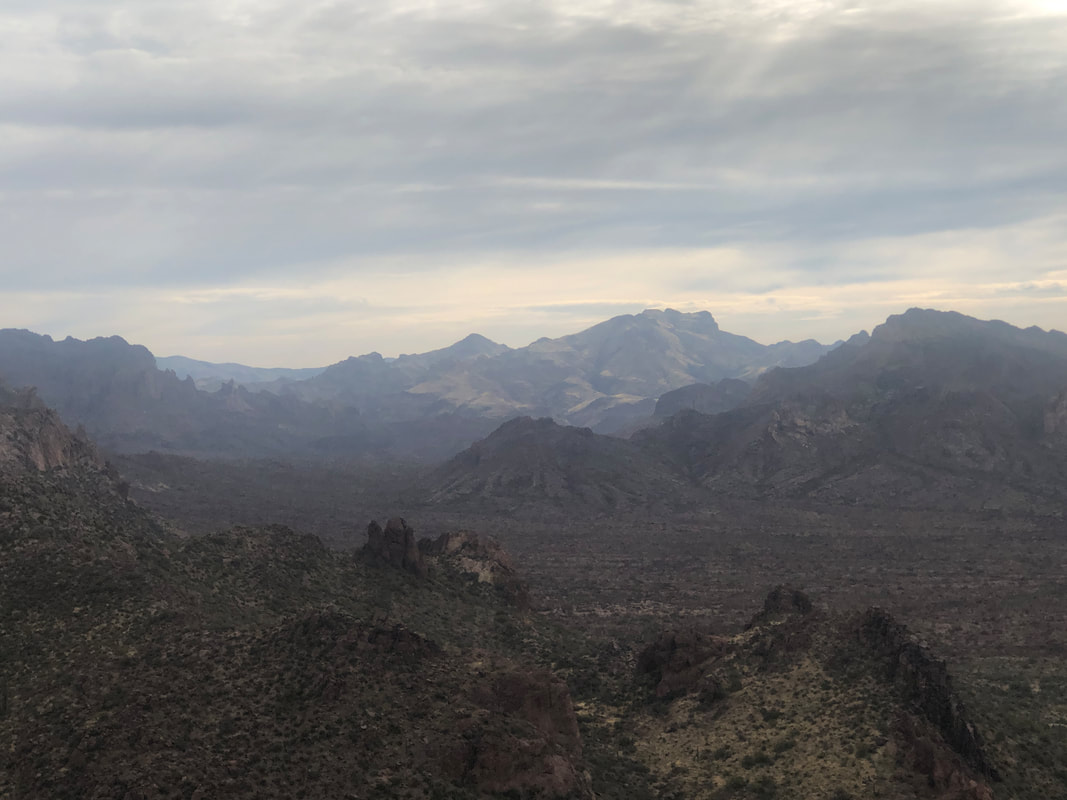 The usual brilliant blue sky is covered for part of today although the clouds add some drama to the scenery. 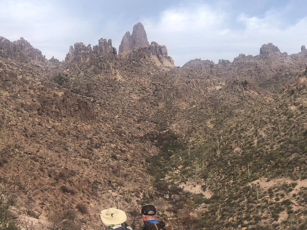 After 1.5 miles of hiking, we descend Bark's Canyon where the fire damage is extensive. At least the vegetation at the bottom of the canyon remains. Weaver's Needle in the distance. 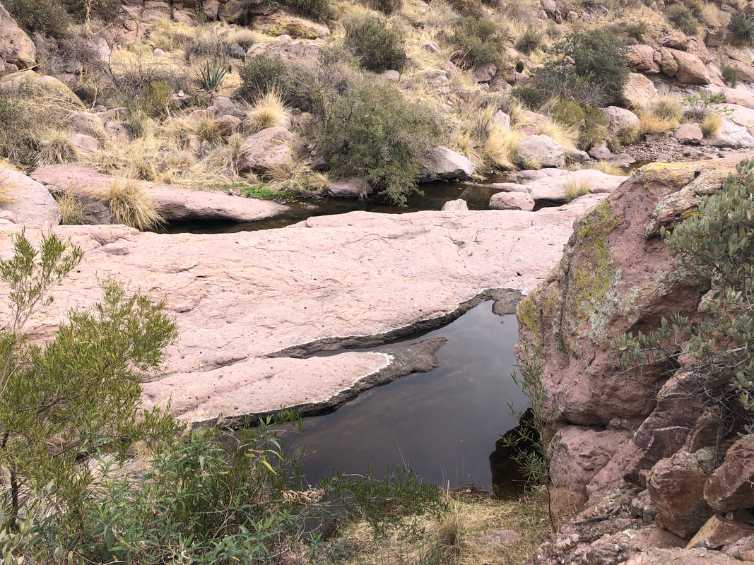 Water is flowing at the bottom of Bark's Canyon. We ascend to a ridge, drop down into.... 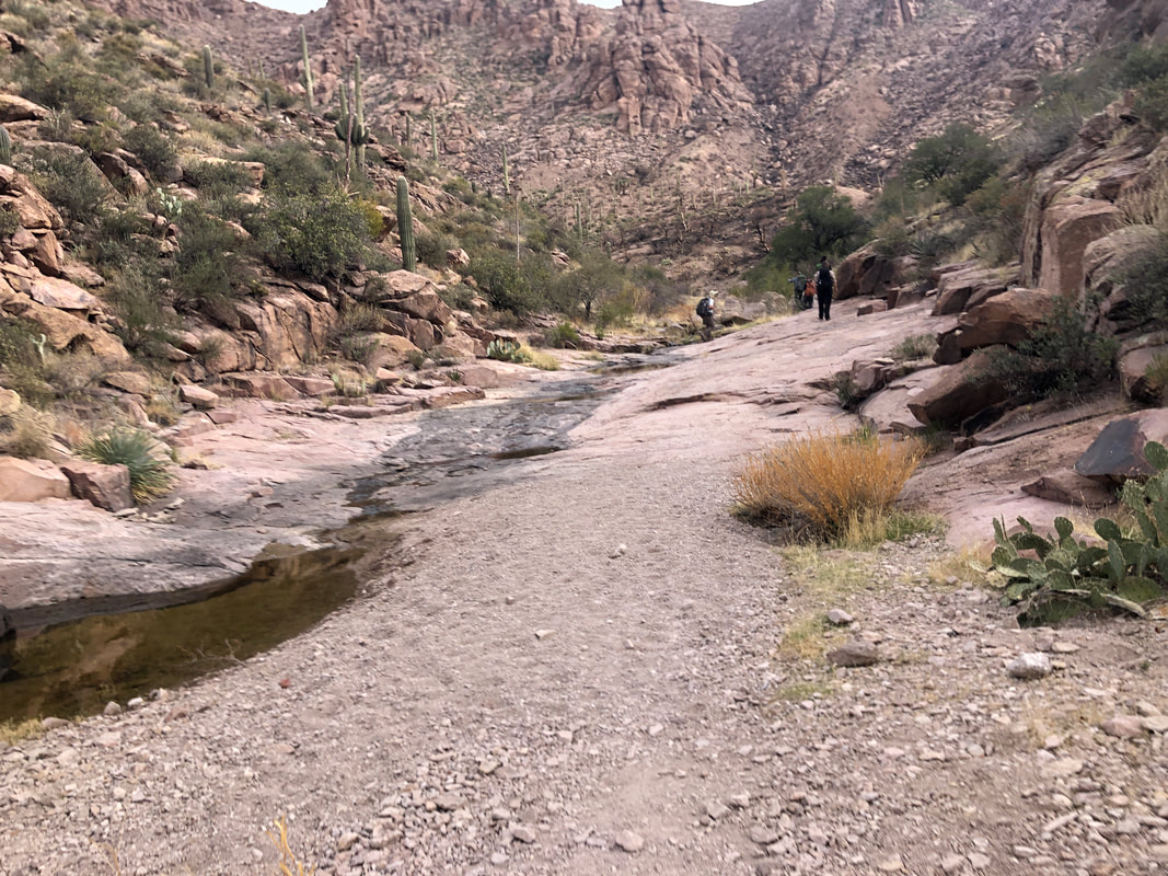 ....another canyon having a broad rock base with another stream. Really beautiful place. I look for a boulder on which miner A.R. Peralta had inscribed his name and.... 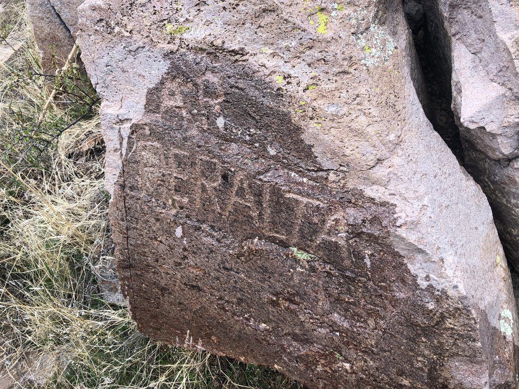 ....find it. I opened a water bottle and poured it over the surface to enhance the viewing pleasure of the group. Only then did I think, "I just poured half a bottle of my water over that boulder. That's really stupid." Especially with water flowing through the stream bed a step away. Fortunately, I still had plenty at the end of the hike. 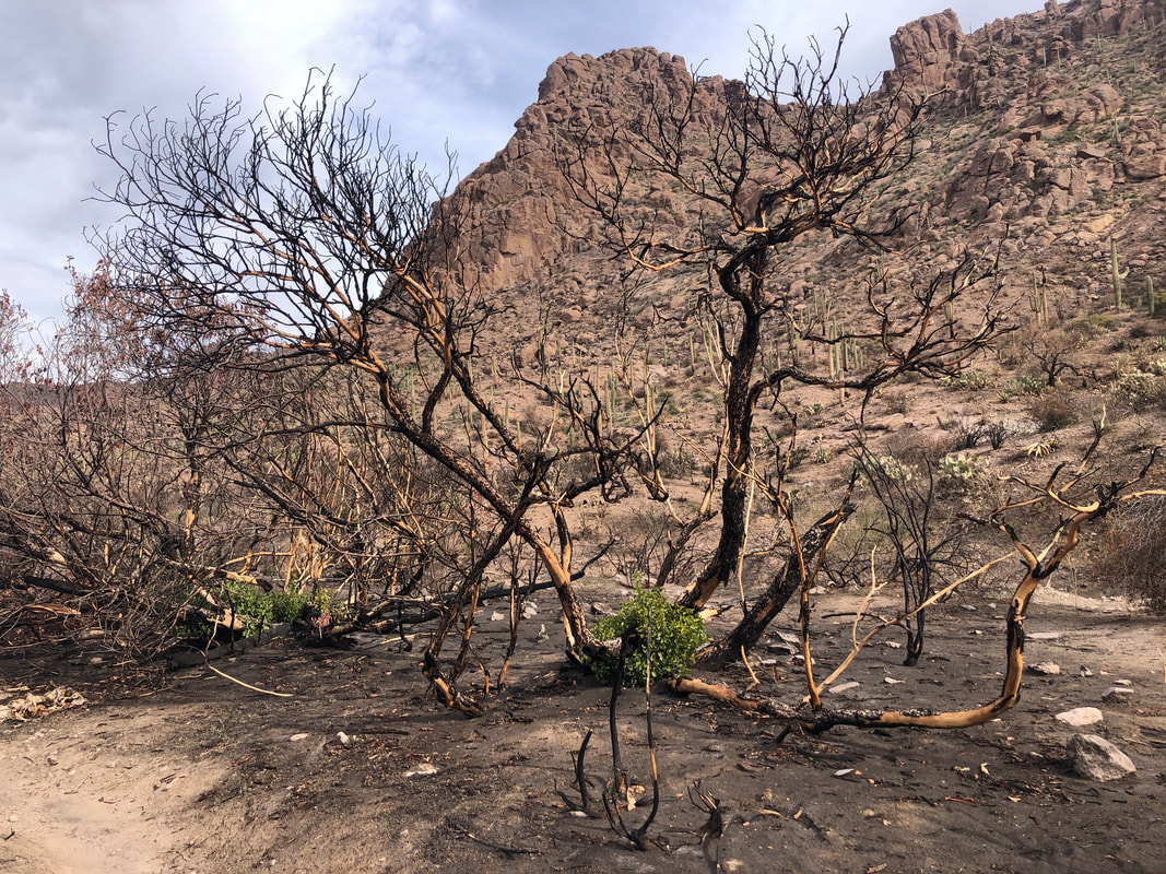 The skeletal remains of burned plants but the roots survive and already, green shoots have emerged. We ascend out of this canyon and take a break at a ridge. 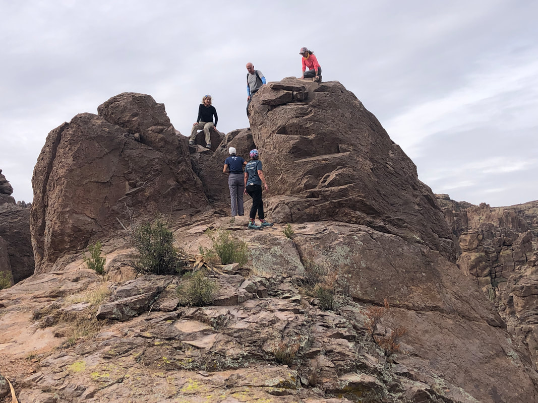 During the break, most of us explore a nearby formation. 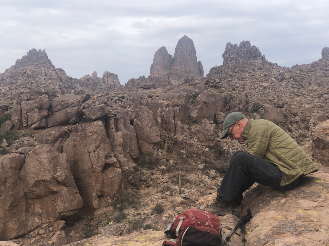 David takes a break as the Needle continues to, if not dominate, at least almost always present itself in the distance. 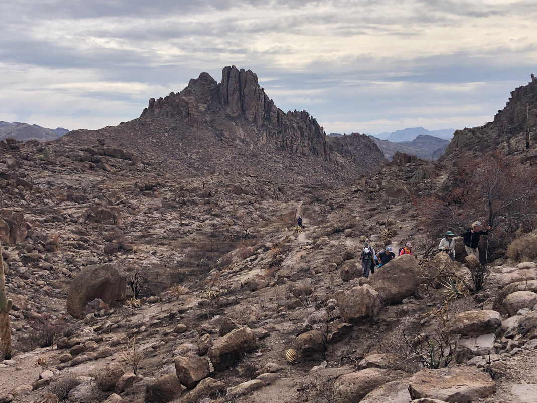 I know to look for a left breaking trail at mile 3.1. I'm at 3.5 miles and a tad anxious that I may have missed the trail. About the time I decide I did miss it and will need to announce the embarrassing news to the group, at 3.6..... 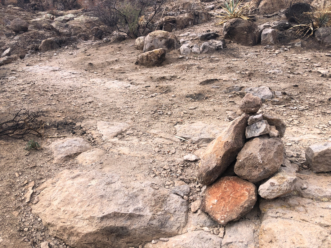 ...whew! There it is. I had parked a distance from the trail head so that added enough to the hike to skew the trail find an extra .5 miles. Now on the unsigned, Weaver's Needle Crosscut Trail, we soon see.... 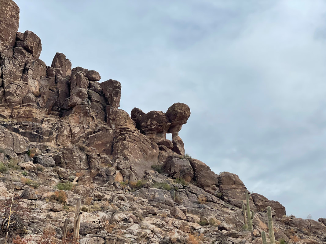 ....the standing lion formation, upper right. The walk through Needle Canyon is typically.... 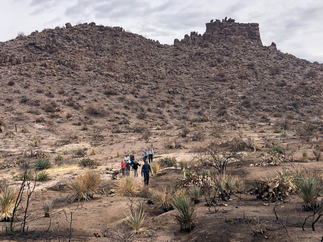 ....beautiful and it still is but so different. With all the brush burned, our attention is turned to the surrounding rock spires and other neat features, much of which would normally be obscured. 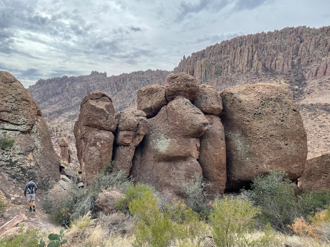 We reach the saddle below Weaver's Needle. There is an option to take a cairned route to get a closer look at the Needle as from our vantage point, it is completely hidden, but I opt not to go. Our hike is taking quite a bit longer than I anticipated and that would have added a good 30-40 minutes. The wind is rather strong so I suggest we descend to a warmer and more sheltered location. The descending route through the boulders is no longer cairned and I am glad I have been through here a few times. The notch toward which I am walking, above is not at all obvious as part of the route. On the other side.... 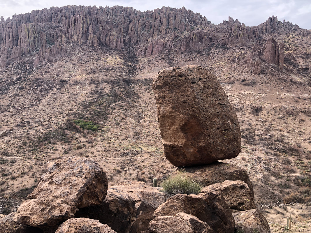 ....a giant boulder balances with an awesome background. 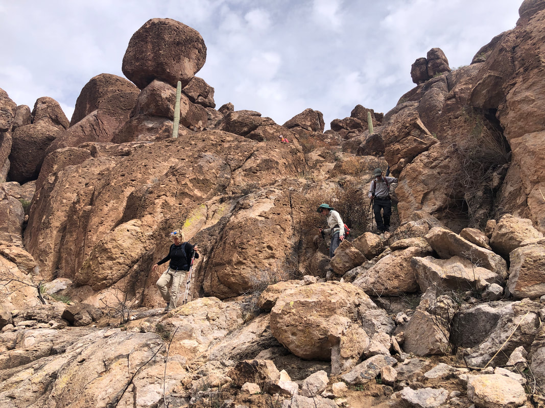 The descent is rather sketchy but a fun, bouldering experience. Reaching the Peralta Trail, we regroup and make a left. 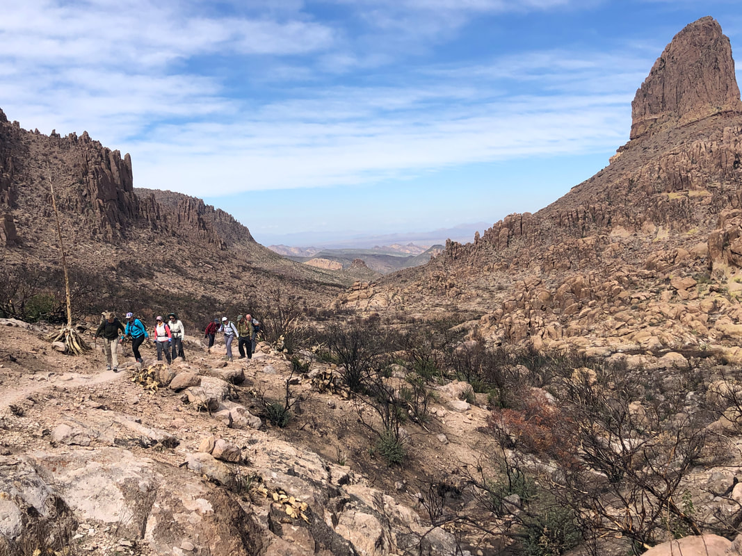 The clouds have begun to shift out of our vicinity and the sun feels great. Reaching Fremont Saddle, we have the option of descending the very busy and boring Peralta Trail or descend via the exciting Cave Trail. 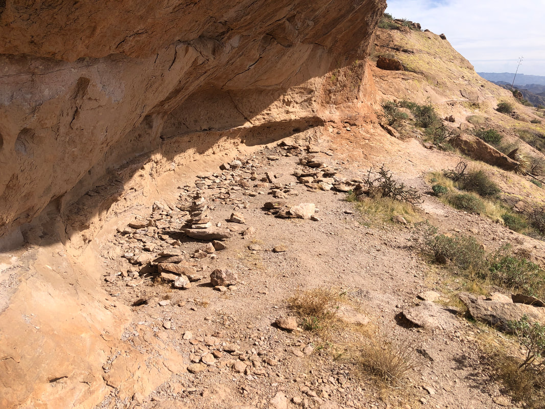 The caves, some shallower then others, are plentiful. Here again, because of time constraints, I had to bypass one section higher up that had some nice cave examples. A couple of our members chose to visit and glad they had the opportunity while I escorted the others through some challenging route finding that included... 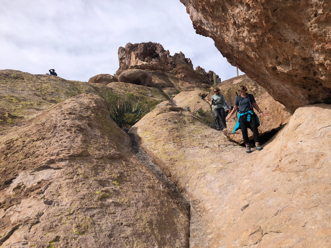 ....descending several steep drainages, visiting the Devil's Bathtub (see last week's report for details) and of course..... 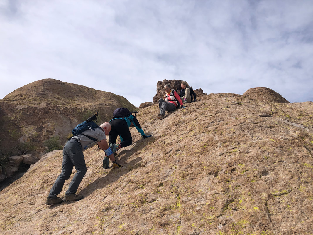 ....down climbing the wall. I guessed the grade was 40% and later checked and it was 41.5%...that's steep and a couple of us had some issues but Marc was always there to assist. Hey! I could have but I was taking pics and offering verbal encouragement, "You're not going to make it!" The experience was complicated by wind gusts reaching 30+mph. After 1.5 miles, we reach the Bluff Springs trail again and.... 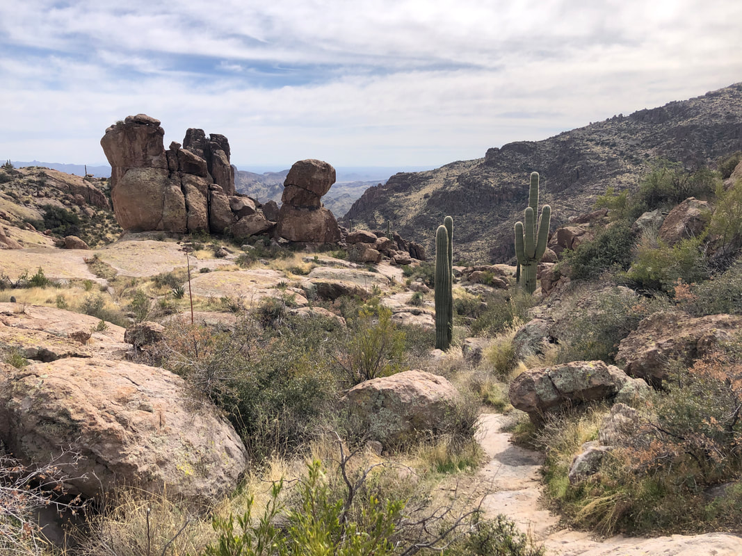 ....descend to our cars. I finished with 9.5 miles and 2400' of climbing. I badly missed my estimated overall time (4 hours) by a bunch (6) hours. I need to build in more time on future, adventure type hikes like this one.
 A group hike I organized for this Saturday, had us hiking down the Peralta Trail, which I have done way too many times. Above Peralta is a little known alternative, the Cave Trail. Been a few years since I hiked that and on-line descriptions were alarming enough that it undermined my route finding confidence. At home on Thursday, I thought, "Well damn. I better check it out" so here I am, ascending the Bluff Springs Trail. 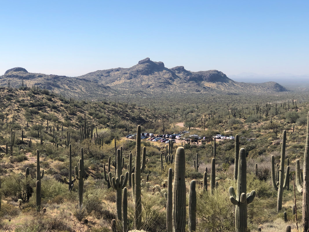 Bluff Springs is a rapid elevation gain type trail, ha, ha. Looking back I see the parking area and soon, gain a ridge with.... 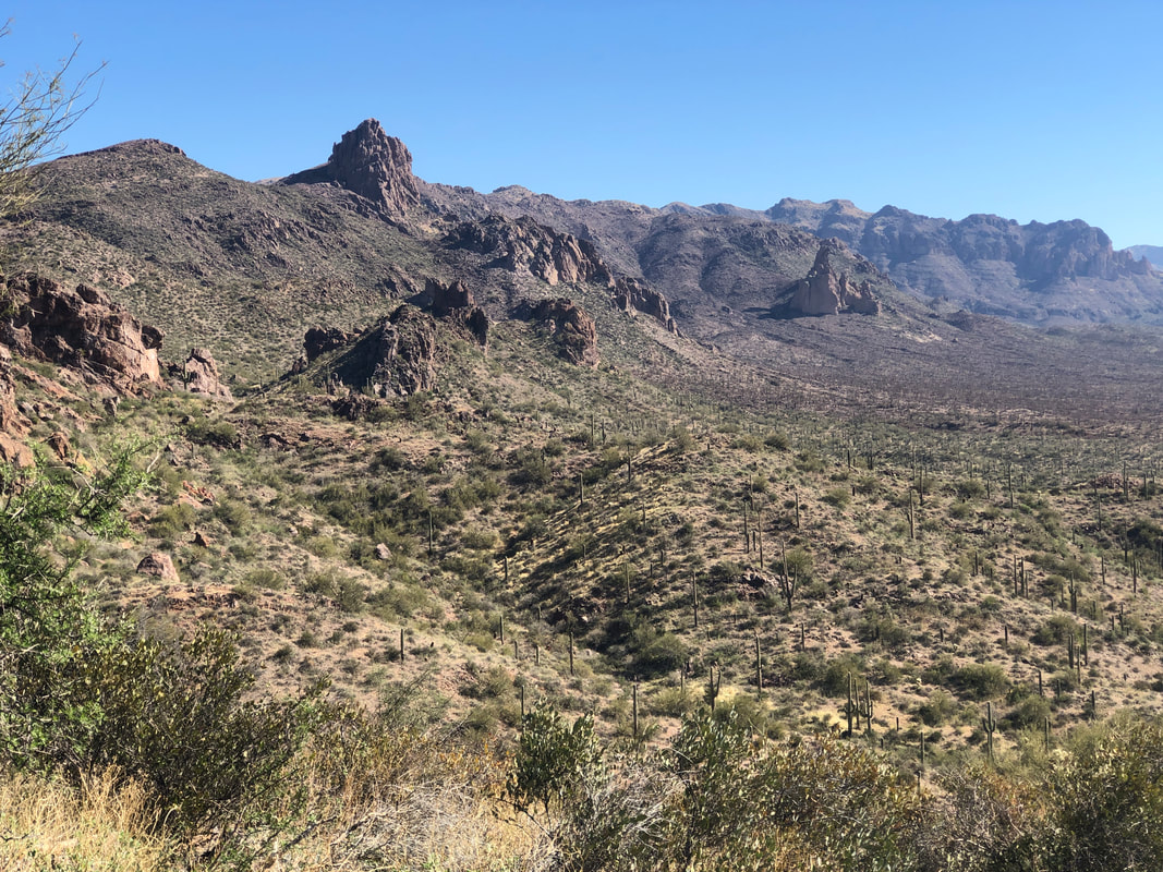 ....awesome views of the interior of the Supes. The Cave Trail breaks left off Bluff Springs and is more obvious then the last time I hiked it. I caught a foursome who only had a vague idea of where they were going. I gave as much information as I could to help out. 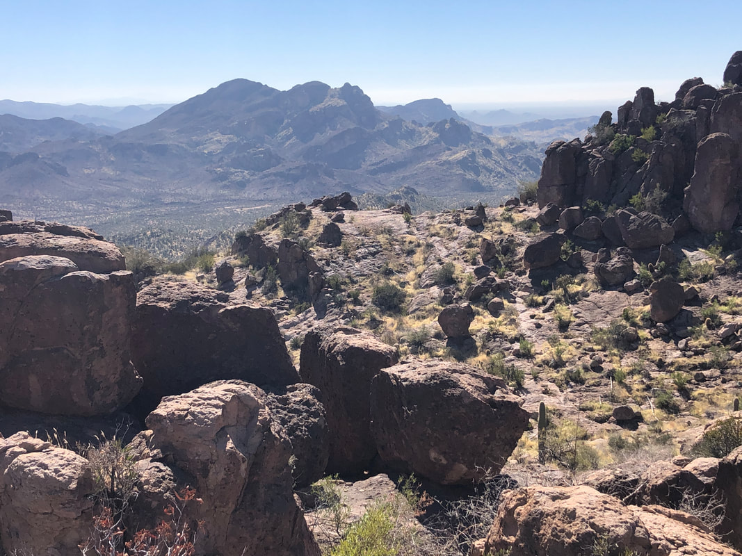 I heard them discuss their plans, which included following me. After climbing a bit, I watched to make sure they did not follow my route. They never would have made it.  Sometimes, people have placed objects on a breaking right or left trail to keep me on the correct route. Probably all trails lead to the same place but who knows? I tried not to check a gps route I had on my phone as I enjoy the route finding challenge but a couple of times, I had no choice. 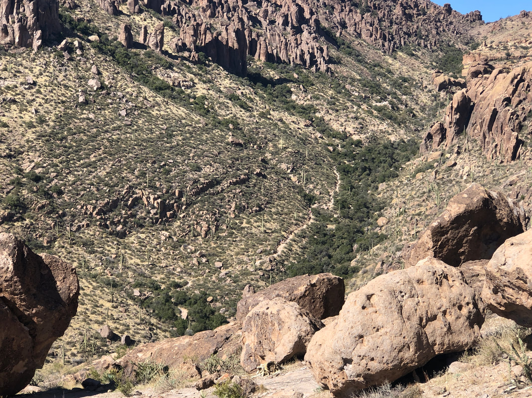 One of the many nice things about this route is while I am hiking in solitude, far below me, the masses hike the Peralta Trail and we're all going to the same destination; Fremont Saddle. 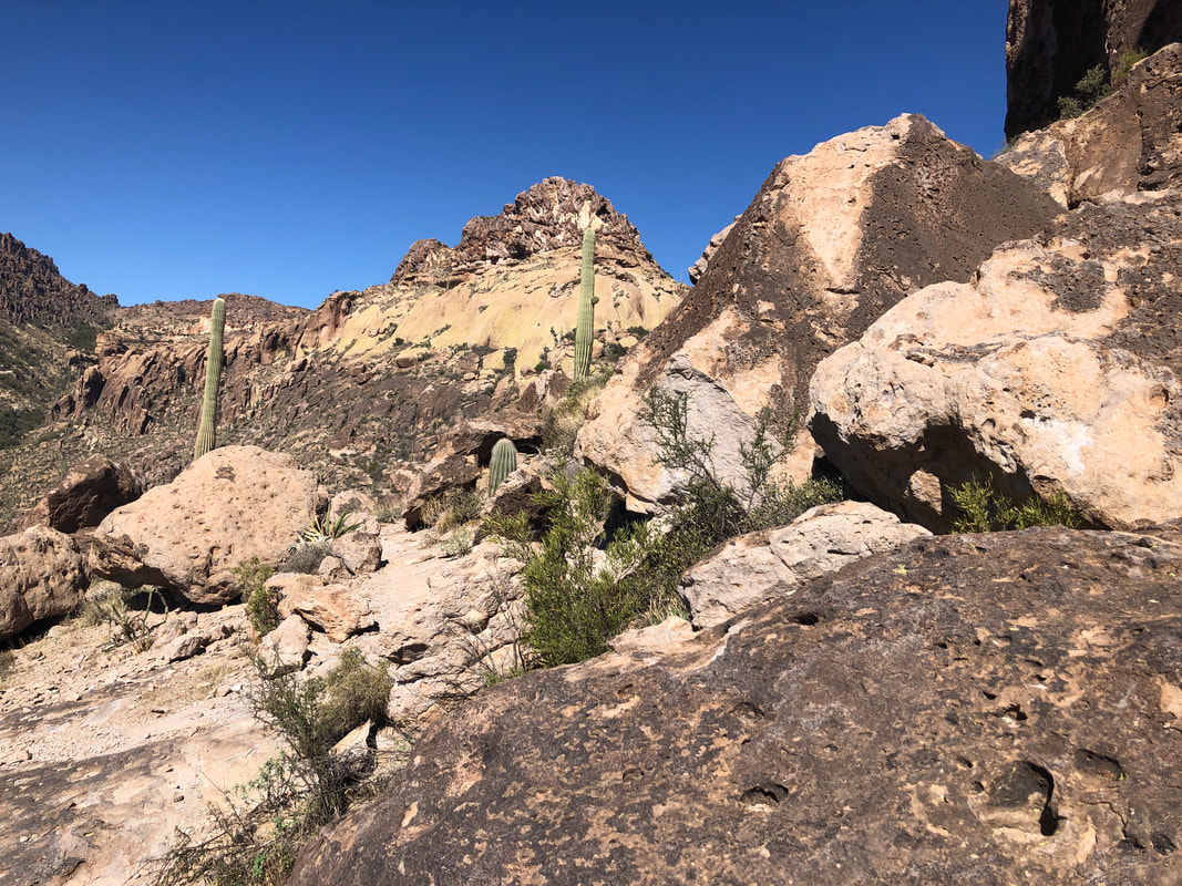 I remember from a prior visit that the dome in the distance is the mid hike objective. The challenging route is up the ridge facing me. There is a less challenging route to the right. Soon, I arrived at.... 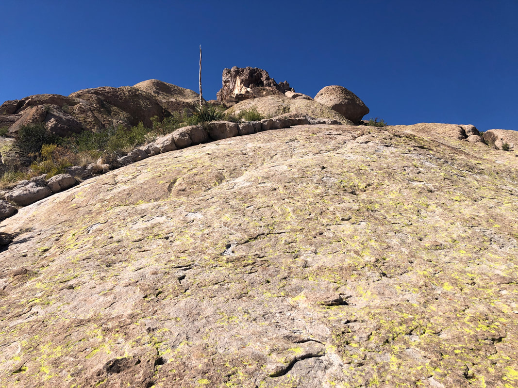 ....this. Rarely does an image accurately capture the slope but this one does. There are enough pockets on the surface to make the wall climbable. This was one time I checked the gps route as I walked to the right and left but nope, ya gotta go up this. Once I reached the top I realized.... 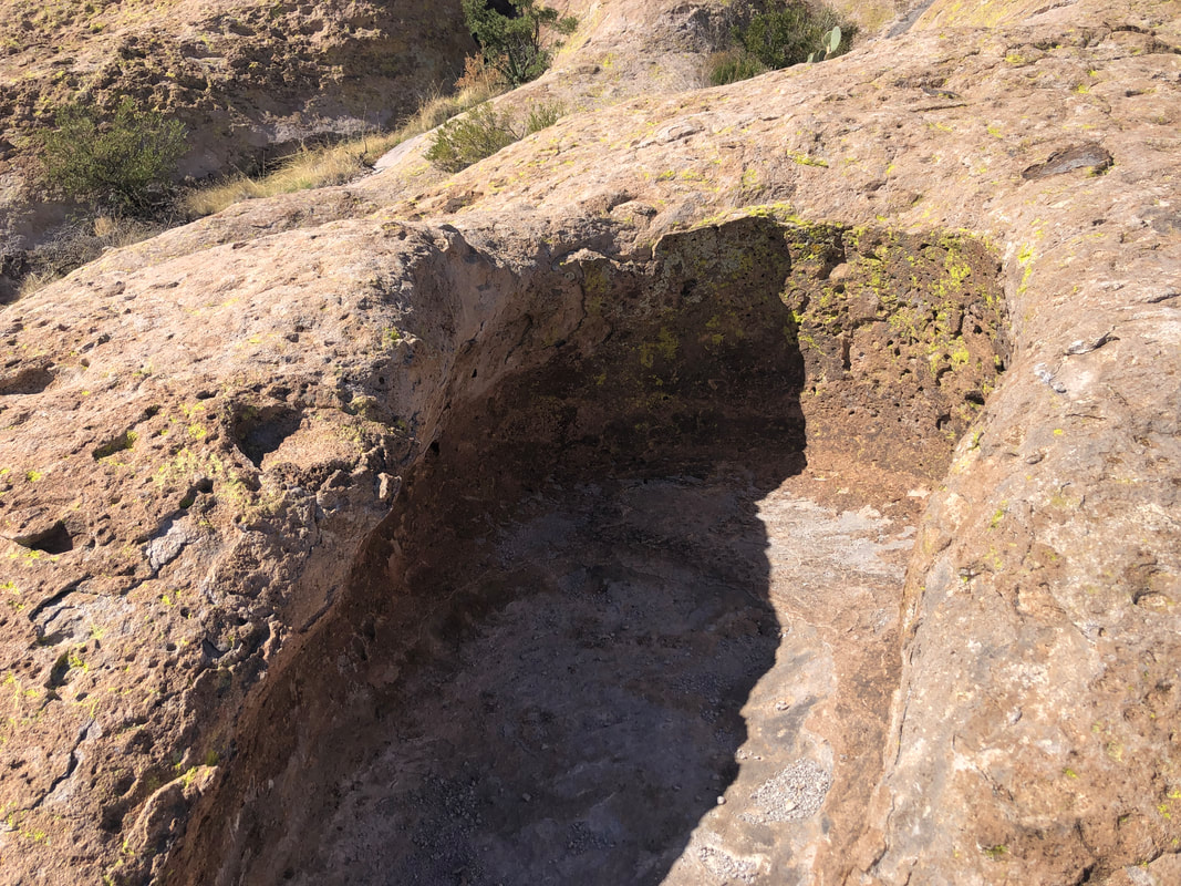 ....yep, this is the correct route as I encountered the "Devil's Bathtub." This brought a sigh of relief, confirming I was on the same route as I previously hiked and understanding, the worse was over. 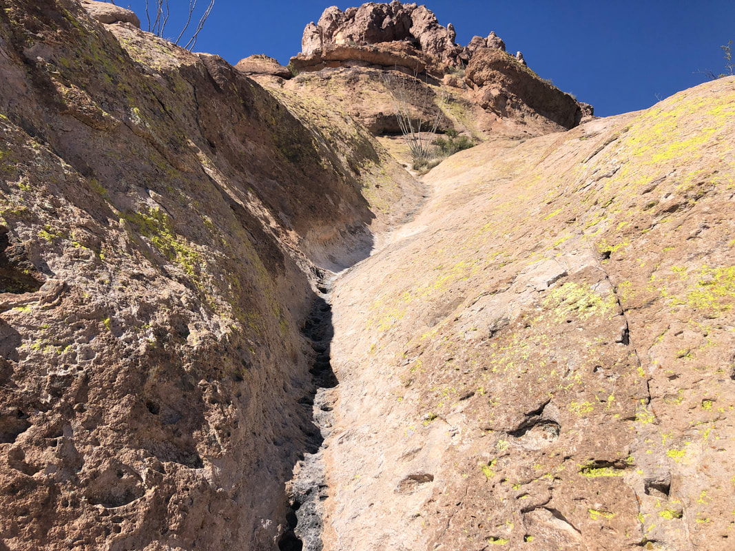 I scrambled up a series of drainages, rounded a corner at the top to my left and soon.... 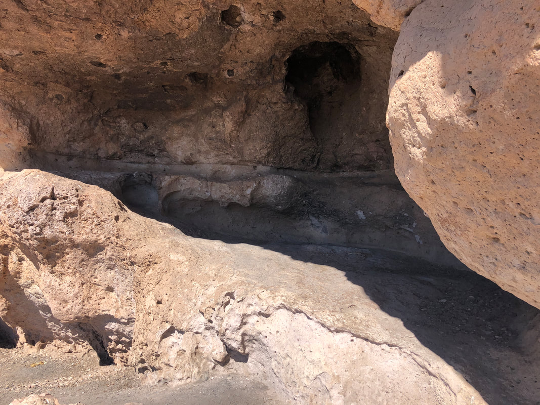 ....hiked past several caves, one of which is known as "Geronimo's Cave". 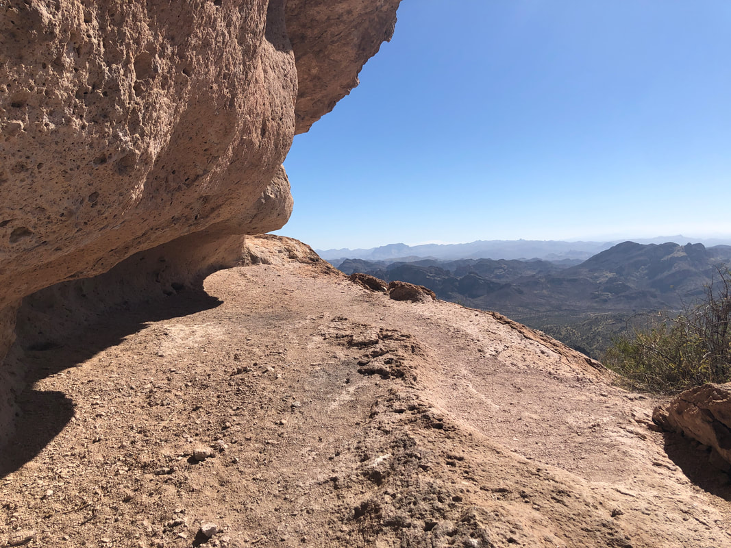 One of the alcoves used to have many rock stacks but someone has torn them all down. Over time, they'll be rebuilt as it was a neat sight. 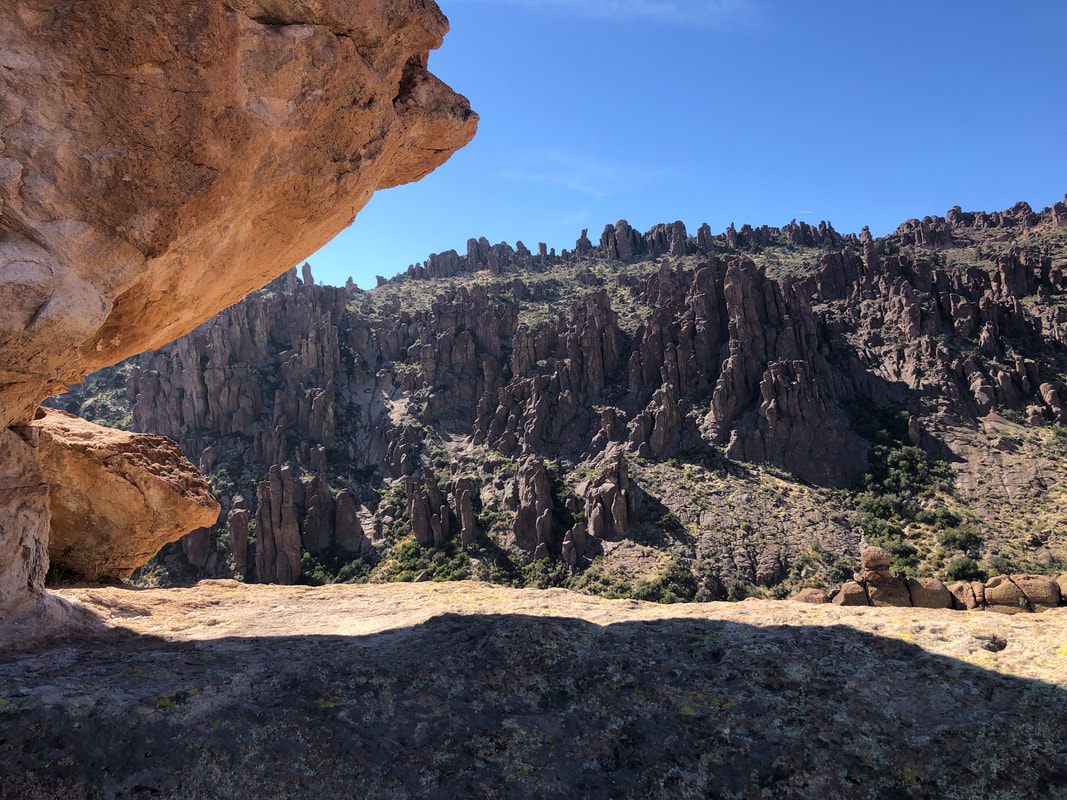 I frequently hear faint voices coming from Peralta Canyon but I have largely oblivious to the people below. 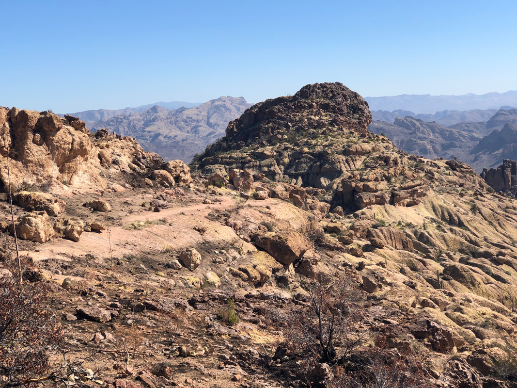 Most of the time there is no real route finding but when the route crosses broad expanses of rock, it takes some time to figure the way forward. There are some but not many cairns. 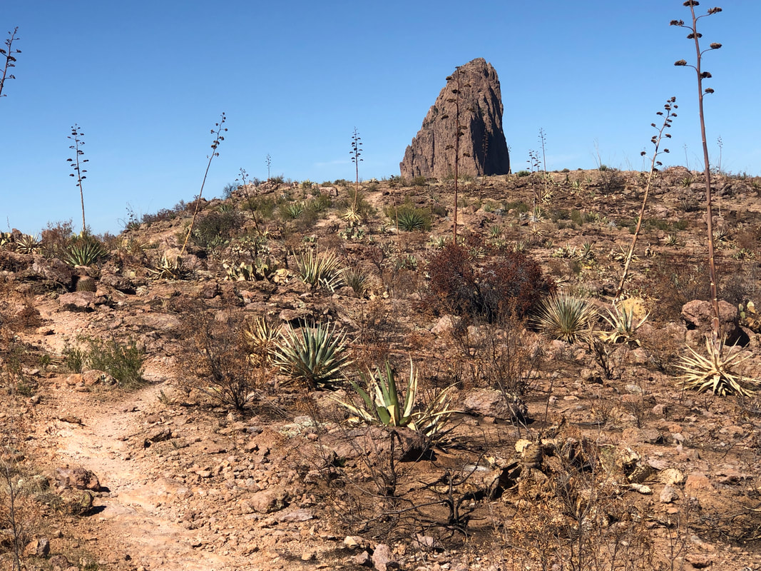 The route briefly enters a burn area and then ends at the trail coming off Fremont Saddle to the Lone Pine tree. It took me 2:06 to cover the 3 miles from the parking lot...not good. But, with the route finding mystery solved, I figured I'd make the return in a better time and did, 1:10. 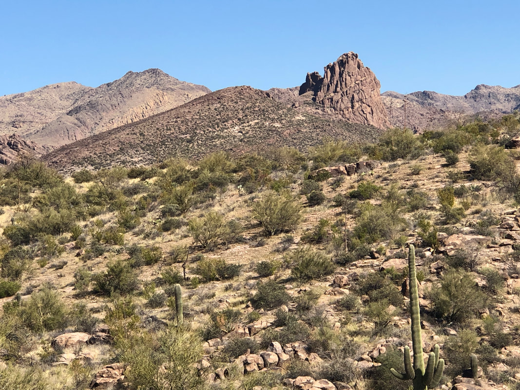 This is such a more enjoyable alternative to Peralta. I'm looking forward to showing this to the group. In the distance, Miner's Needle. Doing a group hike around that beast in a couple of weeks. Finished with 5.6 miles and 1300' of climbing.
 I park at the Sabino Canyon over flow lot. Some where in the distance is Rattlesnake Peak but not sure which one. This is an exploratory hike although I held out some hope I'd make it to the peak but typically, for hikes like this, it takes me 1 or 2 efforts to figure out the way. 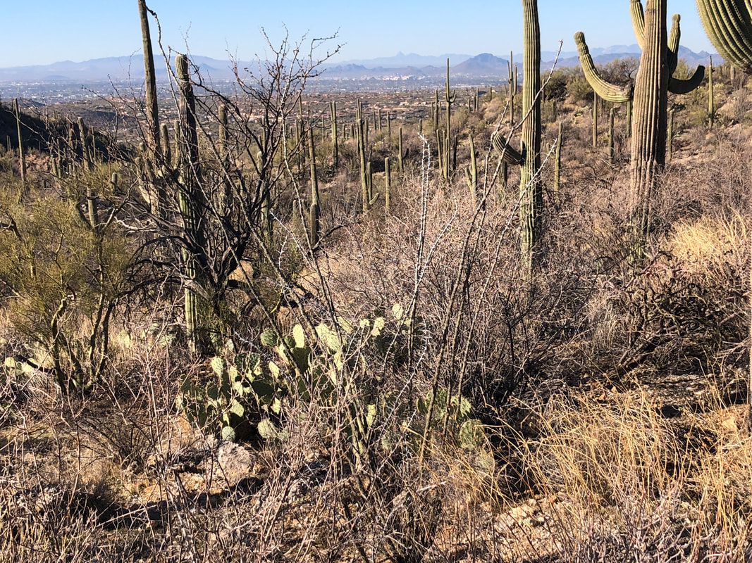 I take the trail out of the parking area, reach Sabino Canyon Road, follow it briefly and then make a left onto Esperero Trail. Later I figured out there is a back trail that saves half a mile. Then I go off trail and wind my way through somewhat dense brush. Although I have a gps track to follow, I stay too low and miss..... 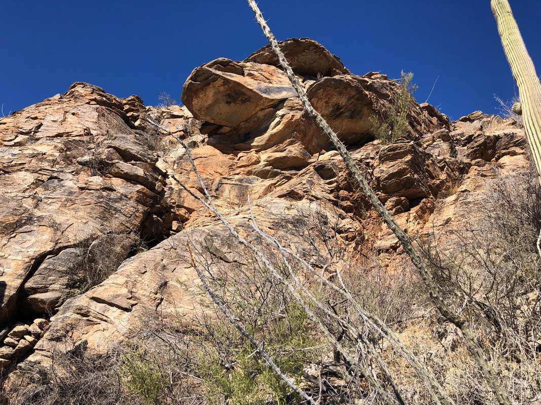 ....being on top of the above. Again, later, I return and stay up there and that too was easier. I was wasting a lot of time, checking the track, winding through the thicket but that is part of the learning process. Won't make the same bonehead mistakes next time...just a time killer those. 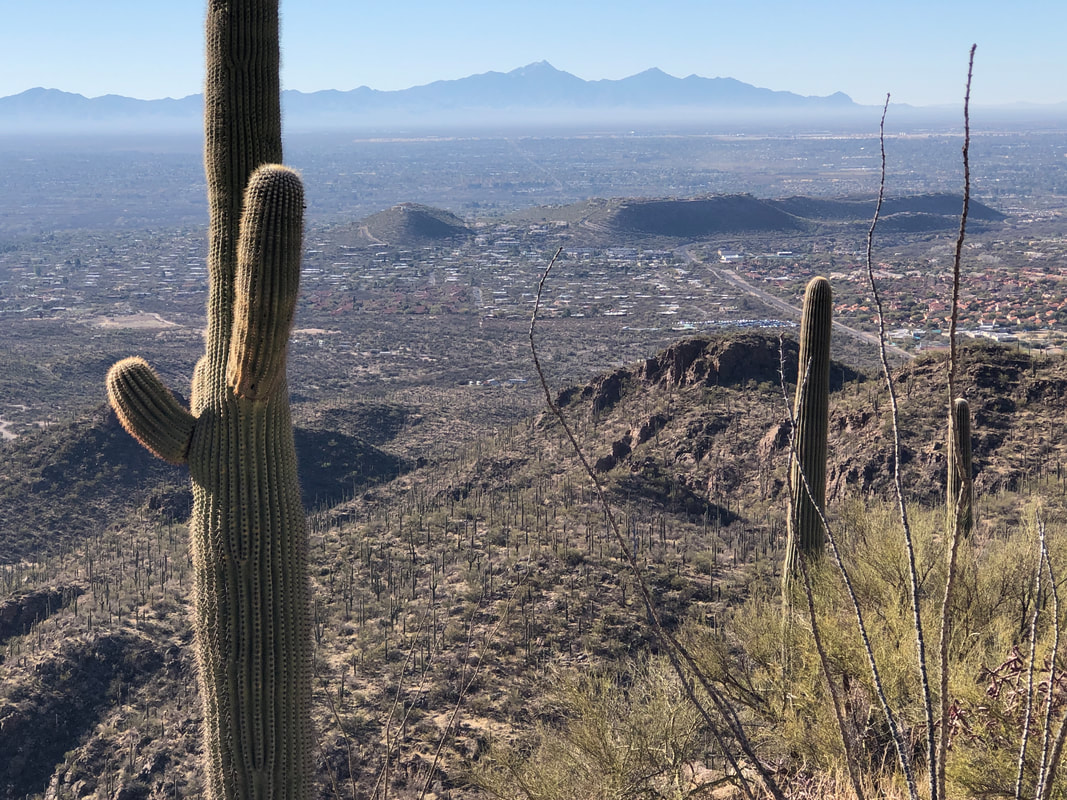 But hey! The views were great. 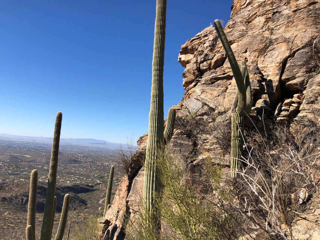 I work around the obstacle, climb up to where I should have been and gain the top of the ridge, much later than when I should have been up there. 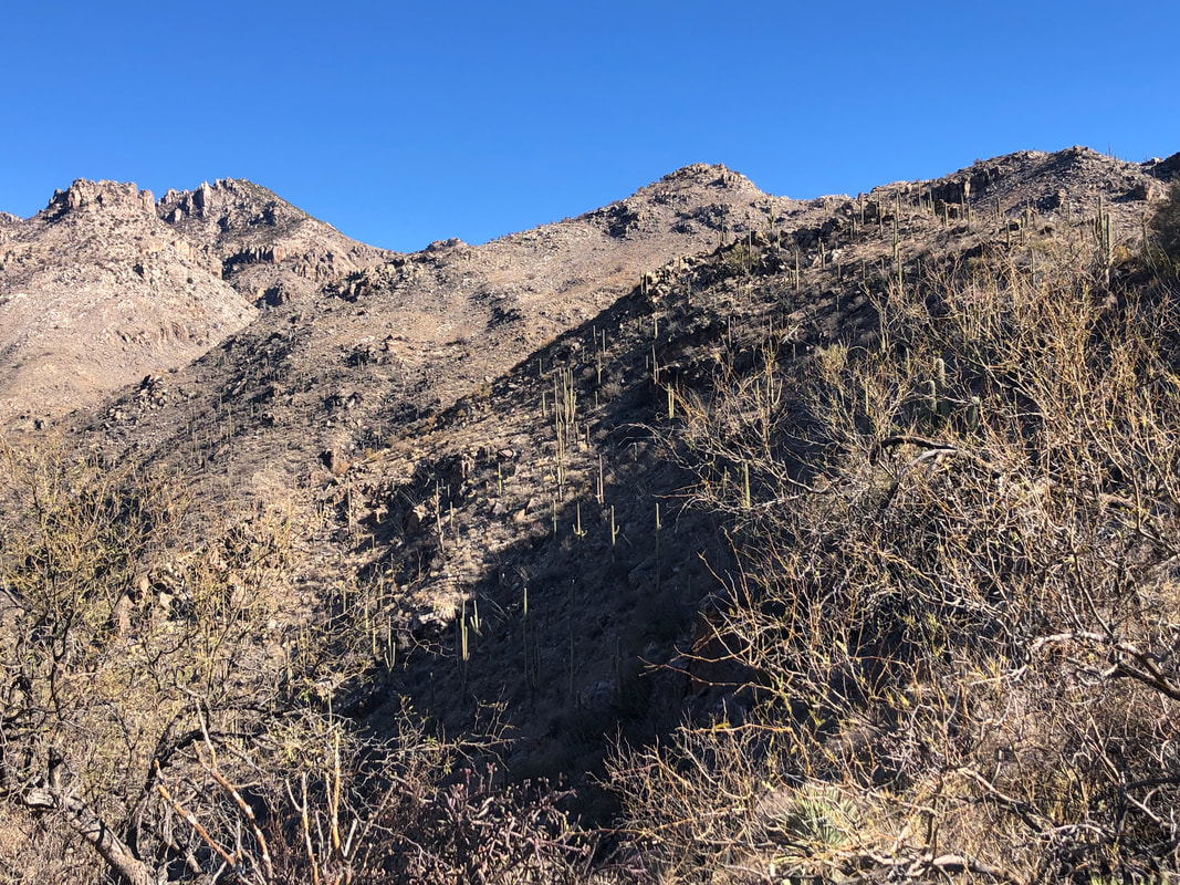 In the distance, a number of peaks and still unsure which is the destination. 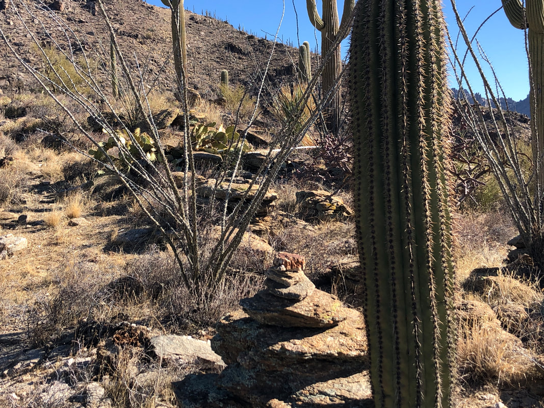 Hey, how bout that, a nice cairn. I am aware there is another route coming from the right but it is longer than the route I have chosen. Here though, they meet and I now had cairns to follow, at times. 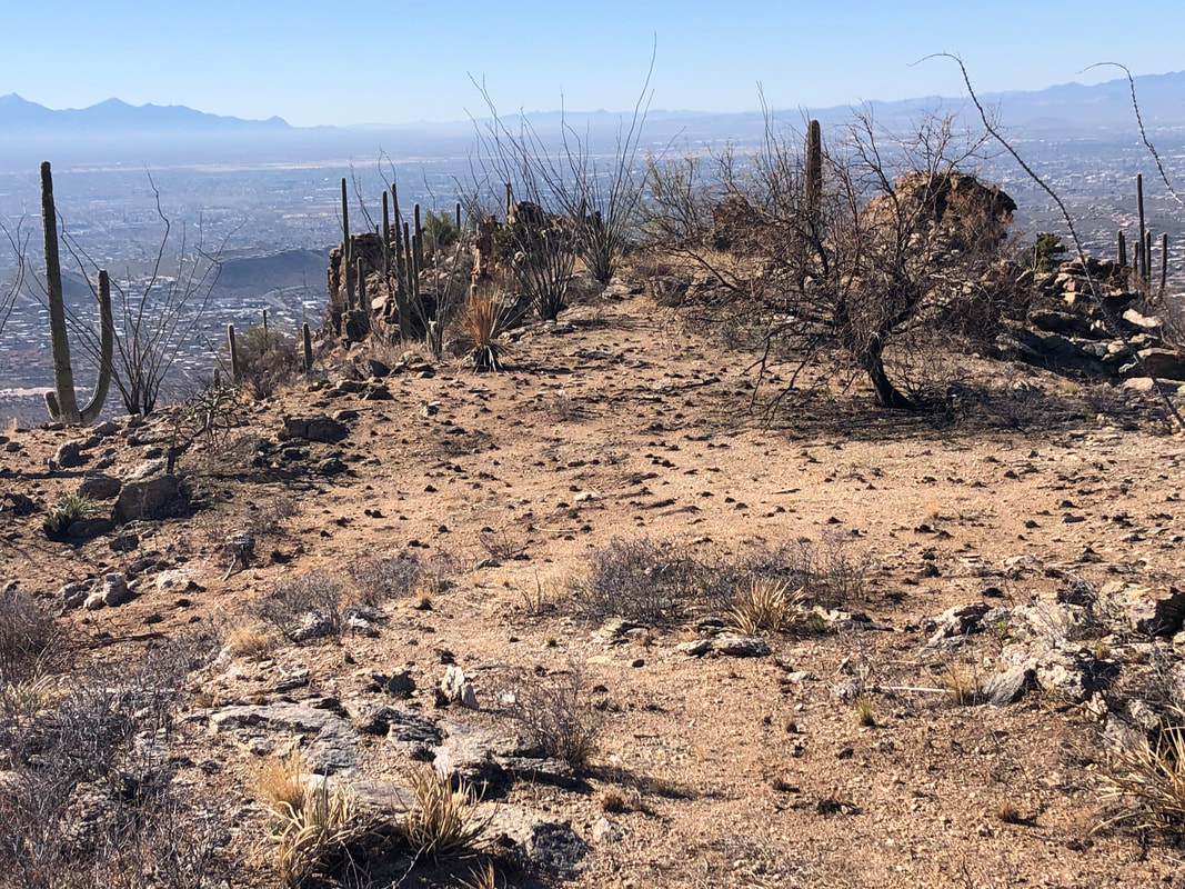 I enter a burn area that is quite extensive. Hiking is much easier now although some of the climbing is quite steep as I gain one prominence after another. 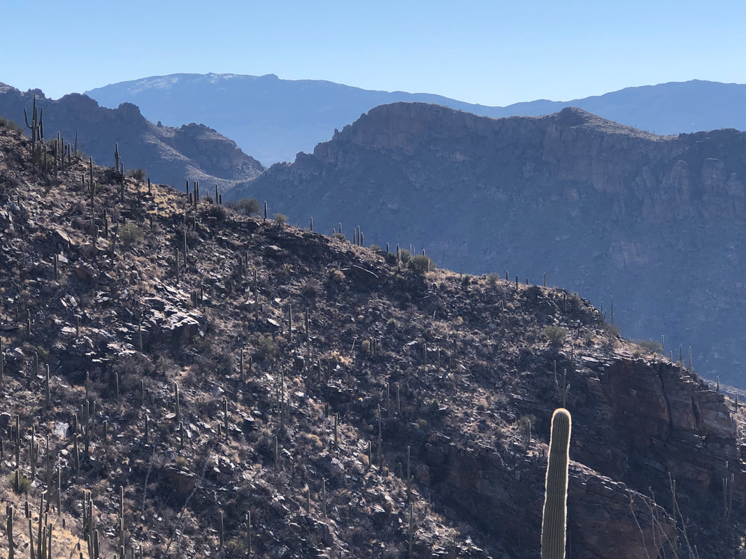 In the distance, still some snow on the Rincons.  Someone had made a nice cairn using a fallen saguaro as a platform. The slope above it is way steep.  Finally, I realize which of the peaks is Rattlesnake, the one to the left. Left of it is.... 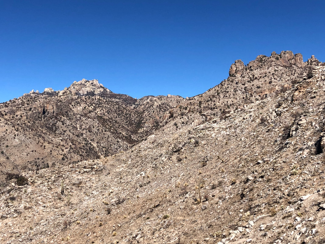 ....Cathedral Rock. Beyond Rattlesnake, there is a way down to Hutch's Pools and a return on West Fork trail to the top of Sabino Canyon Road. 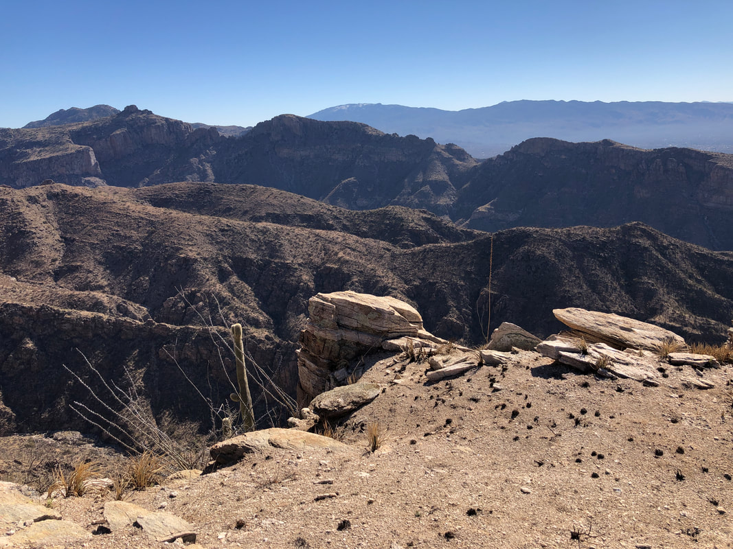 I climbed too far up a prominence and had to retrace my route a little. Seeing what was ahead of me, I figured time was going to be a problem but the way forward seemed obvious. Thinking I'd run out of time, I decided to turn around and grab the peak another day, rather than fall just short farther up. I wasted at least an hour wandering around down range. 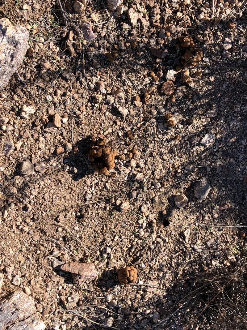 On the slopes, I noticed a lot of deer scat. Amongst it was the above and I could not identify it. There was no hair in it so likely not from a carnivore. Upon reaching Esperero Trail, I crossed directly over it, gaining a new trail that is a back way to the parking lot. This would save over a mile on a return to the Peak. 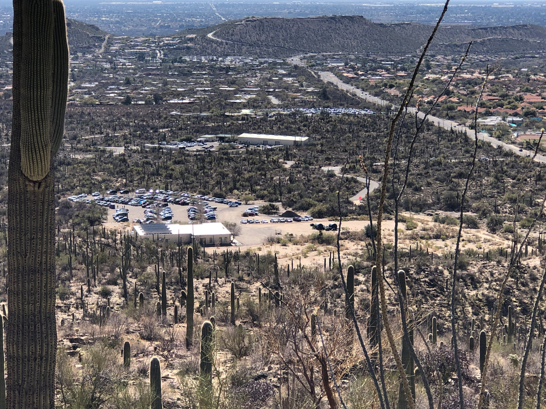 The over flow lot was quite full and slightly above it to the right, the regular Sabino Canyon parking lot was too. Finished with 5.5 miles and 2200' of climbing.
 Our group of 11 gathered at the Wild Burrow trail head at Dove Mountain and began the trek to Big Caprock Peak in the Tortolita Mountains. The first 1.5 miles we hike in a broad sandy wash, climb to a second, sandy wash, climb to a third level and.... 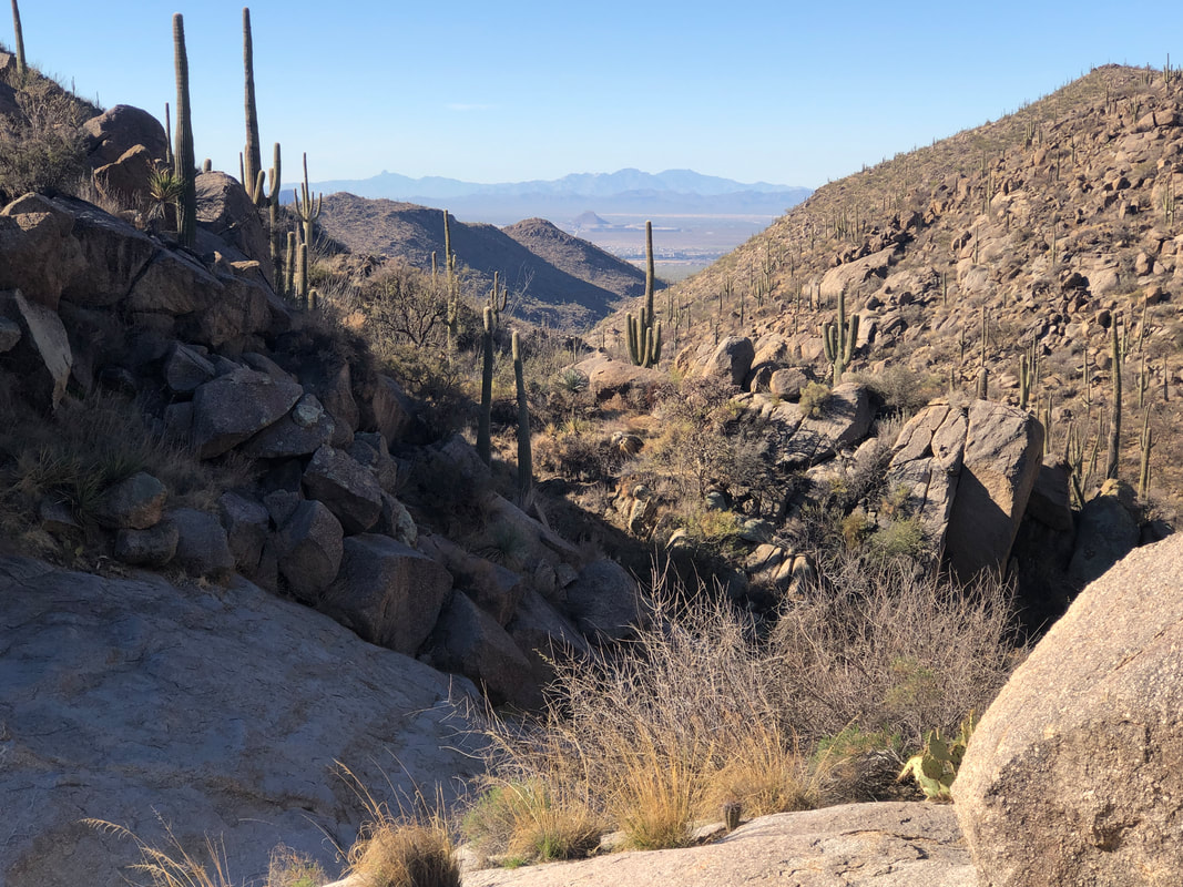 ...enjoy a short break with grand views down canyon. The gang..... 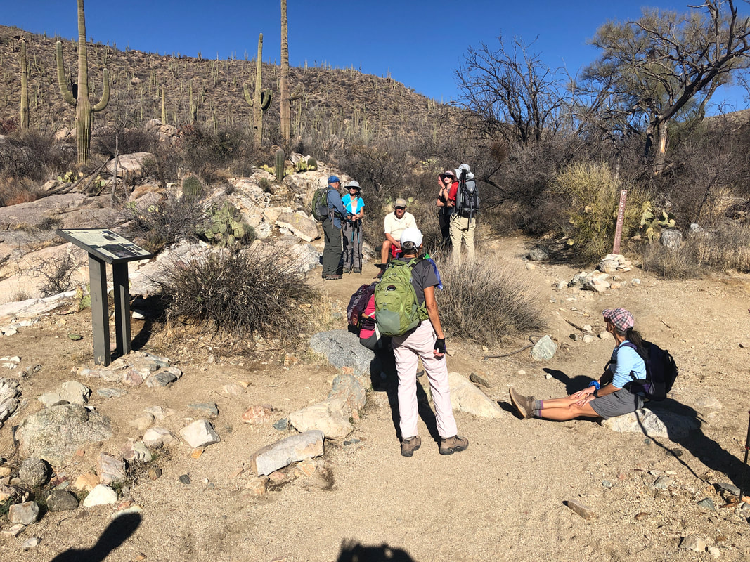 ....relaxes. Dee, with her back to me, carries a full pack and I have often wondered what all is in there. I'm kind of a minimalist while others are maximalists. Later she declared she carries three different pairs of gloves in her pack so there's that, ha, ha. 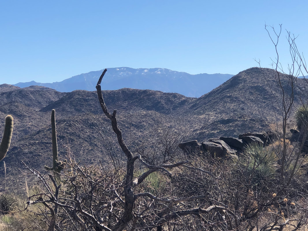 At mile 3 we turn left onto the Wild Mustang trail. Marc hangs back to close a gate I opened. So helpful is he on these hikes that I should promote him into an unpaid position. We climb steadily and soon the Catalinas come into view to the east but not nearly as spectacular as just a week ago. So much of the snow has melted but the streams/washes are surging. 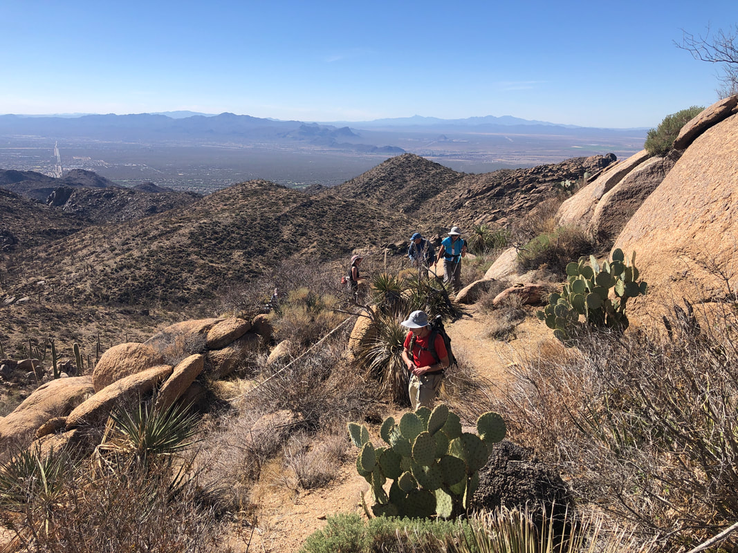 At mile 4.5, we go off the Mustang trail onto a faint trail that soon leads us.... 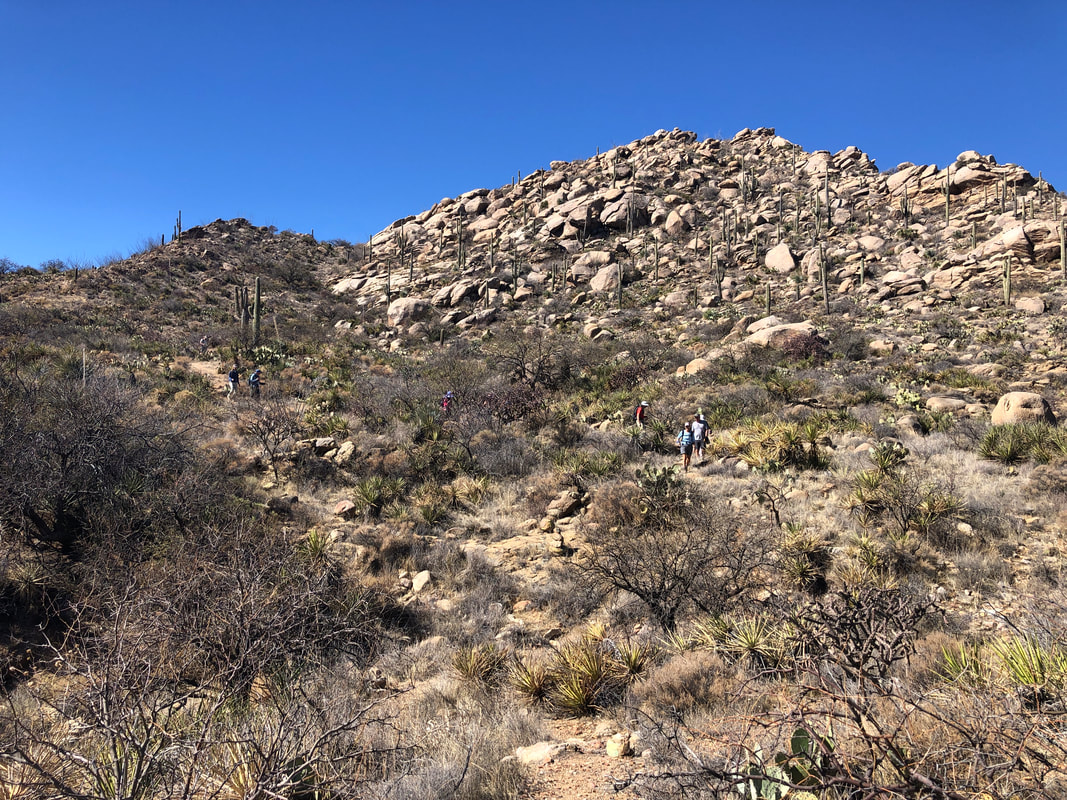 ....to a ravine coming down from our left at the base of Big Caprock. You can kind of see how it acquired the name. The routes is fairly well cairned and soon we... 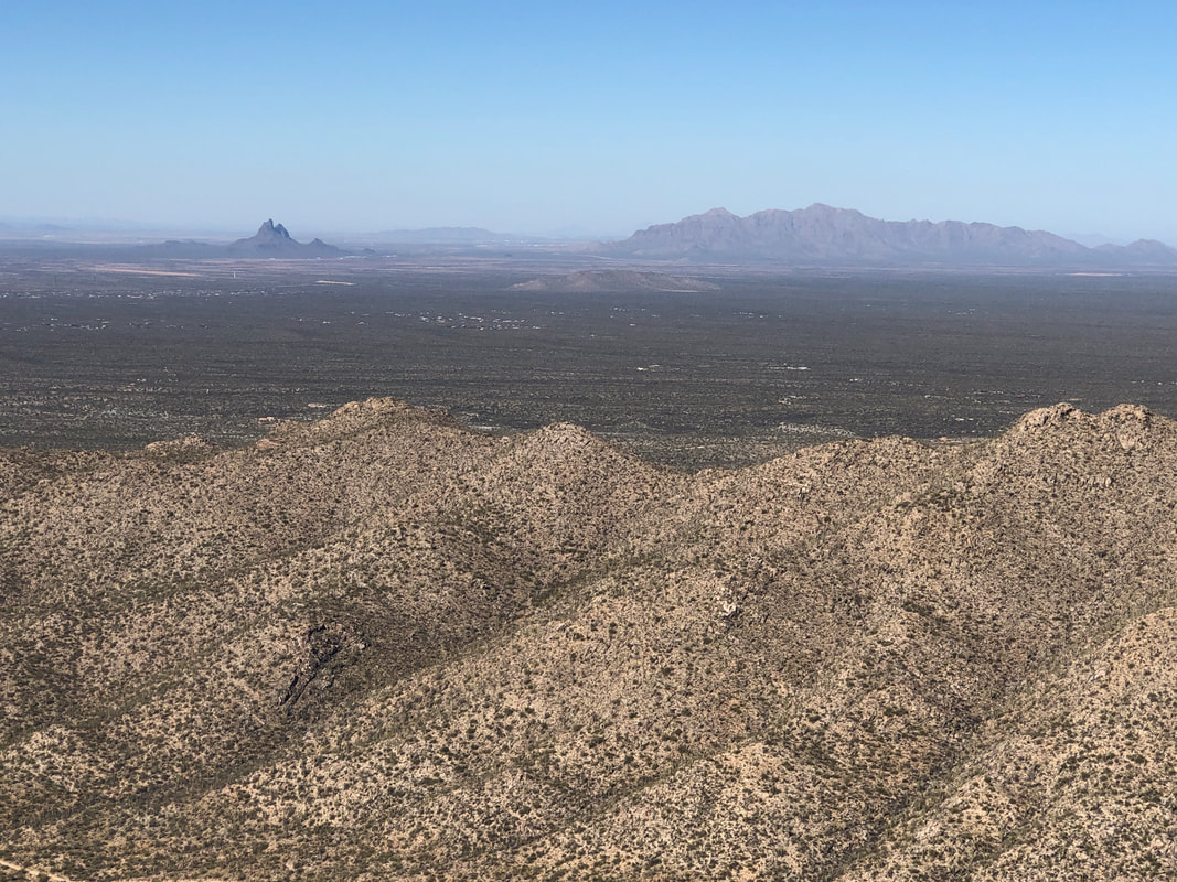 ....are at the top. In the distance is the well kn own Picacho Peak on the left and the much lesser known Newman Peak on the right, which is 1100' higher than Picacho. I've been up Newman a couple of times and likely will schedule it for a group hike soon. Kind of brutal that one. 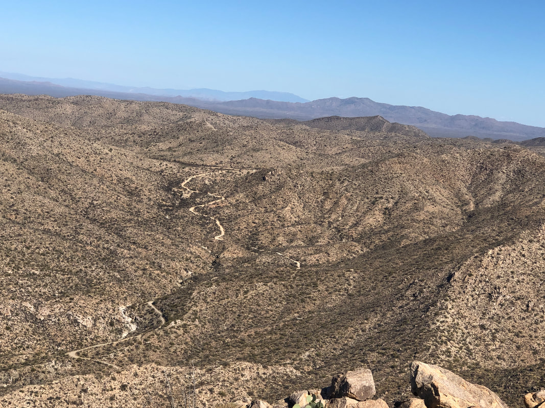 Not a lot of room on the primary Caprock peak so I stayed for only a few seconds, taking a few pics and scrambled down so others could ascend. The peak soars over Cochise Canyon to our north. 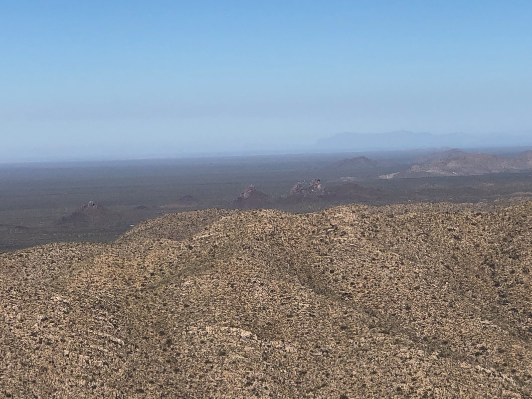 After scrambling down I climbed an adjoining peak and was asked if the Superstitions would be visible to our north. Turning, I looked at sure enough, faintly visible, upper right in the above image is the western end of the Supes. The Flat Iron on the left, Peak 5024 above it and to the right, Superstition Peak. Couple of great destinations there too. Yet more hikes to organize. 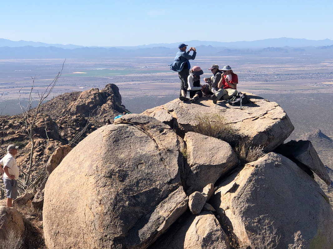 Looking across from our small group, the other group snacks as they too enjoy the 360 views. 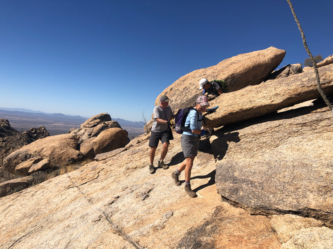 We begin our descent, which had a healthy area of slick rock with enough of a slope that we had to be careful, being ably demonstrated by Lorna and Marc. 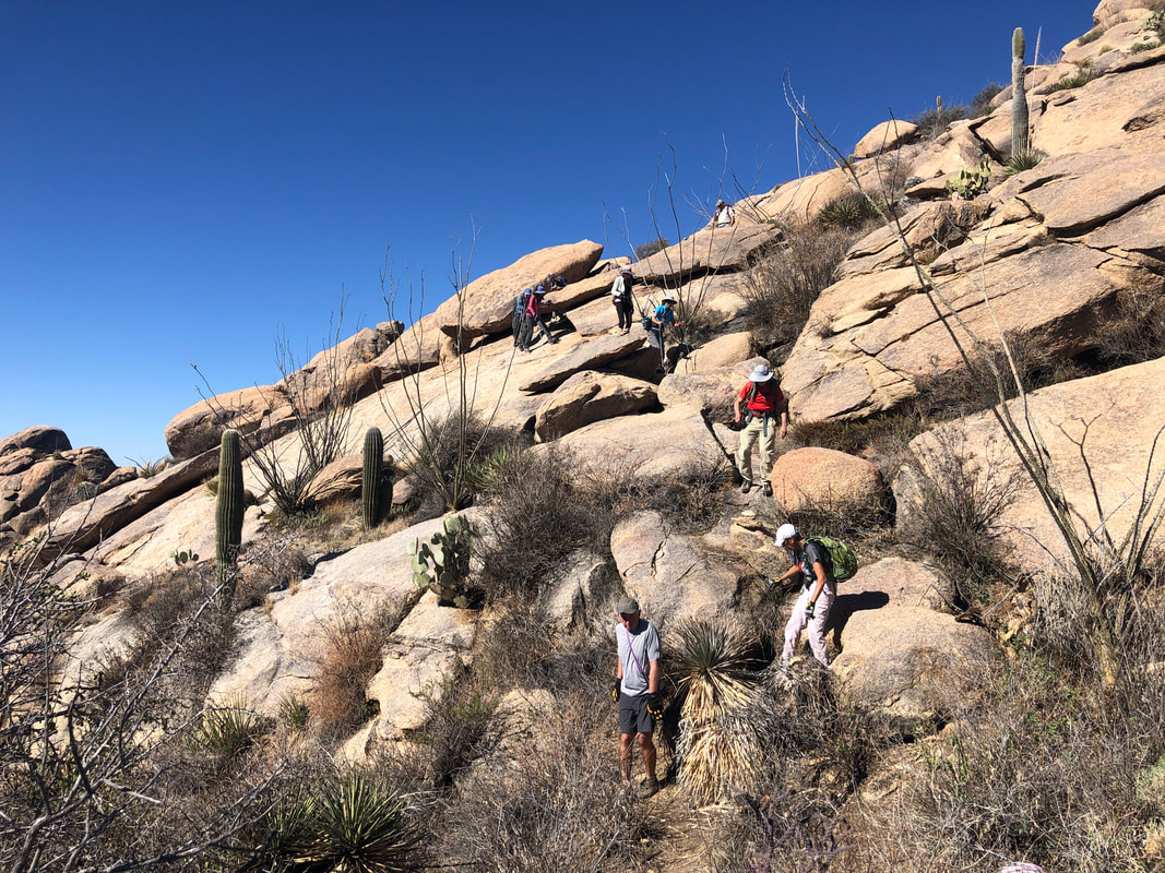 All the gang safely navigated the slope and soon we were back on the Wild Mustang trail and completed our 9 mile loop hike with 2000' of elevation gain. Unfortunately, for the second hike in a row, Katherine left a hiking pole somewhere in the wilderness. I thought of suggesting she just cut a branch on future hikes so when she loses one, it's far less expensive. 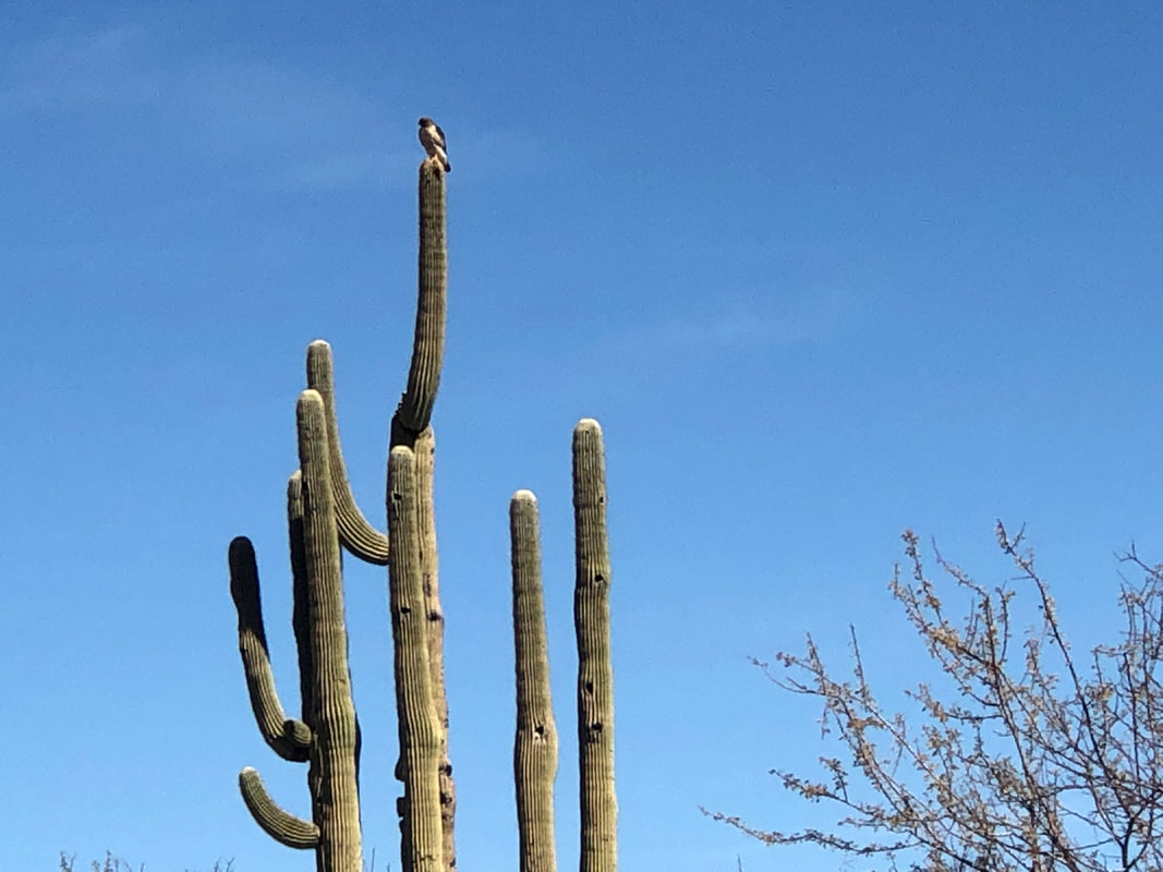 My short drive home was interrupted by a road construction delay so I was able to catch a hawk, standing on top of a saguaro. Beautiful day with temps in the 60's, cooling wind at times and abundant sunshine.
 After Saturday's hike, I took Sunday off. I've got an Ohio cycling friend coming out in early March and then will spend a couple of weeks in Ohio in late April. I would really like to at least ride with the "B" group if not the "A" group while in Ohio so plan to work in more rides to get ready. I rode 30 miles on Monday then 40 on Tuesday. Average speed is rather slow at 17 so a lot of work yet to be done. lol. 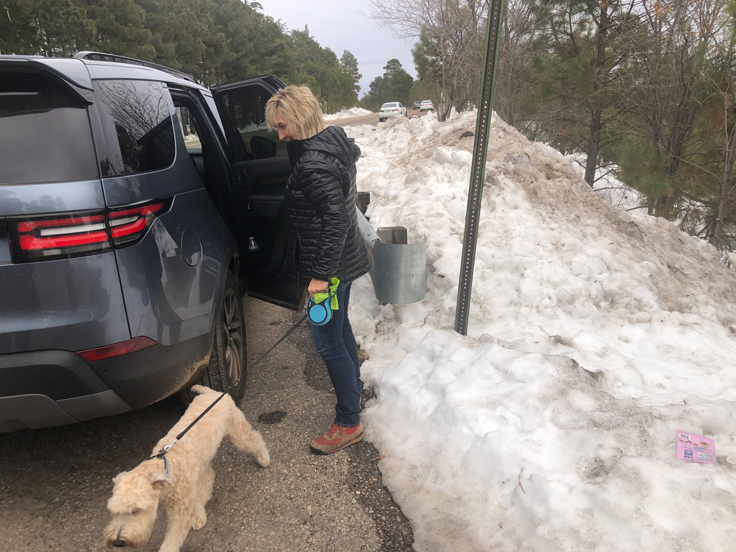 On Wednesday, Amy and I decided to take Jack, her Wheaten Terrier, up Mount Lemmon to see his first snow. I was surprised how far we had to drive to reach significant snow, all the way up to mile marker 21. 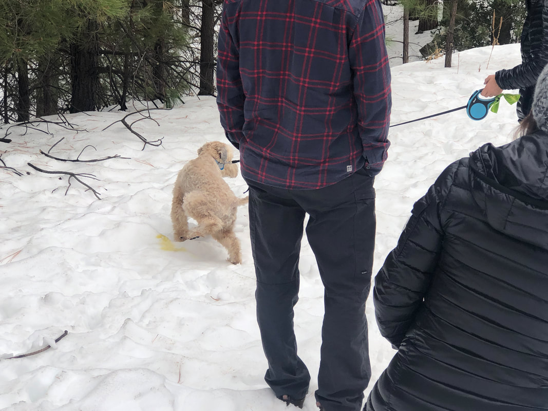 Two friends of Amy's, Frank & Lisa from PA, had arrived for a visit so they came too. We were all curious how Jack would respond to the snow so after taking care of "business", he.... 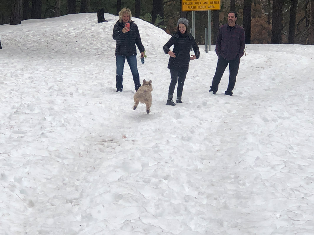 ....ran around and enjoyed the experience. 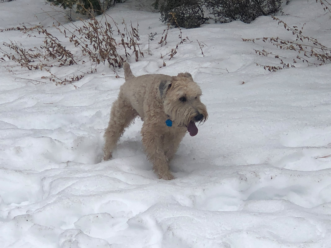 Finally exhausted, we gathered him and headed back to the SUV.  I think we were at 8000+' while higher up, there was 2' of snow on the ground, especially at Ski Valley but the snow line is advancing rapidly up as we enjoy several days, in the valley, at temps in the low to mid 70's. Well, big hike coming tomorrow.
|
