 I led a small group of hikers to one of my favorite destinations, Battleship Mountain. I enjoy helping people experience something that otherwise, they probably would not do on their own. May as well lend the expertise I have gained from my trips to this and other very cool destinations. We depart First Water trailhead hiking the Second Water trail and after about a mile, gain.....  ….the unusual Garden Valley. So odd to hike a trail where you do not have to have your eyes glued down to avoid obstacles. After about another mile, hills begin.....  ….to creep in and note the black rocks populating the slopes. We enter a gentle slope that is covered with the rocks so now our eyes are focused as we carefully step from rock to rock. At last..... 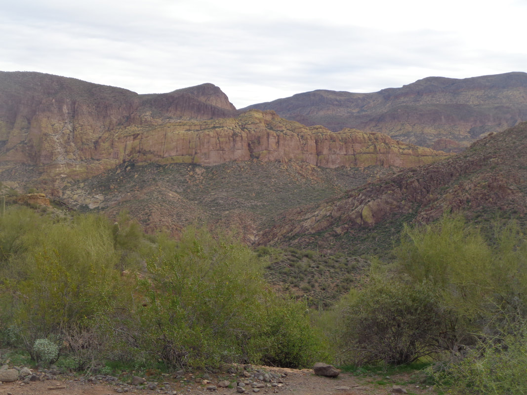 ….the yellow, lichen covered rock walls that form the Battleship comes into view. We descend a medium steep but again, rocky slope, reach a..... 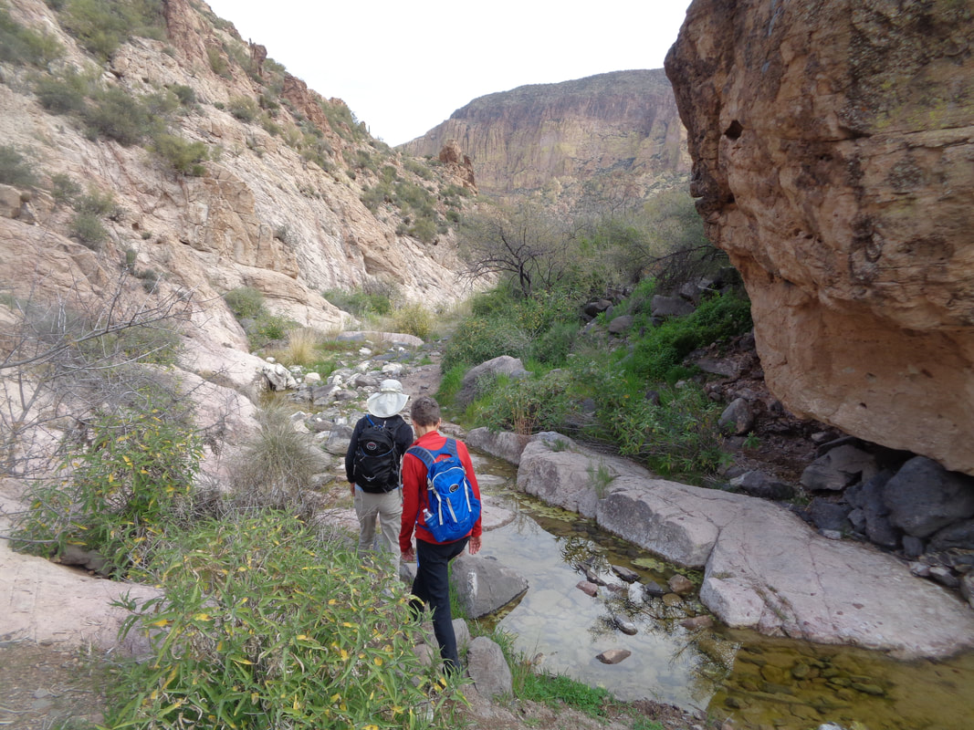 ….stream, cross it and then..... 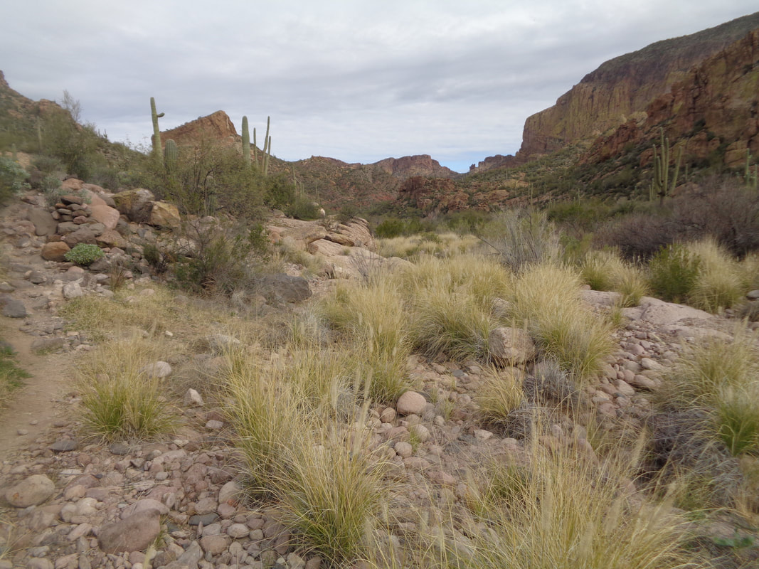 ….hang a right on the Boulder Canyon trail. This is aptly named and the multiple stream crossings, again hopping from large rock to large rock becomes a bit tedious. It is so well worth it because eventually, at mile 5, I reached a point where I knew to go off trail and ascend a steep slope where..... 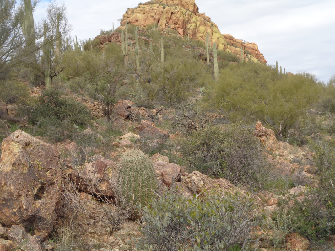 ...we were confronted with another steep slope that took us to the stern of the "ship". 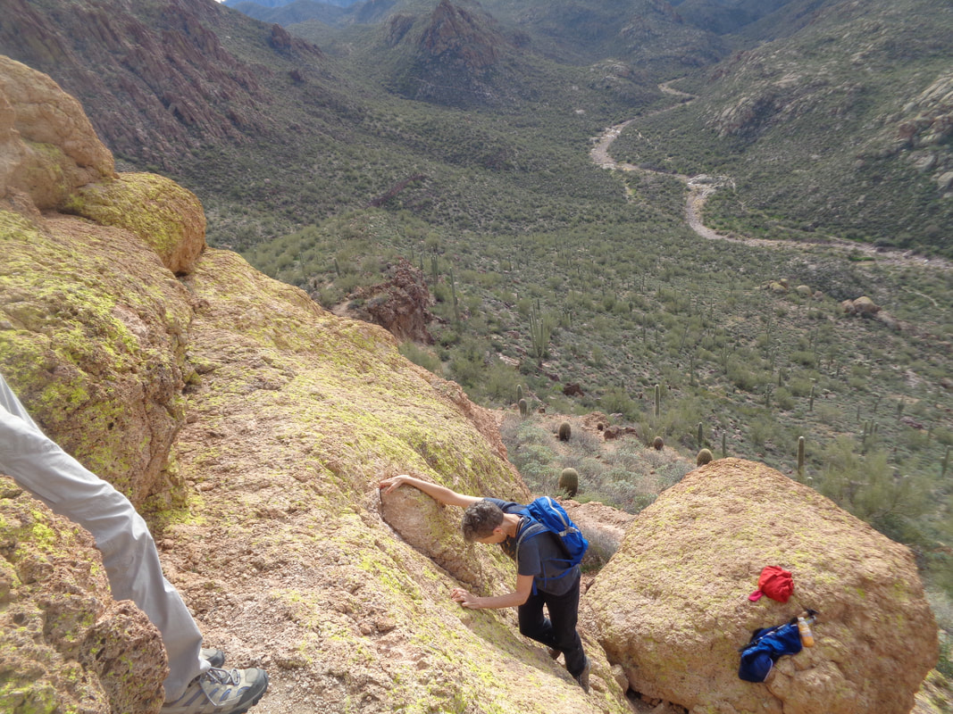 There we off loaded items we would not need and first climbed a fairly steep wall that fortunately had just enough hand and foot holds. Boarding the ship we.... 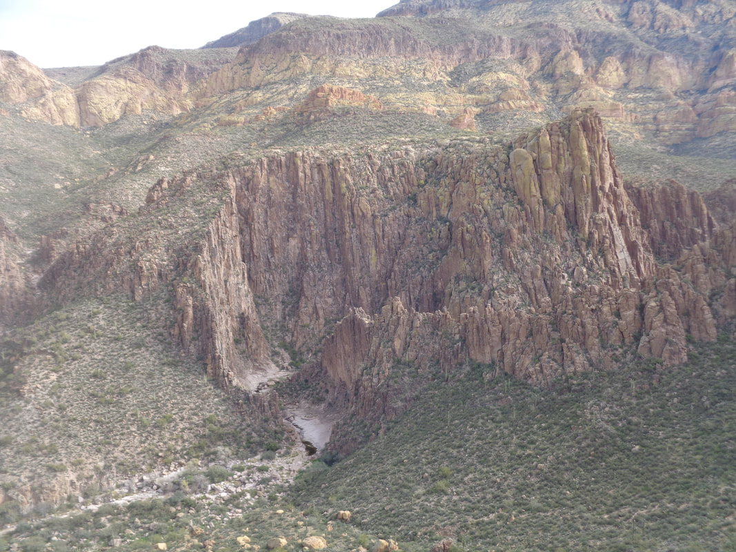 ….were awed by the views. Above, the entrance to Lower LaBarge Box Canyon. Looks like something out of the "Lord of the Rings" movie. 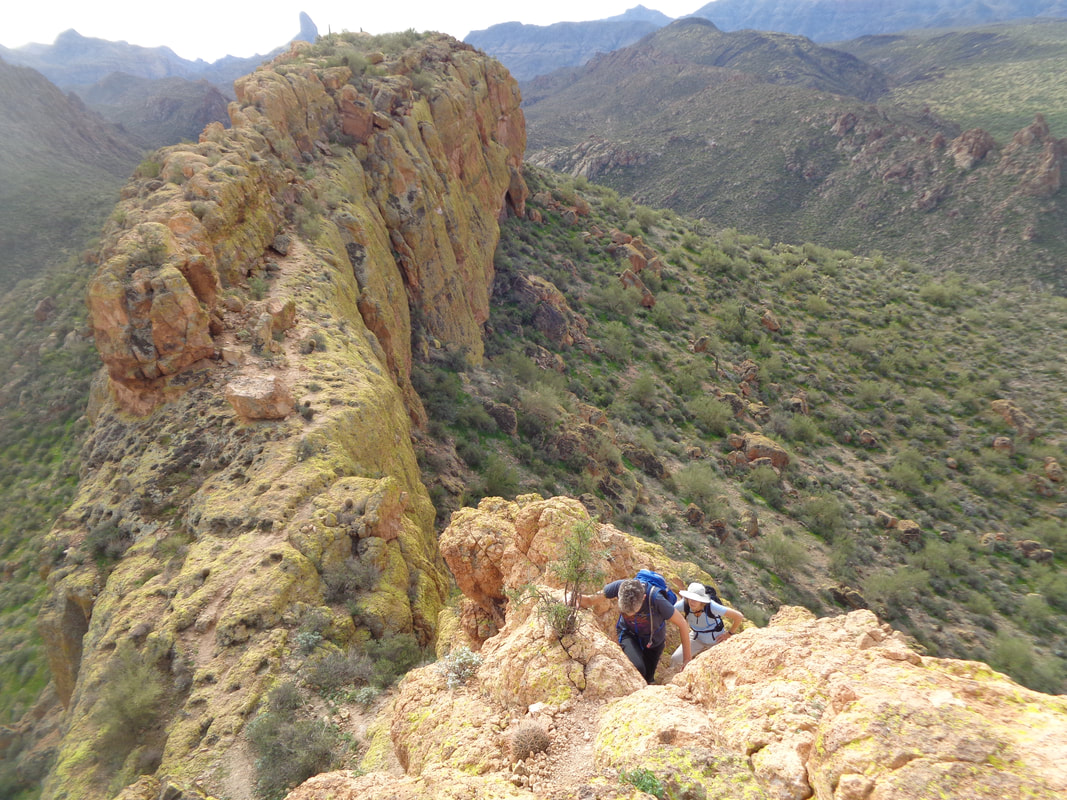 Above, we slowly make our way through the somewhat challenging first half of the ship and then enter the very challenging second half that includes.... 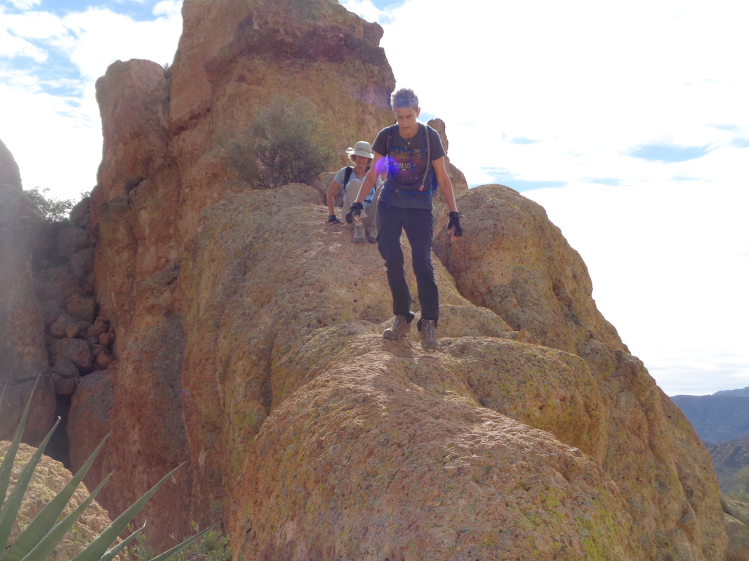 ….the famous rock bridge. Going down, I have to butt hike some of it. The fall would kill me so why risk skipping along and tripping although I can stay upright on the return. 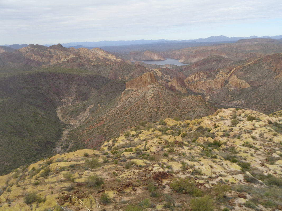 We circle clockwise to the back of the peak and then ascend to the top and again, amazing views including that of Canyon Lake. We refuel and my two companions are a bit apprehensive about some of the walls that must be down climbed but.... 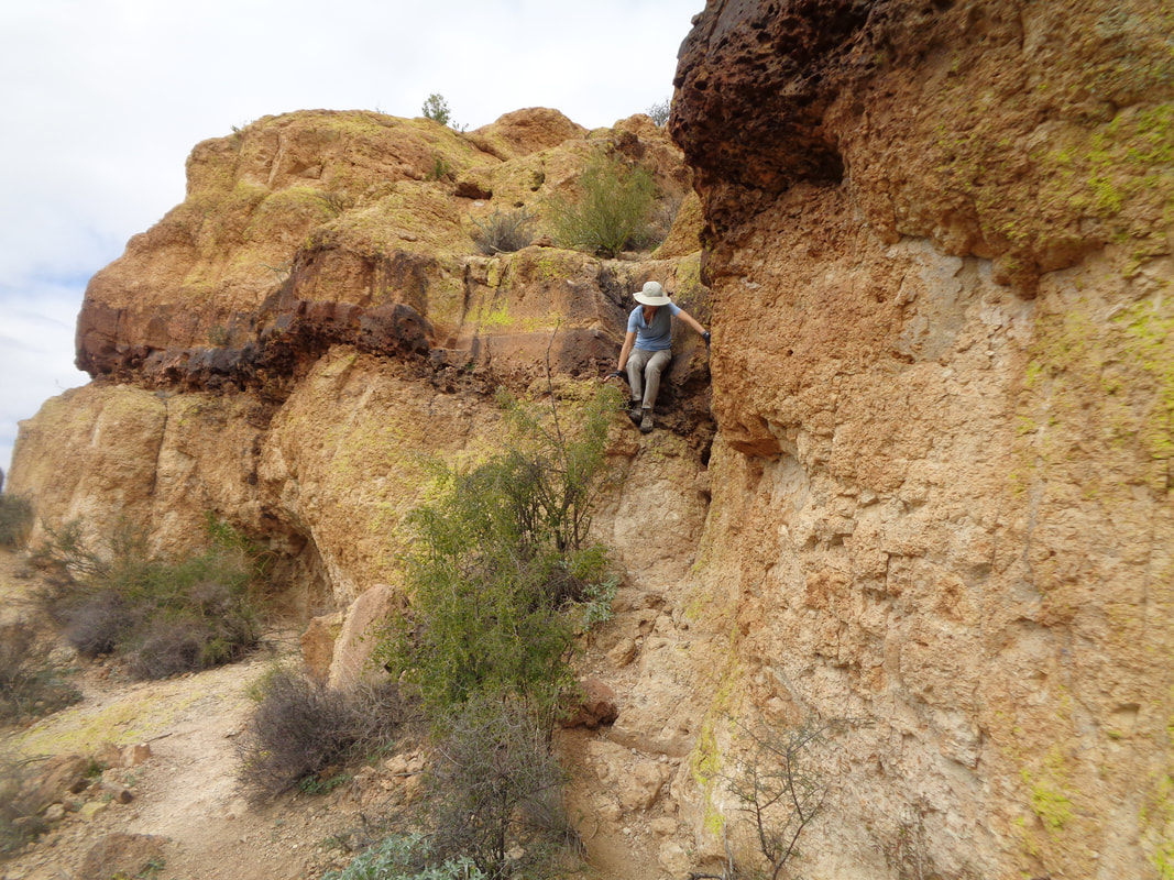 …..they did a great job. Not all of the challenges are climb/descending walls because.... 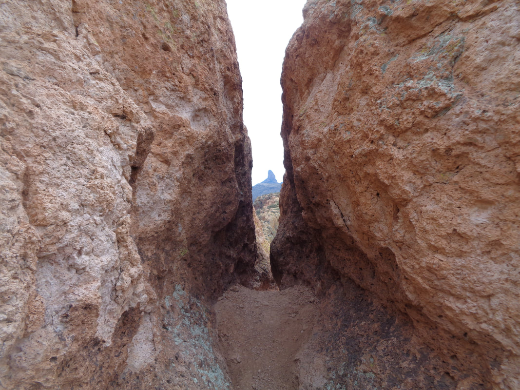 …...there are other challenges, like "Fat Man's Pass". Note Weaver's Needle in the background. To give some perspective on how narrow is the Pass..... 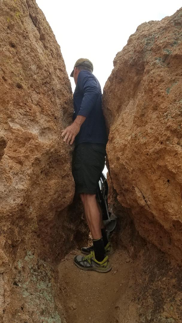 ….true, I've gained 4 pounds this winter, nothing odd about that but still, it was a tight squeeze for me. I'm wearing "Treksta" brand trail running shoes and this is my second pair, I like them! Once off the ship, it is largely an unremarkable return until..... 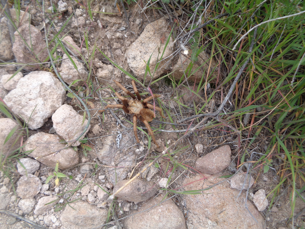 ….it wasn't when I almost stepped on what is by far, the largest tarantula I have seen, out of the 5-6 I have encountered. I should have putt my hand next to it to give you...… yeah, right. Finished with a little over 12 miles and 2000' of climbing. Always an adventure.
4 Comments
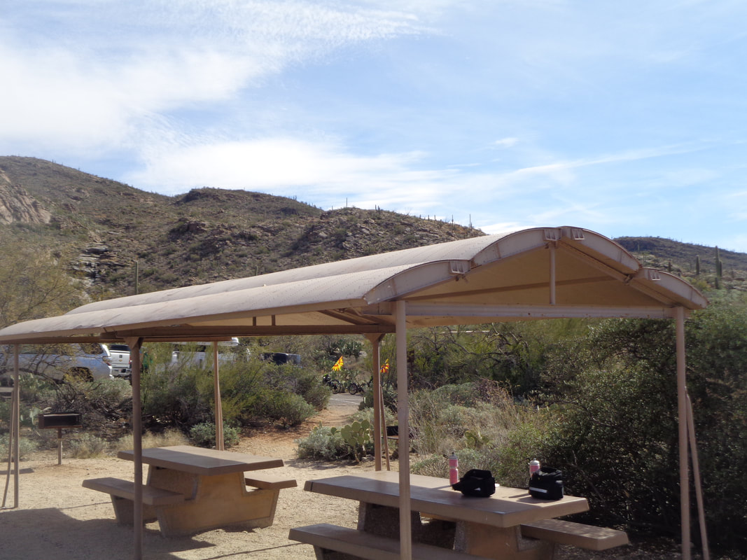 I've taken the last few days to get out on the bike as the pedaling motion did nothing to aggravate the groin pull. Nothing too strenuous, just 30-40 mile rides and kind of flat. I did roll through Saguaro National Park East and stopped to take the above image. Unremarkable except the coverings for the picnic areas are repurposed bomb bay doors from B-29 Superfortress'. 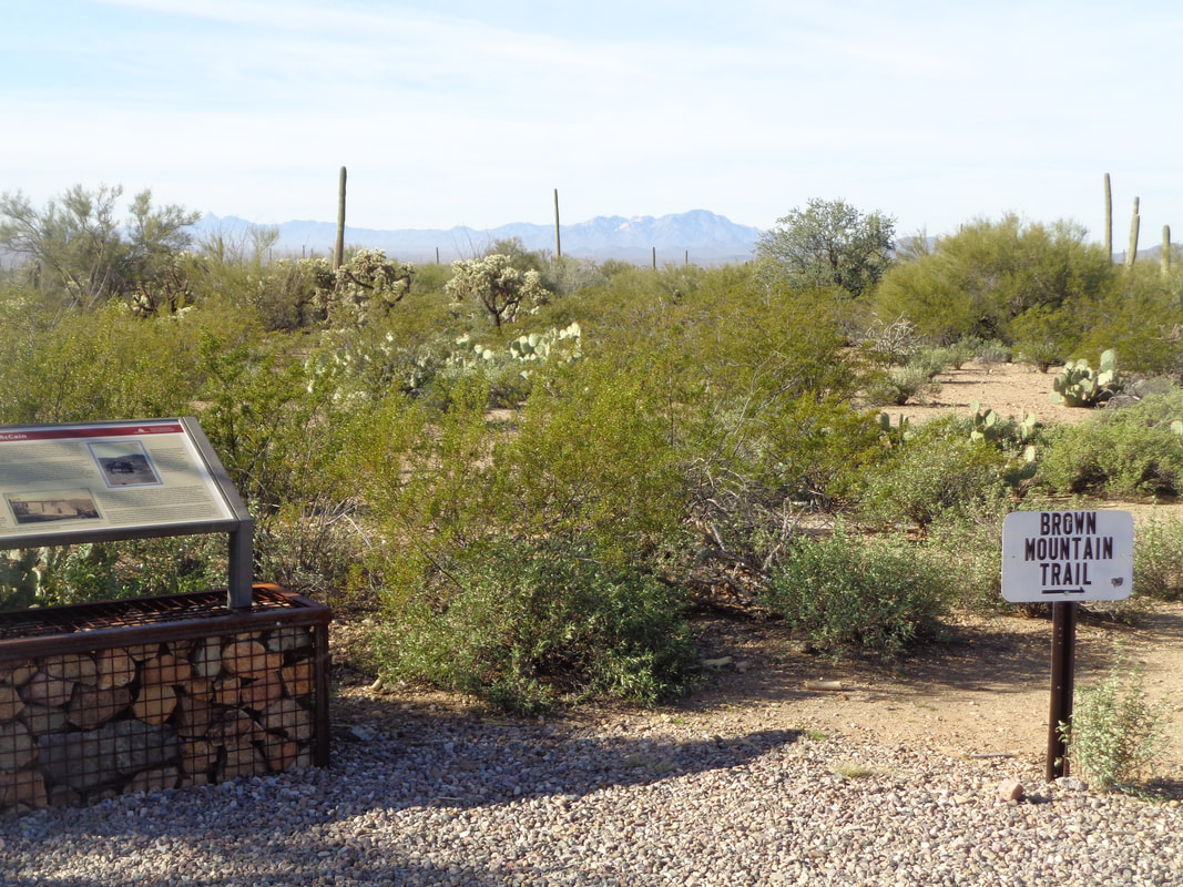 Sooooo, time to test out an injury that is keeping Lebron James on the sideline for 15+ basketball games. Yeah, his was much worse and the rigors of basketball much more demanding. I slotted in with a moderate hiking group led by Alex who let me know if I had a problem, they would not carry me back. 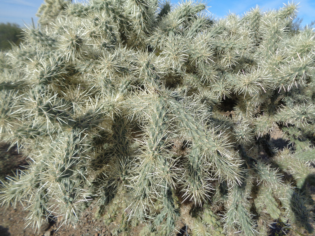 I arrived too early so walked around for a few minutes at the Brown Mountain trailhead on the far west side, in the Saguaro National Park West. Hard to believe birds fly into this warren of needles and make a nest. 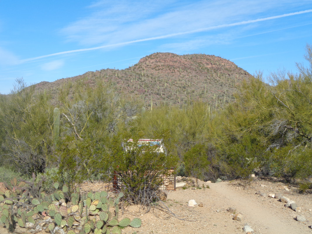 Eventually, Alex, Tim, Terry and Lola arrived and we began following a rolling route where eventually, Lola split off to hike around the mountain while the rest of our group headed up and over. 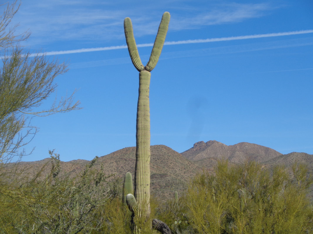 A strange looking Saguaro having rabbit ears. Also strange was my behavior because the group was startled that I asked if the climb to the peak had begun and when told it had, I turned around, headed back to a wash which indicated the start of the climb and then, for the sake of hunting a Strava segment, hit it pretty hard and later..... 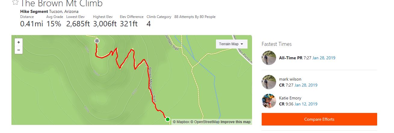 ….yay, got the CR for the segment. Reaching the top of Brown Mountain I was surprised to find..... 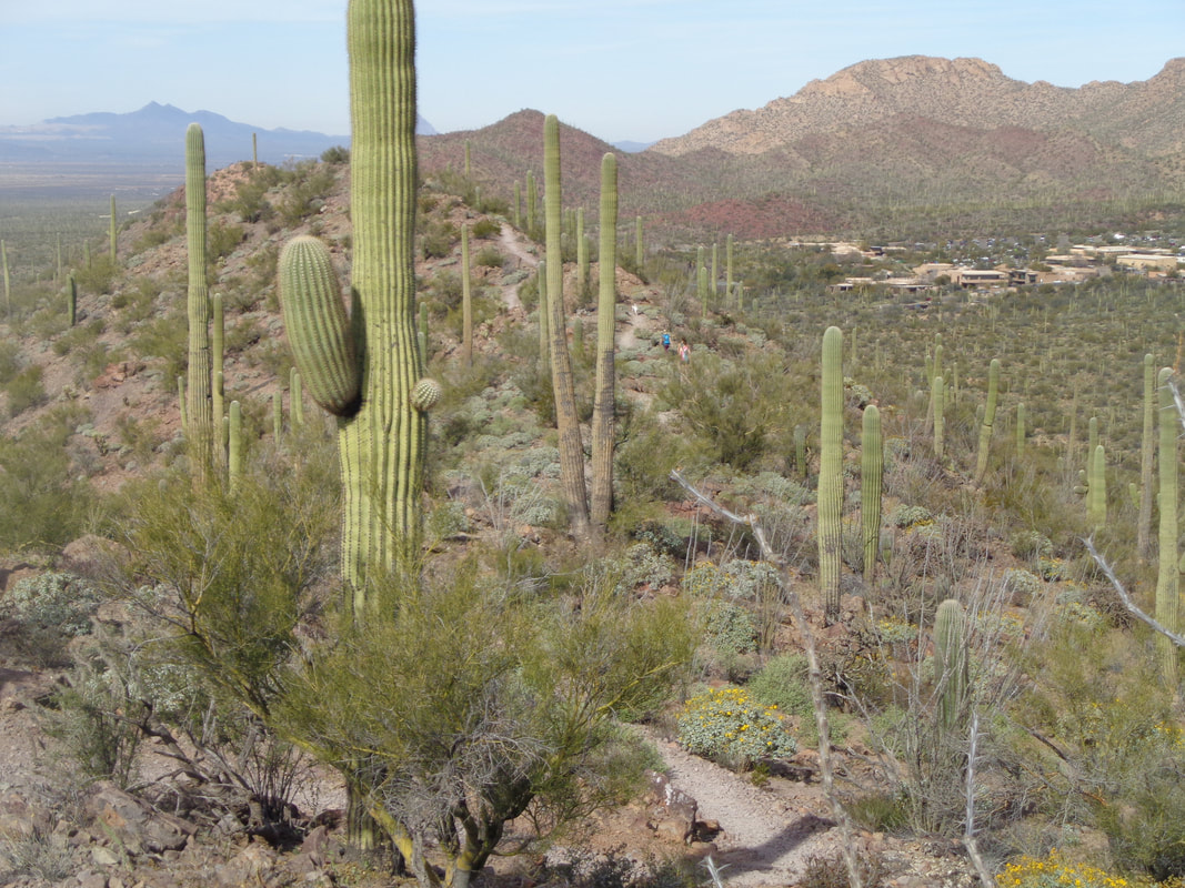 ….rather than descending to our planned reunion point at a picnic area, the trail dropped and then rose again and again as we followed a ridgeline. Really enjoyed this trail, which covered 2 miles prior to reaching..... 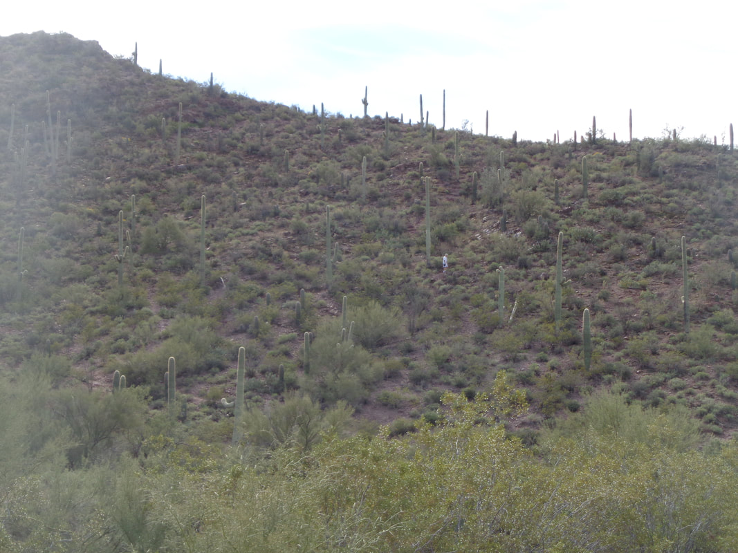 ….the picnic area. It was a pleasant wait for the others to arrive. Sun, warm temps and throughout I could hear..... 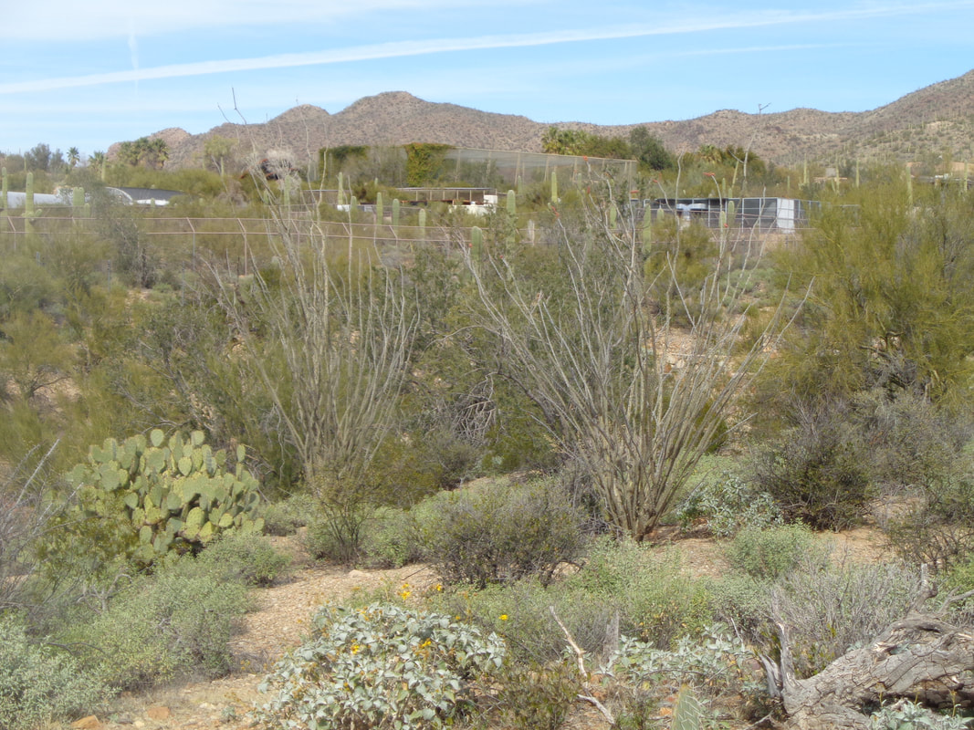 ….Raptors screeching in their enclosures from the adjoining Desert Museum. The group gathered for a snack and then, rather than go up and over the ridgeline to the trailhead we all....  …..followed the flatish trail that bordered the mountains. Finished with 5.5 miles and 800' of climbing. It seems all systems are back to normal which is good because I am leading a small group on an epic hike, Wednesday. Really looking forward to that.
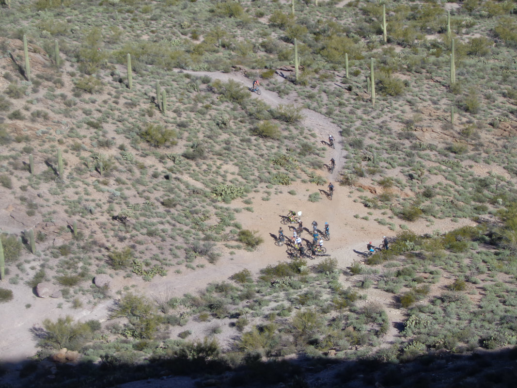 Last week, I was trying to find a way to a mountain peak, off trail and had given up when I heard a noise below. It was neat to see mountain bikers streaming in from the center and right trails. By the time all had arrived, there were approximately 30 of them. I still have not acquired a mountain bike. I hear good things about the trails here in the Tucson Mountains, then there is the "24 Hour" course where a big race is held every February, back side of Mount Lemmon, Honeybee Canyon, a couple others but many other routes are technical. Falling onto pavement is one thing but a rock shaped like a pyramid or bouncing of a saguaro. Yikes. 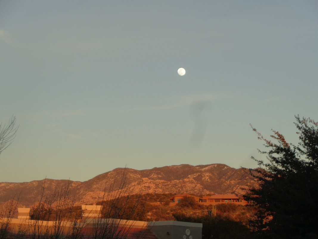 Were you able to catch last Sunday's full moon? Hope so, it was spectacular. The full lunar eclipse was at 10:12pm out here and I forgot to take a look but did catch it as the sun was setting earlier in the evening. Some Ohio people have or are about to visit. Doug M arrives
Wednesday and the forecast looks good with highs in the low 70's. I alerted the Tucson Rivets that an Ohio Rivet was coming out.  Little Cat Mountain and the start of a series of trails that would take me to a spot on the left of the mountain where I could begin the ascent. The image makes it look rather insignificant but it was a fun hike until it wasn't.  I go counterclockwise and enjoy some nice views prior to entering a narrow canyon.....  ….where the walls are peppered with Jumping Chollas. Later I would watch a herd of deer descend toward this point and decide not to follow. Just because they could make it doesn't mean, of course, that I could.  Big Cat Mountain in the distance as I have emerged from the narrow canyon and at just under a mile, see a very faint trail headed up and.... 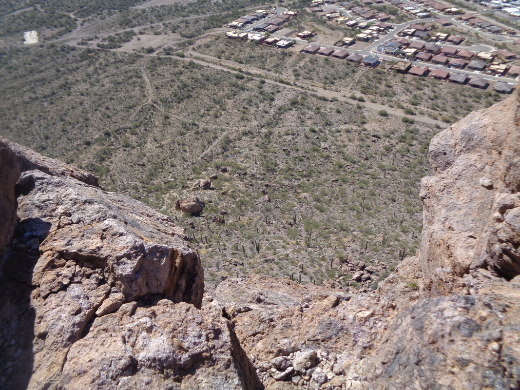 ….up. While the trail was faint (and steep), there was a saddle that seemed obvious it was the destination and upon reaching it, no trail existed but fairly easy walking across a slope to the above peak. 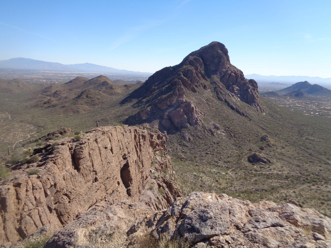 Looking across at Big Cat, a destination for another hike soon. 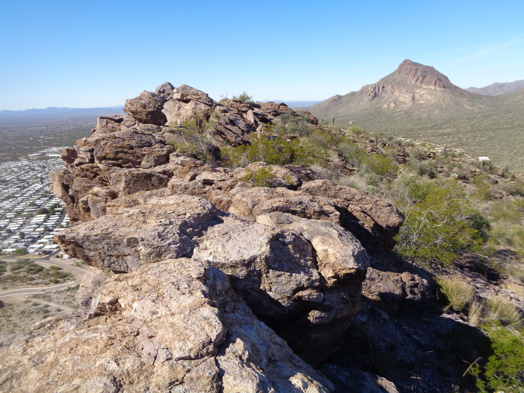 It was a lot of fun hopping along the edge and pausing to look down. On the right, the slope that allowed access to the peak from the saddle. 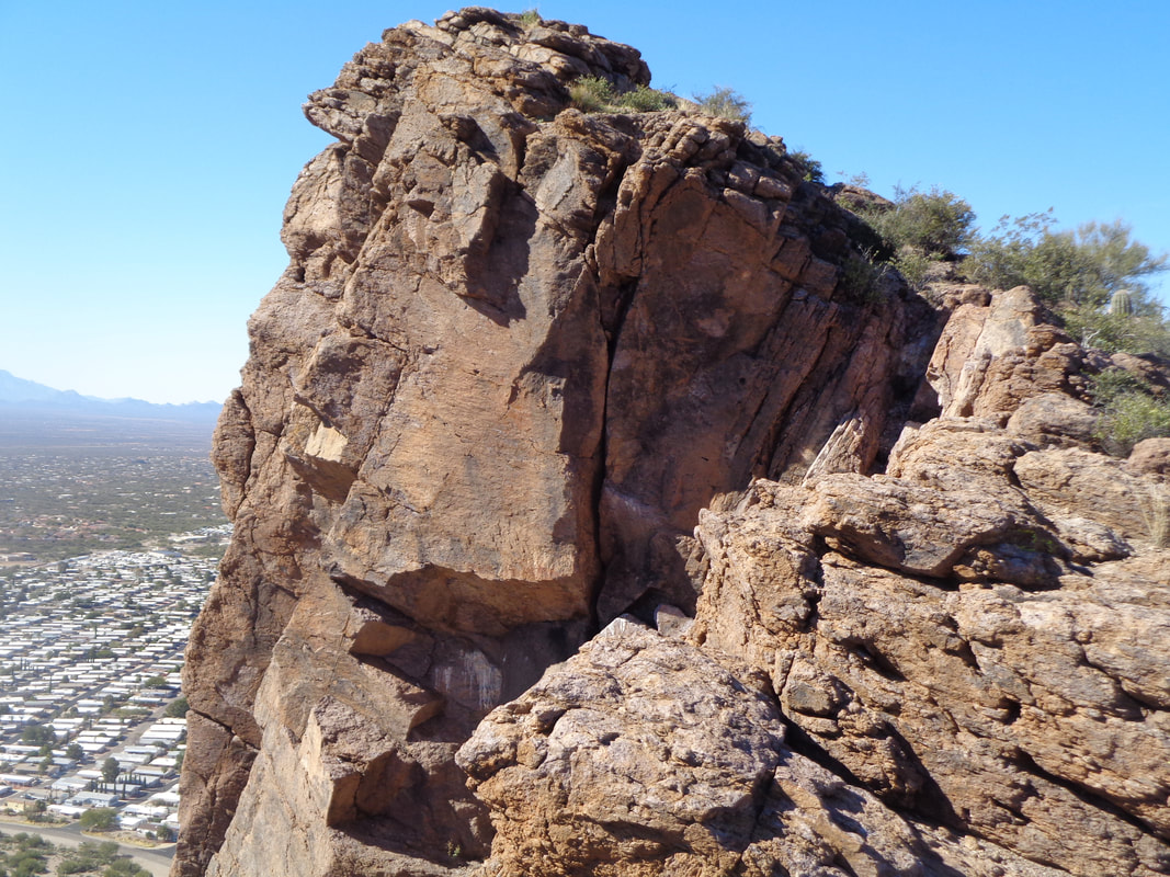 I spotted a cairn on the southern end of the peak so decided to see if there were more that I could follow as an alternative way down. I heard the sound of hoofs on rock and spotted.... 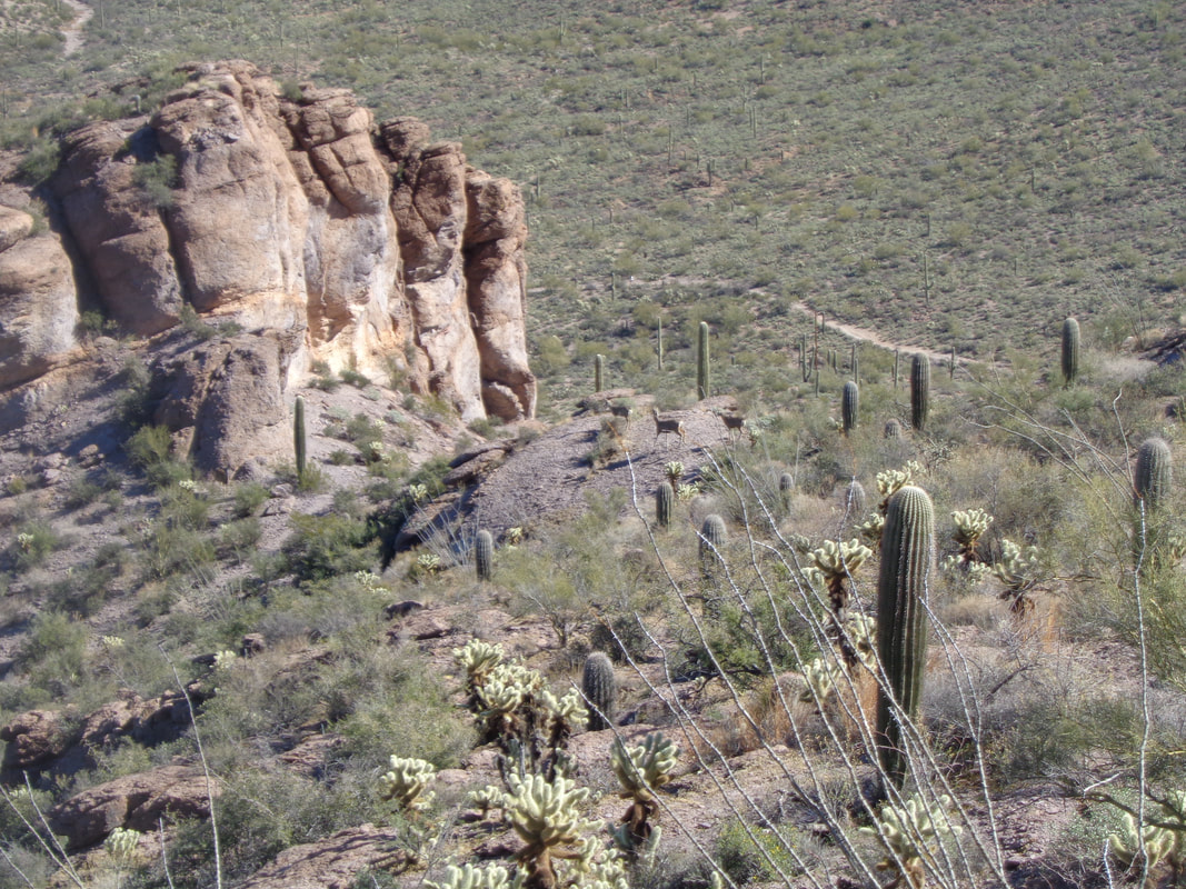 ...seven deer, three of which you can see in the center of the image. They disappeared through the opening, just forward of where you see them. Finding no other cairns, I walked down there anyway to check it out. Hmmmm, maybe but went north and..... 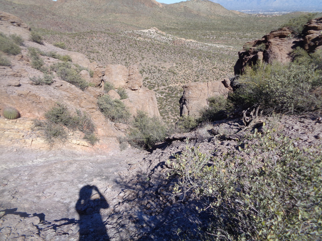 ….spotted another break in the rock but upon inspecting it, while I could make it down, if I became cliffed out below that, not sure I'd be able to climb out so headed back..... 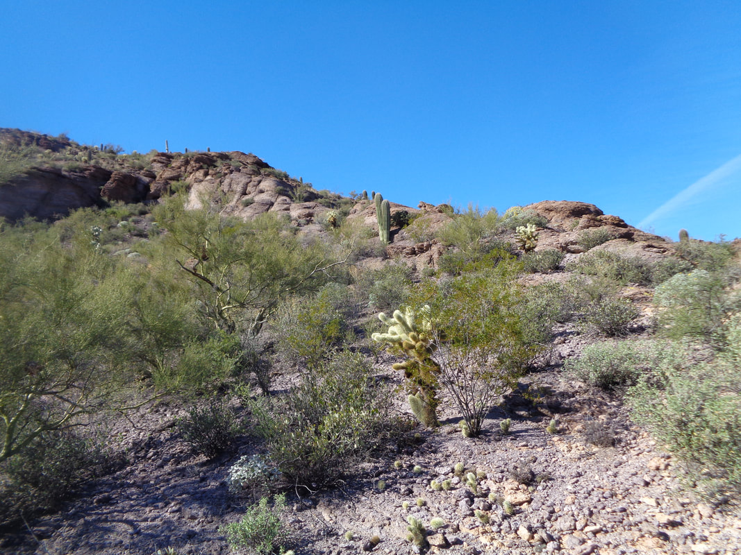 …..the way I came, regained the peak and returned the way I had arrived. After reaching the saddle, I began the steep, gravel covered descent. Having lost my 3rd hiking pole in 3 years last week (left it on the back of the car as I drove away:(), I really could have used it as a 3rd leg. Really sketchy surface but I made it down from the steepest section, lost focus and bam! Now that hurt. I tell people the distance I fell ranged from 6' to 0" depending on what part of my body hit. Pulled something in my groin, my right knee was dented, right hip bruised, right shoulder hurt and I had cactus spines to remove. Hobbled for a day but everything is almost normal in day 3. Probably should spend a day or two on the bike.
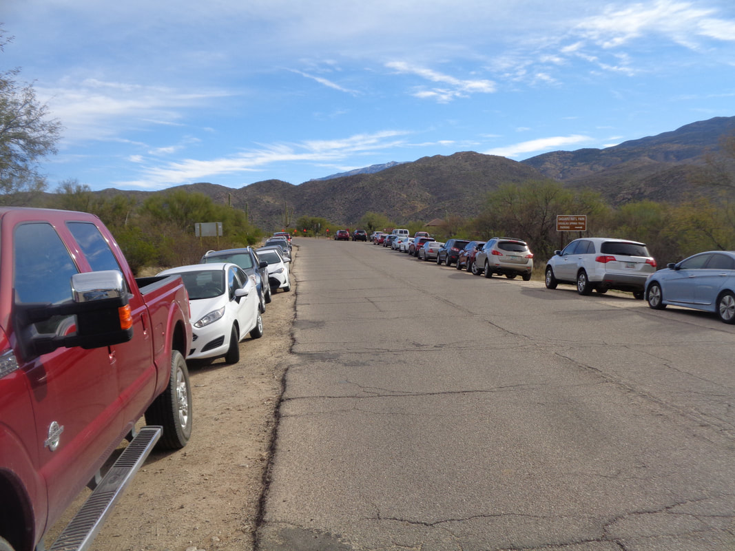 The parking lot was full at the end of Speedway where the Douglas Springs trailhead is located so I joined the line of cars parked on either side of the road. My destination was Bridal Wreath Falls and wanted to explore the area above it where I heard there are additional falls.  A windy day due to a cold front moving through, paving the way for a couple of days of cooler temperatures. Should return to daytime highs of around 70 by Thursday. 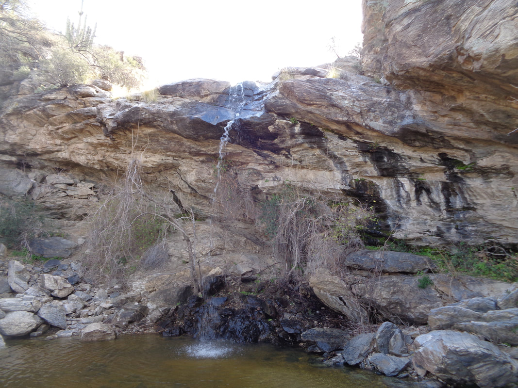 The trail is easy to follow, signed well and not very steep although you are climbing for practically all of the 3 miles that is required to reach the junction for the falls. The water flow was decent, reflecting some snow melt higher up. Ruggedly beautiful. 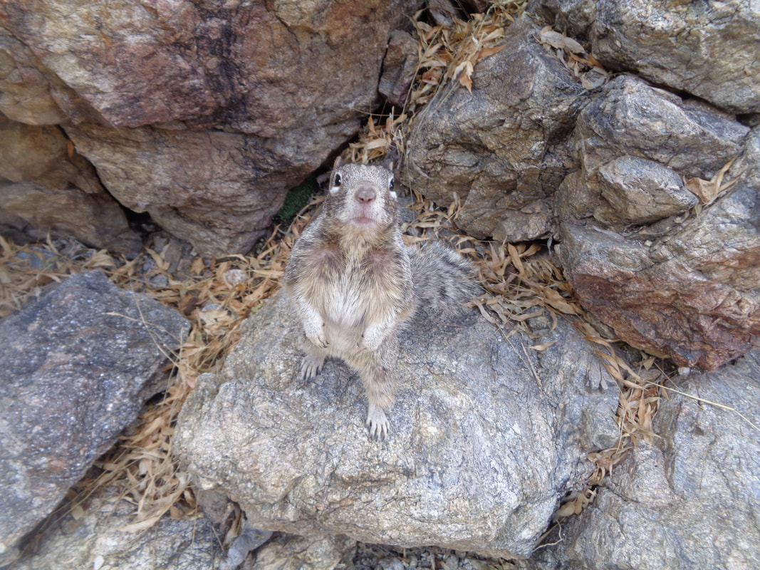 A squirrel came bounding down out of the rocks and appeared to expect a snack but of course, I don't feed the wildlife.  I've been here once before and was able to climb up the left side of the falls but erosion has taken out a handhold or two so I went down stream and worked my way above the falls before reaching a point I could..... 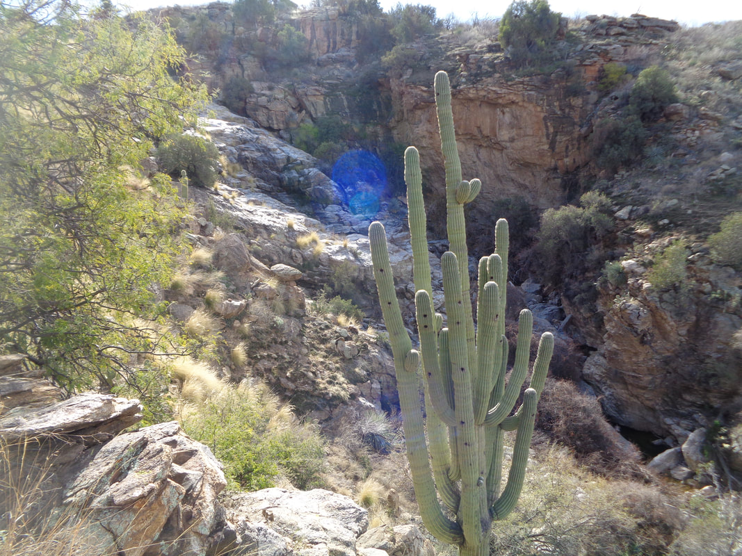 ….climb down into the upper falls. Marvelous Saguaro standing guard over the entrance to the seldom visited upper falls. Spectacular but first I rock hopped to the..... 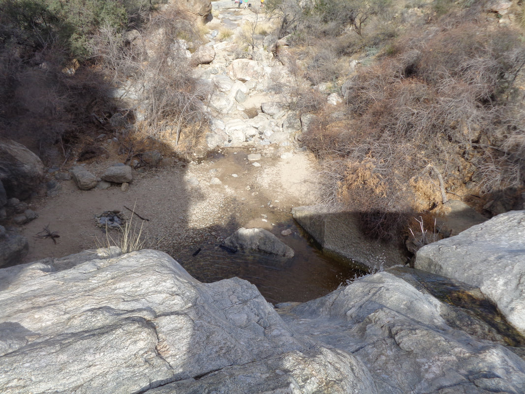 ….edge of the Bridal Wreath falls and peered down into the pool. Then I.... 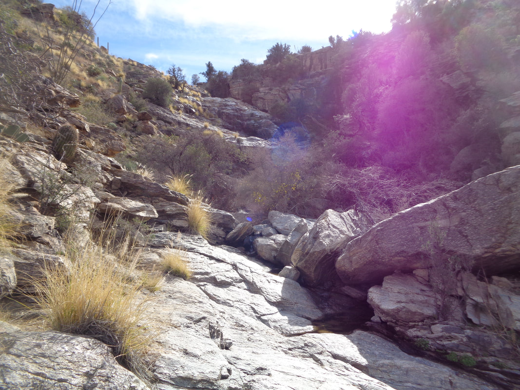 ….began climbing. Each time I was confronted with a slope that was too steep, there was always a work around, usually to the right. Most of the time I was able to walk the slickrock along side the cascading water. The canyon bent to the left and.... 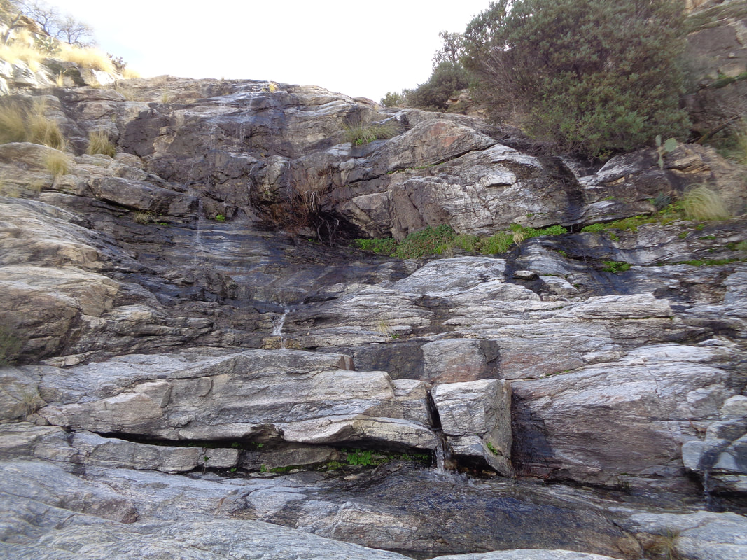 ….another series of falls, again climbable on the right and then..... 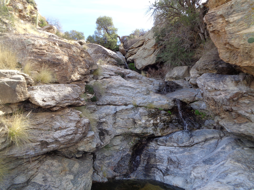 ...more falls. This time, while I was certain I could climb, I was less sure of my footing coming down and who knows, once above this, there could be more walls and falls. I scouted the hill side to the left of the canyon for an alternative way out and spotted something pink. I carefully worked my way around cactus and some exposure and discovered.... 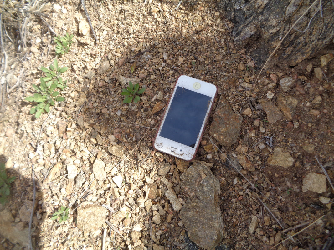 ….how about that? An old iPhone. It was in a crevice so could have been brought down from above via numerous washouts. Later, I gave it to someone with an iPhone charger but it did not fit the receptacle. Probably can't be charged but would be curious to find out how it got here and to whom it once belonged. I retraced my route, sliding/walking down the series of falls, got back onto the trail and.... 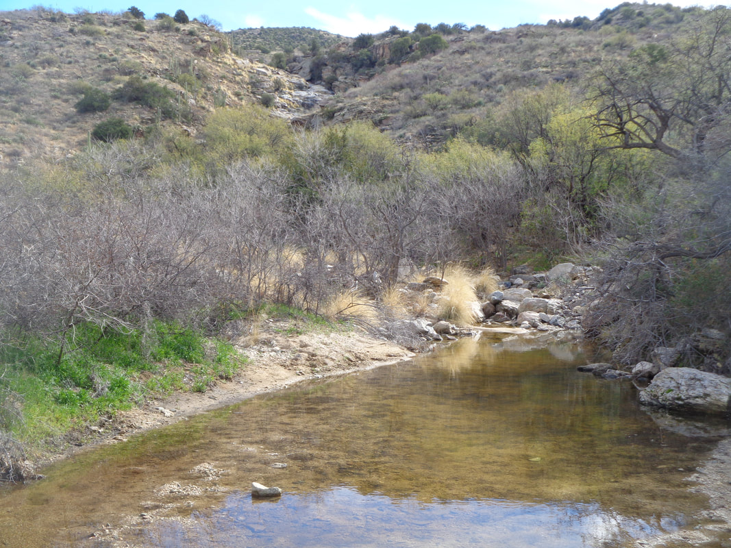 ….began the hike back. Finished with 7 miles and 1300' of climbing. Nice day for a hike.
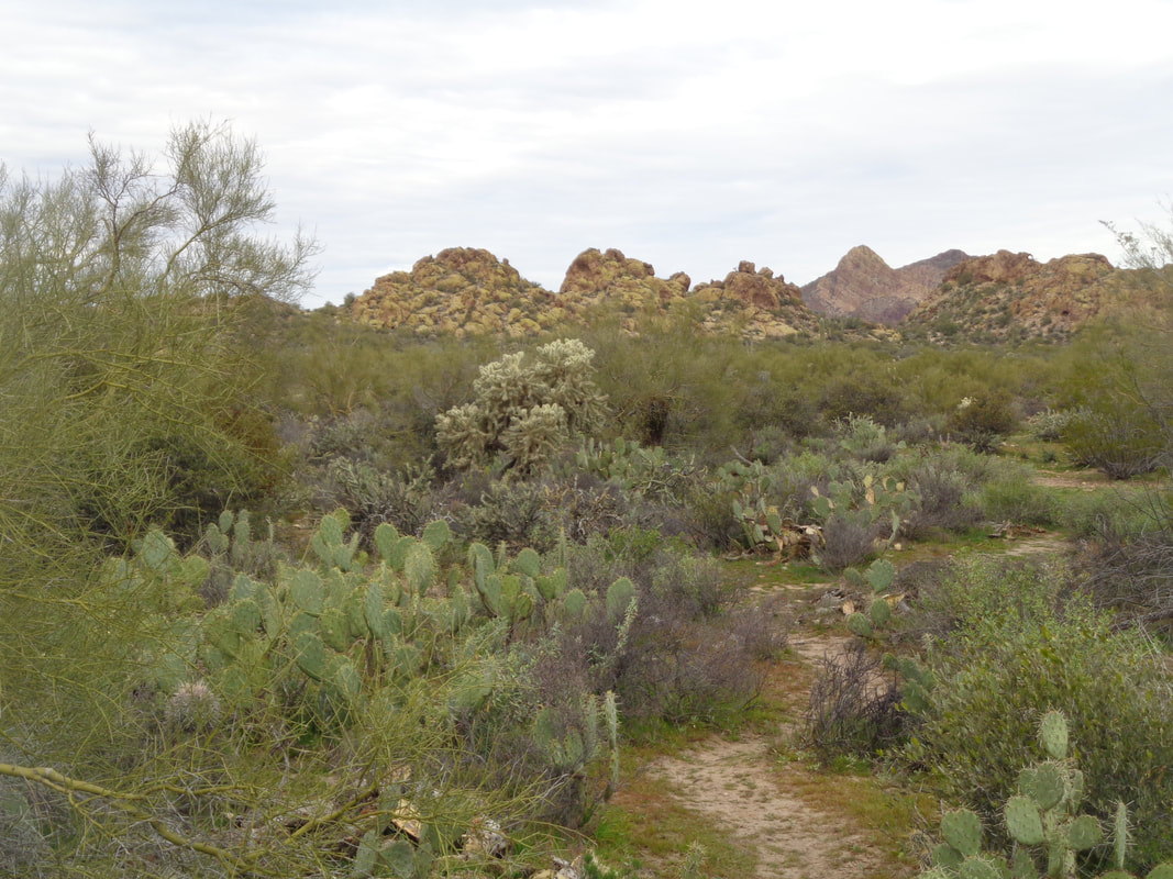
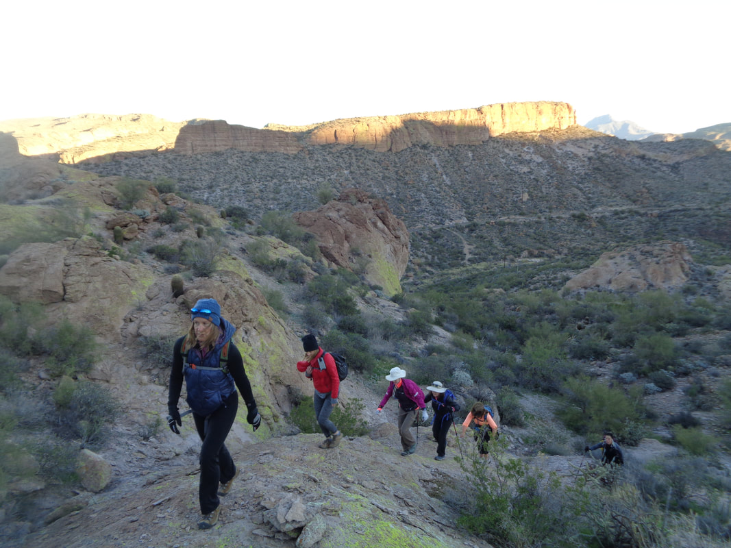 In the car at 5:30am for the long drive to Tortilla Flat, an authentic remnant of an old west town sitting on the historic Apache Trail (St. Rt. 88) and across from Canyon Lake. Our group of 15, led by hike organizer Wade, head into the wilderness following a route that at times is a trail and at times not, requiring some route finding. Above, the rising sun lights the mountains behind us. 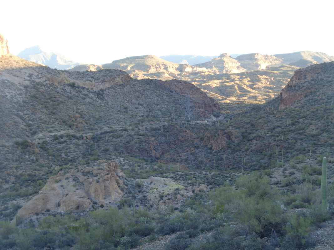 The colors are in a constant state of flux as both the sun and our group climb higher. As usual with this group, most of my images are taken during the return because going out, the pace makes picture taking a challenge. 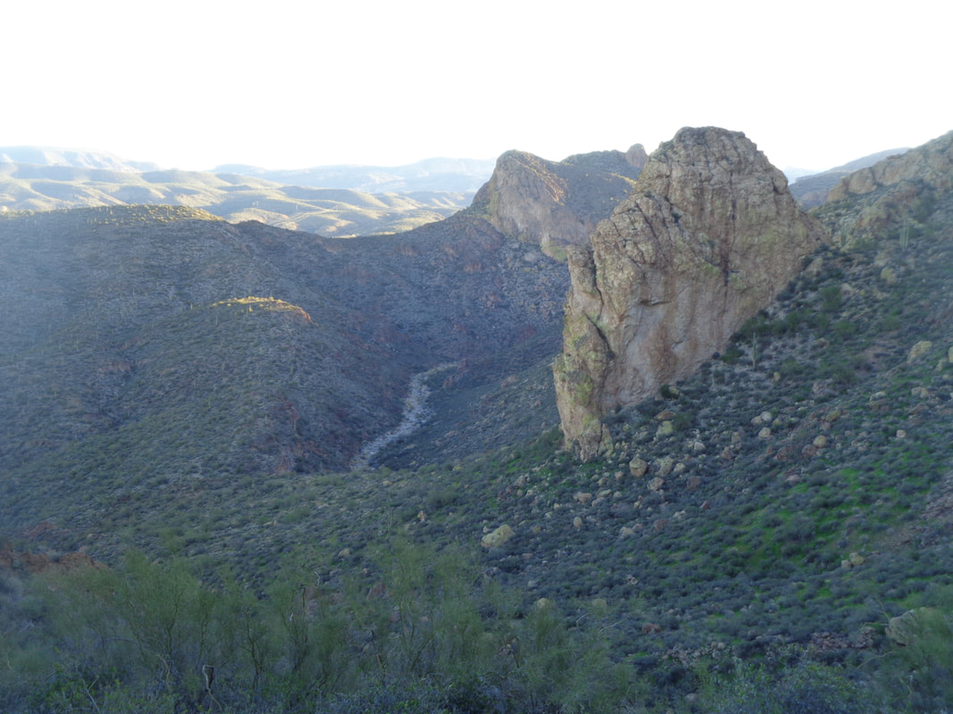 I think that is Peter's Canyon below us. 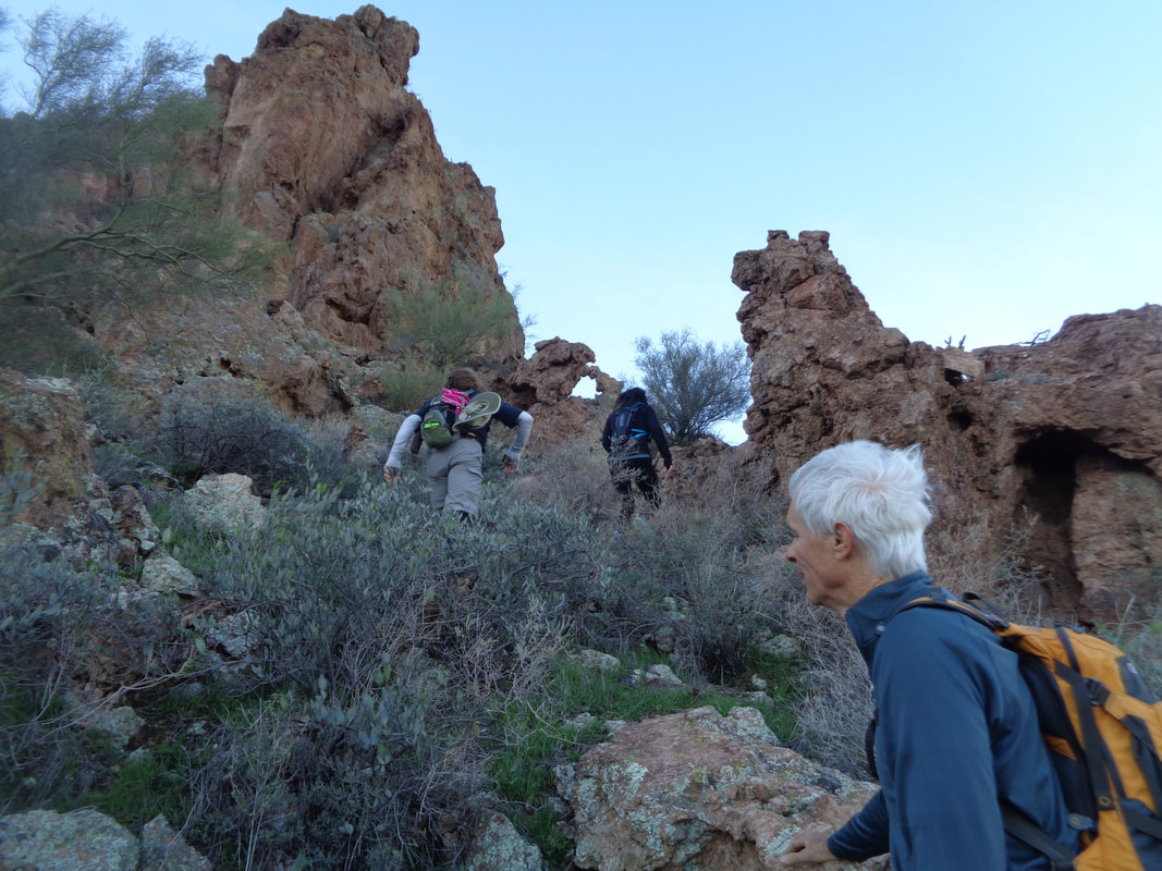 In the center of the above image is "Fragile Arch", indicating we are near the finish of the initial climb out of the valley. We pause there to examine the small arch and debate whether it is man-made or natural. We agree that the fit of the pieces that form the arch is natural. 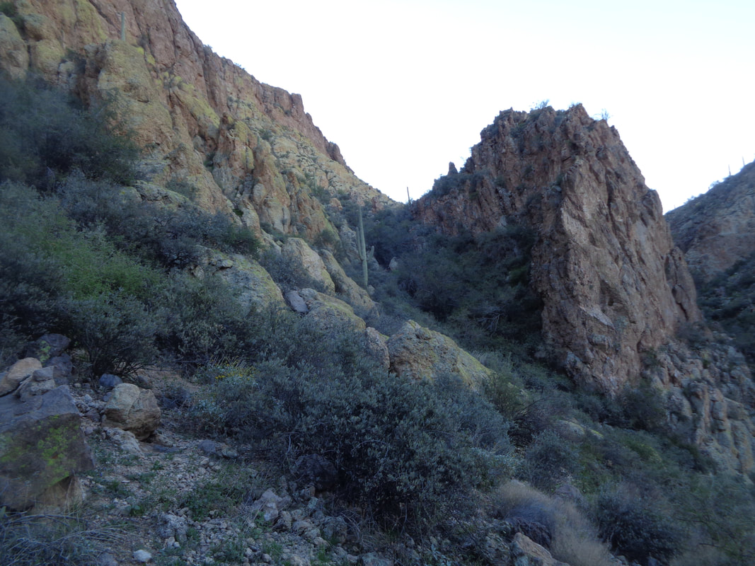 The route drops into a shallow canyon prior to reaching another saddle and we look and the next challenge. We will forge our way through the brushy area on the left. Wade assures us it is not as bad as it looks and he is correct but it does..... 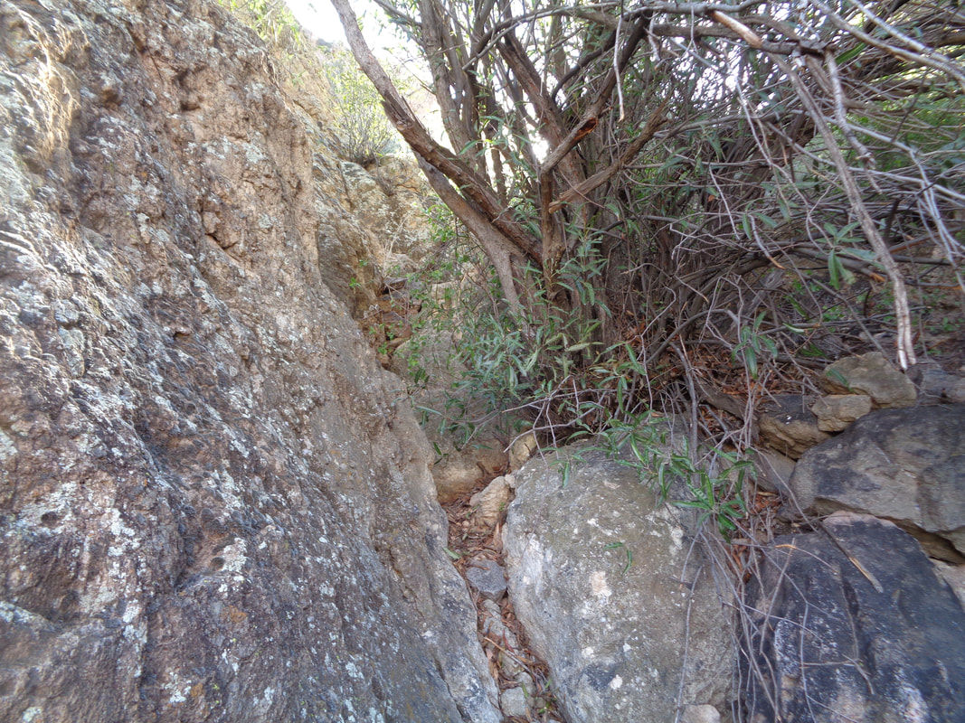 …..get kind of tight in places as we ascend the far slope to a final ridge before dropping into Geronimo Canyon. 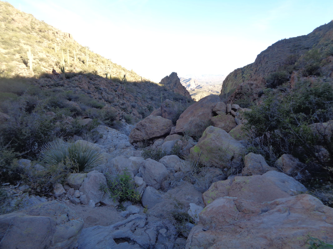 It's a wee bit rough in this one. This is where things went awry through no fault of Wades. Having been here once before, I thought the Geronimo Head summit was to the left of the canyon after it bends to the left of its course. Well, maybe the below is a better example of what happened next. 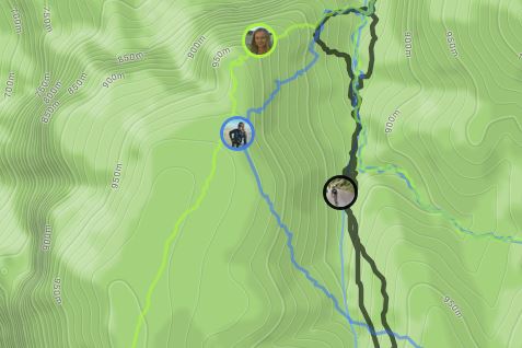 From Strava, my icon on the right represents Don and me, mistakenly thinking Geronimo Head was the next destination. To my right is Tom and his group of 4, thinking they have made a mistake and now headed directly toward Geronimo Head after bushwhacking on a slope. The lime green icon of Kate represents the others, including Wade. on the correct route. Don and I bear some responsibility for the mess because we were yelling at Tom that he was off route when in fact, he had been mostly on the route until we intervened. 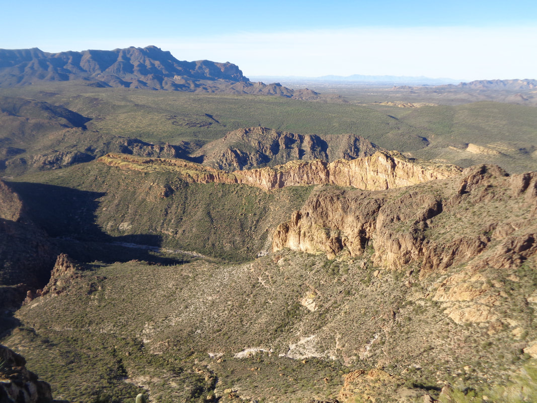 Don and me confront brush that prevents further advance in the boulder filled wash. I break left while he breaks right, climbing out of the wash. I am now nearer to Geronimo Head and reach it first where I get a fantastic view of Battleship Mountain, highlighted by it's yellow cliff face. 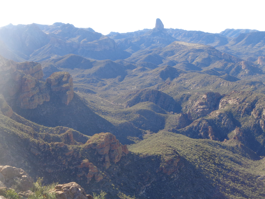 The landscape is stunning in all directions, as always. After a few minutes..... 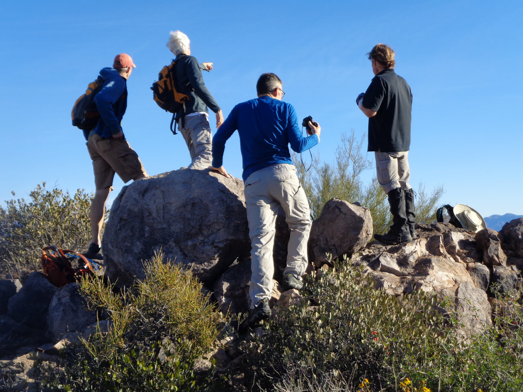 ….Tom's small group arrive and now we see Wade's group, one canyon over and wondering how they had mistakenly gotten so far off track....they weren't. After 20 minutes, we pack up and begin our descent but notice the other group is also up and headed toward us. Makes sense since that was the plan all along and they were.... 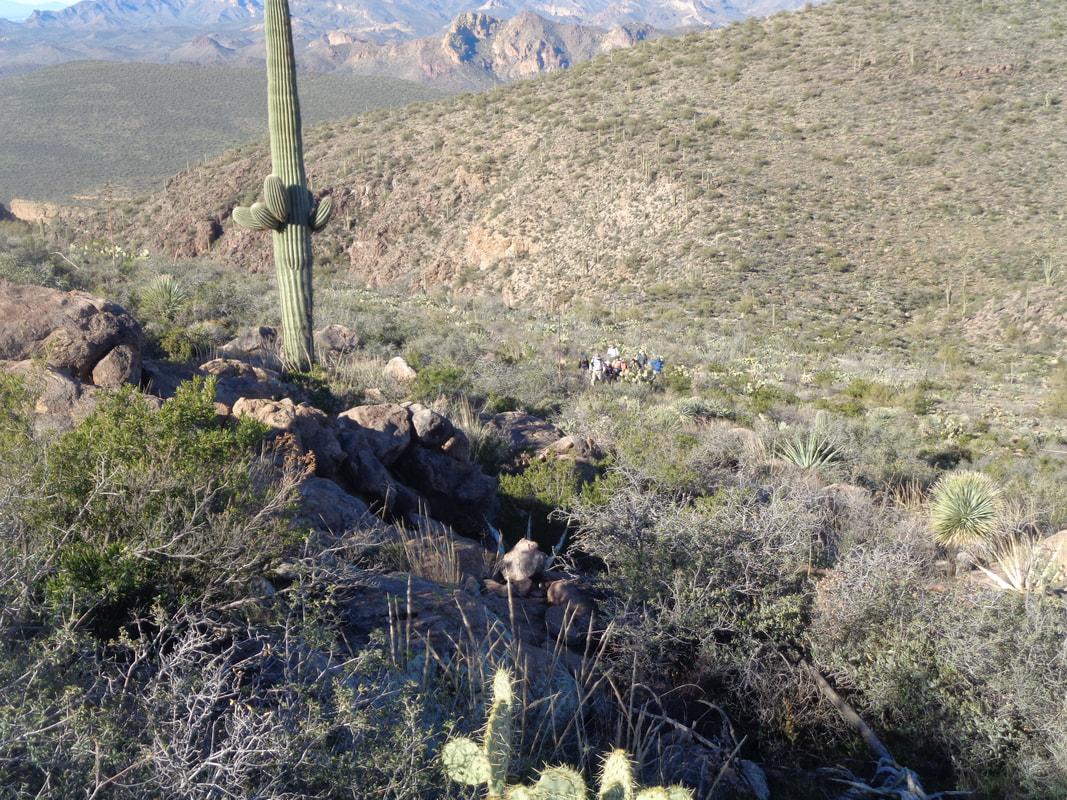 ….there in the center, on the route. It was windy and kind of cold and I didn't want to linger again so I let them know I was headed back and began the.... 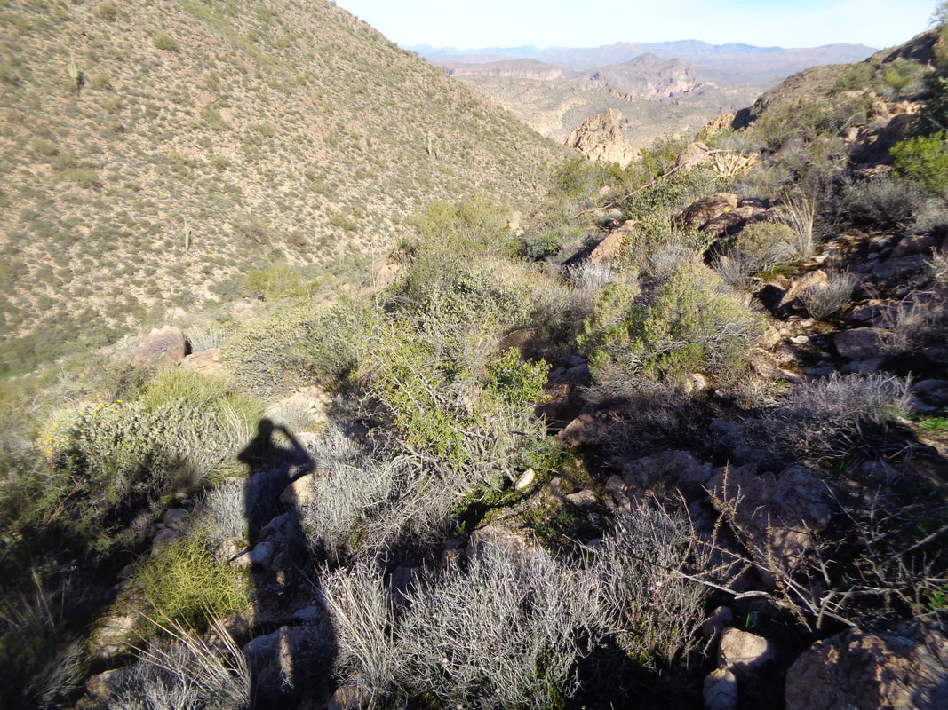 ….trek through the above which really isn't as bad as it looks. But, it's not all that good either:) 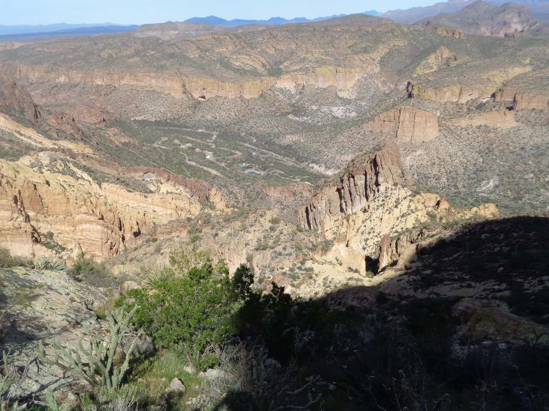 Almost back with some additional hiking and descending ending the 5.5 mile, 2000' elevation gain effort. It's not the distance nor the climbing that makes this a special hike. It's the destination, the route finding and overcoming the obstacles that one finds in the wilderness. Oh, it's about the scratches that at one point had my left hand mostly covered in blood. The prickles of the Cat Claw bush are especially effective at shredding skin and clothing. I put my things away and.... 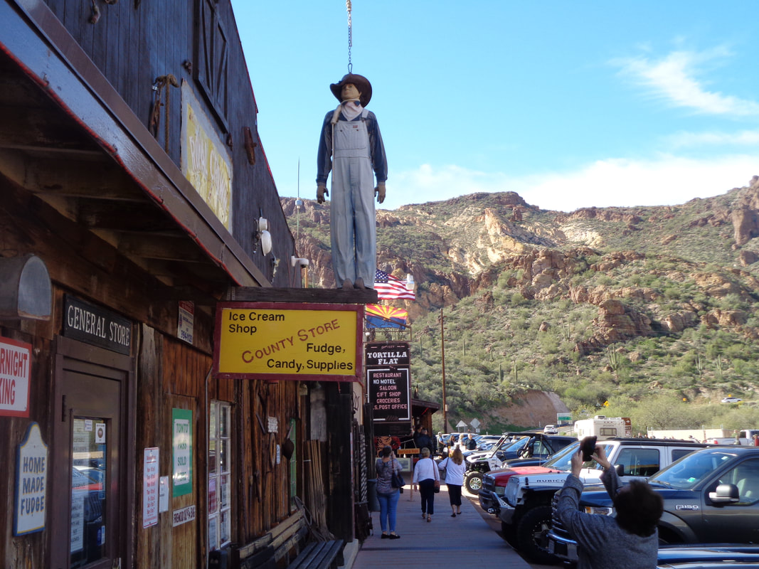 ….walk into Tortilla Flat past a general store and into.... 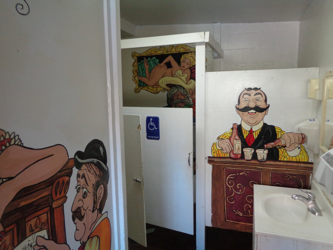 ….the saloon's rest room where I wash off the dried blood that I was unable to previously remove. Interesting décor in there. 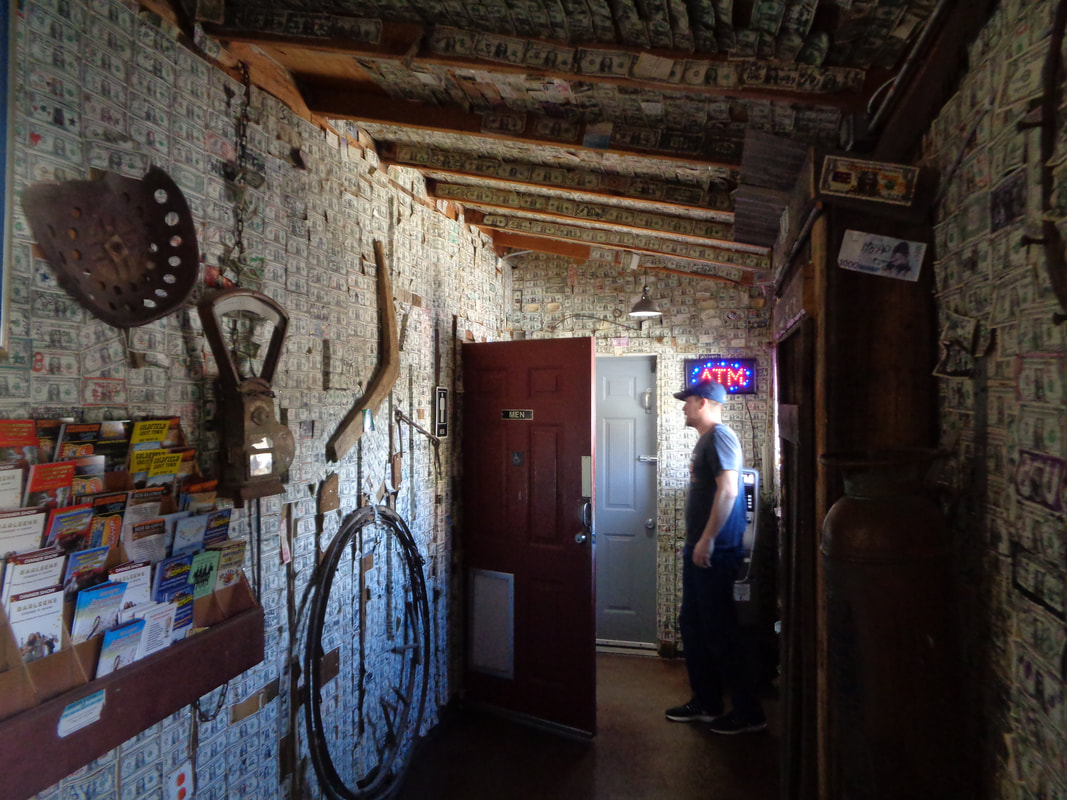 The saloon's walls are covered with $1 bills. I had kind of promised the group I would buy a round of "snake venom" after the hike but considering the drive and what would have been an hour wait for the group to arrive, I took off. Next time!
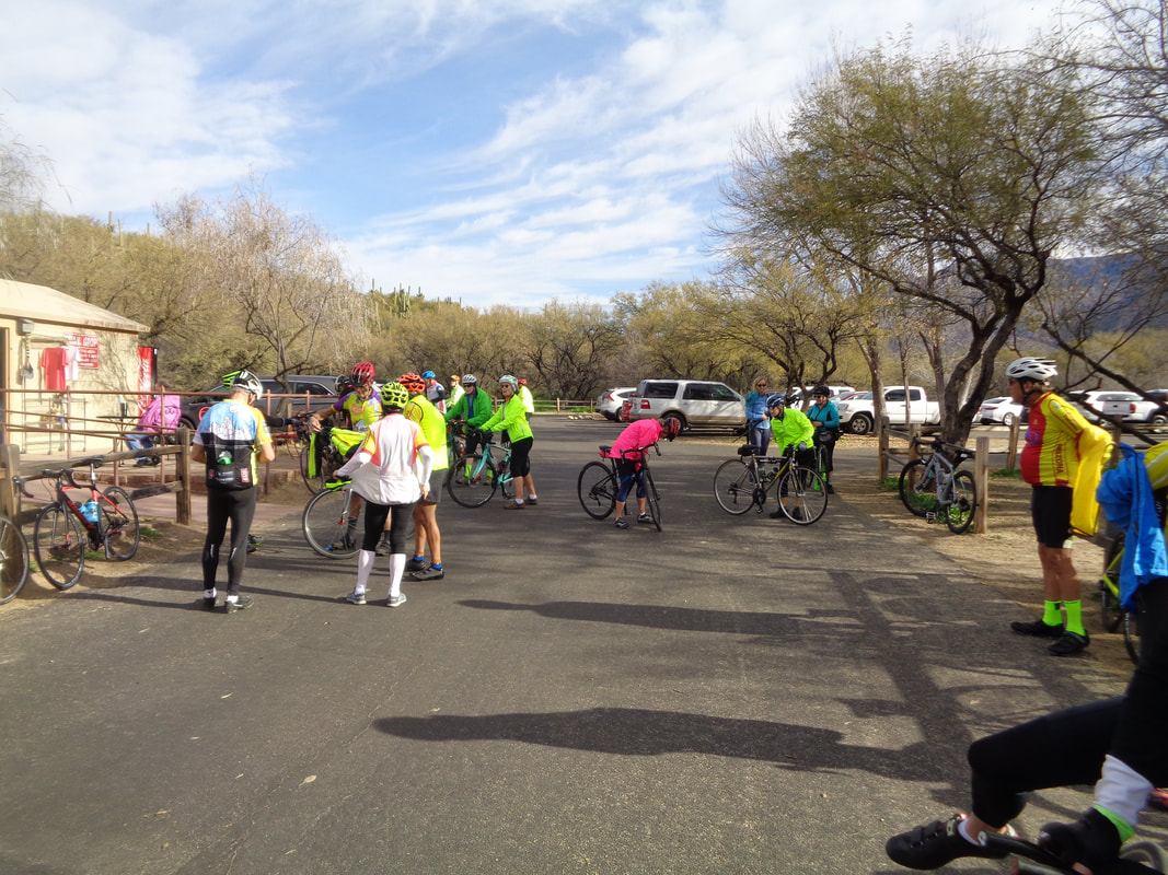 I joined a "C" bike ride for 33 miles and it was kind of fun to get back on the bike after cycling so little in the last couple of months. The start of the ride was 9am and the temperature in the low 50's so that was good. There were two guys there, Scott and Chuck who were better than a "C" rating and we got away from the group. Then, a couple of days later..... 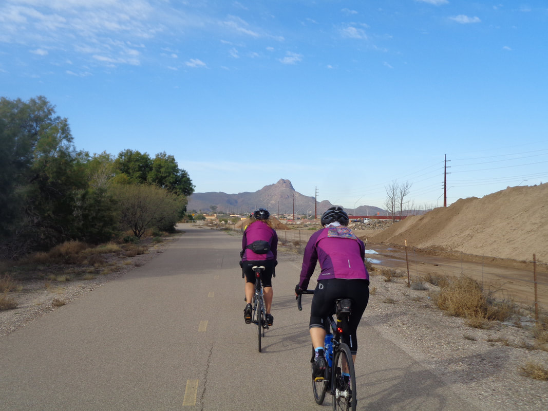 ….I joined a ladies' group that once each month, invite the guys to join in so what the heck, may as well check it out. I again had a good time but still not raging to get on the bike so maybe another month of hiking will put me in the proper frame of mind for cycling. Anyway, we got in 38 miles. Purple must be the latest fashion color for cycling jackets. Remember when it was lime green and everyone had one of those, or so it seemed? Kim, the woman on the left, rode the 100 mile Tour de Tucson in under 5 hours. 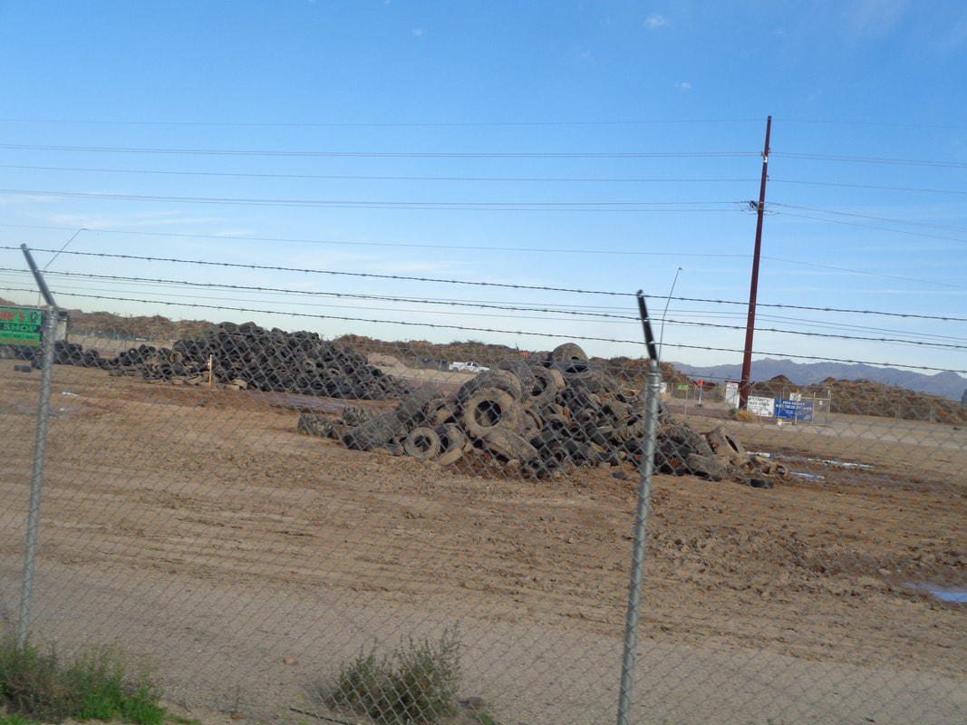 Least you think it is all fantastic views of the mountains, there are plenty of places around Tucson where the views are not so good, unless you enjoy looking at tires!
 Well gang. I am behind with reports and a monster hike finished today that I've got to put up. I had a rest day a few days ago but the sun and warmth was too much to ignore so joined a new group that do easy to moderate hikes, mostly in the Tucson Mountains. It was, easy but that was ok. I got ahead of the group coming in and dumped my stuff into the car, turned and..... 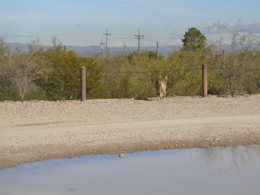 ….a coyote walked by, in no particular hurry. I did not have my camera as it was in the car and I was standing at the trunk so above is the best I could do. A couple of hikers were bitten by a rabid fox last week and I thought it a little odd the coyote was out in the middle of the day but he appeared normal.
 I made a last minute choice to join a moderately paced group hike and so, what the heck, decided to give it a go and test my patience. When I arrived early at the parking area, I looked at the above and thought, maybe we will go there. I should have paid more attention to the description. 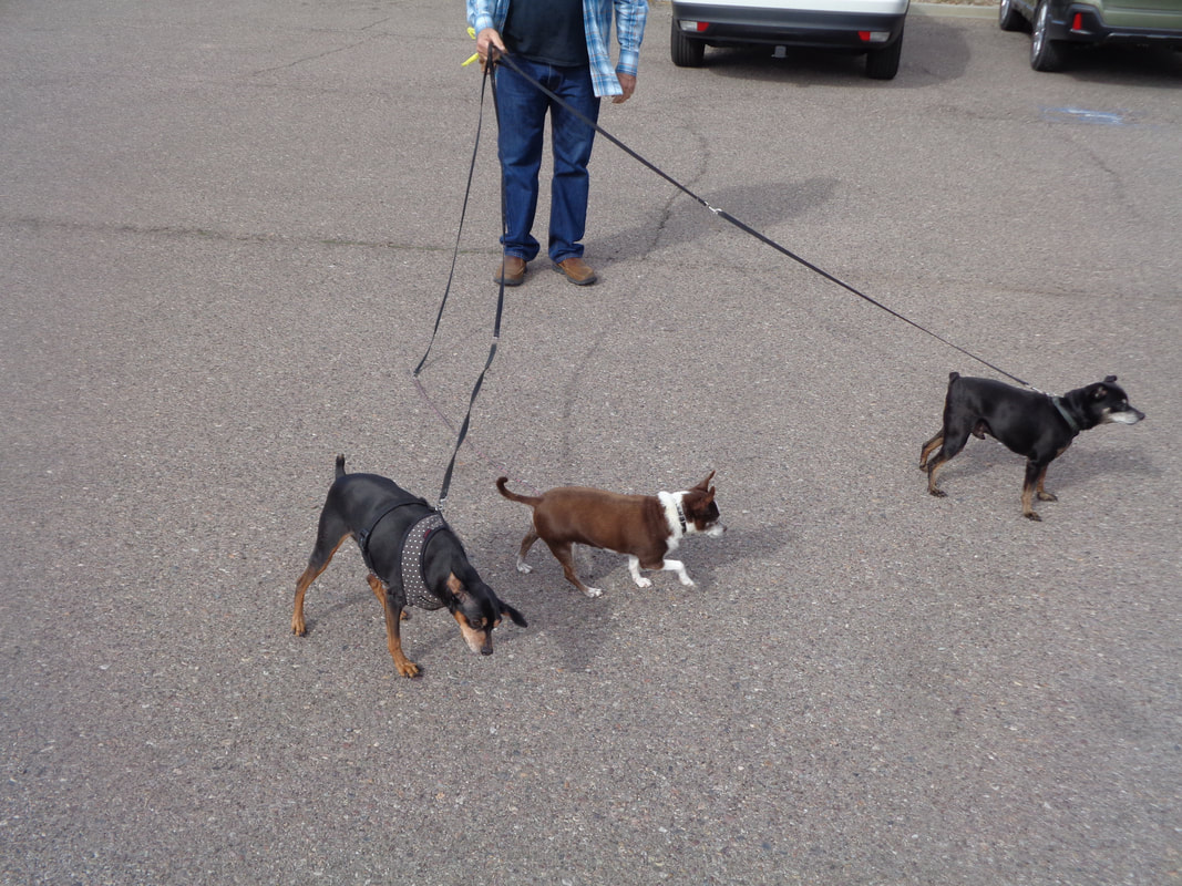 A guy was walking his 3 dogs and one approached me and I said, "Hey buddy" and he replied, "How did you know his name?" 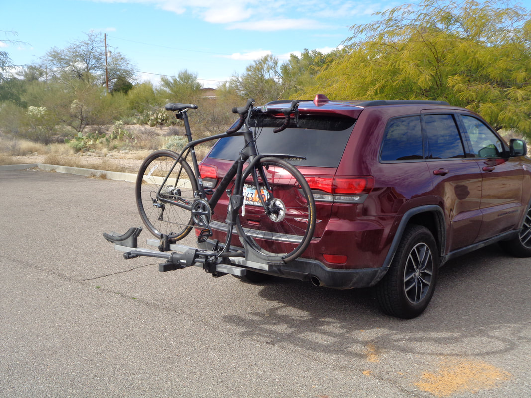 Also in the parking lot was a nice road bike with Di2 shifting. Very strange as someone could easily remove the frame from the wheels but.... 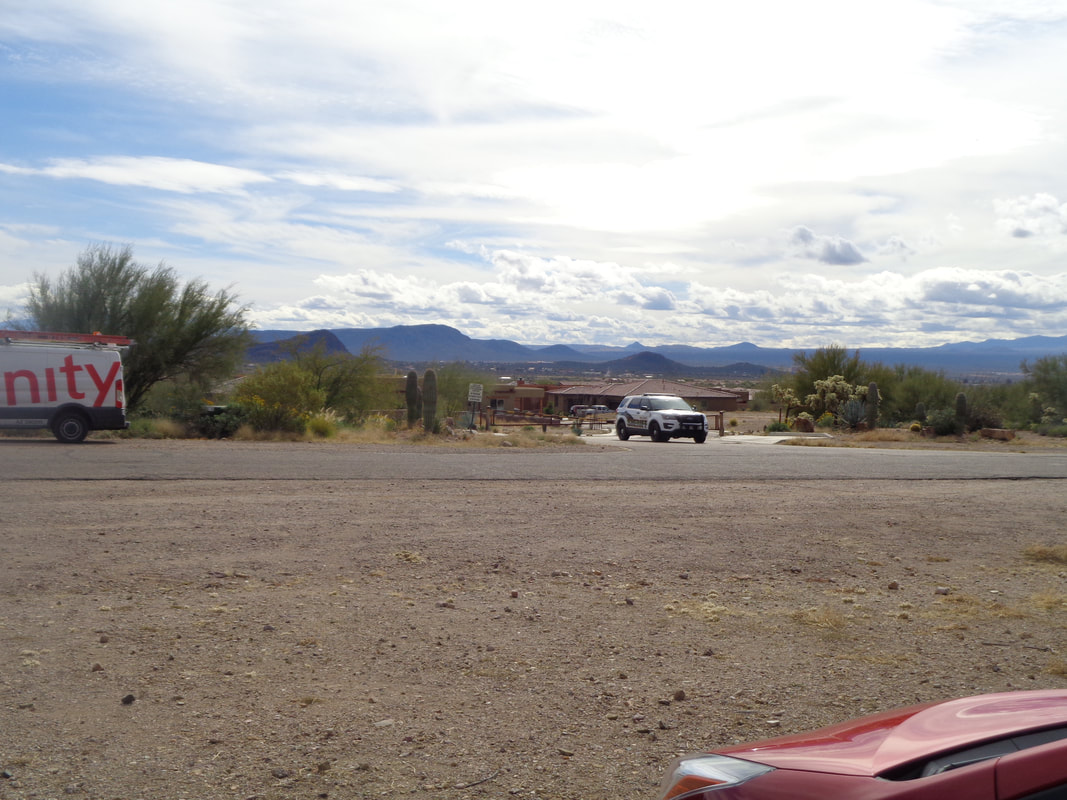 ….across the road was a sheriff's patrol vehicle and I wondered if the bike was a plant, to entice a would-be thief. There was a broken windshield in the parking lot with plenty of glass and I have heard there have been a number of break-ins. Glad I left my BH at home.  The small group arrived and we began our trek through the Sonoran desert. The group was going a bit slow and the trail was unusual in that it was runnable so I picked up the pace and soon began running too. Nice not to worry about rattlers although the temp did reach 70 degrees.  The trail avoided climbing for the most part but I decided to take a side trail that zig-zagged to the above saddle and then.....  ...dropped back to the parking lot. California continues to pass through disturbances that leave us with drizzle, gather energy as it churns northeast and then dumps 8" of snow on parts of the Midwest. Damn those Californians! Finished with 5.5 miles and less than 1000' of climbing. Actually, kind of nice not to do a knee buckling hike. On the bike tomorrow!
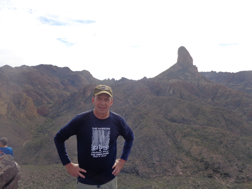
 Yes folks. Another early start as the sun has just crept above the horizon, lighting the mountains to my west. An 8am start is not bad despite the 90 minute drive. I was introduced to the group as "Mark from Tucson" and for once didn't correct with Oro Valley. 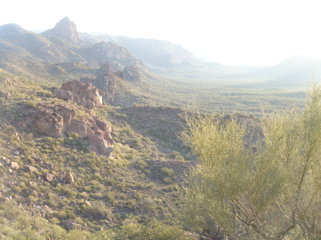 Our hike leader, the legendary Phil Livingston, leads us from the Peralta trailhead via Bluff Springs trail. We quickly rise above much of our surroundings. Phil has explored the area like few before him. After the initial climb, the trail is mostly rolling prior to dropping into.... 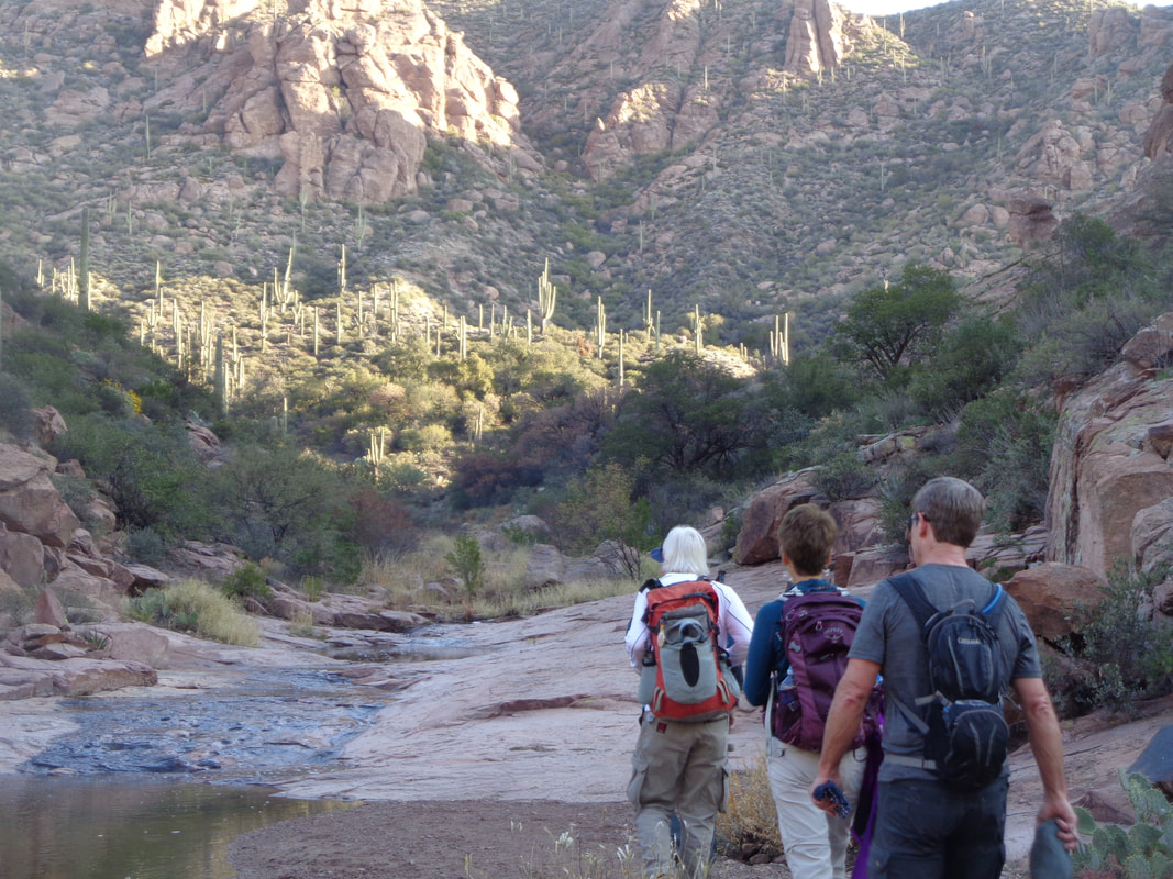 ….a cool canyon with water flowing through it. Here, we pass the start of the Terrapin trail to our left but remain on the Bluff Springs trail. 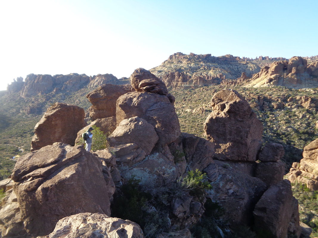 We climb out of the canyon and take a break. The experienced hiker knows to watch Phil carefully whenever there is a pause in the action. Phil knows where all the gold is hidden and just maybe, I will catch him bending into a crevice a retrieving a bag of gold dust or something similar.  After 3.5 miles, we reach the faint and little known Ely Anderson trail. Heading into the thicket I jump ahead as I enjoy testing my route finding skills and know Phil could care less if I leave the group for awhile. It was a fun and steep ascent. I did lose the route and found myself on the opposite side of a canyon but managed to wind my way back on route while also, as always..... 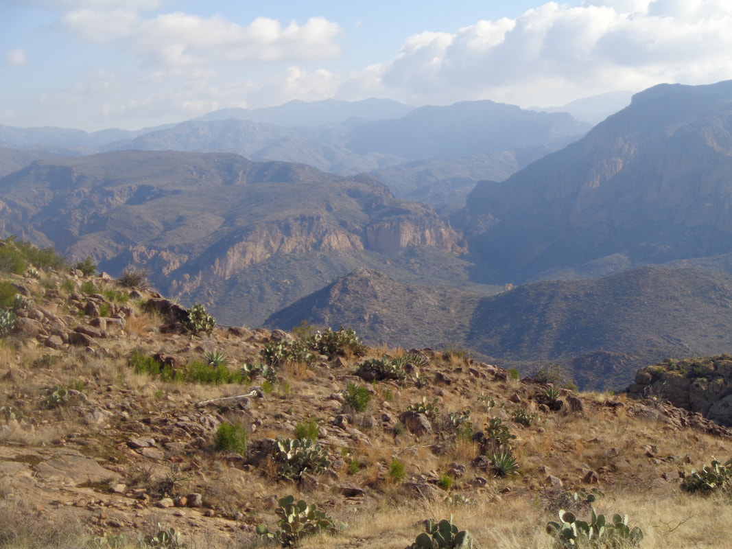 ….enjoying the views!  I reach a ridge and continue on up to the above rocky point. There I can see another and final ridge to the west that would have afforded magnificent views of Weaver's Needle and other features. The group had not yet reached the first ridge and I began to doubt they would advance farther so I sat, ate an apple and..... 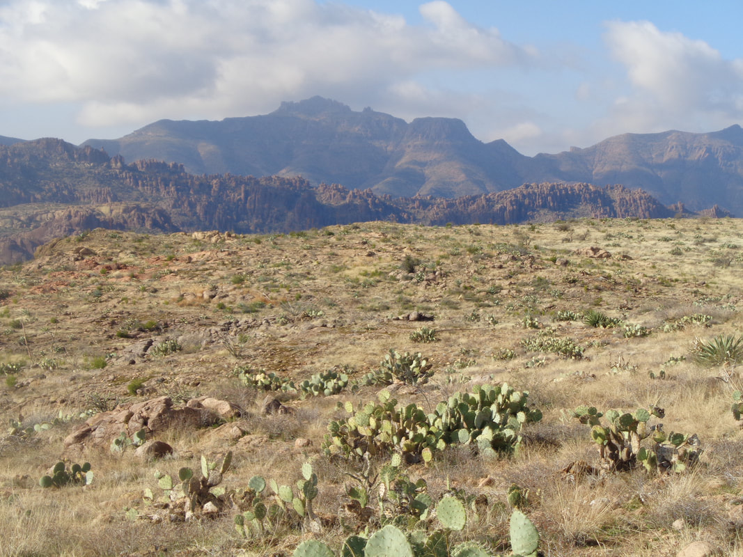 ….continued to be awe struck by what I saw. Superstition Peak way in the distance. 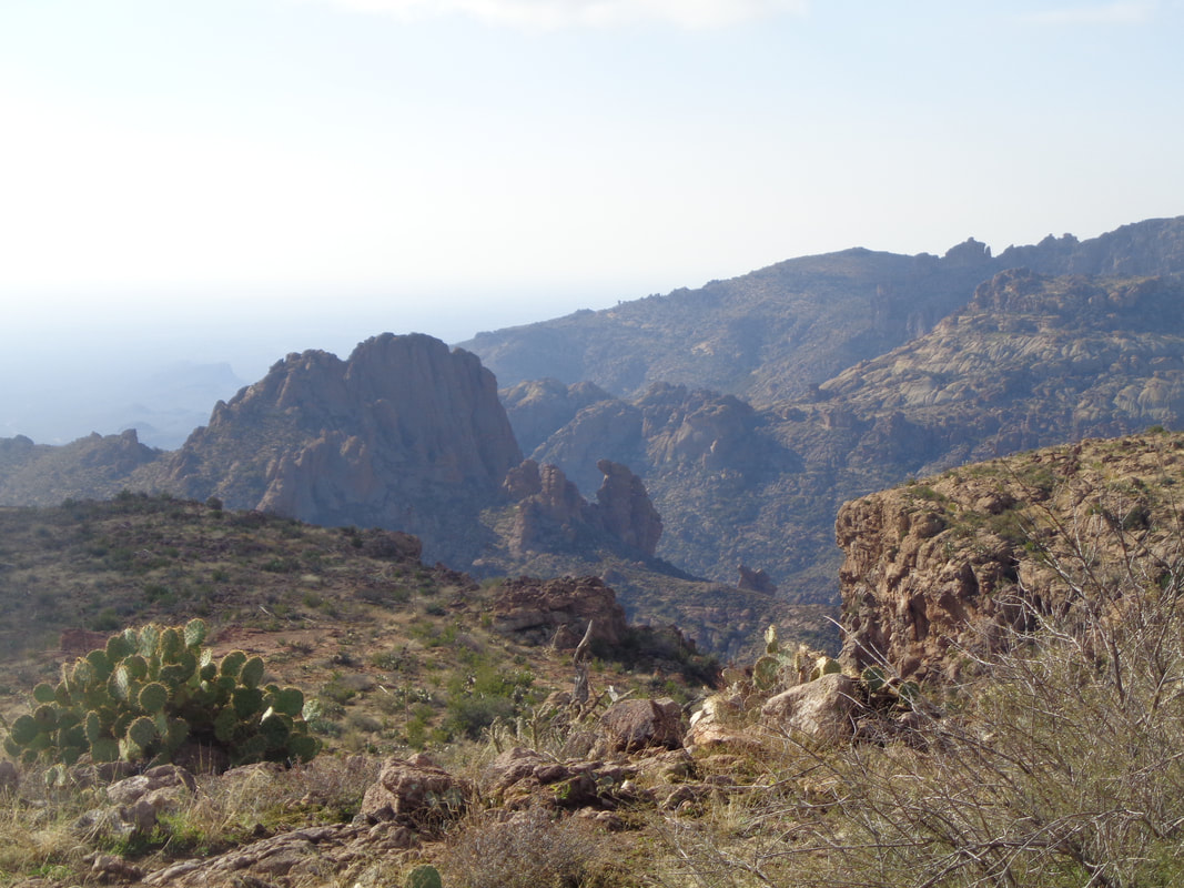 More and..... 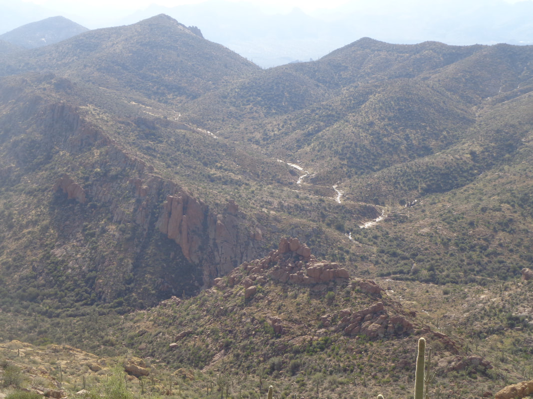 ….more. I spotted the group, stopped at the ridge and settling in for a break so I..... 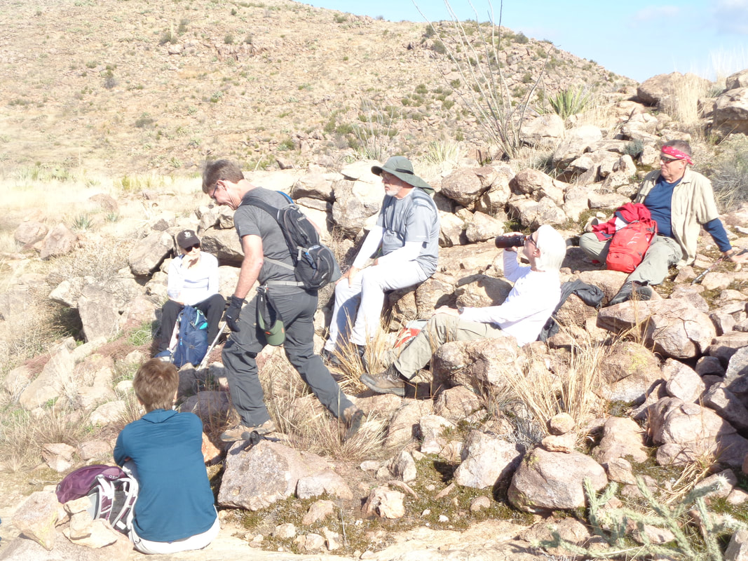 ….walked back down and we decided, rather than continue to climb the gentle slope to the aforementioned overlook, we would.... 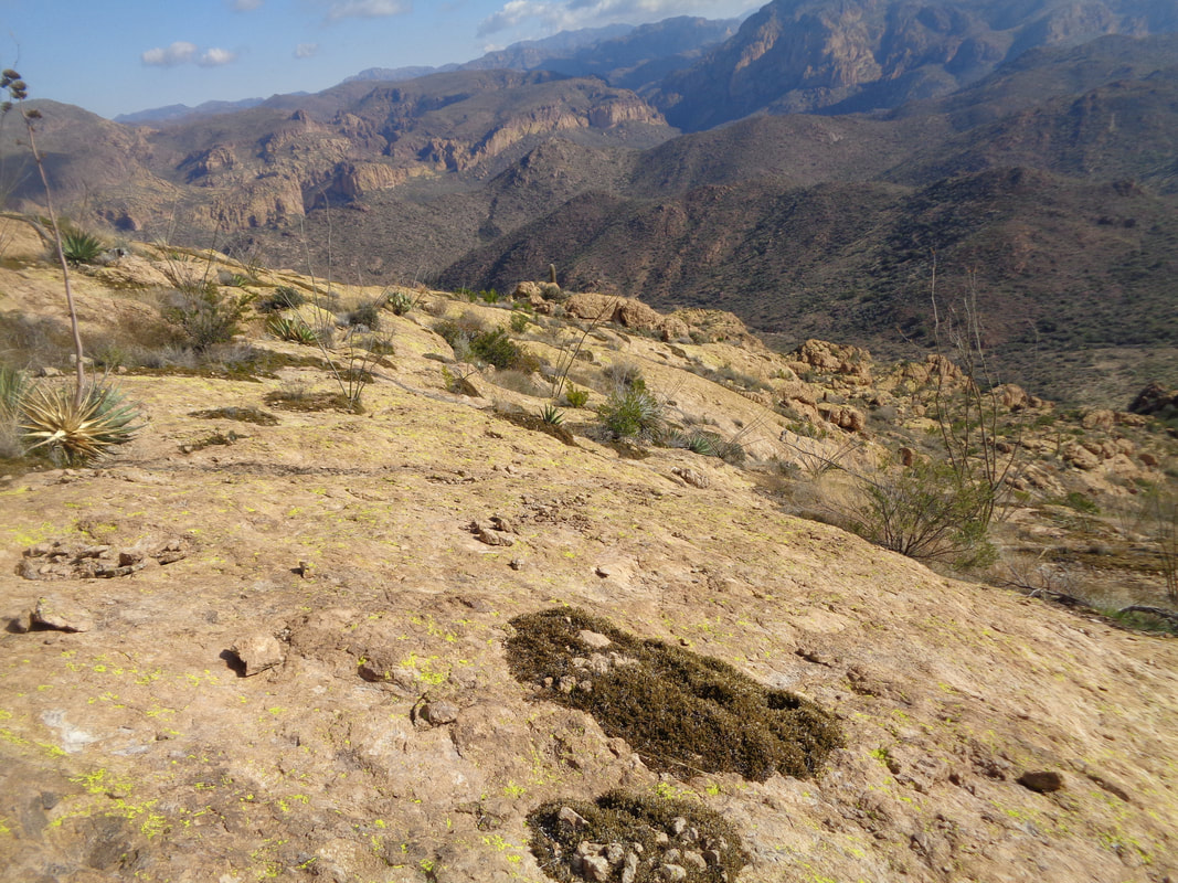 ….descend back to the BS trail, hang a left and then a quick right onto the Dutchman trail, then pass Miner's Needle and back to the parking lot. A fine loop. 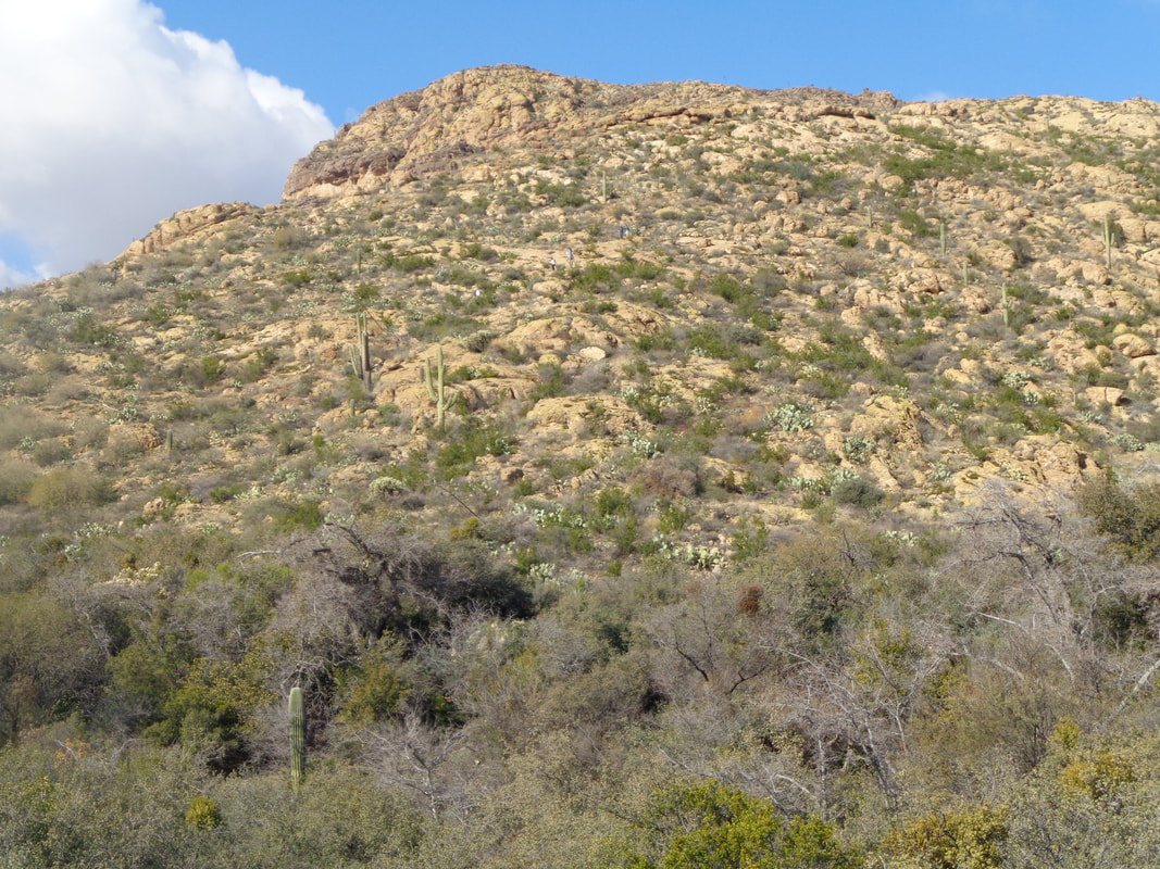 Reaching the main trail, I looked back and saw the group navigating the descent. Phil had given me the ok to just keep going since I had that drive so I kept going. 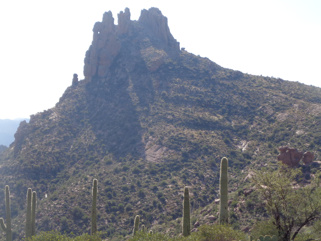 After about a mile, I reached a saddle and whoa, Miner's Needle. The slope to the right is a fun scramble into the Needle but I did not have time to do that today. 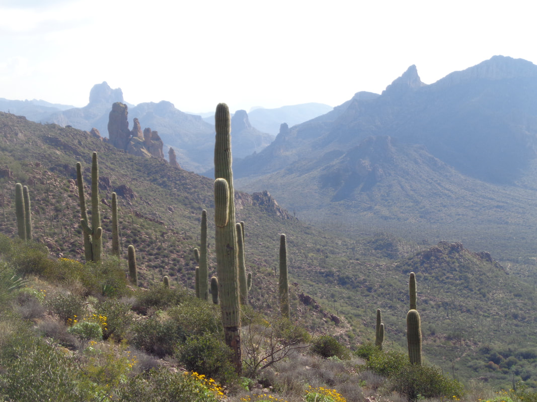 Awesome views to the southeast. I proceeded on a long and winding descent but looked back and.... 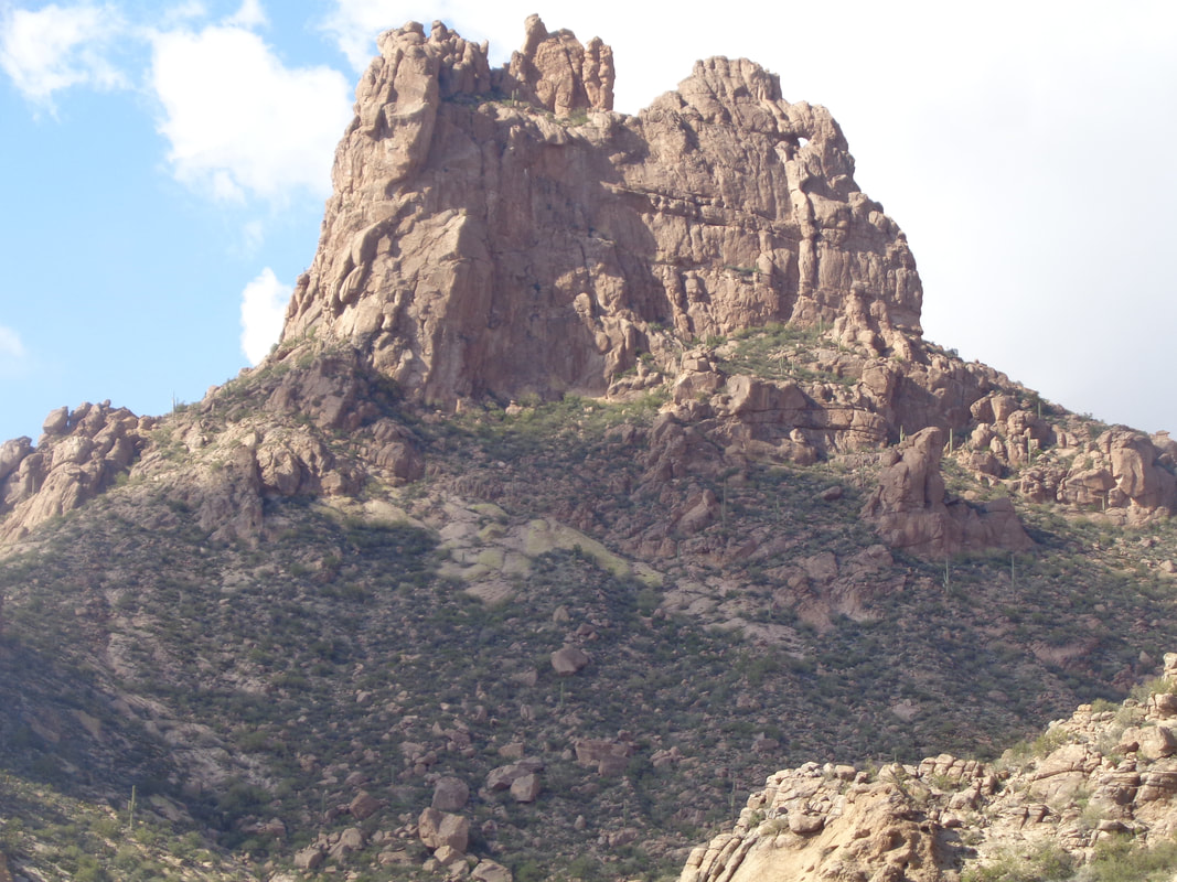 ...if you look closely at the above image, there is a small hole on the upper right side of the rock formation. Legend has it that on one day of the year, at a certain time, light cast from the hole shows the exact location of buried treasure. As implausible as the story is, I have no doubt many have been here when the sun sinks to the west, looking for the spot. 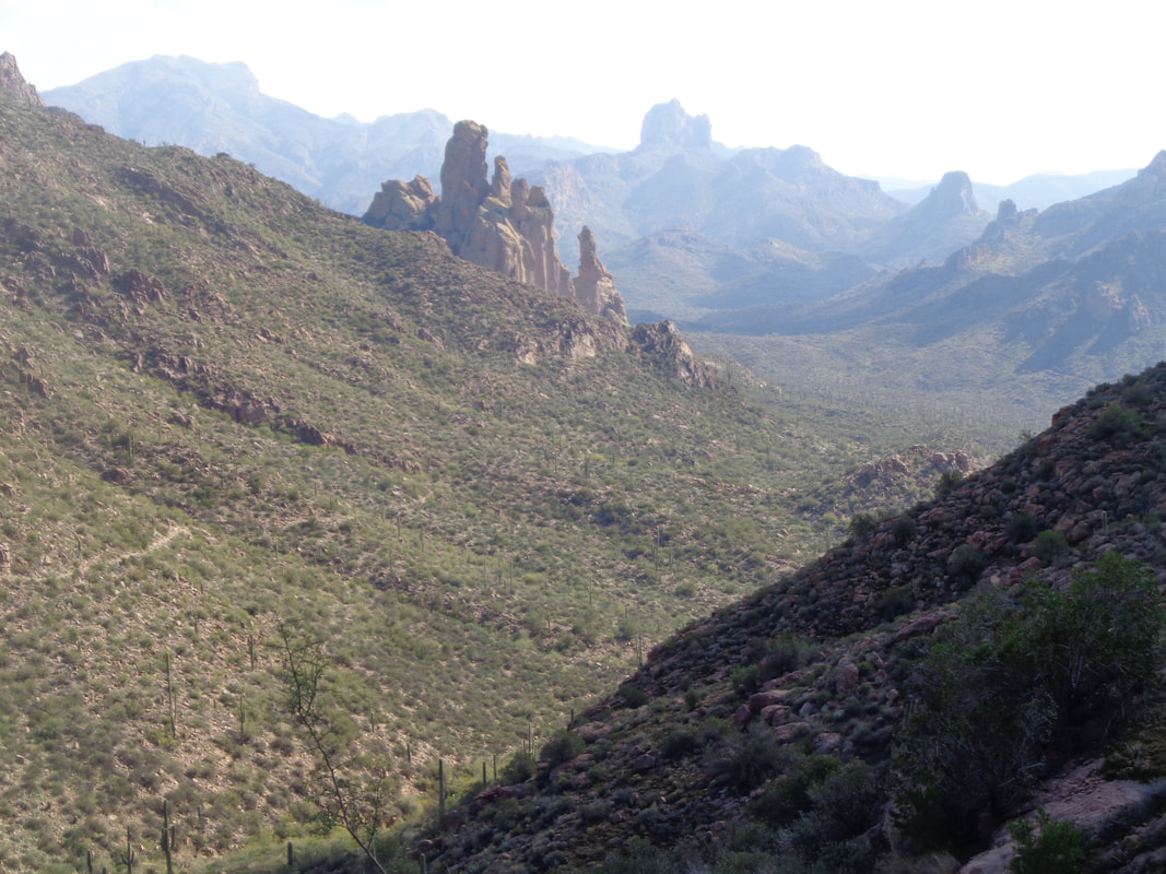 I follow the trail, there on the left canyon side, serpentining it's way down canyon. After 12 miles and 2400 accumulated feet of climbing I..... 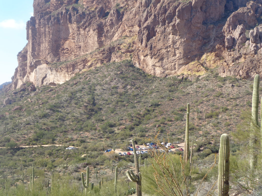 …..reach the best view of them all at this point of a hike, the parking lot.
 Poking around for a future adventure. More to come, of course.
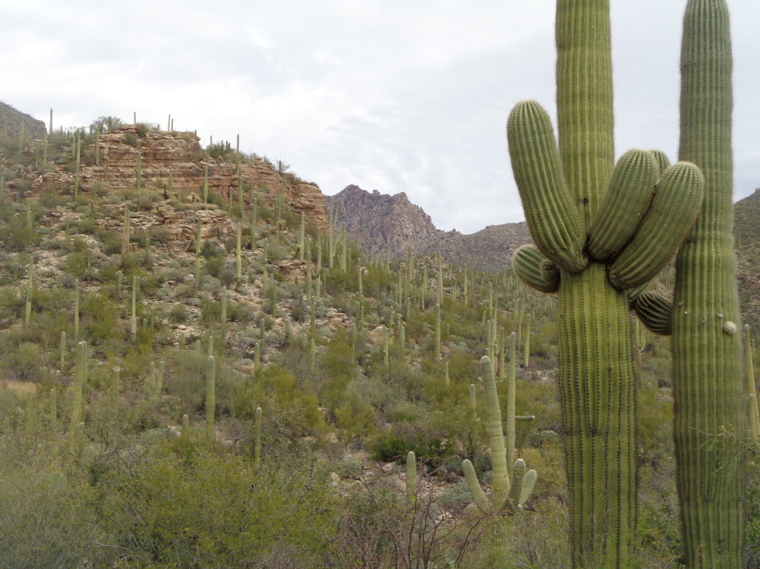
 There I stood, atop Black Top Mesa, my first visit. I was a happy camper since the brutal ascent set by a hiking machine (more later) was over but I needed a break. Thus, another very enjoyable experience with what I think is the premier hiking group in central/southern AZ, "Arizona Strong Hikers". They have accepted me into their midst and given me a whack-job nickname. Me, after having given dozens of nicknames to the undeserving cyclists in Ohio, am now on the receiving end of one.  Another early start at 7:30am up in the Superstitions so I put off the race across the desert in my car by 30 minutes so I'd have some light for some of the drive. I thought if I ran a bit I'd catch the group but the trail was like this so 90% was walking and little running. Gotta keep the head down too on these trails but..... 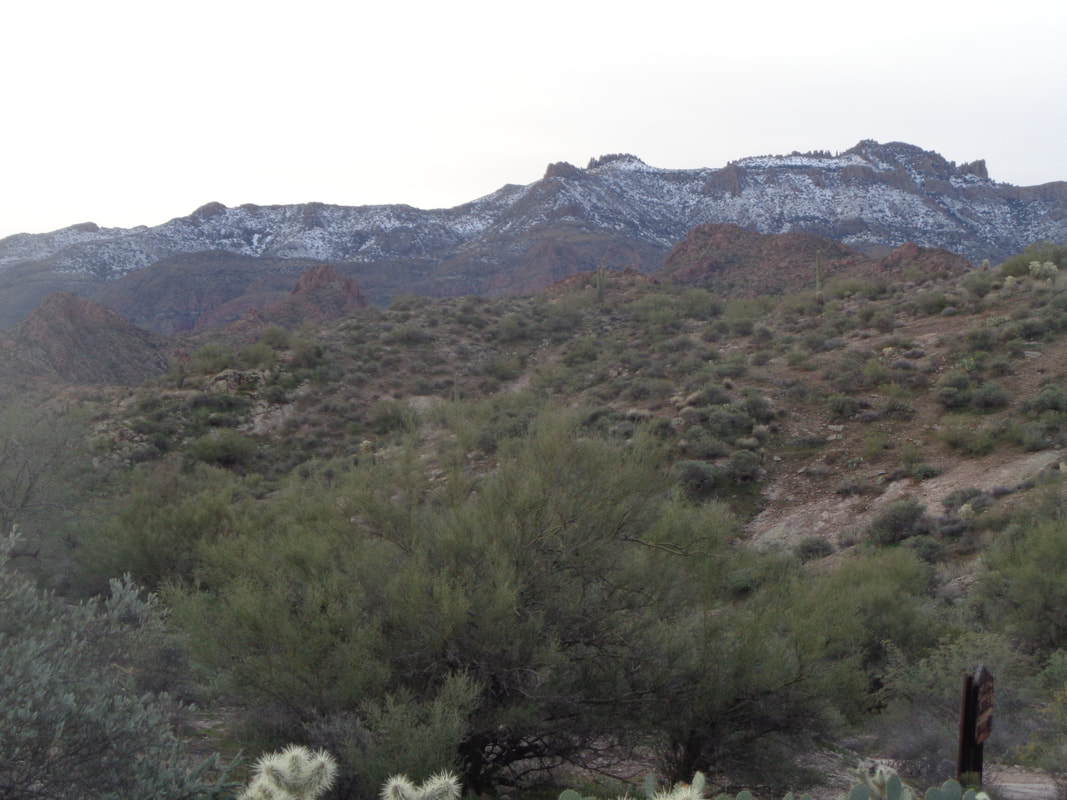 ….sometimes I would look up and snow is present on the north facing slopes of the "Supes". 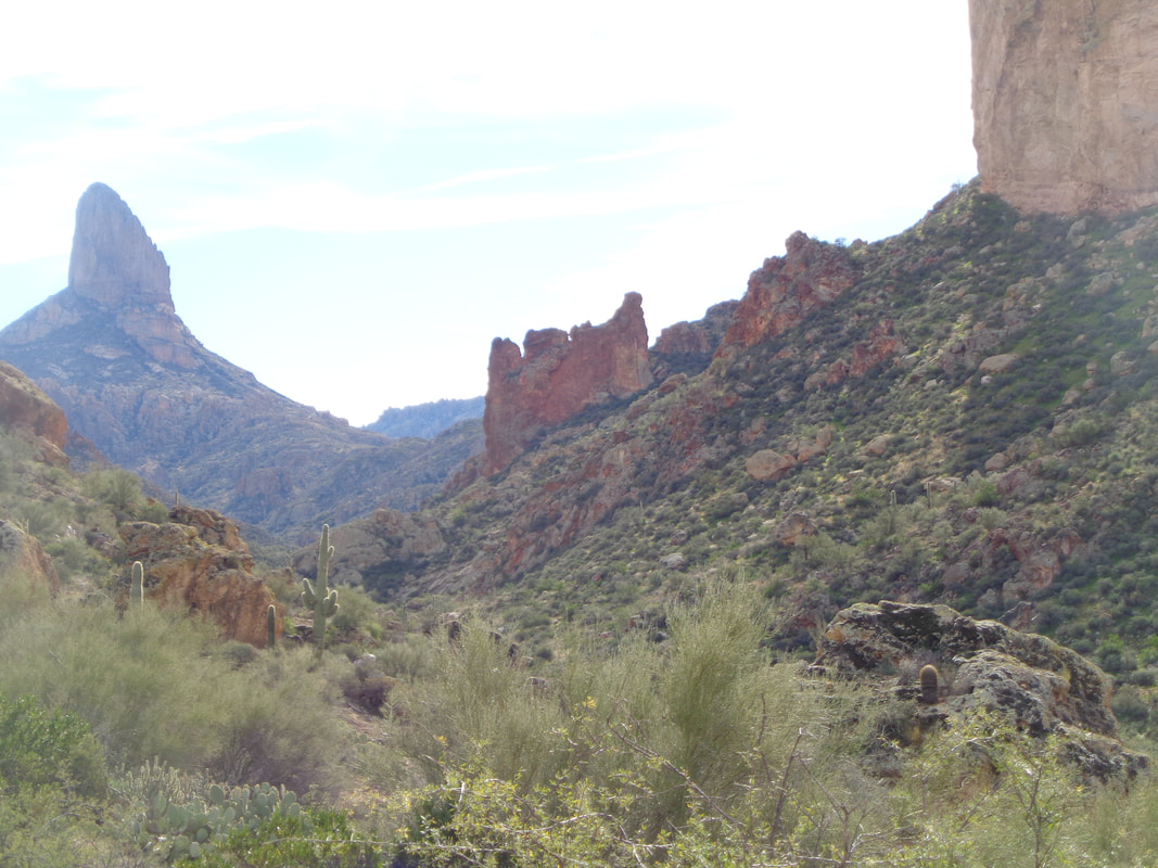 During the 4 mile hike on the "Dutchman's Trail" I had some fine views of Weaver's Needle and other features. After the 4 miles, I went off route, up to a saddle and dropped into a rocky wash. 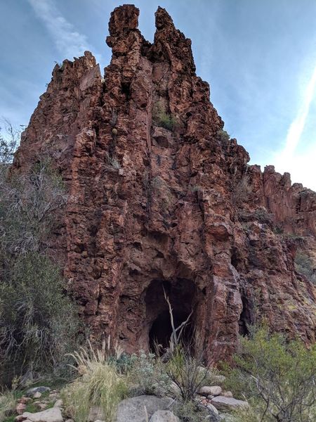 While boulder skipping through the wash, one passes an abandoned mine (thanks to a fellow hiker for use of this image). I did not catch the group because if you can not run, you ain't catching this bunch. They hike at warp speed. I reached a side canyon and began the short, .30 mile, but extremely steep, 33%, climb to Palomino Mountain. Eventually..... 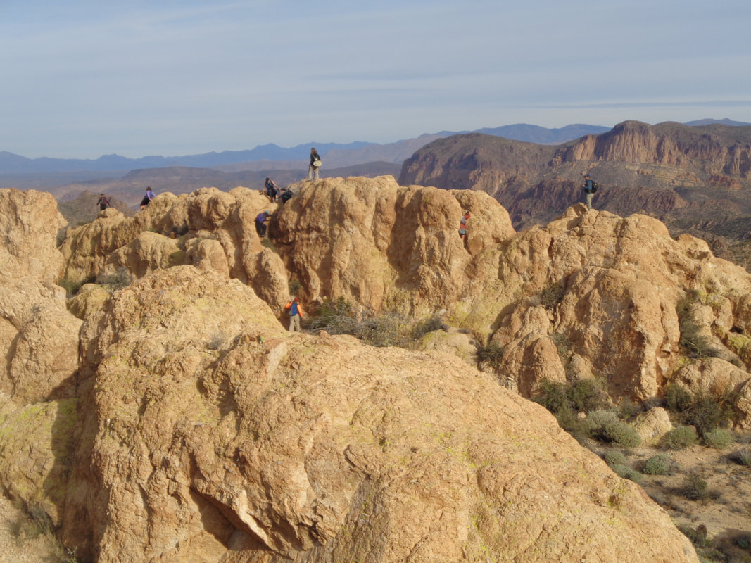 ….I reach the top and find them on the narrow fin that leads over to Aylor's Arch. I get through the obstacles, arrive at the base of the fin and.... 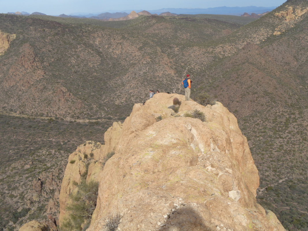 ….climb on top. I baby step may way for a little distance but the exposure on both sides was too much. Yeah, I know, it appears you could drive a truck across that but it is very narrow. Given time, I'm pretty sure I could have butt scooted across to the arch but instead I joined..... 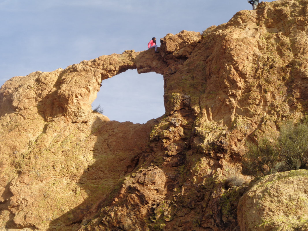 ….the others who also were reluctant to go arch sitting, far below. Congrats to those who made it, about half our group. 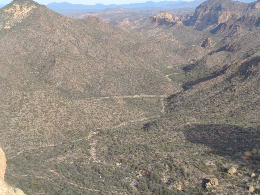 The views were fantastic as always. Soon we began the steep descent where Tracie and others.... 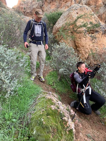 ….fell. It's not only the steepness, it is the gravelly surface that makes for a precarious descent. Once we make it out of the canyon we.... 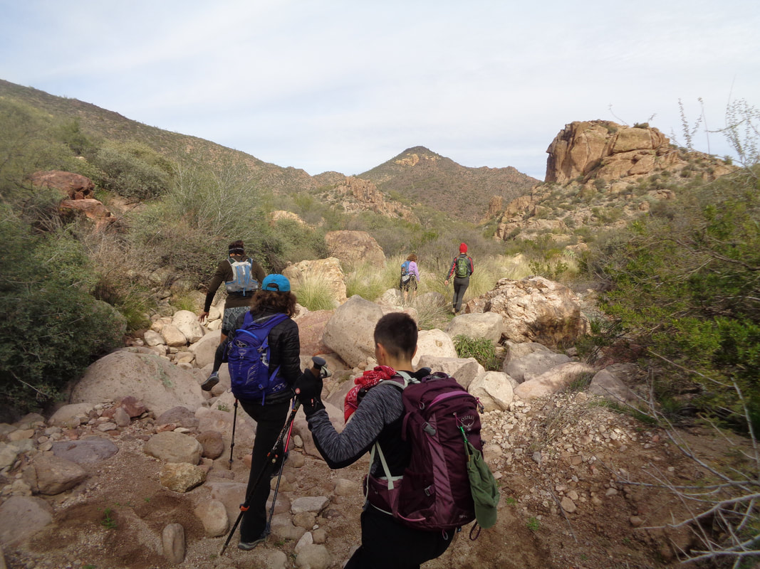 ….begin boulder hopping back to the trail. Doris on the left entertained us with stories of her youth when she burned ants alive with matches and enjoyed dissecting creatures in school. Makes sense she became a nurse and now teaches nursing to others:) Having one major climb out of the way we headed toward Black Top Mesa. After a long climb we reach a saddle where hanging a right begins a .70 mile ascent with an average grade of 16%. 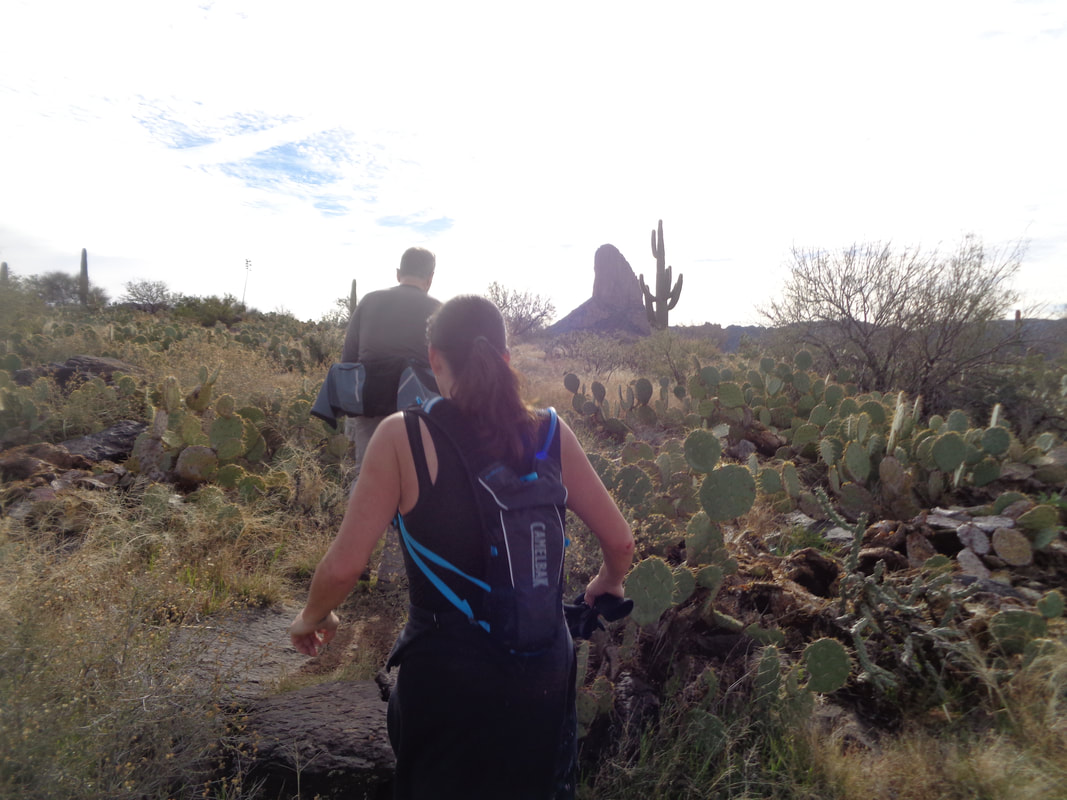 Four of us get ahead of the others and try to follow the torrid pace set by Gina. She is one of the fastest/fittest hikers I have encountered and certainly the fastest woman hiker. Just as I was about to spit the bit, as the others had already done, the trail flattens and I survived. Above, we catch Bill who had gotten a head start. 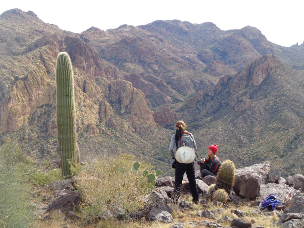 We all enjoyed the break and especially, the magnificent views. Our hike leader, Wade, looked for and found.... 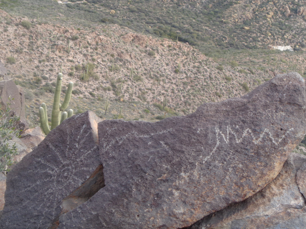 ….a petroglyph whose origination dates back to when the Spanish explored the area. Legend is the petroglyph has a clue to the location of a cave full of gold. Prospectors and explorers have been killed by making the mistake of encroaching on someone's claim or search. With 7.7 miles so far, it was time to retrace our route albeit without the side excursion to Palomino Mountain and Aylor's Arch. 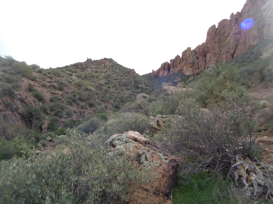 The descent off the Mesa and then from the saddle was brutal. Finished with 14 miles and 2800' of climbing. Now for the nickname. If you live in Grosse Point outside of Detroit do you tell people you live in Detroit or GP? Exactly. Or, Encinitas rather than San Diego or Beverly Hills rather than Los Angeles??? So, when I am introduced as "Mark from Tucson" my knee-jerk reaction is to correct and say I am from Oro Valley. So, the crew gave me the nickname "The Snob from Oro Valley" wtf??? All in good fun of course.
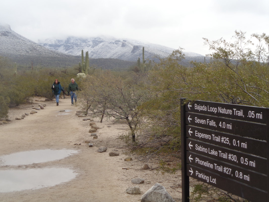 Prior to checking out the road closure (see below) I hiked around the lower elevations of Sabino Canyon. Note all the puddles from overnight precipitation which added to the snow levels. Catalina Highway is now open so the skiers have been freed. I think I will check it out in the next couple of days. 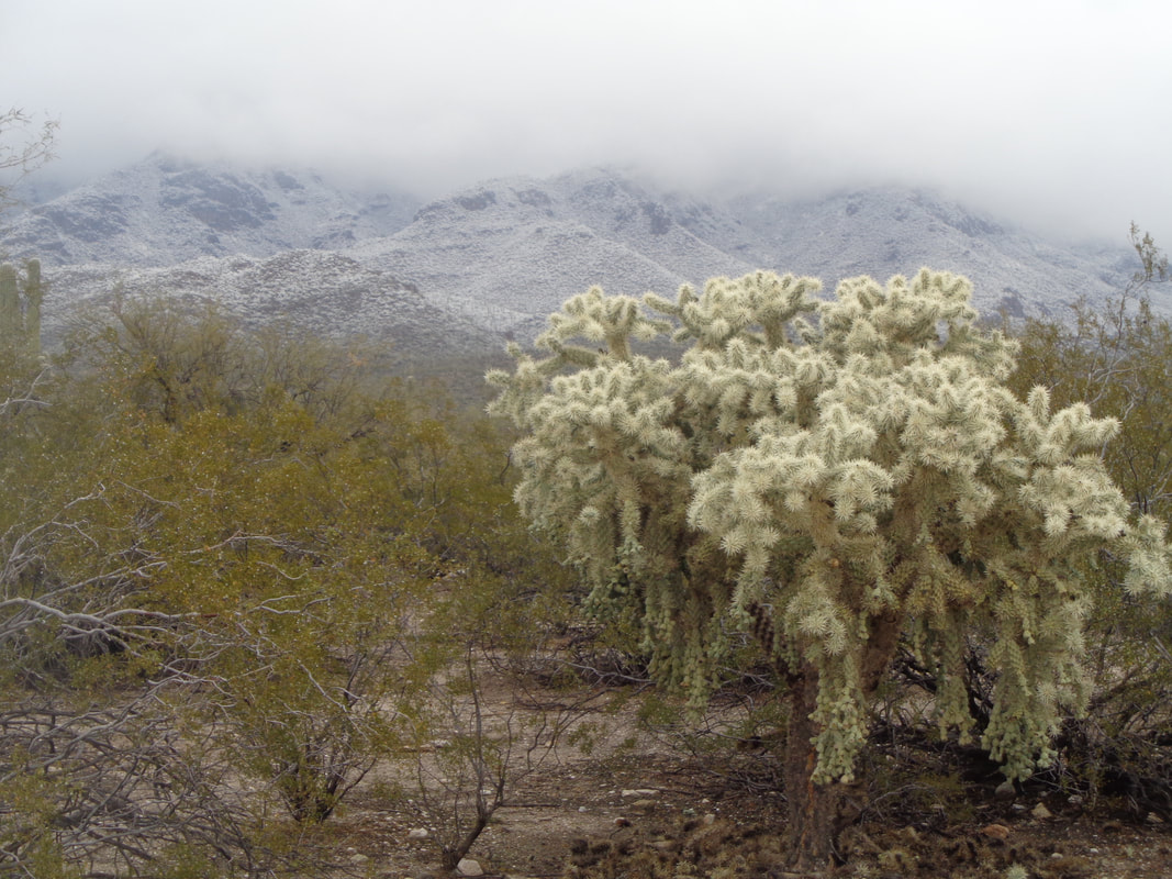 The dreaded jumping cholla has a color not too different from the snow covered hills. I listened to a national radio report that mentioned wild weather in the southwest where Phoenix had a low of 30 and 6" of snow in Tucson.....fake news! There were flurries in Tucson but no measurable snow. Some towns at higher elevation received a few inches, even Tombstone had 3-4" but nothing in Tucson. 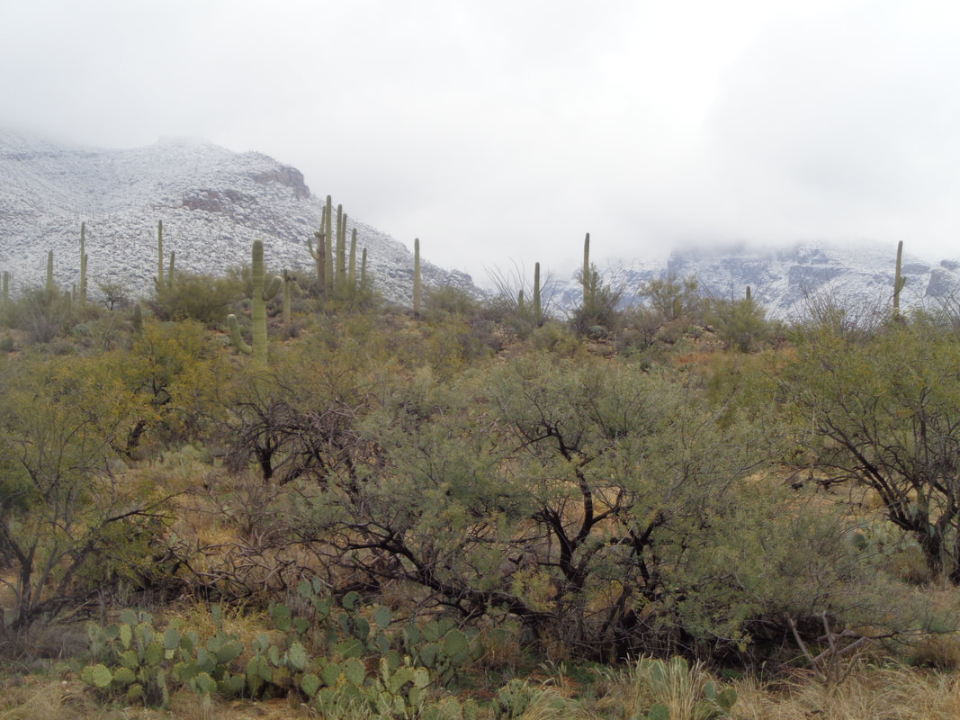 A nice contrast between the Sonoran desert and nearby hills with snow. 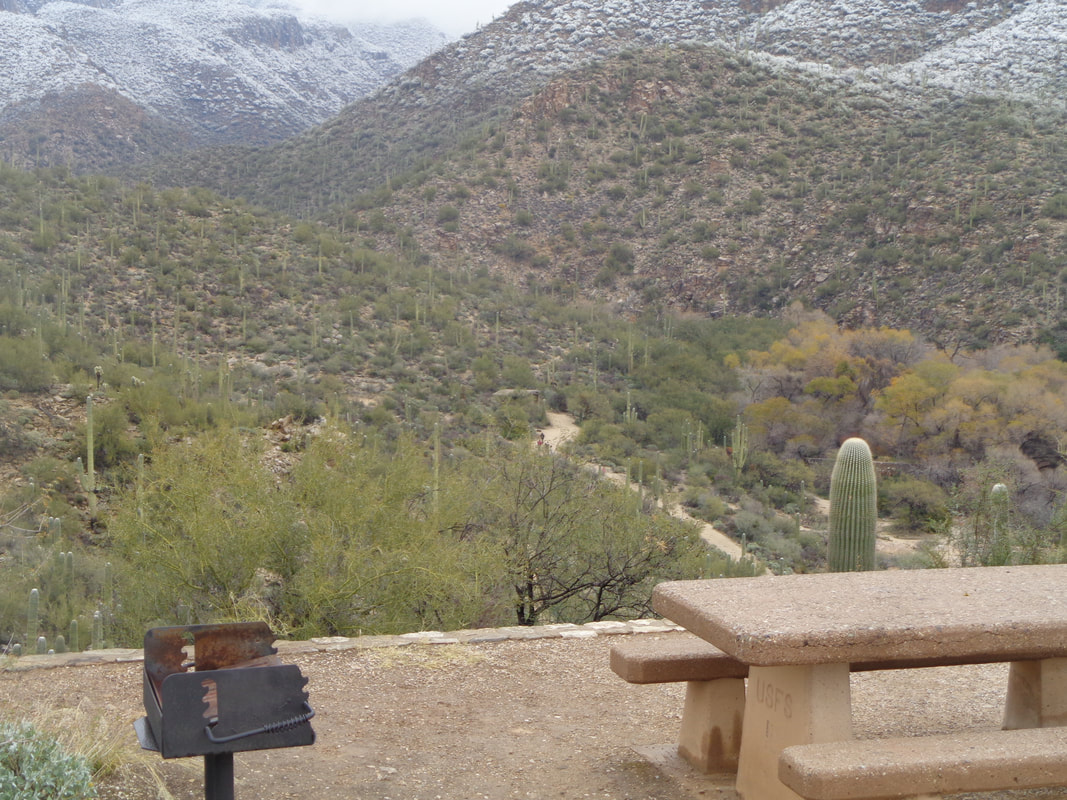 I visited a picnic stop and looked into the canyon below. A few people walking around but not many. The clouds were again very low so no point doing any climbing and disappearing into the mist/snow. Looking to the southwest..... 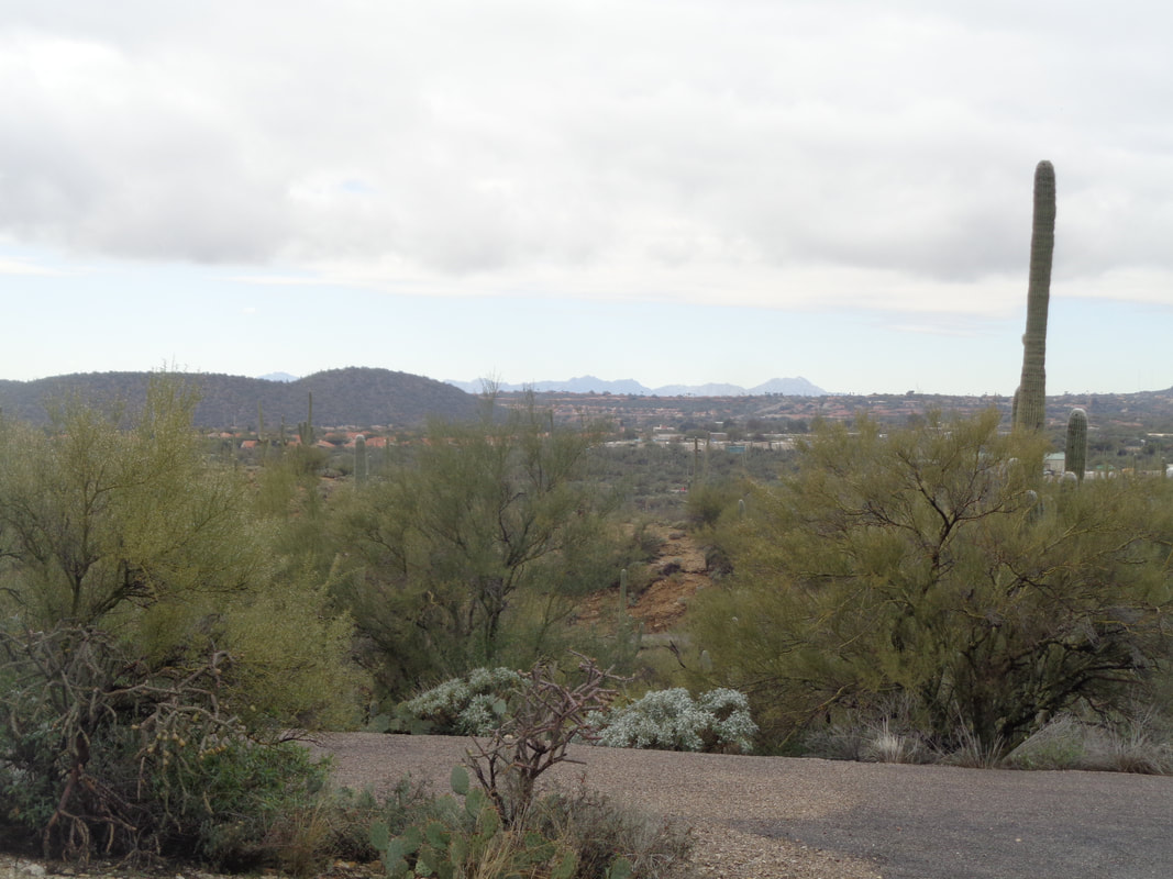 ….blue sky!!!! Once the sun hits and with an improved forecast, the snow will beat a hasty retreat back up the mountains. Golfing on Friday and big hike on Saturday.
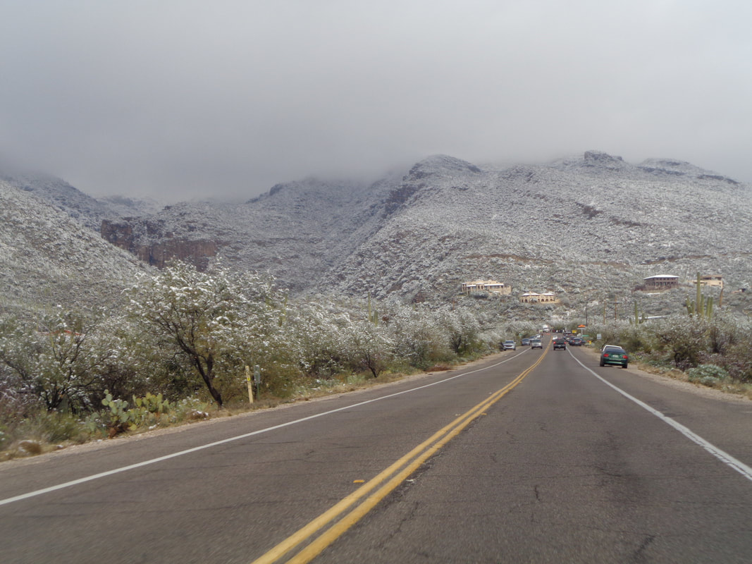 On Wednesday, I hiked at the lower elevation of Sabino Canyon (images to come) and since Mount Lemmon Is around the corner, drove there to check out the Catalina Highway road closure situation that has caused quite a stir. Ski Valley, above the town of Summerhaven, has received 40" of snow so far, perhaps a record for this time of the year. The successive cold fronts that have swept through have brought colder air and so the snow has reached almost to the desert floor. 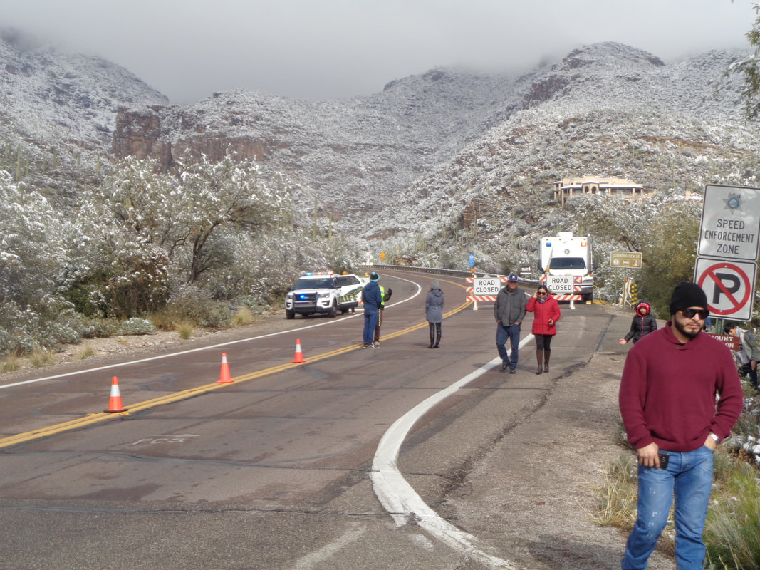 The joke among locals is how can you have a ski operation that closes when it snows? Of course, Ski Valley is open but Pima County is outmatched when it comes to snow removal. I talked to one of the deputies at the barricade and he explained the snow plows won't work anymore because they can no longer throw the snow above what lines the road. They have to use a front end loader instead which is slower. The deputy said he has been here 13 years and never seen the snow so low on the mountain. 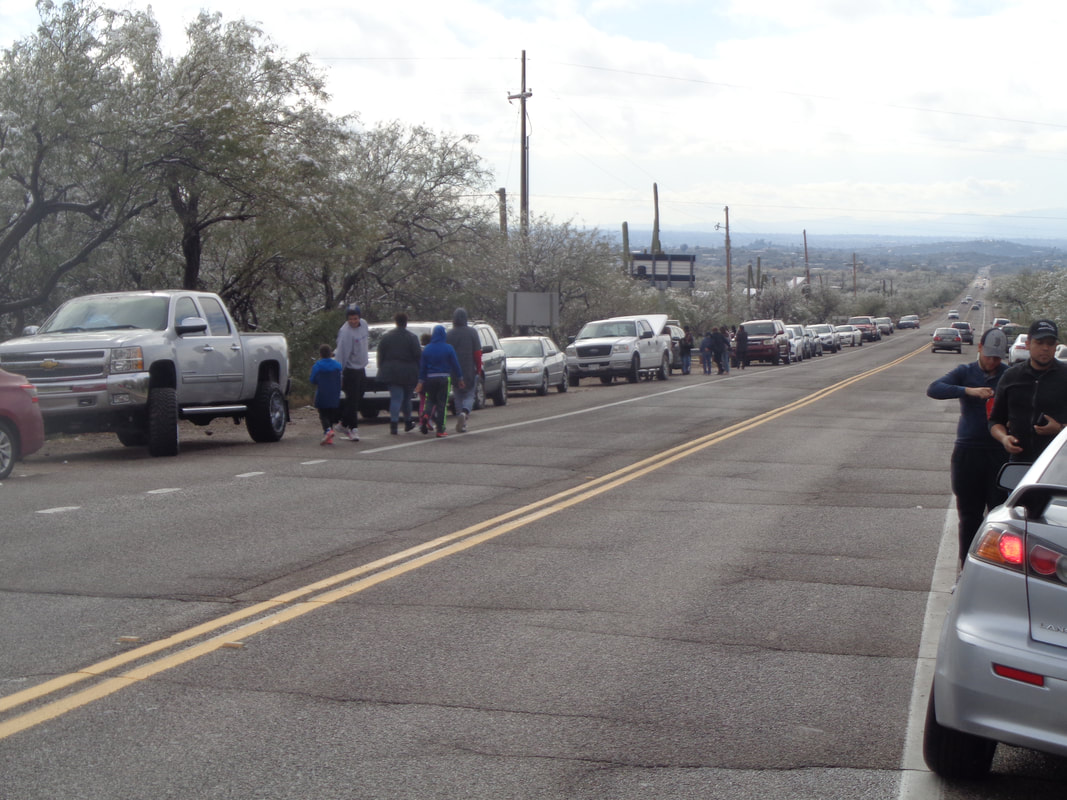 It was a circus atmosphere as dozens of cars lined the highway with people walking into the desert to have their picture taken alongside snow covered cactus. Some or many of these people have no experience driving on snow covered roads and I hear it is chaotic when they venture up the mountain. Not a good time to be on your bike up there for several reasons.
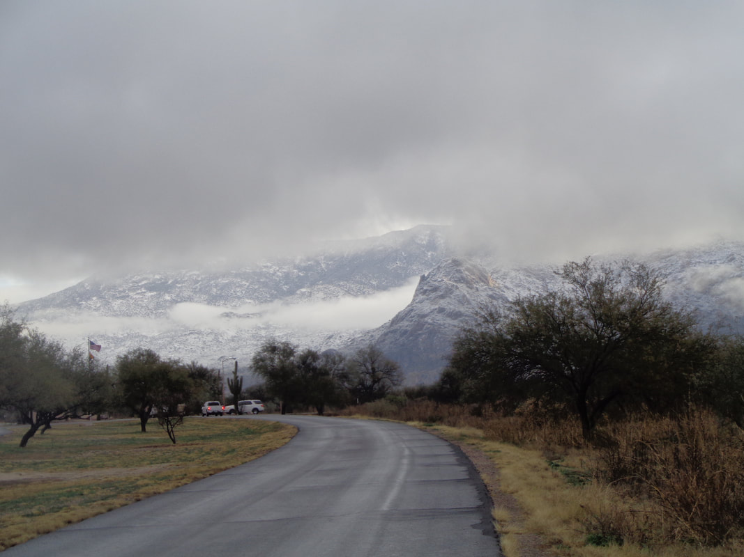 Now this is becoming surreal but yes, beautiful. Catalina State Park, about one mile from home. Sunday morning after the aforementioned cold front moved through overnight. Snow fell down to about 3000' and where I am the elevation is 2500'. 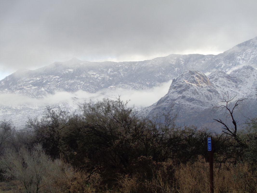 I drove north, rising from the valley and encountered snow on St. Rt. #77 at the most expensive animal bridge in the history of animal bridges (approximately $12 million), only 5 miles from home. 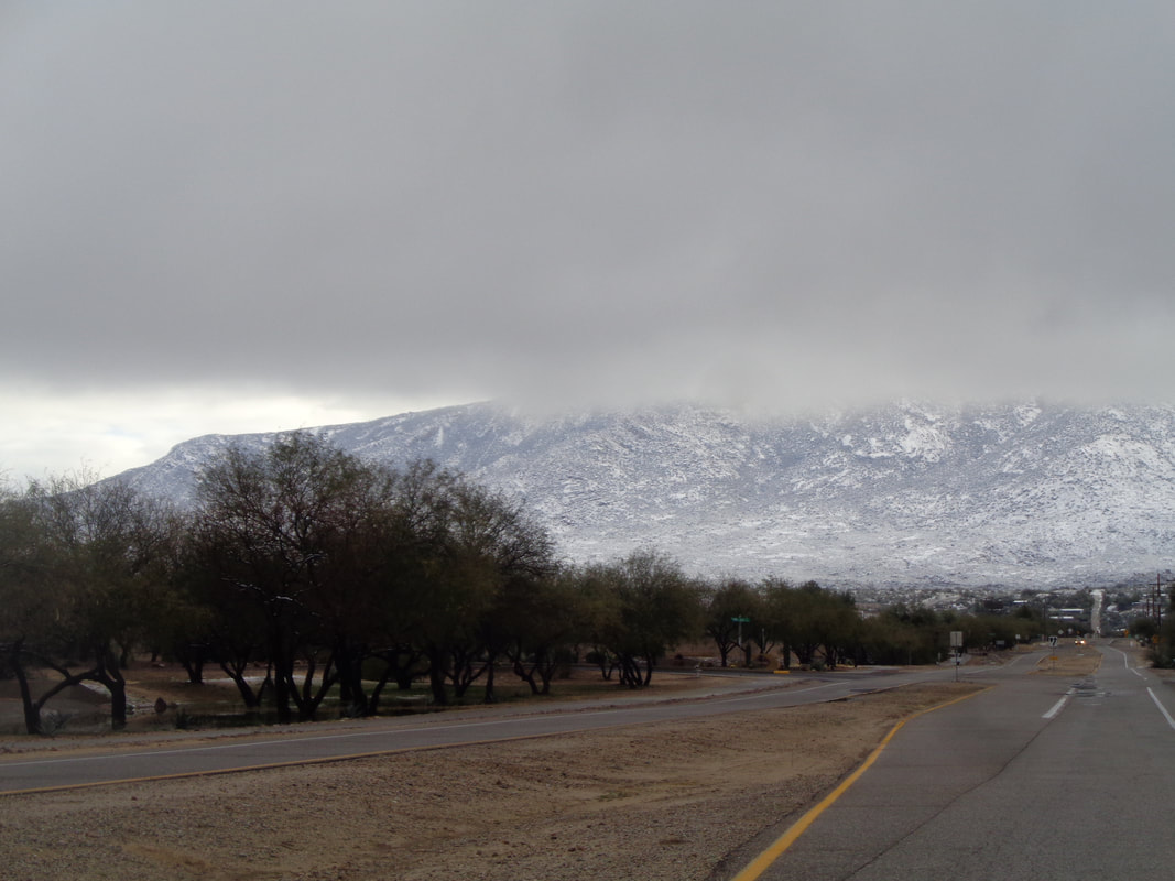 Go a little farther to the town of Catalina, the clouds were very low. The good thing about fronts out here is the clouds do not linger. A front comes through, drops its precipitation and then has the good sense to..... 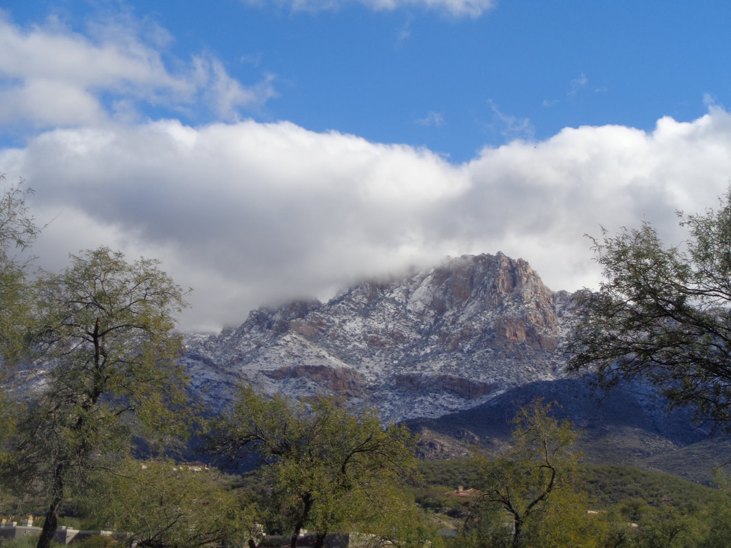 ….move on! I like that. Then, incredibly, Tuesday night another front came through dropping our overnight low to an amazing 30 degrees with yep, some more snow. I drove around for a few minutes and stopped to get gas where.... 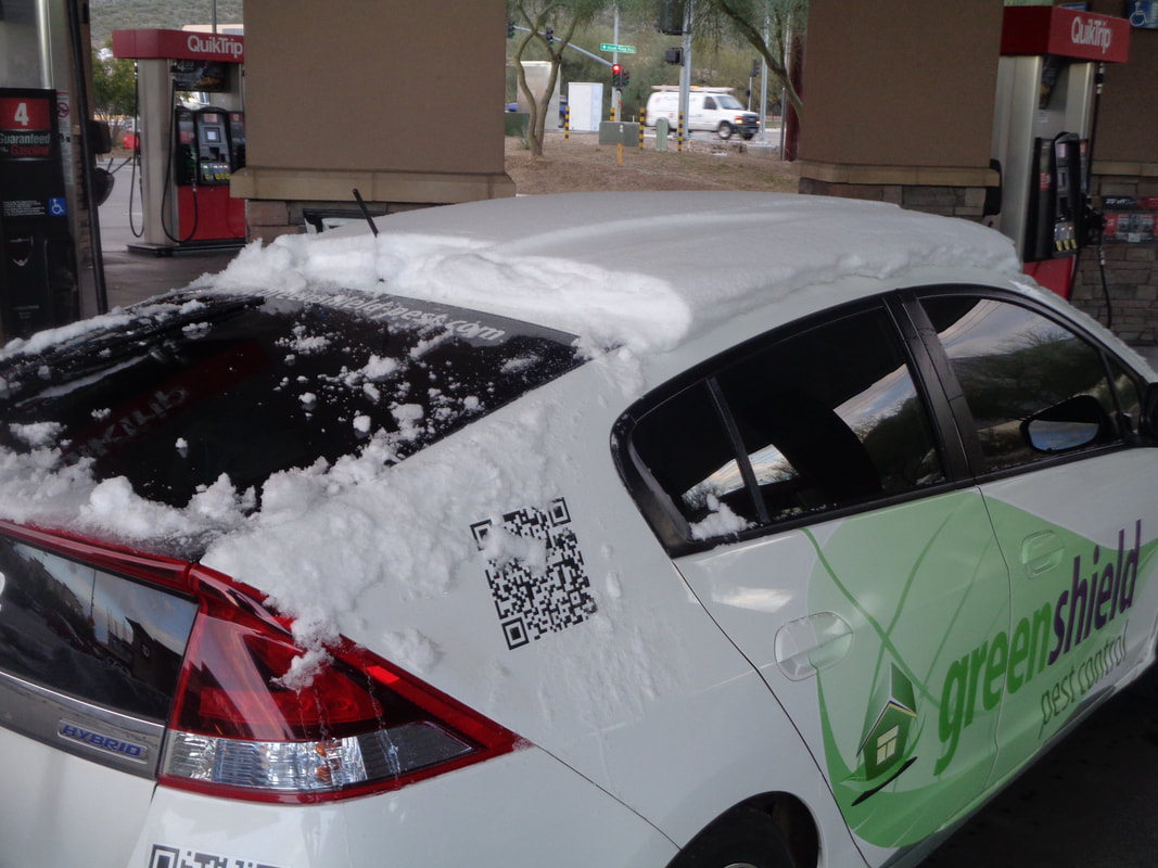 …..a guy had just driven from the town of Oracle, about 24 miles up the road and was cleaning snow of the rear window. 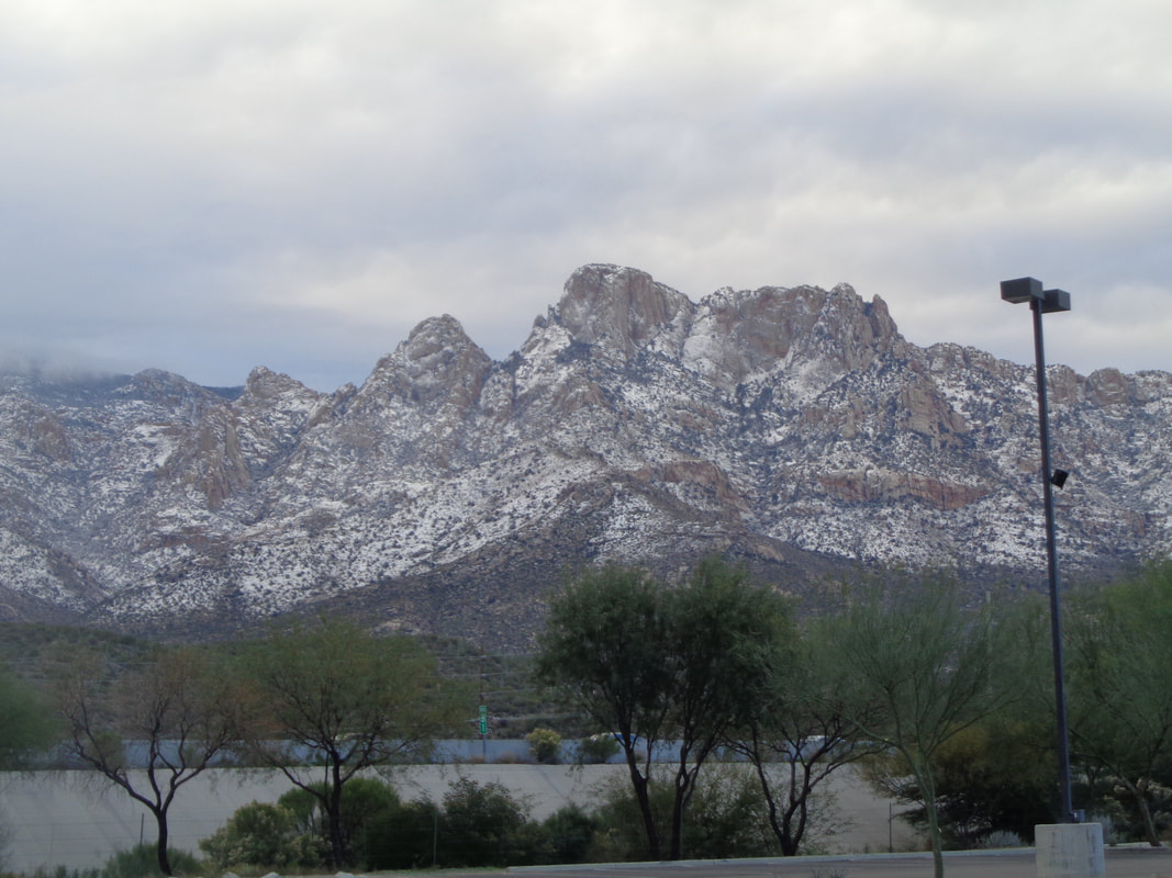 Last week, I stood at the top of the mountain in the center. comfortable in a long sleeve t-shirt. Warmer temps are finally around the corner, 60's by Friday and next week, even low 70's. Take that snow!
|
