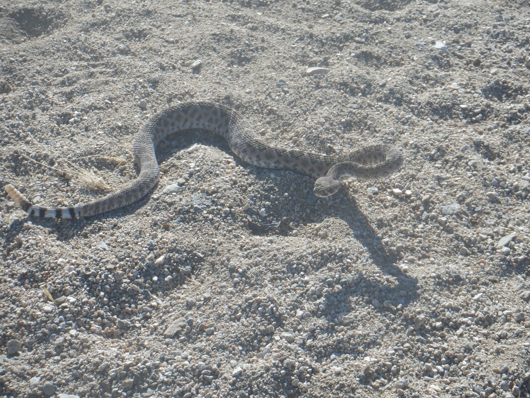
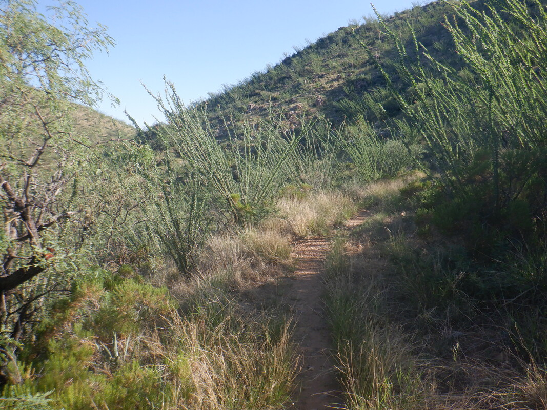
 We drove up Mount Hopkins Road, made a left on a forest service dirt road and followed it for 2.5 miles. Actually drove past the trail head so turned around and found the small parking area. Off the three of us went, first following a trail that rises and falls a couple of times prior to dropping onto an old mining road. Pretty overgrown, much more so then when last I was here in 2016. 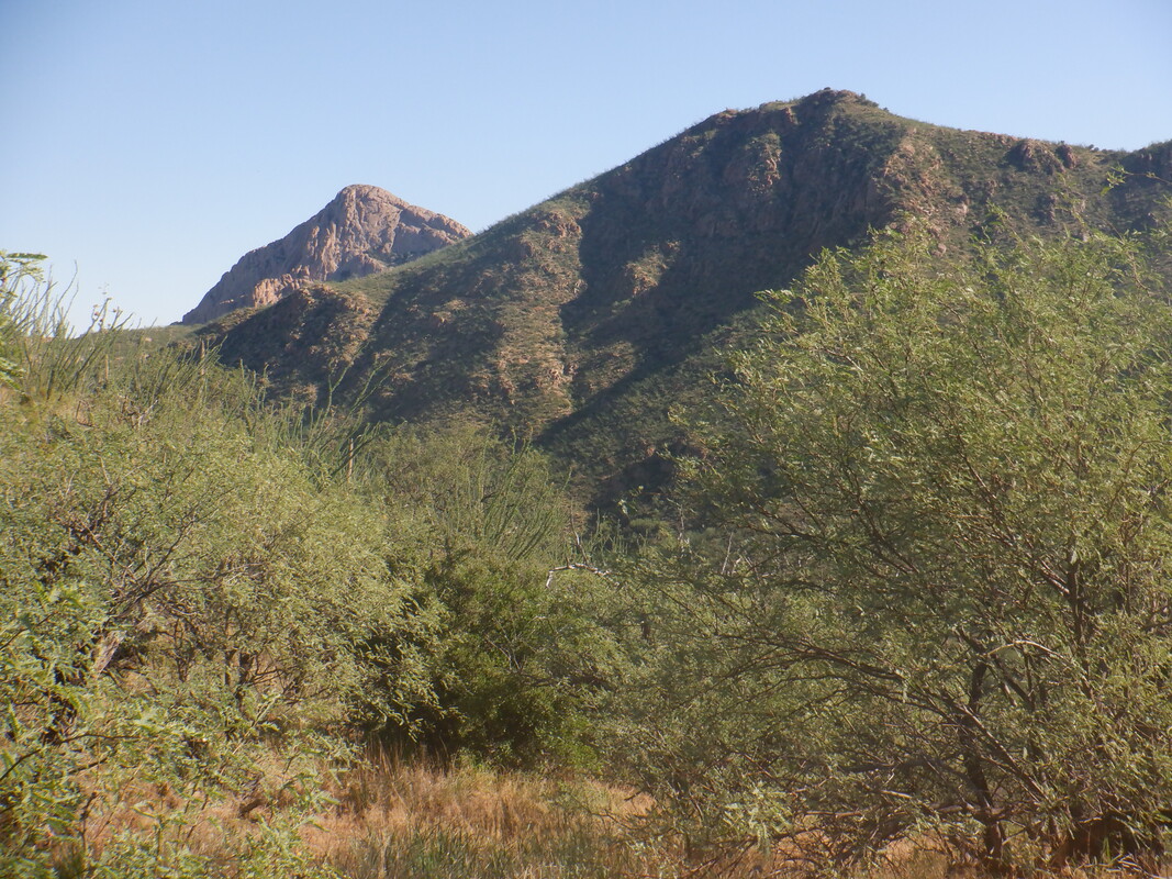 At some point, we catch a glimpse of our destination, Elephant Head. It's a fun hike/scramble to the top of that. We continue to ascend via the road and soon pass.... 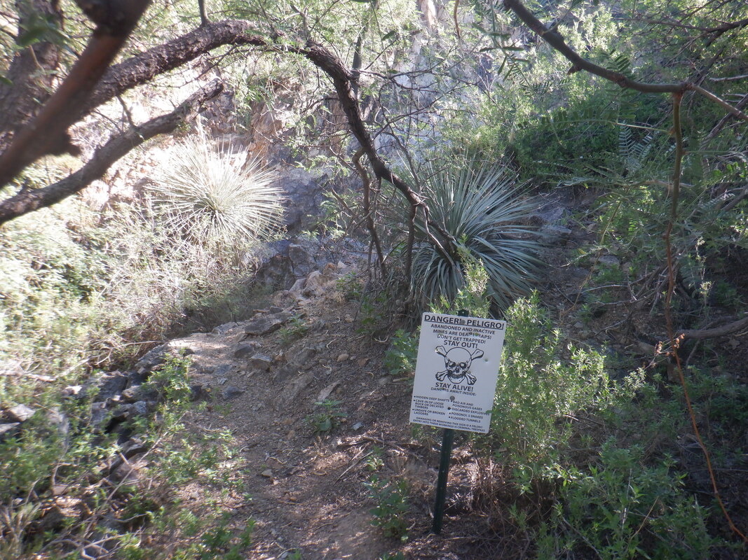 .....an abandoned mine having appropriate warning sign about the dangers lurking beyond the entrance. 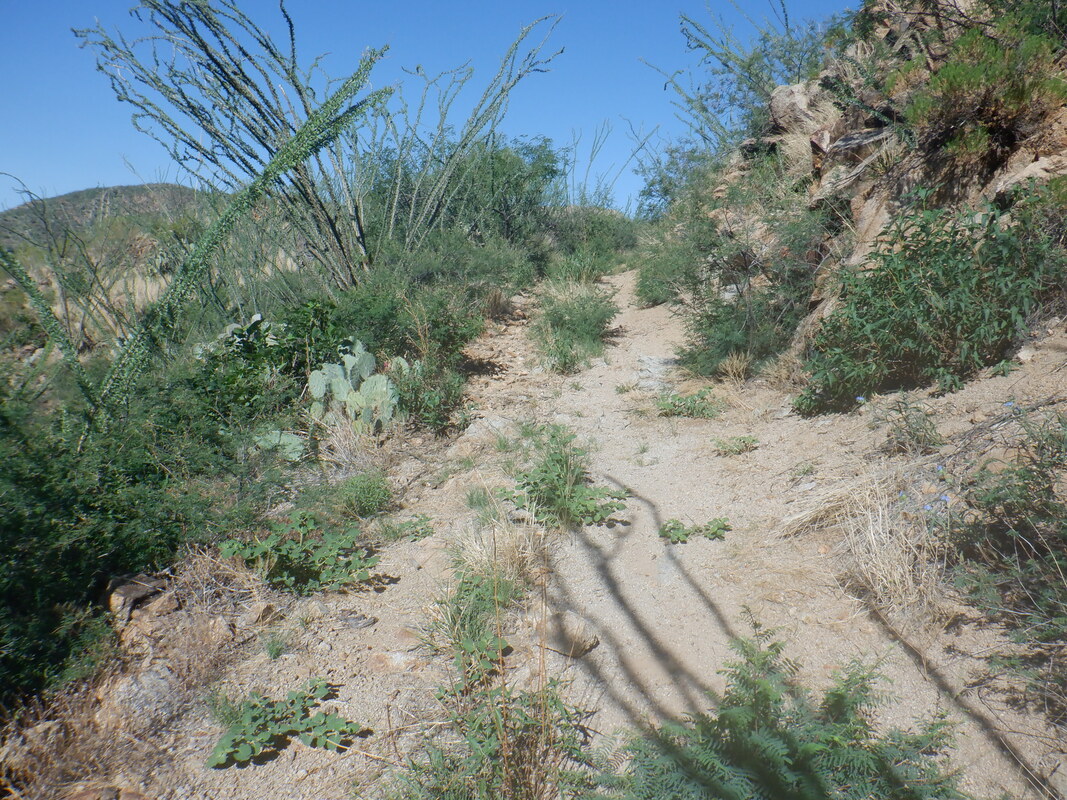 The road bends clockwise around a mountain and then.... 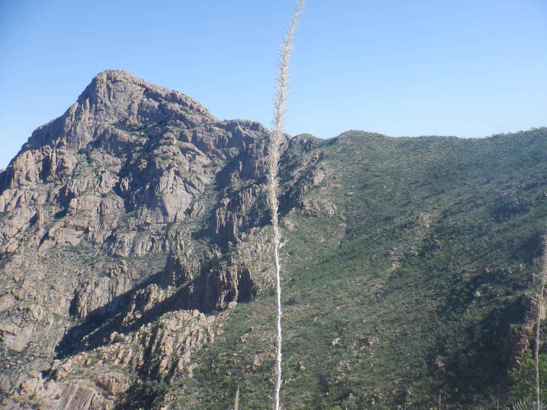 .....we got a really good look at the objective. We got a late start to our adventure, 7:50am on a day with a forecast high of 109. Just past the 2 mile point of our hike, we noted a cairn on the left side of the road and began the very steep and sketchy descent. We would lose about 500' prior to.... 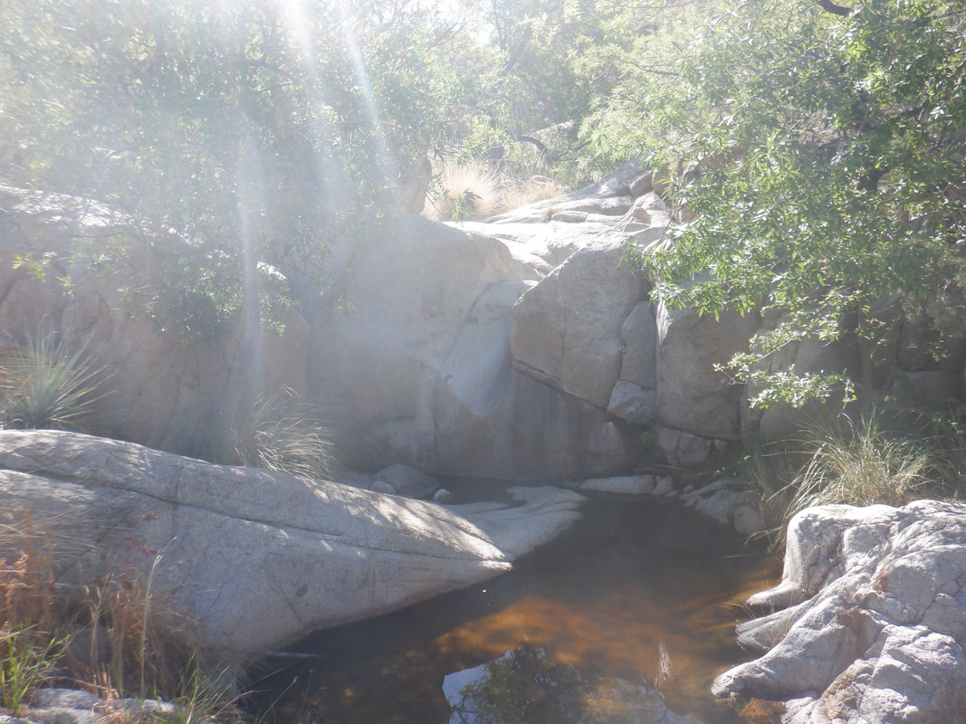 ....finding the bottom of Chino Canyon. Nice spot with shade and running water. We paused briefly before beginning the climb..... 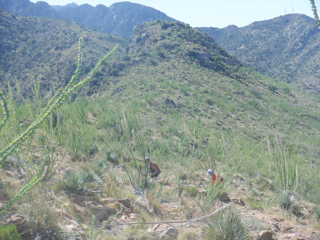 ....the canyon to the saddle below Elephant Head. The climb out of Chino Canyon gains about 700' but is not nearly as steep as the other side. 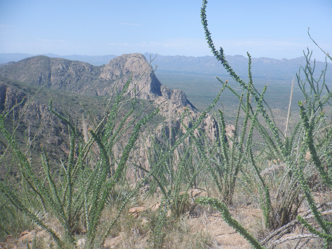 Looking to the south we see Little Elephant Head. Been there once but don't remember much about it. We found the trail that breaks left off the saddle, followed a faint trail over a couple of protrusions before coming to..... 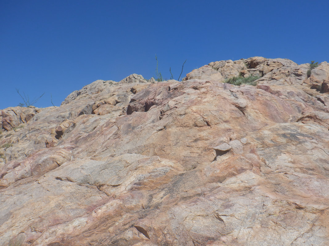 ....the base of the neck of Elephant Head. It's an awesome sight as we ditch our hiking poles and begin the ascent. 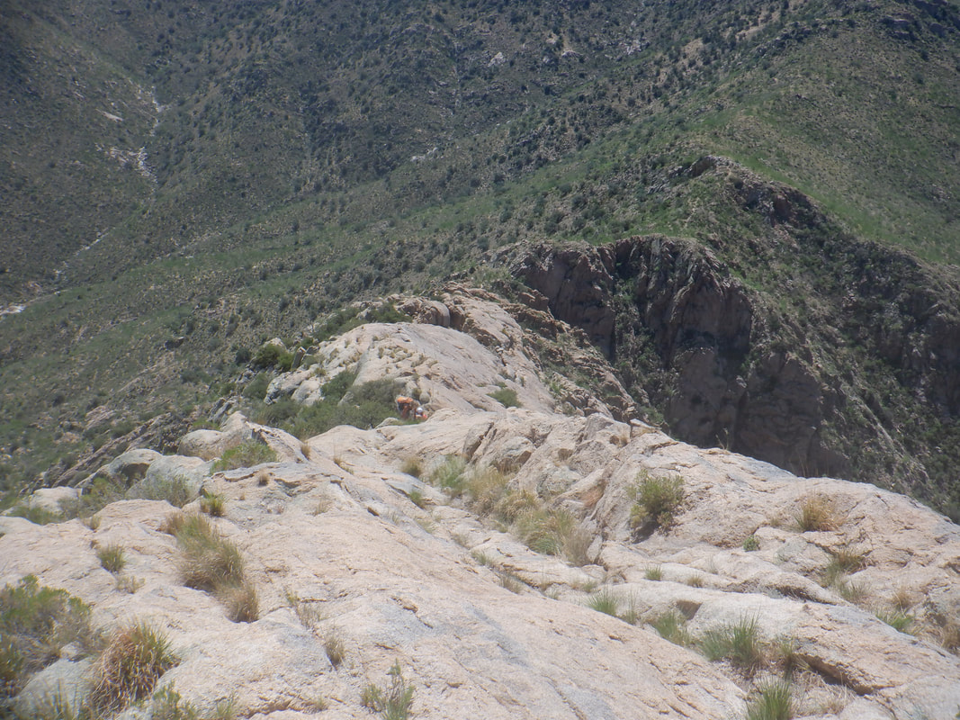 My companions, Amy and Tracy, had a great time as we slowly worked our way, bypassing the steepest sections on the right while enjoying some modest scrambling up the nape of the neck. Finally.... 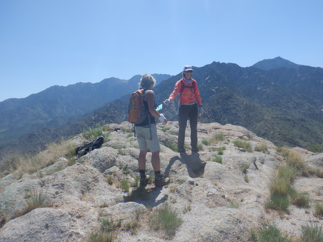 ...we reach the top. Unfortunately, the peak was swarming with some kind of flying ant, the presence of which made it too annoying to stay. We quickly signed the register and departed. 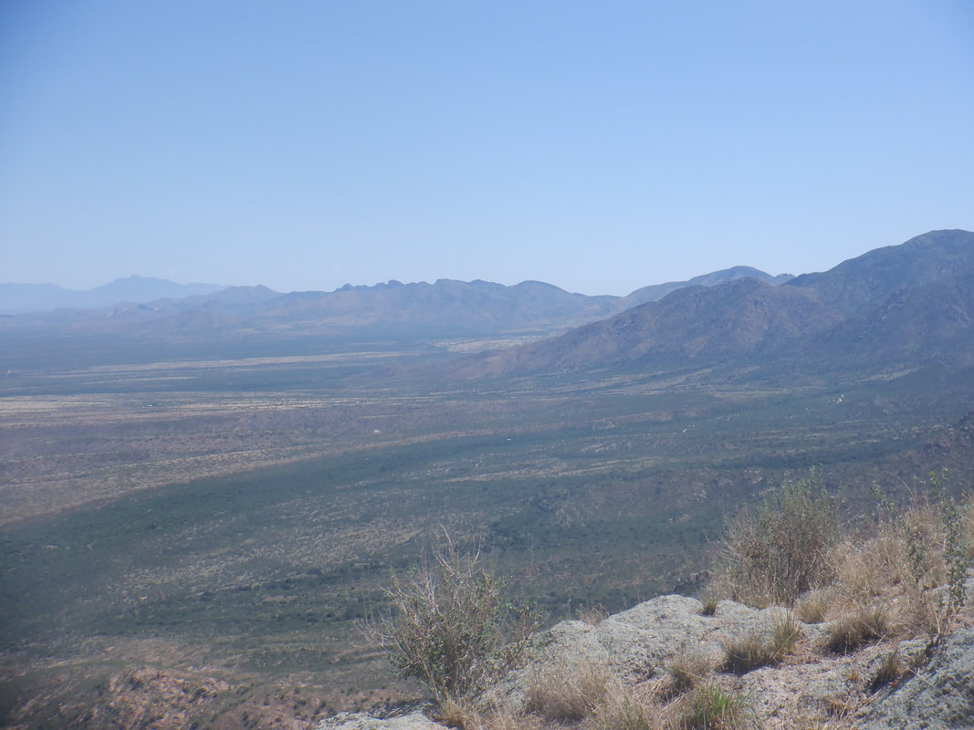 I took a few quick images and led.... 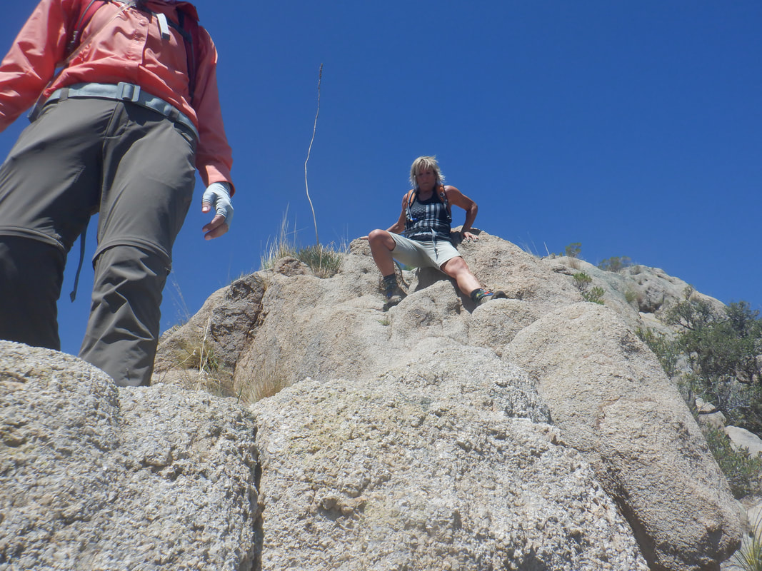 ....the ladies down. There is surprisingly not a lot of exposure but I think for some hikers, there are a few places where there is enough they may be freaked out. There definitely are many spots where a fall would cause serious injury, perhaps death so be careful. We reach the saddle, find the trail into the canyon where..... 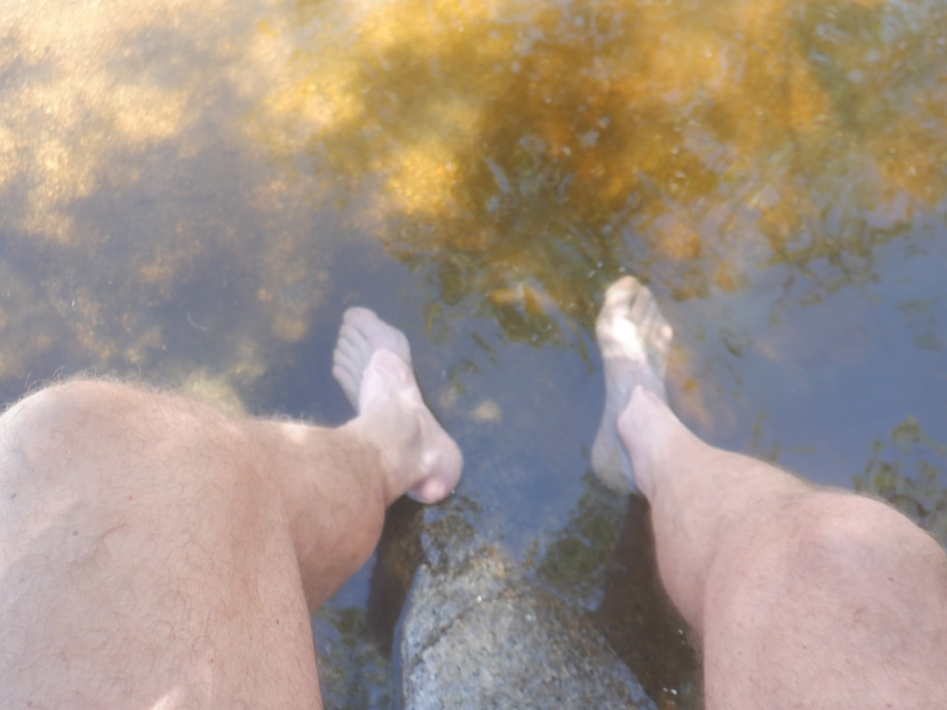 ....arriving first, I cool my feet and douse my head. I underestimated my fluid needs so ran out soon after climbing out of the canyon and reaching the road. Tracy had extra so with that, I scooted ahead to reach the SUV where there was more water waiting. The hike was 6.8 miles with 2500' of climbing yet it took us 5 hours to finish. I really underestimated the time and that got me in a bit of trouble as I walked the final mile with empty bottles.
0 Comments
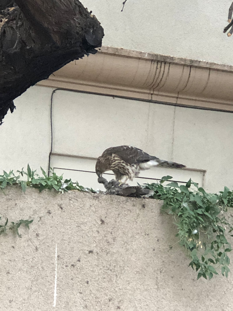 Began the day driving through for a breakfast sandwich as a hawk dined on another bird, nearby. Headed to the west side of the Tucson Mountains, arriving at a trailhead at the top of Sarasota Road. We were headed for the pass between Big and Little Cat Mountains. Reaching a signed junction, we go left and visited....  ....the famous buried vehicle. Continued counterclockwise around Little Cat, staying on trail until it topped out..... 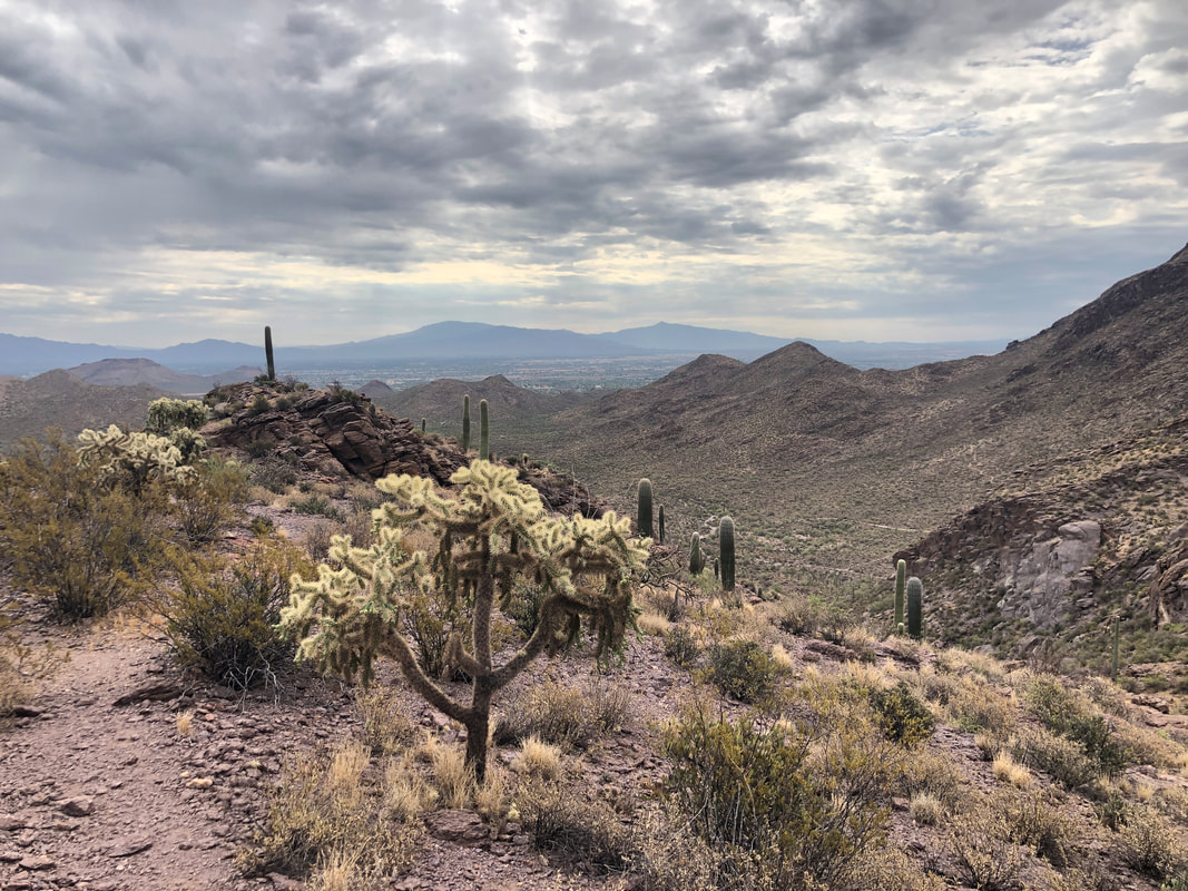 .....at a ridge and then went off trail to our left and began a fairly steep ascent. 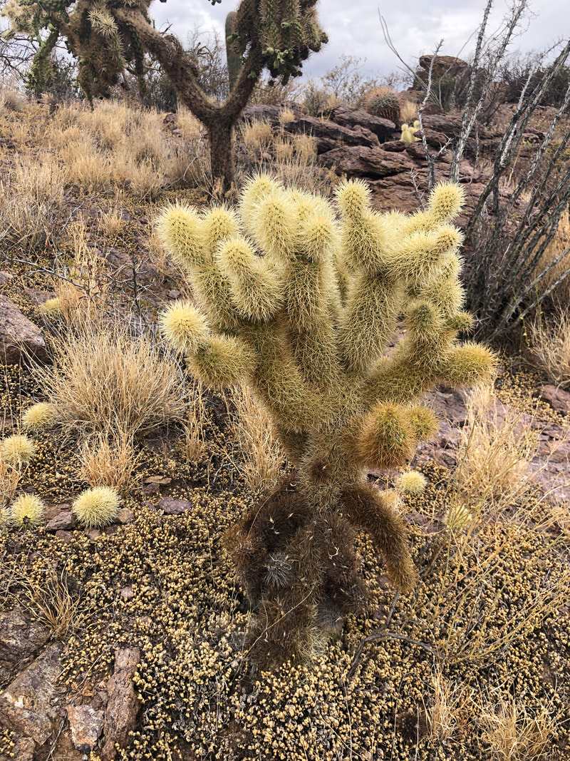 Ugh, evil looking things that are plentiful in the area. The dreaded Jumping Cholla. 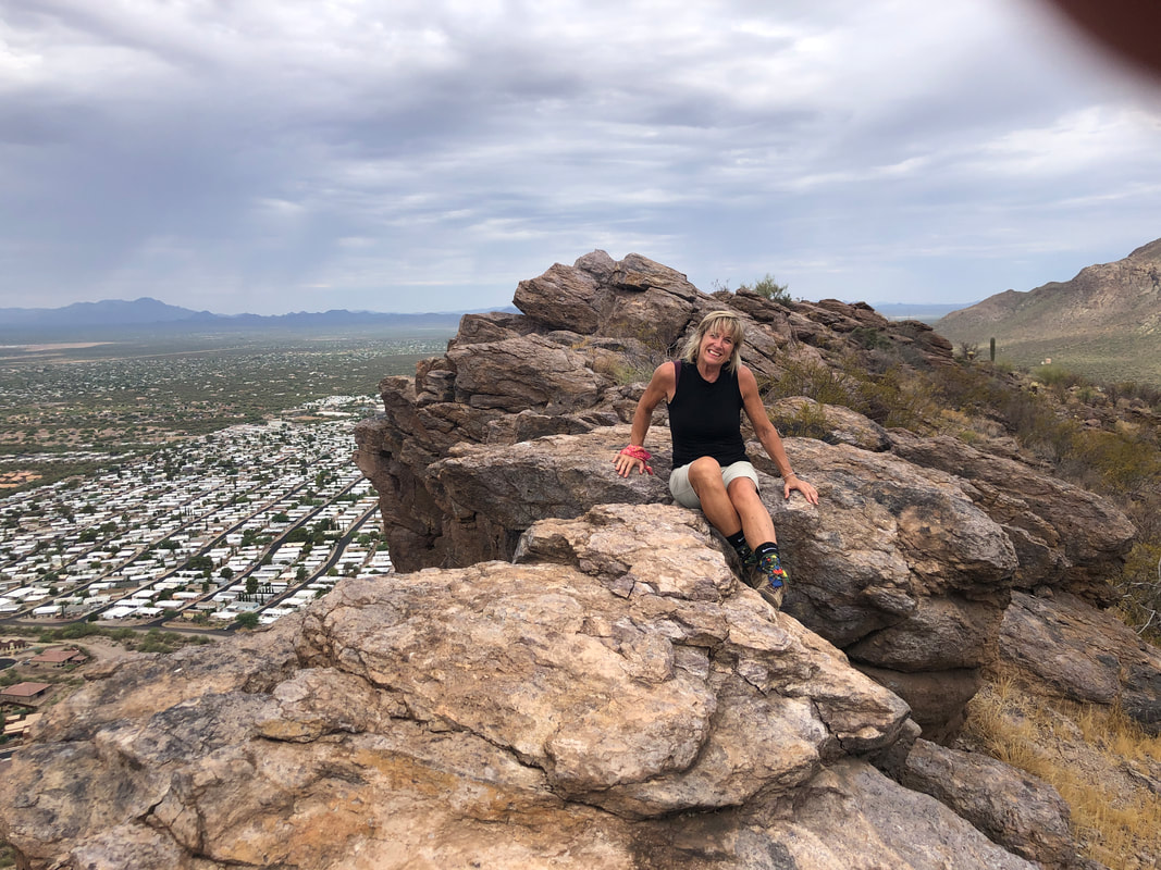 It's not a long hike to the top of Little Cat but once up there, it's a beautiful view. It's fun to top along the ridge line with a several hundred foot drop to the west. 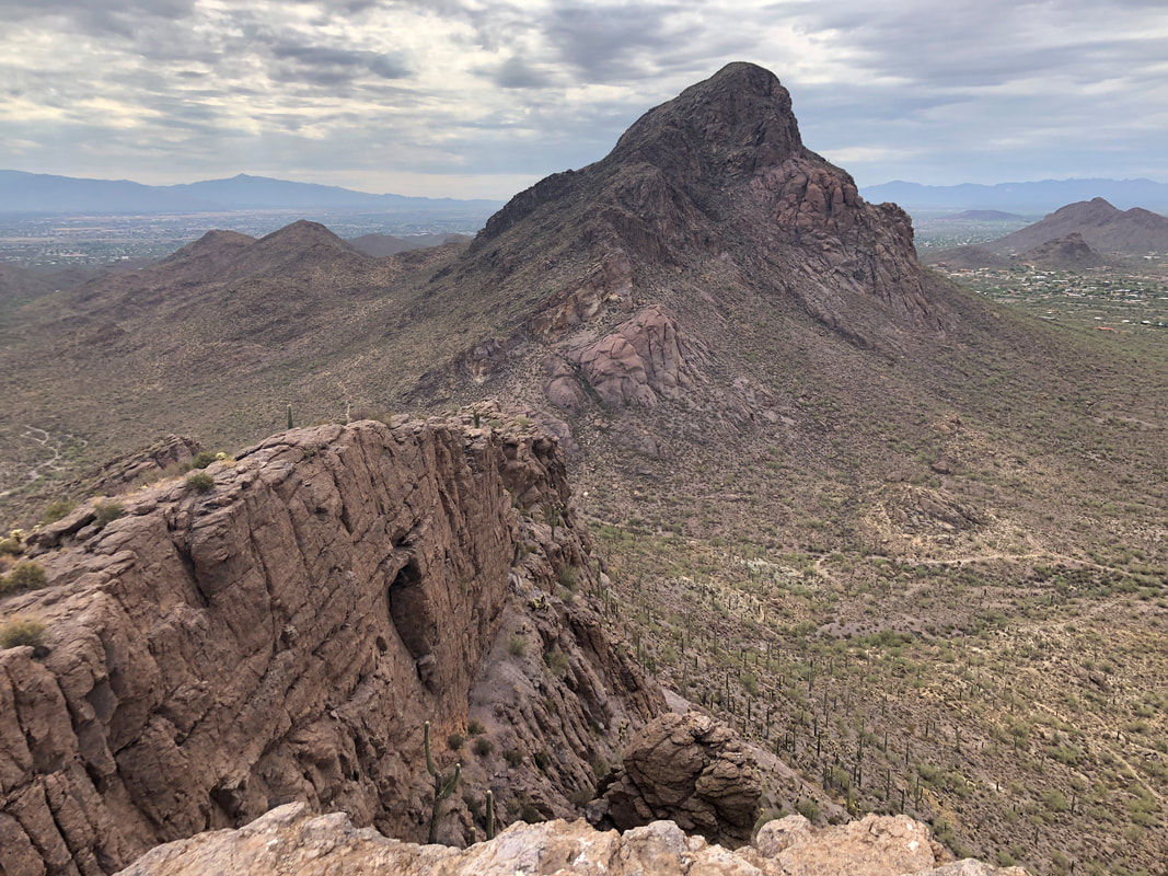 In the distance is Big Cat Mountain. I've not climbed that yet but pretty sure it's on my schedule for next week. 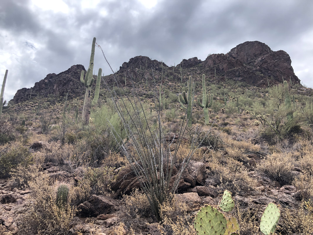 We were going to return the way we came, as I once did before but as we descended the ridge, hopping among the boulders, we spotted an opening that appeared to allow a descent down the west side. What the heck, if we get cliffed out we'll just climb back but while the descent was very steep, we made it. I became rather cautious when we passed the skin of a rattlesnake. Below is.... 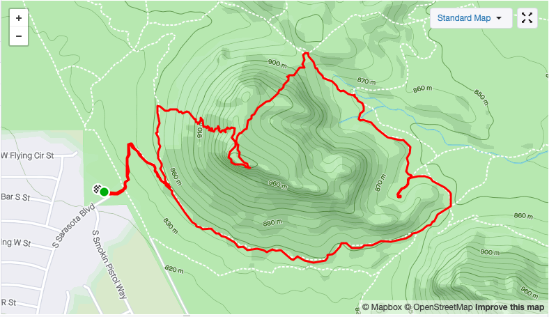 ....the route we took. Finished with only 2.5 miles but a very fun hike.
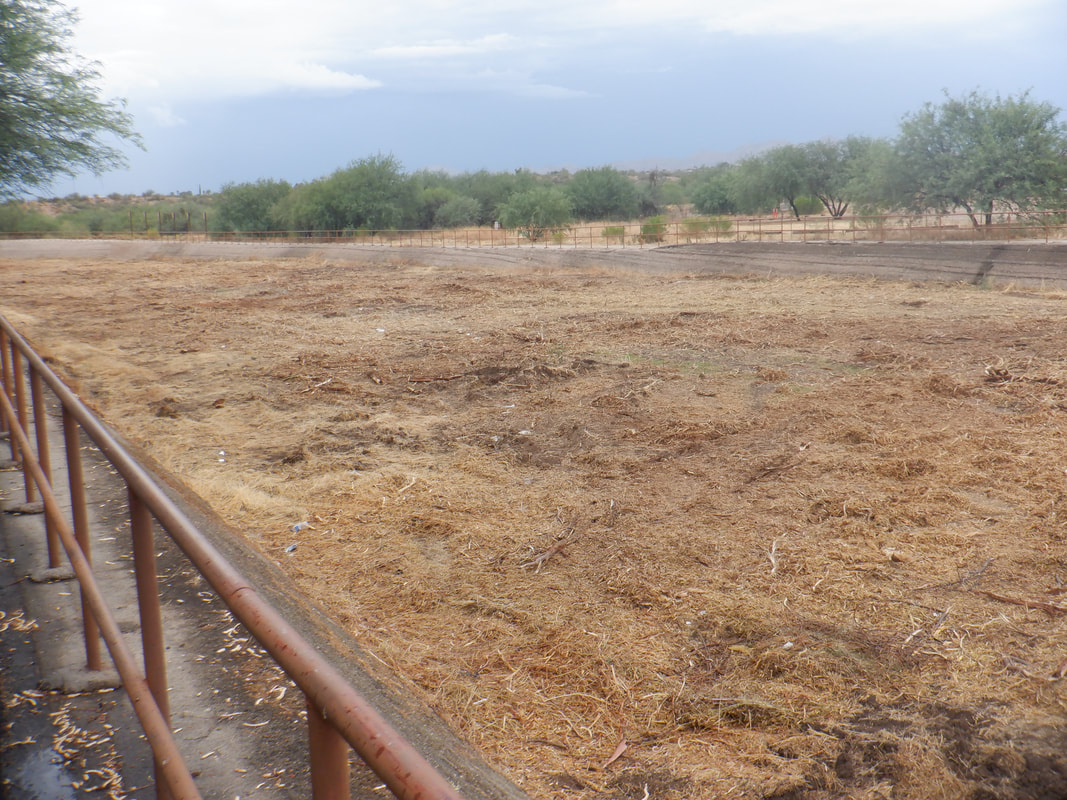 The 119,000 acre, Bighorn fire is out. In anticipation of runoff, the washes are being cleared. This one is across the street from me in Oro Valley. Typically, it is packed with trees and brush but.... 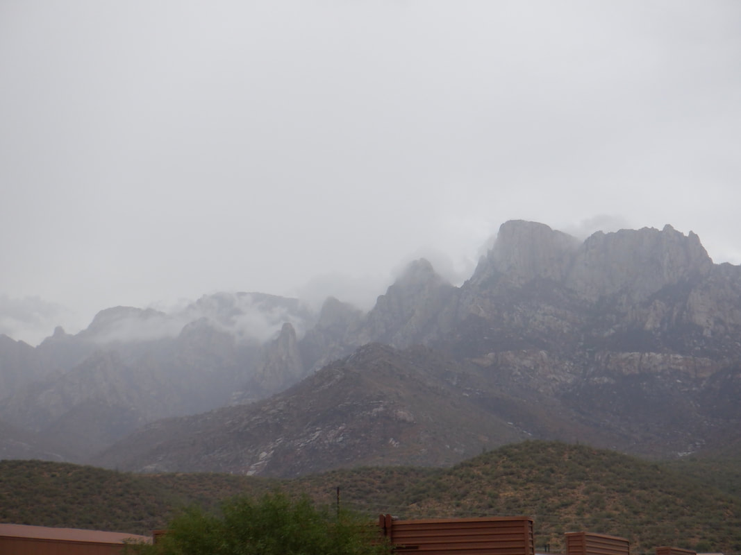 ....looking across to the mountains, rain has come and the forecast is for a bunch of it. 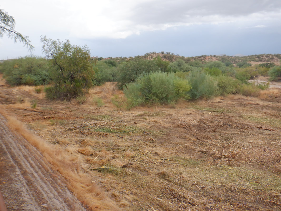 The work crew is working their way down stream but have a couple of miles yet to clear. 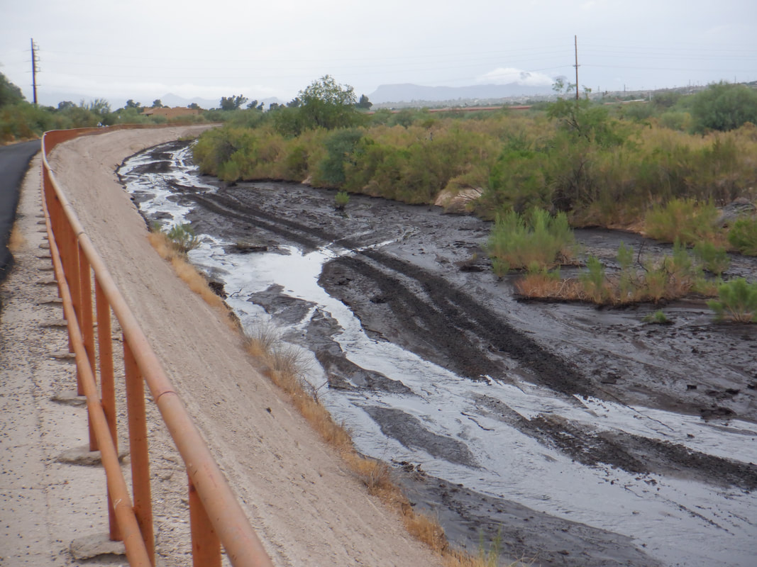 The runoff is black from the ash but the majority of the rain hit the south side of the Catalinas where many roads were closed but on my side, not so much. Well, many days left in monsoon season so we shall see if it is a "Nonsoon" or a "Monsoon".
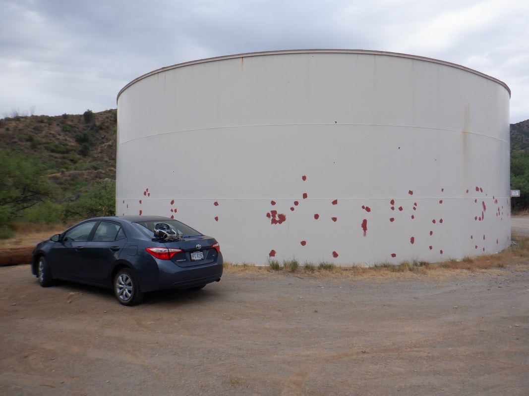 As many know, I live at the base of the Catalinas but they are off limits, perhaps until early November because of the fire. Also off the board is the Superstition Mountains. There is a mountain range to the southwest called the Sierittas. Never visited but did some research and discovered there is a way to Keystone Peak, the high point. Following directions, I eventually get on McGee Road and park at this water tank. 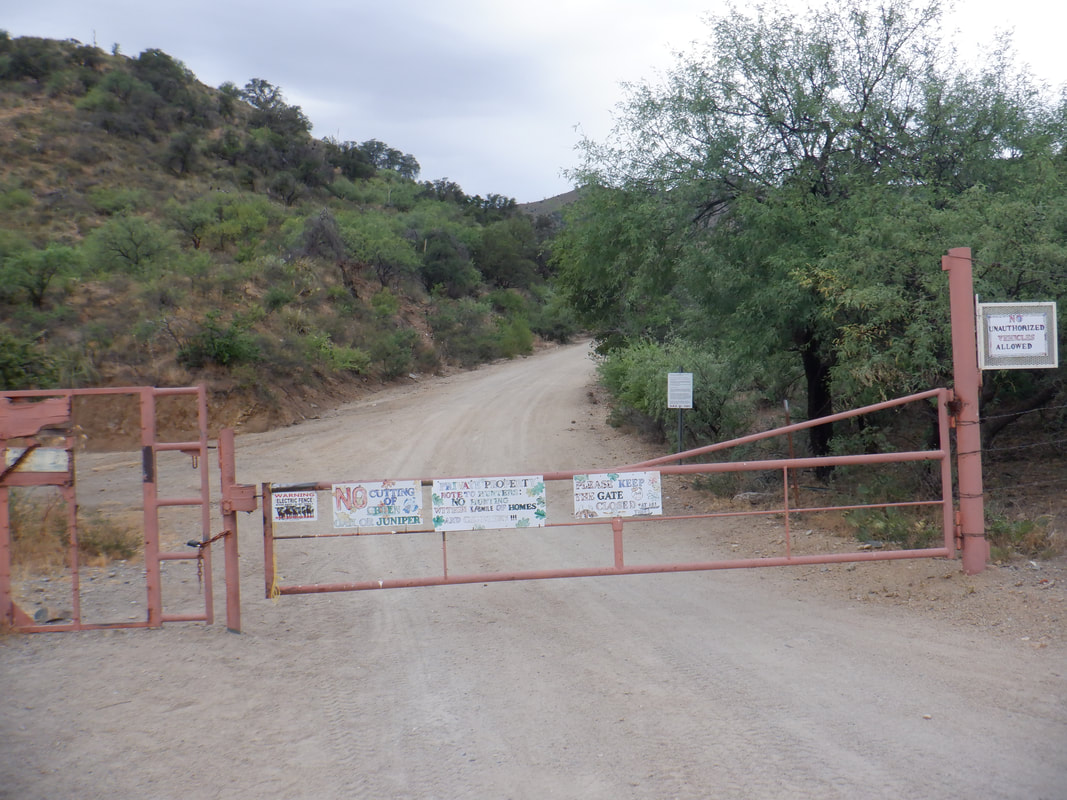 Don't block this entry nor go through it in your vehicle. The McGee family allows access to hikers so park (probably 4 vehicles max could fit) and begin your hike. 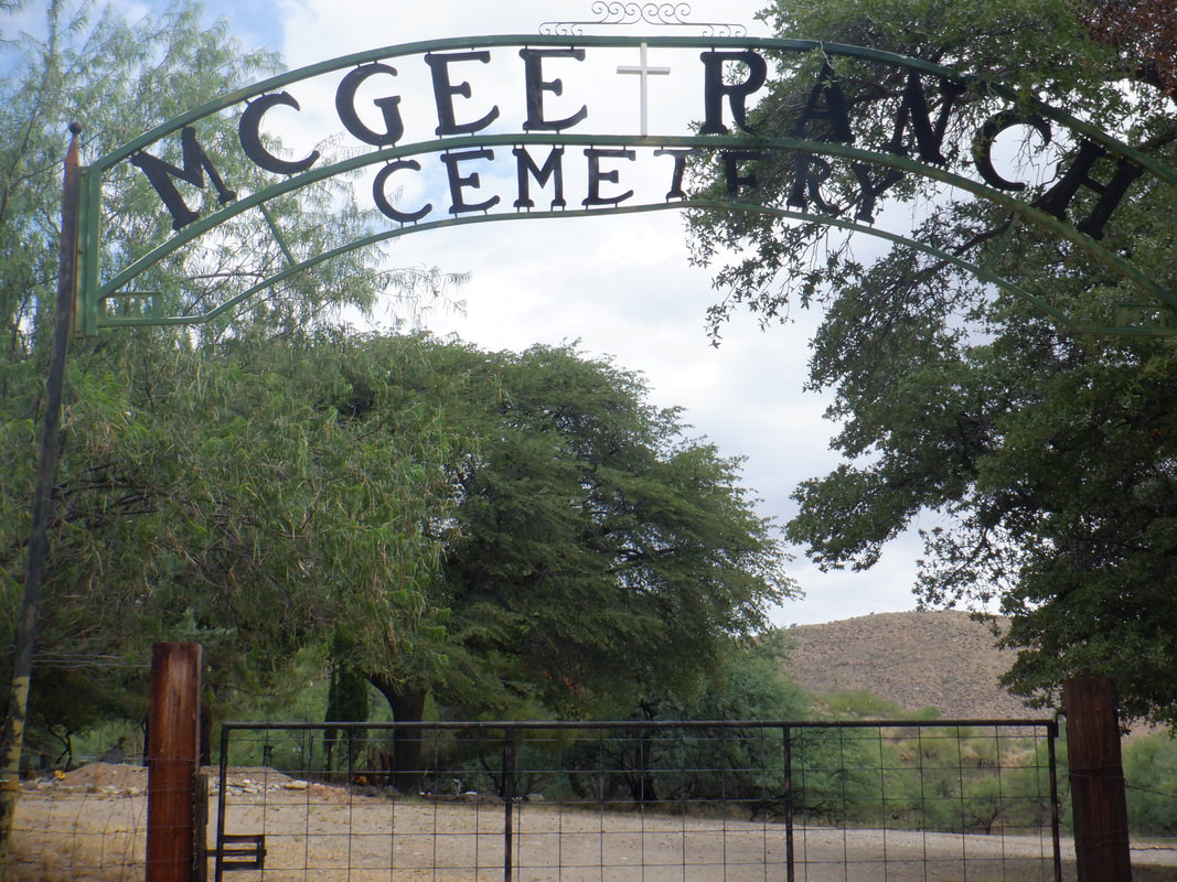 Soon, you pass the family cemetery on the right. I counted at least 25 grave sites. You will pass several intersections so it's a good idea to have a gps route to follow to avoid the confusion of guessing which direction to go. 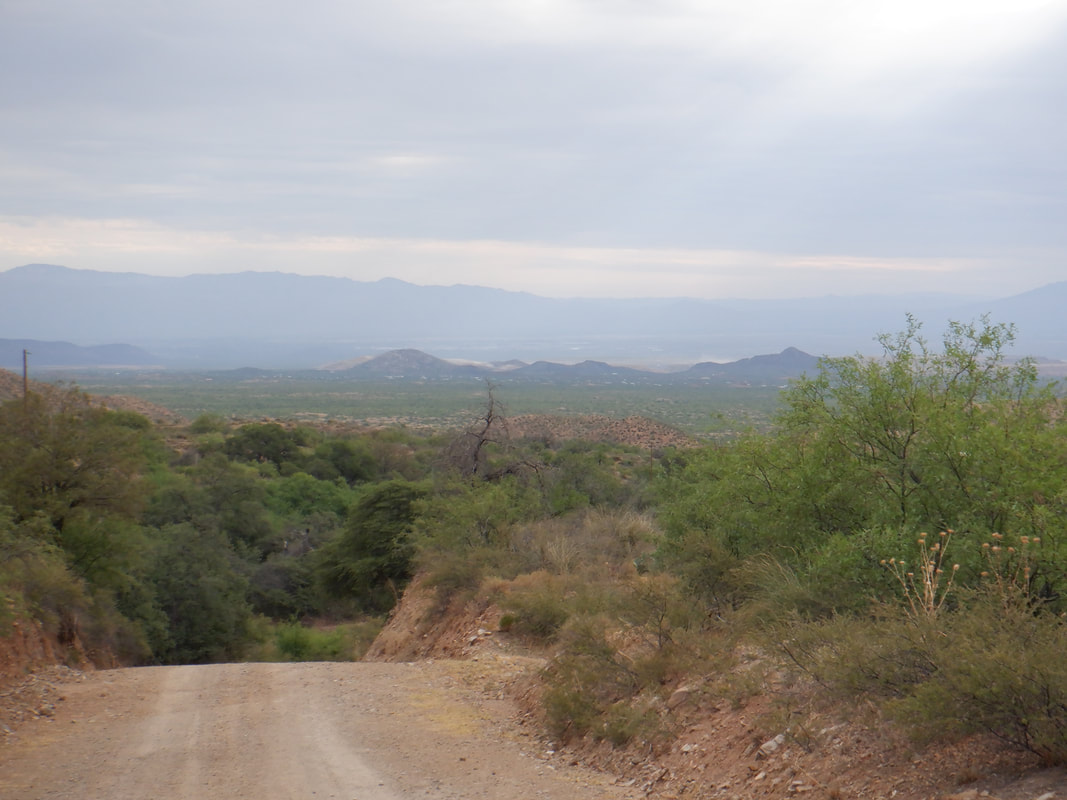 The entirety of the route follows a wonderfully groomed, dirt road. In place, it is quite steep. 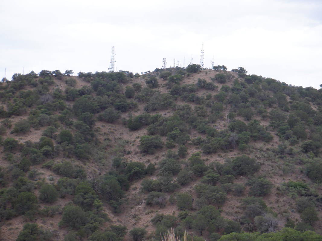 Eventually, I reached a turn that gave me a view of the peak, except it was not, just a hill that aligned perfectly with a more distant peak. 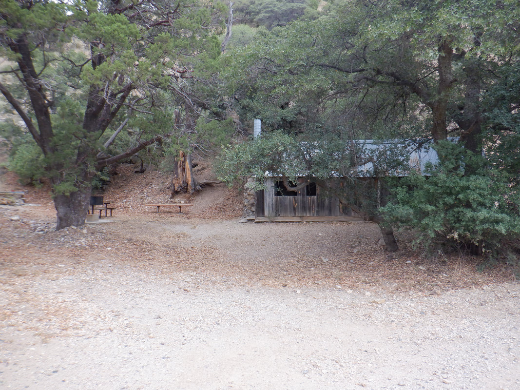 I passed an old mining camp. This being only about 20 miles from the Mexican border, I wasn't overly curious to look inside. This area is remote so I'd recommend having a hiking buddy for the effort. 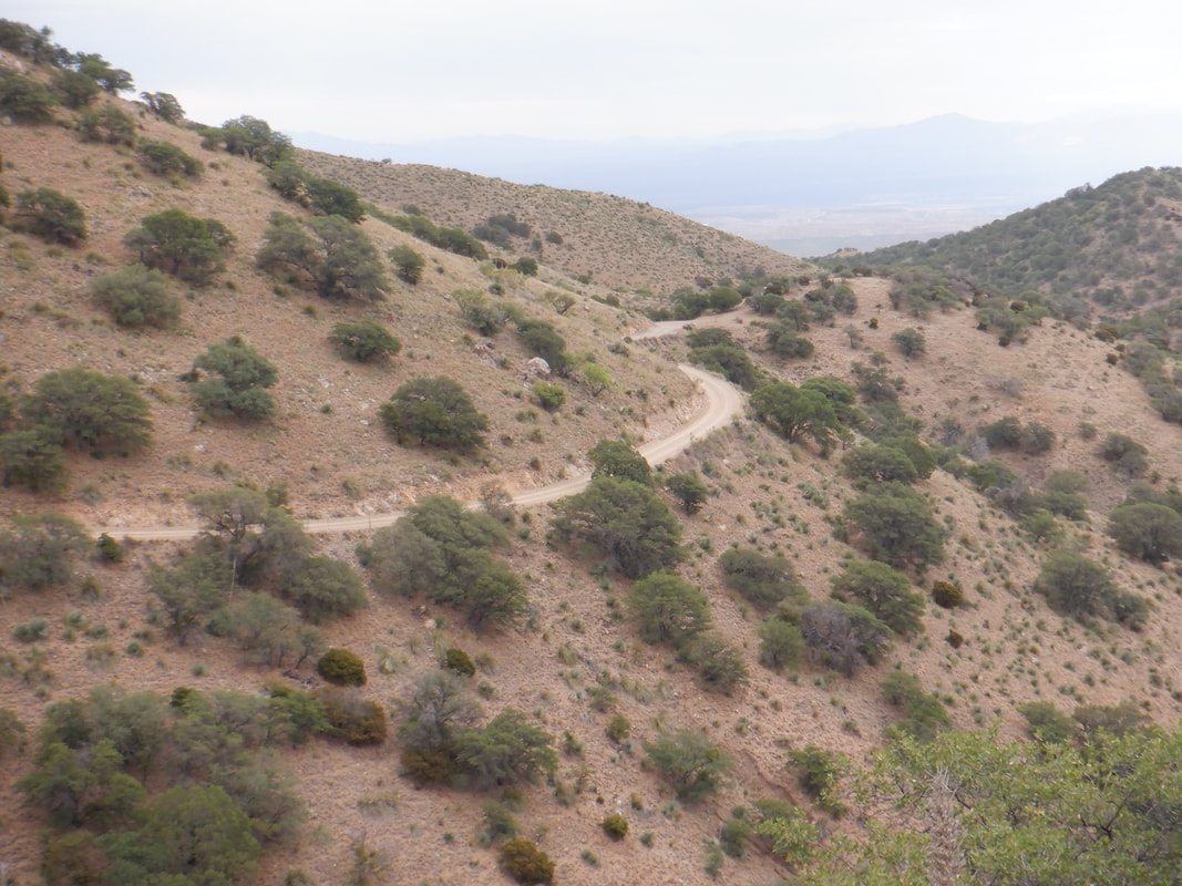 Looking back, the road is very easy to follow and so after about 4.3 miles I..... 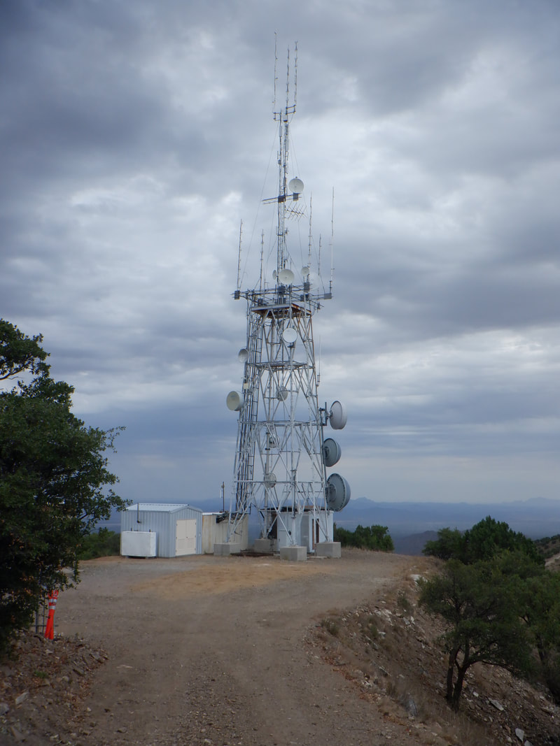 ....reach the peak on which there are several.... 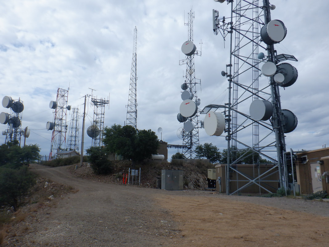 ....antennas and similar structures. I read a hike report where someone claimed he met a member of the McGee family up here and he said it was ok to climb "their" antenna to the platform for an even better view. I looked at that and decided....no. 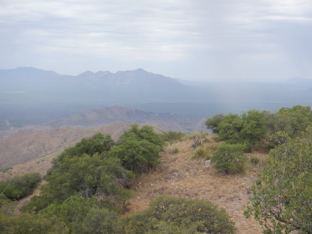 What's that?!?!? A cloudburst in the distance, slightly right of center. Would rather not get caught in that so.... 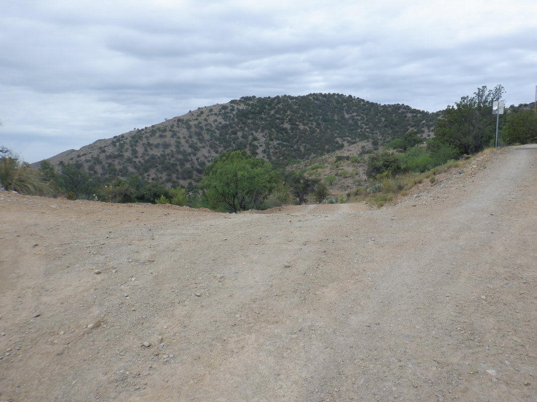 ....headed down. To reiterate, there are several places where the way to go is kind of confusing so download the track of the internet, via the Hikearizona site. 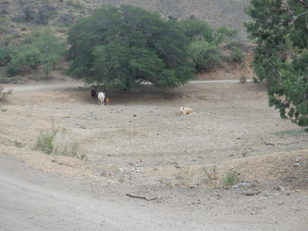 Some cows watch me as I pass, finishing with 8.7 miles and 1560' of climbing.
 The day prior to this hike, I read it was only 1.3 miles (actually 1.5) so I filled a water bottle about 3/4 full and arrived at the parking lot. Hmmm,....... 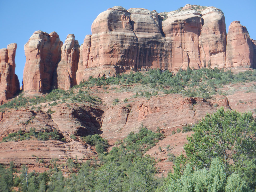 ....I could see people climbing steep sections and thought, "Damn, I don't have enough water for this!" We began.... 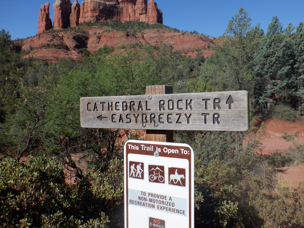 .....while passing the signpost for the "Easy Breezy Trail" and I thought that would probably be better but we stayed on the cathedral Rock Trail.  Check out the cairns which dotted the route. So much of it is over slickrock, without the cairns it would be a navigating challenge although for today, there were lots of people too. 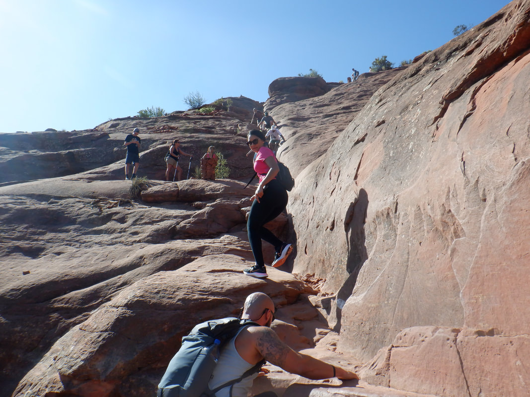 Of course it doesn't look like it but this was very steep. 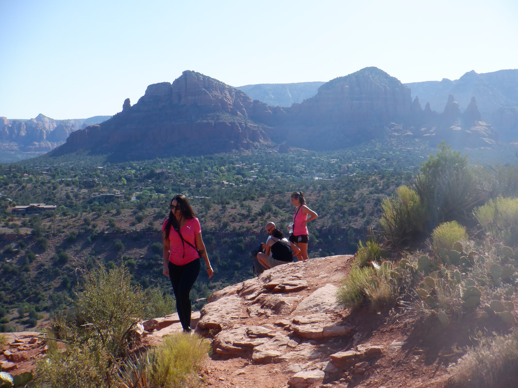 Fresh, the views were abundant for the entirety of the climb and so too were.... 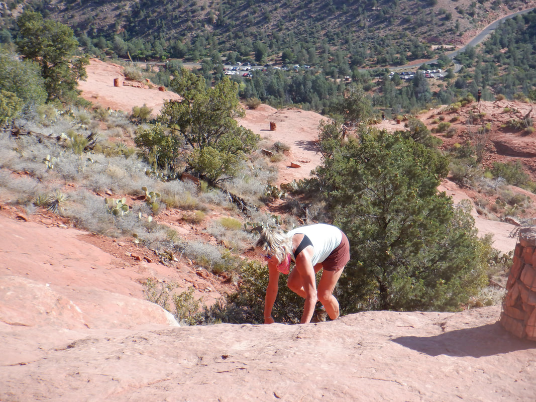 ....more steep sections as Amy surmounted them all. Note the parking lot in the distance. The average grade for the climb is 38% and that includes a few flat sections. Where there is climbing, it is steep. 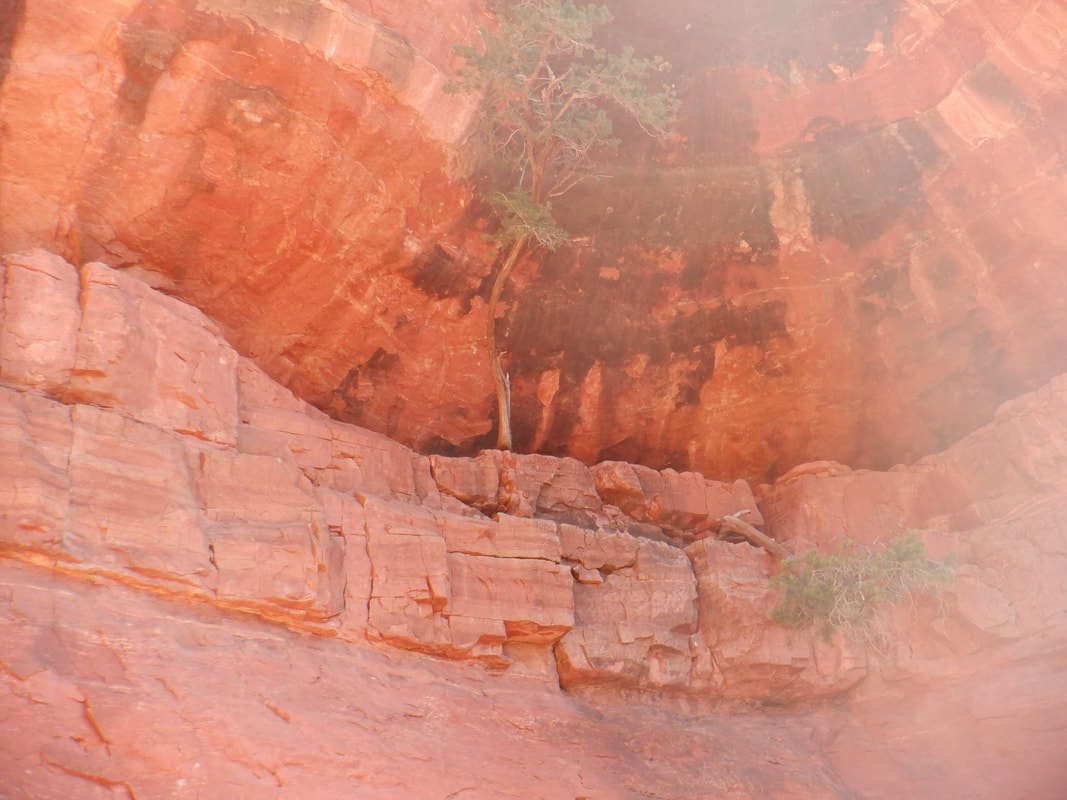 We pass an alcove that had a couple of trees growing from inside. Soon thereafter we reach.... 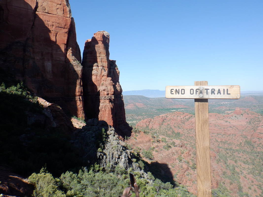 ....the end of the trail, marked as such too. 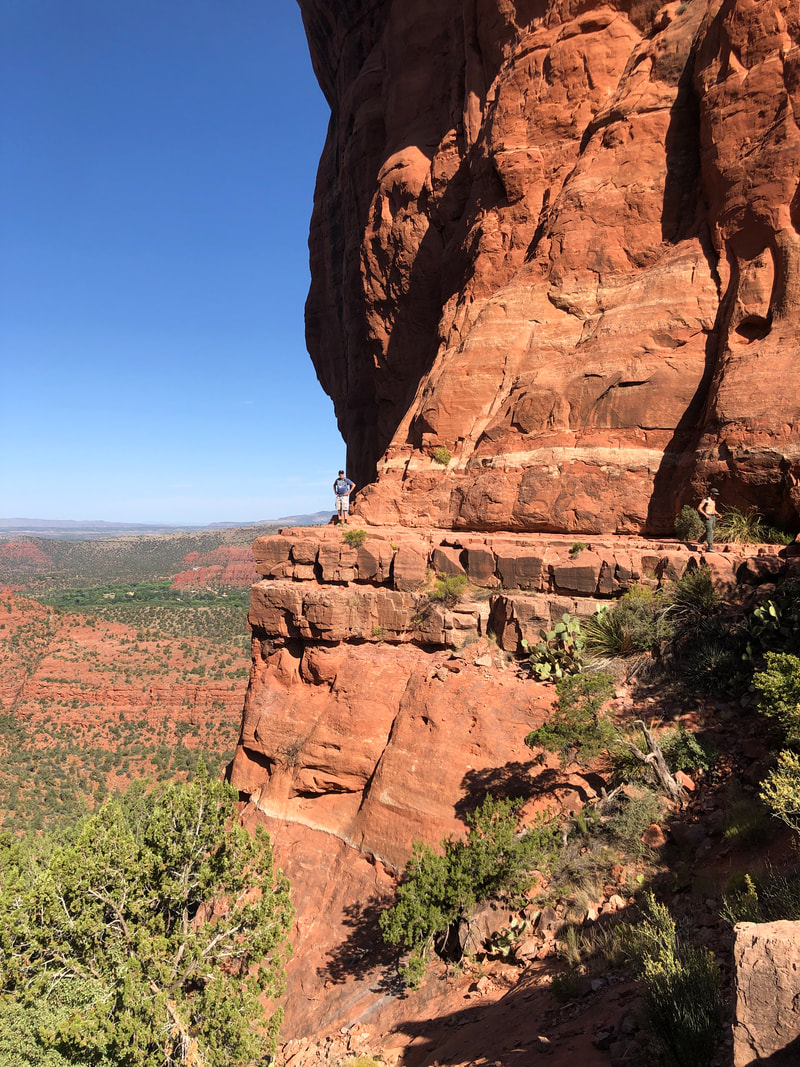 Off to the right was a ledge so I walked out there and posed. Looking back across the gorge.... 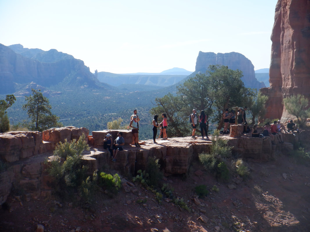 ....wow, what a great scene as a dozen or so people gather to enjoy. 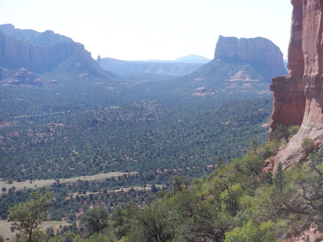 We began the descent. 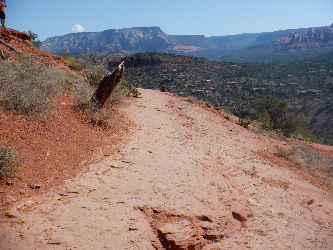 Here is one of the flat sections prior to another.... 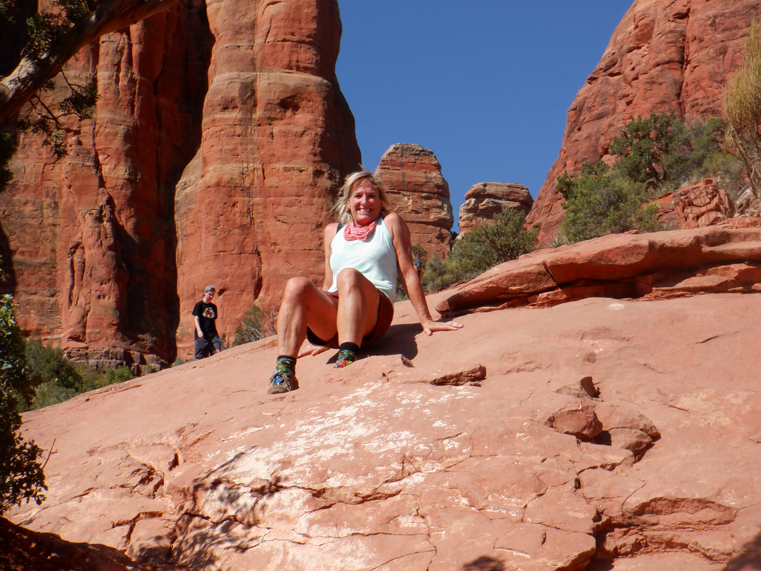 ....steep section. This type of "hiking" is so much fun. Note, no one wore a mask and you are sharing many hand holds so we applied the hand sanitizer upon returning to the car. I'm a bit of a skeptic about mask use. I have a cousin who worked at the CDC for 3 years, sequencing viruses and developing DNA vaccines. at a BSL3 lab. Yes, washing your hands is good, maintaining distance is good, don't stick your fingers in your orifices is good but the cloth masks are worthless. In his words, "you may as well wrap your head with pantyhose". I never delve into politics, here and won't ever but in this day and age, I trust my cousin and his experience far more than any health agency. Well, on to another hike!
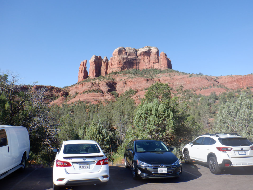
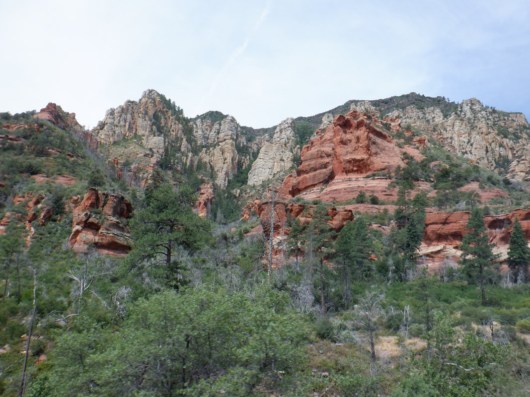 Following the hike to Humphrey's, we took a day off to take 89A from Flagstaff to Sedona. I'd not driven this route so enjoyed the winding descent followed by a pleasant drive along a stream in which lots of people were playing. 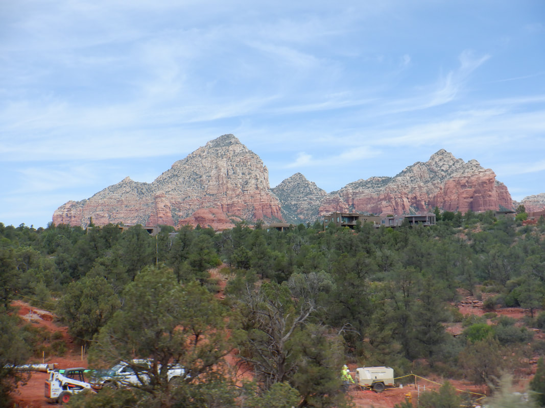 We drove through Sedona, going on to Cottonwood and then driving half way up Mingus Mountain to visit..... 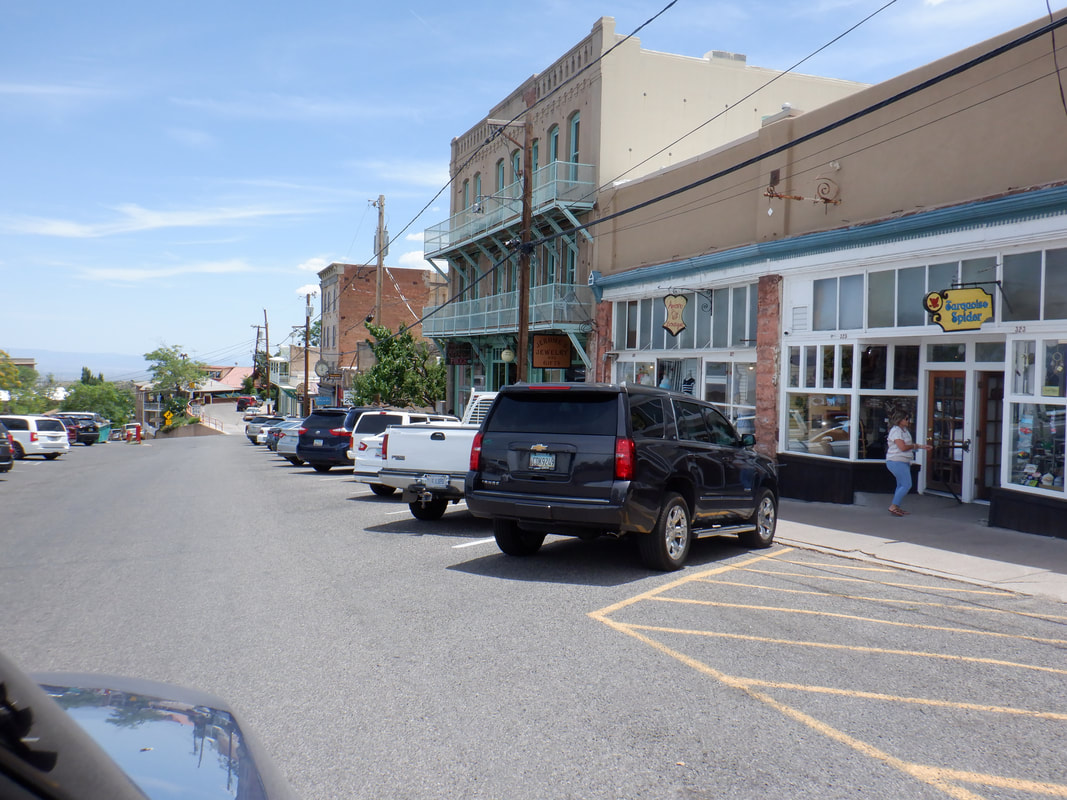 ....the small town of Jerome. Interesting history of this long time, mining town with many unique shops and good restaurants. 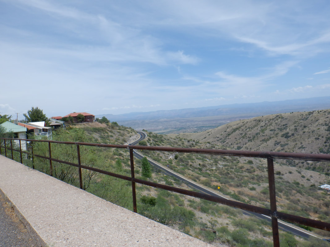 Following lunch, we headed back to Sedona, paused at Red Rock Park where a ranger advised me keep going to get the best view in the valley of Cathedral Rock so off we went.... 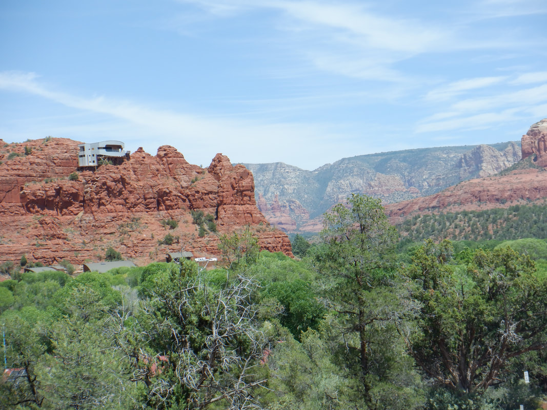 ....but paused in front of a beautiful home built into a rock formation accessible only by the home owner's tram. Just then, a guy driving his truck in the other direction stopped and gave us the story, "He is an engineer and his mama gave him a bunch of money!" We got a good laugh then drove and found..... 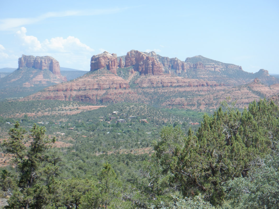 ...the spot from which to take the great image of Cathedral Rock. 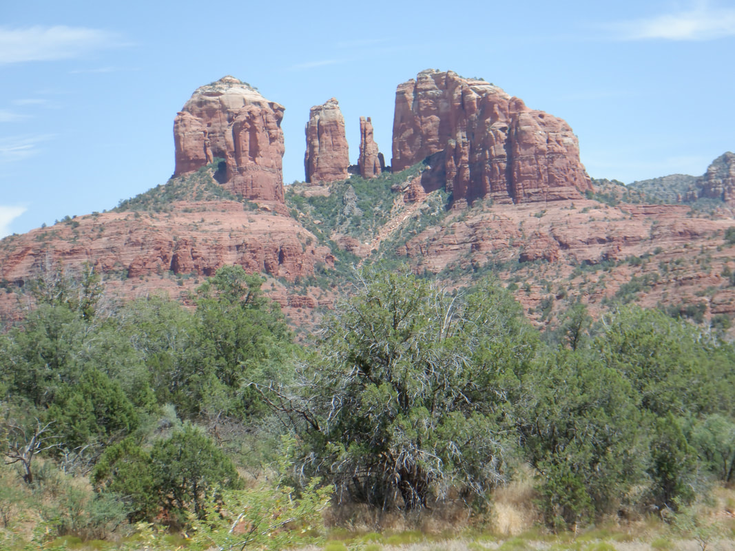 A closer look and the next day, we climbed that. 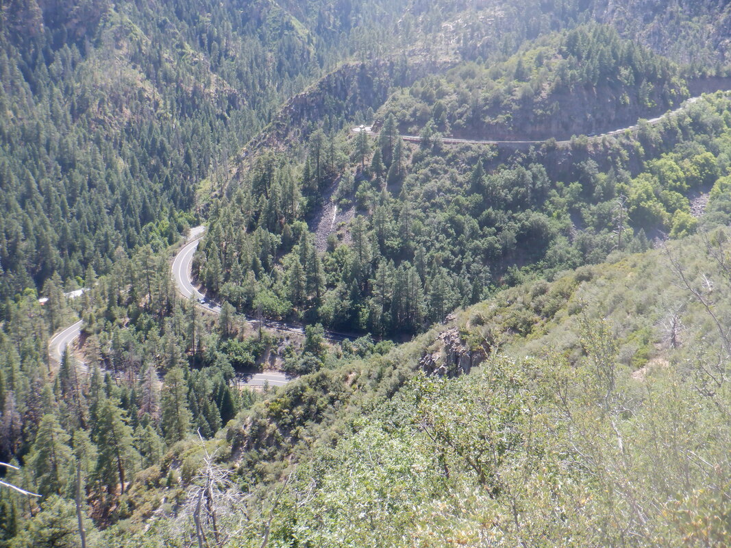 We drove back and note the serpentine climb out of the valley.
 Amy and I continue our trek into the thin air above Flagstaff. The trees are becoming scarce and not much higher, we climb above the tree line. 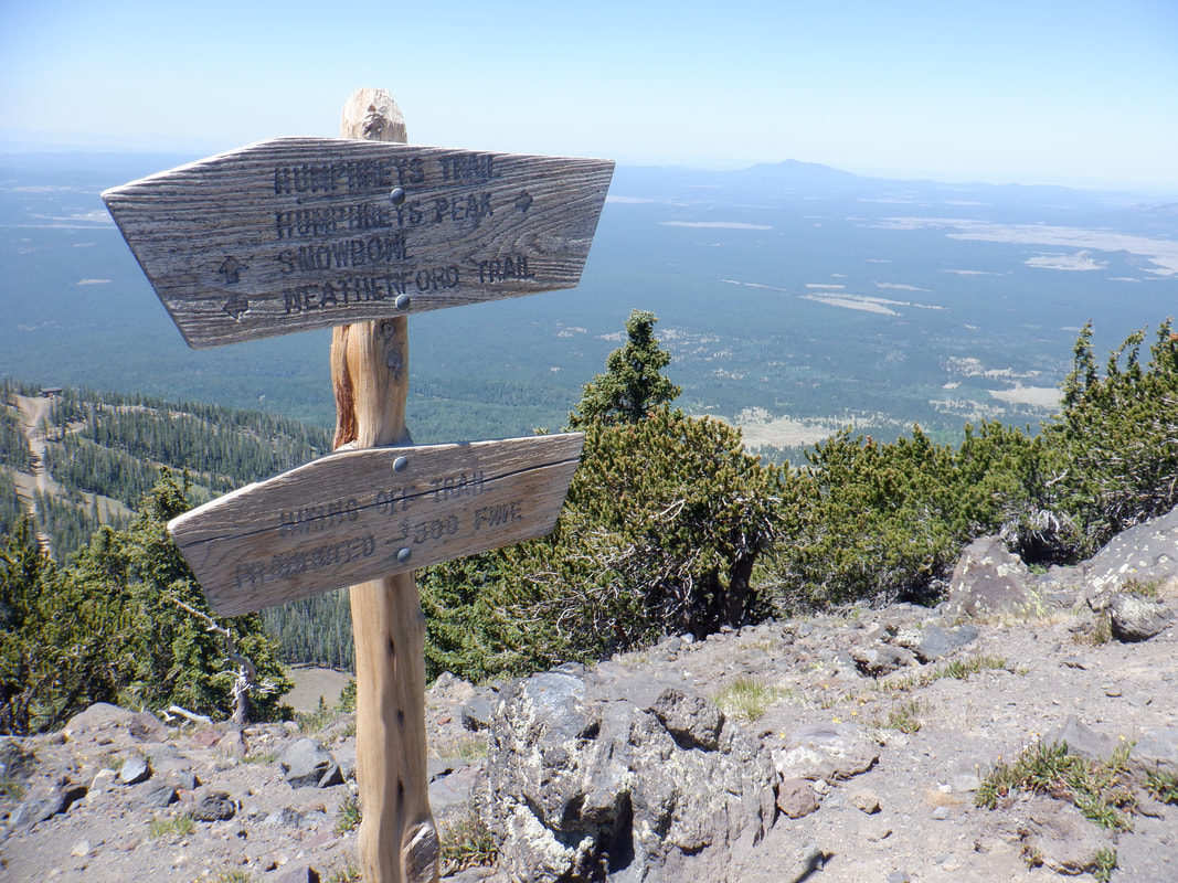 We reach a saddle and in this exposed area, the wind is howling. We seek shelter behind a rock wall while.... 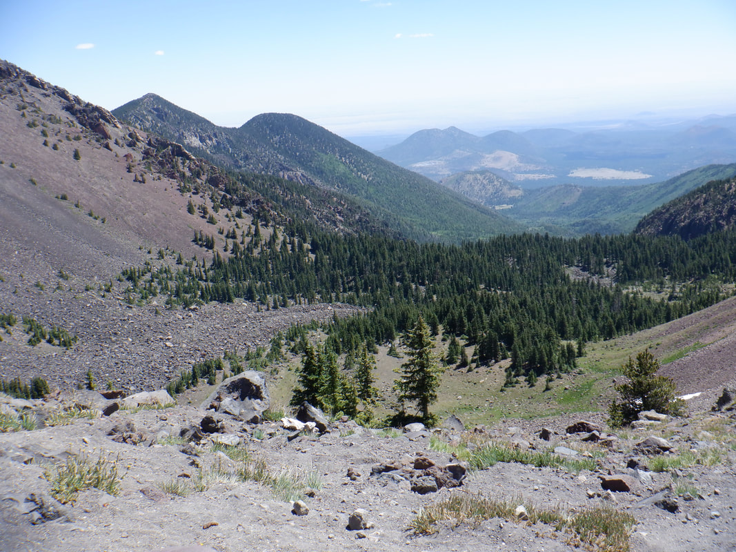 ....admiring the view. This is looking, I think to the northeast. As we sat and looked.... 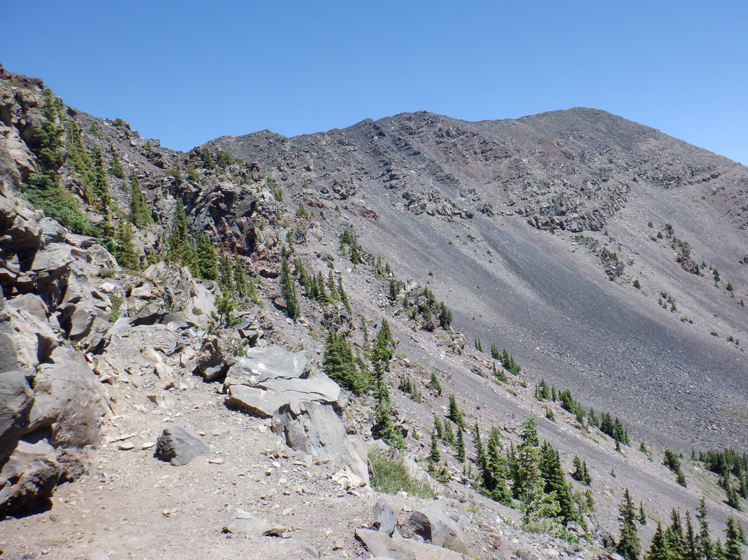 ....at what was left to climb. The trail ascends the other side and you can't see the summit, just a series of false summits but I know what is coming and advise Amy not to be discouraged as we access false peaks and discover that is not THE peak. 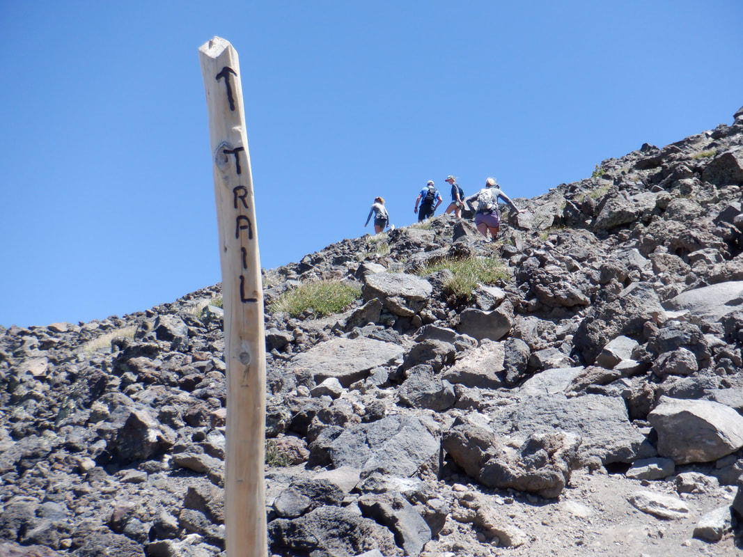 A series of posts guide the way. Not needed now but when snow is present, no way to follow the trail without these useful items. The wind is ferocious from my left and I was always on guard when lifting one foot off the ground. A few times I was thrown off balance but lots of boulders to steady myself. 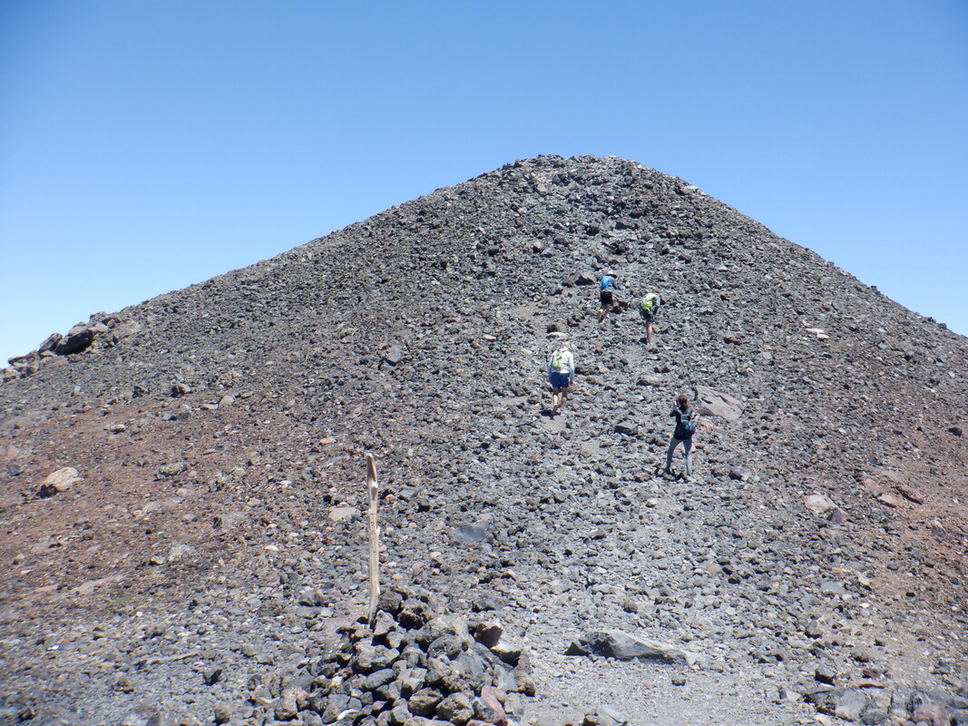 At last, we reach the final slope, a stark moonscape. I was very excited when Amy reached the peak, a goal of course, having fought through the altitude complications. An opening in one of the rock walls to protect against the wind opened so... 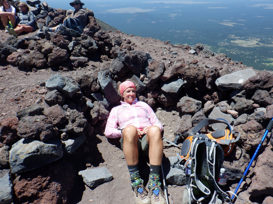 ....she gladly laid for a few minutes to recover. 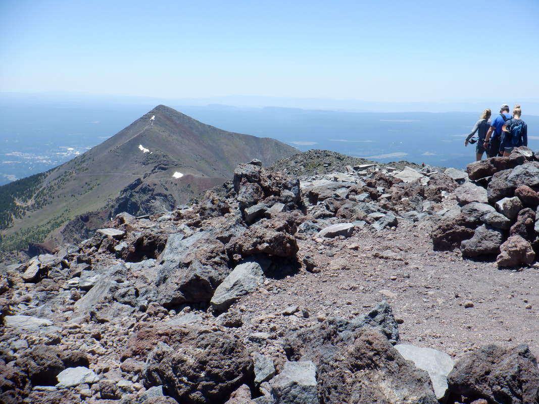 Note the small patches of snow on the north facing slope. 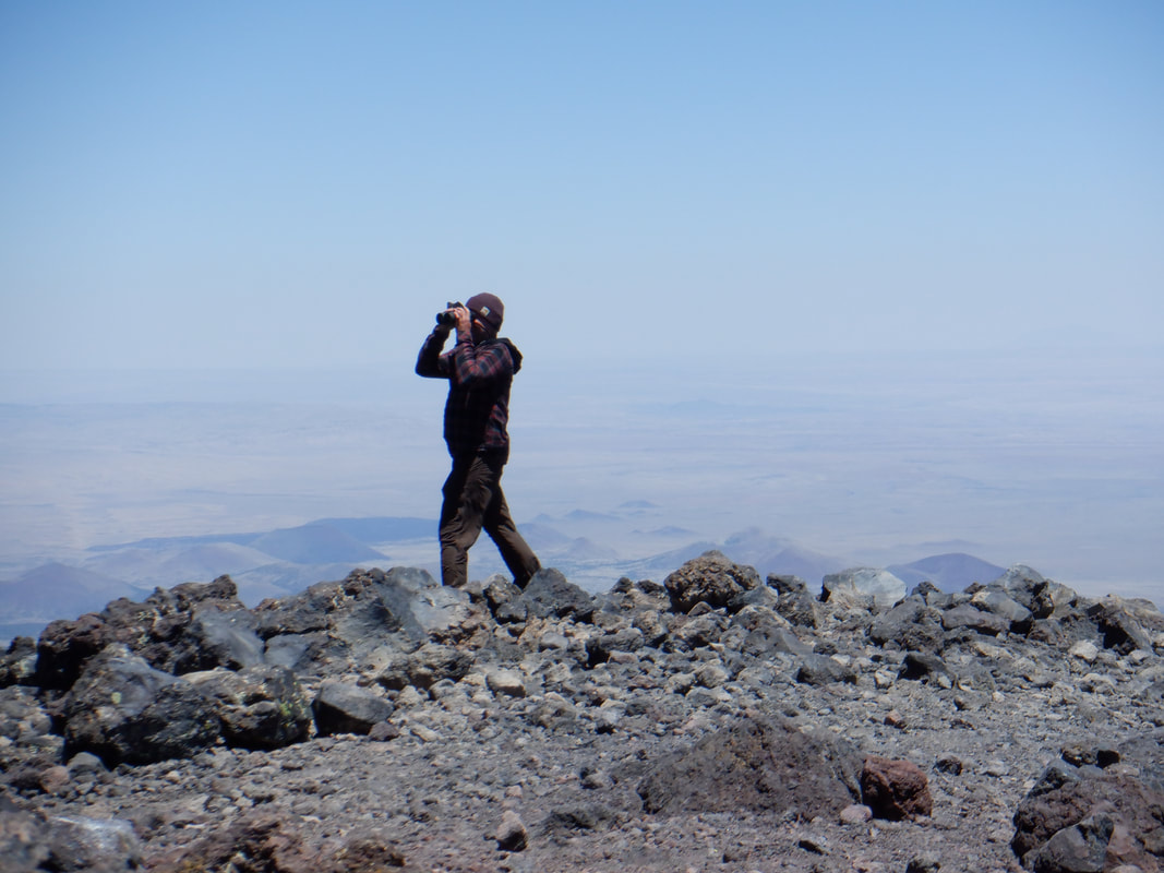 A guy uses binoculars. Beyond him is the Little Colorado River flowing into the Grand Canyon. 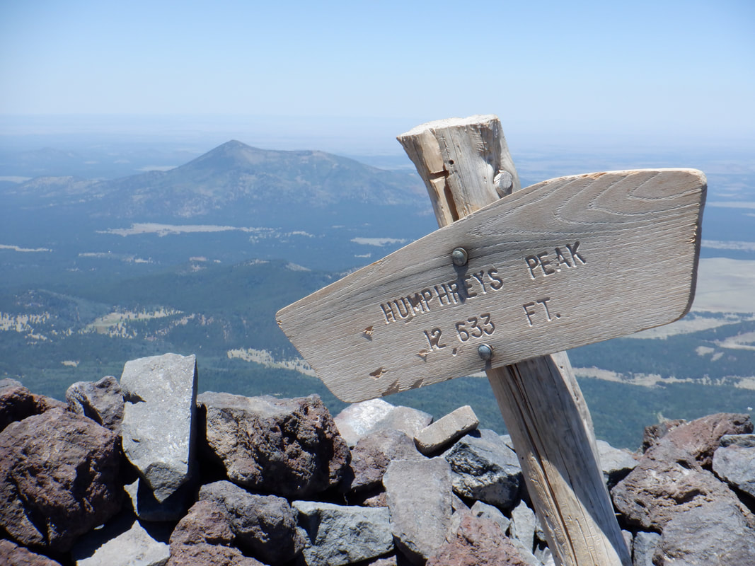 My previous two visits, I was swarmed with buts but not today. Maybe that is because the wind was 30+mph on this day. 12,633" at this peak. 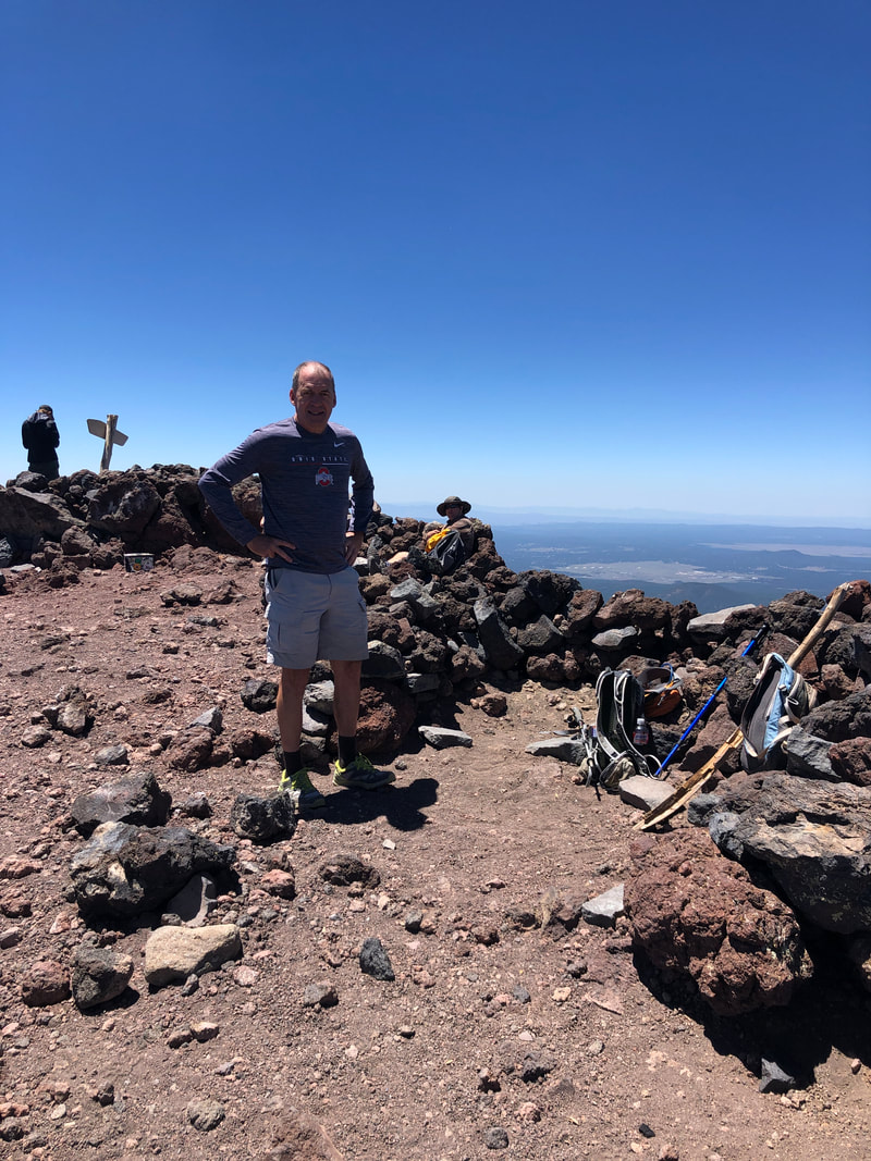 If you look closely, I am almost always wearing an Ohio State item. It is rare for someone not to yell "OH" or "Go Buckeyes". We are loved all over except maybe in the state of Michigan:). After about 15 minutes, we put our backpacks back on and begin the long descent. 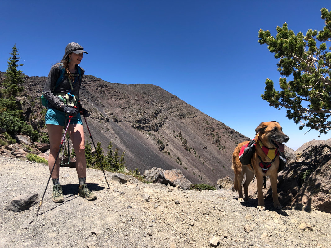 At the aforementioned saddle, we run into a woman with a dog carrying some supplies. Dropping below the saddle, the wind thankfully diminished as we retraced our route. Note the descent is really time consuming and requires patience to pick through all the tree roots and boulders. Finished with 10.5 miles and 3400' of climbing. That doesn't seem that difficult but couple that with the wind and elevation, quite the worthy hike!
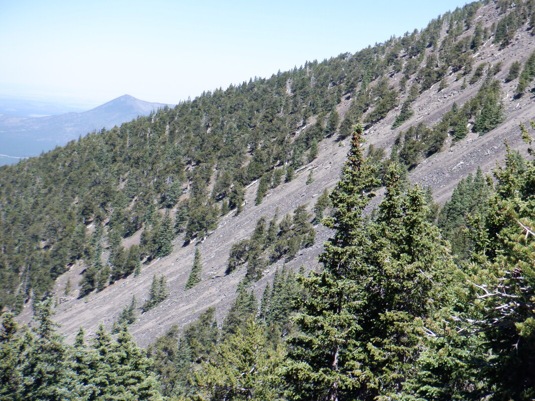
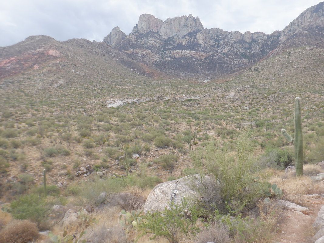
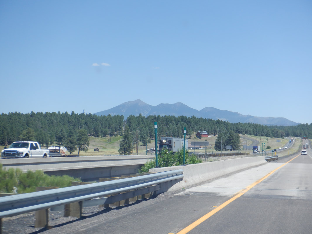 We make the 4 hour drive to Flagstaff with a plan to climb Humphrey's Peak, the high point in the state at 12,600'. The timing of the trip was not random, had to choose a time when there is 0 chance of rain because up there, above the tree line, in a storm....yikes. 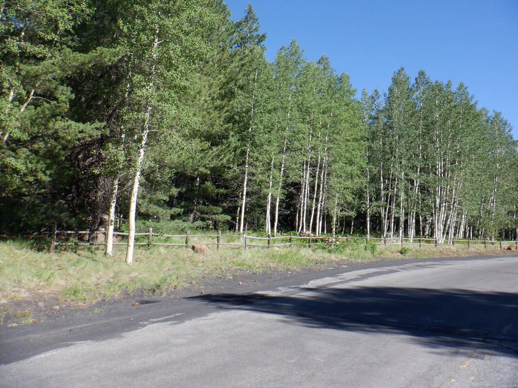 Of course, while Flagstaff is at 7000' elevation, the start of our hike is at the Snow Bowl at 9000', despite being just a few miles out of the city limits. Temperature is a consideration so we wait until about 8:30am to begin where it is in the low 60s here and by the time we reach the peak, in the low 50s. Lots of Aspen mixed in the pine forest. 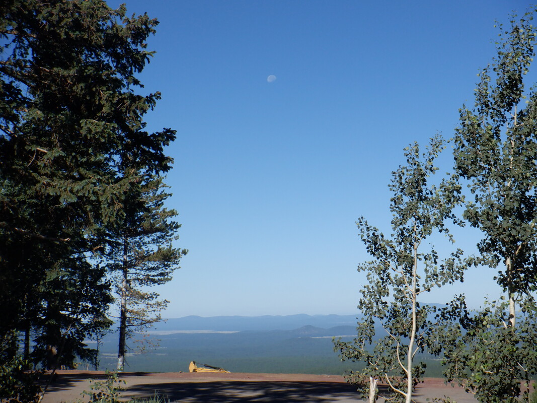 We arrive at the large parking area and I take a pic of the moon. We gear up and walk to the..... 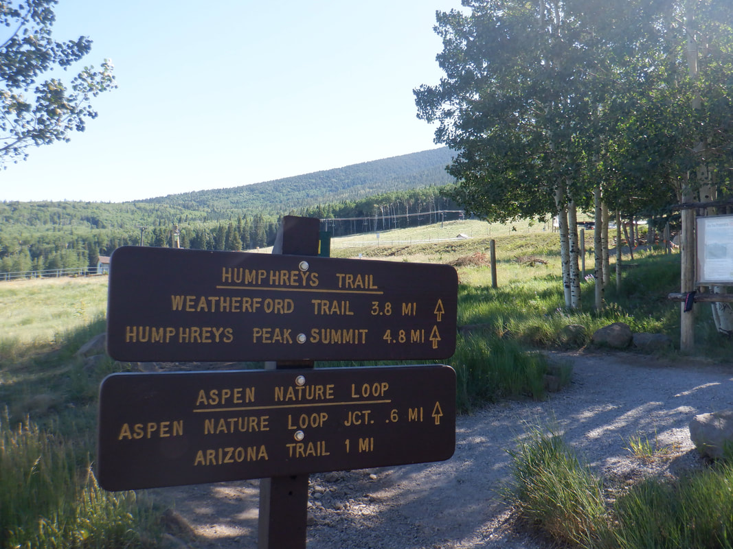 ....trail head. Round trip, the hike is 10.5 miles from where we parked. 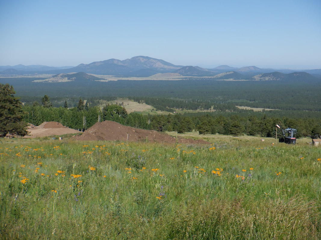 Such a benign start to our adventure. Many wild flowers blooming as we cross the ski slope and head to the..... 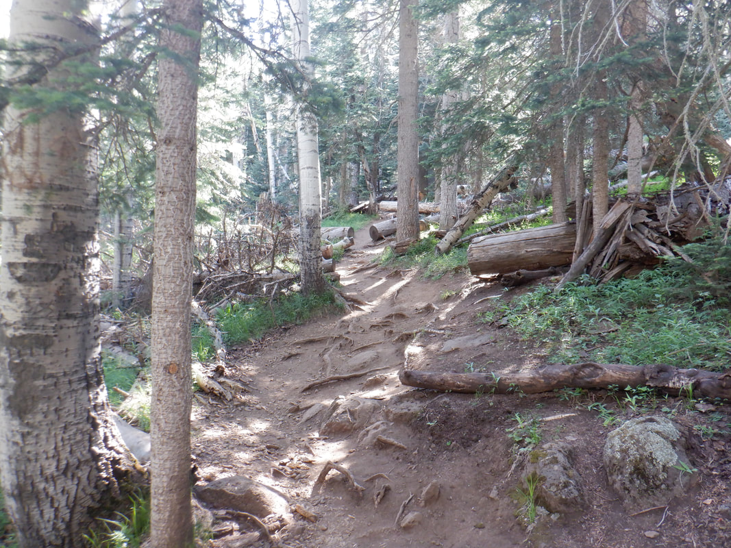 ....forest. This area receives an average of 260" of snow so plenty of water to support the giant trees. The trail is not smooth. Between the roots and boulders, it is a head down kind of hike. The average grade is 12% so not as steep as Mount Wrightson in my neck of the woods. But, where it is steep, it is really steep. 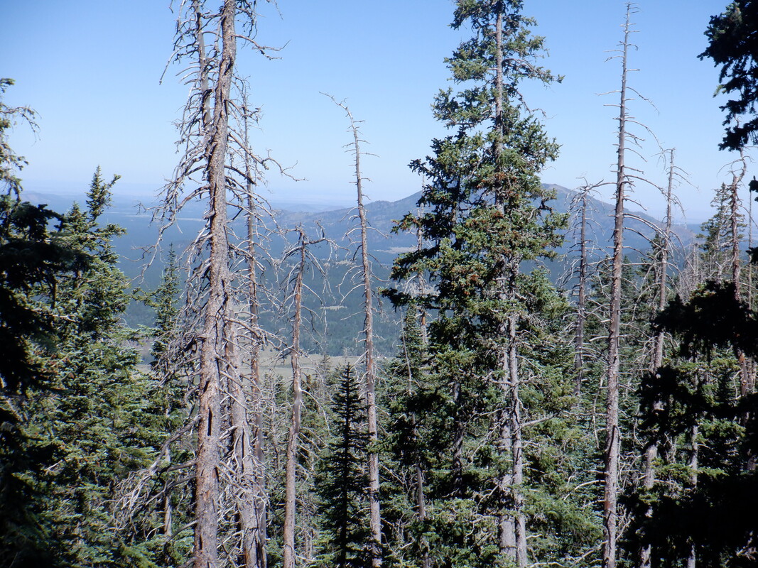 Early, all we see are tree trunks and a canopy that keeps us in the shade. Eventually, we reach a point in the trail, maybe at mile 2ish, where the views open. 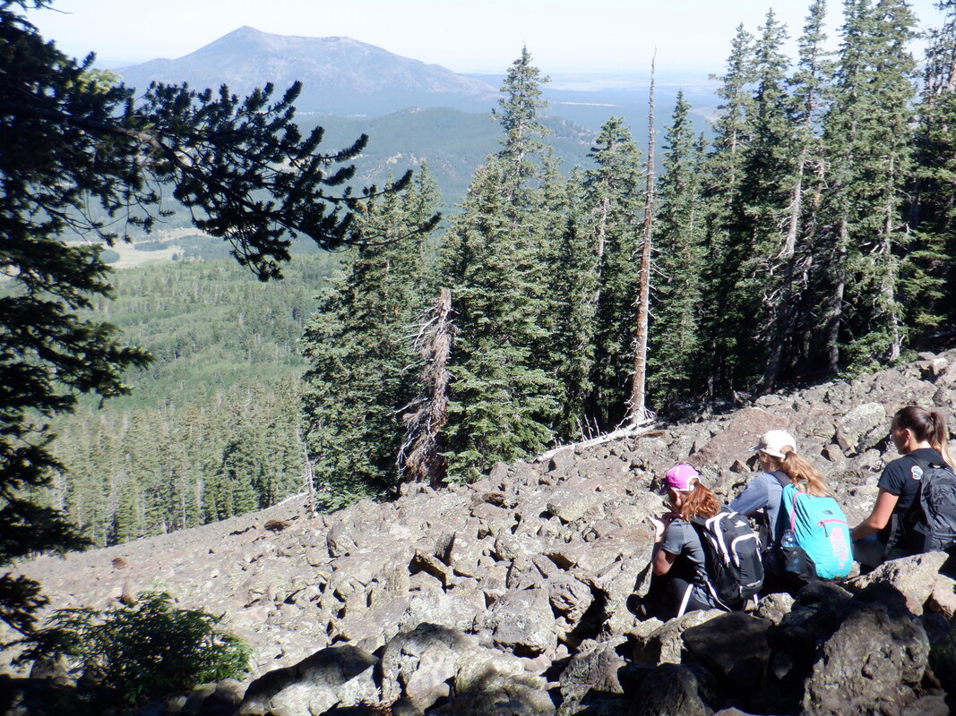 We reach a broad swatch of rock fall. Above this point, a WWII era plane crashed and you can visit the site and see relics. 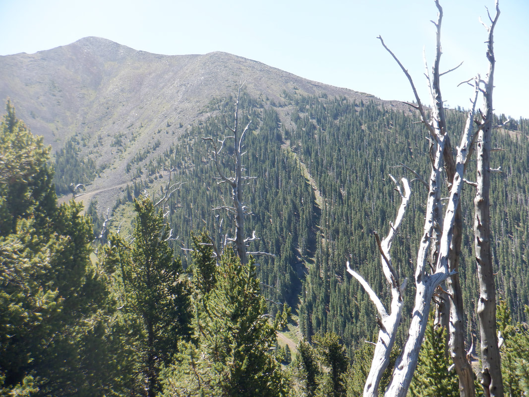 Another of the peaks in the San Francisco Peaks area is seen across a valley. We continue to climb but Amy lets me know she is starting to feel the effects of the altitude. That is normal for most people and I hope that..... 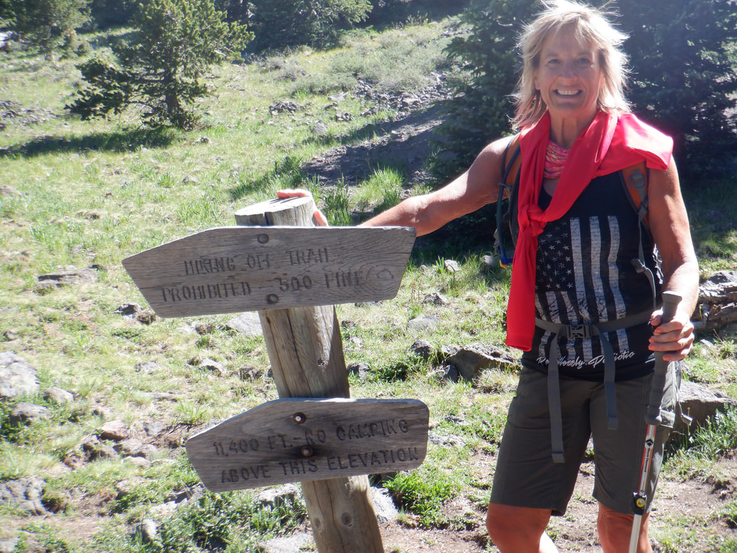 ....with another 1000' of elevation gain to go, the condition does not worsen. Amy pauses at a prominent sign and as always, smiling despite some dizziness. My first visit, the altitude was a problem for me but on my 2nd visit, I did not notice it. I assumed I too would have an issue since I've not done much higher elevation hiking with the fire forced closure of Mount Lemmon. We shall see in the next installment.
 I'm climbing via the Aqua Caliente trail. Decided to get in one more hike before the drive to Flagstaff. Beautiful view of the Catalinas. 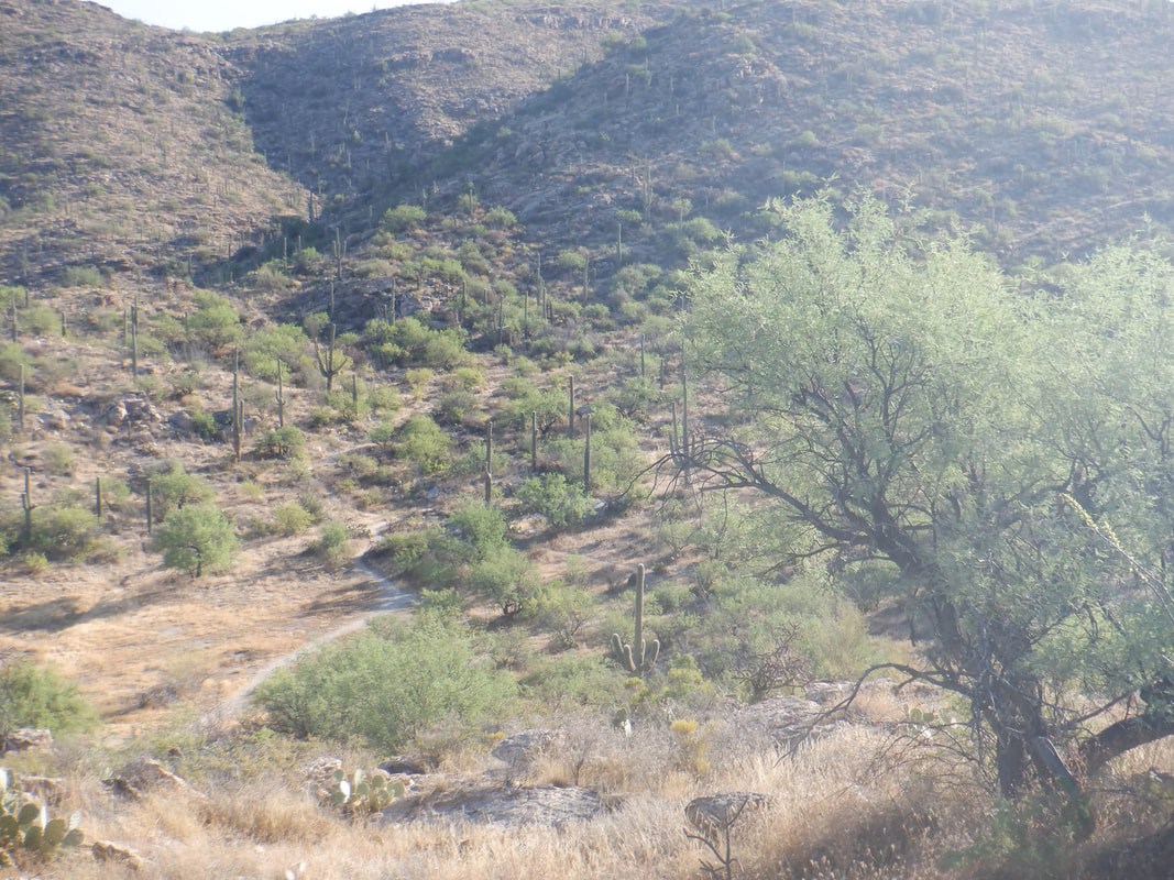 Great trail but I dislike climbing, then yielding that effort to drop into a ravine, climb again, drop into another ravine. I prefer a constant climb. 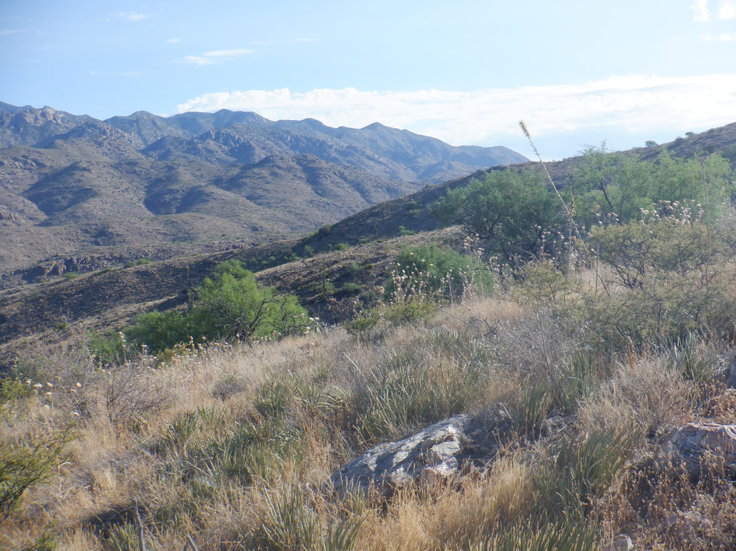 After about 3 miles, I reach a saddle where there are good views of the eastern end of the Catalinas. 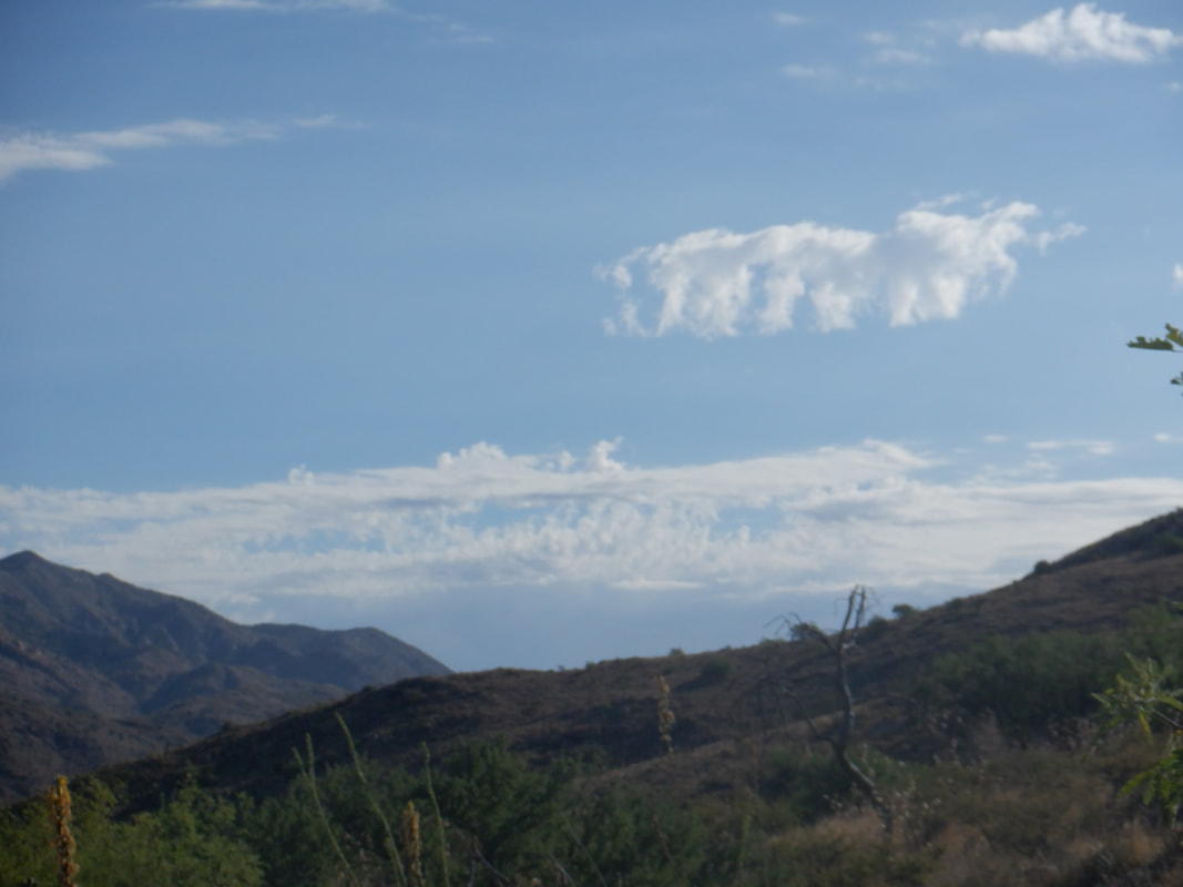 There is an odd shaped cloud in the distance. 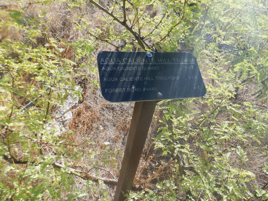 Do I want to climb all the way to the peak? I sit on a rock and think about it. Damn, it is going to be really hot soon, even at this modestly higher elevation....  ....I remove a bottle of Gatorade that I had removed from the freezer earlier today. Sip off some of the ice cold fluid, add water, a wonderful cocktail. I'll have a cold drink all the way to the parking lot, which I decided would be where I go now.  During the return, I pause to peer into a canyon. Finish with just under 6 miles and 1500' of elevation gain. OK, now on to Flagstaff.
 The story begins in Iowa....ok, kidding. This is in Marana where the plains are spotted with a variety of crops. Soon..... 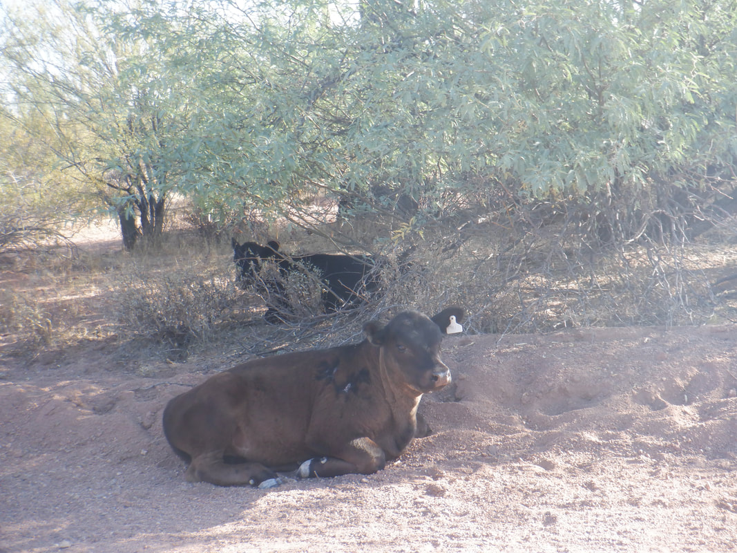 ....I am on Silverbell Road, dirt, where I pass a couple of cows undisturbed by my passing. Smart cows as they seek the shade on this hot day. 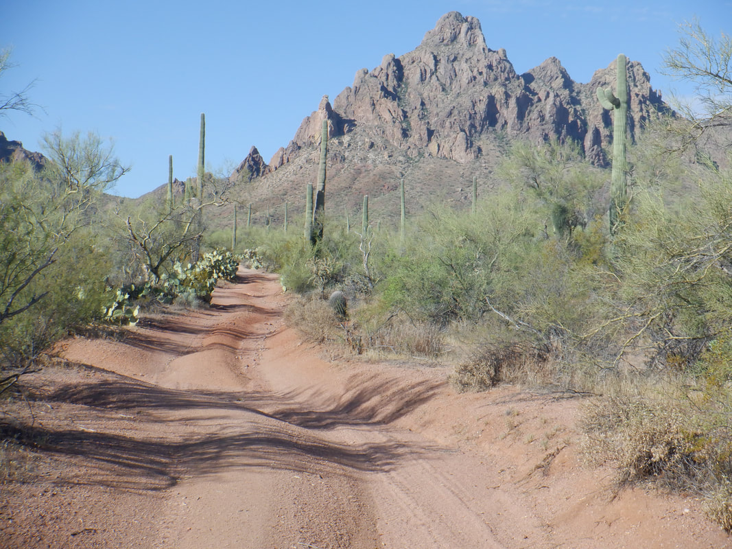 Following directions from the "hikearizona.com" website, I find a turnoff and follow it a short distance until I decide my car ought not go farther. I park and begin the trek toward Ragged Top in the Silverbell Mountains. I've done this hike once but a long time ago. 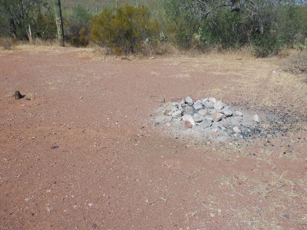 Reaching this obvious point, I head into the thicket, following a gps route that I also downloaded from the AZ site. 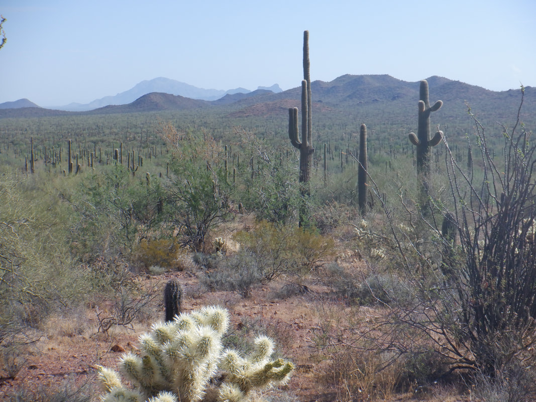 I look back from where I started to make a mental note of where I should return, just in case I lose cell phone power. The function that enables me to follow the route is a battery eater. I know, just heading toward the distant mountain I'll eventually reach Silverbell Road and could probably figure out how to get to the car. Today's high is 105, a very dry heat of course but still...105....yikes. 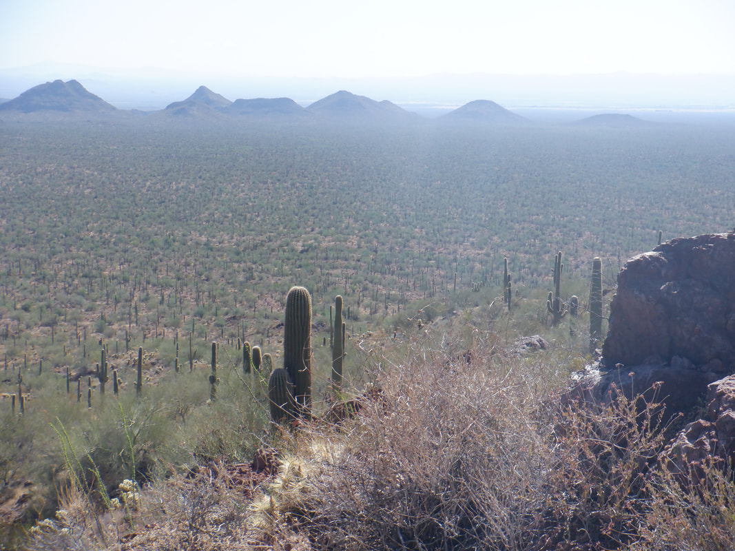 Round trip, the hike is only 4 miles from where I started but it is all bushwhacking. Fortunately, the hiking is not too encumbered by brush but it was a good idea to wear long pants. 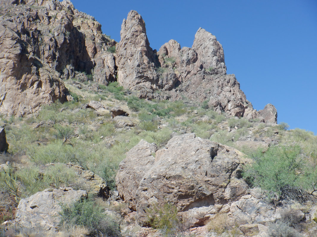 I'm headed toward a saddle, just over the above ridge. I pause and ask myself a question I am forced to ask, too many times; "What the heck are you doing out here?" You're supposed to do this hike in the late fall or winter but before lambing season. In July??? It's freaking hot already and I am going through fluid bottles like crazy. Then I think, just out of the blue, "Turn around you idiot!" So the "Good Mark" who sits on my right shoulder wins the day and I turn around. The "Bad Mark" merely stews but will have his say, another day. Headed to Flagstaff for cooler hiking.
 I'm anxious to check out the burn area below Bighorn Mountain but also to see if I can access the ridge between Bighorn and Table. I approached it from the Pima Canyon side and stood at the ridge, looking down and it appeared I could get through if not for the dense brush. I also think it would be really neat to find the lightning strike. A fire fighter told me it had been located from where the fire began. 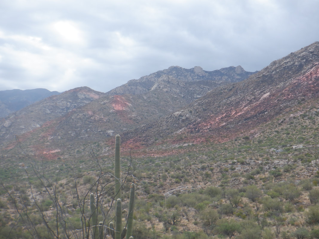 I park in front of the park in Ram's Canyon Pass and head up via the dirt road. 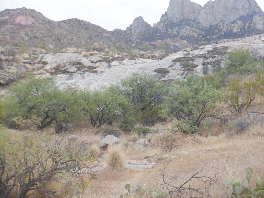 Beautiful as always, prior to reaching the burn area but at a fence..... 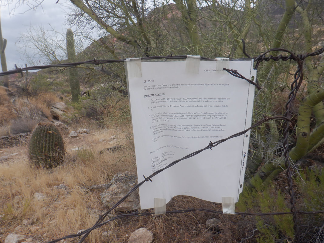 .....I am stopped by a strongly worded notice. Jail time and/or a serious fine for going beyond this point. I don't think anyone will remember to come out and remove the sign so I'll wait, as the notice stated, for the "Incident Command Center" to be dismantled. There was also a phone number that I tried to call a couple of times because the Catalina State Park based fire folks have all moved to the east side. Maybe that triggers the expiration of the notice? Probably not. 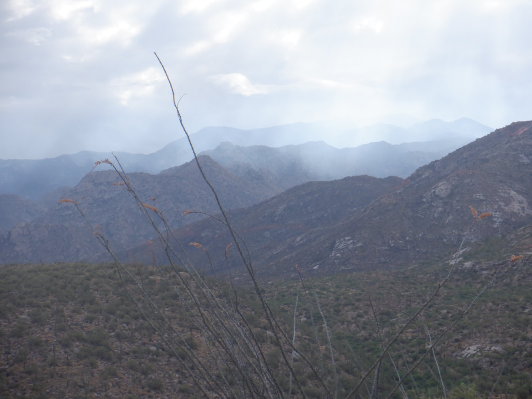 In the distance, some lingering smoke in this early morning. Back, I hope, soon.
 OK, forget about the snake story, mentioned below. The hike was not that interesting so I'll move on. We park outside a gated community after driving on Snyder and a left on Avenida de Suzena. We walk on a road that is sometimes paved and sometimes dirt. They have extended the road to accommodate more lots so it's a little different from a recent visit. Walking up a steep but short hill, we drop into a canyon and ......  .....ascend the Milagrosa trail. Easy to follow as we hike while sometimes peering into....  ....the canyon. My partner..... 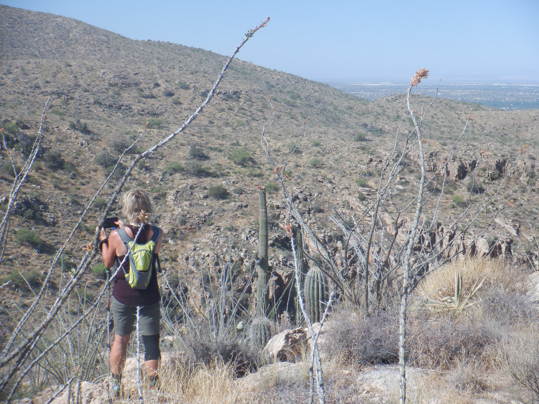 ....Amy's first visit so she takes a few pictures as I watch for a cairn at mile 2.5 (from the car park). Finding it, we leave the trail but what follows is also easy to follow. 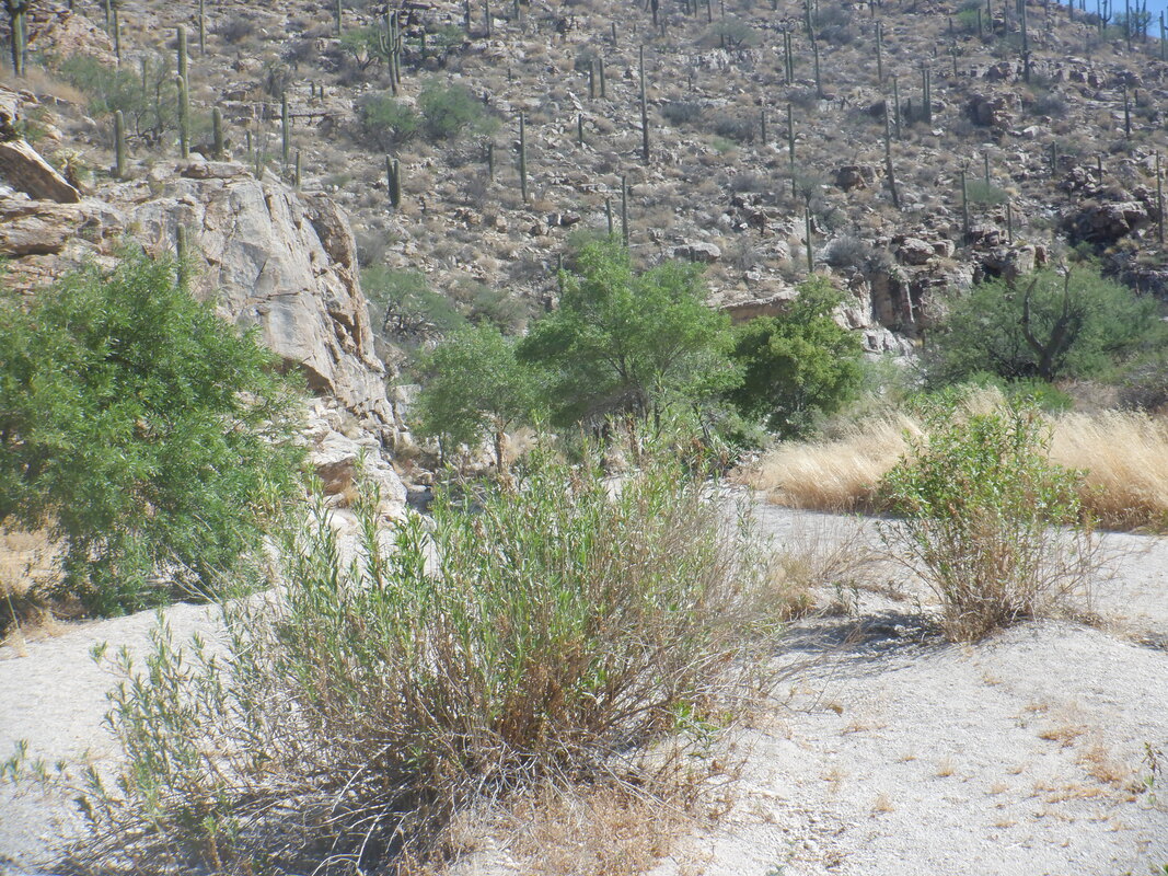 We drop into Aqua Caliente Canyon, follow it down canyon for about 300 yards while watching for a trail departing from the left. We begin climbing again and pass a faint trail going right but it has rocks across it so ignore. At some point, the trail jogs back to the east which has a nice.... 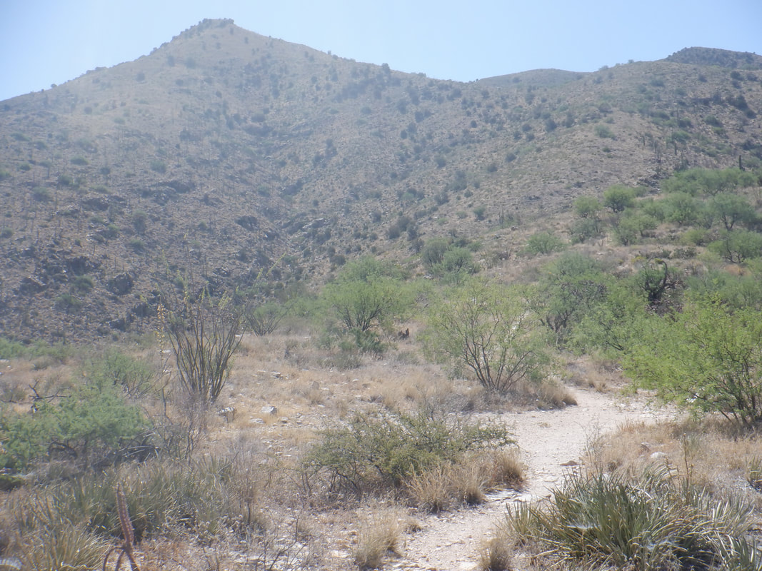 ....view of Aqua Caliente Peak. We reach an intersection having a large cairn and break right. Going straight takes one to Aqua Caliente Peak trail. 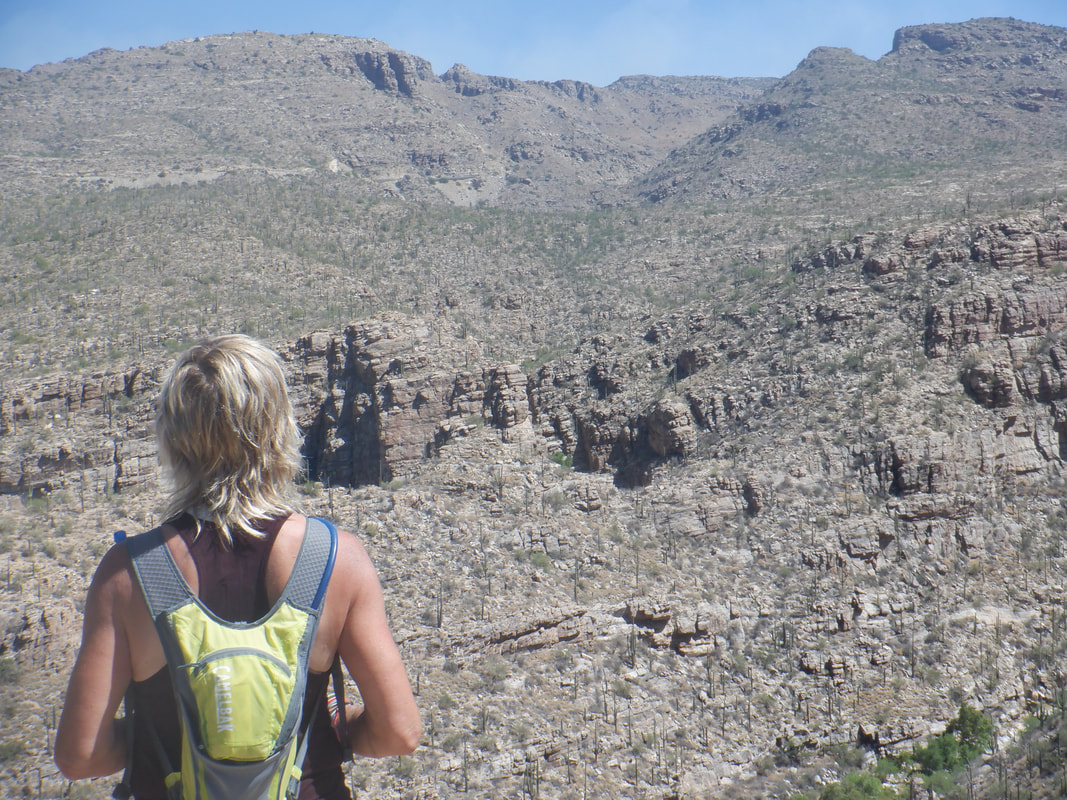 We pause to take in some more great views. The trail is descending now and we pass through.... 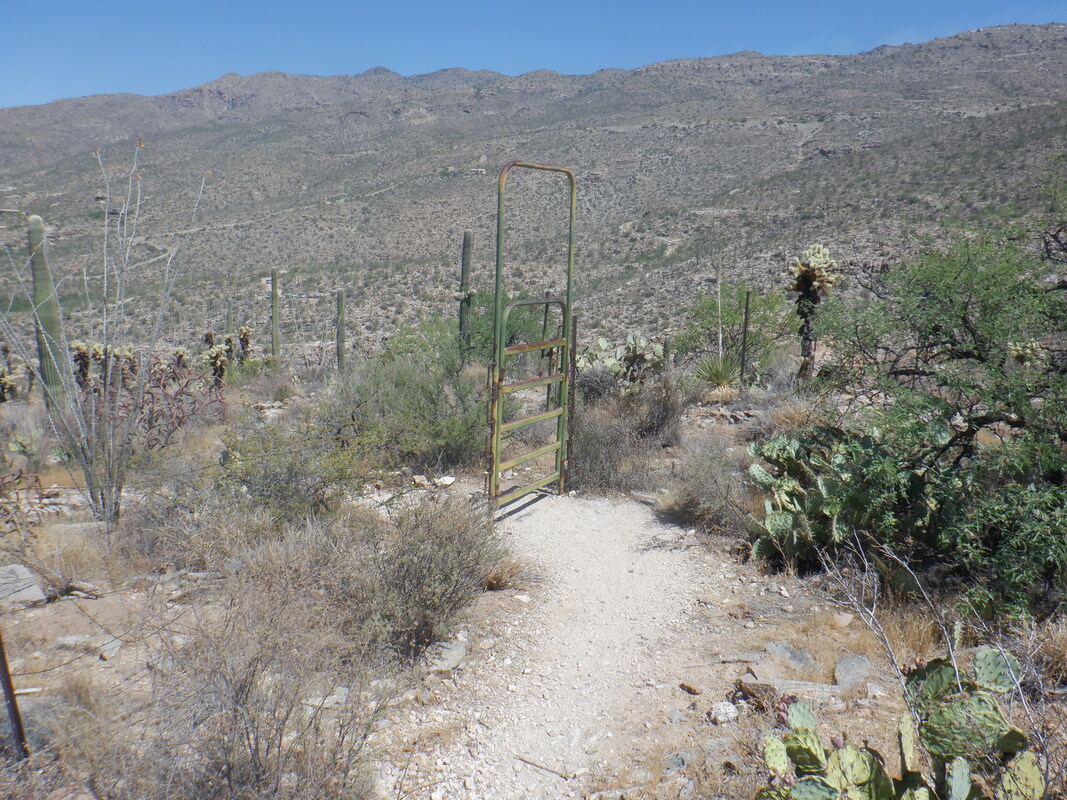 ....a gate. Eventually we reach an opportunity to break right or continue straight but I suspect going straight leads to an overlook so we go right. The trail is very steep here as it drops into the canyon. We found..... 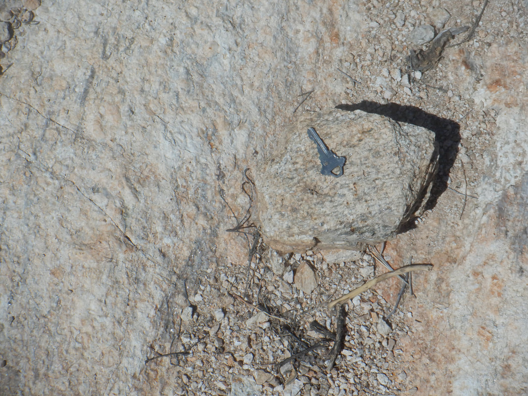 ....a key that was placed on a rock in the middle of the trail. Odd. Probably someone found it and placed it there, hoping the owner would retrieve it. This is a fun loop as we finished with 6.45 miles and 1500' of limbing. Seemed like more climbing then that to me. 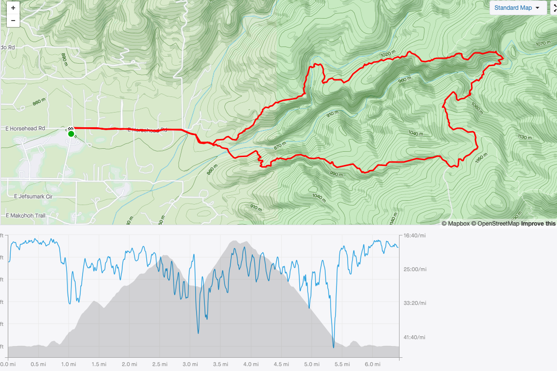 |