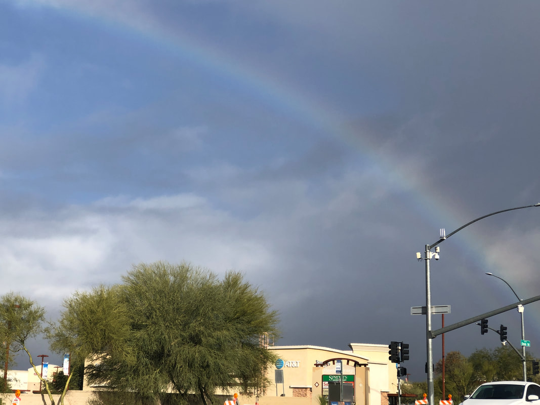
 It's been an unusual weather pattern for our region with cool temperatures and daily chances for rain. The arrival and departure of a system produces some dramatic and beautiful views. 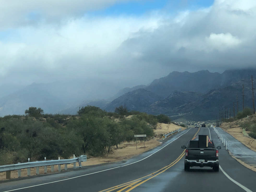 A small amount of snow has accumulated on the top of the mountains but on this day, it was too cloudy to get a visual. I got in a short hike on one day and on another, Amy and I played pickle ball. There are a lot of beginning players and where we play has 16 courts so no shortage of other beginners with whom to arrange a match. 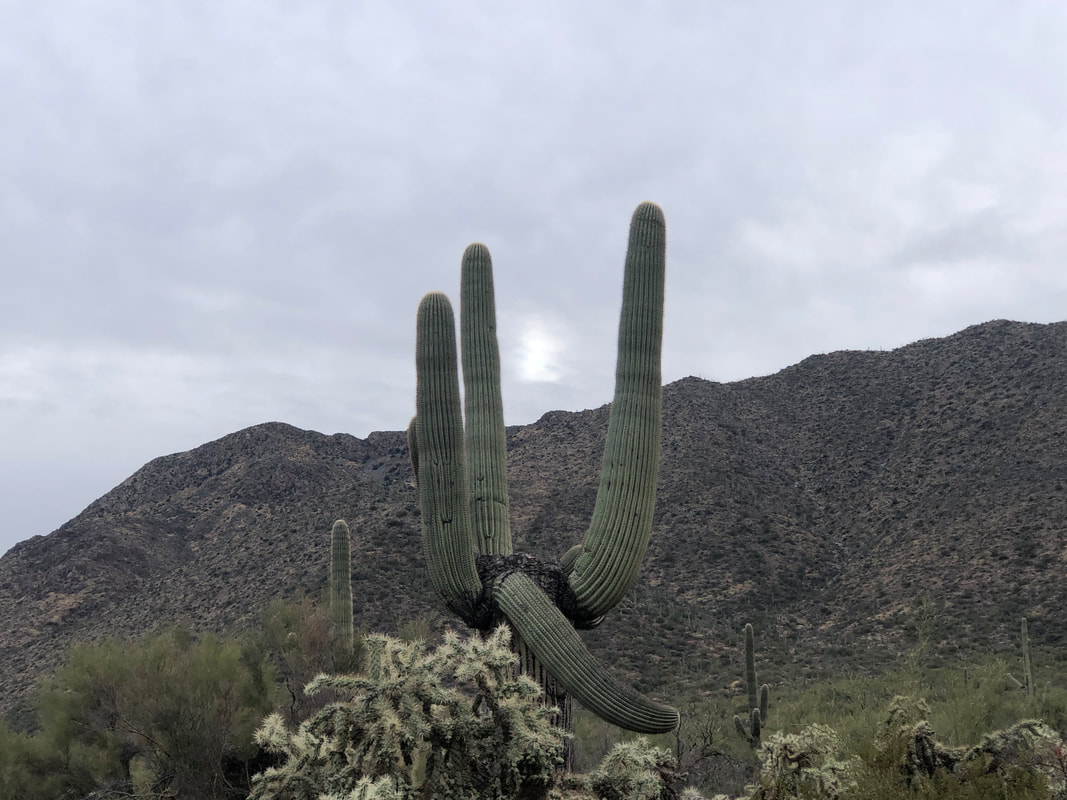 With two more days of rain forecast for Friday and Saturday, I made sure I got out on a dry but cloudy day on Thursday. The sun is barely visible between the arms of a saguaro as I depart on the Sandero Esperanza trail off Golden Gate Road on my way to Wasson Peak. 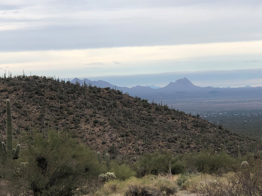 I much prefer this trail over the alternative approaches, especially Kings Canyon trail. That trail has an abundance of loose rock while the trail on which I am hiking is smooth. 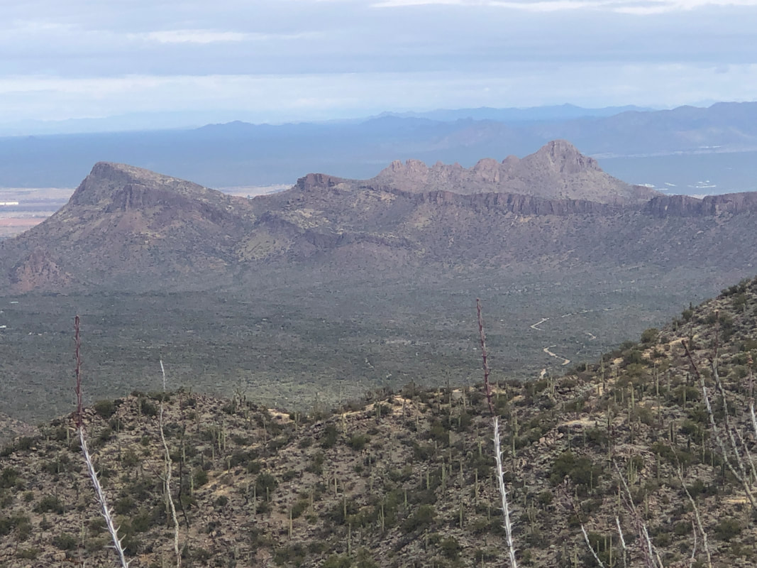 I'm zig-zagging up to Hugh Norris trail while enjoying the view of Panther Peak on the left and Sombrero Peak on the right. 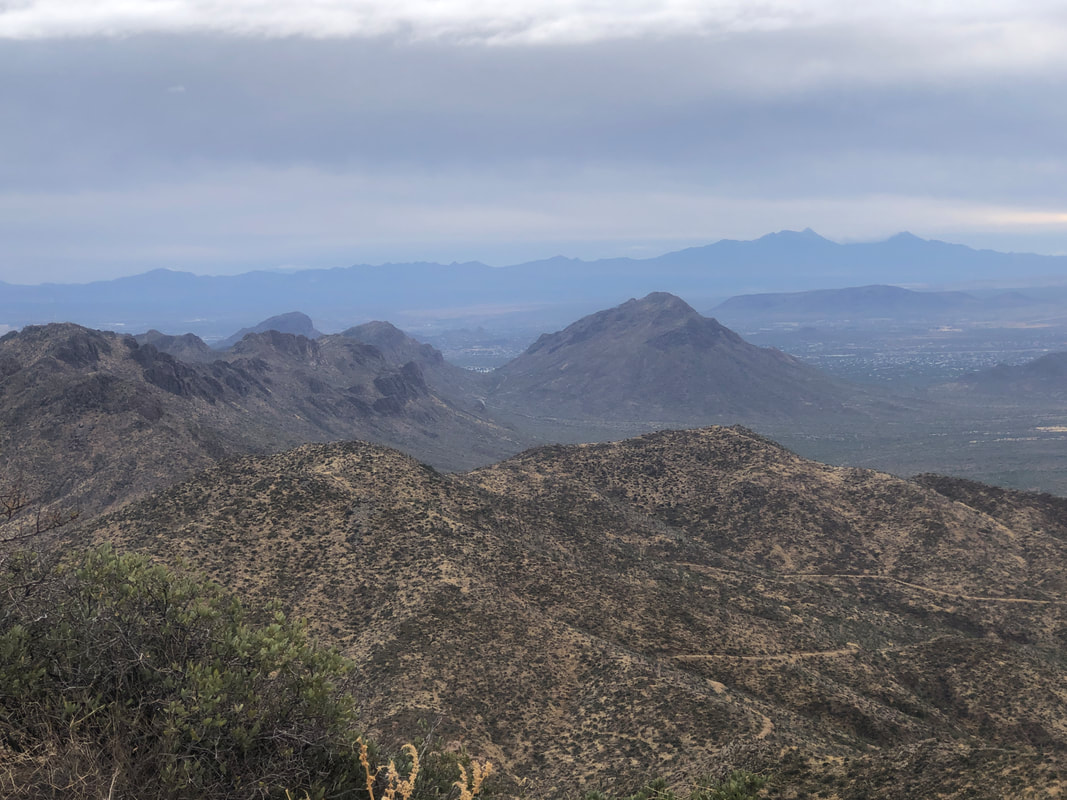 I can see the Kings Canyon trail and its serpentine course in the distance. Actually, that is a social trail that parallels Kings Canyon and most people are unaware it exists.  At last, I reach a deserted peak save for a guy who is visiting from MD. I always enjoy meeting visitors from the east or midwest. They just marvel at the views this region offers. I was surprised there were not more people up here. Typically, the week between Christmas and New Years draws scads of people to the trails and with Wasson being one of the more accessible peak, scads more up here. 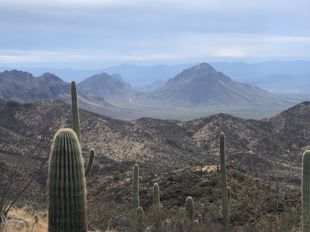 Gates Pass Road winds between Golden Gate and Bern Mountains. I use the Strava app so it keeps track of my hiking time. I reached the peak in 1:10:22 and last year, also on December 30th, my time was 1:10:22. What are the odds of that???? 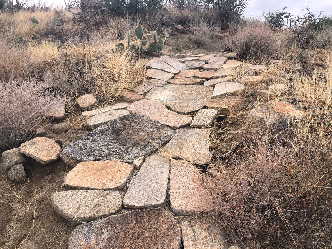 Another aspect of the Hugh Norris trail that I like is the effort and workmanship that went into the trail construction. I finished with just under 8 miles and 1700' of climbing. 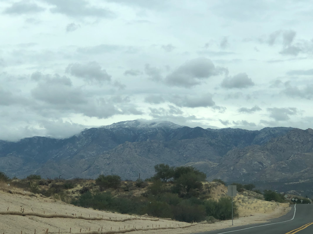 Mount Lemmon in the distance and forecast to receive up to 24" of snow this weekend!
0 Comments
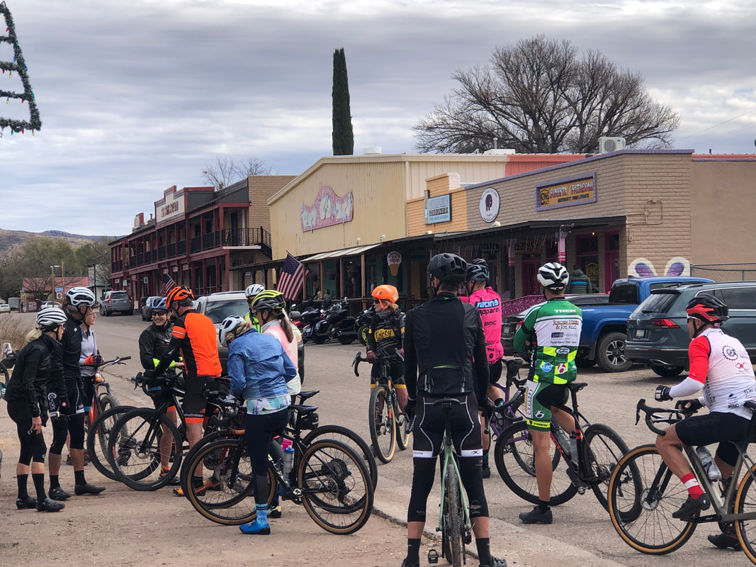 An organization that promotes gravel grinding, "Dirty Freehub" organized a group ride out of the small town of Patagonia. The town has become a destination for gravel bike riders as between it and the border, there are many miles of relatively smooth, dirt roads. Gravel bikes differ from a road bike mostly with much wider tires. Thirty-five of us rolled out at 11:00am, with a cool temp of "only" 54 degrees. 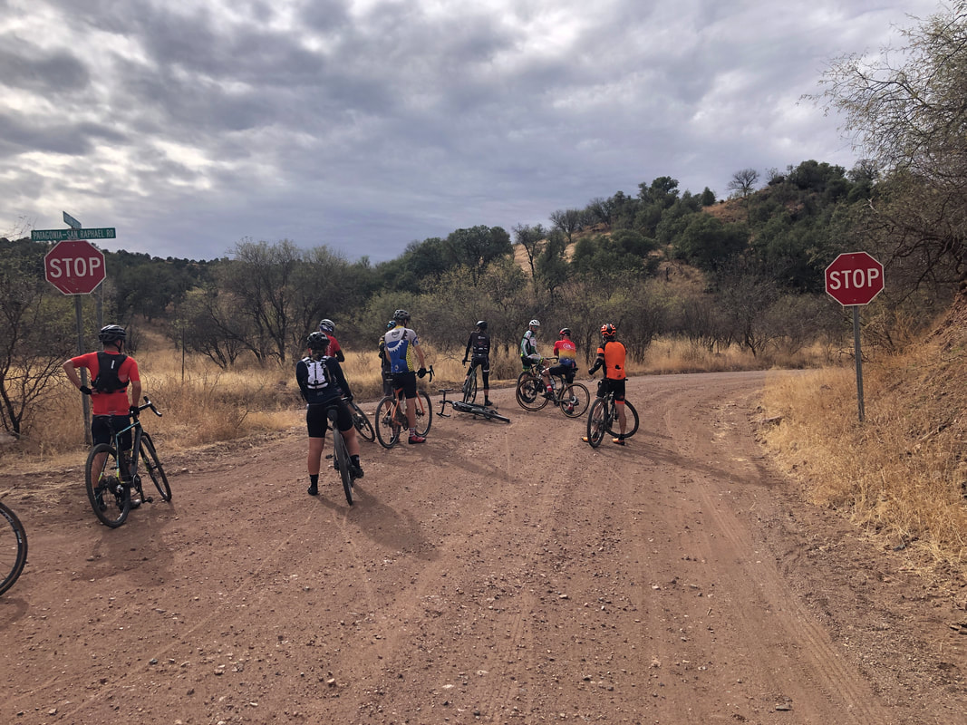 We had two routes from which to choose, 30 and 50 miles. Gravel riding miles are more difficult than road riding miles due to the rolling resistance. I chose the 30 mile route but ended up on the tail end of the 50 mile group and never saw the 30 mile group again. Above, we pause to remove a layer of clothing. 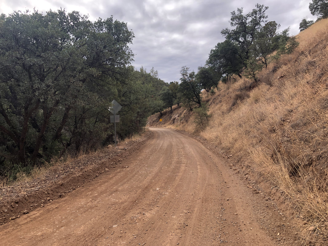 For much of the route, the roads were well paved with a few rockier sections. I'm a real novice at gravel riding and so am nervous about rocky sections or stream crossings, of which there were two. The first 13 miles was a steady but not steep climb to "American Peak". 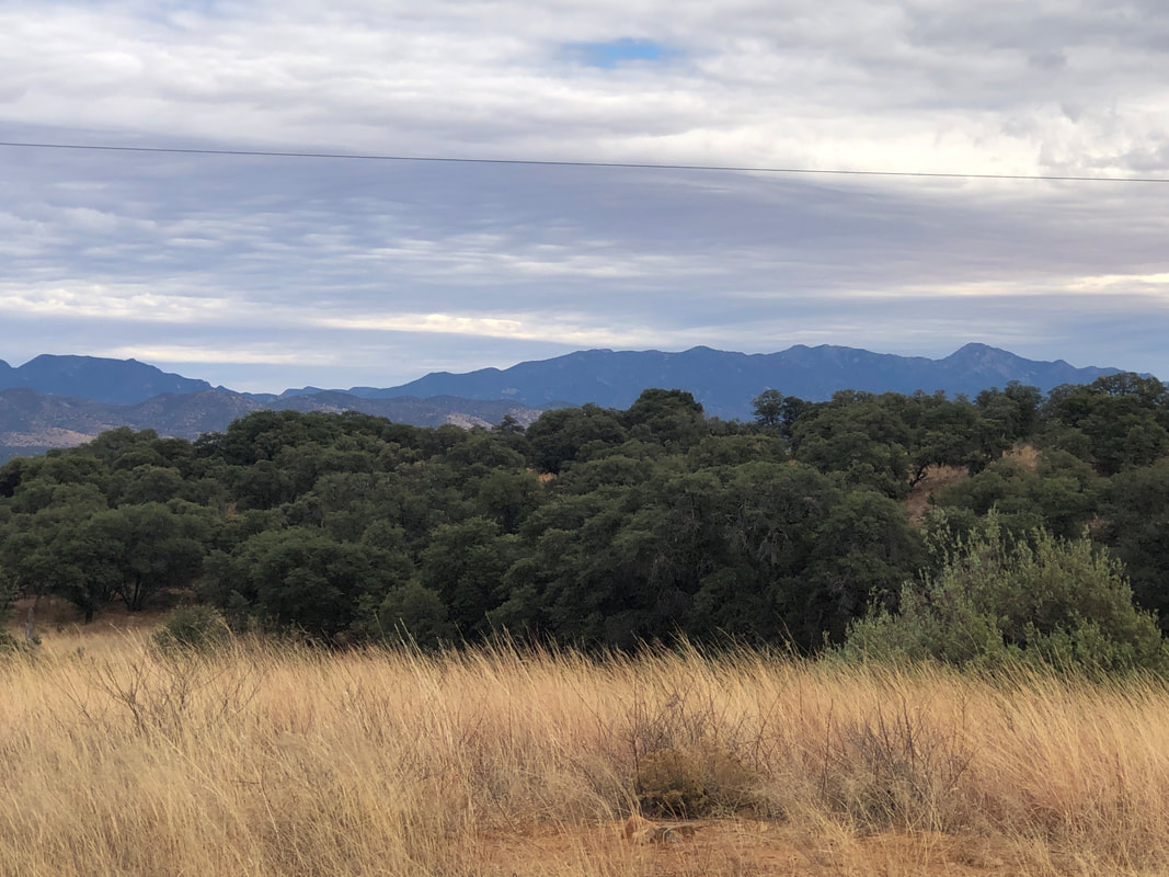 Reaching the peak, we finally had nice views to the southeast. Not spectacular, just nice on this mostly cloudy day. 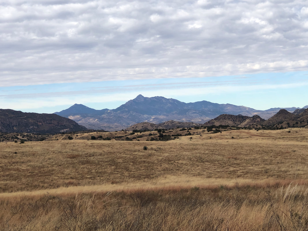 I hooked up with a couple who decided to abandon the 50 mile route for the 30 miler. We descended into a valley of wide ranging grassland. Patagonia is only an 1:15 drive from home yet at an elevation of around 4000', no cactus and a much different look. 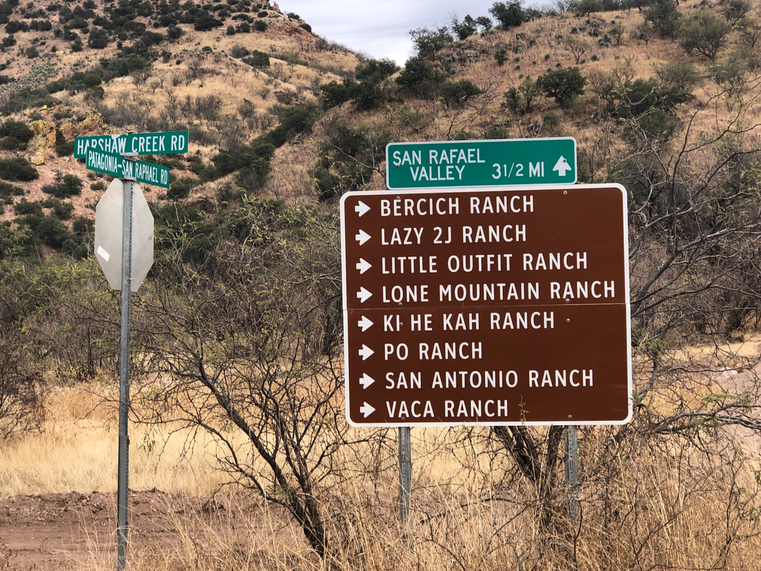 There is a lot of ranching going on in the region. The descent from the peak yielded many miles of coasting but one road had lots of wash boarding. Ugh, that was brutal. I really don't like that aspect of gravel riding but otherwise, the absence of vehicles, the change of scenery, new roads, etc.... is good. Finished with 30 miles, 1300' elevation gain and a modest 13.3 average.
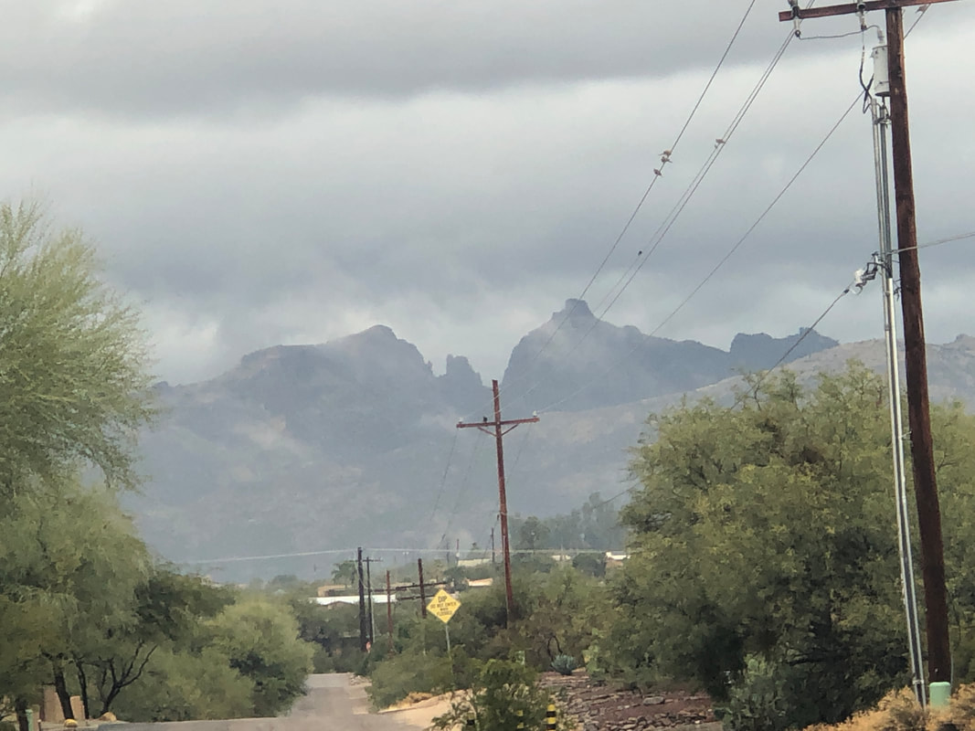 Future weather radar indicated it would begin to rain Saturday morning so unfortunately, I had to cancel a group hike. The hike was a short one, to Tanque Verde Falls but within a canyon over, around and under huge boulders. Couple that with the smooth slick rock surfaces on which we would be hiking and, well, a wet surface would be dangerous. The rain did arrive as predicted as I take Jack the Dob out for a walk and get a good view of Thimble Peak through the clouds. 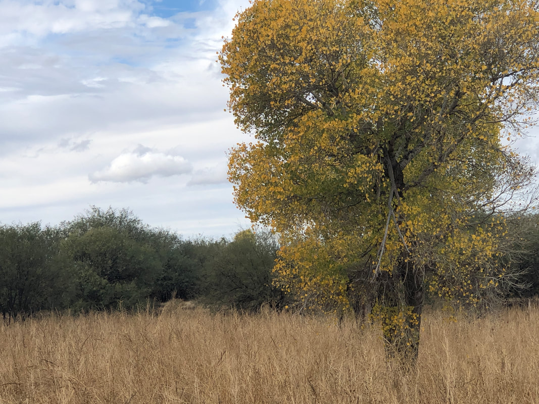 I'm excited to do my first gravel bike ride from Patagonia on Sunday so I took my gravel bike out for a spin to make sure it was good to go. 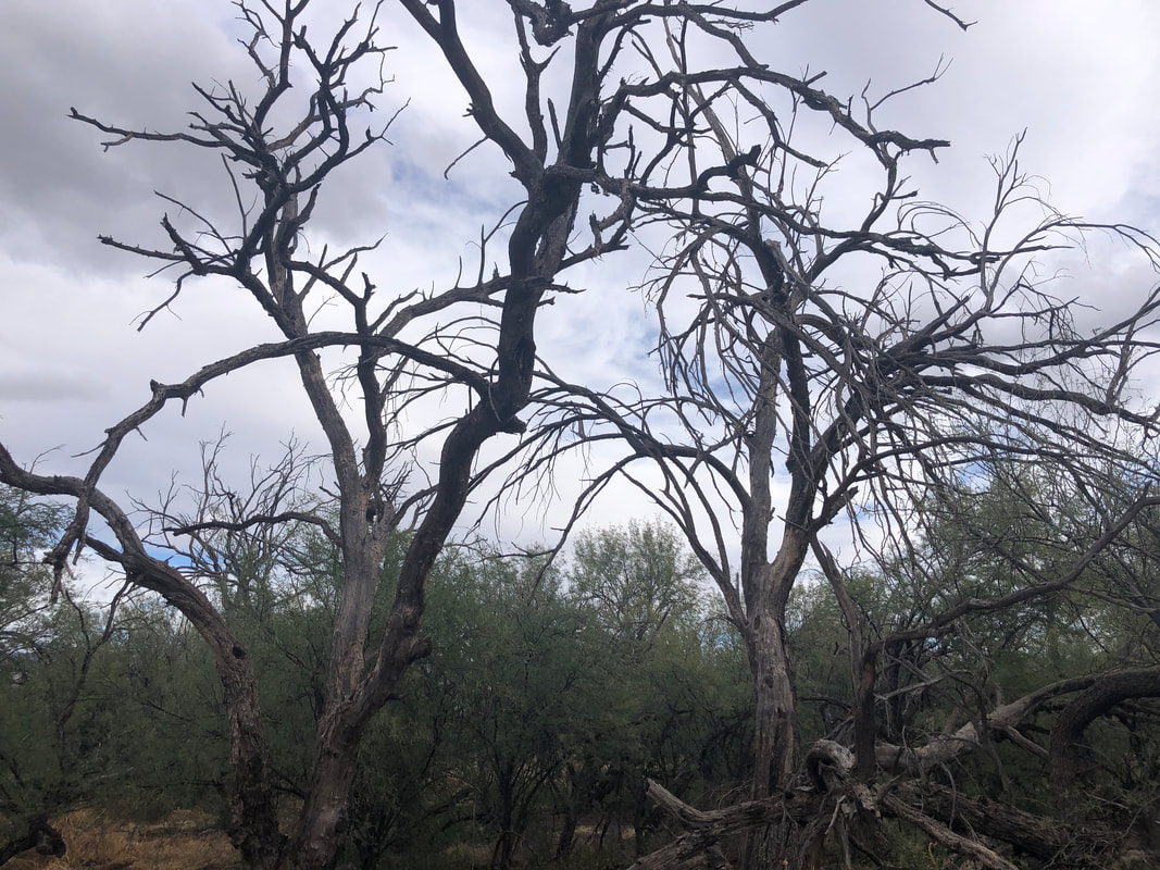 Oh wow, lot of good firewood. If only I had access and a chainsaw. The latter is easily solved, the former, not at all as I ride through a nature sanctuary. 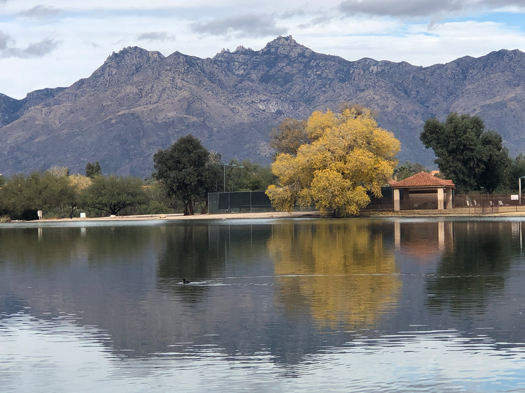 The route passes by a lake and check out that view!!! 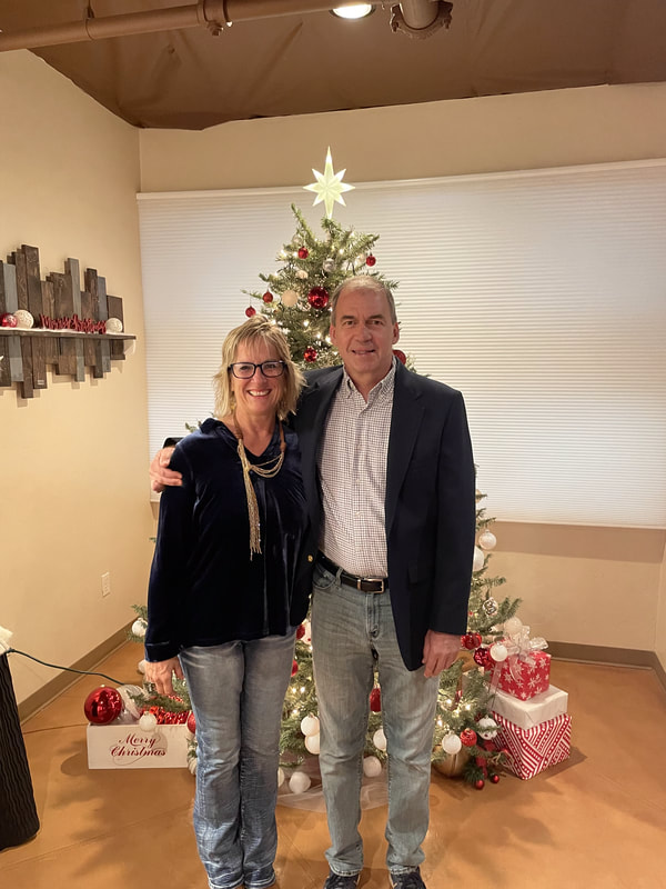 Merry Christmas everyone!
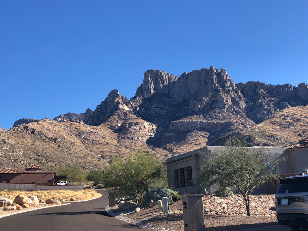 I, probably like most hikers, enjoy viewing the mountains and noting which peaks I have visited. I'm glad that I can now add Table Tooth, the prominent feature, slightly left of center in the above image. Just left of Table Mountain. Just so you don't think all I do is hike and bike..... 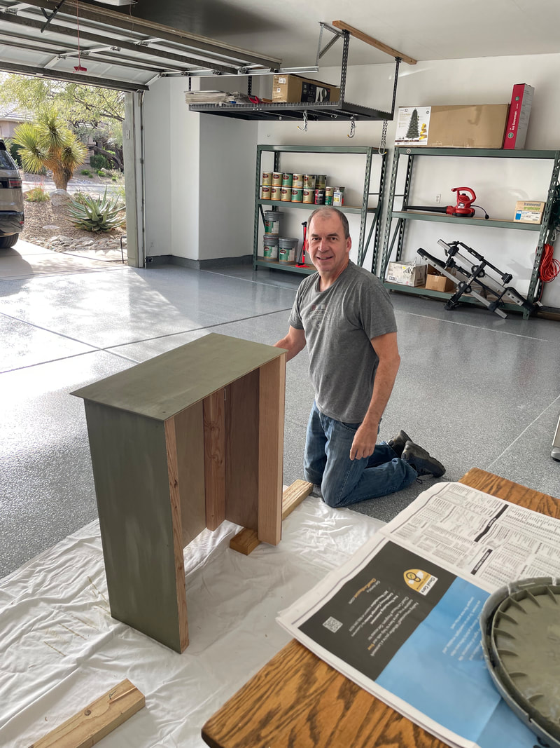 ....here I am, finishing the construction of a masterpiece! Amy has an odd collection of plumbing protruding from a wall in her portico. So I built this table thingy to hide the plumbing and on which she can place some decorative item. Welp, enough of that, back to the trails and roads.
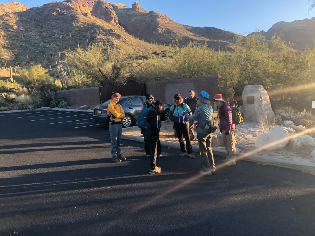 Ten of us gather at the Pima Canyon Trail head, 8:00am, 40 degrees for the start of an epic hike. Our destination, Table Tooth (also known as Table Tower) is a 390' prominence that sits just apart from Table Mountain with the Wolf's Teeth spires a little more distant. 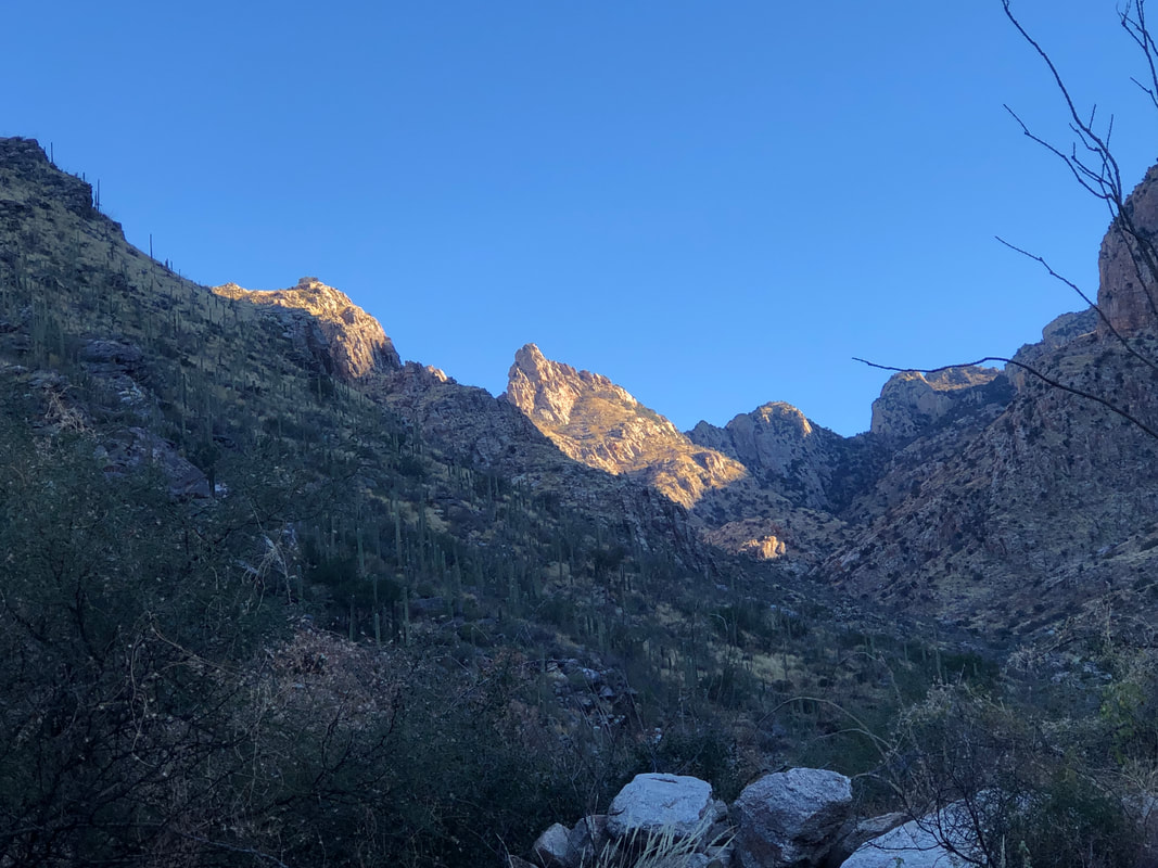 Our hike would follow Pima Canyon Trail for 4 miles. The rising sun illuminates one of the Wolf's Spires. Our destination is left of that and not yet visible. 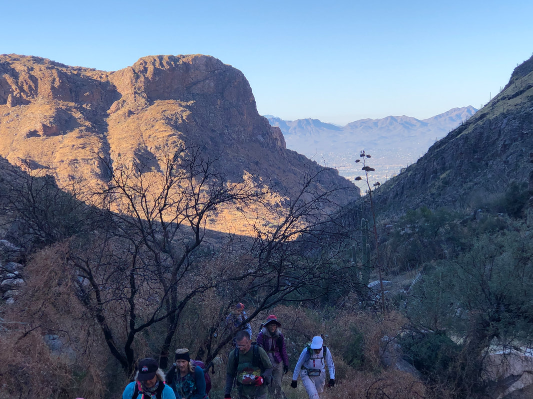 Pima Canyon is very rocky so our focus is mostly on the trail but you must remind yourself to pause and look up. The colors and views always change. None of us have visited the Peak so we were very fortunate that a fellow hiker, Paul, who had already done the hike last week, volunteered to hike ahead. At about mile 4..... 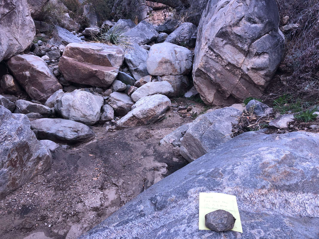 ....we encountered a note that Paul had left for us, indicating this is where we depart the trail and head up the canyon, for .3 miles. 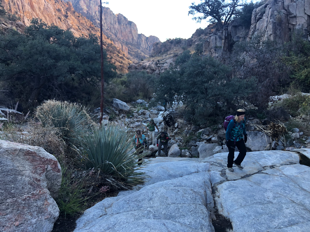 The .3 mile off trail hike up Pima Canyon was fun as we worked our way around and over various bouldery obstructions. There was a trickle of water, a result of snow melt higher up the mountain. Soon we found another note left behind by Paul, informing us that is where we break out of the canyon bottom. 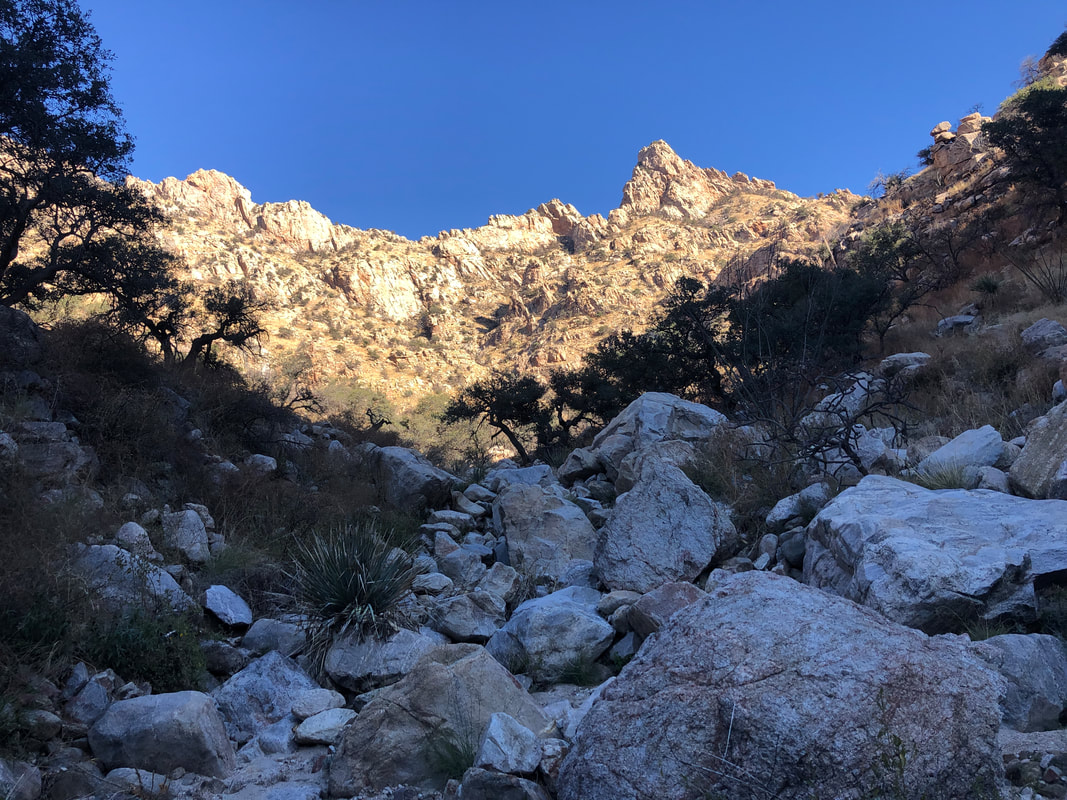 It's about a mile to a saddle that is just right of Table Tooth Peak, during which we would gain 1600'. From this perspective, it's impossible to know where along the ridge line we should emerge so again, it was invaluable to have Paul's help. 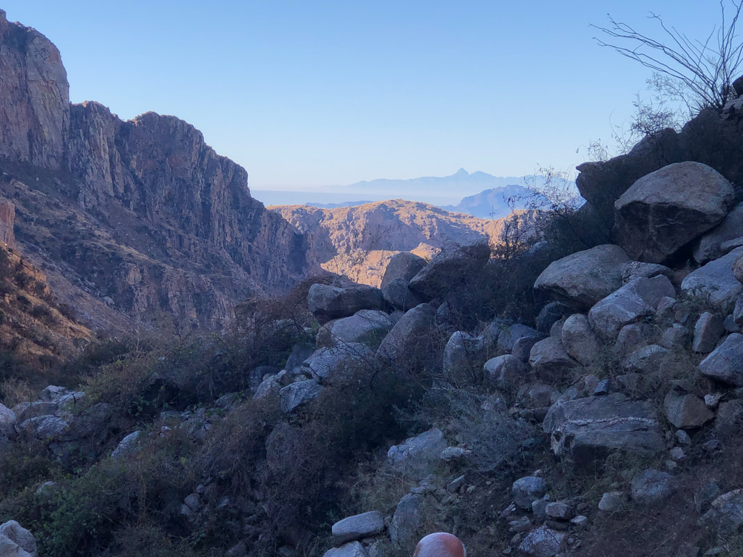 What a great view, Kitt Peak in the distance. 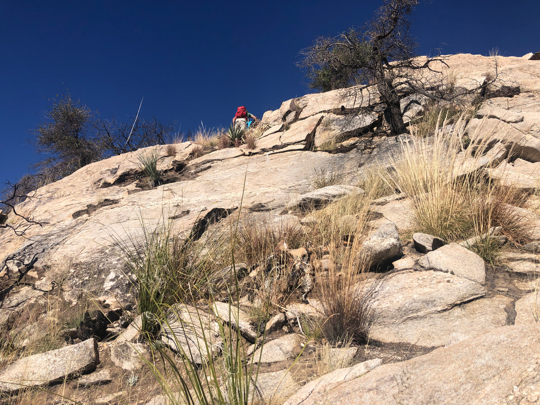 Did I state it was steep? Pics usually don't convey the steepness but this one does. 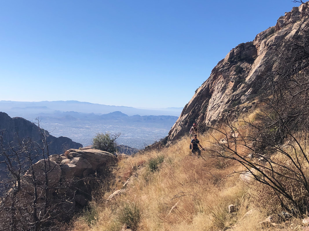 Now that I completed the ascent, had I to do it again, not sure I could find my way without the aid of a GPX route. It was oddly bewildering to me probably because was so steep, I rarely could get a visual on our destination. 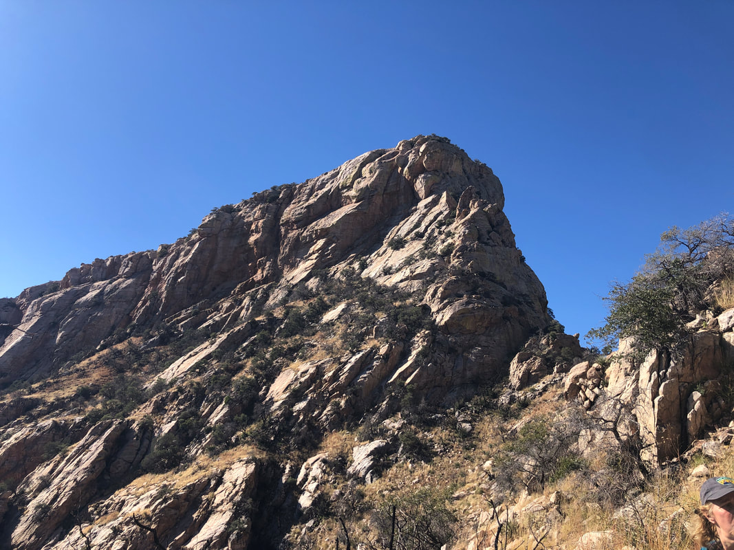 High up the slope, I could see Table Mountain, a notch below it and then the base of our peak. We needed to be at a saddle right of the Tooth. Long ago, there was not a notch but a continuous wall between Table and the Tooth. 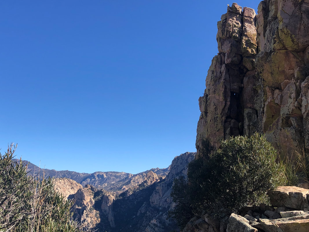 I assumed that upon reaching the saddle, we would be rewarded with amazing views and I was not disappointed. It almost causes my jaw to drop. 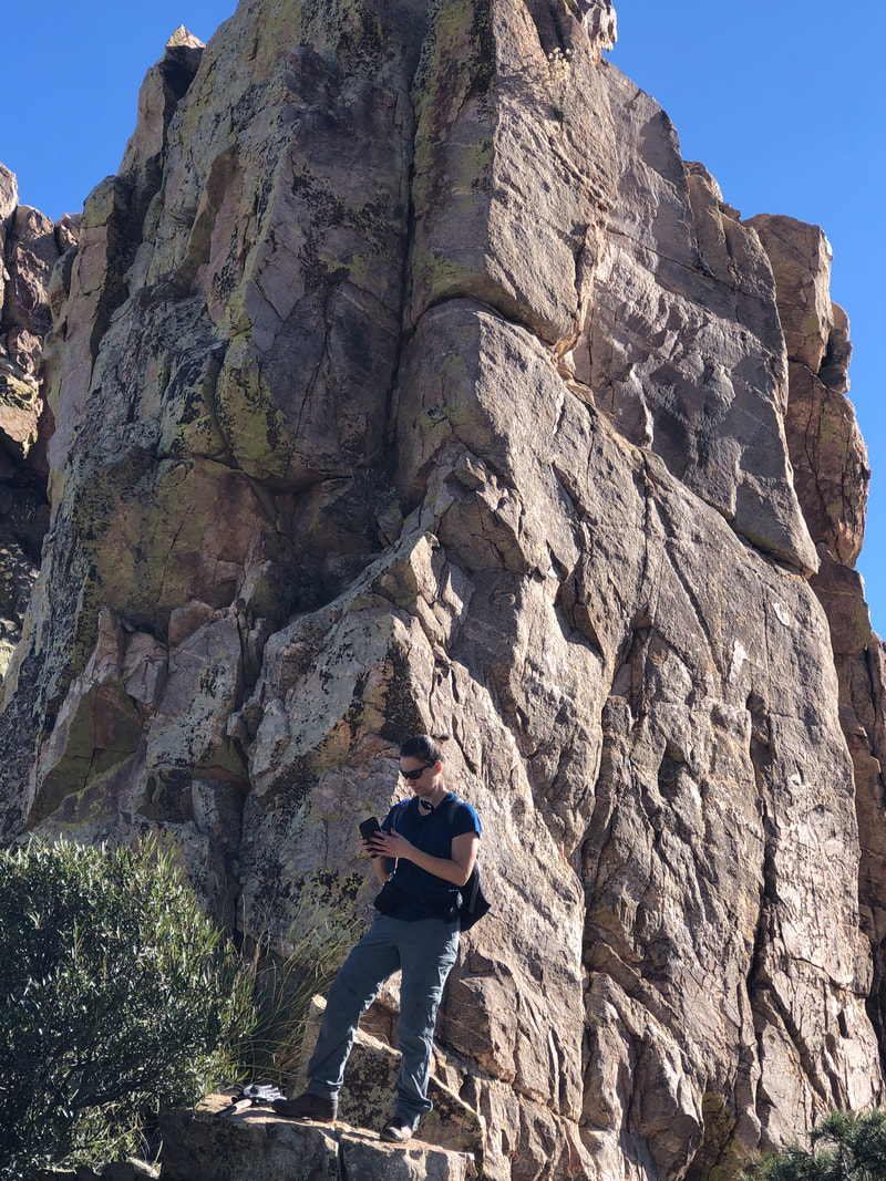 One of our group, Lindsey, stands in front of an adjoining spire and glad we did not have to climb it. 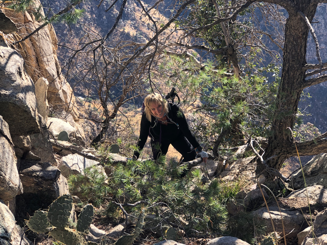 On a bushwhacking climb like this, it's important that you not lose sight of the hiker ahead of you or else you have no clue how to proceed. I should have mentioned the importance of this to the group at the start of the climb. Anyway, eventually, we all made it to the saddle. 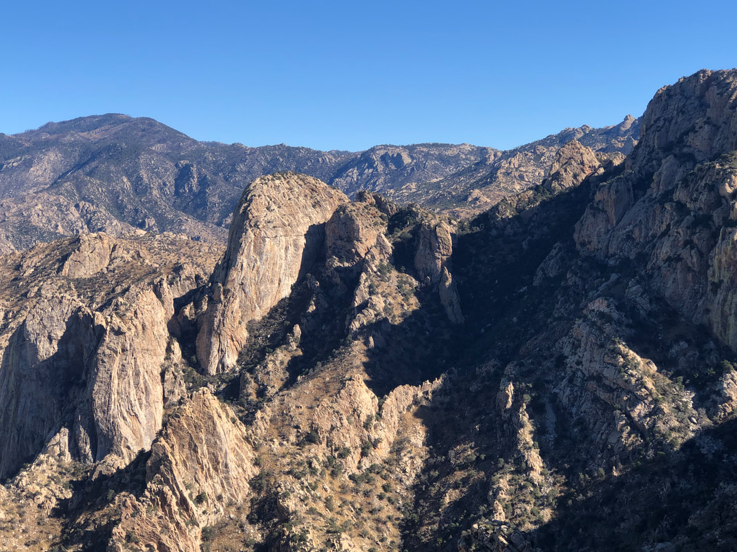 What a view with Leviathan and Wilderness domes a big part of the above image. We all hiked to the base of the first rated wall. I climbed a portion of the wall and decided the exposure was too much for me so retreated while..... 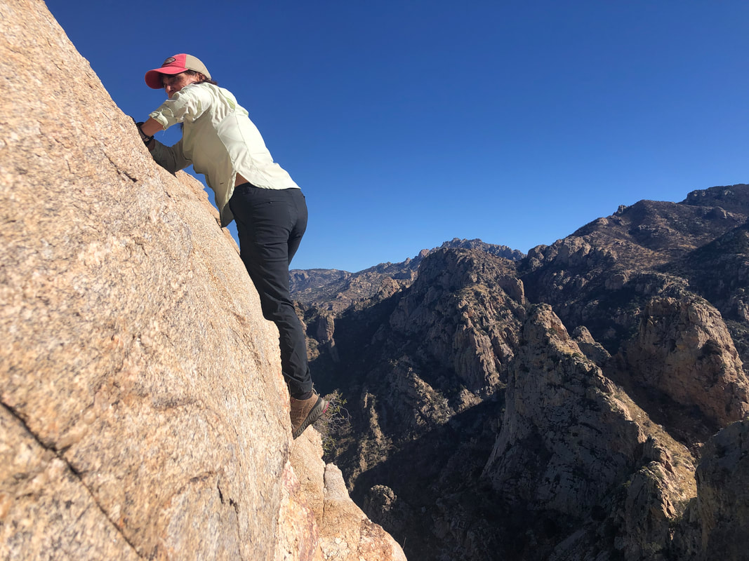 ....Paul was the first to ascend, followed by Lorna. She's a great climber and comfortable with exposure. I watched.... 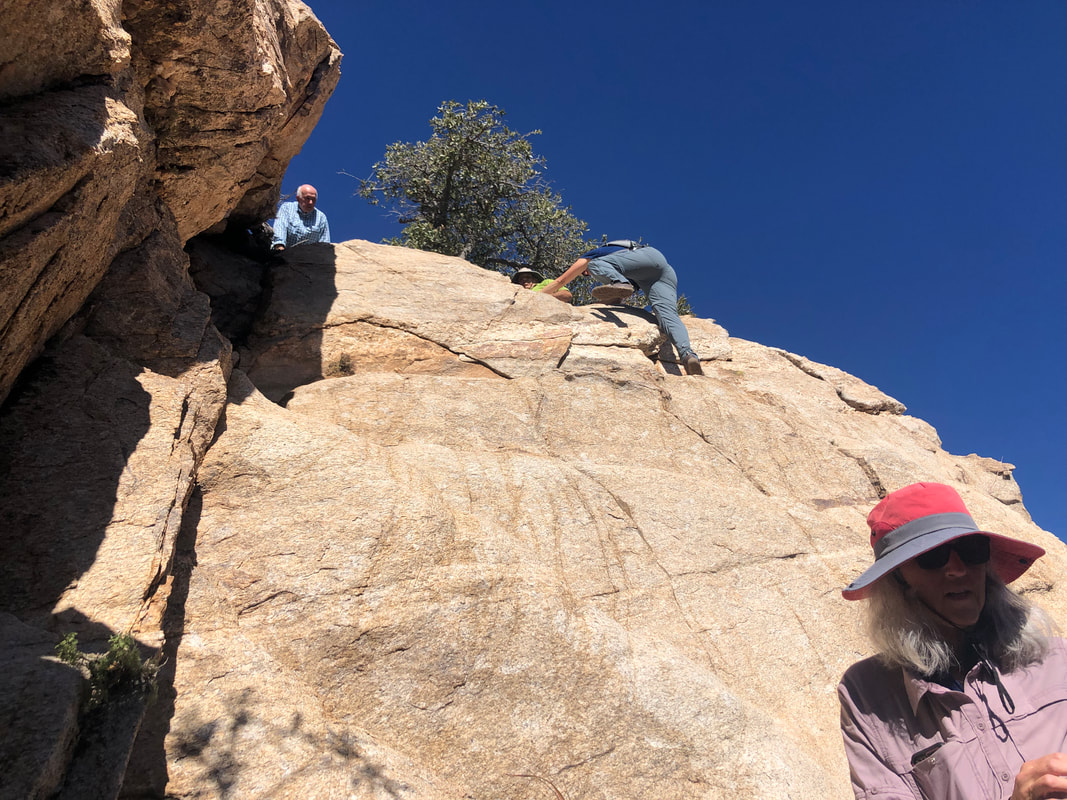 ....Marc, easily ascend, then Lindsey. Paul tied a rope around the base of a tree, dropped it so I climbed the "Z" in the rock face (shown above) as before, grabbed the rope and made it. So glad that I did. Immediately, there was another wall, maybe 20" but around a corner to the right, there were some good handholds but with exposure. I took this route and then we.... 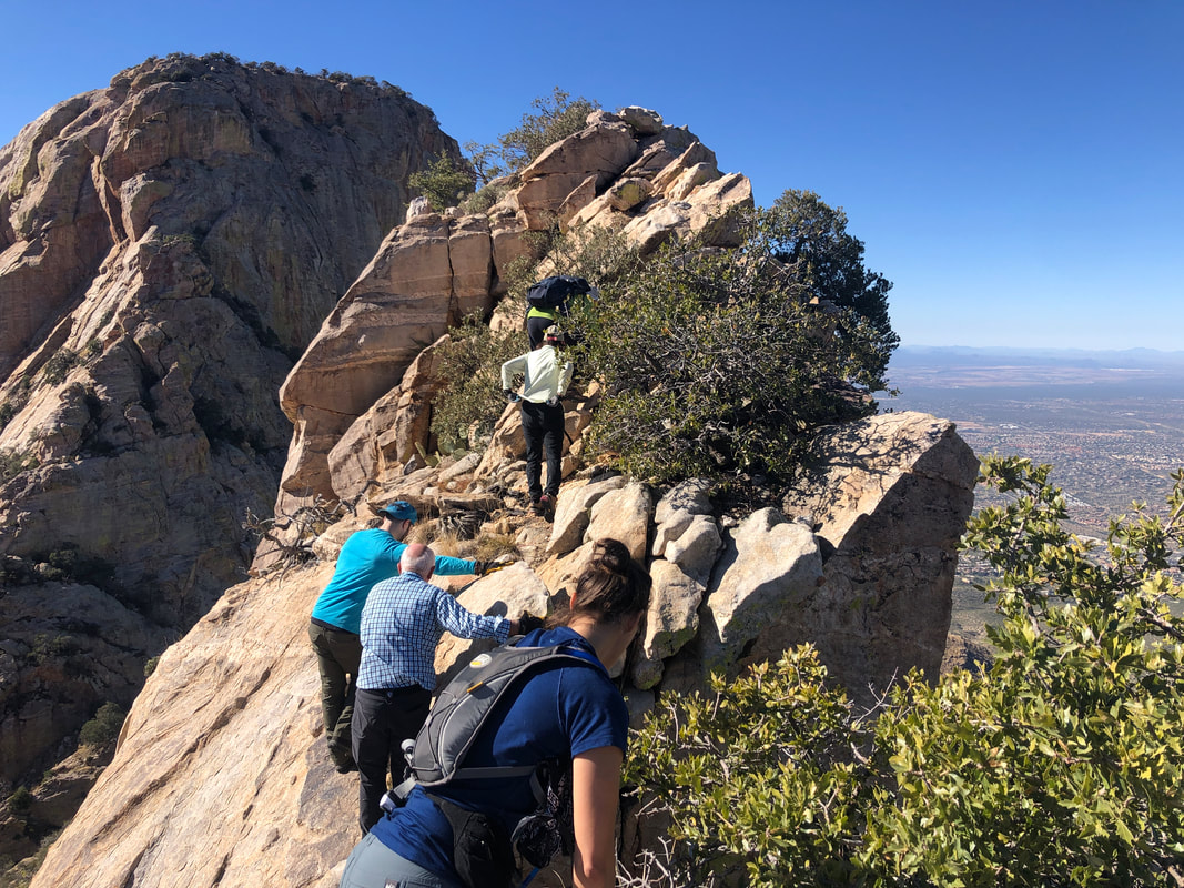 ....carefully navigated a knife edge. This was not as difficult as I thought it may be. Sure, a slip and down you go a couple hundred feet but there were plenty of things to grab. I was very careful here as we approached the peak, with Table Mountain in the distance. 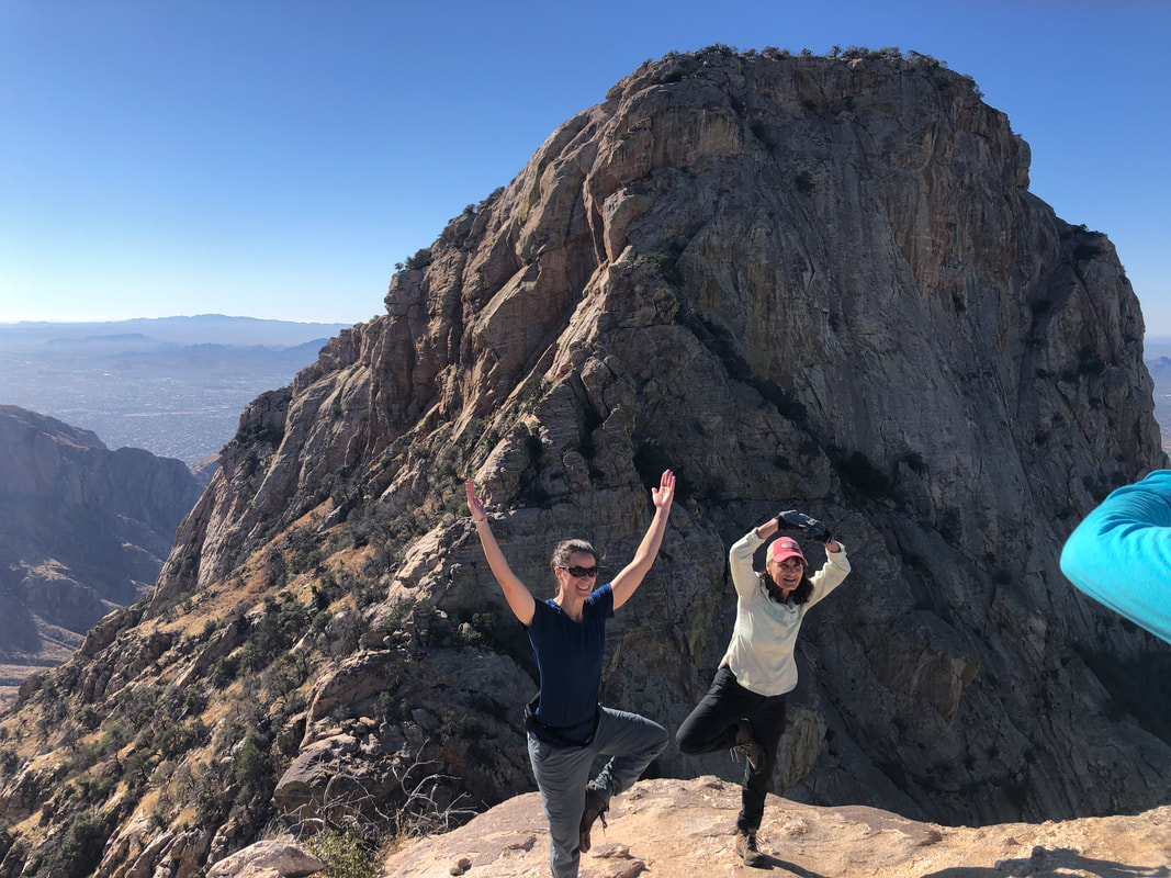 And then we reach the peak! On his prior climb, Paul had left a can, under a rock with a sign-in sheet, past and present. 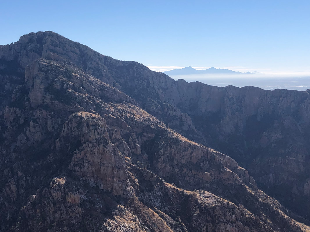 Oh the views! the Santa Ritas in the distance. Mt. Wrightson, Hopkins and Elephant Head are so insignificant. 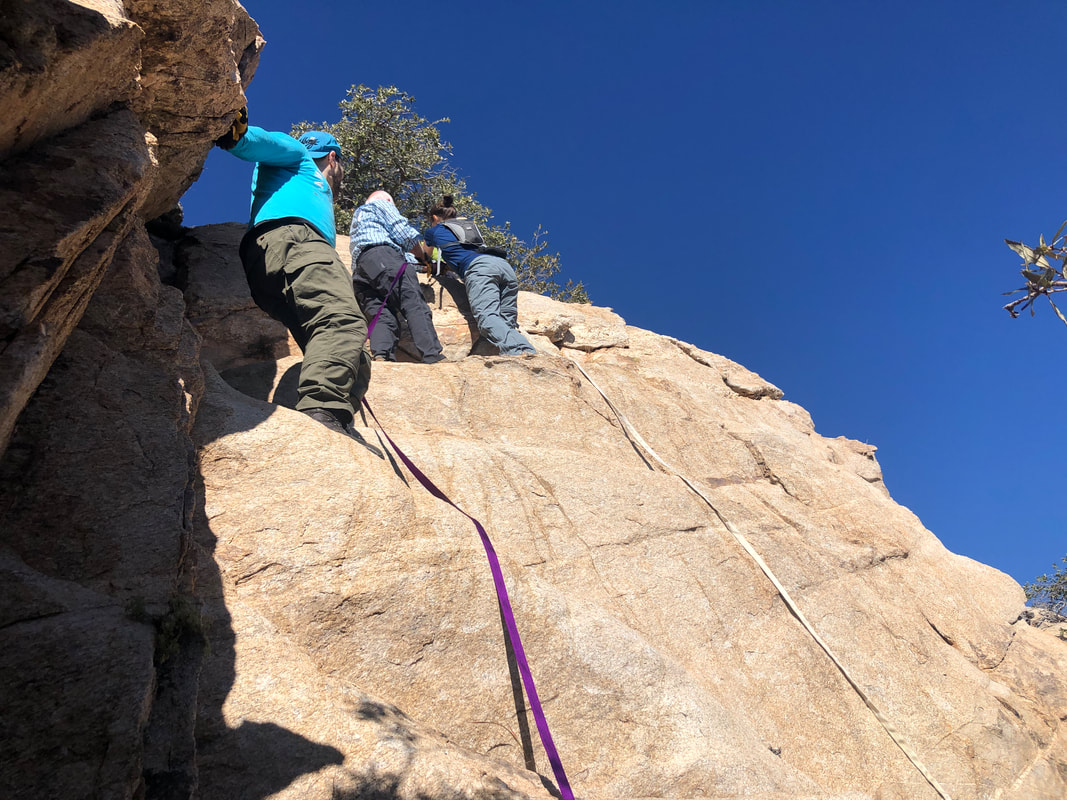 Knowing that our friends, who had decided not to try the climb, were waiting for us we headed back. The walls were quickly passed with Paul removing his purple rope and heaving the white rope back atop, where it had been placed by a local hiker, last year. I understand that is climbers protocol. Several of our group.... 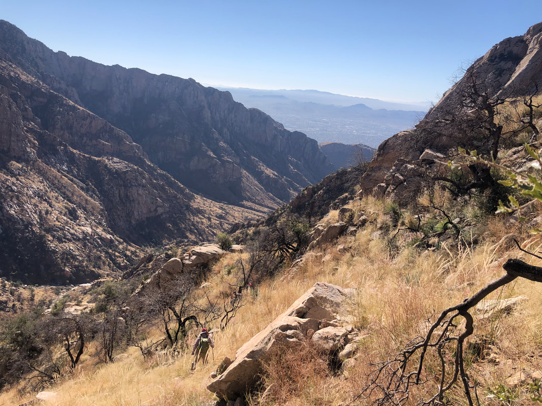 ...had already begun their descent, wanting to get a head start. I was concerned they would not be able to stay on track so plunged down hill too. I needn't have worried as their devices had their ascent so they could follow that. 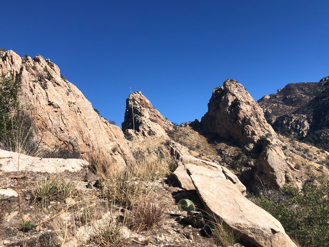 The Wolf's Teeth are plainly visible as we descend. That destination too has been on my list but not sure I want to repeat a nearly identical hike. Of course, thoughts change over time. 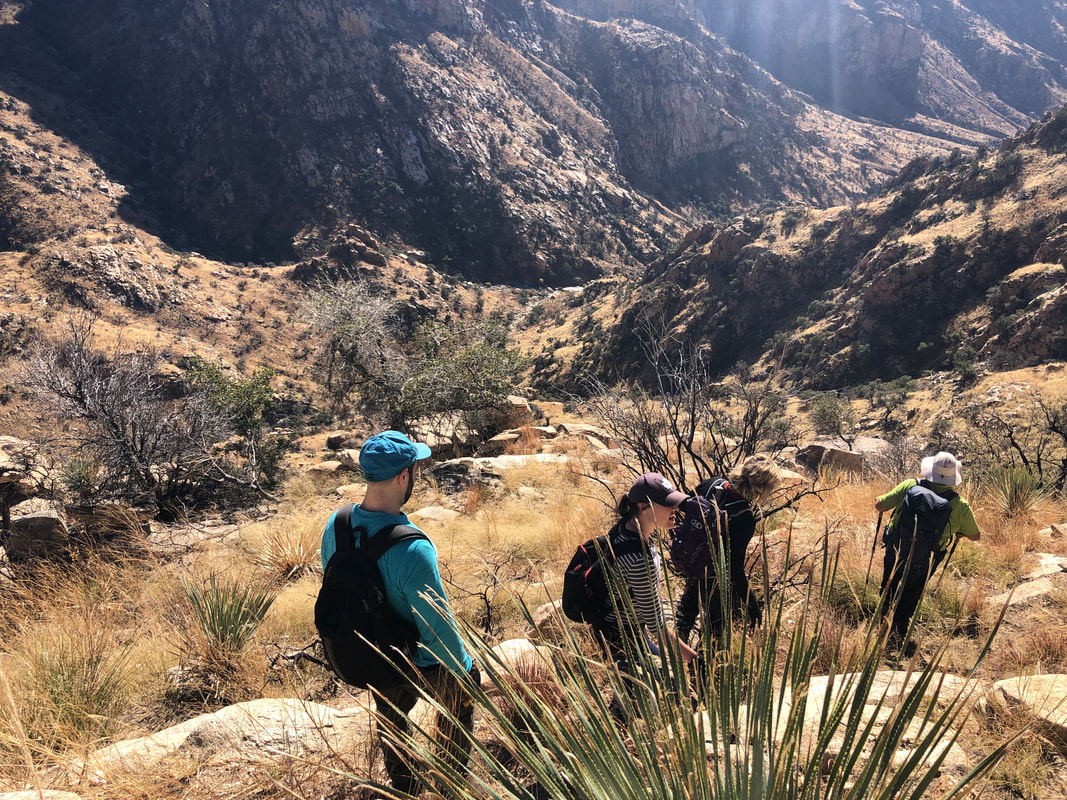 While steep (an average grade of around 40%) we mostly were stepping down into dirt rather than rocks so the impact was reduced, thank goodness. In the distance, Pima Canyon. 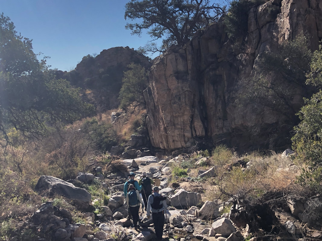 At last, we got on the Pima Canyon Trail and began the 4 mile return. Finished with 10 miles and 3700' of climbing.
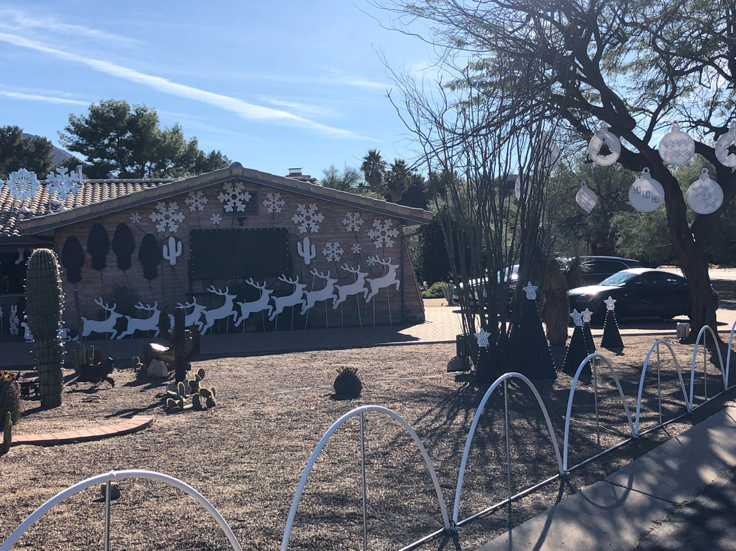 Saturday's hike down Pusch delivered a pounding to my lower joints. So, I did a short, 20 mile ride just to get "things" reoriented. Cycling seems quite therapeutic for recovery from hiking. Some of the homes around Oro Valley CC have nice Christmas displays. I'll have to come back at night to see them lighted. 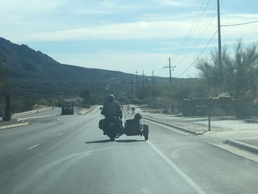 I was driving somewhere and saw this unusual sight, a sidecar having two dogs in it.  Two systems passed through with only a small amount of rain but the cloud formations were...... 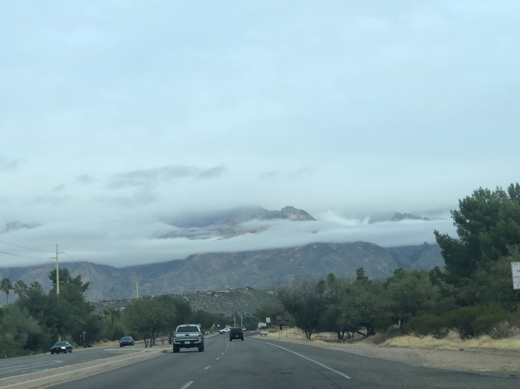 ...very nice and reminded me of one of the reasons I love this region.  Nice! 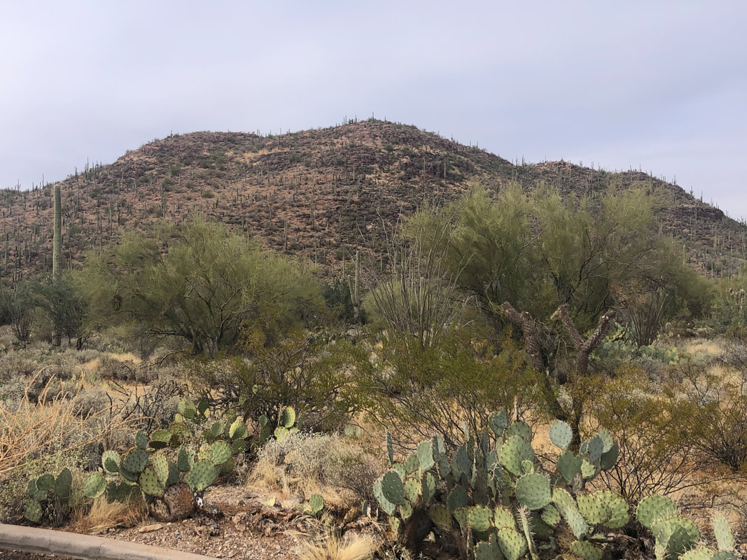 Last couple of days have been too windy to ride so I drove to the Tucson Mountains to hike a loop that included Brown Mountain. 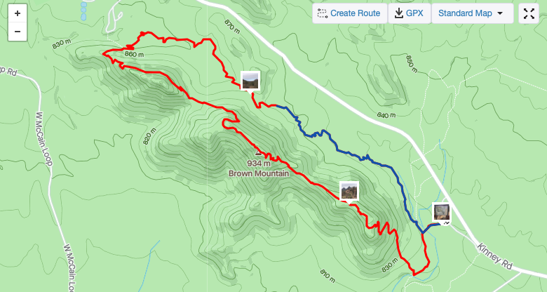 The first half is gently rolling but then you ascend and hike a ridge line. Nothing too steep just something on which I can push myself and get a good workout. 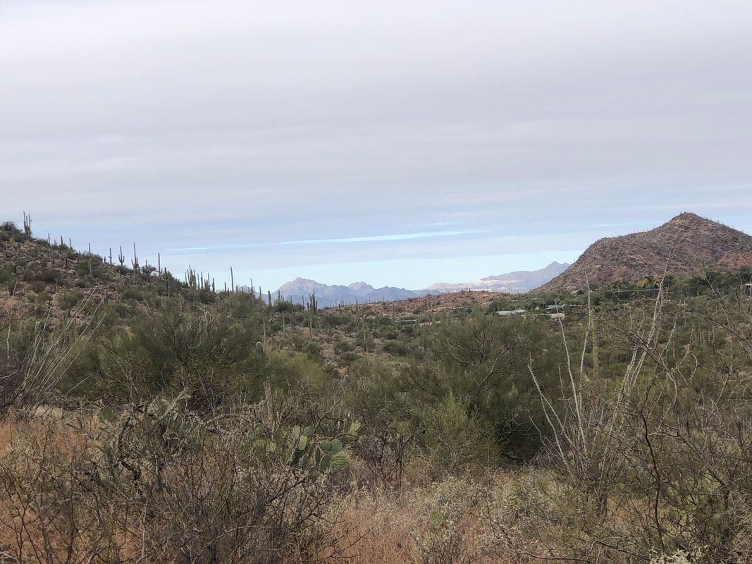 The clouds begin their exit of our skies. 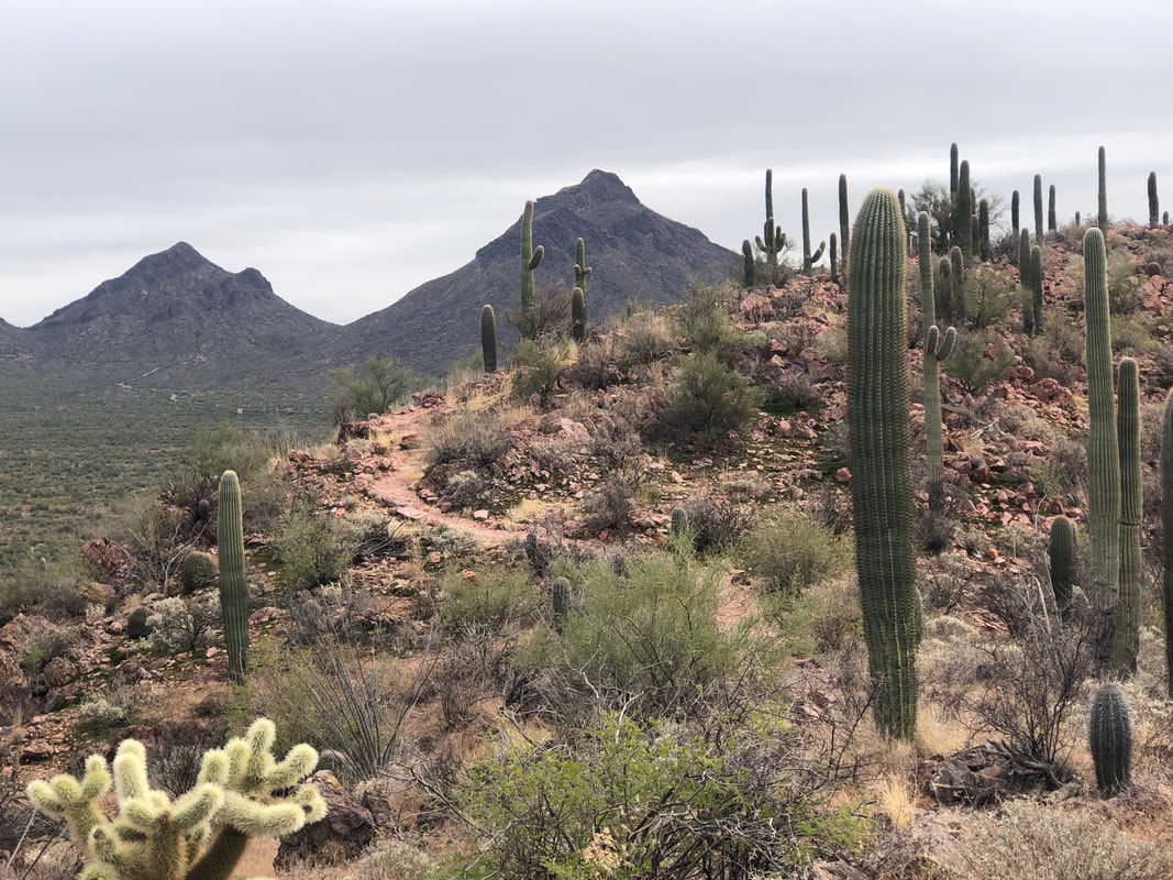 I'm on the final portion of the ridge line trail and see Goldengate Mountain on the right, Bren on the left. Both enjoyable hikes. Finished with 4.25 miles and 700' elevation gain. Really epic hike coming Saturday.
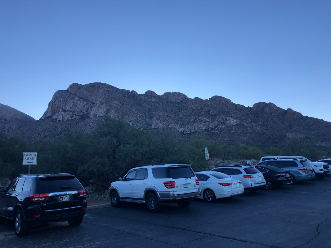 Saturday morning, 8am, 40 degrees and what appears to be an innocuous climb to the top of Pusch Peak......instead, it is the hardest, short hike in the region. Total distance, only 4 miles but we will gain 2600' of elevation, in 2 miles.. 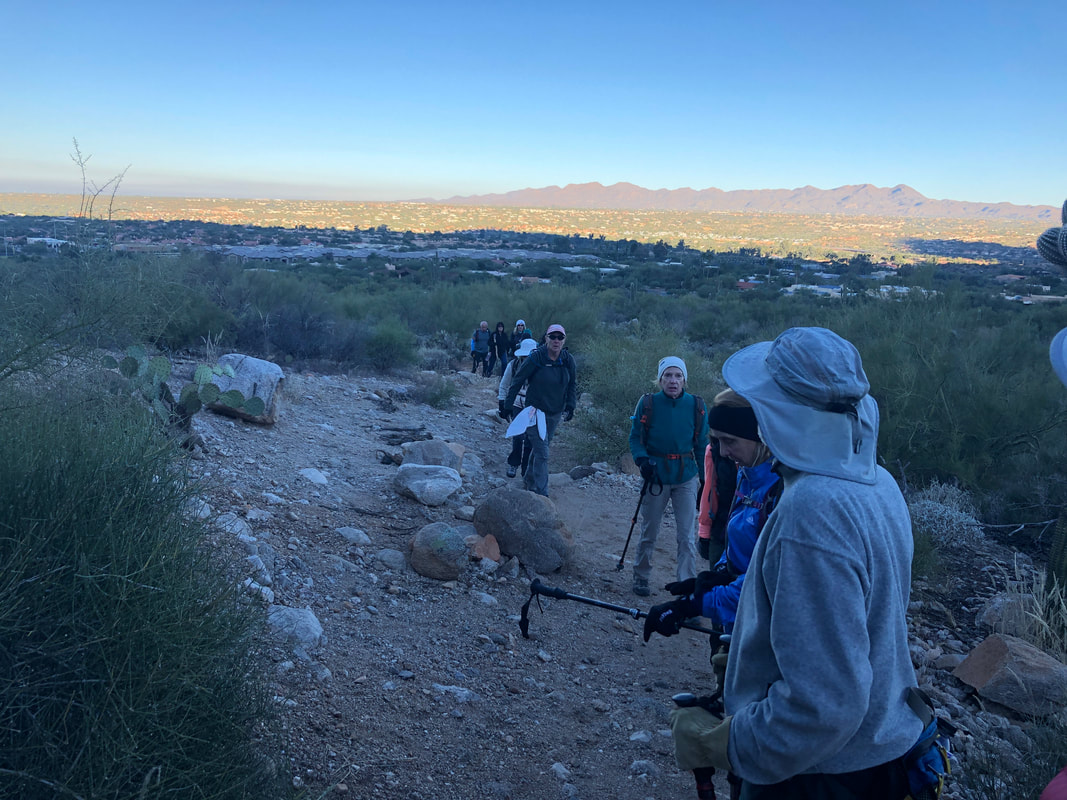 The first .7 miles is on an established trail having an average grade of 9.5% but the remaining distance, on an easy to follow social trail, averages 30%...just a brute of a climb. Most of the climb would be done so in the shade as the sun illuminates the Tortolitas and surroundings to our west. Joining me today were 15, hardy hikers. A larger group than normal but I wanted to give as many people as is reasonable, the opportunity to make it to the peak. 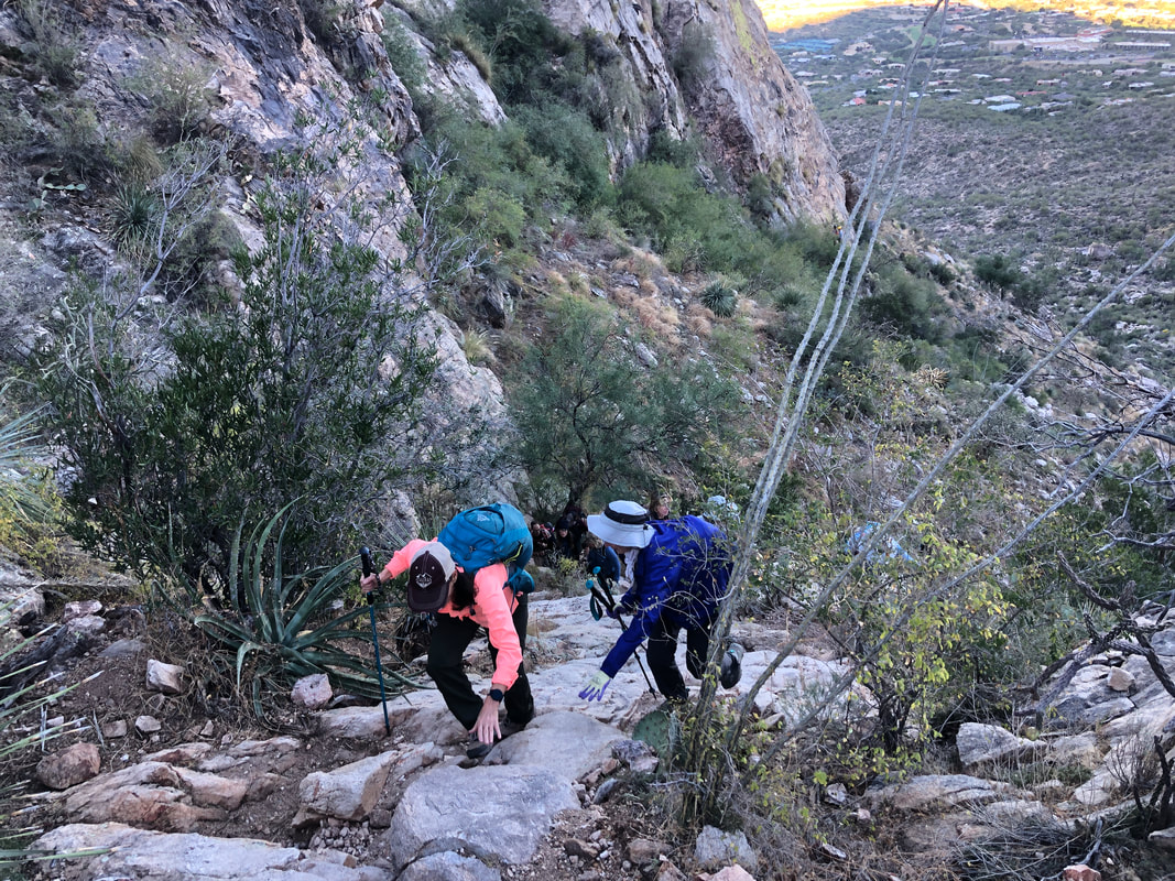 We reach a "wall" but everyone clambers up. 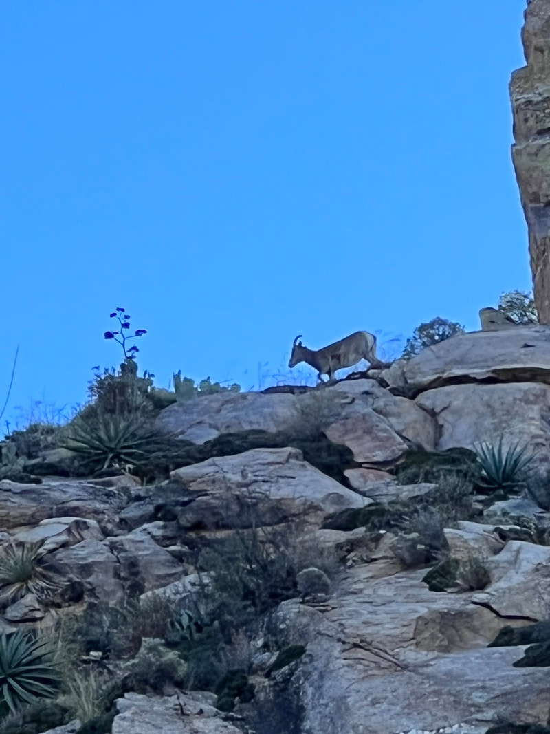 Hiking most of our area trails requires that you keep your focus on the trail but during a regroup, Marc G spotted a big horn sheep, a rare sighting. 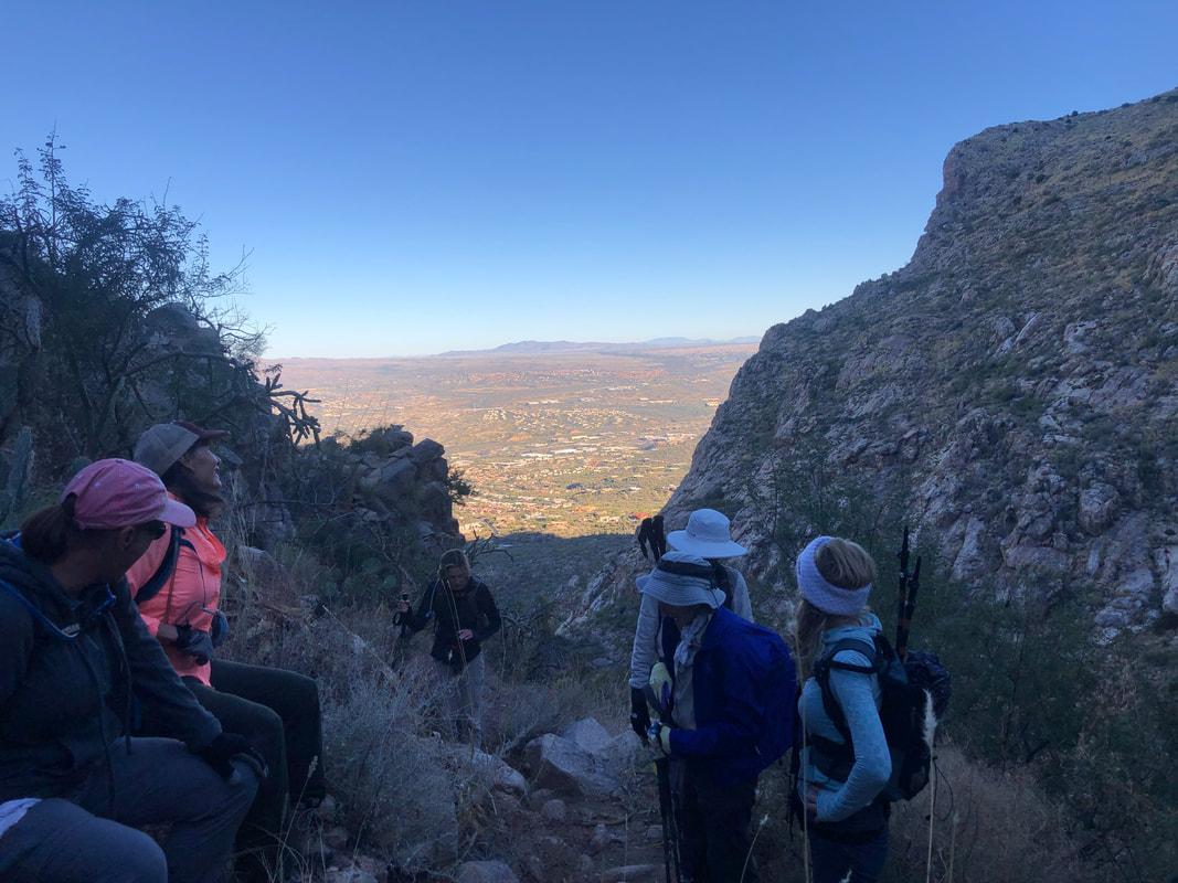 My goal was to get everyone to the peak and so I paused frequently to allow any stragglers to catch up. Eventually, we decided to split into a fast and somewhat less than fast group, which worked out well. 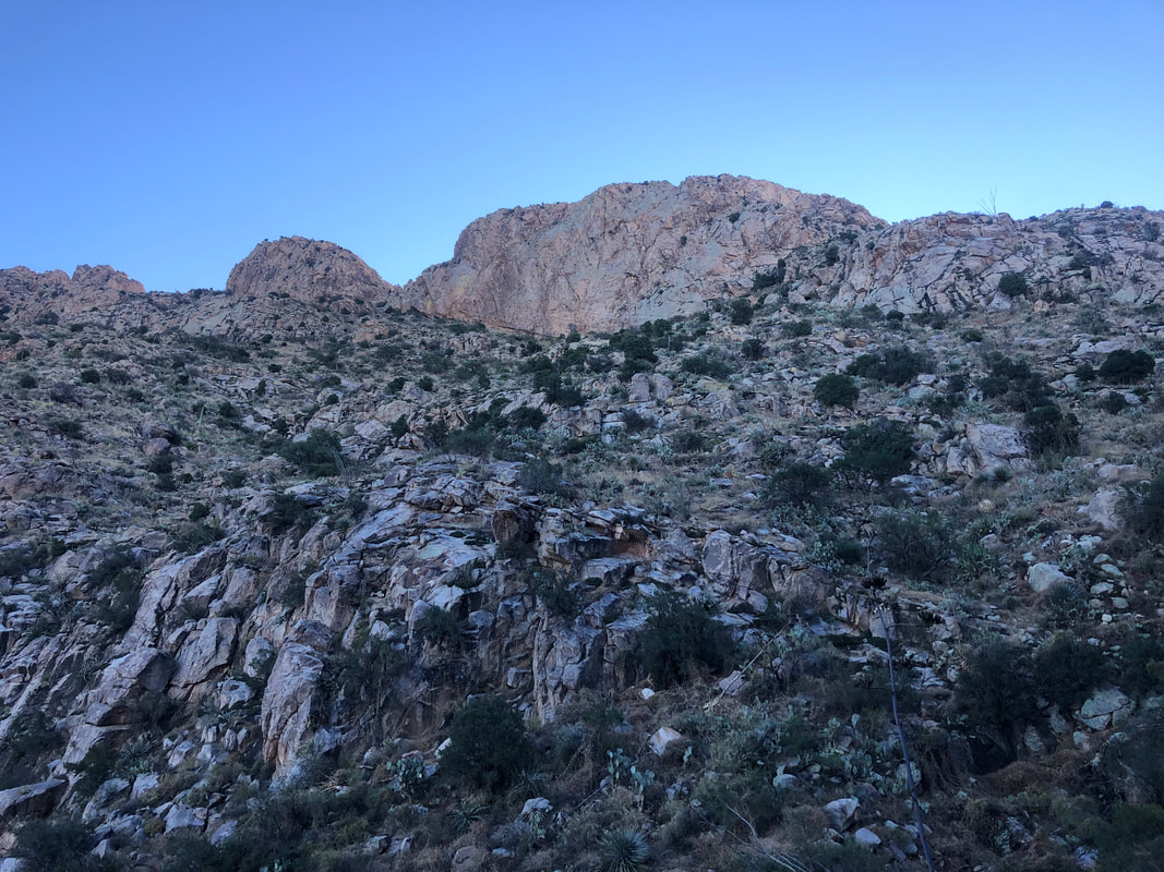 Our route would take us in front of a group of emerging, Stegosaurus shaped, rock features. 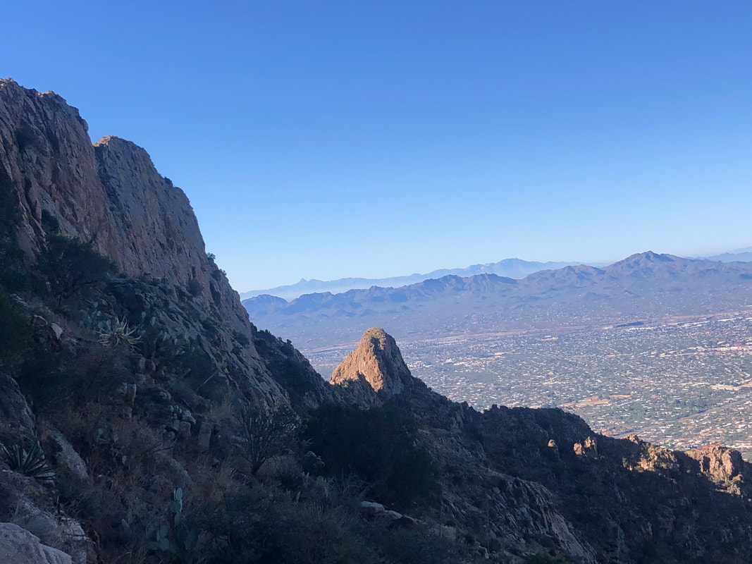 Gaining elevation provided awesome, early morning views of our surroundings. 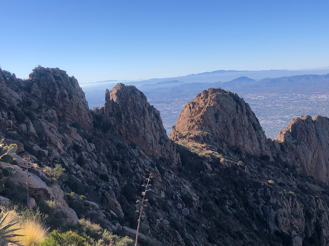 The Stegosaurus shaped features line up nicely. After about 2 hours of hiking.... 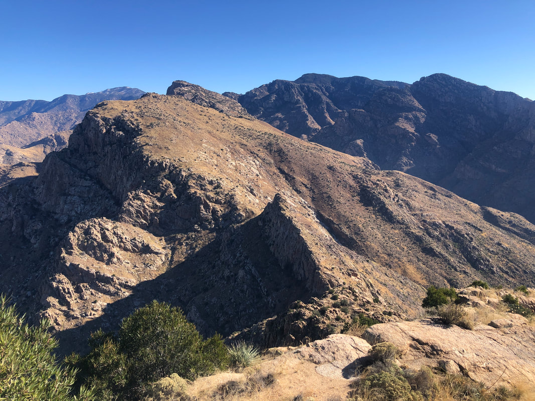 ....we reach the peak. The Cleaver, than Bighorn than Table Mountain in the distance. Unseen and just beyond Table is Table Tooth, next week's destination. Most in our party were giddy with excitement and some..... 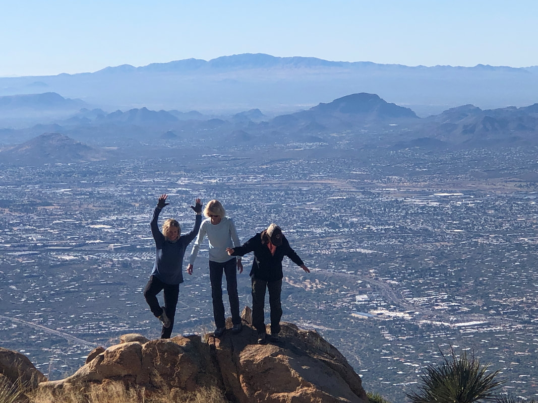 ...hiked to a nearby smaller peak and posed (left to right, Amy, Marcia and Lorna). 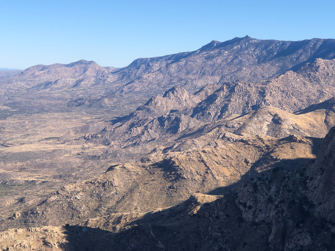 To our north, what a great view. 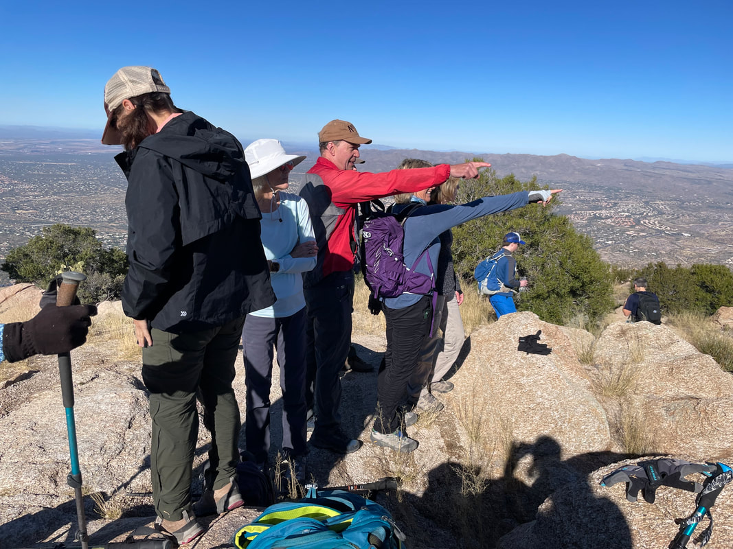 I pointed out a few peaks while others..... 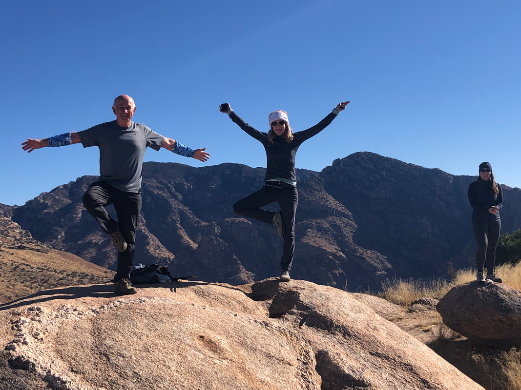 .....posed, lol. Marc G on the left, Jenn and Catherine. 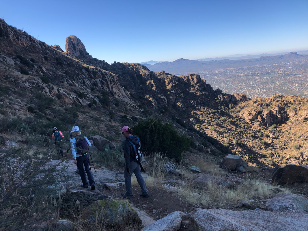 All enjoyed the peak experience but of course, the descent must begin and what a knee buckling experience it is. Post hike, a few of us..... 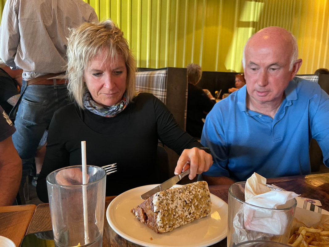 ....met at a local eatery and had healthy meals and than shared unhealthy, carrot cake! Seven of us split the cake fairly evenly even though it appears Amy is intent on carving out a bigger one. Note the intensity with which she eyes the prize. Great hike with fun people.
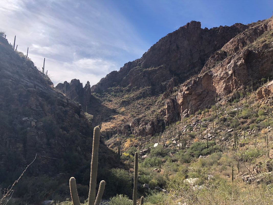 Ventana Canyon, a gateway to The Window and Window Peak but well short of those wonderful destinations is Maiden Pools. With a difficult hike coming on Saturday, Amy and I picked the Pools for an easier hike. 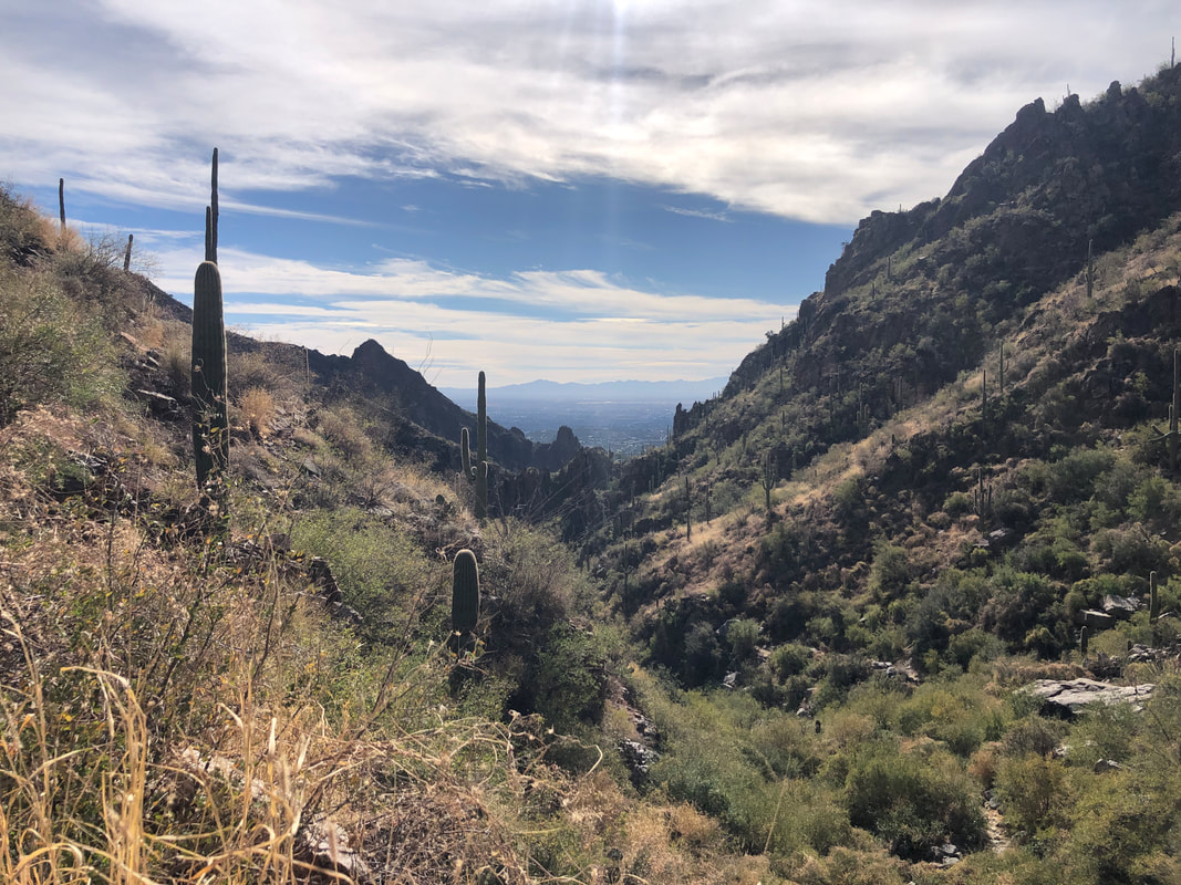 A weather system passing to our north brought in some thin clouds to our region. Clouds seem to add drama to the long range vistas. 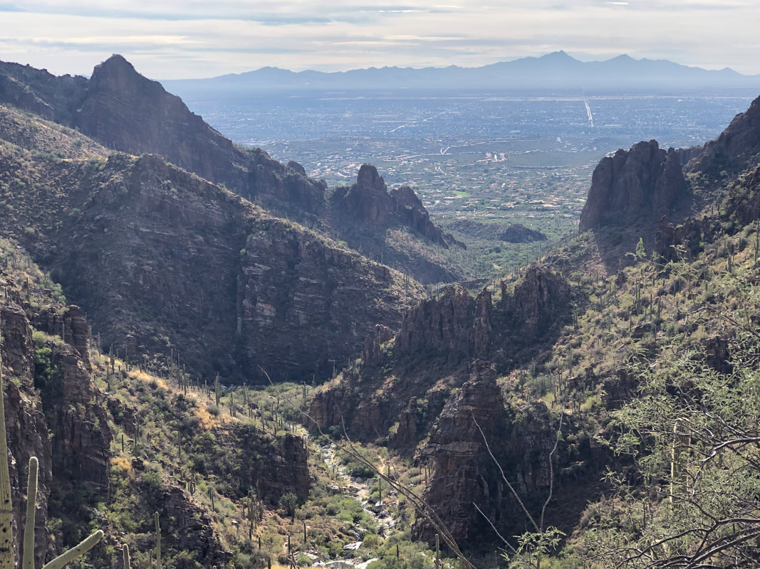 The trail crosses the canyon floor multiple times with no a bunch of climbing until..... 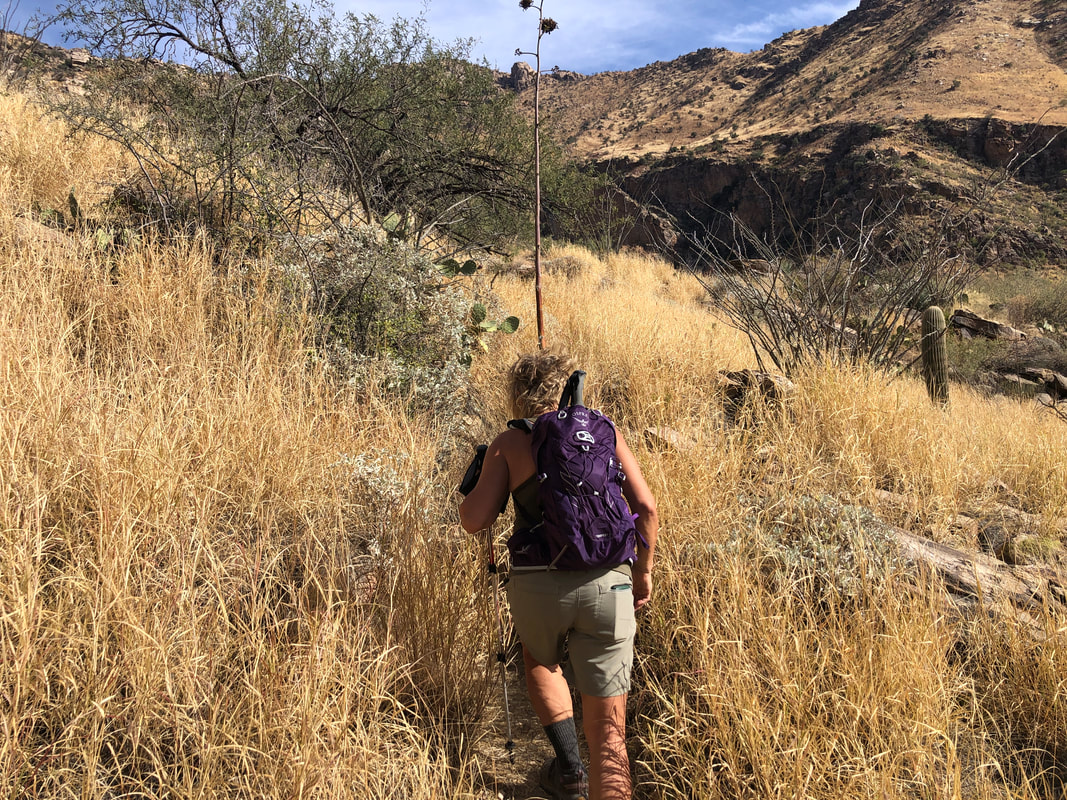 ....we encounter the canyon wall. Now the climbing begins in earnest and once again, the monsoon inspired grass growth is impressive. We had passed a couple of signs warning we were entering a burn area but we saw nothing to suggest a fire had passed any place where we walked. 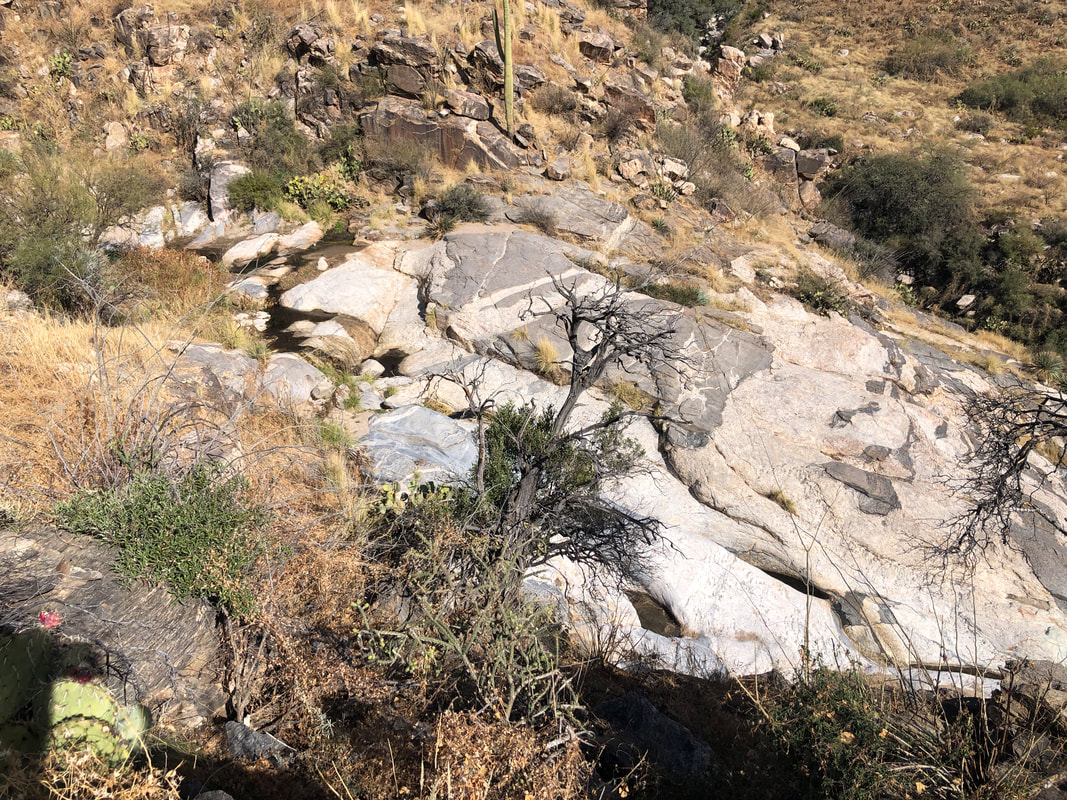 After about 2 miles, we begin a descent to the broad, slick rock area that houses the pools. 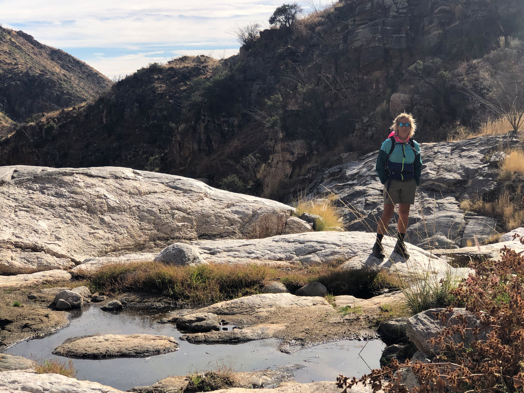 There was a trickle of water moving through the canyon, keeping the pools full. It's a beautiful area and we enjoyed relaxing for a bit before we began the short climb back to the Ventana Canyon trail. 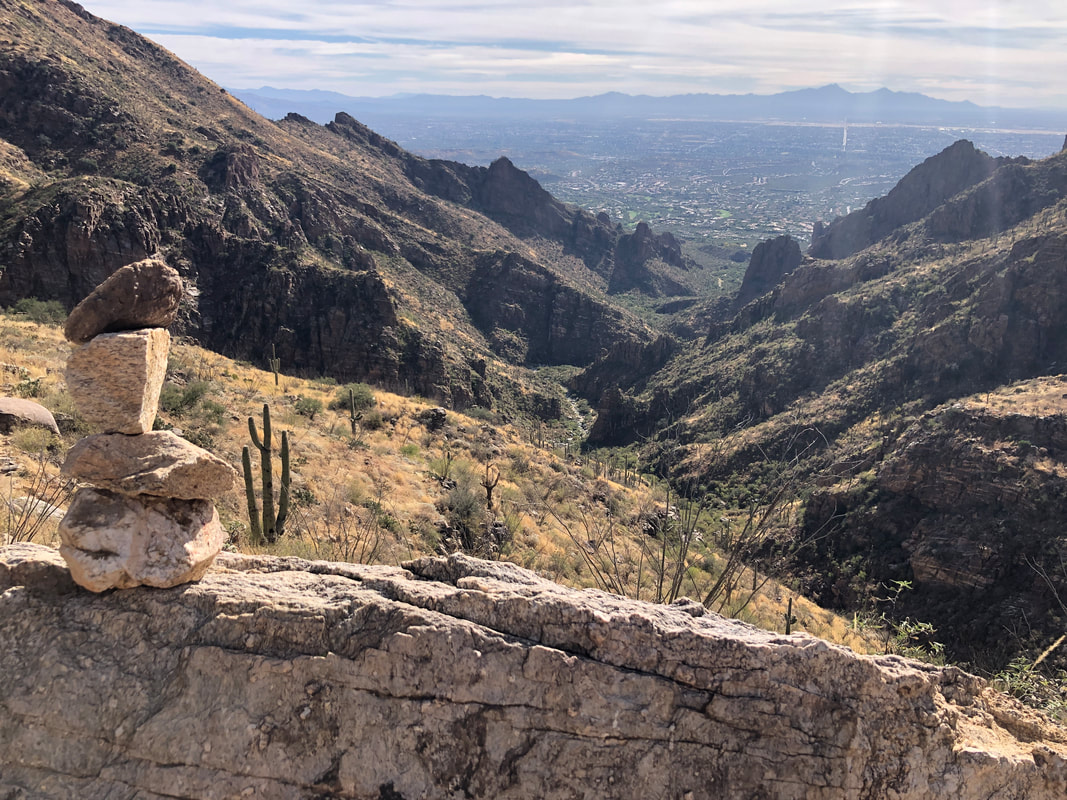 Reaching the high point of the trail, we spotted a cairn and took this awesome picture. 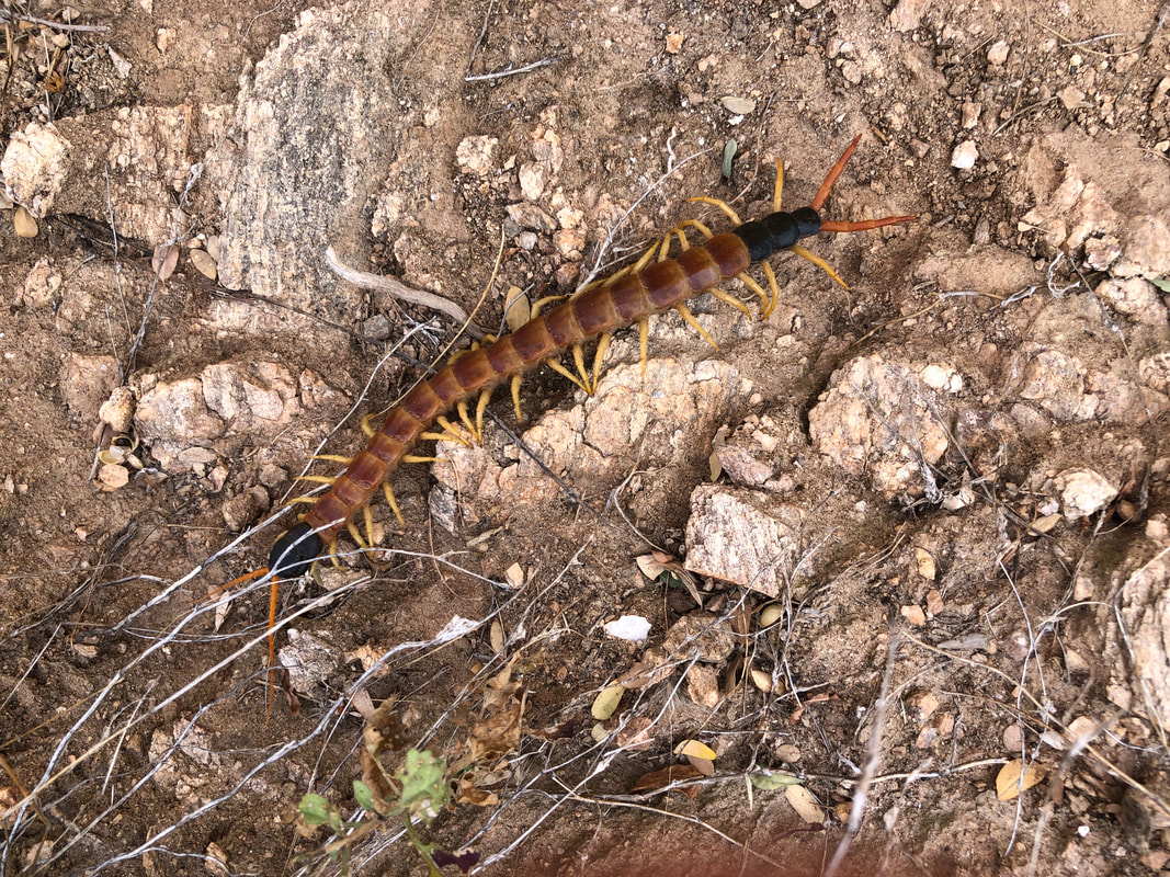 After descending to the canyon floor, I noticed movement and saw this good example of a centipede. Eventually, we finished our hike with 5.4 miles and 1300' of climbing.
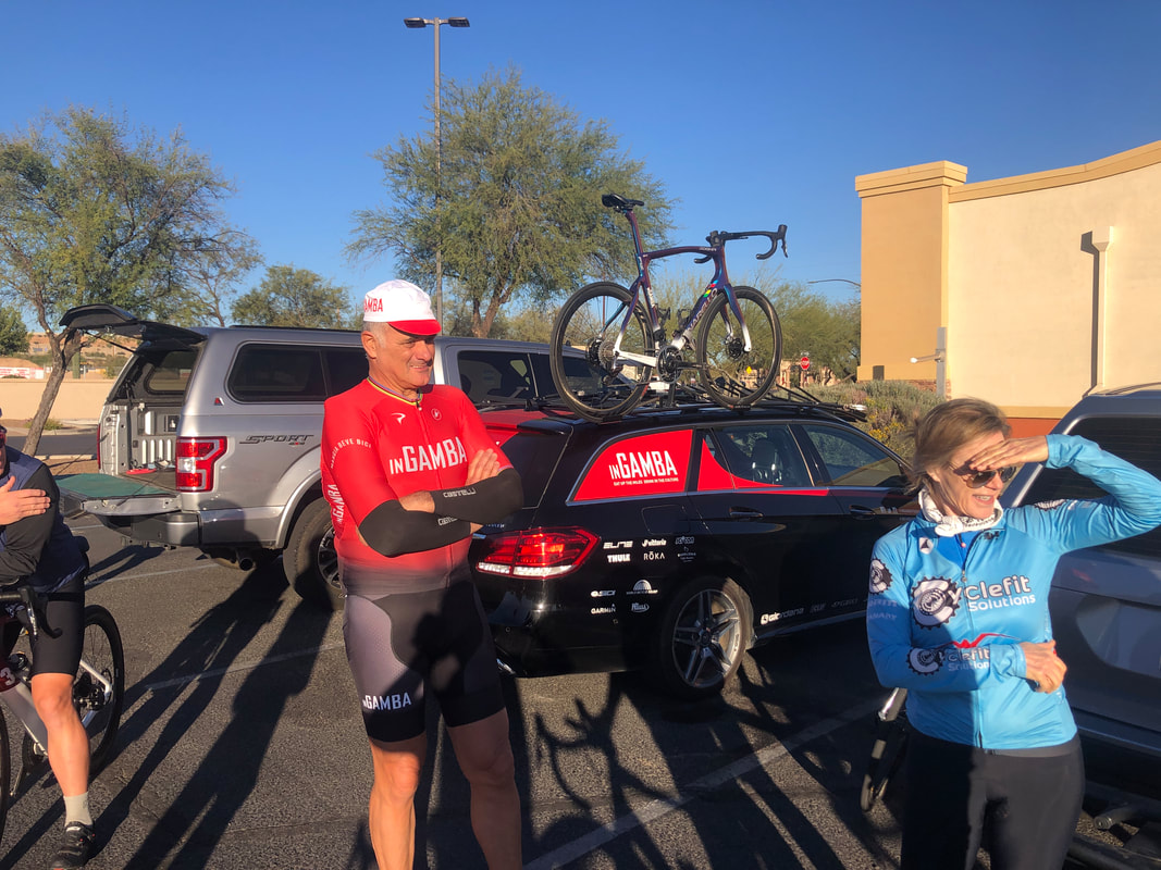 The Cyclefit gang gathered in Sahuarita for a group ride to Madera Canyon. A surprise visitor, Eros Poli, arrived too. I know, you're thinking, "Who's this guy?" Well, he won an Olympic gold medal at the '84 games in Los Angeles but more interesting, he was Mario Cipollini's lead out man on sprint stages at the Tour de France and other races. This is....  ....Mario, winning one of many sprint stages. Eros is a very gracious, humble man with 0 ego and you probably had to have that in order to ride with Mario. Anyway, Eros is a large man, 6'4" tall and understandably, not a strong climber. However, in 1994, Stage 15 at the TDF, Eros attacked the peloton, soloing from the group and arrived at the base of the fabled Mont Ventoux with a 20 minute head start. He was almost caught at the summit but then stayed ahead on the descent, finishing first! 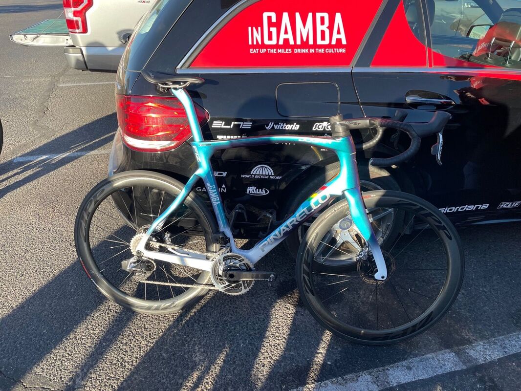 Nice bike! We split into two groups, one for 8:30 and one at 9am. Eros went with the late group and I went with the early group. I assumed I would get dropped and would not have had the opportunity to hear his stories anyway if I waited for the late (and faster) group, lol. 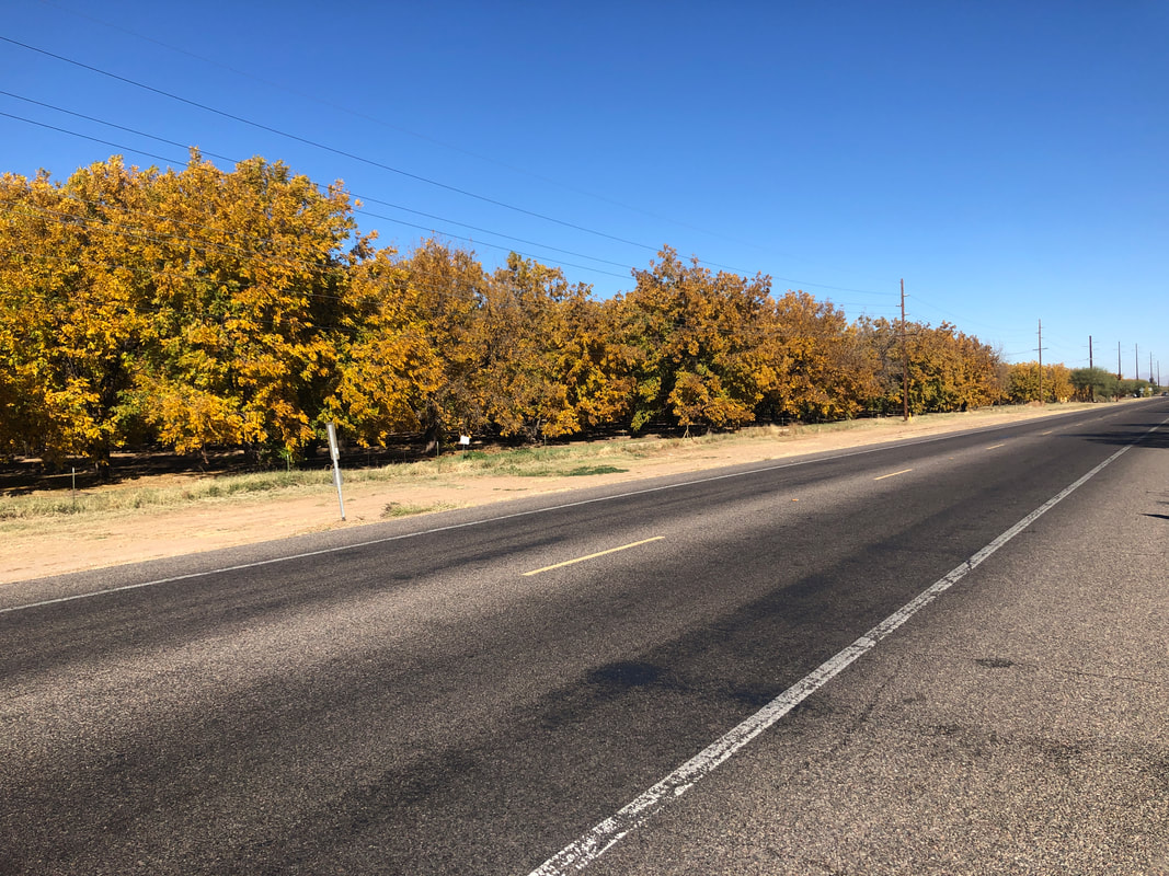 Passing one of the area's pecan farms. The leaves are turning so it must be southern Arizona's fall season on this beautiful day with a high of 78. 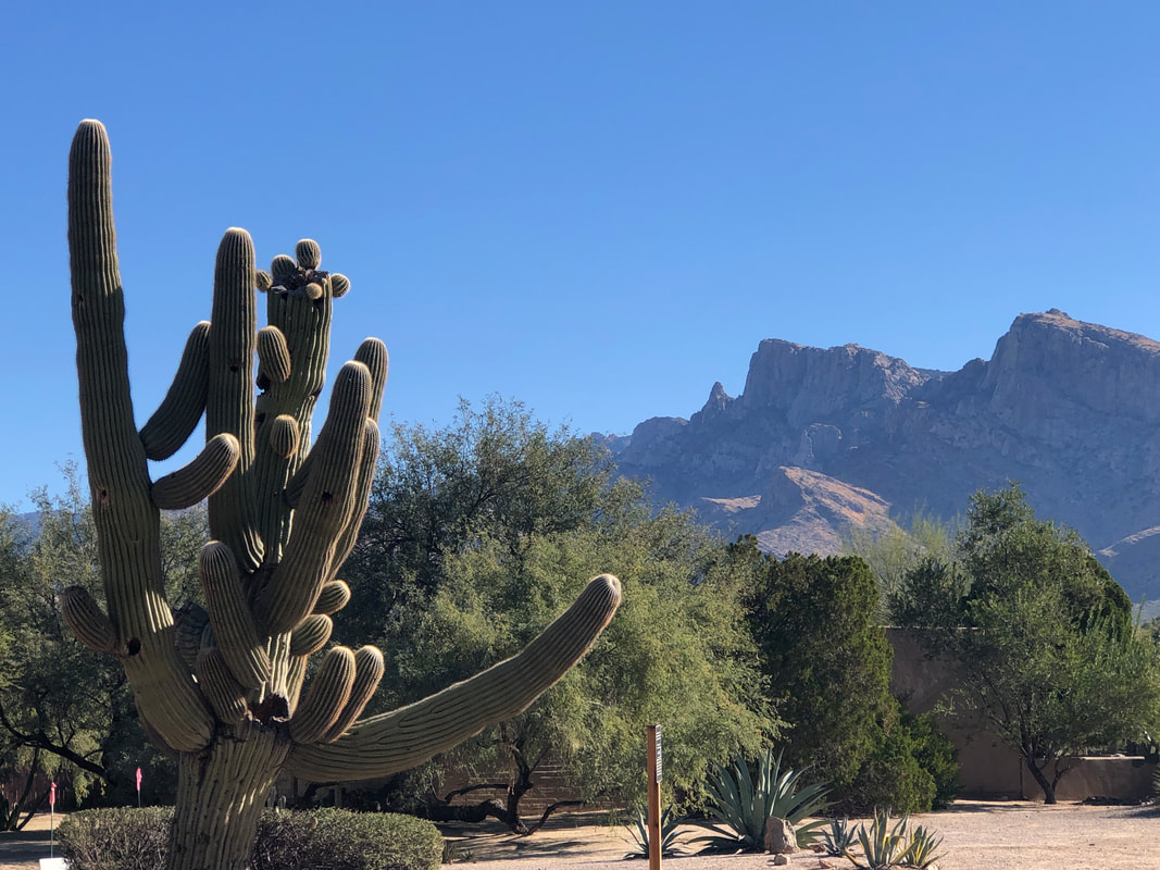 On Monday I got out for a very short ride to stretch my legs which were kind of fatigued after the combination of Saturday's hike and Sunday's ride. Funky looking saguaro and then.... 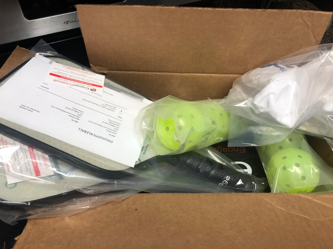 ....our pickle ball paddles arrived! I ordered lightweight, Engage brand. The quality of the paddle far exceeds my skill but maybe I can "grow" into it. Will be interesting to see how much I play as I won't cut back on cycling or hiking so not a whole bunch of extra time in which to play. We'll see.
 My Christmas tree is up!!!! I still find it a little weird with the temps in the 70's that we are celebrating Christmas season but I can handle it. The next morning, Saturday was a hike day for which I was kind of unprepared.  Our group of 10, gathered at a school parking lot in the small town of Catalina to consolidate info high clearance vehicles for a short drive to the trail head. Only then did I discover I had forgotten to bring a hat or sunscreen. Fellow hiker Emily had extra sunscreen but I had to stop at a Safeway to shop for a hat. The first display had goofy straw hats but behind that, a display of baseball style caps so I was good to go. I was the subject of good natured derision and rightly so. 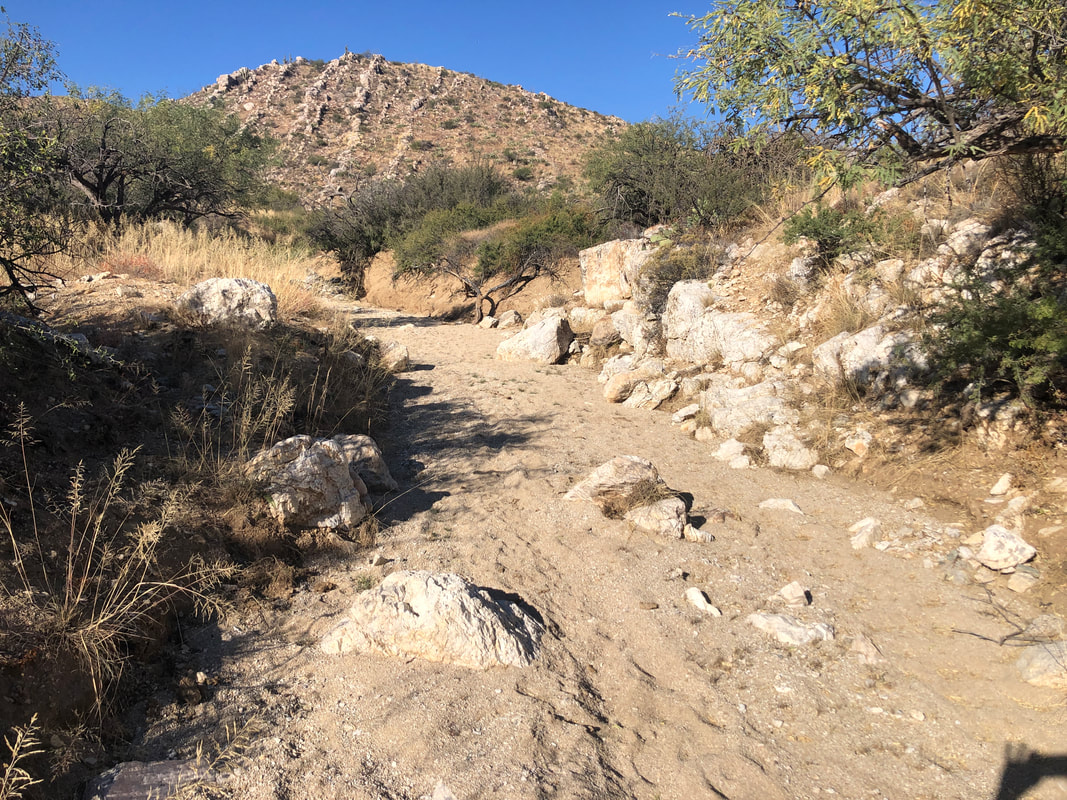 The 5 mile drive from Oracle Road could be navigated without a HCV but there were a couple of sandy areas that may be problematic in a car. Upon reaching the trail head, I then spent several minutes walking down one jeep road, then another before orienting myself to a gpx track I was attempting to follow. Finally we were on the right track and headed up a broad wash which soon narrowed. 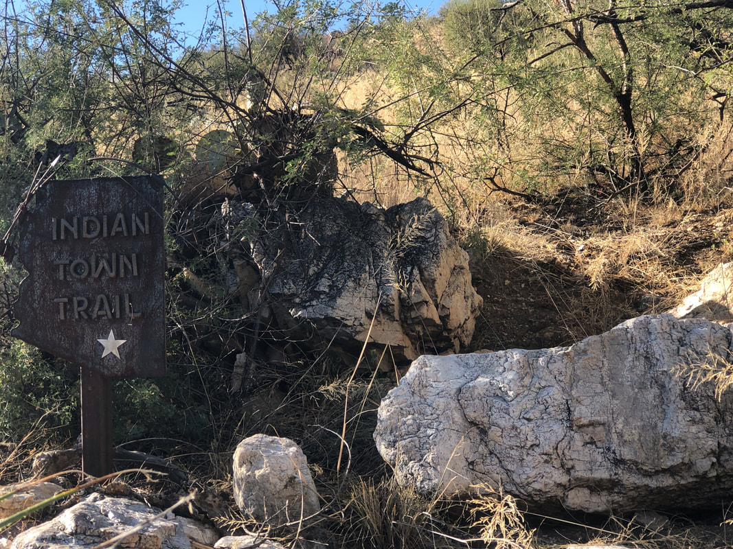 We passed a sign for the "Indian Town Trail", an intriguing name but subsequently I was unable to find any information about it. The wash narrowed and.... 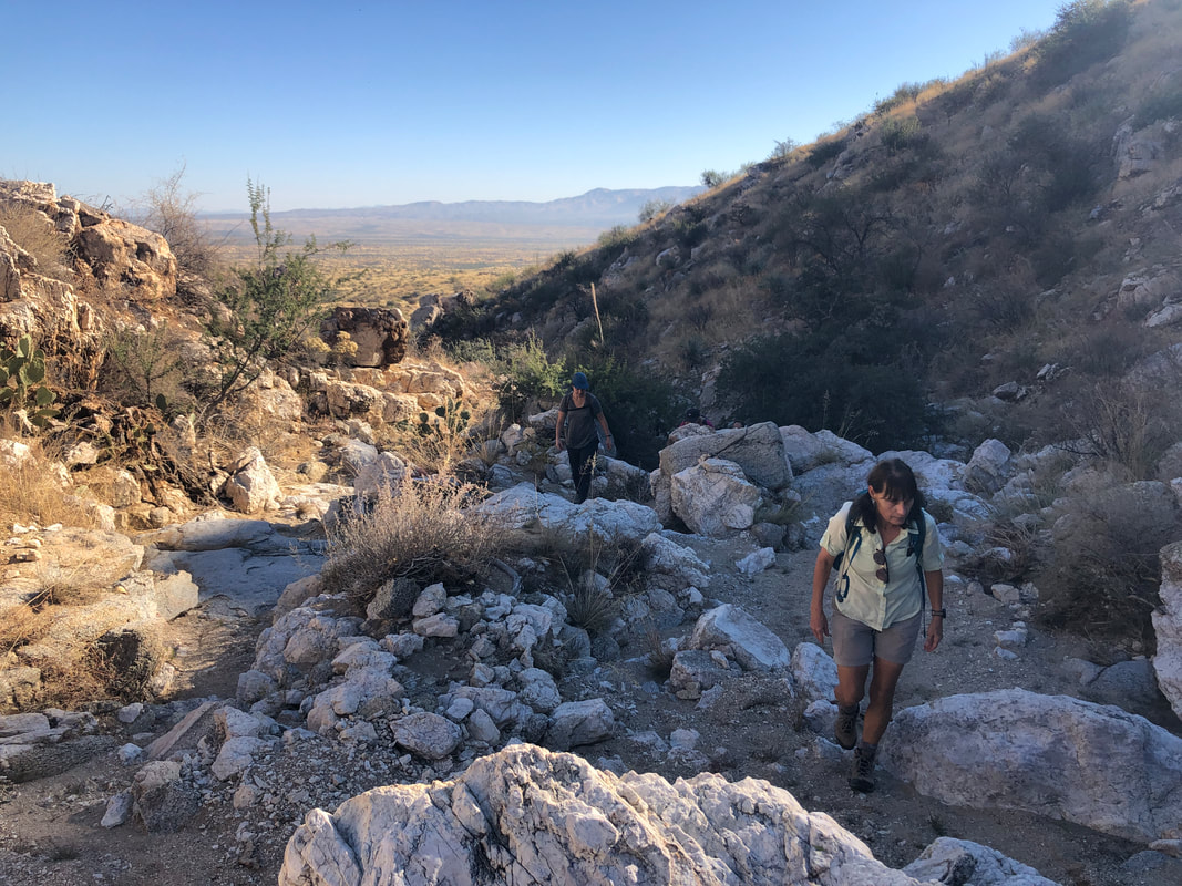 ....became boulder filled. Lorna, one of our favs on the right. I was concerned that around each turn we'd be faced with an insurmountable obstacle but we encountered nothing that we could not navigate.and soon..... 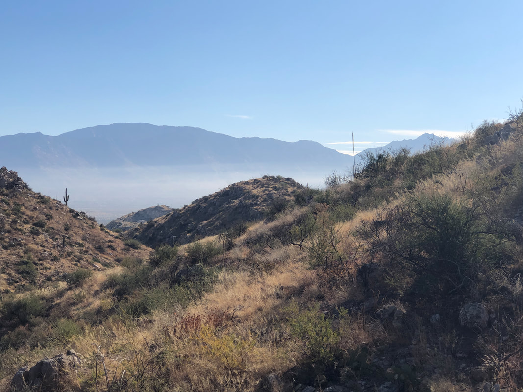 ....broke right from the ravine and began a climb in earnest. Our destination, Jeffords Peak, is the high point in the Tortolita Mountains. Few people are aware of the peak, named after Tom Jeffords who held many important positions, mostly in the 1800s. Actor Jimmy Stewart played Jeffords in the movie "Broken Arrow" but the plot had nothing to do with Jeffords actual work. 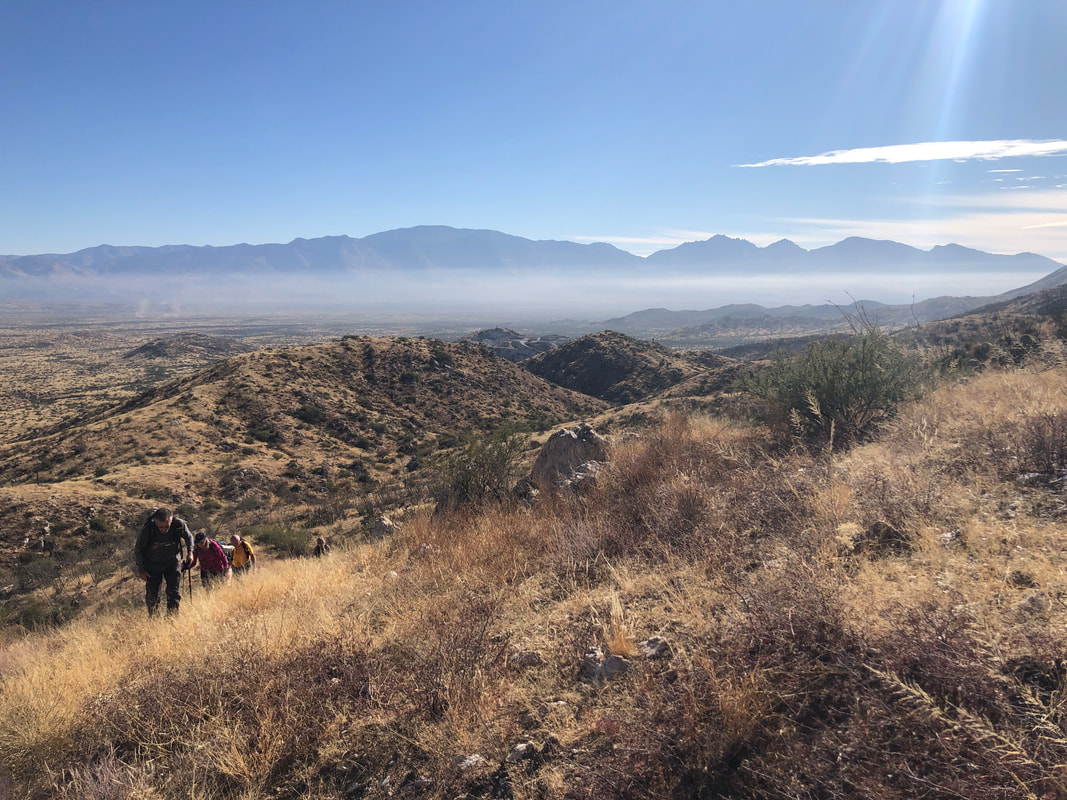 Our hike was 100% an off trail, bushwhack. However, it wasn't nasty, just walking through upper desert/grasslands. There was nothing to distinguish Jeffords Peak from any surrounding peak and it was kind of late in the hike before it came into view. Confirmation of the peak occurred about when I lost power on my phone, losing the gpx track. Got to do something about that. 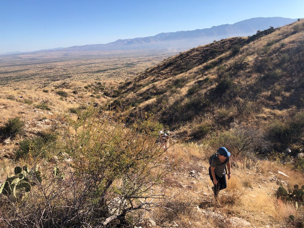 We had been following a loop route which I always prefer to an in and out route. However.....  ....after following the bottom segment and returning via the top segment, I would never travel the bottom segment again. Too much hiking across steep slopes that we did not encounter on the return. 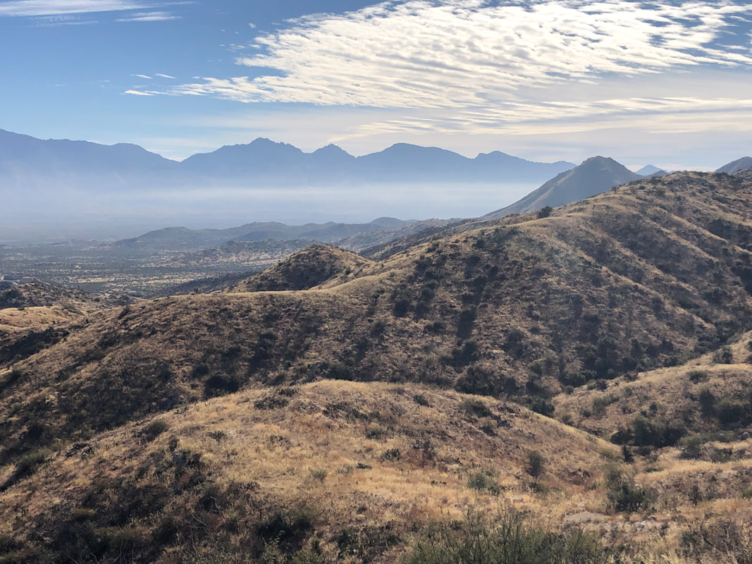 The views were awesome, as with any climb in our region. An unusual haze partially obscured the usual clarity. At last we..... 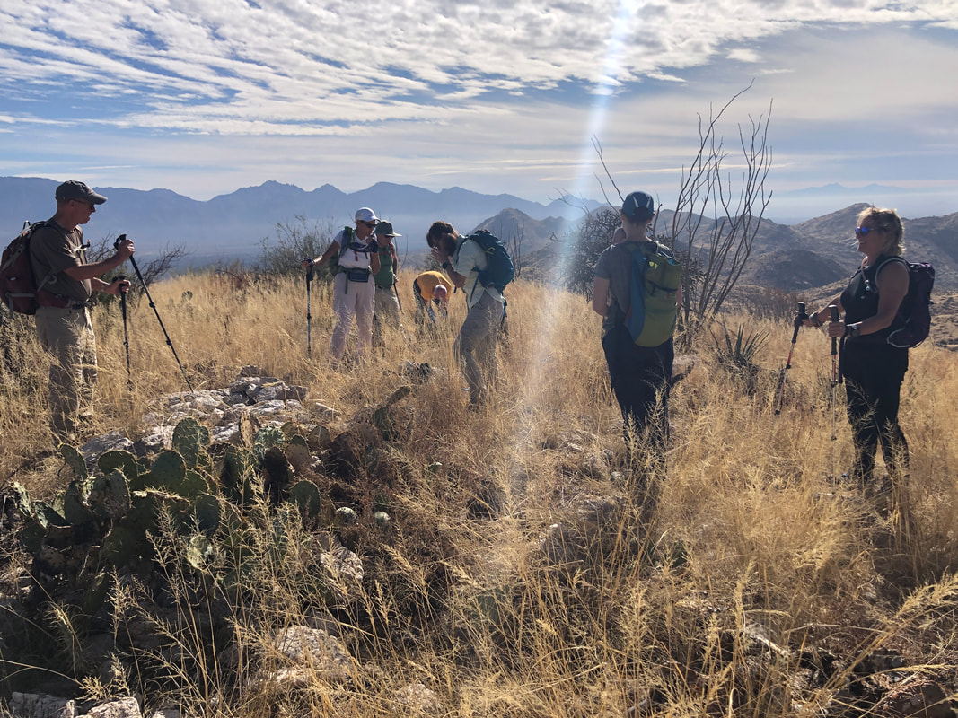 ......we reached the peak! 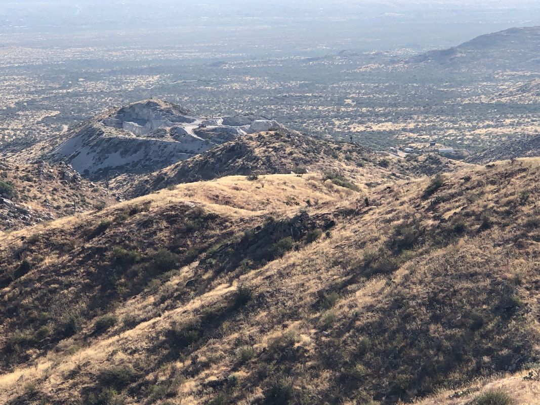 We had passed the edge of a closed chalk mine and now had a good look at it. 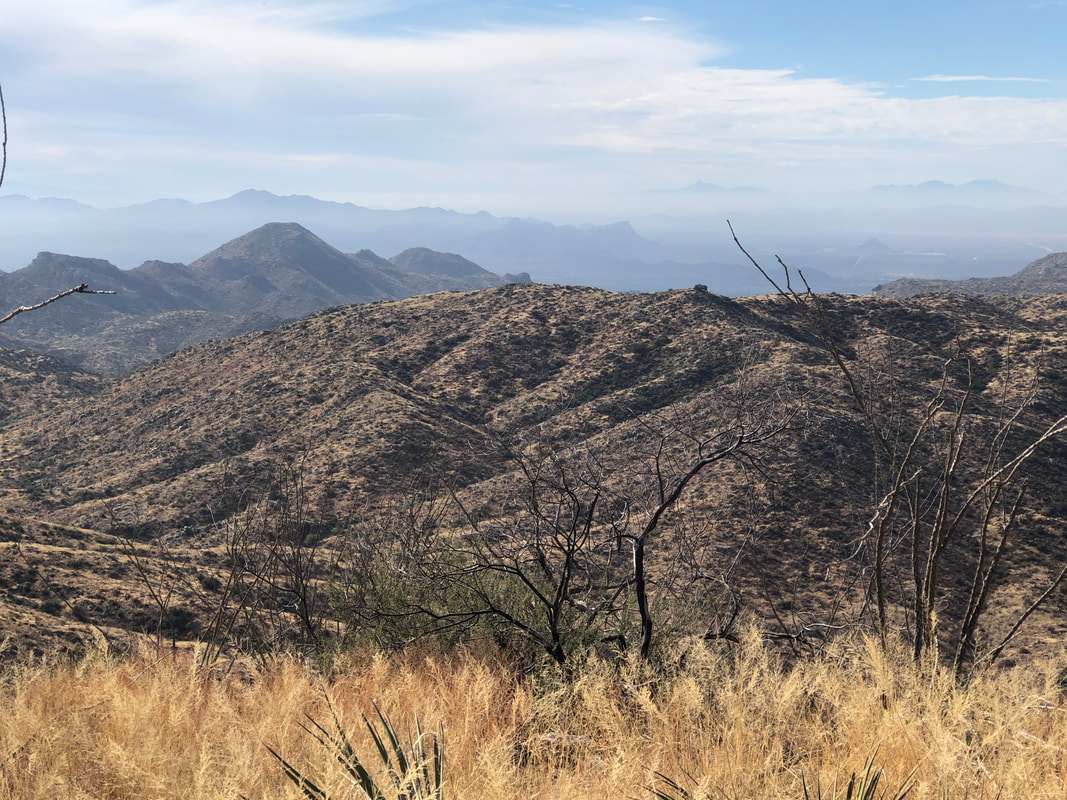 Note how obscured are the Santa Rita mountains in the distance, barely able to make out Elephant Head on the right of the range. Waiting for us at the peak was "Paul" a fellow hiker who mostly enjoys solo hiking. This was his third visit to Jeffords and he kindly offered to guide us..... 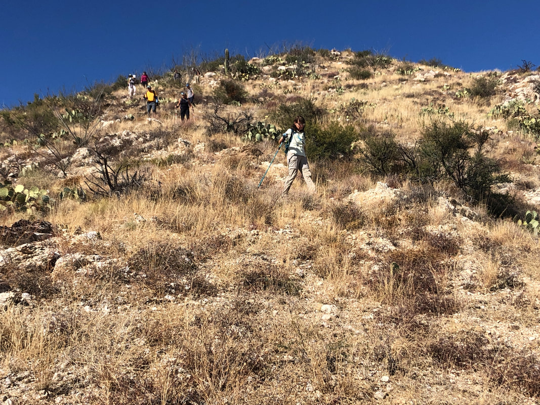 ....on a much more enjoyable route. Of course it was steep in a few spots as evidenced in the above image but we returned to our vehicles..... 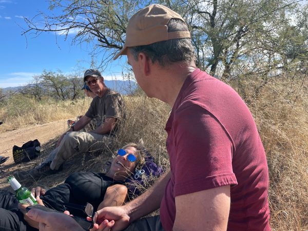 ....where coolers were opened (I forgot that too!) and beverages shared. Amy and I usually have to quickly depart after hikes but the hike was only 4.5 miles, 1100' of climbing and since Jack the Dog had not been alone for as long as most hikes, we could linger. Oh, also.... 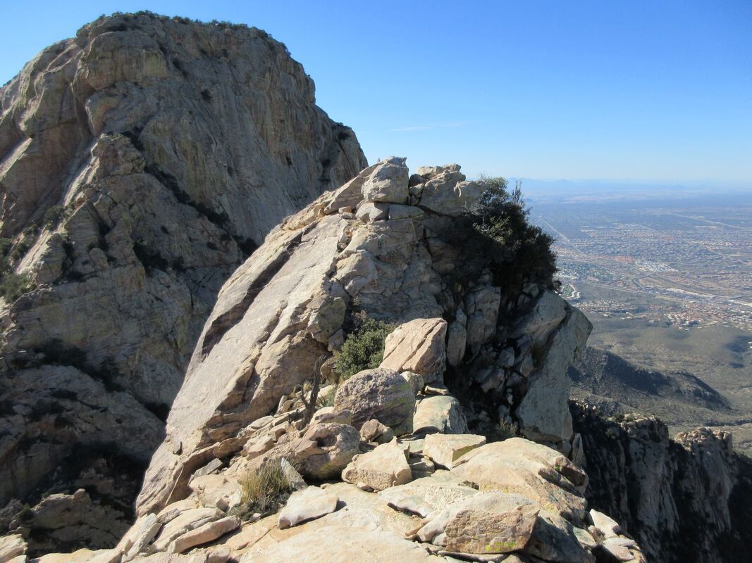 ....Paul has hiked to "Table Tooth" the finger of rock next to Table Mountain (which is in the distance). Working on a date for that.
|
