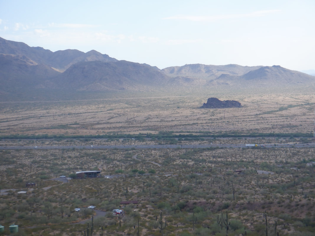
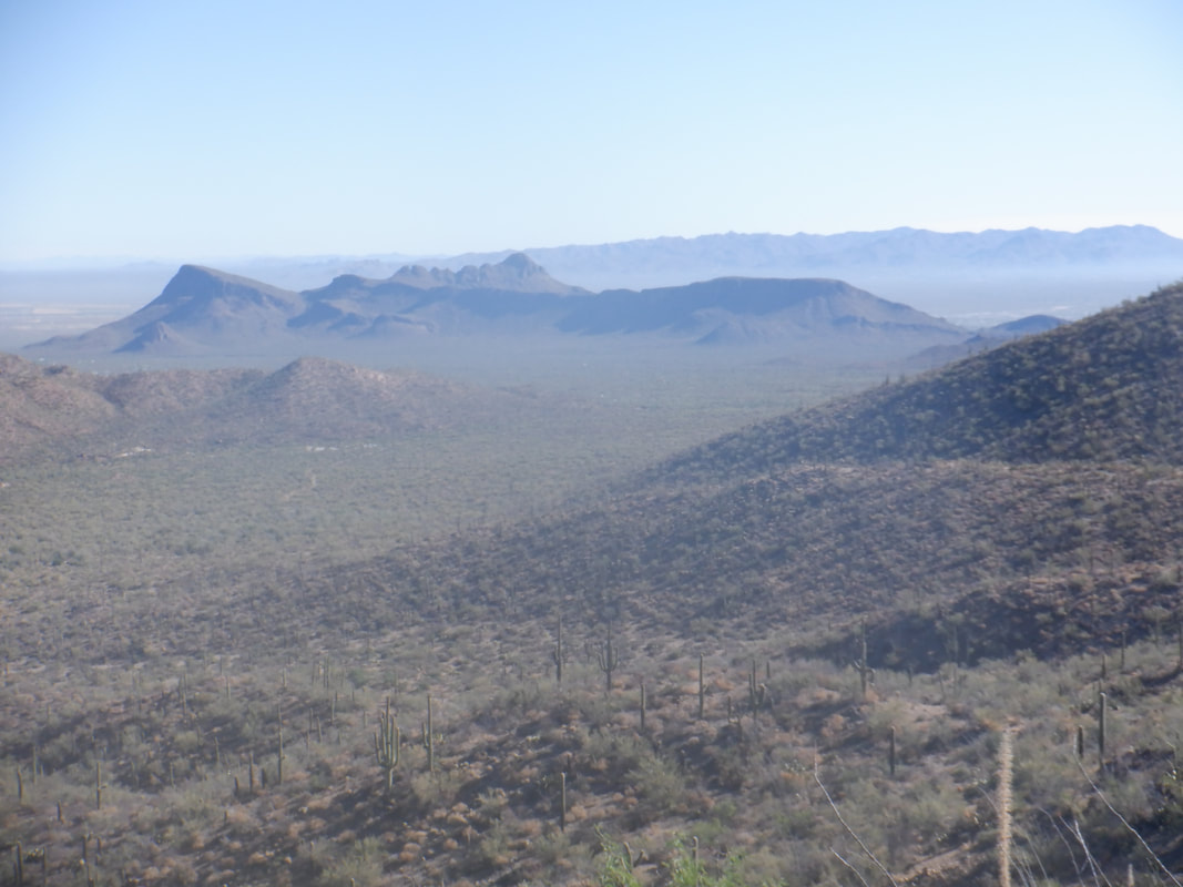
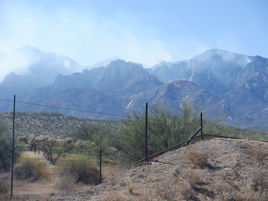
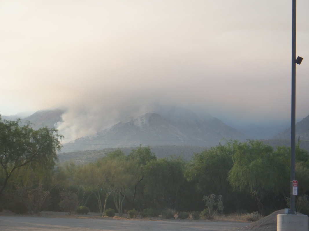
 We got off to a late start so it was already 90 degrees as we climb the Hunter trail, looking across I10 at the views as we march higher. With me..... 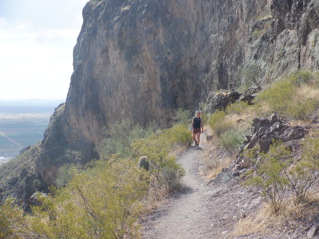 ....is Amy, her first visit to Picacho Peak. It was today that she told me she has a small issue with heights...uh, oh. 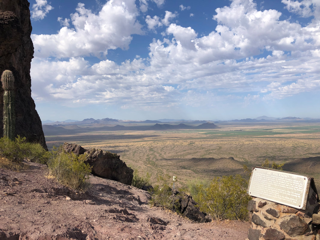 We reach the ridge. This image is from her iPhone. Bugs me that a phone takes better images than a camera I use. 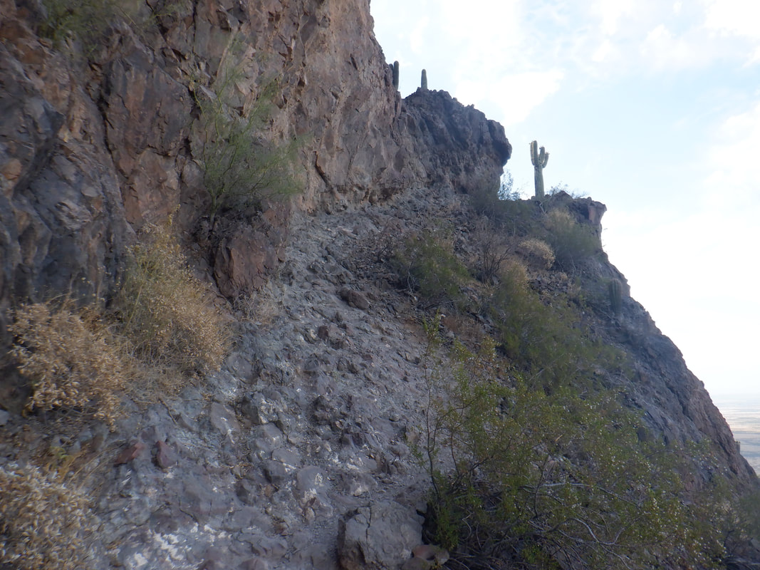 The average grade on that front side is around 30% and the back side, no different. We encounter cables and successfully navigate those but then.... 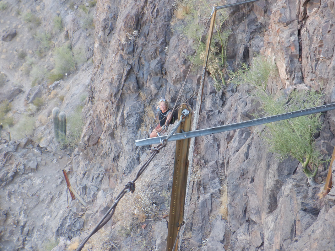 ....this section. This gave Amy pause but she overcame her fear, which was based more on what the descent would be rather then the ascent. 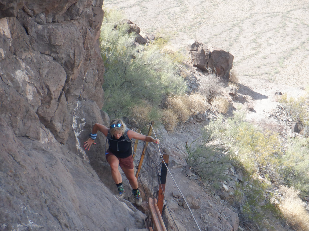 The last obstacle is kind of nasty but through it she went and then..... 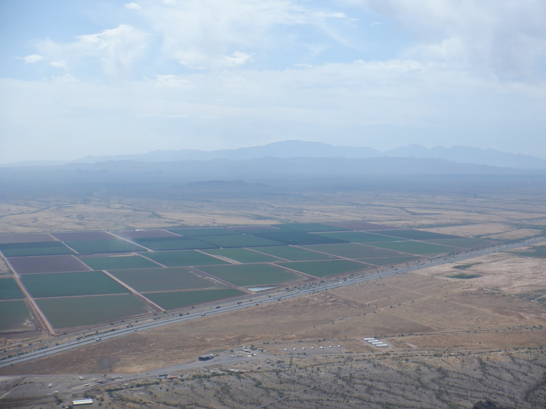 ......made it to the top. Smoke can be seen coming from the Catalinas where the Bighorn fire has consumed over 100,000 acres but finally being brought under control. 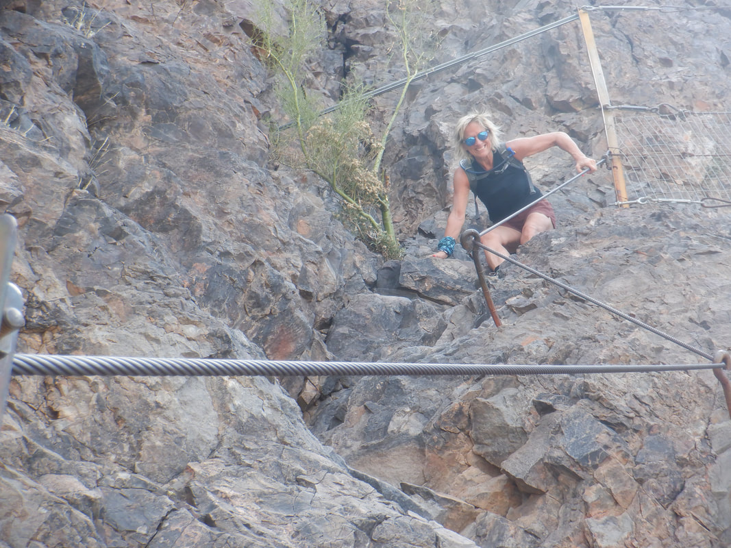 We depart and the descent didn't present a problem after all. The round trip distance is only 3.3 miles but with almost 2000' of climbing. Always a fun time on Picacho.
0 Comments
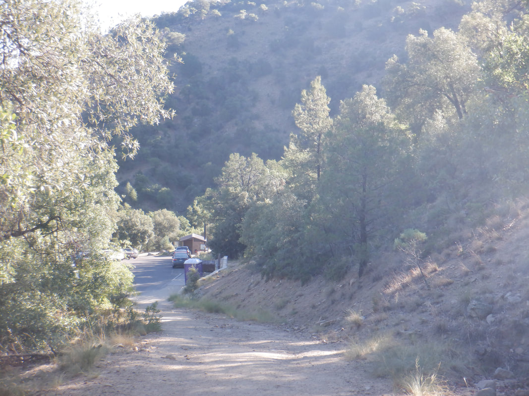 The hike begins but after ascending awhile I discover I left my hiking pole on the back of my car. That's annoying so I descend, grab the pole and restart. 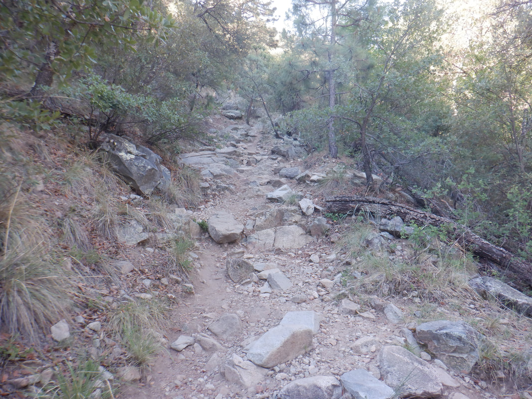 I pass Old Baldy trail on the left, staying straight on the Carrie Nation trail. I'm arguing with myself...stay on CN to Aqua Caliente trail or hang a right on the wickedly steep, Vault Mine trail. I hate the latter trail but it is the most direct way to Aqua Caliente so..... 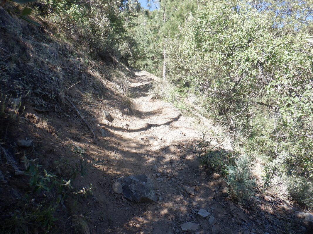 .....I turn right on this unsigned trail and begin what can only be described as a slog. Having an average grade for the .9 distance, the trail is one of the steepest in the region. 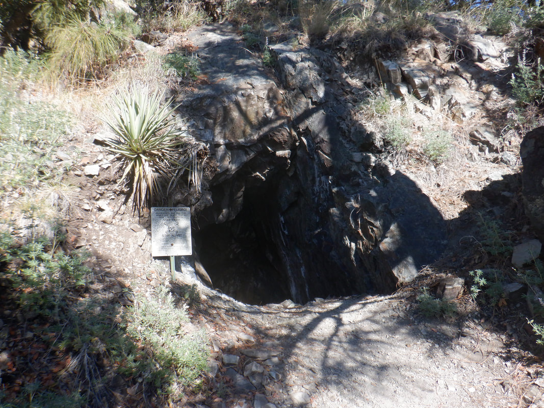 I pass an open mine warning not to venture inside. This also signals I am nearing the top of the trail. It takes me 30 minutes to go less than a mile. 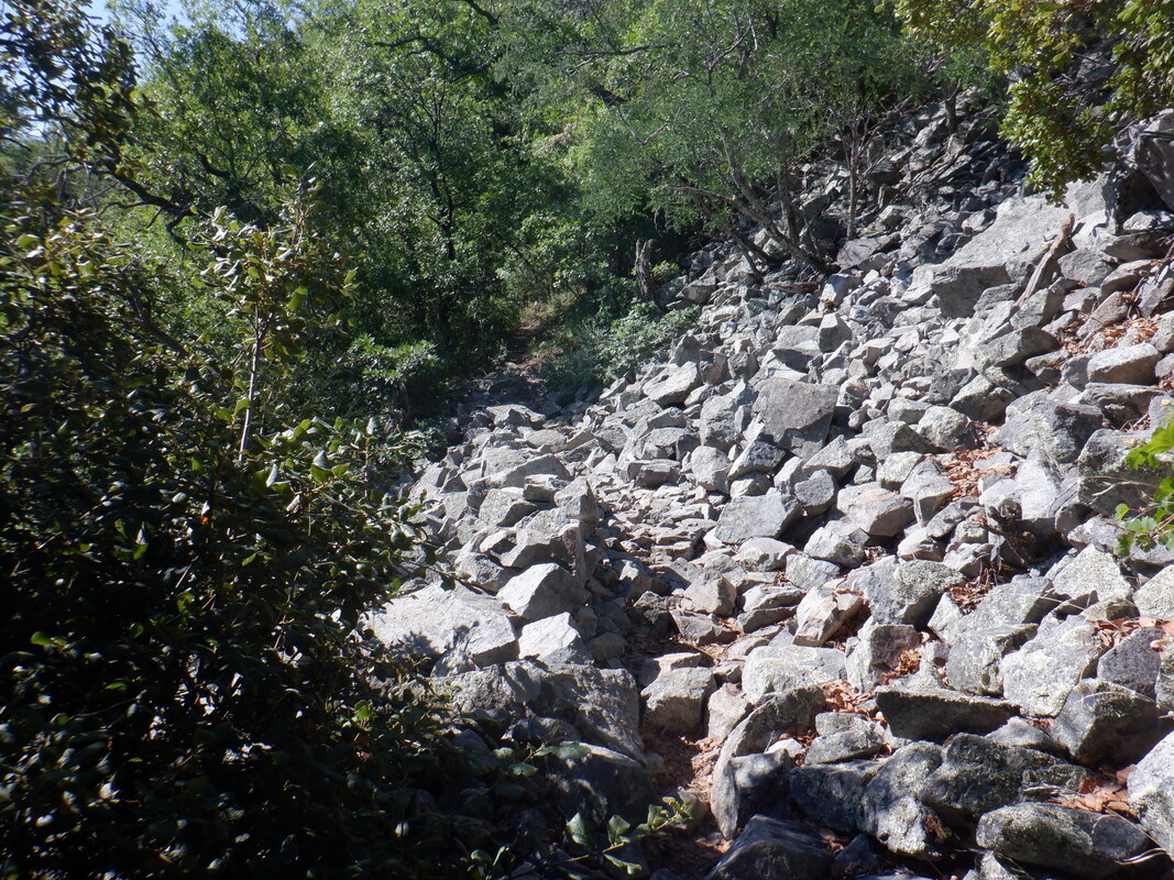 Reaching Aqua Caliente trail, I make a left. The trail is gently rolling, taking one through a few rock falls and lots of..... 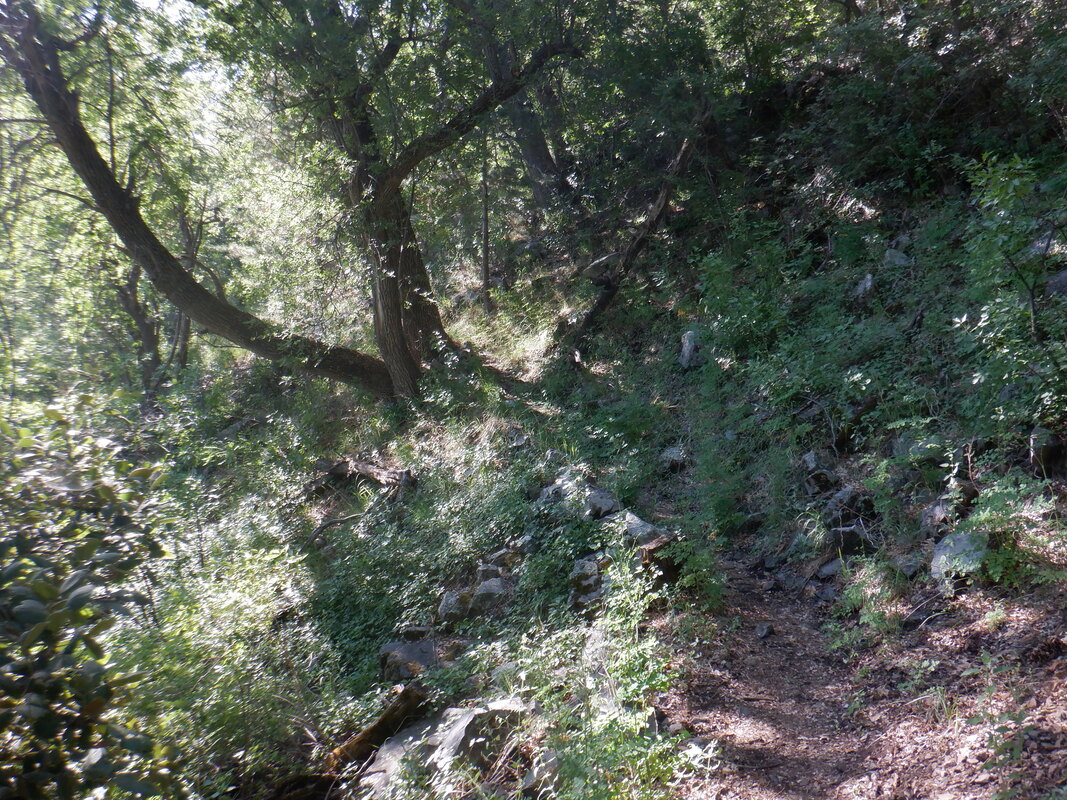 .....shade. I see movement just left of my foot and there is a small snake. How cute. Little whip snake or something but then, it rattles! Yikes!!! Most be in its first year. I bring forth my camera, zoom in and...damn, it disappears into a crevice. I also look around for a parent but see none. 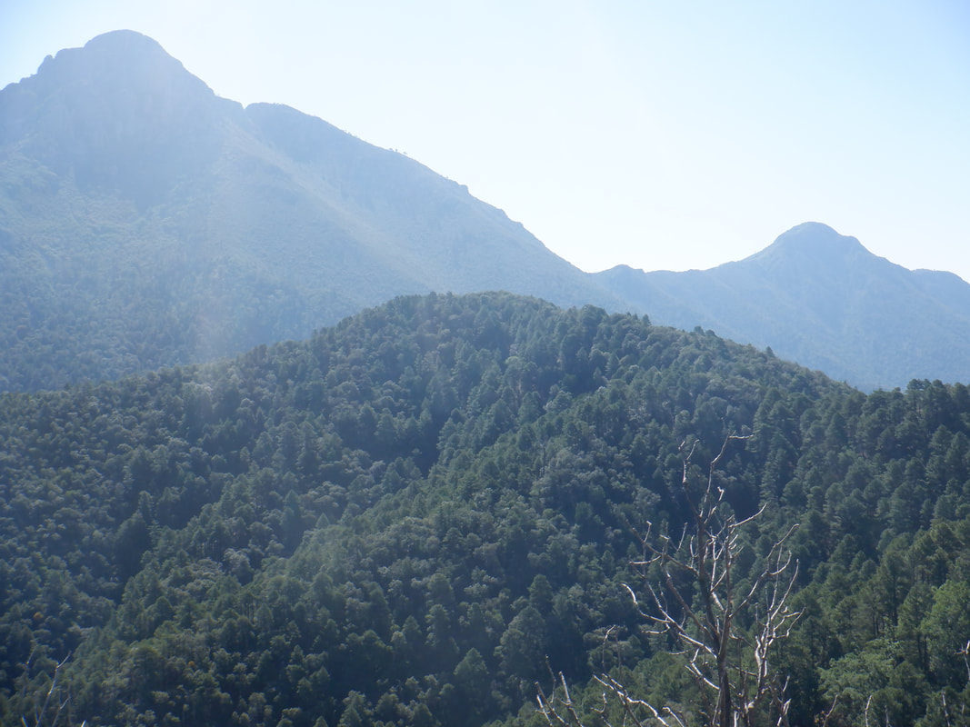 The trail meanders in and out of drainages coming off Mount Hopkins, while headed toward Wrightson on the left, Josephine on the right and that must be Jack Mountain in the center. 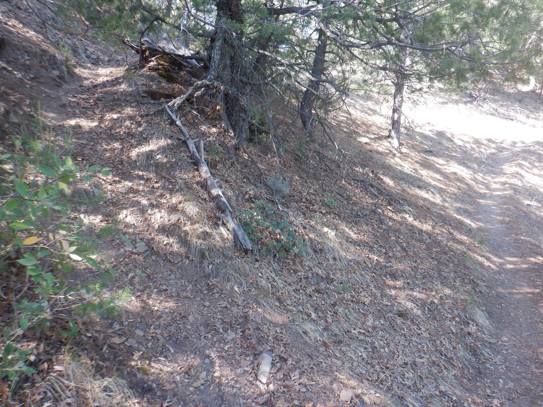 On my right I pass the unsigned trail that takes one up to Mount Hopkins Road. Soon I find the point where the Carrie Nation trail emerges from my left. I 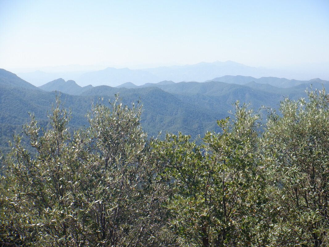 ....continue to enjoy the views while..... 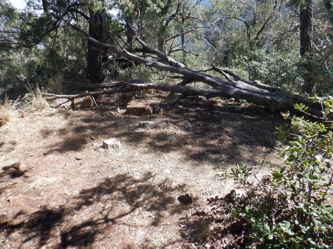 ....looking for what appears to be a viable campsite about .4 from the CN trail. The vague campsite is on my left so turning, I see a very faint trail heading up. 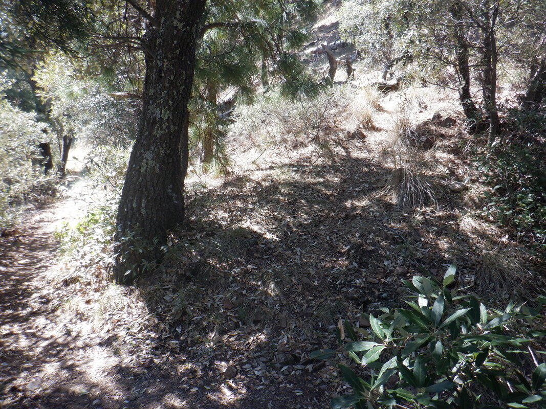 I had read a hike report that describes great views at the top but the report was several years old and the holly and other plants grow vigorously so I shall see. 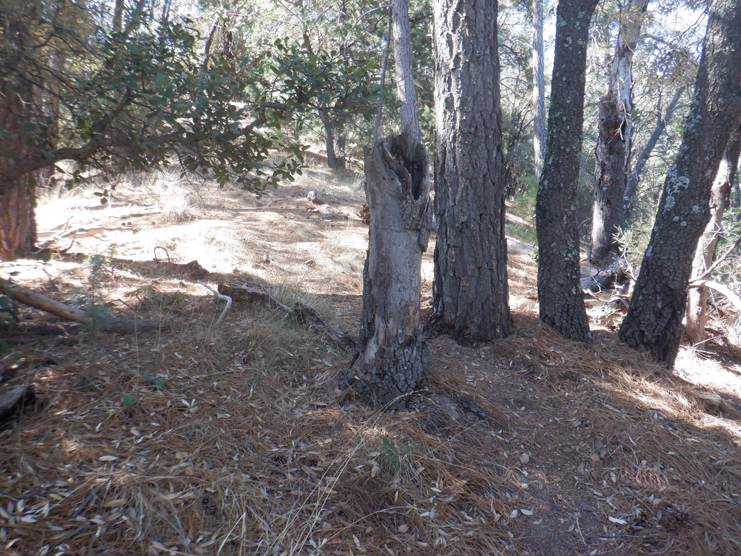 The trail to the top is relatively short at only about .15 miles and not worn in so stay alert. 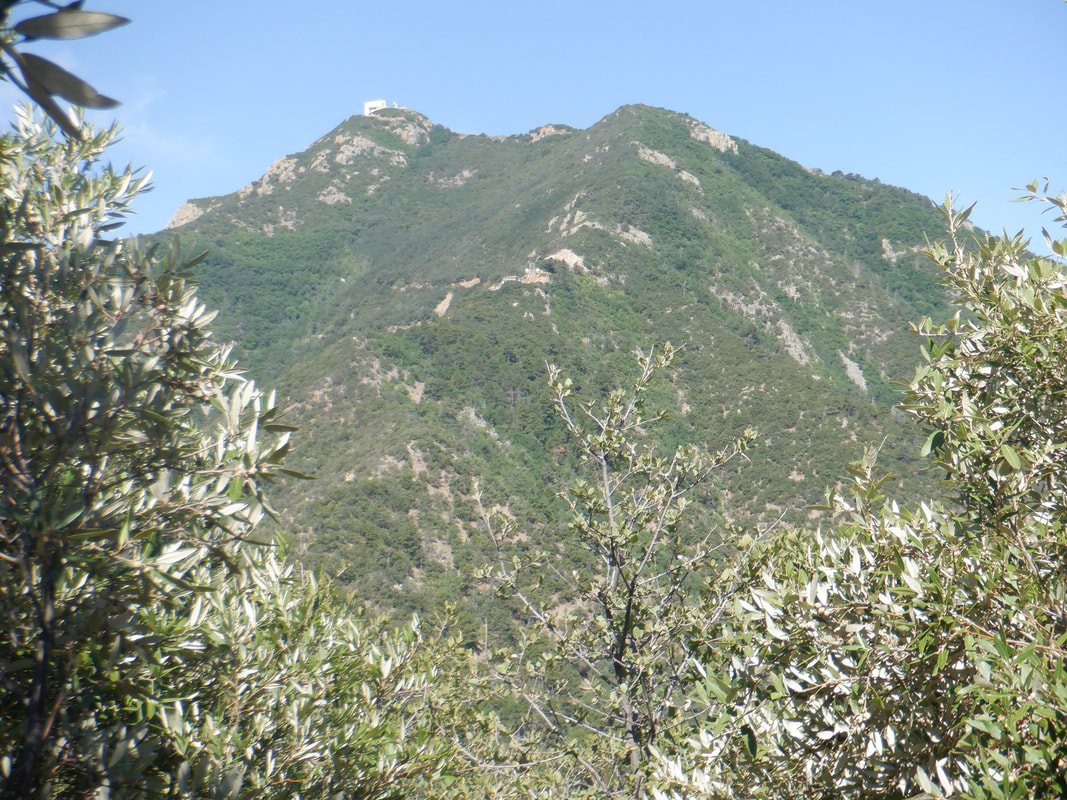 At the top there is a couple of cairns and most of the view is blocked but I found this opening for Mount Hopkins, that's about it. I descend to the Aqua Caliente trail, make a left, find the Carrie Nation trail and.... 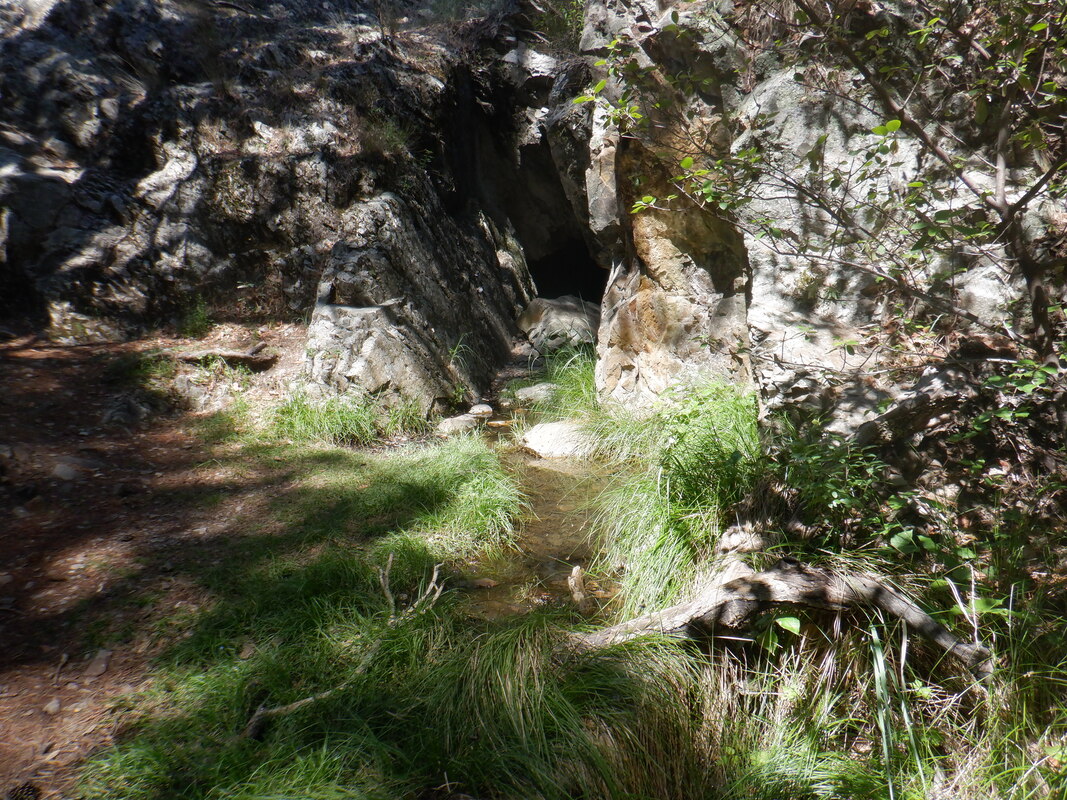 ....descend that, passing another mine on my way to the parking lot. I finish with 6 miles and 2100' of climbing. The entire hike looked like this: 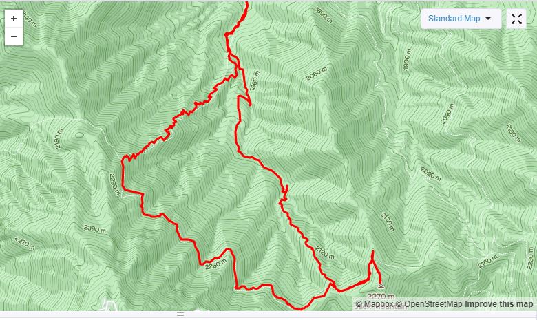 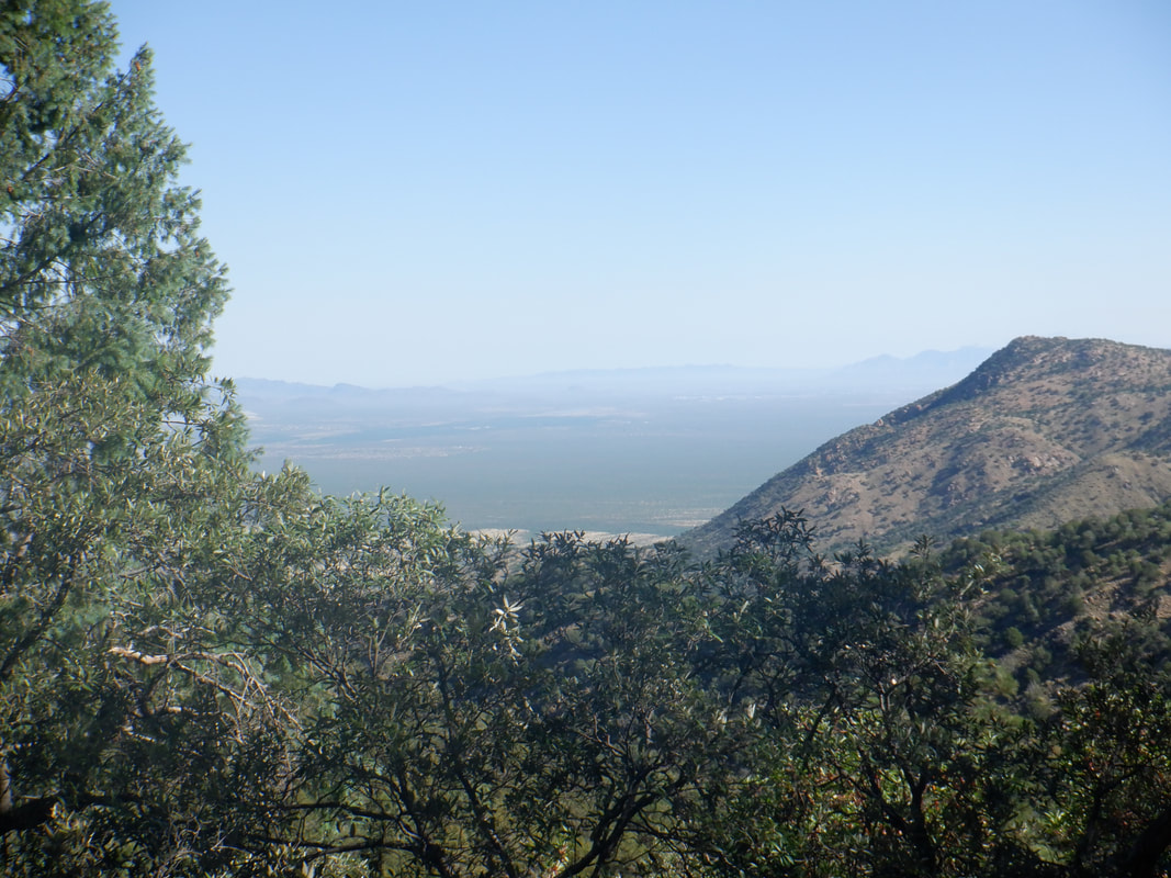 It's hot in the valley but cool in the Santa Ritas so I head to Madera Canyon and begin hiking on the Old Baldy Trail. 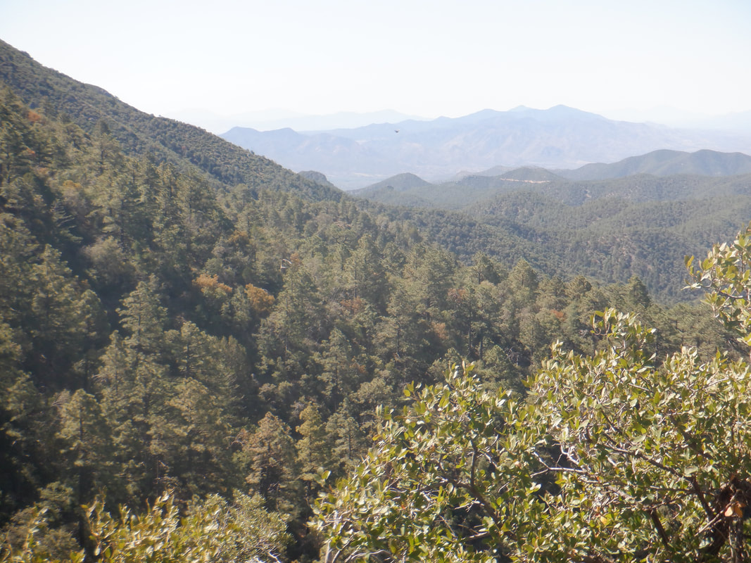 The parking lot was fairly full but I encounter few people as I climb higher, headed towards.... 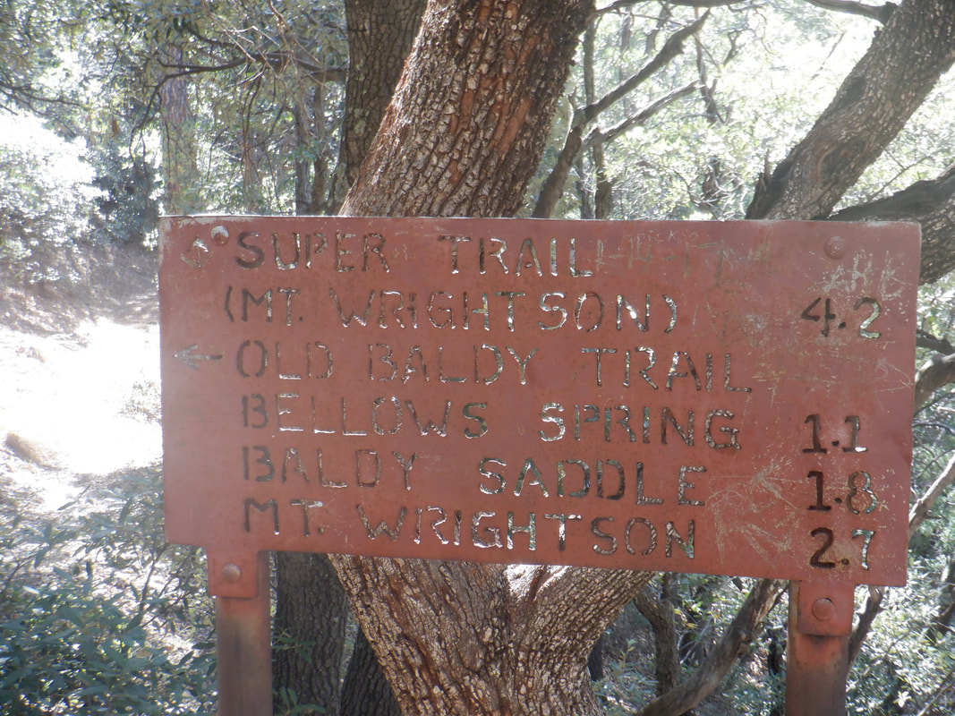 ....Josephine Saddle. It took me under an hour to climb the 2.5 mile, 13% grade segment and well short of my PR but that's ok as I was not pushing the pace. Usually, I continue on Baldy but this time, I jump on the Super Trail which goes counterclockwise around Mount Wrightson. It is longer and not as steep as Baldy, both converging on Baldy Saddle. I however.... 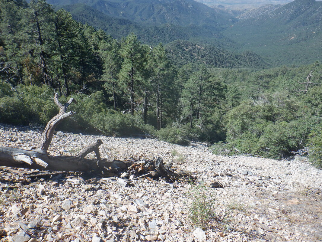 ....am not going to Baldy Saddle, below Wrightson, but instead to Riley Saddle. I cross several rock falls. 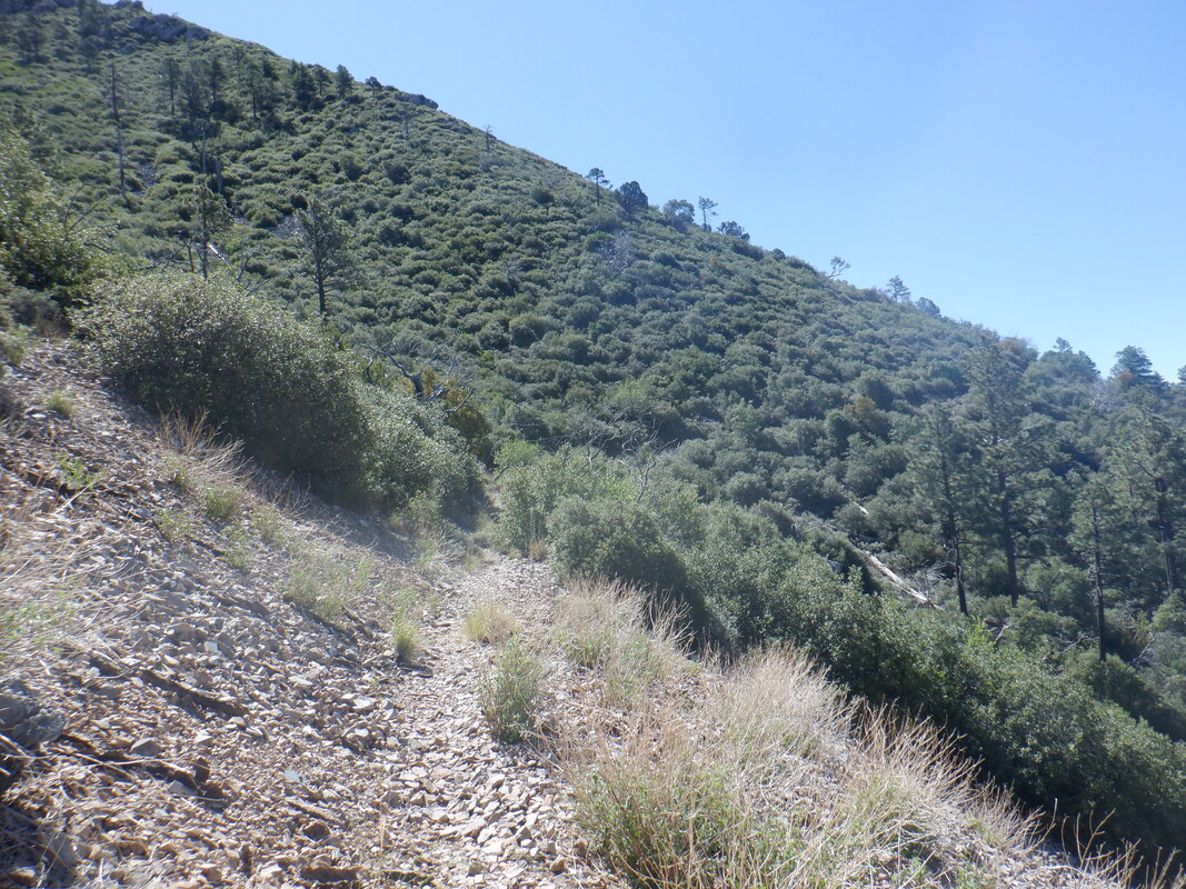 The trail meanders in and out of drainages and I see no evidence of a saddle ahead but eventually, I round a corner and.... 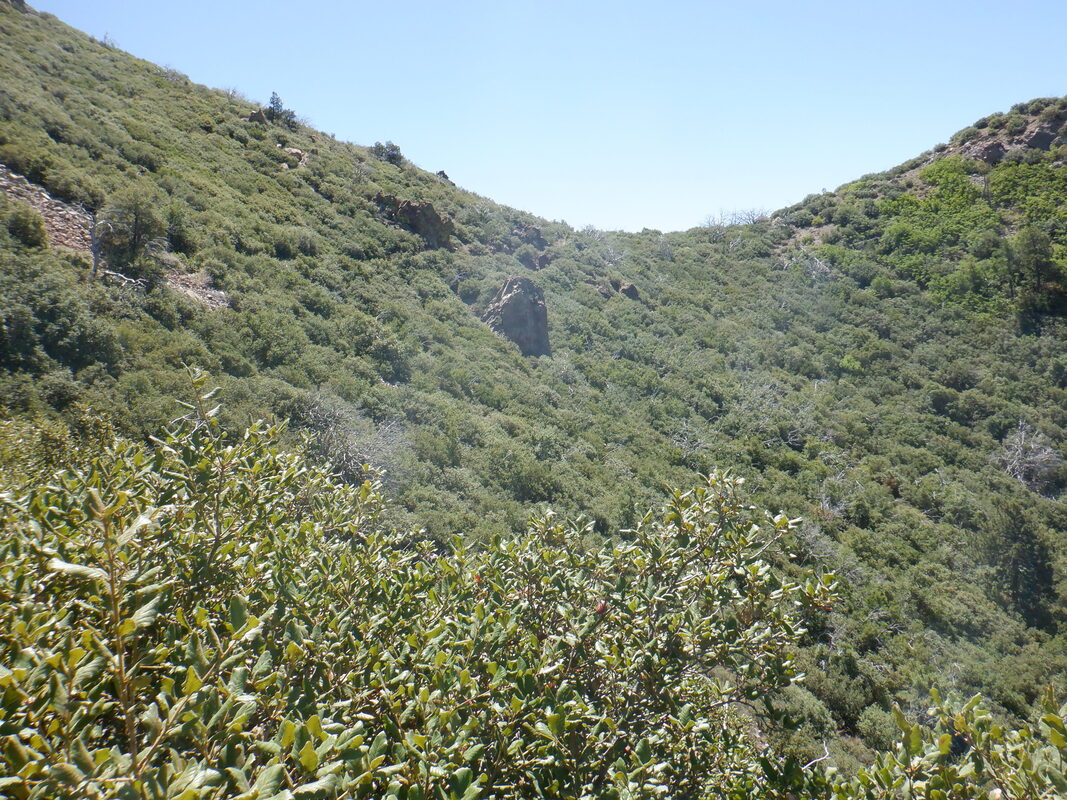 ....aha! That must be it. I pass beneath an outcropping of rock and looking back.... 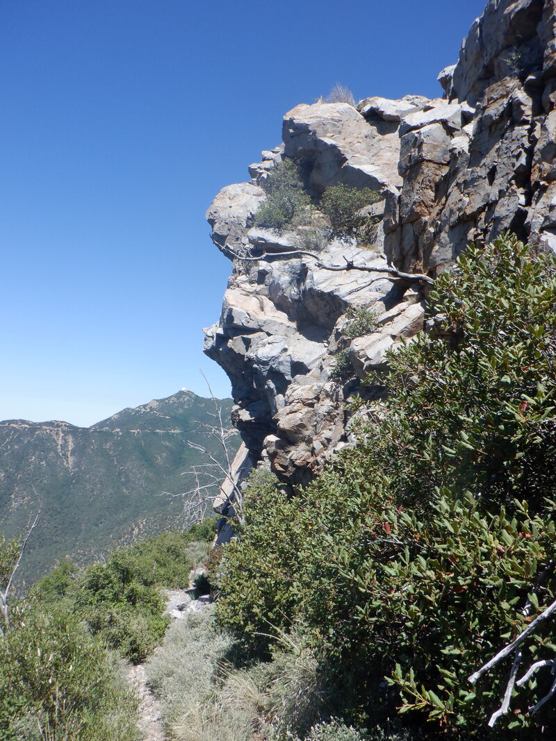 ....eerie. It looks like a person's skull protruding from the rock. Do you see that? Hiking alone, I was armed and prior to reaching this point, I had a round in the chamber. I had a sense of unease and passing below that rock, there was a cave. Ha,ha. I'm not going down without a fight. For my AZ followers, I never carry when in a group but if I hike alone in the wilderness, crazy not to. 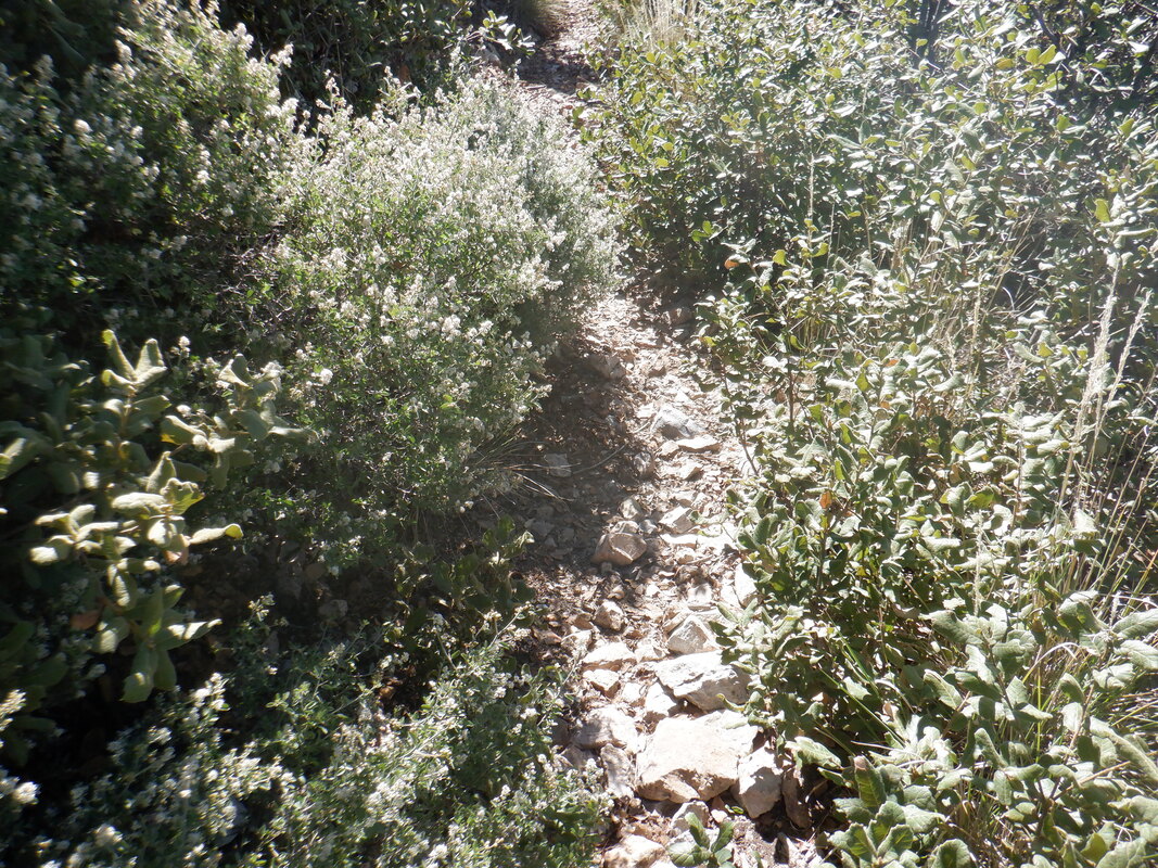 The Super Trail could use some trail clearing. This too makes me nervous when I can't see where my feet are trekking. Not in the winter but summer? 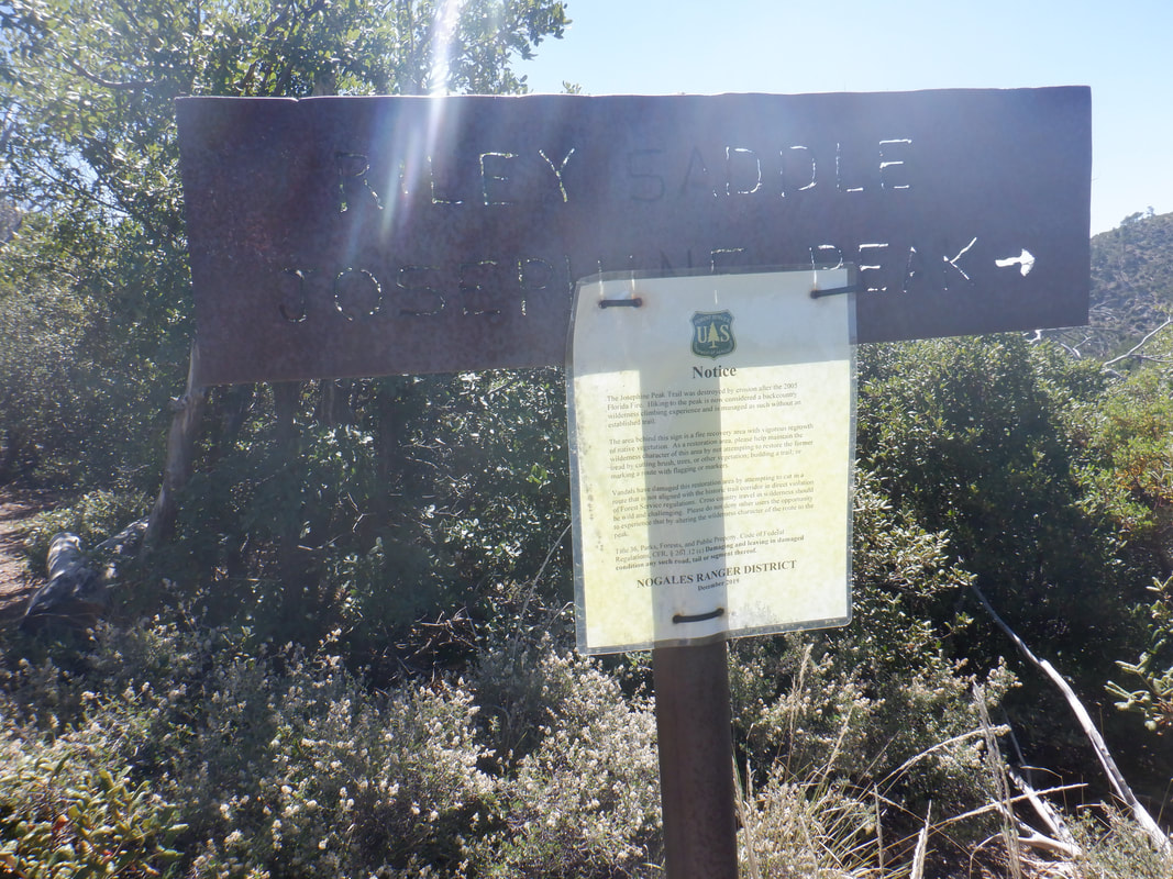 I reach Riley Saddle. There is a notice from the Ranger District about not rebuilding a trail. I peer into the.... 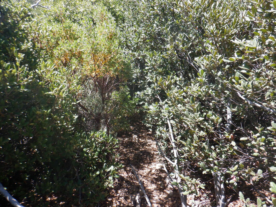 ....thicket. It is .9 miles from here to Josephine Peak but regrowth after a 2003ish fire is thick. I walk a bit farther and...  ...it appears after crawling or pushing through the brush, the balance of the bushwhacking wouldn't be so bad. In the morning, I read a couple of hiking reports and a group talked about encountering a cave with a bear in hibernation, another seeing 3 bears and in a rare case of common sense, decided to be patient and do it again with a hiking buddy. 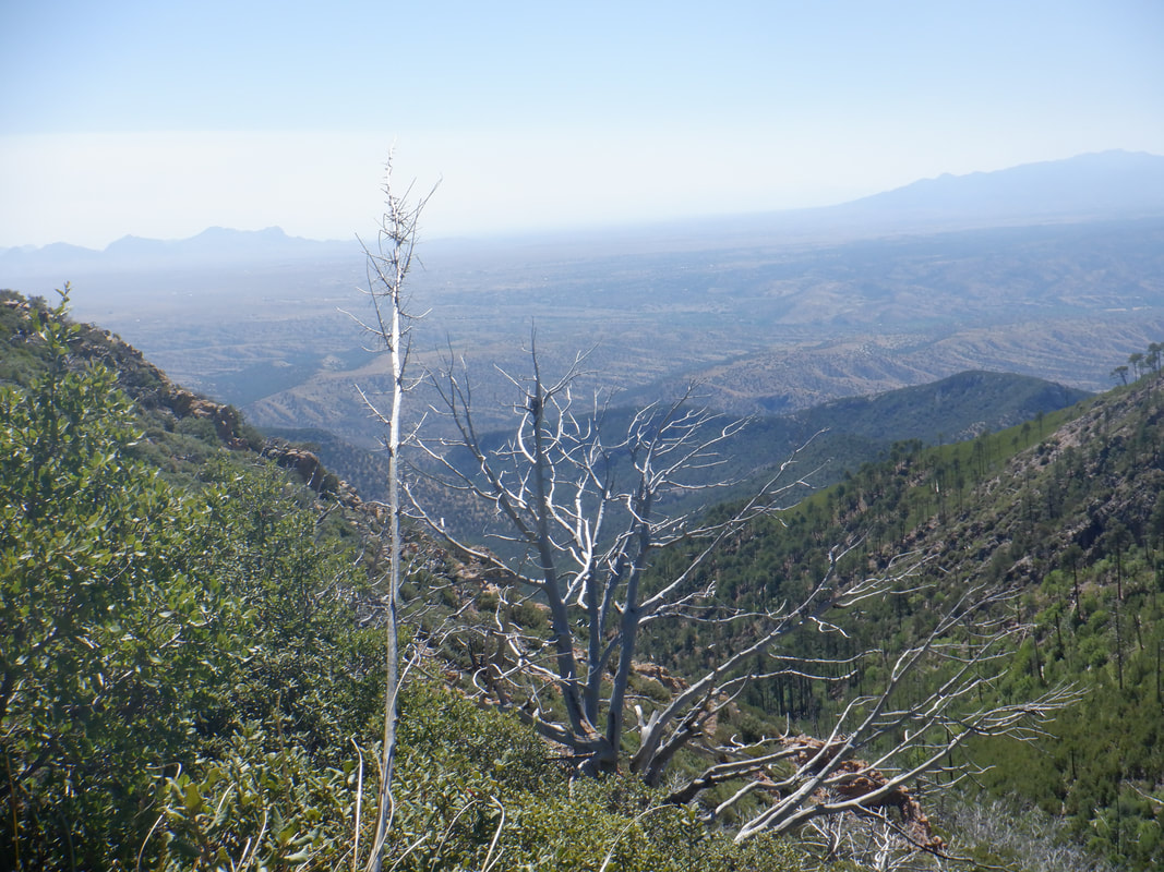 Great views and.... 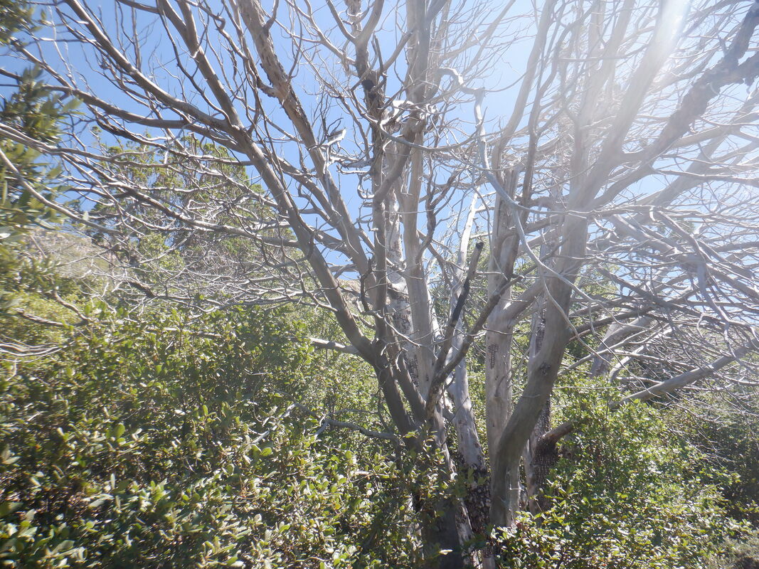 ...this magnificent spread of a long dead tree was good to see. 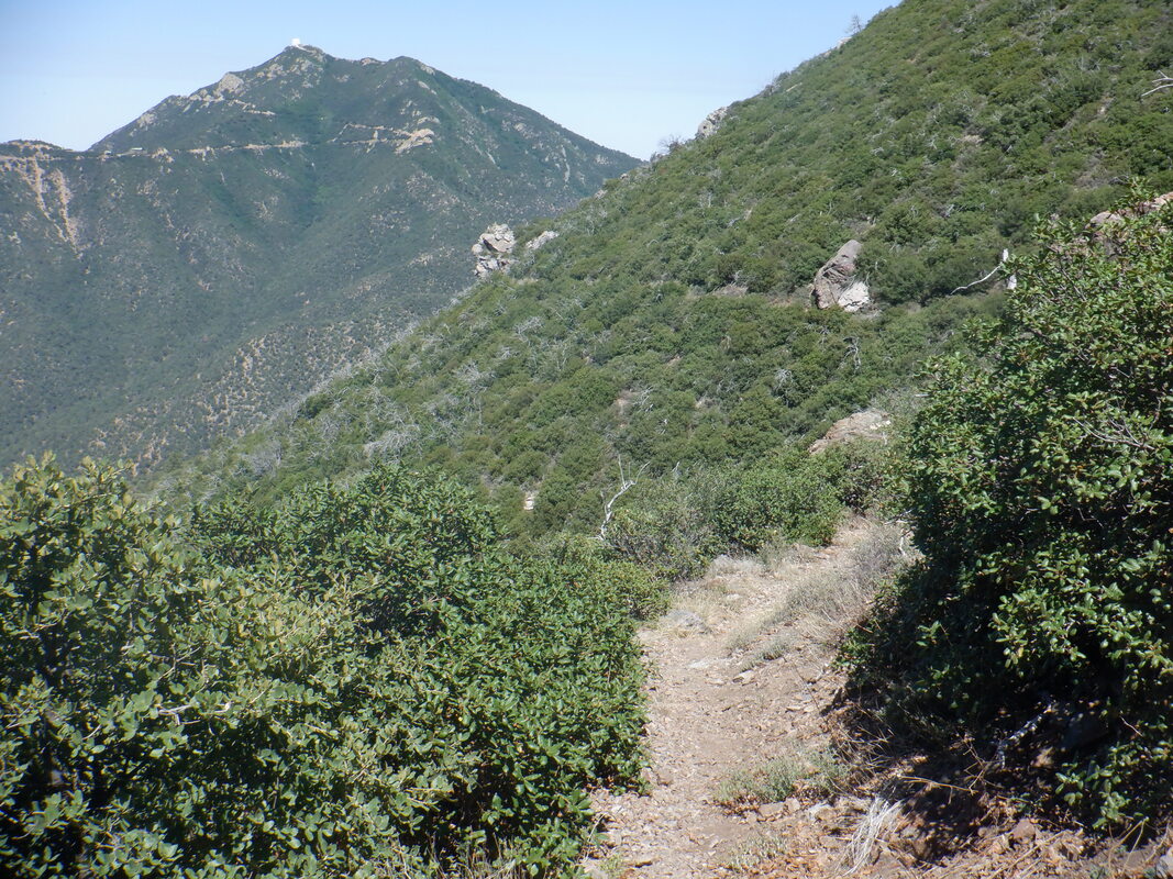 I turned around and began the descent with Mount Hopkins in the background. Finished with 9 miles and 2600' of climbing. I'm making it a habit to store a bottle of fluid in the freezer the evening prior to these hikes. Gosh, does that cold fluid taste great on the return.
 I've not hiked to Wasson via Sandero Trail, which hooks up with the Hugh Norris and Kings Canyon trails, both of which I've done a few times. Wasson has become my go-to fitness hike. I've transitioned off Blackett's Ridge because the descent from that just kills my joints. Otherwise, that is a great hike. 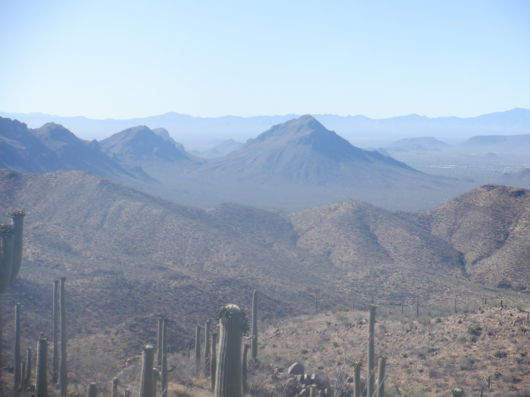 Reaching the intersection with Hugh Norris, I now have good views to the south. The Norris trail is in great shape which contrasts with King Canyon which I don't favor at all. I decided to maintain a good pace with no stops so I could see how well I would do with time.  The tailings from an old mine is distinct in the slopes below.  There is a nice reprieve from the climbing for awhile as the trail is flat to slightly uphill. In the distance though is a final steep section that brings me to.... 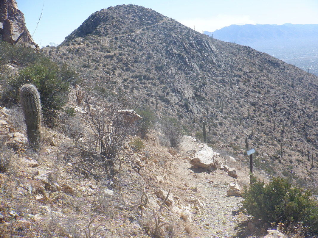 The intersection with King Canyon trail and the final ascent to the peak. 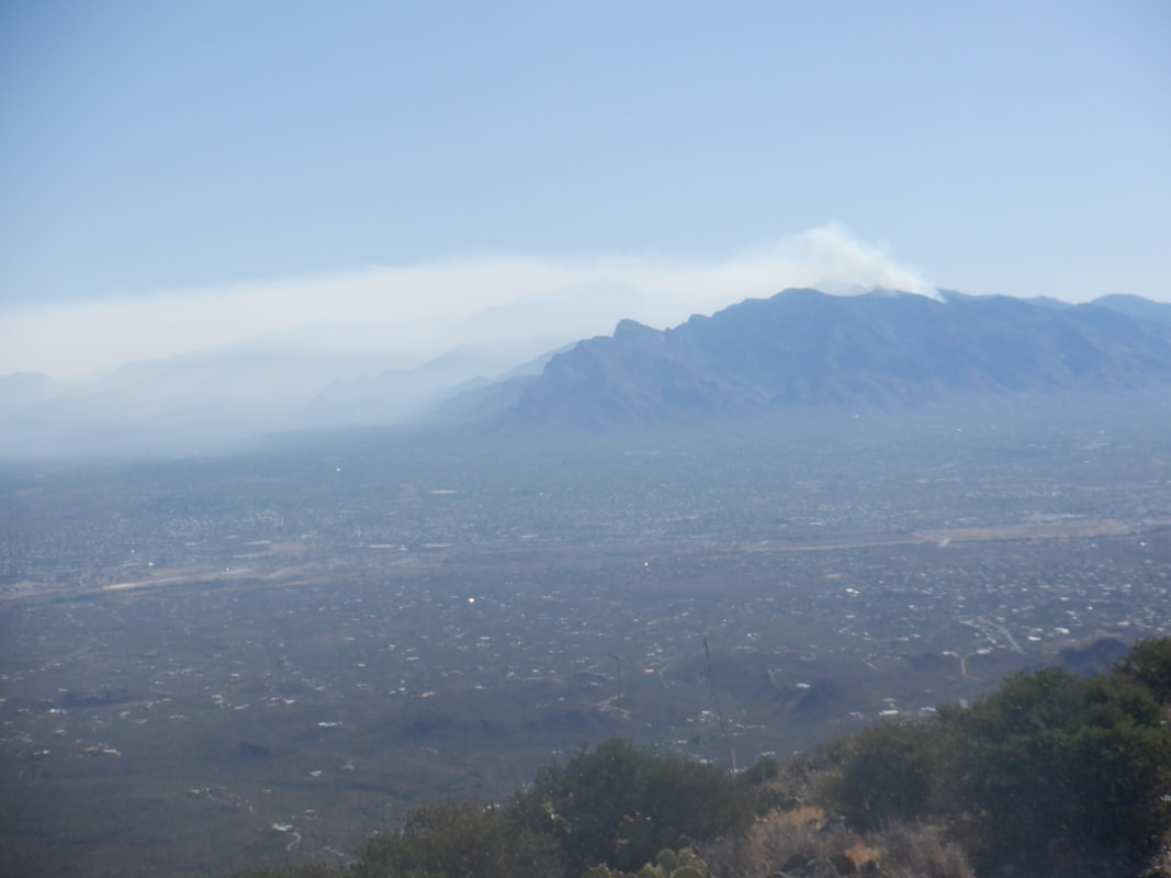 Reaching the peak, the Catalinas kind of look like a squat candle with a wick still burning. I have a nice chat with a couple from Taiwan who are living now in Tucson. Odd that on this Friday there is no one else up here.  I head back down. I think Sandero is the most direct of the 6 routes (actually there is a 7th, seldom hiked route) and starts from a higher elevation so I finish with only 8 miles and 1700' of climbing.  Being a Strava advocate, I couldn't wait to see how I did compared to unknown peers for the full climb to the peak..... 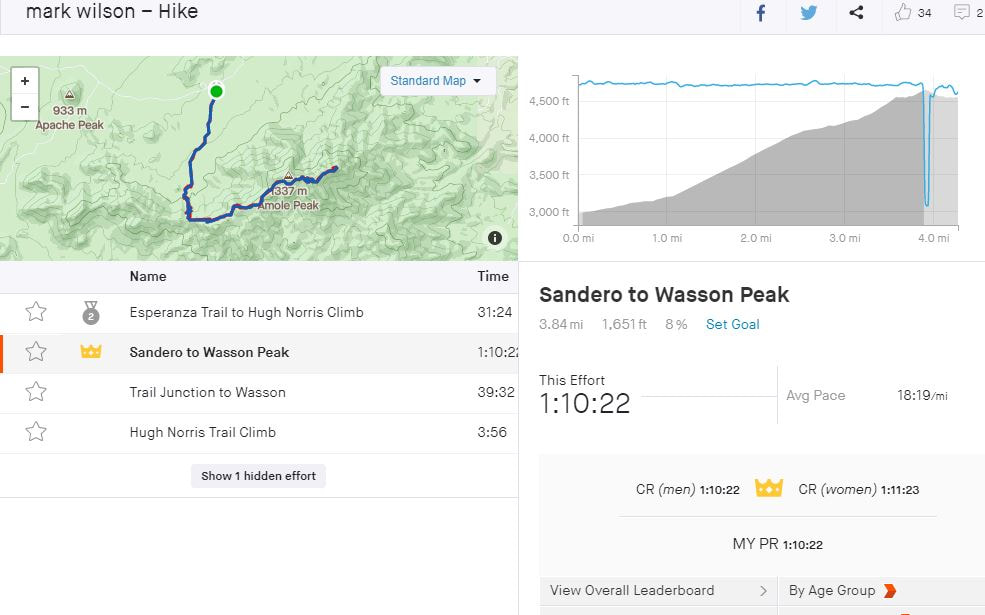 ....yeehaw got the KOM but there are only 74 people who have recorded the hike on Strava so not a lot compared to some climbs. Celebrated a birthday on Saturday, the 21st. Yes, my birthday is the longest day of the year. How bout that? Got in short hikes on Saturday (Hieroglyphic Cave in Tucson Mountains) and Sunday (Sanctuary Cove loop) but then a good one on Monday and more to come on that.
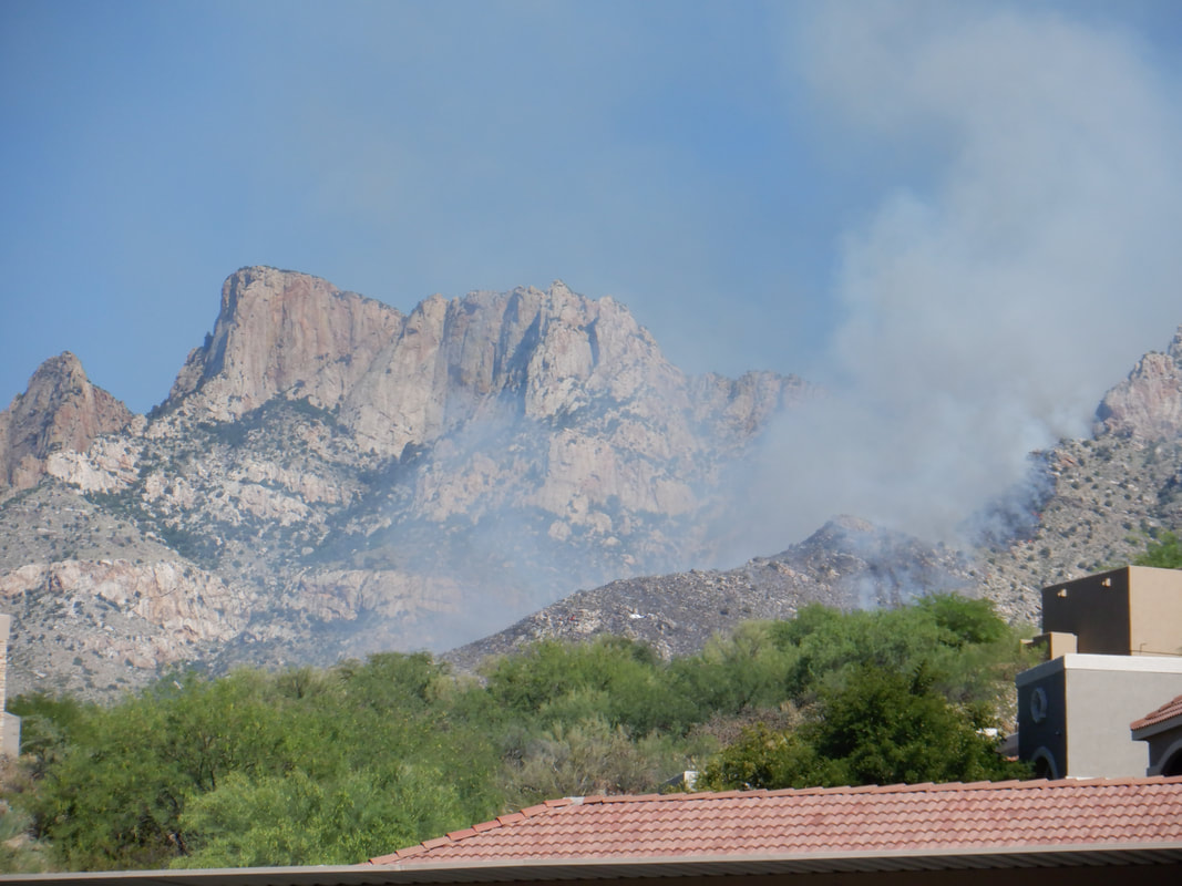
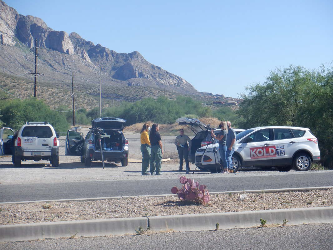 The entrance to Catalina State Park has become a popular location for news crews to gather and give updates. I walked around their van and talked to the deputy standing to the side. Nice woman who chatted with me but nothing of magnitude to report. 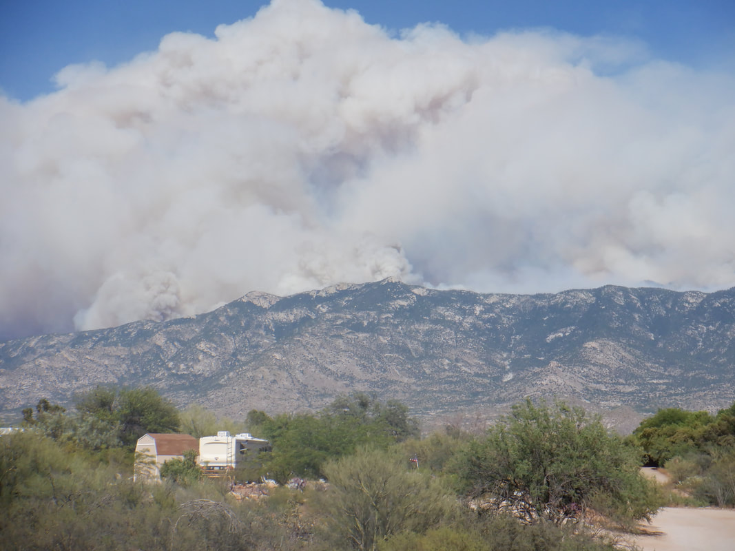 The fire has burned up the southwest facing slopes of Samaniego Ridge. 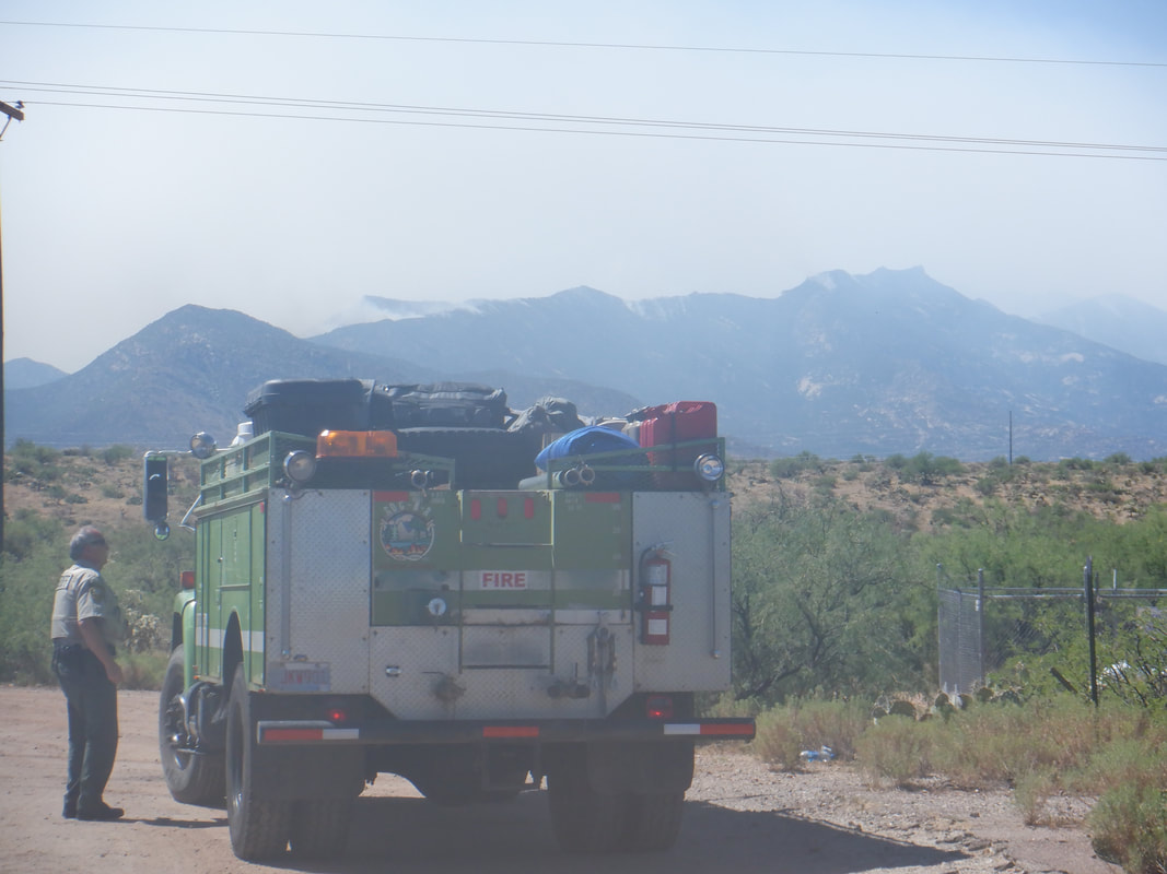 At the Biosphere, a deputy redirects a hotshot crew who are unsure where to go. The area has many crews from all over the southwest, west and even Midwest. 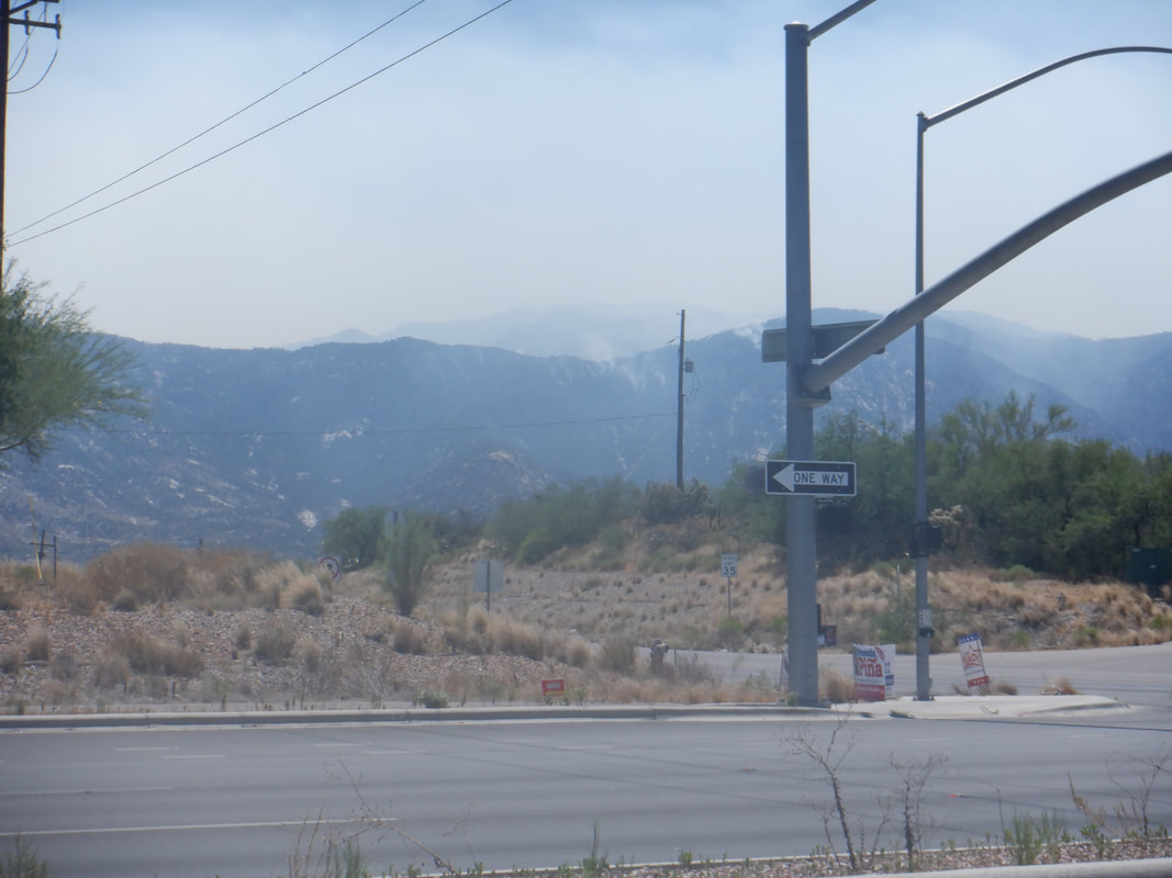 The mountains smolder as now 37,000 acres have been consumed. Efforts have been successful at keeping the fire from communities with the town of Oracle next on the list, likely followed by Sam Manual. So many acres yet likely to be consumed.
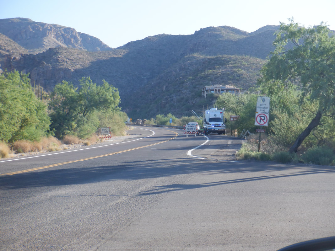 I drove around the mountain to the east side of Tucson, passing the bottom of Catalina Highway where the road to Mount Lemmon/Summerhaven is closed. The community was ordered to evacuate as the fire swept toward it but it appears all the obstacles created in the last couple of days saved the town. The fire is now at over 40,000 acres and sweeping toward the town of Oracle which has been put on alert for evacuation. 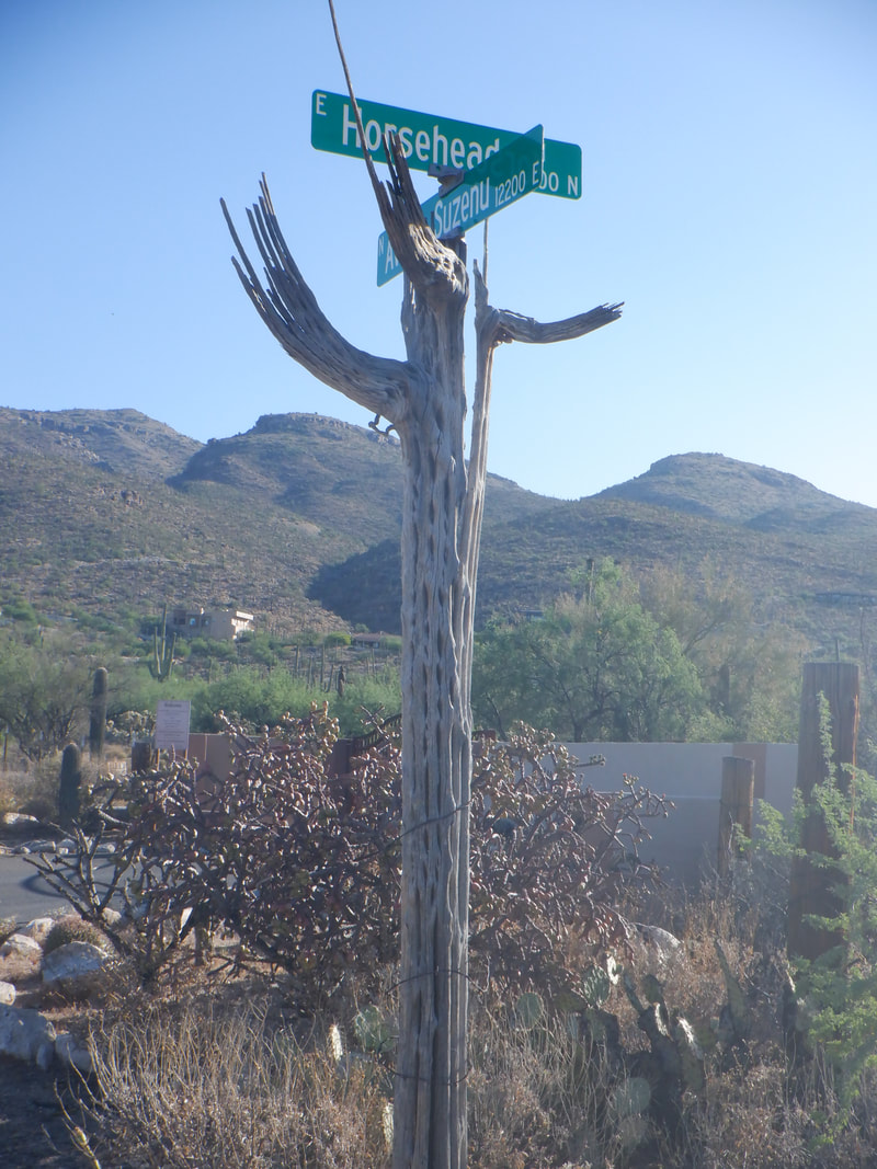 I like this creative street sign where I park. A gated community allows access to the trail but first you.... 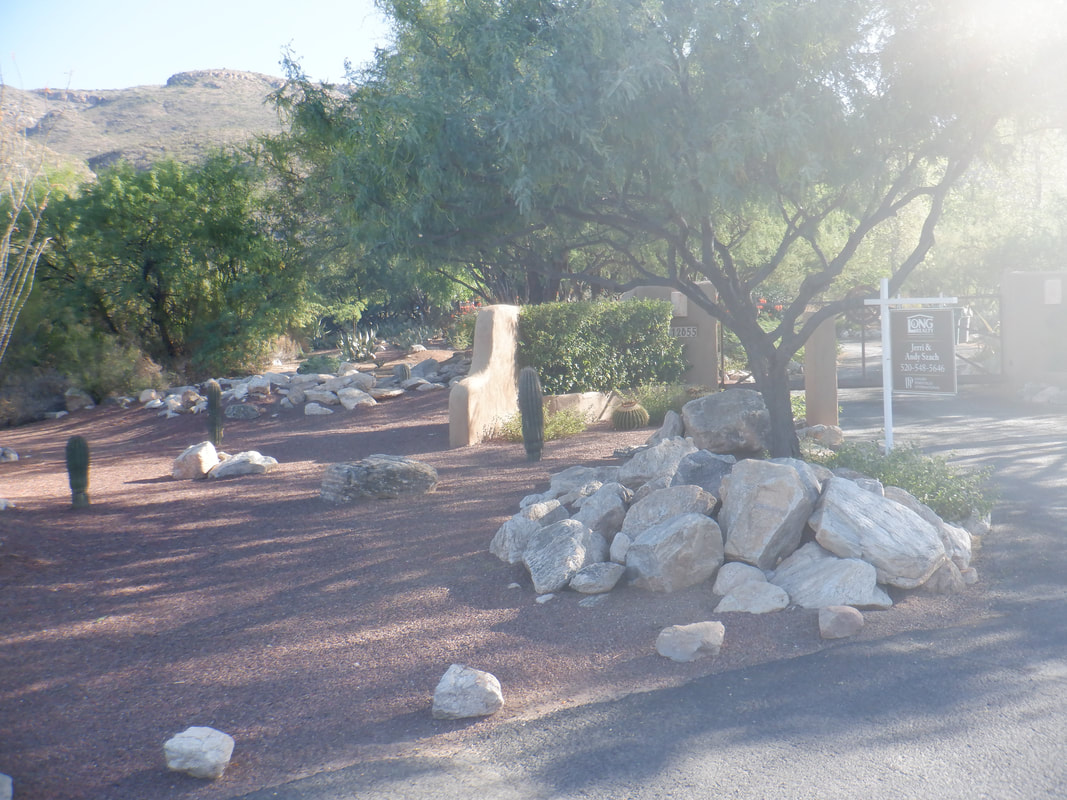 ...walk about a mile past some nice landscaping before..... 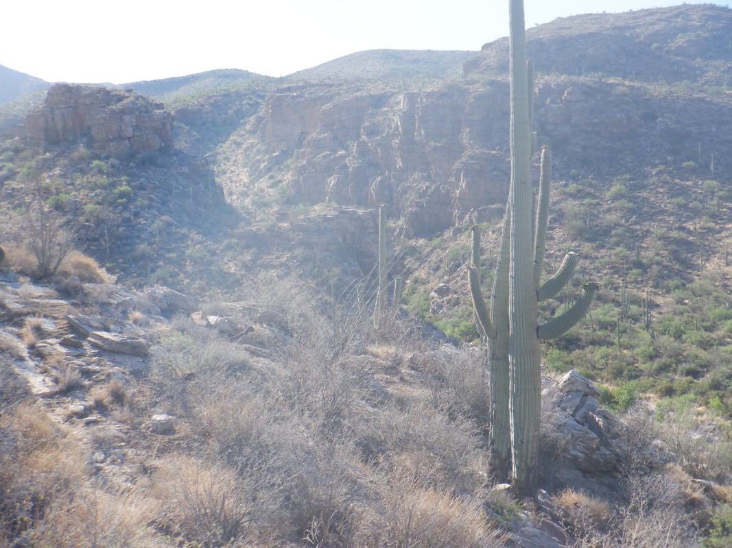 ...beginning the hike on the La Milagrosa Ridge trail. The trail is not steep but rose almost constantly for 3 miles. I bypassed a cairned option for crossing the canyon and returning via a loop on the opposite side of the canyon. 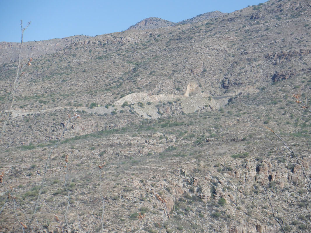 Instead, I just kind of wanted to hike and climb and enjoy the scenery. In the distance is Catalina Highway with a lot of traffic comprised mostly of vehicles going up. Over 400 firefighters had converged to do what they could to protect the structures above, including the observatory, Summerhaven, Iron Door restaurant across from Ski Valley and of course the fire station. 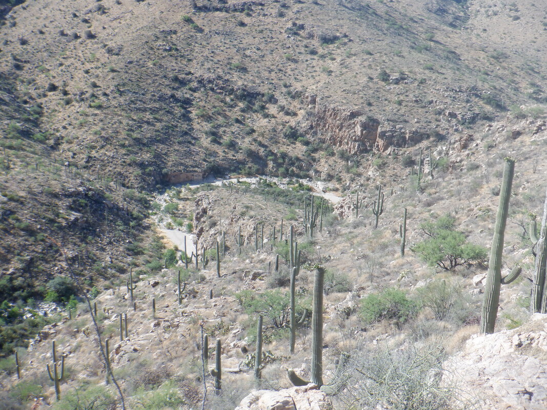 After 3 miles, I began to lose interest. I had a bottle I had left in the freezer overnight but now brought from my pack. Ahhhh, so cold and so delish. 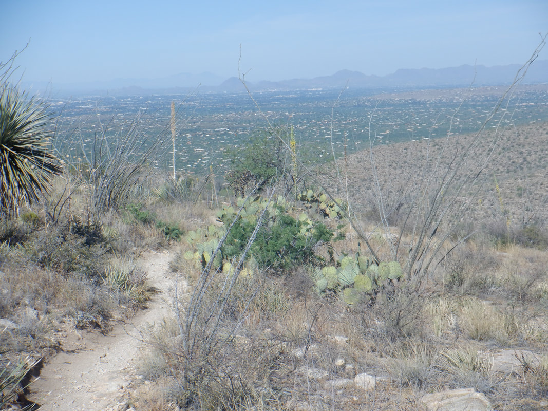 Turning around, the valley views opened as I enjoyed the descent, finishing with 6 miles and 1200' of climbing.
 I rode my bike a few miles north to the town of Catalina where the fire has moved east and north of me. Having originated on the slopes below Pusch Ridge, the fire is moving into the interior of the wilderness and so the flames are not as obvious. At a size of more than 14,000 acres, it is plenty big as it consumes ground that had not had a fire in about 100 years.  Lots of smoke on this morning. Monsoon rains arrived but too far east to be of help. 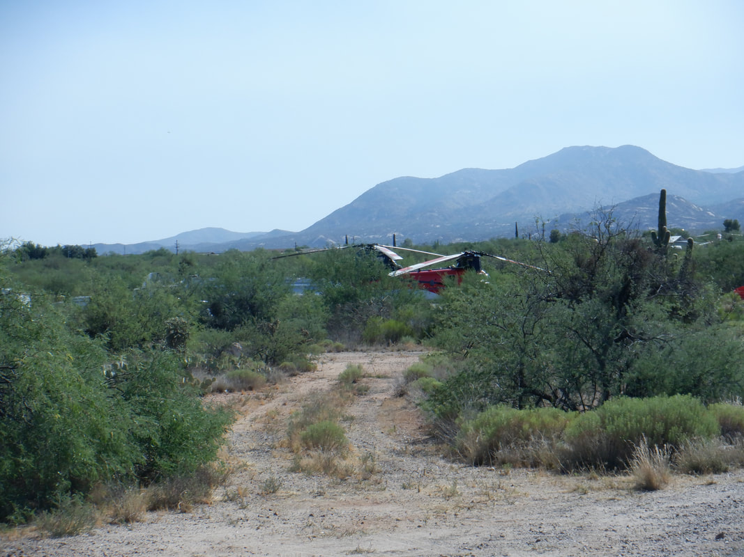 Chinooks and other helicopters parked and waiting for the return of a drone so they know where to spring into action. Ominously, the fire gained Sutherland Ridge which is connected to Mount Lemmon. Now, the residents of Summerhaven have been ordered to evacuate, just 17 years since the devastating Aspen Fire.  For my neck of the woods, it is all clear so glad about that. Finished with 18 miles of riding so not much but more to come.
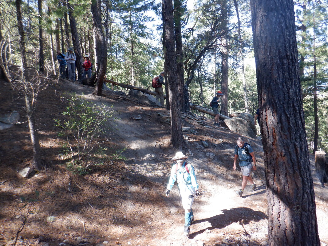
 The Bighorn fire continues, now at 14,000 acres and growing. More ominously though, only 5 miles from the town of Summerhaven close to the top of Mount Lemmon. In 2003, the Aspen Fire burned most of the town and there are many dead trees standing or falling that would provide excellent fuel. Lot of work going on up there. Meantime….. 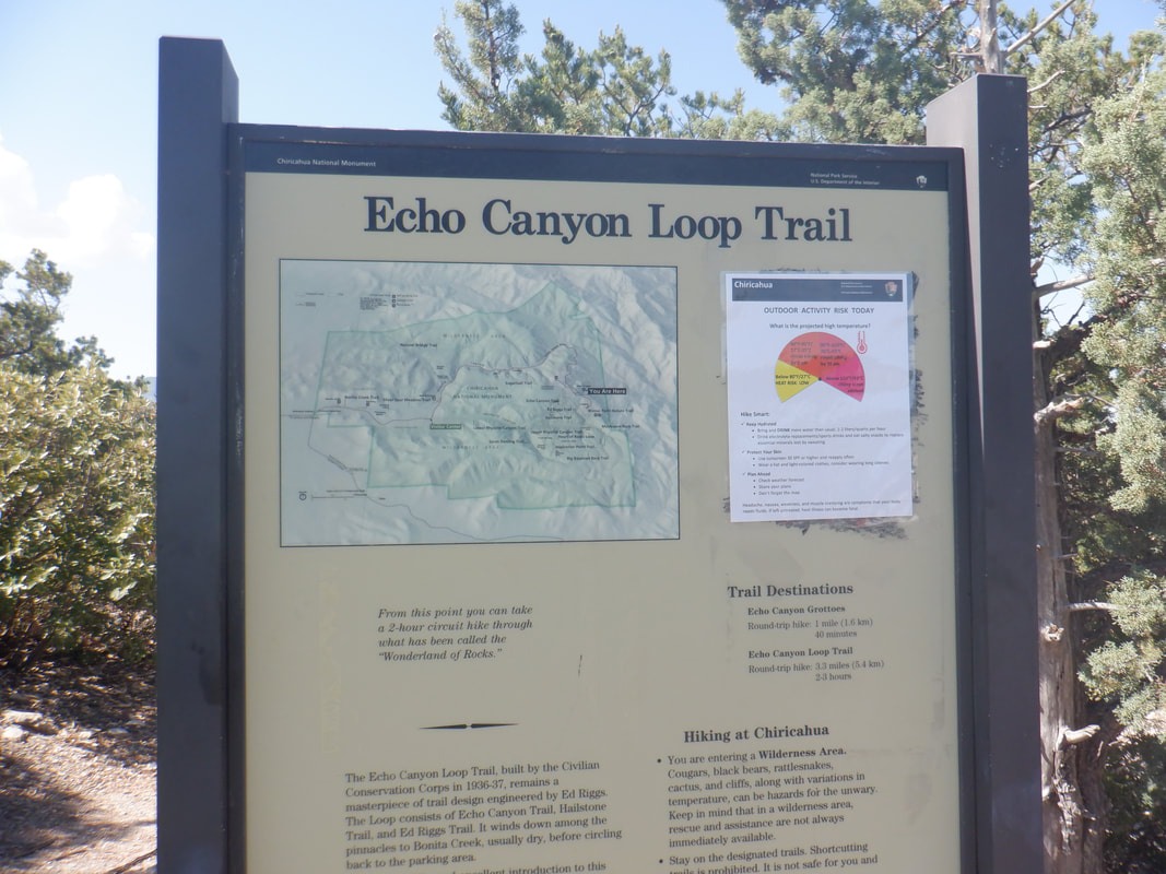 …..many other places to hike so today we are at Chiricahua National Monument, about a 2 hour drive southeast of Tucson. The Meetup group, "Oro Valley Outdoor Fun" scheduled yet another good hike. Other hiking groups (other than the superlative "Arizona Strong Hikers") are mostly dormant, still. We are doing a combination of trails known as "The Big Loop" which will provide almost 10 miles of hiking fun. 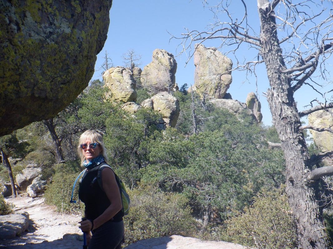 The sights begin early as our group of 14 begins a long descent. Maybe the highlight of the hike is a visit..... 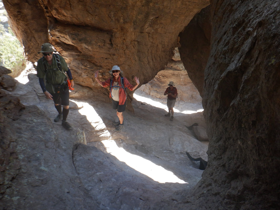 …...to "The Grotto". Kenn, Lilly and David navigate the irregular surface. Really a beautiful spot. 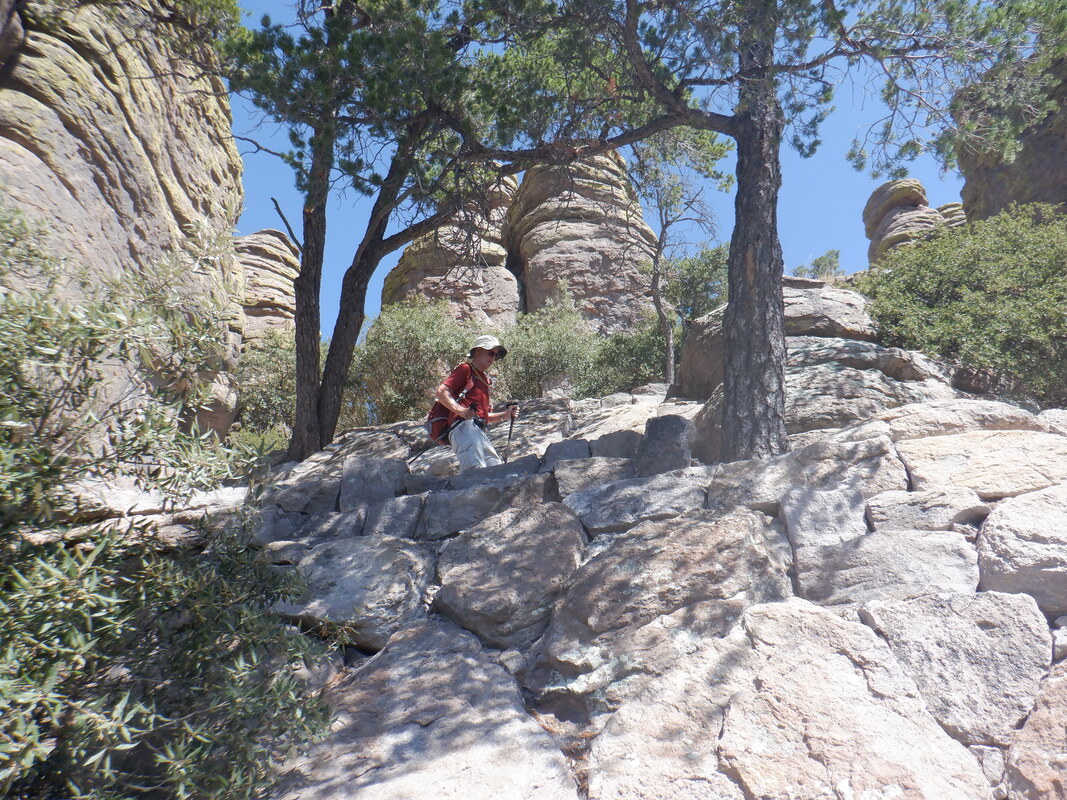 We get back on the trail and continue our descent. It was a long descent and I began dreading the inevitable ascent since two days ago I hiked to Mount Wrightson. 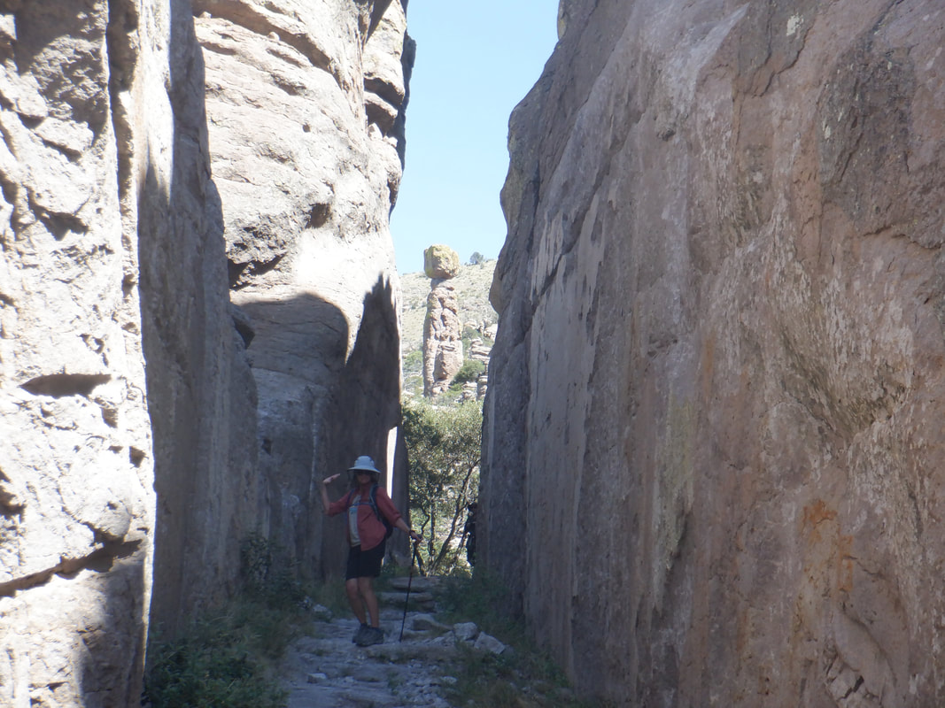 The route took us through and around many amazing rock formations. Note the pillar above the posing hiker. Hundreds of those abound in this park. With all the stops for exploring and picture taking, we had gotten strung out so we paused to regroup. I had brought more then enough fluids for a 9 mile hike but not enough for a 9 hour hike, which was what our pace indicated. The age old question, "Stick with the group that was being held back by the pace of the slowest" or..... 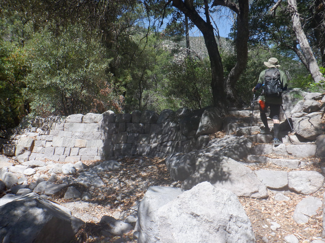 ….Kenn decided for me as he began hiking, followed by Barry, then I slotted in, then Amy and not long after, Kate, from Alaska. She was paying a babysitter by the hour so every extra hour was associated with a cost. We finally reached the bottom of the descent, 2 miles into our hike. 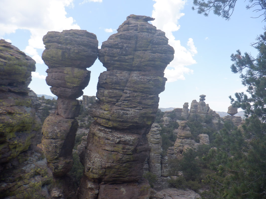 From the low point of our hike, Kenn told me it was 1.6 miles up hill to the entrance of the "Heart of the Rocks" loop. I wanted to get my heart rate up there and see what I could do. Some of you know I am a "Strava" user so yes, I was aware there would be a segment for this and other climbs and hit it hard, later happy with the outcome. Reaching the aforementioned loop, we gawked at all the formations. 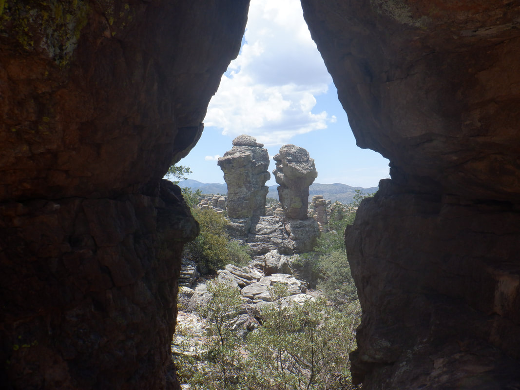 Above, the Punch and Judy formation. Many other named formations were seen including..... 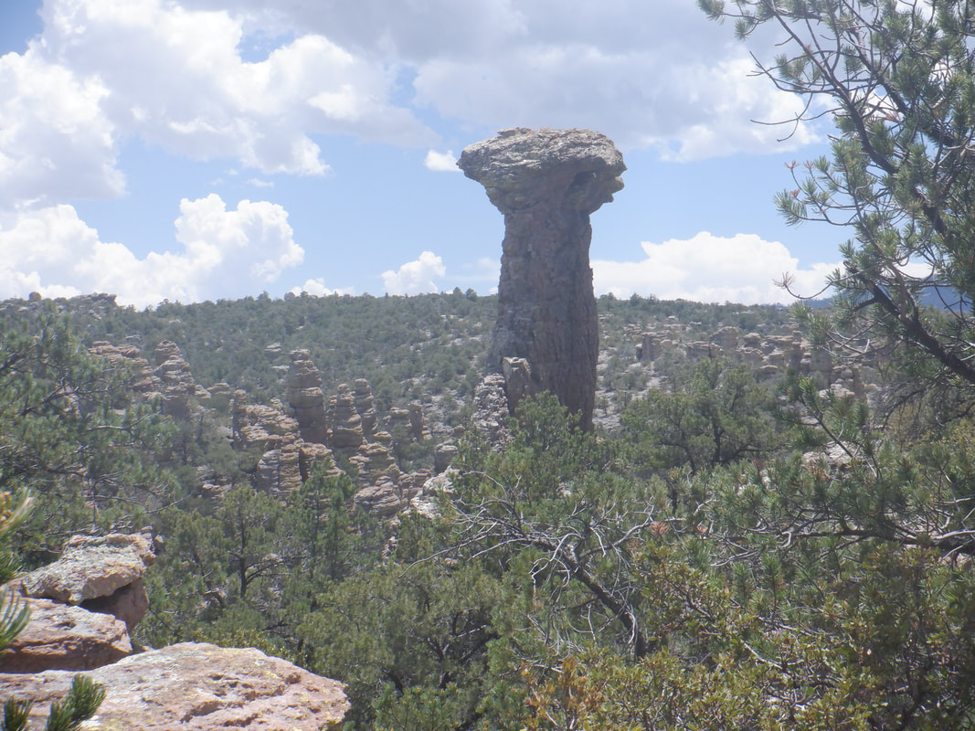 ….Thor's Hammer. Incredible, no? 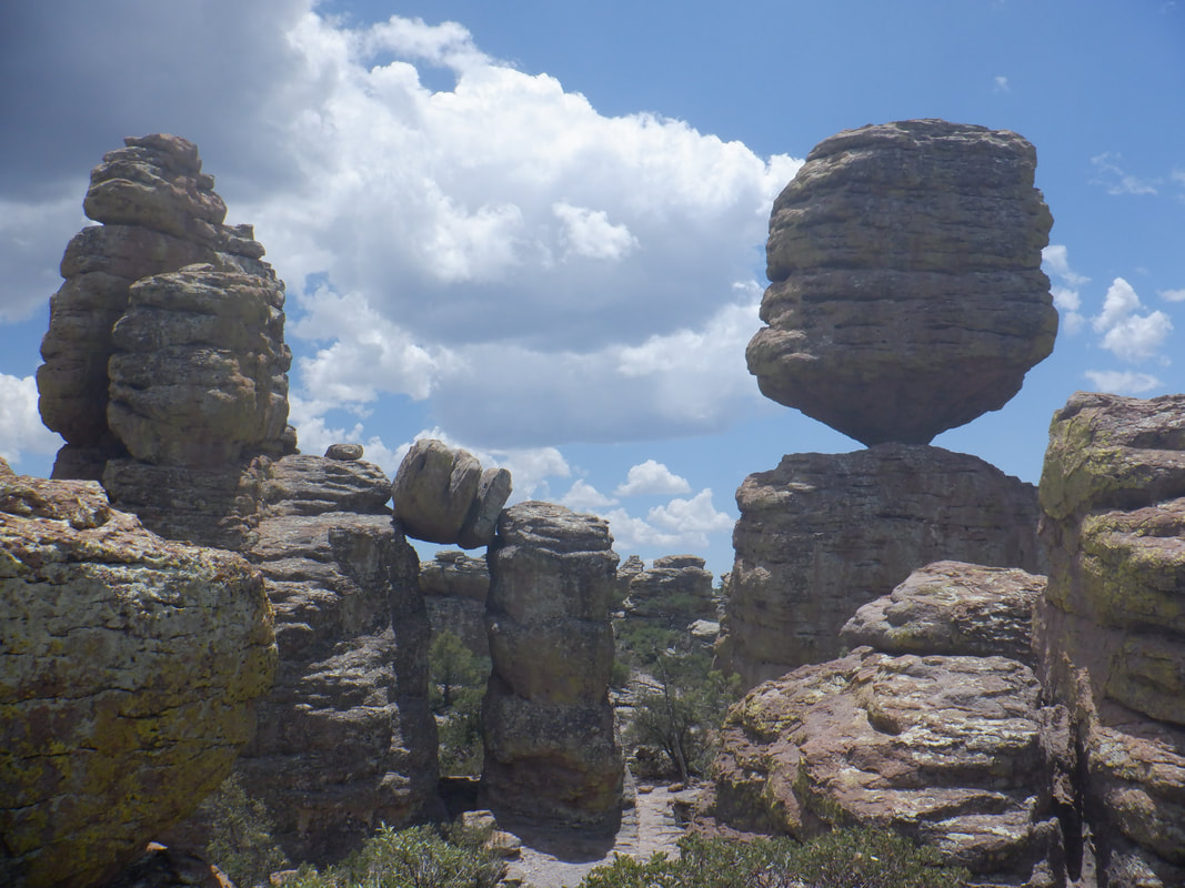 Equally incredible are the many balanced rocks. The above weighs over 1000 tons. 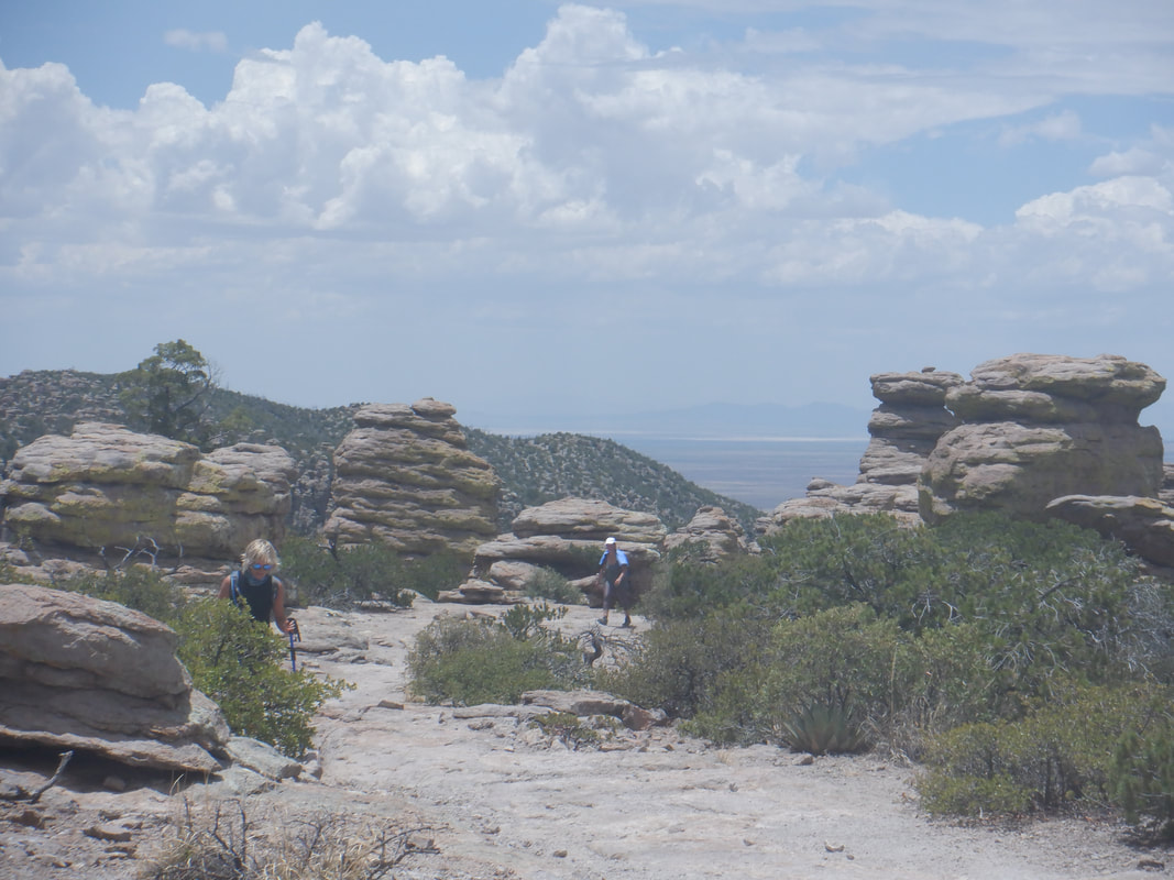 We exit the Loop and begin the long trek to the parking lot. 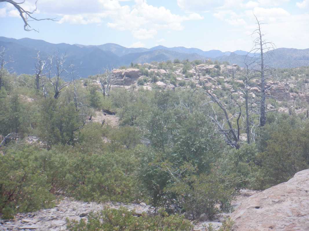 Looking in one direction it is of one type of view and in the other, hundreds of hoodoos and similar rock formations. At this higher elevation (we basically started at the top of a mountain and worked our way down and up) the high was only in the 80's but dang, in the direct sun, the final couple of miles wore us down. 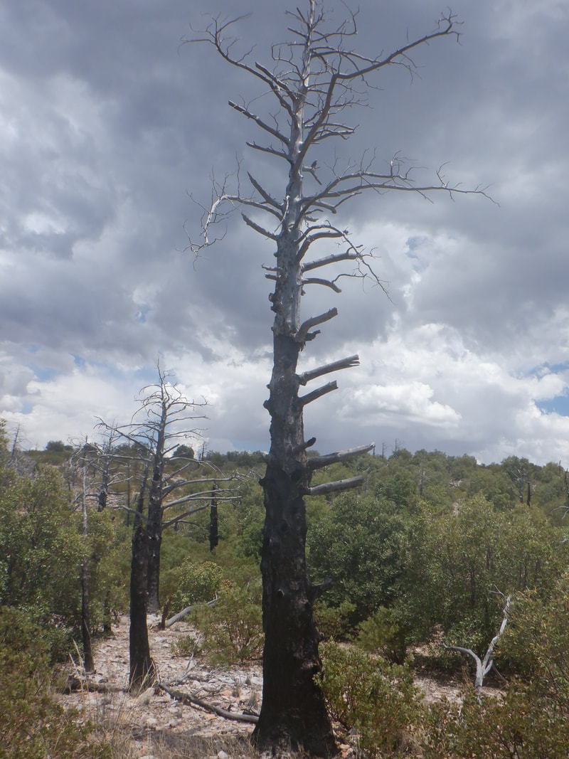 Evidence of a past fire and of building clouds which would produce some rain during our drive home. Finished with 8.8 miles (we declined the option of a 1 mile out/back hike to Inspiration Point) and 2900' of climbing.
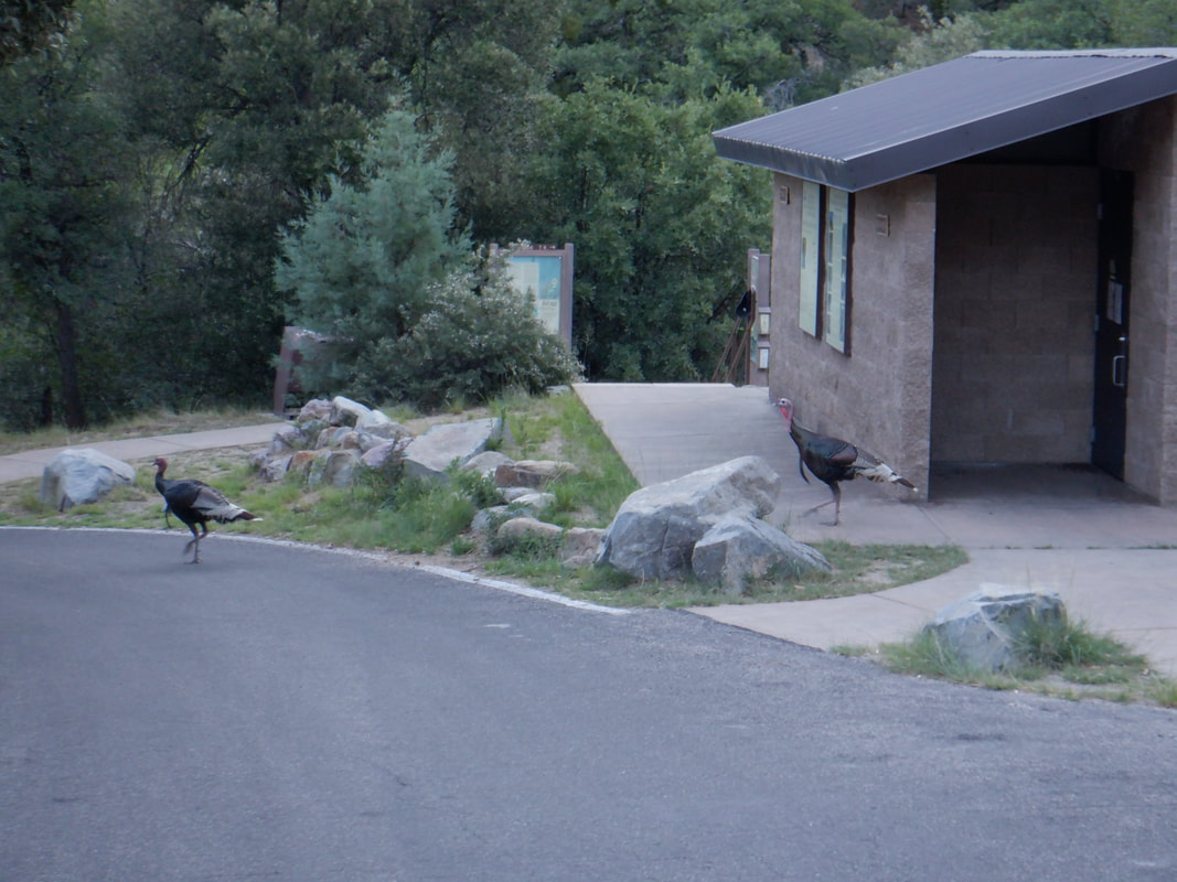 I am the first car in the Madera Canyon parking lot, 5:45 with a very pleasant temperature of 63 degrees. Sharing the lot with me are two turkeys. I was surprised that no one else was yet here but other cars soon arrived. 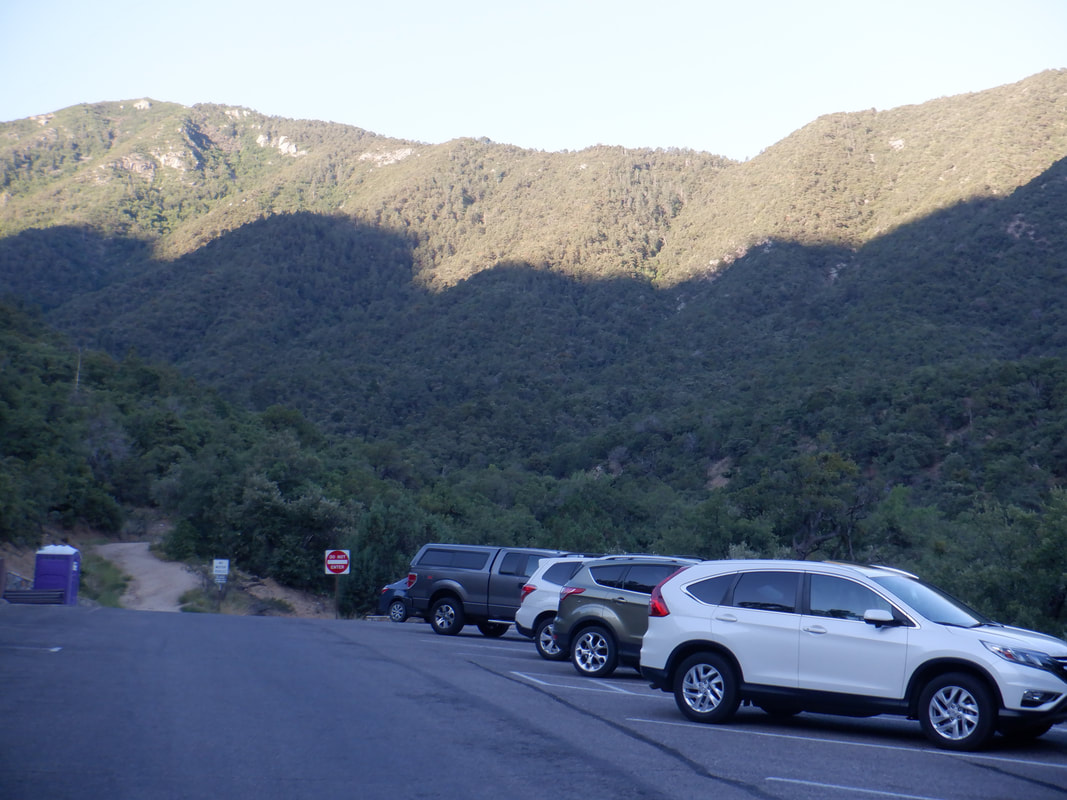 I farted around for a little while as the sun rises from the east as it almost always does and cast a glow on the surrounding east facing hills. 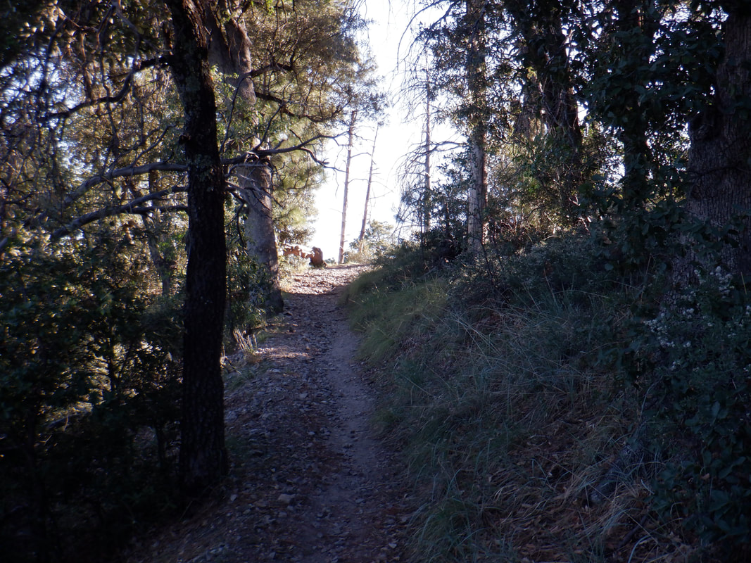 The first 2 miles of my hike was entirely in the shade until I reached this spot but was soon back in the cover. I was walking the "Old Baldy" trail and dreaded the ascent as from memory it was really steep but today, the average grade of 14% to the peak didn't feel that bad. Didn't feel good either!  I reach the Josephine Saddle, take a short break, think about taking the longer (4 miles) and not so steep Super trail to Baldy saddle but go for the shorter (1.8) and steeper continuation of Old Baldy. 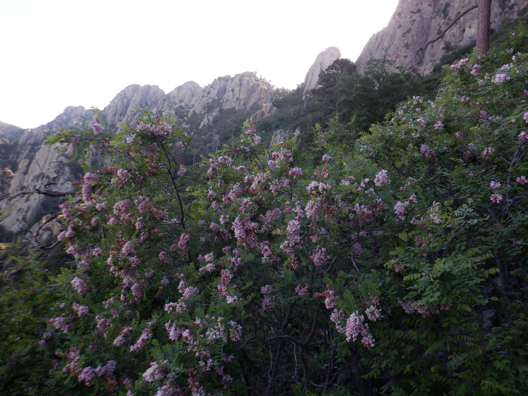 Some beautiful pink and elsewhere, white flowers. The coolness of the morning hung with me as I ascended. 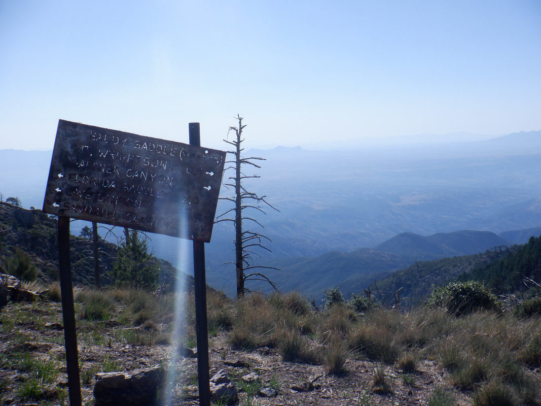 Reaching Baldy saddle, I did a self check. Not good you out of shape fatty patty! OK, that's a bit of a stretch but we are our own worse critic and that's what my self examination revealed. I thought of turning around as I..... 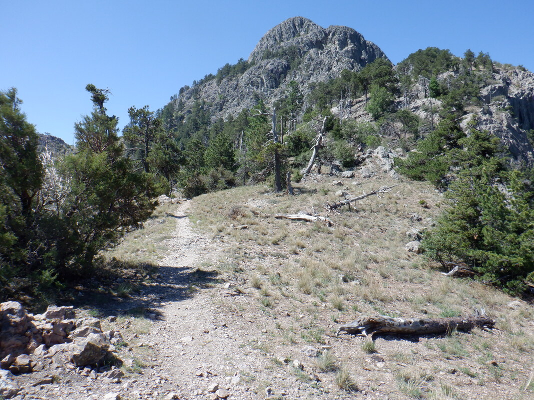 ….peered at the final ascent of .9 miles to Mount Wrightson. 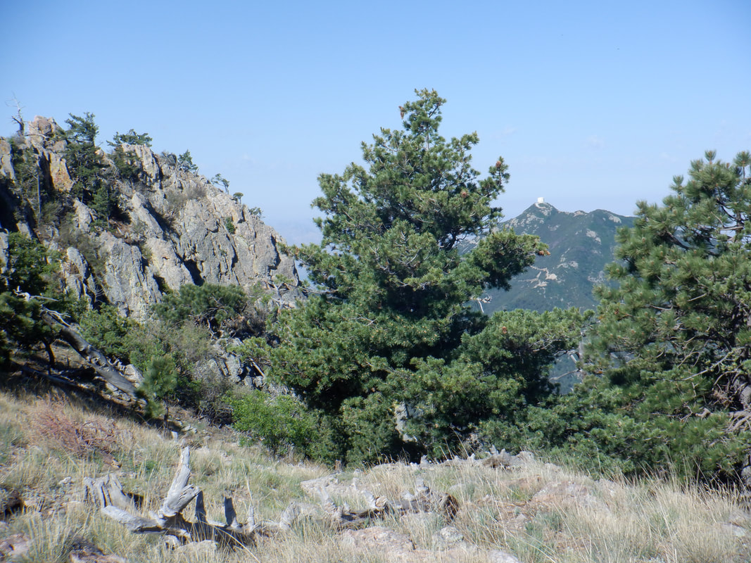 At this point, with 3000' of elevation gain, I was no longer walking, more like a shuffling of the feet unless a protruding rock forced me to lift a foot. Hey! Mount Hopkins in the distance. Next month will be the 1 year anniversary from getting lost and finding the remains of a dead hiker. Maybe I should reprise my role and do the route again but not get lost this time. 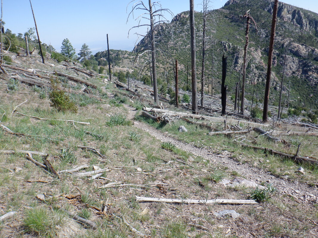 Lot of evidence of a past fire as I look back at the Baldy saddle. 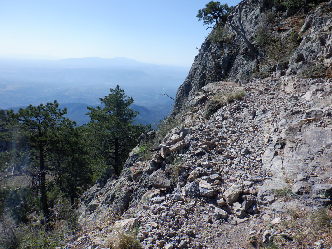 The ascent get a little narrow in a few places but nothing that should cause anyone a problem. Actually, I was aware of my fatigued condition and careful not to trip and go pinwheeling down the slope. 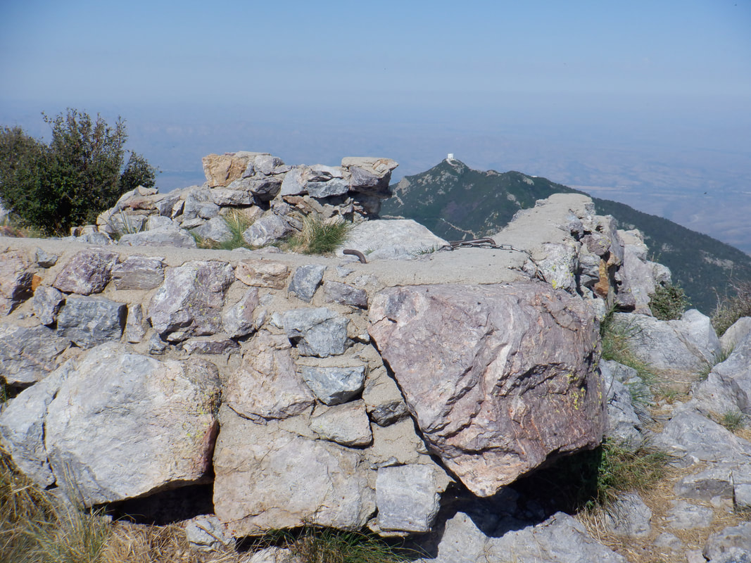 After 5.5 miles and 4000' of climbing, I reach the peak where there is a foundation of a fire watch building. I find the registry in an ammo box and sign in. 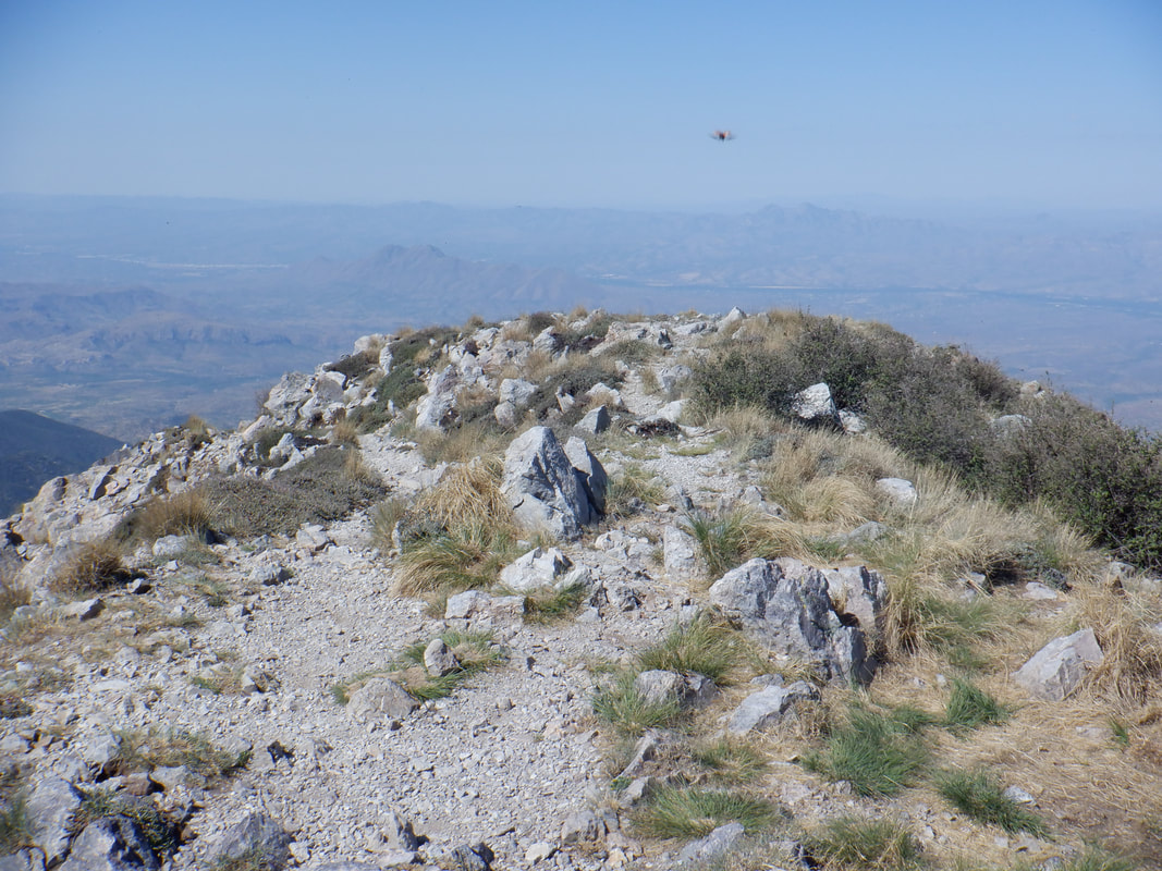 The views are awesome as usual although to the north, the smoke from the Bighorn fire obscures quite a bit. That fire is now at 7000 acres and only 10% contained. Fortunately, where I live is on the edge of the limited containment line so I am good. 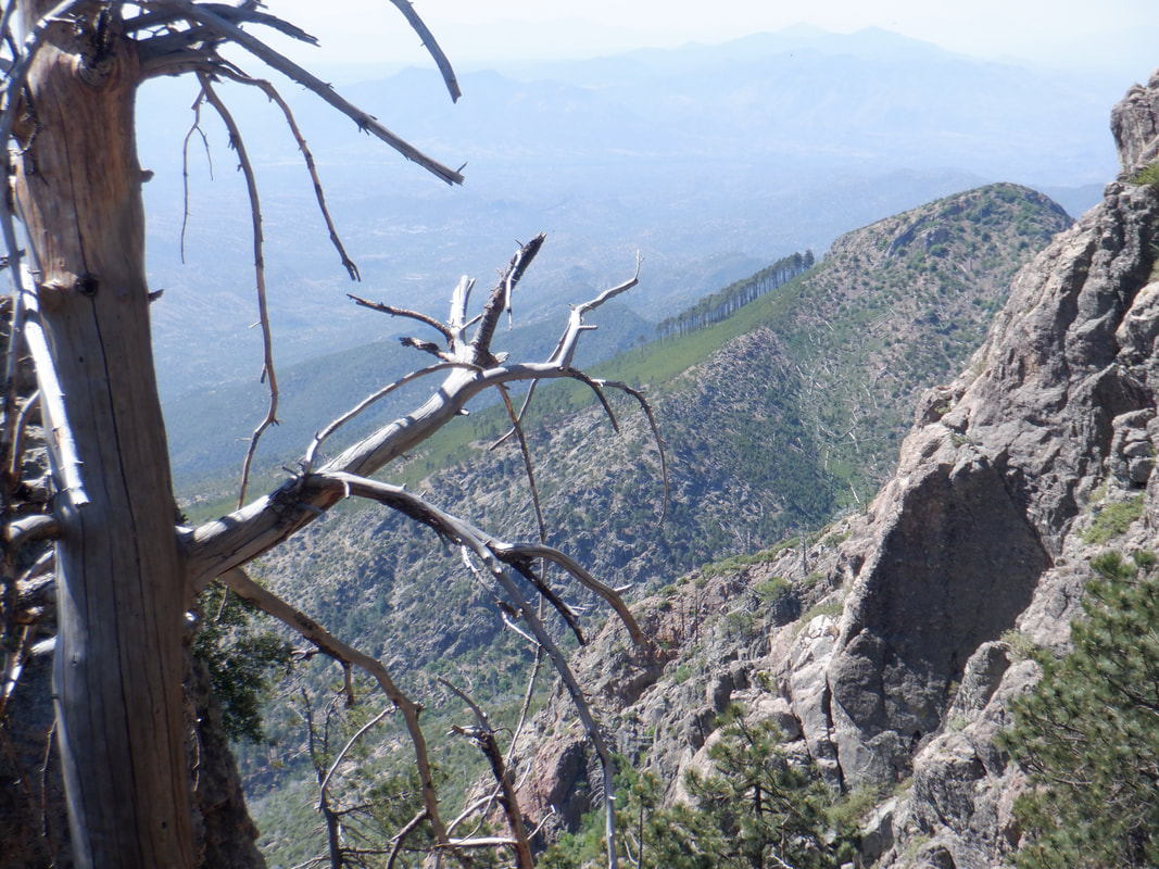 There are billions of ladybugs and a few hundred thousand flies so the stay at the peak is rather unpleasant and I descend. In the distance, a small grove of trees that survived the last fire. 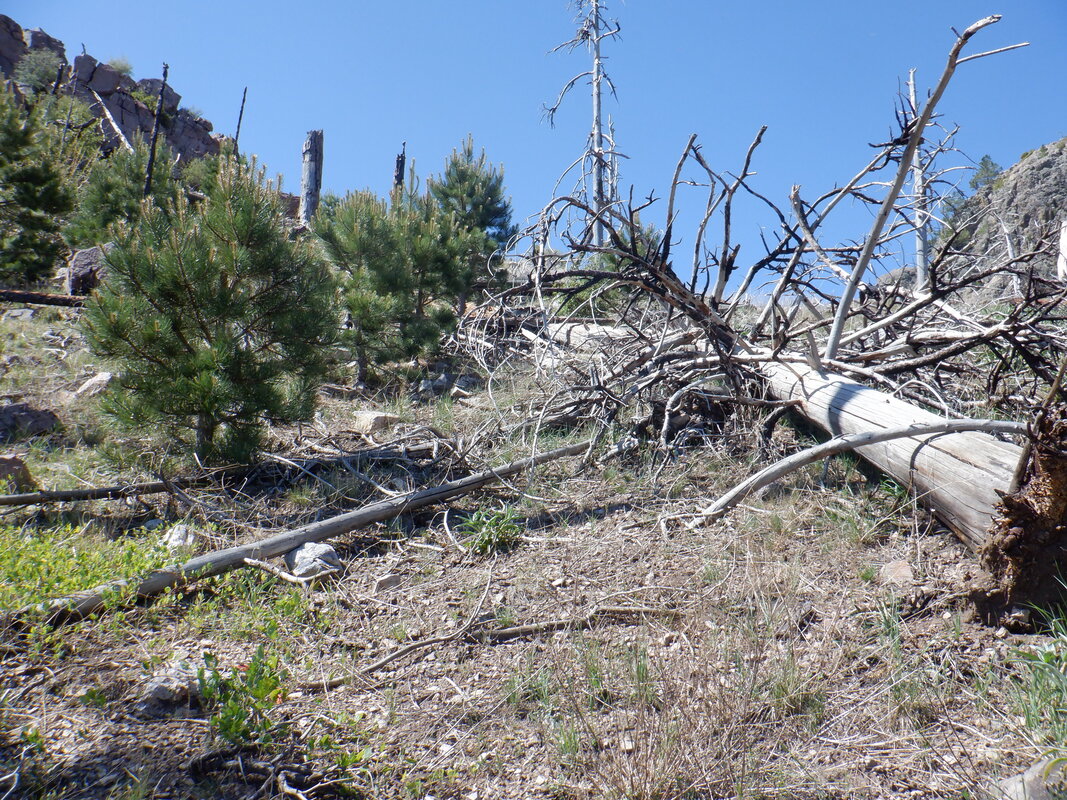 Lots of new trees growing on the hill sides. 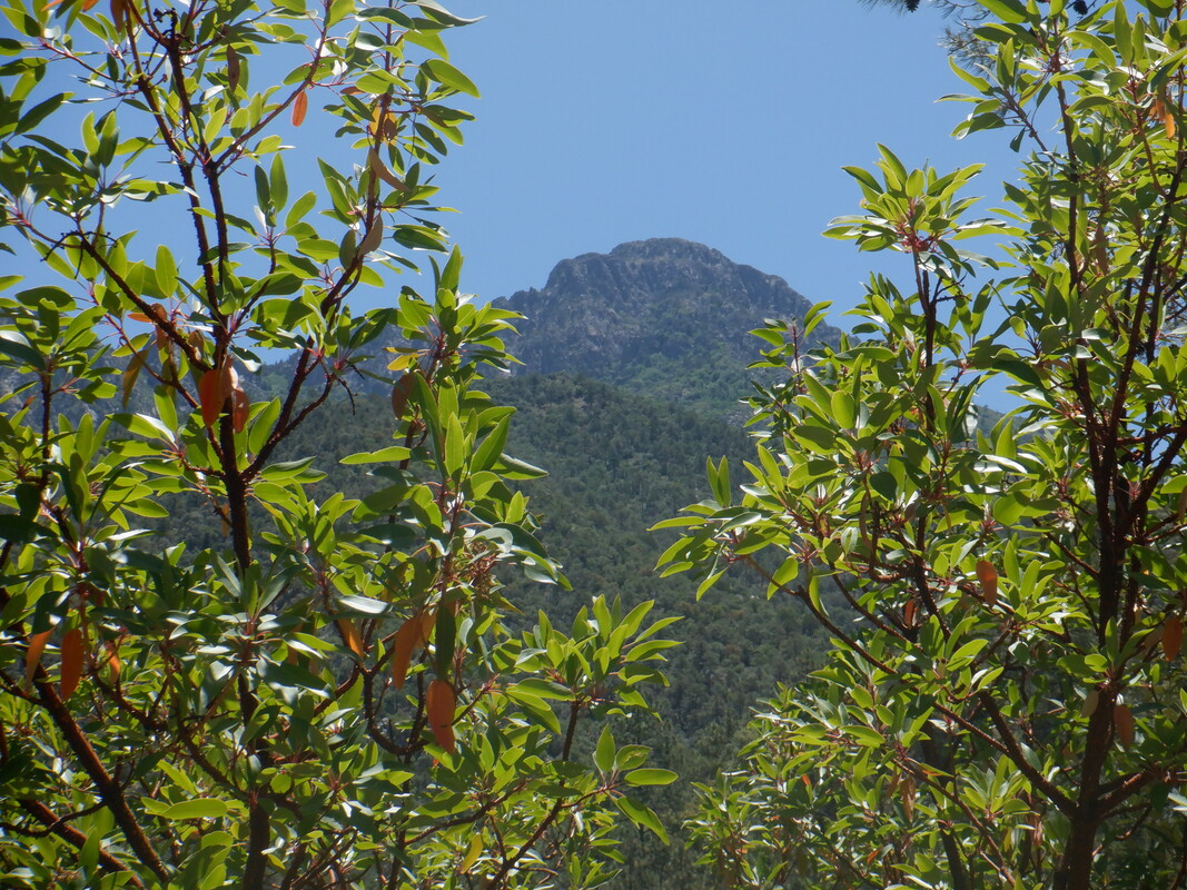 I take a last look, long into my descent, at the peak. Finished with 11 miles and a good calorie burn.
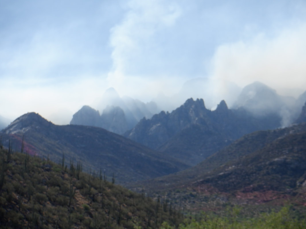 I park in a development that is just south of the closed Catalina State Park. A few years ago someone was going to develop the hills above and put in a graded dirt road. Then the project went into bankruptcy and so hikers have a nice access to the wilderness. My intended route today would not approach the above section, instead the origination of the fire on Bighorn Mountain which appeared quiet. 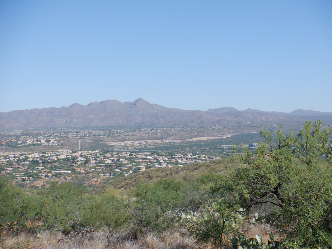 The trail/road rises steeply and I get a good view of the Tortilitas where there was another large fire. I see no smoke so maybe it is contained. I take a well worn trail off the road and see.... 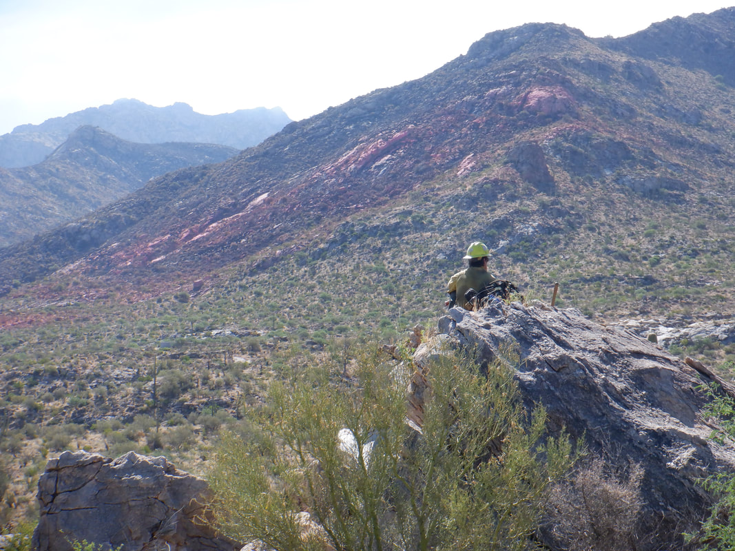 ….a lookout. I leave the trail and approach him, noticing there are a total of 3 of them. He asks if I am out for a hike and I confirm that I came out to check out the burn area. Hearing not a discouraging word, I thank him, regain the trail which takes a serpentine route toward the pink swaths of retardant. 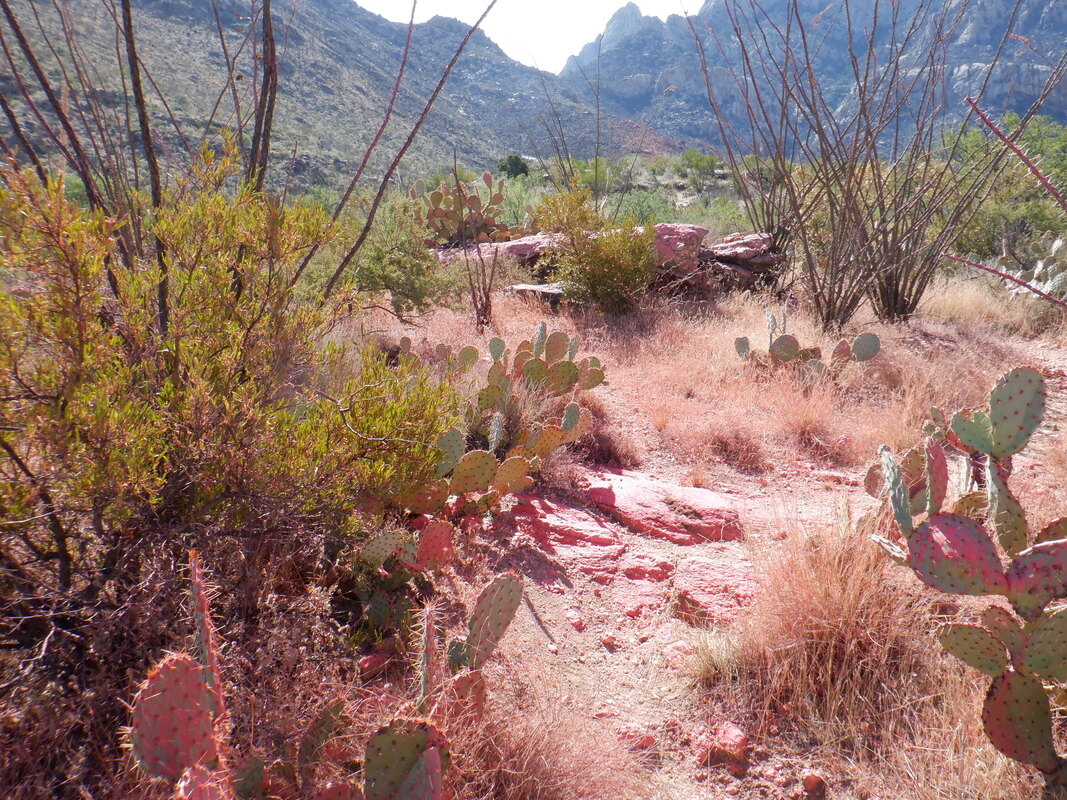 From Oro Valley, it appears the pink line is very close but takes 2+ miles of hiking to reach. 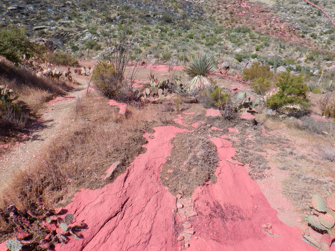 Crossing the retardant area, I begin to see spotty burn areas. I hear some voices ahead and..... 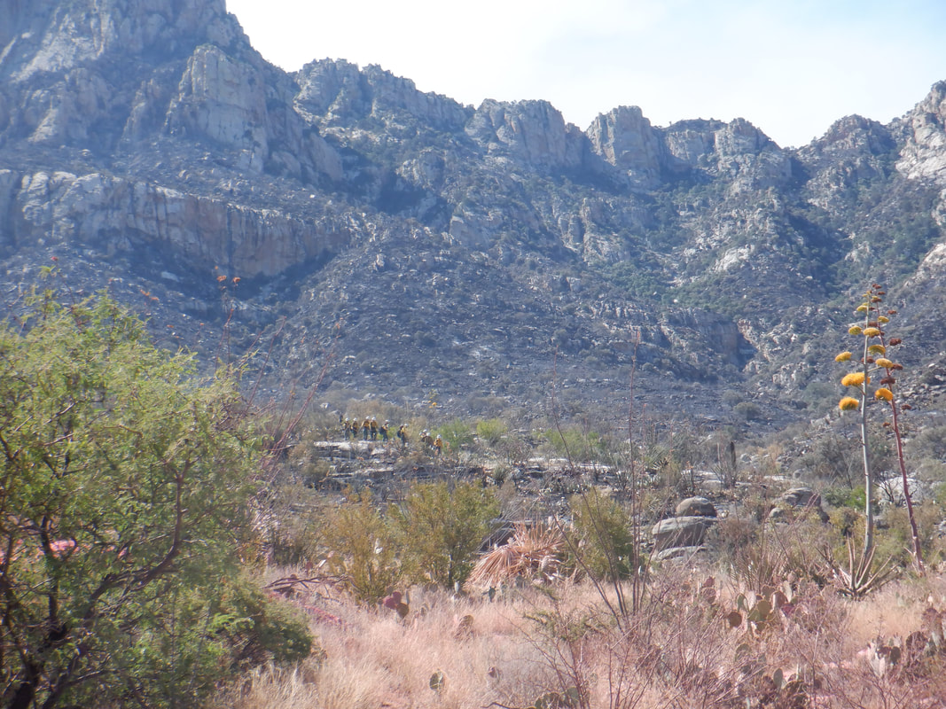 …..how about that! A team of 9 fire fighters, headed toward a distant ridge, their work done here. 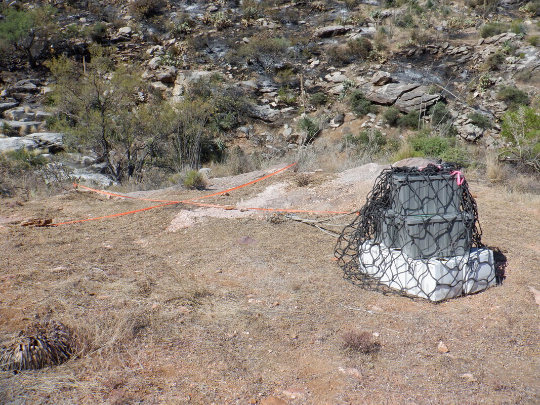 As they had been working, they had ample supplies which have been repacked and waiting helicopter pickup. 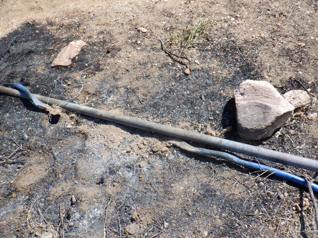 Too bad. A large water tank is filled by this pipe but large sections have melted. Will be interesting to see when/if it is replaced. 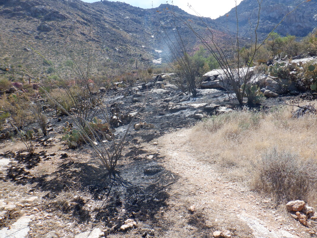 In this area, the fire stopped at the edge of the trail. Will also be interested to see how many of the plants will survive having their feet burned. The trail was not previously so obvious but the foot traffic in the last 3 days has significantly enhanced it. 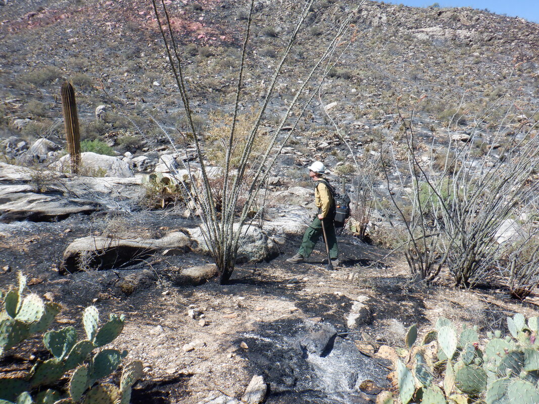 I heard a chainsaw off to my left so still some activity going on and to my right I heard, "Sir". The above guy approached me and I knew my hike was done. He didn't try to stop me but said it may not be a good idea to go any higher. With a helicopter due to pick up the supplies, the effect of the downwash on all the loose material would be significant. We had a nice conversation about the fire and that his crew has created a new trail on a nearby ridge so that's good to know. Wish I had thought to ask about wildlife encounters and what they had observed. 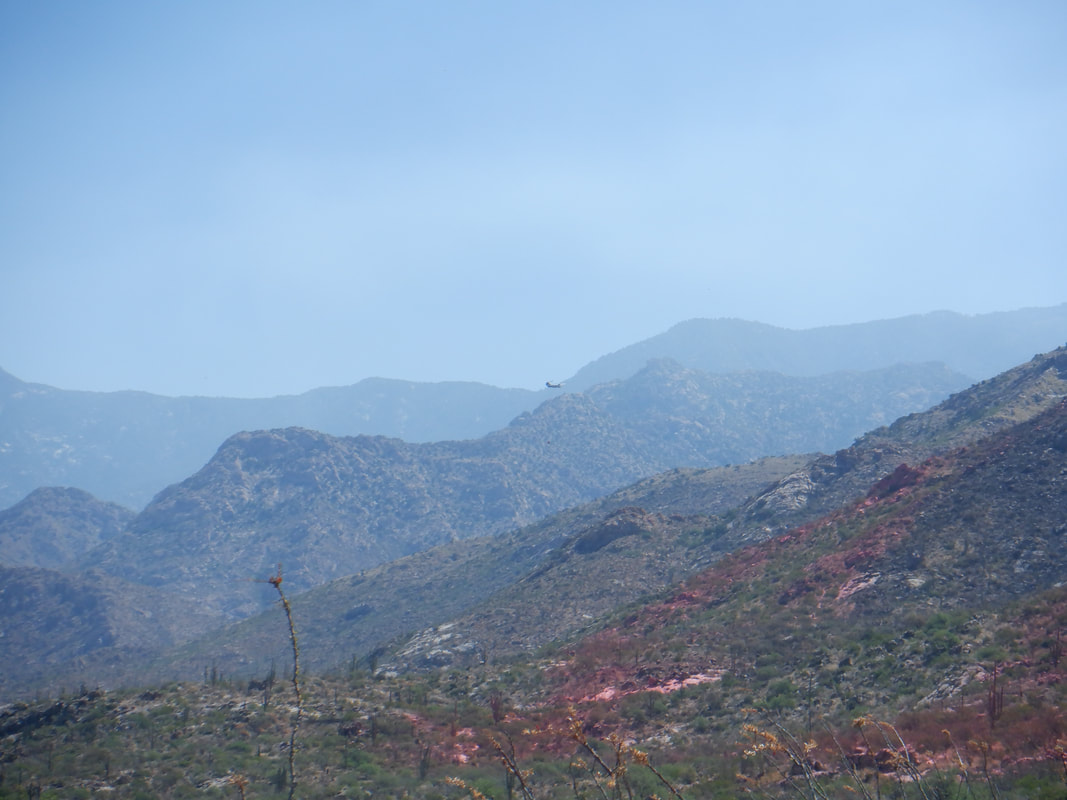 As I descended, I saw plenty of evidence of ongoing fire fighting efforts over the ridge in Pima Canyon. I'll give it another couple of days and then come back if efforts on this side of the ridge are finished. There are access routes between Bighorn and Table Mountains that are choked with brush but perhaps they are open now. 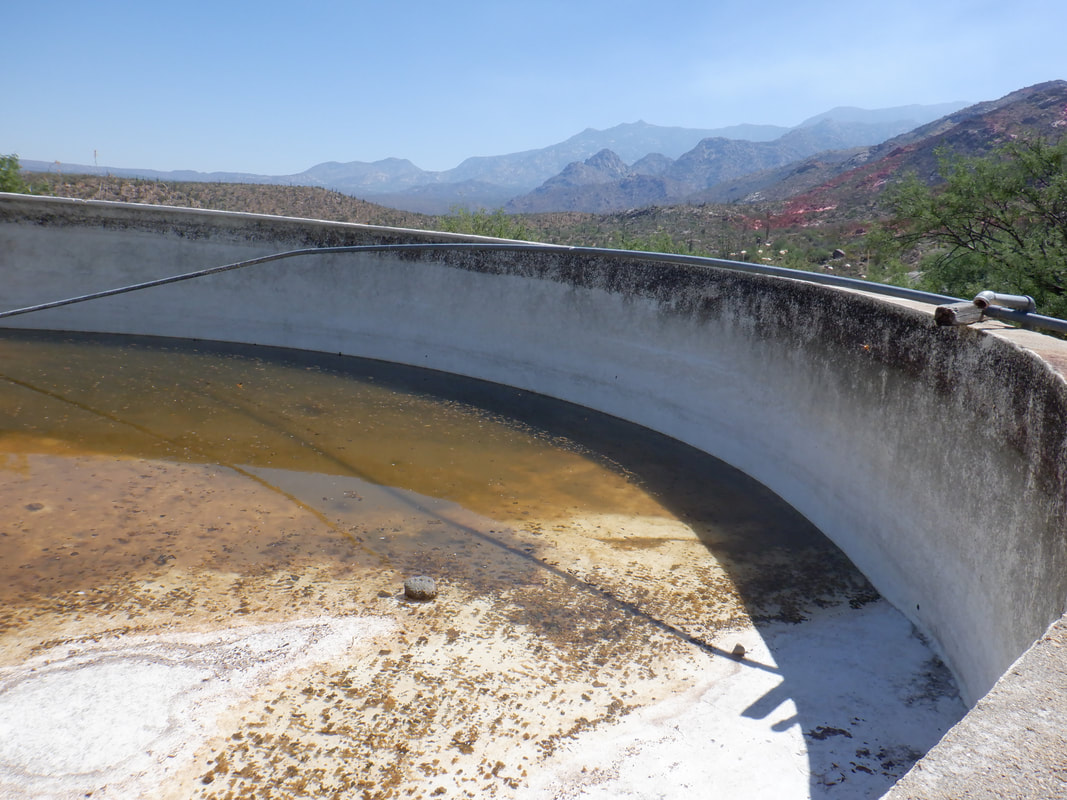 I check out the water tank. A month ago, it was filled to the brim with water overflowing from the pipe. I assume the efforts to put out the fire drew water from the tank. 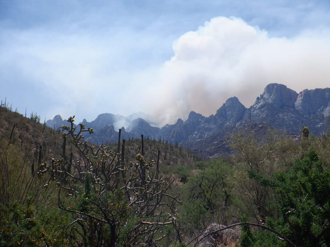 The fire continues in Pima Canyon. There is a glow to the underside of the smoke. Finished with 5 miles.
 The "Oro Valley Outdoor Fun" group came up with a good hike, led by organizers John and Marianne. It's odd, I have been all over the top of Mount Lemmon but for some reason, never hiked the mid mountain hiking trails....that's a mistake. We arrive at the Middle Bear parking area, carpool a few miles up to the Green Mountain parking area and off we hike. 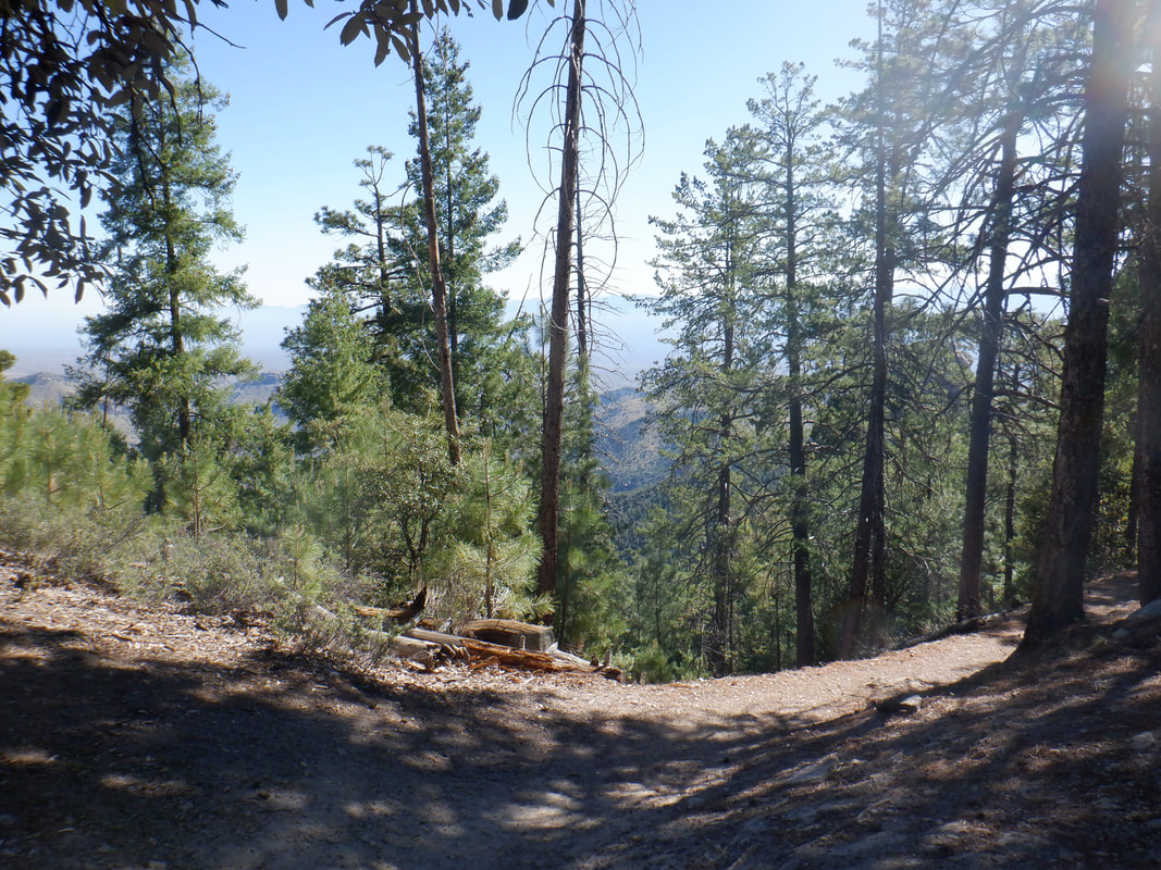 After a brief ascent, we reach a saddle. Here, half our group of 14 hang a right and ascend toward Green Mountain while the other group continues on to Bear Saddle where we will reunite later. Meantime, the fire rages along Pusch Ridge but we are largely oblivious other then an occasional sound of a helicopter. 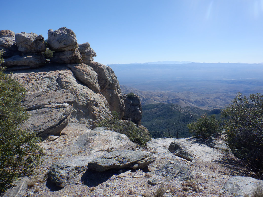 The route up Green Mountain is usually obvious but not always. Pretty steep with the added bonus of pine needles and gravel, sure to make the descent an adventure. About midpoint of the ascent we reach this beautiful spot. This is another of those, "Good to Be Alive Moments." 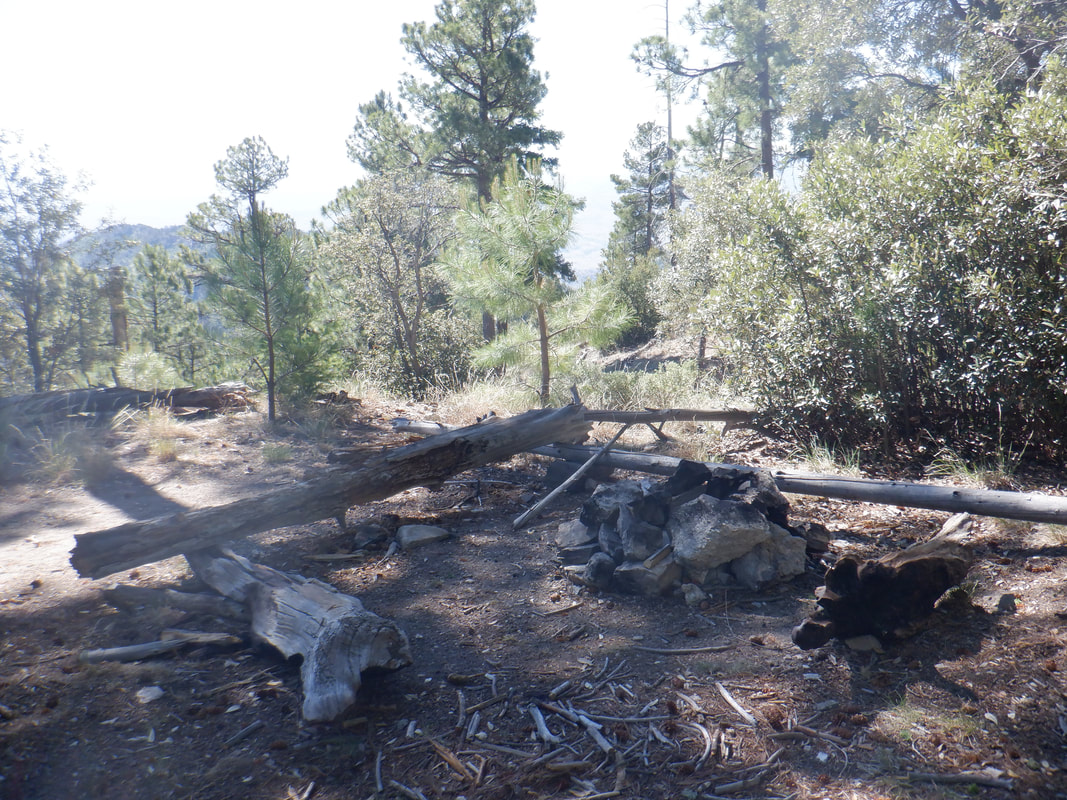 We continue up and arrive at the peak where there is a nice camping spot with plenty of wood around. Since this is not an established trail, I doubt many people make it up here. 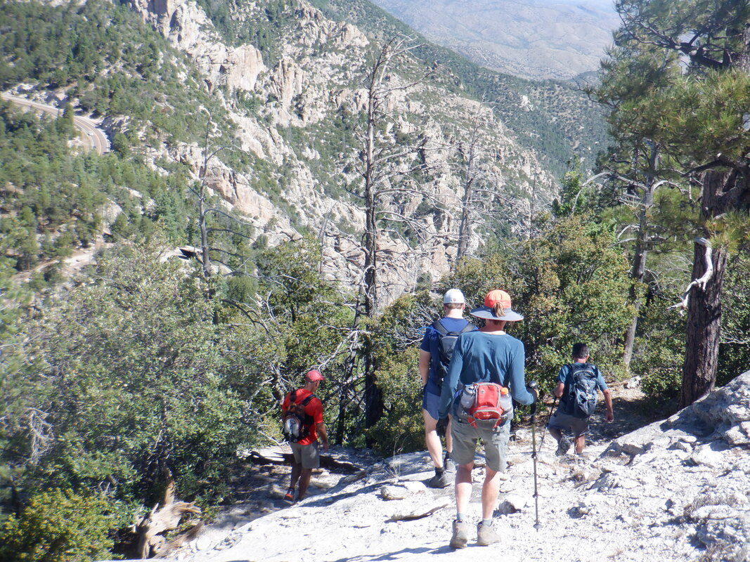 After a round of picture taking, we descend, again, steeply most of the time. 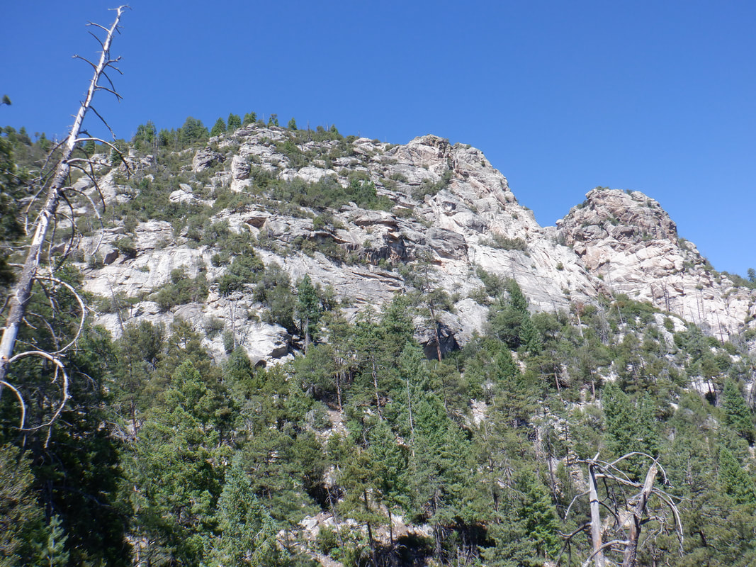 Reaching the saddle once again, we descend through several switchbacks, off the mountain. Above is the peak. We are now hiking on the eastern side of the Catalinas and so..... 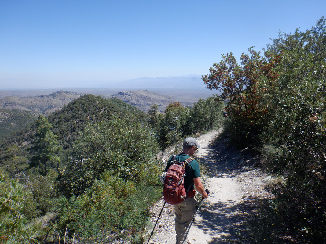 ….have wonderful views of the San Pedro river valley and Galiuro Mountains. The trail is easy to follow and mostly descending. I had planned to turn around at some point and hike back up. Frankly, after 2 weeks in Ohio with little cardio experience, I wasn't feeling all that springy so need the miles and uphill effort. 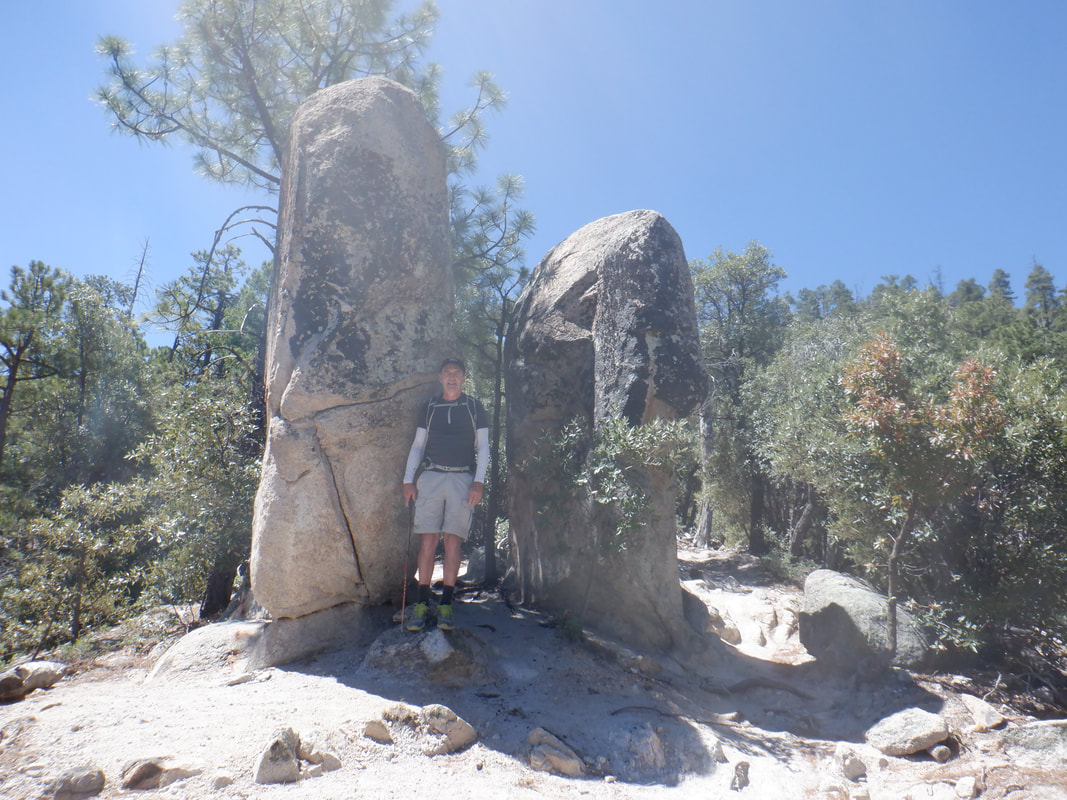 As we neared Bear Saddle, we encountered these monoliths. Yep, that's me, looking kind of paunchy. We rejoined the group and now most of us would ascend Guthrie Mountain. 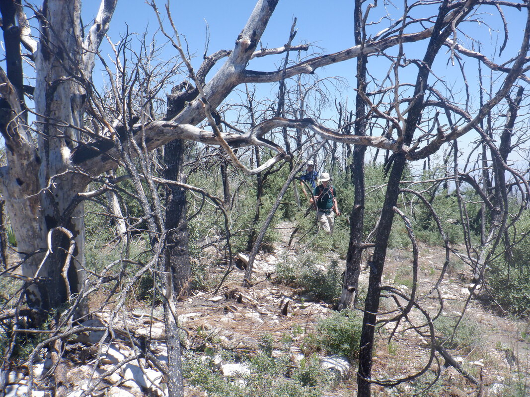 We ascended an easy to follow but not easy to hike, trail. There was one section of steep granite with pink accents. 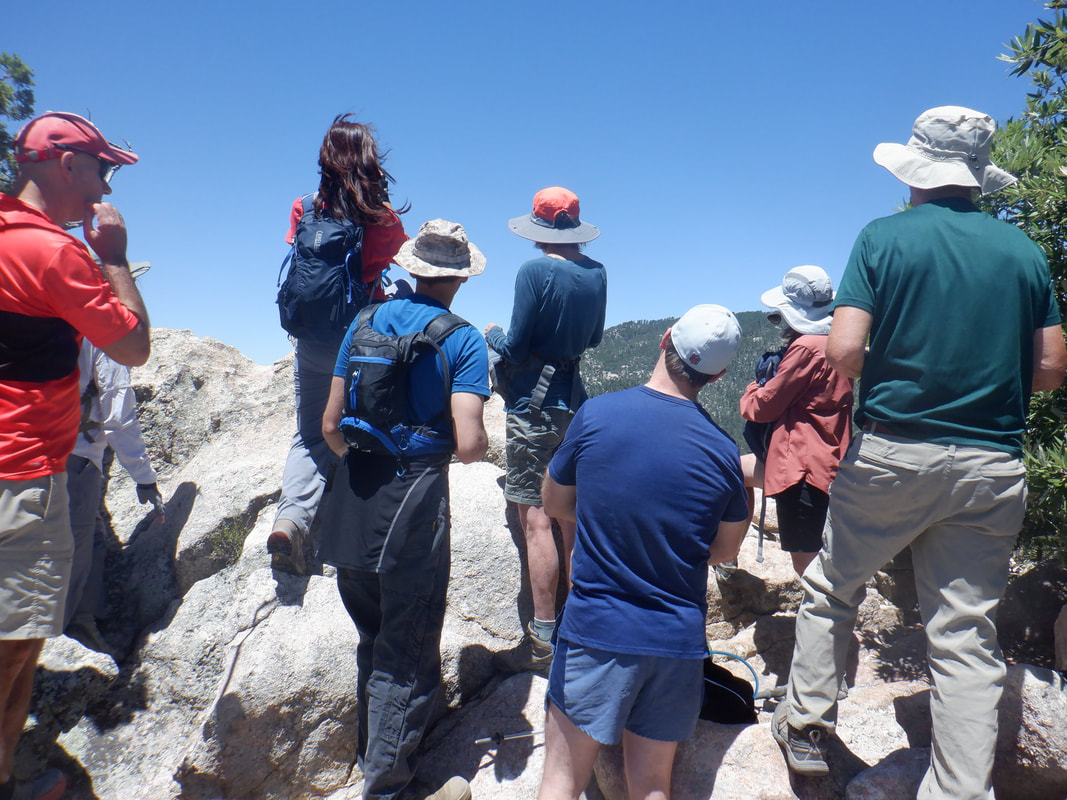 Not much room at the top where we were distracted by the sound and sight of a helicopter, once again dumping water on the distant fire. After a short break and mindful that some of us were waiting at Bear Saddle, we descended and.... 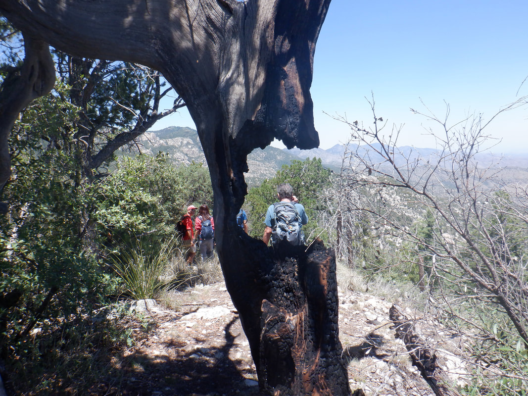 ...passed a tree having an unusual opening. Long dead from a fire that hit this area in 2002. 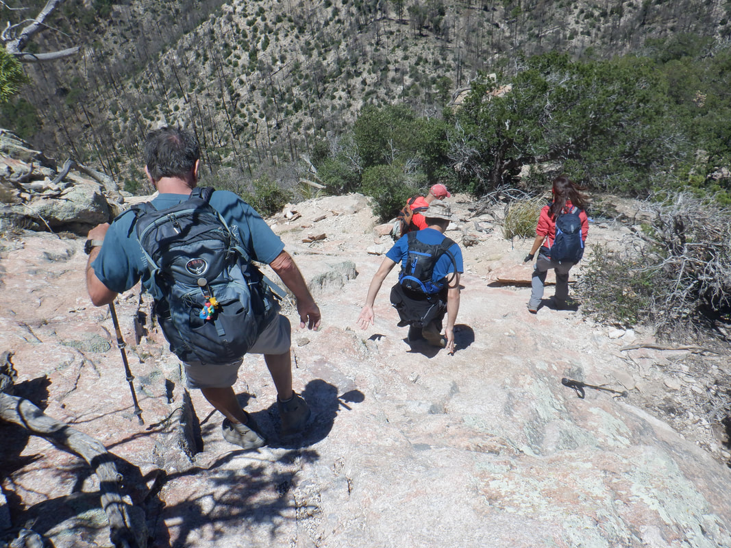 Usually, images don't capture the steepness of an ascent/descent but this one does. Lot of fun picking a route down while utilizing ridges and concave places for traction.  We rejoined the group at the saddle and they descended to the Middle Bear parking area where they would shuttle to the start of the hike at Green Mountain. Meantime, I retraced our route back to my car at Green Mountain, finishing with 7.3 miles and 2200' of elevation gain. Legs and cardio need a lot of work:(
 I arrived Saturday afternoon to this sight. A couple of friends had already warned me so it wasn't a surprise. Friday night, a bolt of lightning struck the ground somewhere in the above image, igniting the fire. 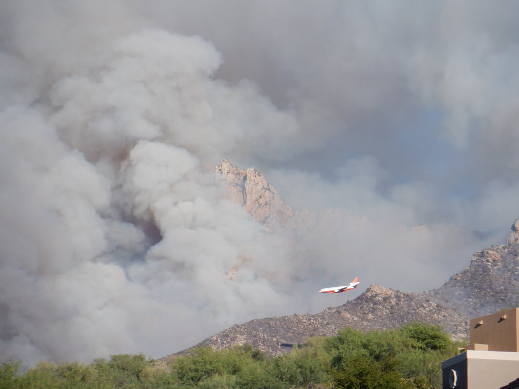 Saturday afternoon, the fire appeared to have been contained and then, boom, it exploded. Tankers came in and dropped fire retardant on the bottom of the slopes to prevent the spread into our community. 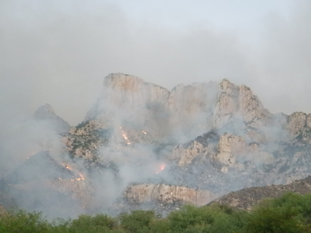 Saturday evening, the helicopters and planes had retired but still the fire burned. If it reached the ridge and spread over the top, nothing over there but acres of grass. 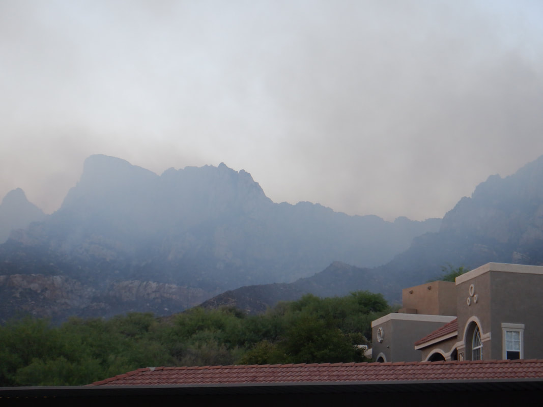 Sunday morning, the smell of creosote was heavy as smoke lingered but the fire appeared to have died down overnight. I attended a group hike so going south on Oracle Road and rounding the mountain on Ina Road.... 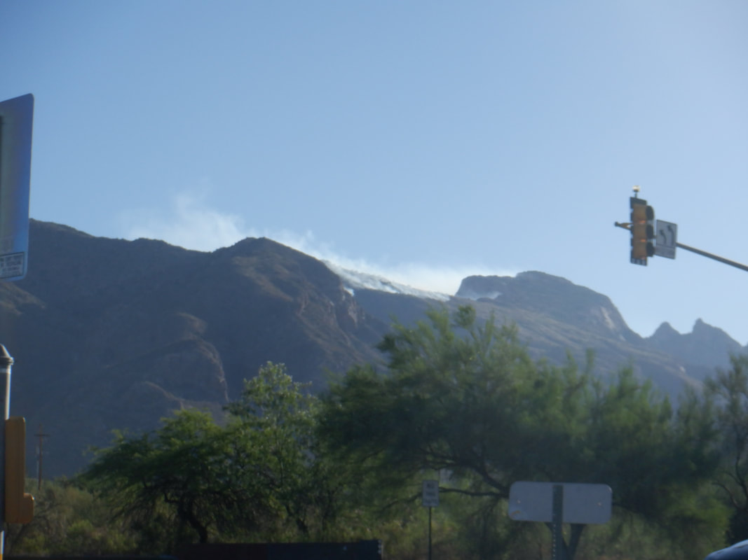 ….nooooo, the fire had gone over the ridge and was now burning into Pima Canyon. 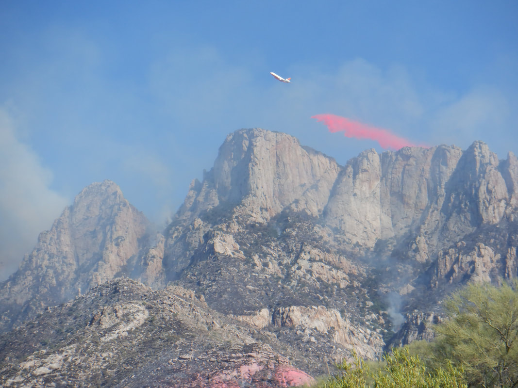 Sunday afternoon, after the hike, I was curious so climbed a nearby trail and caught this image of the tanker releasing the retardant. 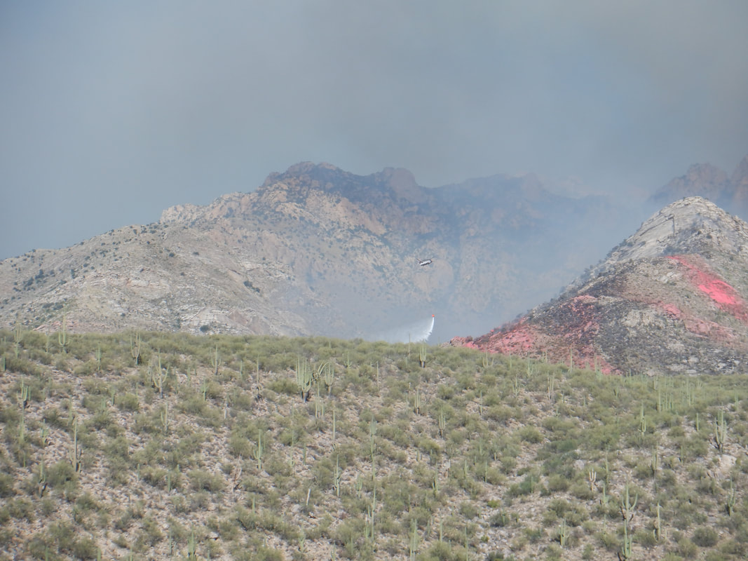 Meantime, on this side of Pusch Ridge, helicopters were dumping water on hot spots and trying to prevent the fire's spread into Catalina State Park, just north of me. That is a Chinook doing water carrying duty. 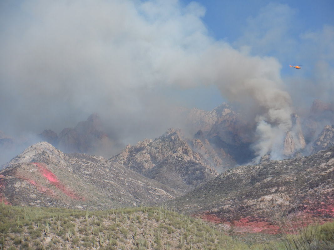 Many people express sadness over this but it has been many years since there was a fire in the area and it was overdue for nature's cleansing. I talked to a ranger who voiced this opinion. The fire will remove hiding places for predators of the Bighorn sheep although the predators have to eat too so not sure that is a good thing.  As I descended the trail, I saw a family feeding brush into a wood chipper, probably clearing as much as they can in case the fire moved west, toward them. At the time, strong southwest winds moved the fire away from this and my area. The Pusch Peak area at the far south side of this side of the mountain range was spared. 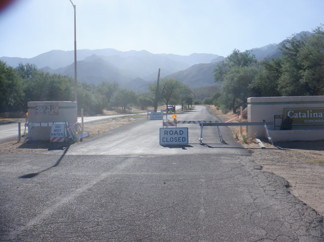 Monday morning now. Catalina State Park is closed as it has become a staging ground for the fire fighting efforts. I rode in and had a nice talk with the sheriff deputy sitting in the SUV seen above. 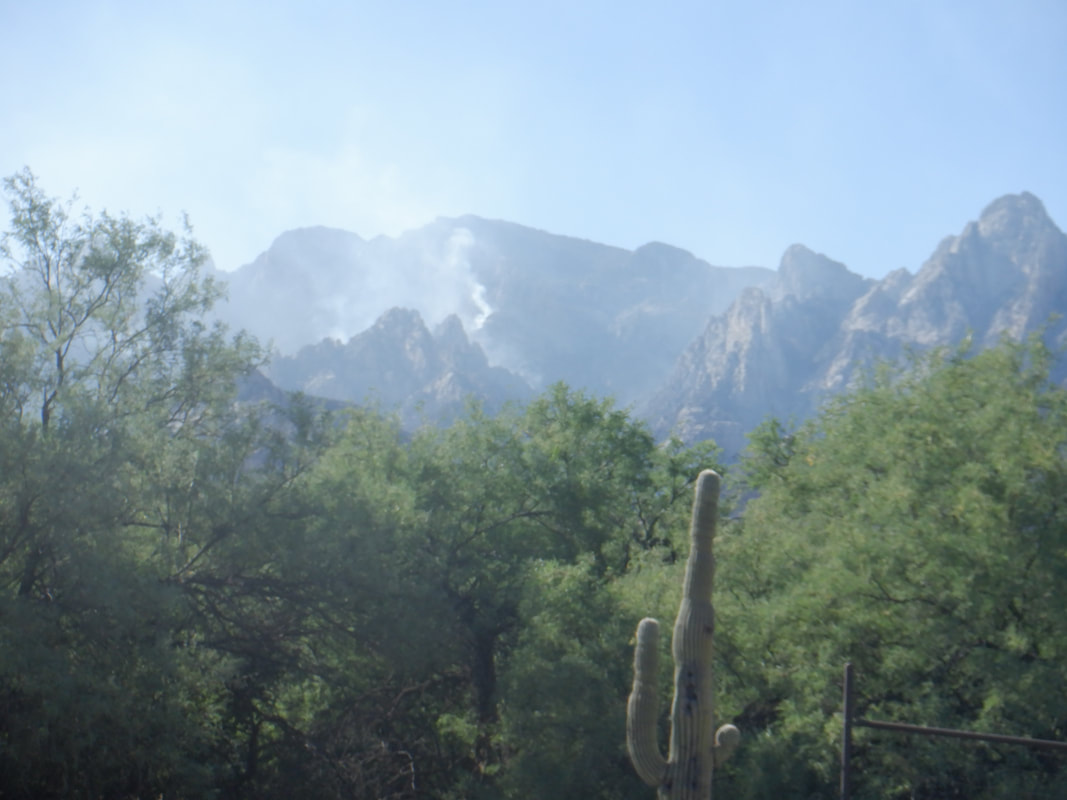 The fire is now reduced to a smolder on this side of the mountains. Tomorrow, I plan to hike up there and check it out, assuming I don't get in the way of any efforts. While the Park is closed, there are a few use trails that one can access to go way up there.
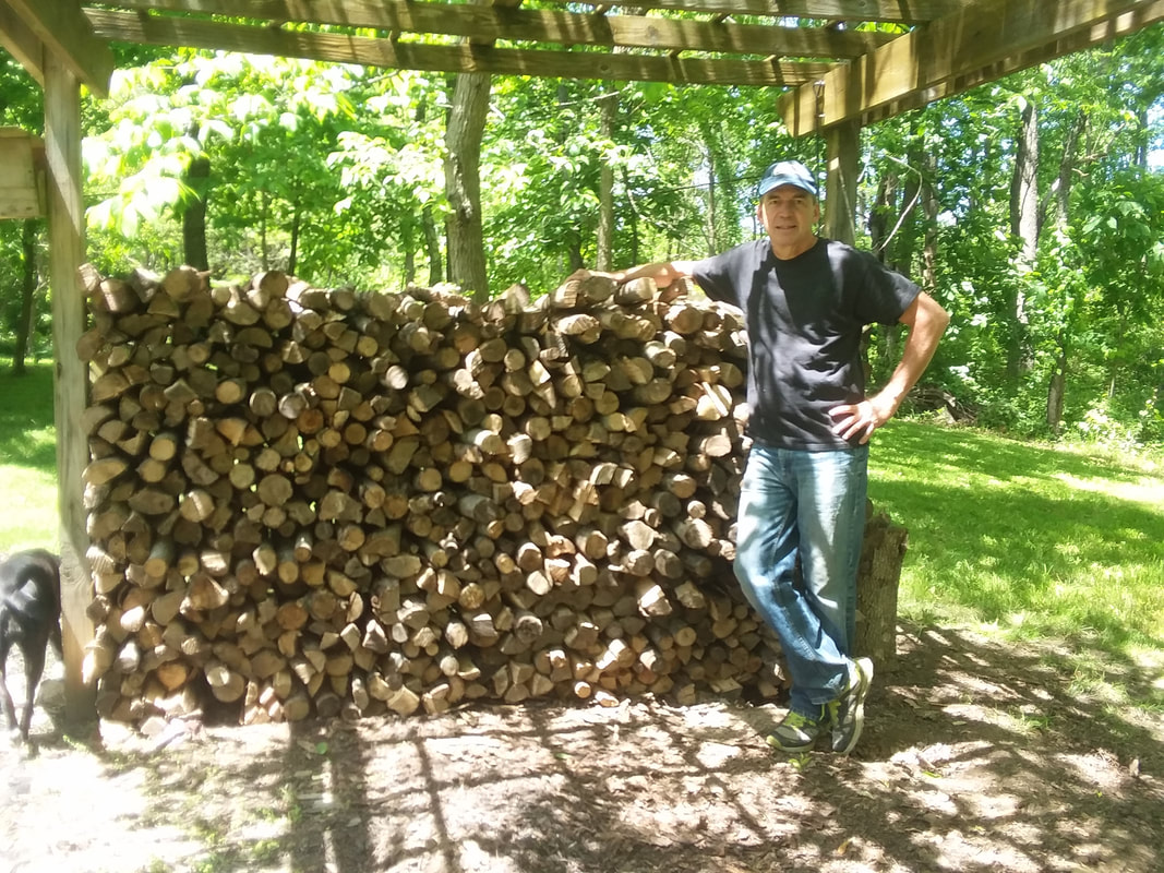 I intended to ride more frequently while in Ohio but once I get in my woods, I don't want to leave. There is something about planting 500+ seedlings, 20+ years ago and seeing how the land was transformed from a field into dense woods. The ash trees, which I never planted but emerged over time, continue to die from the Emerald Ash Borer and therefore, make for great fire wood. I got the above tranche cut and split and will do more when I return later this year. 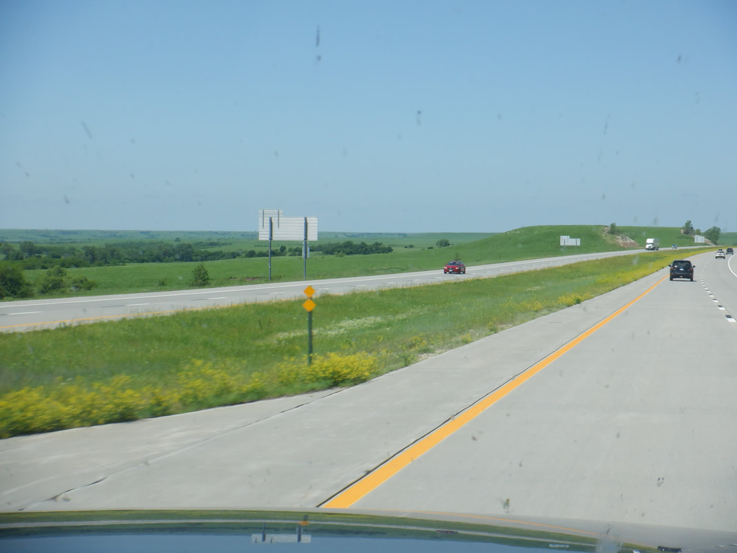 So, off we go but return via the northern route which takes us through Kansas. 400 miles of the above scenery. 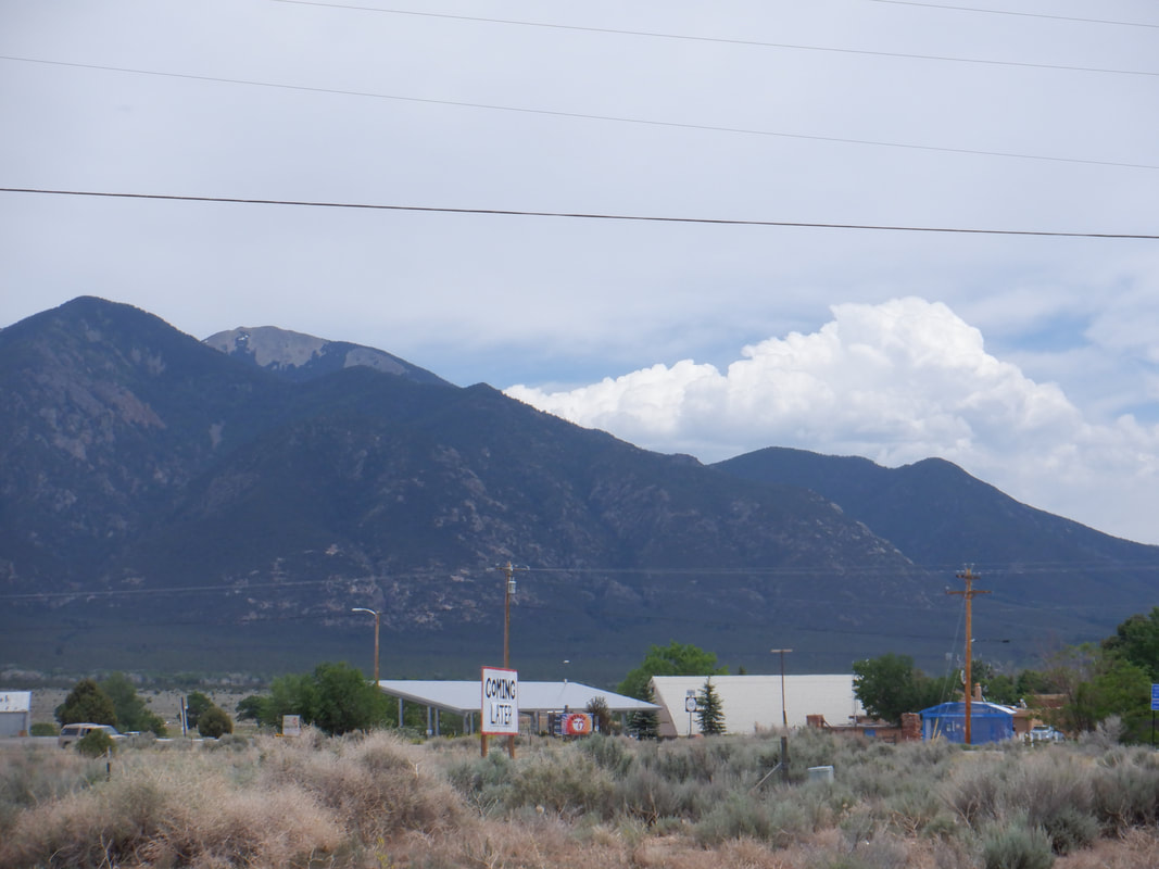 Eastern CO is no better but things improve once we turn south. Clouds forming in NM. 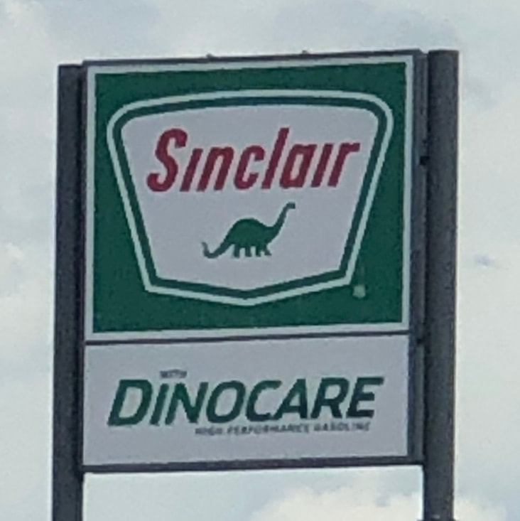 How bout that! Didn't know these Sinclair branded gas stations were still around 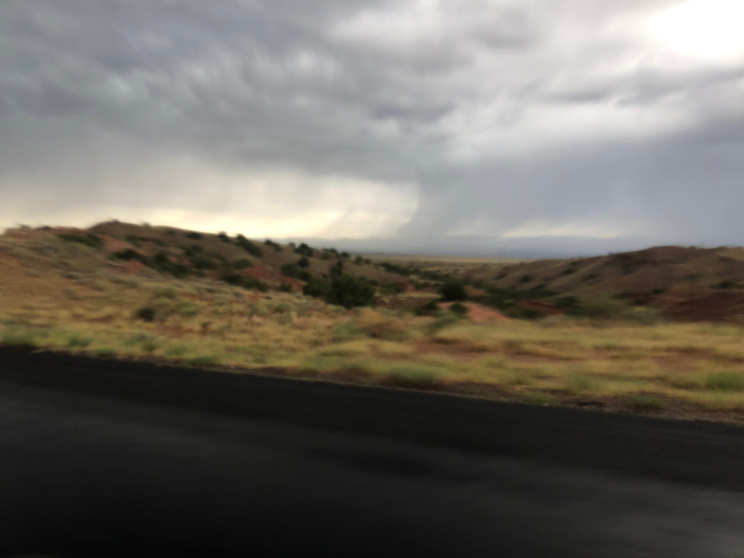 Rain in the distance. Eventually, we enter..... 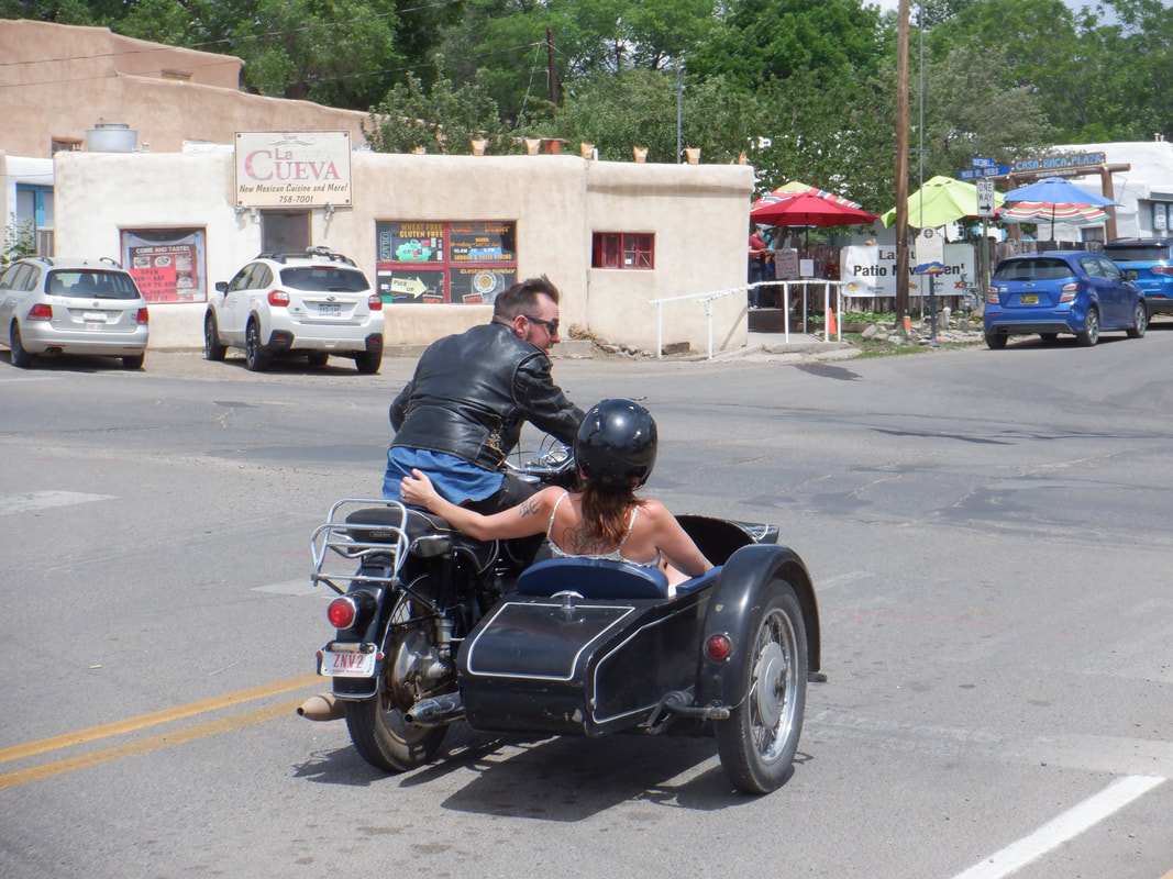 ….Taos, NM. Place is really run down, from what I saw of it. Lot of interesting characters around including a guy on a beat up bicycle, long beard flowing in the wind, who yelled "You are part of the problem" as we were walking. 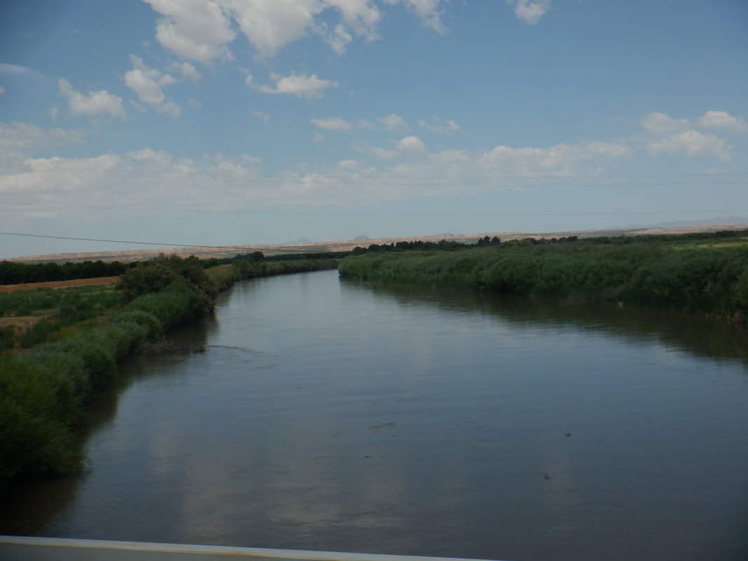 We cross the Rio Grande and enter...... 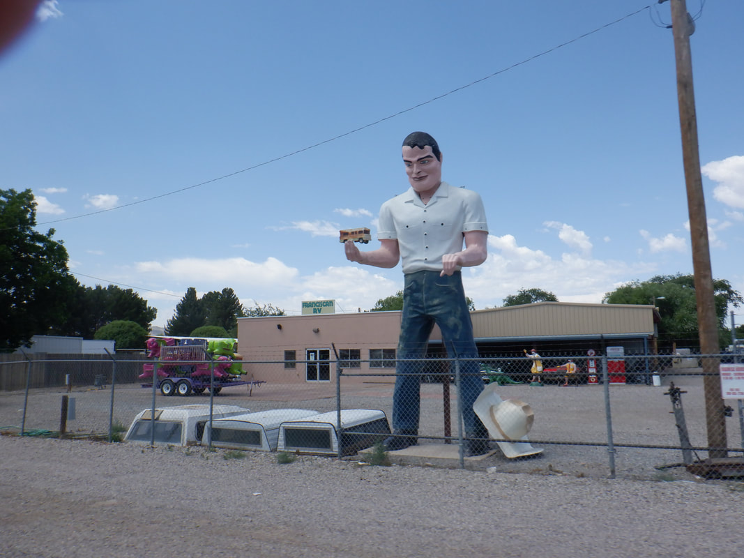 ….the town of Hatch, NM.  We tried to calculate the quantity of smashed bugs on the windshield. At least 1000 so every stop for gas required a vigorous clean of the windshield. At last..... ….we arrive in southern AZ where I am greeted by a fire, above my place. It was caused by a lightning strike and appeared contained by this point but later, it exploded and grew to 1000+ acres. More to come on that.
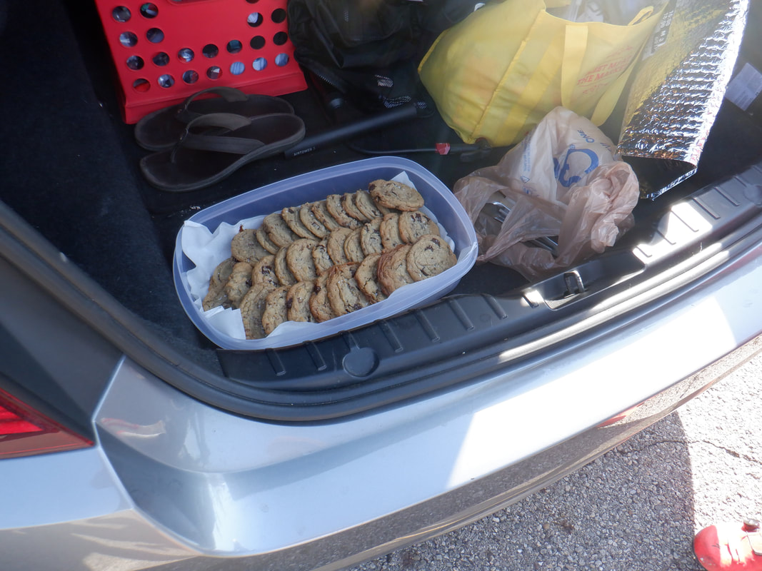 I doubt there is another group ride at which a member brings the above or something similar, to every ride. As in year's past it is..... 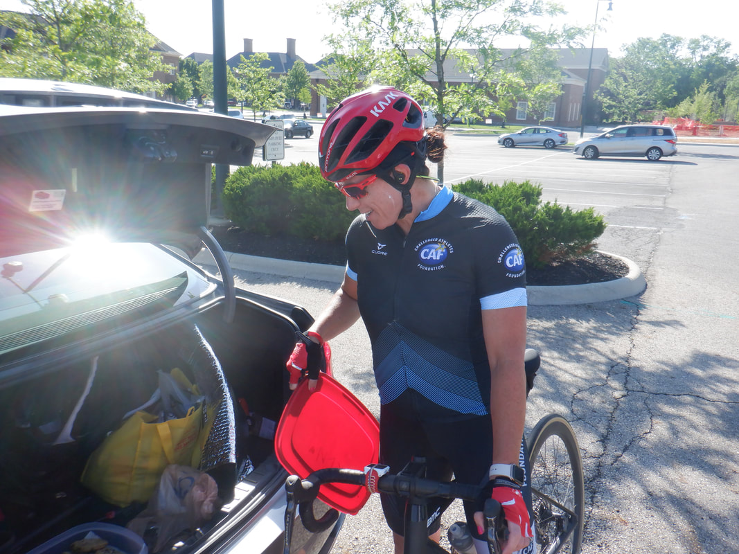 ….Kristie Boltz. It helps to have a kitchen with 5 ovens and she uses nothing but the finest ingredients. Kristie also uses the treats to sometimes fund raise for CAF (Challenged Athletes Foundation). 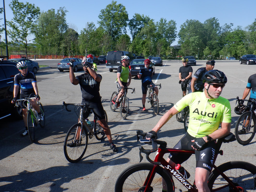 This being the first, official Tuesday group ride organized by "The Cycling Club" I was curious how many would attend. Including Scott Billman in the yellow, Audi jersey, there were 30. Several new cyclists too, which is a good thing. 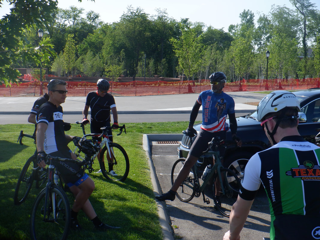 Don gives information about the route and other items to the group and then there are off toward Granville prior to a return.  Given 30 and some Covid concerns, 3 groups of 10 are sent out, each with cyclists of similar fitness level. The groups.... 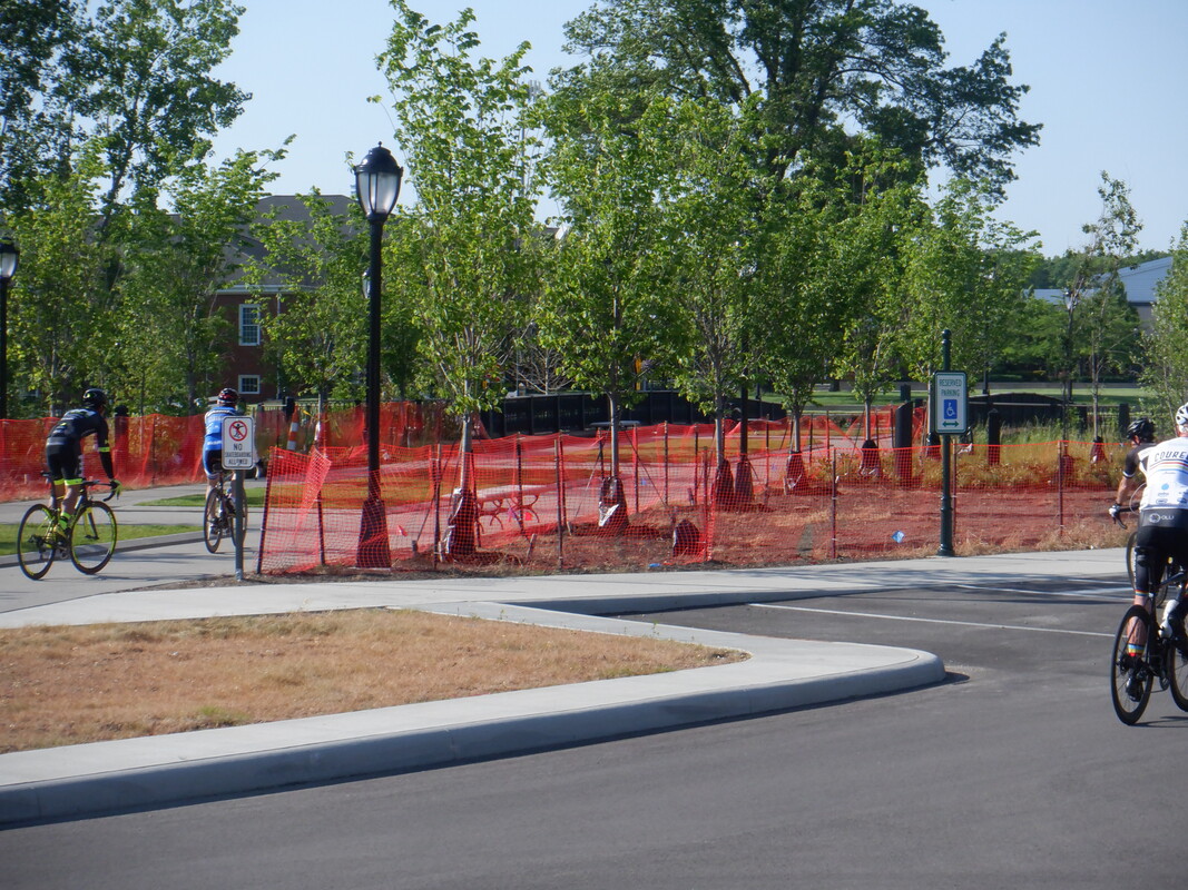 ….depart. Terrible news coming out of the other prominent Tuesday group ride which originates south, in Canal Winchester. A cyclist, Shin Lisaka, was 3rd in a line that had small gaps between each cyclist due to a small climb. Shin was struck by a car, dying at the scene. I have disturbing details of the event but at the request of a witness, as well as common sense, I can not share here. Gruesome and so very sad.
While I have more posts for my OH visit, I could not resist to post this. I arrived in Oro Valley on Saturday. I had read about a lightening inspired fire in the mountains above my place so when I arrived, it all appeared muted but.... ...30 minutes later it had exploded. Large planes flew in with supporting helicopters as they battled the blaze. It appears residential areas will be spared but above that...yikes.
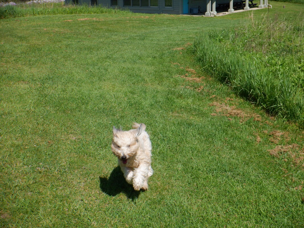 If you follow this blog, you saw Jack running through a sandy wash a couple of weeks ago but today, it is through firm ground with lots of grass. He doesn't care as long as he can run. Yes, Jack accompanied us on our drive to Ohio. 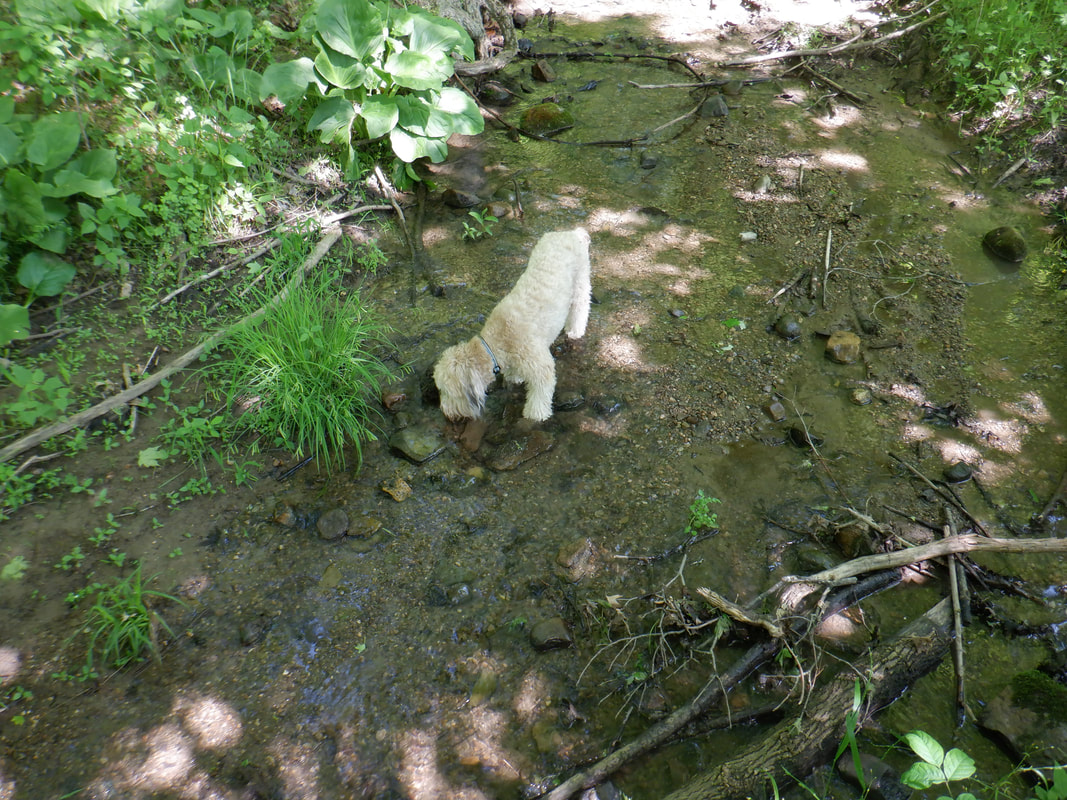 The Bio Reserve has several places where the trail dips and flowing water can be found so Jack has opportunities to tank up. 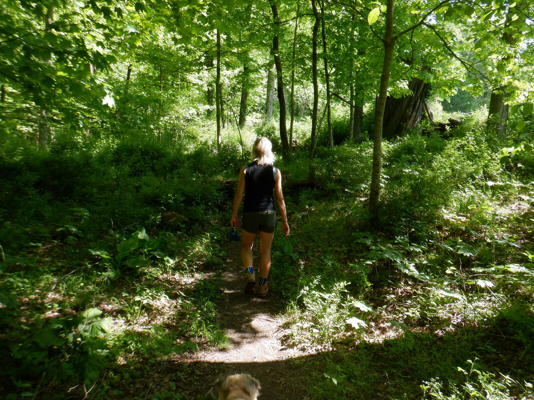 It's odd to hike in almost constant shade. Saguaros don't throw off much shade. lol. 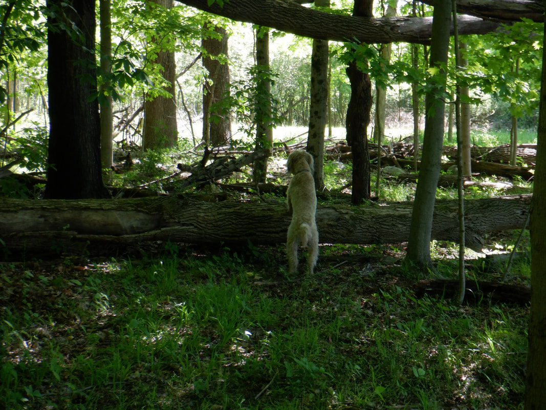 We spook deer so Jack runs to watch them run. 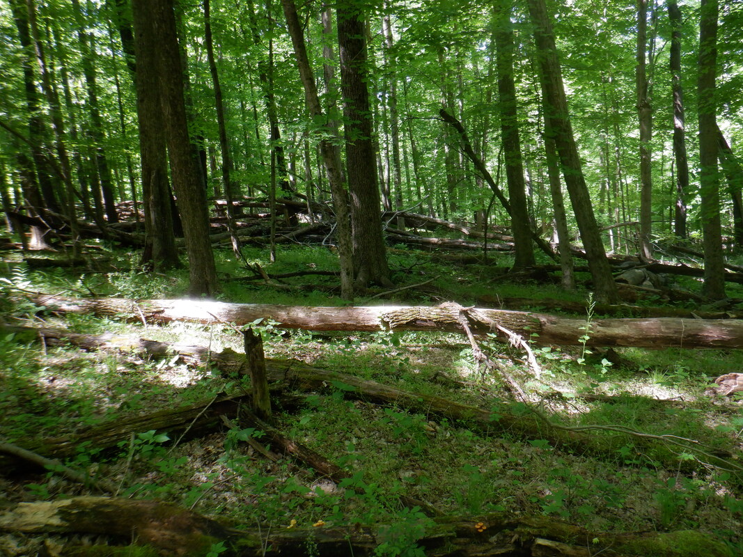 The trails or up and down but one constant is the fallen trees and.... 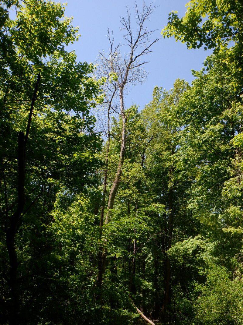 ...more yet to fall of the many ash trees taken out by the Ash Borer, a pest from China. 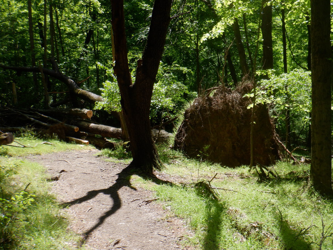 One tree was completely uprooted. Anyone visiting the area, the Bioreserve is a worthy destination as we hiked 5 miles and how other trails we could have hiked.
|
