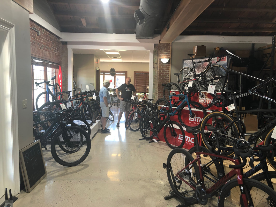
 I had not been to the new shop since it moved last year. Geoff has a much larger space and he was hard at work as we entered. 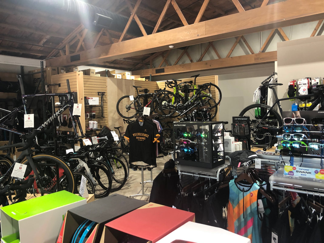 Of course, who could have predicted what has transpired in the last couple of months so some of Geoff's history based assumptions about bike demand for this year have been off. Lots of demand for bikes but more in the "lower" end range. 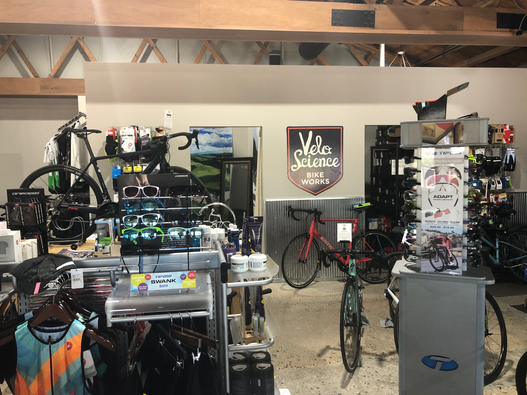 A retooled inventory is meeting most of the demand as new cyclists visit. 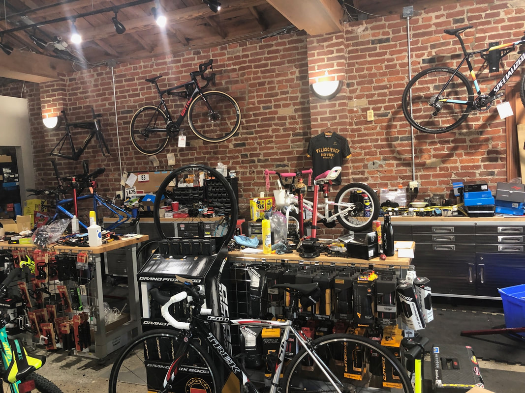 An open repair area. It too has seen an uptick in demand. 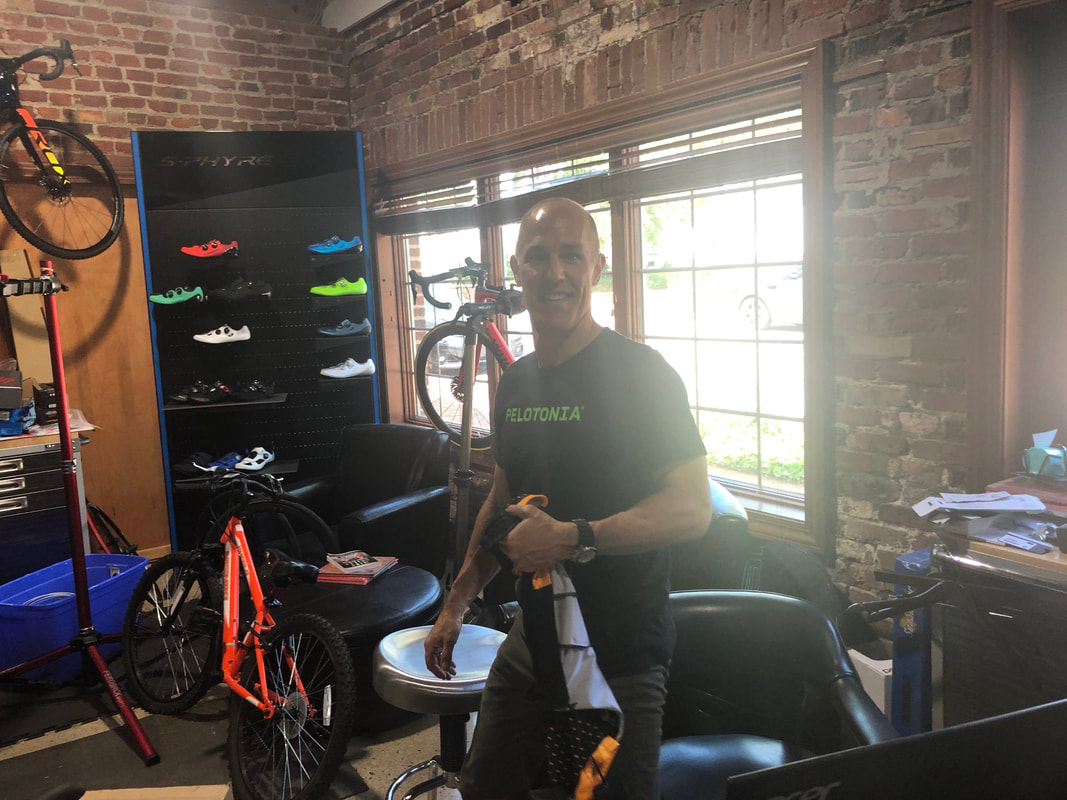 William checked us out with our new purchases of gloves and socks. No bikes for today, for us.
0 Comments
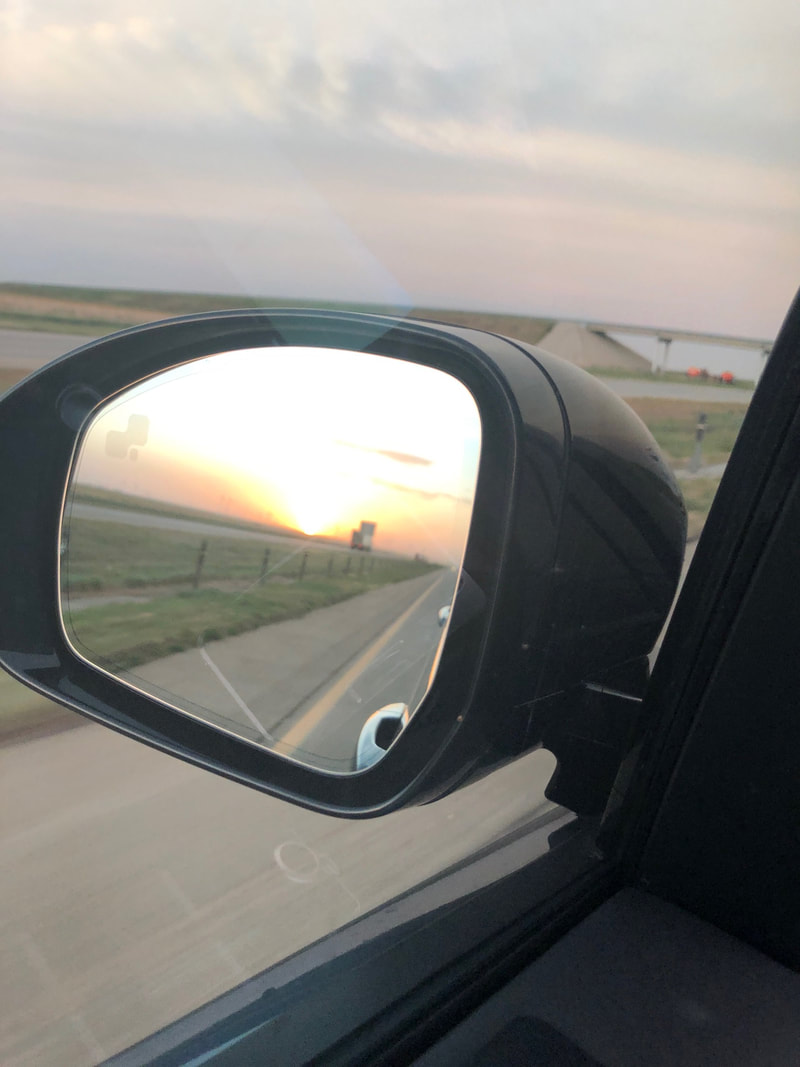 Hey, sorry for the lack of posts. Drove from Tucson through NM and have no idea why that state is the "Land of Enchantment". Boring but maybe Albuquerque and west is deserving but the eastern end...yikes. Driving through TX the winds were in the 40mph range and a modest sand storm kicked up. Eerie but a beautiful sunset that we could watch through the mirrors. 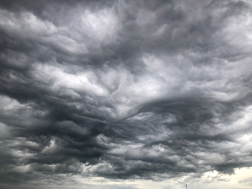 The 2nd day was still very windy driving through OK and I looked for a tumbleweed so I could get a pic but no luck. Enter MO, the sky looked rather ominous and soon.... 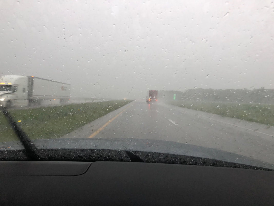 ….was an hour+ of driving in this stuff. A wind storm yesterday and a thunder storm today. Being in a Range Rover rather than my usual Corolla made a big difference. 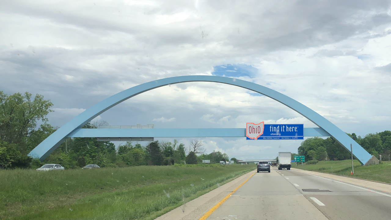 On day 3, at last, we enter Ohio. A few days ago the forecast was no rain for 10+ days but of course, that has changed. 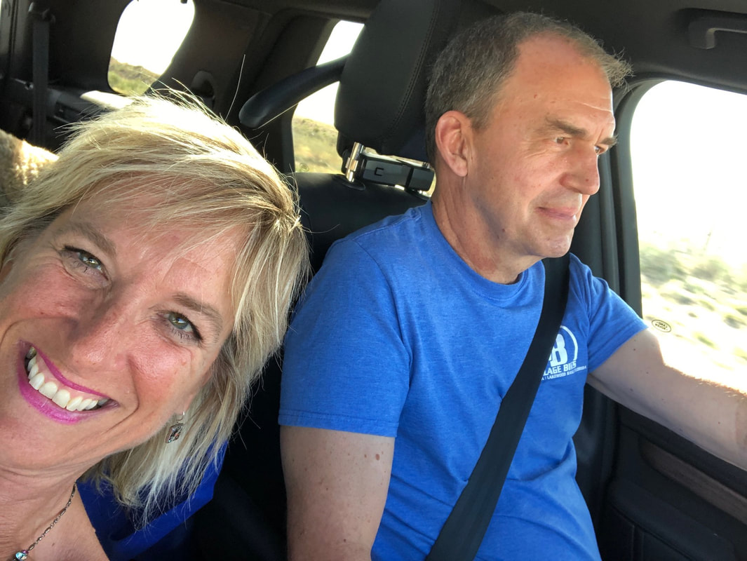 Passengers are always happy when they can veg out while the driver is less so. Well, got more coming soon.
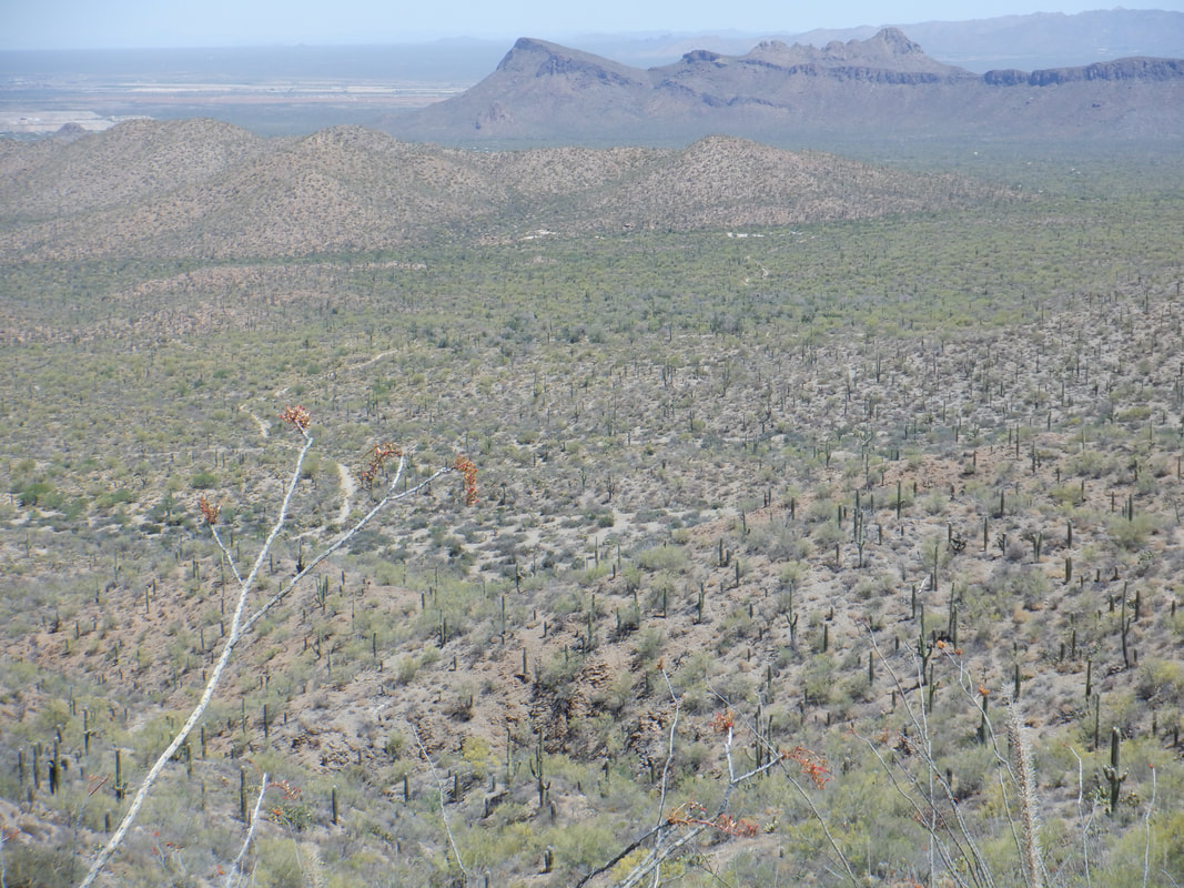 Hey Gang! Been riding a bunch so not many hiking images to post but on a rest day, ventured into the Tucson Mountains to check out a new, for me, trail. More to come along with a drive to Ohio where I will spend a couple of weeks on some acreage I own that is covered with red oaks and other trees.
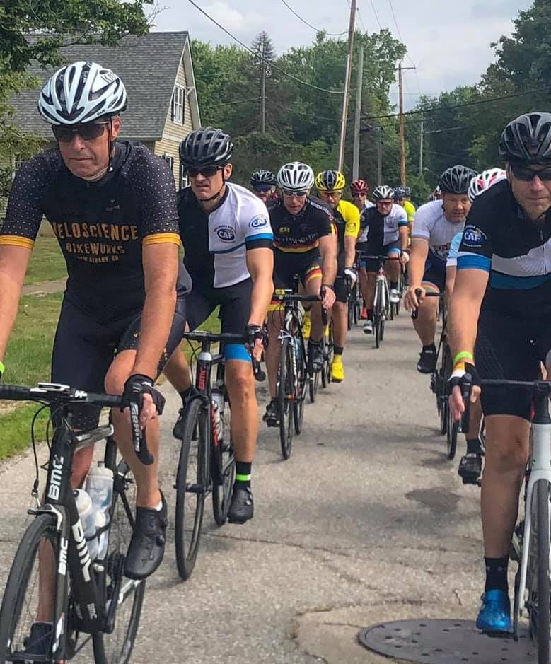 While the sky may be dark and while the rain may be omnipresent and while (yes, I know this is a run-on sentence) the rumbling of thunder is all around and the fields are flooded..., I hear a rumbling of big news coming down the pike!!!! Yes, my few friends, I am returning to OHIO...ok, that's not what you wanted to hear so....yes, we are on the cusp of THE RETURN OF THE CYCLING CLUB'S GROUP RIDES!!! Super Duper Important Information in Anticipation of the Momentous Event for the Newbies:
There are four groups; C, B, A and the Riveters. The Riveters depart promptly at 6:00pm with the remaining groups departing in 3 minute intervals. Parking and departing is behind Veloscience/Philip Heit Center. Yes, it is exciting stuff to mingle with the greats of central Ohio cycling but try to act cool, don't ask for autographs and follow the rules described below. Groups: Riveters: For those of you who can maintain an average of 23+mph for the duration of the route. A Group: Something less than the Riveters and populated by way too many who ought to be in the Rivet group. B Group: 18-20mph average. Sometimes there are two B groups, the 2nd one traveling at a slightly slower pace. C Group: To be clear, I have no direct knowledge of how fast these people go but hear in the 15-17mph range. Rules: 1. Shady Spots-- Never, ever park your vehicle in a shady spot, few that there are, if any. Generally, these spots are reserved for Riveters and guest celebrities to socialize prior to the ride. 2. Ride Leaders--There will usually be a ride leader for the C group but none for the other groups. When it is time for your group to depart, someone will scream, "OK, X group can go now." and if that is your group, depart the parking lot in an orderly manner. Those remaining in the parking lot after all but the C riders depart, will follow the C ride leader who will shepherd you around the route, dispensing knowledge and expertise. This is a congenial group and if you are new to cycling, this is for you. If you are not new but just not that speedy, this too is your group. 3. Regrouping--None in the Rivet group and don't even ask. The A group will regroup for a few seconds, 1-3 times depending on the difficulty of the route. The B group will pause longer and regroup 2-4 times. The C group is a no drop group. 4. Talking--There is no talking in the Rivet group. Only grunting, spitting, sharp elbows to the ribs, etc... Talking is for before and after the ride only. Talking is allowed in the A group but topics must be confined to explaining why you are slumming by riding in the A group rather than with the Riveters. You may also talk about the pro peloton, racing and diet. The B group gets its jollies by jeering those who fall back from the A group so if this happens to you, you ought to abandon the route and solo back to the parking lot, avoiding the jeering crowd. Otherwise B'ers talk about different things when breathing permits. The C group carry on lengthy conversations about wide ranging topics but never about politics. Nothing gets you shunned faster than bringing up politics. 5. Cookies & Treats--Within the group there is the Cookie Lady, Kristie B, who will occasionally provide post ride goodies from the trunk of her car. 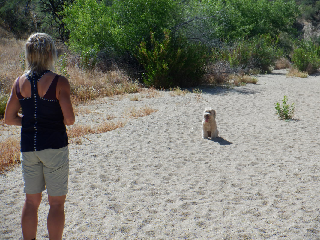 Jack, a well trained dog. Will continue to sit while we walk away but then with the command, "break", ….. 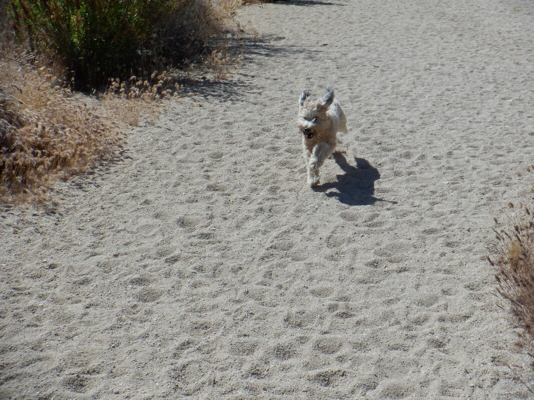 …..! A rest day so heard about petroglyphs within Honeybee Canyon. Parking off Rancho Vistoso (see illustration below for parking), we enter a wash, walk beneath the road and follow the wash for a little over a mile. 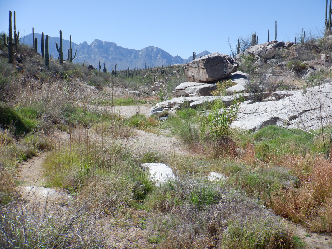 Walking in deep sand is not much fun but eventually the ground firms. In the above image, the rectangle shaped boulder on the right is what you are trying to find. But, I took this image farther up the trail, looking back so you'll look for the boulder on your left as you hike the wash. 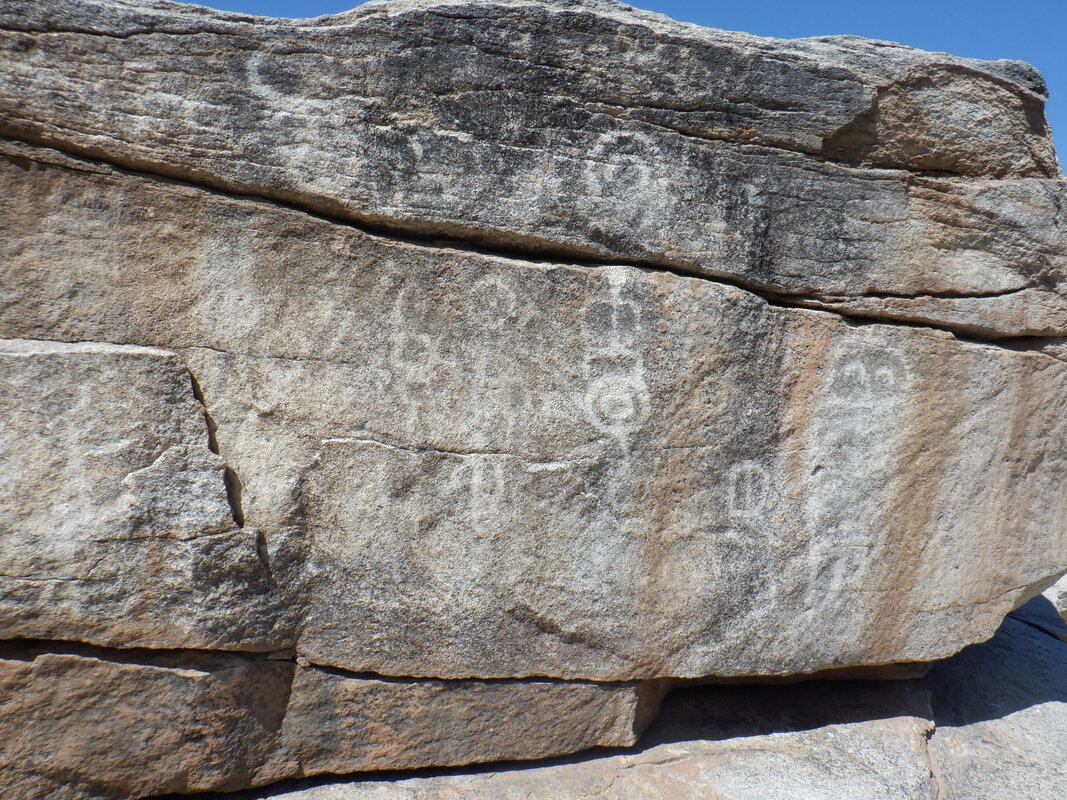 These are all over the valley if you know where to look. The petroglyphs are on the side facing the wash and also.... 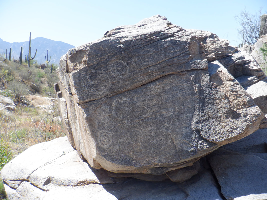 ….on the right side. 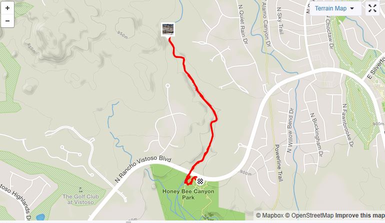 This is about as easy a hike as one can find, that also has a worthwhile destination.
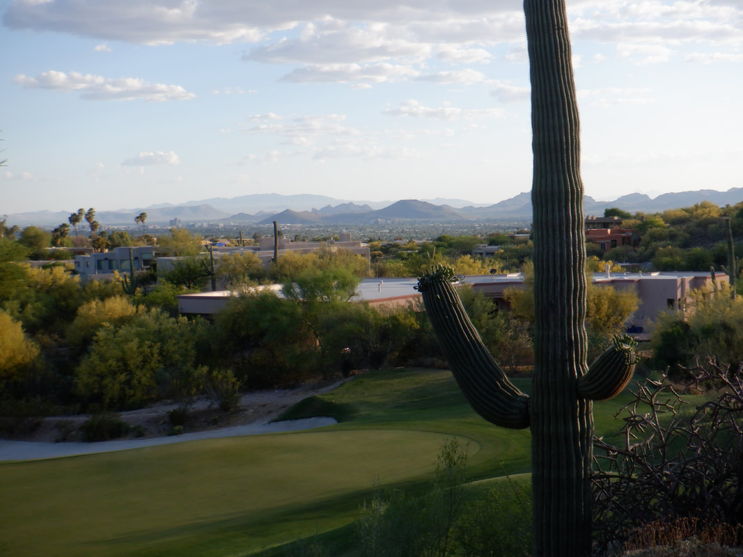 Restaurants have been given the green light to reopen in AZ. Contigo, on the property of the Westin La Paloma, was one of the first and so just had to go and enjoy the view (and food too), looking to the southwest.
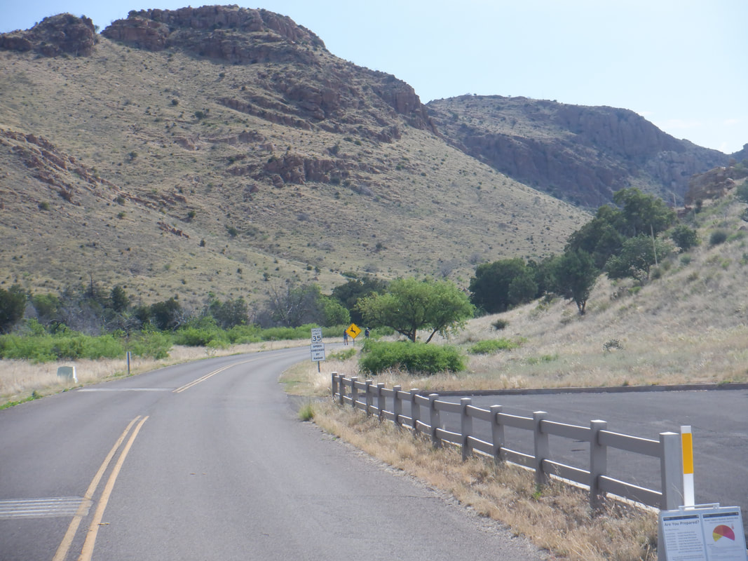 The hike leader (me) failed to perform the simplest of research such as, is the monument even open? Arriving in Wilcox after about 2 hours of driving, there was a digital sign flashing, "Hike OK. Park closed" or similar wording. We parked at the entrance and began a 2.3 mile walk to the visitor center.  Actually, the hike along Bonita Creek was pleasant and informative. 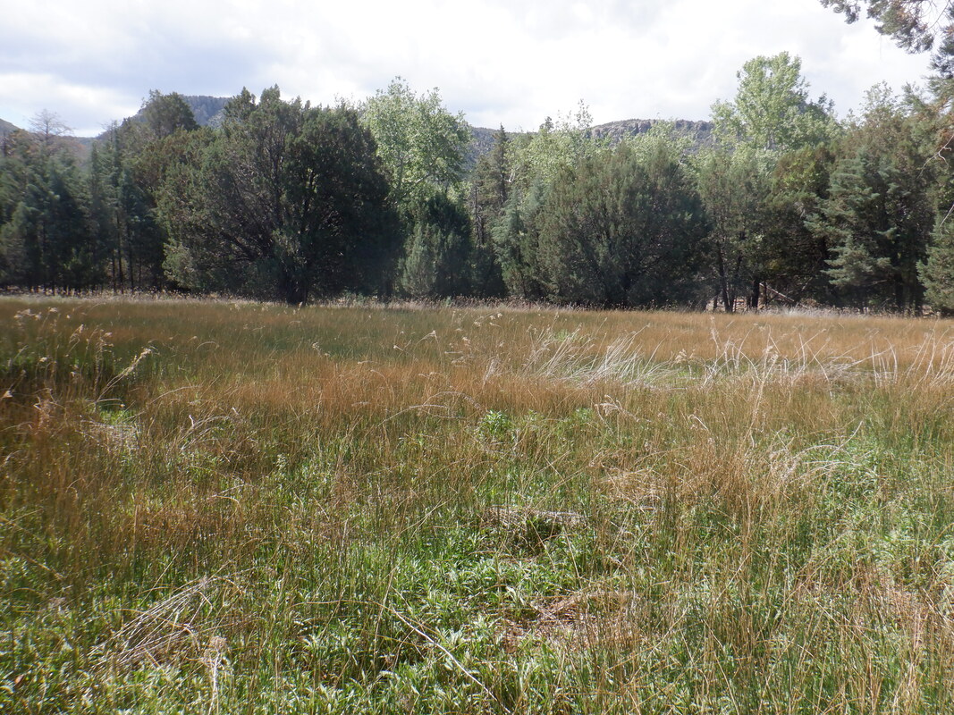 A nice meadow setting with trees having leafed. 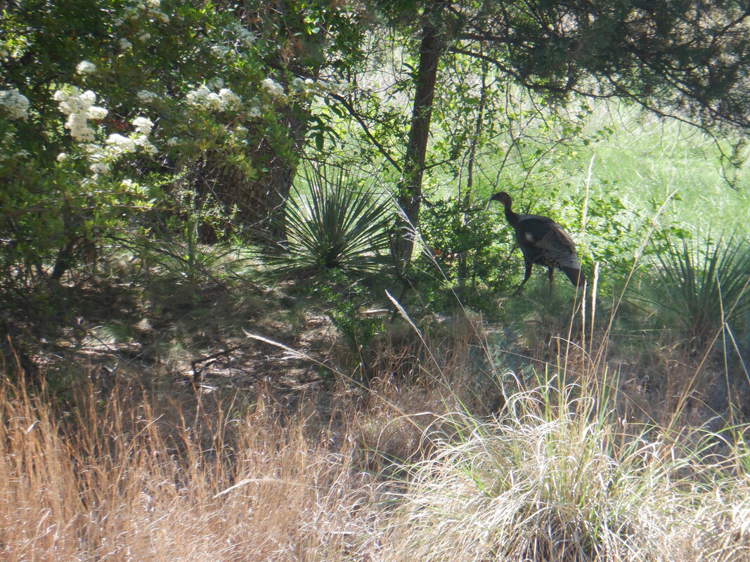 What the....a turkey! We had planned to do the "Big Loop" which would take us on a 9.5 mile loop, visiting the park highlights. But, with the unexpected and extra 4.6 miles round trip from our vehicle, we had to cut it short. 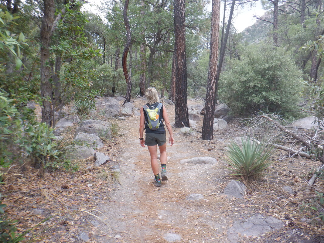 My hiking partner, Amy, leads the way. The terrain is so different from the Sonoran desert. Lots of ponderosa pines, cedars, alligator junipers, manzanitas, etc.... 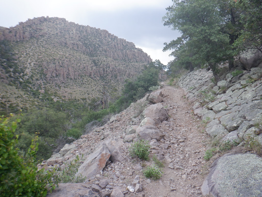 We climb higher but in the distance, we hear the ominous sound of thunder. Now that is a very weird sound! 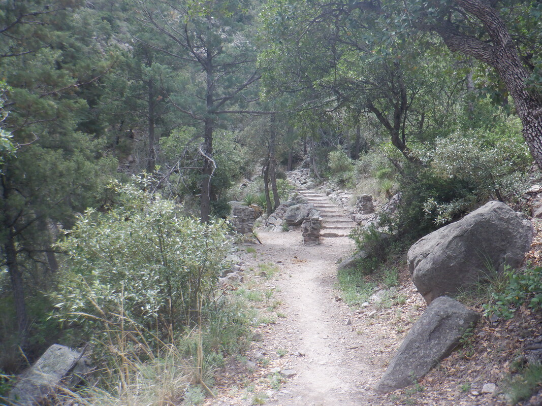 We decide to keep going to where the trail splits. Really too bad to have to cut the hike short because of the road closure and thunderstorms. We decide to head back.... 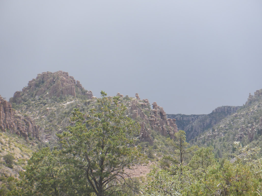 ...and looking back it was the correct decision. Later I looked at weather radar and there had been a red/orange blob ahead of us so we did the right thing. 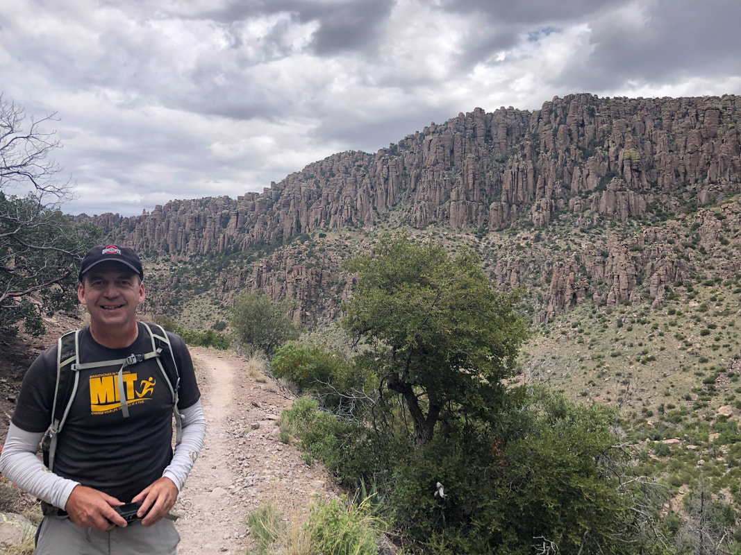 There is the hiking guide, proudly wearing the Ohio State hat. 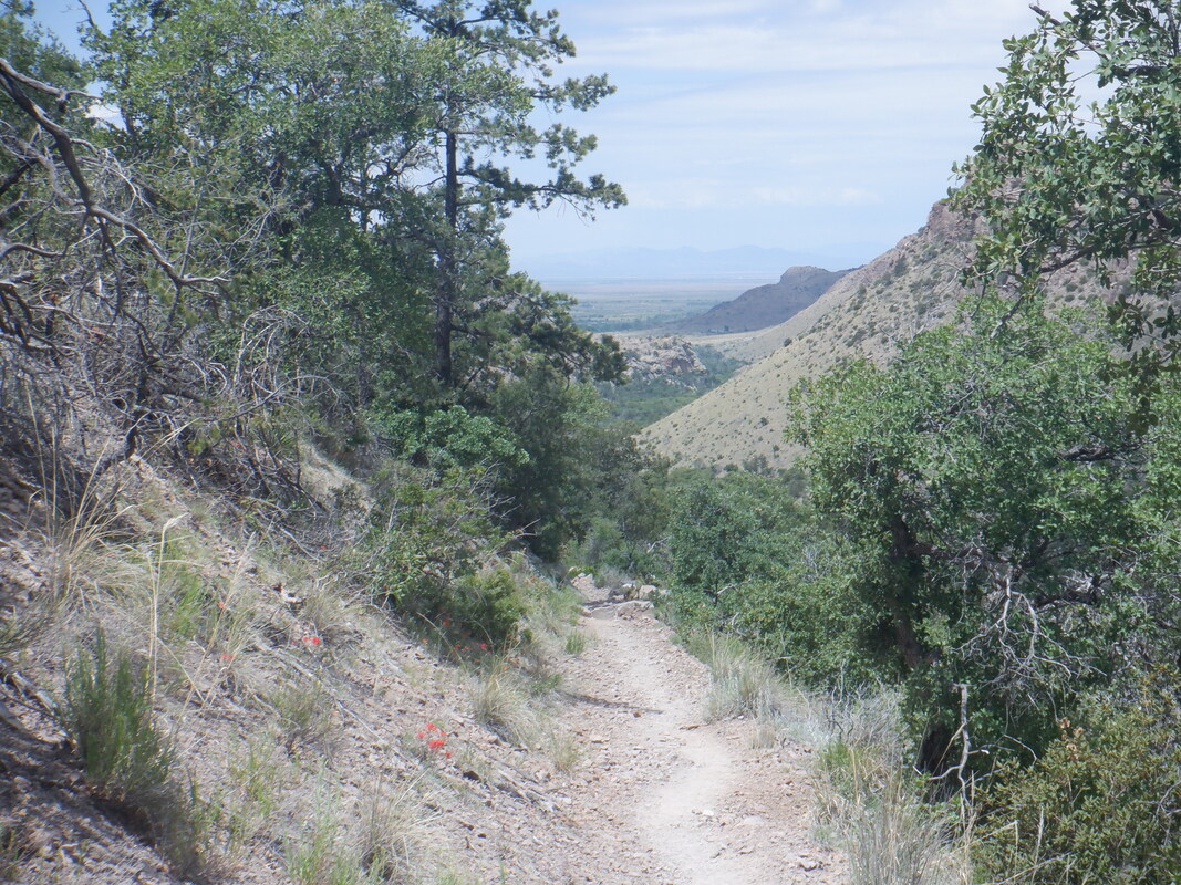 As we descended, to the west the sky was clear and other then a few sprinkles, we stayed dry, finishing with 8 miles.
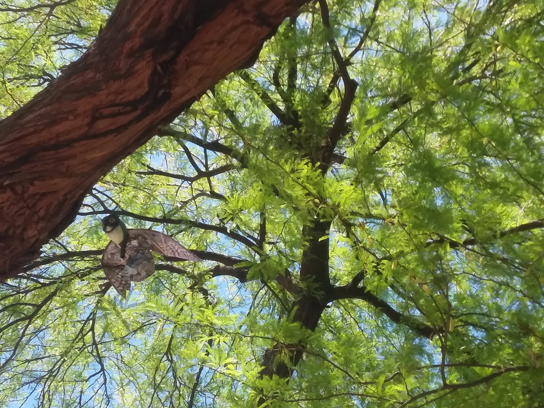 An artificial owl has been hung in a tree to discourage hawks from rebuilding a nest. To the right of the owl is the undiscouraged hawk's effort, a new nest. The HOA hung the owl because the hawks, last season, swooped down and whacked people walking in the vicinity of the tree.
Tuesday morning, walking to my car, I hear something and whack! A hawk got me! Didn't hurt much but did draw a small amount of blood. I keep walking, hear the same noise, turn and here is a hawk, wings extended, claws extended making a beeline towards me. I duck out of the way as it passes over. Now I begin walking backward and the hawk made 2 more passes. I was bobbing and weaving like an aged boxer. I had to laugh when I arrived at my car. This morning, now carrying a tennis racket simply to fend off an attack but not to swing at it (the cover is still on the racket too), I thought I was out of range, drop the racket to my side and whack! Now, I will look like a dork and wear my bike helmet. It seems that in the morning the two adult hawks are most active. Well, rode yesterday and today but nothing momentous to report. More to come, soon. 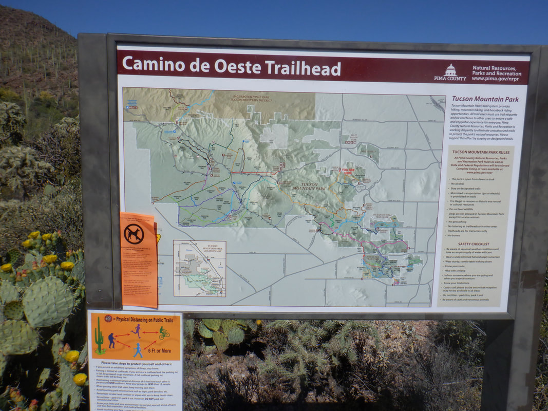 It was a rest day but the thought of doing nothing outdoor active all day was not appealing. So, I did some due diligence on the route to the Painted Cave and hoped it would be a fun and relatively easy hike (it was). I arrived at the parking area at the end of Camino de Oeste Road. The Tucson Mountains have a bewildering mix of trails in places but they also have great signage. I get going on the Yetman Trail. 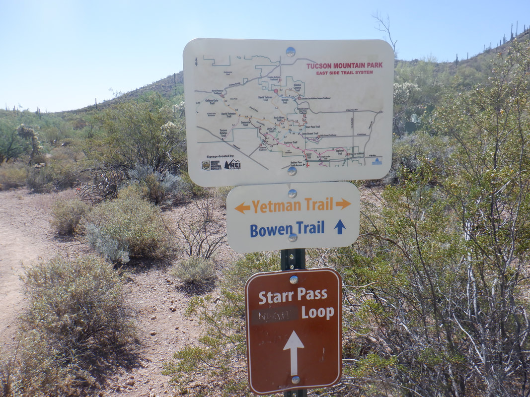 I arrive at the intersection of the Bowen Trail which takes one to Starr Pass Resort but stay on Yetman. The trail is flat to slightly rolling. 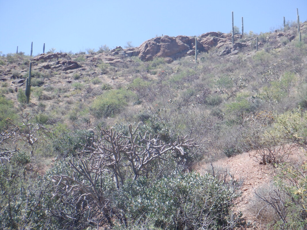 At roughly mile 1.2, I see a faint trail heading to the right and maybe to the above rock formation. My research of the night before stated the trail to the Cave was at mile 1.7 so I ignored that unsigned trail option. 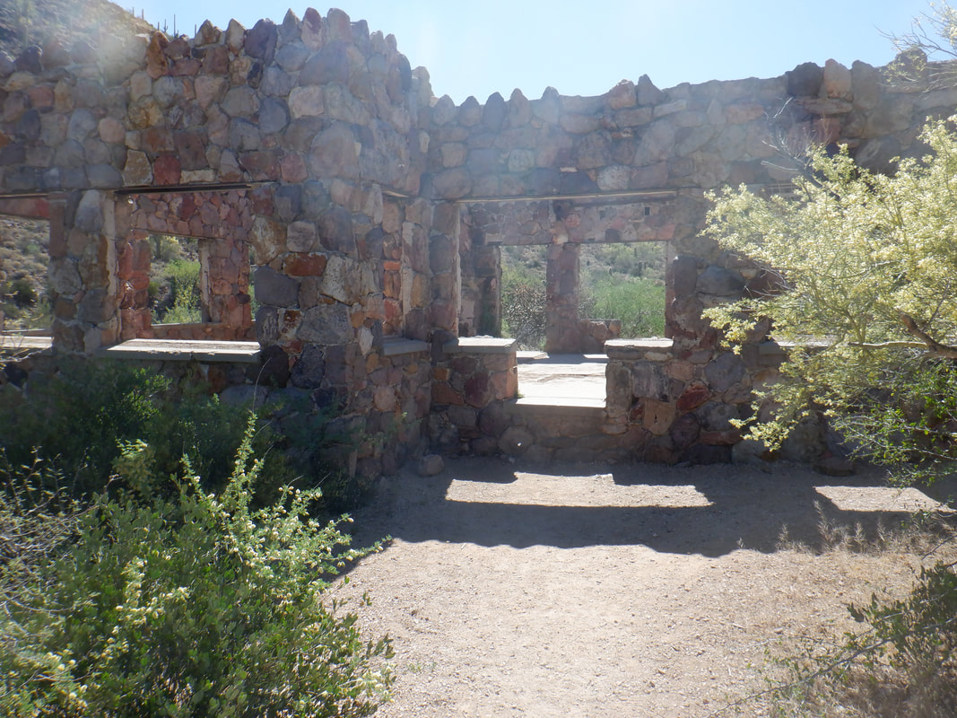 I pass the ruins of the Bowman House. Built back in the 1930's the Bowman's homesteaded an area that at one point claimed 2000 acres. The Bowman's left the area in 1944 and eventually the claim became part of the Tucson Mountain Park. 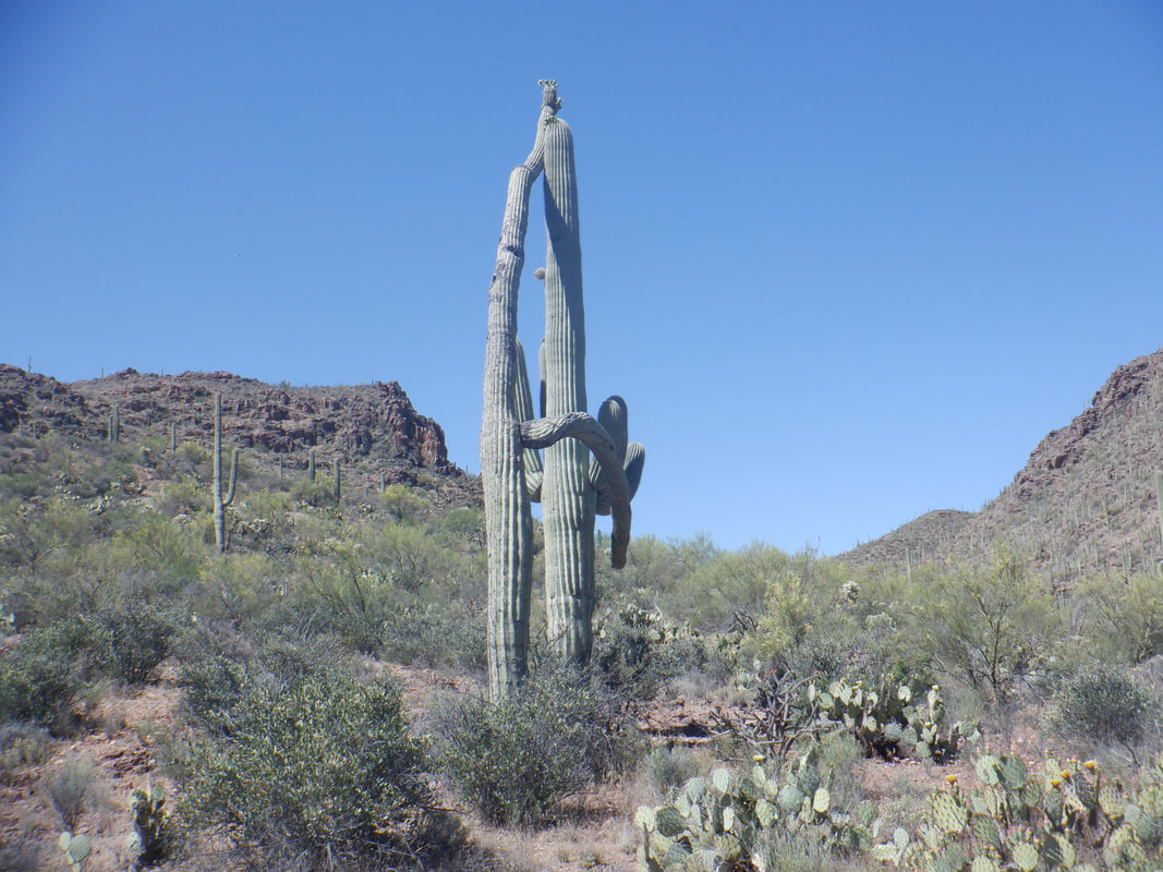 If you are curious about hiking to the Painted Cave, at about mile 1.6 from the parking lot, look for the above saguaros which locals describe as the "Whispering Saguaros". One is whispering to the other. There is also a fairly..... 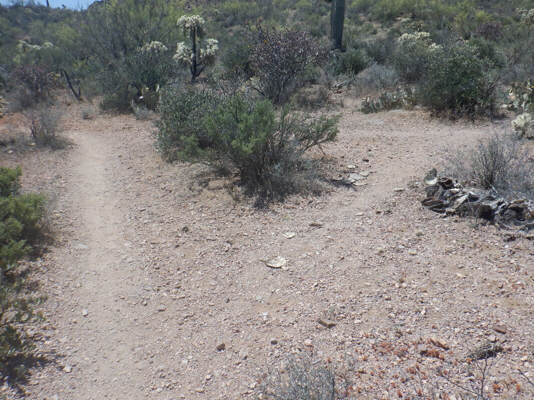 ...obvious trail leading to the right which enters.... 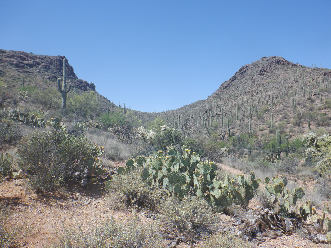 ….this canyon. The cave in on the right even though the easy to follow, unsigned trail, stays on the left slope. After about 0.2 of a mile, watch for a faint trail breaking right. It descends to a wash and then begins..... 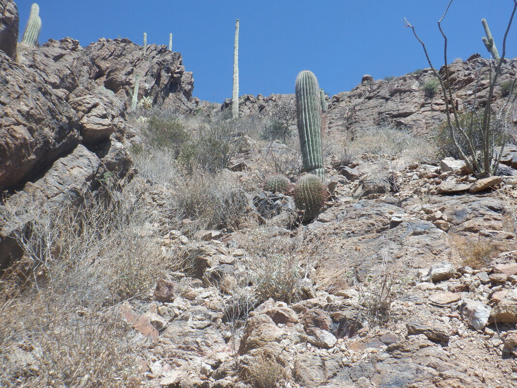 ….a short but kind of steep climb. There is more than one trail to follow as others have pioneered their own routes up the slope. You'll find a hiking pole helpful for the return as the trail is kind of sketchy. All trails lead to..... 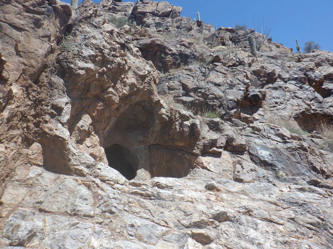 ….the cave. Kind of exciting to reach and note there is a trail that circles to the right of this that leads to other, smaller caves, higher on the slope. I checked them out but did not see any other markings inside. I could have gone higher and will on another visit just to see if there are more caves. 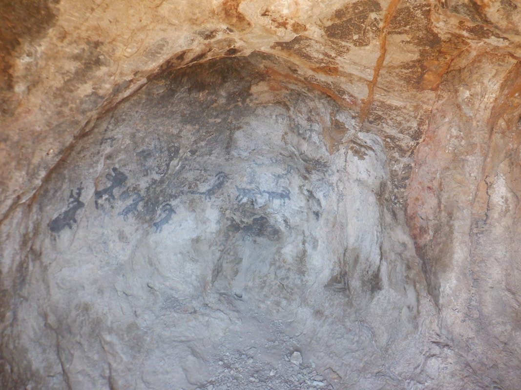 How cool is that? Beautifully preserved paintings of deer and sheep, dating back to the Hohokam's, roughly 300-1500AD. There is space to enter and sit but I elected to stay outside the cave, leaning in to take this image. 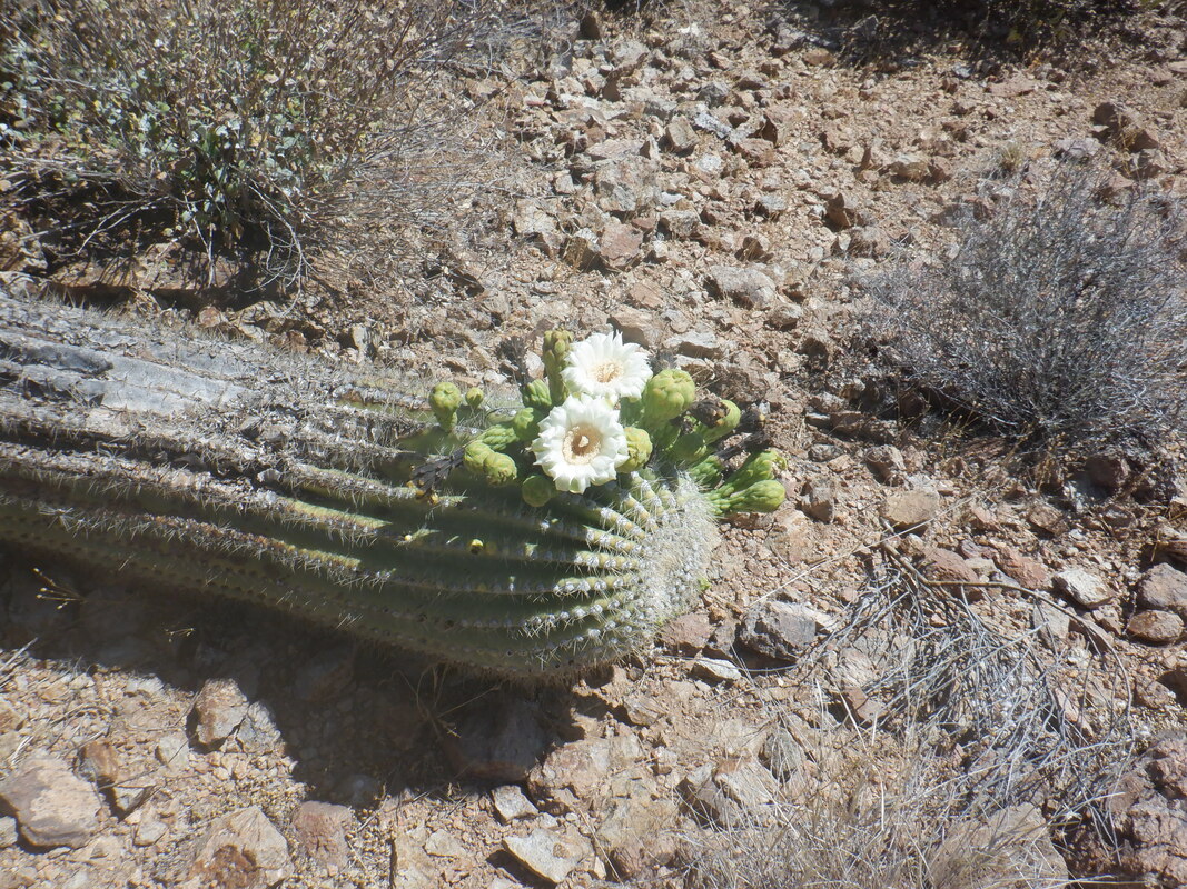 After some exploring, I headed back to the parking area, finishing with 4 miles and a needed, easy day of hiking. It's always good to get outside.
 An early morning start for a ride up to Mount Bigelow where there is a water pump at mile 20. While the winter and spring to date has had below normal temps, that has changed as we are experiencing daily highs about 15 above average. 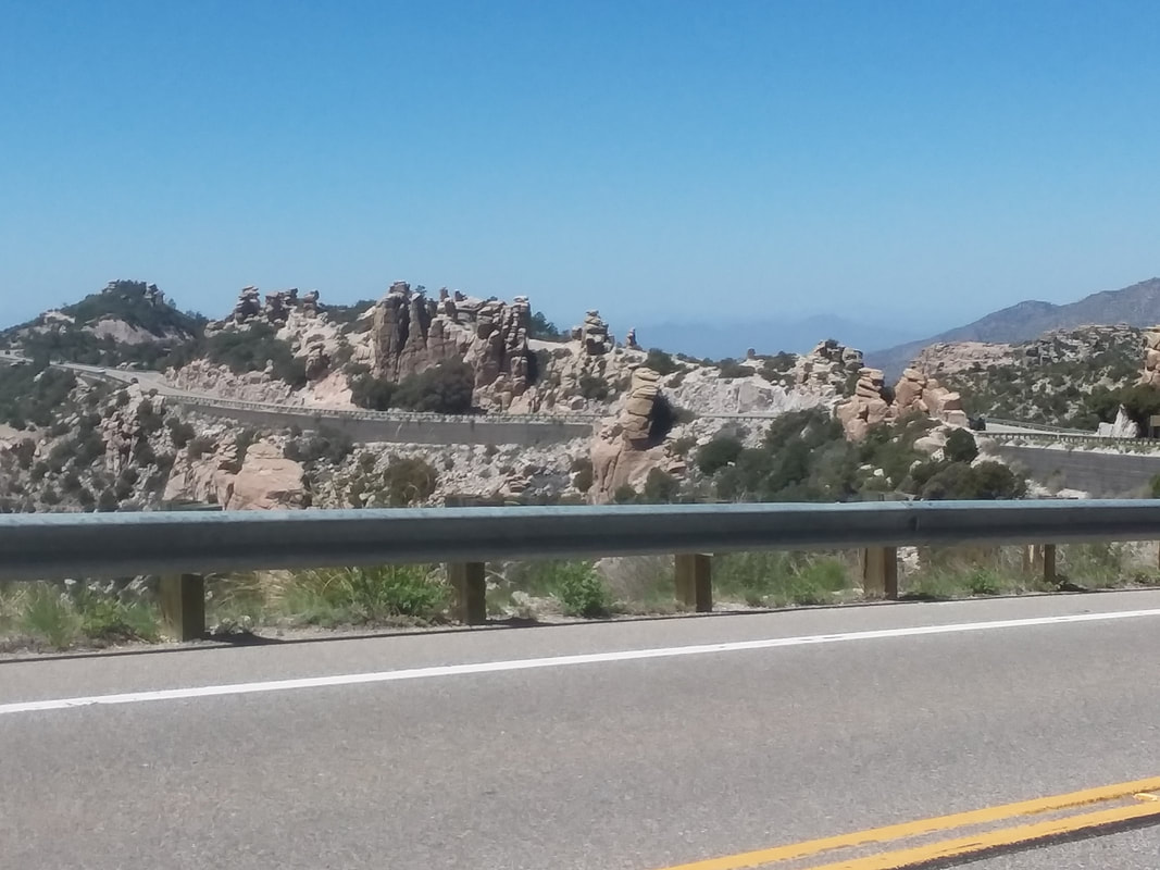 Although not shown in this image, the traffic may be the heaviest I have witnessed, virtually all of it going up. Bigelow is on the shoulder of Lemmon where Summerhaven is located. I can't imagine all the cars having some place to park and as I pass each parking area, the lots are full. 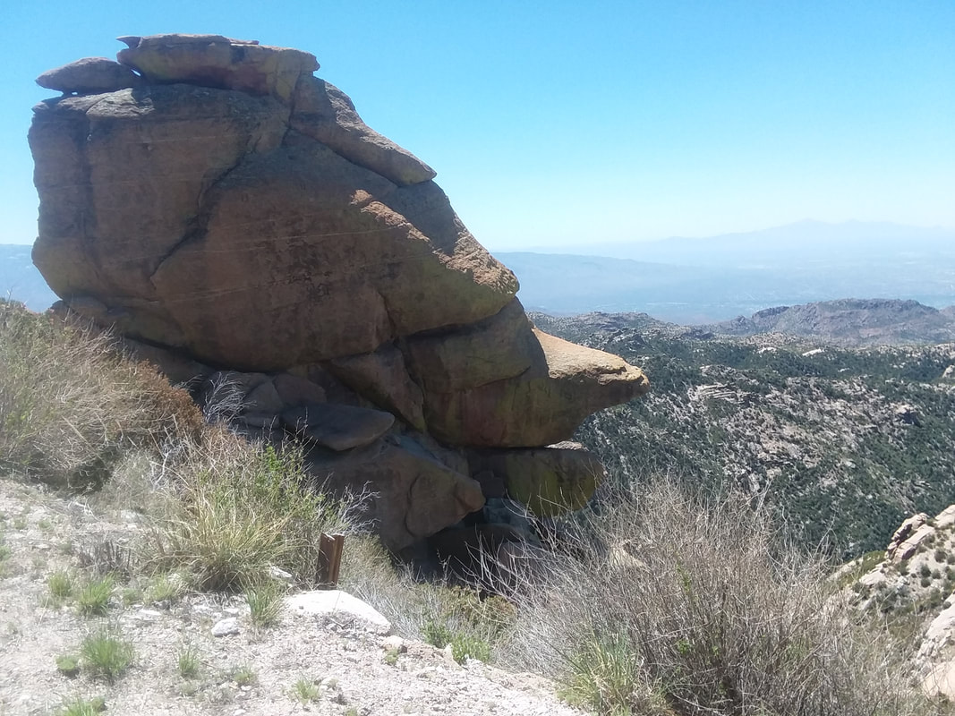 This is an iconic rock formation, visible at about mile 15, above Geology Point Vista. 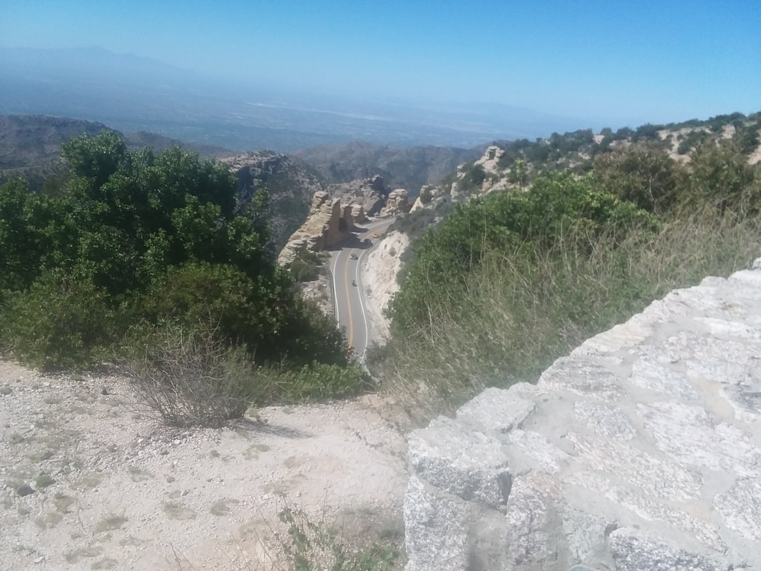 The views, beautiful. The Cookie Cabin and Sawmill Restaurant, both open but for carry-out only are sure to be way busy so I decide not to enter Summerhaven. I pass the time of the ride to count cyclists who are descending. I stopped counting at 100 as they too are swarming the road. 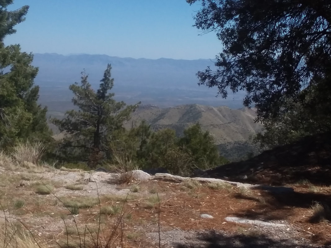 My cell phone is impacted by the humidity of being stored in my back jersey so the images are not so clear. 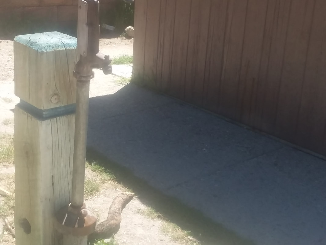 The pump has been turned on and is the only source of water from the climb's base to Summerhaven, again at mile 20. It's only another mile to where the road finally bends down for about 1.5 miles, then rises about the same and rolls into the town but no reason to go there so I turn around and finish with 45 miles and 5000' of climbing. Next day.... 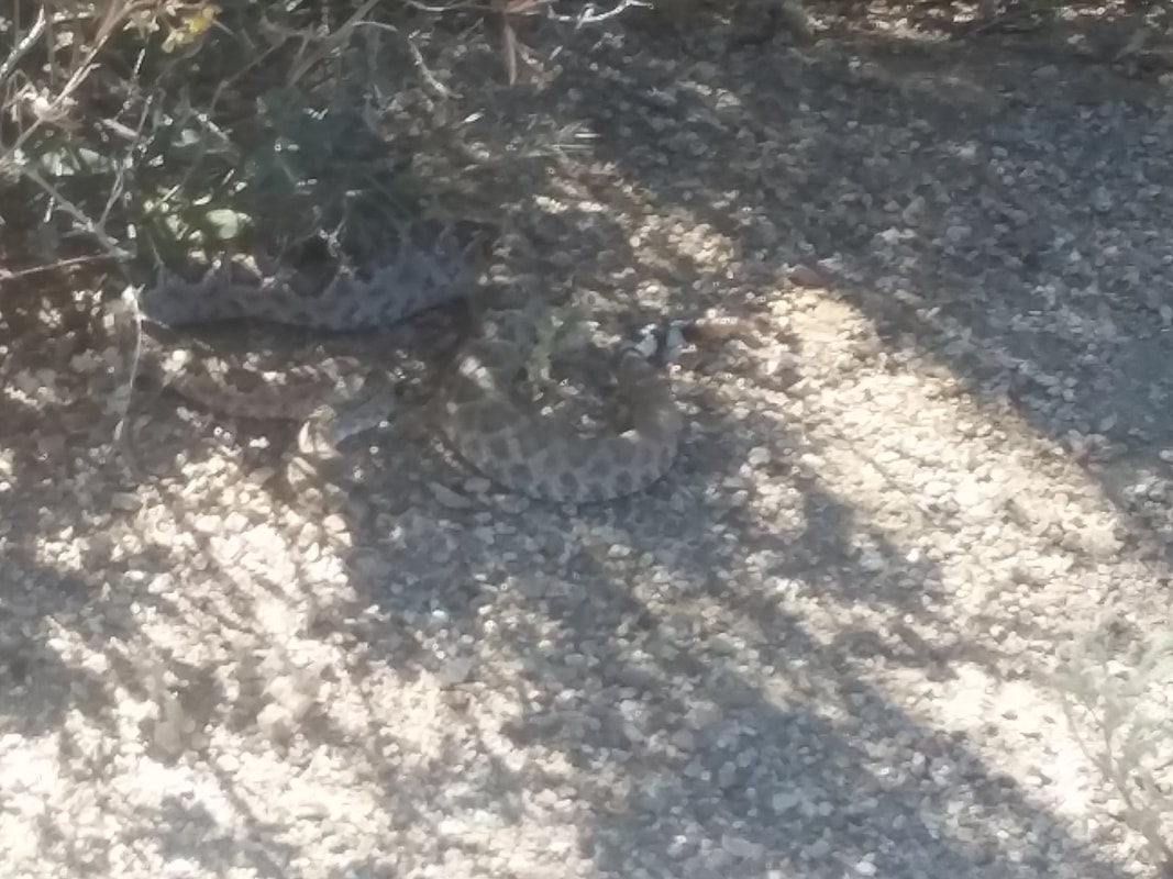 I go out for an easy spin to loosen my legs. While returning the last mile via the bike path, I come out of an underpass and there laying across the path is a medium sized rattlesnake. Nothing I could do but roll over it. I stop, turn around and it is curled as shown above but appears ok. Probably a bad idea to leave it there as a walker could get snagged so I get off the bike, scoot my rear tire under the snake and escort it down a ravine where it had been headed. Sensing I was doing a good deed, it did not strike at me:)
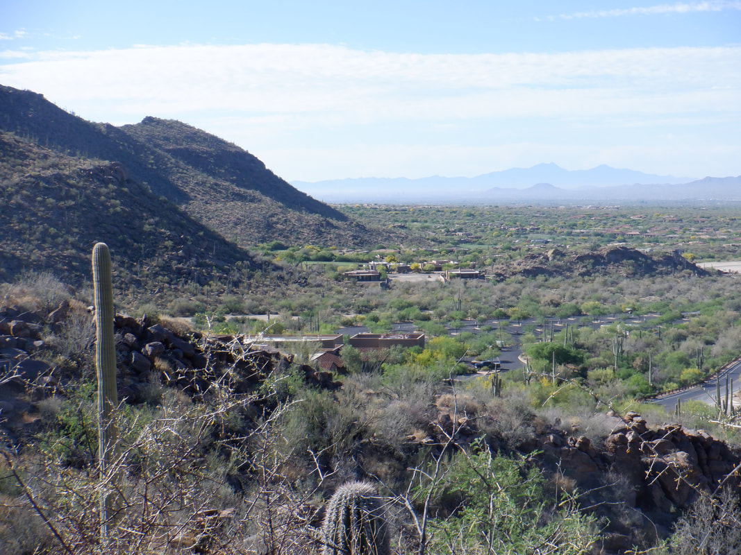 Each of the mountain ranges that surround our area seem to have a different look and feel to them. What I like about the Tortolitas is the climbs are not knee buckling like Wrightson, Rincon, Pusch, Finger Rock, etc... The peaks of course are lower with the top being around 5400' of elevation. So, parking at the Wild Burrow parking lot at Dove Mountain, we are good to go, headed toward the Ritz Carlton before making a left and ascending the Hotel Spur trail. 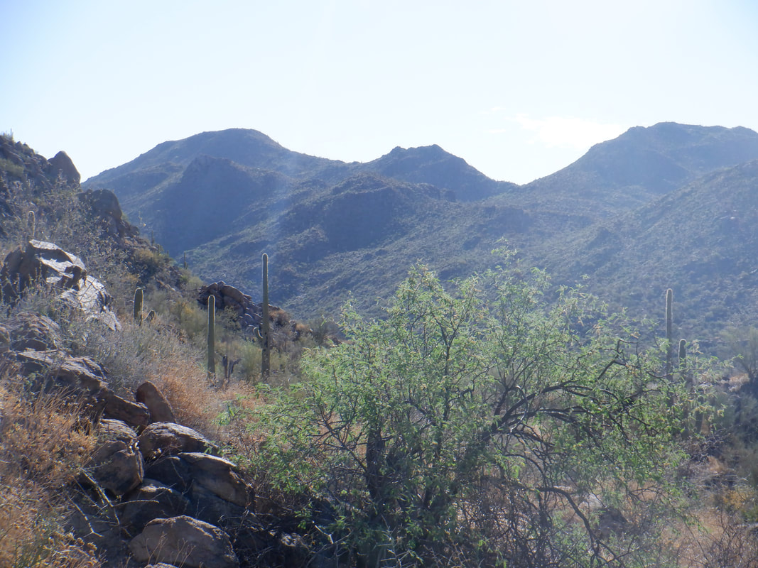 It's a good climb up to the Upper Javelina trail which is followed for a bit before getting on the Wild Mustang trail. The trail drops some before a final ascent to.... 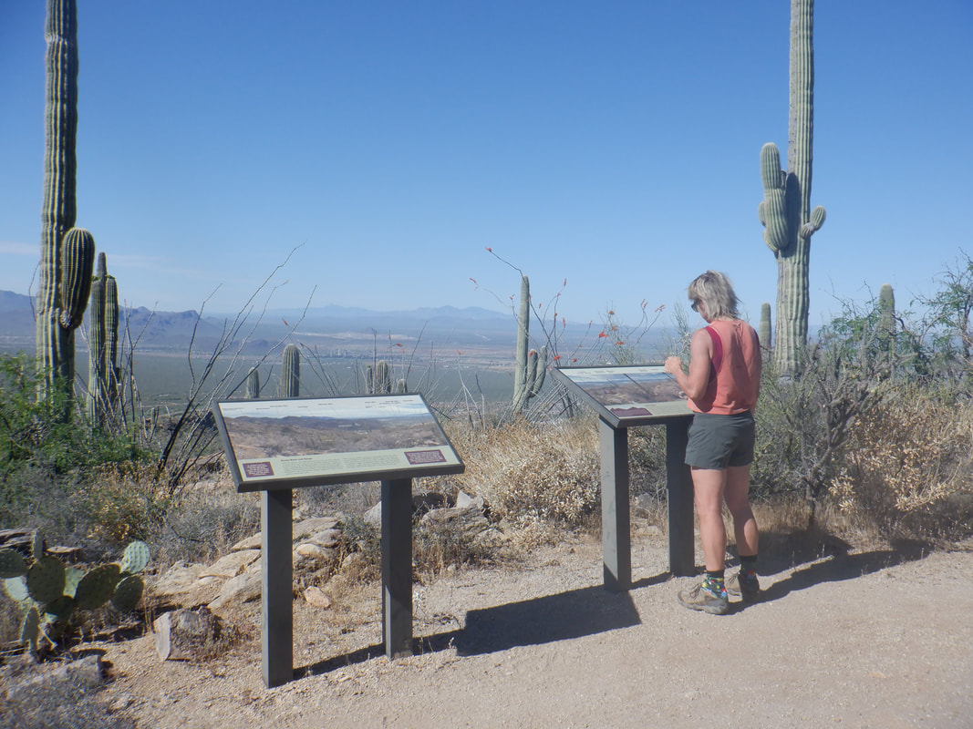 ….a nice overlook. Amy examines the boards that illustrate distant peaks and mountain ranges. I just rest on a bench. The climb to this point is about 1.4 miles, having an average grade of 10% and gaining almost 800'. 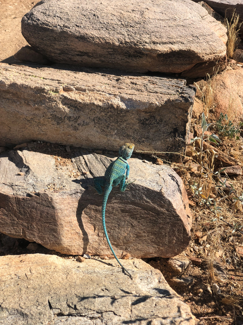 Check out this lizard that paused so Amy could take its picture. The lizards/chameleons were darting every which way in today's sun and heat. OK, the only downside to hiking in this area is you never really get high enough to escape the desert heat. With the high today forecast to be in the upper 90's, the back end of our hike was rather hot. 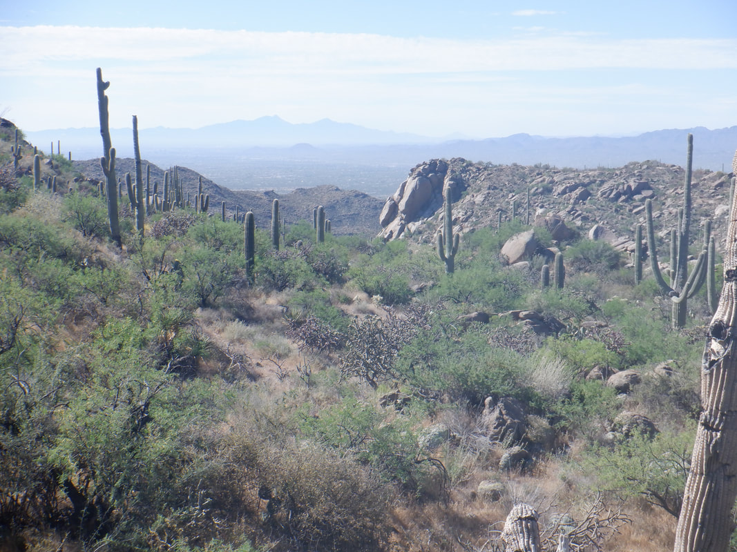 Great views of the Santa Ritas with Mount Wrightson and Hopkins visible. The climbing moderates but still mostly a climb. 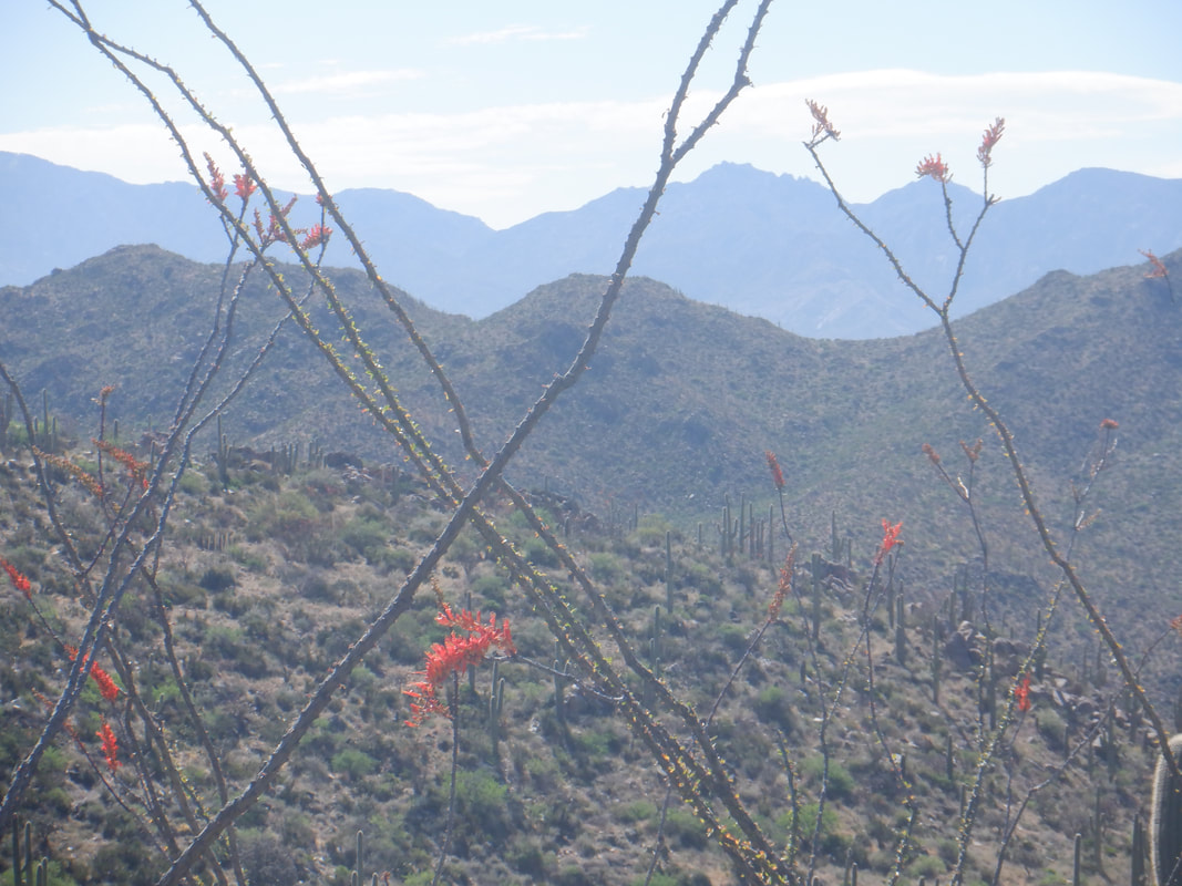 I had intended to reach a left branching trail marked by a cairn at about mile 3 so we could visit Capstone Peak but mid hike I changed my mind. Not sure why I changed my mind as a visit to the peak is worth the effort 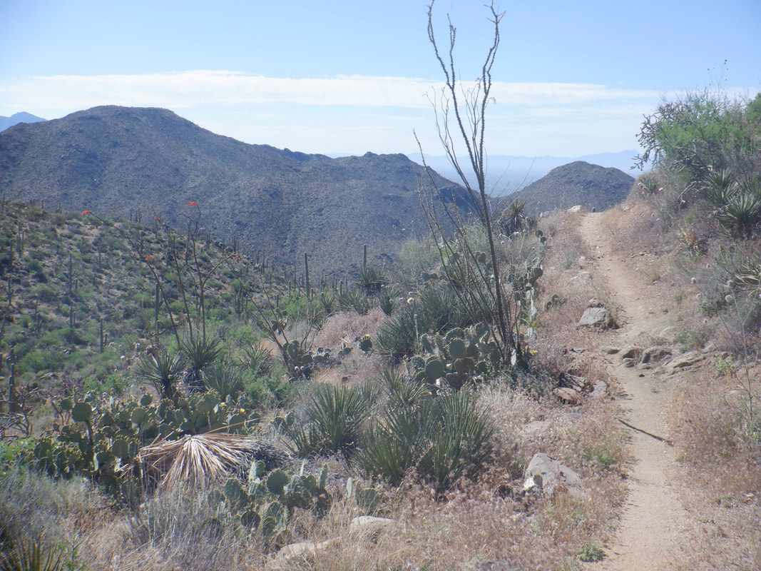 I think partly, I prefer loop hikes over out and back hikes. Considering we had fluids for about 9 miles, I eschewed the Peak route and continued on the Wild Mustang trail. Looking back, I like this image of the trail falling away and it's about at this point that a long descent begins.  The cactus is blooming with some spectacular white flowers atop the saguaros. 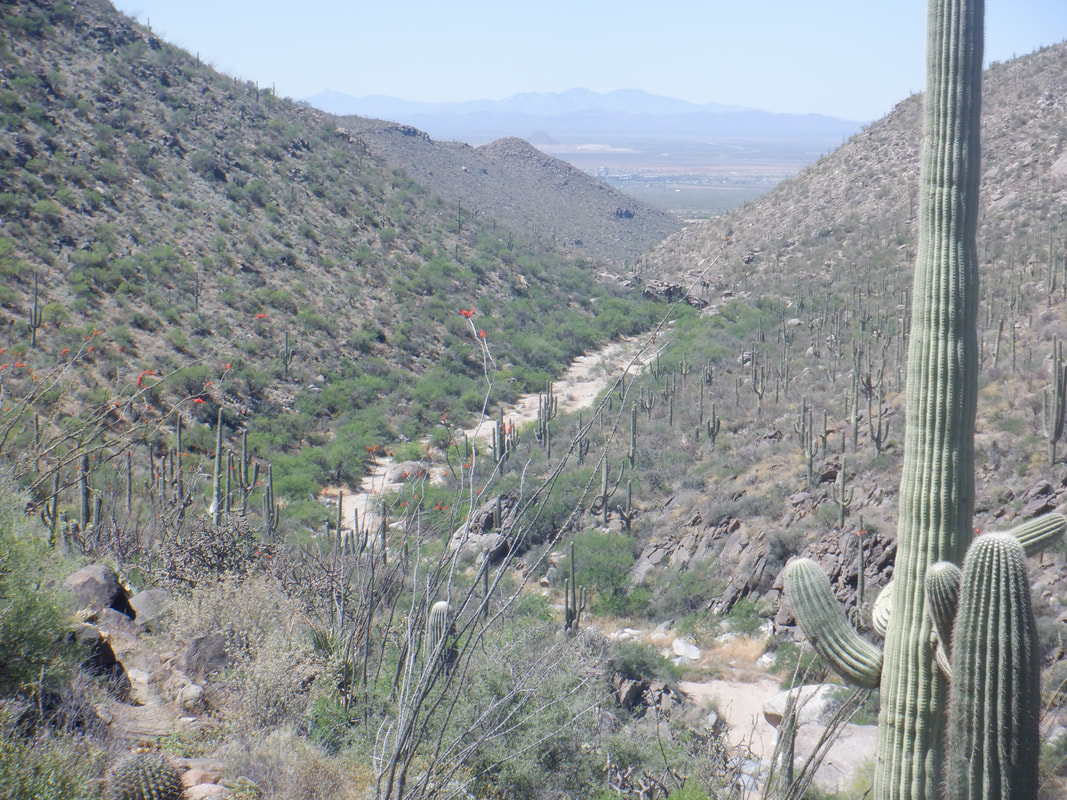 We eventually drop into the above, sandy wash via the Wild Burrow trail and then follow it down one level then another. The final 1 mile is kind of boring though, just walking the wash. Along the way we..... 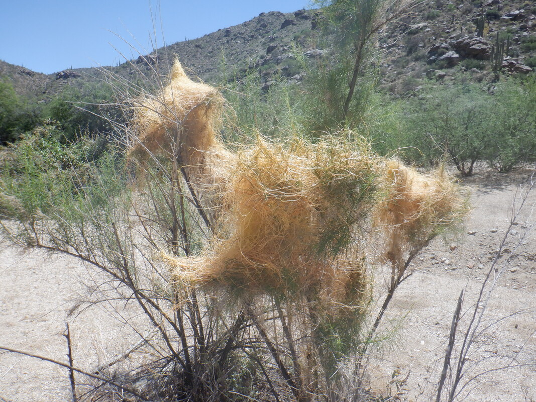 ….spot this plant. Something, presumably a bird, is building a nest in what is not a very stable base. We finished with.....  ….8 miles and 1500' of climbing. Seemed like a lot more climbing then that.
|
