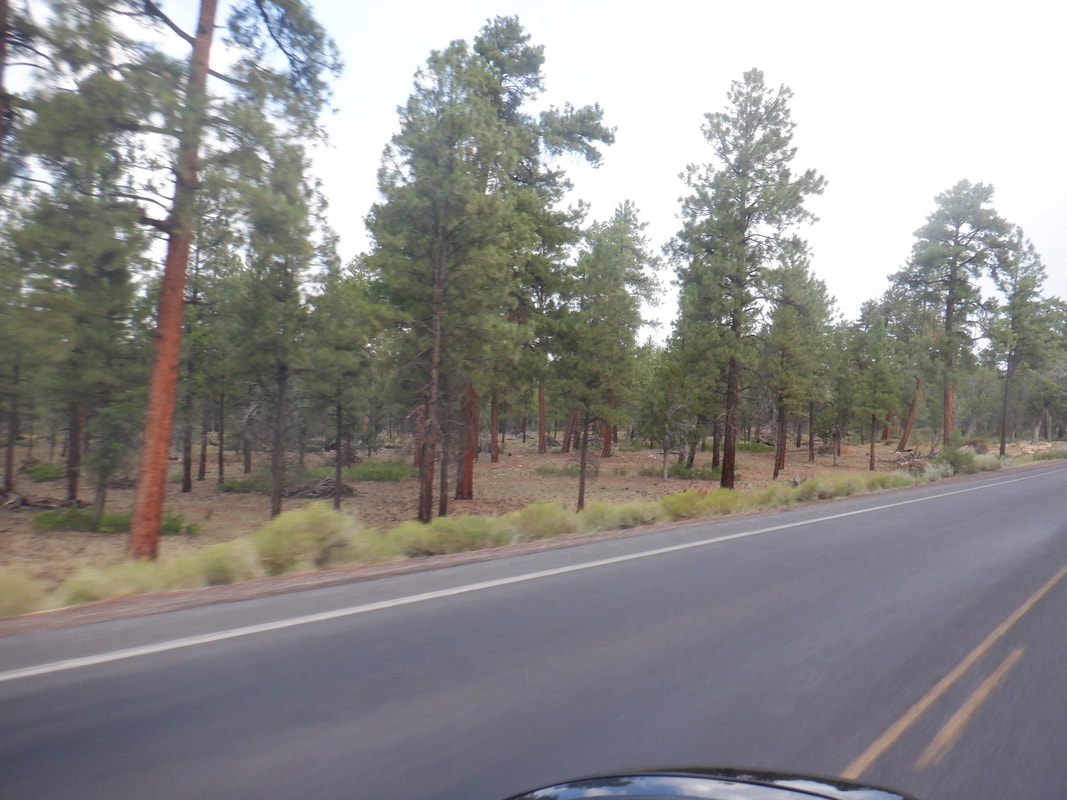
 I've visited the Grand Canyon many times and am always struck by the lack of evidence that just around a corner is one of the natural wonders of the world. My first visit, I rounded a corner, looked to the right and my jaw dropped. So.... 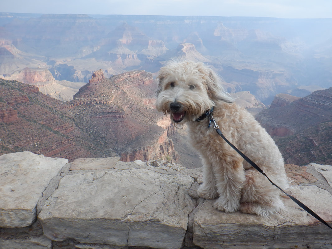 ....magnificent as Amy's dog Jack, seemed to enjoy the view too. We wanted to escape the heat of southern AZ so a 5 hour drive brought us to the South Rim. No pressure to leave early for an outdoor activity so after visiting the Canyon via car, we returned to our hotel where.... 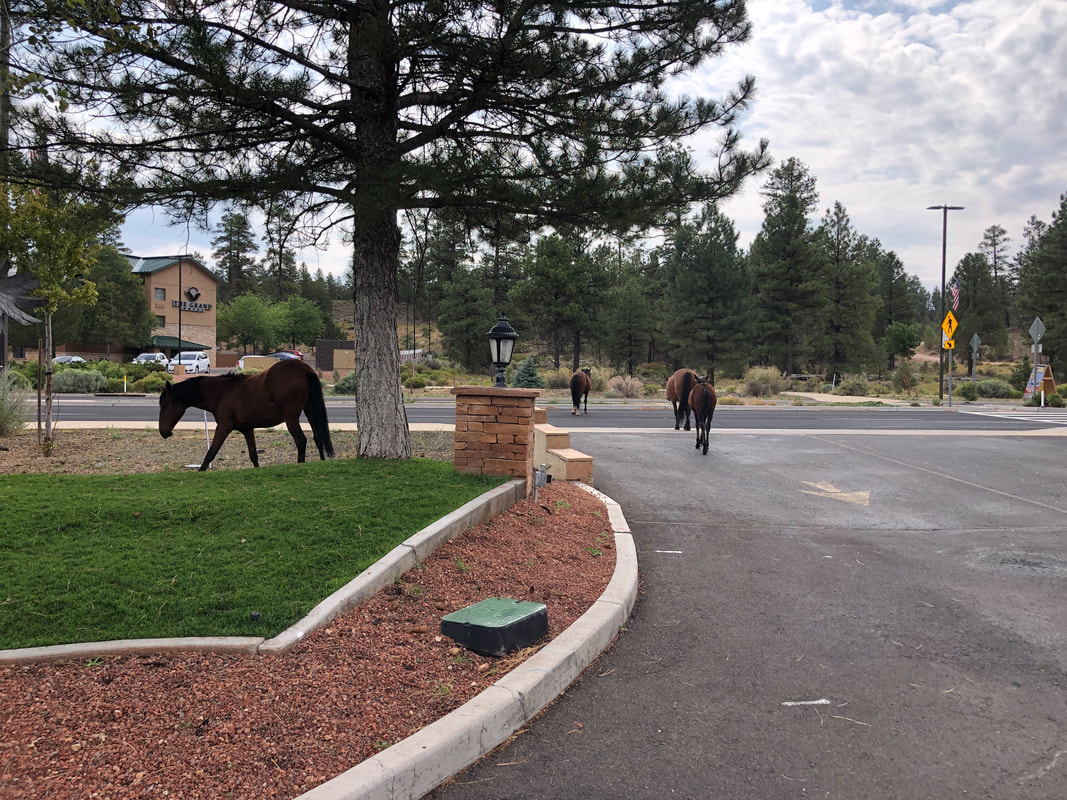 ...wild horses were milling around. We got on our bikes and departed Tusayan, a town a mere 5 miles from the South Rim. Reaching the South Rim, we headed west towards Hermit's Rest.  The road is closed to all traffic and with the buses not running until September 1, we had the road to ourselves except for a couple other cyclists. Several spots provide views of the Colorado River, including some of the rapids. 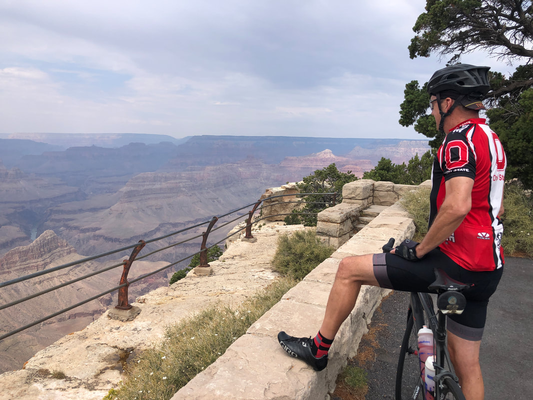 I wore my Ohio State jersey, expecting that to garner a few "Go Buckeyes" from the crowd except there wasn't a crowd. It was almost eerie how few people were at the Canyon. This has to be at least my 20th time here and never have I seen so few people. The buses that disgorge hundreds of people each day are absent too. 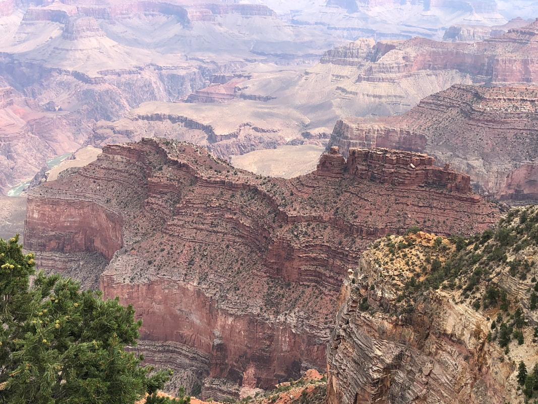 It was fun to stop and view from afar some of the trails I have hiked. The main east/west Tonto Trail was visible from many places along with the South Kaibab, Bright Angel and Hermit's Trails. Our ride was much hillier then I anticipated as at mile 16 we reached Hermit's Rest with 870' of elevation gain. Everything was closed but we were able to refill our water bottles prior to returning. Reaching the area where El Tovar Lodge and Bright Angel Lodge are located we...... 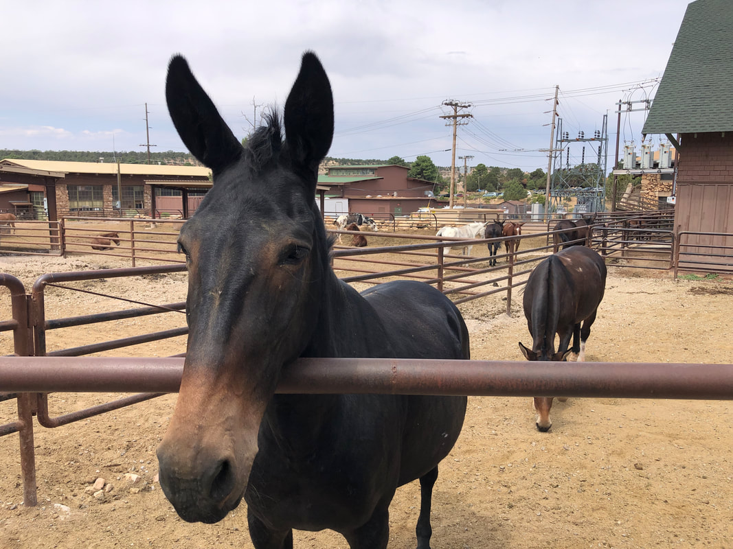 ....paused to take an image of one of the mules. The mule trains are not running as frequently or with as many riders as normal. The bike rental business normally has 28 employees but only 8 are needed to meet the current demand. As we coasted down St. Rt. 89 we saw yellow tape across the road and.... 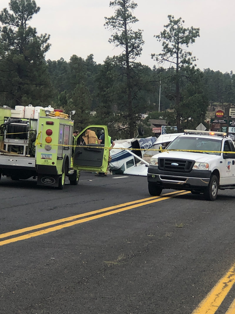 ....reaching the scene saw a single engine plane had crashed. The pilot had run out of gas about 1/2 mile from the airport, attempted to land on the road, wing clipped a pole, turned the plane upside down and bam. The cabin appeared to be crushed yet the pilot survived. We finished with 36 miles and 1750' of climbing. Now comes the hike.
0 Comments
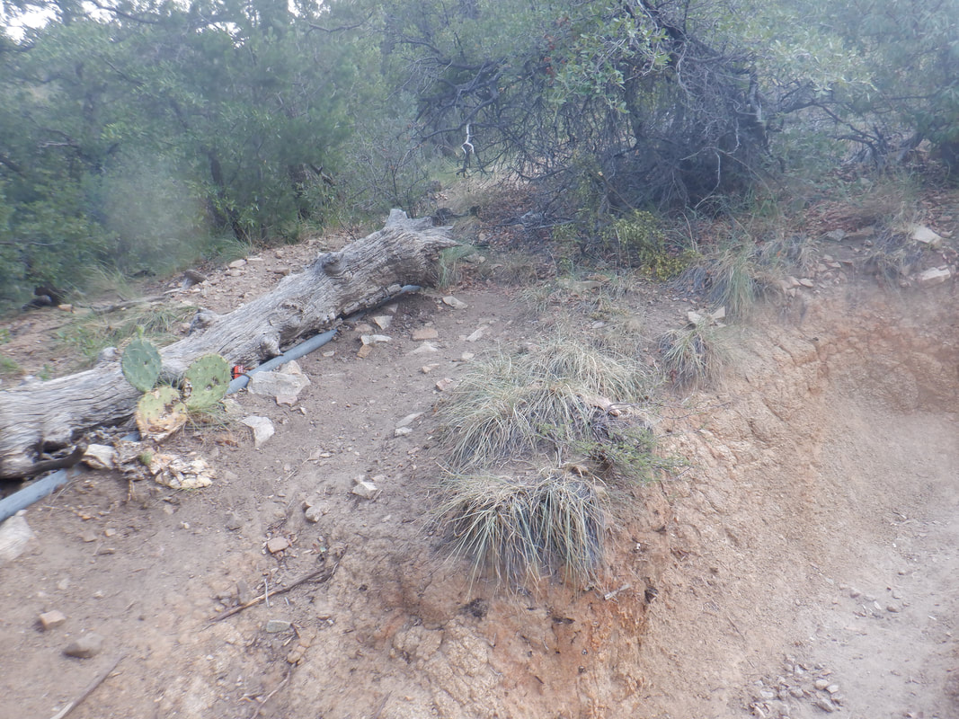 I had long heard about a hike to Roger's Rock but never visited it so had no idea what to expect. A worthwhile destination as it turns out. Much of the route is off the official trails but the route to the Rock is well defined and easy to follow. I start on the Super Trail and less then half a mile, see a trail breaking left at the above fallen log. 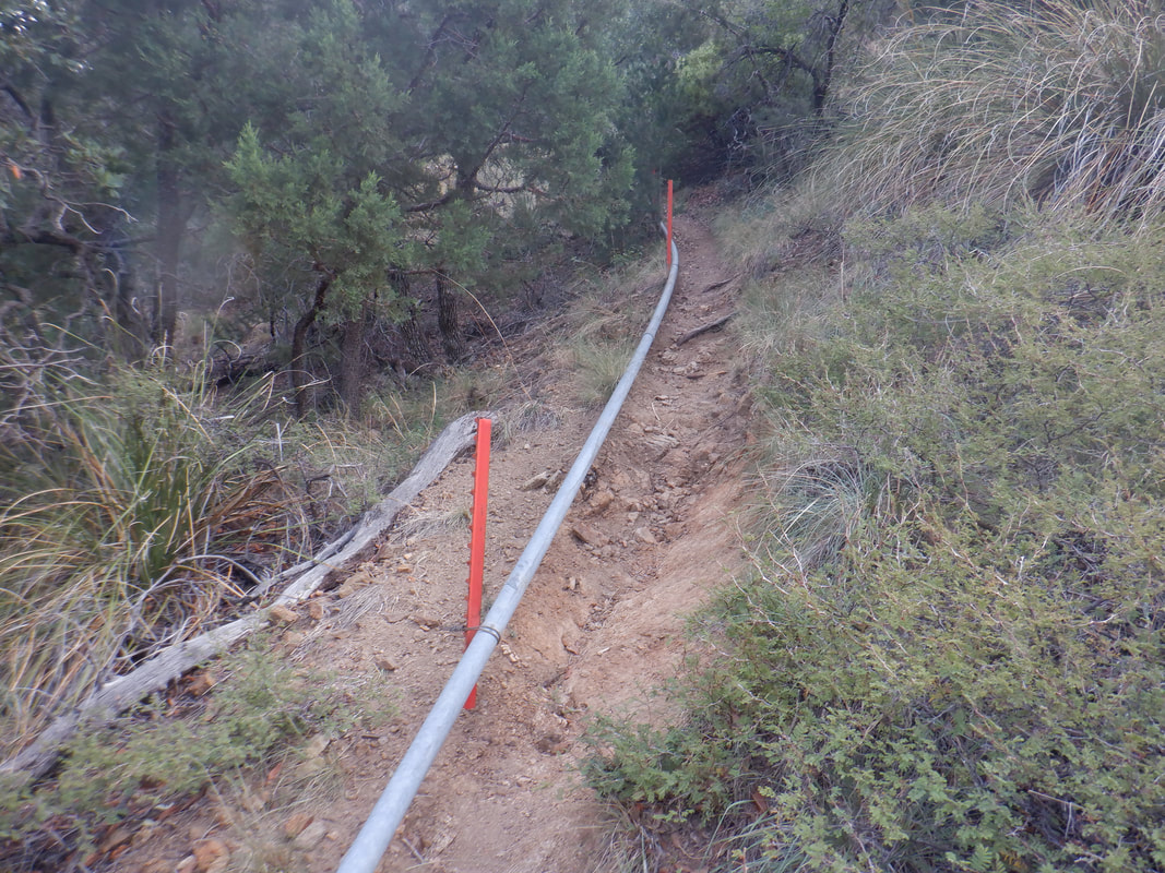 Now I'm on what locals call the Pipeline Trail. It has a few steep ramps but mostly contours around a mountain and generally is a fun, rolling trail to follow. Along the way there are..... 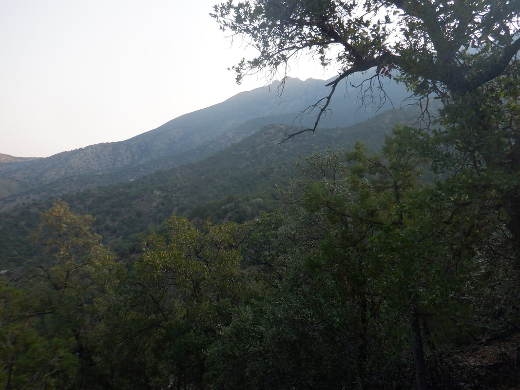 ....many fine views. The trail is above the very steep, Kent Springs Trail and eventually...... 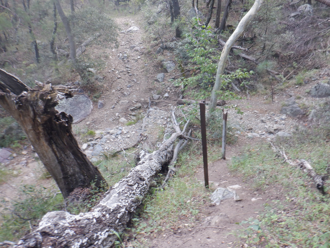 ....skirts it but I bear right and head up a boulder strewn ravine. The trail remains easy to follow although without knowing to go up the ravine, it would be easy to continue on the Kent Springs Trail. 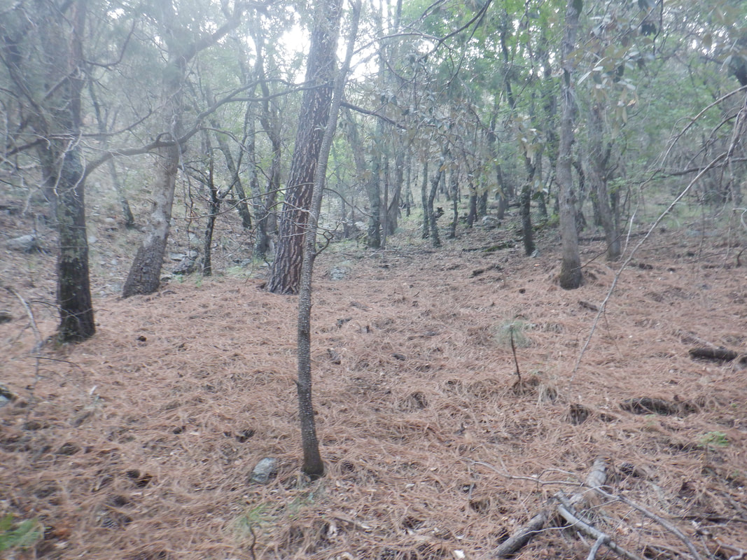 The hillsides are covered with pine needles. Such a different environment from what is a couple thousand feet below me. My hike started at 5400' elevation so the temperature difference is significant. 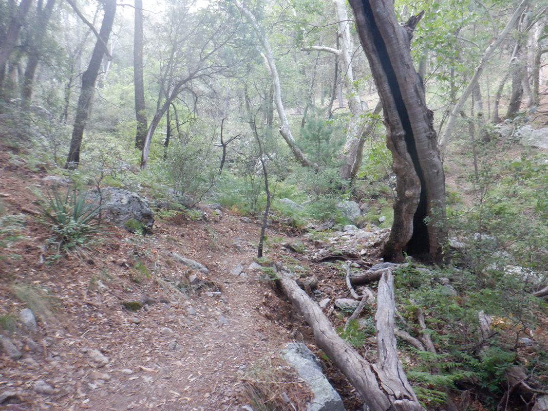 After perhaps 1.5 miles from the parking lot at the top of Madera Canyon, I reach this tree with an oddly shaped trunk. Here, a spur trail breaks left and it too is obvious. 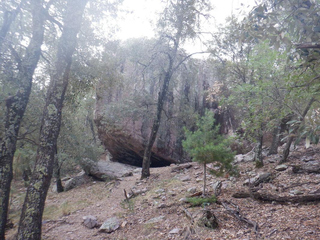 So far, I've not seen any significant rock but rounding a corner, this has to be it. There are several options for climbing around and above it on the right. Reaching the back of the rock I am greeted with.... 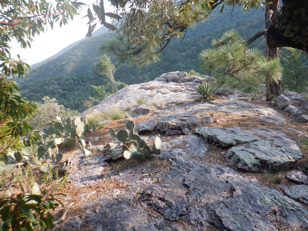 ....a beautiful opening onto Roger's Rock. Don't ask. I have no idea the origination of the name. 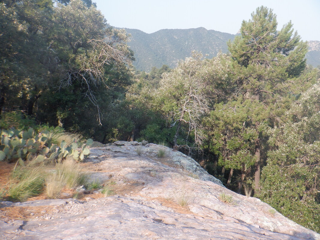 The top of the Rock is relatively flat and expansive. Some good rock seats are available right at the edge. 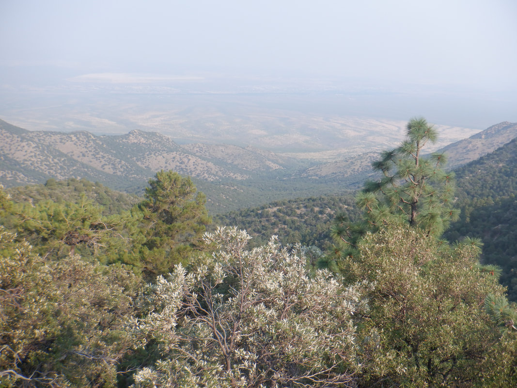 California wild fires are having an impact on the views as smoke drifts to the east and fills our sky. 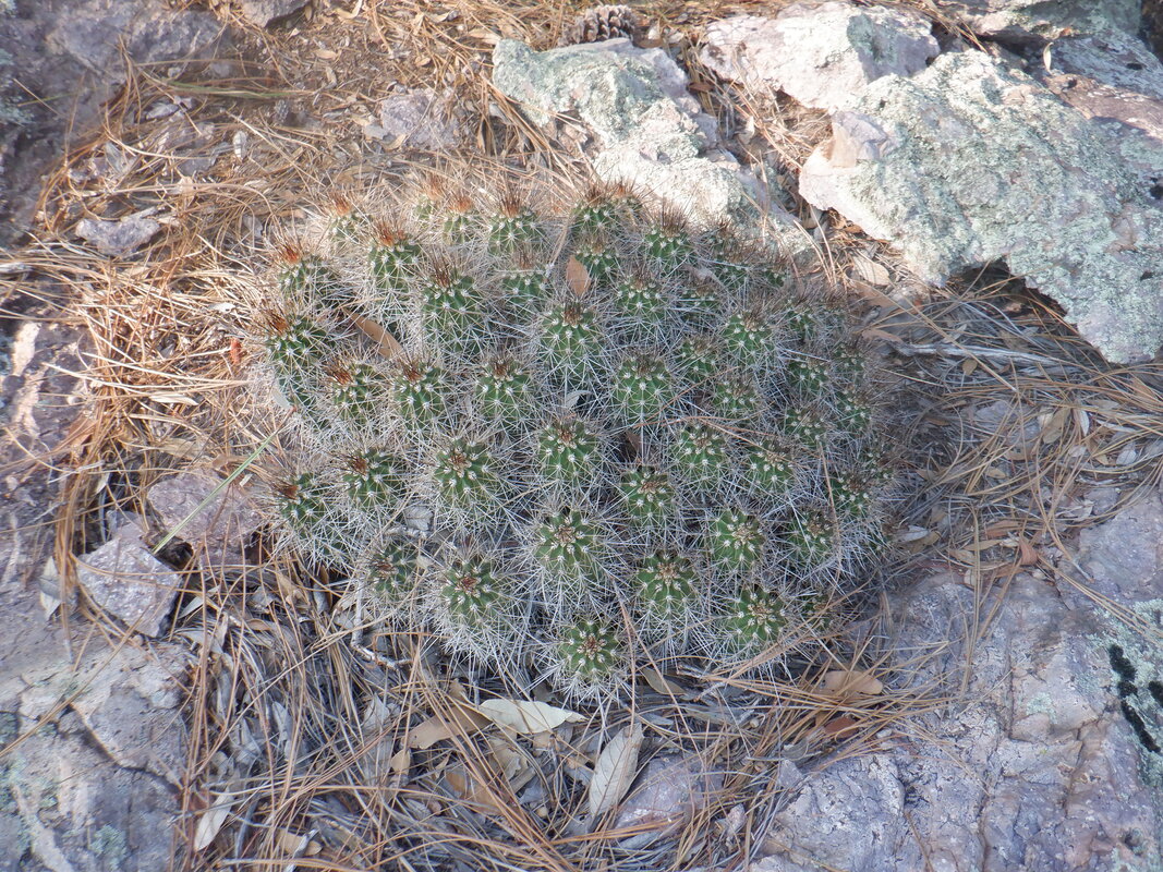 There is a really good example of a hedgehog growing on the Rock. The Rock was not my final destination. I read that a trail continues above it and in 2 miles, reaches Shovel Saddle. It was not my intent to go all the way, just scout the route so I continue up a ridge. 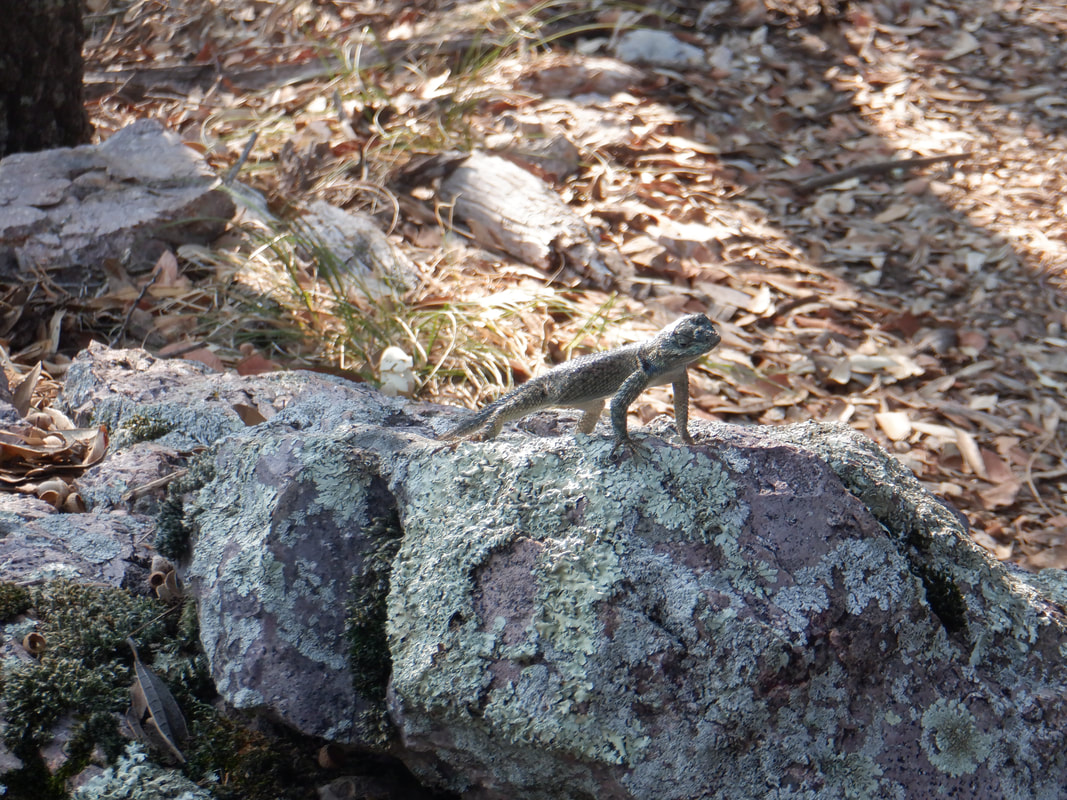 A lizard appears to be giving me the evil eye. 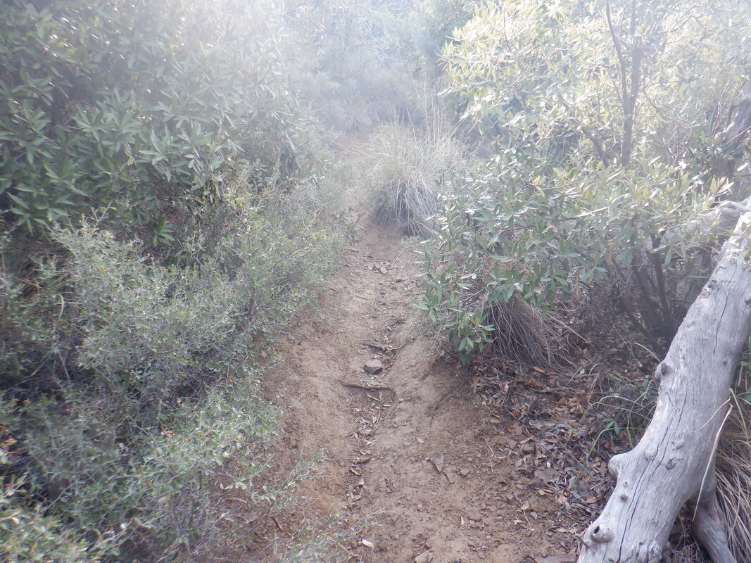 Surprisingly, the unofficial trail is easy to follow although brush is encroaching a bit. 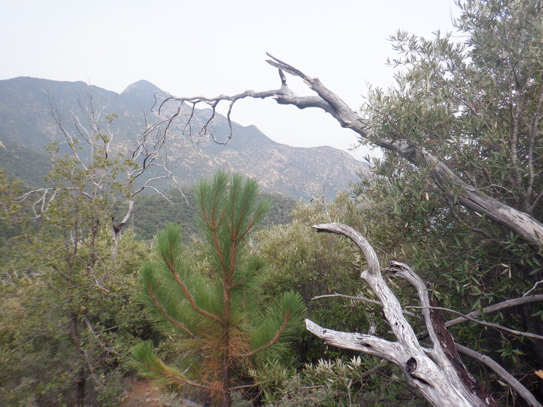 Seeing that the route is much easier to follow then I thought, relieved, I turn around. 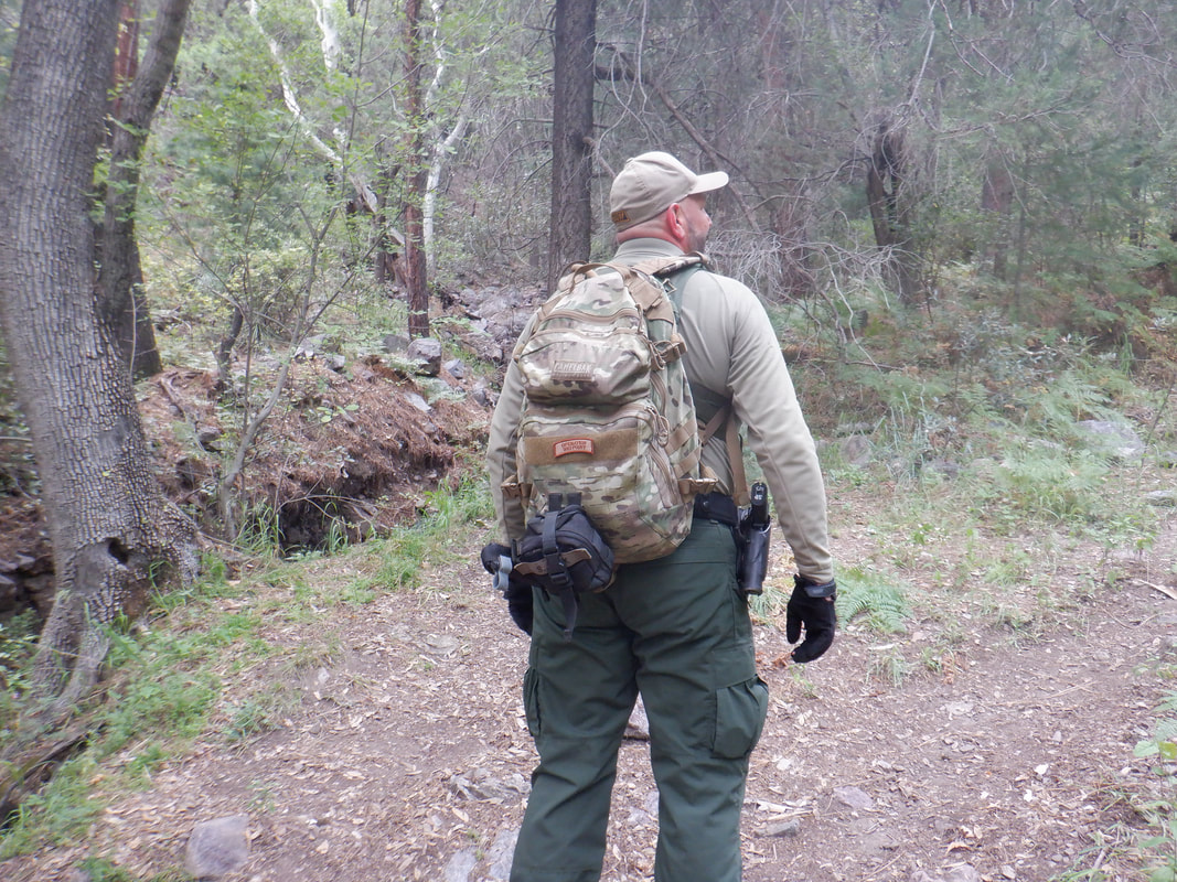 When I reached the Pipeline Trail, I spotted a Border Patrol Agent, my 3rd encounter in the last week. I've enjoyed talking to each of them and their perspective. One thing has puzzled me though; I always assumed the drug runners and other border crossers used the network of washes to move through the area. I asked this guy about that and he said partly it was the availability of springs for drinking water but mainly, if a group is spotted (in this case there were 15 some where in this wilderness), it takes the agents hours to respond, gear up and hike. By that time, the group can be long gone. Finished with 5.2 miles and 1500' of climbing. Well, headed north to the Grand Canyon and much cooler temps. Will report back soon.
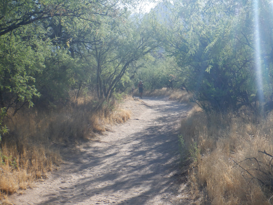
 You can't say you have not been warned as we..... 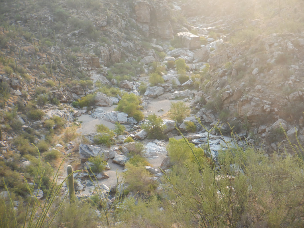 ......descend into Tanque Verde Canyon. We head up the canyon which is littered with enormous boulders that are great fun to climb over, around and under. 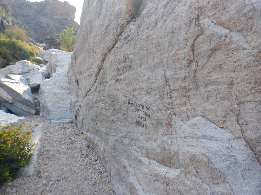 One giant boulder has a message, warning we are entering an area where nudists sunbathe. Way too early for that crowd as we..... 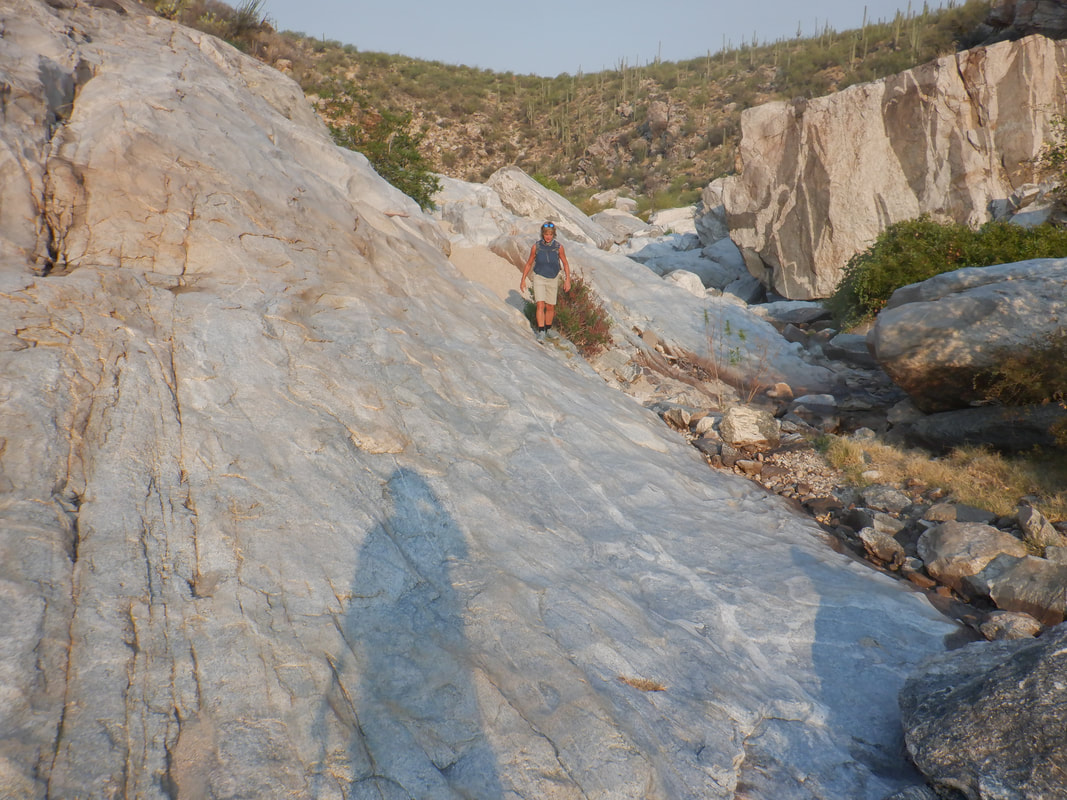 ....plot a careful route. Don't want to have to call 911. The monsoon has been disappointing again this year so rather than enjoy the flow of water.... 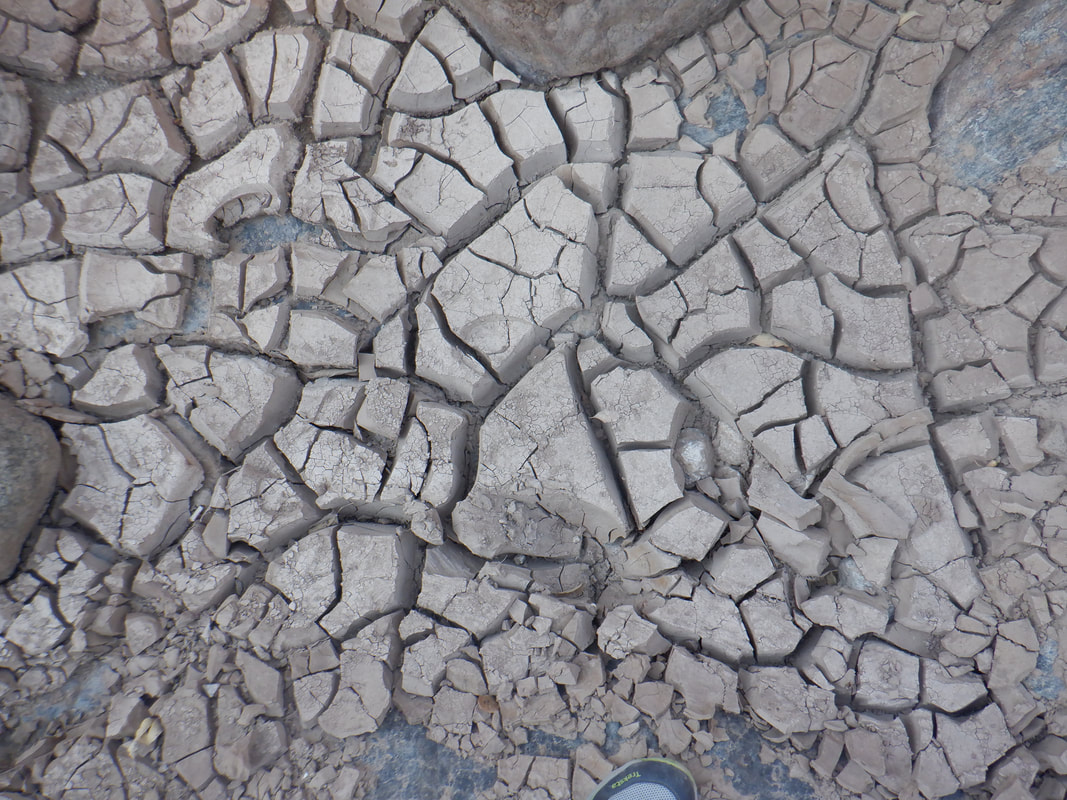 ....it's very dry. The absence of water opens up alternatives so when we approach.... 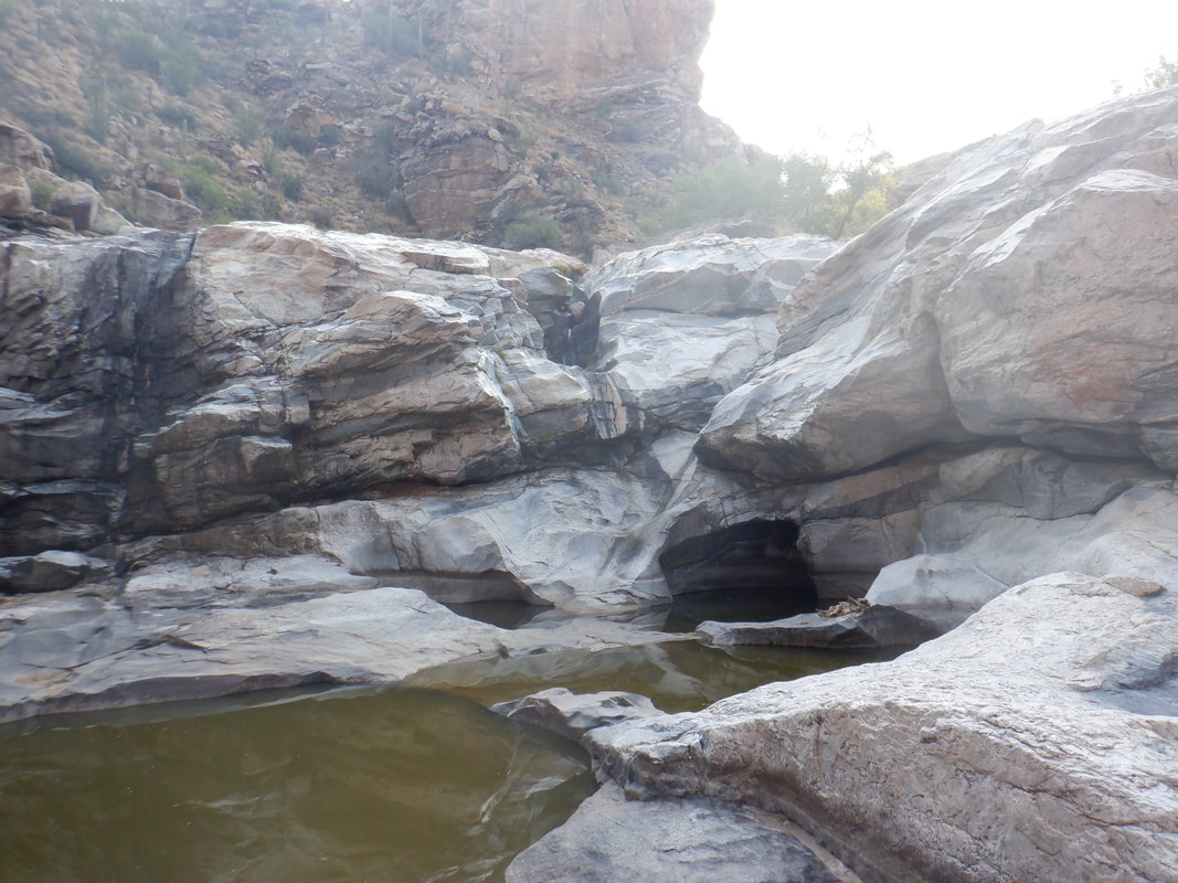 ....this wall which usually has a healthy flow of water..... 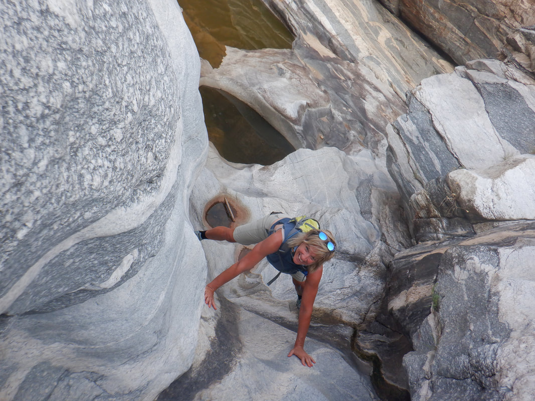 .....we are able to climb up the throat. Pretty steep but enough hand holds that Amy and I are able to reach the top. 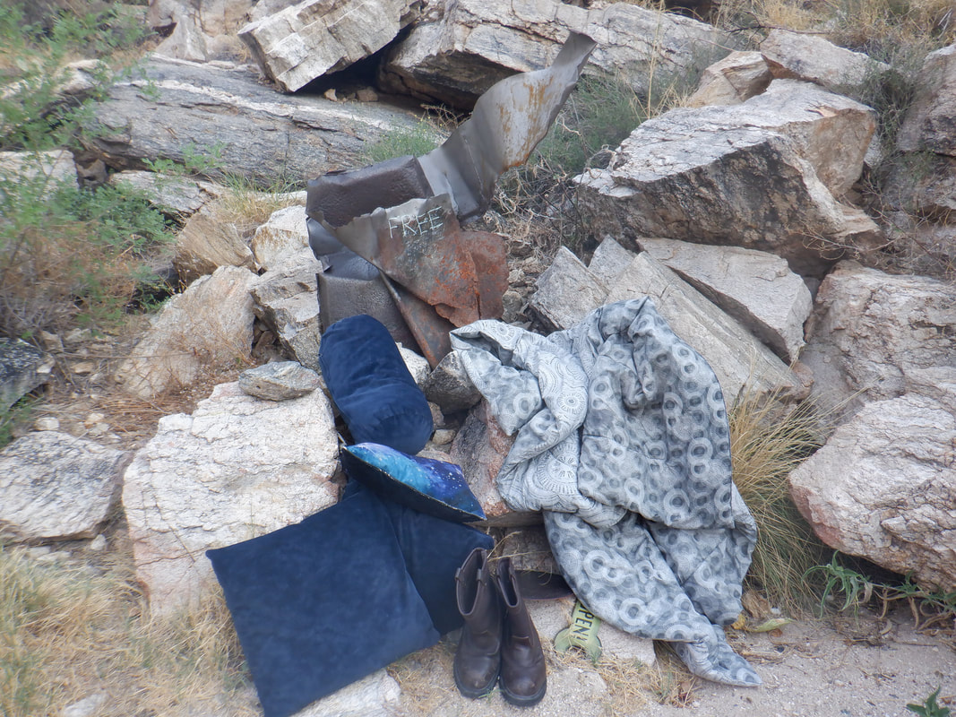 At the nudist's beach, we spot a sign that offers recovered items for free. We reverse course and go down canyon, passing the point where we entered the canyon as we see how close we can get to..... 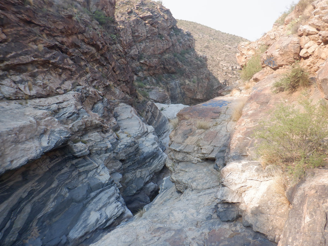 ....the head of the "big" falls. This is about a 70' drop into a pool and supposedly there is a way down. I poke around as Amy..... 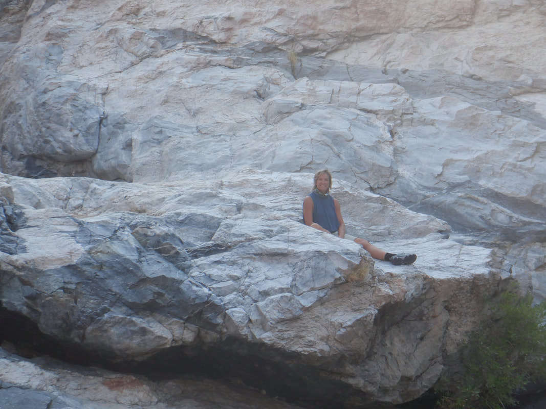 ....watches from a safe shelf. I did see a rope which would provide access to a lower level but that looked very sketchy so we turned around and headed out of the canyon. Finished with a very fun, 2 mile hike. It's about the obstacles rather than the distance of course.
 The west is baking from AZ to the Canadian border. Daytime highs are 10 degrees above normal so most days are 107ish. It's a cliche but a day out here in the upper 90s is rather pleasant but dang, 107....big diff so off I drive prior to the rise of the sun towards the higher elevation of Madera Canyon and the Santa Ritas. 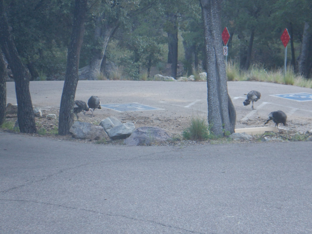 It's a nice low 70s start as I gear up while a flock or gaggle of turkeys pecks at an unseen food source. I have parked at the Ampitheatre parking area, cross Madera Canyon Road and begin a nice loop hike, first on the Bog Springs Trail. 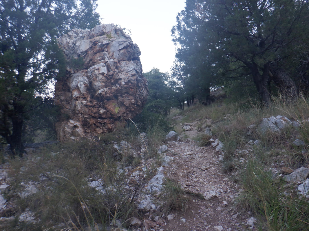 The size of boulders, long fallen from surrounding cliffs, are huge. Even at this higher elevation, maybe 5500', there are still some.... 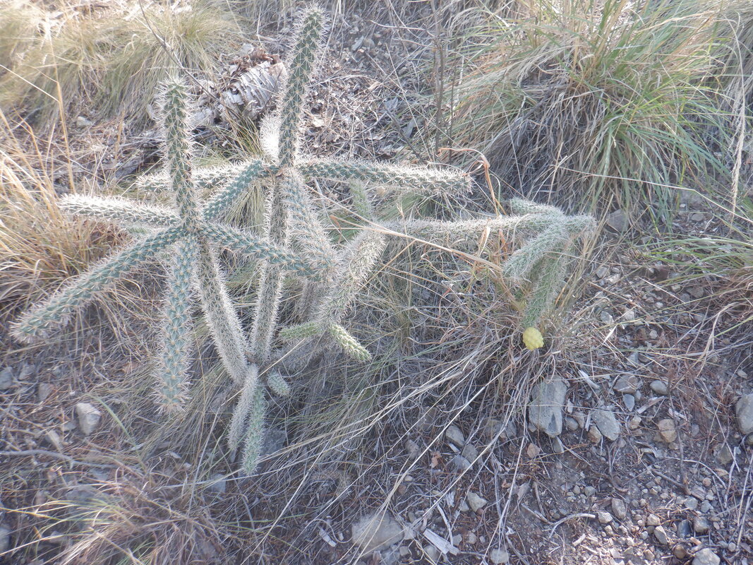 ....pointy cactus like plants but the saguaros are at much lower elevations. I get on the Kent Springs Trail and began a really steep slog first to.... 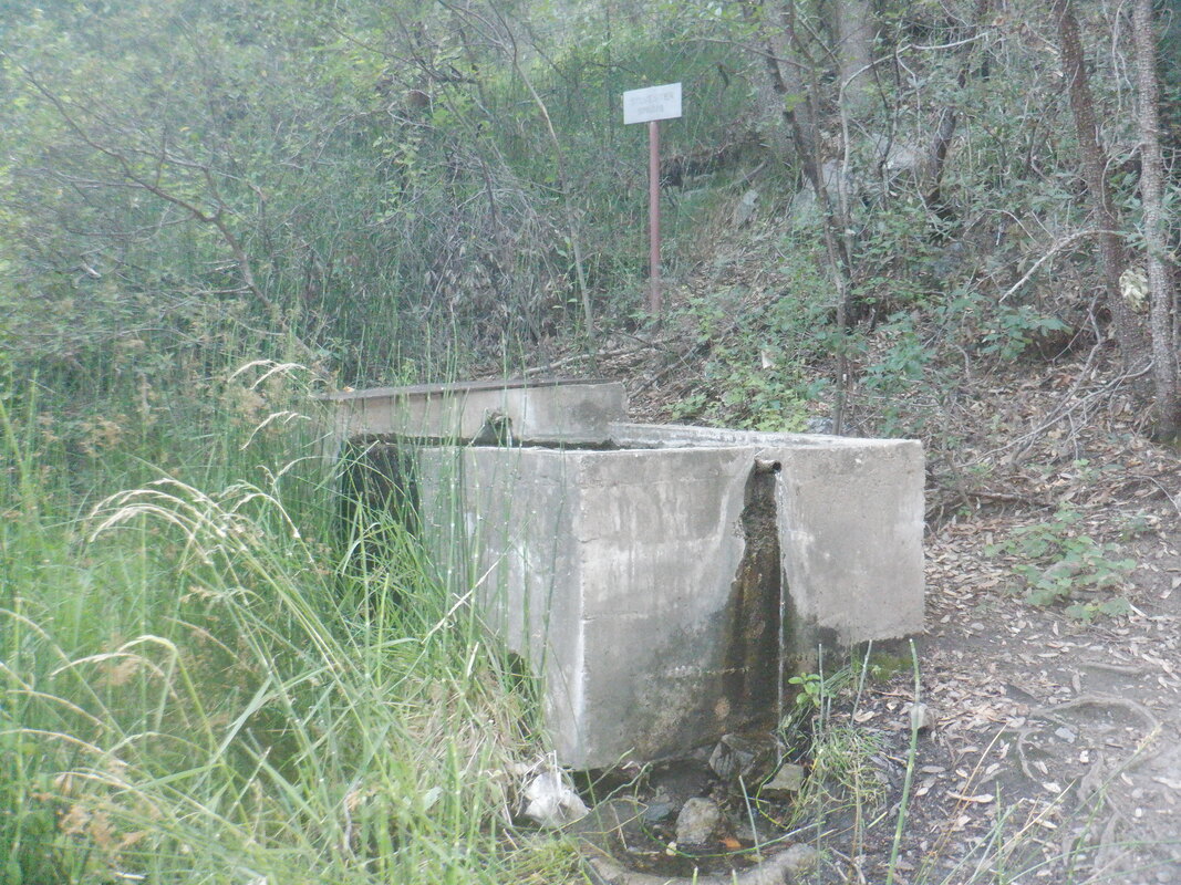 ....Sylvester Springs. Some of the ramps are at least 35% and the final .25 miles, averages 30%. However.... 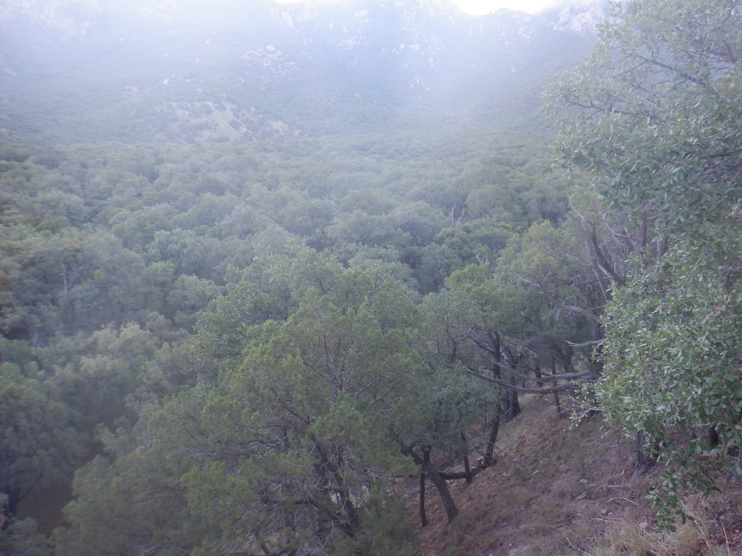 ....the forested slopes and I enjoy a nice, cooling breeze as it travels down mountain. 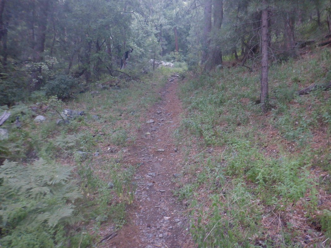 I hate that an image rarely shows the steepness of the trail but anyway, the trail is wide with ferns prevalent as I continue the grind before..... 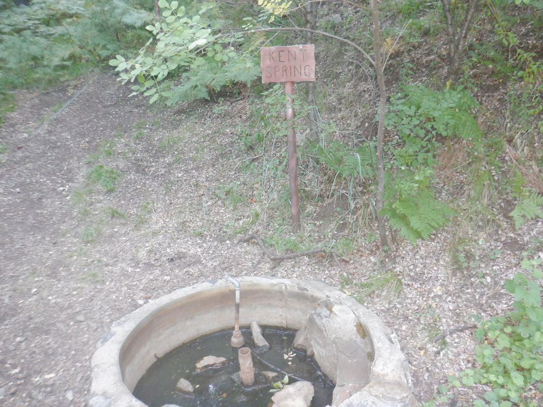 ....at about 2.5 miles, reach Kent Springs. It is a nice spot with a mature forest providing plenty of shade. 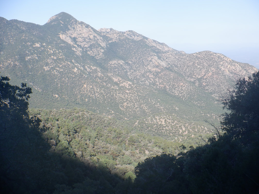 My early start, about 6:30am, kept me in the shade for almost the duration of the hike although the sun was closing on my slope. 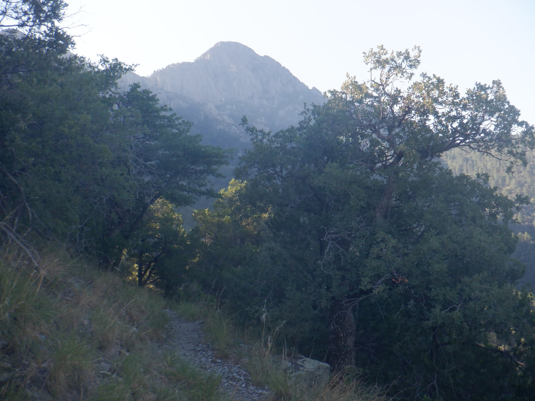 In the distance, Mount Wrightson. Didn't seem too far away and of course it isn't. Some people were attacked by a goat up there a couple of weeks ago and so it was put down. Hikers retreated from it down trail but it kept pursuing them, bumping or ramming into them so and this activity continued over several days. Too bad. 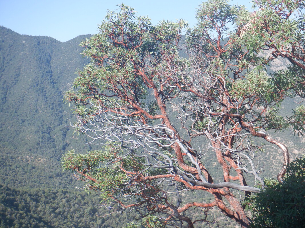 Beautiful as a Manzanita's red branches are highlighted by the sun. Once I reached Kent Springs, the climbing was mostly over, thank goodness. I continued until reaching my 3rd..... 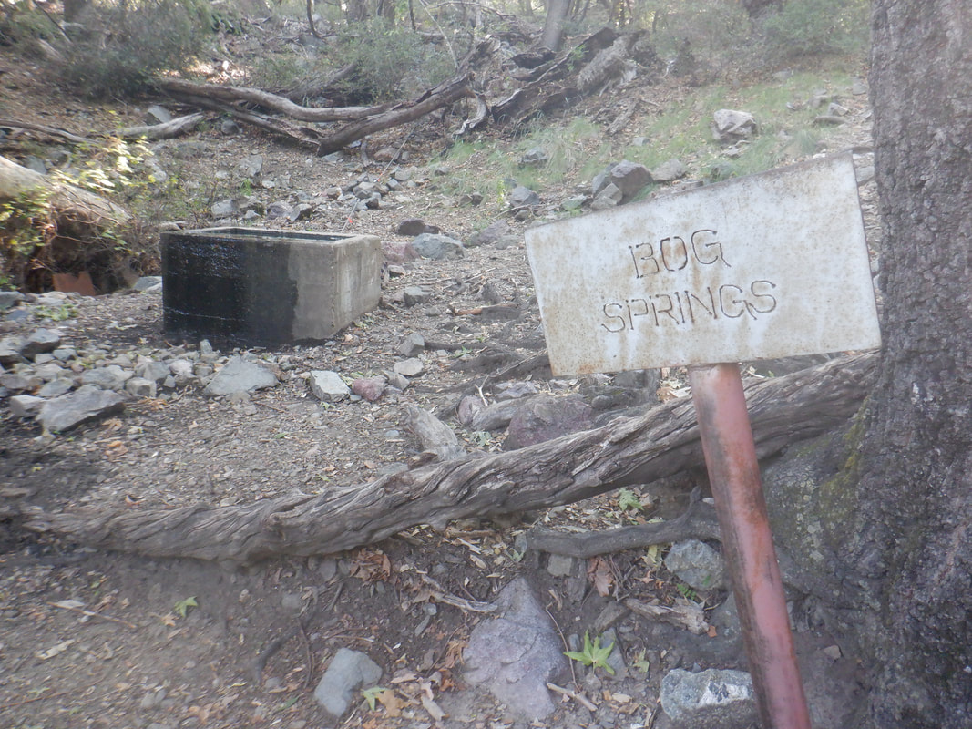 ....Spring, Bog Springs. I continued, finishing with 6 miles and 1700' of climbing. Reaching my car, I noted the temperature was a still, relatively, cool 85 and then watched the temperature rise as I headed into the lower elevation. The heat won't last much longer and as I run into others from the midwest, a summer here is far more livable then a winter, there. Having said that though, next summer, I'm plotting a cooler, alternative.
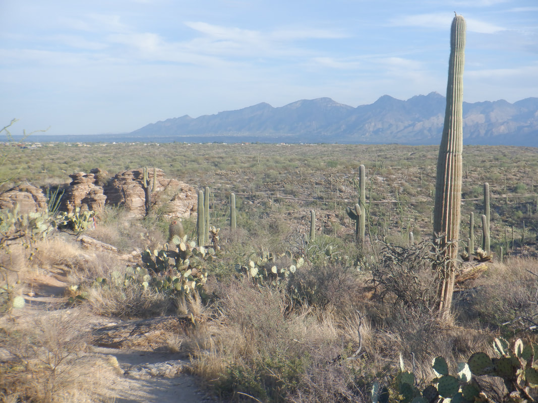 I entered Saguaro East National Park and drove to the Tanque Verde Ridge trail head. Parking was tight but I was able to squeeze into a last spot. I had signed up to join a group hike but never got off the waitlist. I shoved off at 6:45am, 15 minutes after the group departed. 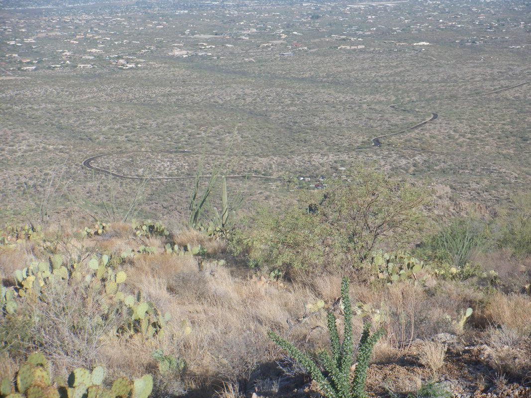 The group had planned to hike about 2 miles up trail and I thought 3 was about right given the forecast high of 108. The trail descends for a short distance prior to climbing but not too steeply. The average grade of the distance we hiked was 11%. In the distance is the 8 mile drive that loops through the park. 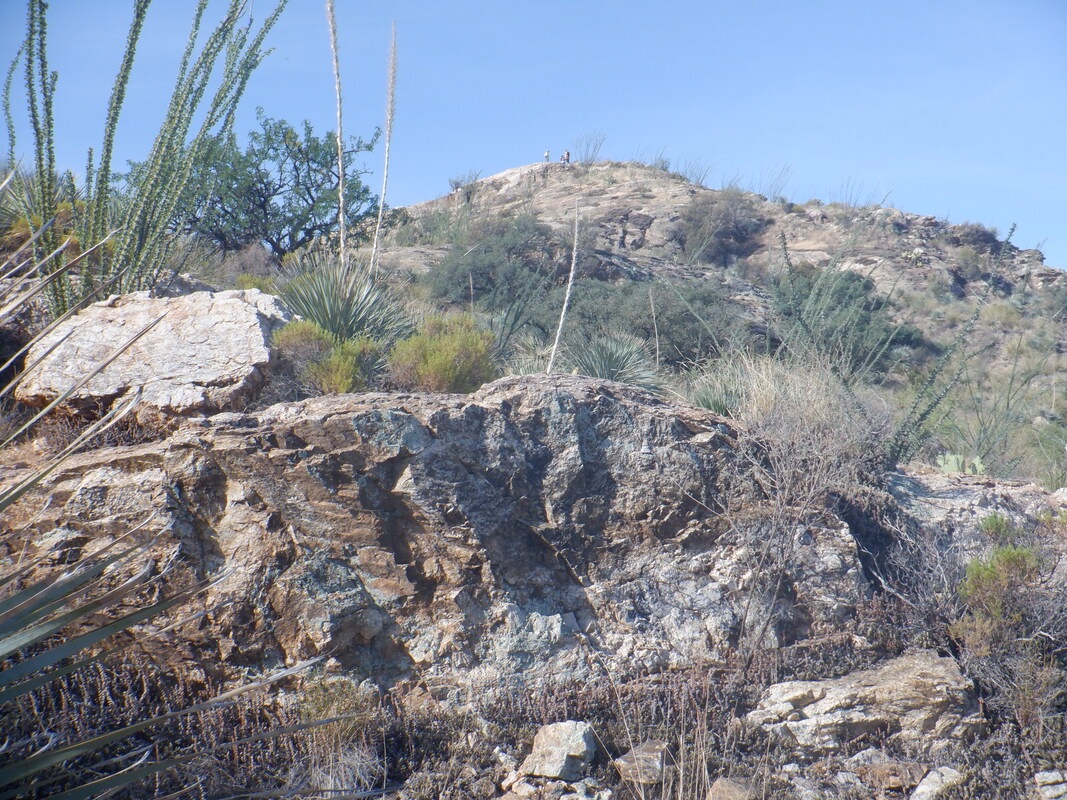 The main group had gotten separated with some choosing to turnaround prior to the completion of their planned ascent. I reached the front of the group, which was down to 3 people, paused, regrouped with a couple others and on we went. I was told of a granite dome that was a neat destination and could see it in the distance. 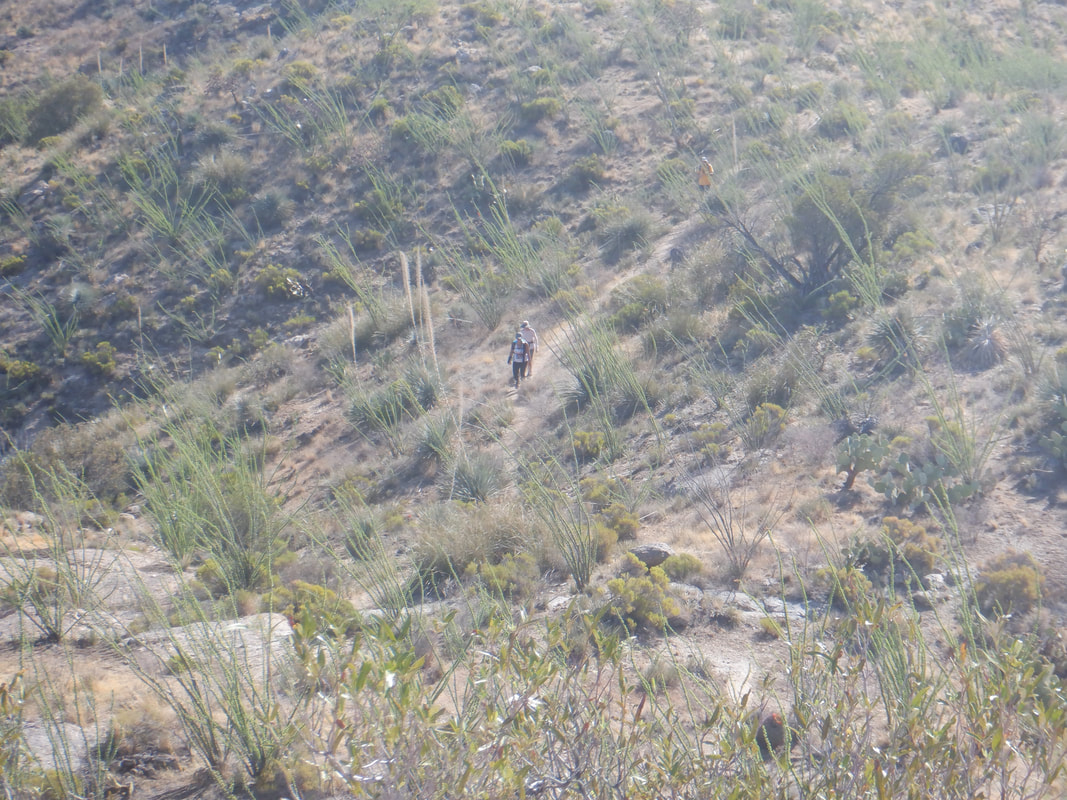 Reaching a saddle at mile 2.6, we went off trail although there is a fairly obvious social trail that is followed. The final hundred yards is fun, scrambling up the dome. In the distance, members of my new group are about to join me. 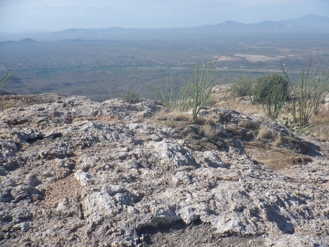 Good views all around. 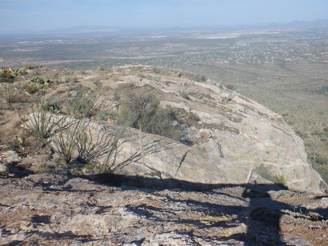 The dome is fairly large so I.... 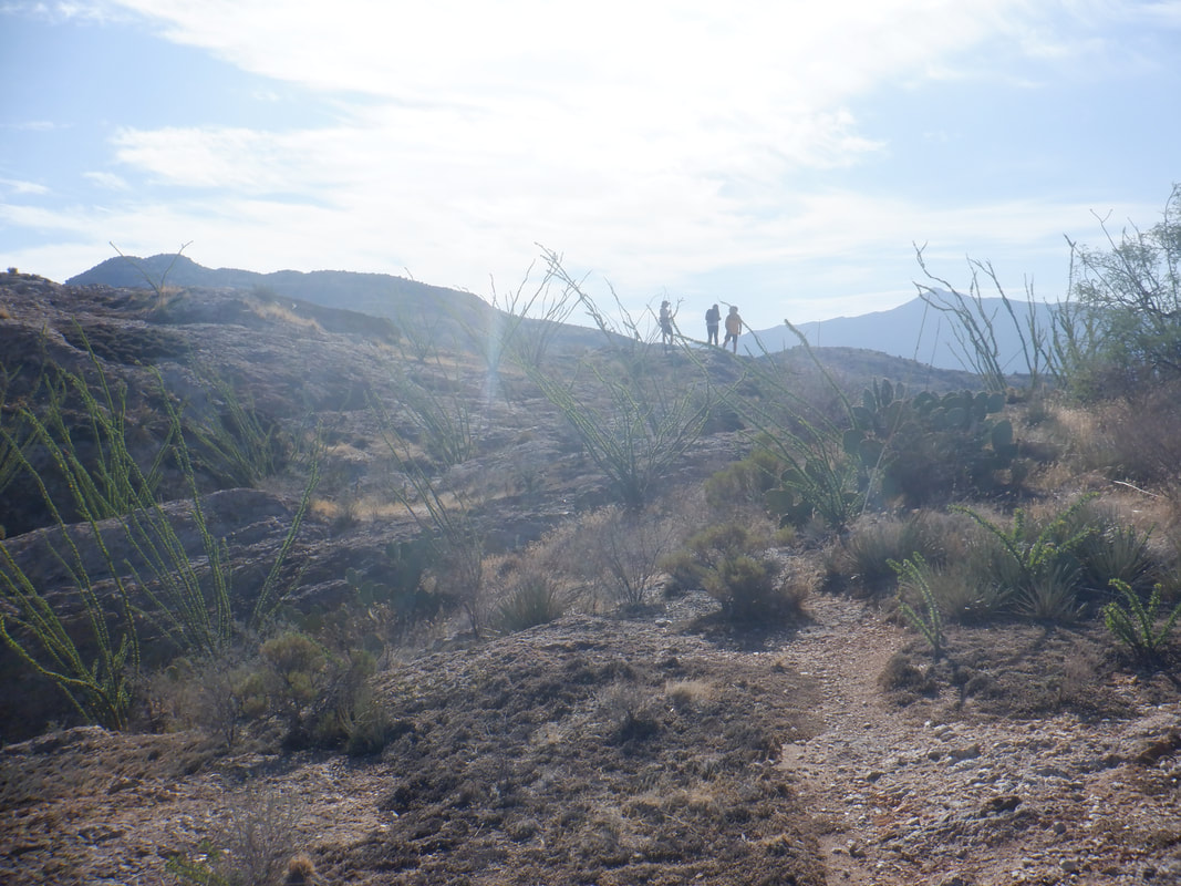 ....walked to a lower portion and scouted around. Looking back my group too is admiring the views. 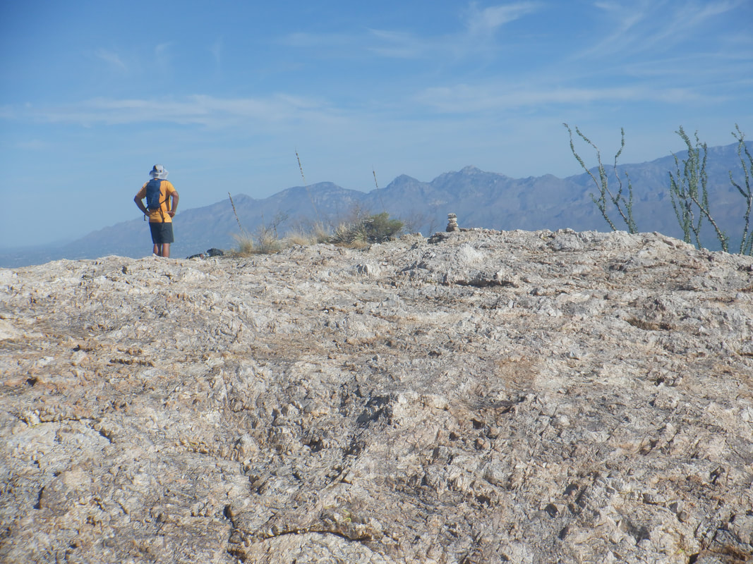 I regain the summit and just then, discovered a fluid issue. I brought 3 bottles but drank from one during the drive. At the summit, I emptied the 2nd and reaching in my pack, withdrew the 3rd bottle, half full.....IDIOT! I excused myself rom the group and scurried down the trail, rationing the water. 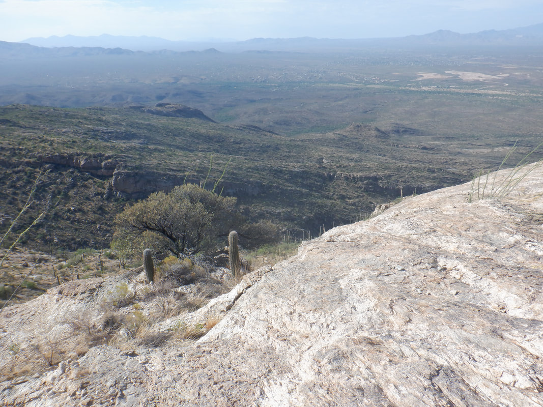 Not much danger of not making it of course but I was very thirsty when I reached my car. I stopped at the visitor center and had a nice, cold drink from the fountain. Finished with 6 miles and 1600' of climbing.
 Catalina State Park opened last week (post Bighorn Fire which burned 119,000 acres) and when first we enter, park, all appears normal but of course, how could it be given what has occurred. So, no surprise..... 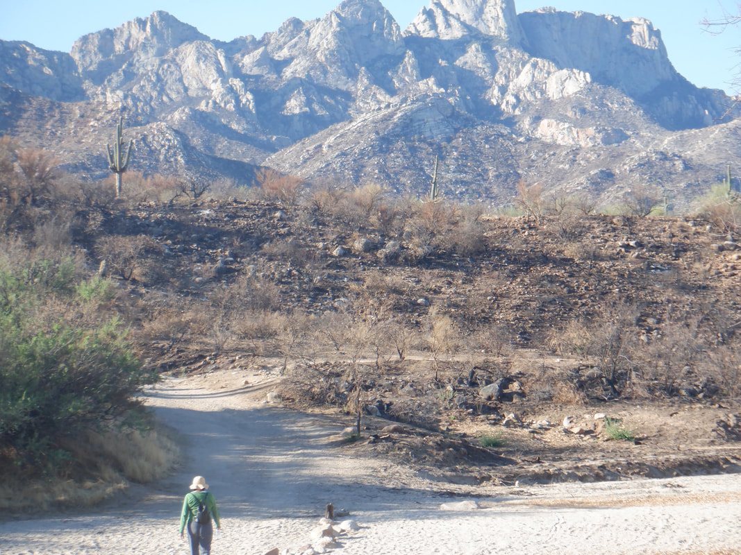 .....we park at the end of the drive, walk a few feet to a wash and see the above. It's impossible to know how much of the plant life will survive. Time of course, will tell. 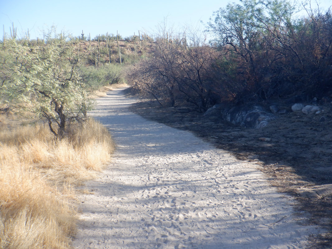 It appears the wash was one backstop and when that failed, crews pitched in to limit the burn to the main trail. 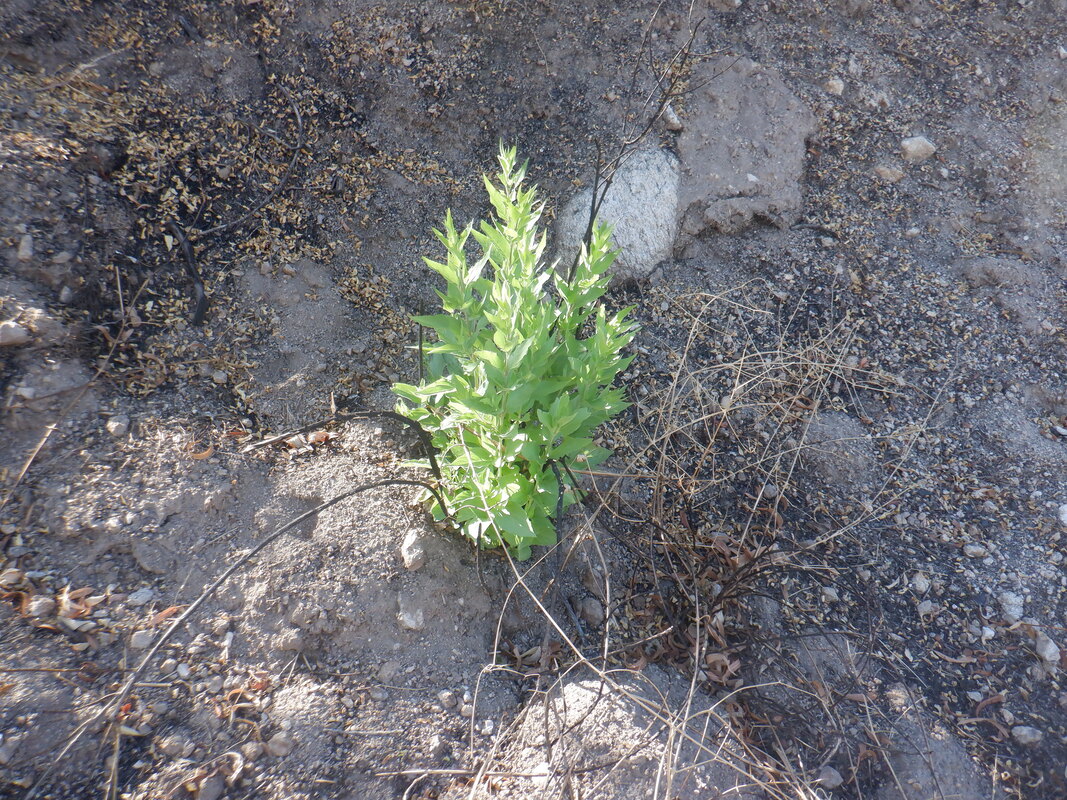 As sad as this is, I spoke to many volunteers from various states who had been brought in to assist the fire fighting effort and they all saw the burn as a good thing. It had been about 100 years since the area had last burned. Lot of good fertilizer on the ground and already, many shoots of new growth are apparent. 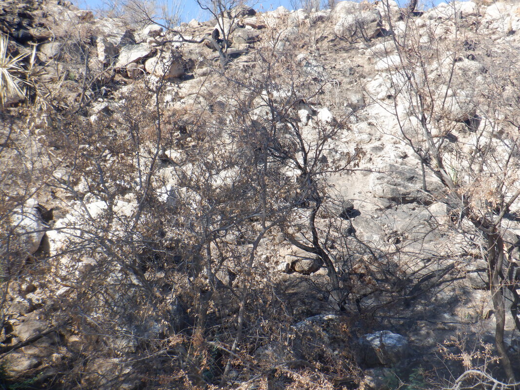 The surrounding hills, stripped of vegetation, seem ripe for rock fall if we get a good rain during this 2nd consecutive monsoon season of little rain. 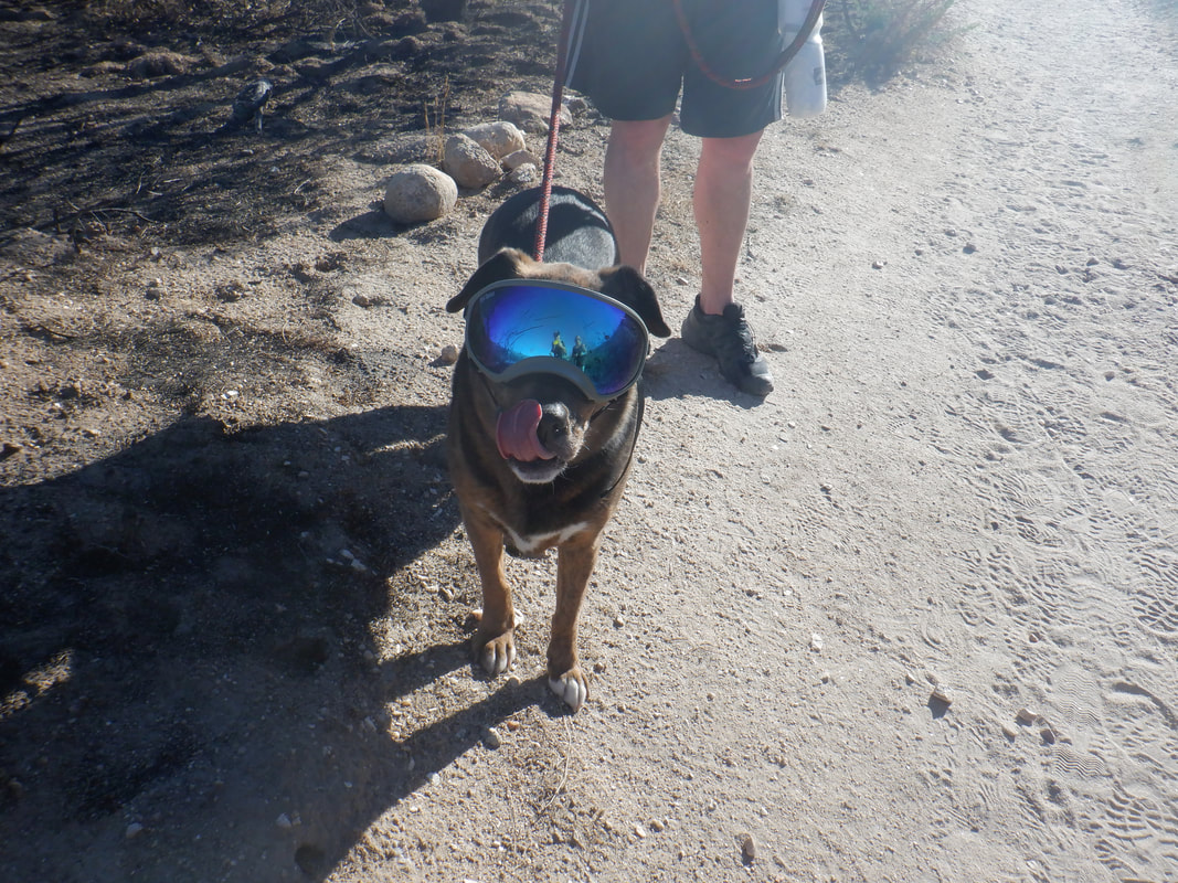 Many hikers were on the trails within the park, including this dog wearing glasses. My timing could not have been better, capturing the tongue out. 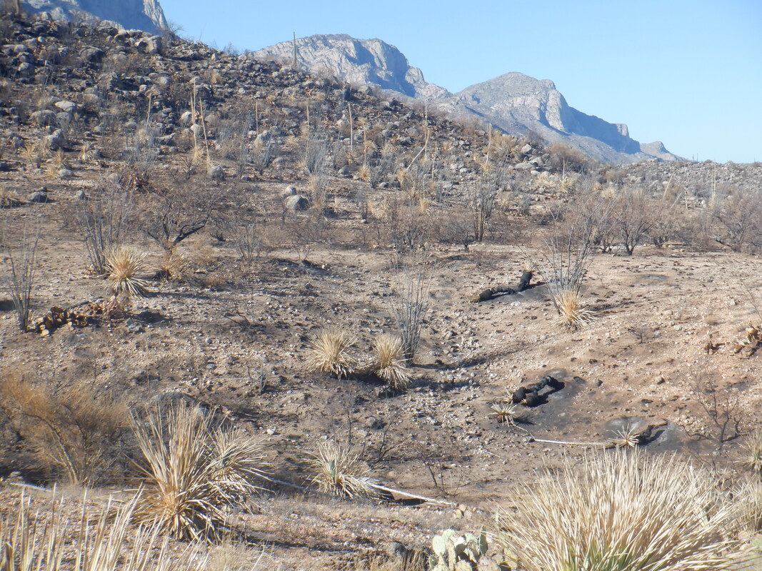 Nothing green in this image and a nearby Saguaro.... 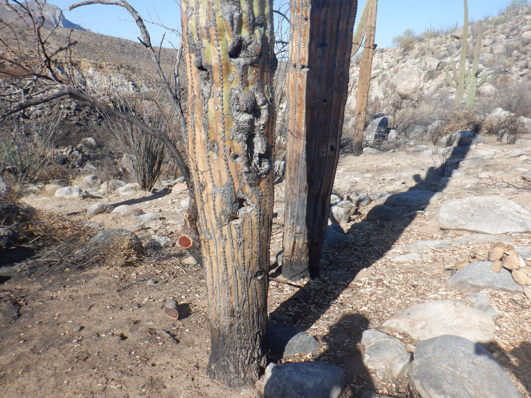 ....made us wonder if it would survive. I have no idea how quickly the fire moved through or how much it lingered, burning fuel while the Saguaros suffered. 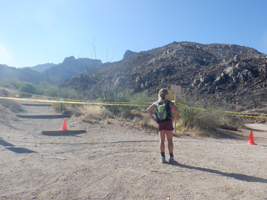 The biggest disappointment is when reaching state trust land, trails are closed at least thru October. Frankly the justification for closing some of these trails is really weak....really, really weak.
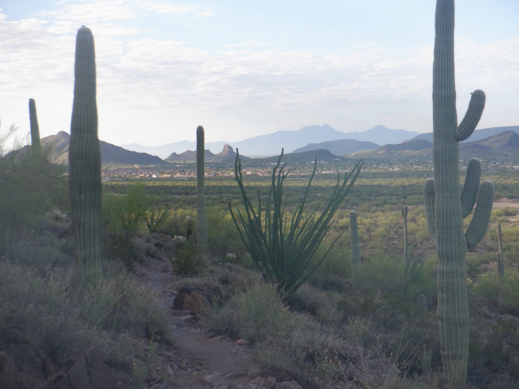
 The early morning views are so awesome as I arrive on the west side of Gates Pass at the Yetman trail head. From the parking lot, I can see Goldengate Mountain to my right and to my left is the little known Bern Mountain. I've read a couple of hiking reports and there are a few different approaches. I follow Yetman to a point where I see the above view. I've reached one access point from a gps track I have but see 0 evidence anyone has ever tread so I turn and follow a..... 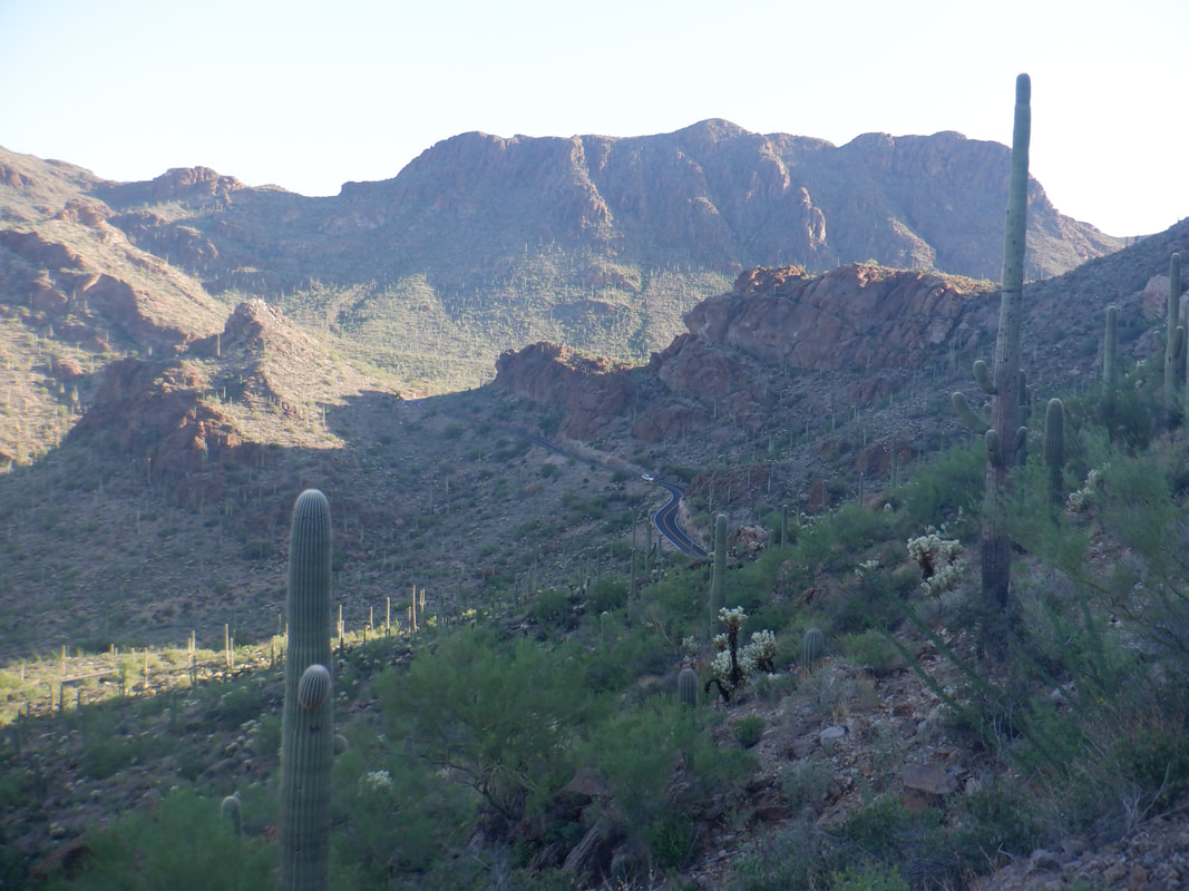 .... trail that is well worn but not on the park's maps. It goes clockwise around Bern and gives nice views of Gates Pass Road and the distant Bushmaster Peak. 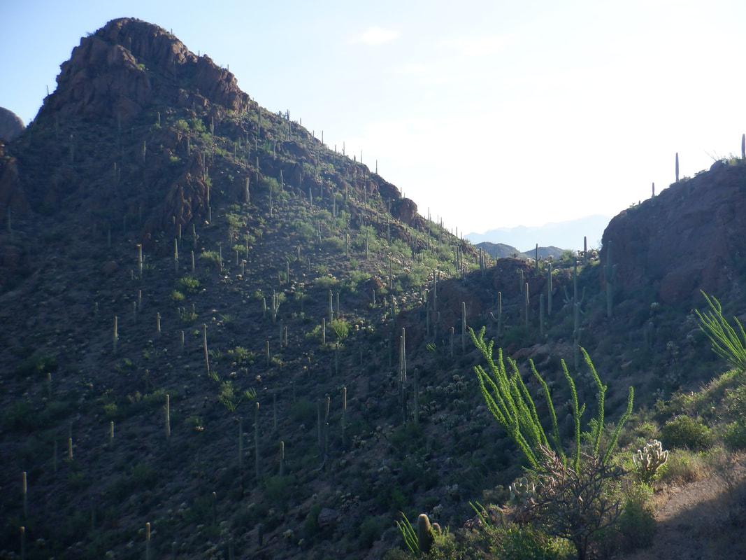 I approach a saddle and soon am in an area of the Tucson Mountains I have not previously visited. The trail mostly climbs and when reaching another saddle, I hear a noise to my left and... 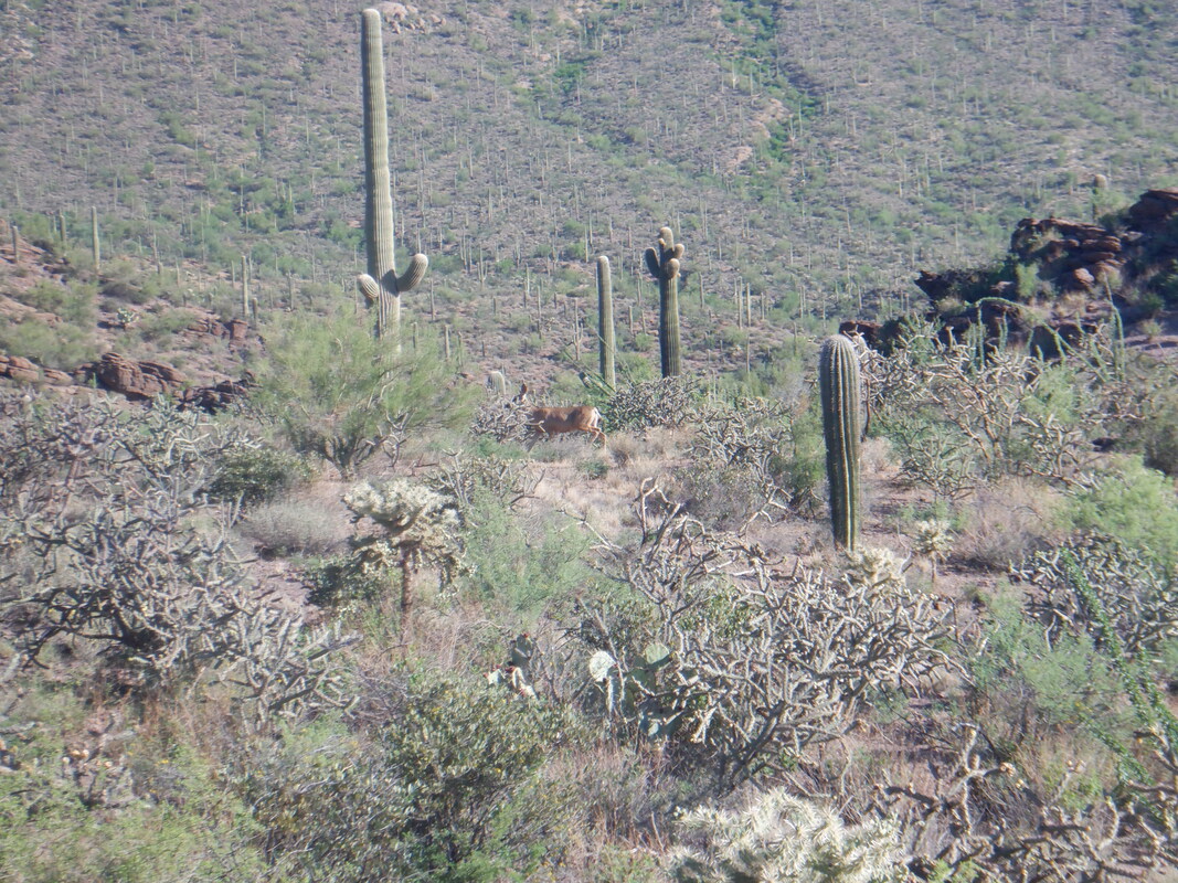 ....see a couple of deer bounding away. I continue to look for a way up and see a couple but don't see any cairns and have no interest in pioneering a new route in today's heat. 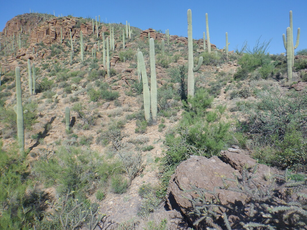 I started the hike in roughly the 6 o'clock position and now at about the 12 o'clock position, see a cairn and begin heading up. It's getting too late so I turn around but now know the access point. The trail I have been following continues but not certain where/if it emerges on a known trail (it does I learned later), turn around. 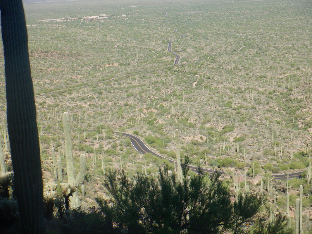 Retracing my route, I see the serpentine Gates Pass Road and as I continue my descent I.... 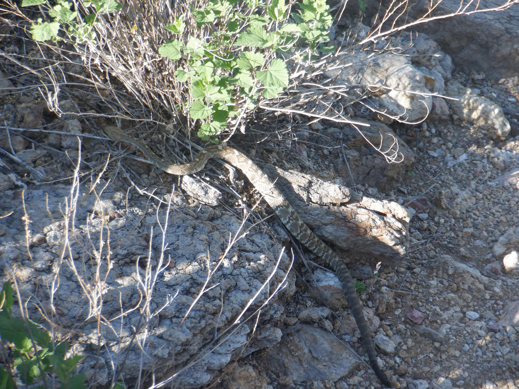 ....see a black tail rattlesnake cross the trail a few feet in front of me. I suppose it is returning from its morning hunt and pays me no attention as it slithers into its den. Finished with under 4 miles so not a difficult hike but will be back to finish the trek to the peak.
 I arrived at the trailhead and began the hike. About 1/2 mile in I woke the heck up and realized I was on the wrong trail, returned to my car, drove a few miles and began the hike. Not a good way to begin but after way too many false starts, I was not going to spit the bit again. I reached.... 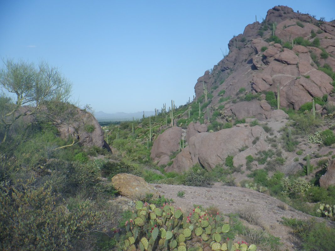 ....the trailhead at the top of Sarasota Road and began. The trail goes through a pass that separates Little Cat from Big Cat Mountain. I got on the Explorer Trail and began hiking clockwise around the Cat. Yes, there is a route that begins in the pass and I have poked around in there but was discouraged by a wall. 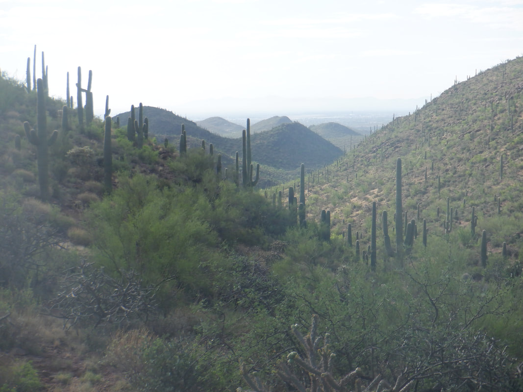 So green but the state is in a moderate drought and the monsoon so far, just like last year, has been mostly dormant. 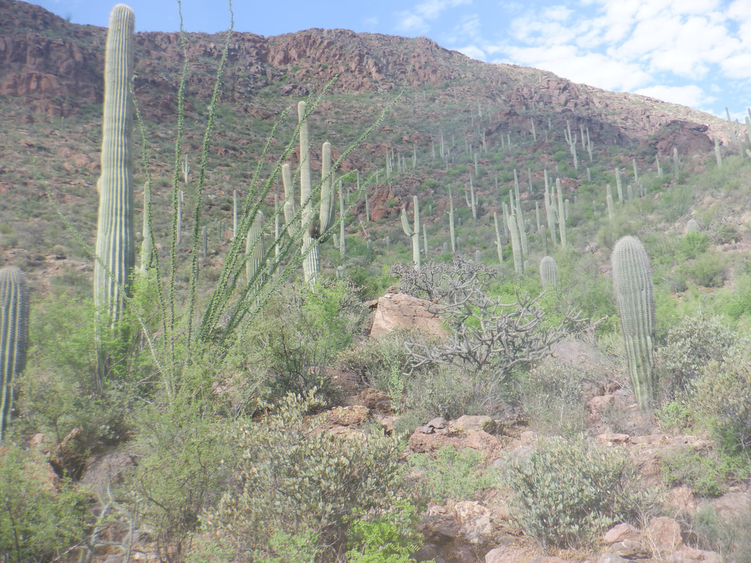 About 2 miles into my hike, I reach the cairn that indicates it is time to begin the off trail climb that eventually reaches the above ridge. Just looking at what was before me I guessed the route would cut right below a rock band but wrong again. The climb to the ridge is about .7 miles with an average grade of 26% so pretty steep. 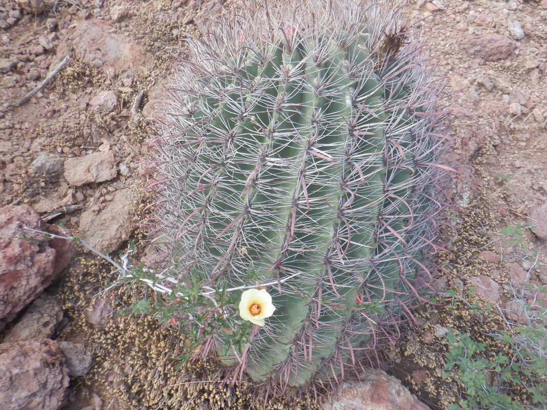 The route has numerous cairns and is not much of a challenge to follow other then I was taking it very slow partly for rattlers and partly because each time I reached a cairn I'd have to pause and locate the next and the next and on and on. Lots of barrel cactus in the area. 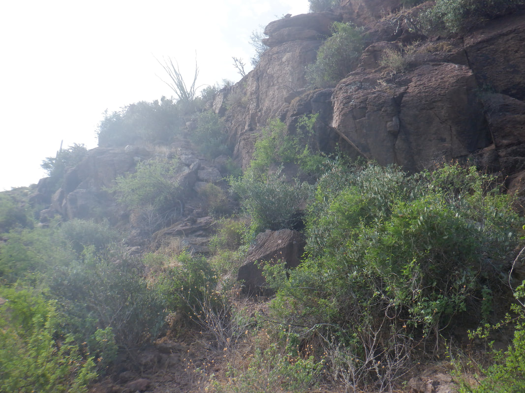 Approaching the aforementioned rather deep, rock band, I was surprised when the route cut to the left but there was a nice staircase that eventually came to a ridge, far to the left of the peak. I did not realize it at the time but I still had almost .5 miles to go but what an awesome time! 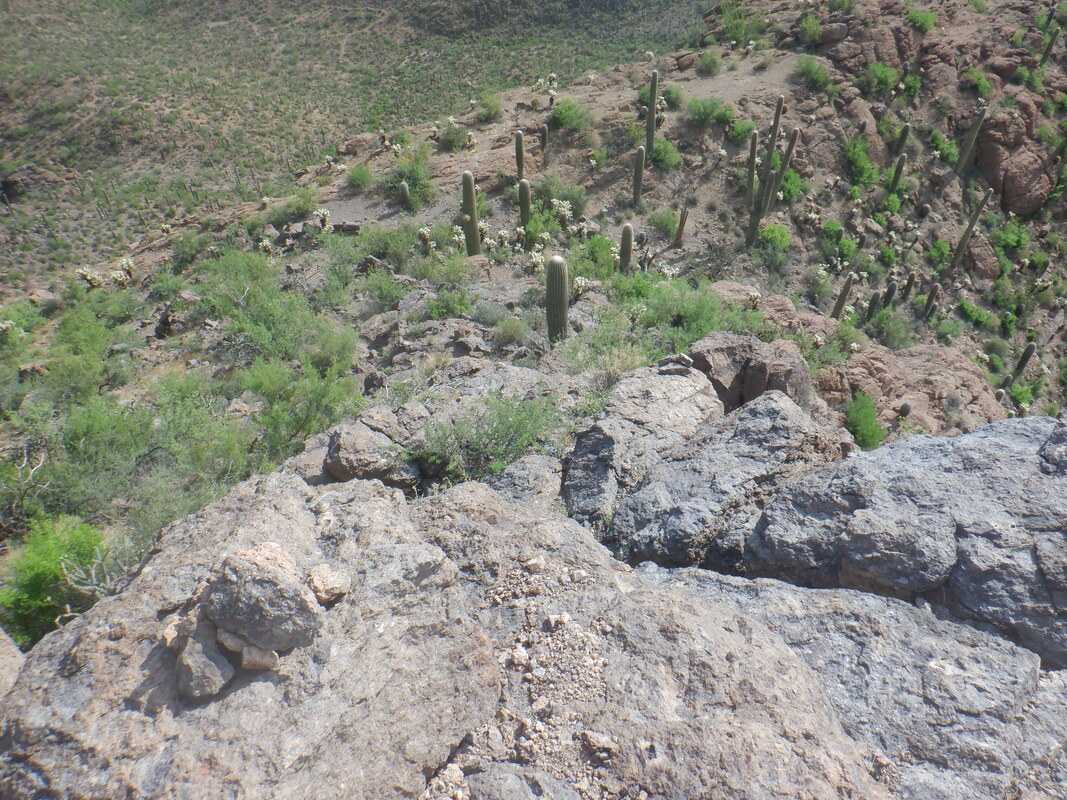 It begins with a wall that has enough foot and hand holds that I was able to clamber up. A fall here would not be good! Then, there are a series of.... 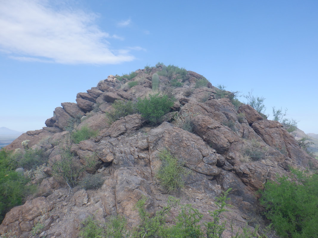 ....false summits as each slope would result in a view of another and another. The ridge is kind of narrow in a few places but always there were boulders jutting from the ground to hop across but again, don't trip. 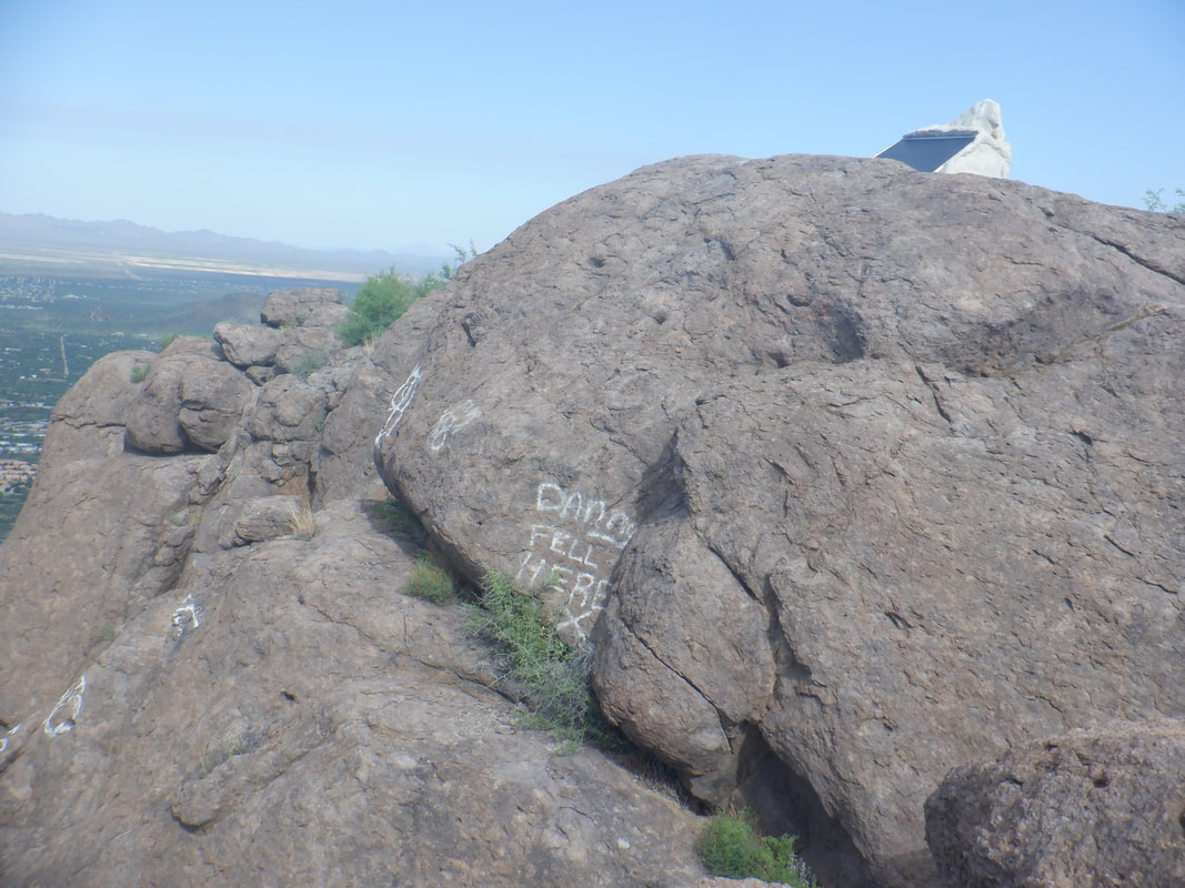 At last, I reached the peak where someone had painted some messages. More significant was.... 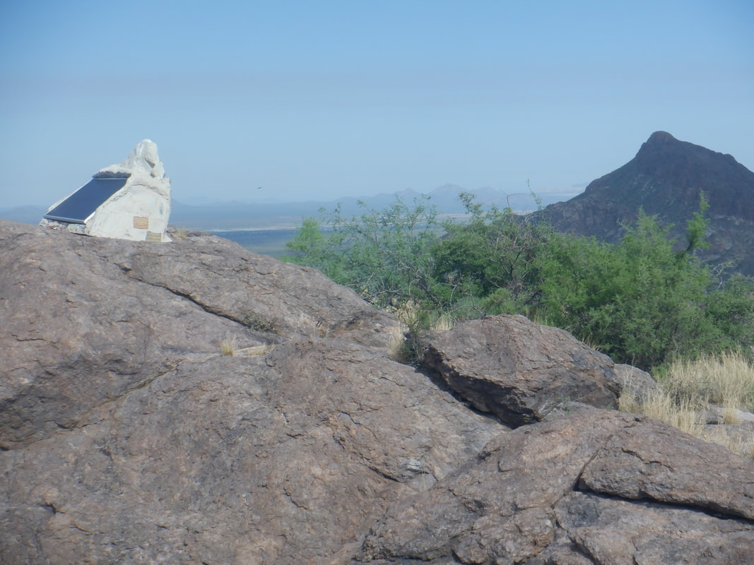 ....a transponder that PIMA County installed. Their effort at camouflaging it was not so good. In the distance, Golden Gate Mountain. 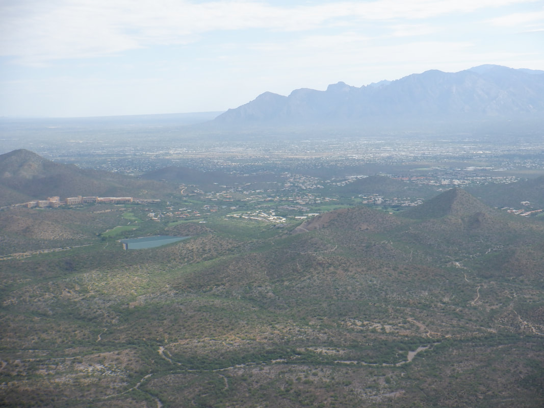 Greeaaatt views from the peak. 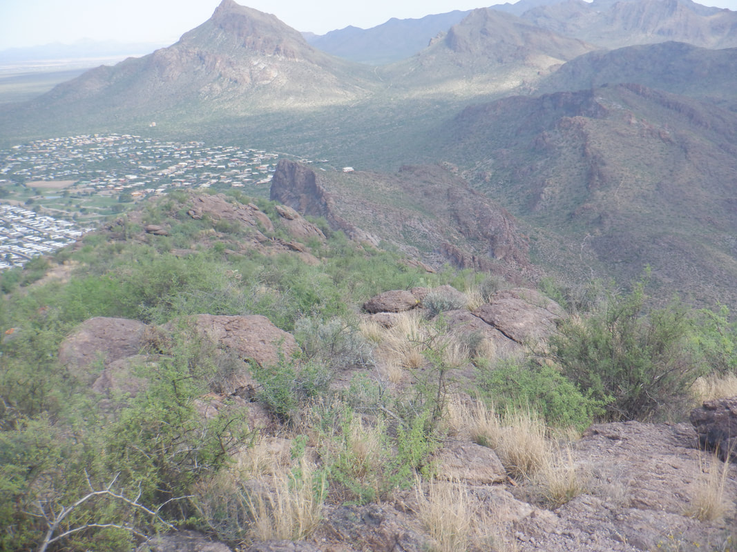 The option exists to continue ahead and descend the northwest side as mentioned earlier. I walked a little down and checked it out. Given the rising temp, if I got down there and became cliffed out or lost the route, I didn't have enough fluids to retrace my route so instead..... 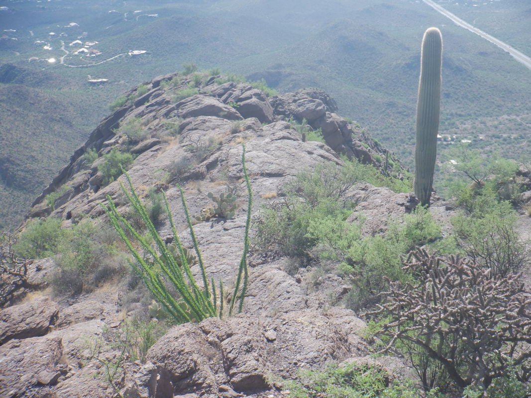 .....I headed back the way I came, finishing with 5.4 miles and 1350' of climbing. A fun hike. Back at the car, with the temperature at 100, I removed my shirt and could wring sweat from it. It was soaked, so too most of my shorts. Hot hiking these days with humidity.
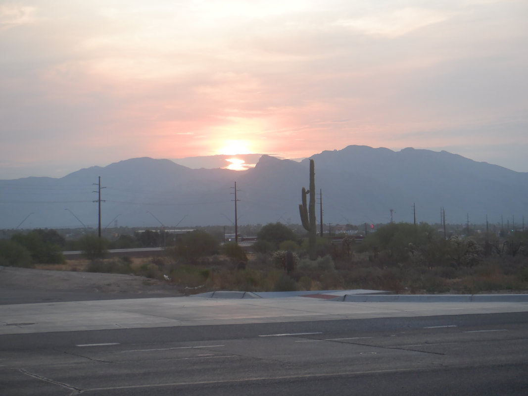 Another hot one so another early start as the sun rises over the still closed, Catalina Mountains.
 Some butt hiking caused an opening in a pair of shorts. Not wishing to dispose of the "seasoned" pair, I was ironing a patch over the opening while failing to realize the back of the iron was resting on the freaking shorts! For gosh sakes you idiot!!! My so far fruitless search for an alternate way to the peak of Cat Mountain was finally solved today. This is about my 4th attempt at finding "the way" and not sure why. Chalk it up to lack of due diligence. I once again park at the top of Sarasota Road, go through the pass between Big and Little Cat mountains as shown above. I've poked around on the slope at the base of Cat a couple of times and know there is a route but looks kind of sketchy so I.... 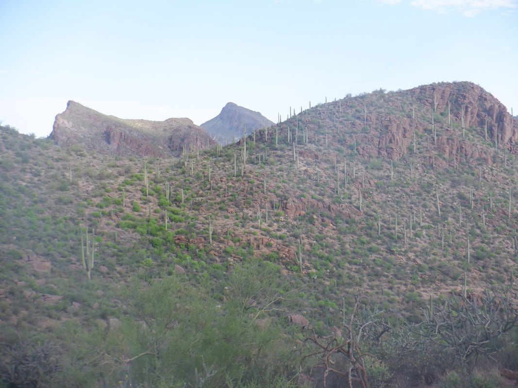 .....get on the Explorer Trail which winds clockwise around Cat. It's early and the views are fantastic as the sun rises. After about 4 miles, I spot a cairn indicating the start of the route to the peak. I start up it for a hundred yards and find it is easy to follow with lots of cairns if not an actual trail, to follow. It's getting a bit late and I'd rather do it next week with more fluids now that I know exactly how to ascend. 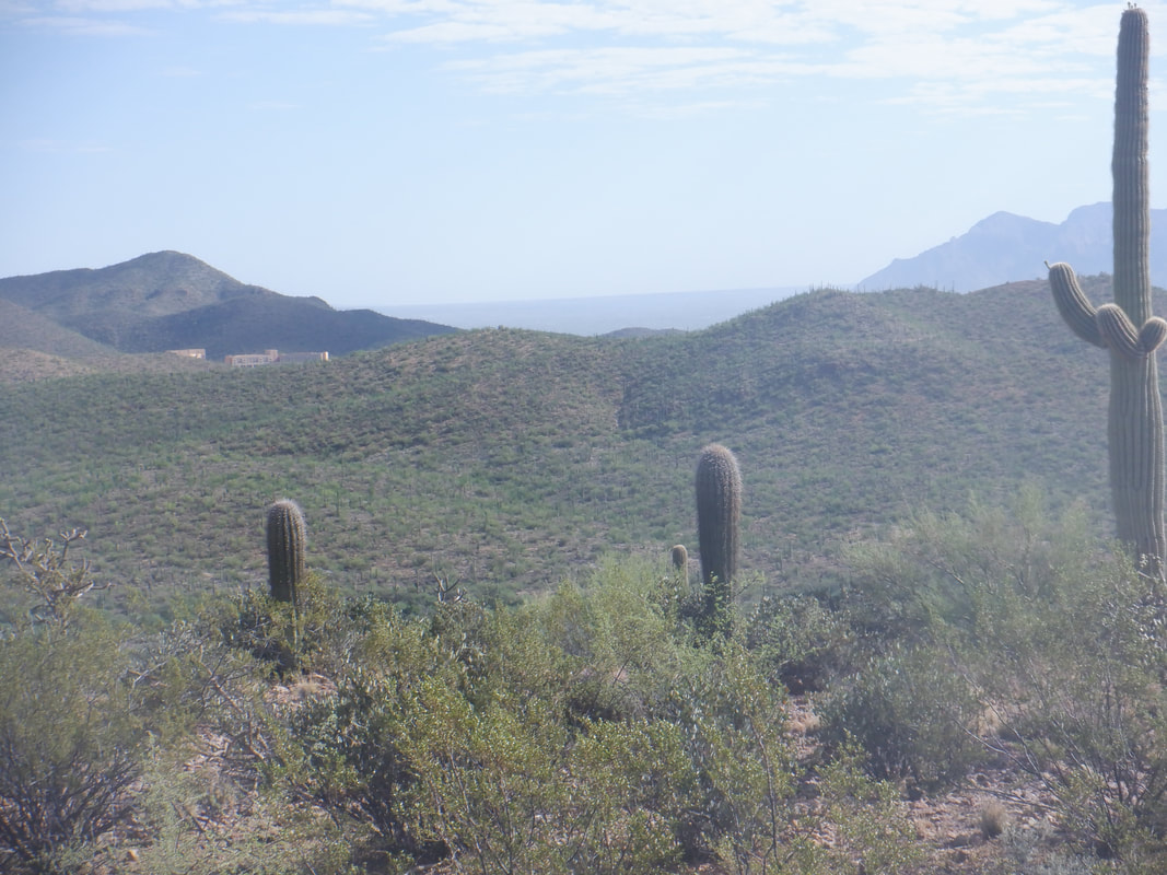 I head back and spot Starr Pass Resort in the distance. Going to visit that in a couple of weeks for a staycation. Finished with a little over 4 miles for this day.
|
