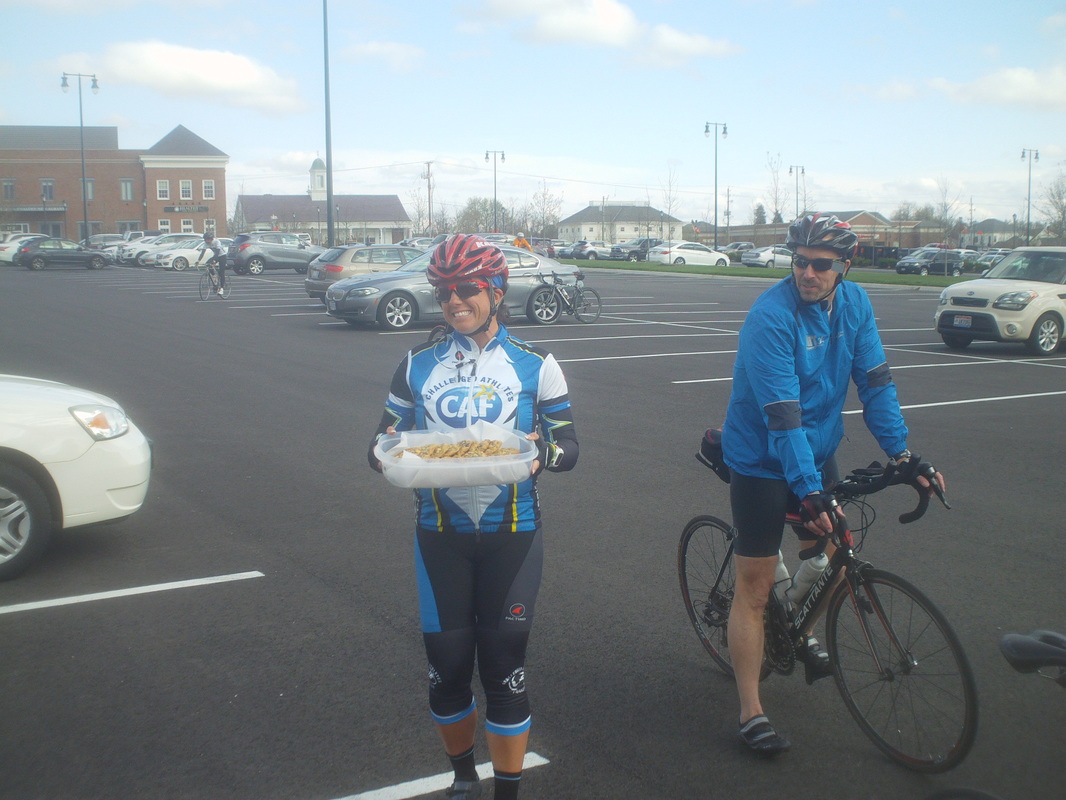
 No doubt Kristie read there was a substitute teacher tonight so she whipped up a batch of cookies and brought them to the ride.  I received quite a few questions about the location of a restroom and so I sent Bruce off to inspect and he came back confirming that the doors beneath the "150" in the distant building do indeed lead to a very nice facility.  Well, that did not last long. George has returned after a disappointing two days on the new job. What he was assigned to do differed significantly from what he was promised he would do, so he is back for the evening rides. 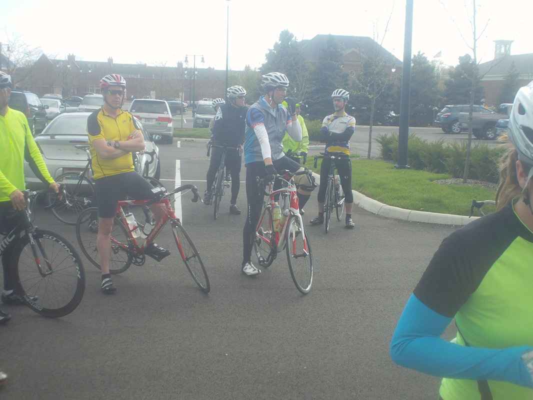 Mike, in the middle, was asked by Rick to announce that the "A's" who drop back to destroy the "B" group shall forever be shunned. Well, no just don't drop in with the "B" group and ride at an "A" pace, breaking up the group. Don't be one of those people. Note the guy in the yellow jersey, no jacket, arm warmers or tights. Yikes. It was a cloudy, cold and windy evening and that cut into the turnout with only 26 and the.... 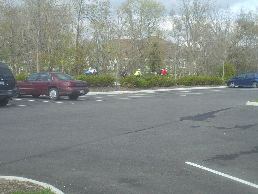 ....A group had only 6 participants, led out by Ron Budzig. Where are the stars, the cognoscenti, the Dave Chesrown, Jon Morgan, Luke Russell, Patrick Warren, Shannon Kurek, Marty Sedluk, Pete C, Rich Lewis, Maya, Lori N, Jon Hastings, Danny Alarcon, Scott Young, Muscle Dude, Paul Stock, Todd Mullins, Tym Tyler, Chris Grisvard, Muscle Dude Junior and others? Are they too waiting it out for warm weather? 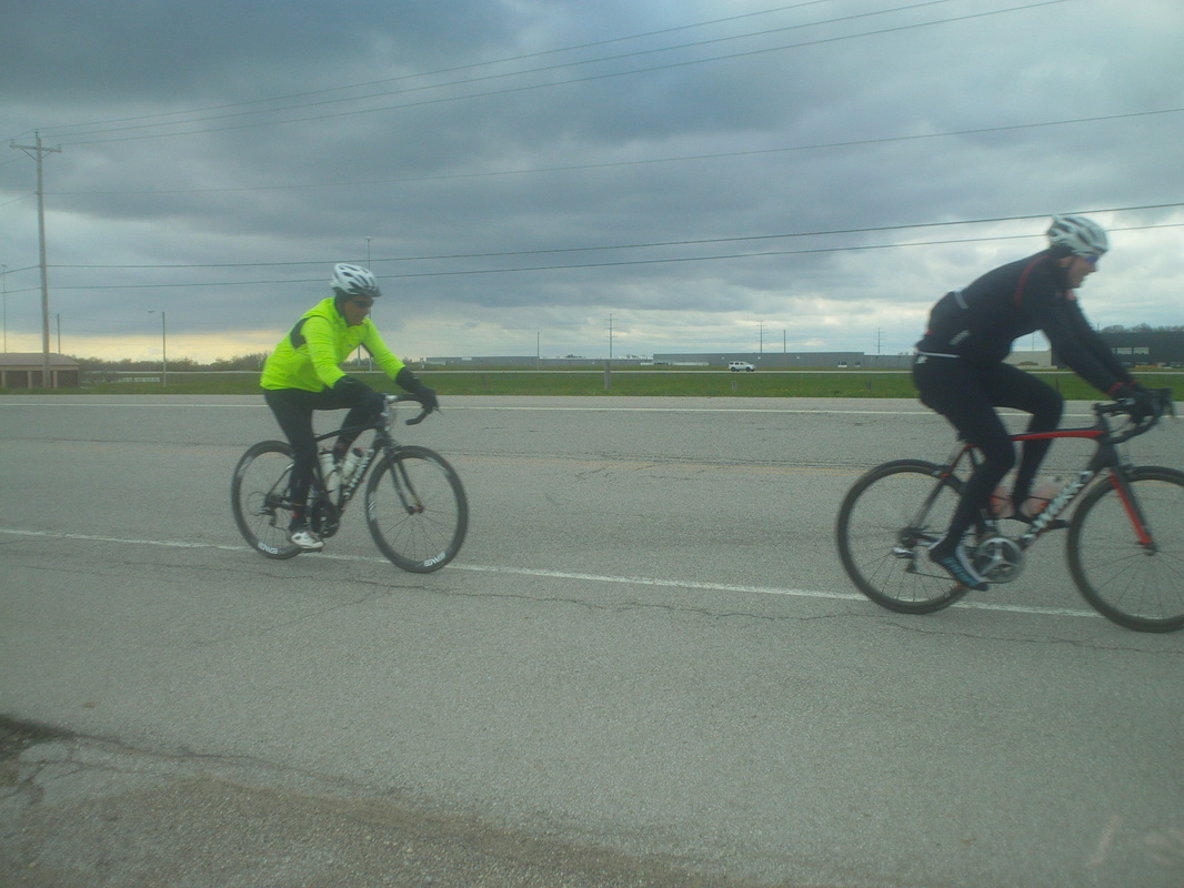 My duties done as substitute for Rick, I drove home, passing the A group above where it appears Benton's elastic band is stretching and about to break. Or, the more plausible explanation is he is riding way off the back so as not to draft.  Our esteemed ride leader, Rick Miller, will not be able to attend. However, Rick reached to the depths of the talent pool and a person of almost as much stature, respect, leadership ability, competence, rank, virtue, station, eminence, cachet, caliber, ability and capacity (I bet you know where this is going) will be there in Rick's place........me of course. 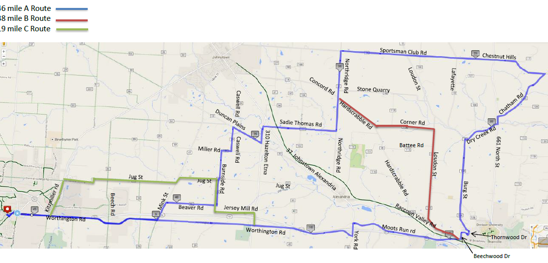 Wow, seems like a contest between Ric of Tuesday and Rick of Thursday for most miles each week. Tuesday the A route was 45, Thursday the A route is 46 miles. Forty-six hard miles so ride rapidly boys and girls. I looked at the Thursday forecast yesterday and got out on a nice 71 mile ride north and east of Granville/Newark, using one of Tym Tyler's routes. The pavement is not good on most roads with a lot of large pot holes, usually in shady areas so be careful. Chatham is a mess in spots. I will be out for pic taking so dress up and wear smiles. Here is a link for more info on the routes and remember, print your own map:http://www.thecyclingclub.org/club-rides/thursday-evening-ride/
3 Comments
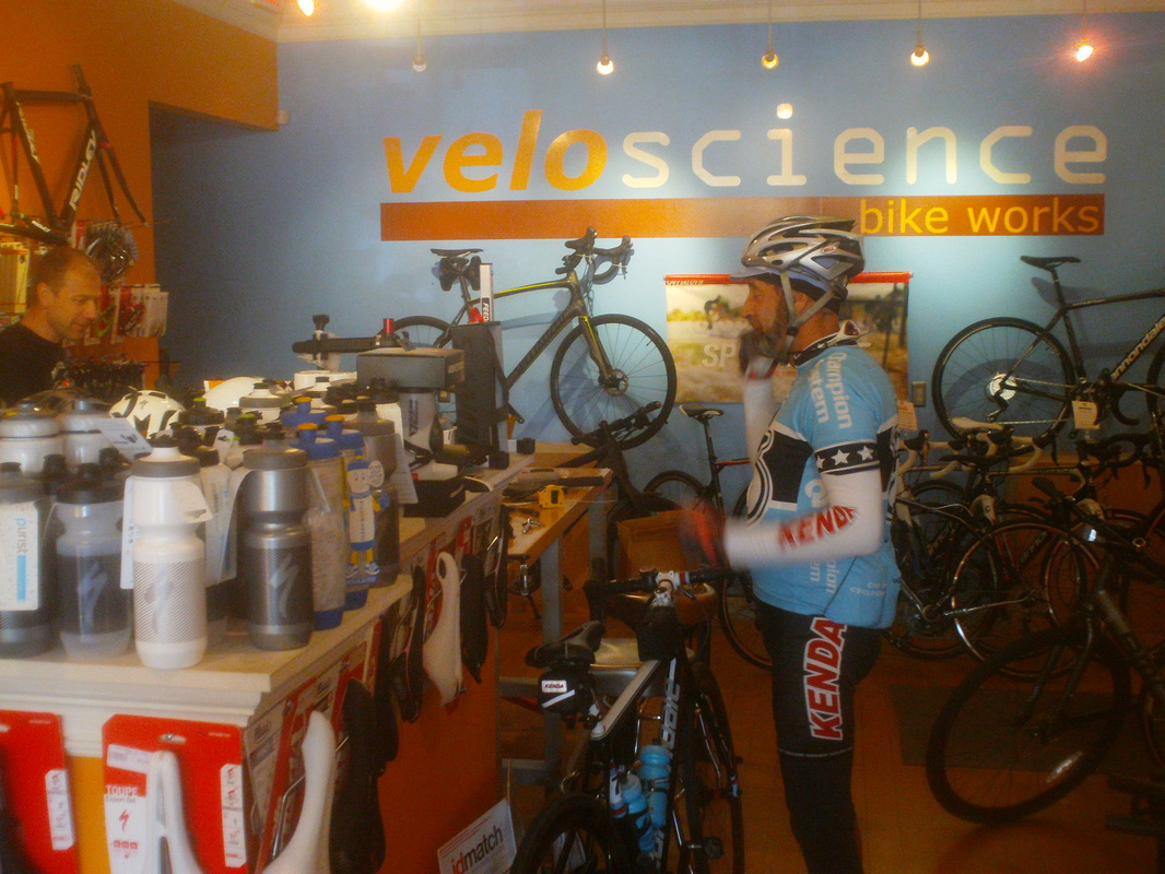 I planned to do the Canal Winchester ride but then I saw the 45 mile, hilly route and thought, egads. So, I rode from my house to Veloscience, the great bike shop in New Albany, killing a few minutes waiting for the ride start and in walks no other than Farmer Mike, back from being a snow bird in Florida! Mike already has raced at Mohican, probably winning his age group again. Mike revealed that he keeps a list of names of cyclists who populate the Ohio rides, which he reviews, prior to early season rides. He also maintains a list of Florida names so when he returns in the fall, he can recognize them too. 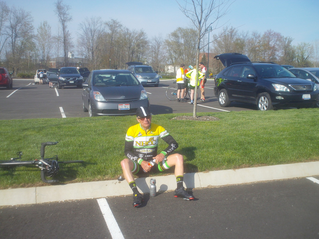 The troops began to gather outside so I walked into the brilliant sunshine and found Tym Tyler, sitting on a curb contemplating whether he and Lisa will visit France and Italy in July. Lisa was working and Tym was to have been mowing but why do today what can be put off until tomorrow? 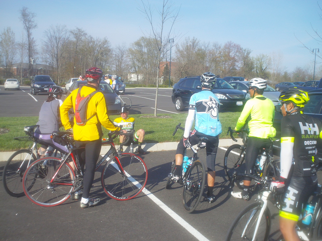 Others join the discussion. Visit France and Italy or stay in Ohio? Meredith on the left, Rick, Mike, Benton and one of several "Healthy & Happy" team members to join the group, including John and Anthony Sada out on the road. Having not seen many of these people in many months, it was good to get caught up on the news and oh is there news but nothing I can put into print and besides, I'm not one to spread gossip, as you well know. Make up stuff? Of course. 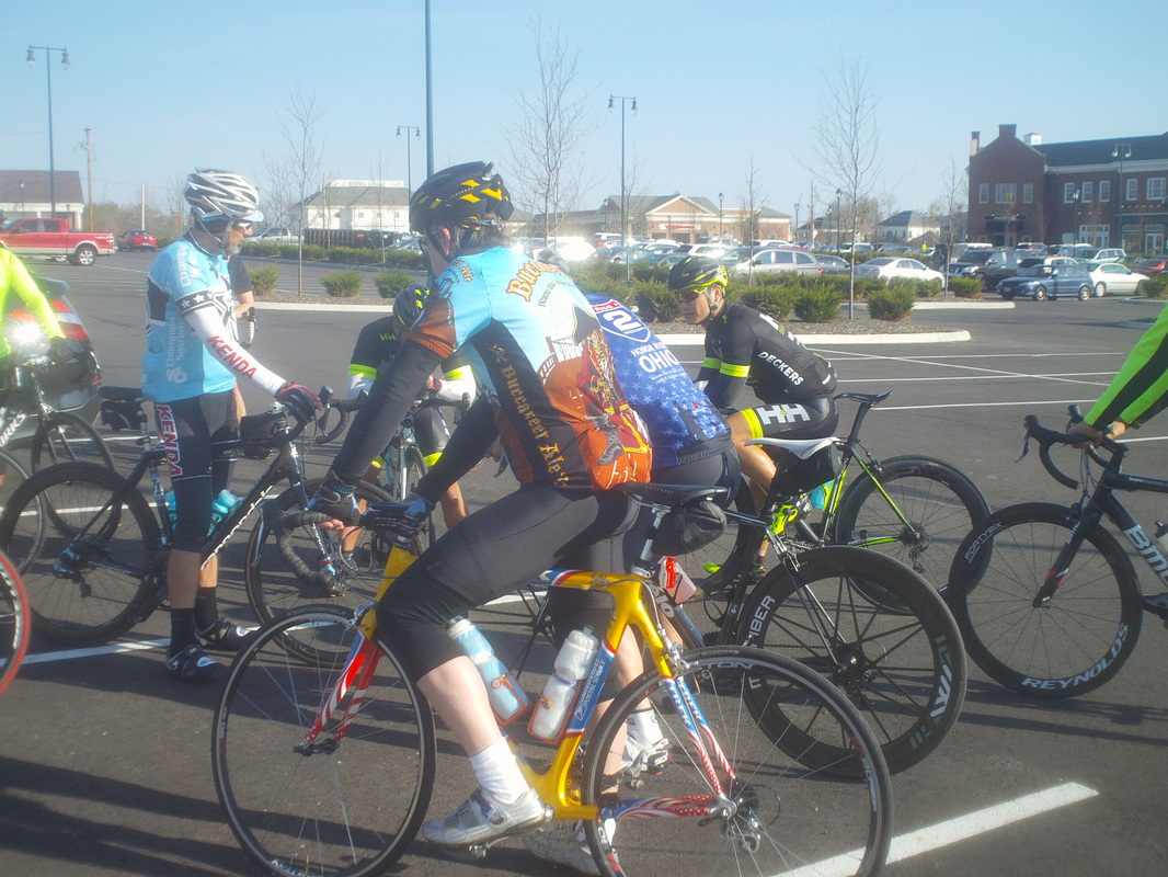 Axel joined in too, Jap P gave some remarks and sent our group of 20ish to the streets. 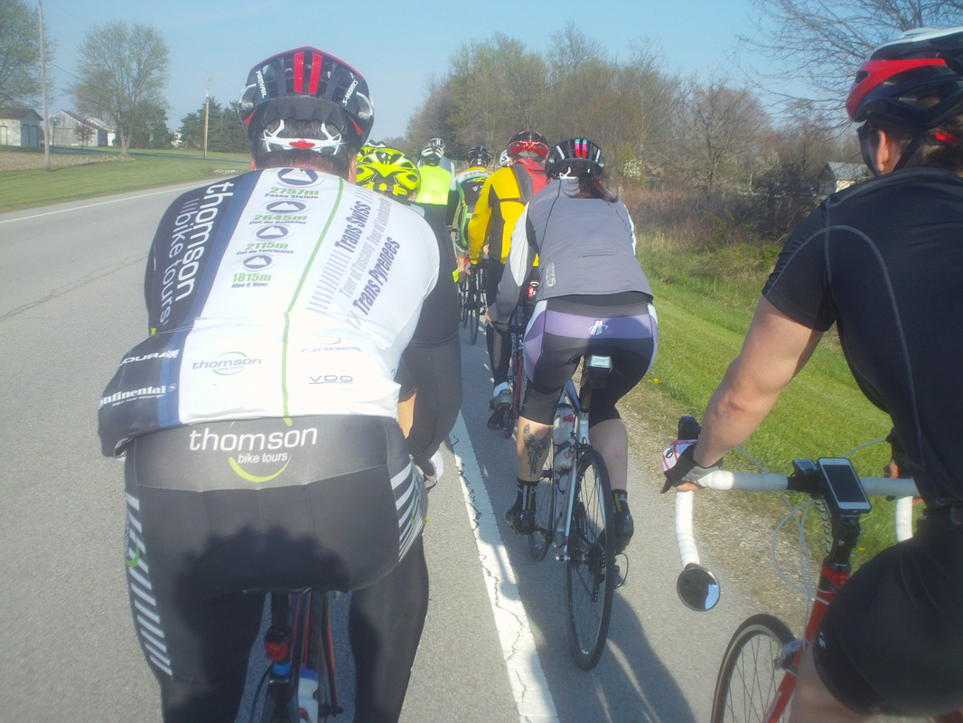 Meredith sports one of the great calf tattoos of all time, looks like wings of victory or something like that. The pace out old 161 was moderate but things became sporty after we turned left on 310 and then a quick right on to Jersey Mill. We arrived in Alexandria with a 20.5 avg and there I left the group to pedal home, finishing with 36 miles.  Widely known as the most difficult cycling event in the US, 140 miles with 13,000+ feet of climbing on both paved and unpaved roads, the BWR attracts cyclists from all over. Among its many features, it may be best known for the refreshment stop at..... 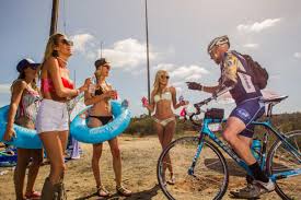 ....mile 120 where bikini clad women hand out liquid refills. Below is a screen shot of the results page showing Nick and Marty's placement and time. Note they began the race in different waves (groups) so they were not racing against each other in the same group to start but I bet there is a good story to tell. Note in..... 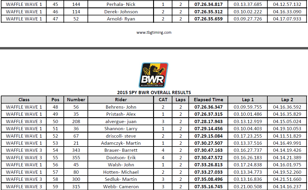 .....Marty's group (below), he finished 11th among his peers of Cat 3 & 4 in a field of 465.. Nick finished an impressive 34th against a field of 140 of mostly Cat 1 & 2's. 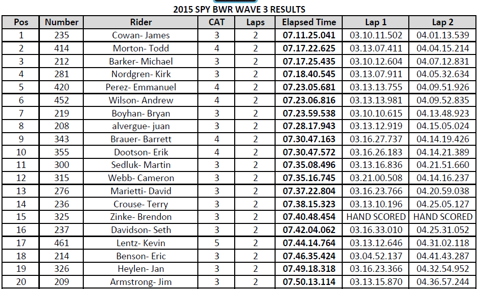 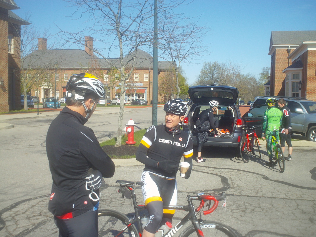 Doug McConaha, with coffee, spent about a month in and out of a hospital, battling pneumonia. The good news is he is on the road to recovering his legs and while terrible he had to go through the ordeal, he did lose 15 pounds. Above, he is discussing various medicines he was required to take with Dirty Dan who is a pharmacist and sometimes referred to as the "Michele Ferrari" of Central Ohio by certain cyclists who suddenly ride a lot faster. Just kidding. 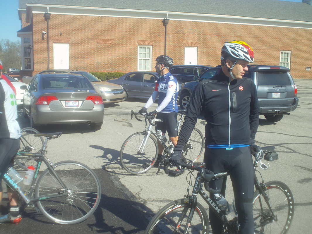 Isaac in the background rolled in to roll out with our group of 16. Isaac is riding very strong. So strong that after kicking my ass at the end of the Northridge climb and tiring of playing with us like a cat with a mouse, rode off to do hill repeats on Reynolds Road. However, prior to leaving, Isaac put in long pulls on Jug, staying well to the left so we could draft to his right, somewhat protected from the strong winds out of the NE. Dan too took long pulls alongside Isaac, way to the right, right even of the white line so not to give benefit to the unfortunate who lined up behind him. That Dan, dirty, dirty, dirty. 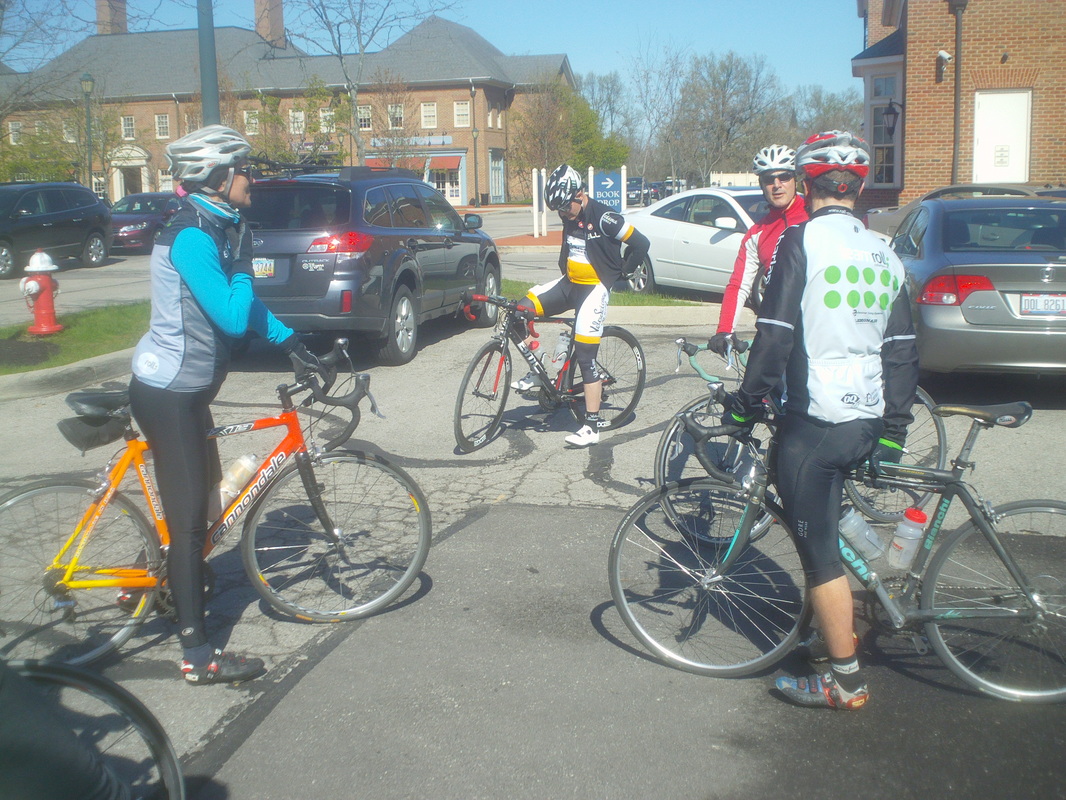 Eva on the left is also riding strong as she prepares for a tour in Colorado in less than 2 months. On the right, Larry P and Steve P. We were late getting started by about 10 minutes as first Corvair was late arriving and Engineer Mitch had trouble finding the parking lot. Off we went on a good 35 route to Granville, where we came in from the northeast via the Welsh Hills Road climb. 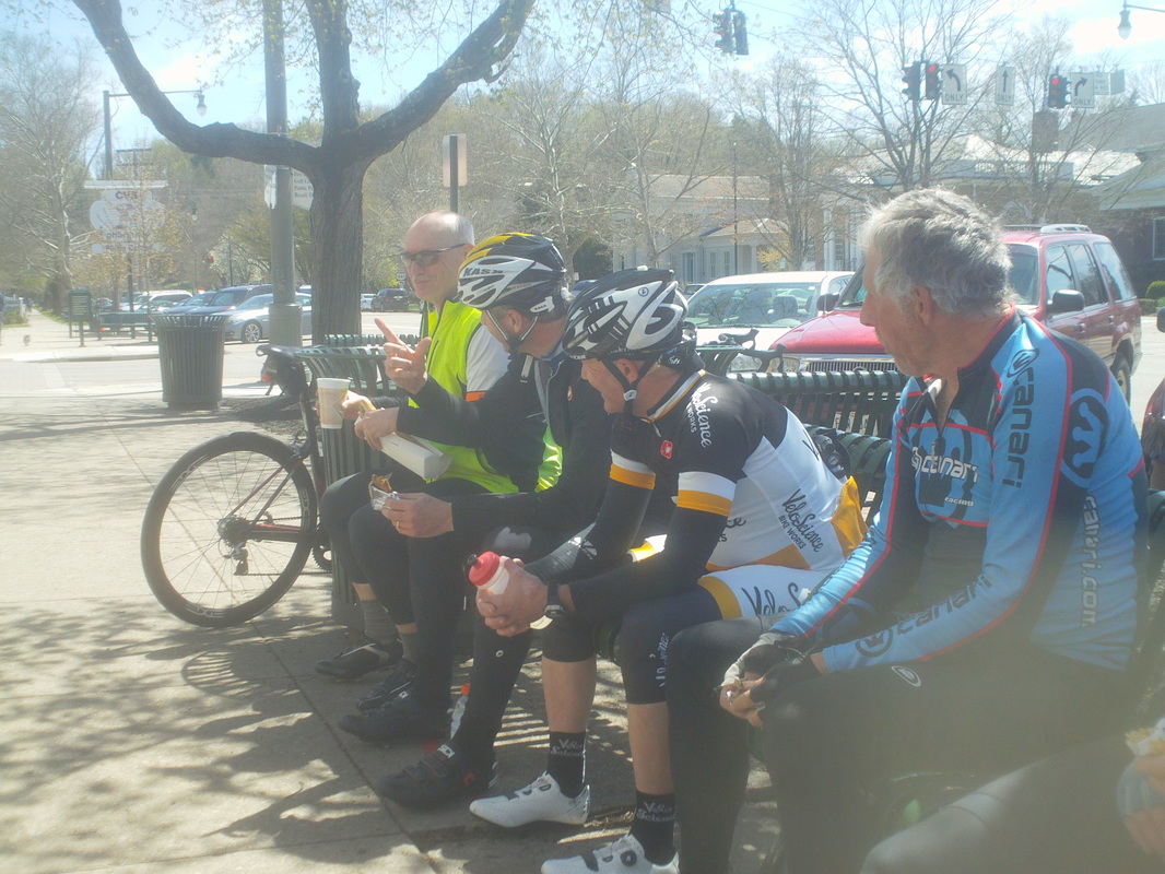 Arriving in Granville, some went to CVS, some to the Soup Loft and some just munched on what they had brought along, while gathering on the benches and ..... 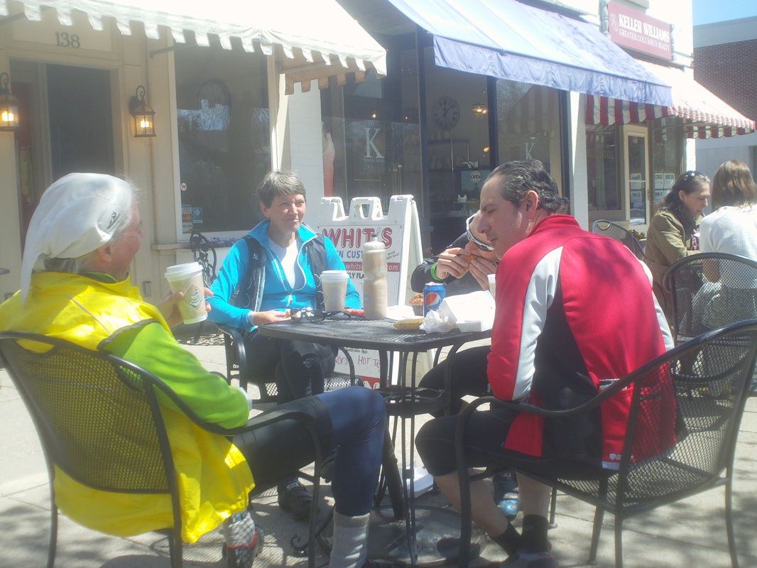 ....chairs, basking in the sun. We headed out of Granville when I noticed....  ...Crazy George was riding without a water bottle. Probably some of you, lacking the long history of George's activities, think it unfair that he be labeled "Crazy". You just have to trust me, the nickname is entirely appropriate. One thing is for sure, at 65, on the flats, he is not strong for his age but simply strong. He took massive pulls out Hollow, Headley's Mill and old 161 on the way back as Doug, Larry and I struggled at times to hang on. After the ride, George announced he was starting a new construction job on Monday and will therefore have to miss the evening rides. 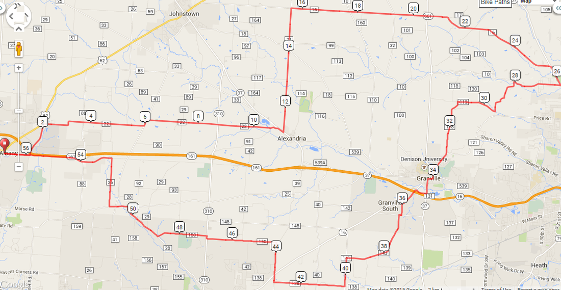 OK, the plan is to be at the parking lot behind Starbucks, New Albany, to roll out at 10:00am. Jeff Schluep came up with the route with two options, depending on if you want to head straight back from Granville or take a longer route. The outward route has a couple of interesting roads that you may not have previously visited on your bike. Everyone is invited so come on out. Among those attending are Crazy George and Flyin Tuna, two of the strangest personalities in Central Ohio. http://ridewithgps.com/routes/7604523 http://ridewithgps.com/routes/7604626  We open this season's coverage with an image that is a bit jarring, Crazy George. George is in good shape health wise and stronger at this point then he was at the same point last season, by about 2mph he claims. George is looking for a place to ride on Sunday and I promised news on that front by tomorrow. Then there was Andrew Clayton....  ...or that may be a character from Star Wars....  ....or this is Andrew C. Not really certain but one of the previous two images is Andrew and one is a Star Wars character. The similarity is striking.  Moving up the food chain, there was Kyle, looking every bit the A cyclist he is.  And Mick too was there. Are you starting to see a pattern yet? Usually I post group shots but the turnout was so low, it was difficult to find a group. It was freakin cold but the wind was not as ferocious as predicted. 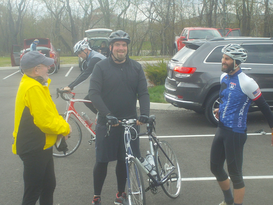 Our leader, Rick Miller on the right, C group ride leader Steve Hewitt on the left and a new guy. We assured him if he came out again on a good weather evening, there would be 60+ out here. 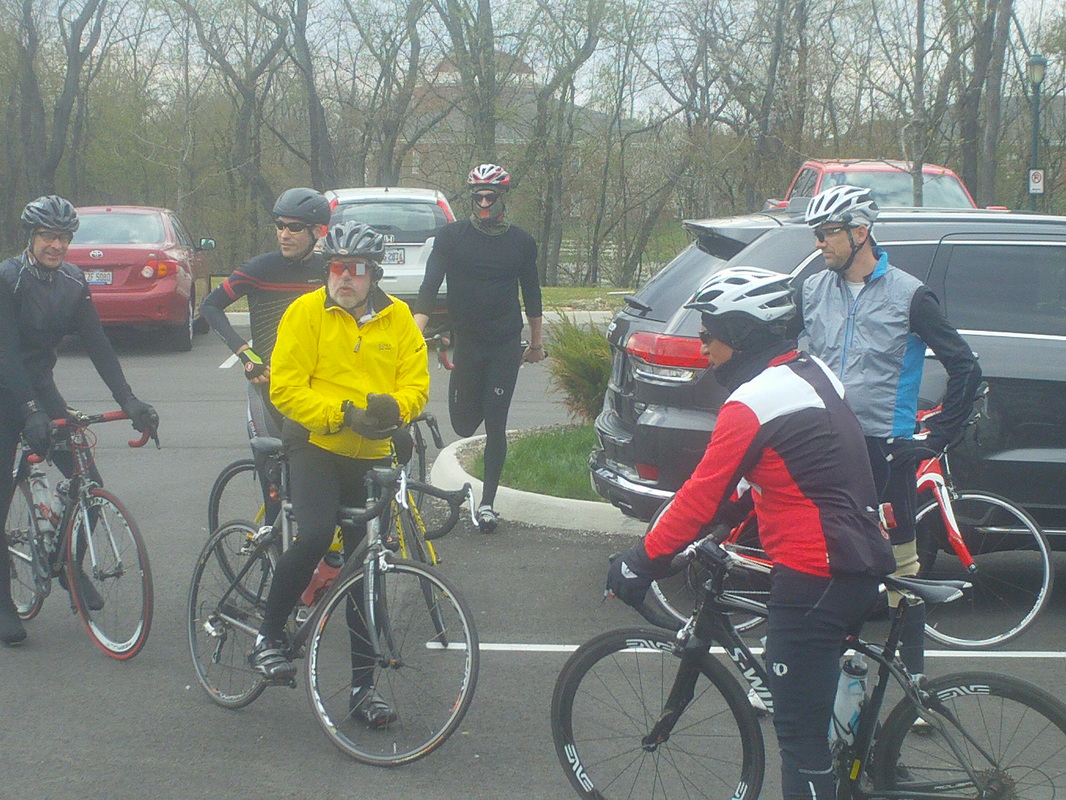 Rick called the 18-20 participants together, including Ken Biddle in that fancy black helmet, who led out the A group. 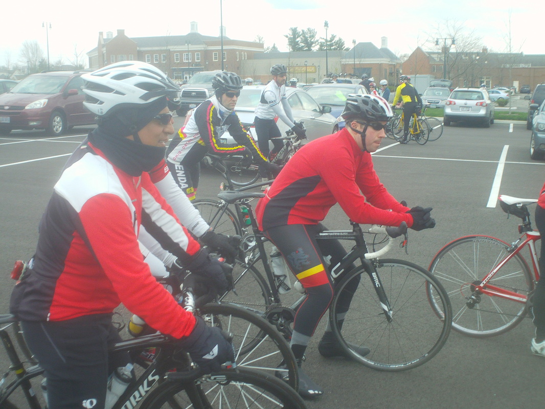 Jeremy, in the middle in red, has trained hard this winter and rarin to go in the A group. Note how already he is inching forward, even during Rick's remarks. Let's see, who else was there...Benton, John Sada, some new faces but I'll root them out soon and expose them here. 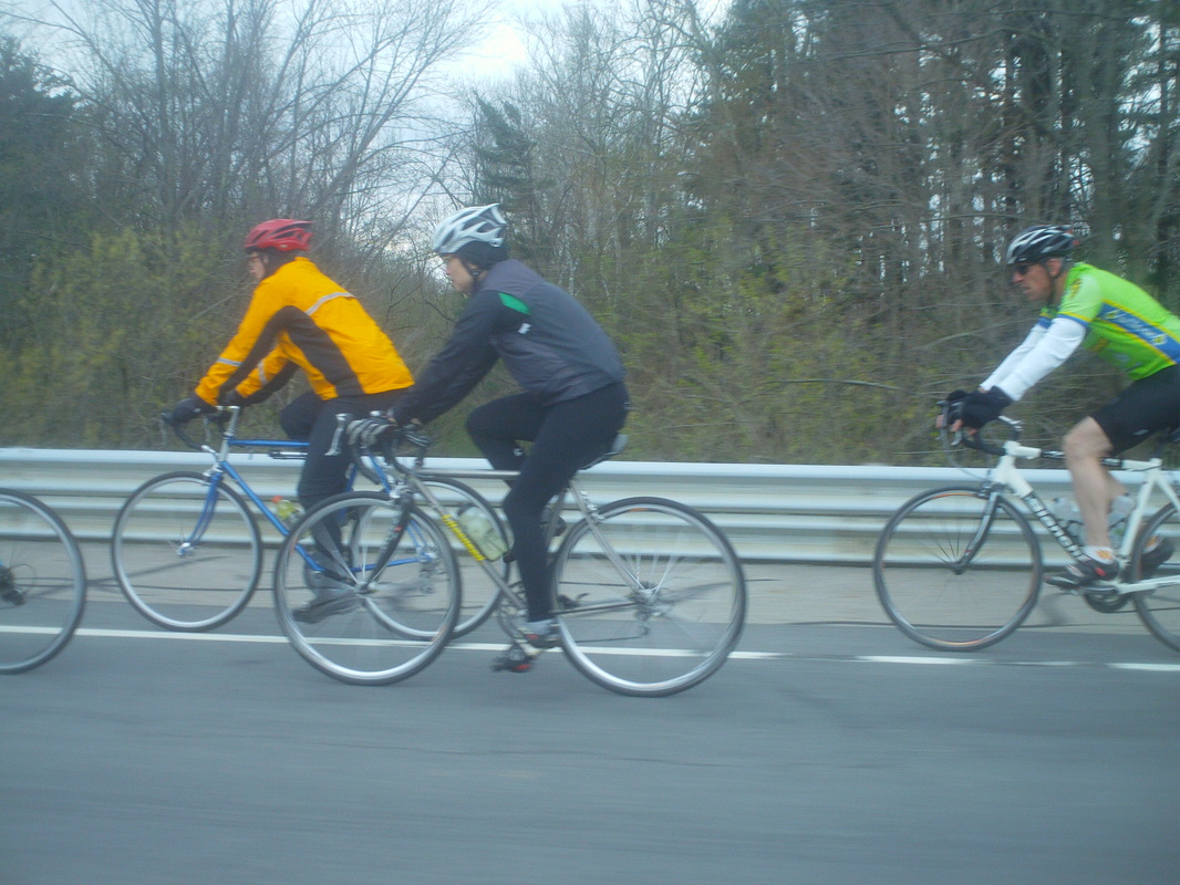 We headed out. We in that you know how if you are a member of a basketball, baseball or football team and you are injured, suspended or on leave of absence, unable to play? If the team wins, you still say, "We won.", correct? Well, I am a member of the Thursday peloton but was unwilling to play yet I am still allowed to say we played or rode. Anyway, as I drove carefully by the B group I took a pretty good image. Think that is Frank in the back and then... 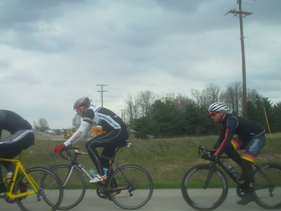 ....sped ahead and caught the A group where again, I carefully avoided ramming them while taking this image. I lnow most Kendaites but don't know the guy in the middle. Unfortunately for him, that won't last. 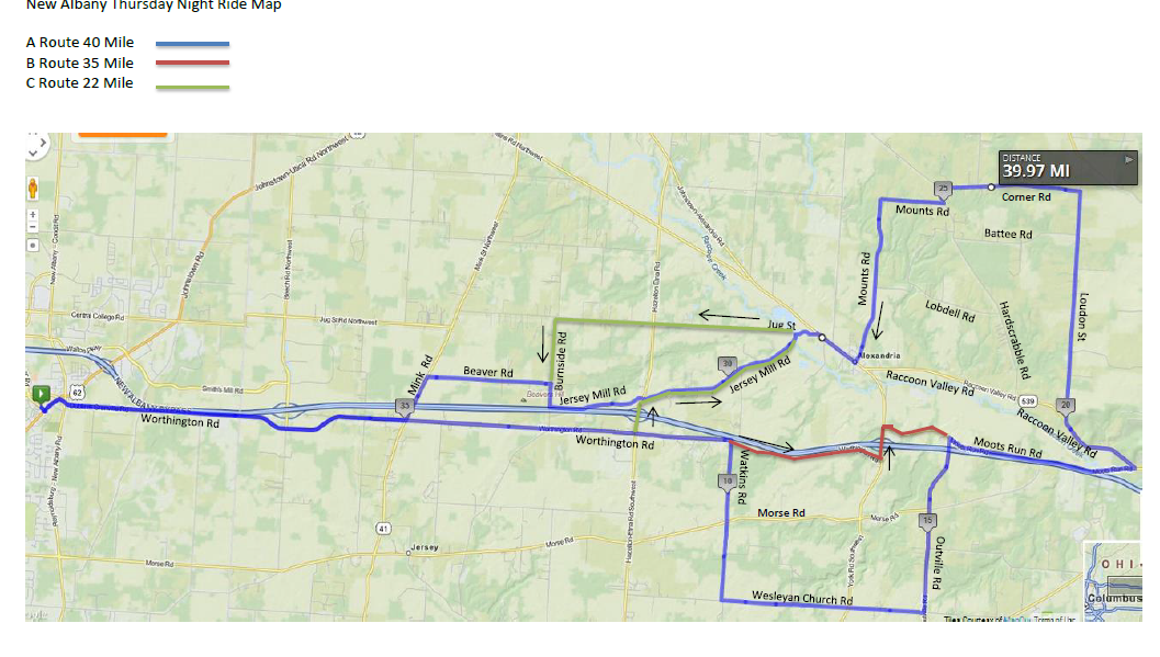 The vaunted New Albany ride route. For those who can brave 20mph winds and 50 degrees, have at it. For more, click on this link: http://www.thecyclingclub.org/wp-content/uploads/2015/04/The-Cycling-Club-COP-Week-4-2015.pdf 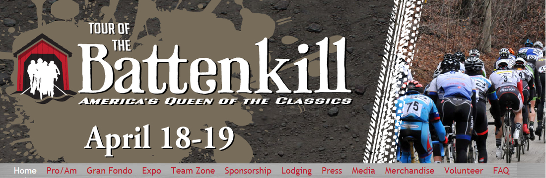 From the Batenkill web site: America's largest one-day Pro/Am cycling race. Racers compete over 65+ miles of rolling terrain on both dirt and paved roads as they travel through the world famous Battenkill Valley. Set in early spring, the race courses includes covered bridges, family farms, and rural villages along the many challenging backcountry roads that traverse Southern Washington County, New York. The 2014 edition played host to nearly 3,000 amateur and professional cyclists from throughout North America and 15 countries. Marty participated in the race and I was able to get the below out of him. He told me what stuck out to him the most was all the guys walking around with bike parts, left over from crashes, during and after the race. 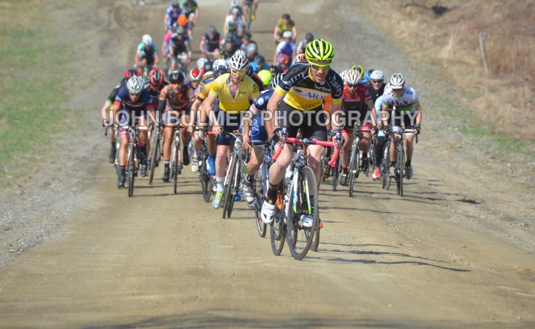 I did Battenkill this last weekend, I just knew that it was a famous race and thought that it would be fun to check it out. It had lots of dirt roads, nice and hilly. It was warm and windy. They did not have any mixed Cat fields so I signed up for Cat 3. When I walked into the registration room they had the Cat 3’s in the corner and the masters races on the same long table to the right. As I walked up, the gals were watching me and they were reaching for the masters books, it looked like they were trying to guess which masters book to open. Their eyes opened up when I announced that I was preregistered for the Cat 3. It was like they were surprised and a little embarrassed. Ok, I guess that you will be in the Cat 3 book is what they said to me as they moved over to the Cat 3 book. To give you an idea of the field, even though I was ranked as the highest Cat 3 in Ohio, I was ranked 37th out of 131 in this race. (I am now 17th out of all licensed racers in the state of Ohio) I will include a few pictures of the race, not very interesting blog material but I thought that it would be fun to share with you. Even the guys that are pictured off the back of the group looked super fit. I finished with the chase group and ended up 25th place. Still, that gave me my best ranking points for the season. The guy who won is in the BMC kit, orange helmet and shoes in the second picture. He attacked the field until he got away with two other guys and burned the two guys off his wheel. He was on a whole different level as were many of the other guys. Little story on Araya: http://www.ticotimes.net/2014/12/14/tico-ronald-araya-wins-first-leg-of-vuelta-ciclistica-a-costa-rica You can see me on the right with lots of sun screen and a smile or grin or pain, maybe all those things (above). 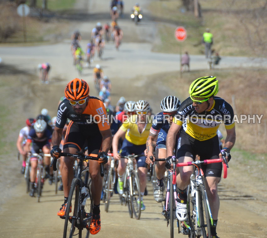  If you don't mind riding in 30mph winds then has Ric Nolan got a route for you for the Tuesday Canal Winchester ride. More here: http://ridewithgps.com/routes/7560886 Now, for a special treat, a member of Central Ohio's cycling peloton participated in the Tour of Bettenkill last weekend and I have the story, to come, soon. 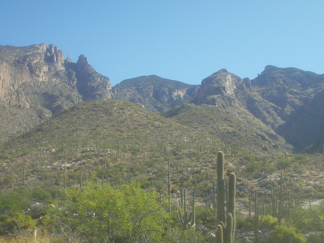 Friday. Would have liked to do a really epic hike but too much to do to get ready for Saturday's return to Ohio. Having hiked to Finger Rock (upper left) a couple of times and Kimball Mtn (center) I departed via the same trail but it branches soon toward..... 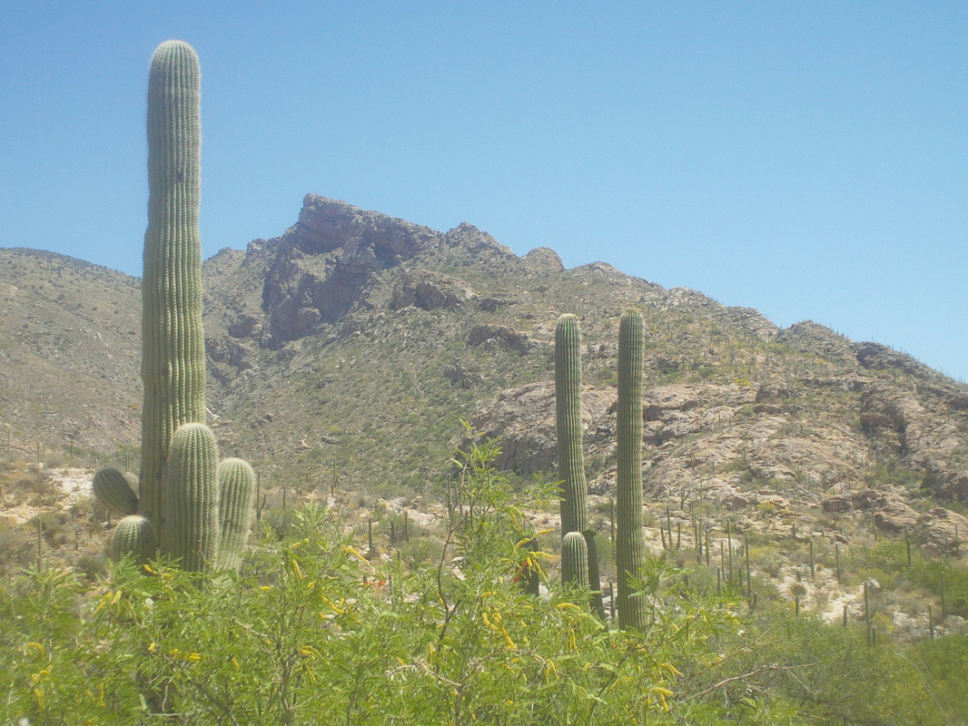 .....Pantatoc Ridge trail, a 5 mile round trip with some good climbing. 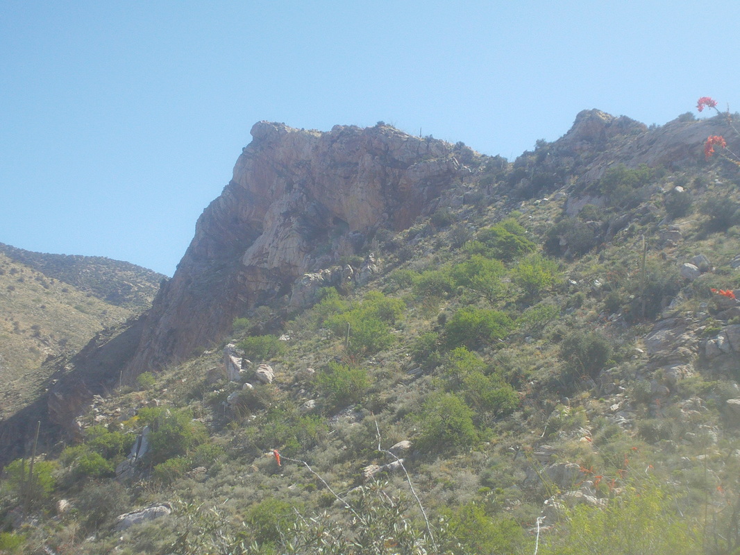 After climbing toward the ridge, I was surprised that the trail never went to the top of the ridge. Reaching a saddle.... 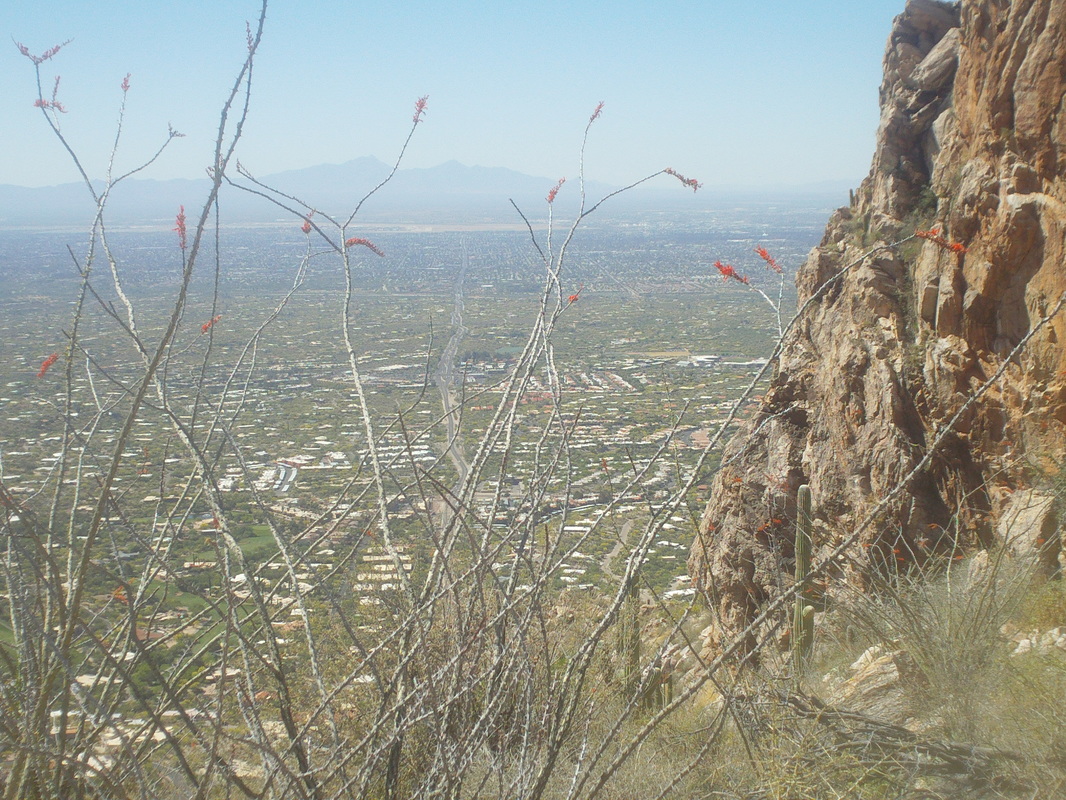 ....which had good views to the south. The trail continued to skirt just below the ridge where I reached a sign that simply stated. "This is the end of the Pontatoc Ridge Trail." 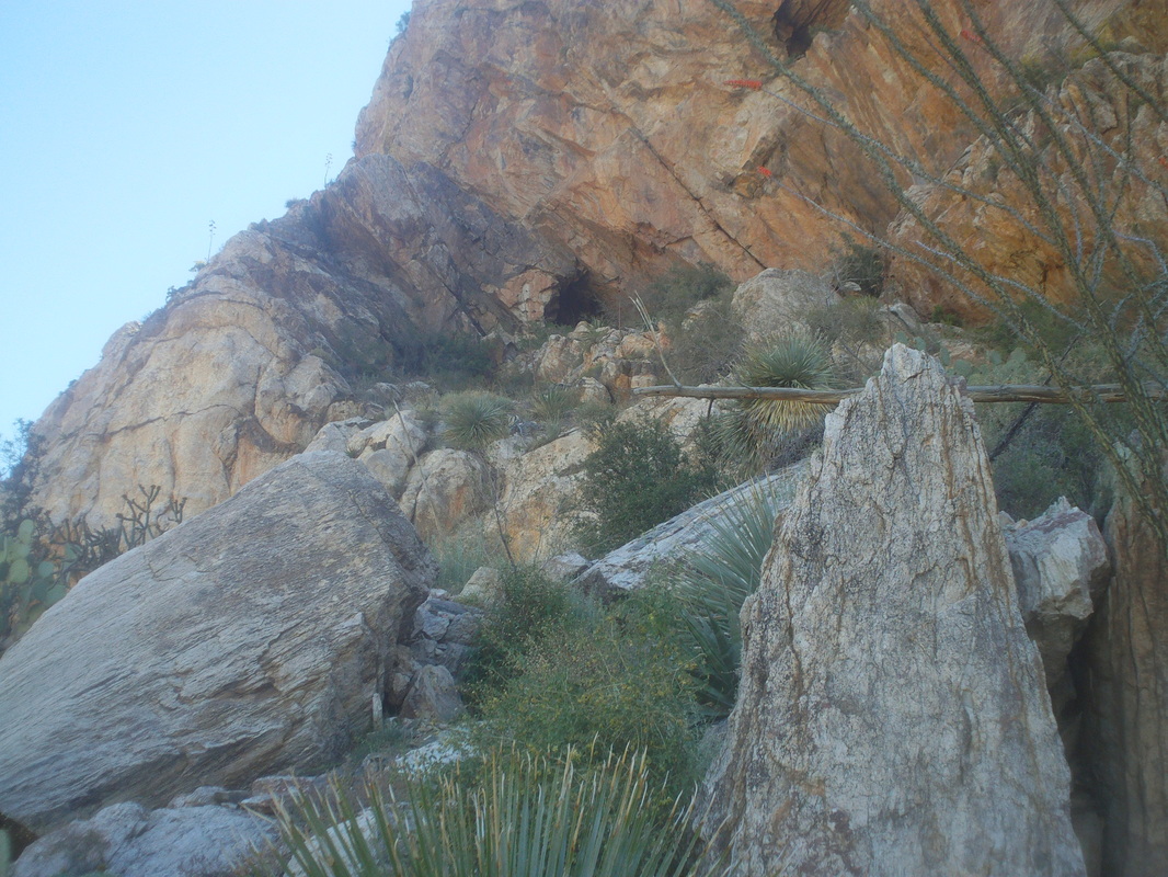 Above I could see an old mine. A very sketchy trail continued and I followed it until it became apparent it would dead end at the mine so I turned around and headed back. There was a cool grove of Cholla cactus along the trail (below). Looking at the 10 day forecast for Ohio, I regretted not staying out here for another 10 days. 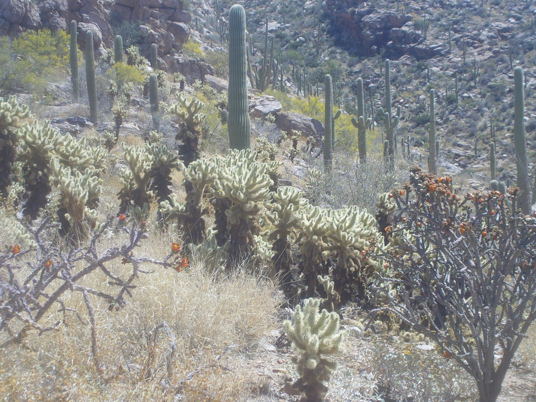 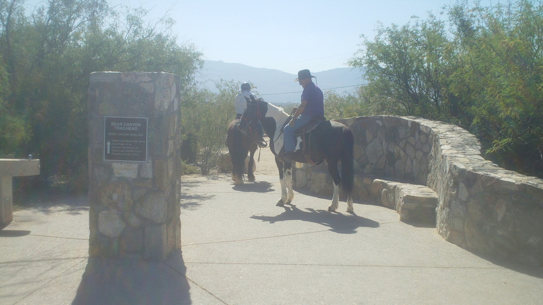 Time to take a break from cycling and I didn't want to do a lot of heavy lifting (climbing) so I headed to Sabino Canyon to do the Seven Falls hike, a 9 mile, rolling route with a climb in the middle. A few people were out on their horses going somewhere unknown but this is the west so.... 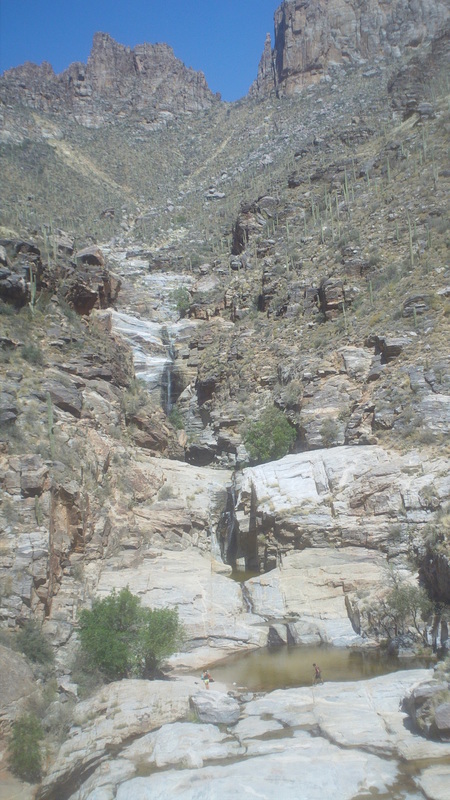 At mile 4-ish, you get a great view of the 7 falls. 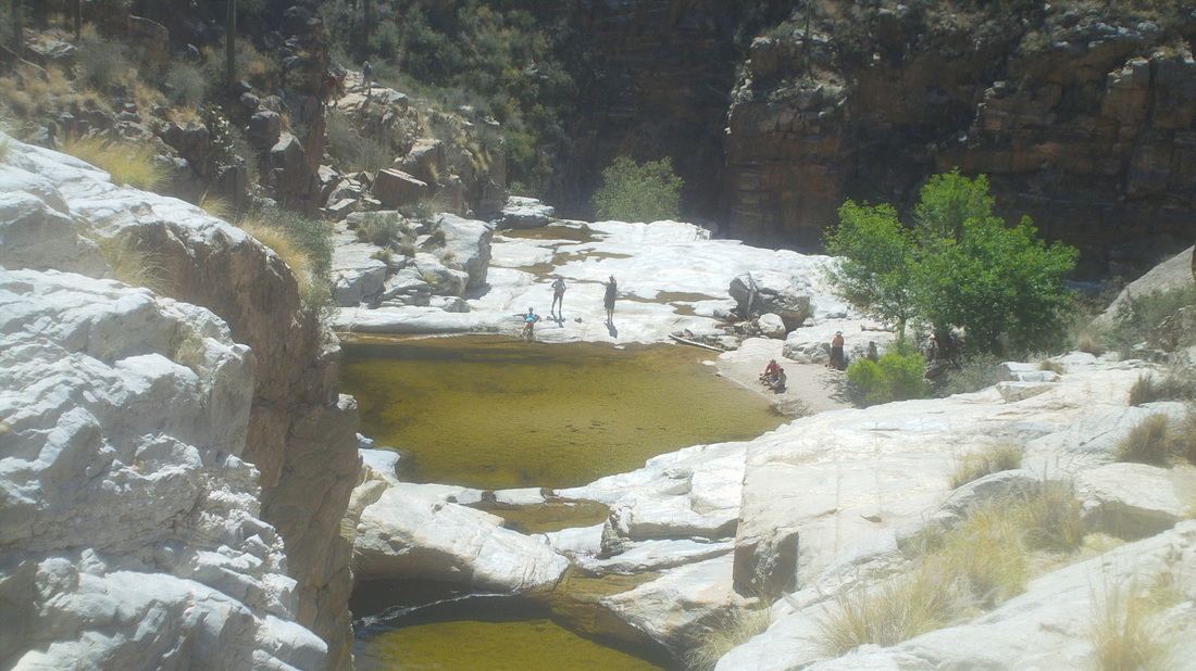 Reaching the base, I continue up the left side to reach the next pool and up another level to the next pool but the way up from there is kind of sketchy. Looking back down, I can see people cavorting around in and out of the lower pool. 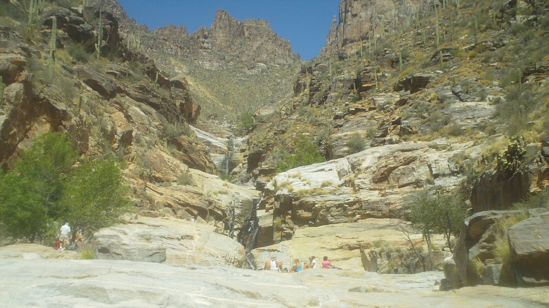 Another look back at the falls after I retreat back to the lowest pool. I hang around long enough to munch on an apple and head back..... 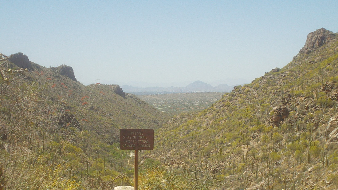 ....enjoying nice views to the southwest. It's Wednesday, I ride on Thursday and then comes Friday, my final full day in, for me, paradise. I'm a mountain guy. When I drive the Pacific Coast Highway, I don't look at the ocean, I look inland at the mountains. Here, mountain ranges surround the area and beyond them, more and more mountains. Couple that with the sun, blue skies and warmth/heat, geesh.
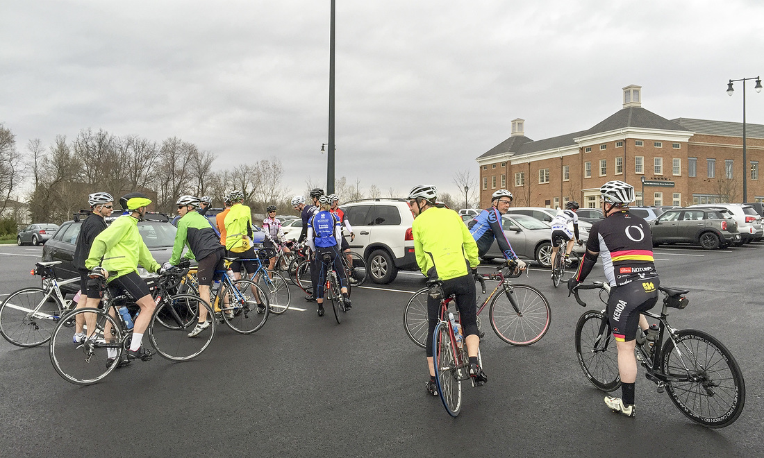 A source, who wishes to remain anonymous, sent me the above image from tonight's ride. Was a small turnout due to lingering and/or impending rain. My source does not have the trained "eye" that I possess for prowling the parking lot and pic taking, of course, so with so many backs turned it is hard to identify many but I do see Crazy George, I think David Smith...maybe Doug McConaha......perhaps Peggy Cook there in the middle.....could be Andrew Clayton on the left....well, the expert will return for next Thursday so you should all be jacked about that....just kidding. 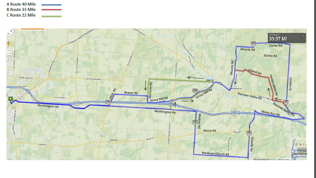 Wow, Rick Miller has already reached the 40 mile plateau as, week by week, he builds toward the 60 mile (or maybe 70) distance around Summer Solstice. Anyway, click here for additional information and remember, print your own map: http://www.thecyclingclub.org/club-rides/thursday-evening-ride/
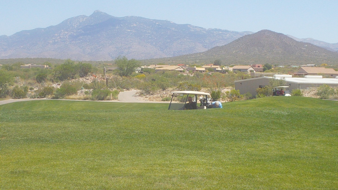 I was out riding south of Tucson, hitting Saguaro East Park and Pistol Hill when suddenly, I became hungry, very hungry. I could not find a gas station or market but found a golf course, rode up the drive, rode to the back where there was a veranda with a restaurant, went into the building where golfers were scattered around watching me out of the corner of their eyes, ordered a BLT and fries, walked outside and enjoyed watching golfers tee off the first hole. It was kind of nice and in this setting, I am svelte compared to those around me.
 Since one of the evening rides appears that it will not be cancelled due to inclement weather, I can begin posting the Tuesday and Thursday routes. Soon, I will be there to add my bland and fact filled commentary, along with grainy and hard to view images but for now, all I can offer is the route. You can view it here:http://ridewithgps.com/routes/7490930
Looks like a fast route. 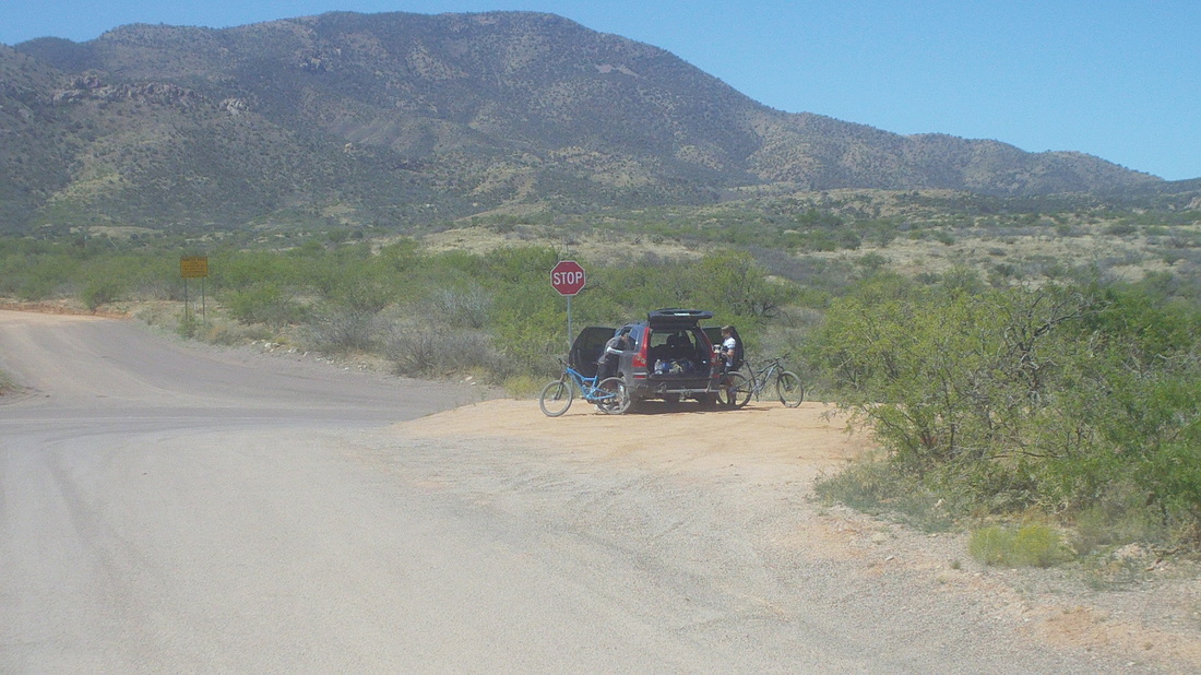 Cyclists who visit the area always hit the slopes of Catalina Highway for the 26 mile ride to Summerhaven. Most are unaware that a right turn just before the drop to the village, a steep side road takes you 2 miles up to "Ski Valley" and then if the gate is open, another 1.5 miles up is the observatory. Just before that side road though is another road that drops steeply to a fire station. Beyond that is 24 miles of dirt/rock surface of unknown, to me, quality. I've asked around about the road, known as the back side to Mt. Lemmon, but few have ridden it and those that have always on a mtn. bike. A few days ago I was searching around the internet and came across a blog post from Chloe Woodruff, in which she described doing the ride a couple of months ago on a road bike. That was an "aha" moment for me and so I decided to check it out. Above, a nice couple prepare to ride the route on mtn. bikes. 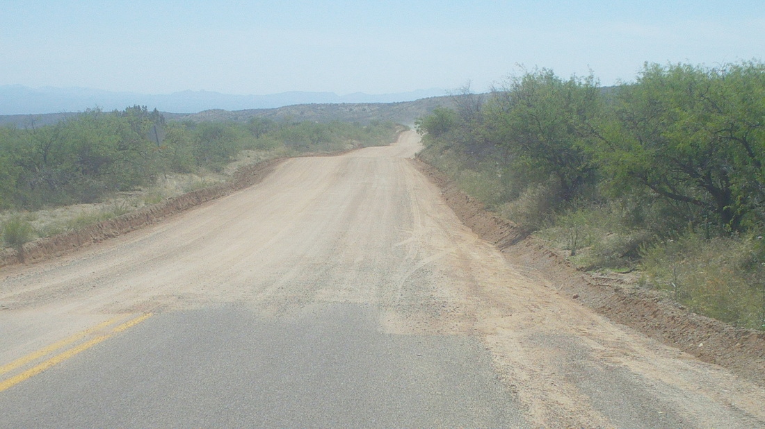 I reached the end of the pavement, now 24 miles of dirt and rocks. The first 2 miles is smooth dirt but with plenty of washboarding so the going is very slow. 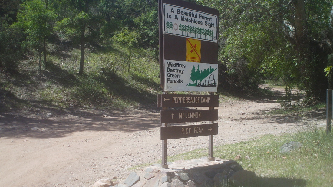 I reach this sign, indicating a turn for "Peppersauce" campground at about mile 3. Going straight to stay on the route for Lemmon, the road became packed dirt with embedded rock. Riding on this surface with a road bike is kind of stupid. My Trek took a terrific pounding but kept going because while rough, I could still pedal and keep the bike moving. 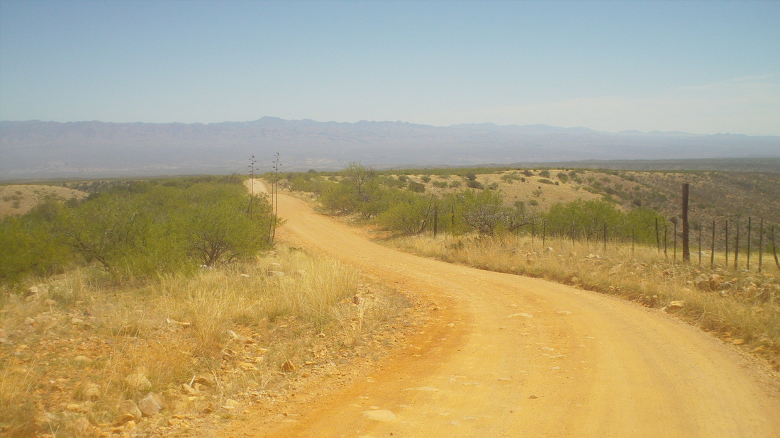 The couple with the mtn. bikes caught me. I pedaled easily on the up hills and stayed with them but on the down hills, forget about it. I had to brake all the way and they whooshed away, never to be seen again. It was kind of troubling that the route descended as much as it ascended and soon the road went away from Lemmon and toward a distant mountain range..... 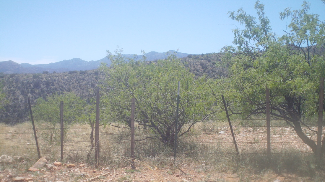 .......instead of that distant range, Lemmon. So, at mile 8, satisfied that I had a feel for the road, I turned around. If I kept going and made it to the top, there would be no way of coasting back down this rough road. I'd be committed to a 100+ mile loop around the mountain, first reaching Summerhaven, down Catalina Highway, west through the foothills, north through Oro Valley, Catalina and Oracle to my car. That would be epic for another day. 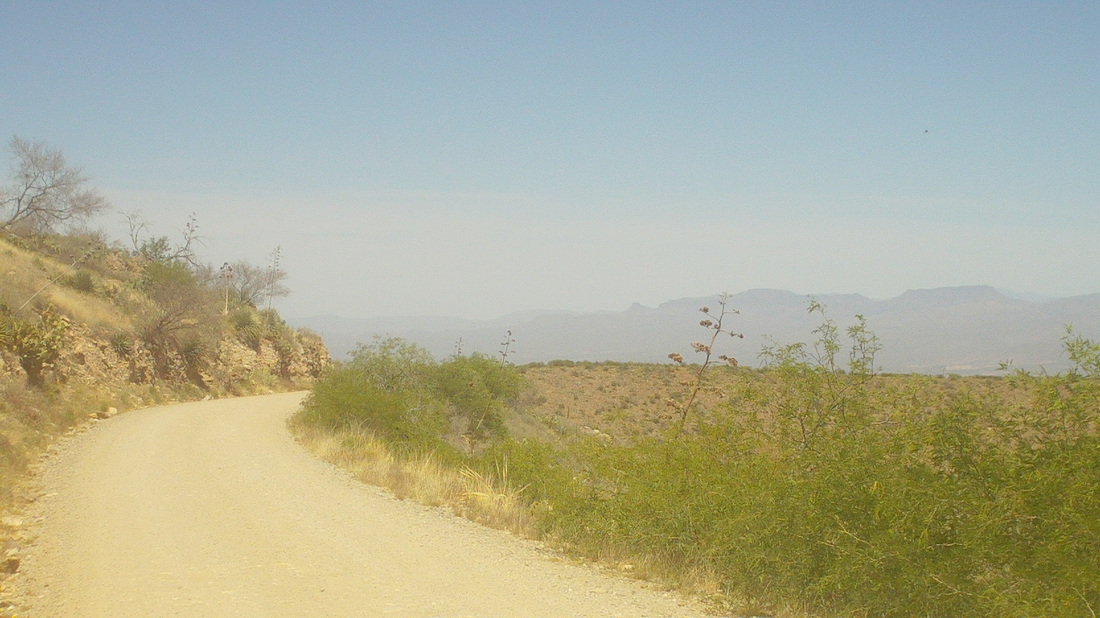 The way back was very bumpy but with great views, the few times I could lift my eyes from the road to see. I could do the loop but with the beating the bike takes, not certain it would make it. I heard you can rent a new mtn. bike as a demo for $50 and use it for a day. That probably makes more sense. Anyway, finished with 28 miles and 2700' of climbing. 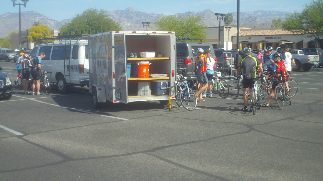 So many tours and camps in the area. I have been surprised at how many originate in Canada, especially the province of Quebec. Someone drives a van with some help with all the bicycles while everyone else flies in. They love it here and why not? I have been here since March 1 and it has rained twice with temps in the 70's and 80's. Actually, it reached 90 a couple of times but that is unusual for March and early April. A few days have been windy but usually it is single digit wind speeds until noon or 1:00pm on those days and then the winds ramp up quickly. 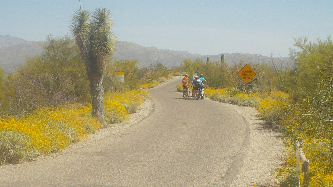 It was especially windy on Wednesday and after doing a group ride, I came back via the bike path and approached a woman who was riding her comfort bike in the middle of the path while hitting the bell. "Ding ding, ding ding." I yelled "On your left" and she replied, "Bobcat" and so I braked. She had been riding and there was a bobcat, sunning itself on the path. She turned around, gathered herself and went back, dinging the bell, which caused the animal to move in to the brush a second before I arrived. Not taking any chances, she kept the bell dinging. Thursday, I headed to Saguaro East and took the above image at the start of the 8 mile loop. A great ride with around 500' of climbing that I did a few times, finishing with 55 miles. 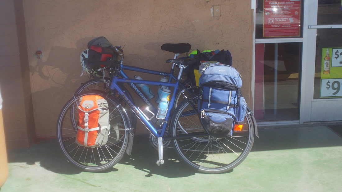 I am aware there is a back way to Summerhaven, close to the top of Mt. Lemmon. I have asked around about the route but few have done it and those that have did so on a mtn. bike. Then, a couple of weeks ago while searching ride reports I came across a blog from "Chole Woodruff" a pro cyclist who had done the ride while on a road bike with 25" wheels, a few months ago. I emailed her and she was kind enough to reply back with info. An epic ride would be leaving my place, riding to Catalina, onto Oracle, up the back of Mt. Lemmon, down Catalina Highway and around the mountain, returning home. A little over 100 miles. Saturday, I drove to Oracle to reconnoiter the dirt/rock route and while getting ready, a couple rode up on these machines.  Really nice people who flew from Vancouver, BC to Tucson then hopped on their bikes to ride north to the Grand Canyon and Utah before returning home. They told me about a ride from Banff to the coast that you can do, "With a bike and credit card". It sounded interesting. Well, more to come on my road bike gravel ride, later. 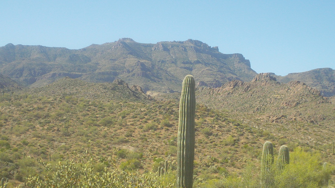 Monday was to be a windy day so rather than fight it on a bike I decided to have it cool me while on a hike, although at 85 degrees, it would be a warm wind. I hit the trail at First Water parking area at 9:00am. 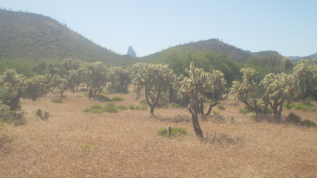 Soon I arrive at the Second Water and Black Mesa trail intersection and make a left, headed to "Green Valley" an unusually flat piece of walking for the "Supes" as the wilderness is called by locals. 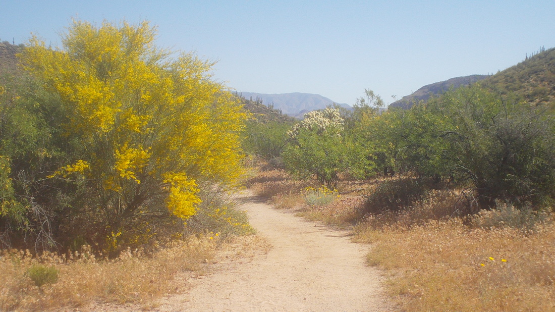 The hiking is easy prior to descending a very rocky trail to Boulder Canyon. 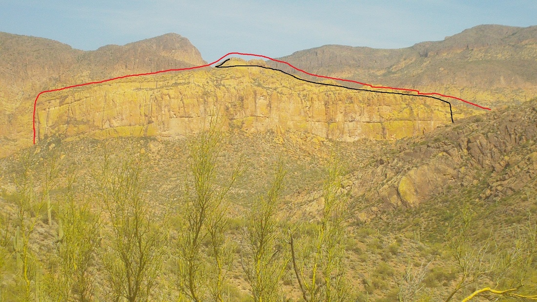 The battleship comes in to view during the hike down. Because it camouflages so with the surrounding rocks, I have outlined it in red and in black, roughly showing the route to the top. 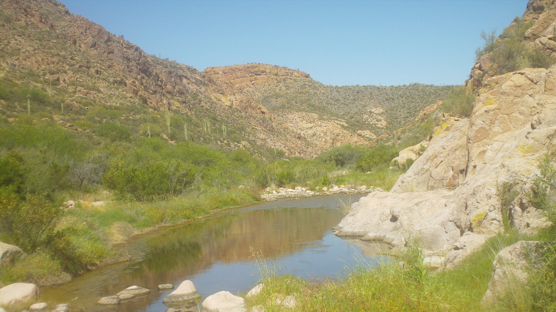 Boulder Canyon has some pools of water but mostly it is walk in and alongside a dry stream bed. Having walked almost the length of the "ship", there is a pile of rocks that marks where to go off trail and begin climbing. 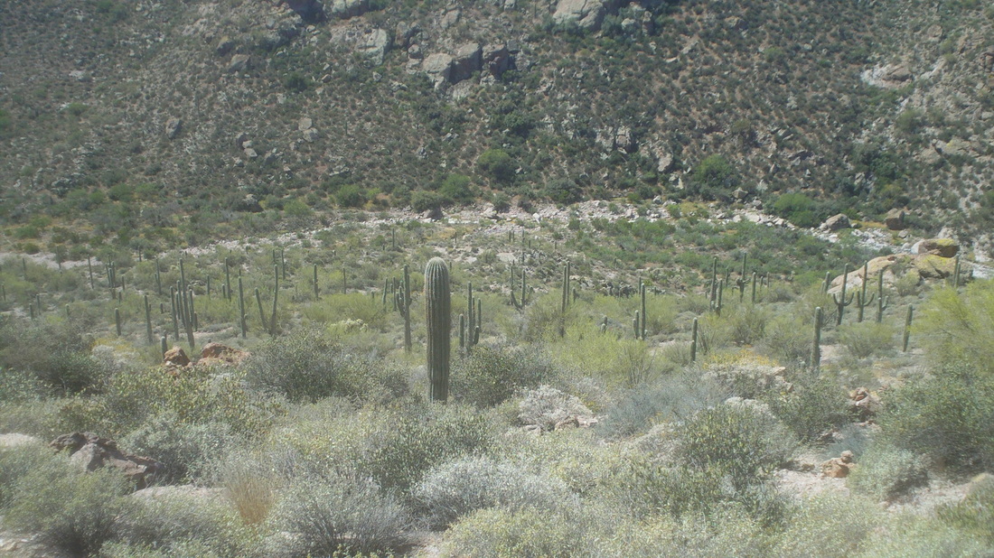 Nearing the "ship's stern, I look back and get a good look at the creek bed. The way up was all bush whacking and I kept a close eye out for a rattler but did not see any, which surprised me but given the time of day, they are likely sitting it out in a nice cool den some where. 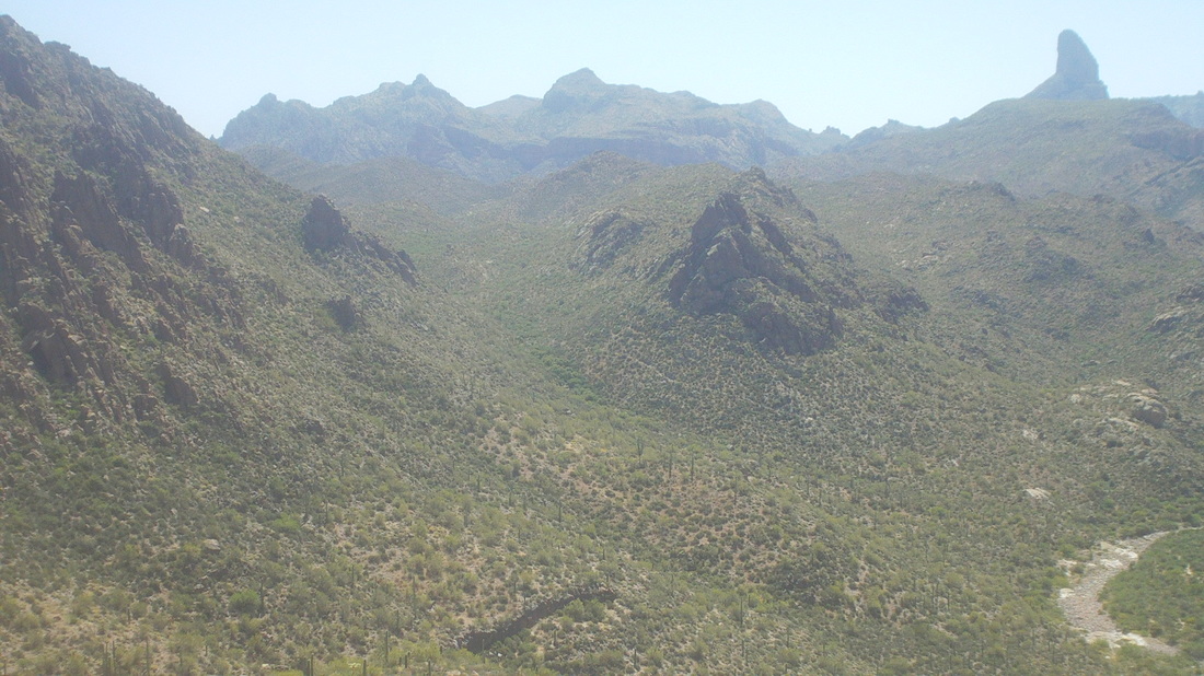 At the bottom of the "ship" I look to the south and have good views of Weavers Needle. I arrive at the boulder with a tiny alcove, cache a hiking pole and back pack and climb the wall to gain access to..... 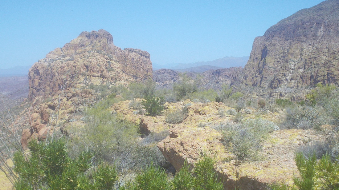 ....the top end of the "ship". Looking ahead, the middle looks so close but it is almost a mile away and the route.... 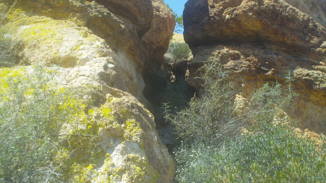 .....so much fun working through many obstacles including.....  .....a 20' wall and a couple of......  ......rock spines that I "butt hike" (sit down on your rear and scoot along it) because of the exposure......  .....with plenty of more places having exposure that gives me pause.  Almost there I look back. It all appears so simple and easy. 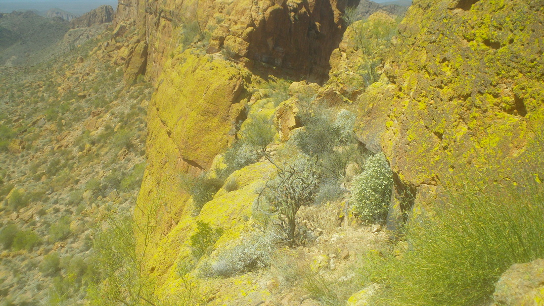 Moving to the left side there is a narrow ledge with pea gravel, like walking on ball bearings. Really careful here before reaching the back side of the middle summit and then climbing up another wall to see..... 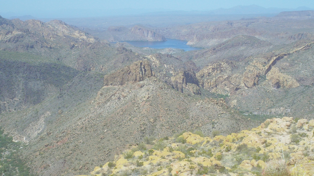 ......Canyon Lake and then looking in the other direction.... 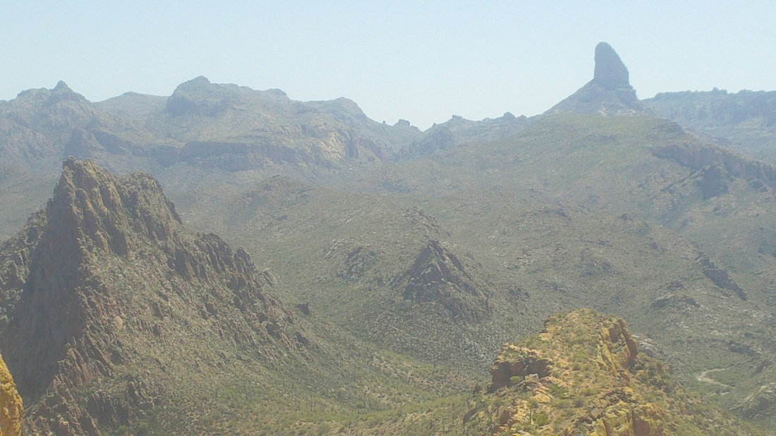 ....Labarge Canyon on the left, Weavers Needle in the distance. I signed the summit register and headed back down, finishing with 12 miles. I stopped at "Lost Dutchman State Park", which is around the corner to grab a cold drink. While there, the ranger received a call from a couple who were on one of the trails and looking at a rattlesnake. They wanted to know what to do. The ranger said that was a first. I guess they were afraid to go around the snake because that would put them off trail. The ranger advised them just to sit it out and the snake would eventually move. 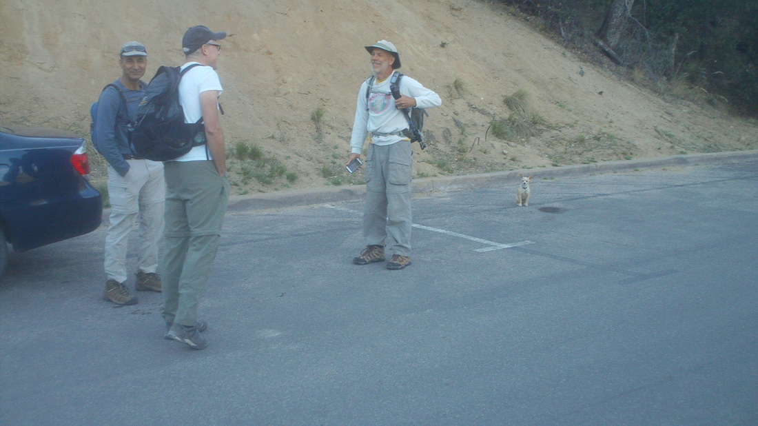 At the Madera Canyon parking lot, we gather, including (left to right) Kamaran, Chris, Patrick and Patrick's dog, there behind him. An amazing dog that walked every step of the 9 mile route with 3900' of climbing. Not in the image is Dale, Gary and Heidi, a dentist who sold her practice in Hilliard, OH. We shoved off on the "Old Baldy Trail" but soon came to a fork and selected the right turn. This new trail is named "Vault Mine Trail", rising 1800' in 1.5 miles. 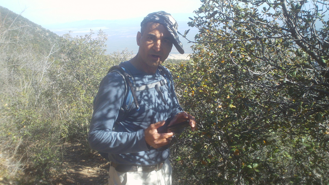 Kamaran got the jump on us at the beginning as we worked our way up what has got to be one of the steepest climbs I have done, very close in difficulty to the last 1./2 mile of Rincon Peak. I was unable to catch Kamaran until the trail dead ended at "Aqua Caliente Trail". It appeared that Kamaran at least had to work hard to stay in front of me. Neither of us had memorized the required turns but he thought we were to make a left so we did, which was the wrong way. We should have just waited for the others to catch up but we are competitive enough that we did not want to give up the gap we had worked hard to create. 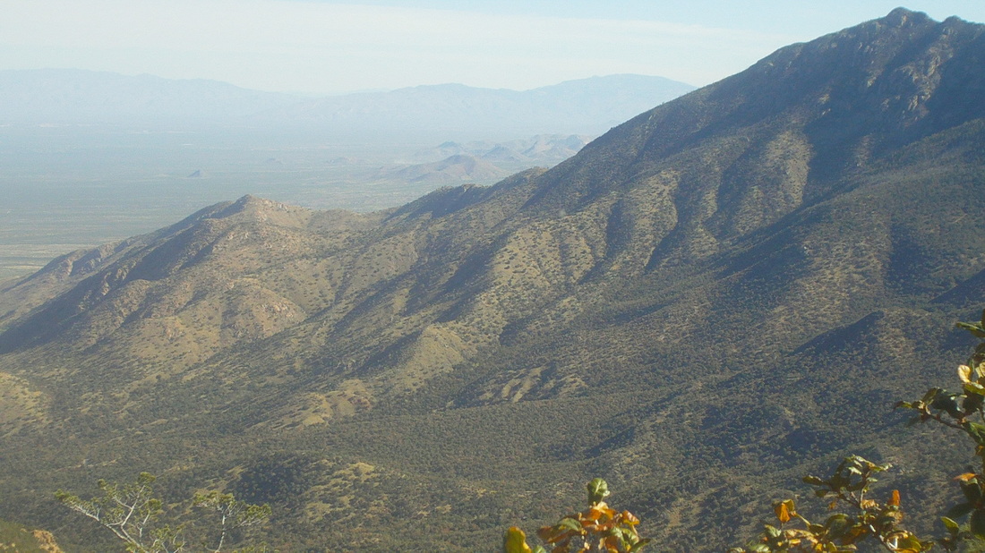 There were some fantastic views to the northwest. We hiked for around 1/2 a mile on a trail that hardly climbed or descended before we decided we should turn back and regroup. Reaching the "T" intersection where the Vault Trail dead ends again and not finding our group, we continued on our new course. 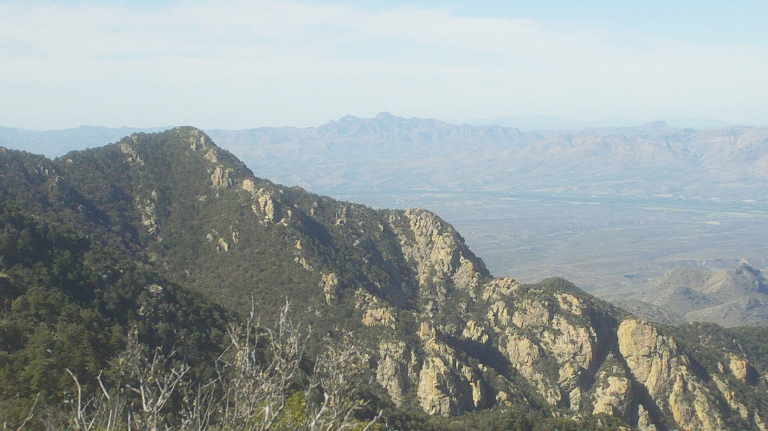 We arrived at a new trail intersection where I saw a very faint trail going west. I had recalled from the hike description that at some point we would go off the main trail via a seldom used and unmaintained trail so figured this must be it. 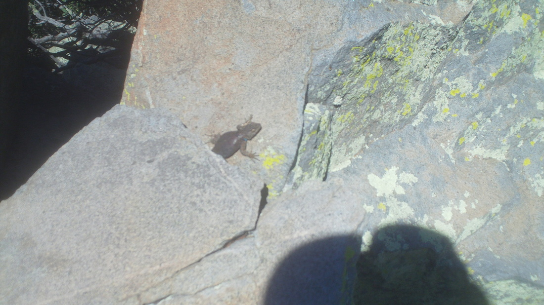 Kamaran and I followed the trail while it rose to a group of large boulders. On one, someone had created their own petroglyph showing what looked like a wolf's head and paw prints. Later I learned someone had put them there about 10 years ago. Above, a lizard cautiously emerges from a hiding spot. Not sure why I did not think to take a pic of the petroglyph. Kamaran and I decided this trail was going in the wrong direction so we turned around, again. 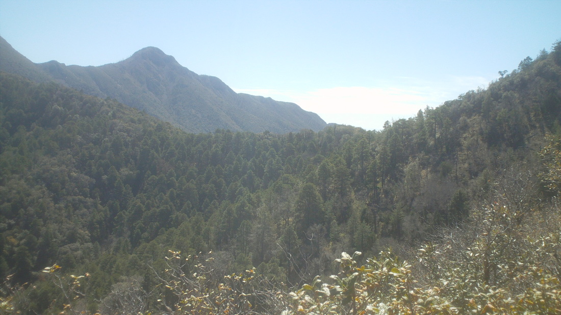 Returning to the maintained Aqua Caliente trail, we found a man who gave us some trail suggestions on how to access the peak of Mt. Hopkins. As he was doing so, Kamaran was looking off trail and towards the peak. He wanted to just start climbing directly to the peak, far above. I looked at the slope skeptically, surely a 30-35% grade and no idea if we would run into a wall or other required workarounds. Kamaran was all for heading up and I encouraged him to go ahead but without me. I was glad his brain returned to functioning normally and we..... 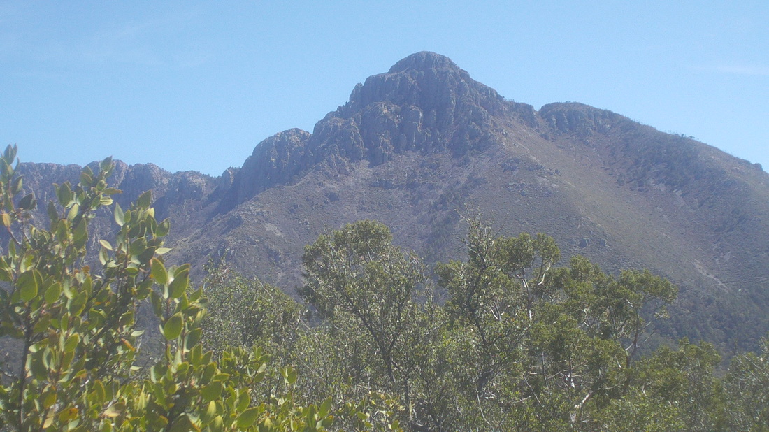 .....headed back toward the Vault Mine trail via the Aqua Caliente trail, reaching and passing the Vault Mine on our left and continuing on, as we had originally when we emerged from the Vault Mine, toward the Josephine Saddle (describing our movements is challenging so it may not make sense to readers unfamiliar with the area). Our zigs and zags had added about 3 extra miles to the route. Above, across the valley is Mount Wrightson, about 1000' higher than Hopkins. 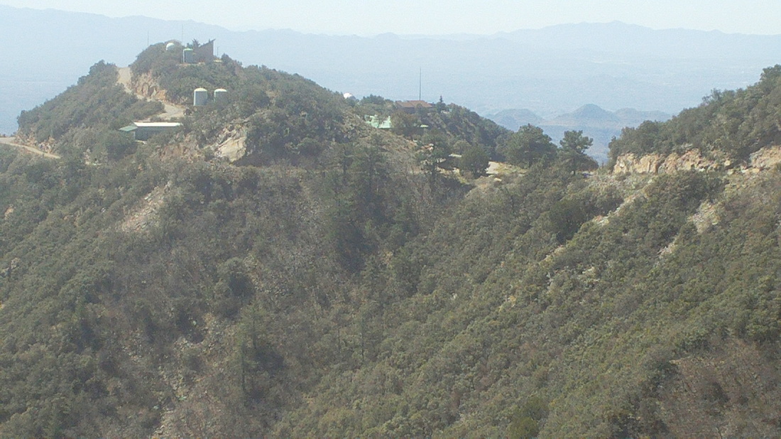 Prior to reaching Josephine Saddle, we had been instructed to take a faint trail that would come in from our right. Kamaran walked by it. I yelled for him but the wind gusts carried the sound away so I gave up on seeing him again as I began another hard climb. I arrived at a group of rocks and thought I heard a rattlesnake so stopped to unsuccessfully identify its location. Just then, Kamaran came up and we restarted our hike, eventually emerging from the brush at a small power substation and a paved road. A little below we could see an observatory. 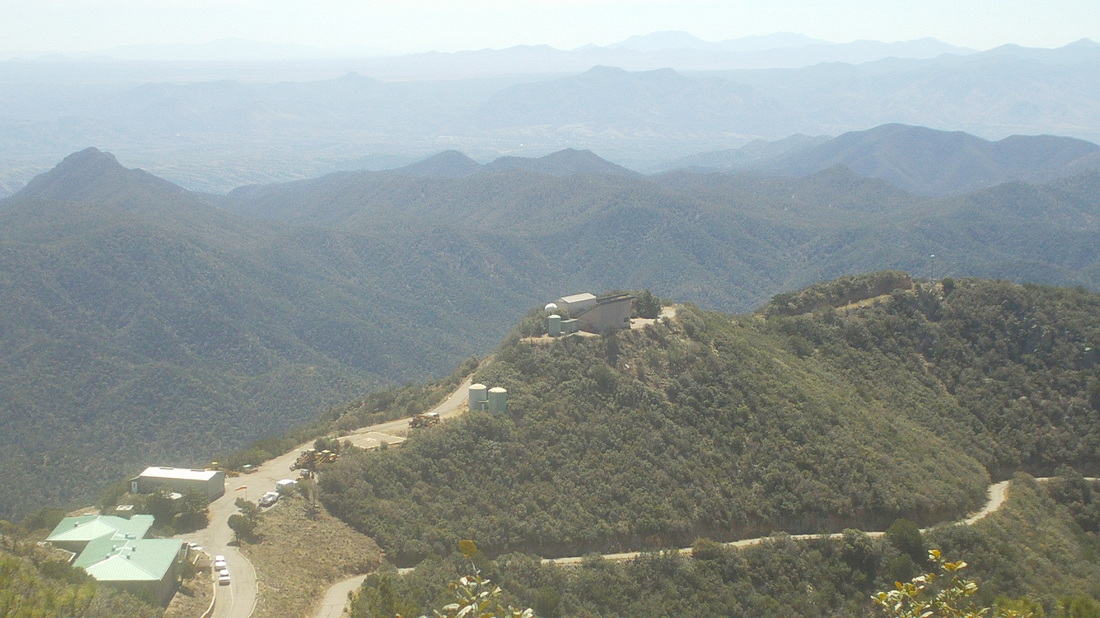 We followed the road up the mountain, the observatory growing smaller below us. We ran into the rest of our group, having already been to the top and now headed down. In talking with them, I discovered that when we reached that pile of boulders with the petroglyph, we should have kept going as the trail eventually turned back toward the mountain. 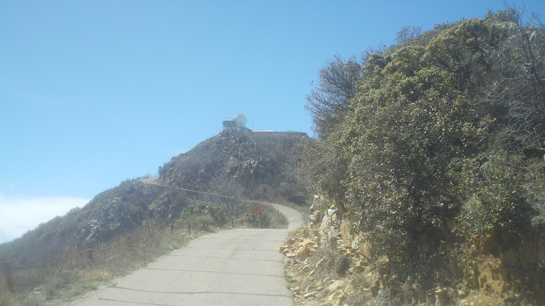 The final approach with a nasty pitch at the end that had to be in the 21-23% grade. After 6.9 miles, we made it.  We did not stay long, retracing our route (without the wrong turns this time) and eventually catching up to the others so we emerged from the trail at the parking lot as we began, one group. Their group had just under 9 miles, our twosome had 12.1.
 Dirty Dan called me to give me the sad news that the season's first Thursday New Albany ride was cancelled. Meantime, Dan did give me the good news that Southwest is starting direct flights between Washington and Columbus so he will participate in more rides (assuming the little woman says he can). This crummy weather will not last forever so keep polishing those bikes in anticipation of a warm, dry day. |
