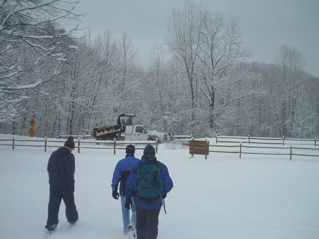
 So, Saturday morning and yet another 3" of snow on the ground. Yuk. Level 1 snow emergency but I had an obligation to show up at Clear Creek Metro Park and so, headed out. I was surprised by how clear the roads were, even Clear Creek Road. Flyin Tuna was no where to be found but I have heard her bike handling skills are better than her driving skills so having her out would have only put one more maniac on the road. Unfortunately, with her was the champagne and cups. At the parking lot were the brave fellows, Mitch O, Steve O and Jeff S. We trudged through the snow while a snow plow cleared Starner Road. 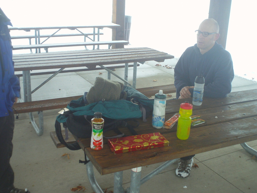 After 4.6 miles, we reached a covered area and Jeff removed the contents of his backpack. What a cornucopia of food! Beggars can not be choosers but after seeing the expiration dates began with 19xx on many of the food items,I deferred to the gift wrapped box. Even though Jeff had cleaned out a basement closet of old Christmas gifts, it appeared the Russell Stover pecan clusters were made in this century and so I eagerly ripped off the paper and crammed down many clusters. 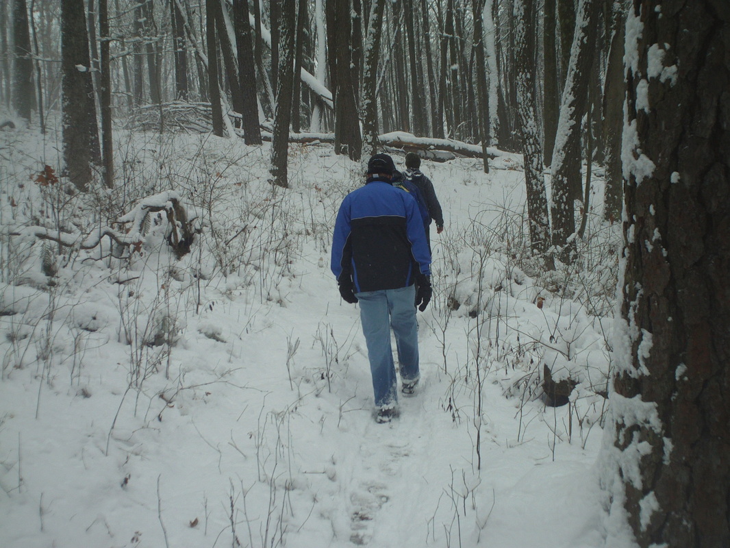 We then truged back, finishing with 9+ miles and 1500' of climbing. Always fun hiking or riding with these guys and if the weather kept you from attending, I'm sure the weather will force us on a snowy hike again, soon. 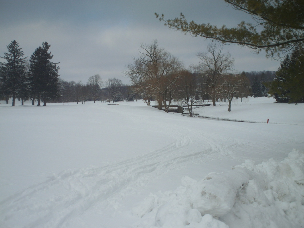 I'm really beginning to love this snow!!!! Wow, all this whiteness and coldness and cloudness.....I love the winter! OK, I hate it but what can one do? Sunday I headed to Granville Golf Course and did the cross country ski thing. Being a naturally gifted athlete, this activity comes easy but I can't help but think that untimed lunges with the skis and poles and general flailing about is not the most efficient means of transporting oneself from point A to point B.
0 Comments
The below was sent to me by Chrissy & Jeremy, as an option for New Years Day.
Kidd Families’ 1st on the 1st 2013 Come out to the sticks (6509 Miller Siding Rd. NE, Rushville, OH 43150)- rain, shine or snow, on January 1st, 2013 for a FREE/fun walk, run, or bike. The walk/run will be a 5k (roughly) on country roads and the bike ride (if roads are bad then bike ride will be canceled) will be around a 1.5 hr. trip to Millersport and back at a very casual pace. Event will begin around 10:00 am. A roaring fire (weather permitting) hot cocoa/coffee, bagels and bananas will be provided (donations for cost of food will be greatly appreciated). Come start the New Year off on the right foot (pun intended). Please RSVP to Chrissy (614-638-5932) or Jeremy (614-900-0715) so I can make sure and have enough food. 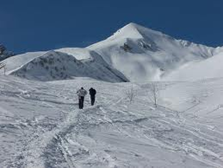
I have surveyed some influential people and they want to hike on Saturday. Next, I found a dolt who was willing to put his/her name to the hike to personalize it and make it more appealing. So, a quick call to Flyin Tuna confirmed she would bask in the glory of having her storied name attached to a hike. Next, I called Mark C to see if he could do the actual leading of the hike but alas, he is helping his wife recover from a back operation that went well but requires Mark to be close during her recovery. So, we will meet at Clear Creek Metro Park at 10:00am for a hilly hike or if you prefer, a trail run. We'll meet at that parking lot next to the infamous Starner Hill Road, the road where Lance Armstrong pulled away from his hangeroners during Pelotonia and more importantly, where Kenda Janet won the hill climb challenge and a $50 gift certificate. Distance is to be determined but it will be worth your while take the drive to hike all or part of it. Everyone welcome. I believe this area escaped most of the recent snow. Lastly, since it does not appear that the weather will permit a New Years ride, Tuna is bringing a bottle of champagne and cups for a post hike toast. See you there.
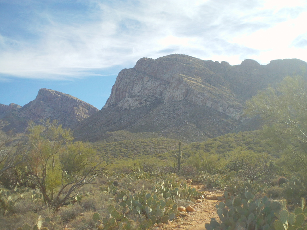
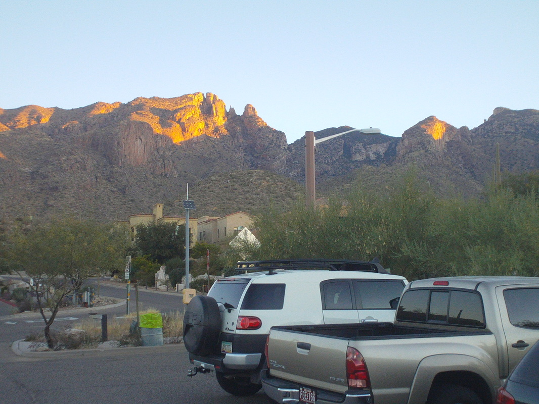
Every time I find my self in Oro Valley, I gaze at the 3-4 peaks that comprise the west end of the Santa Catalina Mountain range and wish there was a trail to take me to the top of one of the peaks. After asking around, I discovered that yes, there is a trail and it is only a mile from our place, the Pusch Peak trail. I could find little from a search of the internet and found the one hiking report a little misleading so I've put the title of the trail on this report and will go into too much detail for the casual reader, just in case a prospective hiker finds this. It's too bad the image makes the peak appear so close because it is not and the hike is one of the more strenuous in the area. 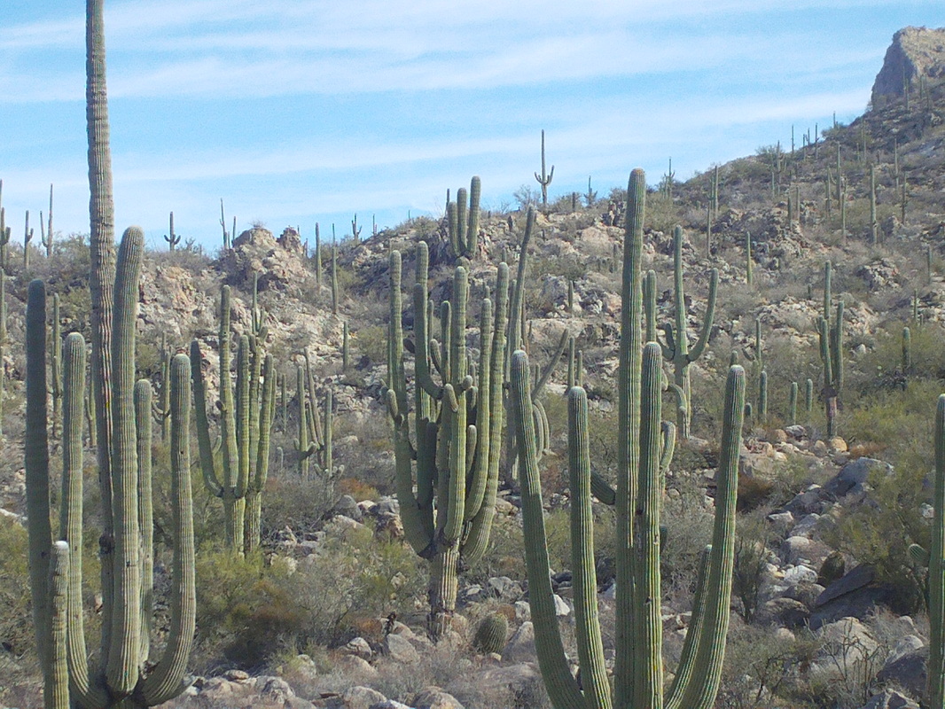
As I said previously, the example of Saguaro cactus are really neat adn some of the most mature I have seen. At the trailhead, there is a sign of the trail that I found confusing regarding the distance and direction one should take. It illustrated options I did not see from that point. Anyway, I began hiking and quickly left the sounds of the city behind. After about 3/4 of a mile, a trail came in from the right that is easily missed, and in fact I missed it until my return. Within a few yards of this branch there is another fork with a signpost. Take the right branch to access the peak and immediately the real climbing begins and at times is ridiculously steep with a near vertical 15' wall that is climbed up on the right side where there are some foot and hand holds. 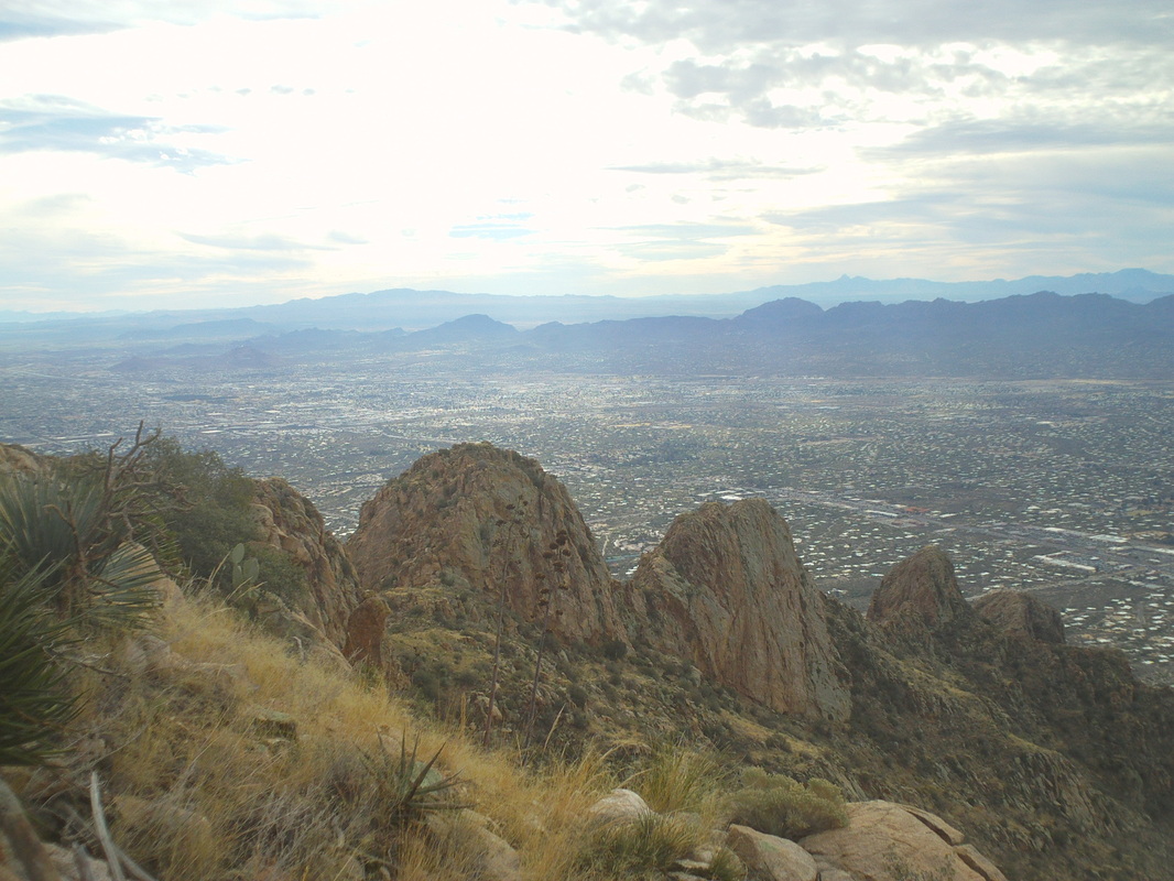
I regret not makiing precise distance notes but by the time your muscles are aching, more or less, there is another fork. I took the right fork which does not take one to the peak but instead the lower right shoulder where there is a campsite and a fine overlook of the valley. Prior to reaching this point I passed two trails coming in from the right, down canyon, but ignored them and reached the campsite, not yet aware I was not on the peak trail. I continued on and up and eventually reached what on this image is the third from the left peak and decidedly not "The" peak. Rats so I retraced my steps, found the fork where I had gotten off the official peak trail and proceeded on. 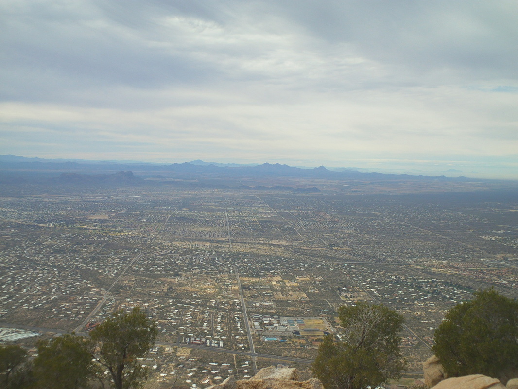
No letup as the trail kept going up and them up and for the heck of it, up some more. The wind was howling and in the distance I could see a weather front approaching. I quickly signed the "I've been there" sheet, which was tucked in an old rusted can under a boulder and headed back down. I lost the details but believe the total wsa 6 miles with 3500' of climbing. The views from this point are one of the best and I could clearly see Table Mountain and other peaks and moutain ranges in the distance.
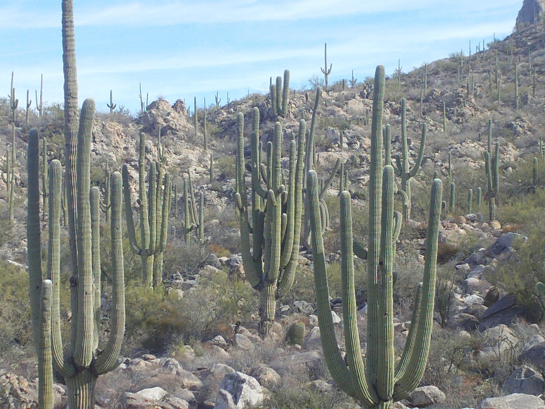
Well, see my Ohio cycling buddies are bracing for a rain and snow storm and then a cold and windy weekend. I feel for you but won't allow my feelings to deter me from taking advantage of the sun and fun out here. I hiked up to Pusch Mountain and the entry to the drainage was populated by probably the most spectacular saguro cactus I have seen. These were monsters, 200-300 years old I'm guessing. 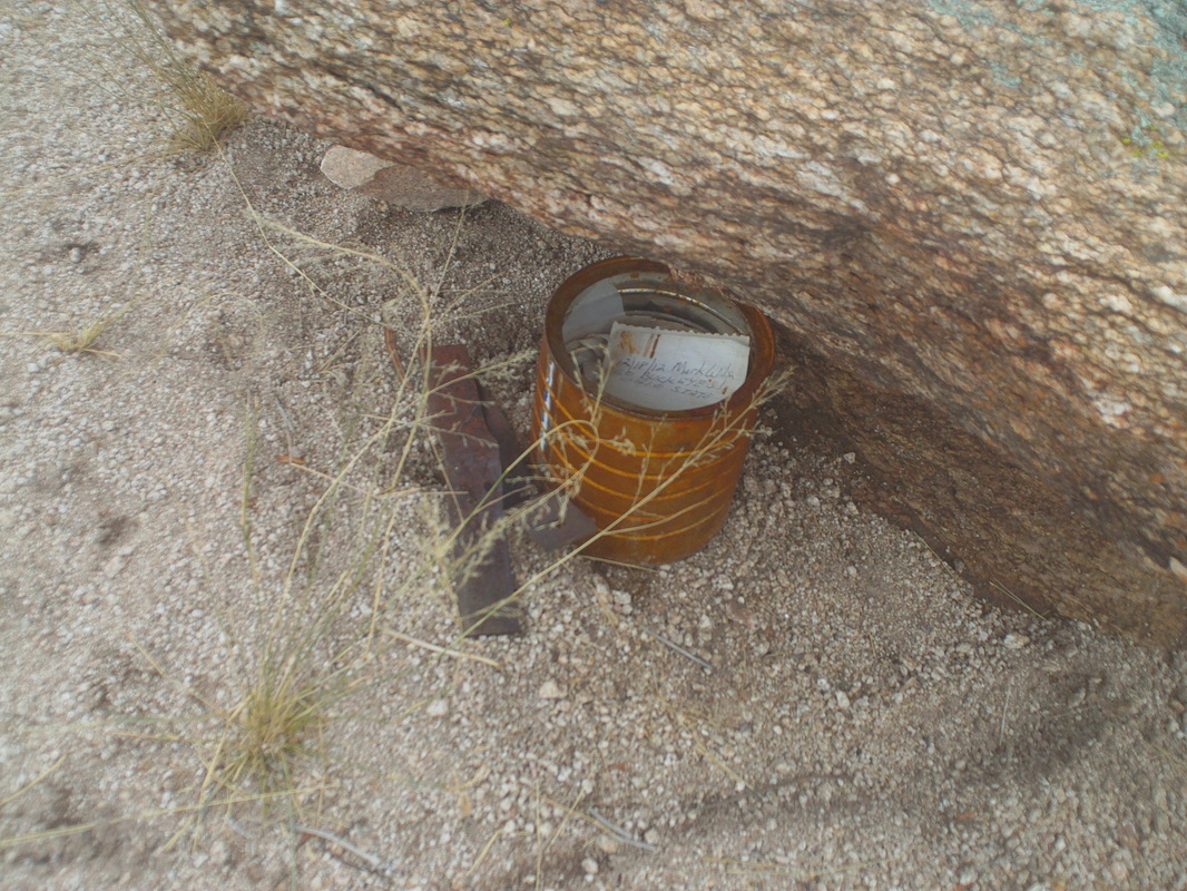
At the top, perched under a large rock was the sign-in, which I always sign with my name and "Go Buckeyes". Yes, it's selfish to take up the limited space but I have an important message to spread! Much more to come on this very neat hike. Now, as many of you know, tomorrow is an important date, as it will be 12/21. Yes, it is again time to celebrate the shortest day of the year. Each day thereafter gets incrementally longer, all the way to my birthday, 6/21. Coming next week too is the annual "Should the blog shut down for good" survey. Please check in and register your vote, next week.
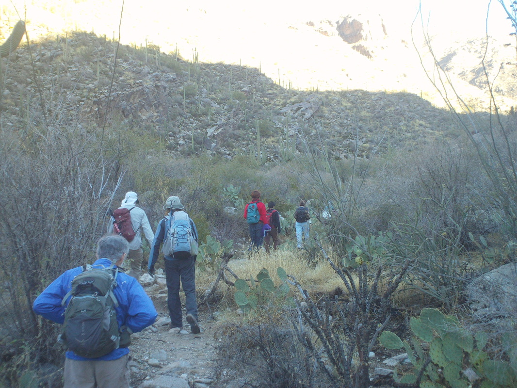 With the cancellation, due to weather, of the hike to the top of Table Mountain, I was lucky to find another hike that still had an opening for the next day, Sunday. Eight of us gathered, took the obligatory group image and shoved off out of the Pima Canyon trailhead for what was promoted as a 9 mile hike. However, Joel, the lead hiker let me know the actual mileage was to be 7, 6 on trail and 1 off trail. This group and other hiking groups, routinely exaggerate the distance, the exposure and the climbing to deter the marginal hikers. However, what I have also discovered is they under estimate the amount of time to complete the off trail hikes. Instead of starting at 7:30am, the start was pushed back to 9:30 to allow for the last of the rain to clear the area. It's not a good idea to hike over wet rocks. 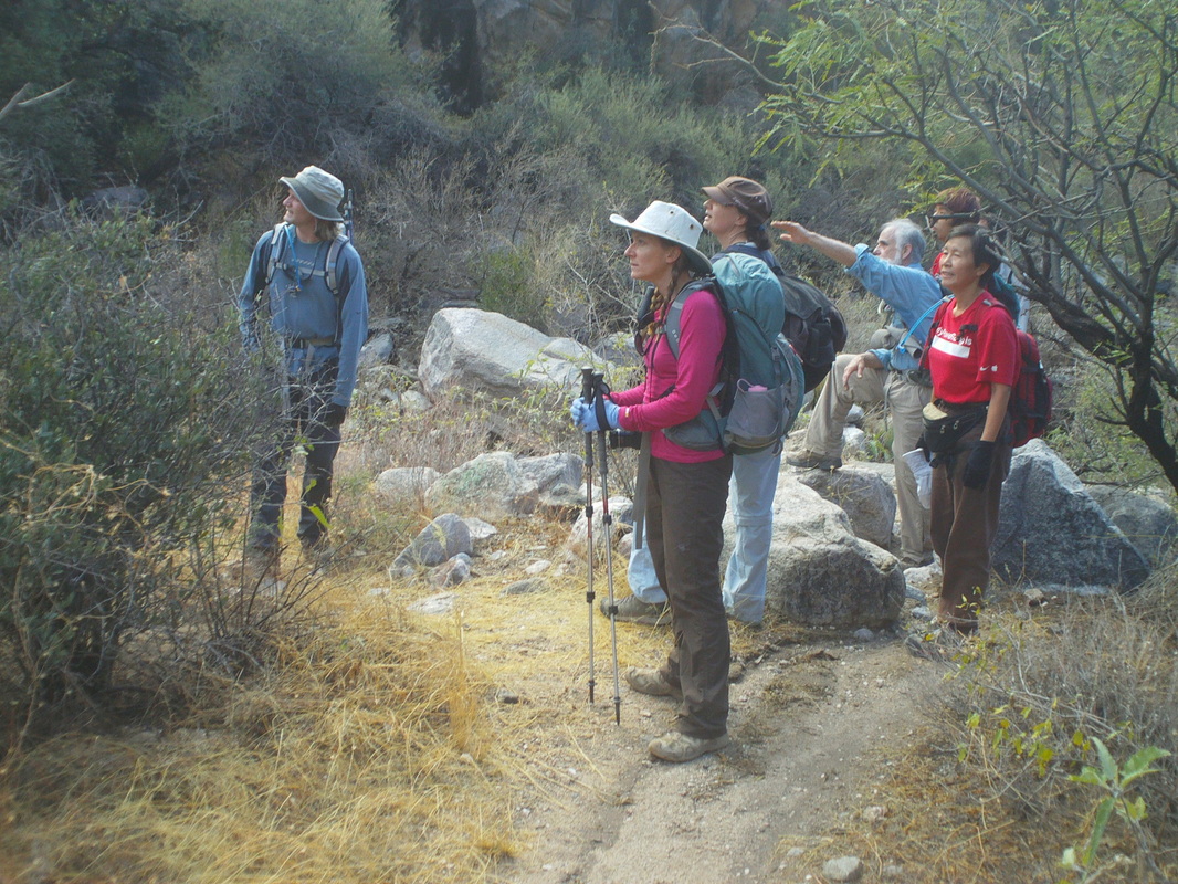 After a somewhat brisk 3 miles, we stop, check the map and try to figure out if this is where we plunge into the thicket. Left to right are Joel, Belinda, Lisa, Gary and Stephanie, who I later described as a bulldog with wings. Just when things looked most desperate, she plunged over, under and around boulders and various obstacles to get us back to a trail. 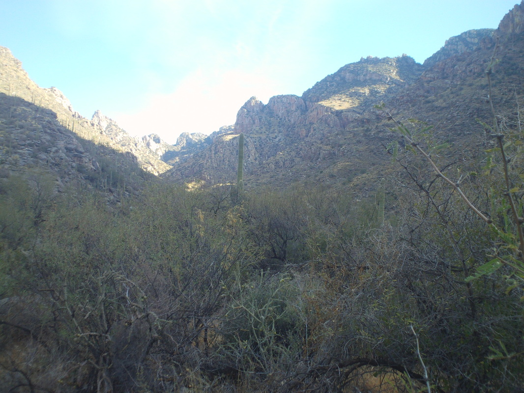 Yep, this is the place and so once again, we begin the bushwhacking, up a fairly steep drainage through the usual suspects of pointy type plants that are all poised to inflict projectiles into my skin. This time though, I outsmarted the bastards! I wore a pair of pants and a pair of shorts over top. Seems the spiney things would enter the fabric of the shorts but then the movement of the fabric between the clothing would sheer off the pointy things. 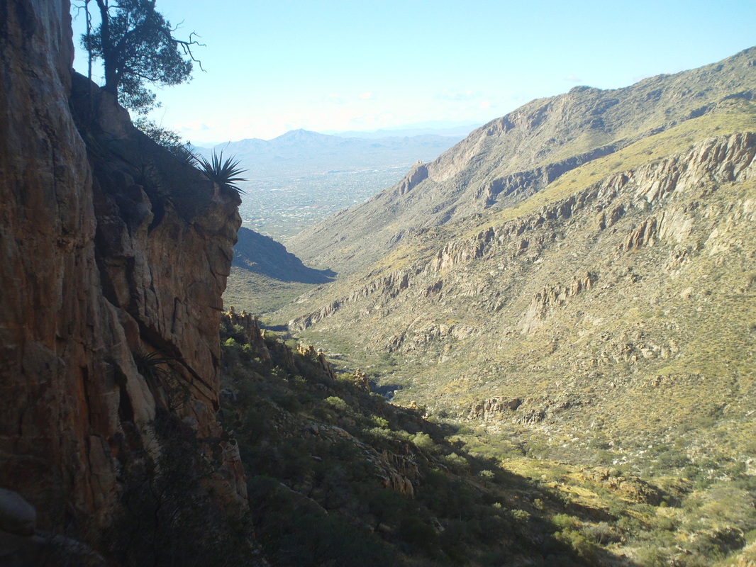 Somewhere about 3/4 of the way up, we got cliffed out and had to stop and plot a workaround. The temperature at the start had been around 45 and now, a couple of thousand feet higher and with our gloves wet, several of us had problems with frozen fingers. One of us, Belinda, had been shivering and with that and the calories burned from the hike, began to bonk and suddenly sat down and became faint. Some food and drink allowed her to recover rapidly. 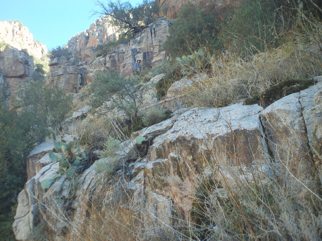 We found a way up but it still involved some steep climbing in spots. Joel above, waiting for us to catch up. 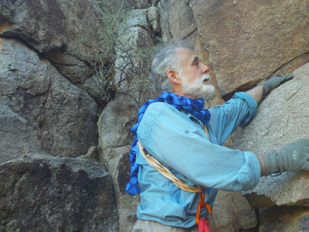 Gary Tenen, interesting guy and story. Back in the 70's, he was hiking around a property with a friend and they came across an opening in a field. Upon further exploration, they discovered what became known as the Kartchner Caverns. They kept it a secret for 20+ years as they explored the expansive network of caves and after much effort, had the natural wonder turned in to a state park, officially opening in 1999. With only a little way to go, we were confronted with a class 4/5 climb, meaning ropes would be needed to ascend about 30 feet. Gary climbed up, established the webbing/ropes and up we went. 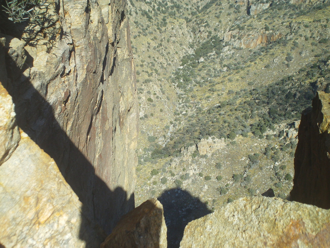 Prior to that, some wanted to climb up via an alternate route on a nearly vertical wall with just a wee bit of exposure over a 1000' drop. No thanks. 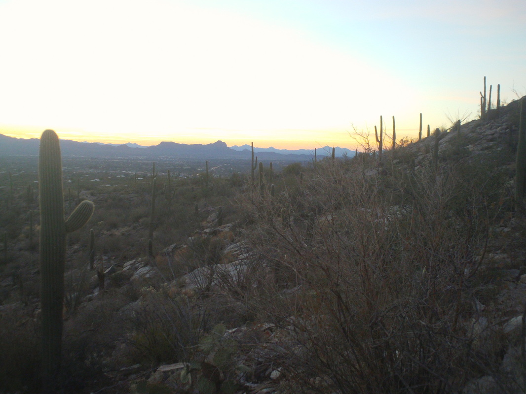 Upon reaching the top of Valentine Peak, we signed in at the sealed register, apparently the first to visit the peak since 2010. I thought we spent way too much time at the top, yes eating and resting which was needed, but also too much mucking around. I was getting antsy since it was almost 3:00pm, the sun sets at 5:15ish and the way down was unknown. To make a long story short, we down climbed through the brush and rocks, reached the trail at 4:30 but farther up then where we had entered. I and two others began trail running and at 5:37, I arrived in the parking lot. Above, a cool view with the sun below the horizon. The other hikers must have had flashlights and exited later. Ended up with 10 miles and 3800' of climbing. Long day but lots of fun.
I have a neighbor who lives across the gully. Good guy who loves golf so played 9 holes with him (I could not take playing more than that). Played at Pusch Ridge Golf Course, a very tight layout through the foothills of the Catalinas. No driving range so I strode to the first tee, having not played but once this year, once last year and.....heel sliced one into the middle of the fairway. First 4 holes were bogey, bogey, double bogey, double bogey and 1 behind my neighbor. I tried to put on the havin a good time facade but geesh, losing to my hacker neighbor was tough to take. But wait, the light went on and went par, par, par, bogey and par for the Ohio victory. Well, it will be at least another many months before I participate in this activity. 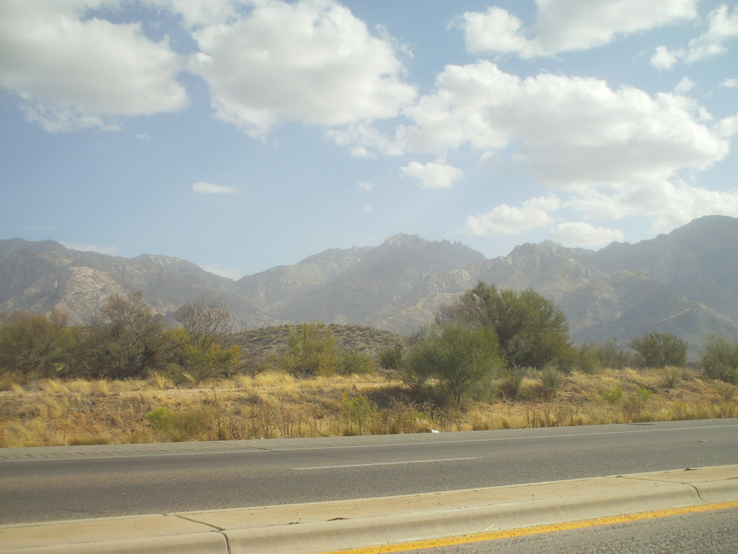
Beth arrived on Thursday and brought Ohio weather with her. High winds kicked up the sand and obscured the usual clear views and saw clouds too. Very odd. 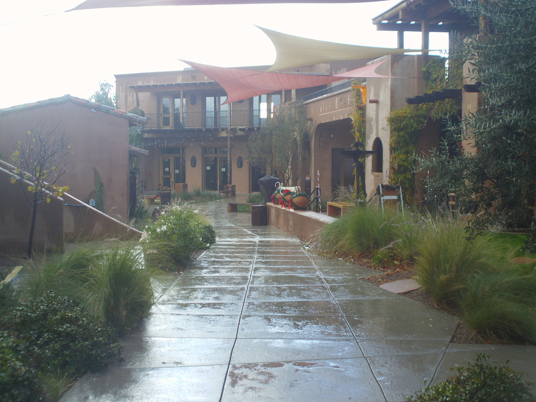
A front came through and it rained all day Friday and by the end of it, deposited a very well needed 1"+ of rain in the valley and in the mountains? Around 20" at the 7000' and higher elevations. The folks at the ski slope at the top of Mount Lemmon must be thrilled. Beth and I visited Tubac, an arts and crafts dominated village about a mile south of Tucson, just south of Green Valley. Well worth the drive and all the goods are made by local artisans. 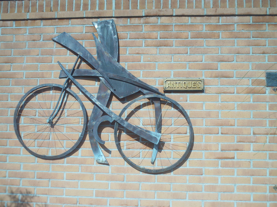
Pretty cool metal work. 
Saturday it remained cloudy and kind of rainy so the hike to the top of Table Mountain was cancelled. Bummer. 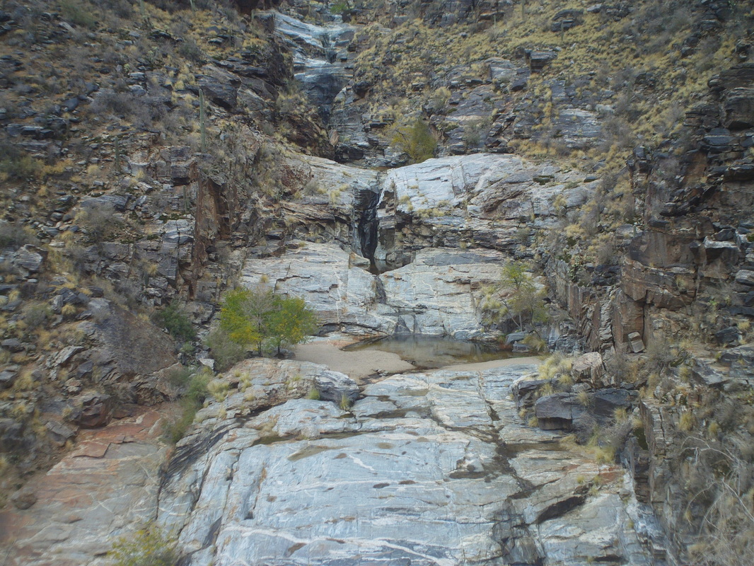
Beth and I hiked the Seven Falls trail, thinking the rain would have filled the run-offs but too early and the water was still low. The following day, the run-off had come off the mountain and I saw images of the creeks flowing strongly. So, had been taking short hikes during the week, the "50 Year Trail" out of Catalina State Park, Rattlenake Canyon Trail out of Sabino Canyon, rode my bike to Oracle and was ready for the weekend. After seeing theTable Mountain hike cancelled, I immediately took the last spot available for Sunday's Valentines Peak hike. Off trail and quite an adventure. This to come soon. Also, heard about the Saturday bike ride at which Kenda Janet took some verbal abuse from Steve O and Mark V. This is unacceptable. Only I can make fun of the Kendaites. Those two should kiss their bike shoes every day that they have the good fortune of mingling once a week with someone of such class and good taste as any of the Kendas (please note. no Kenda participated in the preparation, in any way, with these comments).
Looking at the weather forecast and looks like we will have a good chance to have the 3rd annual New Year's bike ride with champagne. 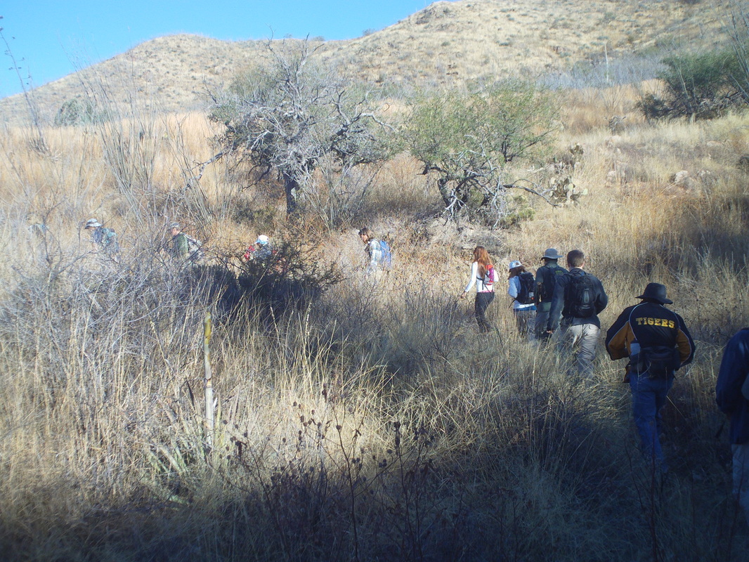
This was as much about the trail as it was about the drive. South to #19, then on to Mount Hopkins Road (which takes you to the top of the mountain and yet another observatory), then Elephant Head Road and then a left turn on to a dirt road that supposedly was ok for cars but.... It was 2.2 miles over rough, rocky road and during the drive, a driver behind me in a high clearance vehicle said about me, "That guy is making me feel like less of a man because he's driving this in a car" This was stupid and as I approached a really nasty section, I pulled in to a turnout and what luck, it was 100 yards short of the trail head. Thirteen of us shoved off on a not very steep path that passed a closed gold mine. 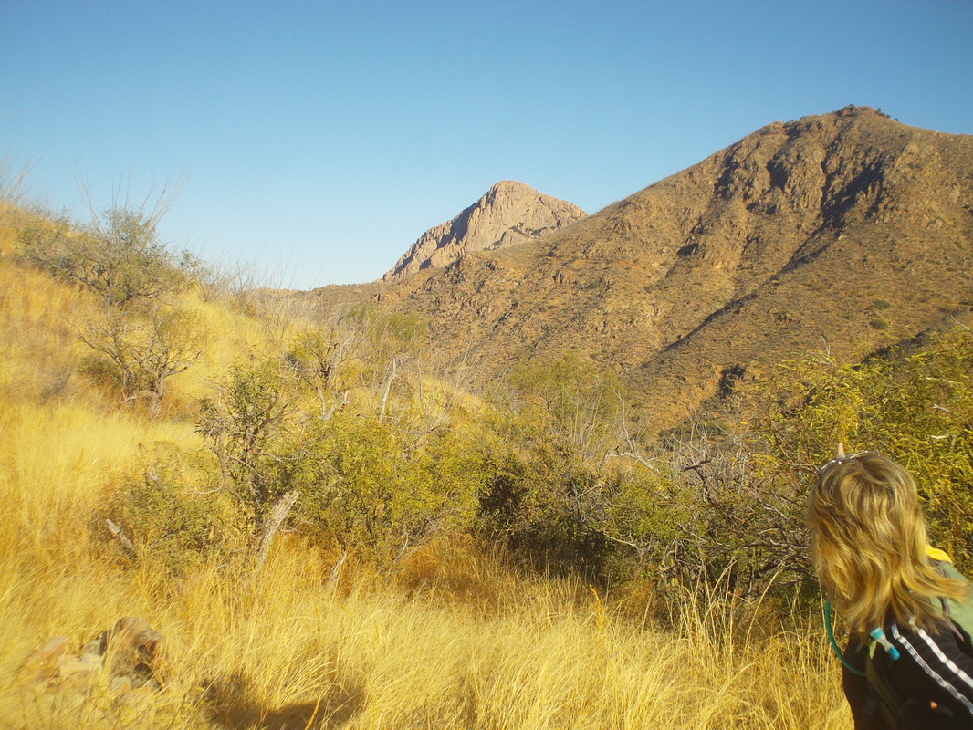
We got an early look at a portion of Elephant Head. Here, the back is seen, rather than the trunk. 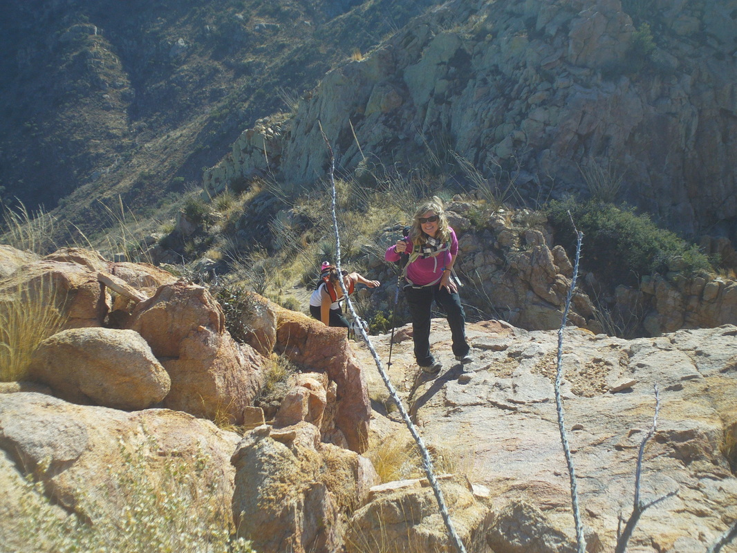
The hike to the base of Elephant Head is not too difficult other than a very steep descent, followed by an ascent of a canyon. 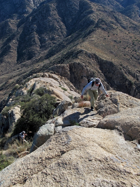
Then, yours truly shown carefully scrambling up the nose of the elephant. Yes, it's friggin steep and narrow and exposed but mostly it is the howling winds that causes you to bow as you creep up the nose. 
Shards of pottery from ancient peoples is found halfway up. Why anyone thought this was a good place to dwell is beyond me. Oh, these are pronounced "shirds" rather than "shards" as a local corrected me. 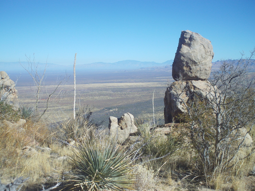
Pretty cool view, no? 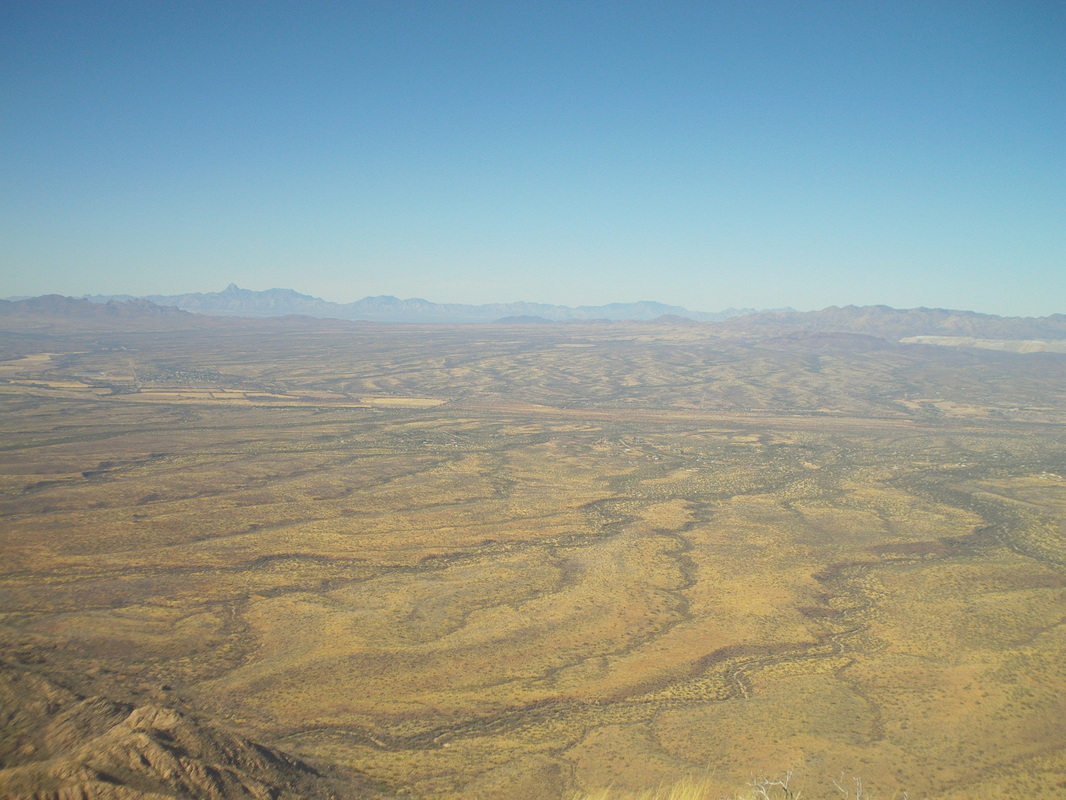
A panormanic, 360 degree view from the top and one of the best I've seen. 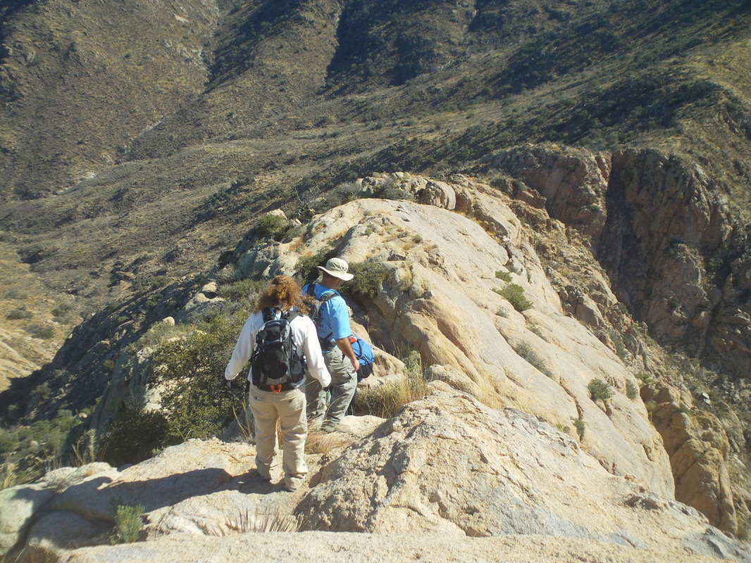
Heading bacck down after delivering elephant head trinkets to the shrine at the top. Finished with just under 7 miles for the hike. Oh boy, did a bike ride to try to get my knees and joints back in order from the pounding and now, a long bushwhack up to Table Mountain on Saturday. Rain is forecast for Friday with 10" of snow up on the top of the mountains. Should be loads of fun!
Dawn breaks at the Finger Rock Trail parking lot. Today's destination, Mount Kimball, which is above the light pole. Not a dramatic looking peak but at 7200' elevation, one of the highest and higher than the peaks you see in the foreground, despite what the image suggests. Quite a few no-shows this morning so only four of us shove off. Not the strongest I've hiked with but as always, an outdoor loving group who like to climb into the mountains. 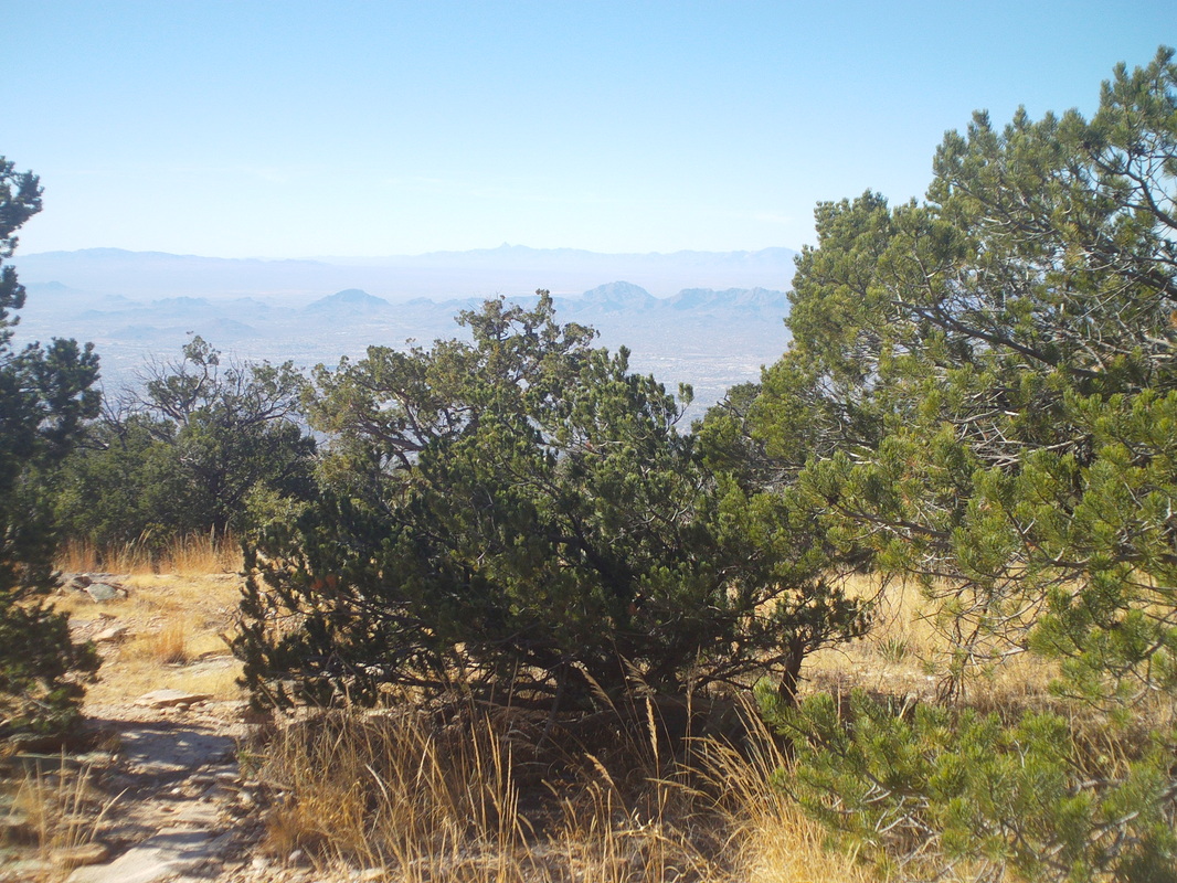
The Finger Rock Trail is one of the steepest, most unrelenting trails in the area. I've heard the climb up Mount Wrightson is the only trail that is more difficult. From the parking lot to this point, where the Finger Rock Trail intersects with Pima Canyon Trail #62, there is no respite. The first mile in, the ascent is moderate but as you turn right out of the canyon, it is 3 miles of knee busting steps. At the sign post, hang a left to continue to Mount Kimball and about 1/2 a mile of moderate ascent, the top is reached. Total length was 4.82 miles and 4300' of elevation gain. However, at the top I was expecting panoramic vistas in a 360 degree circle but the pine trees and vegetation limited views so I was kind of disappointed. The rest of the gang arrived and I inquired how close was Finger Rock, a prominet rock spire. Since I was up here I may as well add that peak to my collection but the group guessed it was 1.5 miles away requiring bush whacking. Screw that so I headed down. After an hour of down climbing, I ran into a couple who were headed up to Finger Rock. They told me it was only 1/2 a mile from Kimball via an obscure trail. Argh..... too beat to go back up so I kept going. 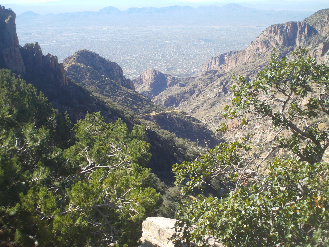
Roughly half way down, I paused to take this image of the canyon I was following and around the curve is the parking lot. The impact of jumping down from step to step on uneven rocks takes it's toll on my knees. I see most hikers of all ages using hiking poles as their use eases the impact so I'm going to learn how to use them. So, finished with just under 10 miles and around 5000' of climbing. One thing about these hikes I like other than the views, I can eat a lot of anything when I'm finished and so I did.

I know some of you like to see images of bike shops. In Oro Valley, there are 3 "Oro Valley Bicycle" shops. 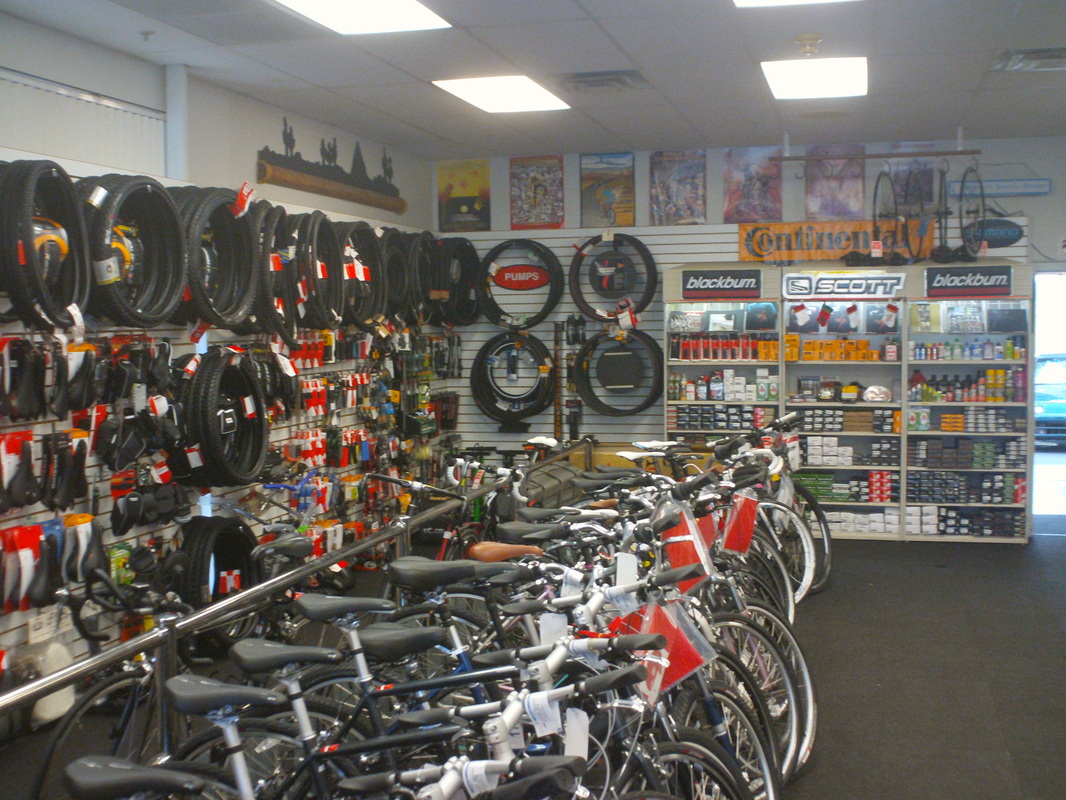
Neat and organized shop servicing road and mountain bikes. Sounds like they have a good reputation among the locals. 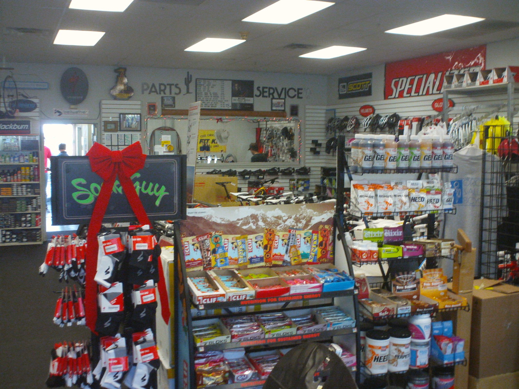
Like many shops, next to check-out are the impulse buy items. 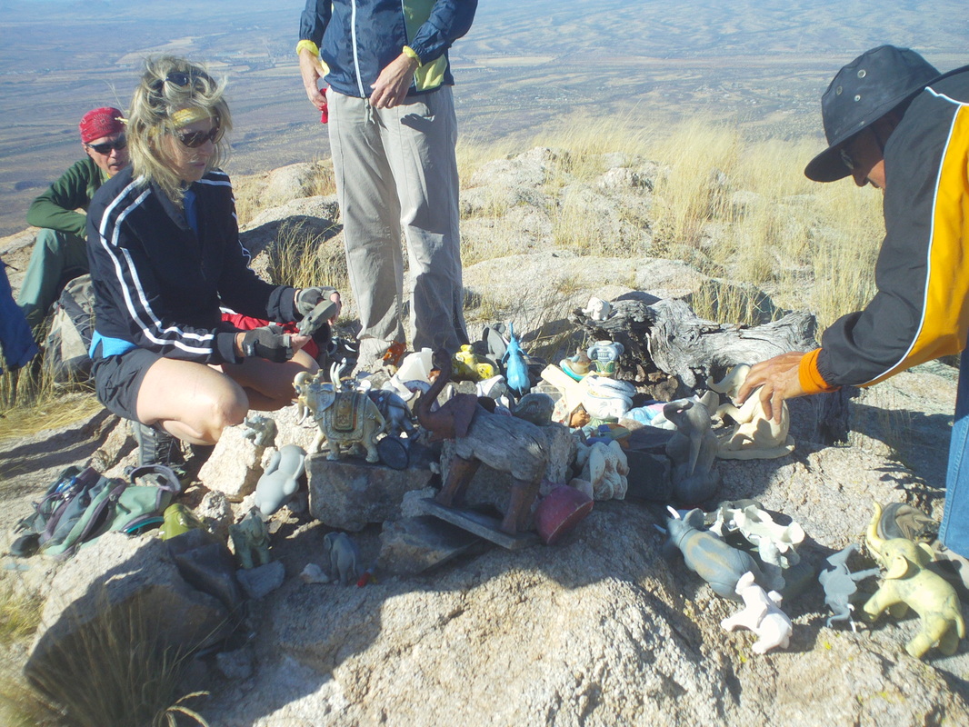
One of the most incongruous sites I've seen but maybe I should have expected it. Reaching the top of Elephant Mountain, there is a shrine to elephants. Dozens of elephant dolls, key chains, glasses, etc.. Each hiker is supposed to deposit an elephant trinket upon reaching the top and then sign the paper, sealed in a plastic container. If you make it up here you will find my name with "Go Buckeyes". Not an especially difficult hike but there is some exposure that deters some and the trail head is kind of remote. More to come later.
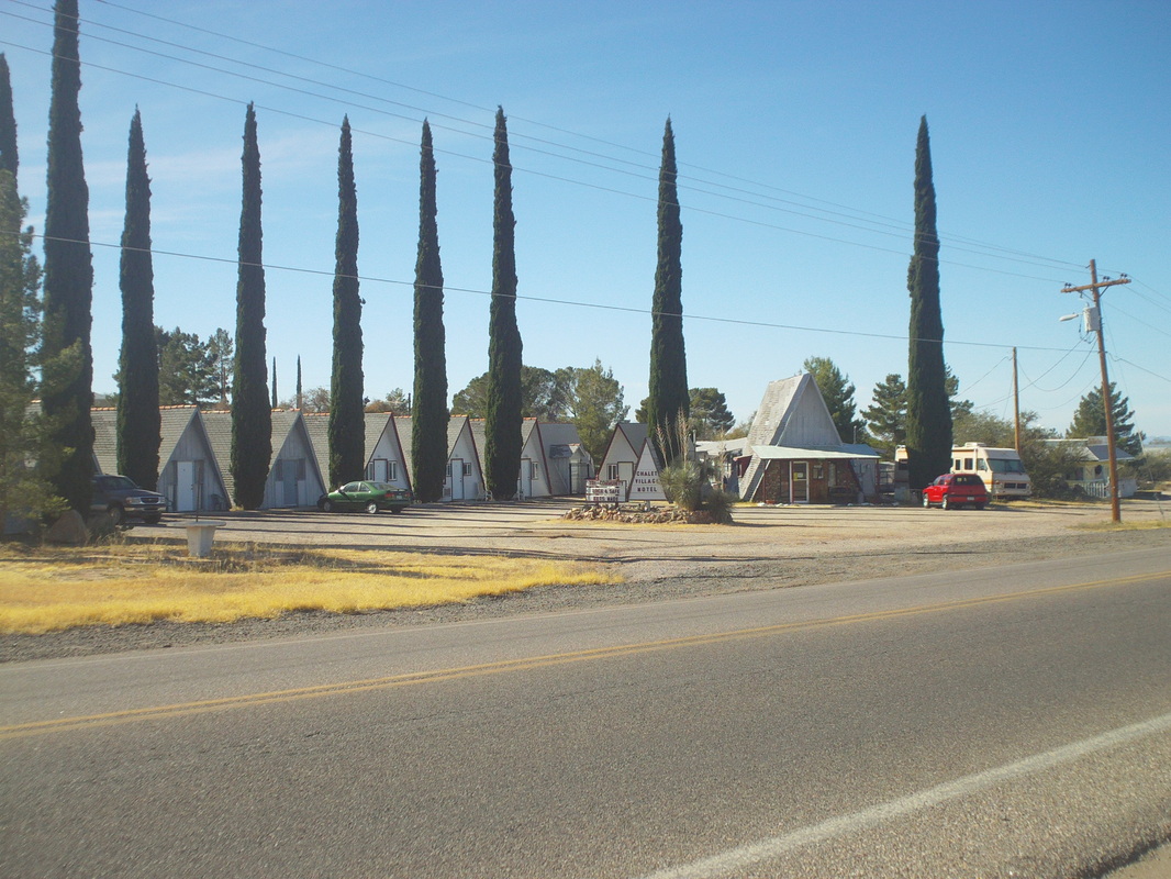
I took off Monday but drove up to Catalina and passed this unique "hotel". Note the unconventional structures. OK, I also checked out the Catalina Steak House. Kind of an old-time western steak restaurant. Good food. 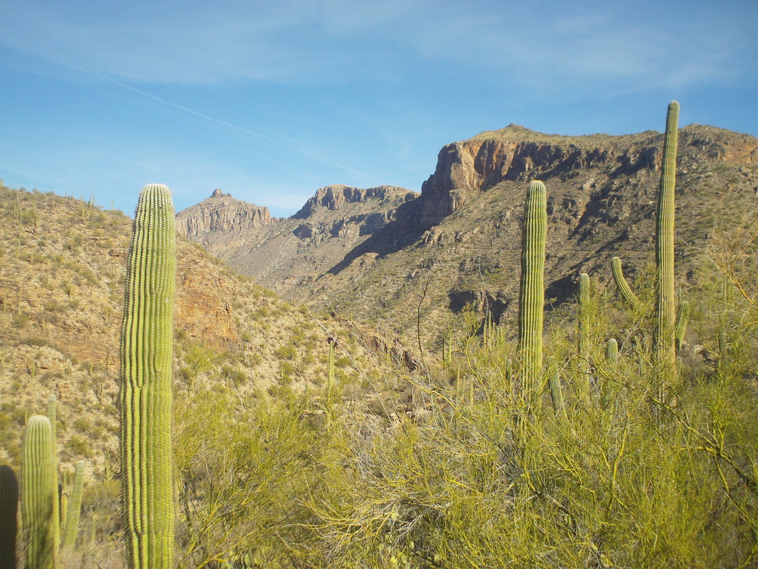
On Tuesday, I hooked up with one of my new hiking groups led by Jeff, a former army helicopter pilot, very fit and a good guy. He winters in Tucson and spends the sumers living out of an RV, touring and hiking national and state parks. I've discovered there are a lot of people like this who love the Tucson area for the hiking and cycling but spend the summers touring the northern US and Canada. Jeff and I had a competitive run up to Blackett's Ridge out of Sabino Canyon, a good, steep hike of 6 miles round trip. 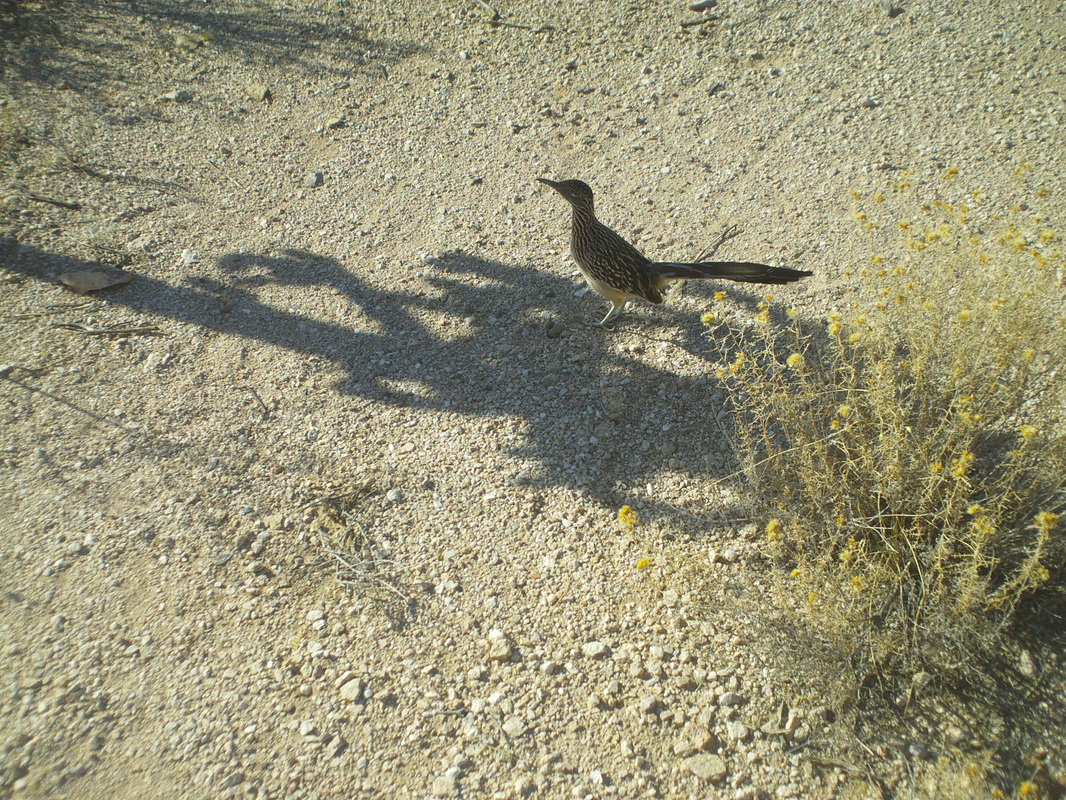
Wednesday late afternoon, I went out on a quick hike and had this roadrunner run right into my shadow. Had just enough time to snap a pic before it sped away. 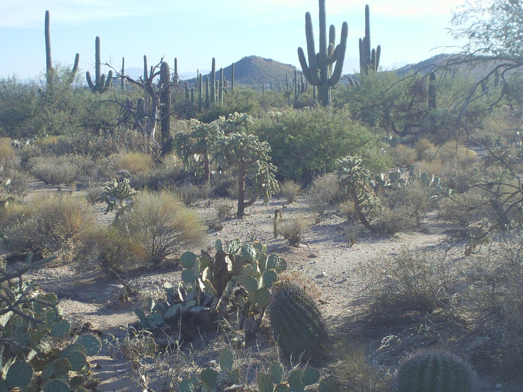
The vegetation in the lower elevations is typically what you see here. Not hearly as thick as it is at higher elevations. There is a saying around here, "If it is green, stay away. If it rattles, stay away. If it's green and rattles, run away" Yep, makes sense to me now. 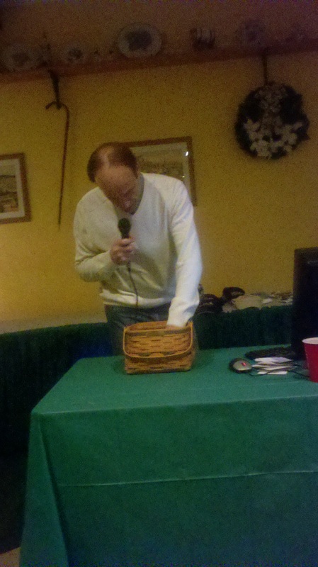
Sounds like around 40 people came out for the cyclist's Chrismast party and I had 3 people on the prowl, looking to snap a pic of Flyin Tuna showing food into that big mouth but she has become too aware and the plot was foiled. Instead, all I have is this image of Oxley, pulling the winning ticket out of the basket. There were some good gifts given away. Looks like the weather is not too good for Saturday and Sunday. Here Mark C, if the weather is crappy, will be hiking out of Clear Creek at 8:00, if weather is ok there is a ride out of the Newark Y at 9:00 and of course Silent Dave has the COP ride at 9:00, I think out of Alum Creek Park. 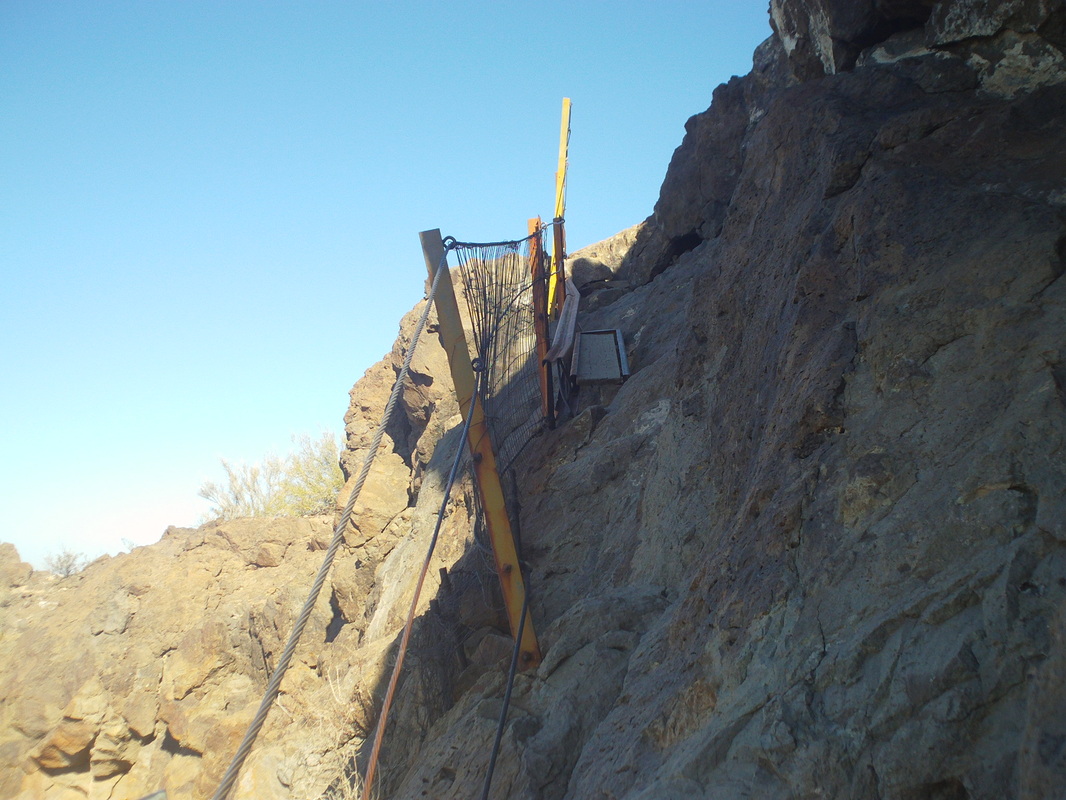
Meantime, the weather out here continues to be sunny and warm, every day. I did the Picacho Peak trail on Friday, a pretty rugged hike of 6 miles with around 1800' of climbing, sometimes requiring the help of cables to get through. Love this hike. 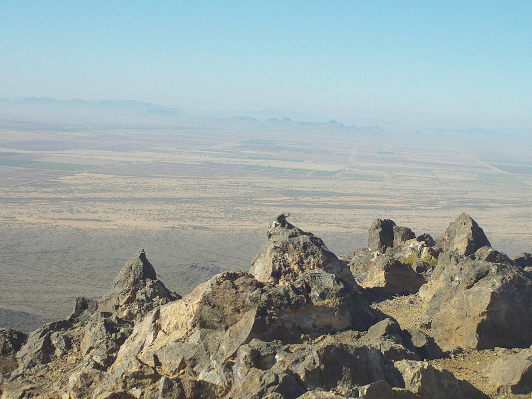
Predictably, at the top, there are great views and a couple of chipmunks, here is one perched on the middle rock. This weekend I'm sliding in with a couple of groups for two grueling hikes, Finger Rock on Saturday and Elephant Head on Sunday. Yep, I am foregoing the Saturday Shootout ride. These hikes are too attractive and challenging to pass up.
Tonight is the cyclist's Christmas party and I have asked 3 people to send me images so probably one will come through. In the meantime, the below poem was created by a cyclist who heard Flyin Tuna took a short cut during last Saturday's Blue Jay ride.
There was an old woman who lived near the Y. Who loved cycling even more than a little Debbie pie. One day she rode blue jay with her cyclist friends, But because of her age, she couldn't finish at the end. The weekend forecast got you down? How to burn those calories without cycling available? Grab your gloves, shoes and head to Lobdell Reserve. There, at 10:00am you will find pick axes, hammers, hatchets, shovels, chainsaws, everything needed to build trail except for the muscles to make them tools go to work. It's a fun bunch of people, made more so because I will not be there to slow things down so come out and help John G and Kyle W. See their message below with additional details. Well, got to go. It's too warm and sunny to stay inside.
From John & Kyle: The forecast looks a bit iffy, but meteorologists prediction skills are also a bit iffy, so if it is not raining hard, we'll be gathering at 10:00 this Sunday near the northwest corner of Lobdell on Mounts Road again for several hours of trail building. Pruners, lopers, garden rakes and chainsaws were the most helpful last time and will continue to rule the day. We had a terrific turnout last time and hopefully we will have another terrific day of trail work. Please feel free to email or call Kyle (614.506.0825) or myself with questions or if you aren't sure whether the weather will hold. Thanks everyone for your help. John 612.817.3353 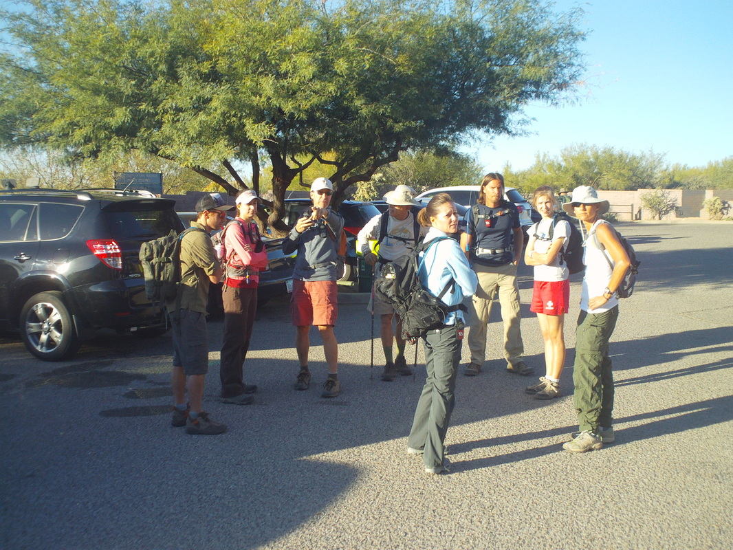
After several solo hikes on maintained trails, it was time to do a group hike with a portion of it off trail so I joined the X=treme club, made up of a bunch of very fit, fun loving people, some of them showing up for Sunday's hike (from left Tobin, the real deal hiker and climber, Susana, Steven our leader, Robert, who bailed early, Wendi, Brian, Tess and Jo). Actually, as I looked around the group I got the same feeling that I have when rolling out with the Thursday New Albany A group ride, the hammer is about to drop and I am the nail. 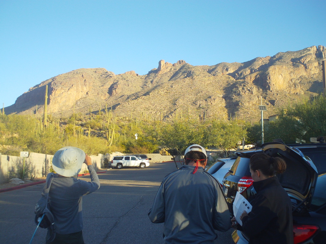
Today's destination, the "Knob" which you can probably figure out what that would be from looking at the image. Only about 3 miles away, which is not far except when there are millions and millions of plants between us and the Knob, the sole purpose of which is to deny us access to that feature. Departing via the Pima Canyon trailhead, we quickly covered 1.8 miles on a good trail before reaching a turn that had a subtle arrow made of stones, that pointed off trail..... 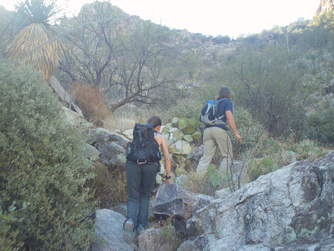
.....up a ravine and so we began a trek through cat-claw, saguaro, prickly pear, hedgehog, jumping cholla, staghorn cholla, barrel cactus, etc... each of which shoot barbed projectiles deep into the unfortunate who stray too closely to them. Would you care to guess who strayed, fell or skidded into them more than anyone? Yes, the pilgrim from Ohio, me 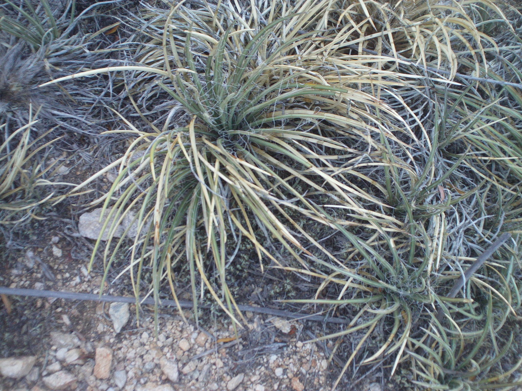
I'm not overstating the difficulty of the hike. It wasn't the steepness or the distance, that I can handle. It was the vegetation that seemed to have gotten the message, "Kill the Buckeye". This plant in particular was evilly placed and placed thickly. Called "Shin Dagger" by the locals, they grow everywhere and on top of each other and those points yield to nothing that is not sheathed in cement, steel or titanium, none of which enveloped my legs.. Good heavens, what I wouldn't do for a thicket of blackberry bushes to wade through as an alternative. 
As we hiked along the east side of the ravine, we spotted a family of 12-15 javelinas on the opposite side, both they and us headed for the same saddle. Somewhere in there they disappeared and we reached the saddle, then headed up another side ravine where some of us paused to climb this rock and pose. Yep, the views were, as always, fantastic. 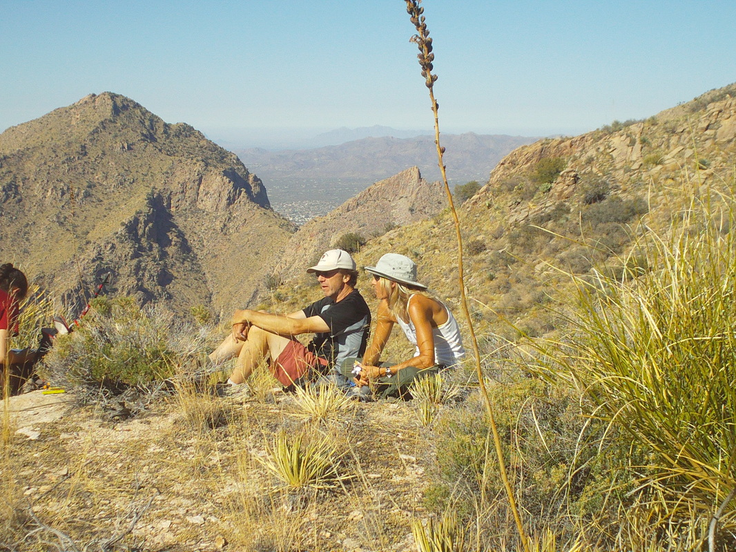
Eventually, we reached another saddle, just below the knob and paused to eat. Here, our leader Steven, converses with Jo with a nice background. 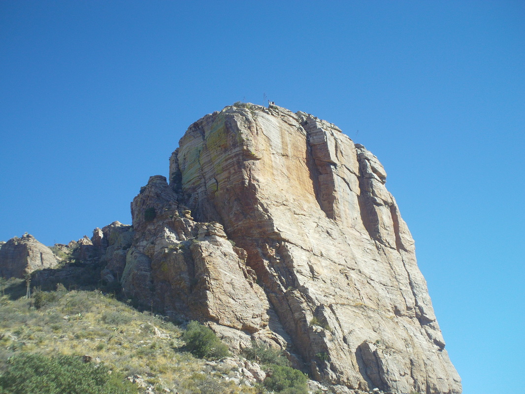
Most of the group then climbed the Knob but I had to beg out, needing instead to borrow a pair of tweezers, retreat behind a boulder, drop my hiking pants and remove dozens of imbedded spines. The ones from the cactus, while set deep into the skin, were easy albeit painful, to remove. It was the dozens of very thin ones that provided the challenge as they were hard to see while being easy to feel. Here, most of the group reached the top of the Knob, via a challenging chimney climb. I was bummed that I could not join them. Maybe you can see them at the top? The way down to the Finger Route trail, two canyons from where we stood, had not previously been scouted by our leader. We could see where we wanted to go but discerning the route was difficult as we sought to avoid getting cliffed out with no advance possible. We traversed a steep slope while I thought often how Mark Clingan, my Ohio off-trail hiking buddy, would have loved this experience. The terrain was very tough and at some point my feet slid out from under me and predictably, my back fell into a patch of shin daggers and spine injecting plants. The good news is I guess your rear end doesn't have the nerve endings that the rest of your body has, otherwise I would have screamed like a 5 year-old child. I also benefited from a very kind fellow hiker, Wendi, who immediately ordered me to stop while she patiently picked out the largest of the daggers. The way down to the base of the canyon was challenging, a very steep drop scrambling over boulders, slick rock, just wild stuff really. We took turns breaking the trail and at one point, Tess walked into and then emerged from a thicket of cat-claw, legs covered with rivulets of blood. The rest of us sought a workaround. We finally reached the bottom and looked upward at a notch in a ridge over which we still had to climb, before dropping into another canyon where we would hike out via the Finger Rock trail. OR, we could just hike down the canyon in which we stood, reach a gated community and hike to the parking lot. While the down canyon route was off trail and undoubtedly tough, I had had enough of the shin daggers and friends and so joined Brian, Wendi and Jo for the scrambling route to.... 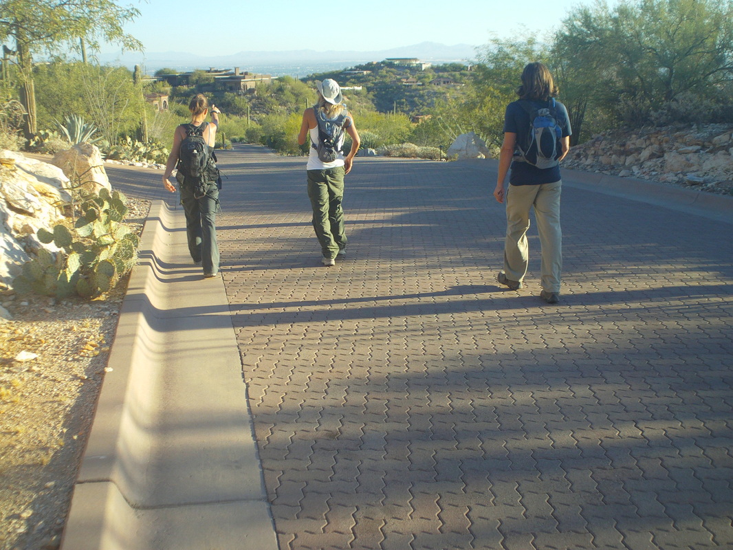
....the red brick road that eventually led us to our cars. A friendly wager had been made at the parting of the group in the canyon and I was thrilled we won. I immediately drove to a market and bought a pair of tweezers, spending most of Sunday night's NFL game picking stuff out of my skin. Now, I'm watching Monday Night football and still digging out plant stingers. I need better clothing I guess or a better understanding of which plants shoot projectiles and should be avoided. Geesh, only 6 miles, 2600' of climbing but almost 8 hours of hiking.
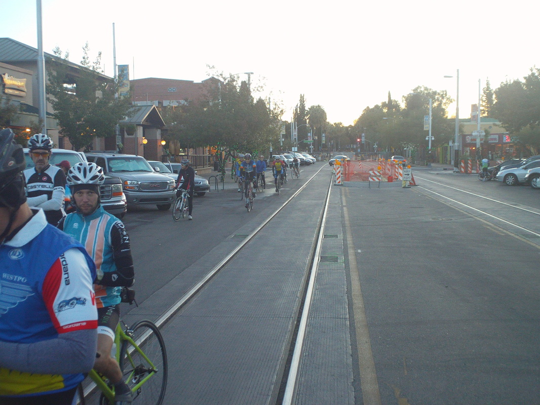
Ahhhhh, the Tucson Saturday "Shootout" ride. A ride that attracts pros who winter in AZ (like Wiggo, Contador, etc...), top amateur racers and schleps like me. Actually, the A group departs at 7:30am and the "senior" group departs at 7:15am. I slot in with the seniors, even though most of them are not literally seniors but those who are, think of Farmer Mike on HGH. These guys ride every, no exaggeration, every day so what chance do I have against these guys and a few gals? Kind of cool that everyone pulls in along 4th street's retail area, parks and then gathers, waiting for Ralph, the dean of Tucson cycling to call us out with a shout of "Let's ride". Temp is 47 at the start, kind of chilly but once the sun crests the horizon, it will warm nicely, eventually to 78. Damn I like it out here. Dude on the left is a grad of Michigan State and a big football fan. We head out through a convoluted maze of stop signs, street lights and detours but eventually reach the outskirts of town and approach an intersection. We are in a long line of about 60 cyclists as the light changes to yellow, the peloton keeps going, then red, the peloton keeps going but I stop. Yep the only person who stops. I once broke a collarbone because I did not stop at an intersection and ran into a cyclist who skidded to a stop because a car ran the sign. Probably that's why I take such a dim view of the couple of dim lights who populate our rides and do stupid stuff at lights and signs. You just can't rely on the driver observing the rules of the road even as you are not. Fortunately, today's group was still in the soft pedal mode and after a mile of chasing, I rejoined, just as we reached Valencia Road, which signals the ramping of intensity. From there, the road rises gently at first, then steeper and steeper.... I asked a gal next to me, "How far to the bridge" which signals the end of the climb. "Seven miles" was her reply!!! People began to drift back, then more, down to about 20 now...then I drop, CRAP!!!! about 50 yards from the bridge. 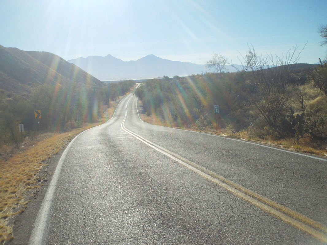
There is some regrouping at the top and I slot in with 7 people. About 2 miles from the turnaround, I shoot this image of the desolate landscape.... 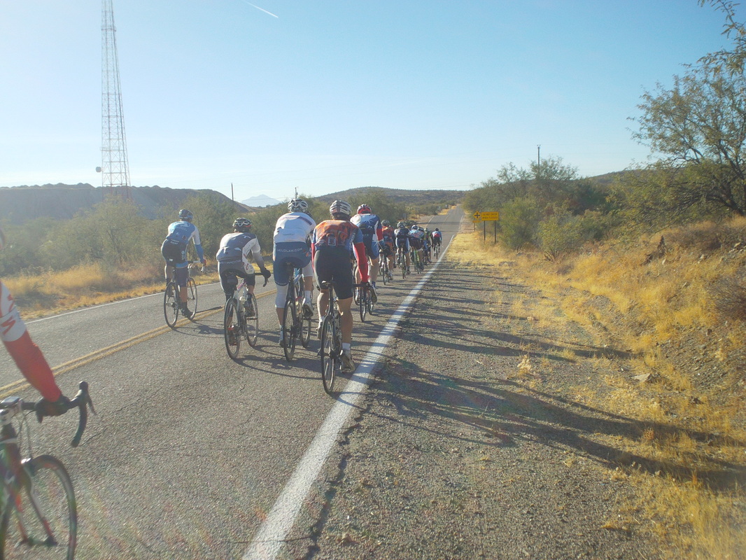
....then the A group streams by. They are the real deal. I catch back on with my returning group and return to downtown Tucson with 60 miles and an invite to join them on Sunday but alas, I'm hooking up with 11 crazies who are off trail hiking into the wilderness. Will have that story tomorrow.
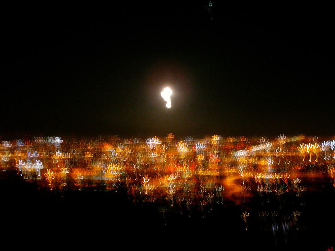
A night hike. I thought it ought to be interesting, gather at 6:30pm well after the sun had gone down. When I arrived, there were dozens of cars parked along the road and I soon discovered this trail, which goes up to an observatory, is a popular night hike for the U of A crowd. Actually, rather than a trail it is a paved road and pretty steep too, 3 miles round trip.
The views of the city lights and a full moon were fantastic all the way to the top. However, what made this especially interesting were the six people who made up our group. It didn't take long for me to befriend one guy who used to be a door man at a popular bar. He had lots of good stories to tell from his five years, including being the point person for recruiting women for the Friday wet T-shirt contests! What a great guy. One of our group works with Kendal Jackson winery!!!!!! Gosh, there is no one nearly so interesting riding around the central Ohio pelotons. Anyway, a fun time and followed on a quick 25 mile bike ride up to Catalina earlier in the day so a good day. Friday was a work day but then Saturday, the famous Tucson Shootout ride. |
