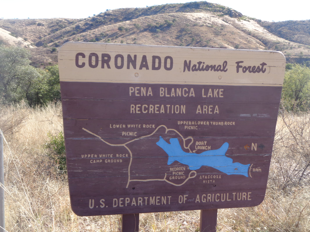
 I signed up for a group hike with 8 others. The entire route was 67 miles but looking at the gps file, yeah, I could cut it to around 36 if I didn't want to do the entire thing. The ride began in a small town called Rio Rico, very close to the Mexican border. It would visit the aforementioned lake and then on to Patagonia Lake.  Alone am I. I hung in there just fine through rolling hills, then began a 1/2 mile climb and I continued to be ok. Reaching the top, they kept pedaling while I, just had to coast. Dropped at mile 10 on A DESCENT!!!. The pace was, by the New Albany, Ohio standard, mid B but dropped like an anchor from an old steamer.  The usually marvelous views are absent in this small slice of AZ. I reached the top of a loooong climb and descended to.... 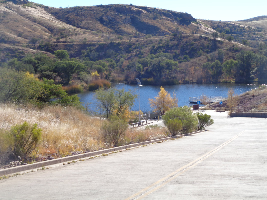 ….the lake, Not much here. It is an odd feeling to arrive at the turnaround point in last place. The guys were good and we began the climb out of the basin. Soon, I was again pedaling alone prior to urging them to continue and not to worry about me. Finished with 37 miles and 2300' of climbing. Nice route with little traffic. Something for next spring when I begin riding seriously.
0 Comments
 Another image, another distortion. Sure, it looks like we are about to take a nice walk through the rolling plains of Kansas (without the cactus of course) but this is the Catalina Mountains and our small group of 9 have some serious climbing ahead. Our destination is the Window, 6.5 miles distant and not visible here. 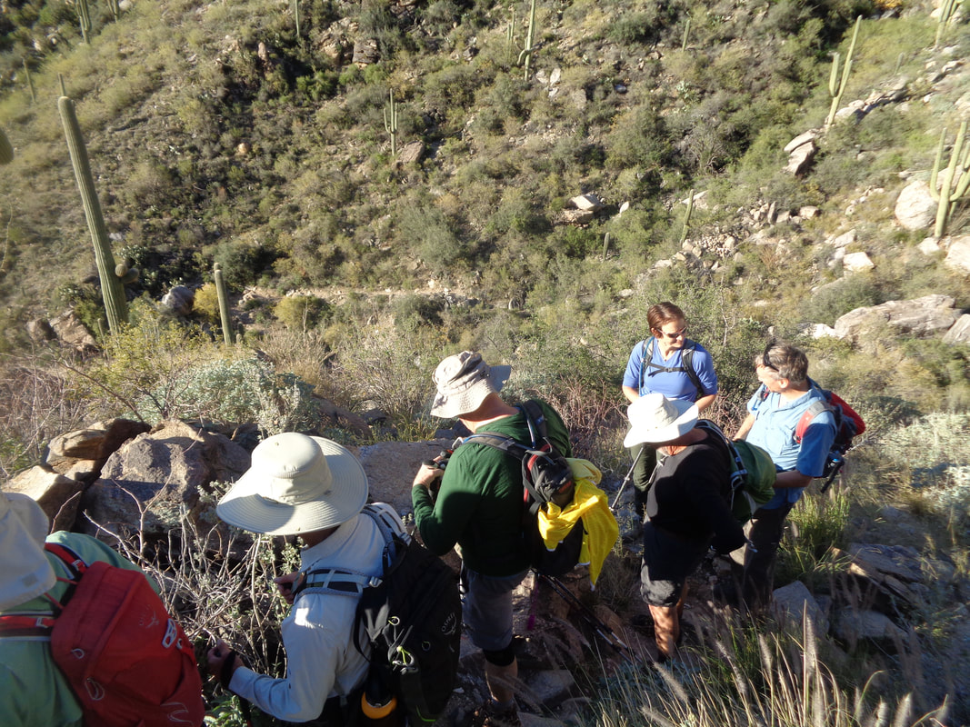 Two are late to our party so we depart the parking lot at a slower pace, hoping they can catch and eventually one does, Cathy in blue, introducing herself. Note all the wide brimmed hats, the common choice for desert hiking. 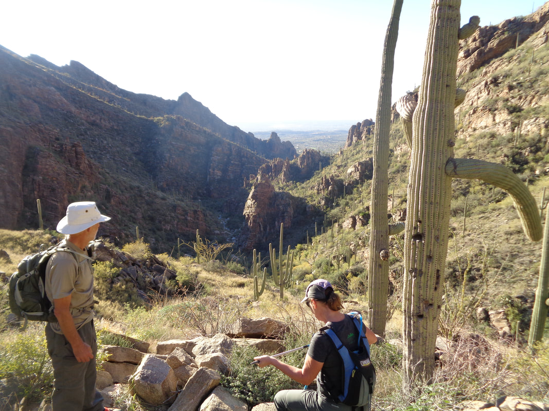 Starting at 7:30am with a temperature of 45, required us to shed layers once the sun hit and the climbing began in earnest. Our leader, Patrick on the left, Heidi on the right, making a change of clothes as we all did at one time or another. 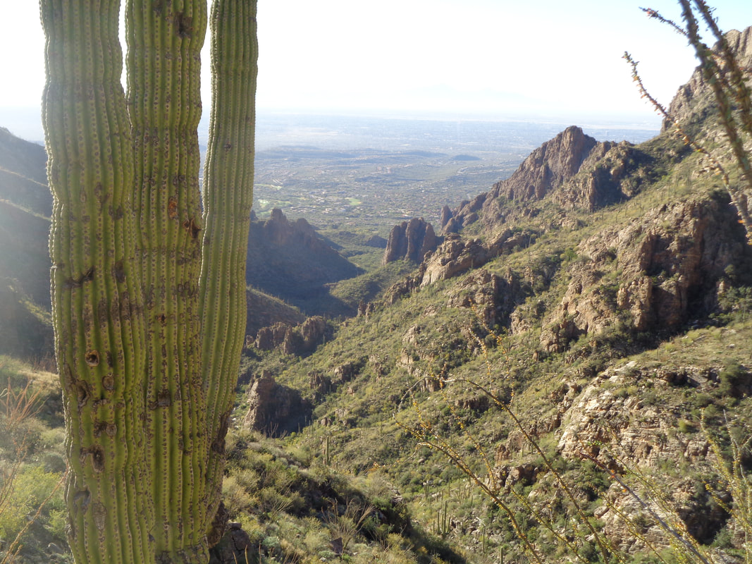 Higher we go and while doing so, the views improve dramatically to the southwest. We have wound our way through and up Ventana Canyon finally reaching..... 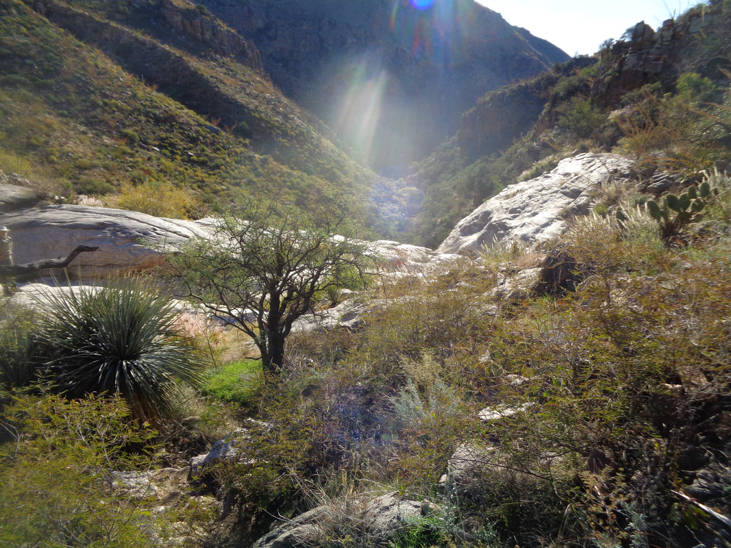 ….Maiden Pools at roughly mile 2.8. The water was flowing at a trickle and the pools were mostly full. A pleasant destination for many but we had much farther to go. We enjoyed somewhat of a respite as the trail crossed and recrossed the creek several times, always gaining elevation but not as severe as what was to come. 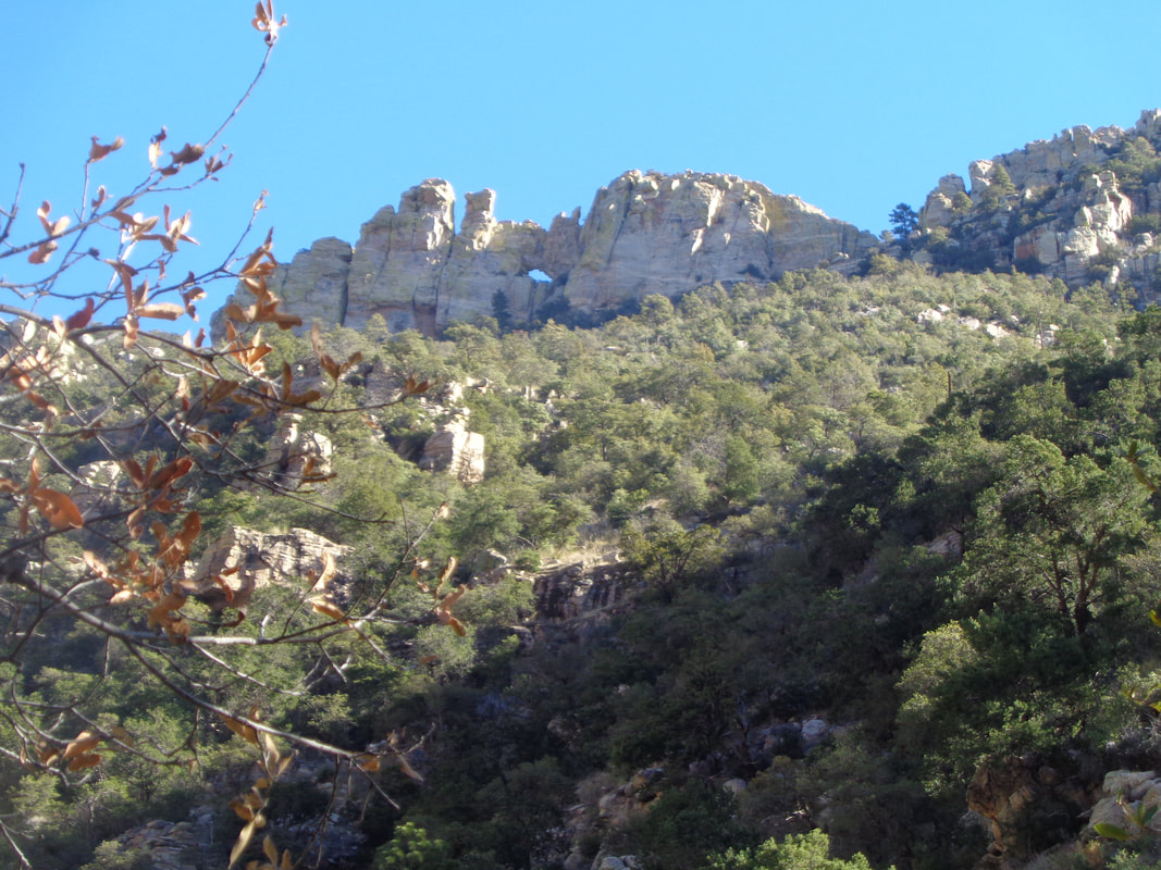 At roughly mile 5, a rare glimpse of the window can be seen. This is the best view of the full window as I will explain later. Now some serious climbing is confronted. At this point, I had departed the group so I could go at my own pace and exist alone in a box of pain. 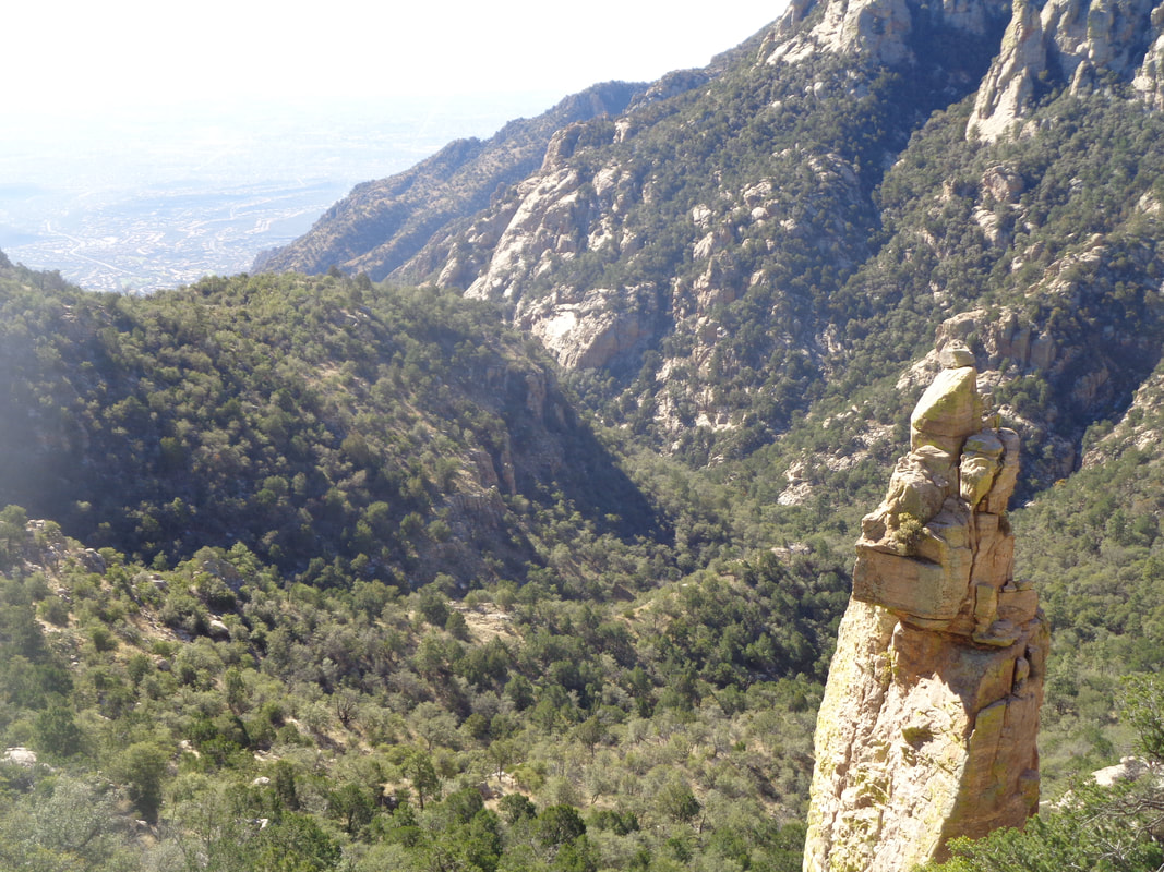 From a couple of previous visits, I knew that once you reach a point where you are above the rock spire, you are close to a saddle and sure enough.... 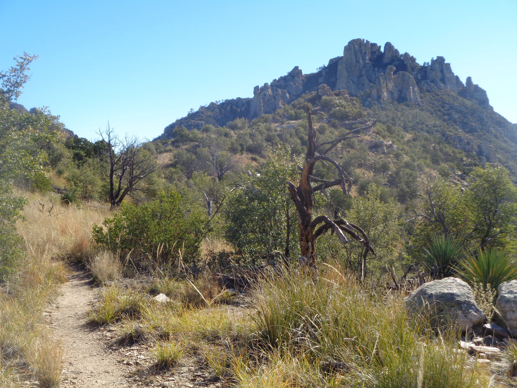 …..I slog through the remaining switchbacks and am walking on a narrow ridge, looking at the jumble of rocks above that houses the window. Yeah, still some climbing to go but.... 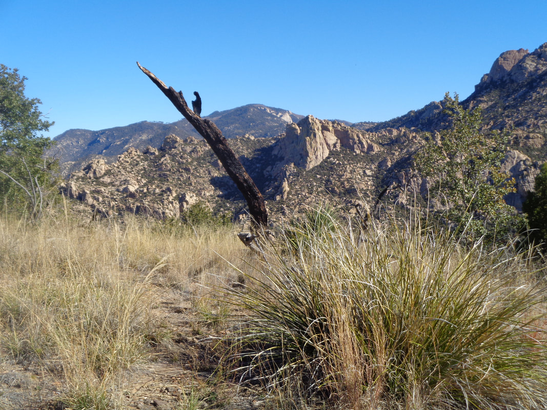 ….the views are incredible. The rolling walk along the ridge is a relief. The climbing begins anew and it is important to look to the right so you don't walk past.... 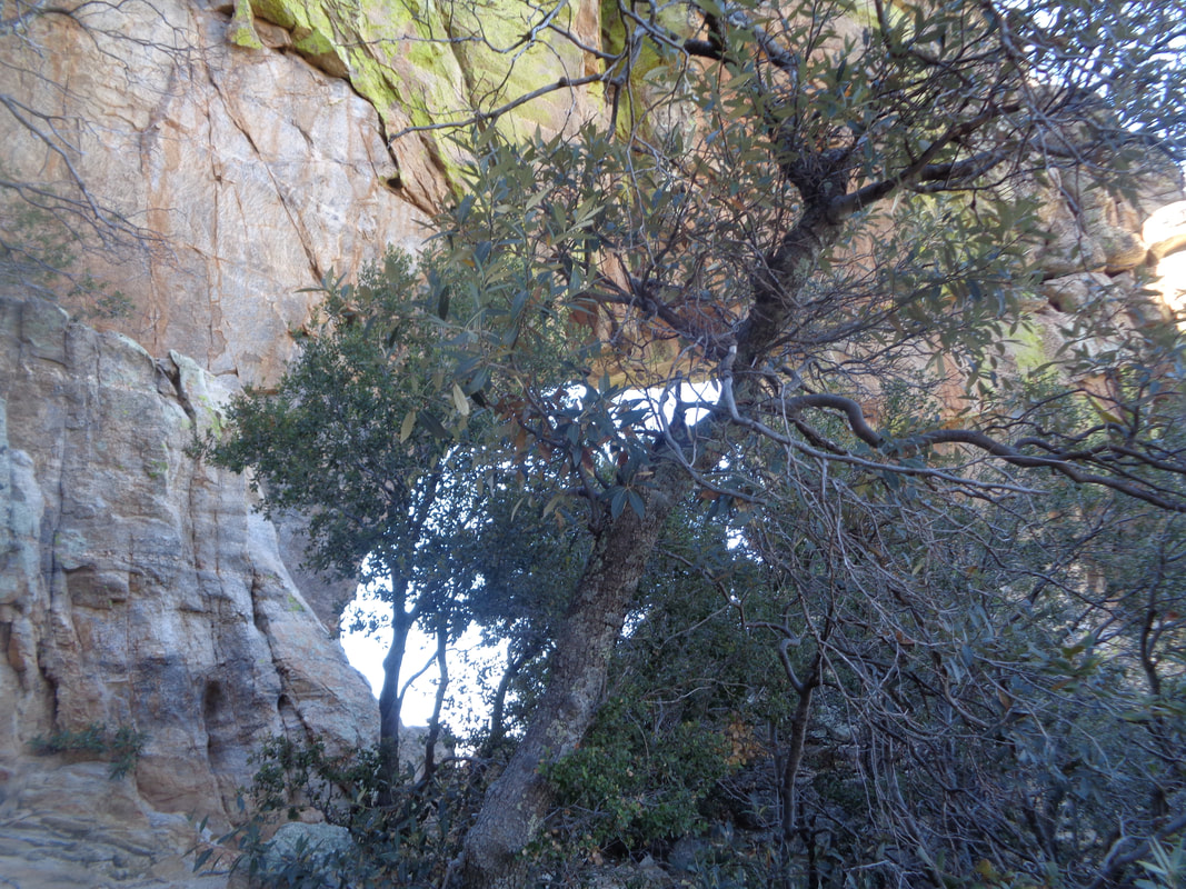 ….the window. I have missed it previously. A wonderous feeling to take the final steps.... 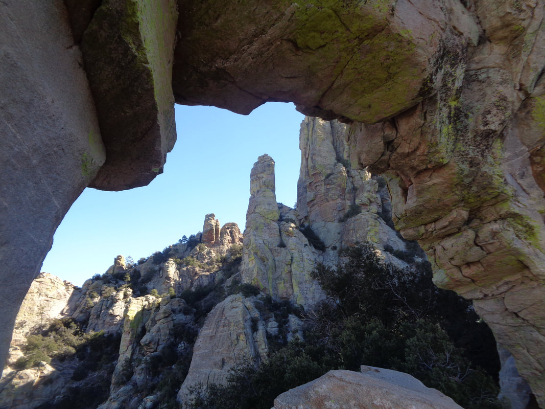 ….into it. Sling the backpack off, dig into a compartment for an apple or snack and just enjoy the magnificence of all that is around. 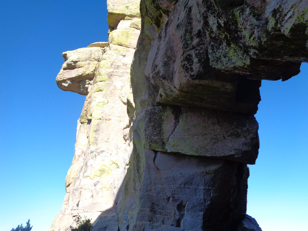 It was not too windy but with a sweat soaked long sleeve shirt covered by a windbreaker, it wasn't long before the cold had me shivering and I was forced to depart. Because of the angle of the window and the sheer cliff close to its front and back, a straight on image is not possible. However, you can see the walls are massive and the arch is unlikely to collapse anytime soon. 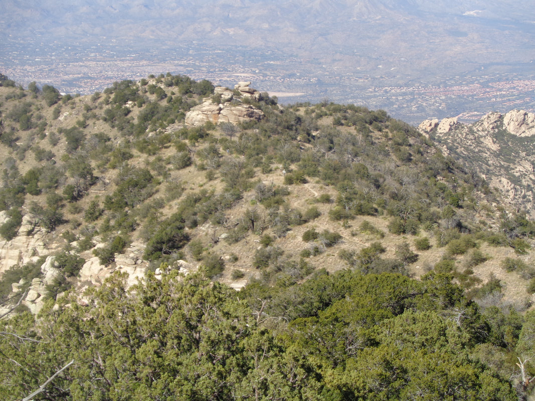 Soon into my decent, I could see the balance of the hiking party walking along the ridge, they too enjoying the fantastic views and soon to take my place in the window. 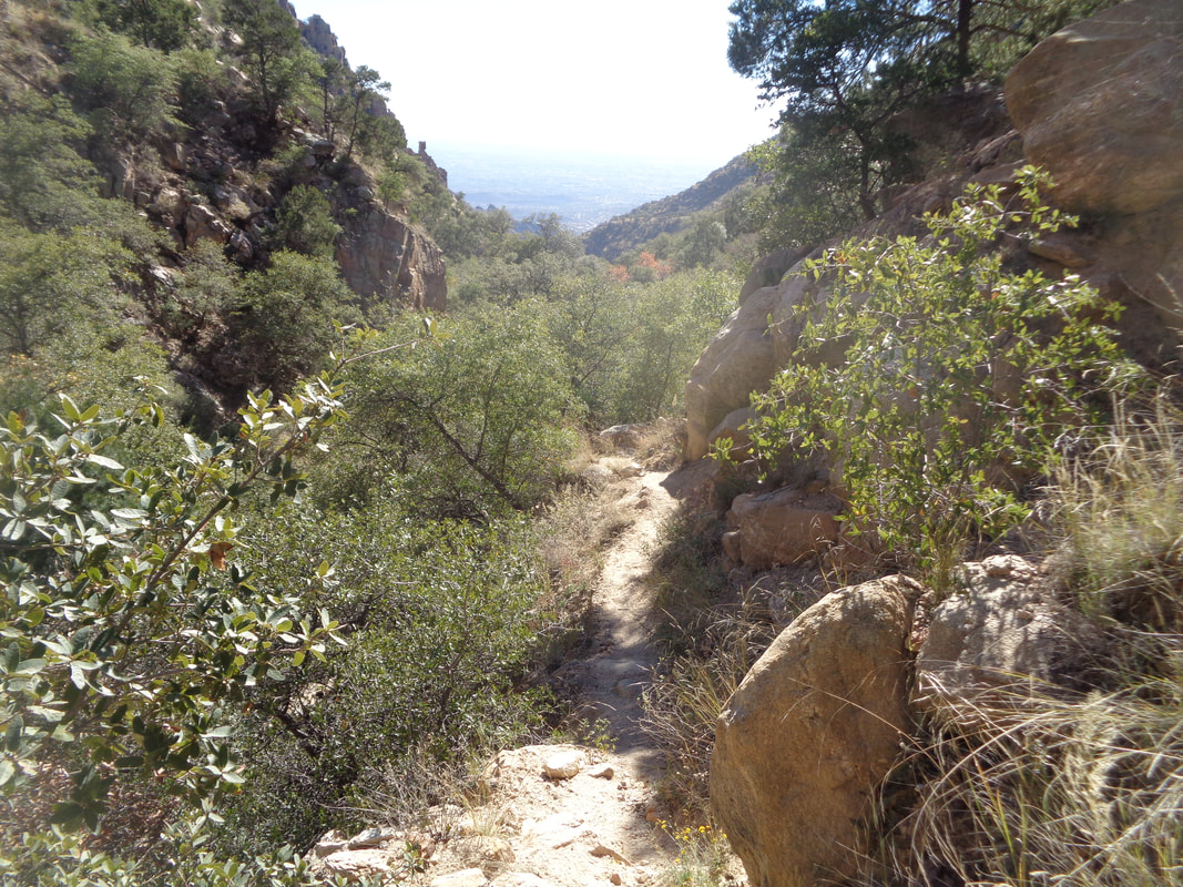 I continue down, down, down. As usual, with a hike of this distance (13.5 miles) and elevation change of 4300', my legs and feet took a beating. Ouch.
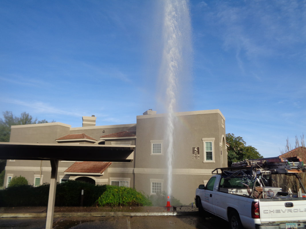 I was to meet someone for a hike. Discovered water was not working but so what. They'll get it fixed by the time I return. Walked outside and..... Nothing I can do to help so..... 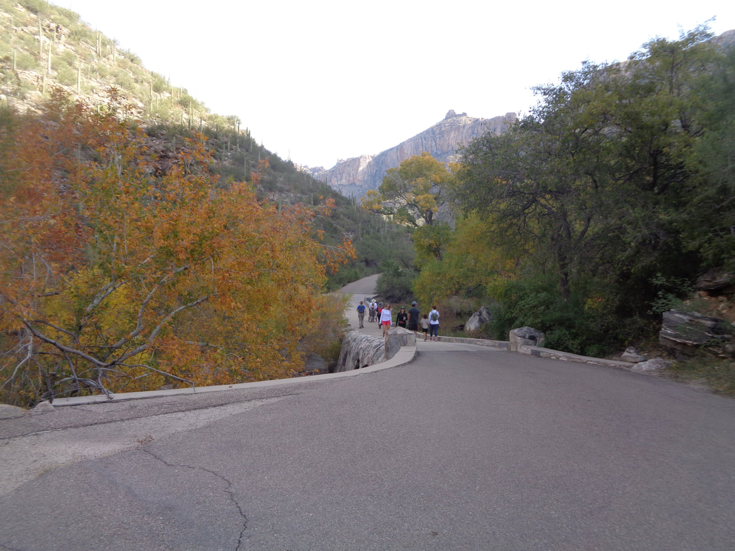 ….headed to Sabino Canyon. I have done this hike a couple of times so won't bore you with a report that I am not motivated to create anyway. Leaves are turning and beautiful on this day of sun and temps in low 70's. 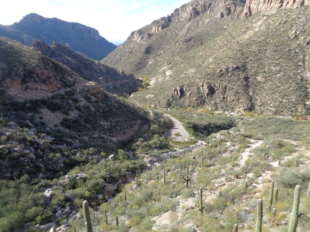 We reached the top of the 4 mile, paved climb via Sabino Canyon road and then head up the Phoneline Trail. I wait for my friend and later I am again 2nd on a Strava segment. Oh well. We continue on and finish with 9 miles.
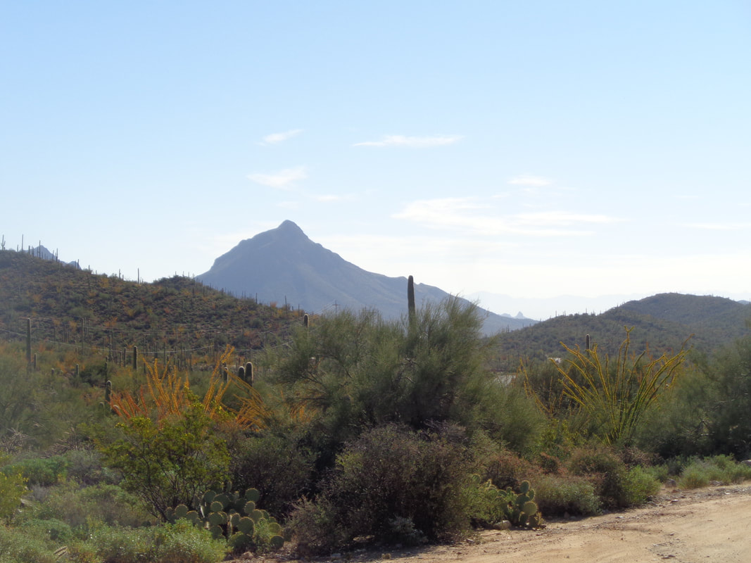 Wasson Peak in the distance, part of the Tucson Mountains that lie to the southwest of Tucson. I don't hike here much as there is not the variety that exists in the other mountain ranges. But, Wasson Peak is the highest in this range and I wanted to see what I could do and so set out on the 3.5 mile ascent at the hardest pace I could maintain for the entirety. 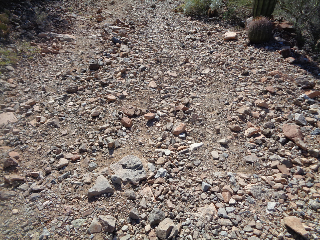 Geesh, don't like the conditions of the King Canyon Trail that leads me to the peak. Covered with fist sized rocks that makes the going difficult. 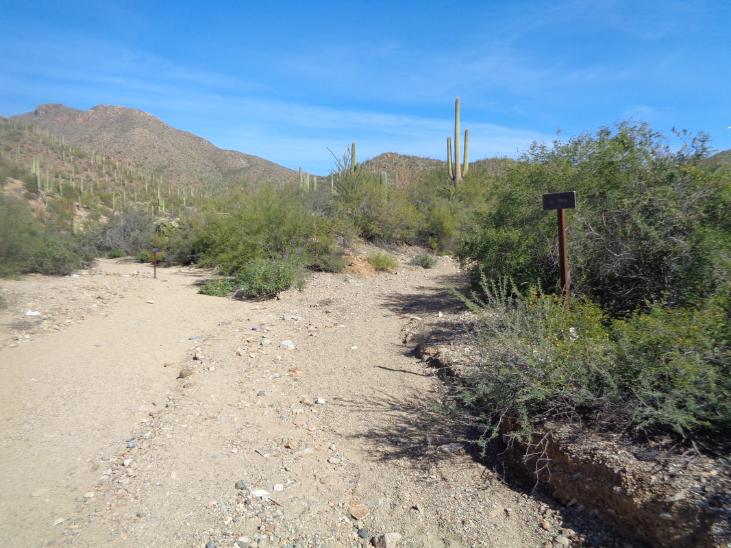 The trail enters a wash. Important note. Note the sign on the right which indicates the trail continues toward the left. Well, if you follow the wash to the right, it actually is an old jeep road, overgrown but a distinct path remains as I show later. Really Important Note: Don't miss the road when it exits the wash on the right, about a 1/4 mile. Dozens of animal prints going deeper into the wash and if you miss the exit right, well at least it makes the hike longer and may make it a bunch more exciting. 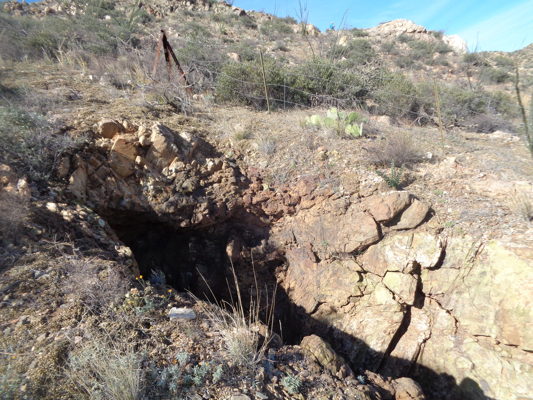 During the ascent, you'll pass a couple of old mines. 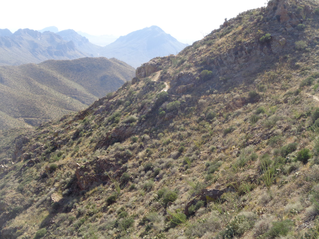 The average grade for the 3.5 miles is only 10% but there are some fairly steep sections too. 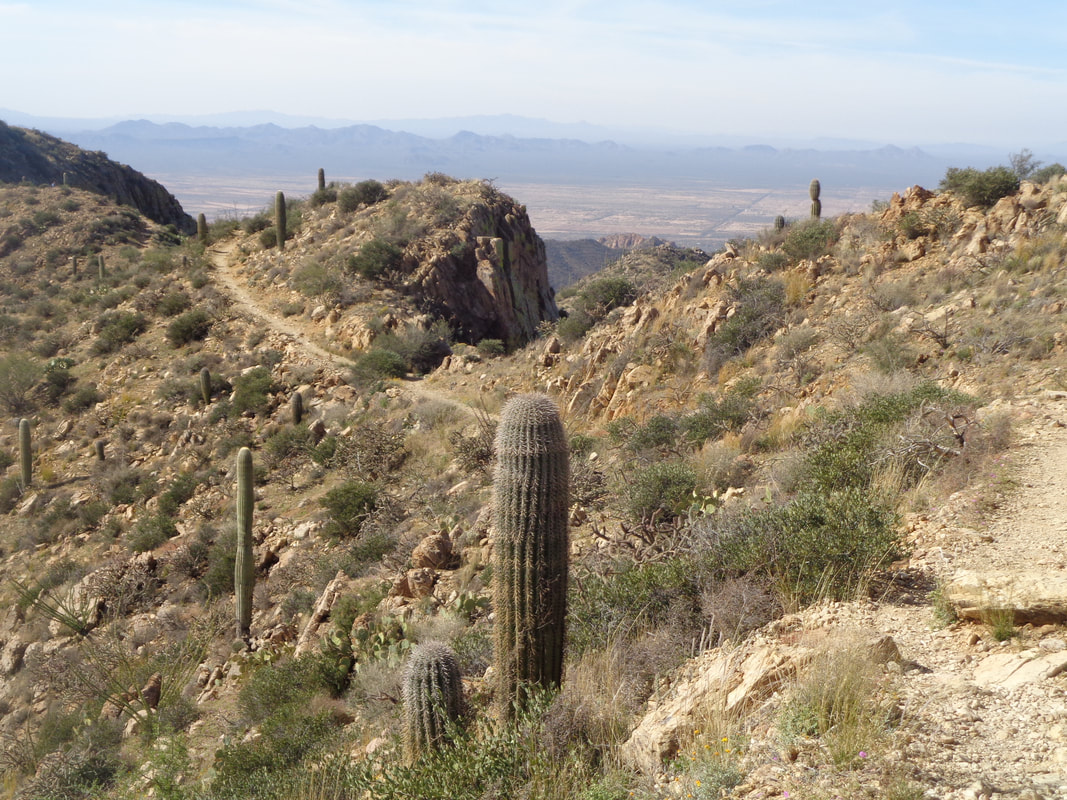 Although from the trail head it appears the final approach is super steep, the trail winds around the mountain and the final 1/2 mile is not very steep. 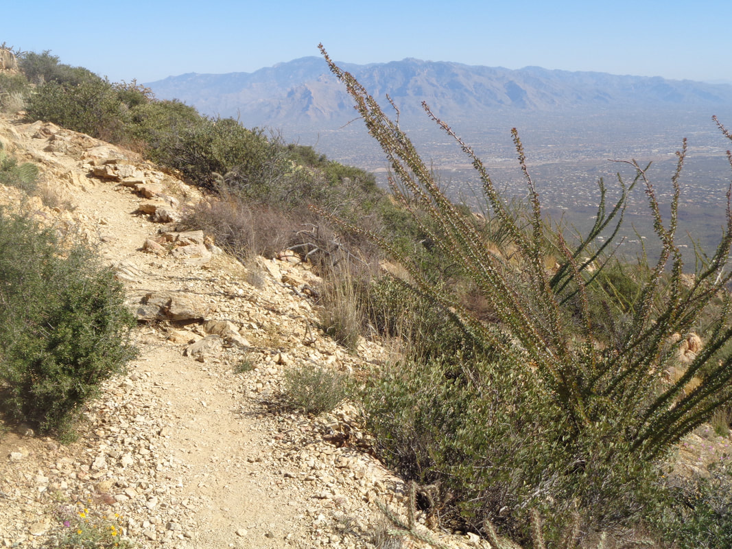 The rocks that litter most of the trail have disappeared. At some point, you will reach a saddle where the Hugh Norris trail comes in from the southeast and then farther up, there is another fork but signs are present to keep you on route. 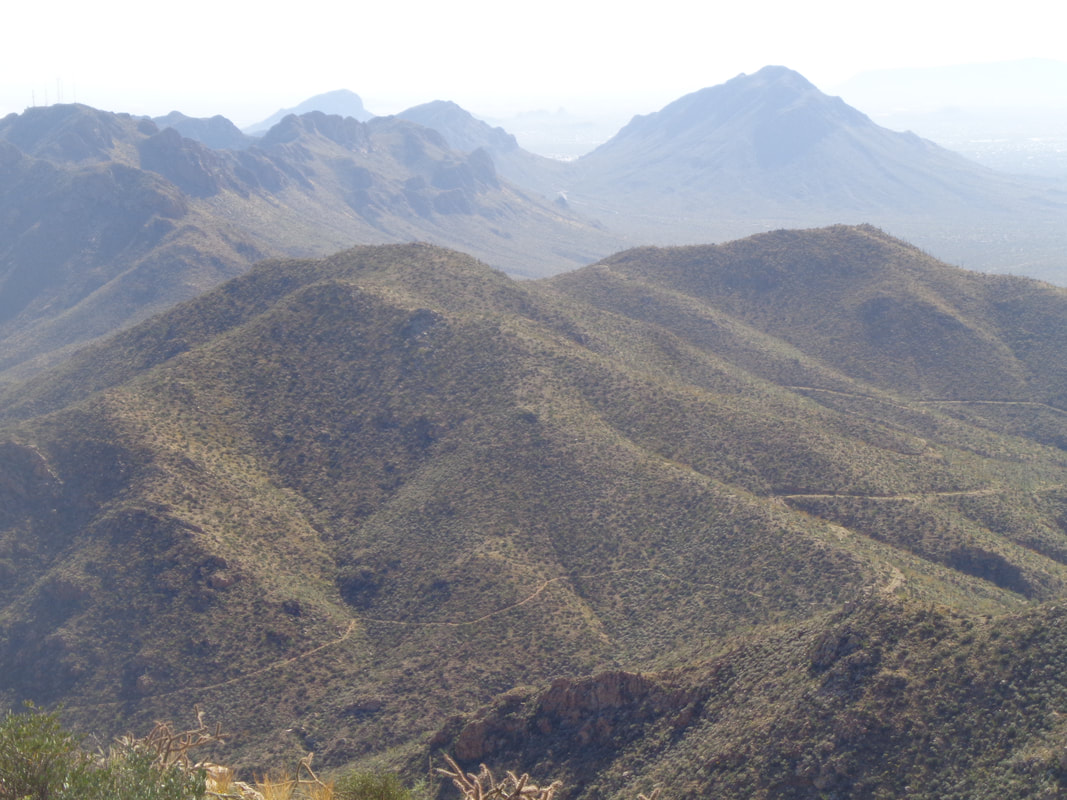 More good views and if you look closely, there winding around the mountains is the jeep road I will take from the aforementioned saddle. Much better option as it is smoother. 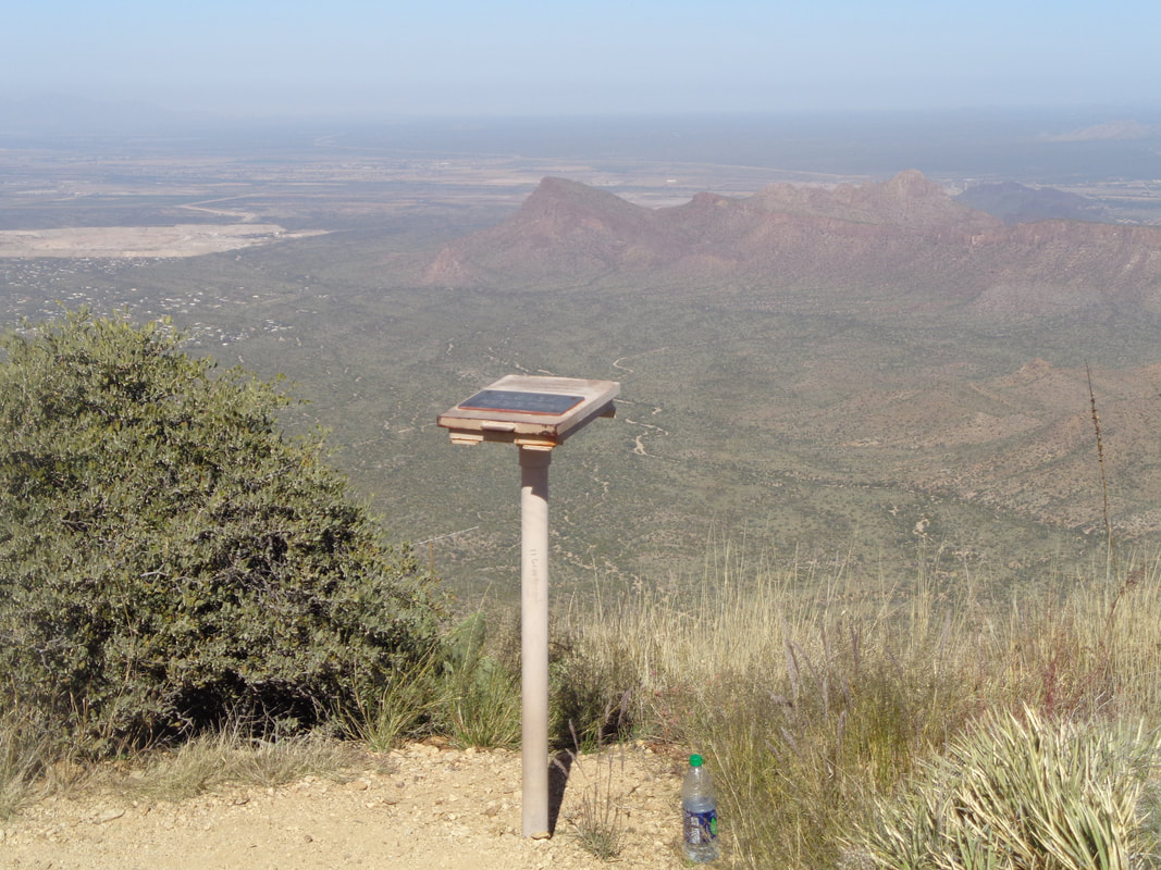 Ahhhh, almost there with a summit register. I don't pause here as I plan to sign it later. In the distance, well below is Panther Peak and Sombrero Peak. 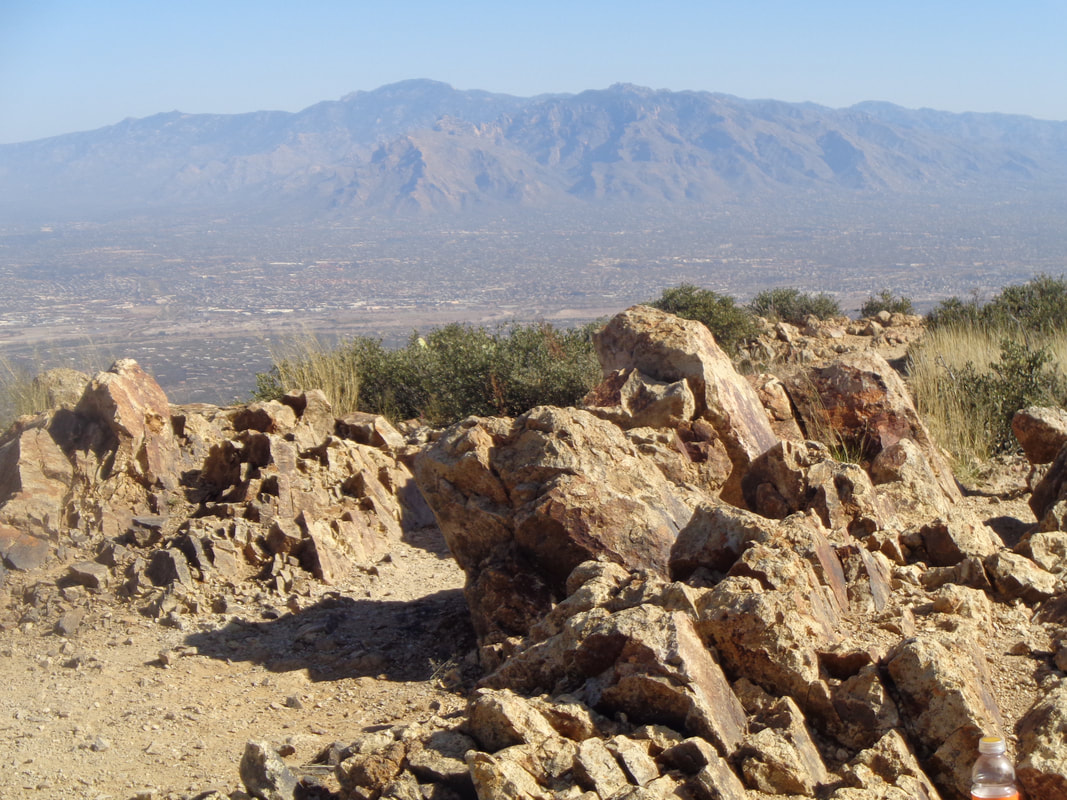 I reach the top. Later I discover I miss the KOM on Strava by 2 minutes at 1:05. Still, settling for 2nd on this peak's list is an accomplishment. I talk to a group from Canada who have hiked this before and tell me about the alternative jeep road back to the King Canyon trail head. 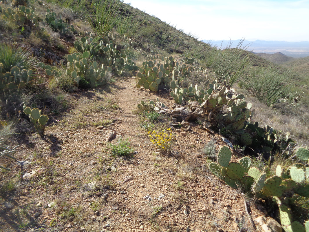 Upon reaching the saddle, I take the road and wow, sure it is over grown but a distinct path exists and much smoother and easier on the ankles.  I have just descended to the point where the road enters the wash I previously mentioned. GO LEFT! It was kind of eerie to think what one might find by going in the other direction. Probably nothing but ya never know. Trudged through the sandy bottom until reaching the signage and regained the King Canyon trail. Finished with almost 8 miles and 1880' of climbing. The jeep road adds about 1/2 mile but again, is the better albeit remoter option.
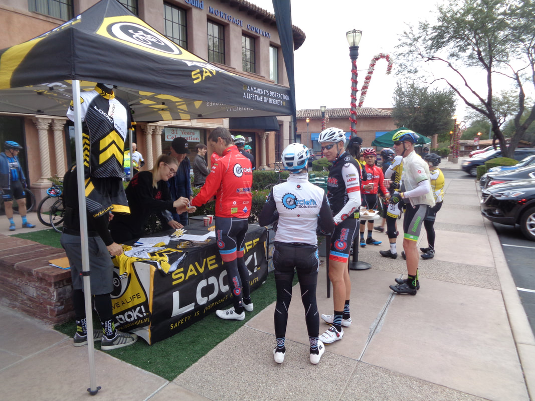 Arriving at 7:30am for an 8am ride, there are lots of cyclists already gathering to participate in the annual Thanksgiving ride hosted by local Cat 1 racer Tim Carolan. This year, Tim partnered with "Look Save a Life" and charged a modest $20. The event was capped at 100 cyclists and filled quickly but they still accepted day of ride walk-ups. Can't guess how many were here but way more than 100.  The local television news outlets all sent a crew to shoot video and we had a police escort for part of the route.  Wow. KOLD Tucson News Now was here! 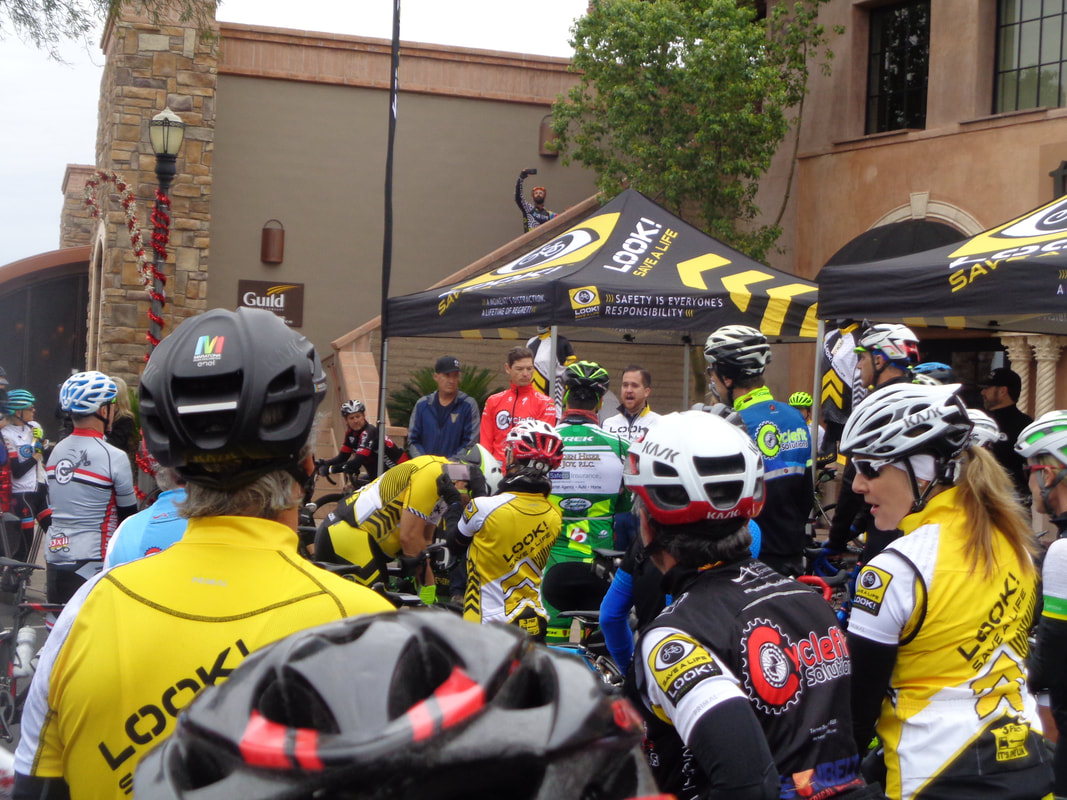 Tim is in red, having given a brief introduction with the representative from "Look" also making brief remarks. The latter appeared overwhelmed by the turn-out and collected funds. 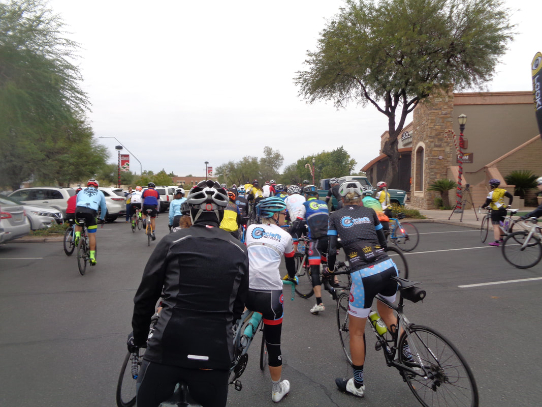 And so off we go into an unusually cloudy day with a start temp of 54. Some of the locals dress like it is 34 degrees. I saw more than one balaclava being worn, lots of leg tights, jackets, ear warmers and of course arm warmers. 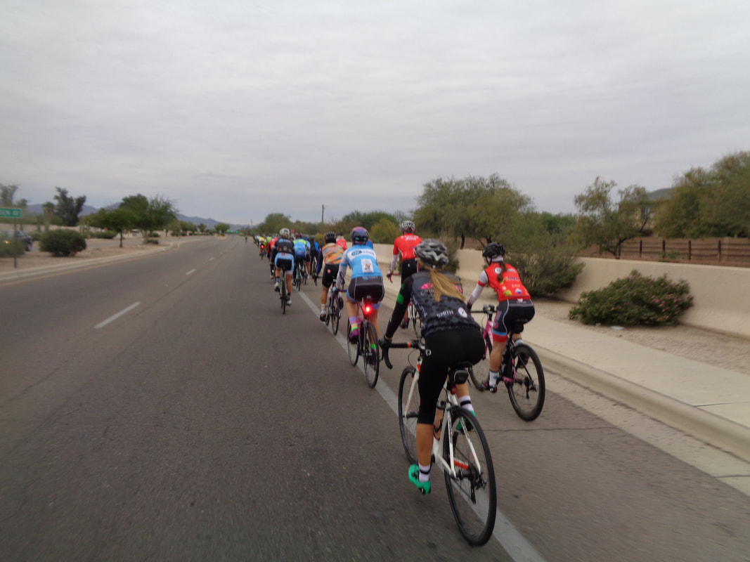 Riding 2 x 2 stretched the line out for like forever. Yesterday, I had a hard hike (not on the blog yet) so came out to take some images, loosen the legs and having done so, turned around. Yeah, no surprise with that. The pace was quite moderate by design, at least of the 5 miles in which I participated:)
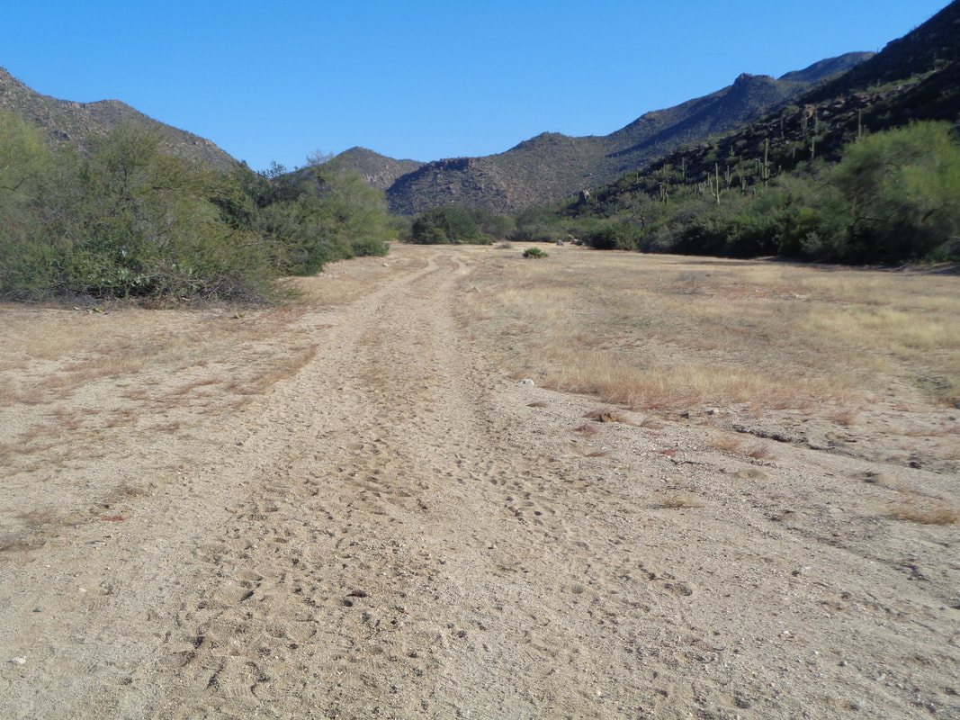 Wellllll, after Sunday's hike I should have gone for a bike ride but so unmotivated to ride so I decided to head to the Tortilla Mountains where the hiking is not so rugged and flatter trails can be found. I cross a wide, sandy wash as I start on the Wild Burro Trail but soon get on a trail I had no previously hiked....  ….the Alamo Springs Trail. It makes a beeline for a nearby mountain and groan.... 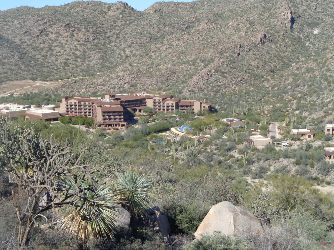 …..I begin climbing. I knew the length of the trail but had been oblivious to the elevation gain. I rise above the nearby Ritz-Carlton resort at Dove Mountain. The pool looks refreshing on this day with temps in the 70s. 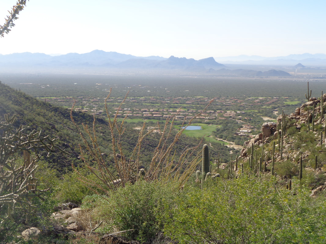 Come on, there is no way the trail will go to a peak but it sure does, drops down and rises again. 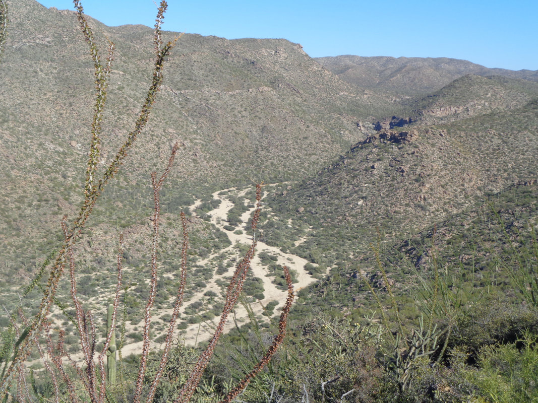 Neat image of the wash and I was looking forward to exiting this trail and walking back via the wash. My legs felt ok after yesterday's pounding but I would have welcomed a little less climbing. Oh well. 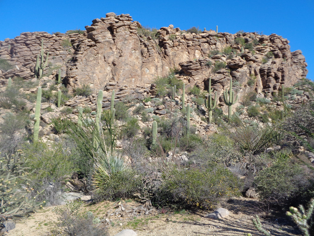 There was an interesting rock formation and a fault would allow access to the top but that is for another day. At mile 3, I reach a sign that gives me the option of continuing on the Alamo Springs trail or taking a .5 spur trail down to the wash so I..... 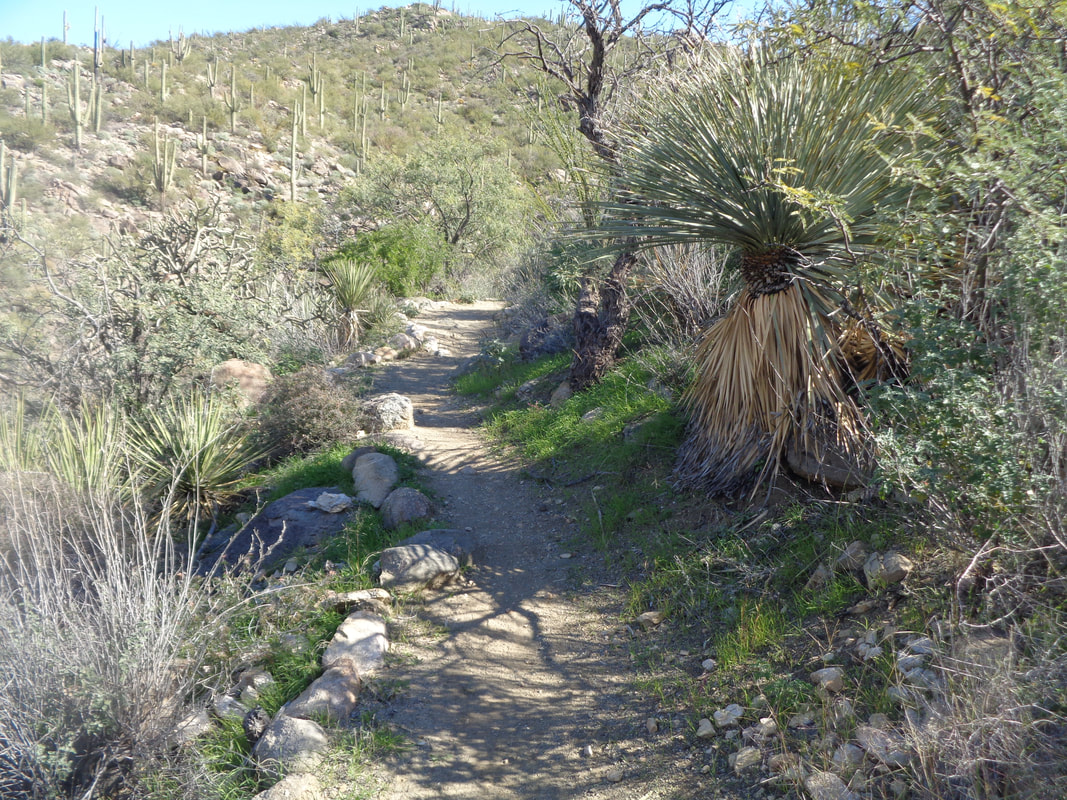 ….begin the descent. This north facing slope has lots of green grass and thick vegetation. By the way, there are two crews who maintain the trail system in this mountain range and the quality of the trails is very good. 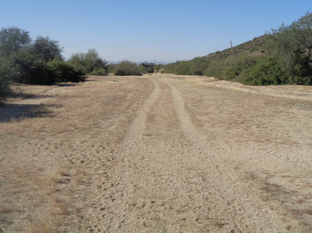 The spur trail spits me out into the wash and I enjoyed the hike back, finishing with 6 miles and 1200' co climbing. OK, tomorrow I really should ride.
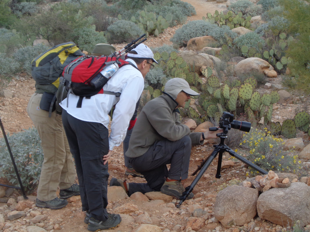 I led a small group of the willing on a very hard but short hike to Pusch Peak. While only 2.1 miles, geesh what a hard hike. The average grade is 25% but the first .8 miles skews the average down. After that opening, the balance of the ascent must be at least 30%. Above, a photographer has set up shop and taking pictures of flowers while my group checks it out. 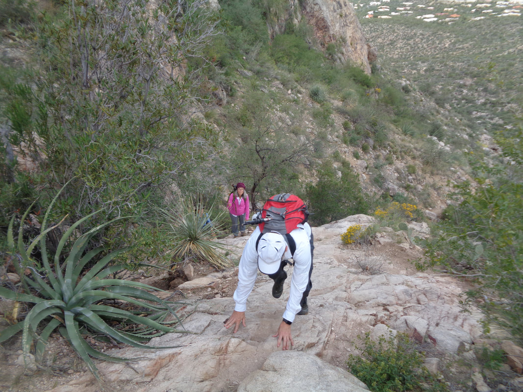 Yeah, steep I said as Zack navigates a place with Marianne waiting her turn. It's not just the grade, it's also those damn pointy things that must be avoided. 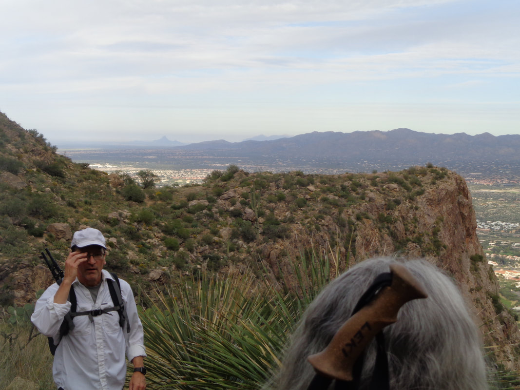 We continue up and pass "Breakfast Point" in the distance and then, wow, what a rare event.... 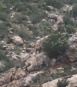 ….a bighorn sheep walks across our route, there in the center. We gawked for awhile as we enjoyed the experience. The first I have seen in the Catalinas. I wondered what we should do and Jessica interpreted that as me being afraid. Ha, ha. That is a good one. A Mountain Lion, ok yes but I don't consider getting head butted by a sheep a realistic risk. We kept going and it scampered across our trail and then gone. 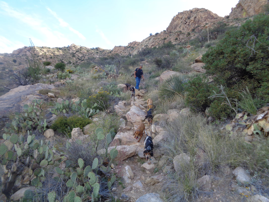 Then, oddly, a guy leads a pack of dogs down trail. Never seen that before either. Each had a tracking collar on it and were well behaved. He had come to the peak off trail from the southeast side and was now headed down via the northwest side. 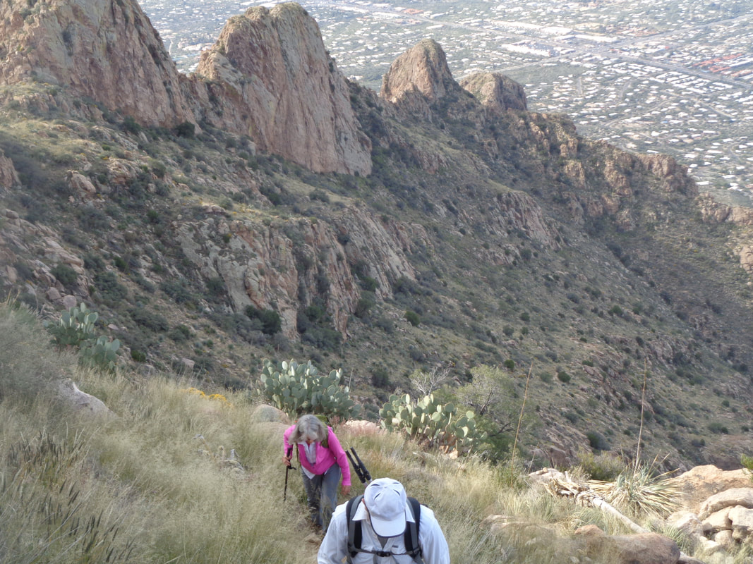 We rose higher and higher. It was a tough hike but big kudos to the gang for not bugging out and turning around. Marianne thought we were only hiking to the base of the peak so I turned on the encouragement voice and told her we were almost there when we may not have been. On each of my previous visits, I had always gotten off the route and been forced to bush whack to the top but today, the trail was visible and not much route finding required. Finally..... 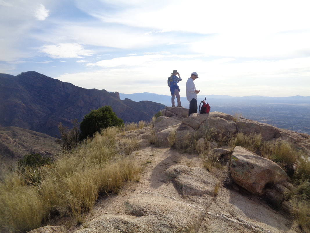 …..we arrive! Zack on the right, Jessica on the left who is a park ranger at the nearby Kartchner Caverns. 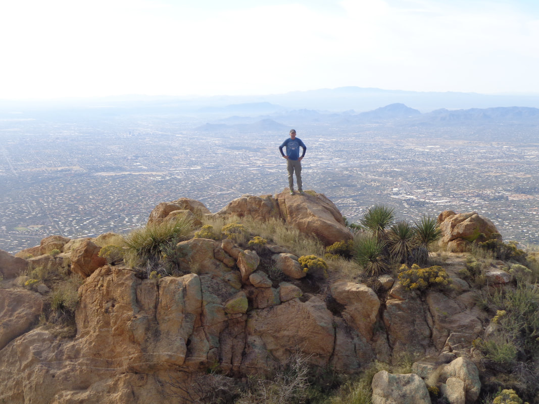 Yeah so, a nearby ridge presents a good image opportunity so each of us hikes there and has our image taken. 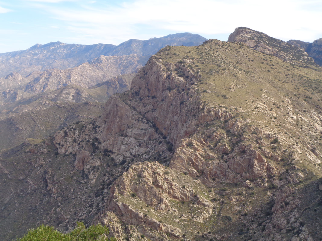 Looking to the northeast, so many peaks, so many places yet to visit. We enjoy ourselves on our peak and then begin the bone jarring descent. The descent is brutal and slippery with all the pebbles strewn about the trail. 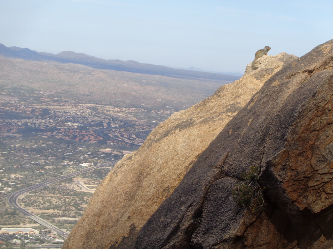 Hey! A Rock Squirrel checks us out as we continue our descent. Oro Valley is in the distance.  Down we go as we hit a rare, not so steep section. Then we hit one of the.... 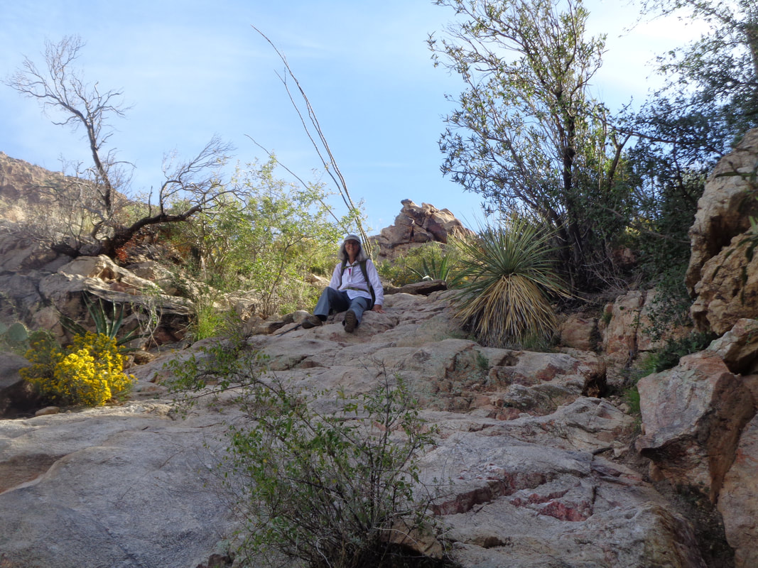 …"walls" where Marianne shows how to butt hike. This is a useful technique when one is unsure if tread will adequately grab the rock. 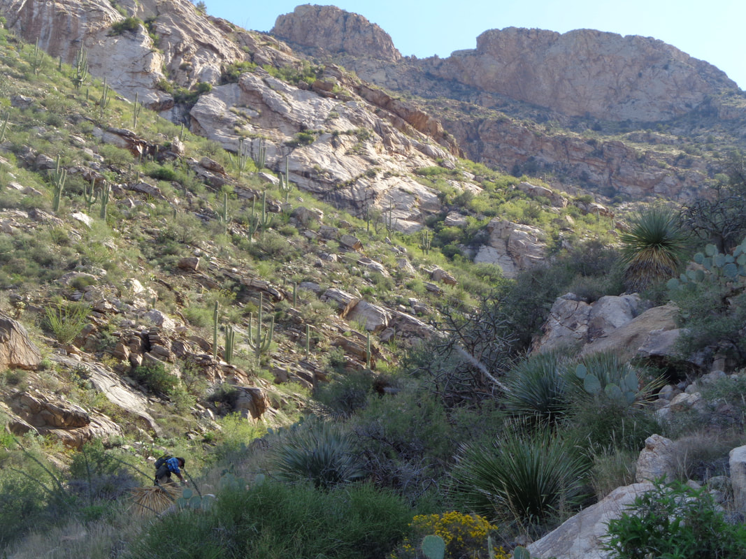 We stopped to regroup a few times but all arrived at the trail head and felt good about our experience.
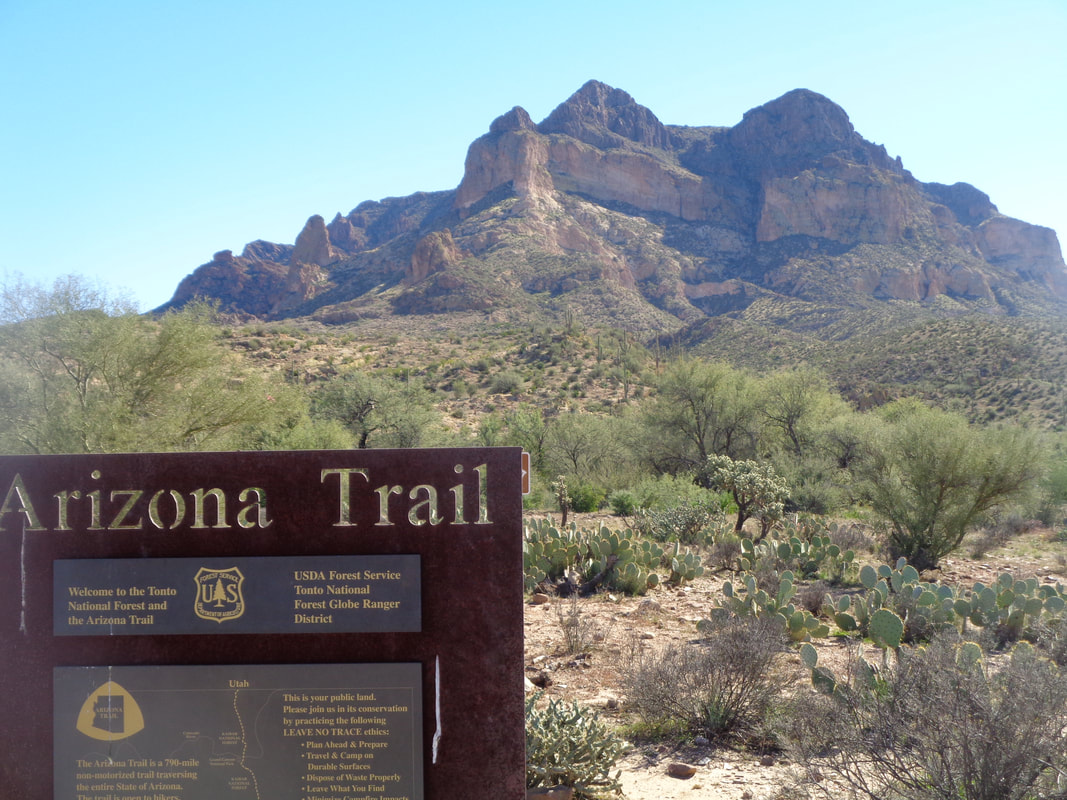 The Arizona Trail comes through to the west side of Picketpost Mountain. In the 1870's the US Army maintained a camp here and used the peak to signal other outposts. Looking at the mountain, it appears an impossible barrier to ascend but there is a rocky, steep way with some exposure. 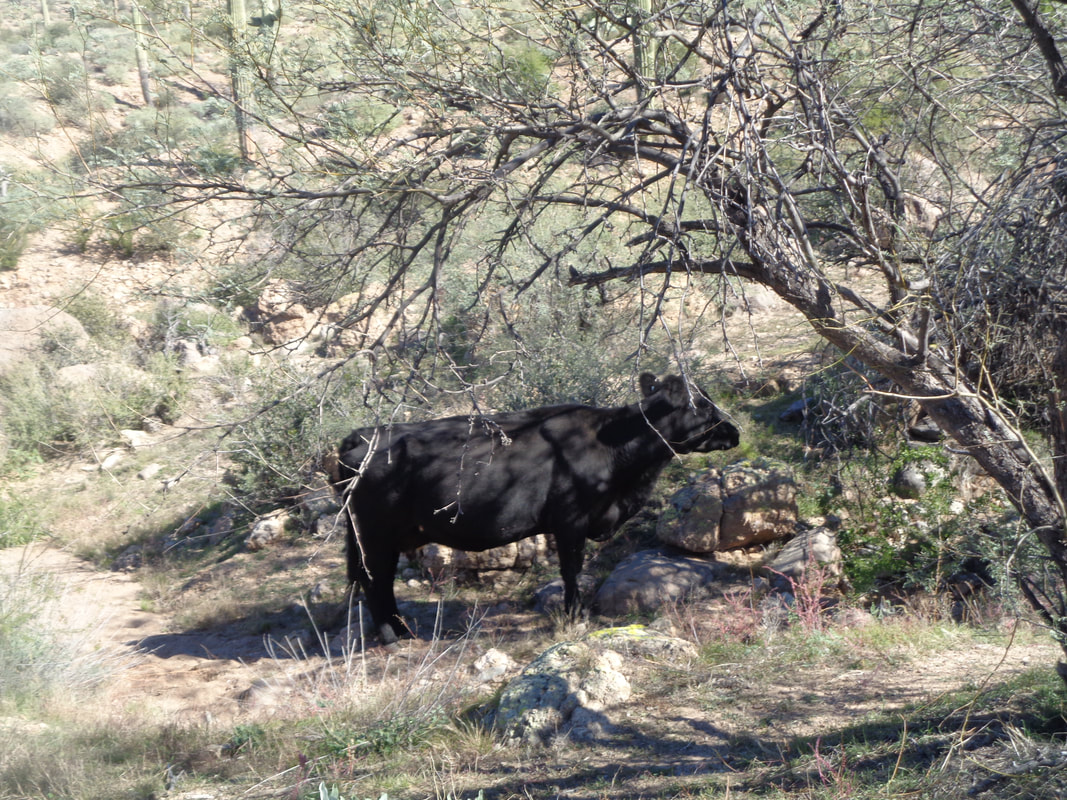 A small herd of cattle graze just off the trail. One snorts at me and with its intentions unclear, I pick up the pace while looking at my surroundings for a place to run, if needed. 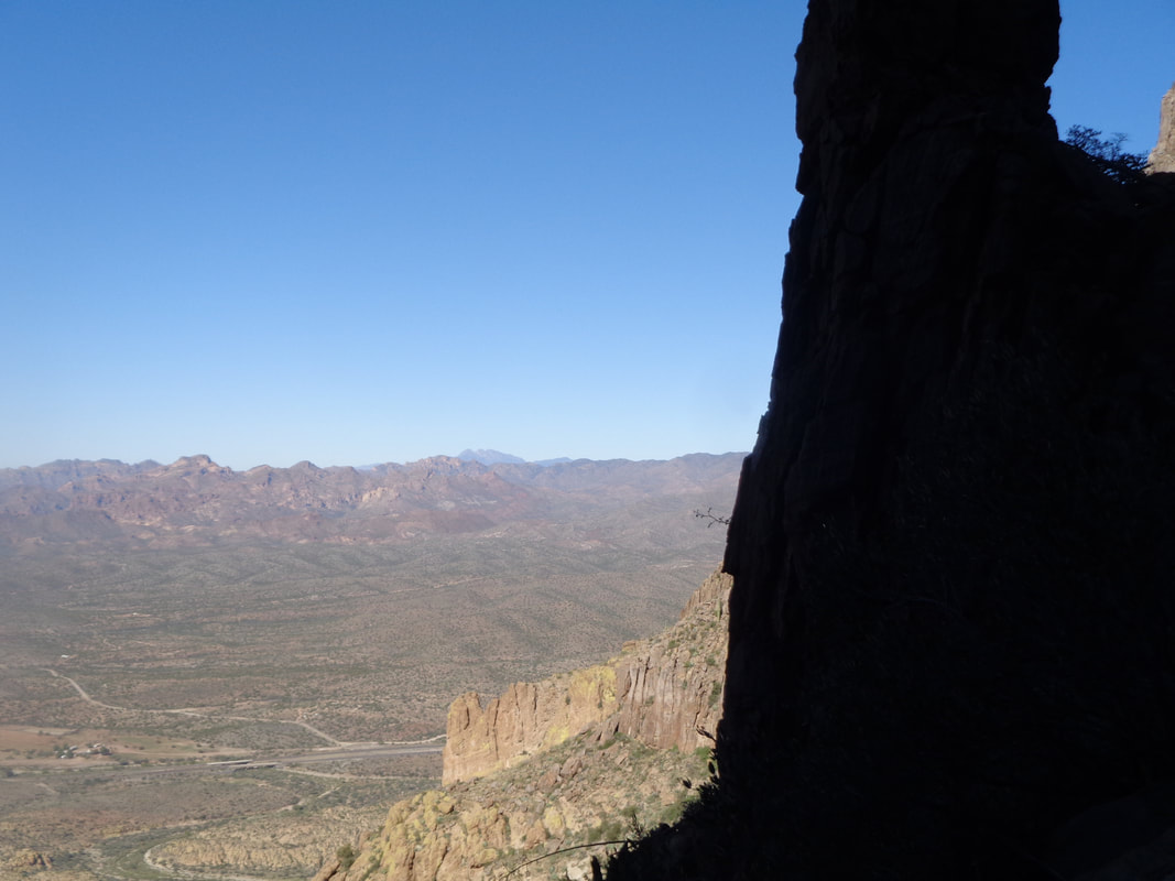 I did say it was steep as I look across St. Rt. 60 and the Superstition Wilderness. There used to be only one trail to the top so it can be confusing at times as at one point, there are 3 trails splitting from the main. 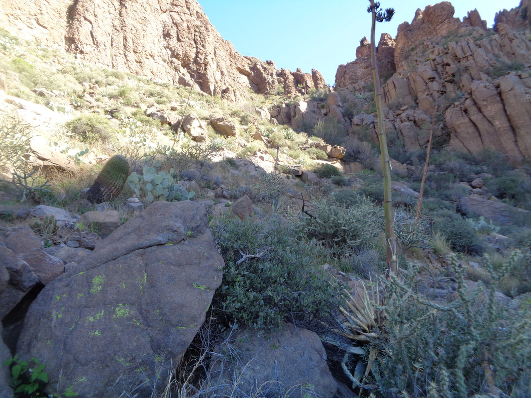 Some portions of the trail are both steep and covered in small pebbles so the footing can be a challenge, especially when descending. 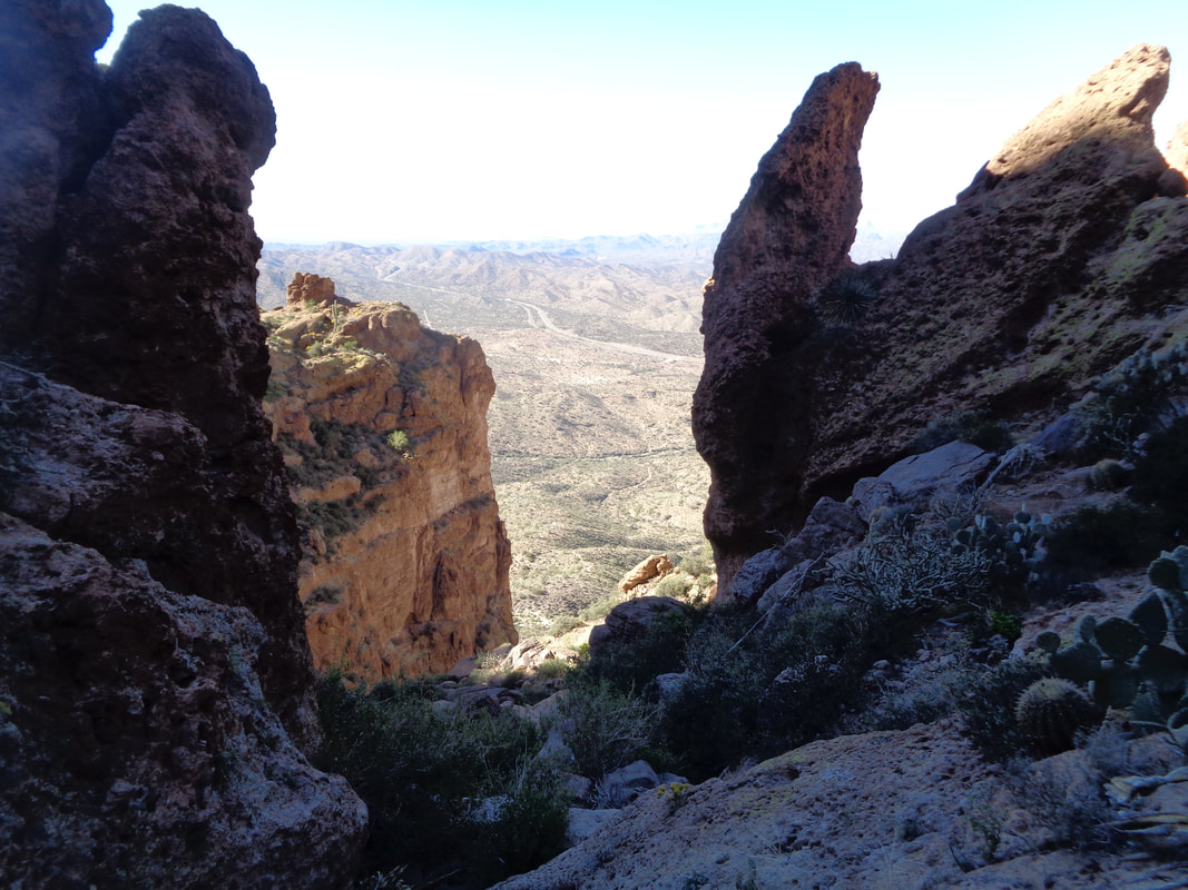 I climb through the notch and occasionally have faced..... 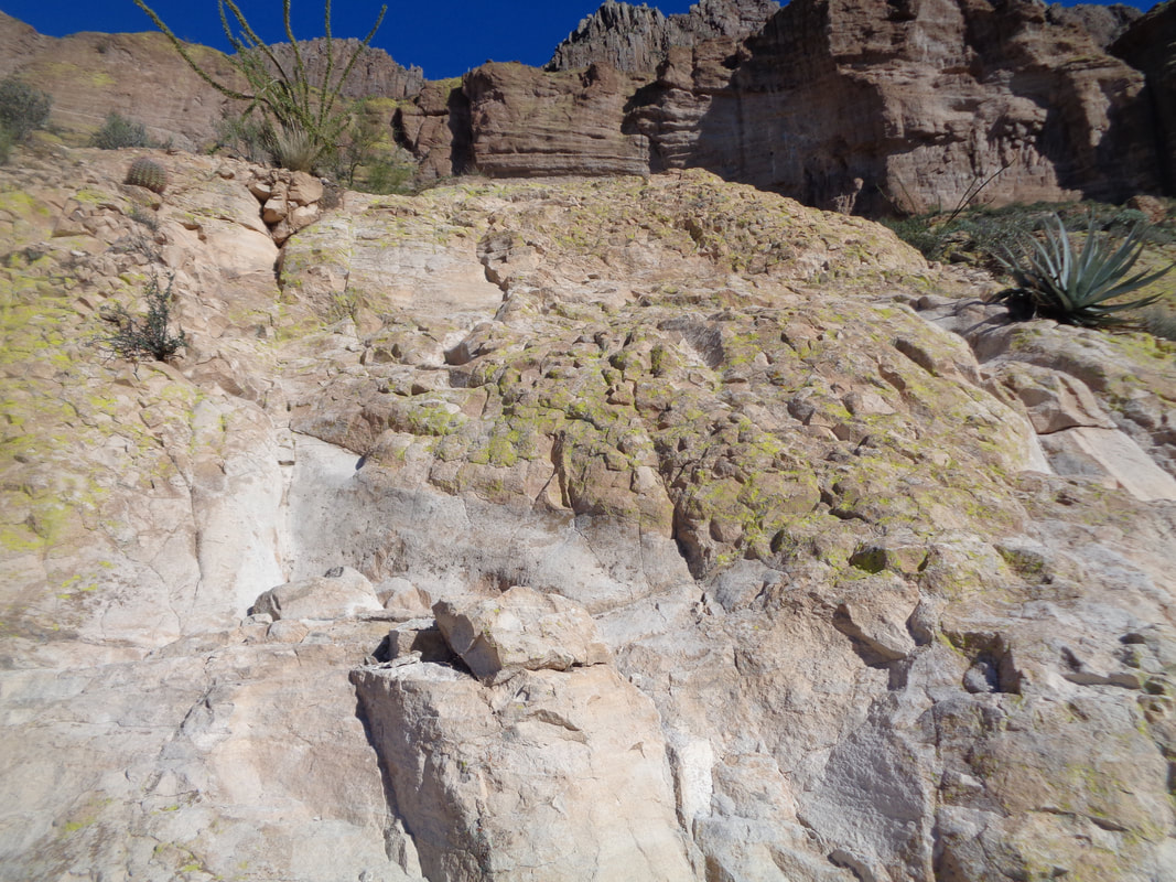 ….these fun "walls" to climb. Always enough hand and foot holds to make the effort possible. Once the climb out of the canyon is finished, you are faced with a slight incline to first one false summit and then..... 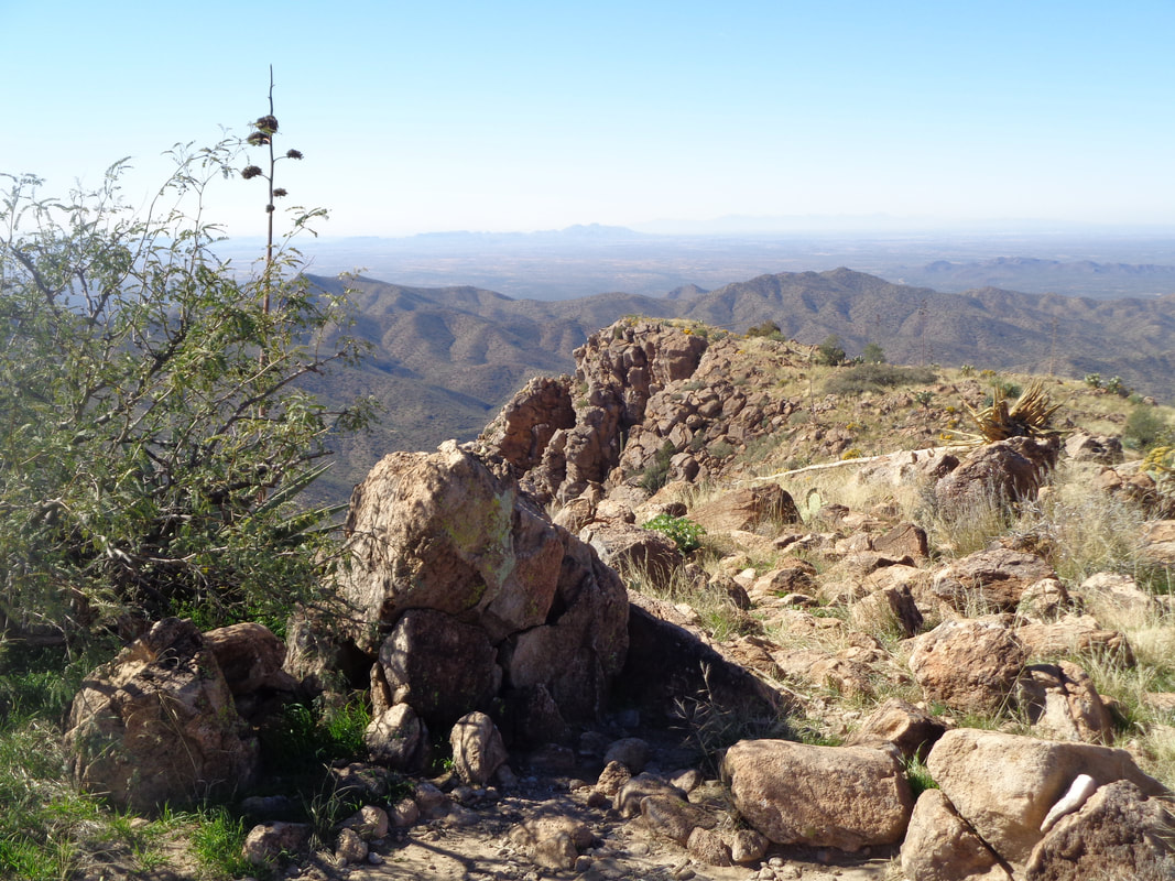 ….at mile 2.3 and 2000+' of climbing, the top is reached. The views in all directions are spectacular even when.... 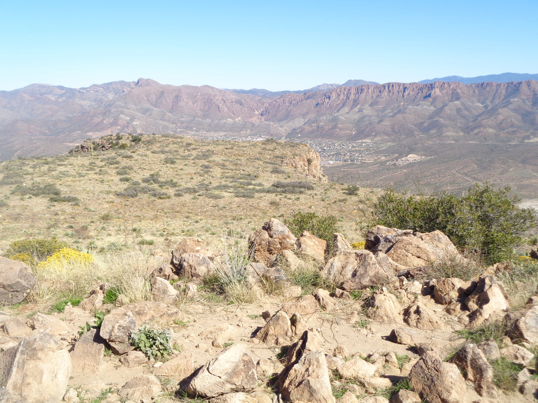 ….looking down at the town of Superior to the east. One of the fun things about the hike is visiting the.... 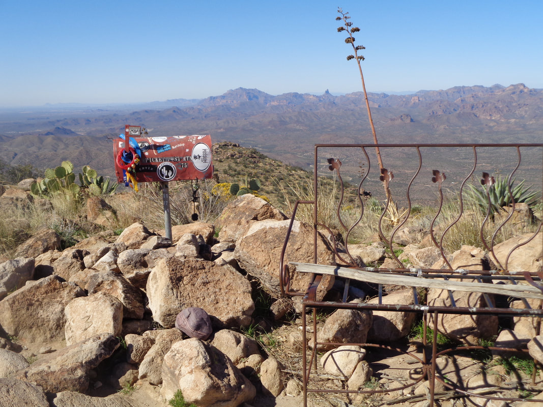 ….mailbox. The bench was brought up many years ago but mostly only the frame remains. 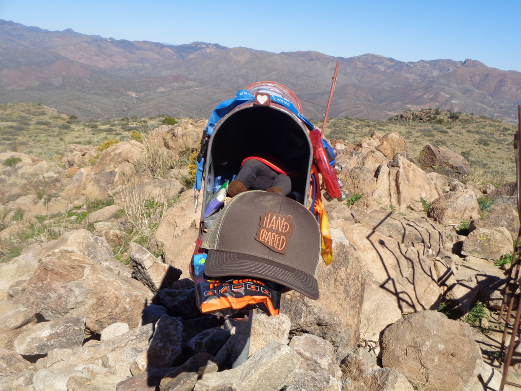 Various items have been stashed inside the mailbox including the hat that had a message that you should take a selfie while wearing it and send to an email address. I found a notebook where you can sign and date so I did that and leafed through the pages. 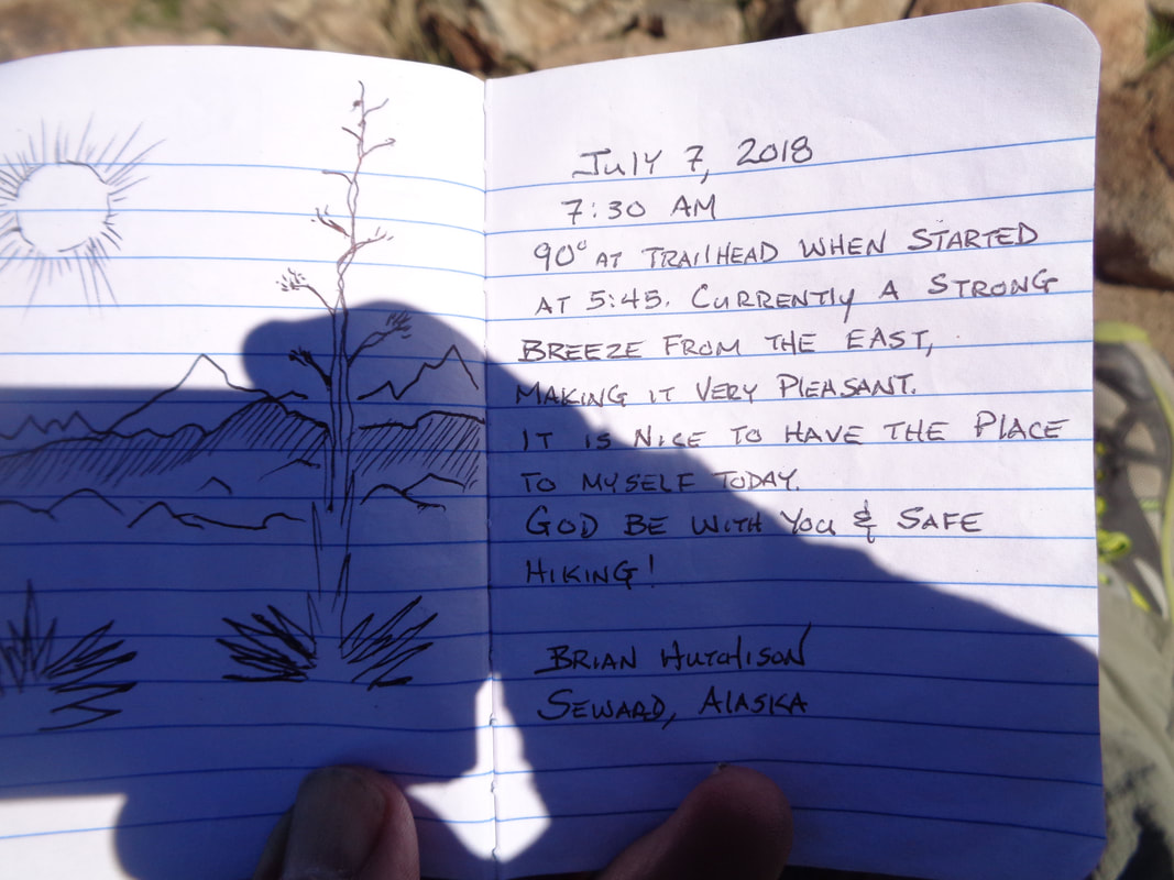 This message caught my eye with the simple drawing. 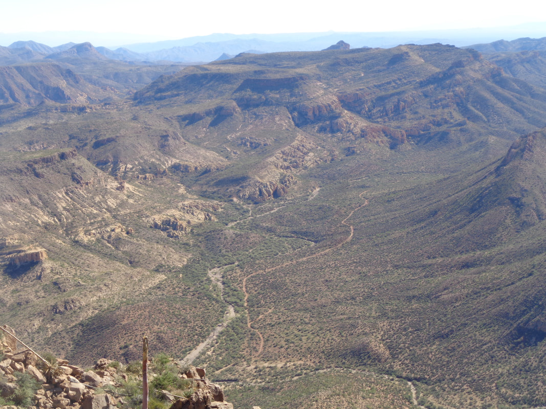 As I look around, I marvel at all the trails and washes that go into the distance. I really need to get a mountain bike for out here. I look at distant ridges and always wonder what it looks like from there. Hiking isn't always an option. 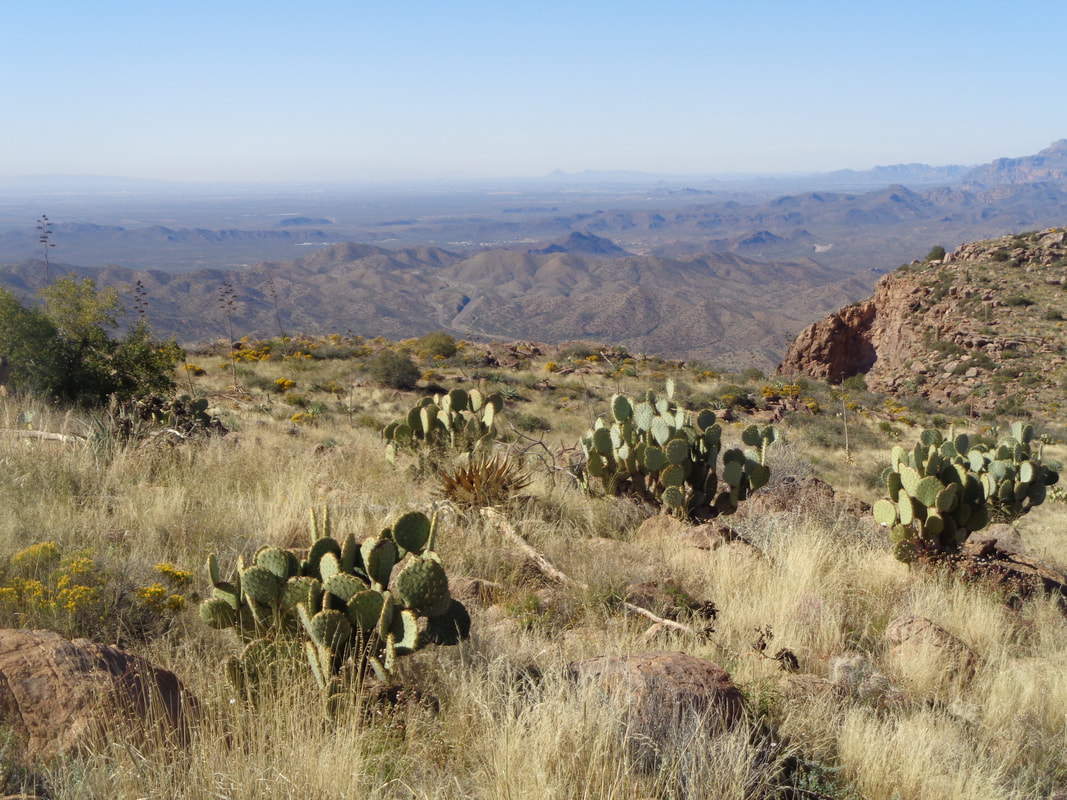 I begin my descent. Toward the end of the hike, a large cow stands astride the trail. Oh great. Now what but as I approach, it walks off and I notice there is.... 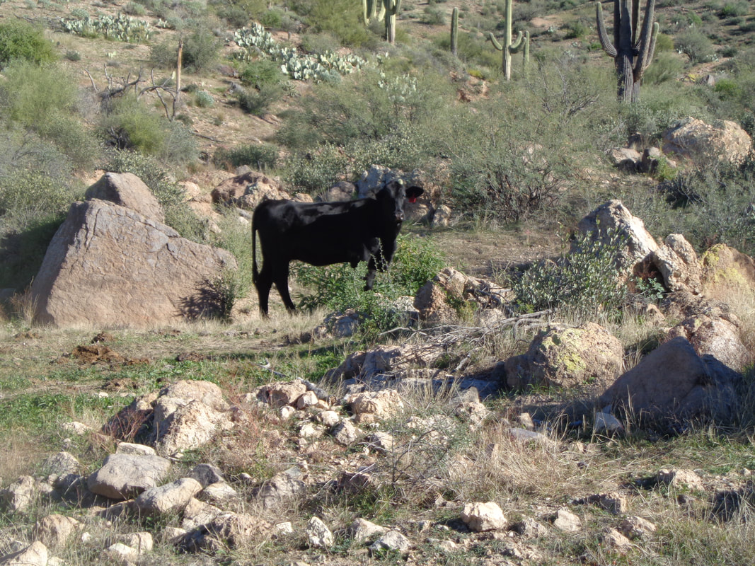 ….a Jumping Cholla attached to its head. Wonder if it is aware or bothered by it. I very briefly think about walking over and removing it but common sense takes over and I end the hike instead. The annual El Tour de Tucson is Saturday and then I am leading a group hike on Sunday.
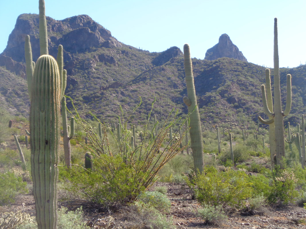 Right of center, in the distance, today's destination, Picacho Peak. Looks kind of steep and it is. Not exactly what I needed after doing Rincon two days ago but the day was cool, high in low 60's so rather than a ride, a hike it is. 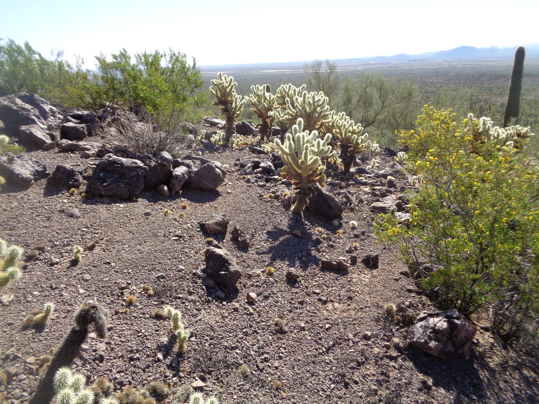 I depart from the Sunset trailhead rather than the more popular and much more direct Hunter Trail. Using Sunset as the launch point gave me 2 miles of rolling hiking to loosen any stiffness. Via Hunter, it is steep from the get-go. The desert this far west of the mountains is more barren then what I usually see. 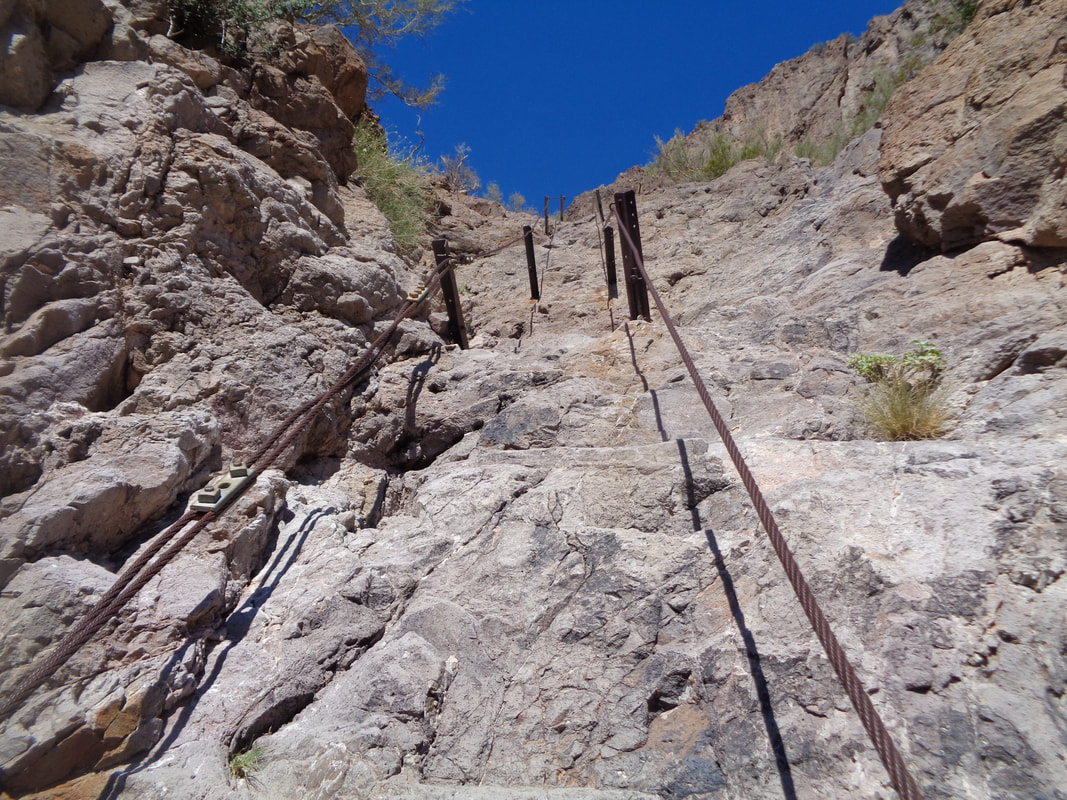 At about mile 2, the climbing begins and soon I face the first of several fun cabled sections. I enjoy pulling myself up this wall, looking for foot holds. Eventually I reach..... 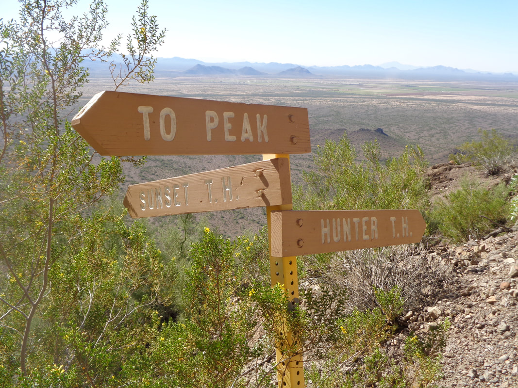 ….the intersection with the Hunter Trail, hang a right and head to the peak where I soon.... 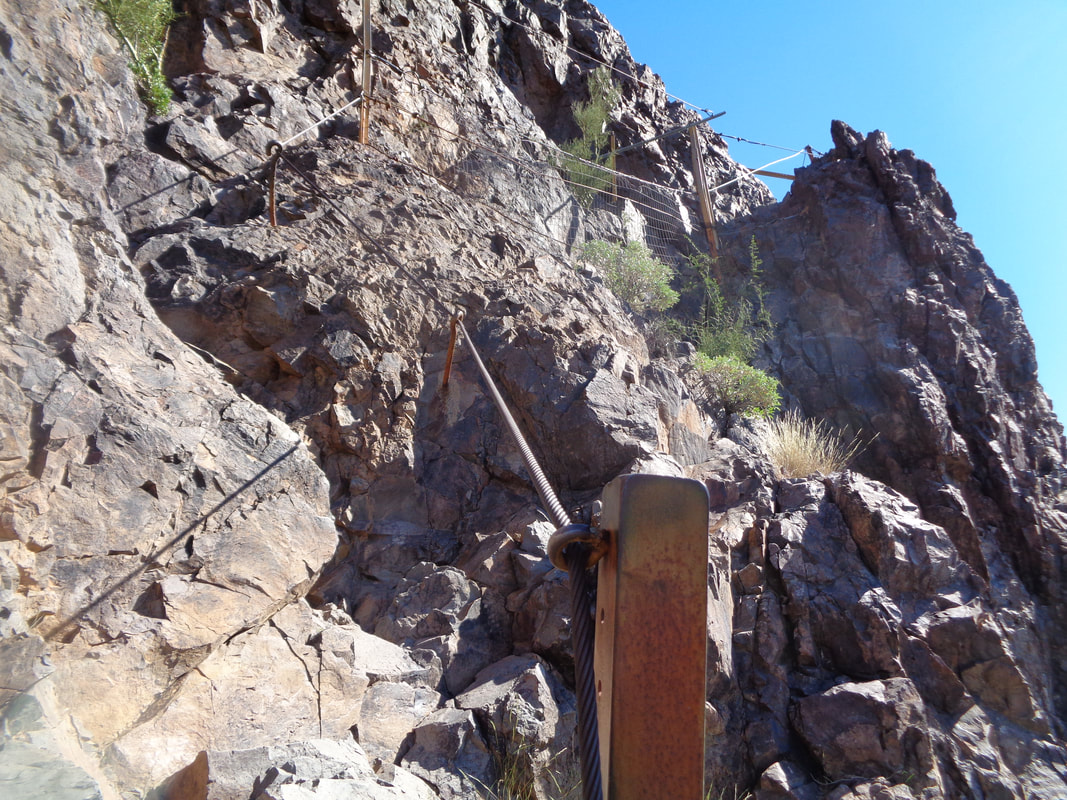 ….more cabled sections because..... 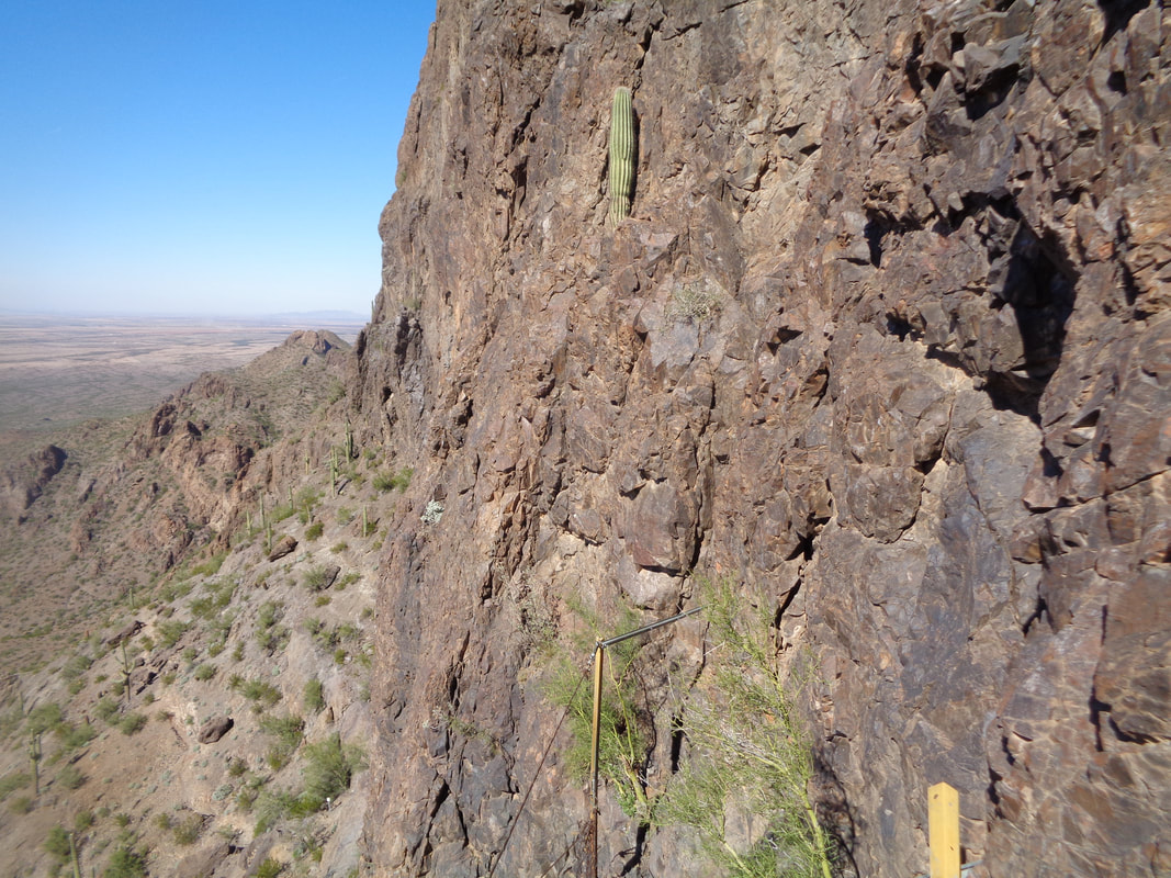 ….it is way too steep to ascend without the assistance of the cables.  Yet another. Each section is broken up by the standard steep walking. Just want to make sure when you begin going up the above, you are not too fatigued. A careless slip could be fatal. 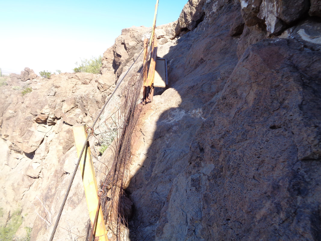 A final section that even has fencing so you are caught should you lose your grasp of the mountain. Also a bridge to get one across a part where there is no other way to proceed. 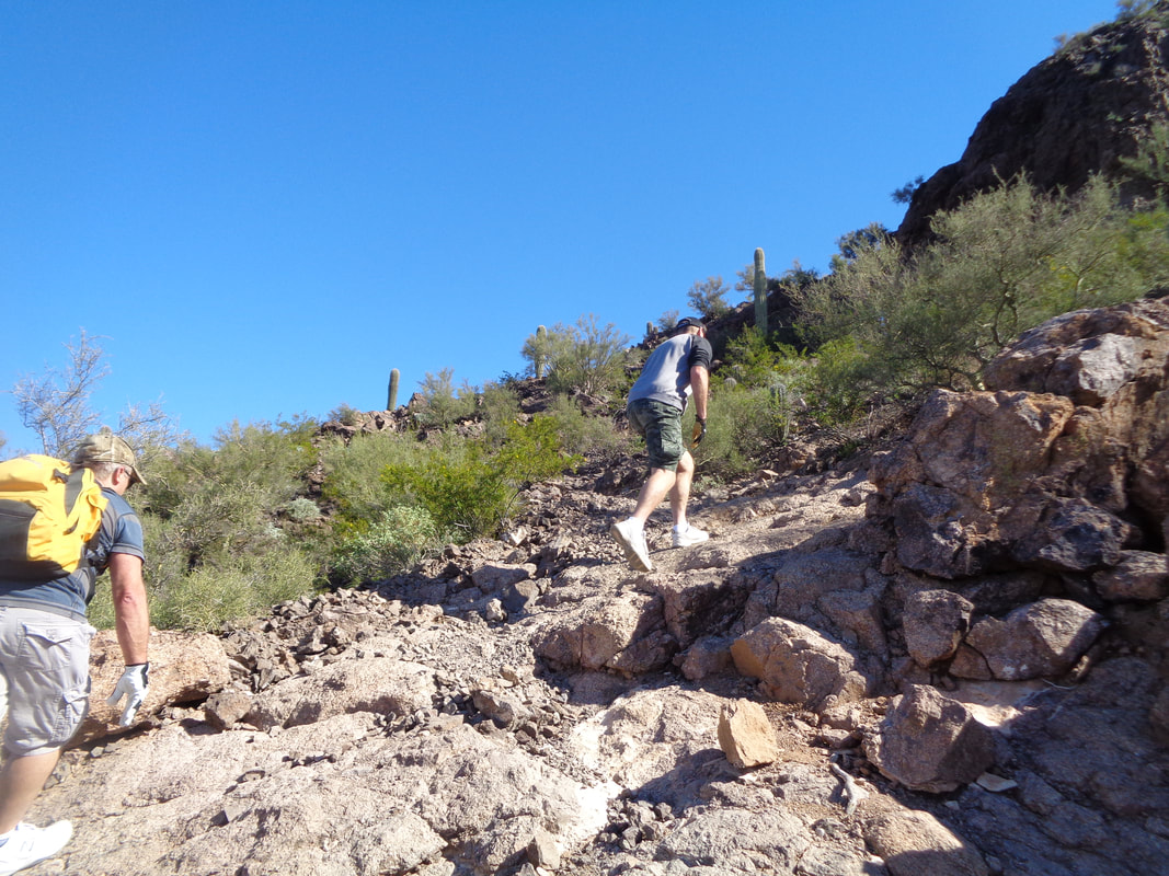 At last, the final slope and soon..... 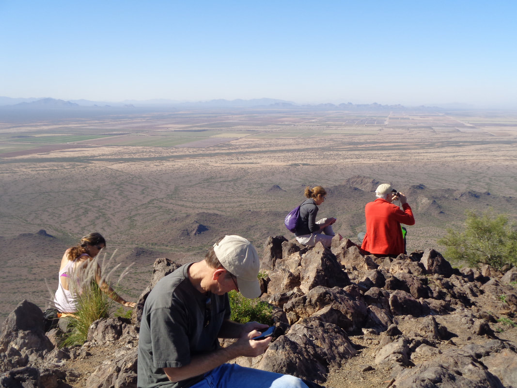 ….on top enjoying the views while some of their noses buried in their phones. Actually, all enjoyed the views and were sending images to friends. The couple on the right are visiting from NH, the guy in the white hat from WA. The sky to the west was obscured which we guessed was smoke from the fire around Malibu. 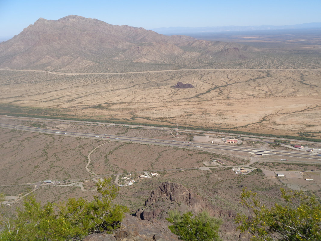 Across I-10 sits Neumann Peak. Brutal that one. The final .9 miles of today's hike is an average grade of 27% which I thought low considering how many 80-90% walls I had to climb. The total hike to the peak was exactly 3 miles and 1650' of climbing. I always hesitate to post my hike time or Strava accomplishments because I don't want readers to think I am bragging. But, the intent of keeping this blog going is to give me something to read when I am in assisted living and have forgotten this stuff. So, 1:08 total time to the top and along the way I set some new course records. Note to self in the future. There is something called Strava and you may still have an account. Have nurse find it for you. Ha, ha.
 I drive about an hour to Benson where I meet a group of 8 who have come down from Phoenix to hike Rincon Peak. I drive my car, thinking I can make it to the trail head as I did a couple of years ago. The final 12 miles to the Miller Creek trailhead is dirt. I observe a truck in front go through a creek crossing above its axels. I stop. Can't risk that and am picked up by a following SUV. 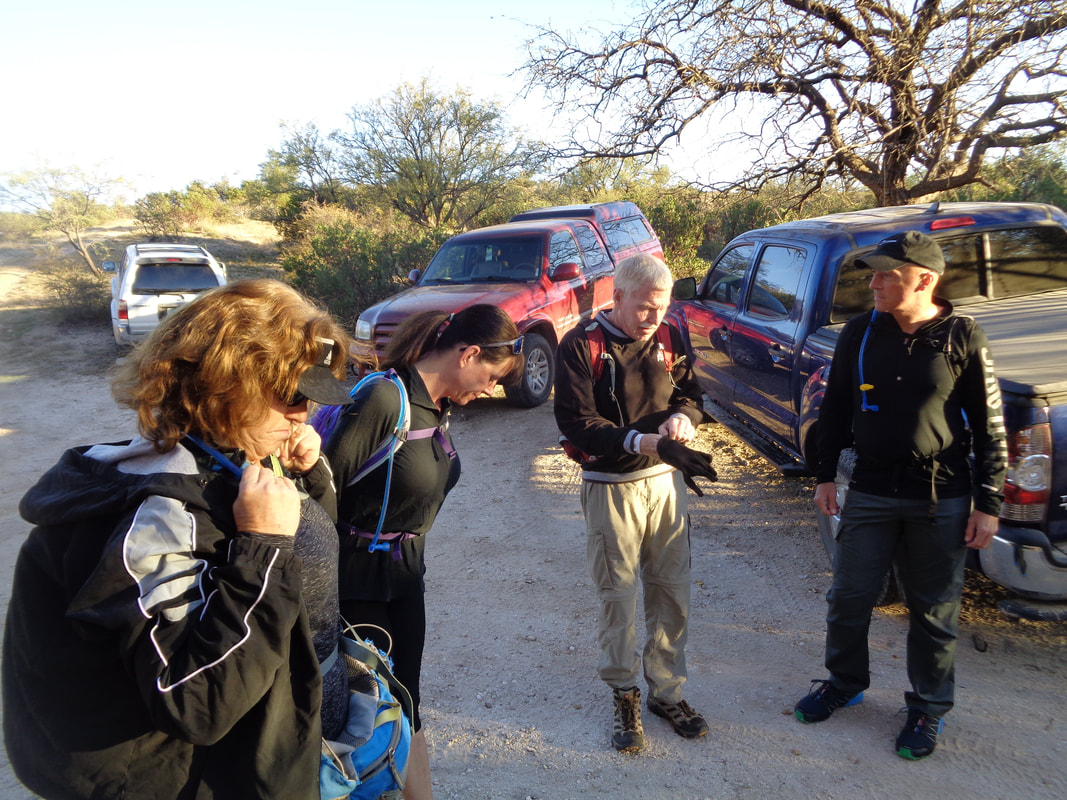 Among this Phoenix group was Gina, 2nd from the left and next to Elaine. She is the real deal. Ultra trail runner and hiker. Everyone knows who she is. Our host to her left, Bill. The guy has an encyclopedia knowledge of Tucson area trails and very fit too. This is a new group with whom I just became a member, "Arizona Strong Hikers." How about that for a name!!! I had to show I was worthy and I had Strava segments to goad me too. That's like the perfect cocktail mix for me. 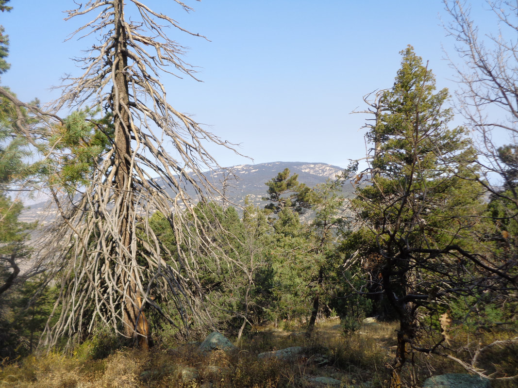 We begin the hike with a fairly flat crossing and recrossing of Miller Creek. We reach a sign-in post and Bill asks me to mark the appropriate boxes. A couple of guys take off (Gina began running at the beginning and so was far ahead) so now the game is on. This trail has few views beyond..... 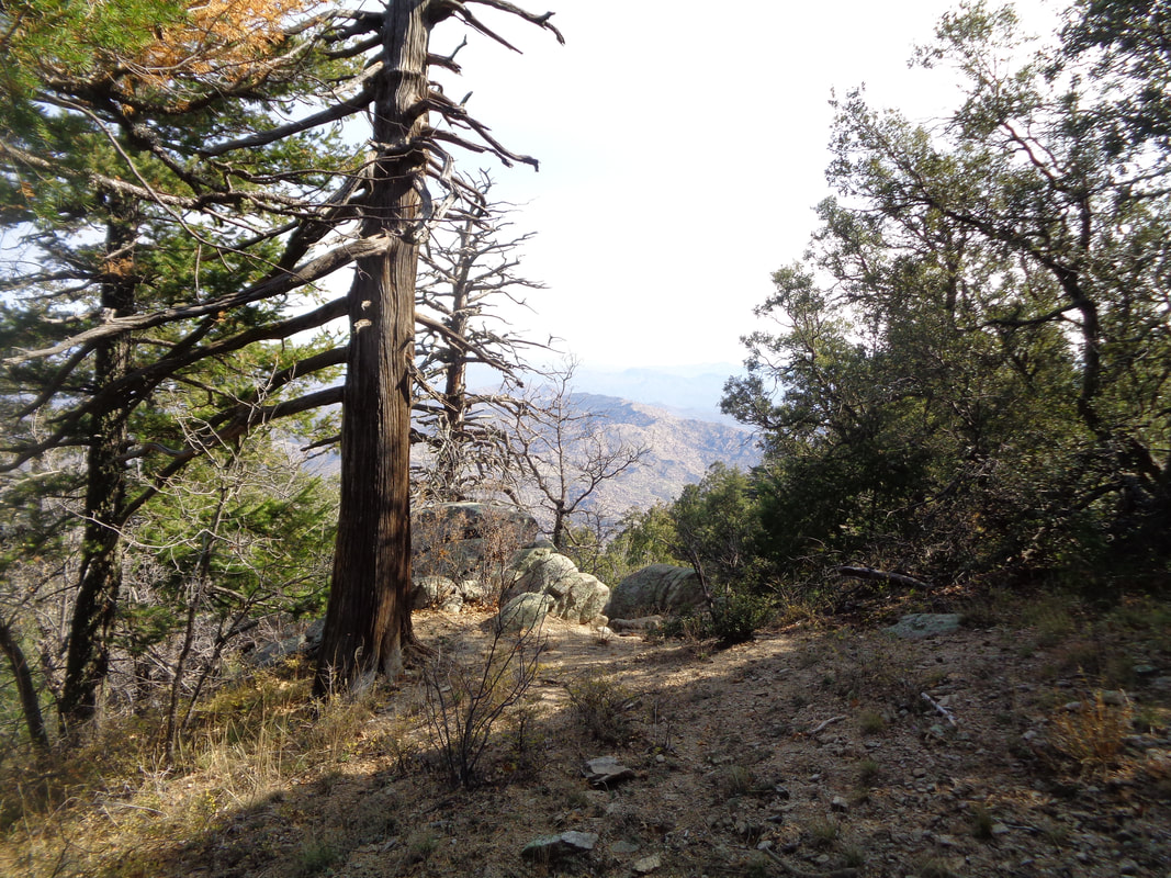 …..the dense vegetation but those that are there are very nice of distant peaks and the valley below. It is 4.5 miles to a respite known as "Happy Canyon" so my plan is to hit it hard to that point and then evaluate. Geesh, the miles to the canyon floor above are a twisty morass of boulders/sand/rock hopping, but at last I pass through a shady and lush riparian zone that comprises Happy Canyon. The trail is bound my by mature pines. What a relief after the steep climb. I reach a sign for the "Rincon Peak" trail and soon, even more serious climbing begins.....  ….in earnest. This is what a 25% grade looks like and I know, the image gives no suggestion of the slope. The final mile is an average of 25% and the final half mile is 30%!!!! Having not done a hike of similar distance since spring, I thought about spitting the bit and turning around. Eventually, I spot sheer granite rock and know I am close. I crawled at times, no kidding as I was in agony. My previous longest hike this visit was only 9 miles.  I sign in to the summit register the usual way, "GO BUCKEYES" and my name. Nooooo. You can barely see it upper center but the peak is still so far away. Now vegetation slips away and I'm navigating through boulders but finally...... 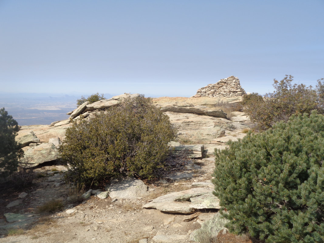 ….the peak. 8 miles and 4500+' of climbing. The rock pile has been assembled over time by hikers as a monument of sorts and is 6' tall. It provides a good wind break as it is very windy and cold too! I'm the first to reach the top but frankly, I am pretty sure had she been motivated, I would have been 2nd to Gina. 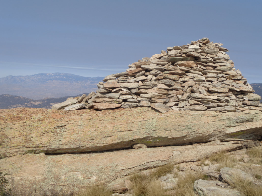 Sheltering behind the monument, I load the ascent on to Strava and am thrilled with the results but the leaderboard is kind of small. Probably only on average, 1 group a day attempts this hike. I can see all the way to at least Iowa from here! 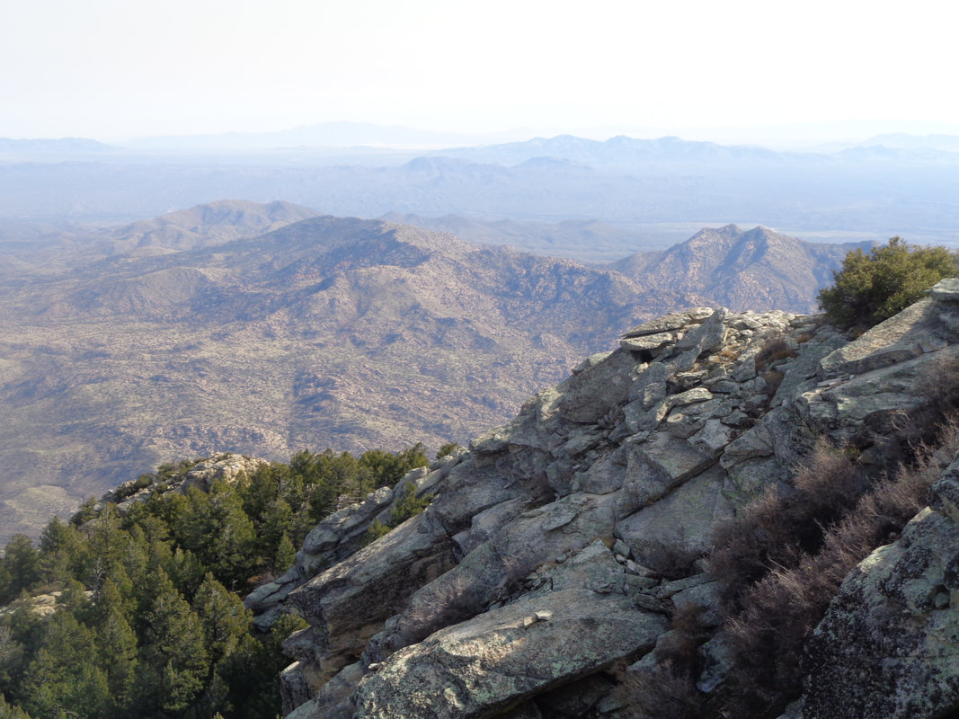 The real prize is the views and the feeling of accomplishment that goes with finishing the effort. After 15 minutes of gawking, I begin the steep descent. I assume I will barely be able to walk the next day after this joint pounding effort. 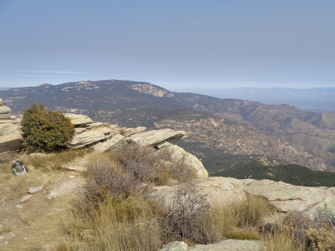 A final look around. I descend and meet the others coming up who wisely chose not to go into death march mode. The descent takes longer than the ascent and there were many piles of bear scat although later I was told they were from Javelinas. Well, Javelinas can be dangerous too! Finally, the grueling descent ends and Gina takes pity on me and gives me a lift to my car. About 2 hours later, I was sitting in the spa. Damn did that feel good. I was surprised to discover my legs felt pretty good this morning so will do a short ride. A cold front moved through Sunday evening so the highs for a couple of days will only be in the 60's.
 I took this image at the end of the hike because in the morning, the sun was at the above ridge, my destination. I had not done enough research so my knowledge of where to leave the main trail, signed as "Massacre Grounds" and begin bush whacking to the ridge was non existent. However....  ....I knew there was a small group ahead of me and thought if I could catch them, once on the route, I could find my way. I encountered a guy and asked if he had seen a group and he said no but that there were a couple of people ahead. I was walking about as fast as I could through these gentle slopes.  I caught the aforementioned two people and asked them about a group and they said they were about 30 minutes ahead! Yikes, more ground to make up. They must have started before the appointed 7am while I started at 7:40am. The views become more special as I rise above the desert floor.  The terrain becomes rockier as always when you approach the Supes.  I'm still on the Massacre Grounds trail but stopping frequently to listen. Maybe if I hear their voices...and I do! They are midway up the rock formation, right of center but how do I reach them as they are now off trail. I keep going, looking to my right for a clue for the exit. 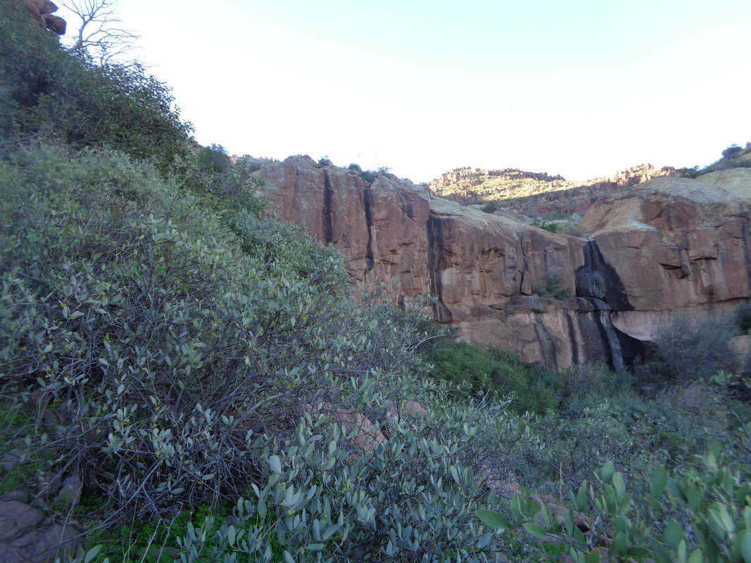 The trail winds toward the above wall. Thinking the trail ascends that somehow but no..... 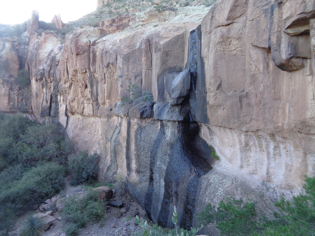 ......it stays low and passes in front. I poke around but the trail ends here. I retrace my path, annoyed that I missed the exit and have lost at least 20 minutes. Heading back, looking carefully, I notice a very faint path. The path disappears but there are enough cairns (rock piles others have left to follow) that I begin to make up ground and..... 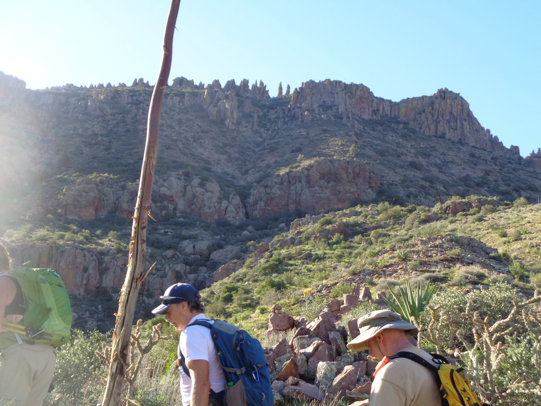 ....the catch is made. Kind of proud of myself and route finding was a lot of fun. I was not part of the group so did not want to interfere. Take a look at the upper portion of the image. See those two kind of distinct pillars like goal posts that stand alone? That is what I did read was the exit from the route. 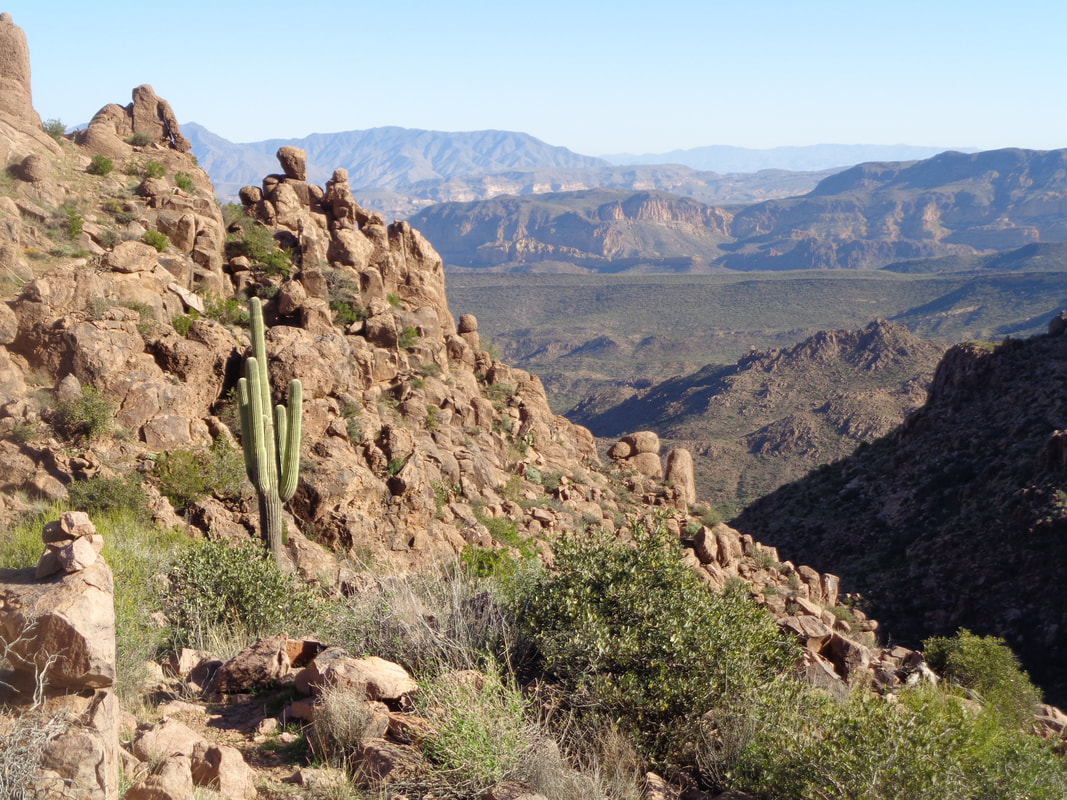 I reach a cairn, stop, look for the next one, reach it, stop, etc... All the while the view is such a nice distraction. 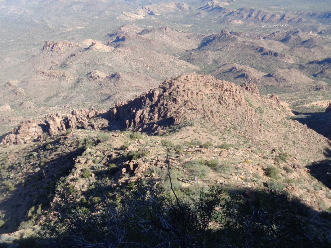 Maybe you can spot the others below me. Super steep through here, rugged, boulder hopping, scrambling, gawd I love it. Exciting stuff to me. 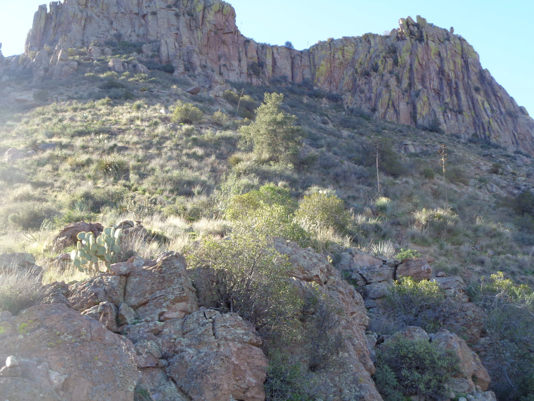 The final slope. The average grade for the final 1 mile is 27%. If I was on a bike I'd have to push it. I was walking so stooped over because of the slope my hands were scraping on the ground. Just could not stand straight. 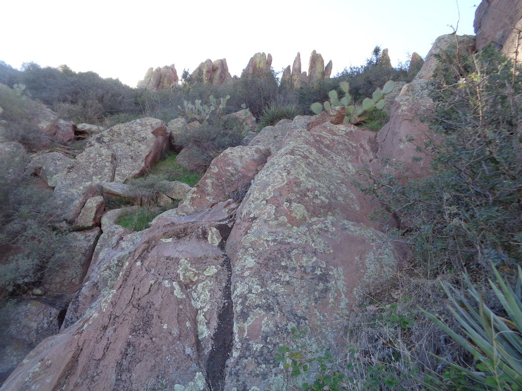 The last pitch and the going is not obvious. I probe several places and at last.... 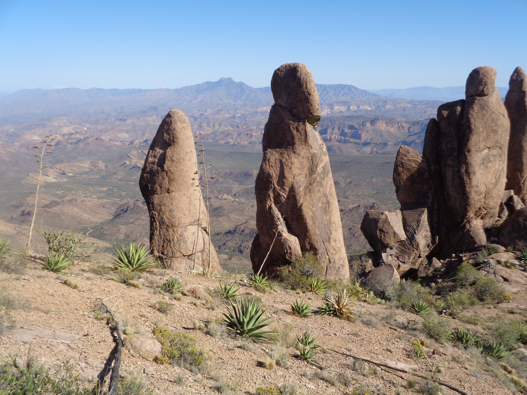 ....emerge to be greeted by this strange alien looking spire. I had walked through the center of the goal posts and that too was cool. Now where to go? I had no idea. 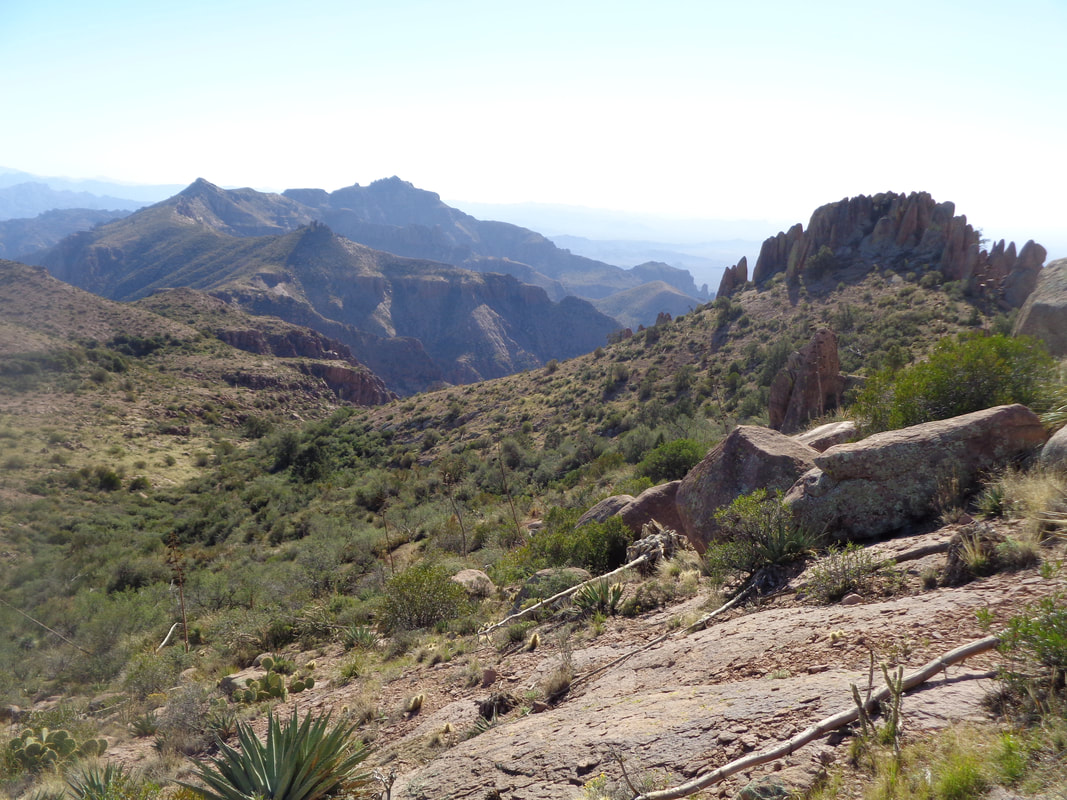 I knew where I was so not lost and in the distance is Superstition Peak so a feature called "The Flat Iron" would be off to the right. I head toward the slope to the left of the rock formation. 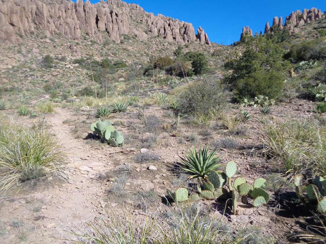 I reach a ridge, look down, see what I suspect is the "Rridgeline Trail", reach it and follow it up and over another ridge and.....  ...eureka! The Flat Iron, so named because it resembles an upside down iron.  I follow the well defined Flat Iron trail to Jacob's Crosscut and march through a wonderful, undulating plain. I reach my car with 9.2 miles and 3400' of climbing. Hard hike and a lot of fun.
 Not from these funky looking monsters, their arms swinging but some pointy plant got me in my left hip and I can't reach the spines. More to come on Monday's hike.
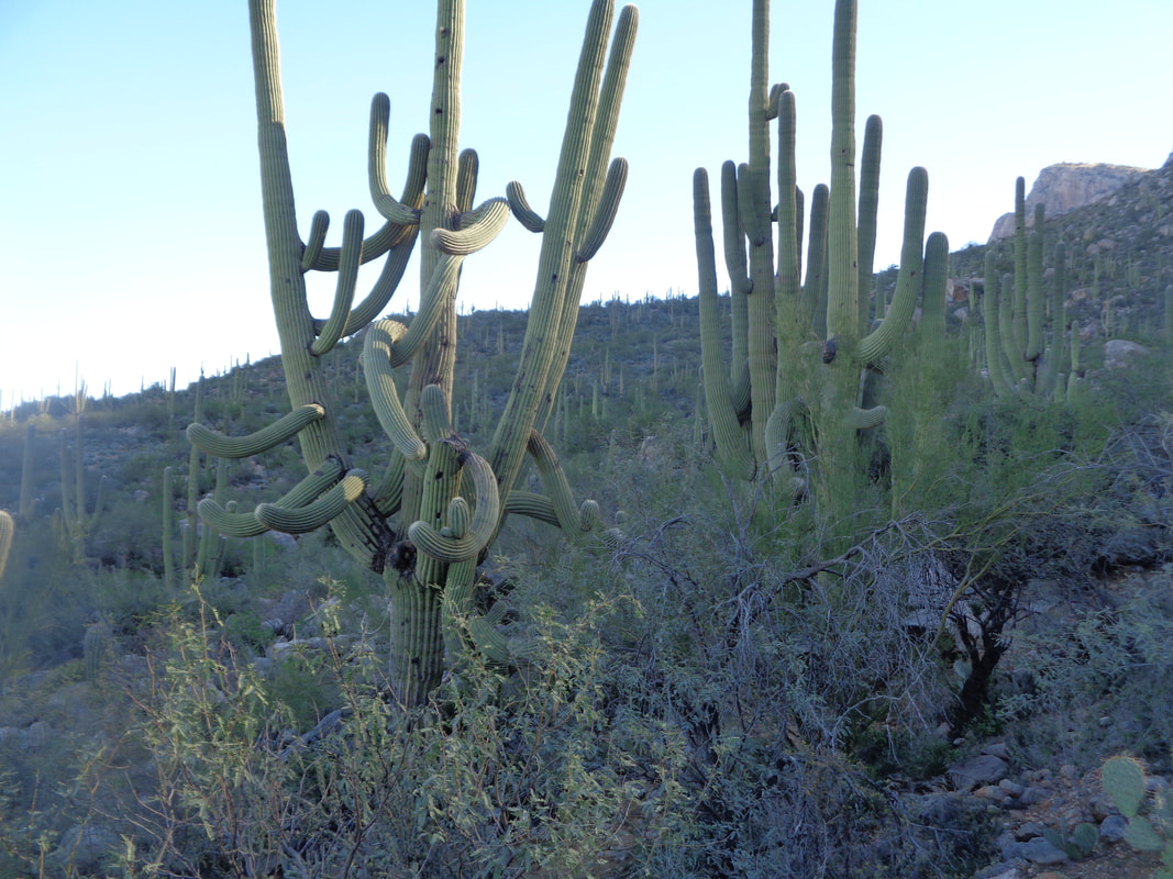
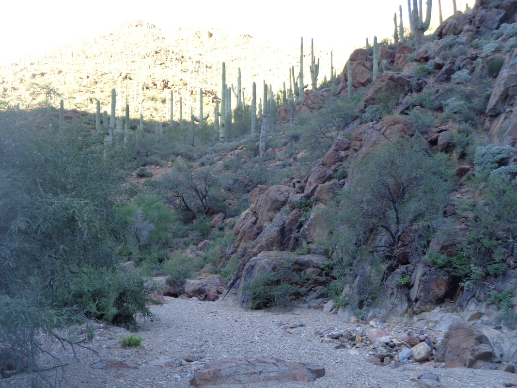 One of the hiking groups to which I belong, put out a short, 4.5 mile hike for Saturday morning. It was in the Tucson Mountains where I rarely visit. Always found the trails kind of boring and having little variety. I did not sign up for the group, just showed up and took off. I cross a sandy wash. Hard to imagine that a couple of weeks ago, water was roaring through here. The hill side beyond is bathed in sunshine. 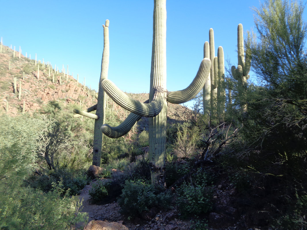 Emerging from the wash, I encounter some funky looking Saguaros. These mountains are covered in a healthy forest of Saguaros. The root ball of this cactus is very small and in high winds, you can see them sway. Amazing they stay upright. Touching one is like touching steel. 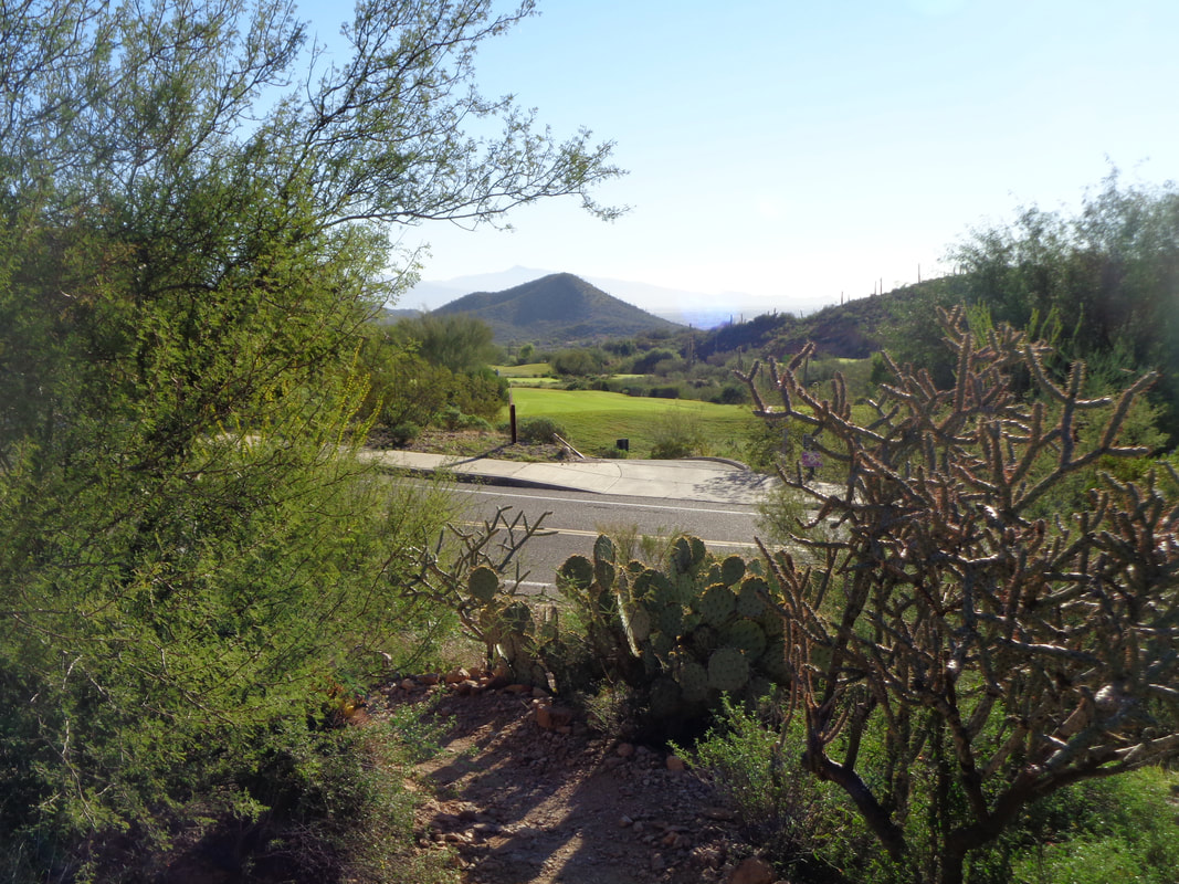 After a couple of miles, the trail spits me out at the perimeter of Star Pass Resort. I walk along the entrance road for a little bit before picking up another trail. The trail system is well signed and I am glad for that. 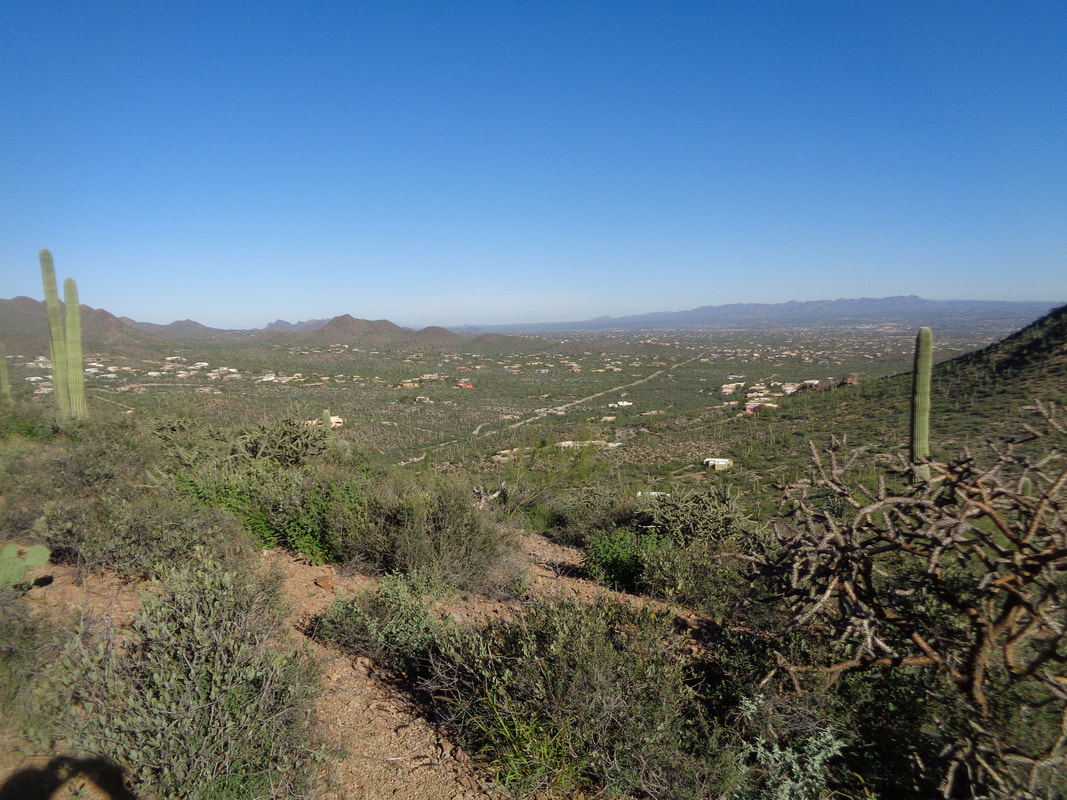 I ascend the only real climb on the route out of Happy Canyon. Thinking it a Strava segment, I go hard but pause a couple of times to take pictures. Damn! Cost me 2 spots for pausing as I finish 6th. 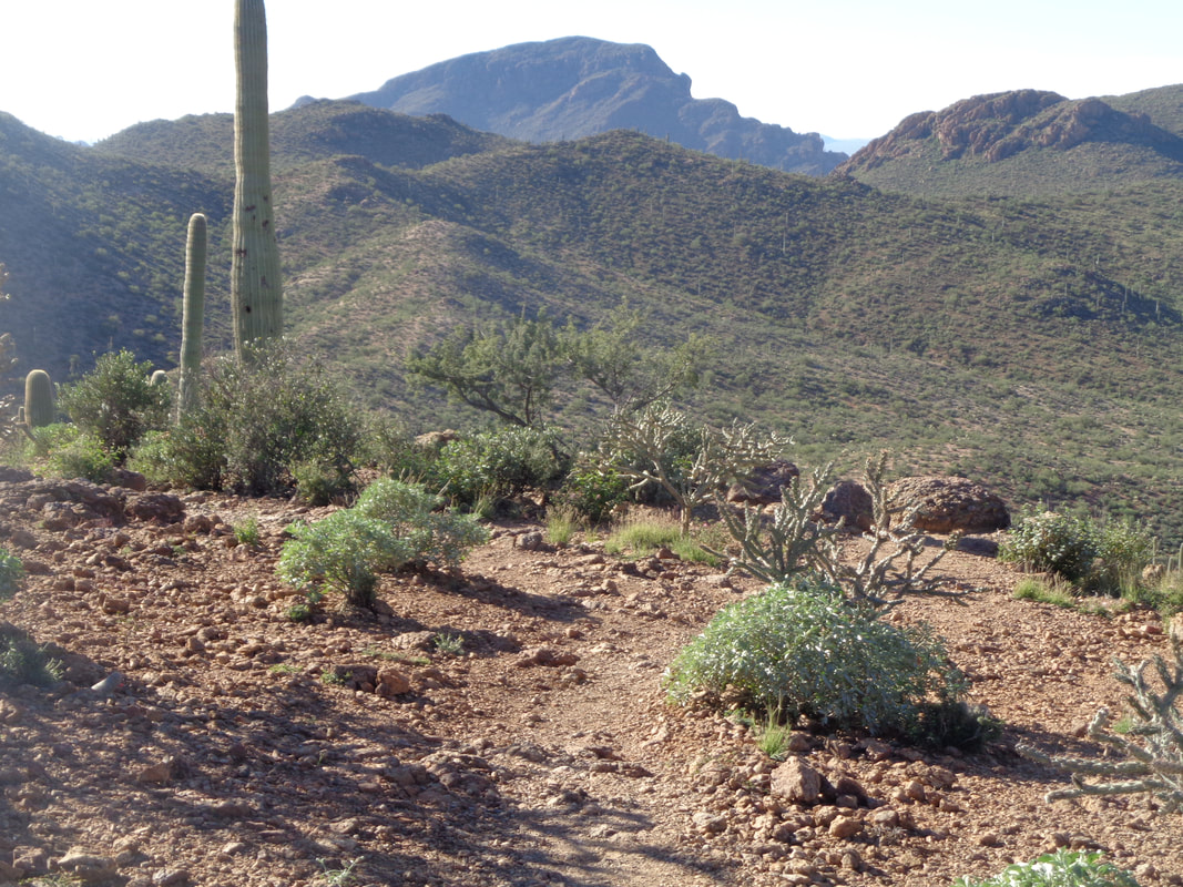 Nice but not spectacular views. 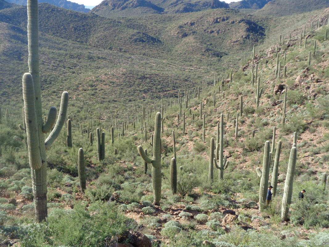 I ascend and return to my car. I noticed nothing unusual but later, police were called to the scene where several cars had their windows broken and valuables removed. The damage must have occurred after I departed. My "BH" bike was in the back seat so need to take it out prior to attending a hike. Returned home to watch another aggravating Buckeye game. Don't like the noon starts as out here, kick-off is at 9am.
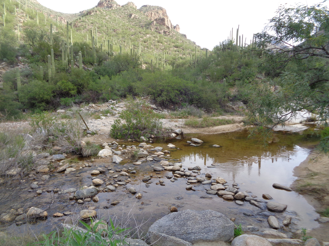 A cool day with highs only in the low 70's. Been unusually cool for October. To Sabino Canyon for a hike to 7 Falls. Entering Bear Canyon, I encounter the first of 5-6 stream crossings required to make it to the falls. Abundant stepping stones makes the crossings easy. 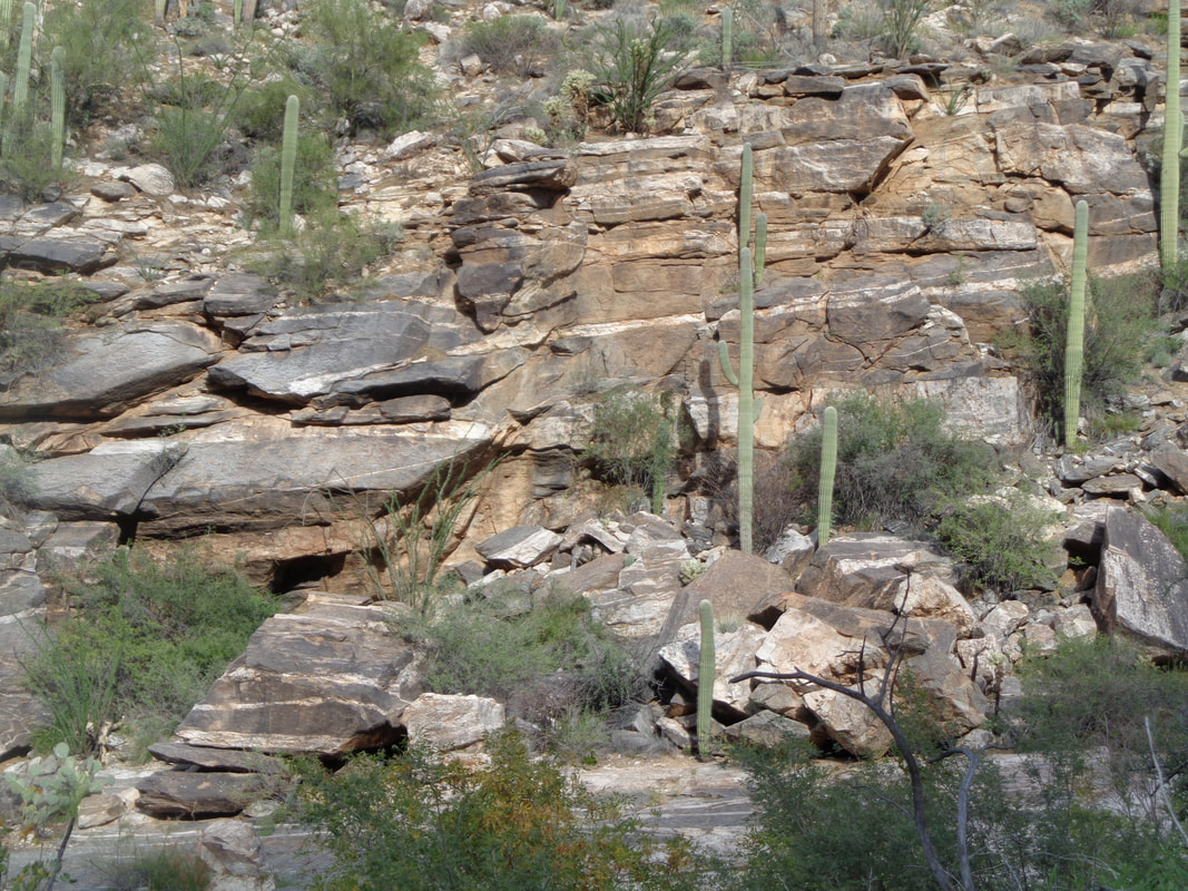 Interesting and beautiful rock strata or layers along the canyon walls. I had to skip across a rock fall that spilled onto the trail from just last week. The canyons are always changing. 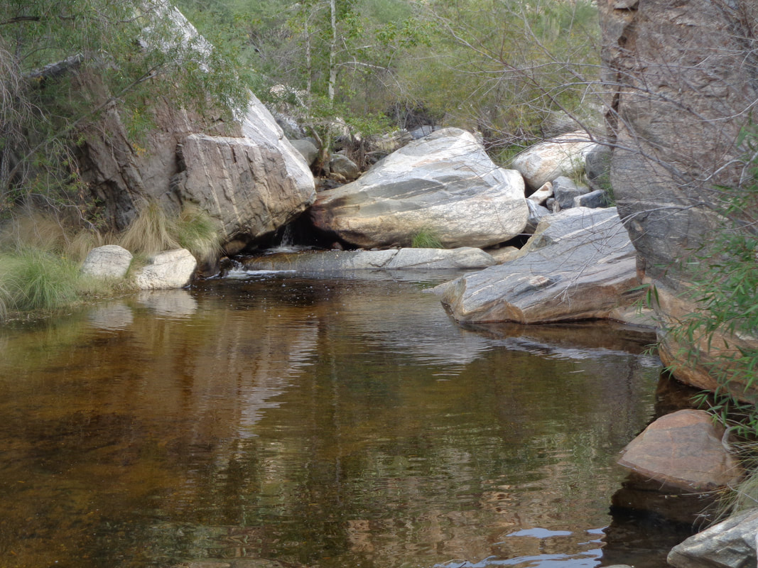 Another stream crossing with a large pool. At the 4.4 mile point I..... 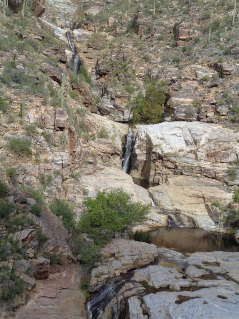 ….reached a point on the trail that overlooks the falls. Yep, there are 7 of them. 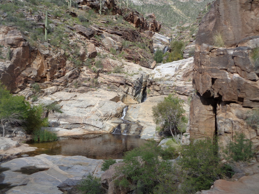 I climb down, look around, take my pack off and pick my way up a level.... 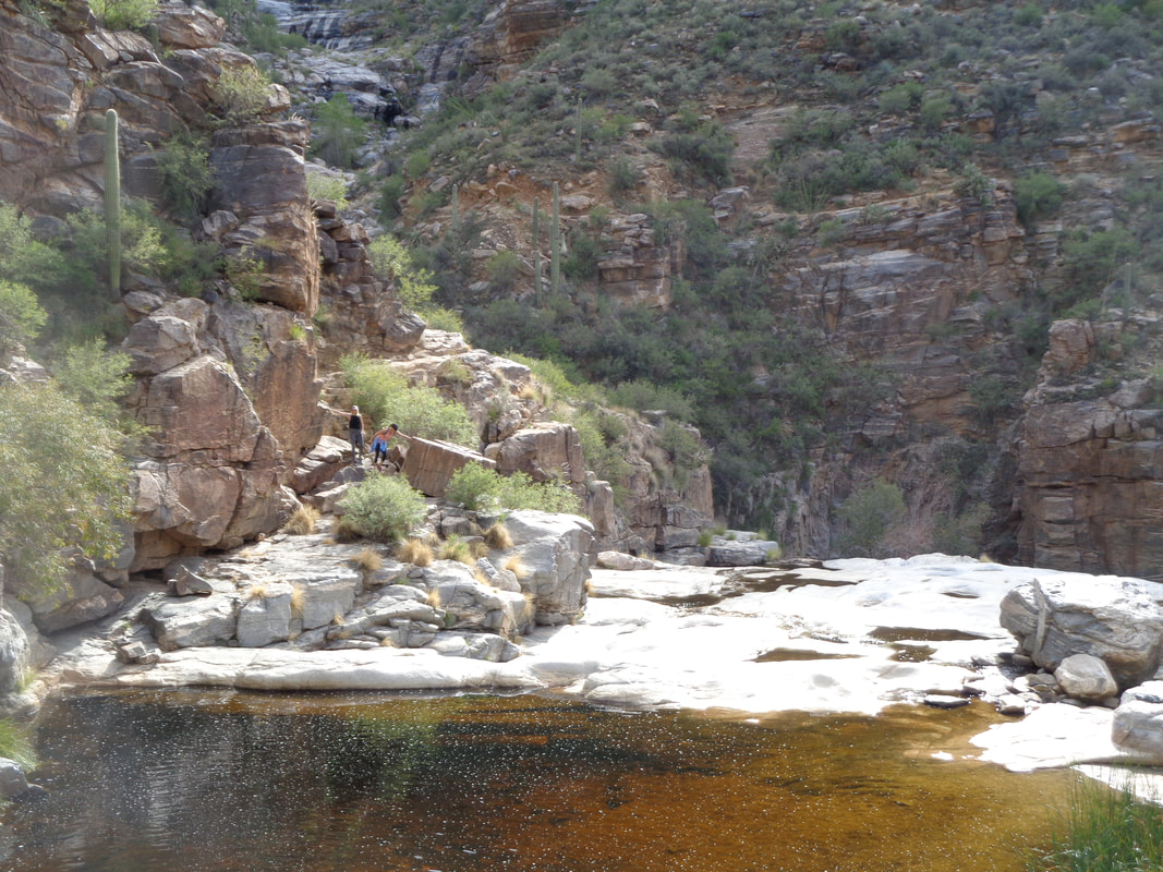 ….now looking back down from where the previous image was taken. A couple of hikers on the left are about to reach the destination. 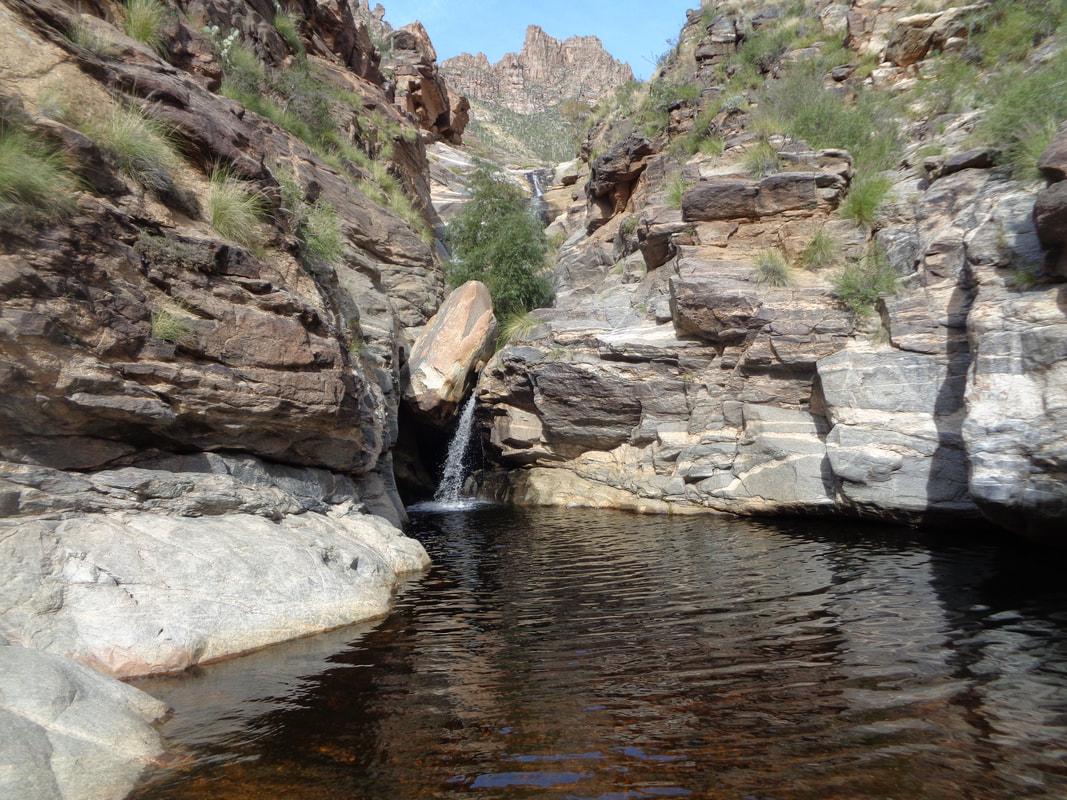 I climb up to another section. That ascent is kind of exposed and I ascend very carefully. Another pool into which the falls is pouring. Some large fish are in here. The climb to the next level is doable but looks sketchy so I head back down and begin the return.  The rains have brought lots of color to the landscape.  Behind the forest of Saguaros is Cathedral Rock. It is the high point in the front range of the Catalinas at almost 8000'. 17 mile round trip hike. Thinking about it but such a long day and so much climbing. The descent will be brutal. We'll see.
|
