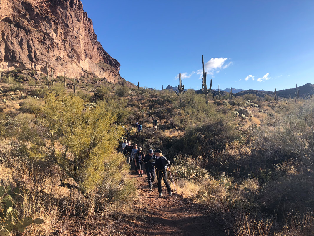
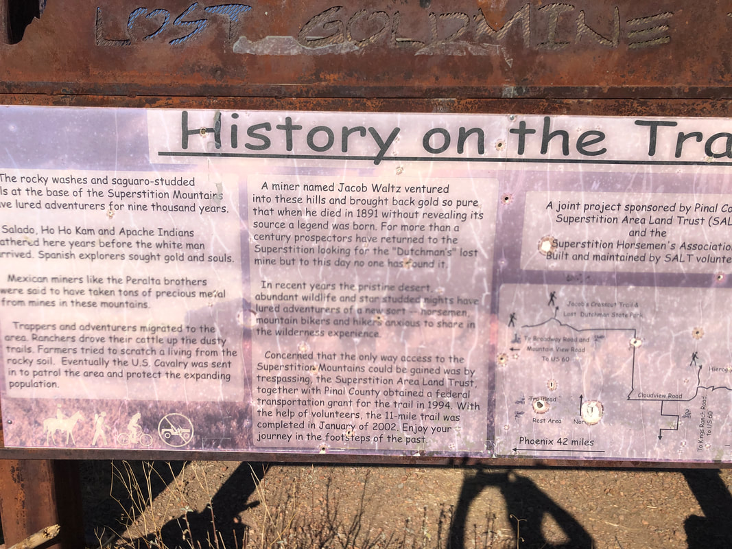
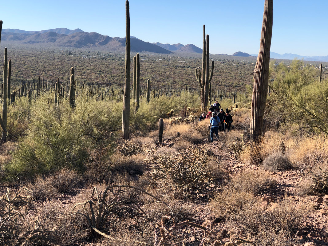
 Twelve outdoor loving, adventure seeking hikers signed up for this hike in the Superstitions with most of them making the long drive from the Tucson area. Overnight rain made the 6 miles of dirt road leading to the trail head a bit of a mud track. So prepared were the hikers that we even departed a couple minutes early...how bout that?! 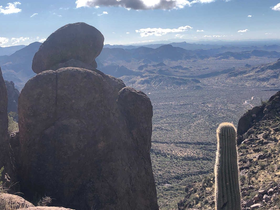 At about mile 1, distracted by conversation, I walked by the turn onto the Carney Springs trail. Kind of embarrassing but I blamed the person behind me for the mistake as they should not have created interesting content that caused me to listen, ha, ha. I got turned around and we began a long, steep climb. 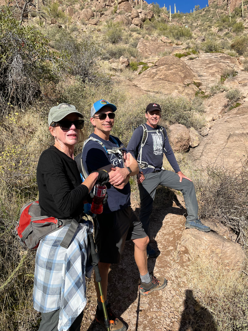 We regrouped a few times as Katherine, David and I wait while people remove a layer or two. The temp was around 50 but the sun, coupled with the strenuous climb, made it seem much warmer. 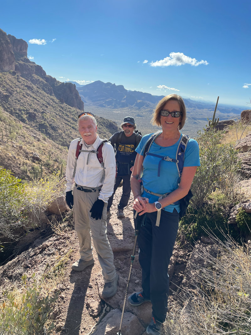 Barry, Bill and Chris seem happy on another regroup. All three are hiking machines and enjoyable company on any hike.  The Carney Springs trail ends at the Superstition Ridgeline trail where we took a much deserved break, while admiring the views. Making a right turn, we heard the sound of running water and soon..... 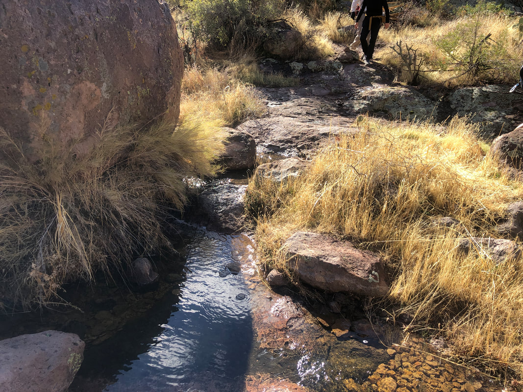 ....crossed a stream a couple of times as we followed the trail that was pretty well defined in most places. The rain had made the rocks..... 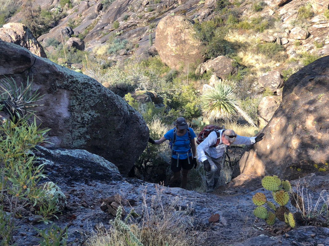 ....kind of slippery. There were a few slips/falls with David having the most spectacular followed by Dee but both immediately recovered and on we went. 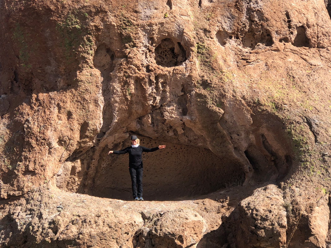 Reaching the giant rabbit formation, many of us took turns posing inside the mouth. Amy gives perspective to the size of the opening. 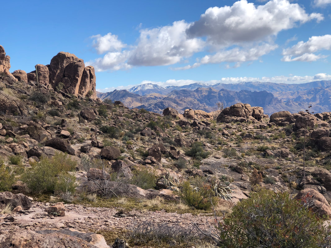 Awesome views, all around us as I searched for the correct ravine that would take us to the entrance of the Roost. 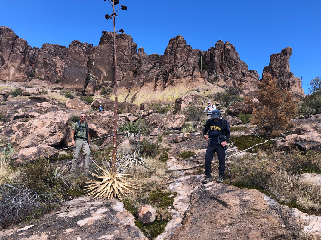 Stan (left) and Barry watch as I poke around looking for the correct approach. 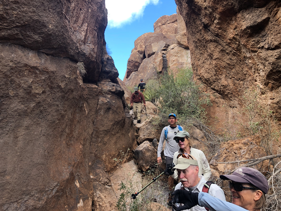 However, at last, I find the entrance and what..... 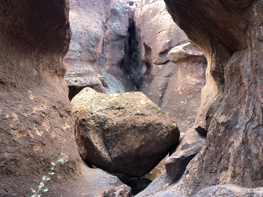 ....a grand opening it is. 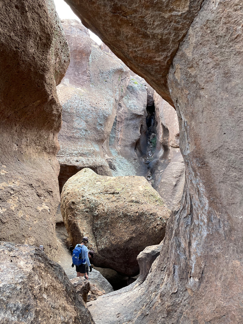 Chris provides a size reference. Stupendous as we squeeze beneath the choke stone. 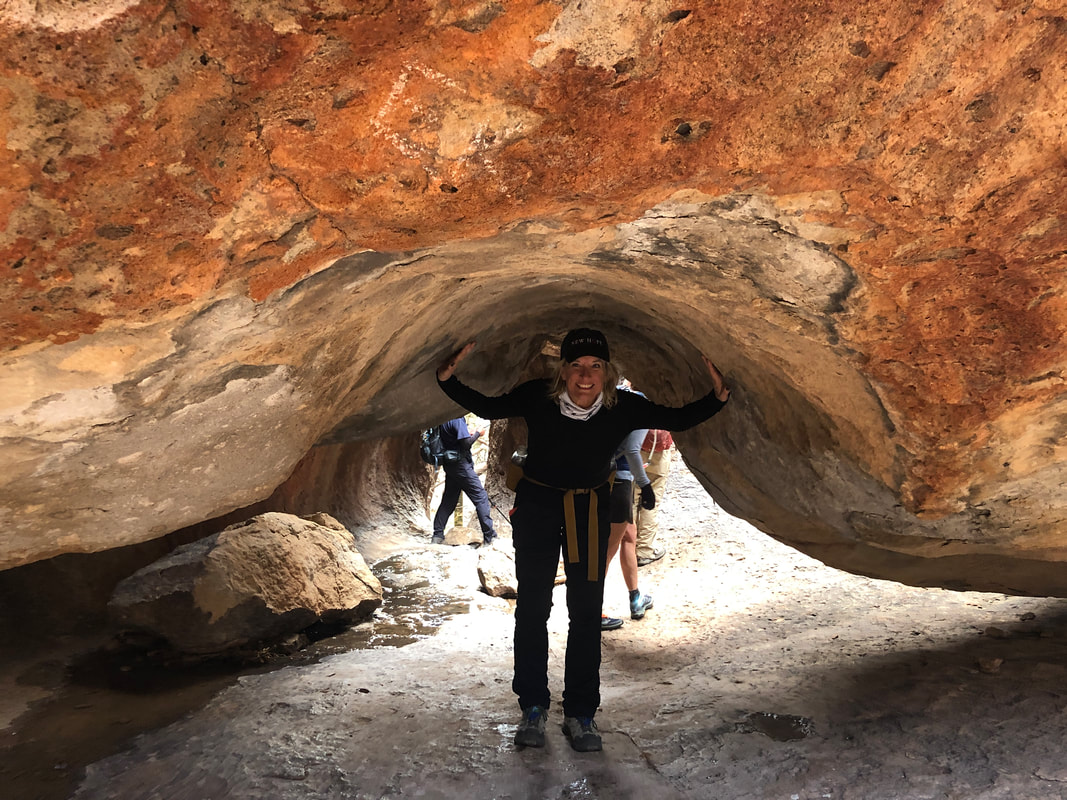 Several of us pose beneath the giant boulder as Amy demonstrates her form. The temperature was kind of chilly inside the Roost so we decided not to take our lone snack break there but instead.... 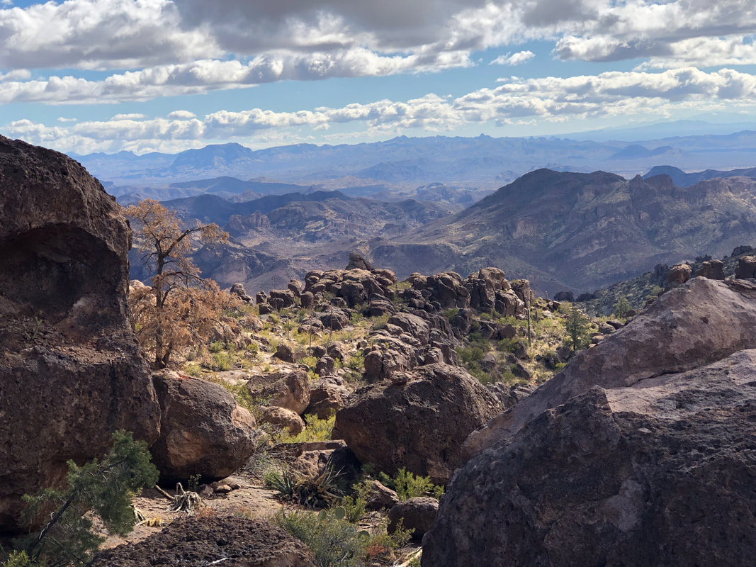 ....exit the Roost, climb to a nearby ridge with great views and sun.  Note the boulder in the foreground closely resembles the shape of Weaver's Needle in the background. We descended to a very crowded Fremont Saddle and quickly headed to..... 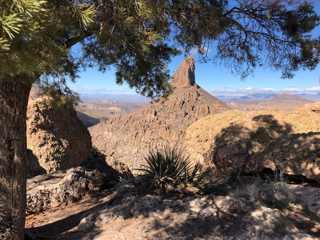 ....the Lone Pine Tree. It appears insignificant from Fremont but towers over us as we reach it where we scramble onto nearby boulders and.... 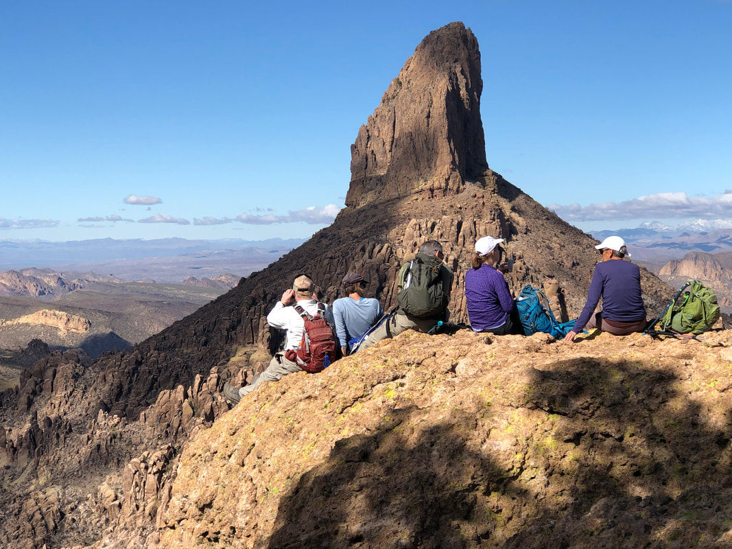 ....pause to enjoy the sight. After a few minutes we regroup, head back to Fremont Saddle and descend the Peralta Trail. This trail is one of the most trafficked in AZ and today did nothing to make us think otherwise. Our fun group finished with 9.5 miles and 2600' of climbing.
0 Comments
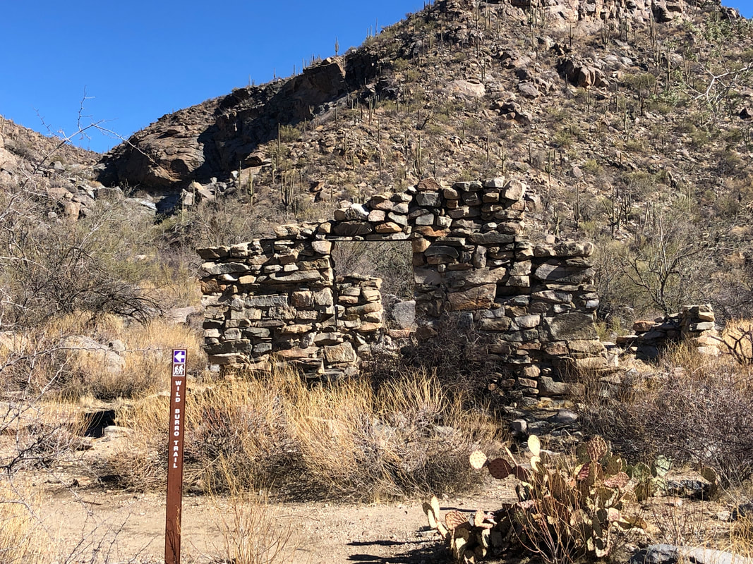 I wanted to check out the snow capped peaks and few better ways then via the Tortolita Mountains. While they too received snow, a day in the 60's probably took care of that since these mountains do not exceed 5000'. I hiked 3 miles on the Wild Burro trail before reaching..... 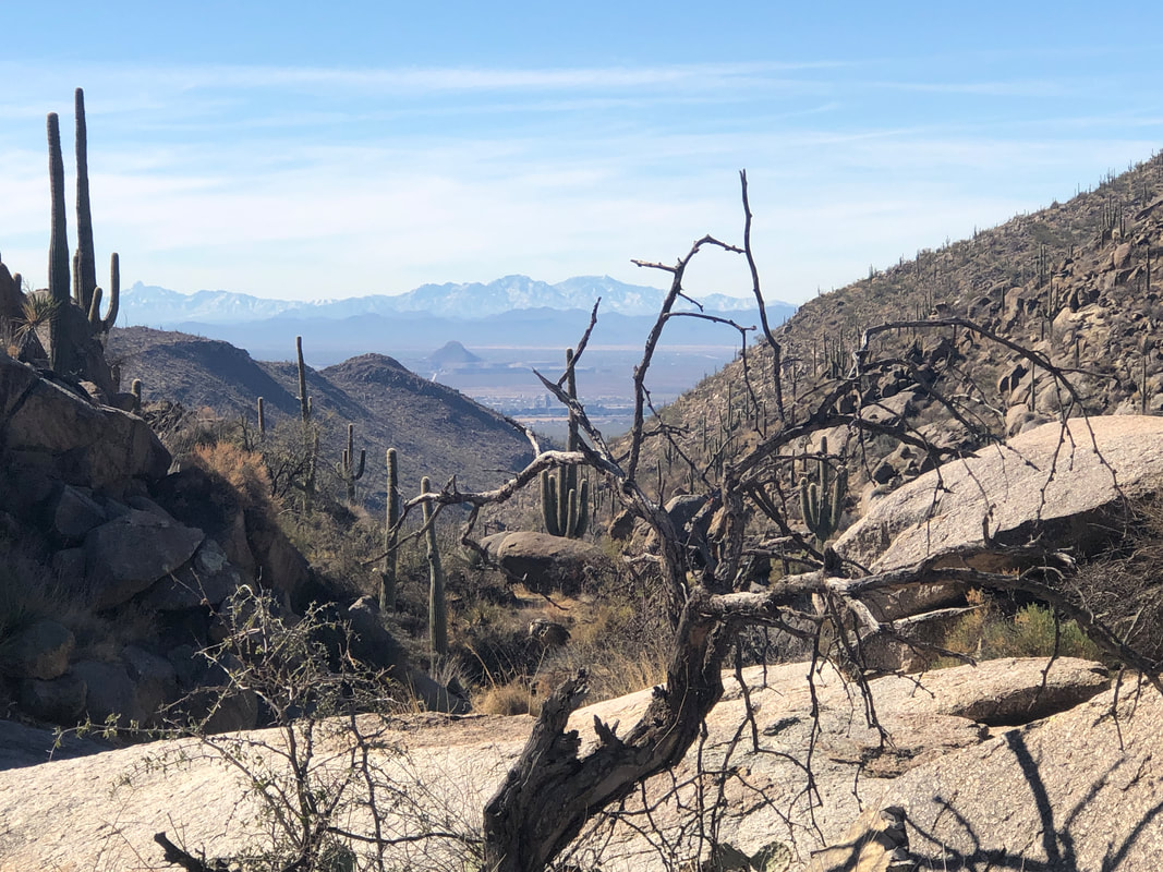 ....this nice few from the head of a ravine and where.... 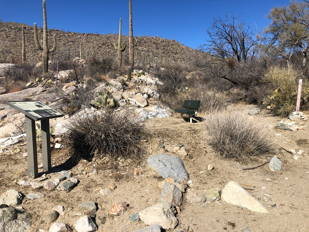 ....there is a nice bench to take in the great view. Then I got on the Wild Mustang trail and began..... 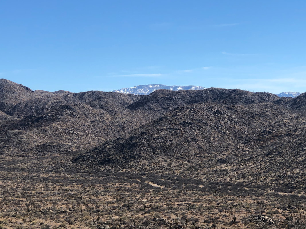 ....about a mile ascent where the Catalinas slowly emerged. 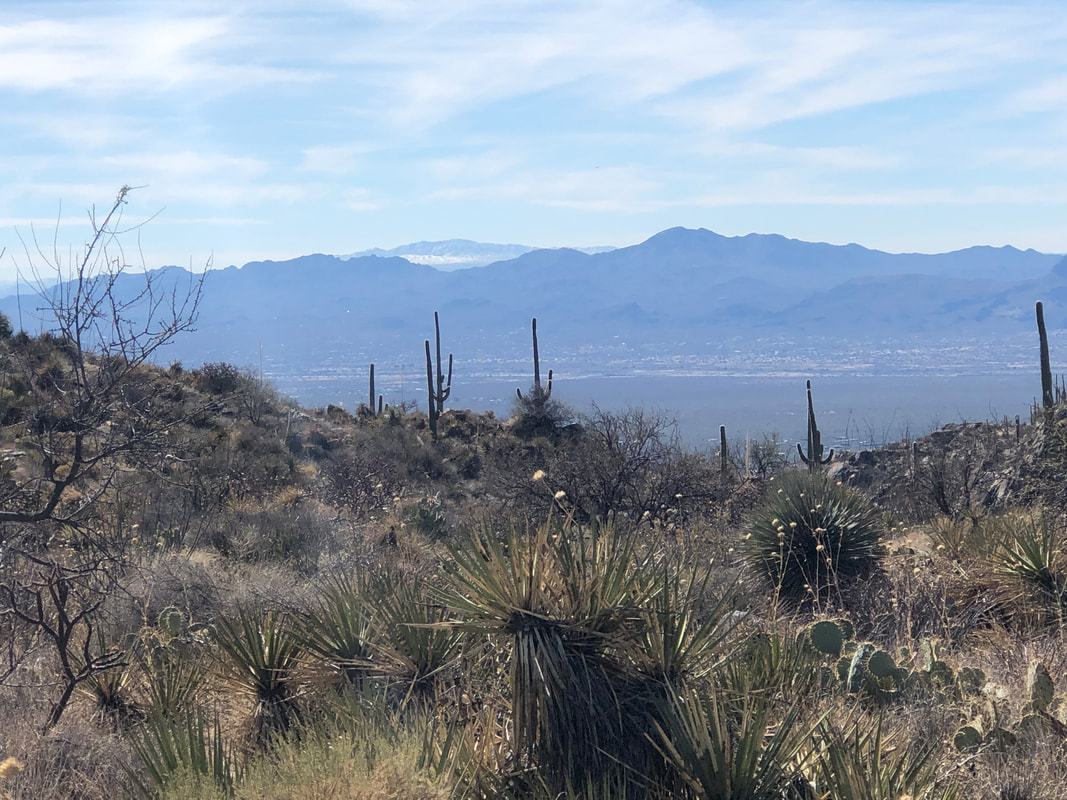 It appears the Tucson Mountains, also with a high point just beneath 5000', are now absent snow. 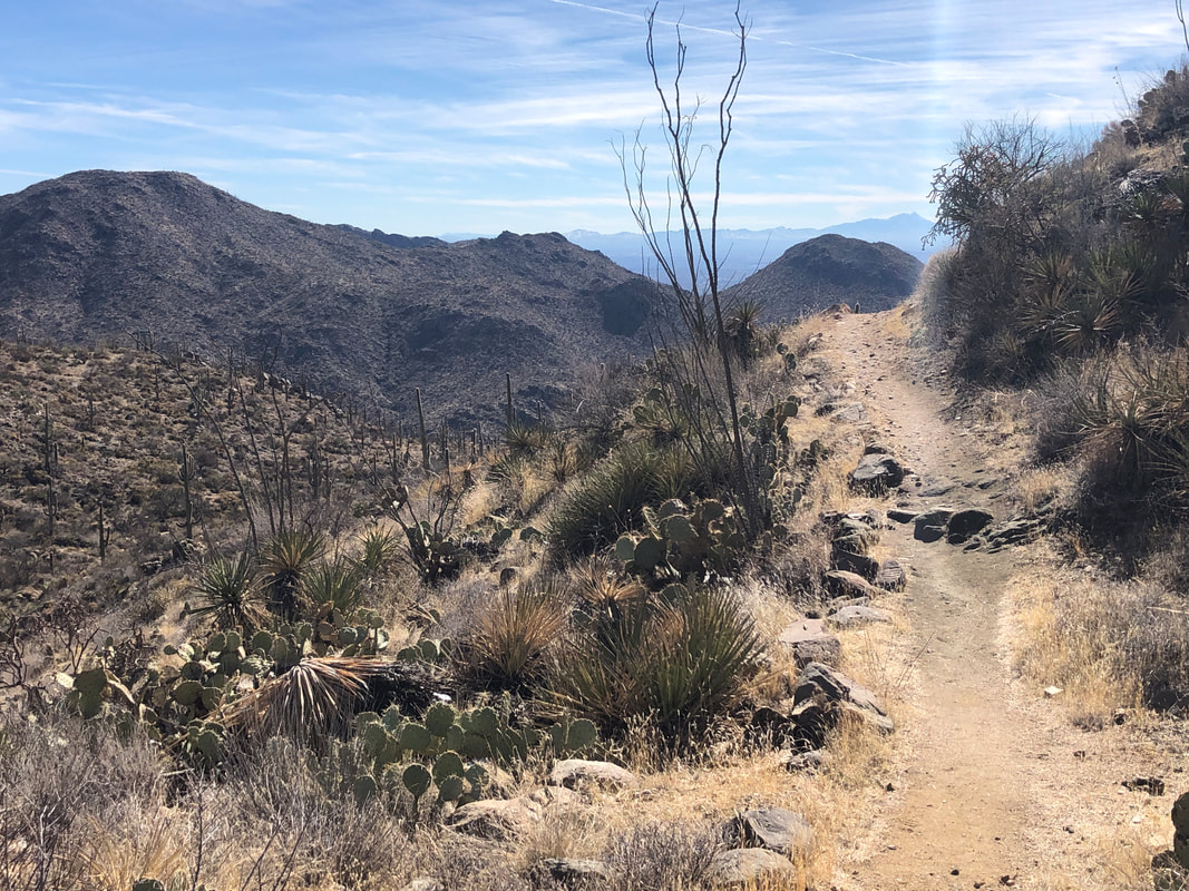 I continue to hike and eventually reach the high point of this trail and am rewarded.... 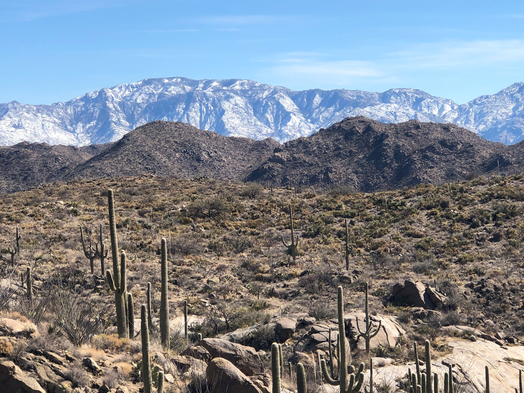 .....with this view. Awesome view of the Catalinas and Mount Lemmon. 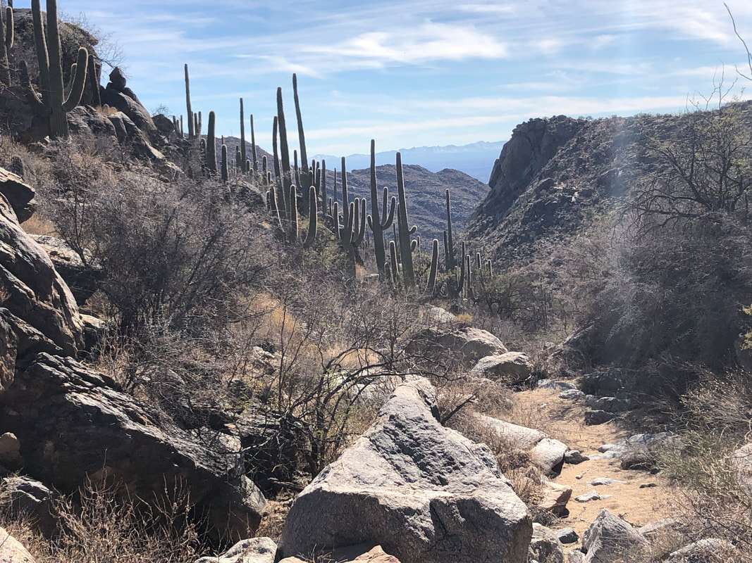 This trail is not as rocky as most so am able to glance about frequently and glad I did. 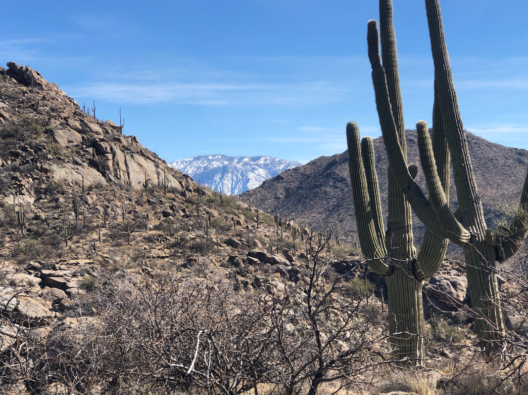 The Catalinas begin disappearing as I descend.... 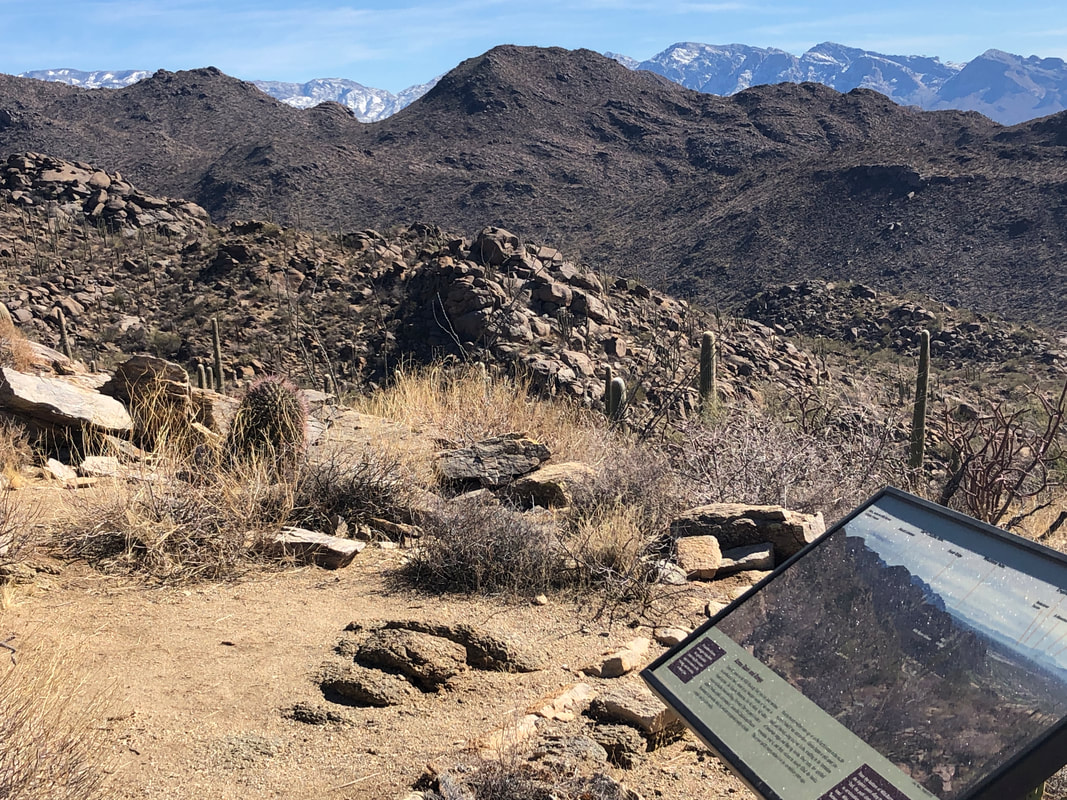 I reach a nice area with benches and signage noting the distant mountain ranges. 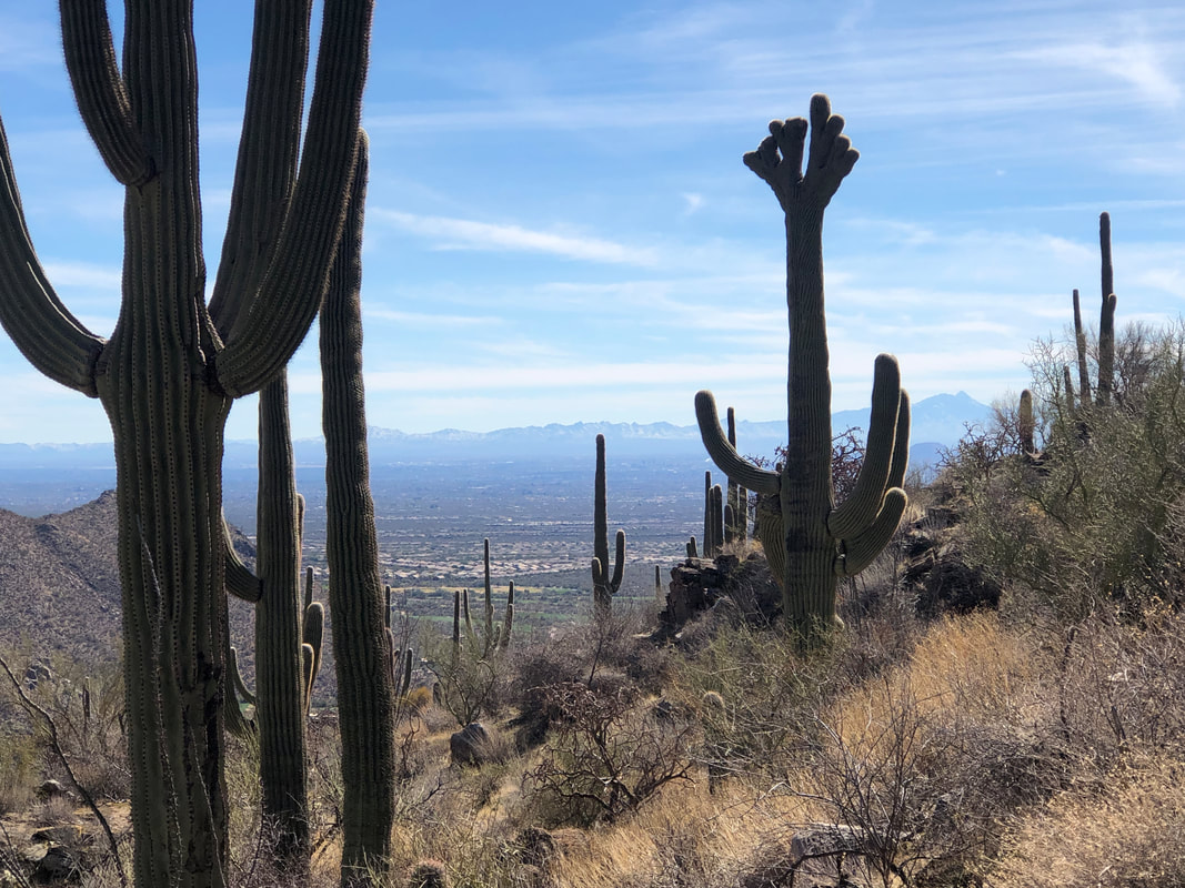 Time to return to the parking lot where I finished with 7.8 miles and 1500' of climbing.
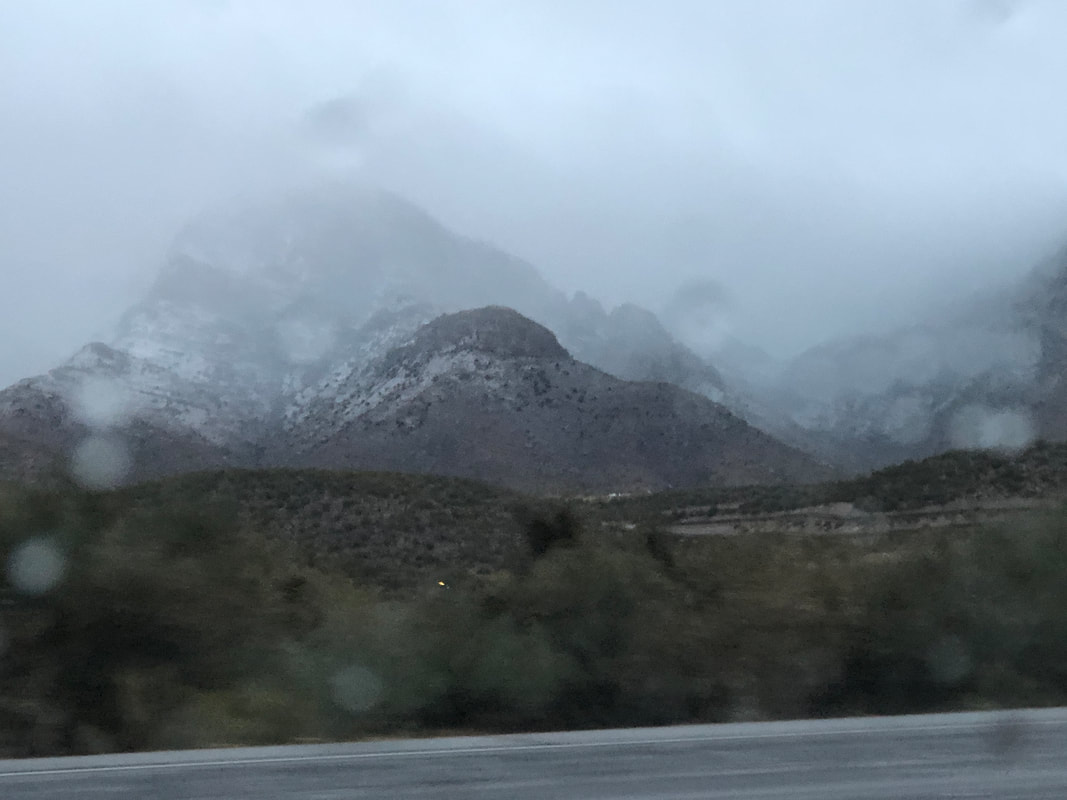 Sunday evening, it's raining and the snow line is creeping down the mountains. Went for a quick hike Monday prior to another round of precipitation and colder air moving in. Tuesday morning..... 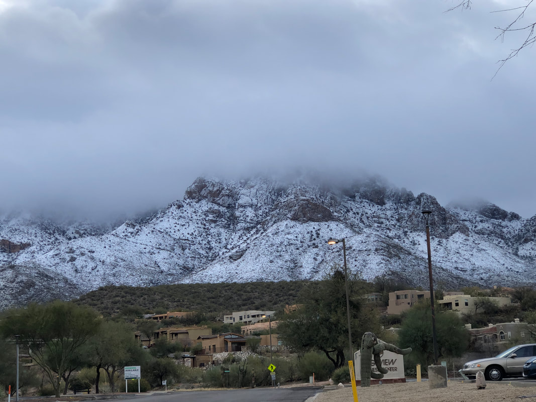 .....I was relieved that the snow line stayed above Oro Valley. It's close but missed us by a couple hundred feet as the overnight low stayed above freezing. 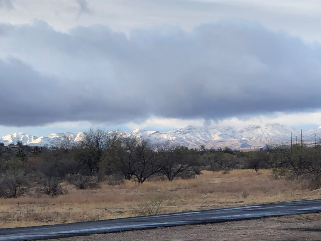 The Tucson Mountains got a good coating. 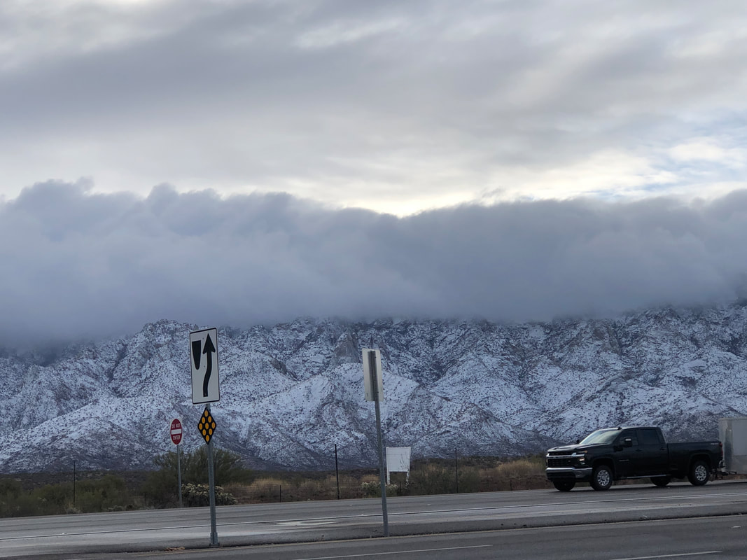 Interesting cloud formation lingers amongst the peaks of the Catalinas. 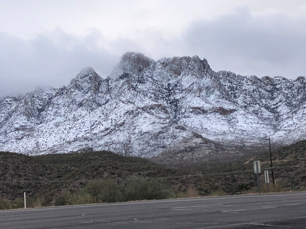 Table Mountain emerges as the clouds pass.
 Our group of 11 arrive at a small pullout at the first hairpin turn on Catalina Highway as it begins the long climb to Mount Lemmon. This being a popular parking spot for rock climbers, we were lucky to grab the coveted spots. We gear up and begin our hike just as two climbers head toward the canyon too.  In the 2 miles to our destination, simply the point at which we can go no farther, we will have gained 1700'. In the distance, the hairpin turn and all traffic noise soon disappears. I am anxious to arrive at the first major obstacle.... 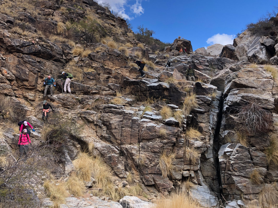 ....the wall. This image was taken during our return but it gives perspective on the height of the wall. Too bad there was no water flow as that adds to the experience.  Above the hardy hikers all make it. The hikes I have been organizing have attracted some regulars who are very fun people to be around. Marc, Lorna, Katherine, Barry, Dee, Lorie, etc... with Amy in charge of the entertainment committee while I focus on the route finding. I become a little anxious prior to these hikes I suppose because hiking solo I just have to worry about me but the "what ifs" mount with others. These hikes tend to be a tad on the dangerous side, ha, ha. 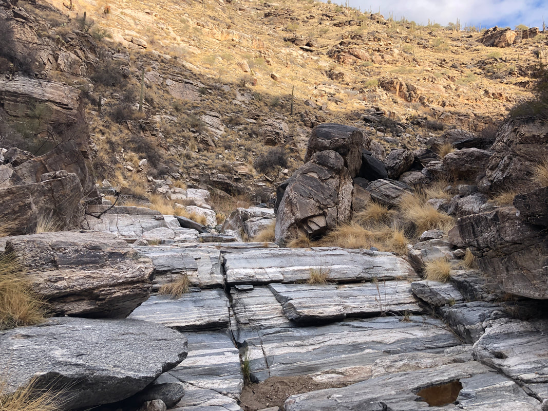 The colors of the rocks with layering is amazing. New hiker, Mitch, has a background in geology so he provided some explanation which I won't pass on here as I trust all know how to use a search engine. 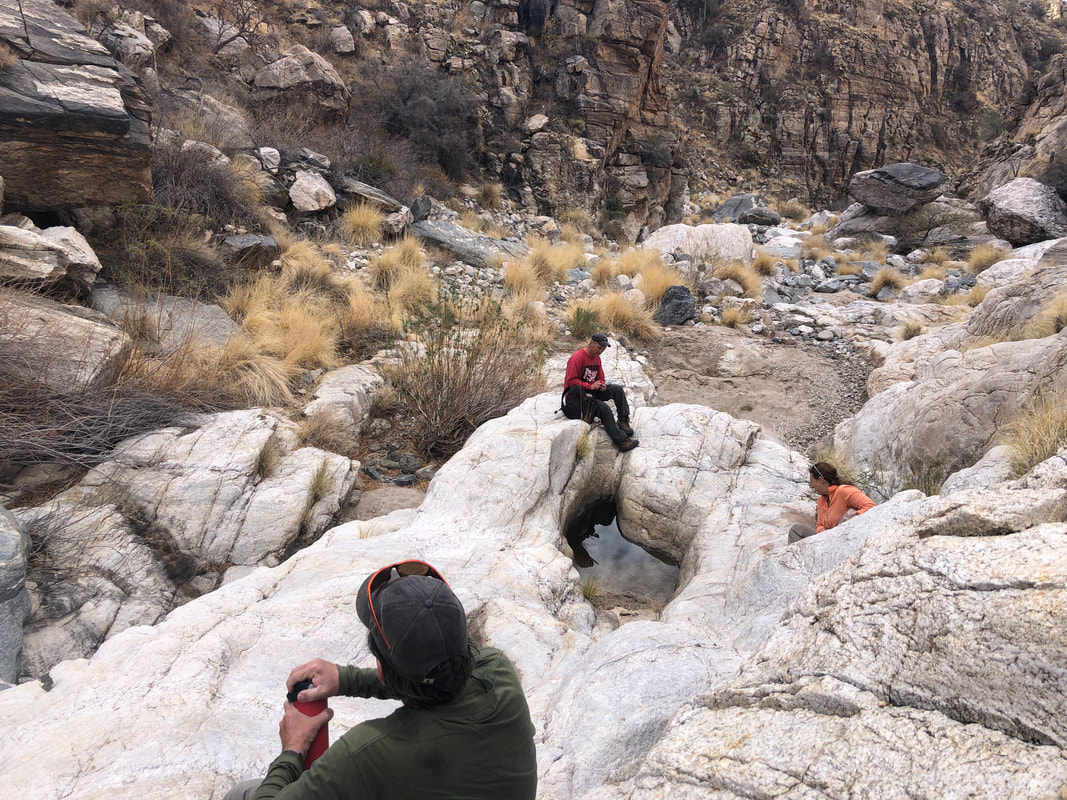 The group for which I am an organizer has 3200 members so I expect new people to join our hikes and all have been up to the required effort. Well, expect for this hike. A new guy was lagging behind significantly which caused some unneeded regroups. I've never had to instruct someone to turn around but told him it would be ok if he wanted to wait for our return. He declined and kept going which I respect but at some point it can impair the enjoyment of the others. I'm sure that line was crossed but everyone stayed patient and then after the hike, the guy quit his membership so that's that. Note the water in the concave area of the rock. That was about the extent of our water exposure. 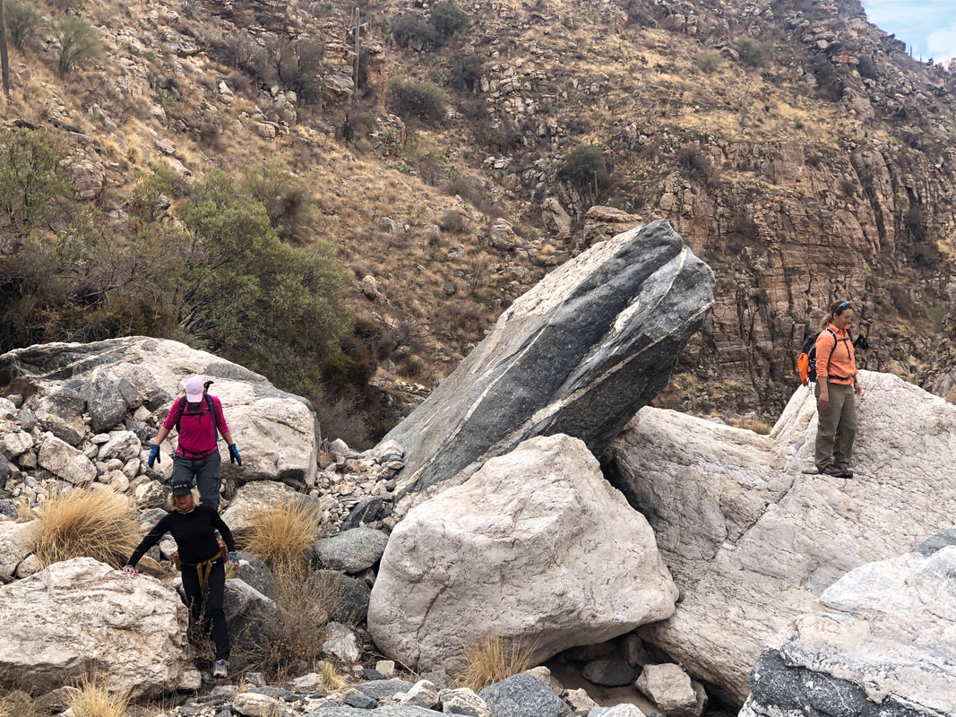 There is more than one way around the many obstacles and Karyn on the right went one way while Amy and Lorie follow me. Usually that is a wise choice but not always. 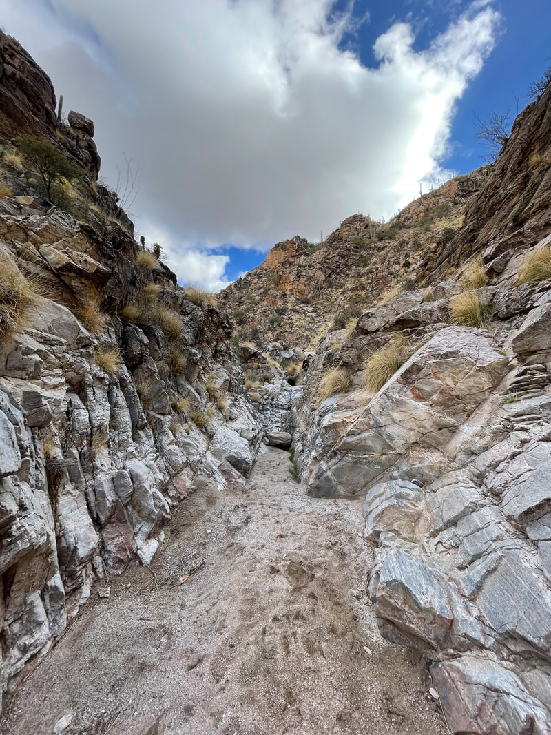 Occasionally there would be breaks in the climbing but that never lasts long. 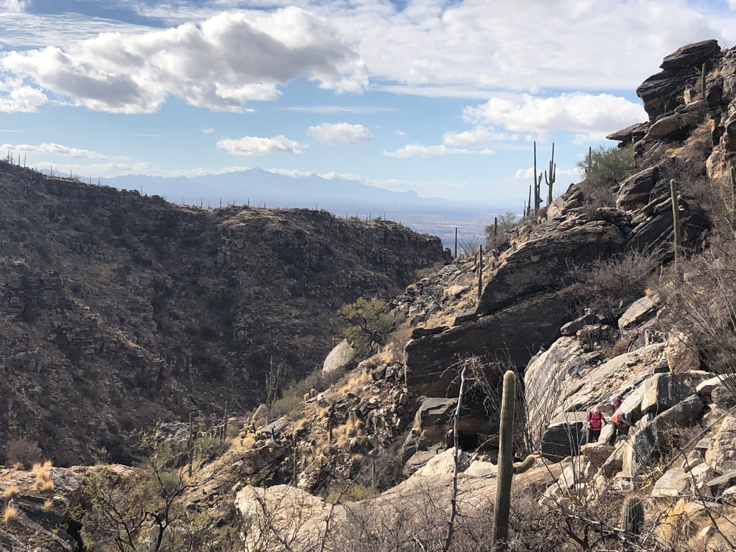 We arrived at the most significant obstacle where I decided to climb high on the west slope to avoid a mass of huge boulders in the middle. On the return, we went down the middle and that approach was more difficult. 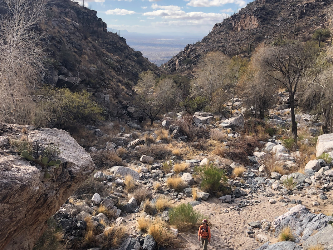 Our hike continued and provided great but narrow views to the southwest. 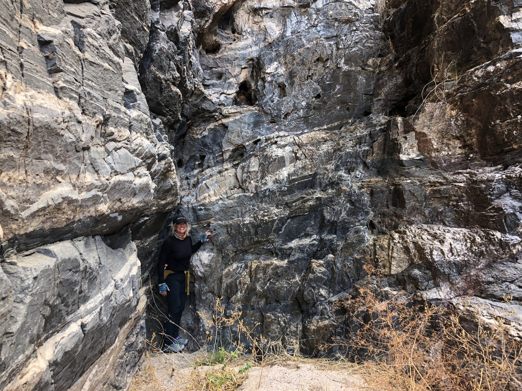 At last, we enter a narrow section and Amy officially touches the end. I had read there was a way to exit the canyon to the east and pick up the Soldier Trail. Some of the group had become a little weary of the bouldering so I wanted to make a good faith effort to find a way out and pick up the trail option. 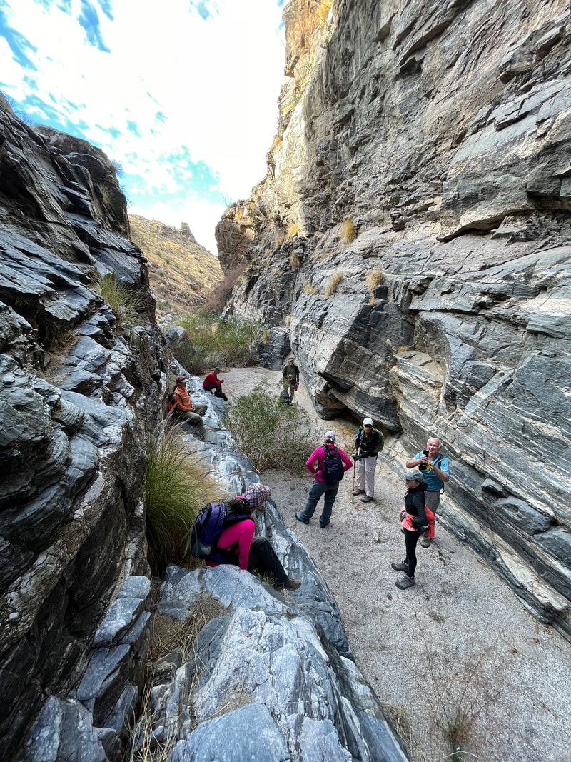 Mitch, having an extensive rock climbing background, offered to climb the wall and see if it was a viable exit option. I was curious so followed him. After some climbing, it appeared the exit was doable but we could not see far enough ahead to be certain so we returned. My reentry to the floor of the canyon..... 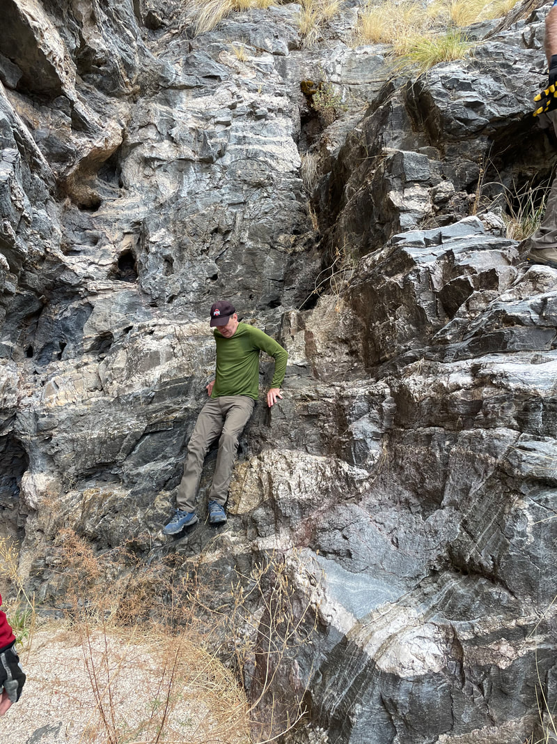 ....was less than graceful but I made it. 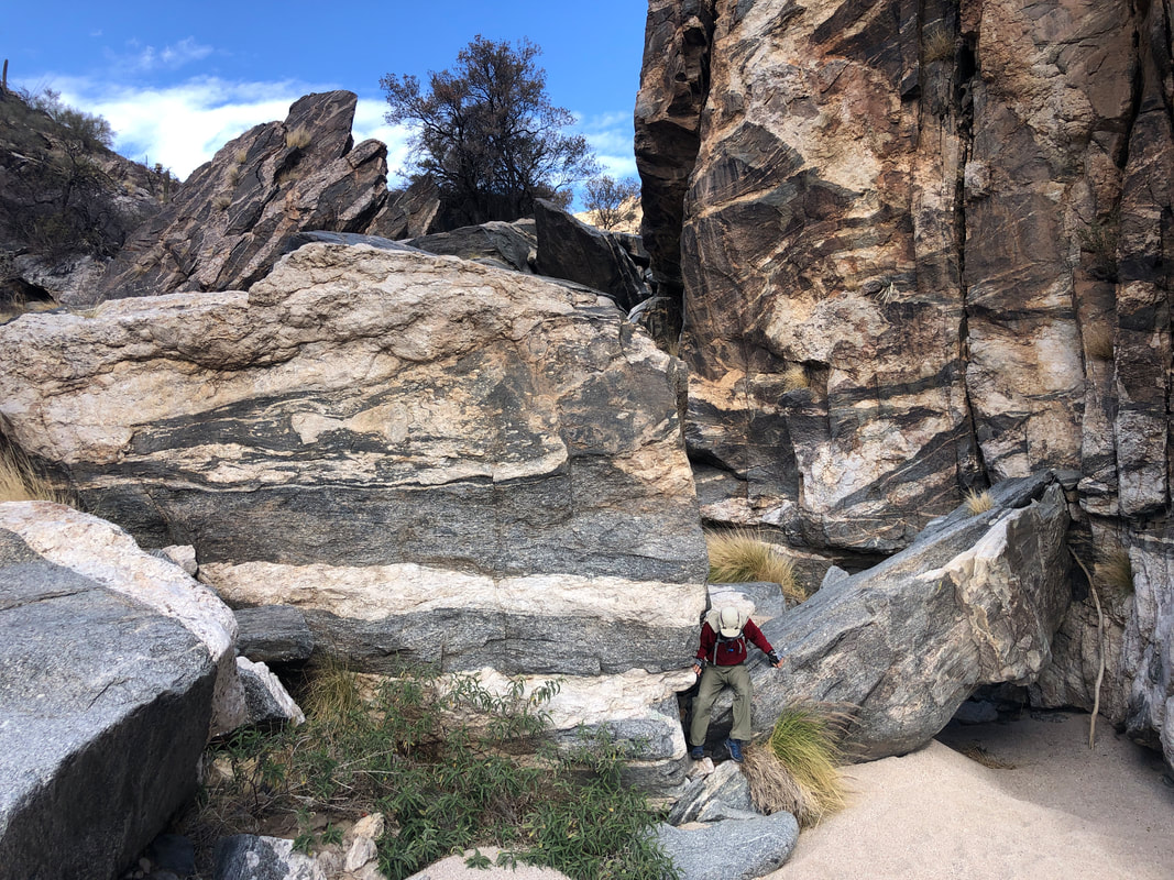 We headed back the way we came. For perspective, note Mitch on the bottom right of the image and how he is dwarfed by the boulders. Some of us wondered how cataclysmic of an event is required to tear the boulders asunder from the cliffs above. 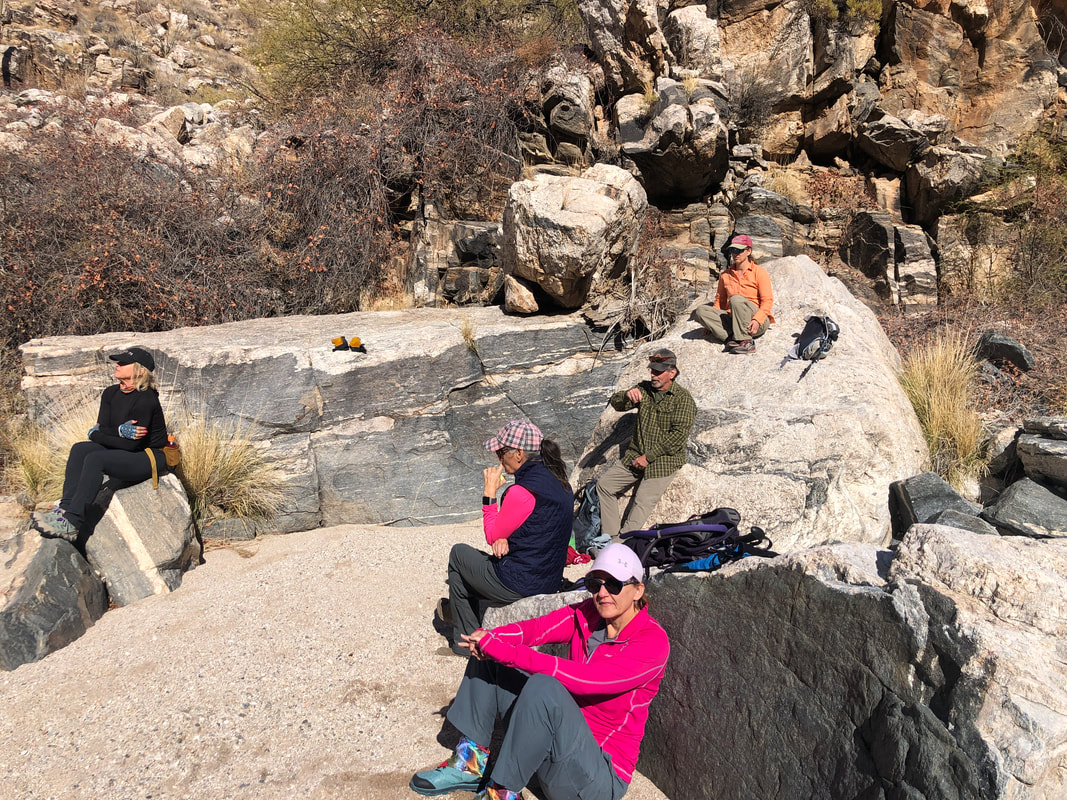 Upon entering a sunny area, we paused for a snack. Then..... 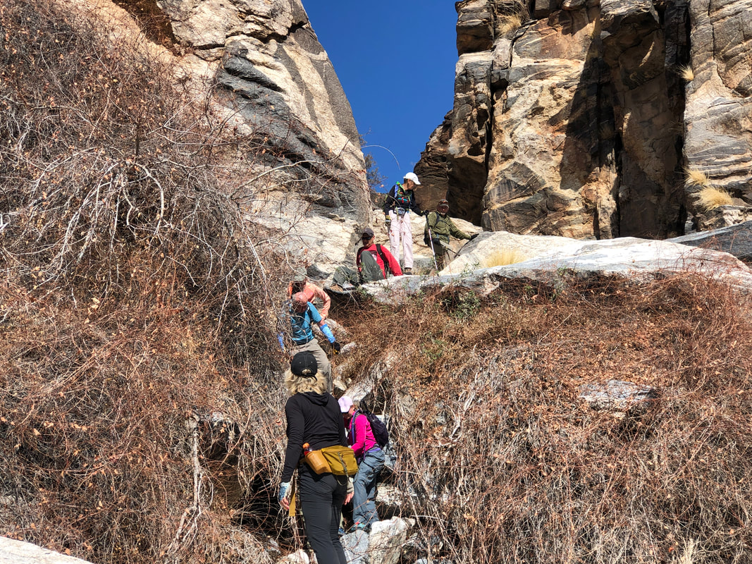 ...we resumed our return. This section was made a little easier by an abundance of vines that we could grab and control our descent off yet another large boulder. 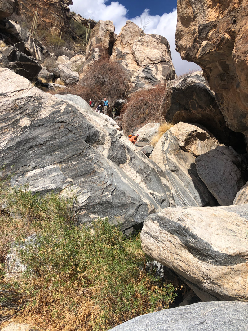 Check out the above. This is the section that I had avoided by climbing on the west side but I thought going through the middle would be fun. I was kinda wrong about that. That there is a route is a small miracle. 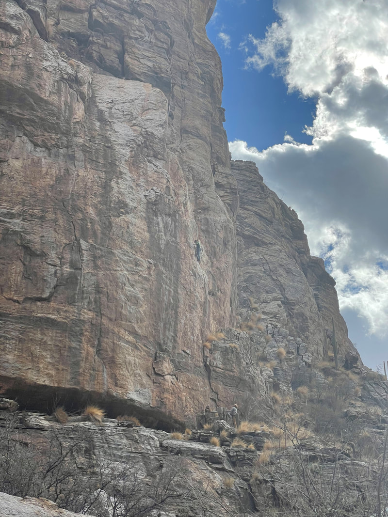 As we neared the end of our adventure, we saw a couple of rock climbers on one of the east walls and later encountered a few taking a break from a climb on the west wall. Fun experience but this is not for everyone and certainly not every week. A return to regular hiking comes soon.
 With recent rain, I wanted to make sure there would not be a problem with too much water flow for Saturday's hike through Soldier Canyon. Although our region didn't get much rain, the mountains always receive more so may as well check it out.  Dry but snow melt at higher elevations or maybe drainage from the rain has not percolated down here yet. By tomorrow we could have some flow which will make a spectacular hike even better.
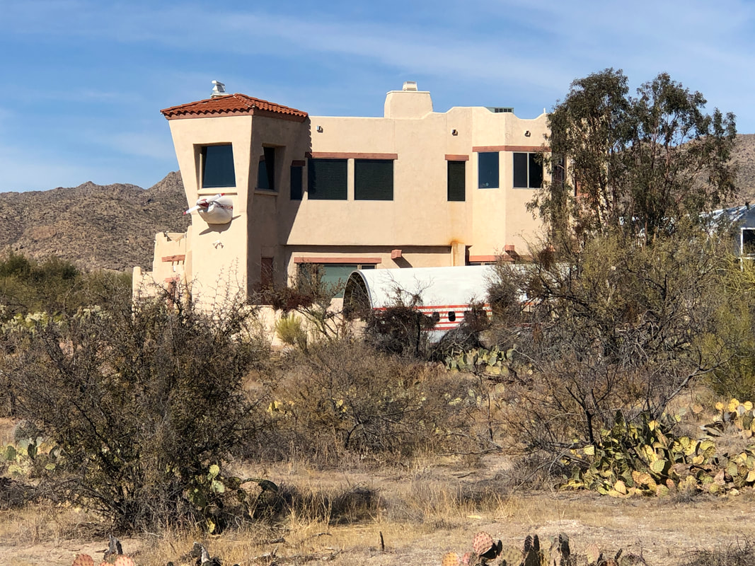 Around the corner from me is a development called, "LaCholla Airpark". The roads are wide because in the middle of the development is a runway so some of the home owners can jump in their small plane, taxi to the runway and take off. Above, a home has the nose of a single engine plane extending from it and the hull of a 727 attached to a hangar.
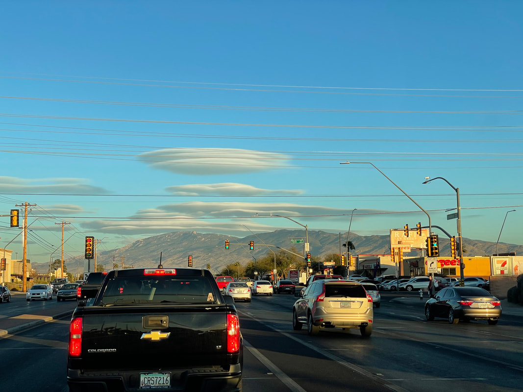 BGE Amy, sent me the above image of "flying saucer" type clouds that have arrived ahead of a low pressure system that is forecast to bring us rain over several days. That means the Hairpin Canyon hike for this Saturday will likely have a good flow of water for our bouldering adventure. More to come.
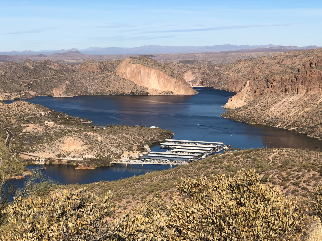 Our group of 8, gather at the Canyon Lake Marina, off St. Rt. 88 (Apache Trail), 2 miles west of Tortilla Flat. Hopping on the Boulder Canyon Trail, we ascend about 600' in a mile where the views of the lake and its surroundings are amazing but so too..... 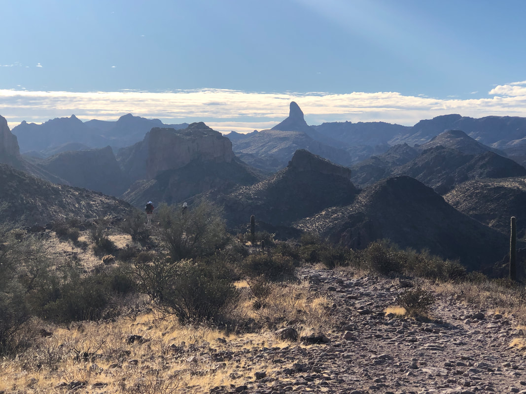 ......the interior of the Superstitions. In the distance is Weaver's Needle with Battleship Mountain and Geronimo Head bordering the canyon to which we will soon descend. 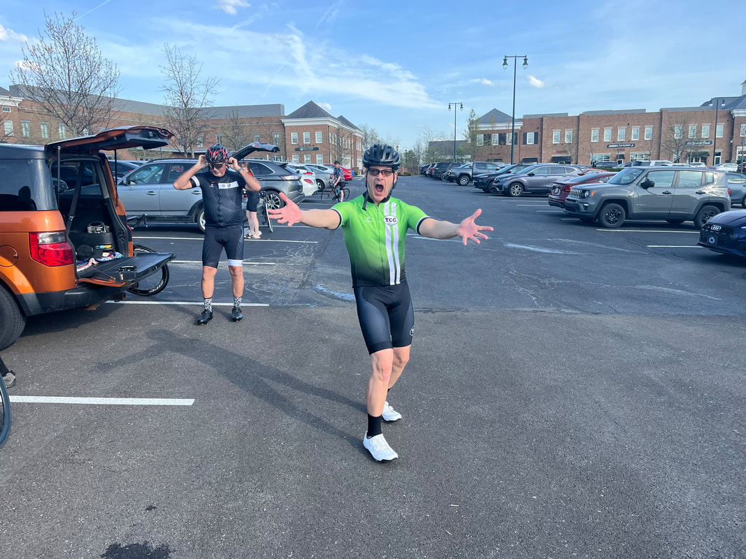 Four Peaks Wilderness can be seen in the distance as we continue our hike. Not surprisingly.....  ....several other hikers are sharing the trail with us. Note the three standing on an outcropping in the distance.  Below us, La Barge Canyon winds its way towards the Narrows. At about mile 3, the trail reaches the canyon but rather than make the scheduled left turn, I lead the gang a little farther so we can visit an abandoned mine. Just before reaching the mine.... 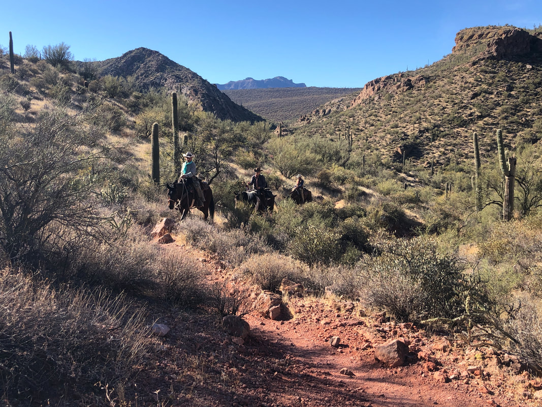 .....a small group of horseback riders approaches. We exchange pleasantries and then reach.... 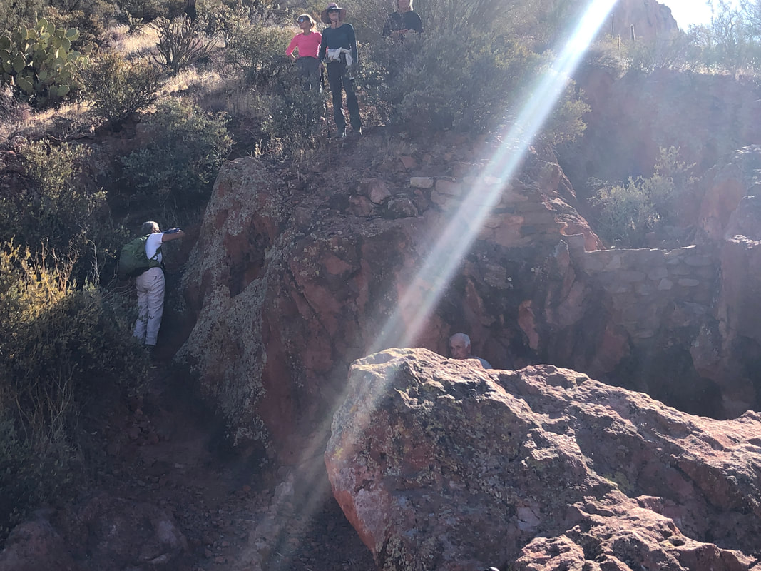 ....the mine. A foundation of a cabin still exists along with (upper right) a wall that was built to catch water. We reverse our course and..... 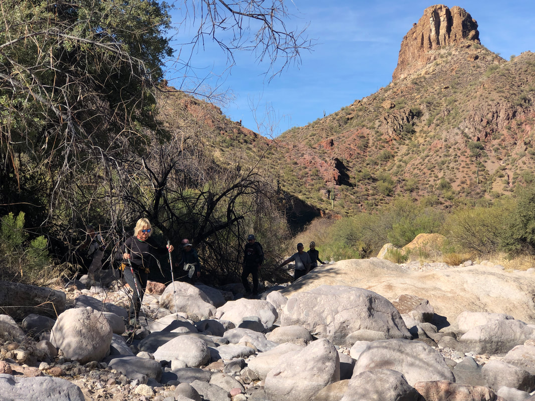 ....enter La Barge Canyon. At first, the going is easy as we walk across bowling ball size rocks but soon they become much larger. The route finding is not too difficult as we work up canyon and see.... 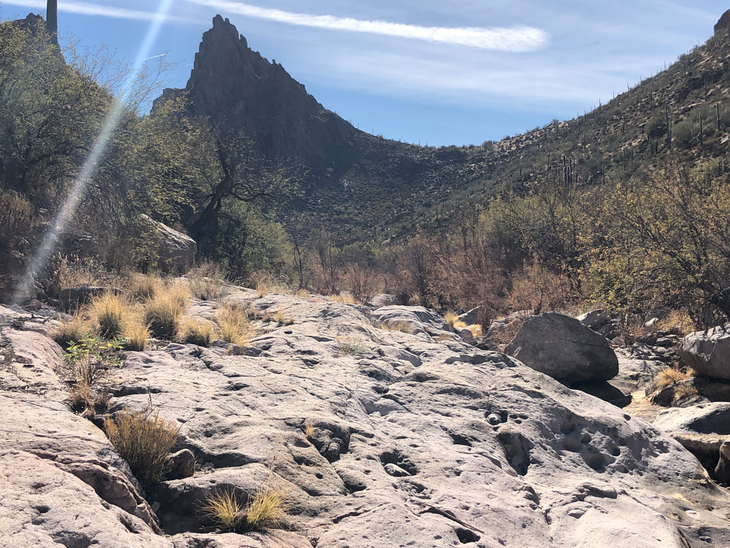 ....our destination, marked by the above, jagged wall. As we draw closer, it appears the canyon is a dead end. 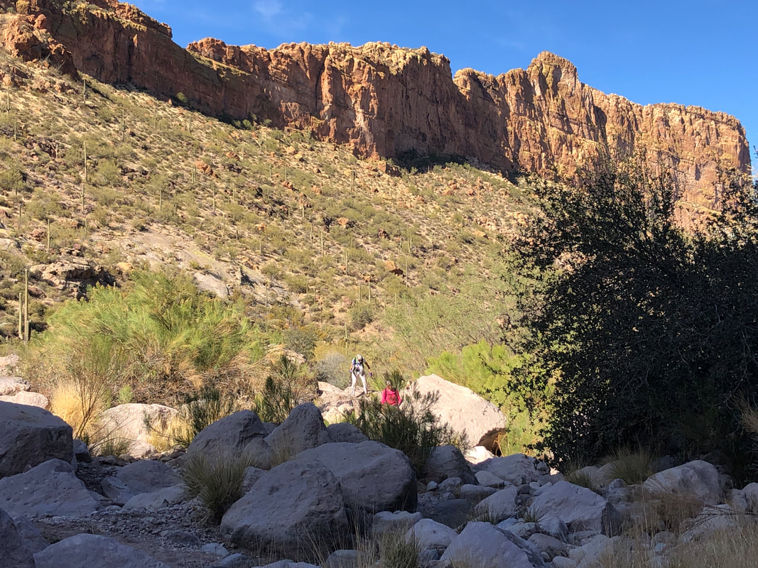 It's kind of slow going as we navigate the boulders with the awesome escarpment of Battleship Mountain touring over us. 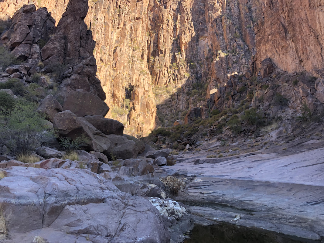 Just when it would appear there is no way forward, the canyon cuts sharply left and we enter the awesome Narrows. 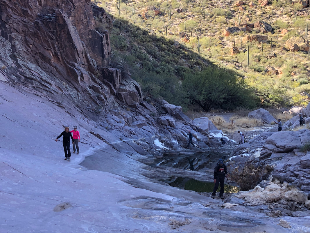 We drop our packs and explore the Narrows. Just an amazing destination. 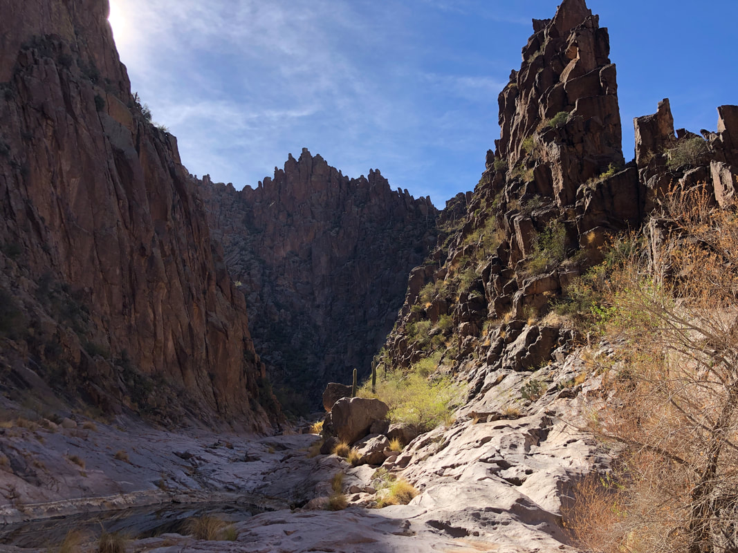 The jagged, vertical walls frame the narrow canyon. It's as if someone with a huge chisel, cut a serpentine route through solid rock.  Given the lack of rain, we are surprised there are pools, with an especially large one containing many guppies. With rain likely for this week, the pools will receive a much needed replenishment. 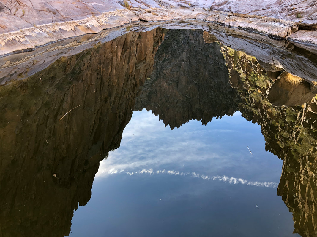 Note the reflection of our surroundings on the water. 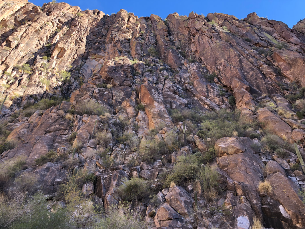 The walls are several hundred feet tall. After a storm, it would be spectacular to watch the water churn through the canyon. Had we continued through the canyon, we would emerge on the Cavalry Trail which we could take back to our cars but that would add about 4 miles to our hike so we gathered our gear and began the trek back. 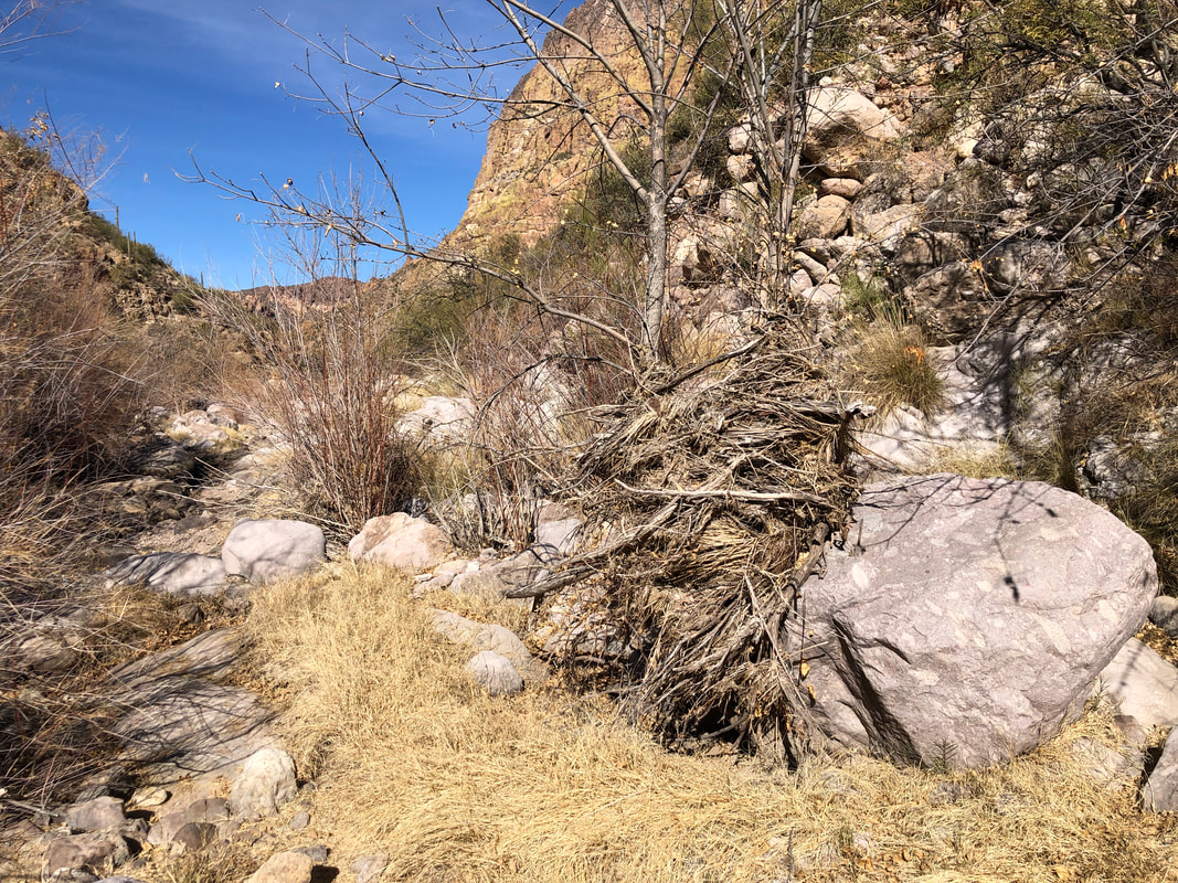 Note the brush, piled against the trees. At some point, water over 6' deep had filled the canyon. 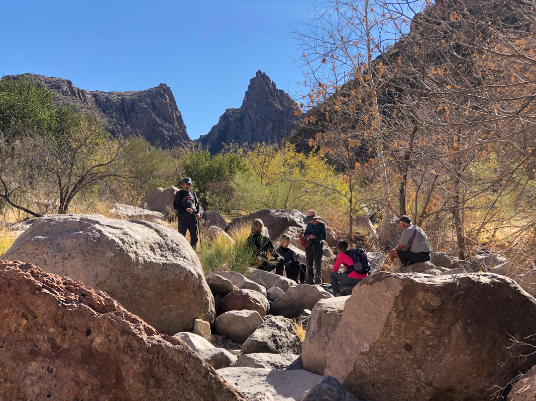 The distance and bouldering had our group spread apart so we paused occasionally to regroup. Always plentiful places to sit and recover. 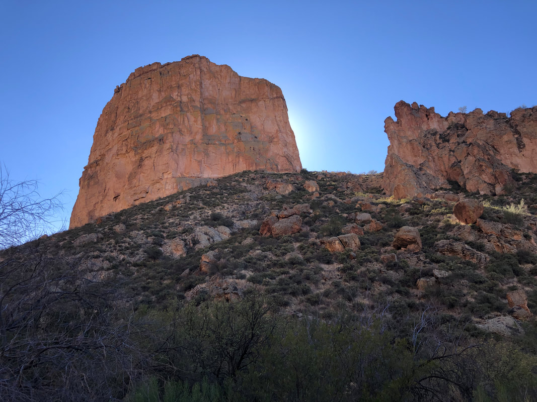 The end of Battleship. Odd how the sun is behind the structure but the light bounces off Geronimo Head, on the opposite side to illuminate the front.  We emerge from the final, steep climb (still a few moderate ones to go) and as always..... 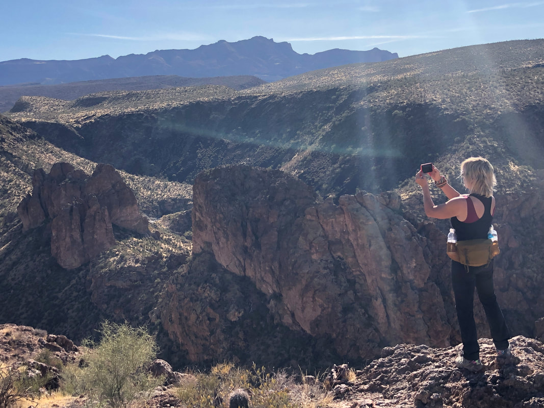 ....we all take many images of all that is before us. Great group of hikers as we finish our 10.5 mile hike with 2000' of climbing....seemed more climbing then that. On the last of the hard climbs, I assumed there would be a Strava segment so gave the climb a good effort but missed the KOM by 15 seconds. Dang it. 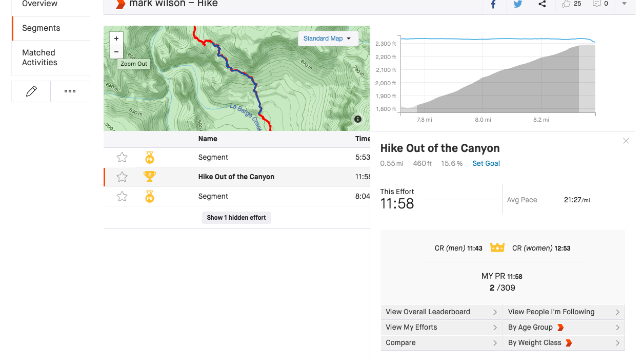 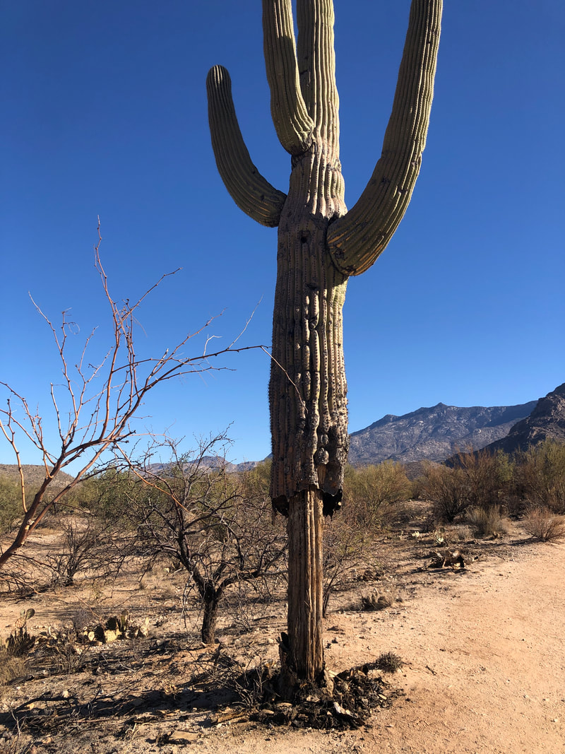 A mighty saguaro, dead now as part of the destruction of the Bighorn fire. I planned to hike to Romero Pools via the Romero Canyon trail. There is a way to check activity on this trail through Strava and I saw there have been people who have been doing the hike.  Signage at the entrance stated the trail was closed. A ranger, a couple of weeks ago, made some vague reference to liability concerns when I questioned him. Seems odd to me that all trails in the Superstitions are open including the many miles through their equally devastating burn area. Yet in the Catalinas, that considerable network of trails are mostly closed.  After a mile of hiking, I arrive at the point where signage restates the trail's closure. I planned to keep going and complete the hike but then.....  ....whoa, a newly installed, heavy duty gate with barbed wire fencing. The fence doesn't extend so far that you can't work your way around it. What to do, what to do? I suspect this is a show to protect the Park from liability issues from inexperienced hikers who get in over their heads. I know the trail and terrain very well. The burn has removed much of the ground cover and I could be spotted from a long distance. I see a couple of volunteer rangers working about 1/4 mile away, I turn around.  The trails that are open are simply flat and lame. I encounter a nice family of 5, visiting from Louisiana. They ask if this is the best Park in the area and I say, no, and give them several, better options  Finish with 4 miles. Back on the bike for a couple of rides and then leading a group to the Narrows, in the Superstitions.
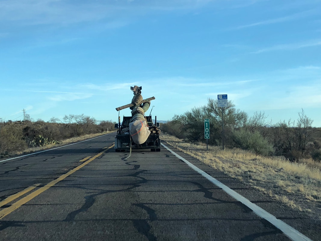 A truck transporting a saguaro. This is not an unusual sighting and interesting how they could an arm to it would not detach from the main body. So, I've got a flooring project going but can't do that all day so out each day for a short hike including....  ....driving Catalina Highway, passing Hairpin/Soldier Canyon where I'm leading a hike in two weeks, then hiking up Soldier Trail. I was looking to find the top of the canyon. I noticed a faint trail coming fin from my left so jumped on that and soon.... 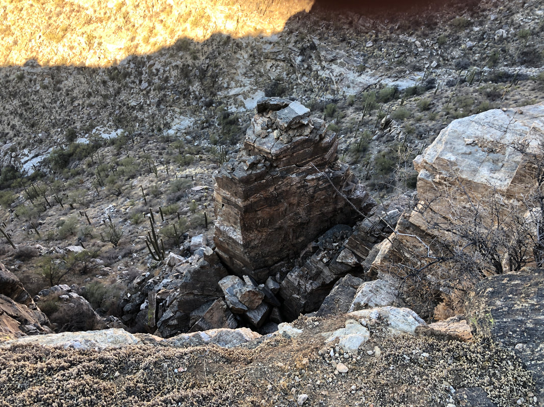 ....how bout that!?! I found myself following a faint but cairned trail that bordered the canyon far below. I wonder if this continues for the length of the canyon??? 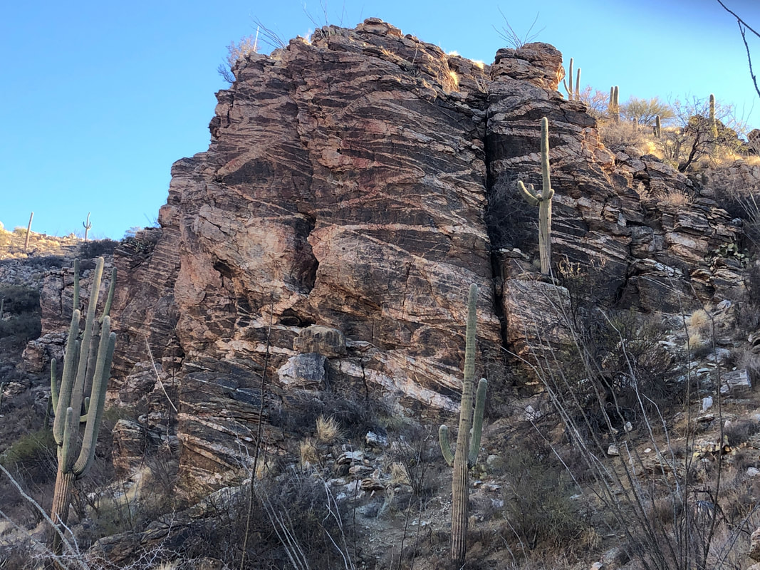 Some interesting rock formations but exited the canyon on the right.... 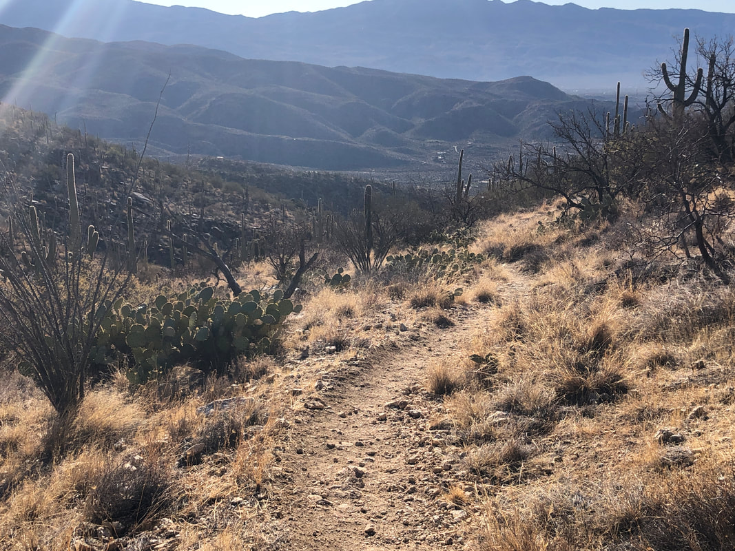 ....regained the faint trail and then onto Soldier Trail. Will come back and complete that rim trail to see if it goes to the end of the canyon which I think is likely. Then, of course, can I drop into the canyon and hike down canyon to the road? On Monday, still working on the floor project I..... 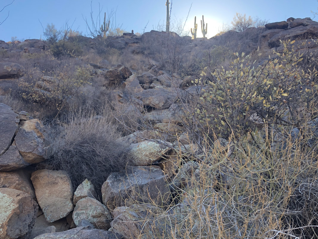 ....needed a midmorning break and headed to the Tortilitas where I picked up the Lower Javelina Trail. The sun rises and illuminates two saguaros. 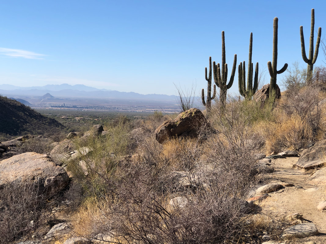 I've not previously hiked this loop but it was a decent, albeit short hike of 3 miles. OK, back to the floor while waiting for kickoff of my mighty Buckeyes later today.
 I've organized a group hike to visit Robber's Roost, high in the Superstitions. While I have visited the Roost several times, only once via the route I have planned and that was 4 years ago. So, thought I better hike in so I don't get the gang lost. I hate when that happens:). Quite a story to read at the entrance to the trail at the Lost Goldmine East trail head. It's a nice cool morning as I begin my hike at 10:30am. 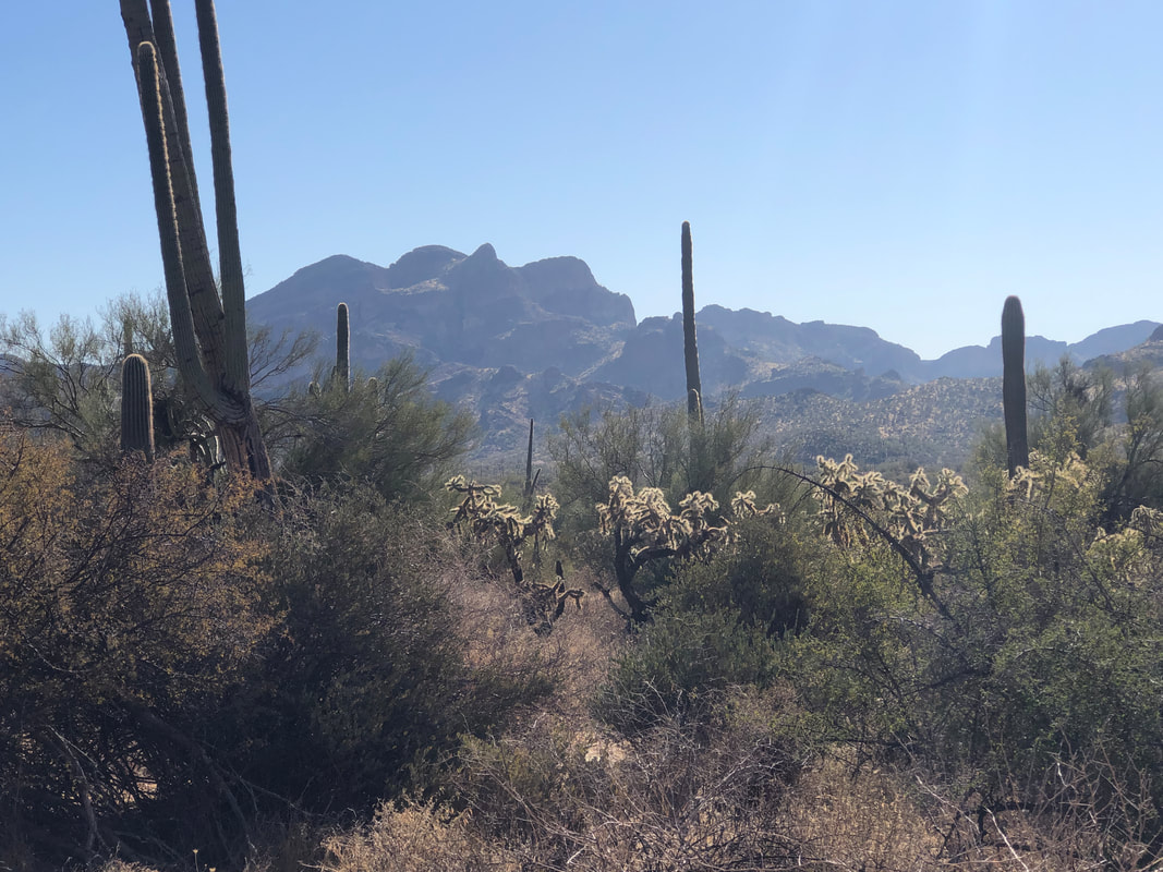 I get on the Wave Cave trail and then break from it onto the Carney Springs trail which is unsigned. The views all around are wonderful. Ugh, Carney Springs is..... 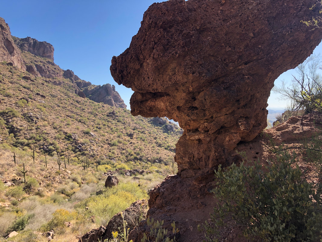 ....rocky and..... 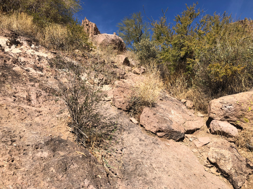 ....steep. I've been on my bike twice and hiked once in the last 3 days and kind of feeling it on the climb. 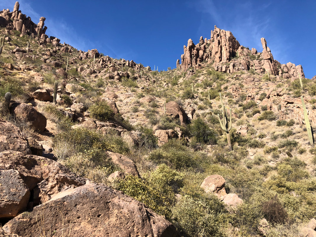 A great fake-out. Yes, I eventually reach the above saddle from where..... 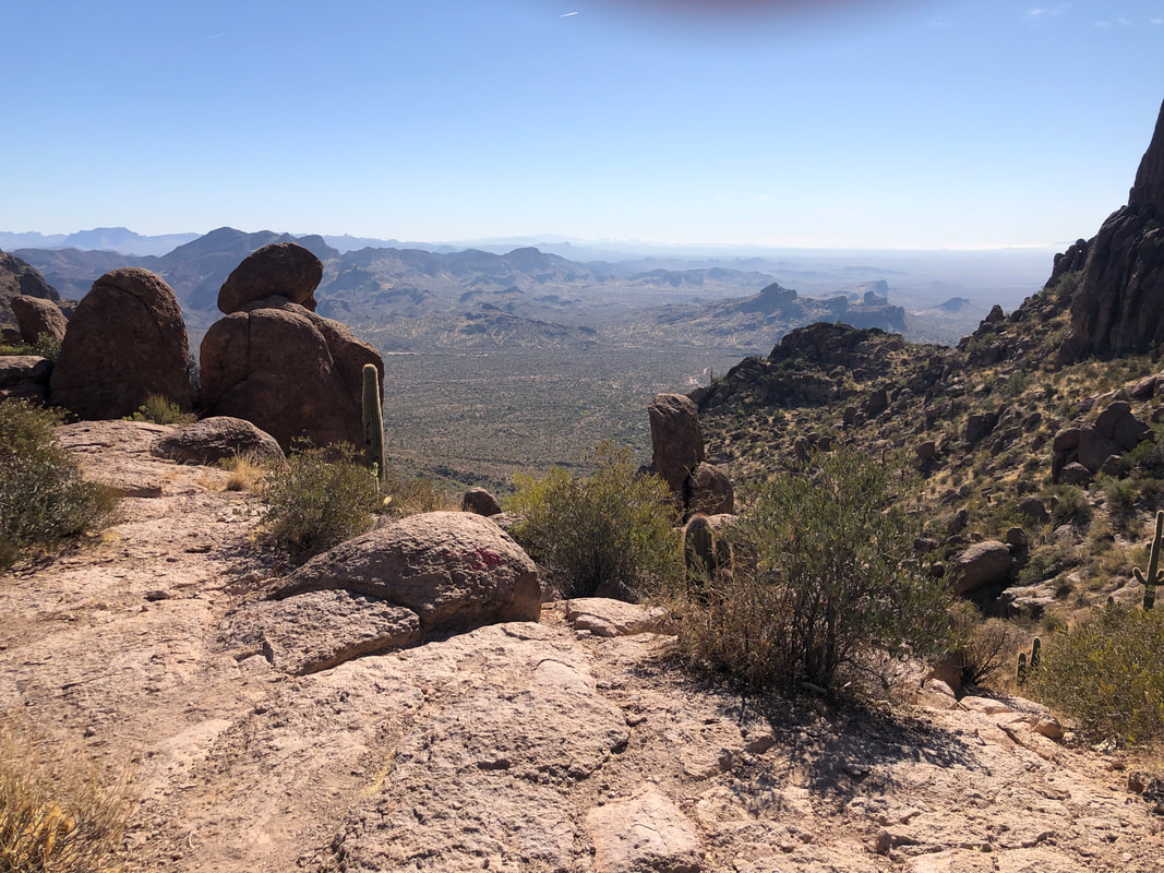 ....the views are magnificent but.....  ....I still have another climb about as difficult. Each climb averages over 30%. I refer to these as "knee bucklers". 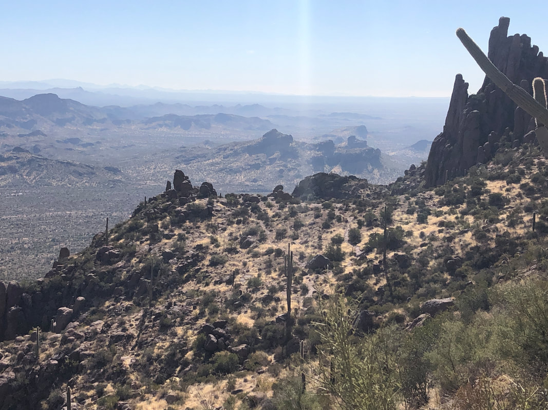 Looking back, I can see the trail break over the saddle and wind its way toward me. 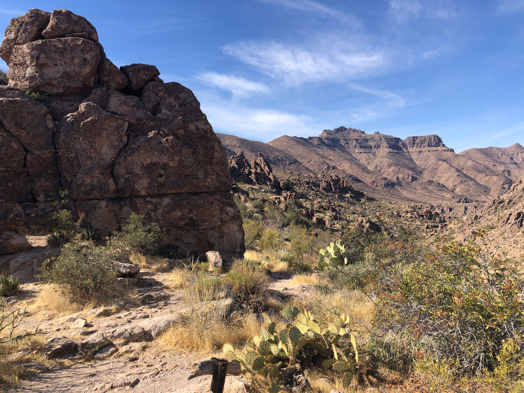 At last, I reach the Superstition Ridgeline and see Superstition Peak in the distance. That too is a great hike starting from the Hieroglyphics Trail. There is a beat up sign post here with a barely discernible etching. Now the route.... 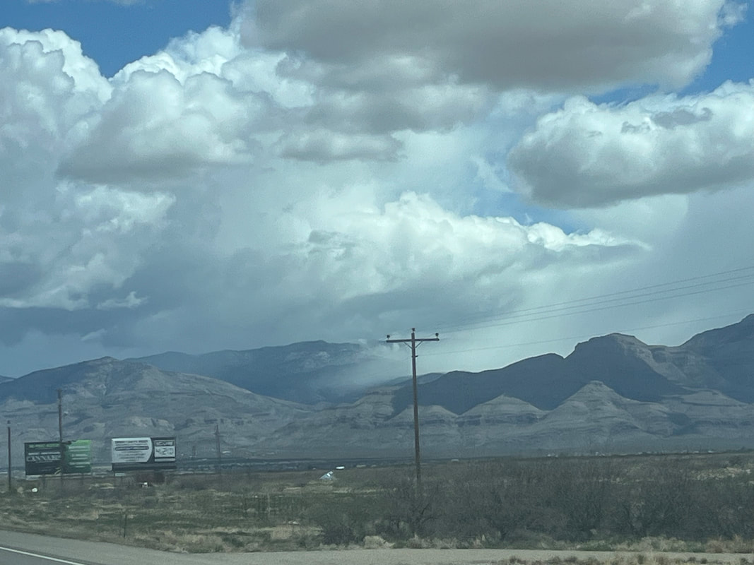 ....moderates as I swing right and begin following a trail that winds to another saddle. The route finding is moderate I guess as I have to stop a few times and figure out how to go. I brought a gps track but don't look at it as I enjoy the challenge. 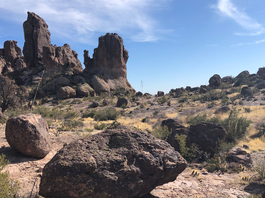 The final slope from where at the top.... 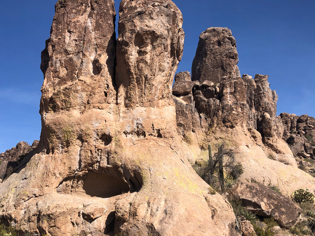 ....the giant bunny stares at me, open mouthed. My group will have the opportunity to climb in and have their pic taken. The route now is rolling as I look for a side canyon. Unfortunately, someone has swept away almost all of the cairns, which I think is a selfish act. 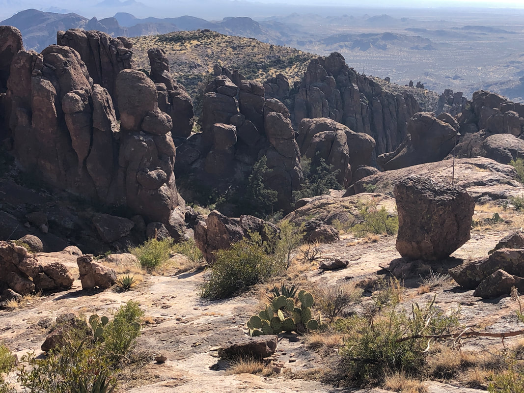 I start down one canyon, realize I made a mistake, retreat and one canyon over begin the descent. 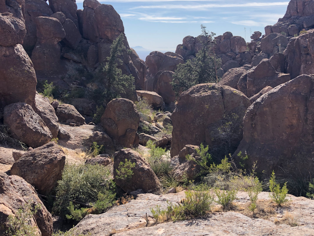 Yes, somewhere in that jumble of boulders is the entrance to the Roost. After poking around and despite having done this a few times, it took awhile but at last.... 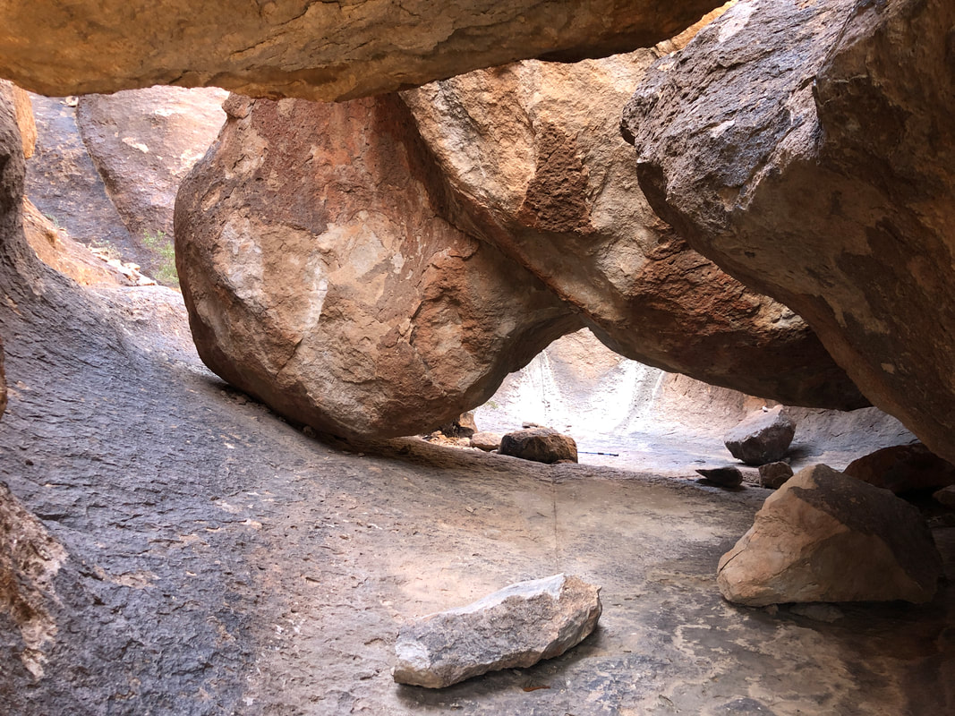 ....I gain access. Very cool place. Evidence that it was discovered.... 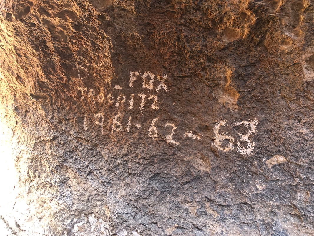 .....long ago can be found on the walls. At one end of the room is an opening to a.... 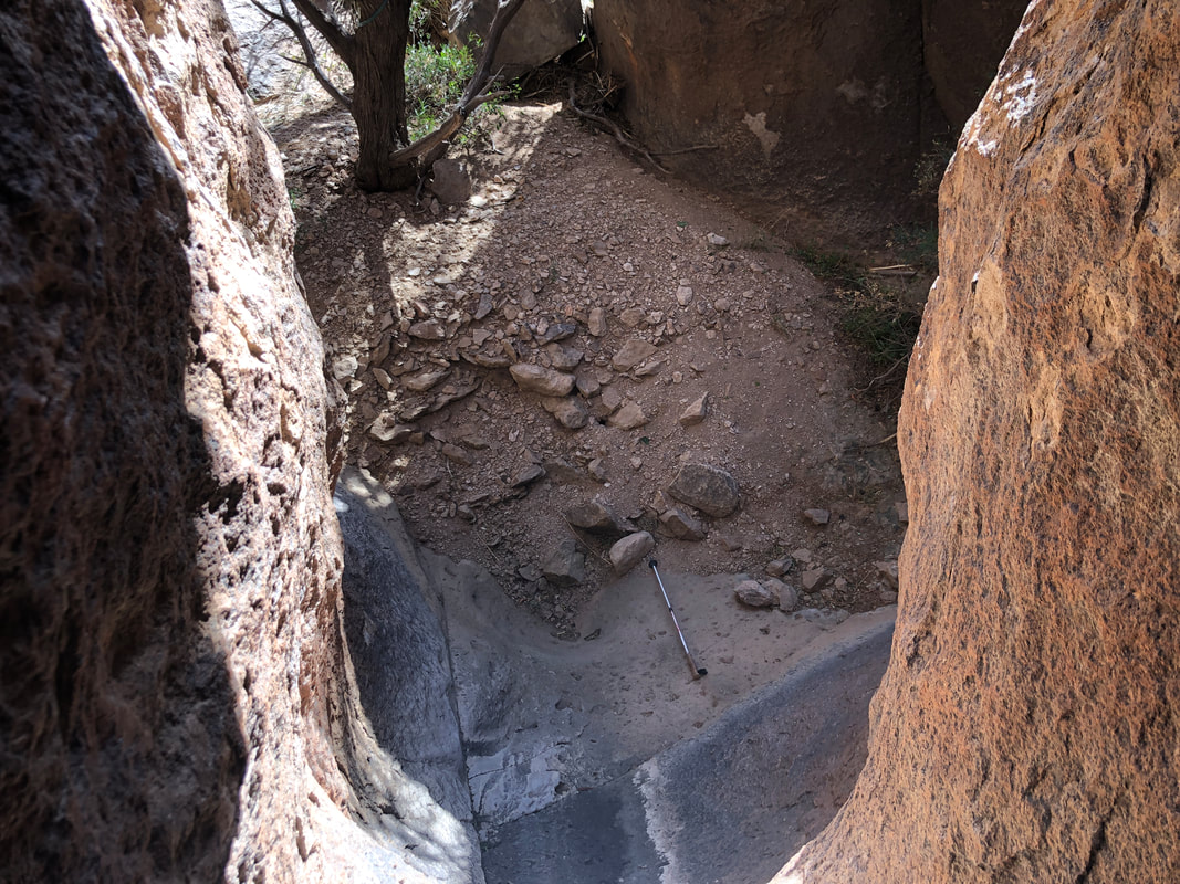 ....lower level where I see someone dropped a hiking pole. There is a sling fastened around a boulder but I don't have rope and would not try it solo if I did. I don't spend much time in the Roost, scramble out and regain the route. In the distance.... 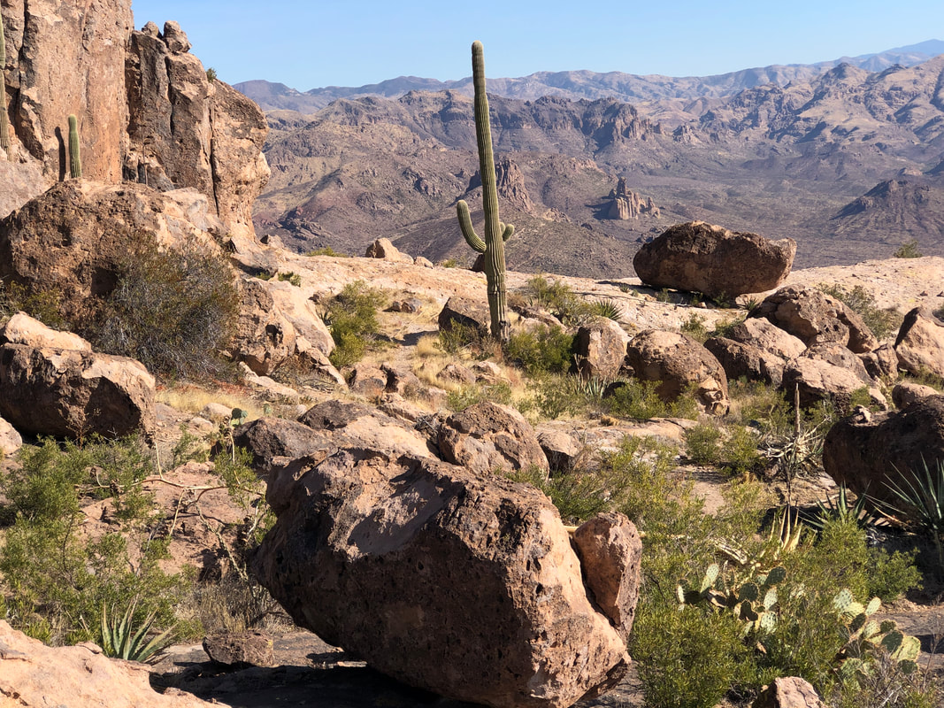 ....I see a shelf and hike over, which affords great views of Peralta Canyon. I run into a hiker who is doing my route but in the reverse direction. He said he was going to try to find the Roost but had no route info so I thought, "Good luck with that." 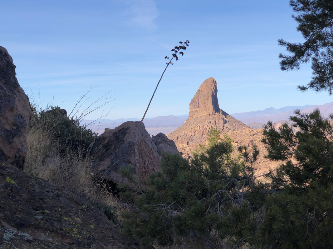 I continue my hike which has grand views of the volcanic plug, Weaver's Needle. Got a little off track but eventually found Peralta Trail and followed it for 2 miles until just a couple hundred yards from the parking lot, my attention is drawn to the cliffs above where I see.... 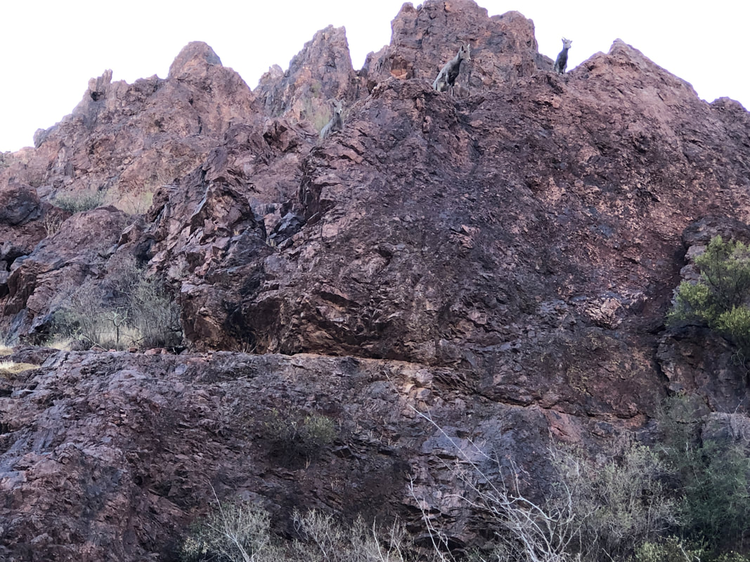 ....5 bighorn sheep. An unusual find. Of course, Peralta is a heavily trafficked trail so they are used to humans and simply stare at me. Finished with a bit under 8 miles and 2400' of climbing. I'm good to go with the group later this month.
 Our group of 11 departs from the Cam-Boh Picnic parking lot PROMPTLY at the designated time of 9am, lol. It's a pet peeve of mine that other hiking groups give as much as 30+ minutes leeway, penalizing those who make the effort to arrive on time...crazy. The first mile of this route is kind of boring, walking on flat, sandy ground but soon.... 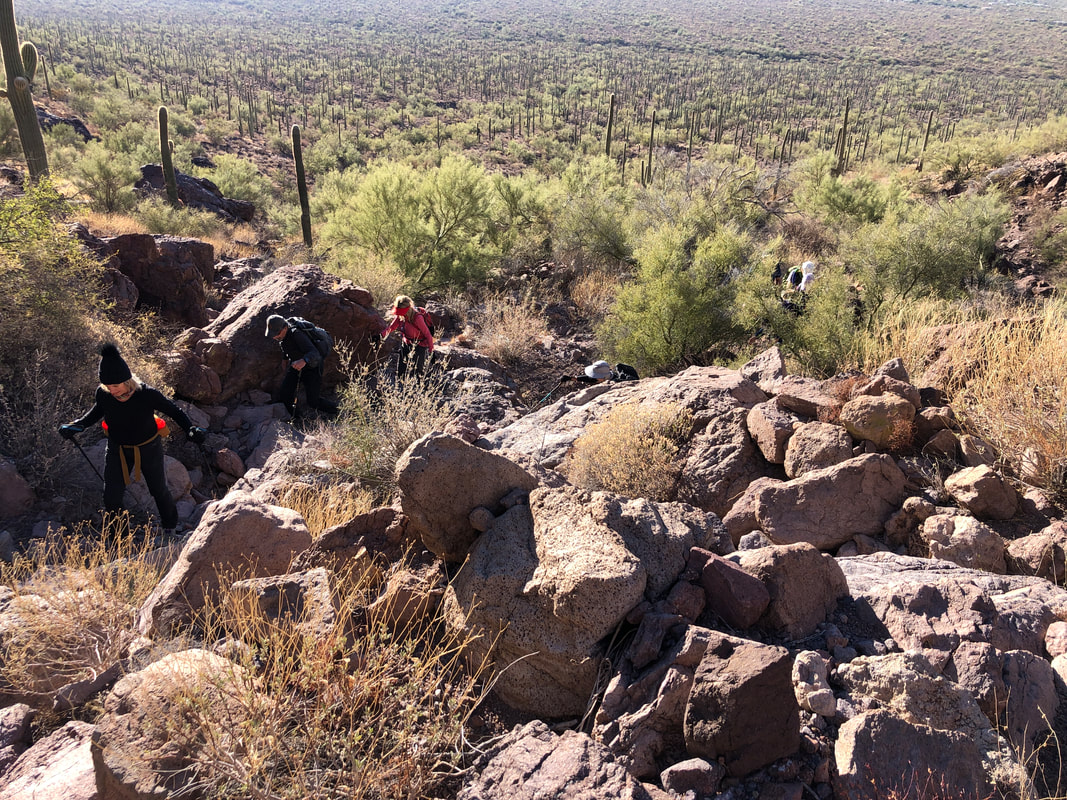 ....we reach a ravine and begin an entertaining route through a boulder field. Not an official trail but enough cairns that the route is not too difficult to follow.  We are headed to a saddle, still a bit distant above but the gang....  ....continues to climb and we are encouraged to see.... 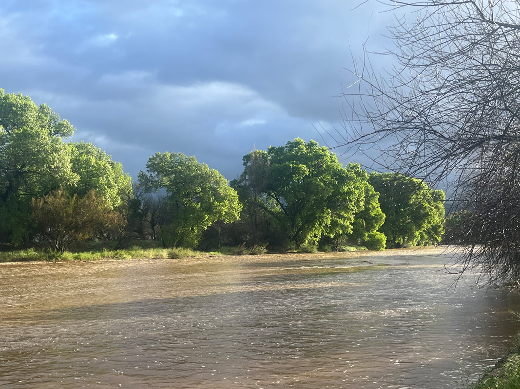 .....our destination come into view. Eventually..... 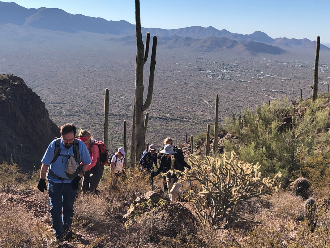 ....we reach a saddle and regroup. After a brief regroup we make a left and begin a more modest ascent. 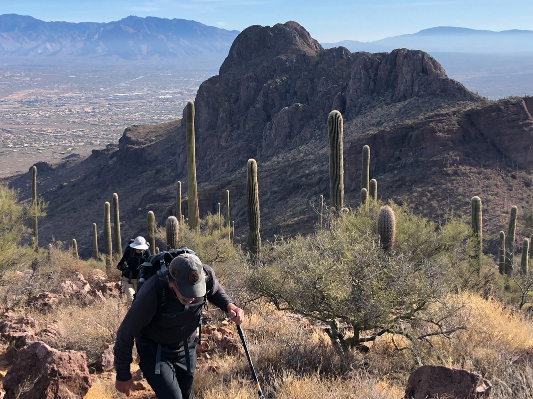 In the distance, the more well known "Sombrero Peak" as Barry leads a contingent of our group with others just behind. 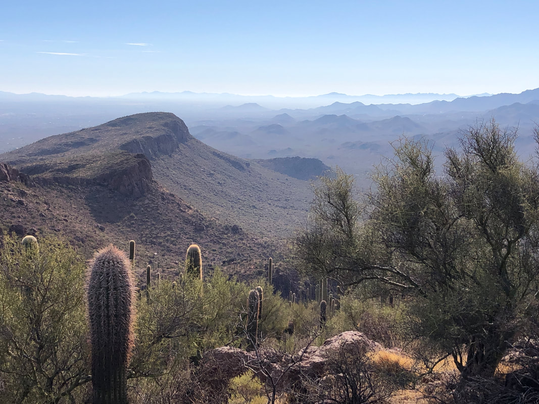 Check out the above view to the south. All the mountain ranges in the distance...love it! 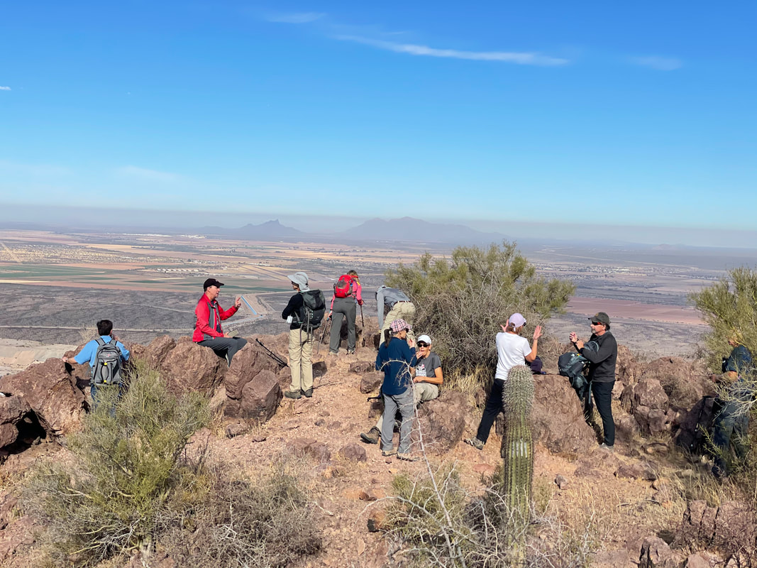 The group gathers at the peak where we refuel, talk a bit..... 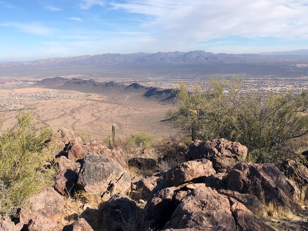 .....enjoy the great views while..... 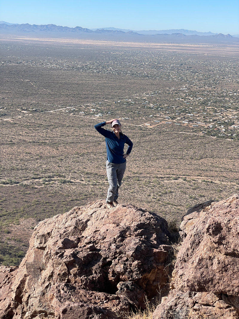 ....hiking friend Lorna scrambles to a prominent point to pose. Of course, any climb is followed by..... 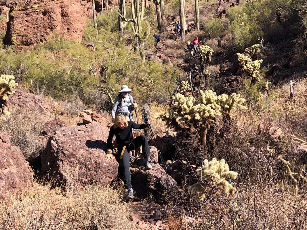 ...a down climb as Amy demonstrates one of the many challenges. We finish with 5 miles and 1400' of climbing. Good group as always.
|
