 Another early start, another beautiful morning. Here's a tip for you newbies. The morning temperature in St George was 64ish each day. With humidity at 10%, felt like 50 degrees. At the park, a degree or two cooler, you may want to pack light gloves and for sure, a long sleeve T shirt that you can remove to a base layer cause once the sun comes out of the shadows, it makes all the difference. 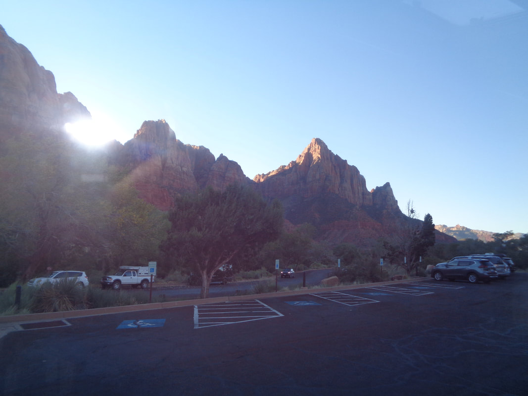 Previously, I suggested that you position yourself so you can sit, rather than stand on the shuttle. The above image is why as you see great views rather than the back of someone's head when standing. We arrive at stop #7, "Weeping Rock" and start on the "East Rim Trail" before the option to "Observation Point" presents itself. 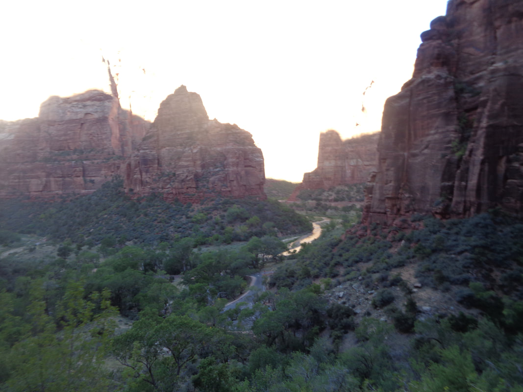 We begin the 8 mile, round trip hike. I was jacked up and motivated so set a pace I thought I could maintain for the first 3 miles, almost all of it climbing. 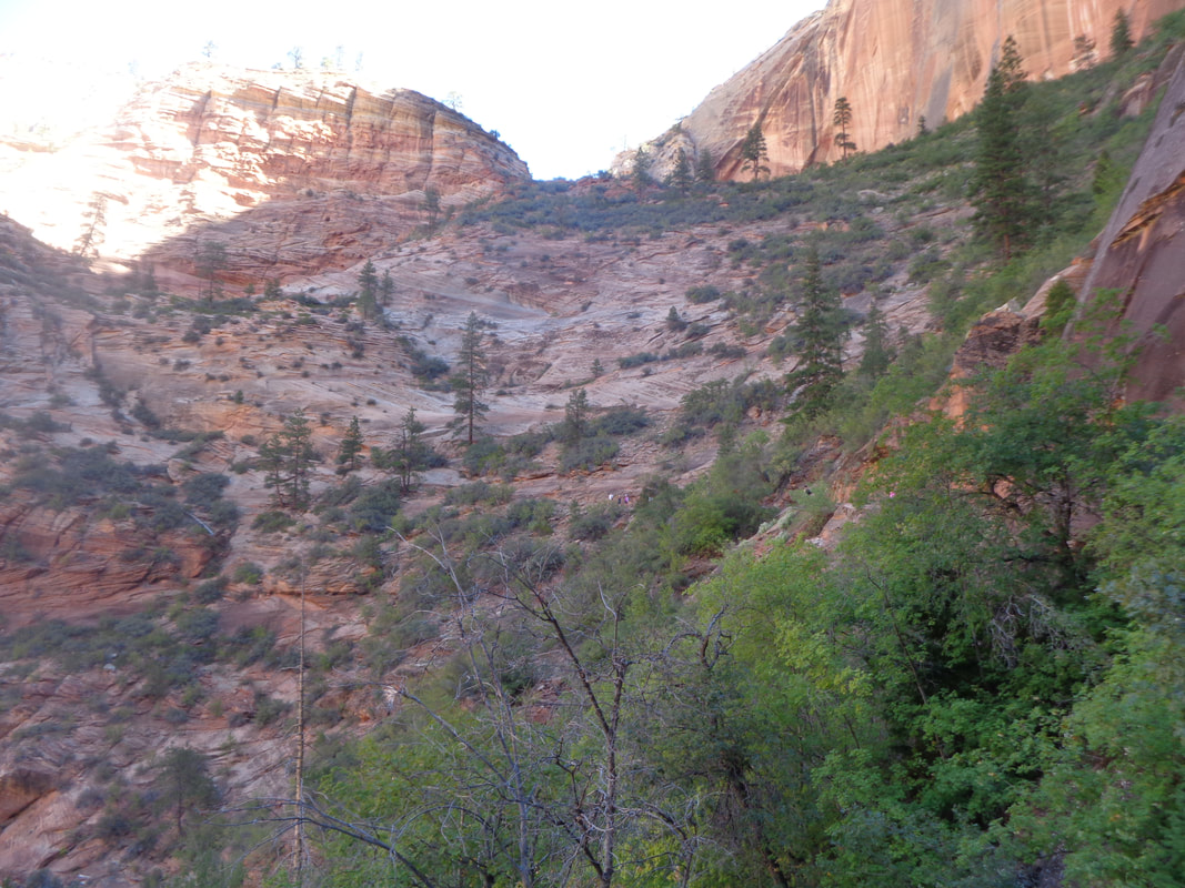 I hit numerous kind of steep switchbacks through this section. None are as steep as the steepest on the "Angel's Landing" hike but still, no walk at the beach. 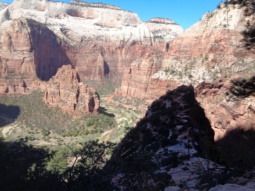 My legs feel pretty good as I look down on the Virgin River coursing through the canyon. At last, I reach..... 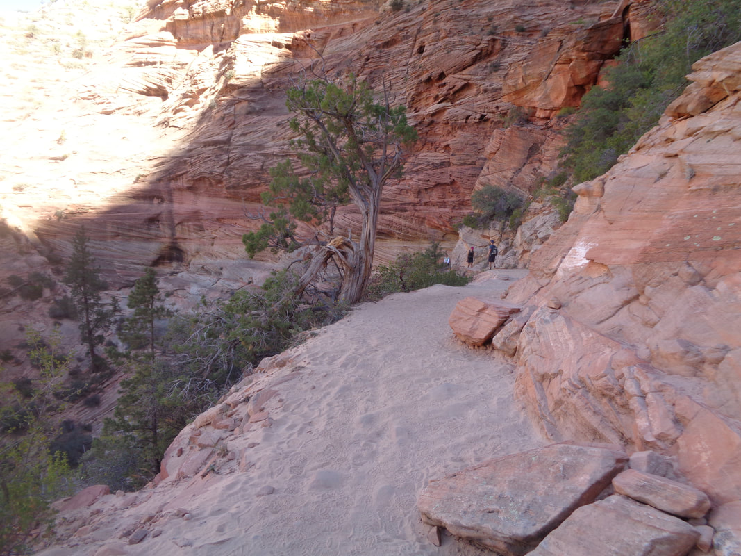 ….the drainage through Echo Canyon where the trail moderates somewhat. 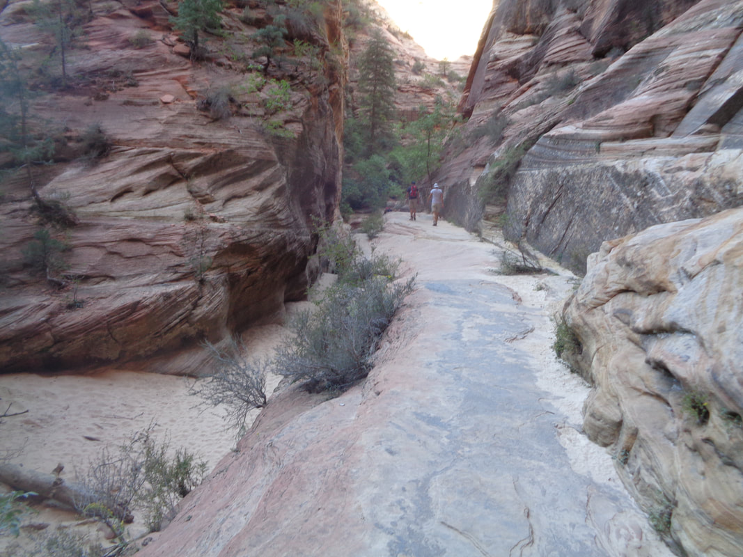 Sand lightly covers the slick rock and quickly I reach.... 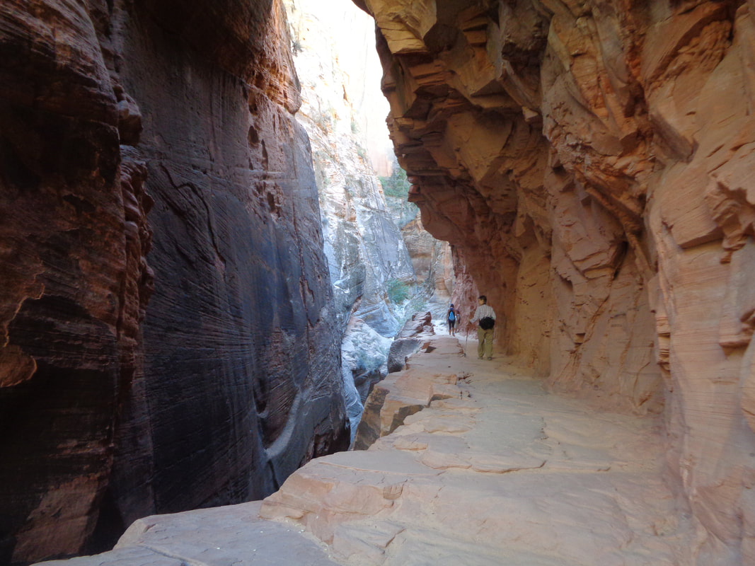 ….this semi tunnel before emerging to cross a short bridge and.... 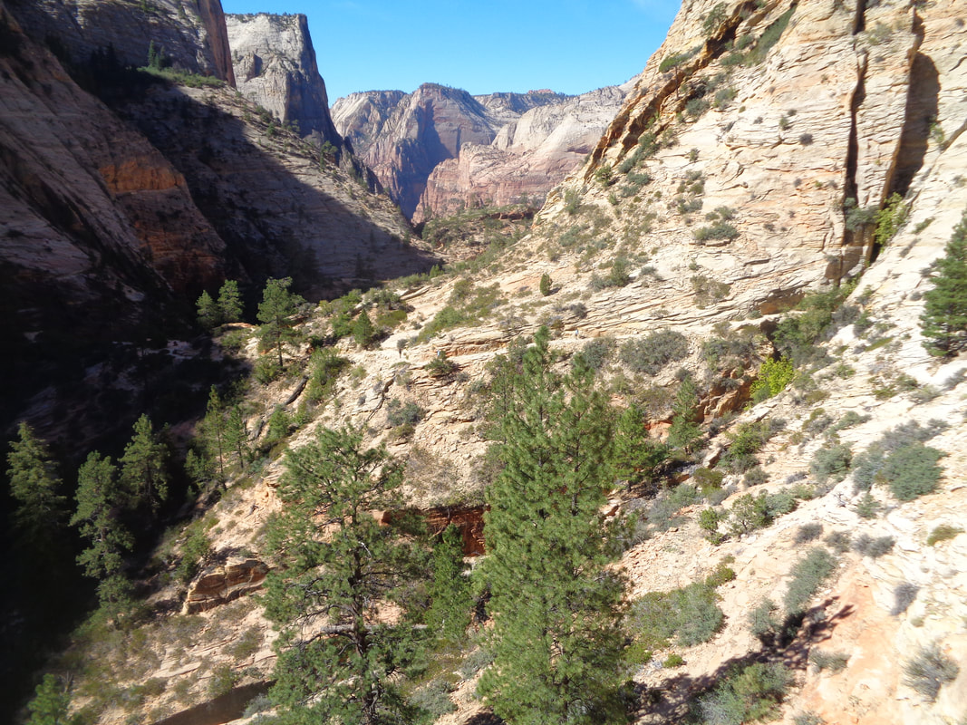 ….of course great views before...... 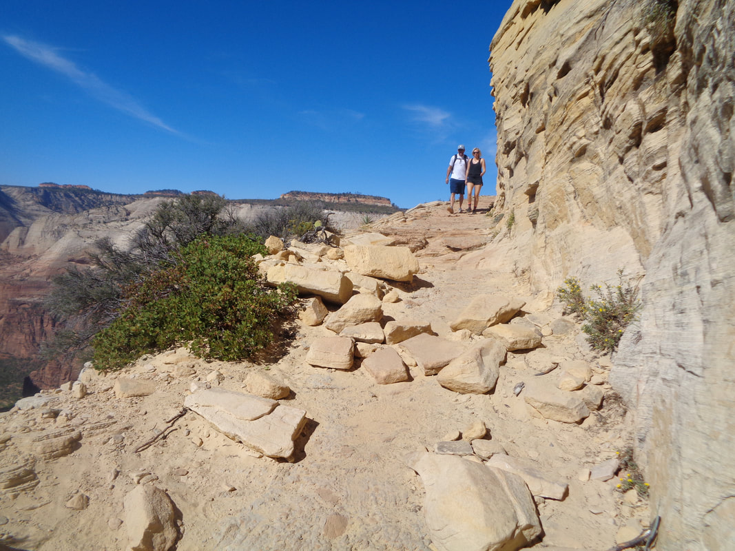 ….ugh, more steepness. Some people describe this long section of switchbacks as harrowing but.... 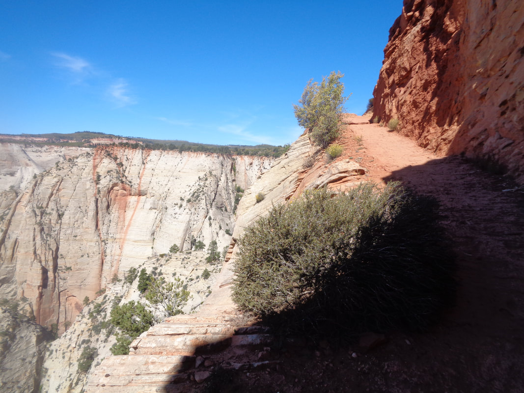 ….the trail is wide enough that I was not aware of the exposure. At mile 2.25 I began to run out of gas as I leg pain began to creep in. My breathing was ok but obviously semi-panting. I kept plugging away though and at reached..... 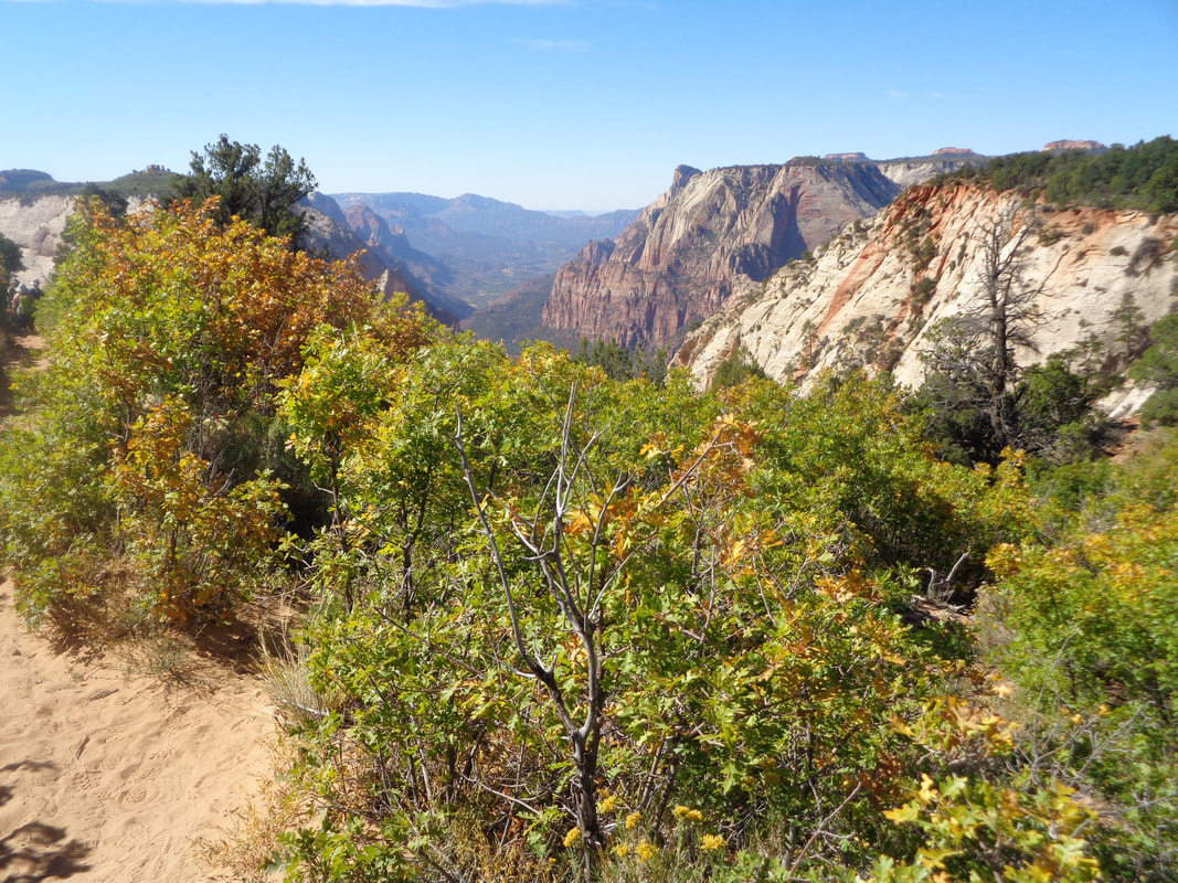 ….a point at mile 3 where now the trail is flat to undulating as it makes its way to Observation Point. What a relief as I enjoyed the views. I wondered how my effort would be rewarded and later discovered.... 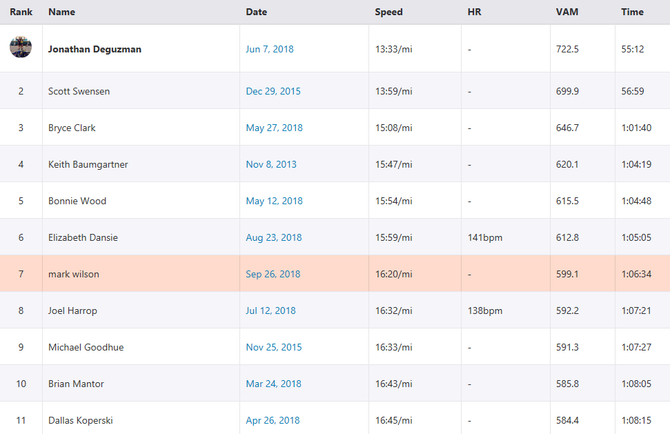 ….7th from bottom to the Point out of 1400 people. For other segments farther down canyon I did as well as 4th out of 2400. I was really happy after the Angel's Landing performance. 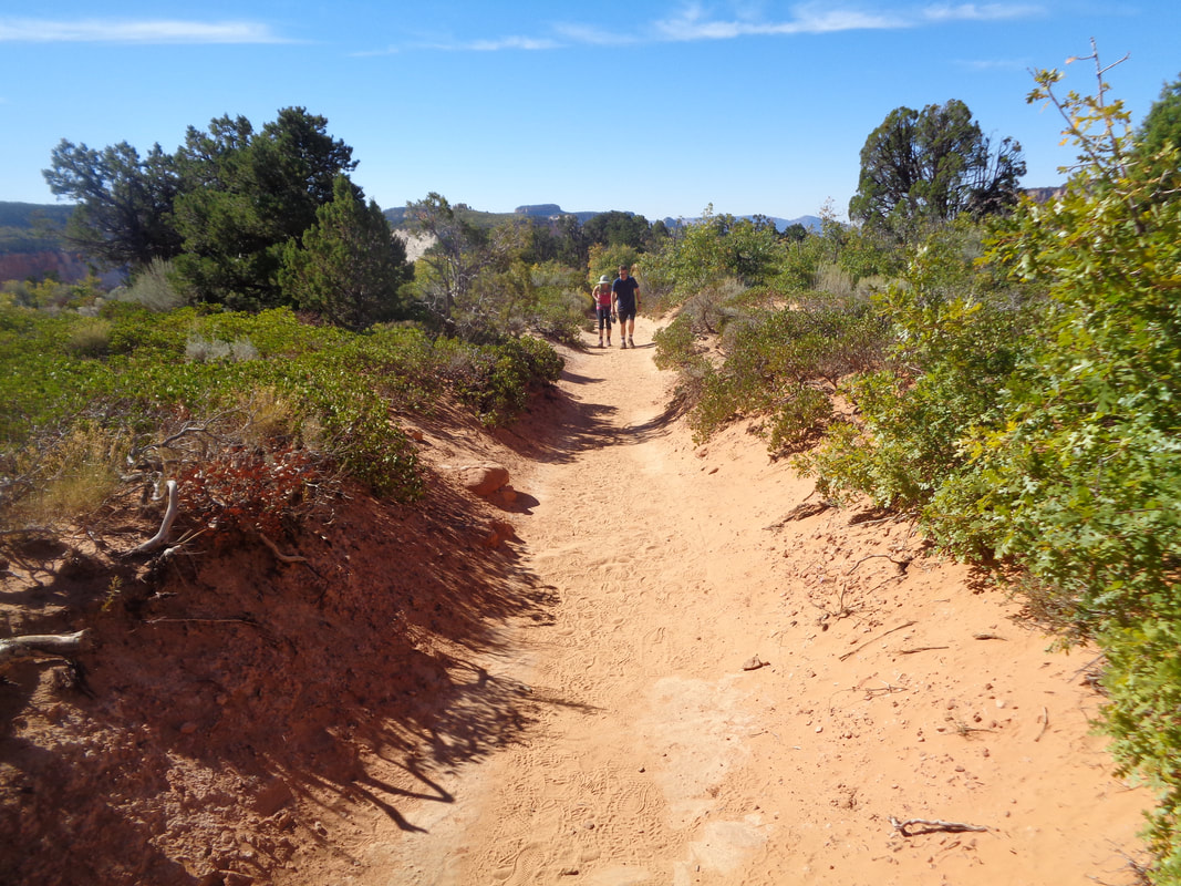 A nice, sandy approach. The average grade for the entire hike is 10% but that is skewed down by the final flatish one mile. For the climbing, 3 mile section I guess it is closer to 14% for an average. 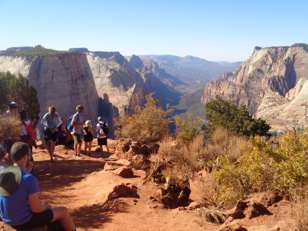 At last! What a view and someone asks if I want my pic taken so.... 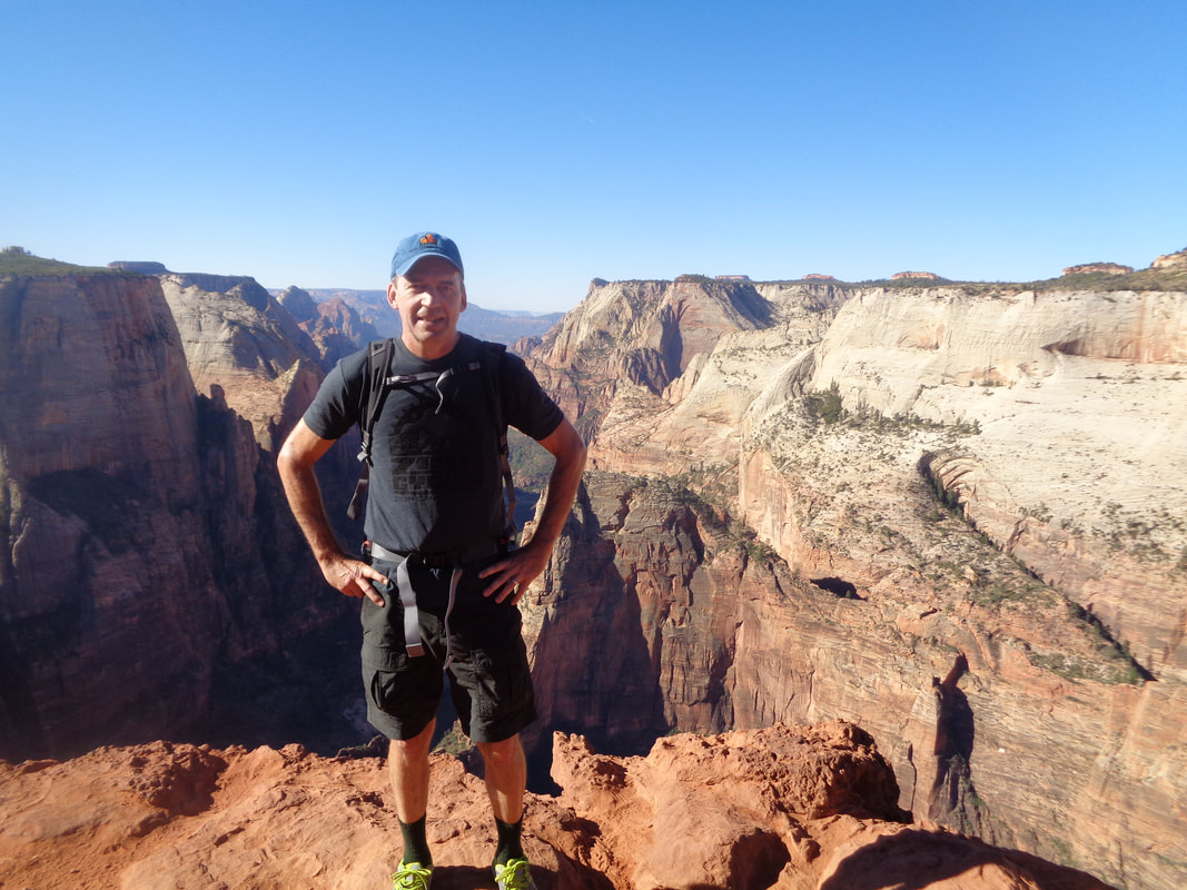 ….ok. I waited for my wife and she too was pleased with making it. An agonizing descent as the down climb muscles ached so after catching the shuttle to the lodge I.... 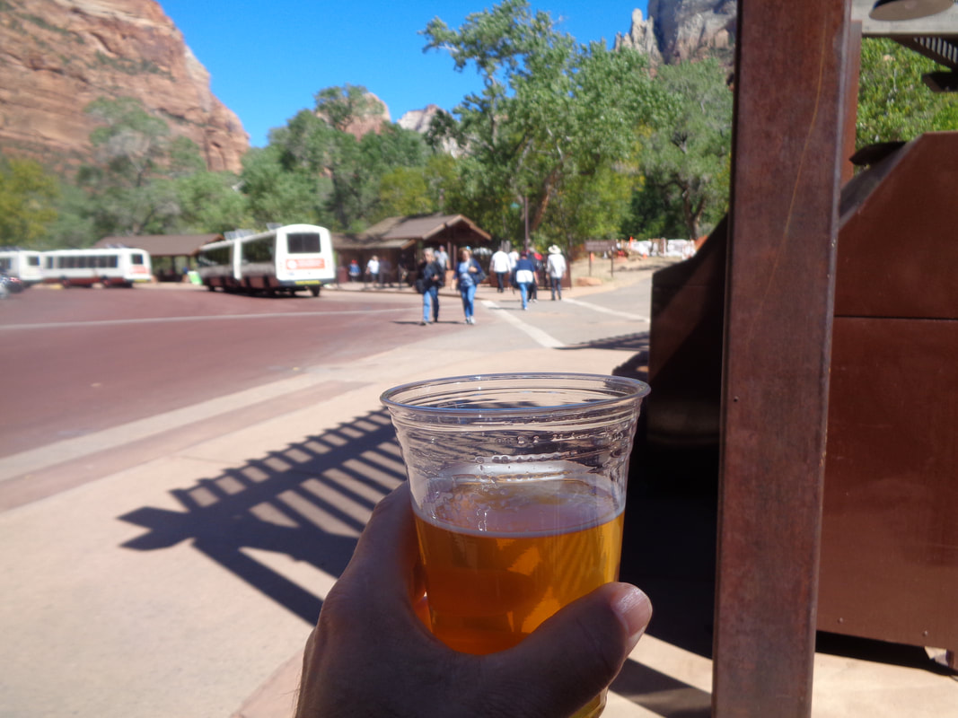 ...toasted myself with a beer. Hard to say which of the two main hikes I enjoyed the most but probably Angels Landing. That final 3.4 mile along the ridge is a bunch of fun.
0 Comments
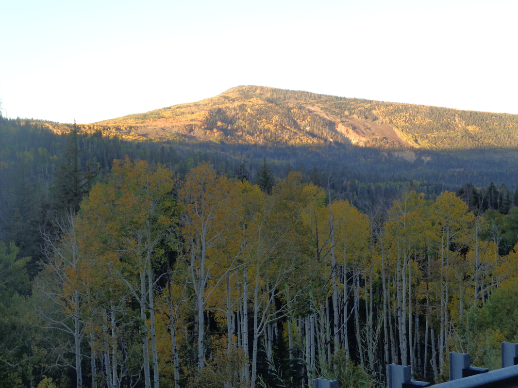 Another morning, another early start. At higher elevations, the Aspen leaves are turning. Our destination was Bryce Canyon and from St. George, there are 3 alternatives, each roughly to take the same time, 2:15. We went the northern route since it spent more time going 75mph on #15. However, we stopped for gas in Cedar City and a guy told us we should take the middle option from there and gosh, glad we did, 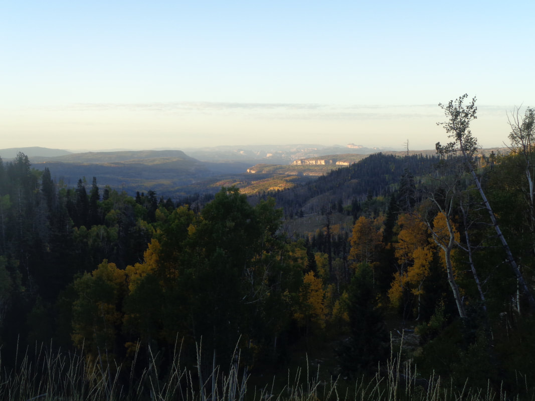 Following St. Rt. 14, to #89, the views are incredible. In the distance, way out there is Zion Park. The road is curvy but not too bad and I recommend it highly.  Another great view. We were at around 7000' elevation and the temps were in the 40's as we headed to the entrance of.... 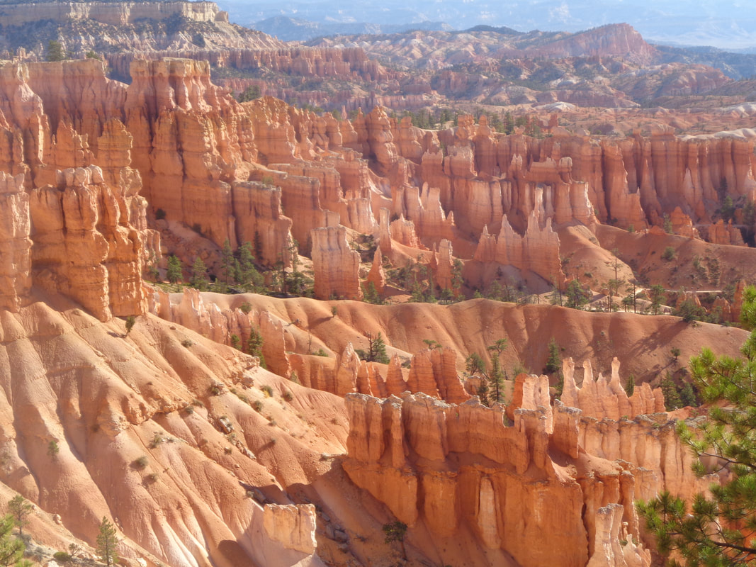 ….Bryce Canyon. This is worth the drive but you can cover it in one day. Zion is worth a multiple day visit but the variety here does not exist. Different from Zion, yes. 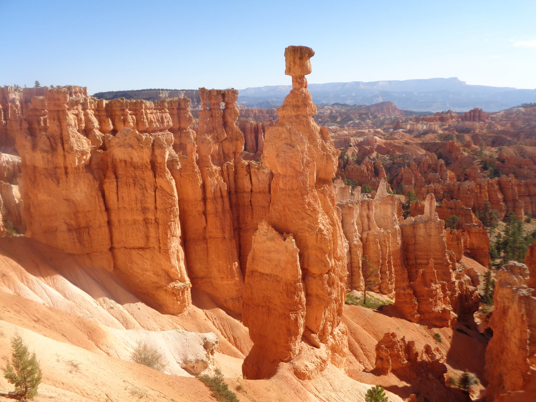 We drove to Sunset Point and started down the Navajo Loop trail which included.... 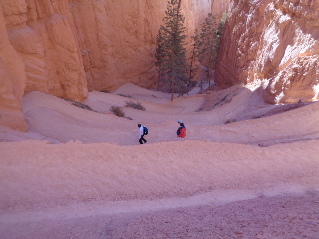 ….these steep switchbacks. Very steep. We left the Navajo trail for the..... 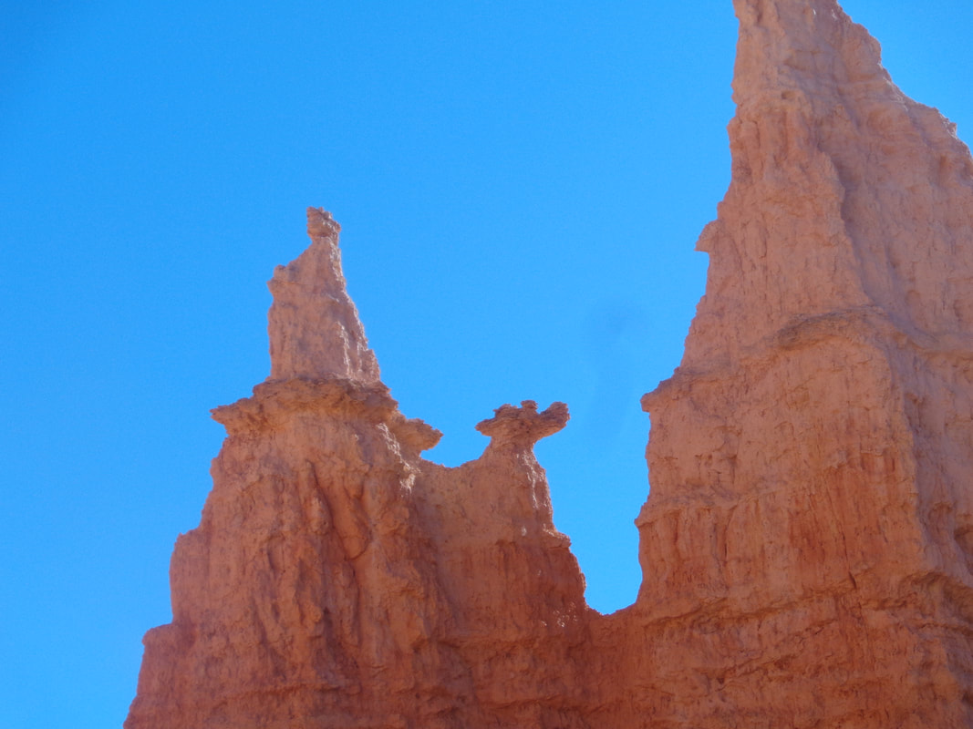 ….Queen's Garden Trail. Probably by looking at the above, which does not require much imagination, you can see why it is called that. This was only a 3 mile hike with a climb out of the canyon but that is ok cause I got a good one for tomorrow. 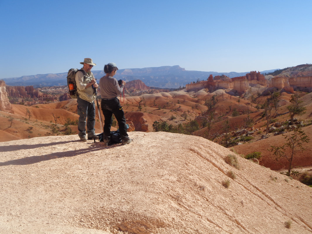 Almost out of the canyon and as always, lots of people taking images. You see a lot of very nice camera equipment when hiking around these parks. 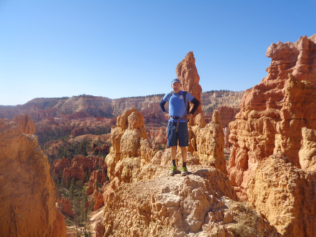 There is that cyclist, posing as a hiker. Glad I did not miss much good weather in Ohio while it was beautiful out here each day. Just moseyed with my wife since usually I leave her behind so had to score some points cause tomorrow, oh my. I am eager for tomorrow cause I am so disappointed in my Angel's Landing hike time. 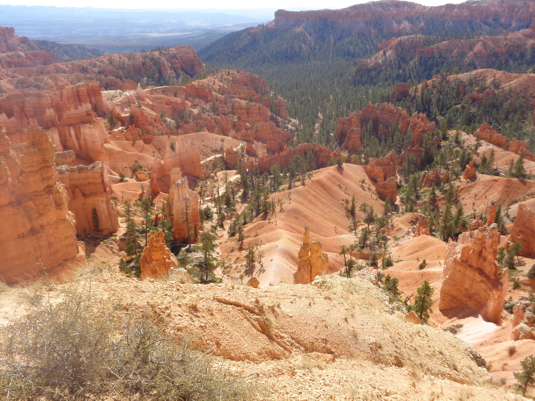 We emerge from the canyon at Sunrise Point and take the rim trail back to the car. Along the way, some people are walking with umbrellas for sun protection and a guy says, "Someone should tell them it ain't going to rain today." Funny. With plenty of waiting time on this trip, I have had the opportunity to talk to many people and all are enjoying their time, most from distant countries, with Germany being the best represented. 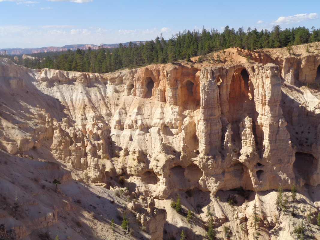 We drove to Bryce Point and had a good look at "The Windows". 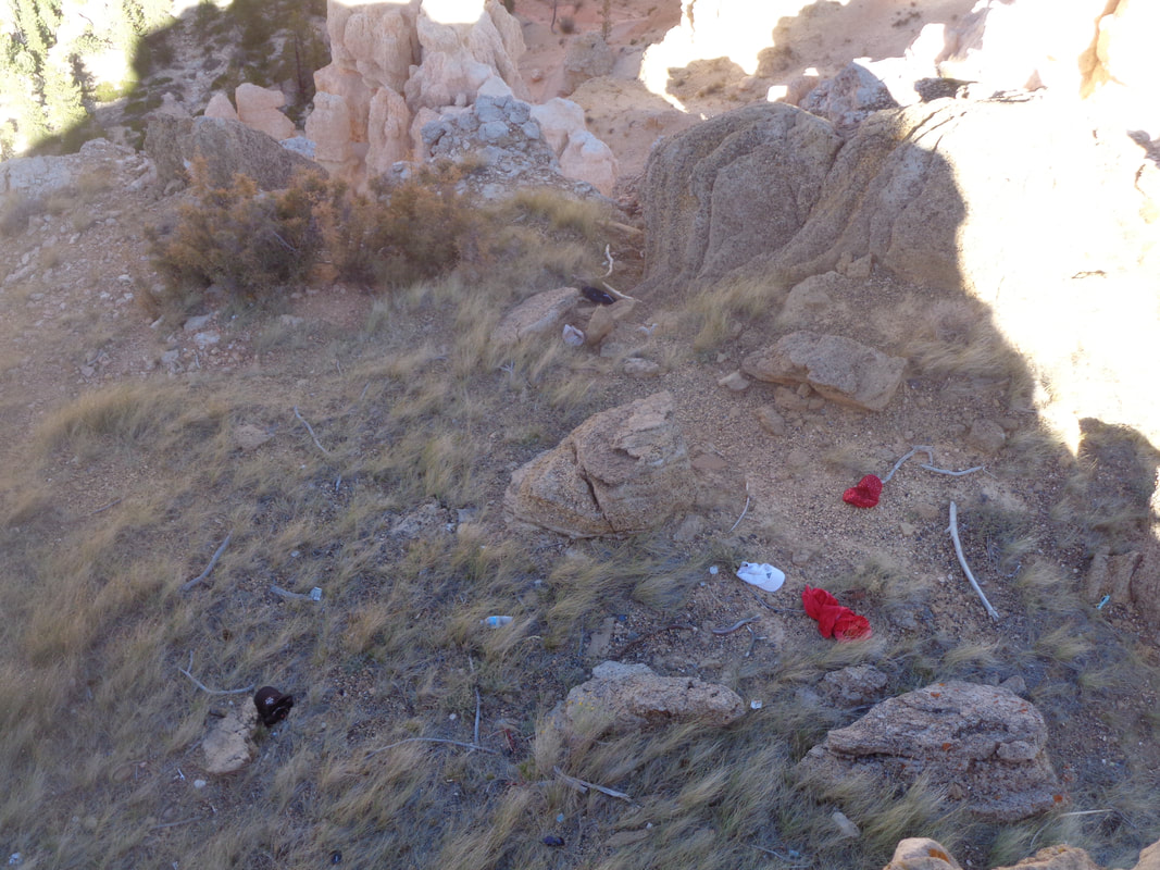 Below the viewing area, I saw 6 hats that had been blown from heads as this area receives some strong winds. Yep, one visit here is enough so back to Zion. Planned to visit Capitol Reef but at 3+ hours, don't want to do that drive time.
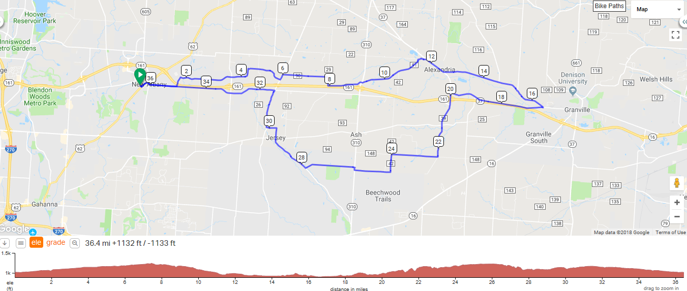 Here are the Thursday routes for yet another fabulous evening of sun, fun and exposure to some of the best personalities in central Ohio. Remember, start time of 5:30pm, sunset at 7:20pm. Chose your routes carefully between 37, 29 and 21 miles.
https://ridewithgps.com/routes/19497279?beta=false https://ridewithgps.com/routes/19497665 https://ridewithgps.com/routes/19497925 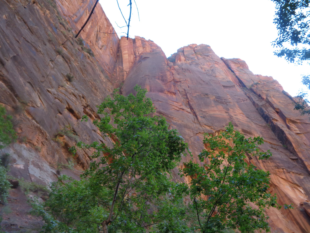 Zion National Park has a variety of worthwhile destinations/activities. One unique one is a hike through the Narrows, a 16 mile hike, 60% of which is in the Virgin River with walls soaring on both sides. 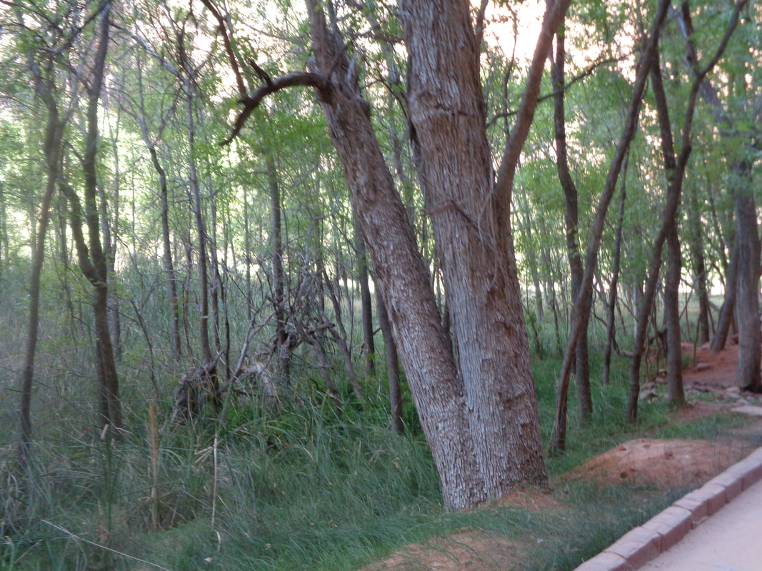 We walk along the river with vegetation supported by the river, including "weeping walls", many deer, all on a paved trail that undulates a little but otherwise is flat. 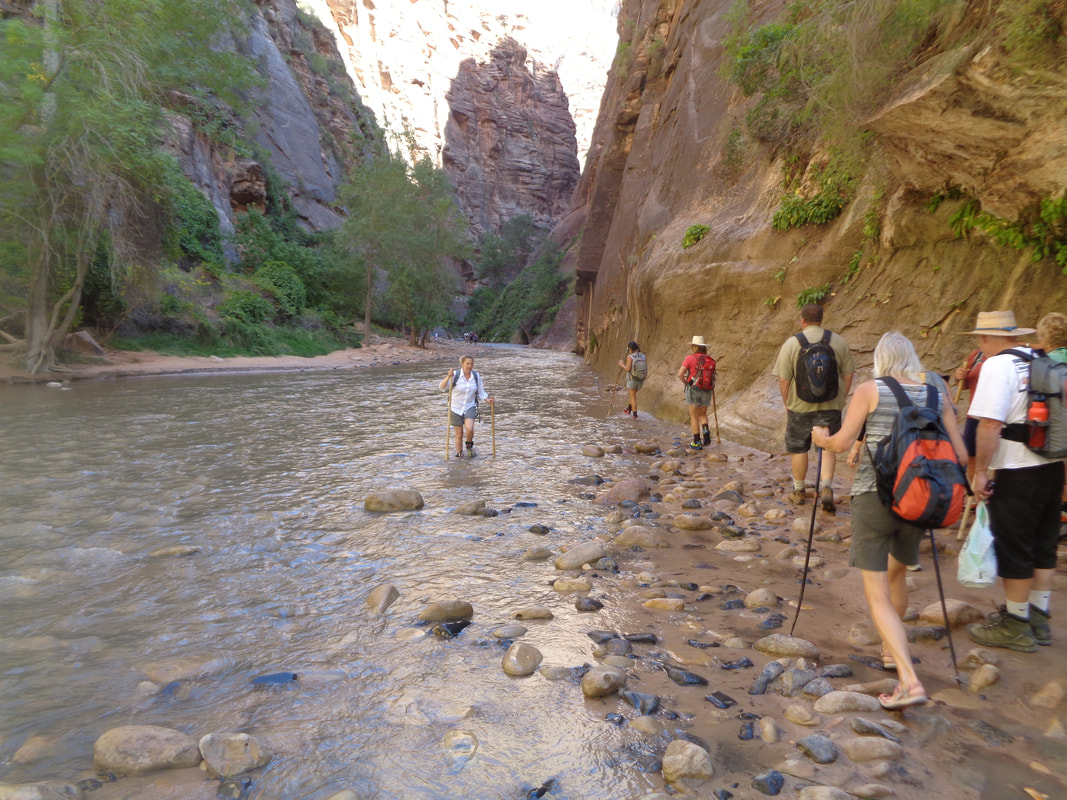 We reach the mouth of the Narrows as some people emerge from it. There is always the option of going in a mile to get a feel for it and then turn around. Or, a local company will rent you a bike and equipment and you ride to the mouth, change and plunge in for awhile. We chose to reach this point and turn around, ha, ha. That was always our intent. Would be a neat experience but walking in cold water is not on my list of priorities. Instead we.... 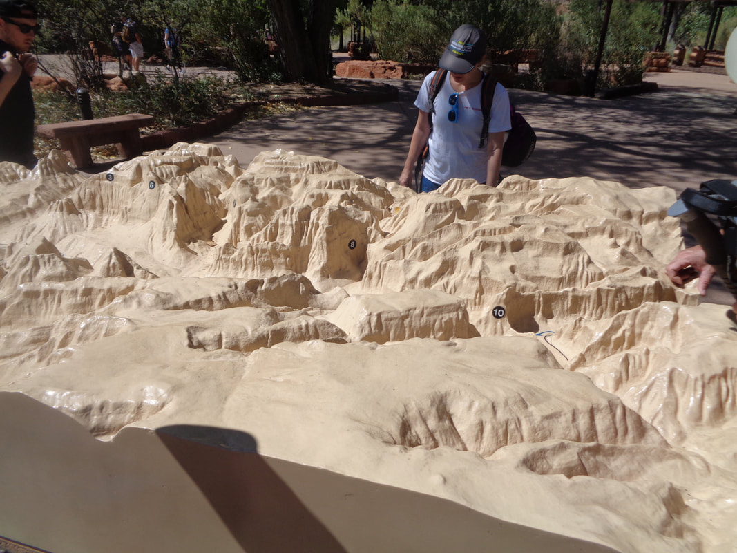 ….turn around and enjoy some light activity as we prepare for something more. Outside the visitor center, there is a neat model that shows the geographic features, including #10 which is Angel's Landing and then that prominent plateau to the left is Observation Point, a destination in a day or two.
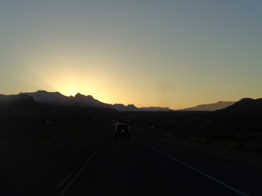
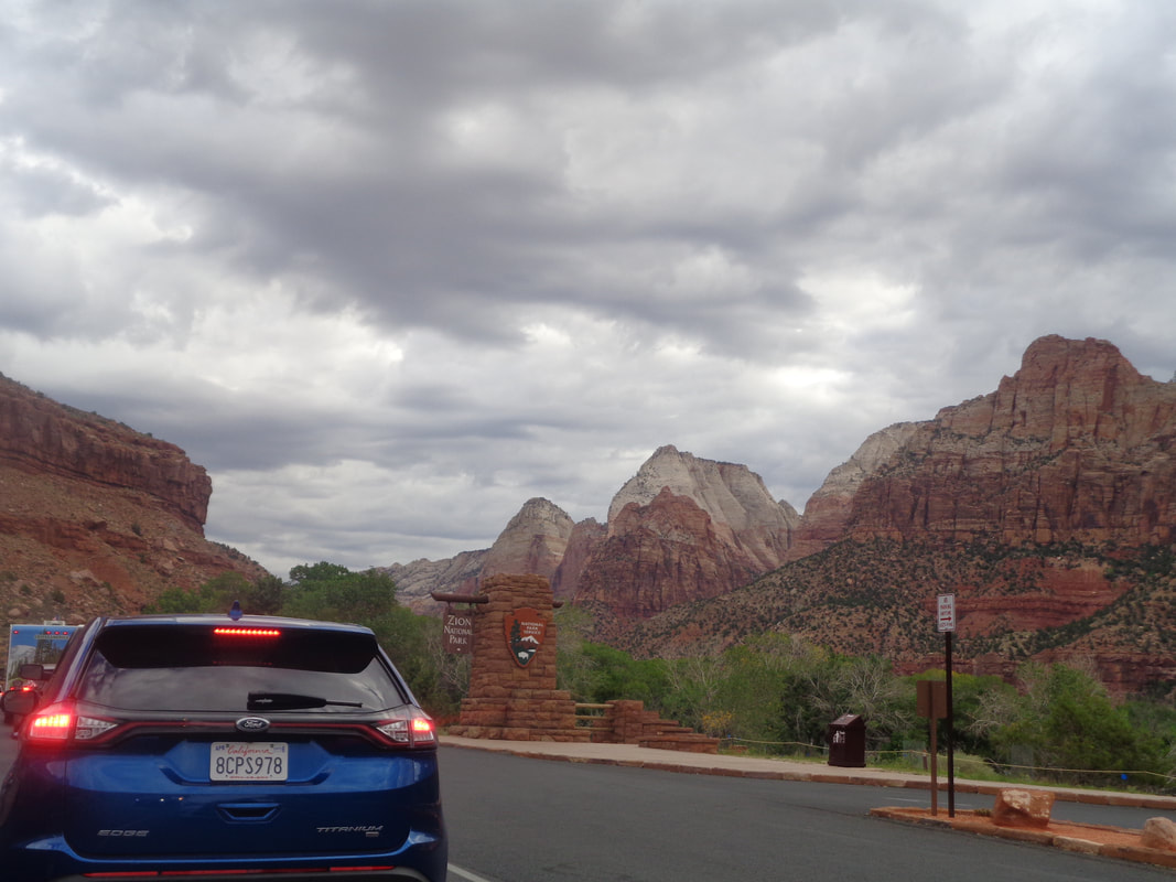
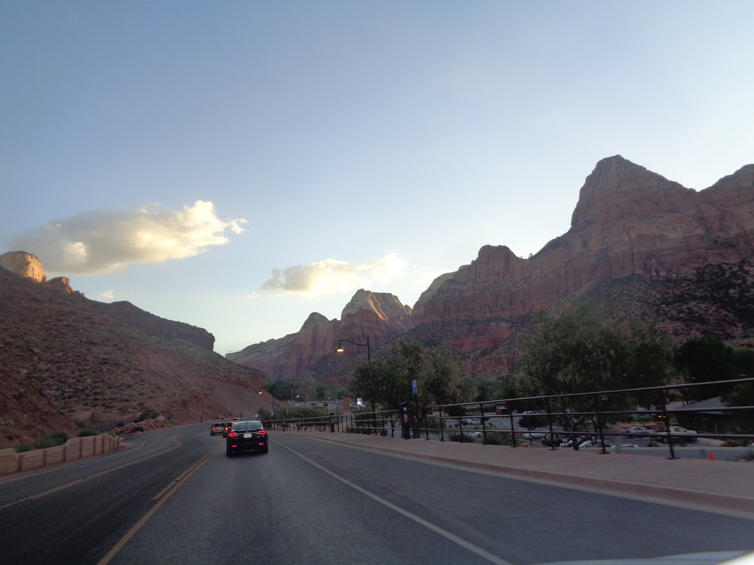 Staying in St George requires a 55 minute drive to the park just outside Springdale. Lot of neat shops and restaurants through the town and when the sun comes up, as it does every day, the mountain tops are beautiful. 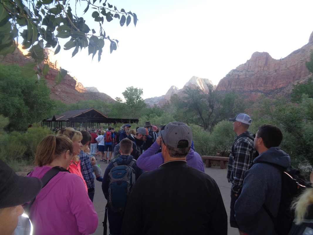 OK, late September, a Monday, I thought we would park at the Visitor Center and walk on the shuttle but no. They start running at 7am, we hoped to get on the 8am one but had to wait through one double shuttle and when the next pulled up 15 minutes later, we hopped on but..... 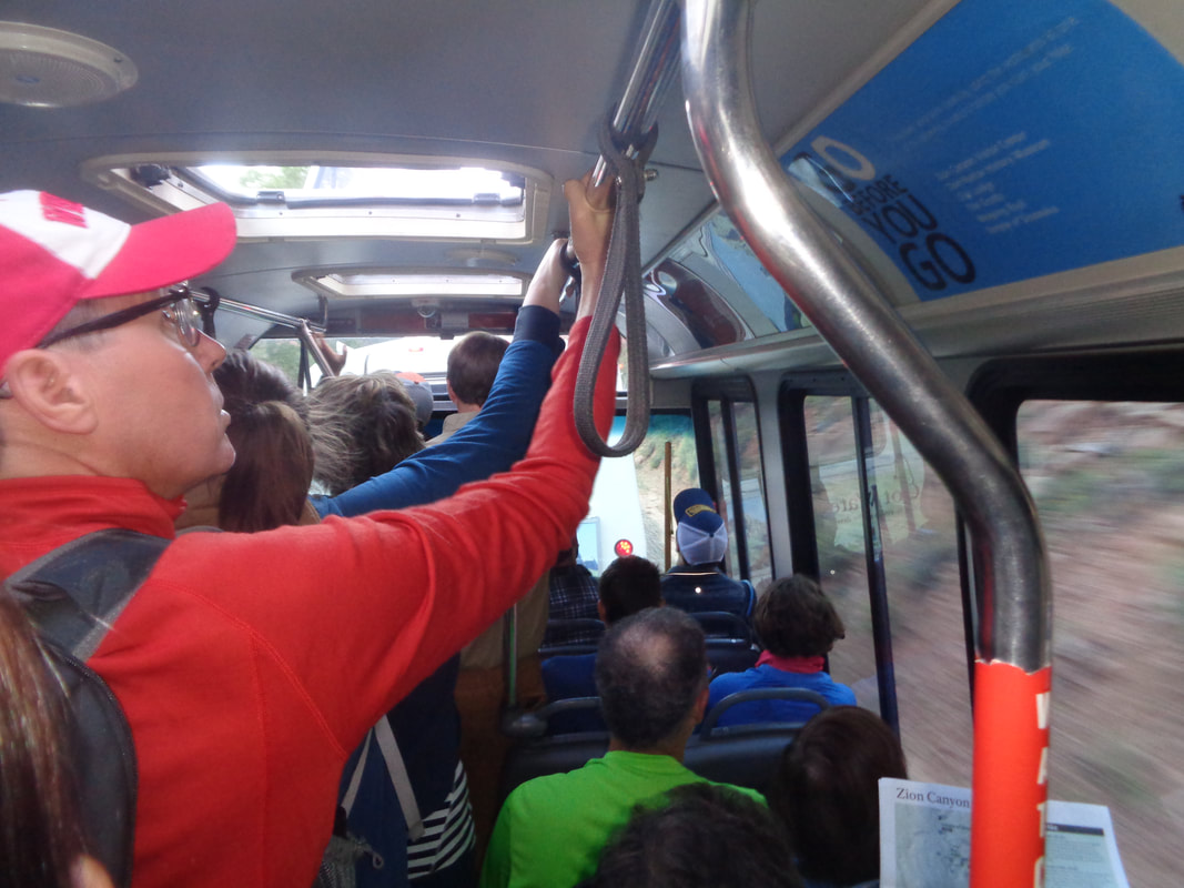 ….all the seats were taken. Do yourself a favor, if all seats are taken, wave the next few people through and get on the next shuttle. Standing takes away all the views and the drive can be as long as 40 minutes depending on which of the 9 stops you select. 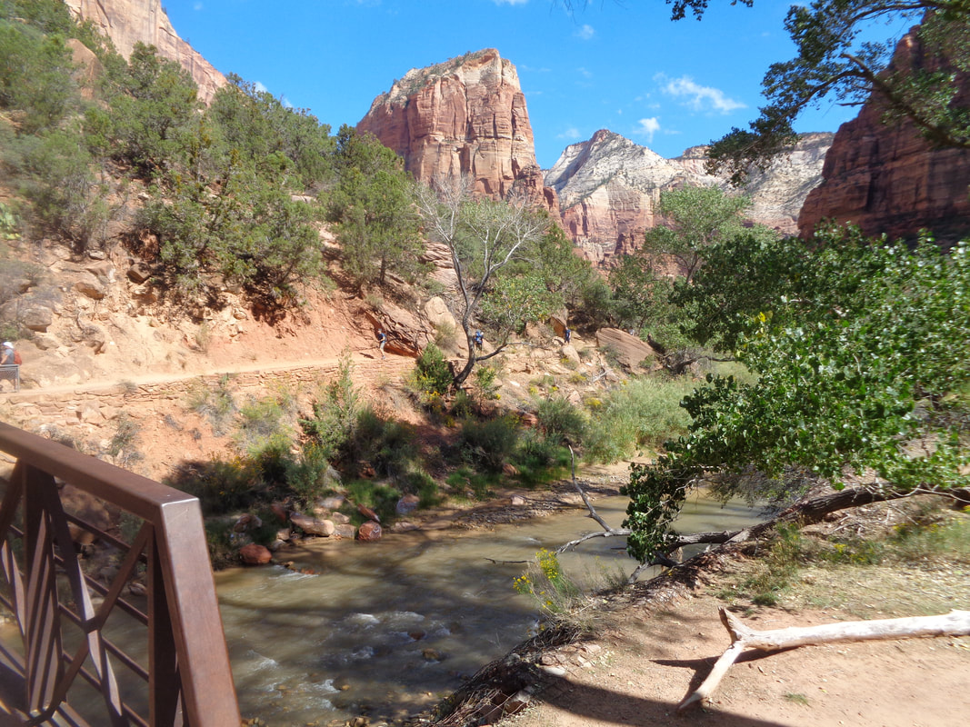 Our stop was the "Grotto" at stop #6. As the shuttle disgorged as many as 70 people, we hung back and waited for all to get a good head start. Then we crossed the bridge and began the hike to Angel's Landing, first via the West Rim Trail. 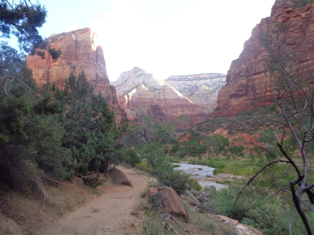 We follow a sandy path that parallels the Virgin River. There, upper left is the destination. 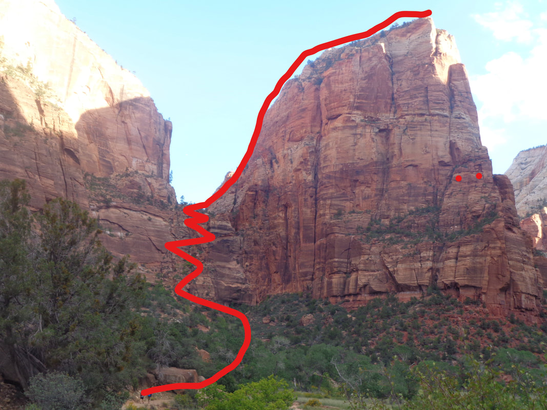 Roughly the route taken. The trail begins to rise, modestly at first and then some really, really steep switchbacks. The trail cuts into the mountain through Refrigerator Canyon toward a saddle and the steepness moderates and then.... 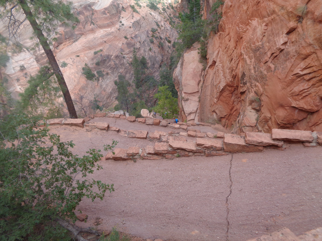 Holy Mackeral!!! The designer of the route, a guy by the name of Walter, must have been a sadist. Tight, extremely steep switchbacks that are known as "Walter's Wiggles". I hit this section pretty hard and was relieved that.... 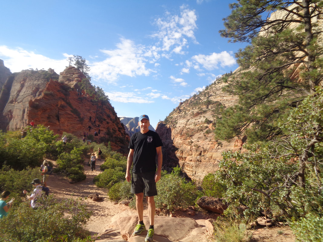 ….at last I emerge at Scout's Lookout. I wait for my wife and I guy asks if I want to have my picture taken so ok. While I wait, I see a steady stream of hikers begin the ascent of Angel's Landing. 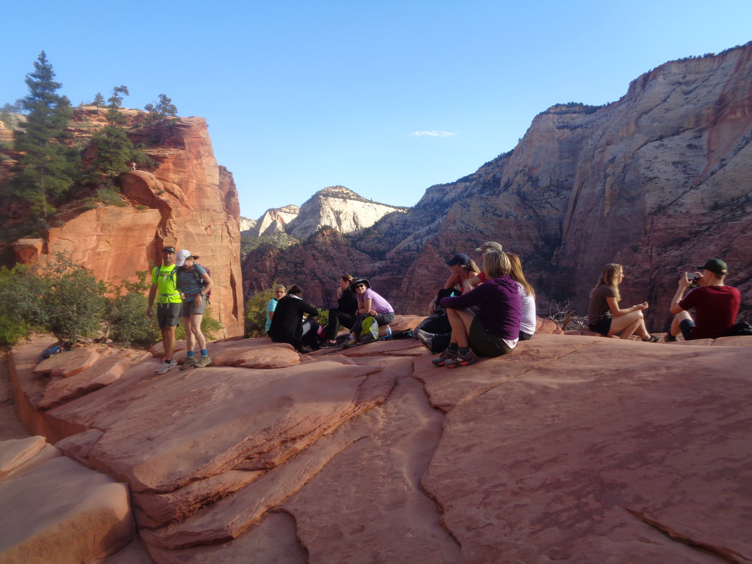 Lot of people hang out here either as their destination for the day or to rest before the real fun begins. 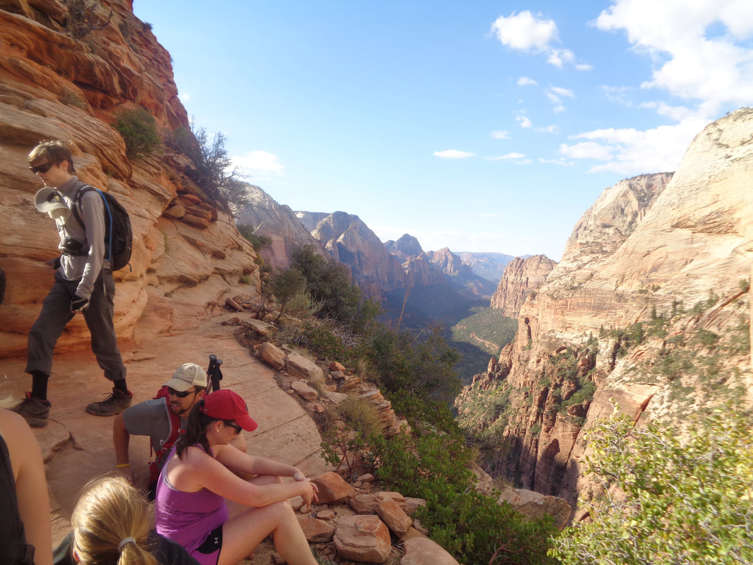 Roughly midway up some people take advantage of a flat spot and rest and the views, magnificent! 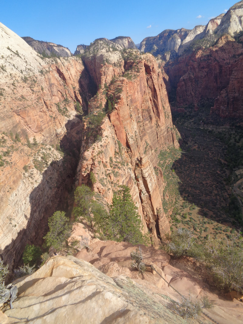 We continue up, required to pause and allow down trail traffic to pass rather frequently. Looking back from where we started, if you have fear of exposure you will have a problem but just focus on the numerous chains that are good hand holds and don't look down, which worked for my wife. 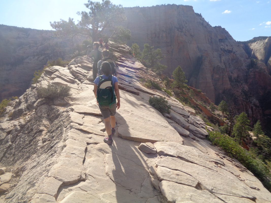 The final mellow pitch to the end. If you want to try to set a good time, go on the first shuttle, get in front of everyone, pass them on the sandy part of the trail and then go. Otherwise, you'd have to be a major Richard Cranium to squeeze by people once you start the Landing hike off West Rim. Since 2004, 7 people have died falling off the thing. 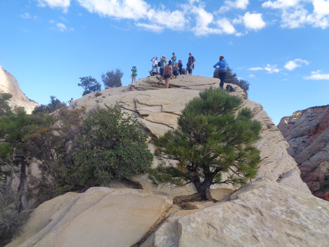 Almost there and then.... 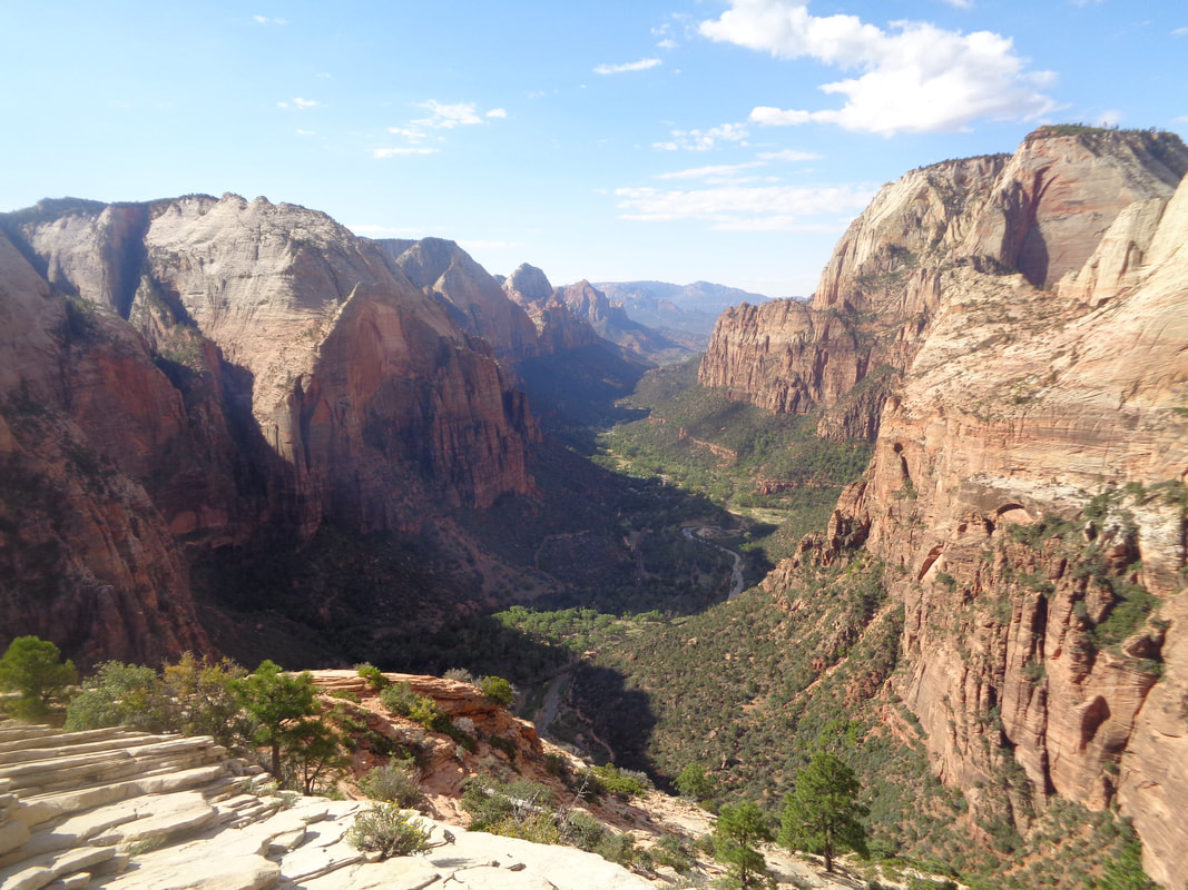 ….there! Round trip is 5.5 miles so the distance isn't much but the views and enjoyment of navigating the Landing portion of the hike makes it one of the best. The 1.6 miles of the steepest part of the West Rim hike that included Walter's Wiggles averaged 16%. On Strava, I am 53rd out of 2400. Kind of disappointed with that but don't have my hiking legs under me yet. May come back in October and do it again. 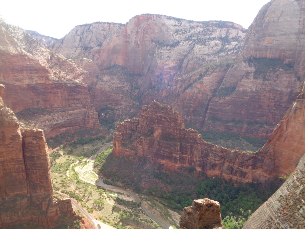 Looking in another direction, one can see the north fork of the Virgin River. On the hike down.... 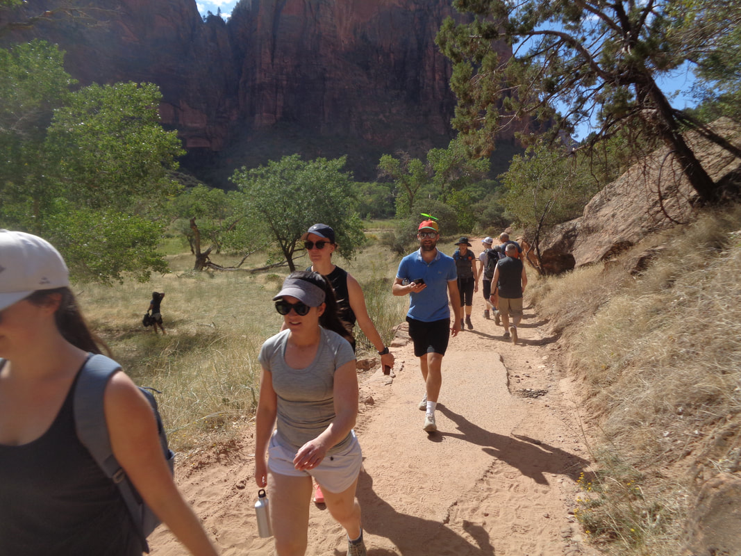 ….I pass lots of people, including a guy with a propeller on his hat. First time for that.
 We arrived late last night and because of the late planning, had to settle for a good hotel in St. George but that is an hour away. Some cloud cover as we enter the park. We planned to just do some reconnoitering and make sure we knew where to go for our planned hikes. I thought the crowds would have thinned this late in the year but the waits were long for entering the park. 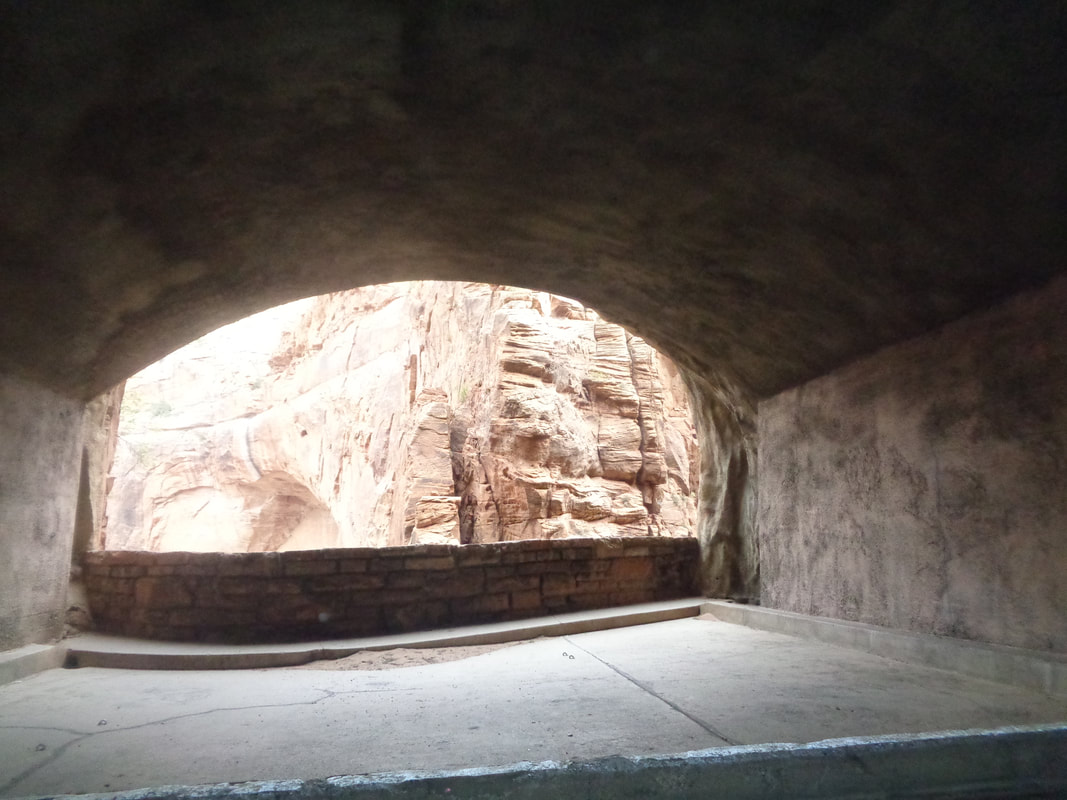 The Scenic Drive road was closed to shuttles only so we drove the Mount Carmel Highway that included a cool 1 mile tunnel with windows that opened to a canyon. Soon after exiting the tunnel we..... 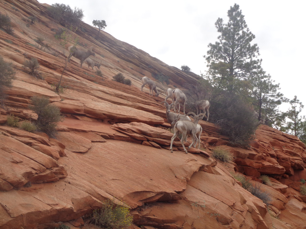 ….passed a herd of Bighorn Sheep. Then, about 3/4 of the way through the drive, I spotted..... 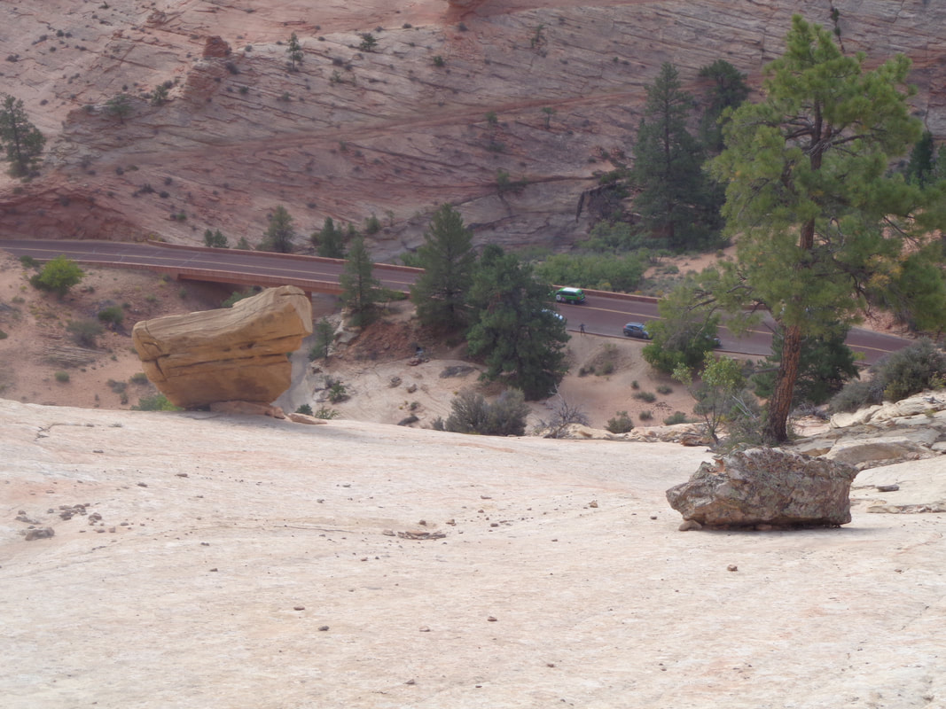 ….this kind of steep but doable slickrock slope so climbed to a saddle and....  ….wow and..... 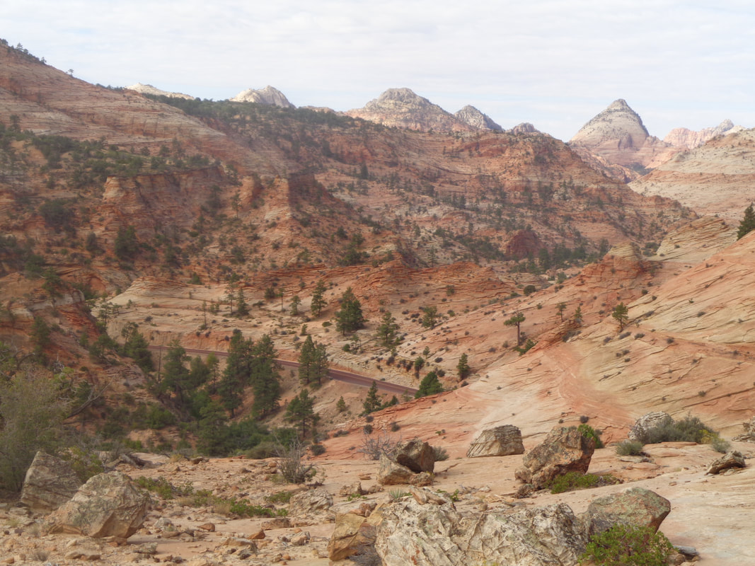 ….wow. Really looking to getting an early start tomorrow to do Angel's Landing and other hikes. On the return I stopped at a bike shop and bought the obligatory T-shirt and adjoining the shop was.... 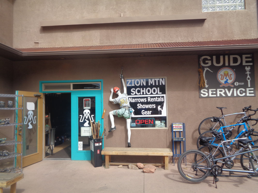 ….a neat gear shop for climbers and hikers.
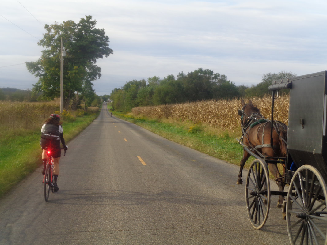 I was glad this image came out as pretty cool as Kenda Janet passes a slow moving vehicle on our way to Bladensburg. More to come, soon. 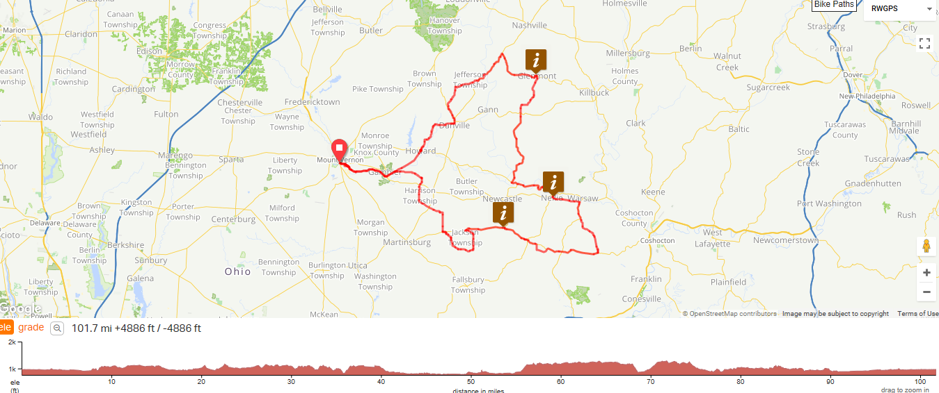 COP cancelled kind of an ill conceived 2 day event for this weekend that included the annual Knox County Bicycle Challenge. Since there was a lot of interest, the Cycling Club decided to offer the route as a free event with a surprise free food/beverage stop. Then COP decided to renew KCBC and marked the route. So, we will defer to them and offer this from their web site:
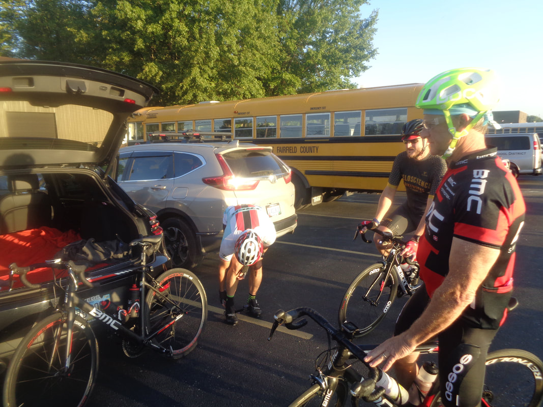
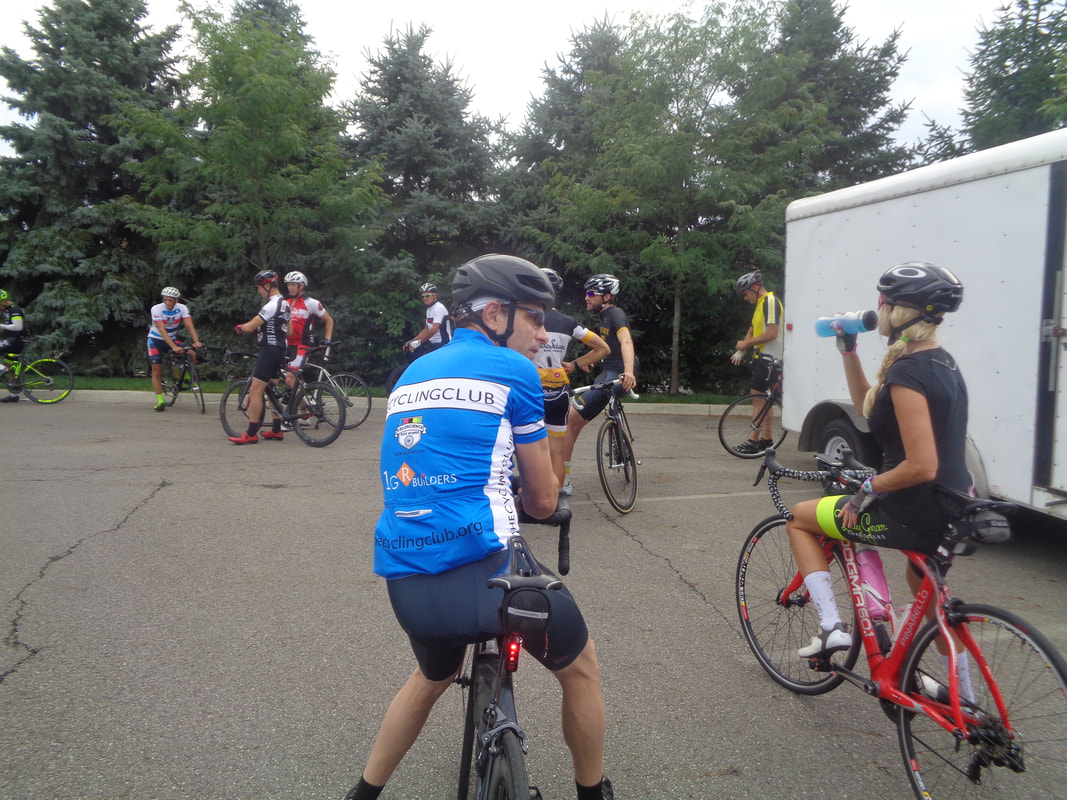
Due to many requests from folks who want to ride KCBC this Saturday, we are going to offer this as a BUDGET TOUR. Ride start in Gambier at Community Center on Meadow Lane. Maps will be provided, and routes will be marked- Metric Cenury and Century, however riders should be aware that bridge closure on Century route will require returning from Glenmont on bike trail. No food provided, so bring snacks. Food is available in Bladensburg, near Tunnel Hill, in Roscoe Village, Warsaw (near Nellie). Food also available in Glenmont (century riders only). No SAG. Cost will be $5 for COP members and $10 for non-COP members. You must register and sign COP liability waiver. Ride organizer Gary Schmidt will be at Gambier between 7:30 and 8:30 am Saturday, Sept. 22. Community center is at: 115 Meadow Lane, Gambier, OH, 43022. The official marked routes are for the 62 and 102 mile options. I have included an 85 mile option if you want something in between but the road is not marked for it. Many of us rolling out at 8am. https://ridewithgps.com/events/61479-kcbc-2018-day-1#routes/28077683/preview https://ridewithgps.com/events/61479-kcbc-2018-day-1 https://ridewithgps.com/routes/16642592 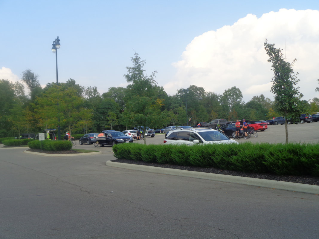 The estimates provides by those already arrived, given the earlier start time, was betweem 35-40 cyclists would participate. A low number as it turns out as around 50 came out. Damn, maybe we should keep it that way and have 70 mile routes next season? 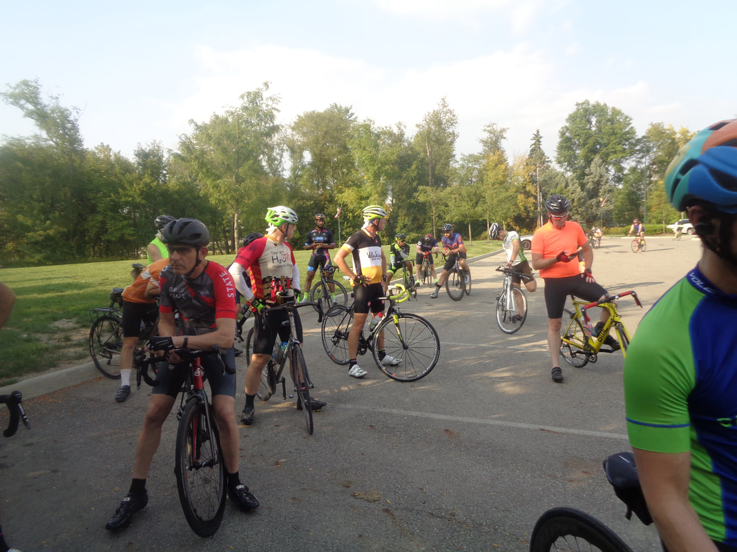 Another hot and humid evening so of course, we gather in the lone shady spot. The trees planted several years ago, elsewhere in the parking lot are the farthest thing from a shade tree as possible. They may as well have planted poles. 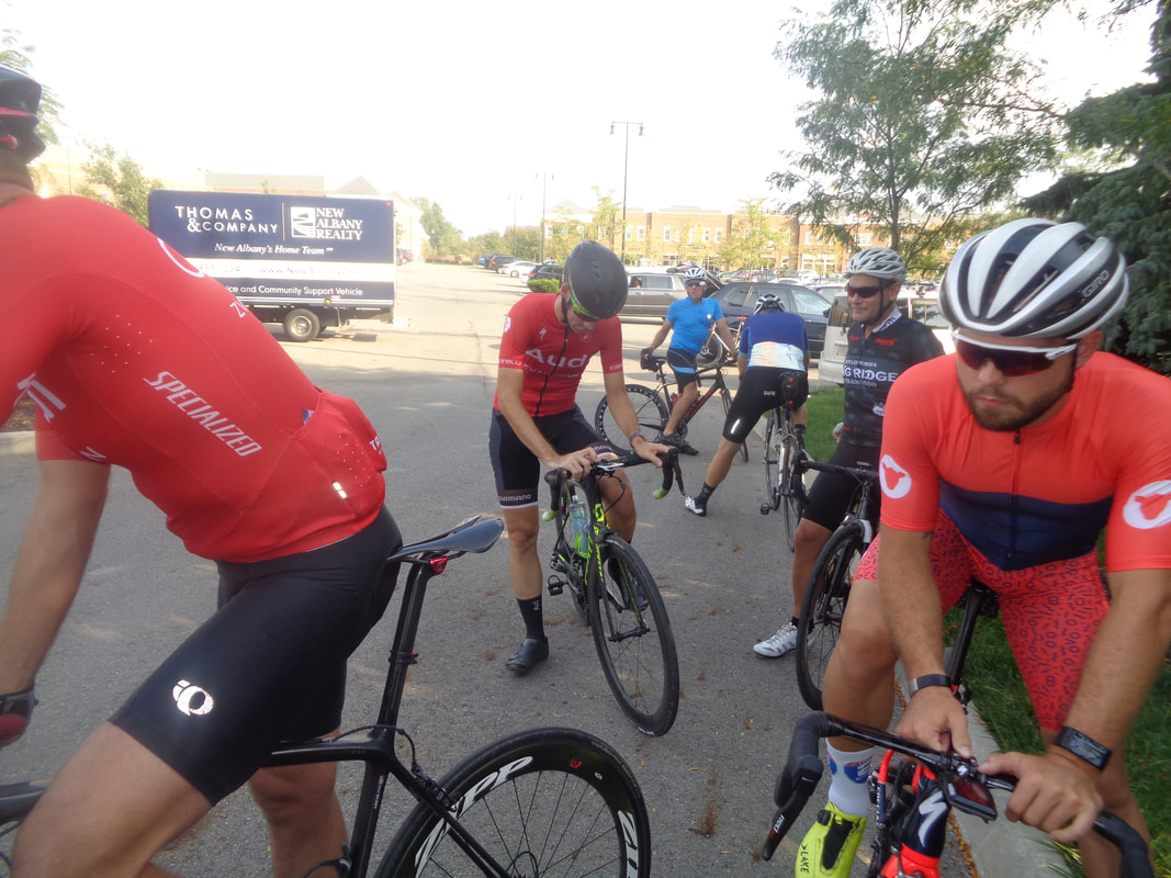 Lot of the Audia gang, Ken B, Kyle, Scott, Travis, Paul, etc.. They confirmed they are making Tucson their spring training camp location for next April. I have pledged my service as a driver. I've put them on to the Saturday Shootout ride and several routes they can follow. Oh, I also got a look at their team lodging, wow, nice. On the slope of the Catalinas, overlooking the city. 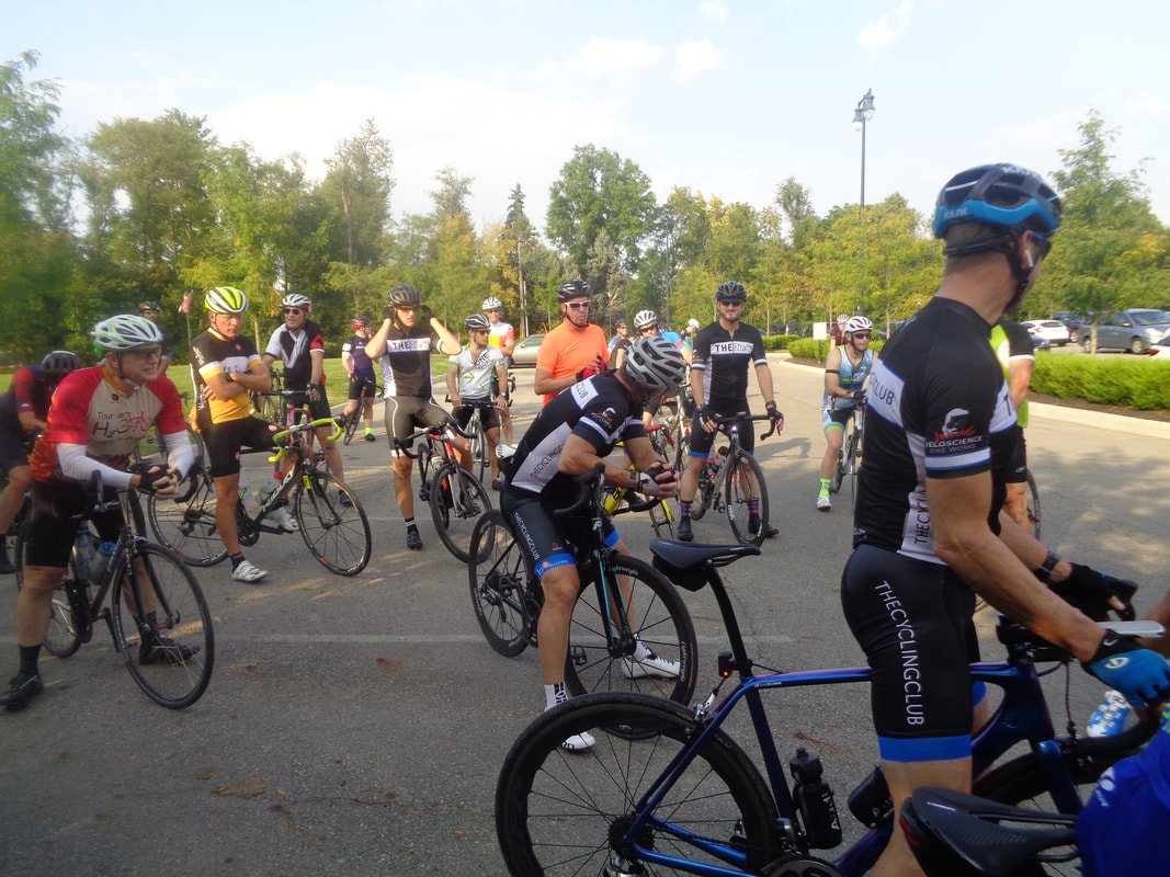 Gus Cook alerted me to the Rivet/A route being on the bike path so we came up with a work around that took us south of Alexandria to Moots Run Road. So..... 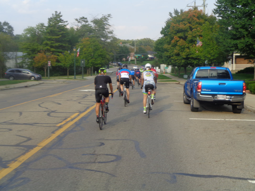 ….off we go with a huge A group of 26, following a Rivet group of around 10. We get.... 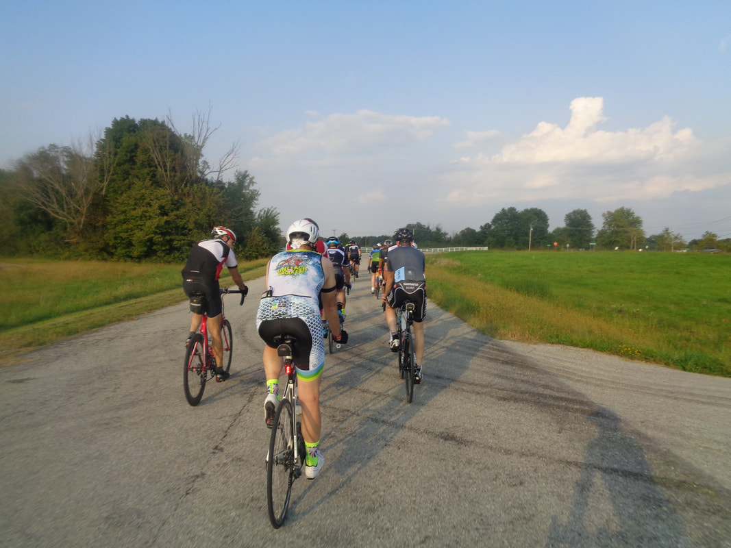 ….onto the open roads, here on Jersey Mill as I follow Paul Stock who was taking a rare breather at the back before once again going to the front and putting in a pitiless effort that left me gasping. I hung on though to Hardscrabble Road where the A route went right and I stayed straight. The B group finished with a 19.6 average, the A group at 21.8, the Rivets at a modest, for them, 23.8 and my blend of A and solo effort was 20.6. 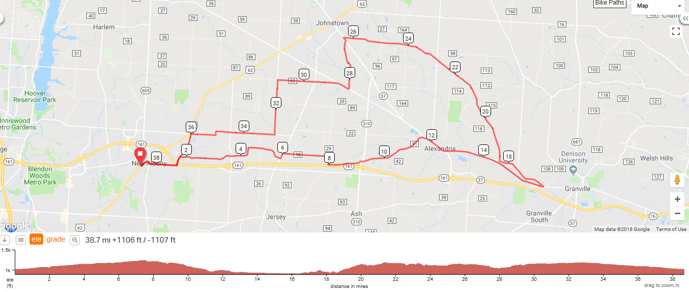 Hey Gang! Thursday's routes are below. A special favor to ask of the elite members of the Riveters; can 1 of you look at the route so you know when/where to make the turns? Thanks in advance. The A group especially thanks you so they will not be tempted to attach themselves like an unwanted virus:)))) Remember, wheels rolling in earnest at 5:30pm
https://ridewithgps.com/routes/19496721 https://ridewithgps.com/routes/19496924 https://ridewithgps.com/routes/19497192 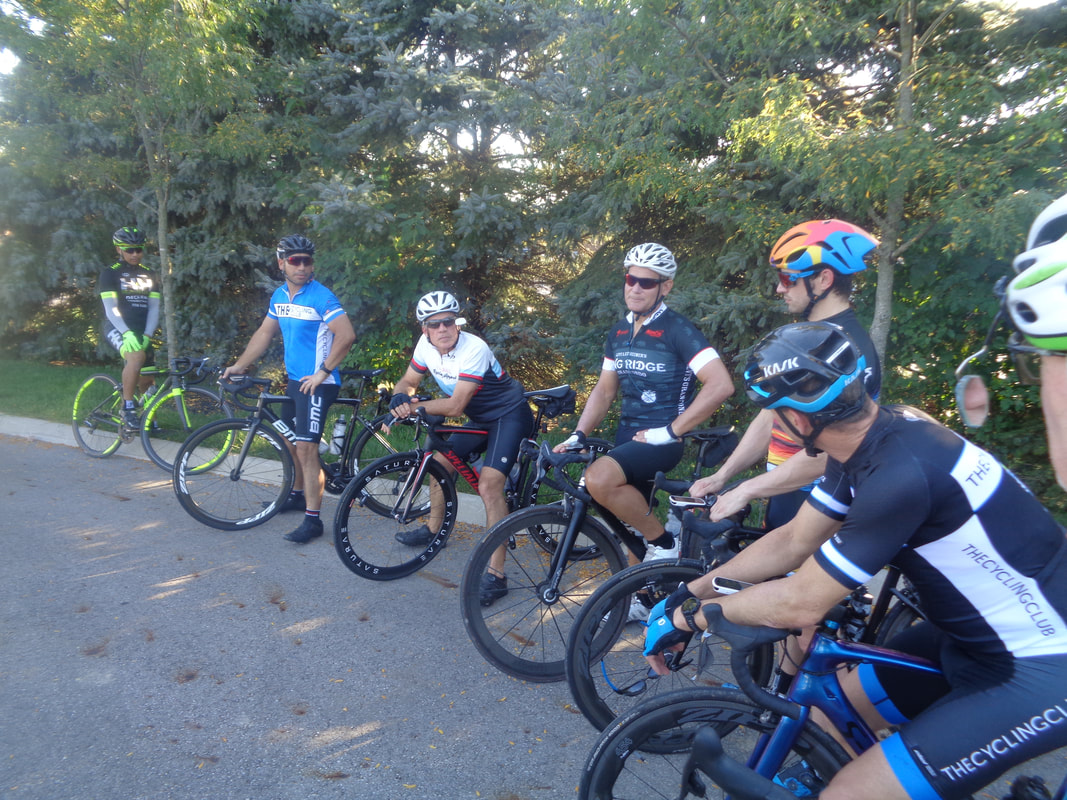 A winning line-up if ever there was one. Sokha, Jonathan, Lowell, Marty, Will, Scott, etc... 21 came out for our early start. Pretty good turnout I thought. Some discussion regarding the distance as our leader Gus was absent. One thought we could do the 43, one thought we could do 43 without the right turn on Milner at the top of Jones Road, one thought that a bad idea, the rest coalesced around the standard 38 mile route. 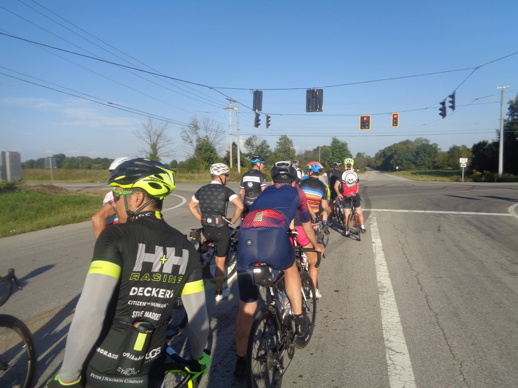 We reach the left turn on 310. I decide I am not all that into riding a bike so after we reach Alexandria and the climb on Mounts Road, when the group turned right on Lobdell, I stayed straight. I finished with 33 miles and a 19.2 average, they did the 38 miles with a 21mph average. Thursday routes coming in a few.
 The Fall HOOT ride brought out a large contingent from the Cycling Club but not many others. Milt is tightening his shoes while Chris I and Michael L await the official go time of 8am. 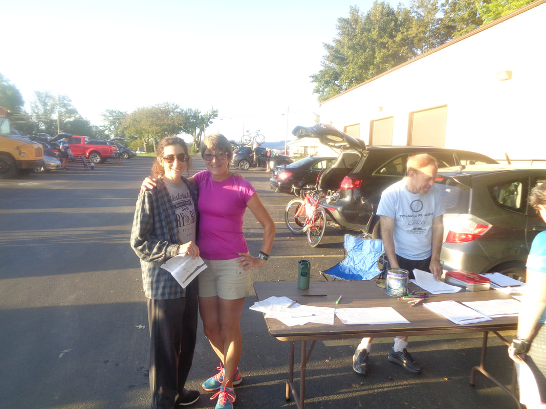 Eva on the right is recovering from a torn meniscus while Janet, dressed for comfort, hurriedly dressed after this shot so she too could make the aforementioned go time. 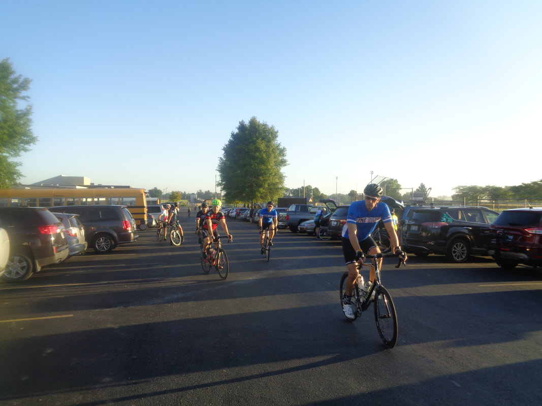 Kirby leads a group toward the front of the school entrance where others join and when we begin we have.... 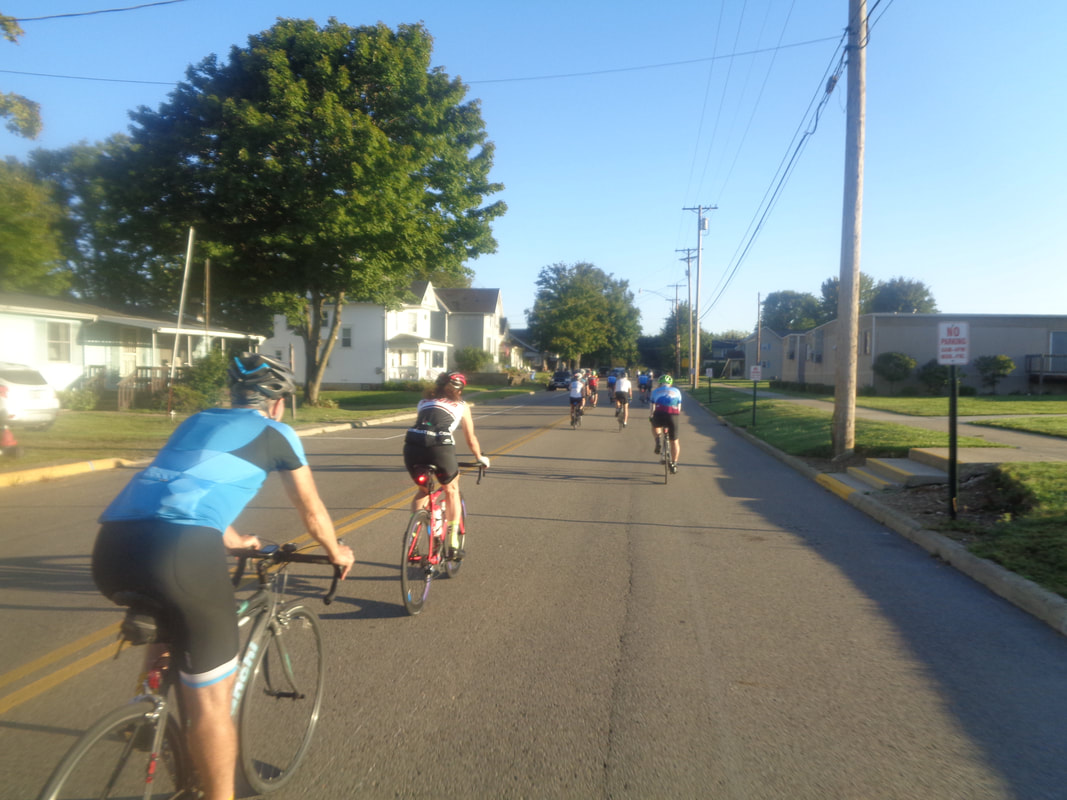 ….25 headed out in a compatible group. Gus Cook marveled at the broad mix of current and former headliners who attended. 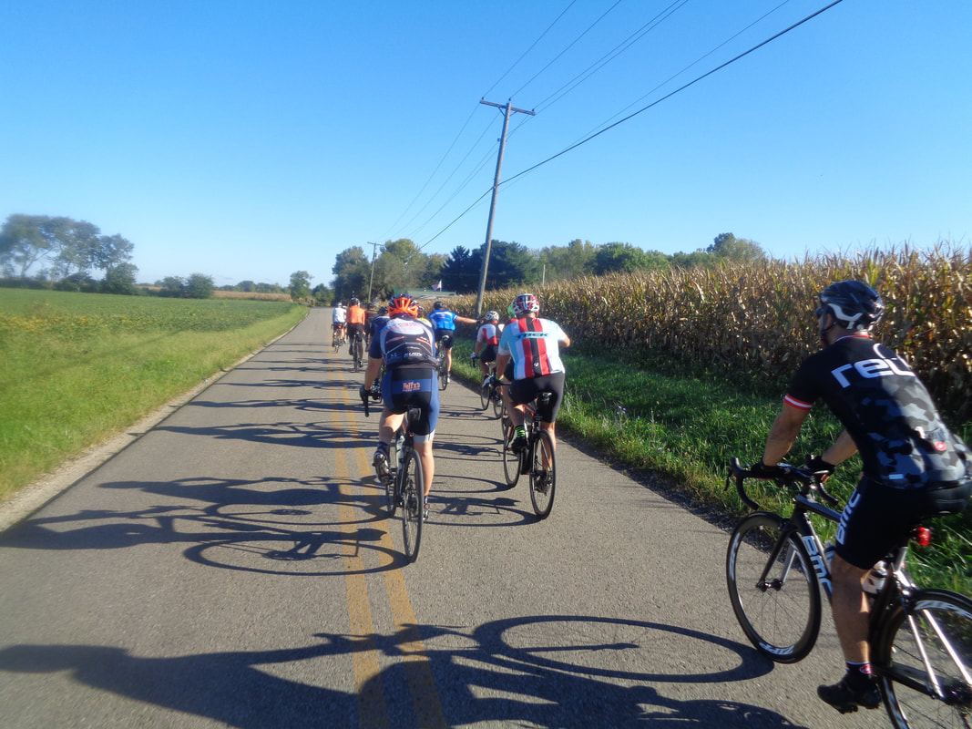 Way in front, on the left, in the bright orange jersey is the "Great Pumpkin", so named by Gus. I first called him a "Jack-o-Lantern" but I like the GP name better. I regret not getting a closer image as we cruise through glorious sunshine and a relatively flat route other than the middle portion. 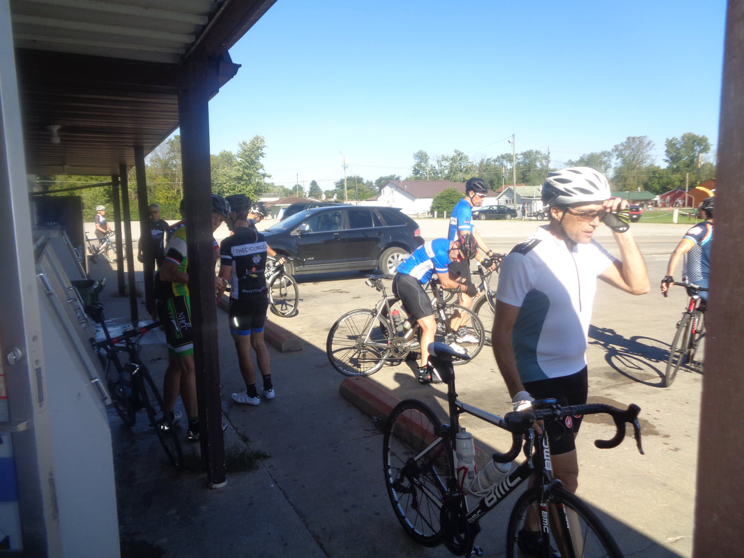 We paused at a market in Millersport and collect any who had dropped off the pace. Then.... 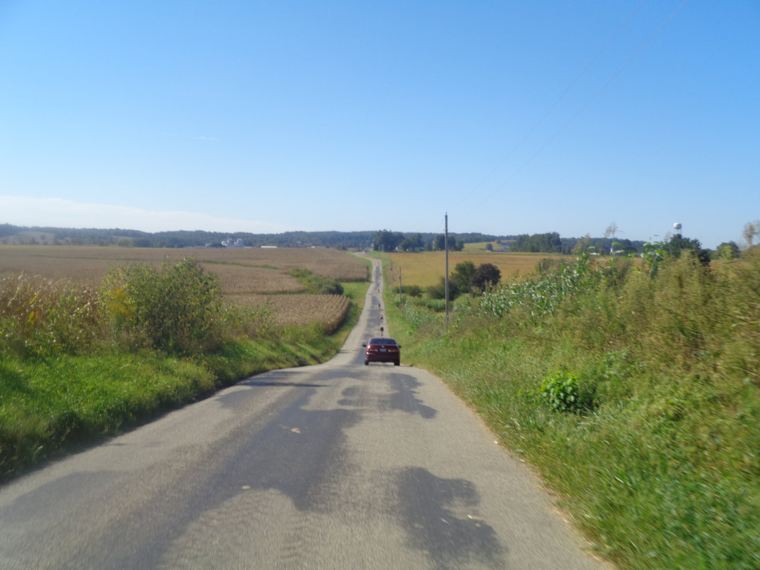 ….we got back on the route. At some point, we got really strung out which caused alliances to be formed between the remnants of our once great group. I eventually got in with the Rossi tandem, Larry & Lisa, Mitch and Dean. 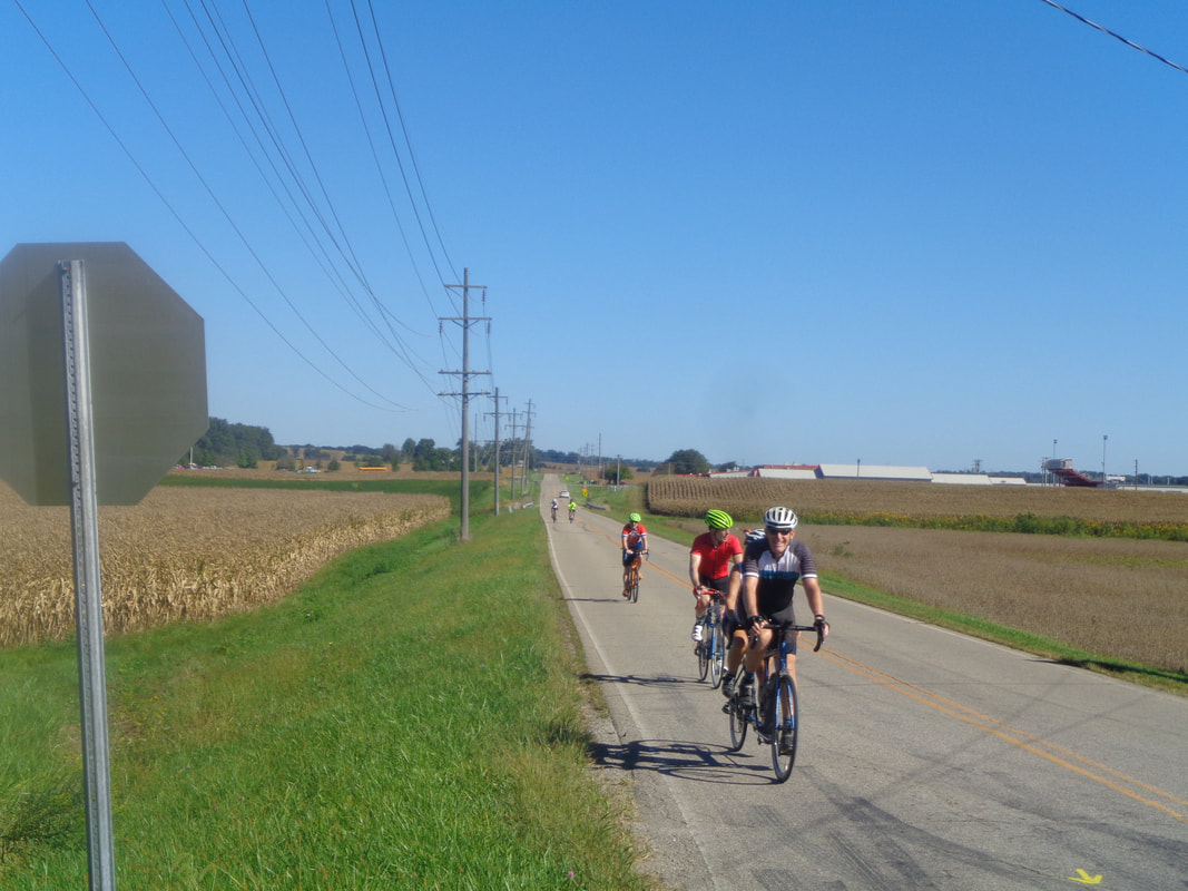 Here comes the Rossi tandem and eventually, we finished with 64 miles and me with a 17.8 average. Good day to be on the bike. 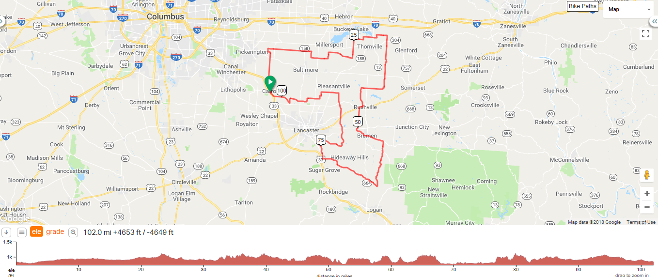 Here are two options for Saturday, not to mention that if you go to the New Albany Starbucks at 7:30 and hang out, you will likely find a group with whom to ride prior to the clock ticking 8am. First, COP has the "Fall HOOT" ride. A group will depart at 8am, a variety of paces. I think Marty will be there, the Kendas, Fairfield County Boys, etc.. Come out and represent the Northern Yankee team. $5 for members of COP, $10 for non members. Bloom Carroll High School 5240 Plum Rd, Carroll, OH 43112 Take US 33 East from Columbus to the Winchester Rd NW exit, turn left at the light at top of the ramp. Turn right onto High St and take into town of Carroll. High St will turn into Plum Rd as you pass the Subway and the school is on the left shortly after. Start is between 7:30 am - 9:00 am. The short route (34 miles) is relatively flat with ~2000' of climb on the mid (65 miles) route and >4000' climb on the century (102 miles) route. I think these are the routes but can't guarantee it. COP has a silly policy of sending the gps file on Friday night to those who have registered. For those of us who pay on the day of the ride, we are out of luck. https://ridewithgps.com/routes/26048313 https://ridewithgps.com/routes/26048155 Then there is this option. They say the ride is free but I understand there is a $15 fee to enter the Festival.
Join us for this gorgeous 55-mile road ride on Saturday, Sept. 15. The ride starts and ends at the 2018 Ohio Pawpaw Festival, taking you from Albany on a circle tour around Zaleski State Forest. Enjoy challenging climbs, ridgetop views and sweet downhills, all along the Raccoon Creek Watershed. A rest stop awaits you at the halfway point. There is also a shorter 20-mile loop option. On-site rider registration will be at the festival from 8:30 a.m. to 10:30 a.m. - get started on the ride any time during those hours. The rest stop will be set up until 2 p.m. The self-guided, self-paced ride is free for your enjoyment, sponsored by Athens Bicycle and featuring some of owner Peter Kotses' favorite roads. The ride includes a course map, marked turns on the roads and the aid station. Afterward, riders can choose to enjoy the festival (admission fees apply). Visit the Pawpaw Festival website for full details on the festival. https://www.ohiopawpawfest.com Lake Snowden 5900 US HIGHWAY 50, Albany, Ohio 45710 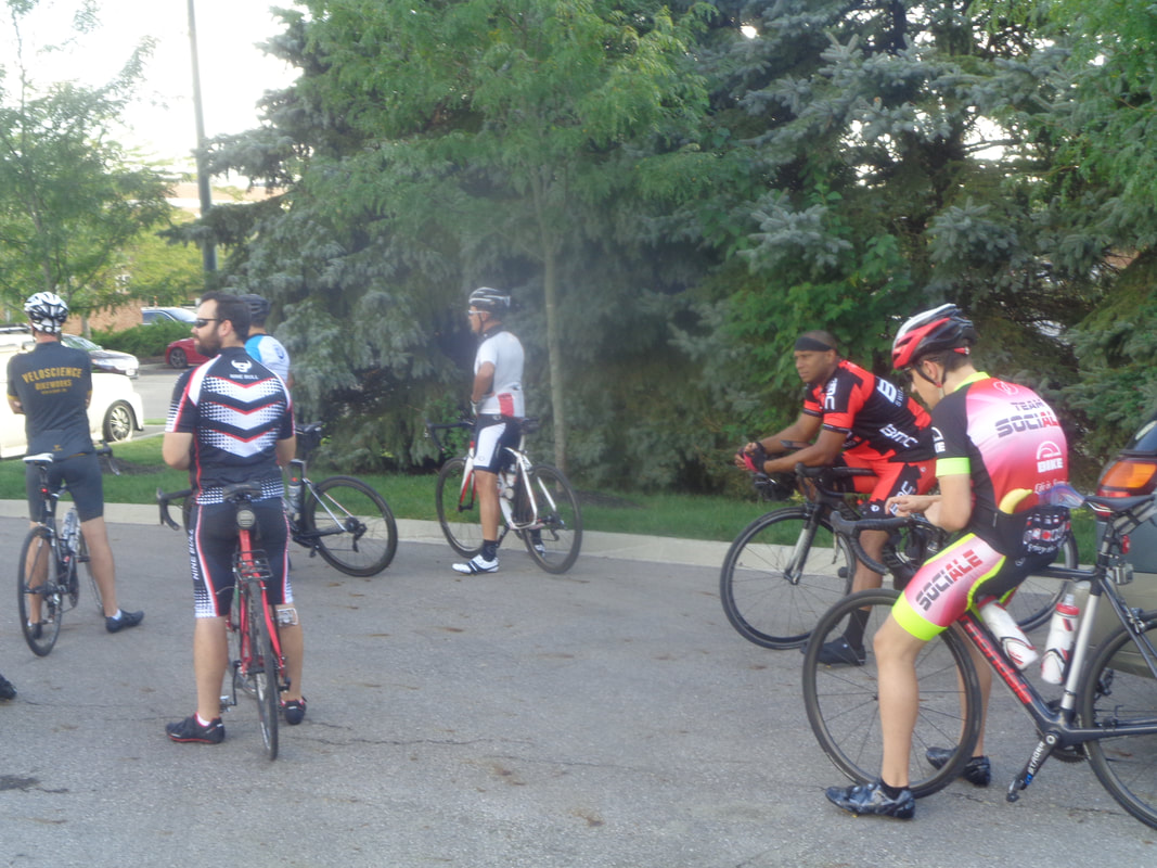 The temperature moved into the 80's so many moved into the shade. Including Bill, the 2nd from the left. A month or two ago, I was at Brio while my wife shopped at Easton. I talked to the bartender, who was giving generous pours, and discovered he was a cyclist. Naturally, I encouraged him to show up for our Thursday ride and so he did. 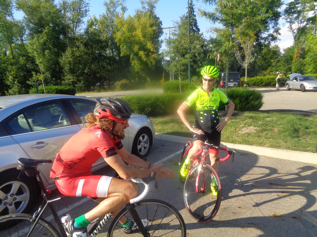 Making a rare appearance was Garth P and a 2nd time for Todd Lee who says he will be here for the next Thursday ride too. 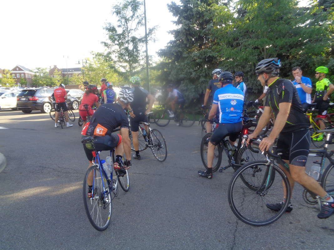 Good sized group of around 55, surprising for how few miles we can ride now. With Steve Hewitt out for the season as the C ride leader and his back-up Jim R out for today, I volunteered to fill in. Out went the Riveters, then the A, then the B and then 4 of us comprised the C group. 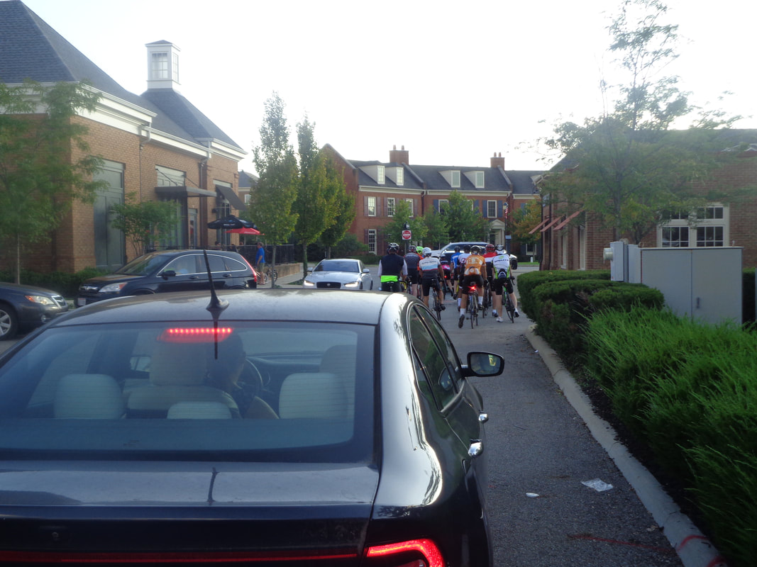 Getting out of here increasingly is problematic. It was 6:12 before my group actually left the town behind because one of us crashed while trying to stop and another had a drop chain and the traffic...yikes. I should have interpreted this as a sign. The gap between each rider is large enough to drive a heard of giraffes. They are uncomfortable riding too close so 4 people, each taking a pull. We arrive at York and turn left into Alexandria..... 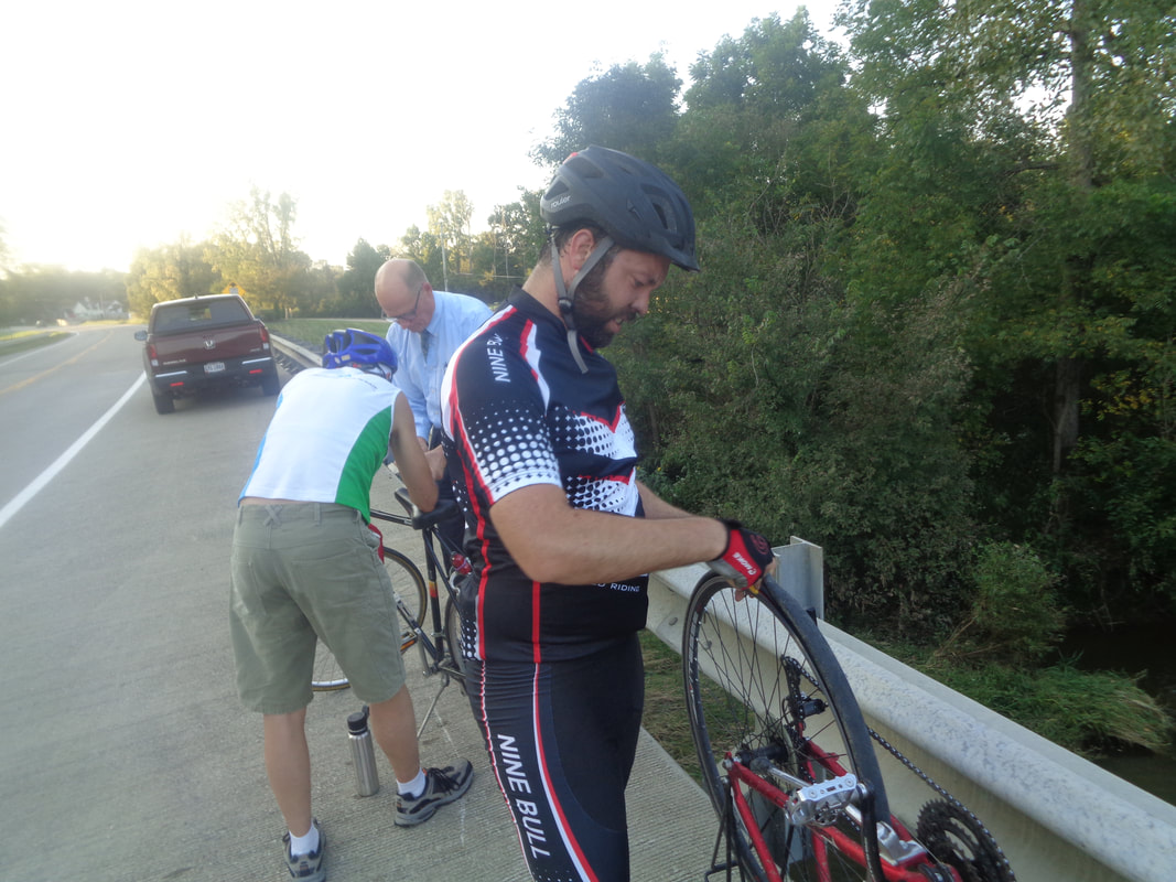 ….Bill suddenly stops and I ask why, he yells "I have a flat". This by itself should not have been a problem even though he did not announce he had a flat, just stopped. I slow to a stop, dismount, lean my bike against the bridge railing and hear "oh no!" Turning, I catch a cyclist from our group headed at me!!! I mean, what the heck??? He was 4th in a line with enormous gaps between each of us. Obviously, I had time to slow, get off my bike so more than ample time for him to adjust. Anyway, I squeeze against my bike and watch the inevitable crash. With hindsight, I may have had time to jump the railing into the creek but who thinks about that? He dislocated a finger but immediately, a doctor stops and straightens it, offers to take all of us back. What a guy!  Bill and the guy who ran me over accept the offer. I and Beth head back, eventually passed by the Riveters and a split A group. It was late twilight when all of us returned. Glad we start next week at 5:30pm. The Riveters covered the 38 mile route with a 23.4 average, the A group was around 22mph as some got in with the Riveters while others hung back, the B group was at 20.5 on their 31 mile route and the C group, as I can attest, was at 15mph. I have some general soreness and minor road rash but the bike and me are ok! Two Saturday ride options coming soon. 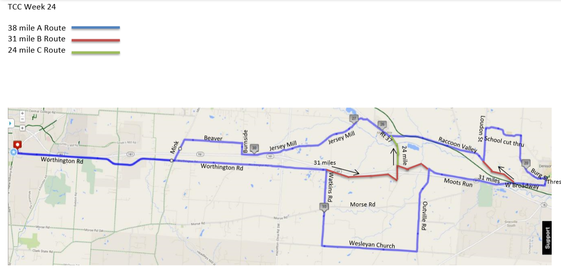 Whaaaaaaa! Only 5 rides to go on yet another epic season of cycling and too often watching it rain. 6pm start time as usual. 7:44pm sunset so keep that in mind as you choose from distances of 38, 31 and 24 miles. Oh, it looks like it might rain but probably not.
https://ridewithgps.com/routes/19489879 https://ridewithgps.com/routes/19489907 https://ridewithgps.com/routes/19489921 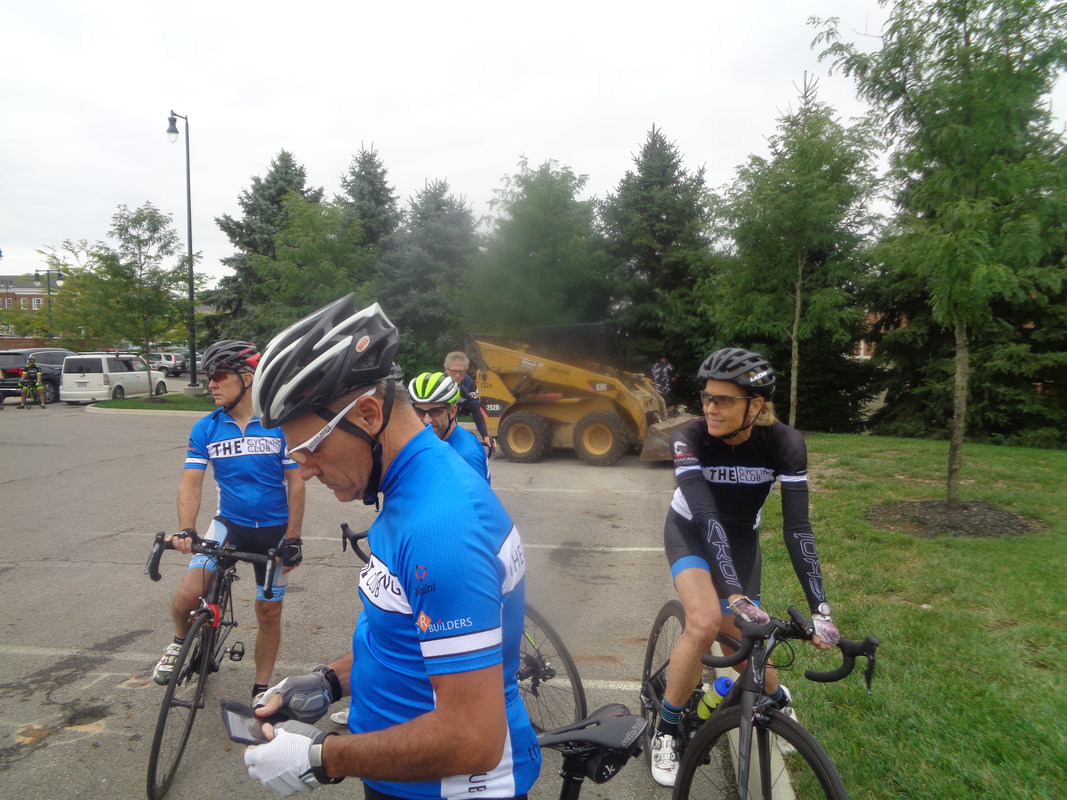 The effervescent personality of Peggy Cook rolls in and immediately the group is happier, although they do not look it but they are. John B survived the 54 mile rainy "Dry Run" ride on Sunday without contracting pneumonia. Nor did the others. Steve on the left, bordering on cocky now that he has 7 forecasts correct in a row but who is counting. 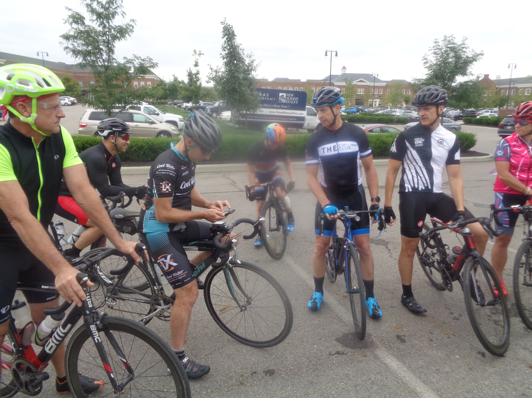 The Tuesday crowd is the latest arriving crowd in cycling history. Five minutes until 6pm and you'd think you will be riding solo and them a happy swarm of bees descends. Will Paskett, in the middle of the camera smudge, came out for his first ride post crash. A heavy bandage protects some serious road rash. 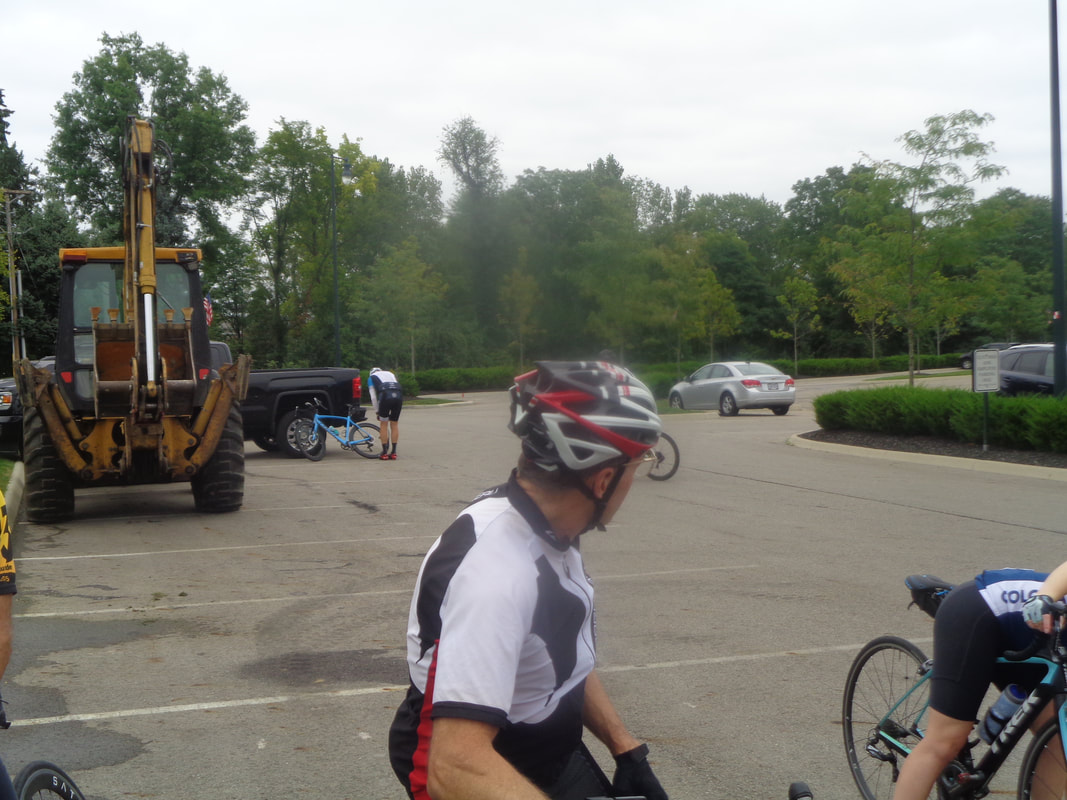 So late is the arriving crowd, some actually arrive late but we were glad to wait for Mike M as he hurriedly pumped air into a tire. Lot of discussion about modifying the route as we doubted we would arrive back prior to a sure to be, early onset of darkness. John B came up with the solution and it cut our route from the usual 38 to 34 miles. 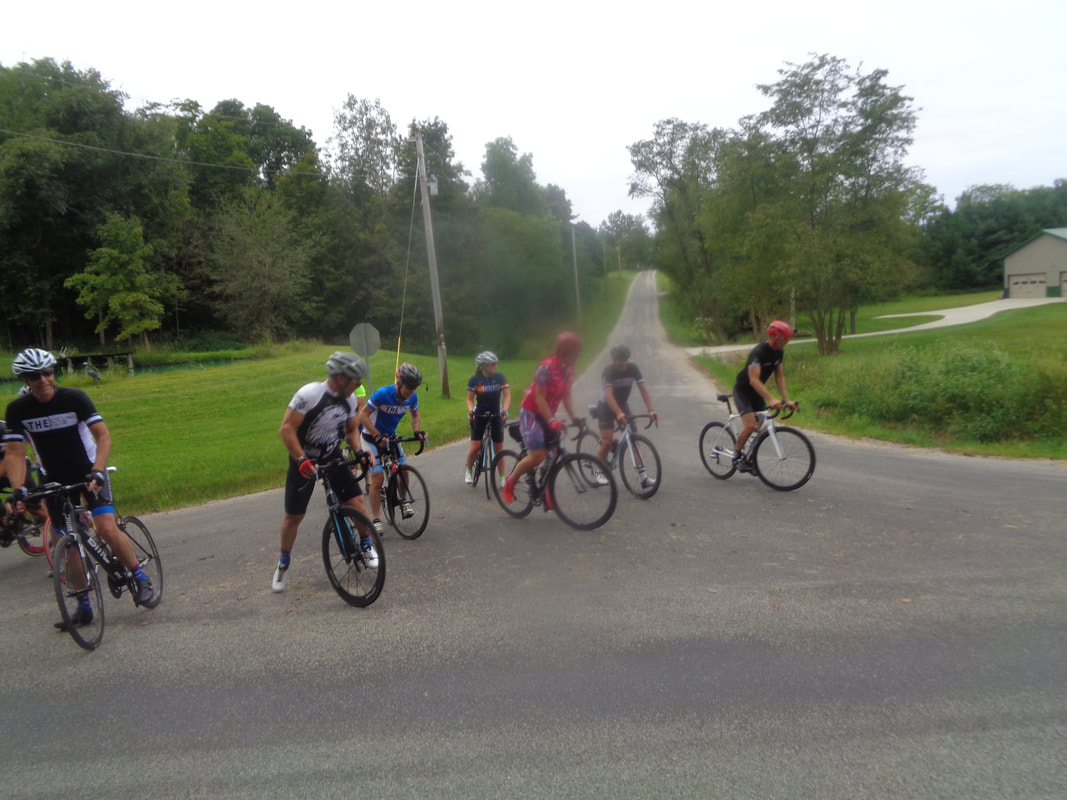 We regroup at the top of the Battee Road climb. Good heavens, my fitness level is deteriorating so rapidly I think I was the last to arrive. Oh well. Rather than make the usual turn right, we turn left and then a right on Corner and a left on Raccoon Run and then.... 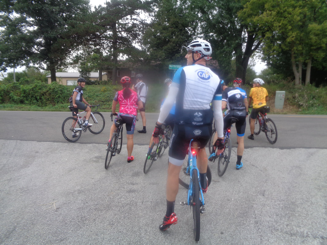 ….a left on Stone Quarry where we regroup for a 2nd and final time. Kristie in a colorful outfit held the key, literally, to our post ride enjoyment. A trunk full of delicious cookies. Doug McConaha on the left worked at Veloscience all day as Geoff is out of town. I asked if he made any big sales and he said he did but could not find the items in the system so had to give the stuff to the customer for free (Kristie so probably she will pay eventually). 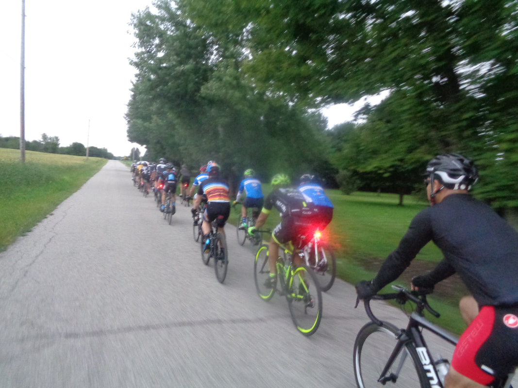 It was kinda dark when we started and now getting darker as we head back to the barn. Arriving at the corner of old 161 and Kitzmiller we were greeted by a spectacular view that the combination of the smudge and road bouncing produced.... 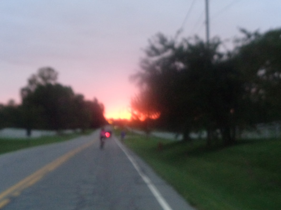 ….a really poor quality image but use your imagination. We finished with a 20.3 average. Next week, a new start time of 5:30pm.
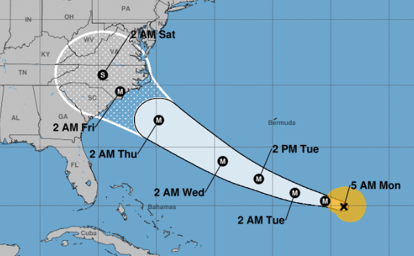 Nooooooooooooooooooooo! Hurricane Florence projected path. Wonder if it will turn northeast and not impact our weekend weather? 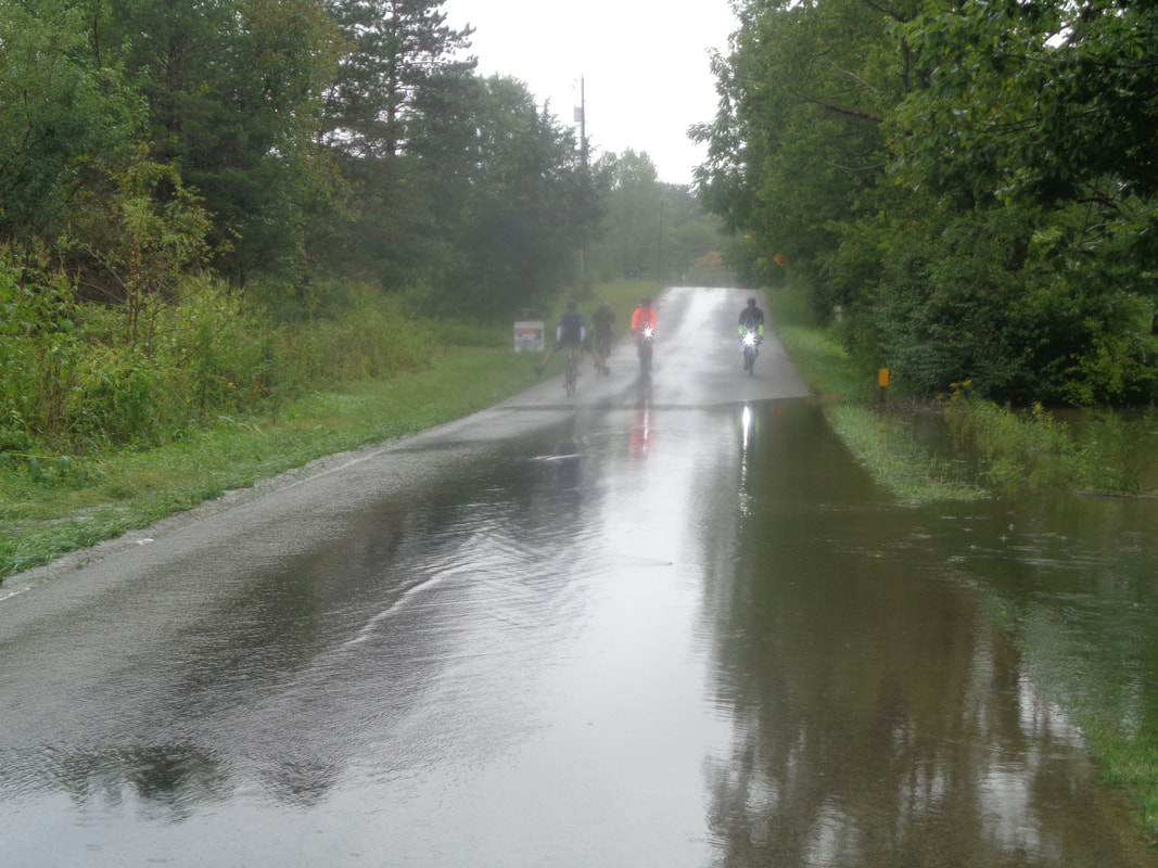 There I sat, bored, Sunday morning. The Dry Run route was close to home so I drove to Sportsman Club Road and picked up the route. Heading counterclockwise, I crossed the above stream on Nichols Road and turned right on Concorde. Here came a group so I turned around and waited a minute to catch them at the crossing. 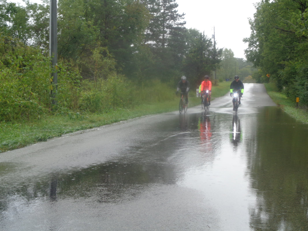 It was Don N, John B, Chris I and two others. This would not be the only wet crossing and I noted during my brief drive on the route, there was a lot of debris spread on the roads too. 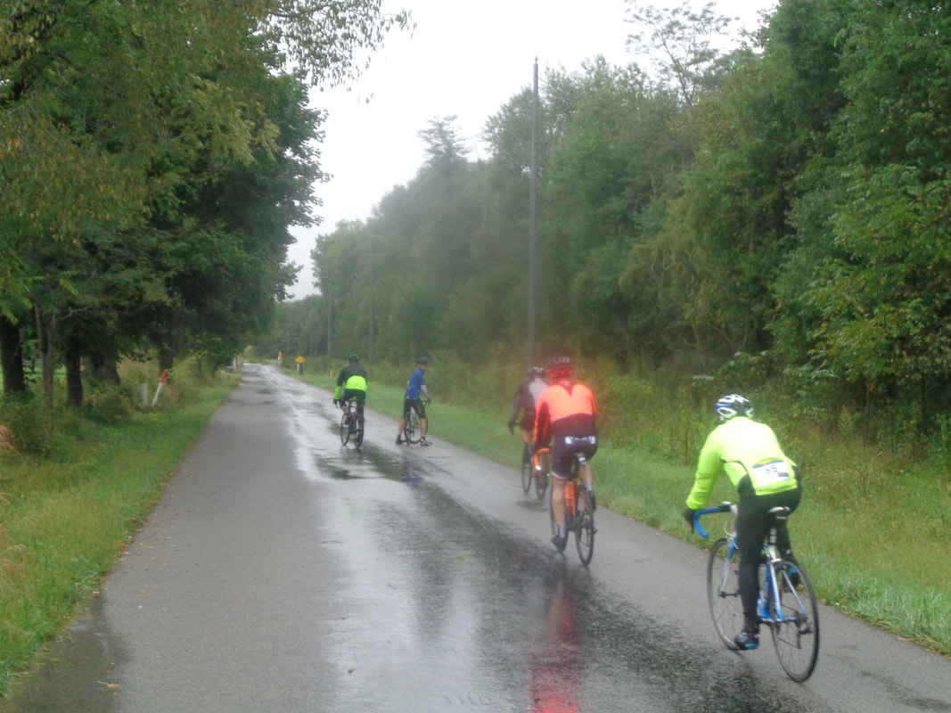 Don turned around to talk and..... 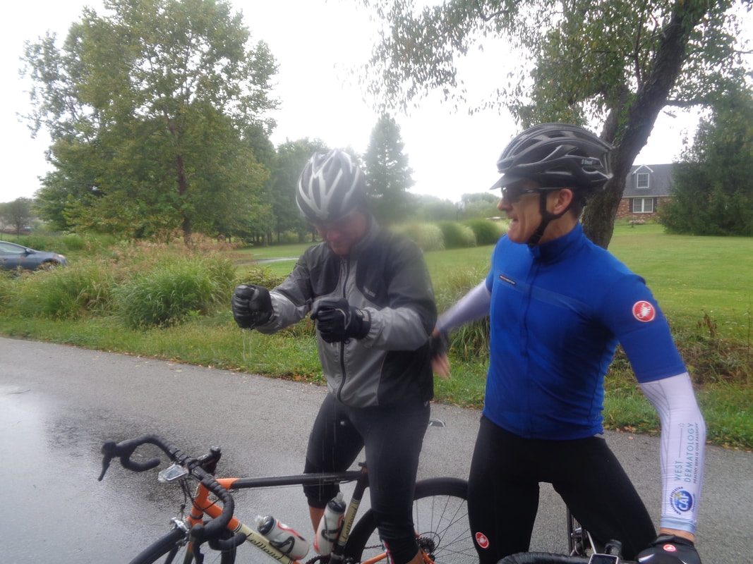 ….John B used the stop to wring water from his gloves. Chris told me about a rather unpleasant wind they encountered going east but now they were headed north and soon to have a tailwind, although a cold one. 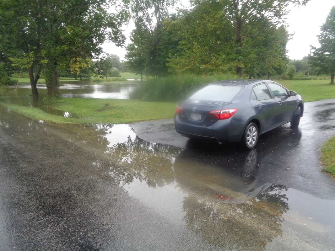 What an unusually wet cycling season we have had. The water was well out of many stream banks including the above. I got my feet wet getting back to my car!
Yeah, the forecast is not all that good but many times this season, disaster dissipates, the front stalls, gnarly looking masses split, we have seen it all. So, if you are looking for something other than riding out of New Albany, Columbus Outdoor Pursuits has their Covered Bridge event with distances of 45, 74 and 102 miles. Some of us are heading out at 8:00am and all are welcome to join. I should have a route up later this evening and someone asked if I could modify the 74 to make it more like 60-65ish and of course, that is my specialty. Cyclist Connection in Canal Winchester is the place, weather permitting. Don't decide tonight! Set your alarm and be ready to go in the morning. $10 fee for non members, $5 for members.
 Another Thursday, another evening under threat of rain. I fielded a call from one alarmed cyclist, Decent Dan, who said he was going to stay local so he would be close to home in case of rain. I had to bring out the big guns, the "man card" assaults and was thus able to convince him to come. The parking lot was not looking good for a good turnout as Jon and Kim await the shove off time. 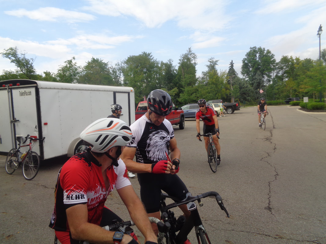 Scott Billman on the right describes participating in a Masters race at Newmark, OH. Scott led all the way around but rather than gift him the 1st place finish as a show of gratitude, some one came around and nipped him at the line. Mitchell and Paul Kilroy finished 1,2 in the Cat 4/5. 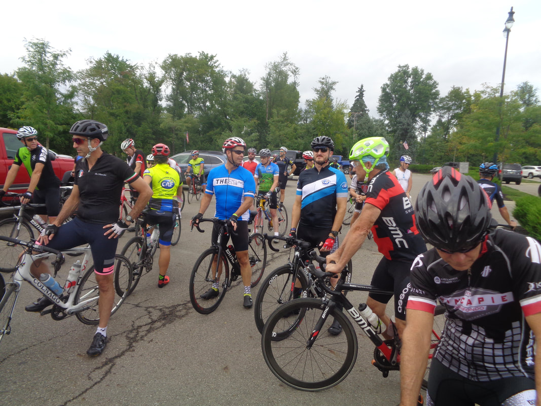 And then, with a few minutes to go, people swarmed from all directions and we had a good sized group after all. On the left, Scott E just back from Italy, Kevin, Kristie, Milt, Chris I, Michael and oh yeah, Steve who once again nailed the forecast of no rain. 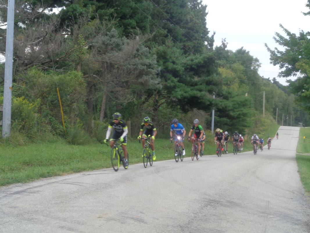 I clung desperately to the A group but as the left turn onto Raccoon Run approached, indicating the point where the B route departed from the A route, Jon and me left the group. We made the obligatory left on Stone Quarry and then waited at the top of a climb to see who arrived first from the A group. H&H led the charge. 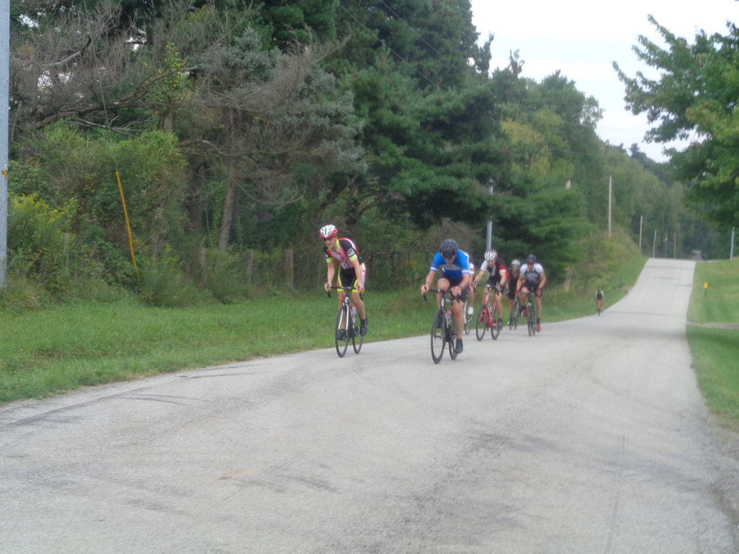 A slight gap and then came the others. I shouted encouragement but they did not seem to need that. We waited for the B group and soon, they too approached led by.... 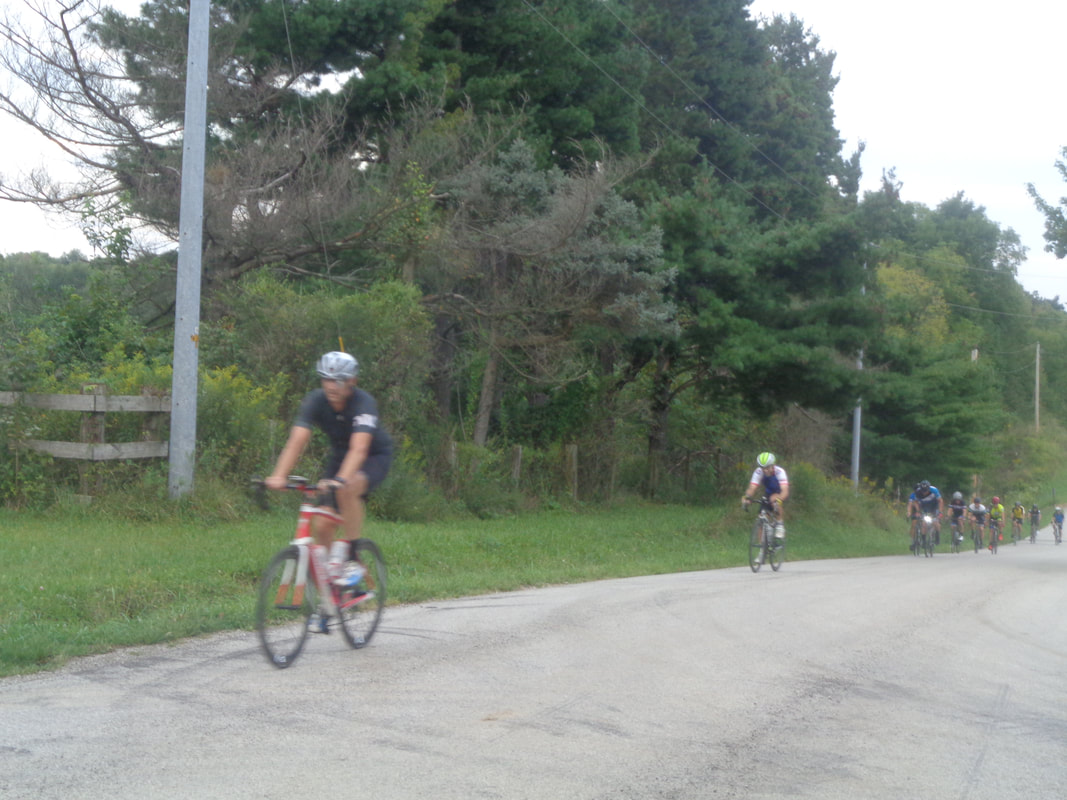 ….Mike M, then Ron, followed by a host of others. We jumped onto the tail and began the western return. 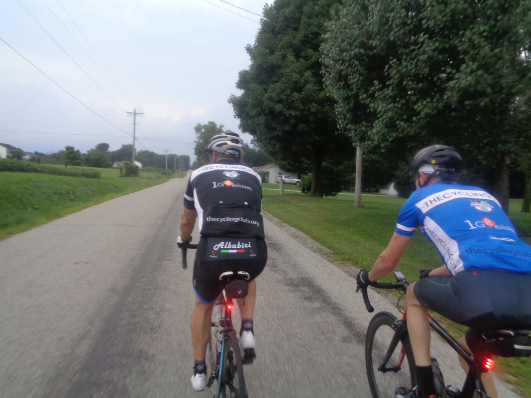 Thickening clouds supported by a hidden sun made the return dark. Jay and Jon lead the way as we wondered if we would arrive prior to the rain or the setting sun. We just made it. I with a 20.4 average, the B group with a 20.2, the A group at 22! The Riveters with a 23.8 average. The Saturday ride option coming..... 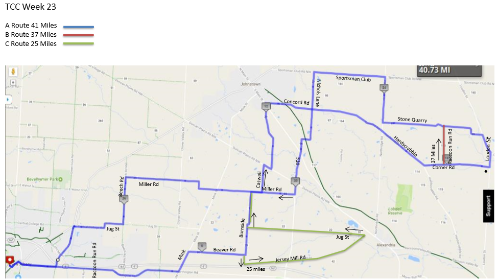 Like sands through the hourglass, daylight is slipping away. Alas, sun sets before 8pm now so the route distances are slipping too. But! Still over 40 fun filled miles for the Rivet/A route and have we got a surprise for you C riders!!! Someone even more capable, funnier, wittier, knowledgeable of all things more so than Steve Hewitt will be there to lead you around your 25 miles. The routes:
https://ridewithgps.com/routes/19489498 https://ridewithgps.com/routes/19489618 https://ridewithgps.com/routes/19489837 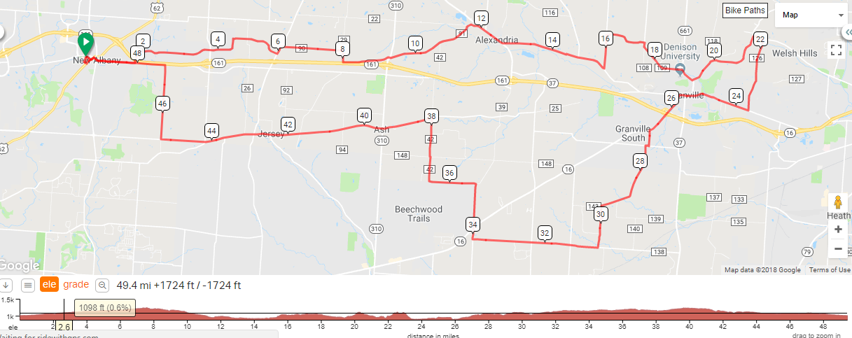 Monday morning, 8:00am, from the Philip Heit Center parking lot in New Albany, there are two ride options. Westerville Bicycle Club has their usual morning ride with a time change of 8 to accomodate the day's heat. A legit C-B paced ride. The route is: https://ridewithgps.com/routes/28504241?beta=false Also, Don N is leading a ride at the same time, same place for 60-70 miles but no route available. All are welcome to either ride with Don's at a faster pace then the Westerville group.
|
