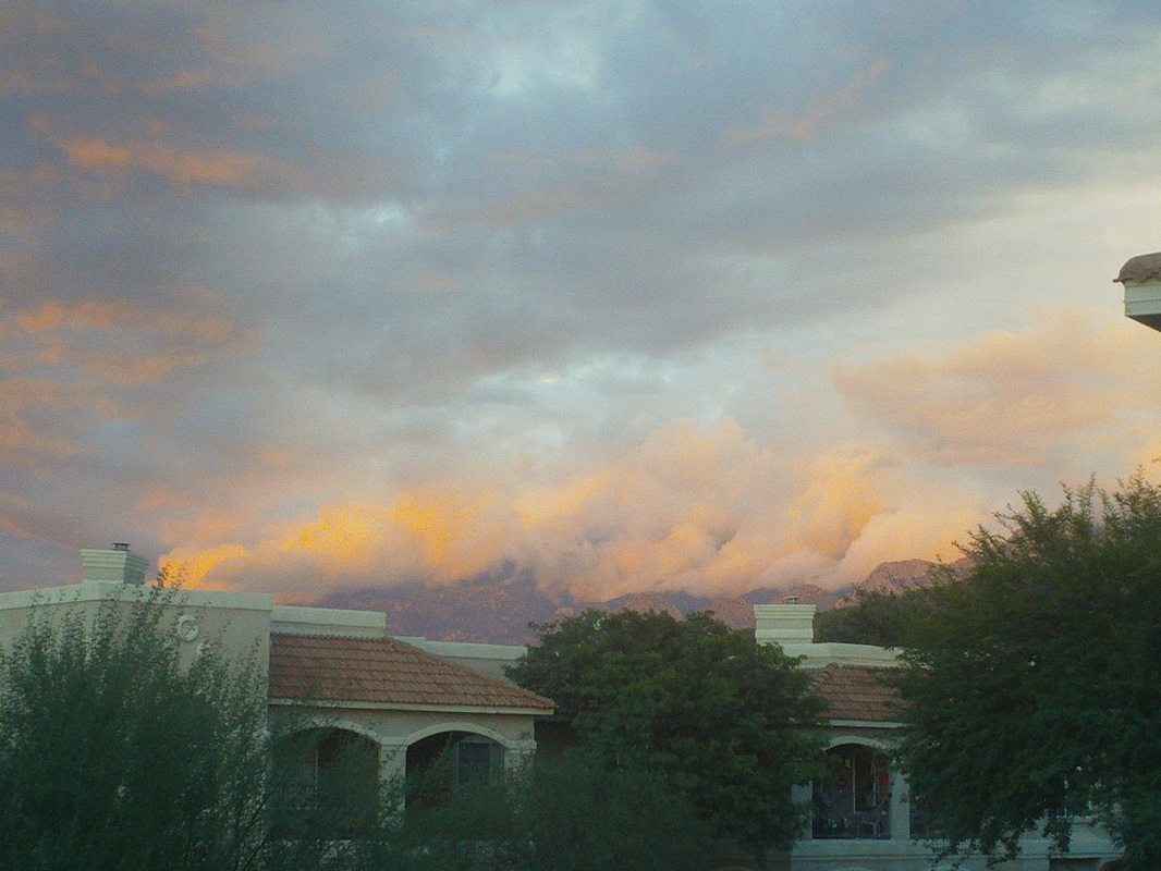
 Yeah, sure the clouds create dramatic images against the mountains but geesh, a 3rd ride is cancelled on this trip, 3 more than have ever been cancelled while I am out here. I am grateful though that the rain is not all day, just spotty. I take my wife and oldest daughter to Sabino Canyon to ride.... 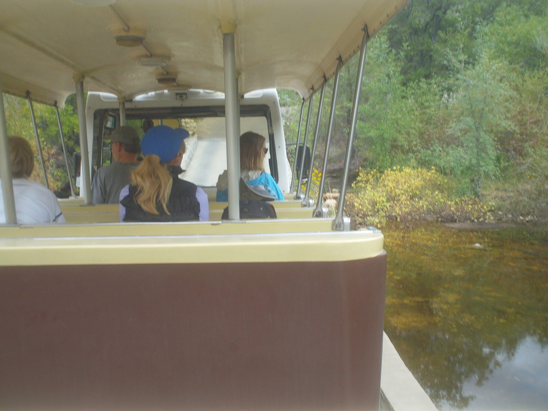 ....the 4 mile tram ride up the canyon. At the end, I lead my gals on a half mile trail to the river and then lead them cross country back to the road. They were troopers through this even though they picked up some cactus spines. 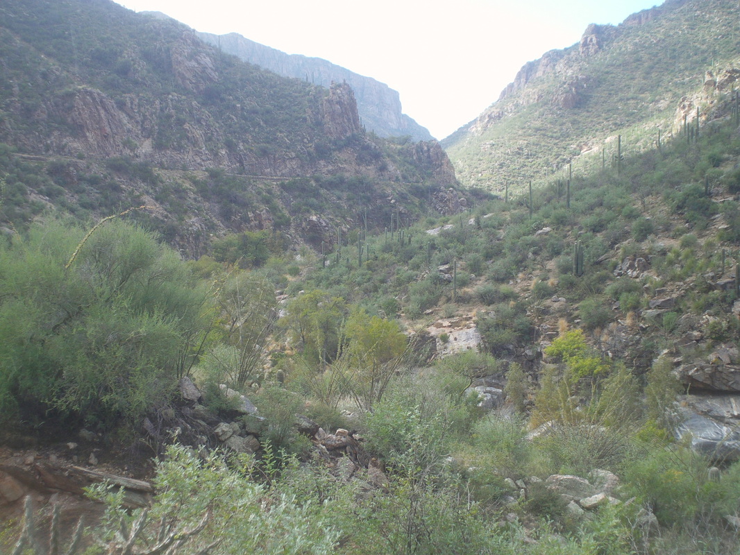 Got out for a short ride on Friday and then drove the family to the Phoenix airport on Saturday morning. While up there I hiked the iconic Camelback Mountain (more on that later) and then on Sunday, a super duper epic hike coming. I hesitate to post superlatives like that because too often I allow weather, approaching darkness, rattler probability, etc... to deter me but I am committed and not to the funny farm.
0 Comments
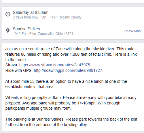 Wow. Heck of a ride option for Saturday out of Zanesville Ohio, birthplace of you know who. The event was put up on Facebook and looks like everyone is welcome. 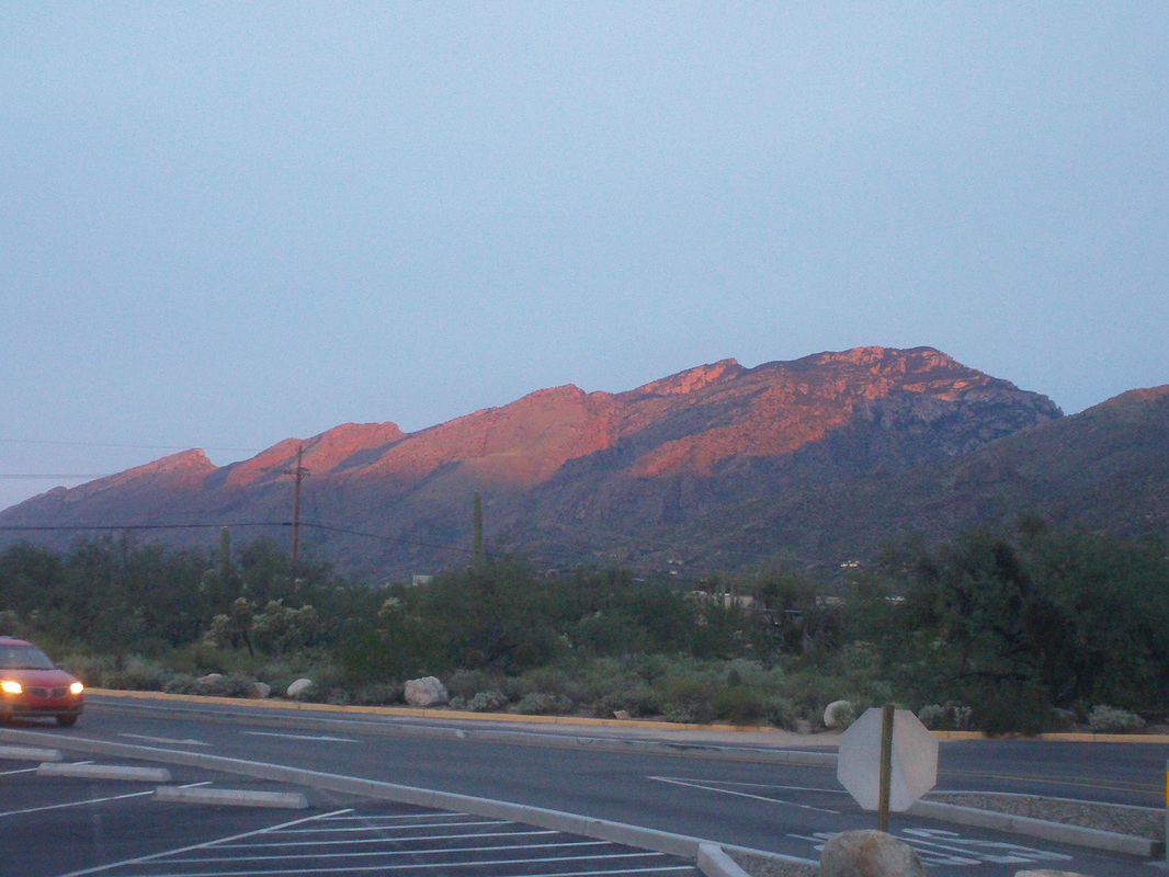 I was ready to hike at 6:30am and already there were 25+ cars in the parking lot as the sun rose, casting light on the nearby peaks. 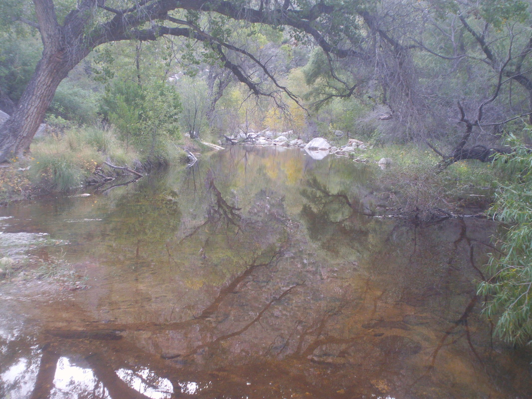 The creek flows most of the year, fed by the nearby mountain range. I followed a road that crossed the creek 8 times before..... 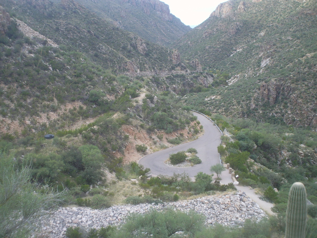 ....reaching the end at mile 4 and heading up. Looking to the southwest you can see the canyon both the road and creek follow. 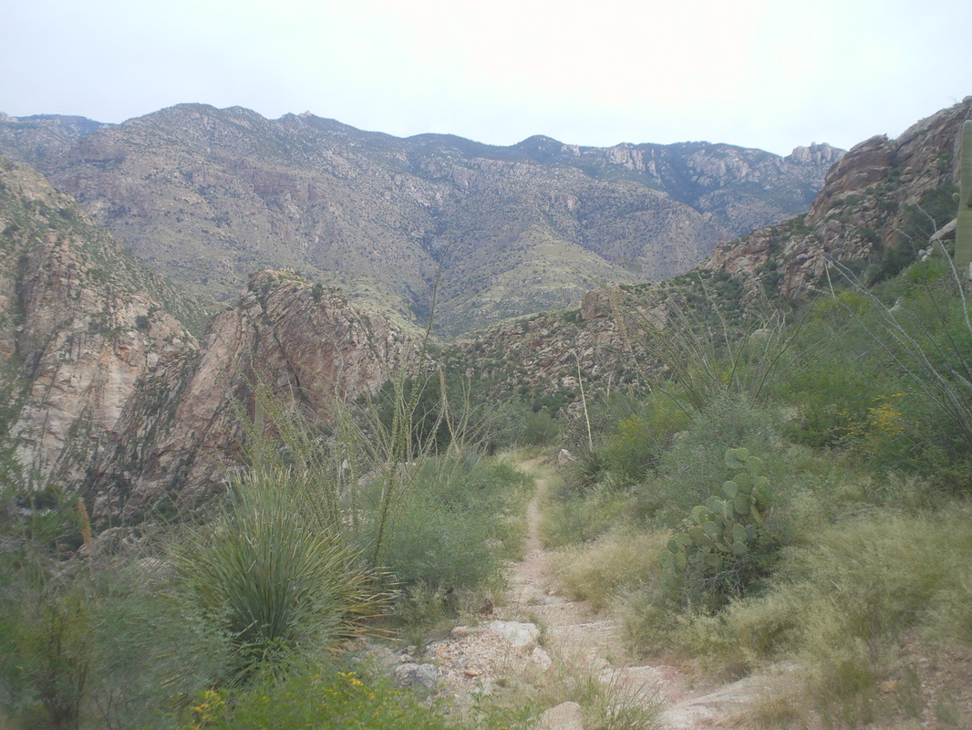 I turned away from civilization and headed into the interior, following a faint path. Beautiful but also remote. I made lots of noise to keep the lions away. Last year a guy was hiking and walked up on a napping lion. It stood and walked off trail then turned around and began walking toward him (he survived). Many times I have thought through how I will act should that happen. The main thing is to avoid running as that triggers the pursuit instinct. The drill is to remove the pack, swing it around to make me appear larger than I am and throw rocks at the lion while maintaining eye contact. Sounds iffy. 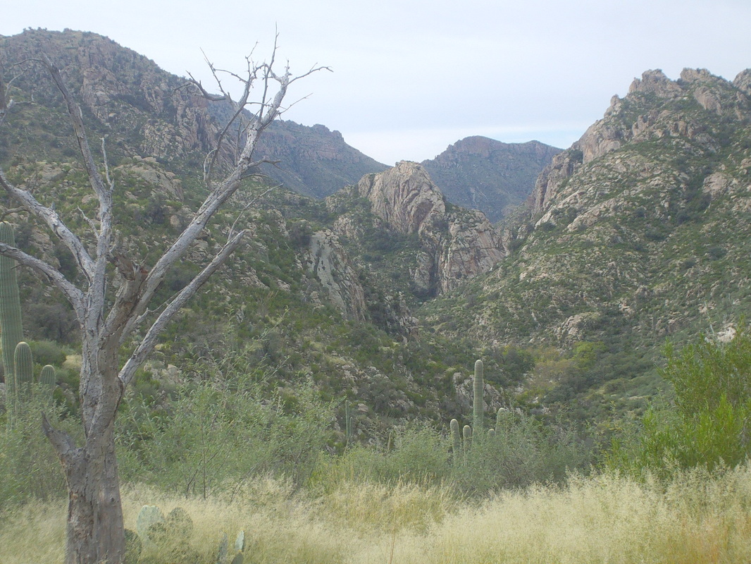 The trail leveled and began contouring in and out of side canyons while slowly doing a 180 from the direction I had begun. 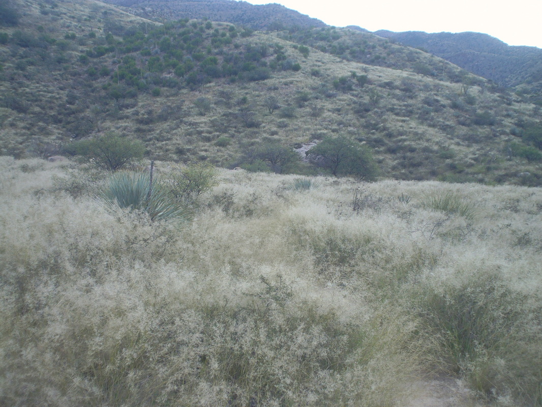 Oh great, thick grass but at this elevation and cool temps, I assumed the rattlers were in their dens. I caught up to three guys camping and hunting for deer. They said the place is crawling with them but they are short and you'll walk by them without seeing them. 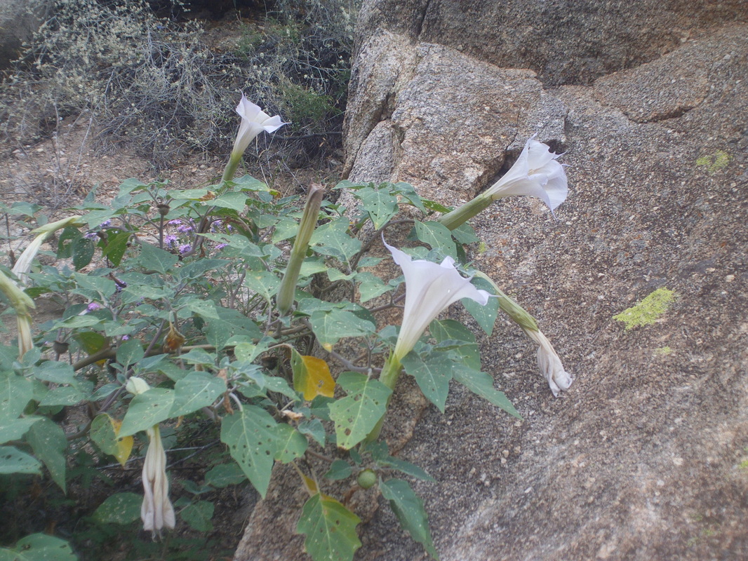 The trail continued to follow the creek and there were lots of varieties of flowers and other plants. 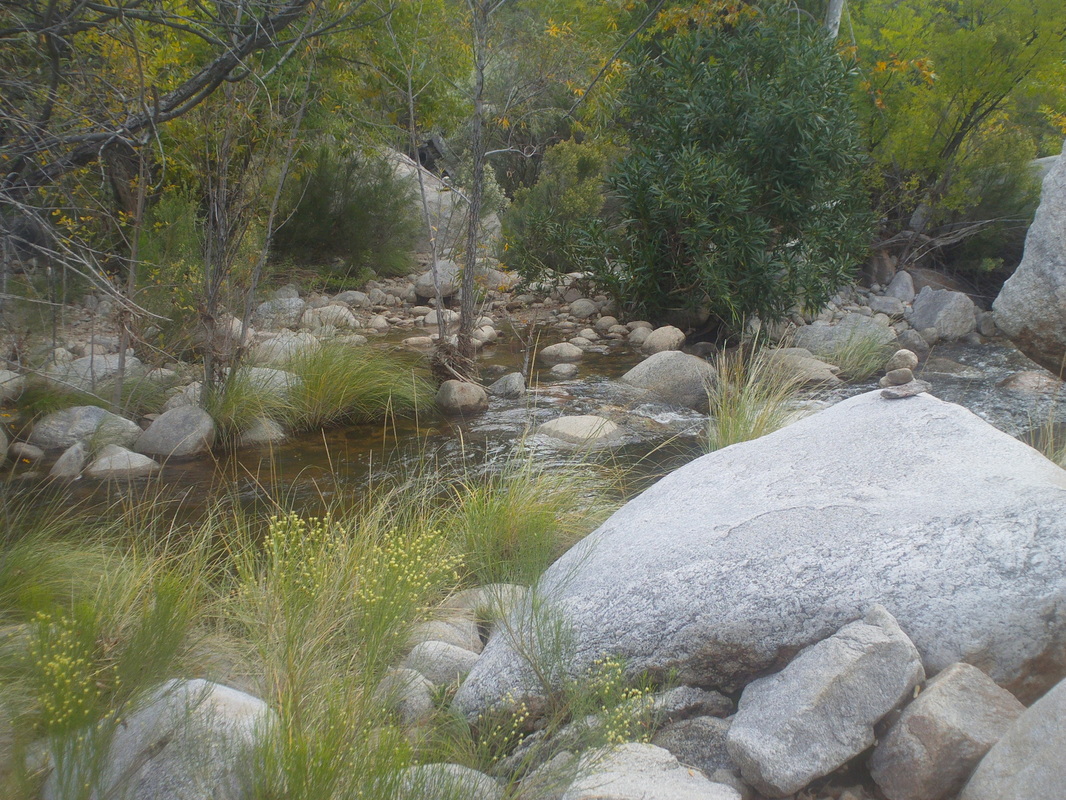 The trail dipped down to the creek and crossed it, so it was now on my right. I found the pile of rocks that marks the entrance to Hutch's Pools, almost exactly at mile 8 but I..... 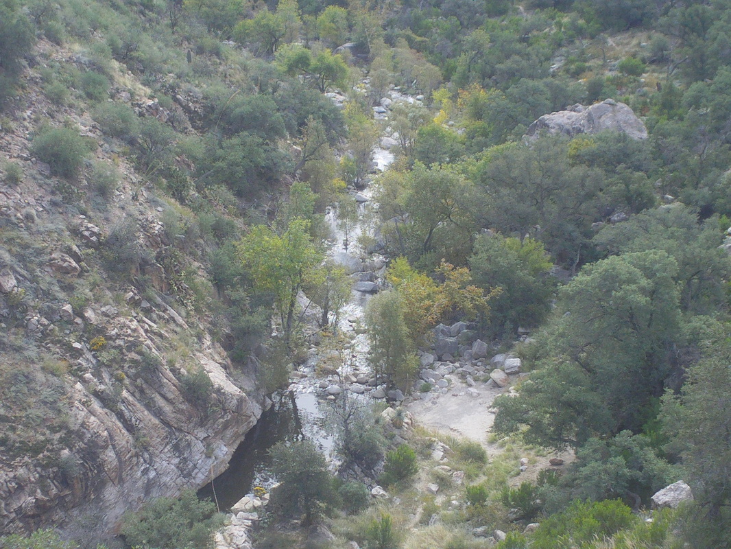 ....continued as the trail began to climb and then turned away from the pools, which I could see below. At this point, I also got a good look at Cathedral Rock, way higher and maybe 3 miles away. An option was to keep going, reach what is known as the inner sanctum within Cathedral and then drop down the other side via the Esperro Trail. Hmmm, that's a 24 mile hike and the longest I have done so far is 9 so probably should..... 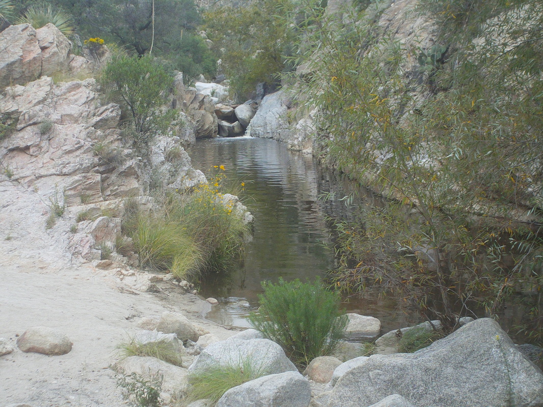 ....turn around as planned and pause at the pools. A popular spot in the summer as it has a small sandy beach, deep pool and cliffs from which people can jump into the water. I scrambled along the edge to reach..... 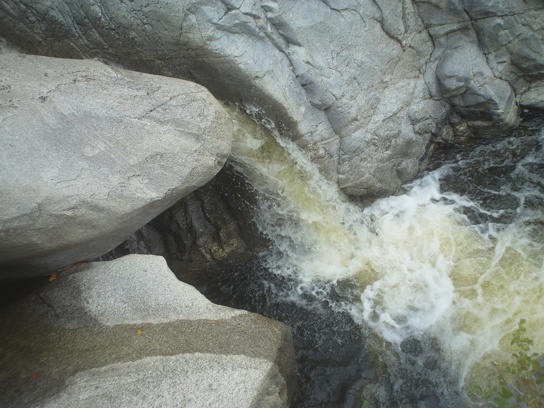 ....a water fall. It was loud and gushing through the notch in the boulders. I continued the hike back and passed.... 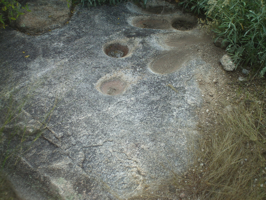 .....a partially buried boulder that had grinding holes where Indians ground corn. Cool and maybe the 3rd of these I have found. I continued and eventually returned to my car with 16.3 miles. I am building for some good hikes coming up. 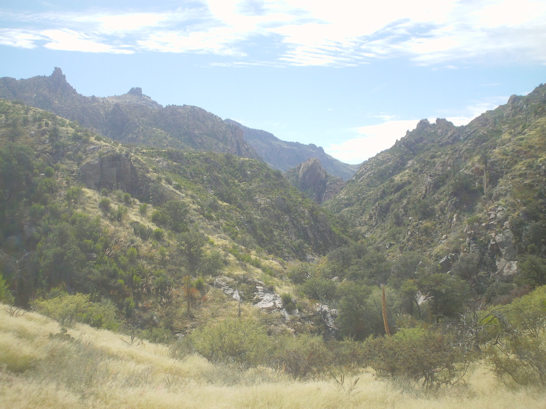 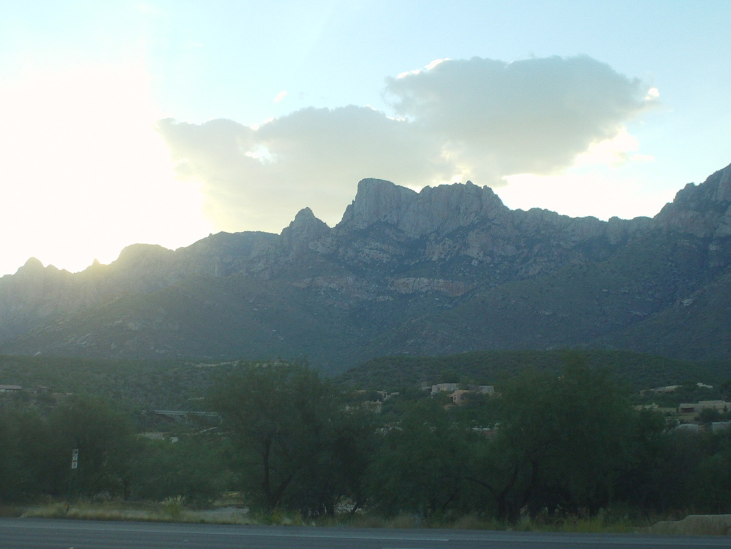 I was dragged through a variety of furniture stores whose names I do not recall on Monday. Today, "the ladies" had the car so I asked to be dropped off in the wilderness, rather than be frog marched through more aisles. So I found my self at the foot of Bighorn Mountain. I needed to do some more exploratory effort before making a push to the summit. It is all off trail and very slow going as I first scan the surface for a rattler and then for the best way forward. 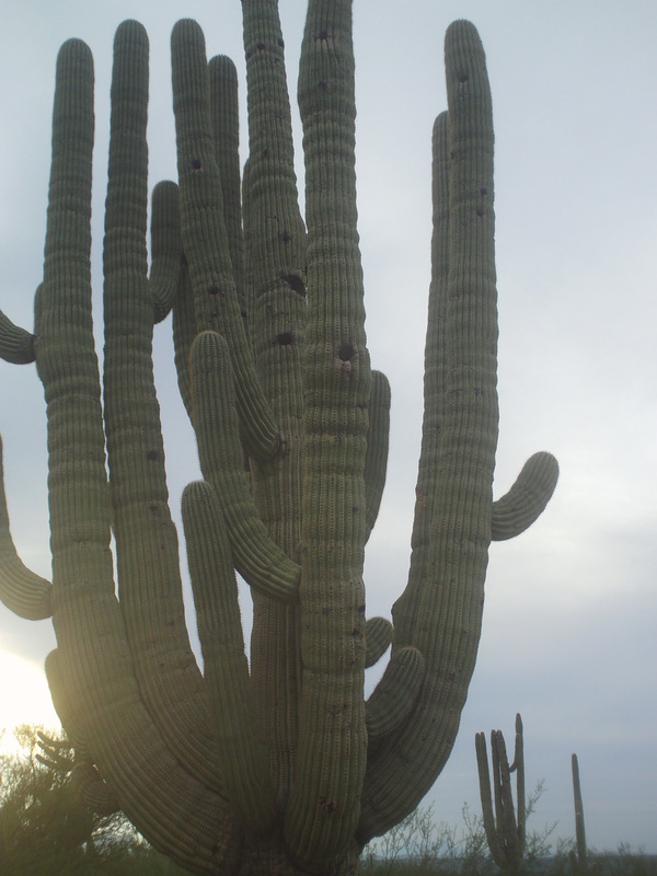 Wow. Check out this saguaro cactus. If I had to guess, I'd put the age at 250 years. It is said 80 years passes before an arm begins to emerge so..... 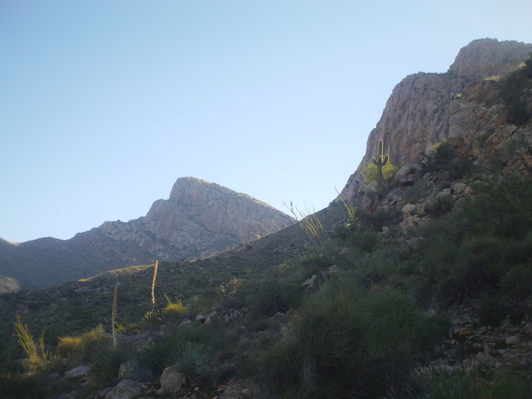 I have to advance through two washes before arriving at what I think is a drainage that will take me to a saddle for the final hike up to the summit. I have no idea how far it is but for today, it is to go farther than I have gone before. 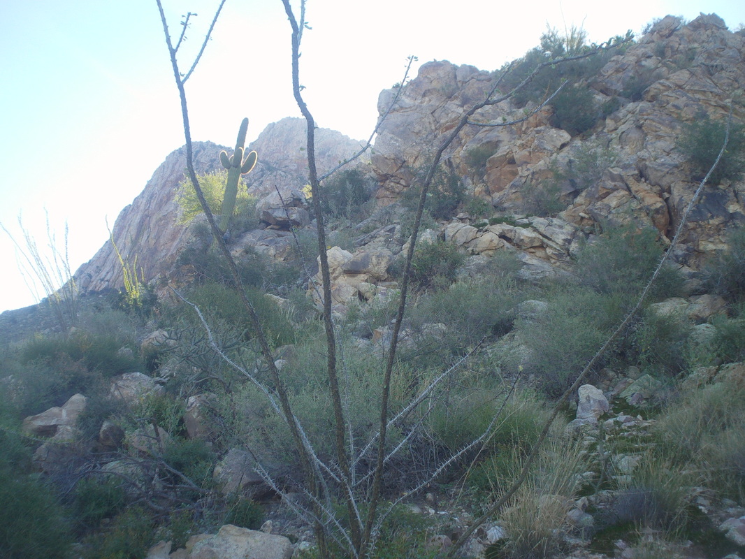 I reach the base of this rock outcropping and go around it and then.... 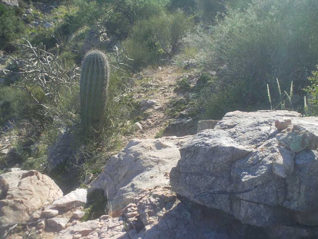 ...how about that!!! I find a game trail and the going is a bit easier. I begin to think what animals I would like not to meet on their highway and then decide to think of the much smaller list of those I would like to meet.....deer, maybe a bighorn sheep...that's about it. Most, if not all of you, think I am a weenie for my concerns about rattlers, mountain lions, bears, javelinas, jaguars, gila monsters, Africanized killer bees, bobcats and scorpions. I know veteran hikers who do not go off trail until November thru February and refuse otherwise. The only thing on that list they don't have too worry about too much during that "cold" season are rattlesnakes and maybe the bee swarms. 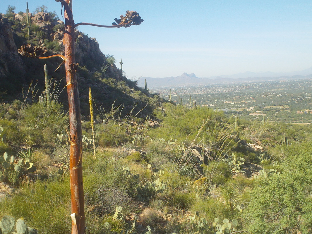 I ran into an impregnable wall of dollar cactus and decide that is enough for today. Looking in the direction from which I had come, the views are terrific, as always. I get the car tomorrow and have an epic hike. I have to be on the trail at 6:00am, a half hour prior to sunrise. So early but I am very frustrated that I have not already achieved an epic journey 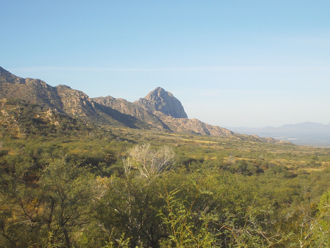 Previously I have hiked to Elephant Head from the south with a group that required a rugged drive over forest service roads. Too much for my car but I read about an approach from the north that seemed doable at 14 miles, round trip. Towards the top of the peak, there is an exposed ridge line with a shrine at the top for elephants. Way cool. 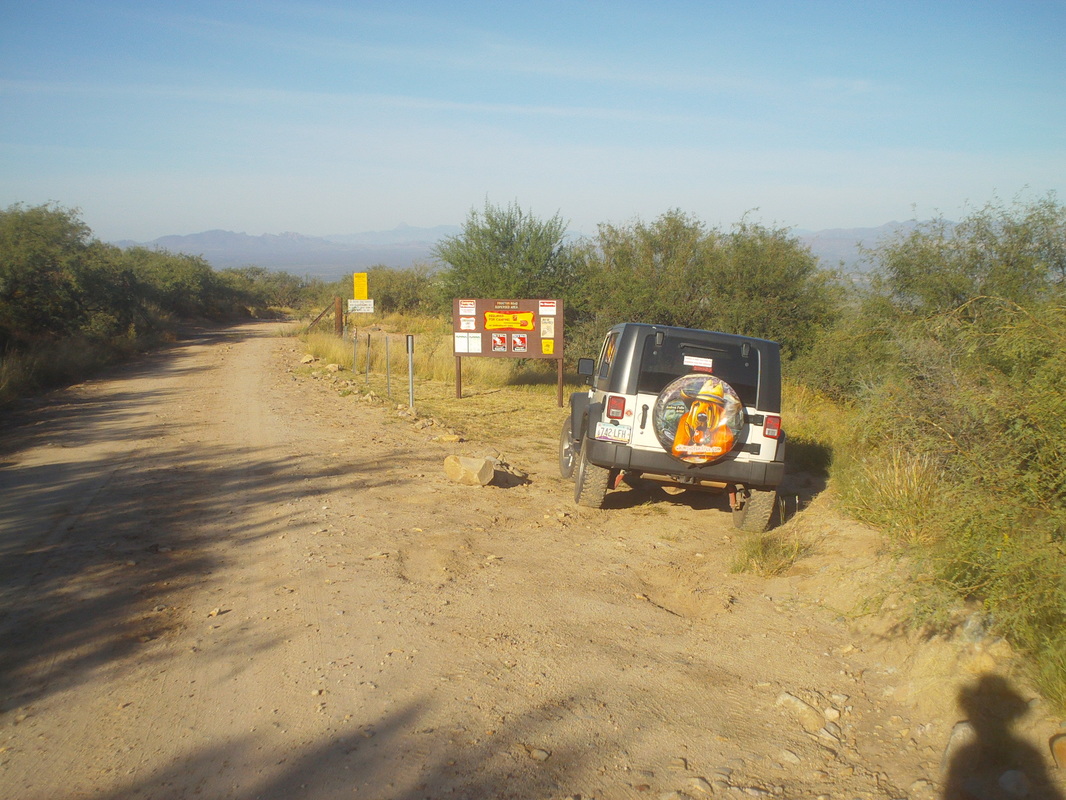 For the first 2 miles I followed a road that had several camp sites that were full and passing a jeep, I wished I too had one as it would give me access to dozens of other trails that can only be reached with this type of vehicle. Then I arrived at a gate..... 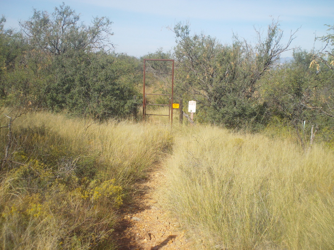 ....great and headed toward the elephant but immediately, the trail disappeared under a cover of..... 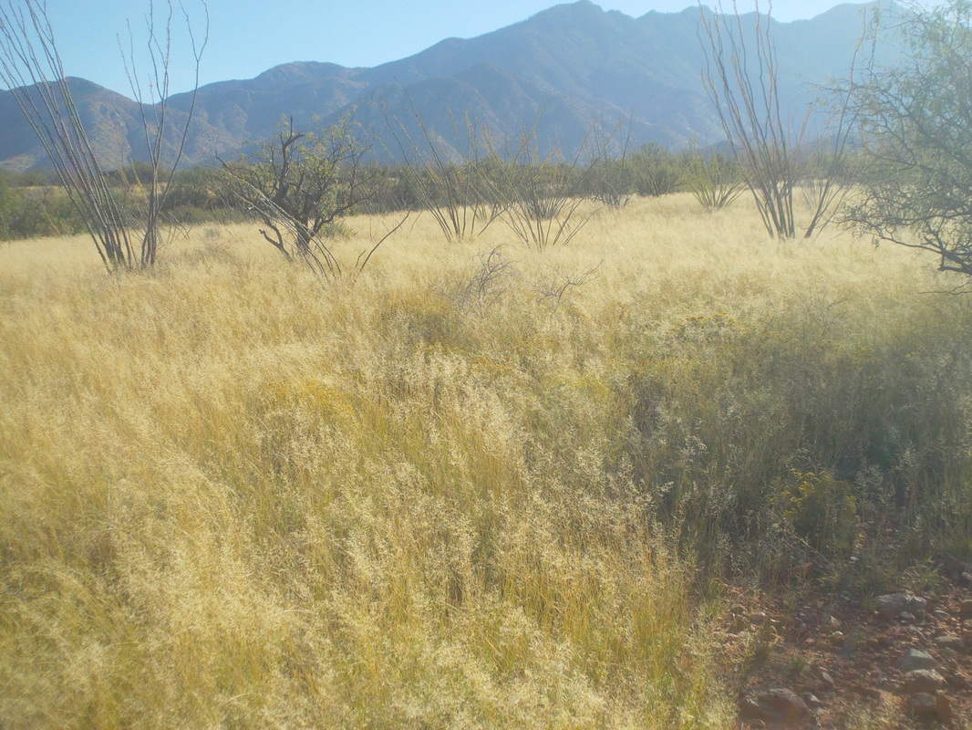 ....tall grass that bent over the trail and after about 1/2 a mile I lost the trail...great. Each step forward without being able to see where my foot stepped is a bit unnerving, knowing what potentially could be down there. I reached a grove of trees under which there was a bunch of deer or javelin scat and completely lost the trail. I decided it would be best to turn around. This has been a very aggravating trip so far. As I neared the gate and the forest service road beyond I found a..... 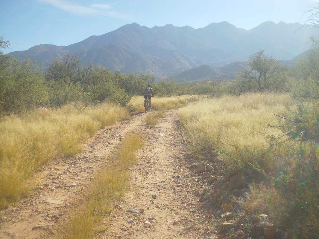 ...guy on a mountain bike. We had a nice talk and he too was uncertain about the trail because if you can't see the rock and debris beneath the grass, it's too dangerous and so later he too turned around and then passed me as I trudged back on the forest service road. 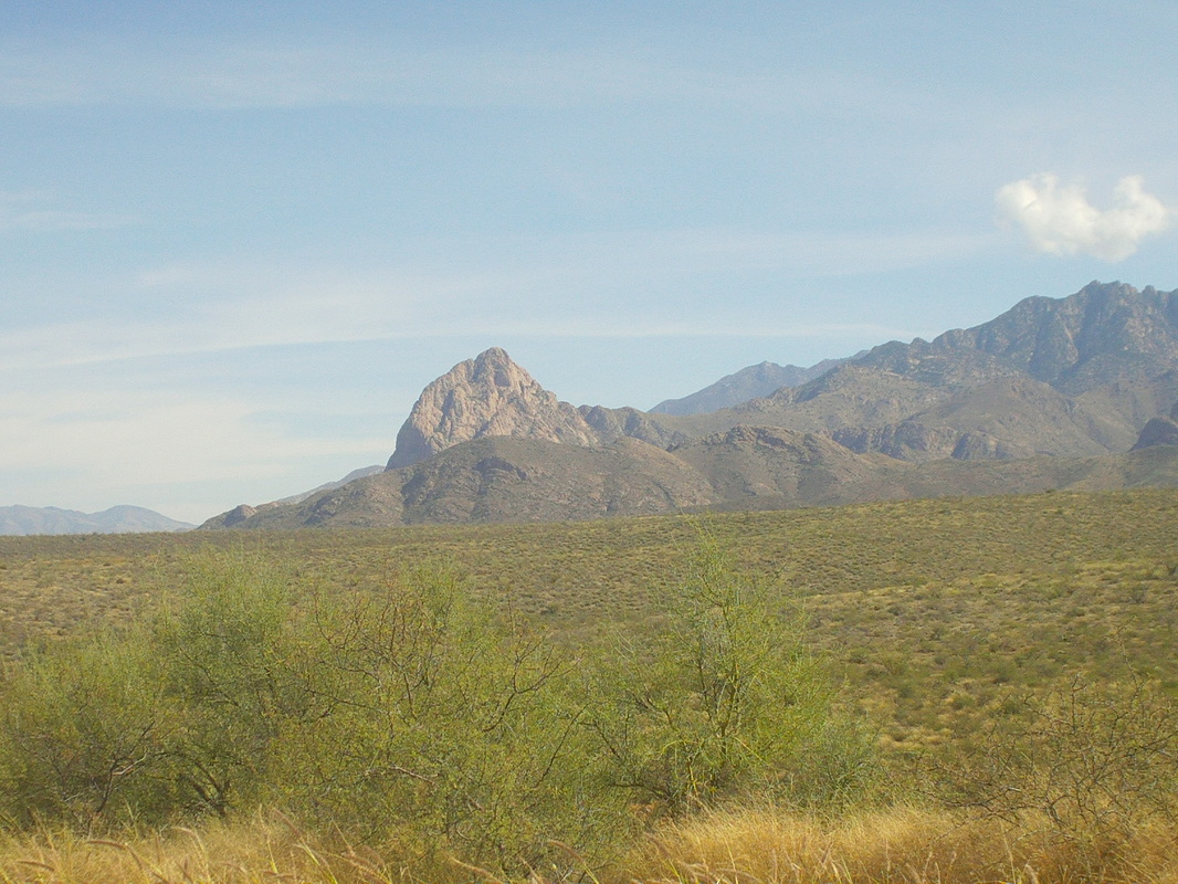 Reaching my car, I drove to the north side and took this image. Maybe this is a better look at a granite formation that looks like the head of an elephant without the trunk. 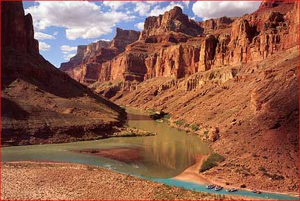 The confluence, where the Little Colorado River merges with the Colorado River. Few have hiked to it but a popular destination of boat parties. I've always wanted to visit. Last year a group organized a visit as a day hike but while the distance of 18 miles is doable, the condition of the route makes that impossible in October. Still, it was a fun hike down Salt Canyon to the LCR where we turned around and climbed back out. Our progress going down was about 1 mph so that gives you an idea of the difficulty. 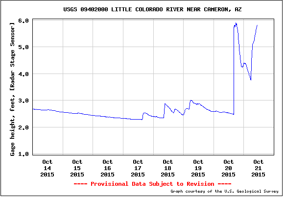 When the flow is normal (that would be at 1.5 on the above chart), the water in the LCR is a beautiful turquois/blue. With all the recent rain, that was out the window but that is not too important to me. However, not only was the flow high, it was very high. The route from Salt Canyon along the LCR to the CR crosses the river several times so..... and then the route would be under water in places, pushing us/me higher into thick reeds. Then the group abandoned for a hike off the North Rim that I have already done twice so... not much interested in that. Would I go it alone? I've done it previously but that did not seem smart this time so hopefully next year. 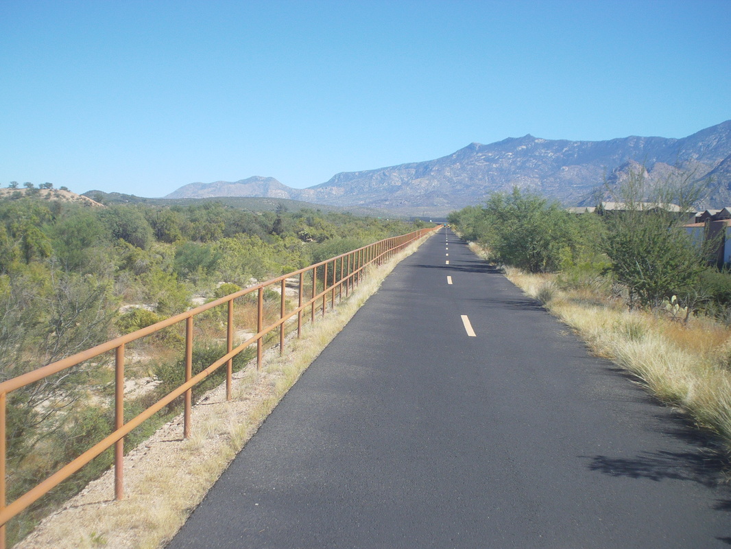 So, I did not drive to the Canyon, hiking Pusch Peak instead on Thursday, doing a group ride on Friday and then after some furniture was delivered on Saturday, I got out for a short ride that included a section of a bike path. 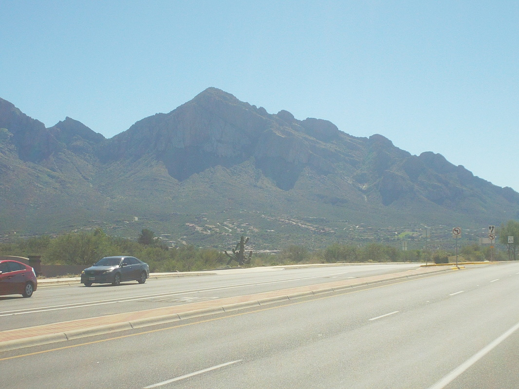 On the way back, I had a better view of Pusch Peak, which I climbed on Thursday. Maybe gives a better perspective of the mountain. Very hard hike that one. 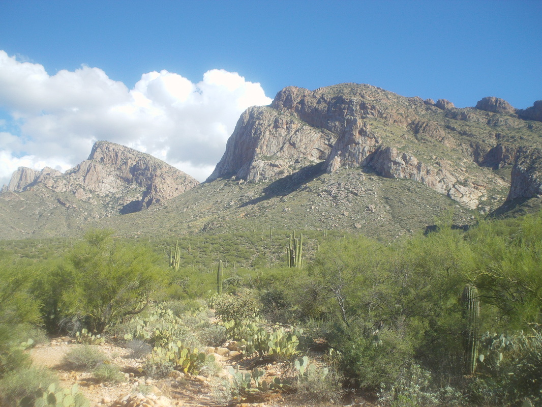 The western edge of the Catalinas with Pusch Peak in the foreground with Bighorn and Buster mountains in the background. A very difficult climb this one. 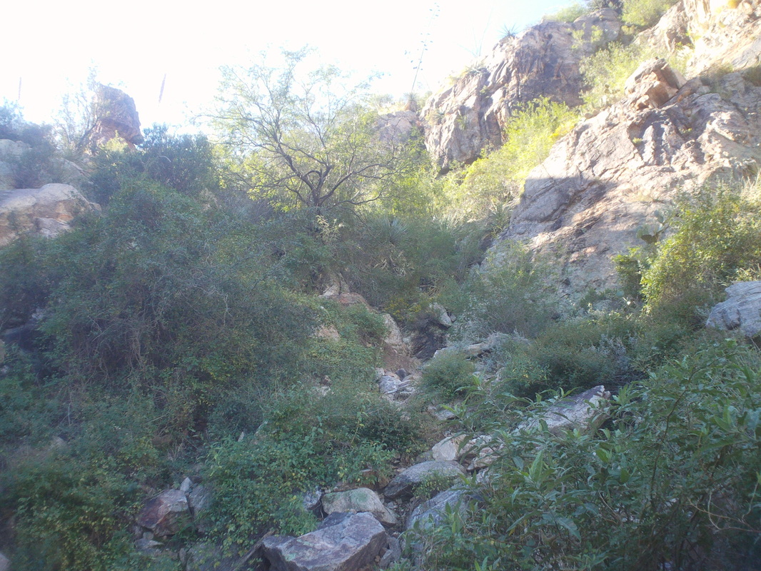 Shoving off the trail head one follows a well worn path until reaching a signed junction that advises you are now entering an unmaintained area. This is where the fun begins as the faint trail heads up at a ridiculously steep angle. After one mile I am well over 1000' of climbing and that includes the opening part where it is not that steep. I arrive at a 12' vertical granite wall and scamper up and over. Fun stuff that scrambling. 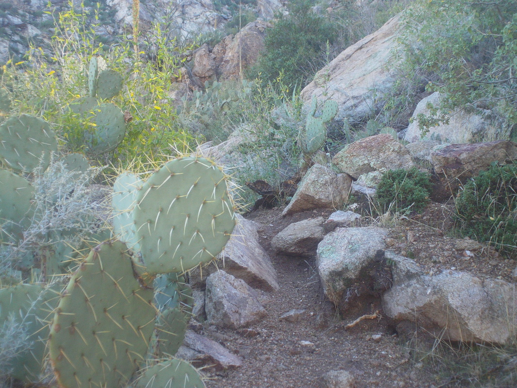 One way to know if a trail is well traveled is if the cactus edges have been worn smooth. Nope, looks like the full compliment of needles is showing as few people climb this trail. Probably averages one a day. 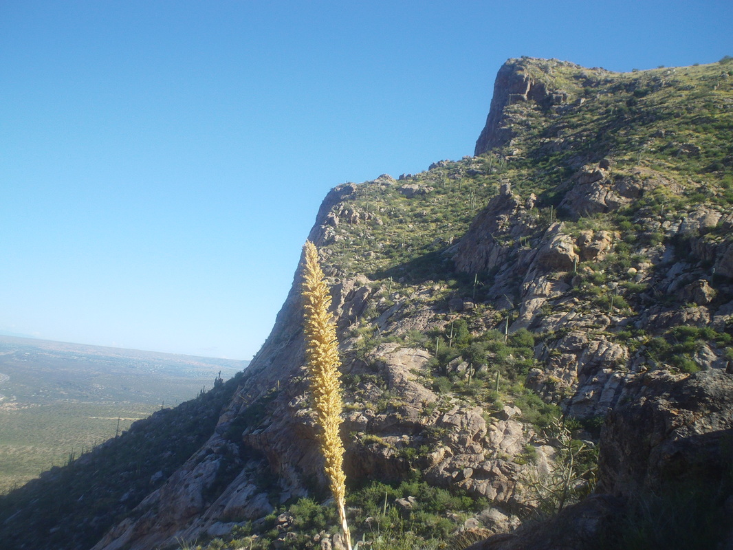 Higher I go with fabulous views to the northwest. 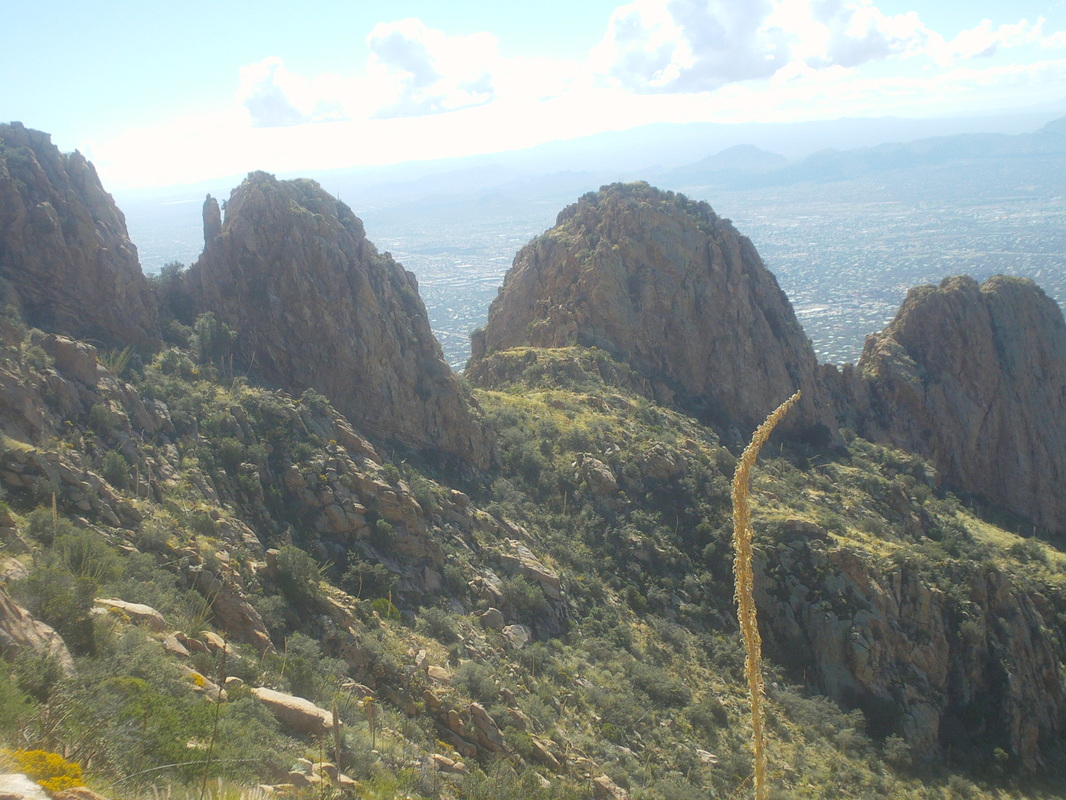 Higher and higher the knee buckling route goes. I'm always fascinated by these ridges which remind me of the back of a Stegosaurus. Finally, after almost 2 hours of climbing I reach.... 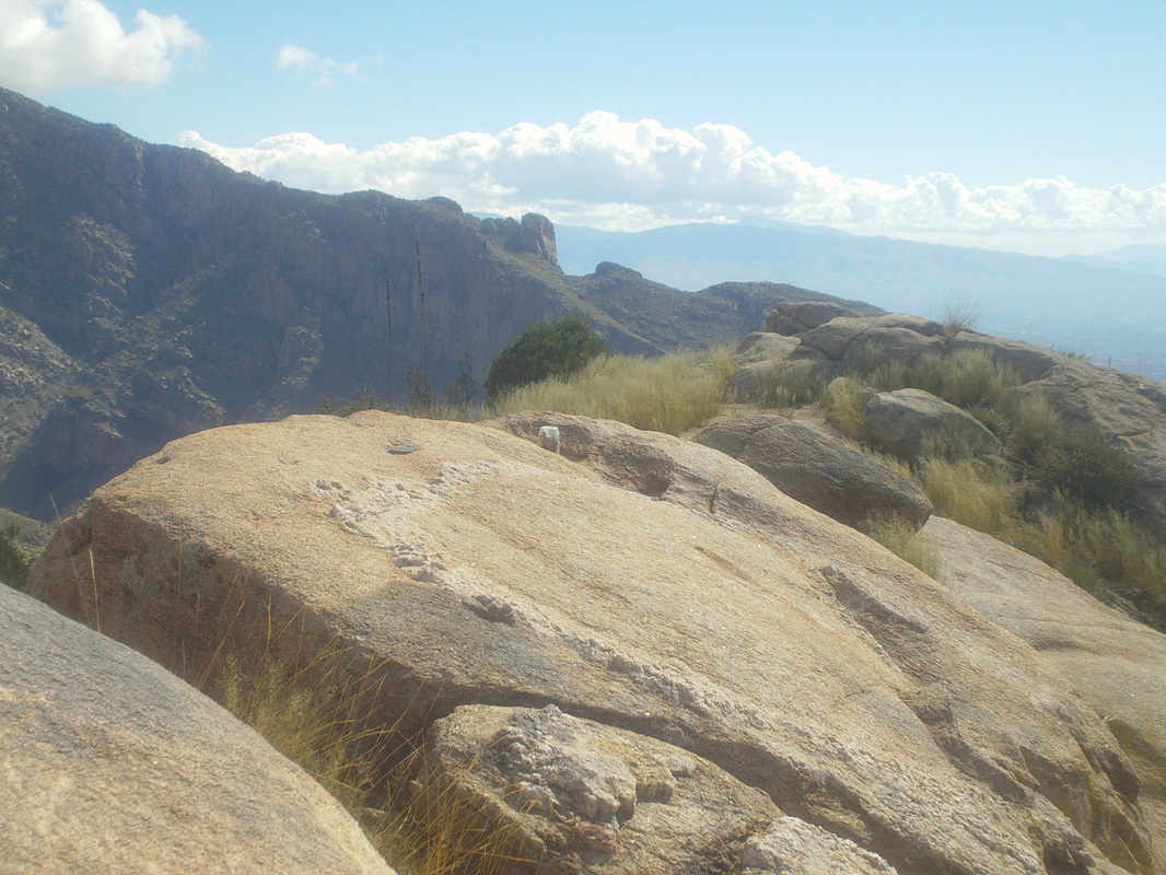 ....the peak. It was a 2700' gain in 2 miles. Crazy. 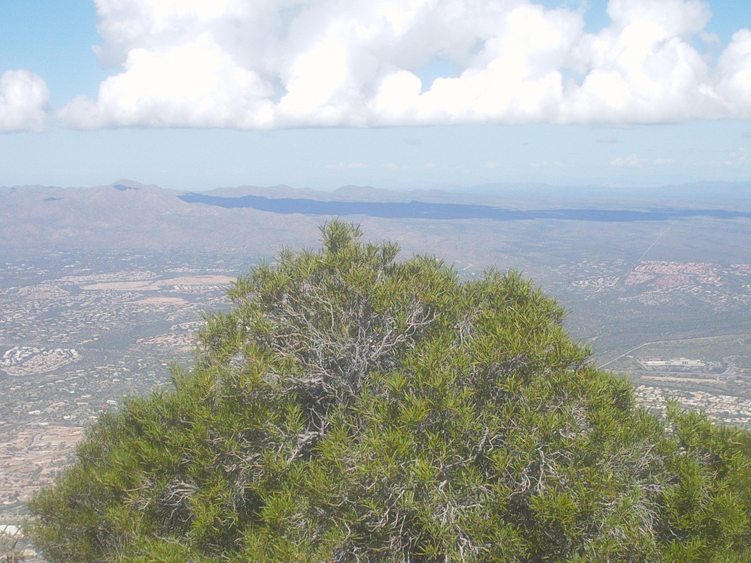 Some clouds linger in the area from the recent rains that thankfully have dropped the moisture, always welcome and then moved on. 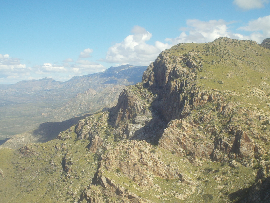 The adjoining bighorn Mountain. All off trail to that peak and the vegetation is thick. I hiked about a 1/4 mile down and concluded reaching it could be done but for another day. 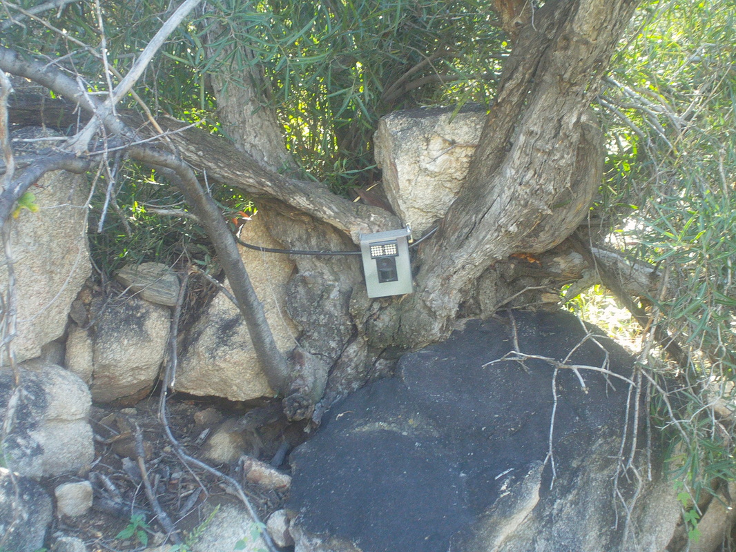 As I hiked the joint crushing route back down, I passed two of these motion cameras that are activated at night when animals (or humans) cross in front. 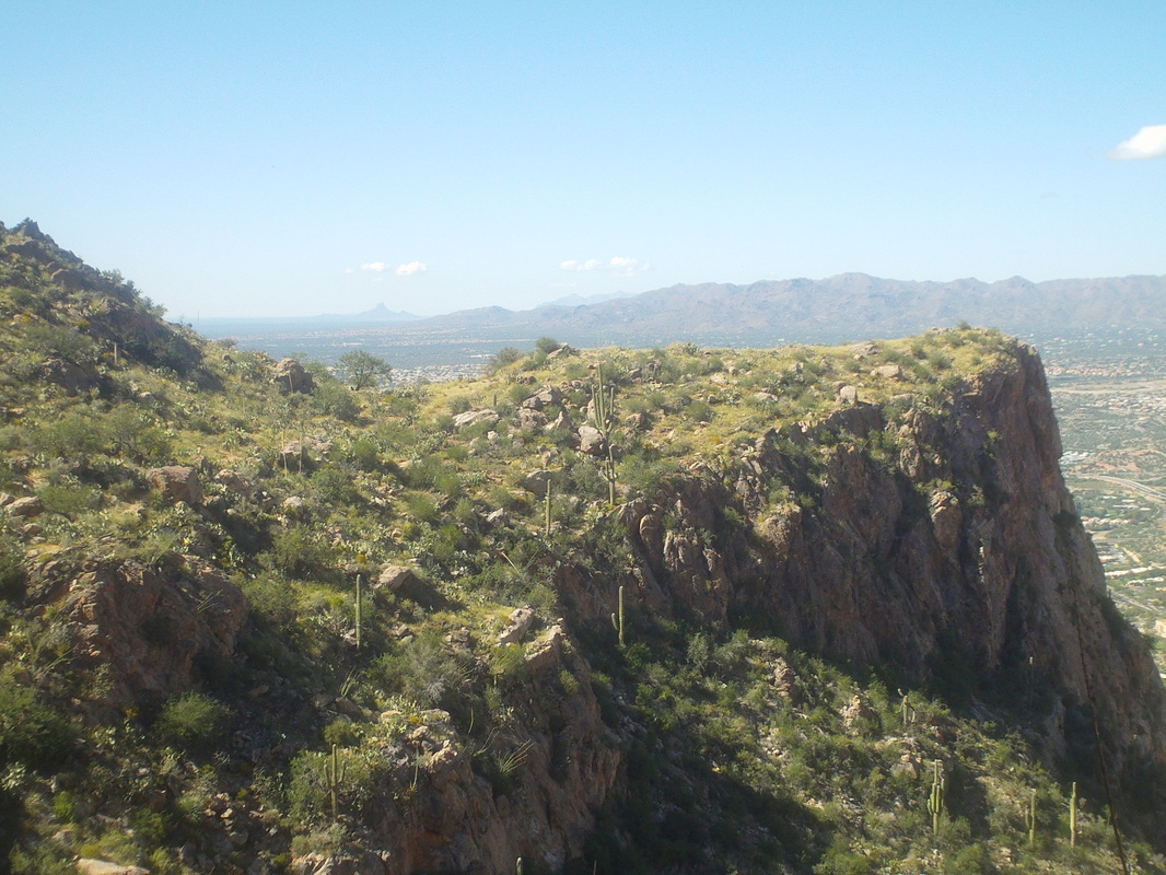 About half way down the trail splits with an option to go out to the point shown above. It is a worthy day hike option too. The Tucson Mountains are in the distance. Well, that was Thursday. On Friday I jumped in with a group at La Buzz and participated in a 40 mile bike ride. I was so much looking forward to the Bicycle Ranch group ride tomorrow, which was cancelled last week due to rain but furniture is scheduled to be delivered between 9-1:00pm. Even though I am certain it will be exactly at 1:00 that they will arrive, can't take that chance. The day began like all days, the permanently unemployed or rarely employed out for a group ride, left to right, The Donald, Flyin Tuna & Old Chubbs with Steve Oxley on camera (I exempt Steve from my description as he works hard, paying taxes so these three can live high on the hog). At mile 67, Cindy inexplicably got ahead of the others. Likely confused by this, she turned slightly to figure out why she was in front when her front wheel entered a small hole in the pavement. The wheel turned and BAM!!!!! the road trembled under the impact. Probably seismologists picked up the disturbance many miles away. Anyway..... 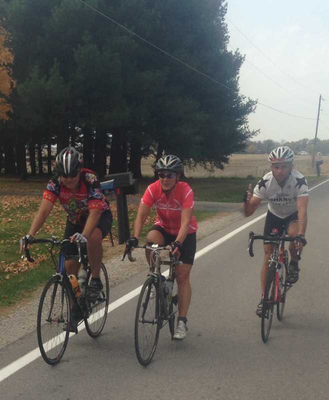 ...my little buddy is ok other than a torn jersey and road rash. There was some concern that her clavicle was broken or shoulder separated but it appears for now, just some tissue damage although husband Rod has her under medical watch. Mean time, road crews are at the scene, repairing the impact damage to the asphalt. 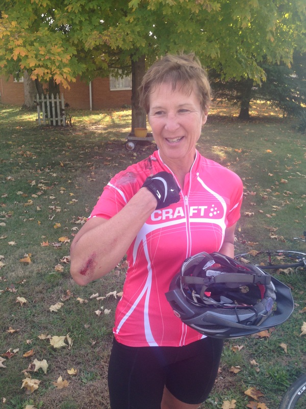 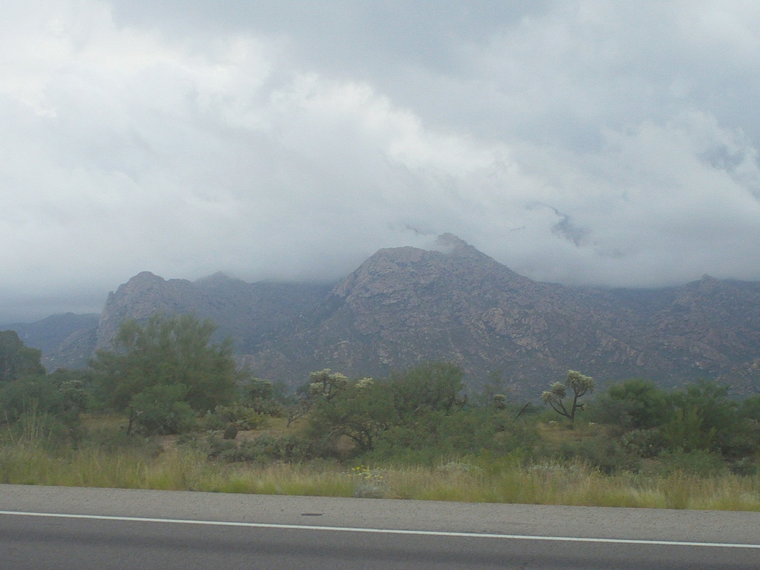 Heavy rain overnight, again, as the clouds linger in the Catalinas the following morning. Afternoon storms forecast for today so can't do anything epic but there are always short and fun alternatives that can be completed prior to the anticipated arrival of more rain. Having already completed Sombrero I go a little farther afield and head to Picacho Peak. 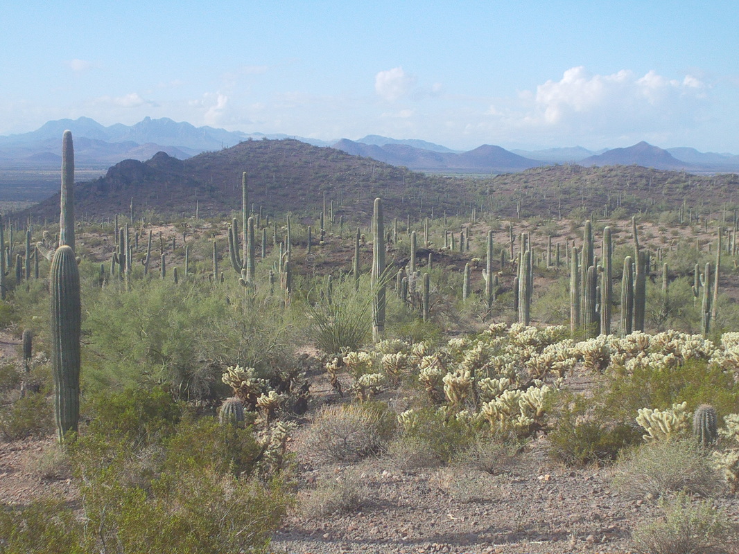 Picacho is between Phoenix and Tucson, near the town of Red Rock. I forgot to take a picture of the peak but a great "fitness" type of hike. Rather than take the more direct trail, the Hunter Trail, to the top, I circle to the southwest side of the peak, park the car and head off through the Sonoran desert on the Sunset Trail. Beautiful and clear in the direction from which the storms will arrive. 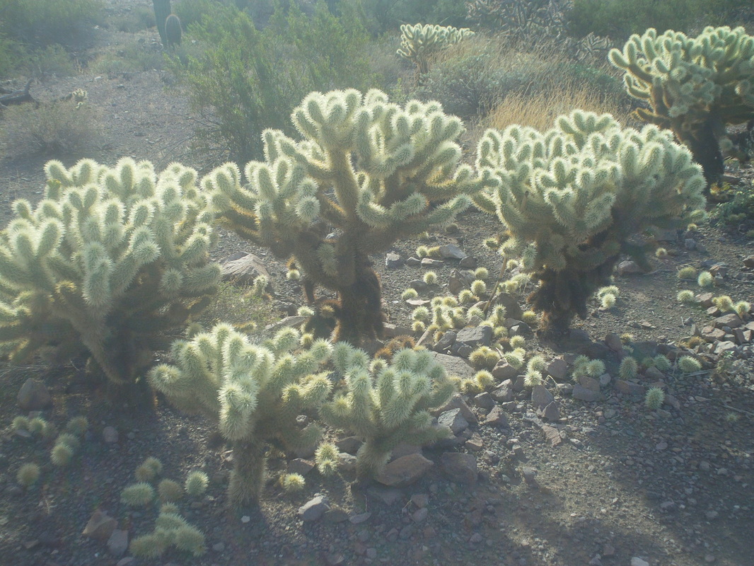 Although only knee to waist high, a stand of these Cholla cactus may as well be a high fence because there is no going through that. Note the egg shaped pieces littering the ground. Passing too close and they will jump from the plant and embed spines deep in the skin. I hiked with someone last year who had one attach to their arm and instinctively grabbed to pull it off...big mistake. 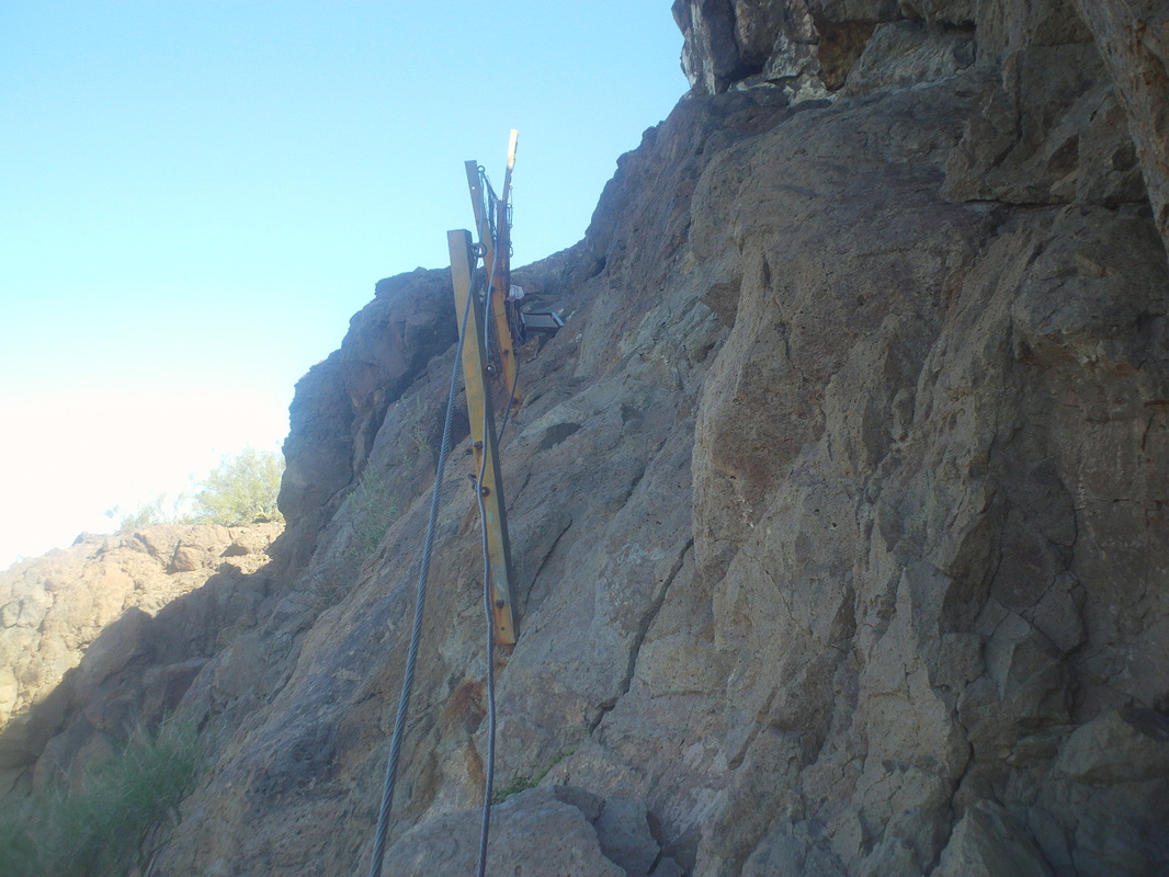 After following a rolling trail counterclockwise around the peak, the trail then ascends, steeply, for the final mile. Sections have cabling to help with the ascent or to help prevent a fall. 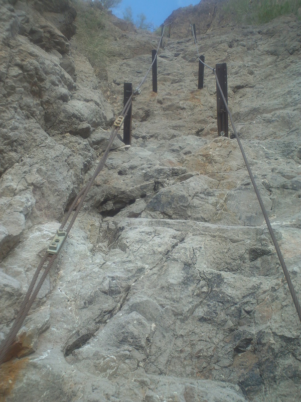 This was the most extensive section, up an 80-90 degree wall about 100' tall. I brought a pair of cycling gloves and put them on for a better grip. After 3 miles and a hair under 2000' of elevation gain, I arrived....  ....at the summit. The first to arrive this day in 1:19. I hung around for a bit, talking to some others who soon followed me and then retraced my route to the car. As I drove out, I spotted another.... 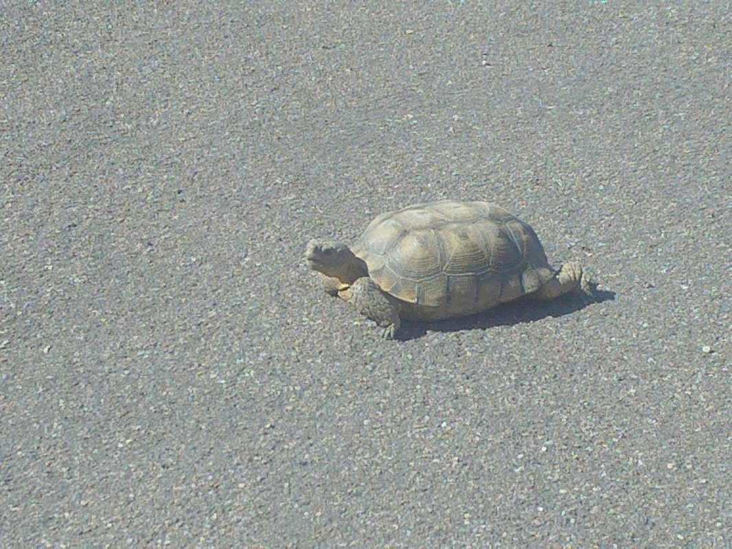 ...desert tortoise. I went three years before seeing a Gila Monster and then last year in the span of a week spotted two. I've never seen a tortoise until this year when I saw one last week and then another this week. And of course while I have previously seen one black tail rattlesnake, seeing two beside a trail two weeks ago was odd. Guess things happen in twos rather than threes. While I have said this before, this time it really does look like this is the last round of rain, after today, for awhile. Although two months to go in the year, rainfall totals are above normal and probably going to finish well above normal by year's end. 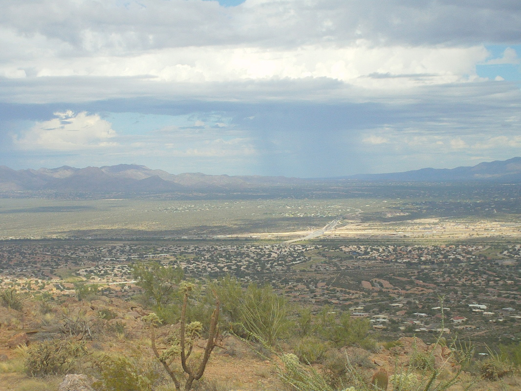 So Saturday rolled around but all night it rained and was still raining when I received an email that the Bicycle Ranch shop ride was cancelled. Too bad. I was so looking forward to seeing if I could duplicate the humiliation of last Saturday's effort. Don't feel too bad for me because the rain is usually late afternoon stuff and almost never an all day affair. There I was, watching the 1st quarter of the MI/MSU game when I thought, "Do I really want to sit all day watching football?"...well yes I do but guilt forced me out of the chair and I returned to complete the Sombrero Peak hike. Reaching the portion of the trail where I turned around yesterday, I heard rumble in the distance and saw rain to the east but to the southwest..... 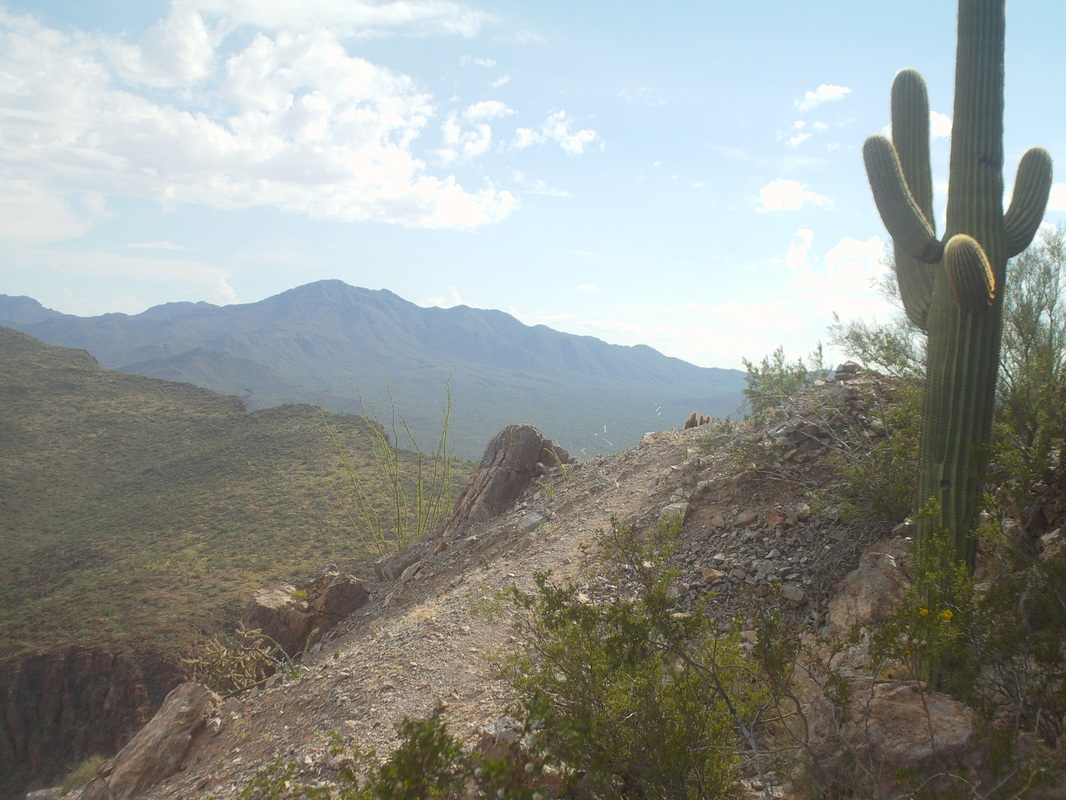 ....from where the storms track, it was clear. Reaching the base of the rock wall and summit, I go clockwise to reach the only point from where you can scramble up to the peak. I saw some cairns going a little farther north and follow them and reach.... 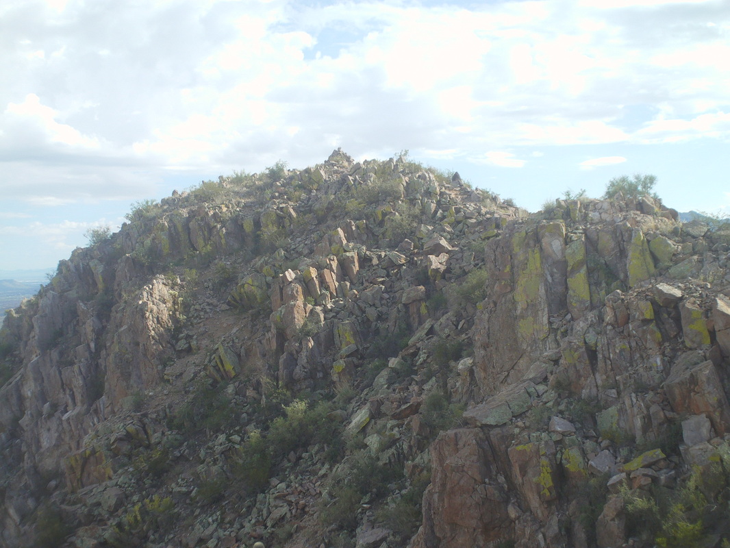 .....hmmmm, nothing looked right as the cairns had led me to a second, lower peak. Looking southwest, I saw the real peak and so scrambled through the jumble of rock..... 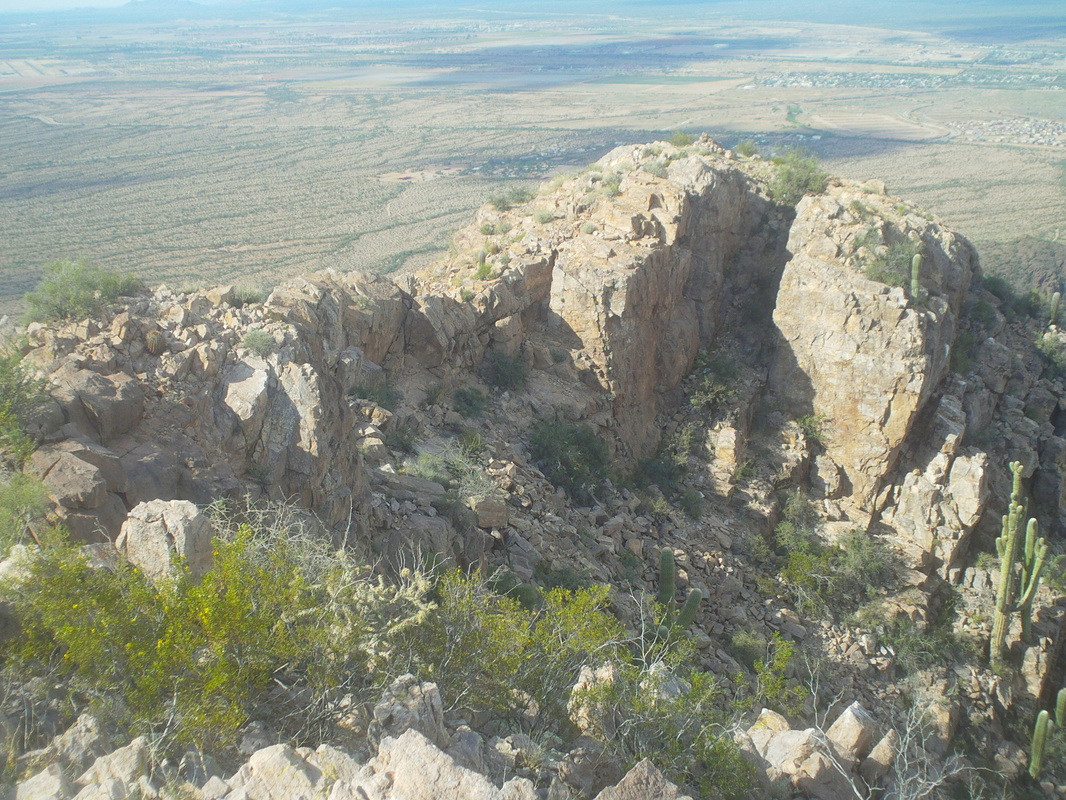 ....and was now looking at where I had been. A little sketchy in spots but other than some exposure, a fun scramble. 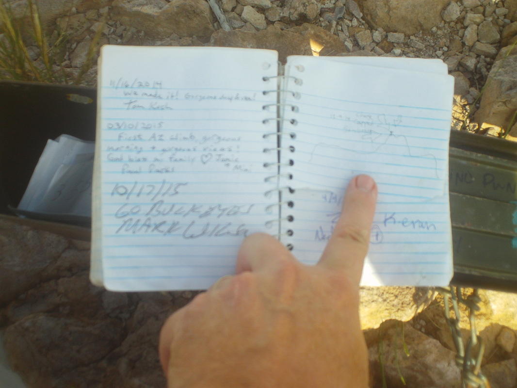 I found the ammo box and a notebook inside and signed my name. My finger is holding down the page to prevent the wind from blowing it closed and not pointing at anything in particular. 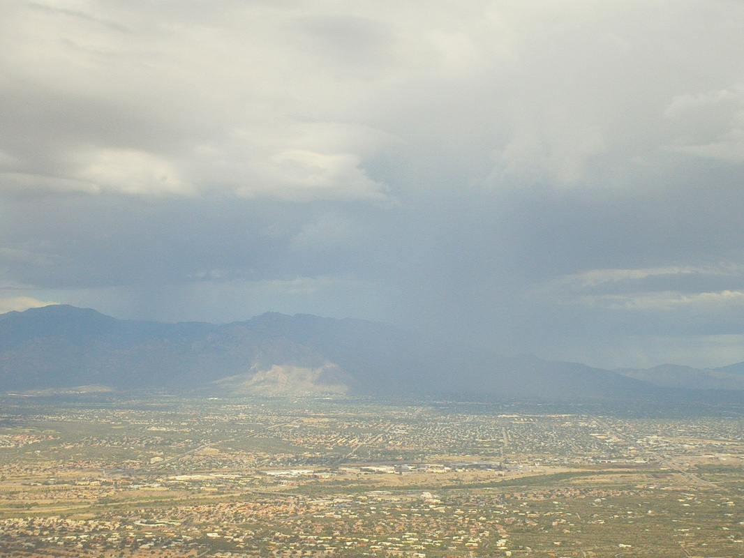 To the east, rain was still coming down as the storm seemed to linger but still to the southwest...... 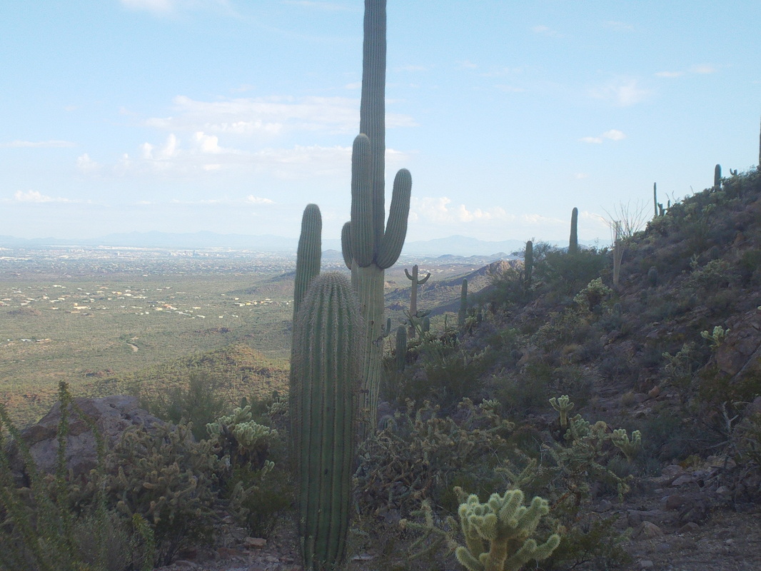 .....it remained clear all the way to the parking lot but while descending..... 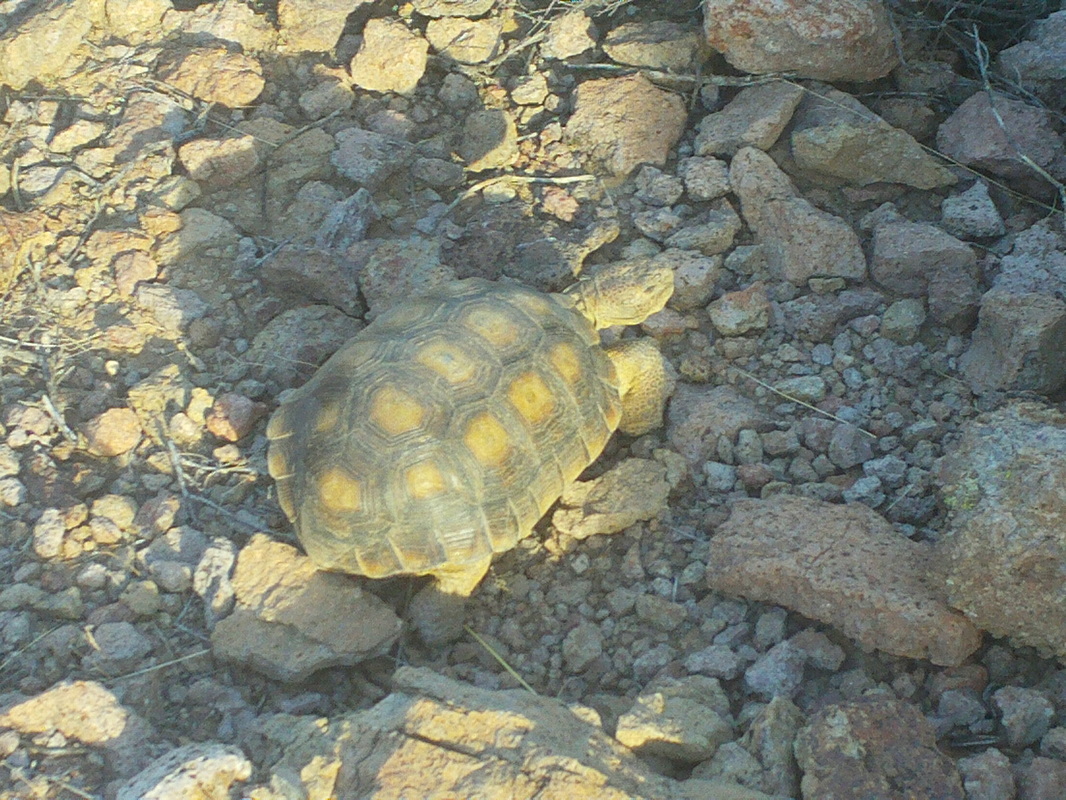 ....I heard a scraping sound and spotted this desert tortoise. What struck me as odd is it is about the only thing of that size that isn't meant to sting, bite or impale me. Well, these practically daily threats of thunderstorms are cutting into plans for more epic hikes but they are coming. So too is more reliable weather. 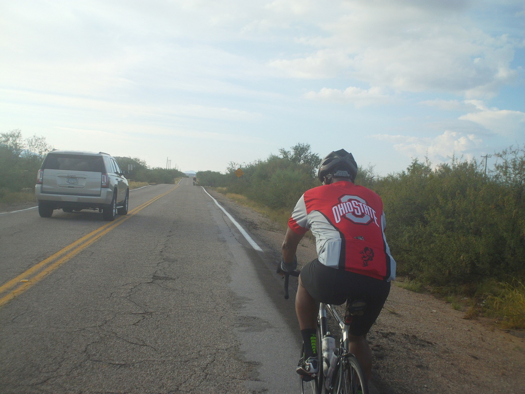 I attended an organized tour on Sunday, having a name I can not pronounce nor spell but there were a couple hundred who came out including this guy, wearing an OSU jersey. The tour would be analogous to a COP (Columbus Outdoor Pursuits) MOC, TOO, etc...mostly flat, kind of boring but it is south of Tucson so an area that I rarely ride. 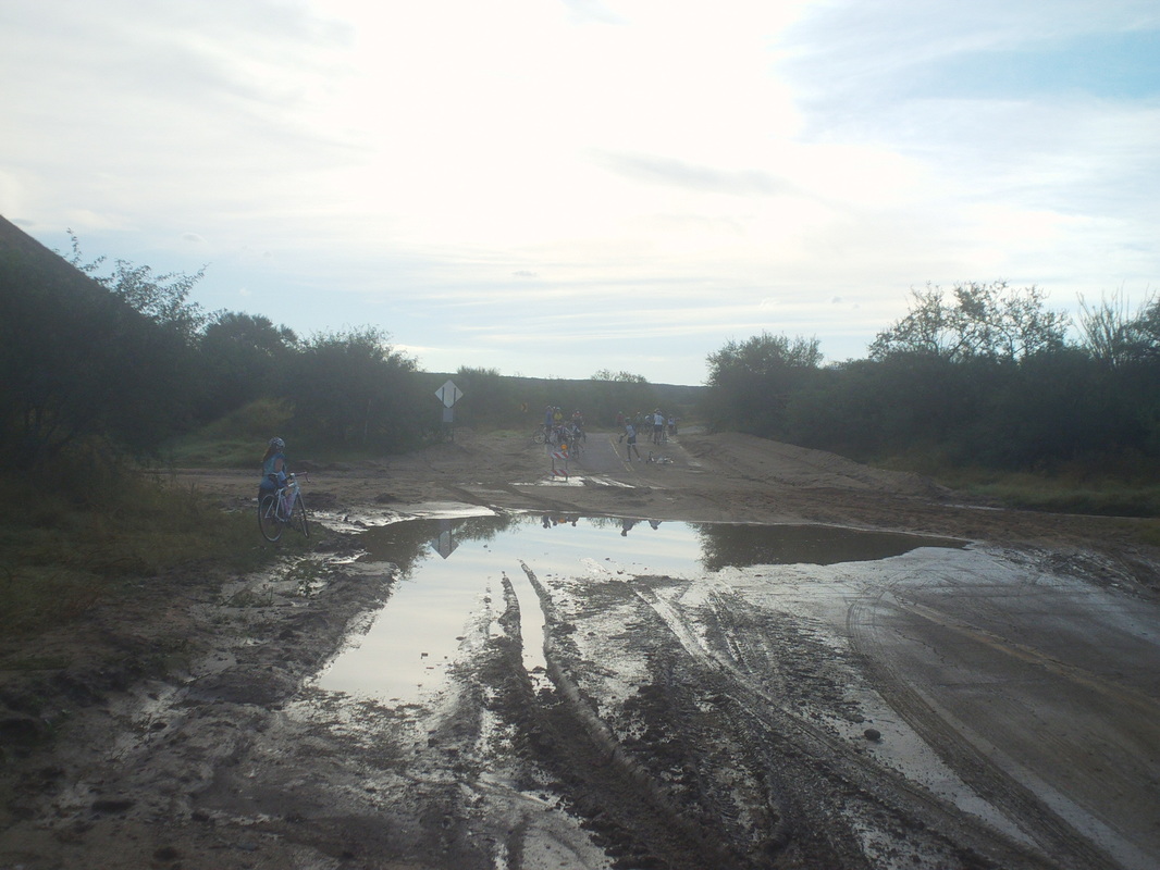 The recent rains have created some washout areas including the above. After walking the perimeter.... 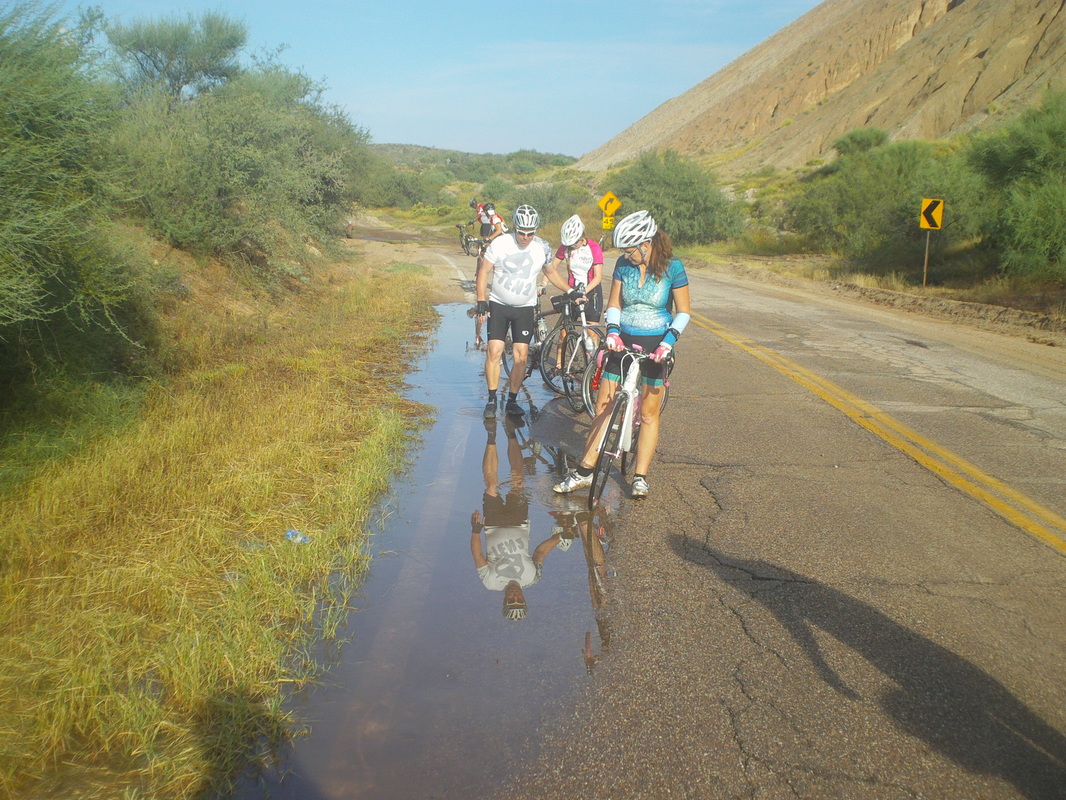 ....we then walked through a shallow pool to wash some of the mud from our shoes and bikes. 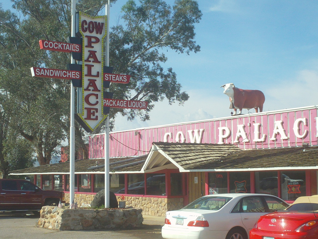 Reaching Arivaca, a village with a cow on top of a restaurant on one side while on the other there is a..... 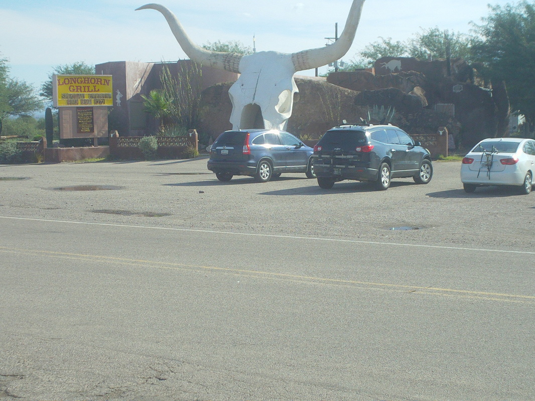 ....restaurant having a steer's head through which you walk to enter. Weird. I finished with 53 miles and 2000' of climbing, most of the climbing coming in the first 15 miles. Overall, not too exciting. More afternoon thunderstorms forecast for the next couple of days and then many days of sun and temps in the 80's.  Congratulations. If you have arrived to see the images and maybe read the report, you are one of approximately 600 unique visitors who have or will land here this week. This being a Monday when I post this, many of you are trapped in an office cubicle, filters prevent you from visiting the sites you'd really like to visit so instead, you come here for a couple of minutes. I see it as my duty to provide you with barely interesting content and so I begin, at the parking lot of Sanctuary Cove, gazing up at Sombrero Peak. Note the remains of a dead saguaro on the right.  Rising from the desert floor, the views open up to the northeast but to the southwest.....  .....several examples of "virga" when rain can be seen falling from the clouds but evaporating prior to hitting the ground. It is from the southwest that storms are coming and I begin to get a little nervous about reaching the top with approaching storms. Once at the top, it would be an hour of mostly off trail hiking through loose rocks if it began to rain or storm. I keep going before..... 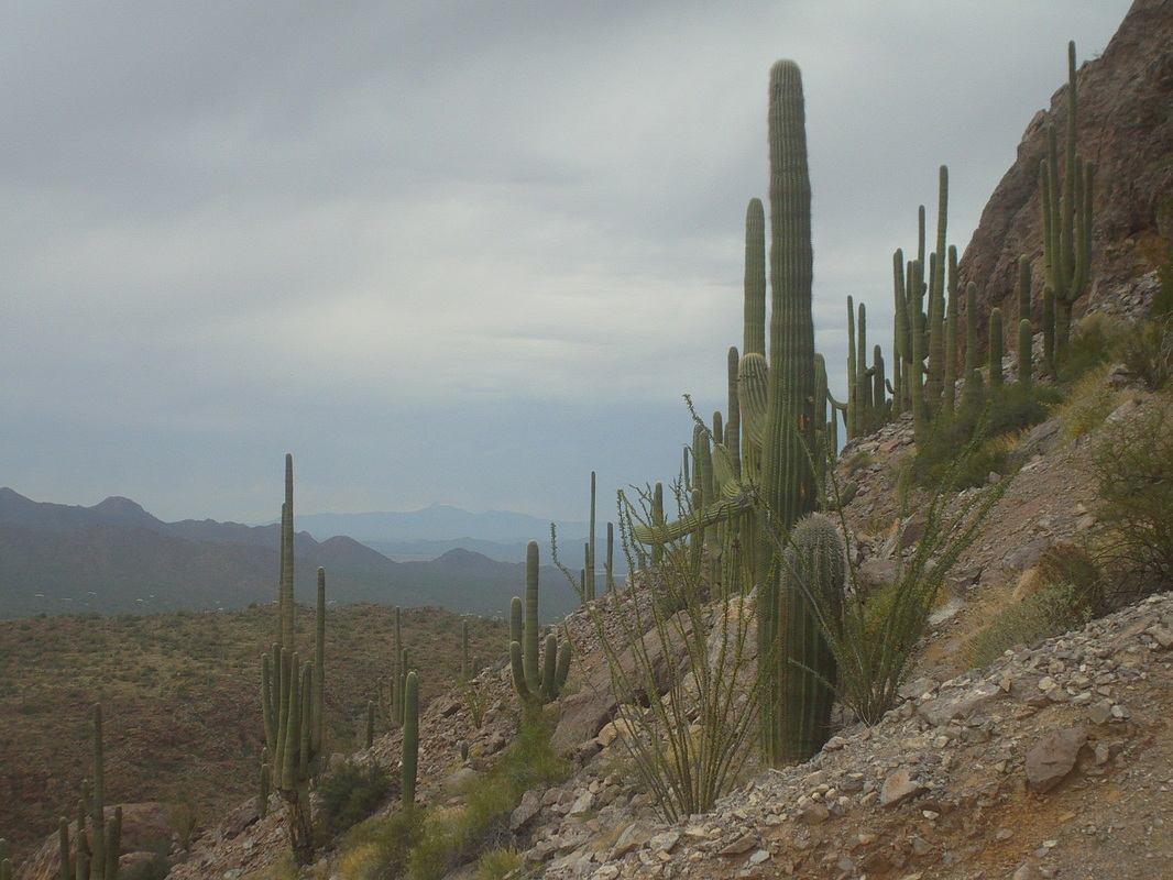 ...reaching the base of the final climb, the sky has darkened and now the wind is howling too. 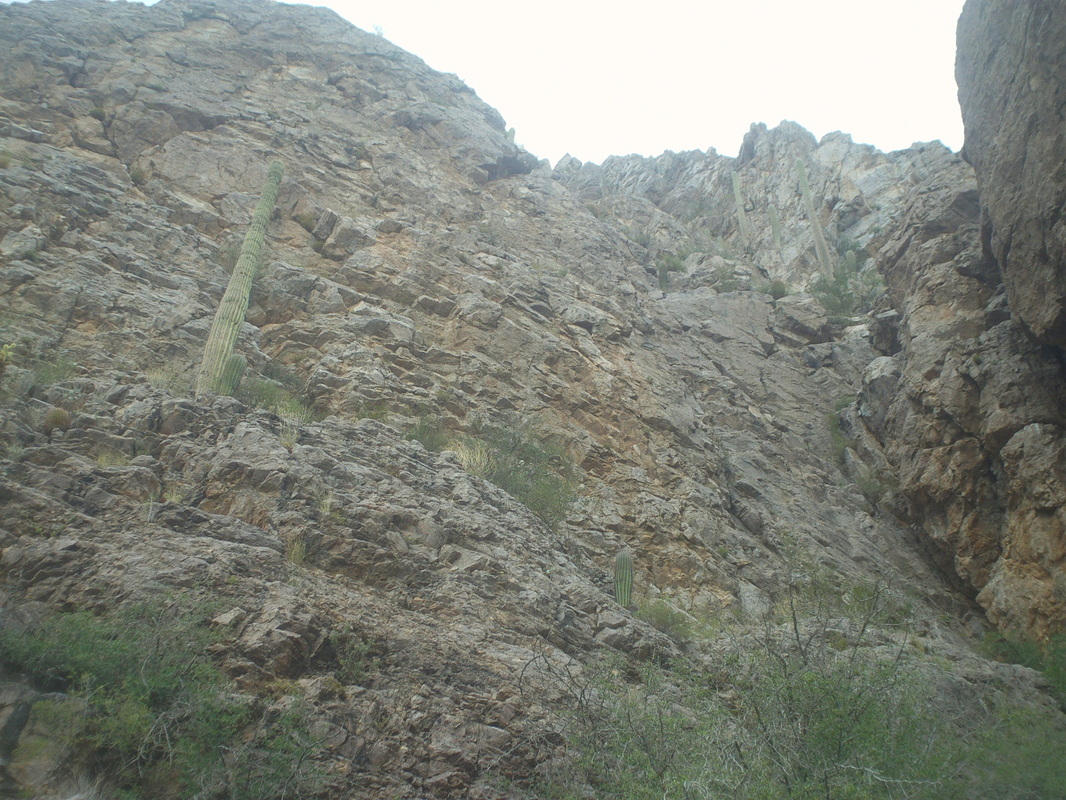 I look to the summit, which is acquired by walking clockwise around the base of this wall and then scrambling with some exposure to the top. Hmmm, maybe I should get while the getting is good and decide to turn around. 3.6 miles with a lot of climbing is still a good day even if I did not reach the peak. 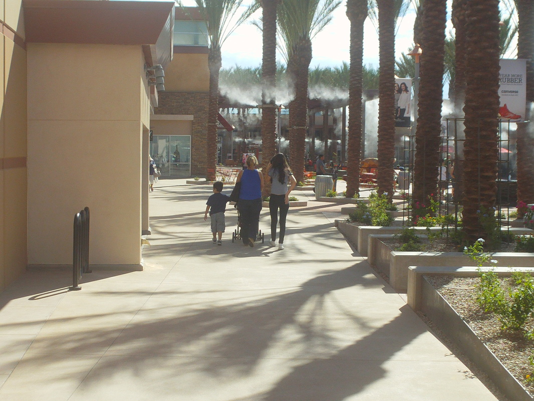 How about that? An open air mall opened a couple of weeks ago so I went on a scouting mission and found it very nice, lots of cool water sprayer type thingys and my wife and daughters, who arrive soon, will love it. Walking around I realized I won't have the endurance or stamina to hang with them so will have to find something else to do on the day(s) they spend there.  Yikes, a 6:30am start for a group hike on the west side of Tucson but the early start was warranted with an unusually hot temp of 84 in the forecast. 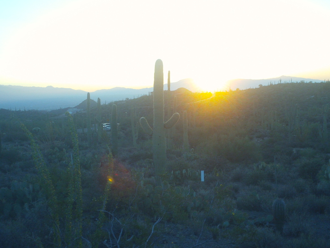 The sun peaks over the mountains as our group, led by Paul Yurgan...... 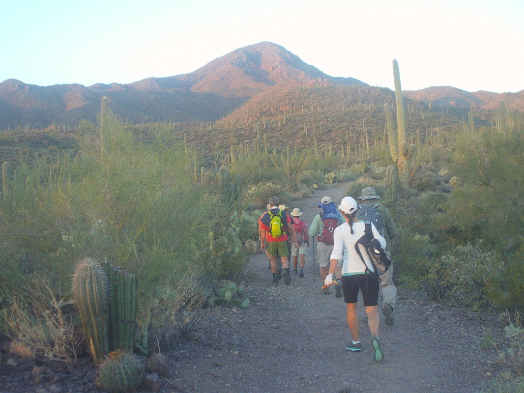 ....head away from the rising sun towards Wassan Peak. Paul, a good egg, schedules at least one hike each week. Group hike availability has taken a hit as one of the organizers is drying out. His problem got so bad he was taking shots of bourbon during hikes. Now that's a problem. 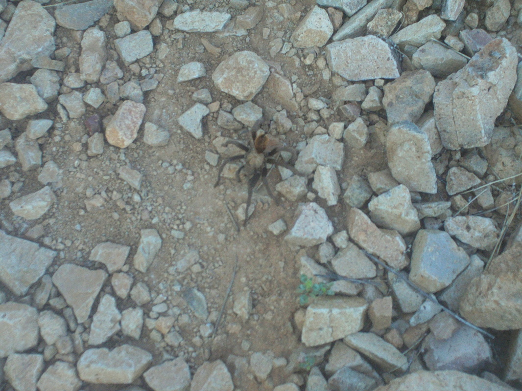 How about that? A tarantula and a really good sized one. It was funny watching people give it such a wide berth you'd think it could strike like a rattler. 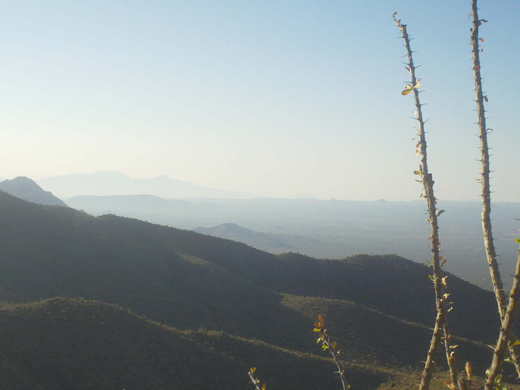 We began rising above surrounding peaks and hills. An Ohioan who now lives in Tucson, Heidi Bunch, set a strong pace that I had difficulty matching as I was again carrying my weighted backpack. She, Lisa and Licha put a hurt on me as I clung to them as everyone else fell away. The trail was not steep, just kept rising from..... 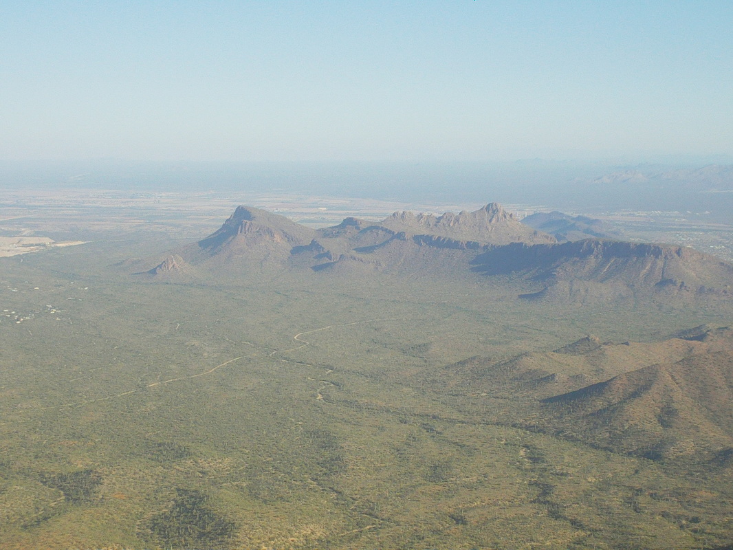 ...the desert floor. There is Sombrero Peak and Panther Peak in the distance. We reached a trail intersection and decided to wait but the pack was weighing on my shoulders and I wanted to keep going to the top, reaching it at the 4.5 mile mark. 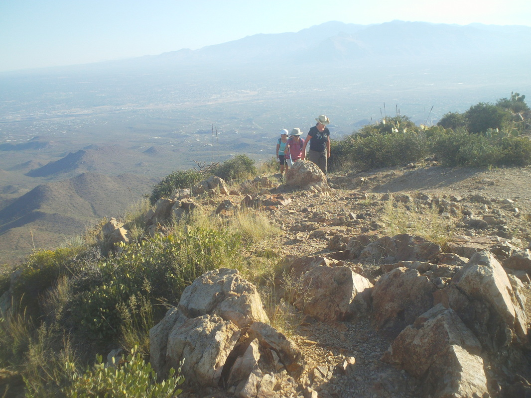 Soon, the three ladies arrived and eventually, so too did everyone else. After snacks and drinks, we headed.... 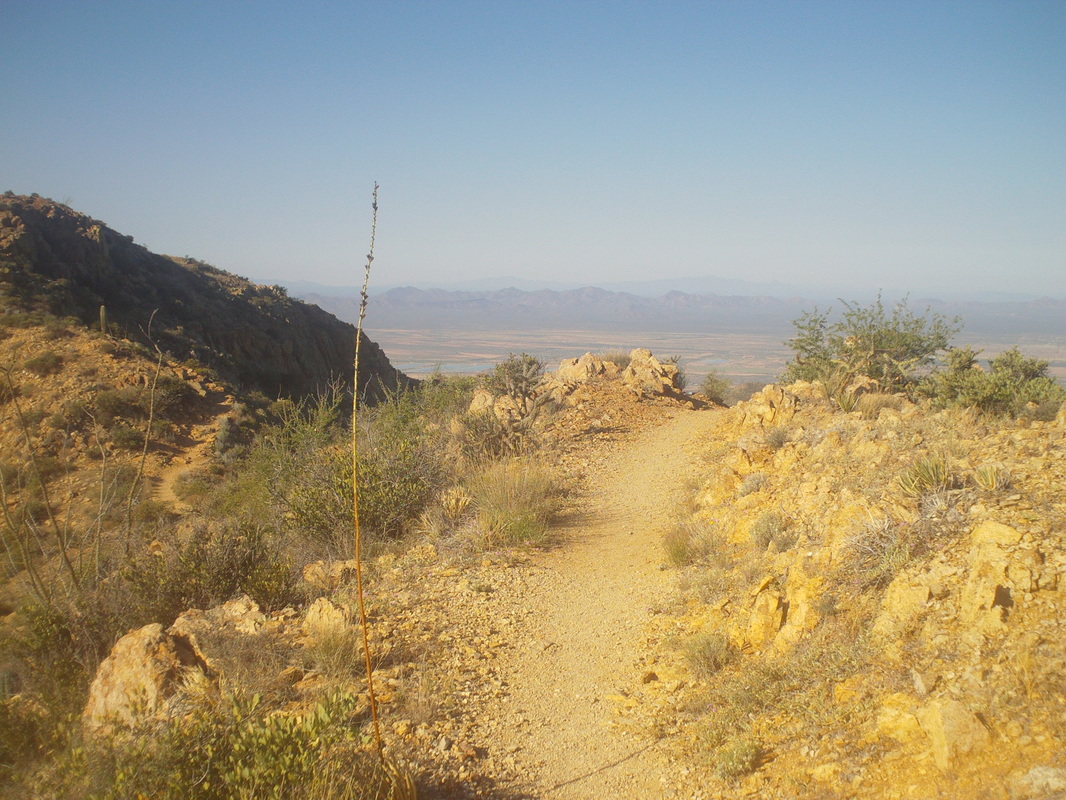 ....back down, finishing with.... 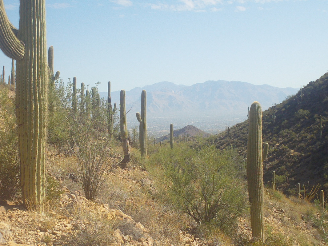 ....nine miles and sore shoulders. That low pressure system that brought rain to the area last week, then dipped into Mexico, then came north west into California bringing much needed rain is drifting back toward us so afternoon rain is forecast for Friday and the weekend. It's been unusually hot but sun and mid 80's are coming soon. 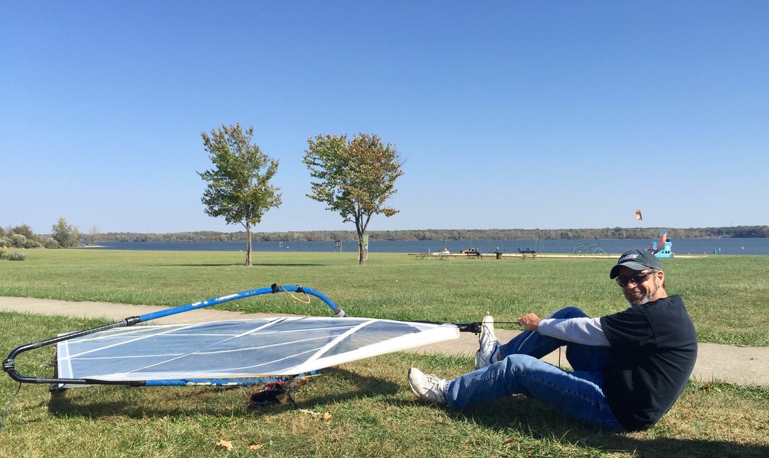 Thanks to Marty S for sending this image of Farmer Mike, preparing to go sailboarding. Soon, Mike will head to FL, a sure sign that winter is approaching.
 Can you guess what is wrong with this image.....it's that you can see this image. I've been on kind of eastern time zone sleeping so have been waking regularly at around 5-5:30 but not today. It should be dark at this point in the 87 mile drive but the sun is well up as I pass through Florence (huge prison complex) and the surrounding countryside. With a high of around 92, I wanted to be on the trail by 7:00am but instead, 8:30. I was headed up the Peralta Trail to the Fremont Saddle and then from there, off trail to Robbers Roost.  At mile 80 the road turns to dirt but it is relatively smooth for most of the remaining 7 miles. Multiple turnouts and other trail heads that lead into the Superstition Wilderness or the "Supes" as the locals call the area.  I reach the parking area where there are about 15 vehicles accessing a network of trails. Most people head up the one I have chosen because at the top is the magnificent view of..... 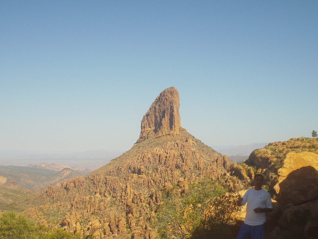 ......Weaver's Needle. People camp at the top of that but ropes are needed to access it. I've been to the base one time but that requires a difficult bushwhacking route. Note to self for future reference, I arrived at Fremont Saddle at 52:30. While sitting in the shade with a few others, I overheard someone say they had tried to reach that lone pine tree just to the right but were stopped by a ledge they could not climb down. Intrigued, I asked about the way and decided to forego the Roost for the Long Pine instead. 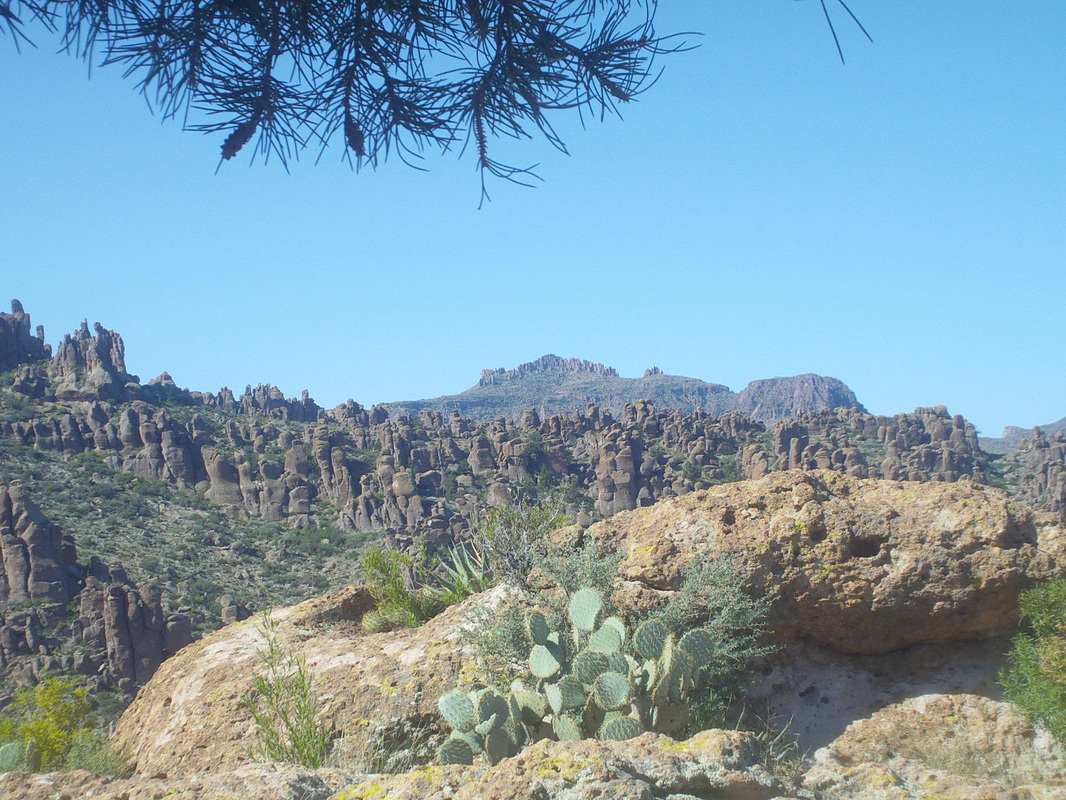 Actually, there was a faint trail for much of the way, during which I could see Superstition Peak in the distance. A hiker told me people are advised not to camp within a rough circle of vertical rock slabs at the peak because during the night the area pulsates due to some magnetic field or something. It is a way cool place but when there I did not notice anything odd. 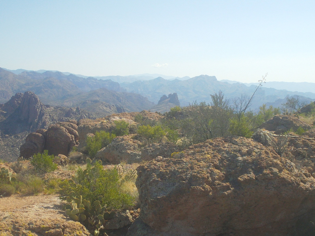 Views to the east were so spectacular. There are dozens more trails and neat places to visit but the roads require a high clearance vehicle to access so I patiently wait for the area hiking groups to schedule, during which I can hitch a ride. 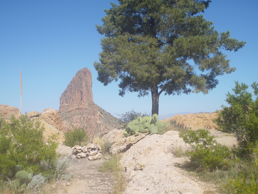 The pine, appearing so small at the saddle is actually very tall. The first branch is 6' from the ground. There was a metal box at the base of the tree with a notebook and pencil so I signed in. Signatures go way back and many are matched with a written reaction to their visit. I just write my usual, "Go Buckeyes". 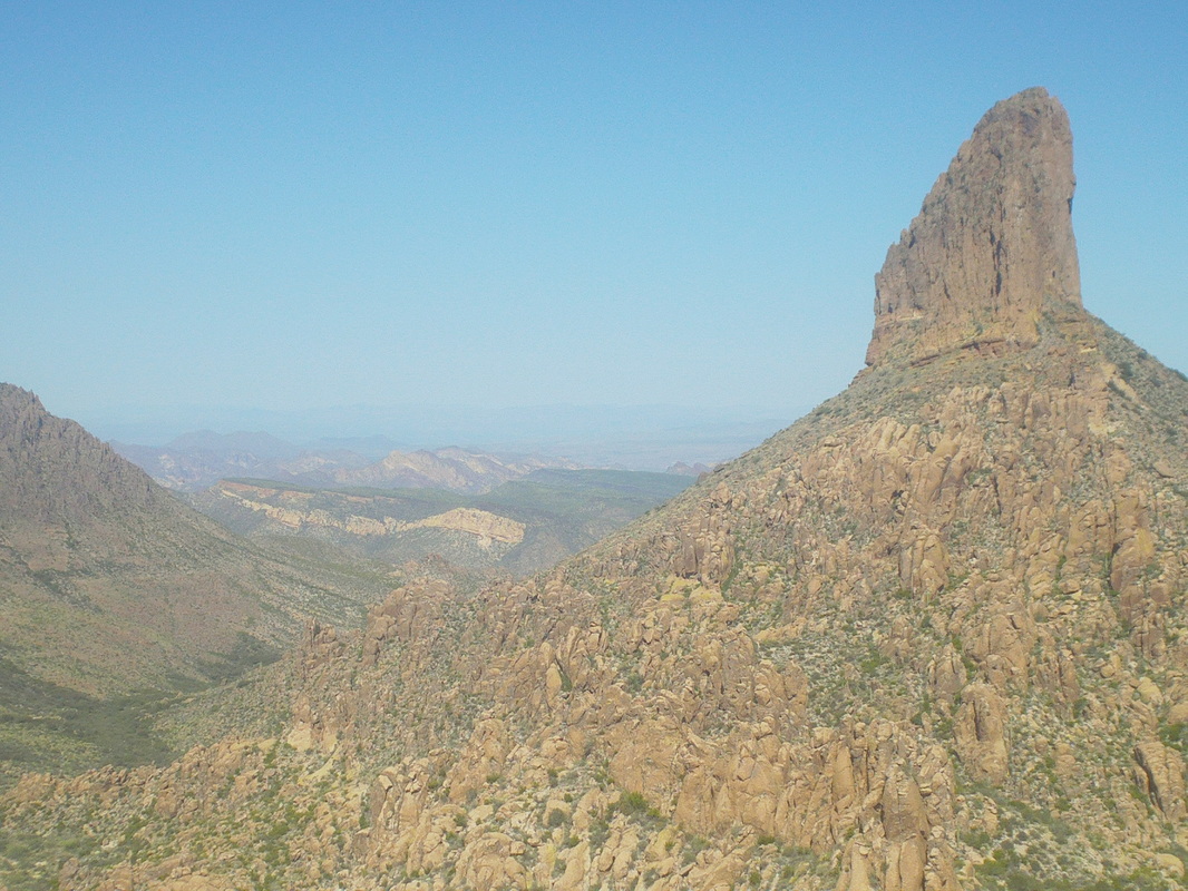 In the distance, unseen, is Canyon Lake and that may be Battleship Mt, the yellow rock area in the middle. I jumped from boulder to boulder, each giving a slightly different view and snapped lot of pics and video.  Looking back, I noticed there was a lone Saguaro too. Kind of unusual at this elevation. I begin the hike back and then down the Peralta. It is hot but not too bad as I finish the 7 mile hike.....  ...with the always welcome view of the parking area. 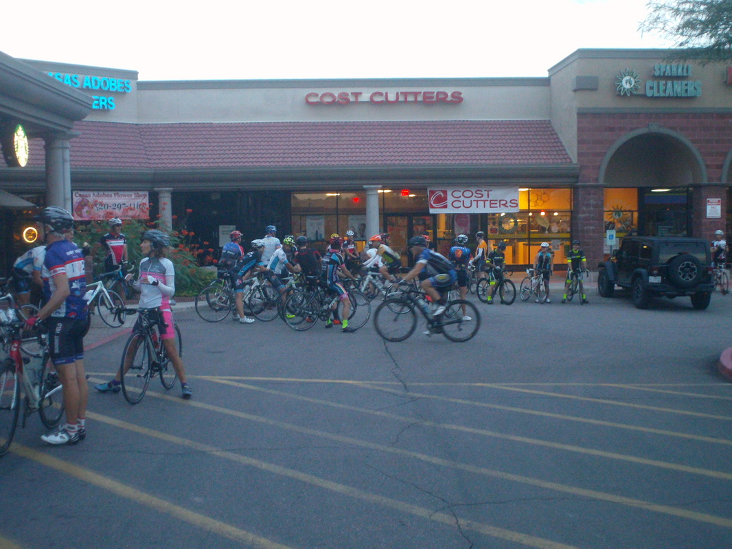 Dang. The Saturday group ride from in front of the Bicycle Ranch bike shop has become huge since last I checked in April. There were 50+ with others who hopped in during the opening mile. They even have multiple groups now but I rolled out with the A group on a 49 mile route. It is the same route each week, west to Frontage Rd which parallels I-10 then hang a right on Twin Peaks and begin the long slog to the resort at Dove Mt for a regroup, coast down to the Giant gas station for refueling and return to the shop in a circuitous route which includes the rolling Rancho Vistoso loop. A good route. 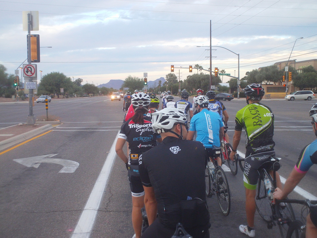 Of course, unlike Ohio when a couple of pedal strokes gets you out of town on lonely country roads, this route passes through many intersections with stop lights but eventually we reached Frontage where there were 5-6 emergency vehicles stopped with a train. Learned later a guy committed suicide, very sad. Our train kept rolling and we were doing an easy 27mph when we reached the Twin Peaks turn. I was at the back of a group of 31 and rounding the turn, could see it was over already as multiple gaps had opened at the base of the 9 mile climb. I looked at my fellow droppees and was not happy. I would say the average weight was 200+ combined with an average age of 80. I managed to drop the heavy, octogenarians but made no progress on anyone else other than Michael, with whom I rode on Thursday. The climb starts at 1% and very gradually increases to 8%. It's a heck of a workout at a good pace. Michael dropped me. Reaching the turn to the Ritz Carlton resort at Dove Mt, I could see the leaders had already regrouped and headed back down. As they passed, I began to count, 1, 2...12,13.....21....25 freakin cyclists. I'd never missed the regroup and then to add to the humiliation, I also missed the refueling regroup at the gas station!!!! they like spend 15 minutes there. I waited for the B group and slotted in with them for the return. A nice bunch, most of whom could be my grandfather. Well, on to hiking and I have a great one to show, tomorrow. 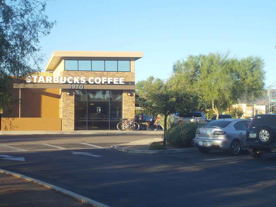 Like in New Albany, a Starbucks is a popular starting point. I'm glad the rides start at Starbucks since I don't drink coffee, I am not tempted to go inside. If the ride started at Dunkin Doughnuts, that would be a very bad thing for me. Only 8 people came out for the 7:30am start of a 44 mile ride that included an up and over Gates Pass prior to a return over a lower shoulder known as Rattlesnake Pass. 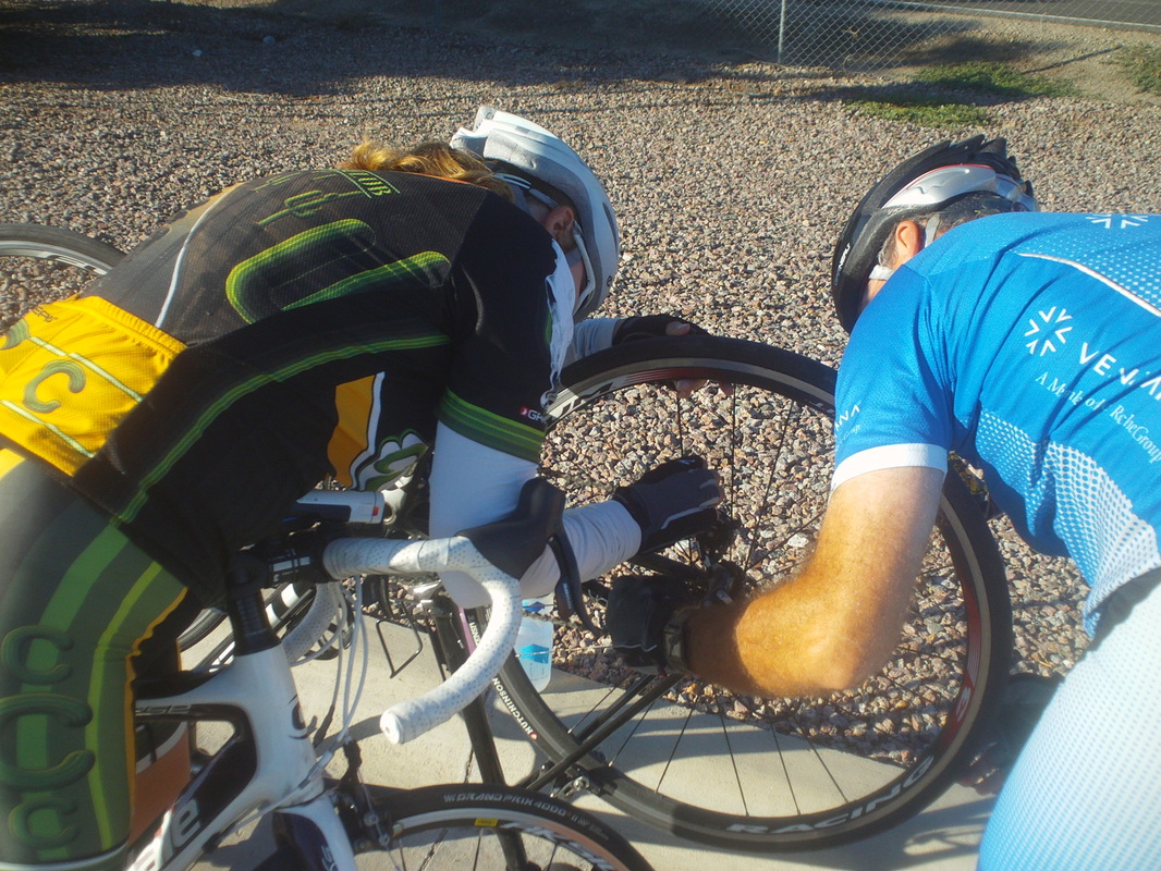 A mile into the ride, a guy somehow got a coat hanger wrapped around his rear hub. Took awhile to unravel it but eventually we got going again and that was the last unplanned stop. We got to the turn onto Gates Pass Road where I was on the rivet trying to keep up with an old guy. Dude had to be over 65 and later while we were talking about the Tucson Bike Classic he mentioned he won the 65+ category and has won several other races. Oh. He stopped to regroup but I kept going, preferring to stop at the top, so I missed finding out how large would have been the gap he put into me on the long climb.  While stopped and waiting for the others, I started talking to a young guy who had passed me like a race car. He said the Saturday Shootout ride out of downtown Tucson has been kind of mellow but things will pick up as more pros arrive for the winter. Above, the view to the east. As others in our group arrived, someone asked if there had been any sightings of the Yeti. Seems there is a guy who rides the area with no shirt and looks like....  .....this. We descended the back side of the pass, made a left onto the McCain Loop and coming toward us is a guy on a bike that had long wispy hair flowing from his back, head, face and honestly, looked a lot like the image above. I was too stunned to think to take a picture and that would have been awkward anyway. During a rolling climb out of a valley I managed to draft the old dude until at the last climb he rose and sprinted away from me and one other guy. Turns out he also won the masters category in the AZ time trial championship with a partner on a tandem. Good guy who gave up the information grudgingly while we were waiting. I like humble people.  We stopped at Saguaro West Park to refill water bottles and while there, I could see the observatory on top of Kitts Peak in the distance and yes, that is the yellow/black/white Trek winter beater bike. Luke Russell sent me a message that I should measure my bh bike so I could have the Trek adjusted to match since the fit is different. Unfortunately, Luke's message arrived the day after I arrived. The rain is gone and today it was sunny and 86.  The low pressure system continues to linger, bringing more needed rain to the area. The mountains received over an 1" and most places are well above the normal rainfall. A ride scheduled for today was cancelled but there was a hike available out of Sabino Canyon so I grabbed my Gatorade weighted backpack and headed the 15 miles to the trail head.  Quite a few no shows so only the hike leader, Michael, was there and we shoved off. The guy talks way too much and ordinarily I would just put in a gap but carrying the pack, no such luck. I could have fallen back but then I risk him thinking I am weak. About half way up, he stops and I keep going, reaching the top of Blackett's in 1:10, about 15 minutes slower than without a pack. My shoulders feel ok so that is encouraging but after 3 miles and 1800' elevation gain, I still have to go back down so we'll see.  The views at the top are always dramatic but more so with the clouds. Michael drones on about different books and movies he enjoys, how Reagan is responsible for income inequality, guns are evil, why he didn't make it as an Uber driver, why he didn't make it as a real estate agent and doesn't take my silence as a clue to shut up. If I wanted to listen to NPR I would have brought a freakin radio. 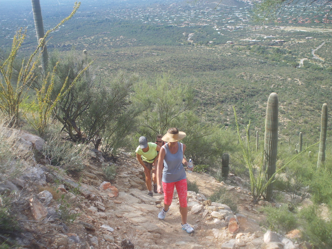 Now this is counter intuitive. Trail etiquette requires that those going up hill have the right away. I would think those coming up trail would welcome the break and allow those coming down hill to continue but nope, the uphillers get to keep going, momentum unimpeded. The woman in front was, what I thought, wearing an odd hat, open at the top. If I wore that I'd have a red beanie head. No snakes today even though I was hiking at about the same morning time but I did.... 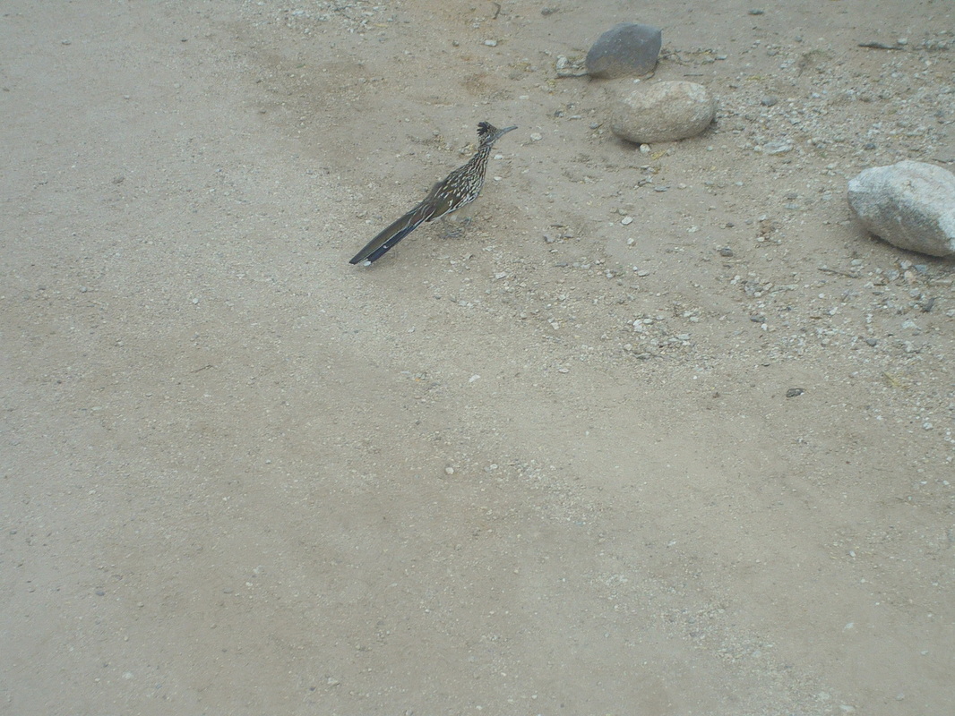 ....catch this roadrunner traveling across the trail. The rain arrived soon after we finished but it appears that is the end of it for awhile. On Thursday, I saw the Yeti during a ride. More to come, later. 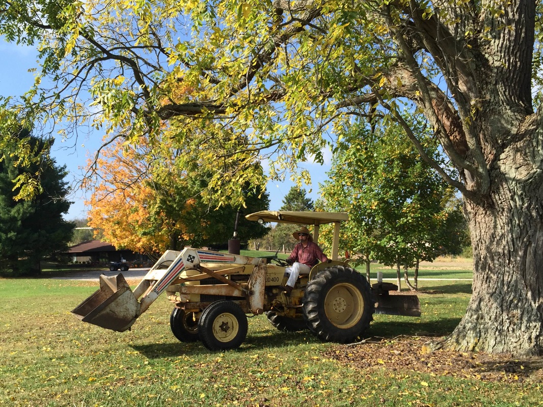 I don't think I have ever seen Farmer Mike sitting on anything that was other than a bike seat so that alone makes this a unique image but check out Licking County's largest landowner, a land baron even by Texas standards, riding a tractor. Also note the cool hat. Big thanks to "anonymous" who provided me with this image.  Despite my twin encounters with rattlers on Sunday, I still came back outdoors on Monday. There has been an upper level low just kind of meandering around the southwest and with it have been scattered thunderstorms so on Monday I saw a window and dragged the backpack out of the closet, loaded it with 6-packs of Gatorade and made the quick drive to a nearby trail head for a shakedown cruise. A little ways up the trail, the views to the west open up with Sombrero Peak in the distance. 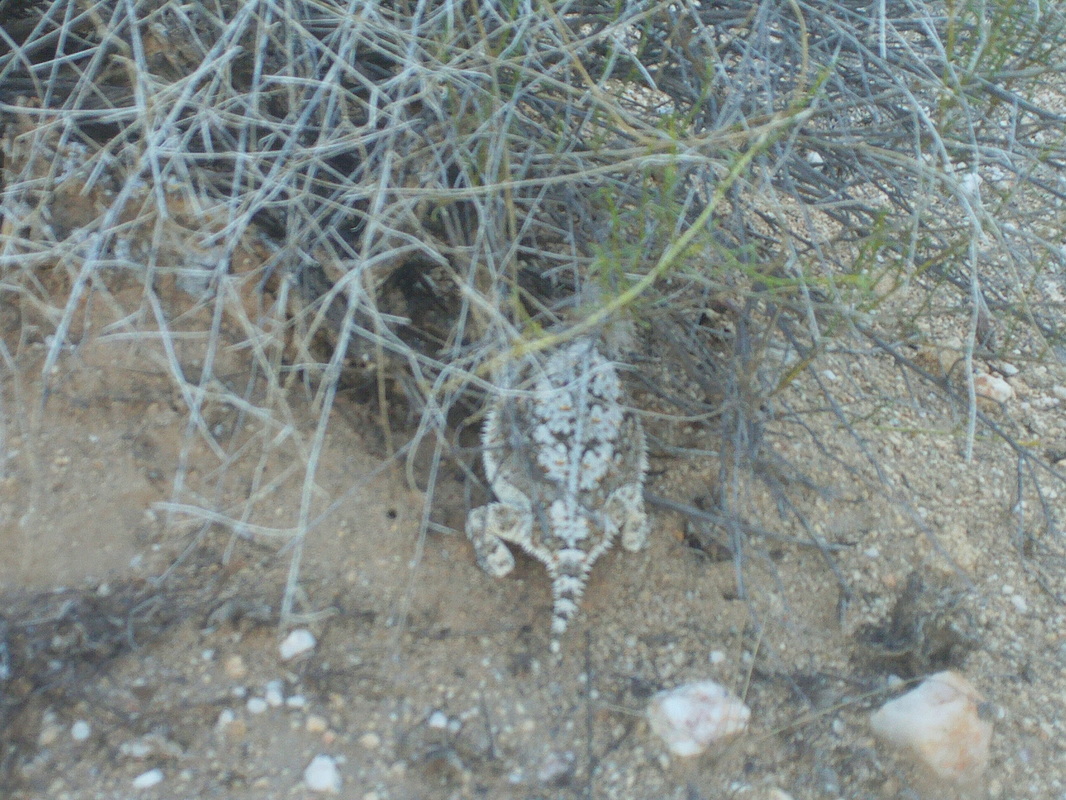 Hey, check out that unusual lizard. A local came walking by and said it was an unusually large variety of whatever it is, the name of which I forget. 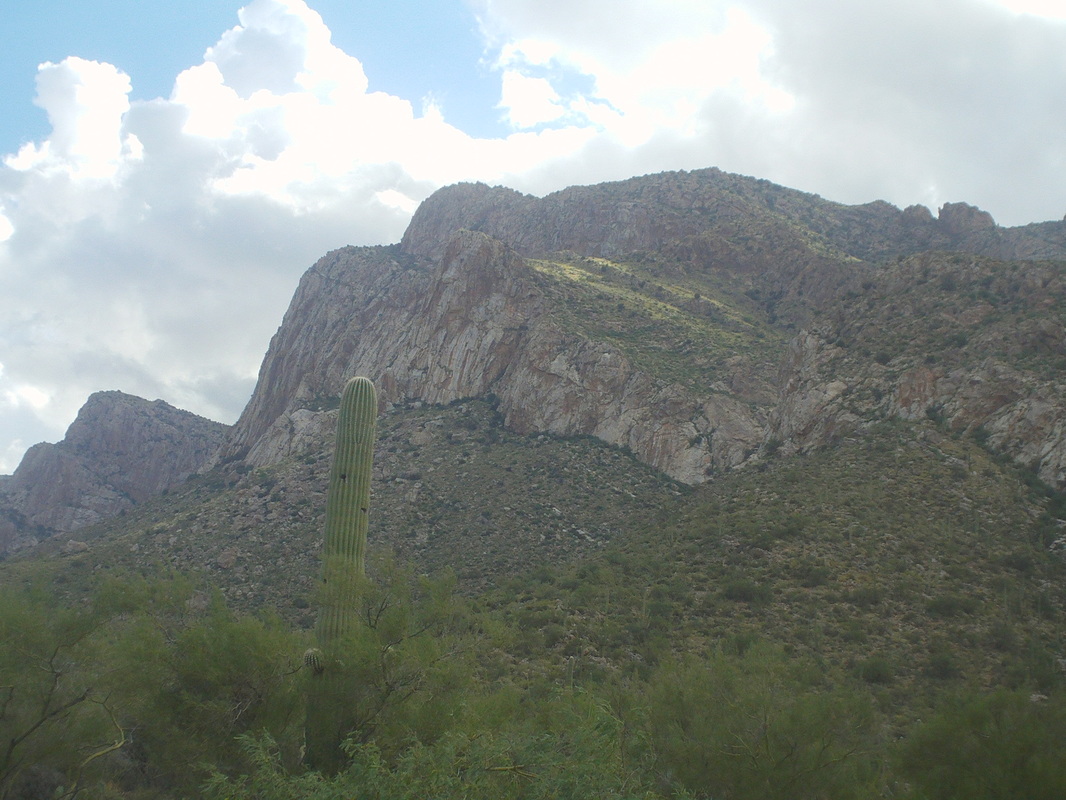 The pack weighed about 30 pounds, not the 40-45 it will be when I load all the gear but close enough as I hiked an up and down trail for 3 miles around the base of Pusch Peak. It was a strong monsoon season that just ended with above average precip. There is green everywhere. Kind of odd when you think that coming out of a summer it is much greener than when summer began. Well, it actually rained lightly on me and so I headed indoors. Been busy, picked up a 2nd condo and so am washing the walls, removing fixtures and preparing to paint. When "She Who Must Be Obeyed" arrives, I'll be dragged into furniture stores and boring places like that so got to cram in more activity until then. |
