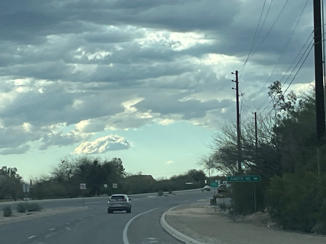
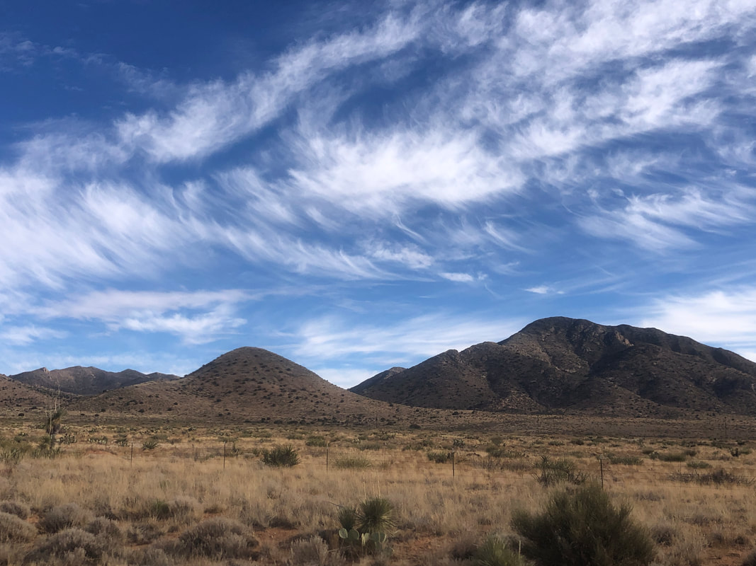
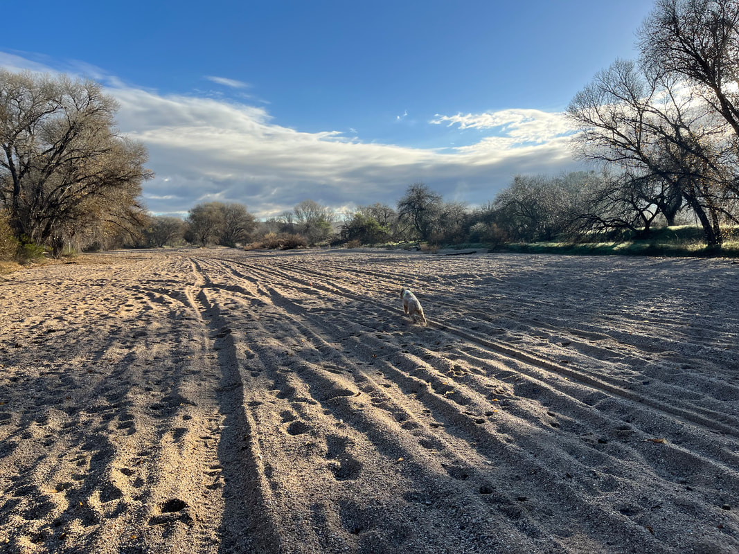
 This is not a drive I would like to take again. Originating in Silver City, St. Rt. 15 is the "windiest" road I have followed. It's only 34 miles to Gila Cliff Dwellings National Monument but it took us about 90 minutes to arrive. Interestingly, the "Tour of Gila" bike race occurs on this and other roads. The main circuit is 72 miles with a robust 6000' of climbing. May have to come here in warmer weather and do that ride. 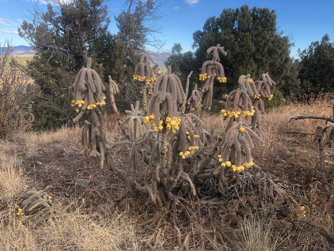 An unusual type of cactus. We stopped at a couple of overlooks where.... 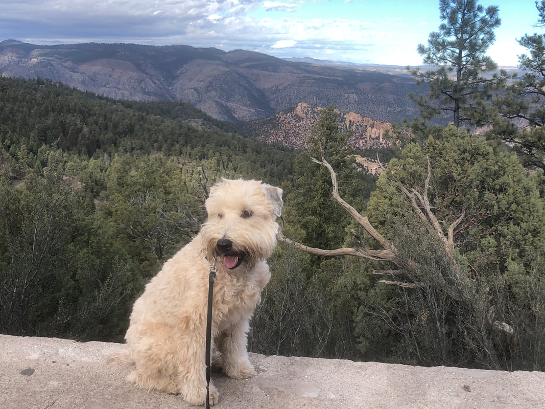 ....Jack could exit the SUV for some exercise. As we close on our destination....  ....the mountains grow taller, almost hitting 11,000', capped by Mogolon Baldy. We arrive and do a warm up hike that includes....  ....hiking along a trail that has flooded due to beaver activity. A guy came along and carried his dog while maintaining a good balance on the log. Later, as we came back....  ....Amy came through demonstrating almost as good balance but the poles sure helped which I too used. Putting Jack in the vehicle we....  ....walked across a bridge, climbed some and reached.... 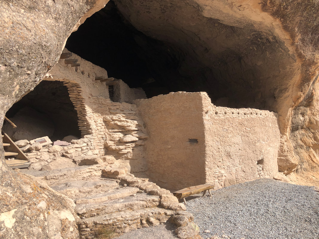 ....the cliff dwellings. These date back to 400AD and housed several families. 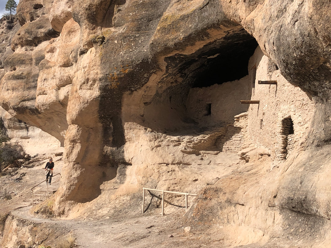 It was awesome how close we were allowed which included a climb....  ....into the interior. Of course, a climb in required.... 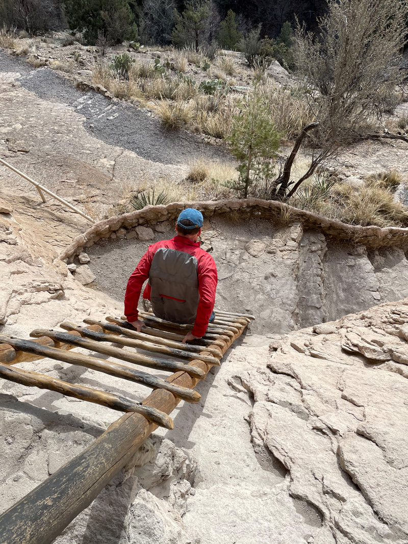 ....a climb out as I demonstrate something less than able form. A trail routes us back to the parking lot but... 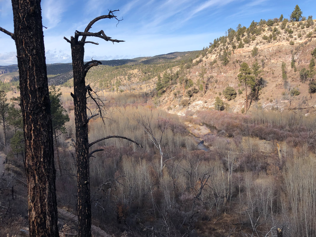 ...via a loop that allowed us to look at the valley we had hiked a portion of, earlier. Finished with 4 miles.
1 Comment
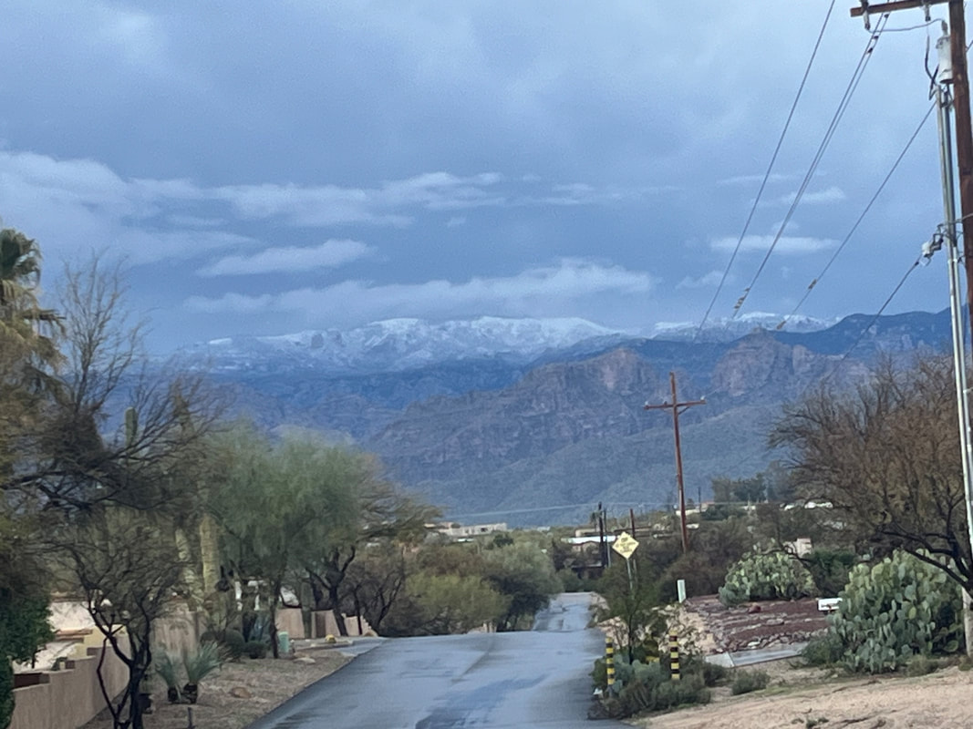
 And we're off to Silver City, NM for a few days of fun in a small village just north, Pinos Altos. We stay in..... 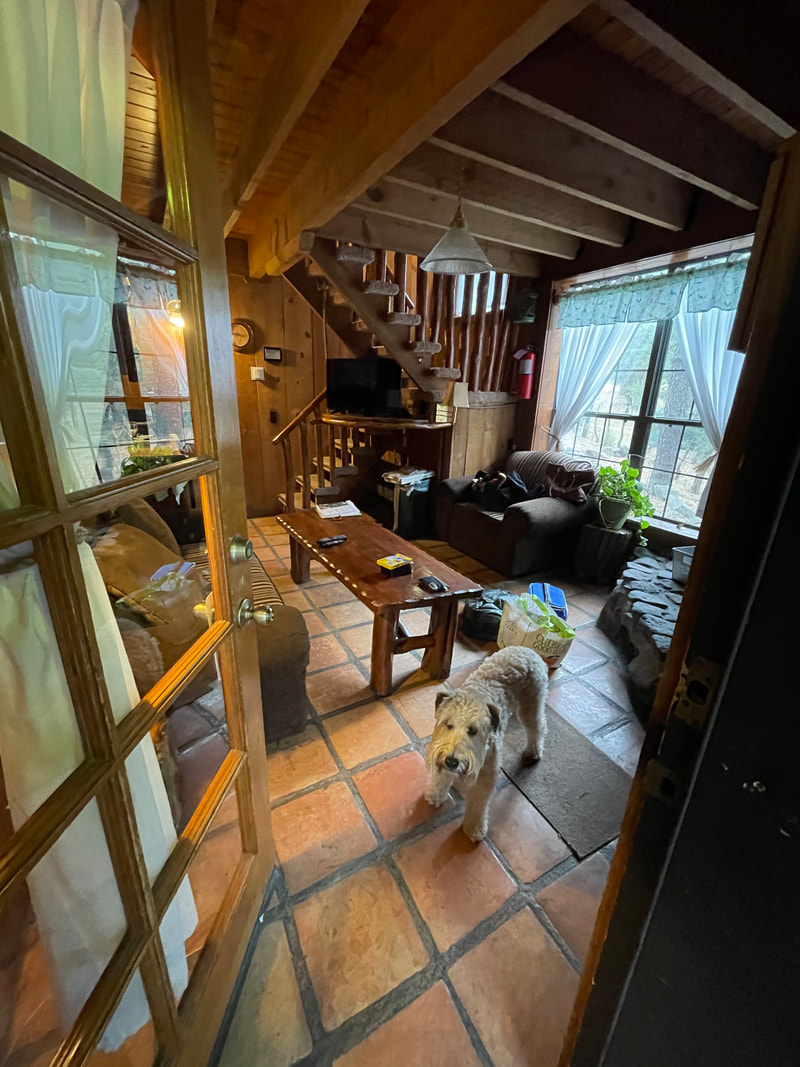 ....a two story cabin that includes..... 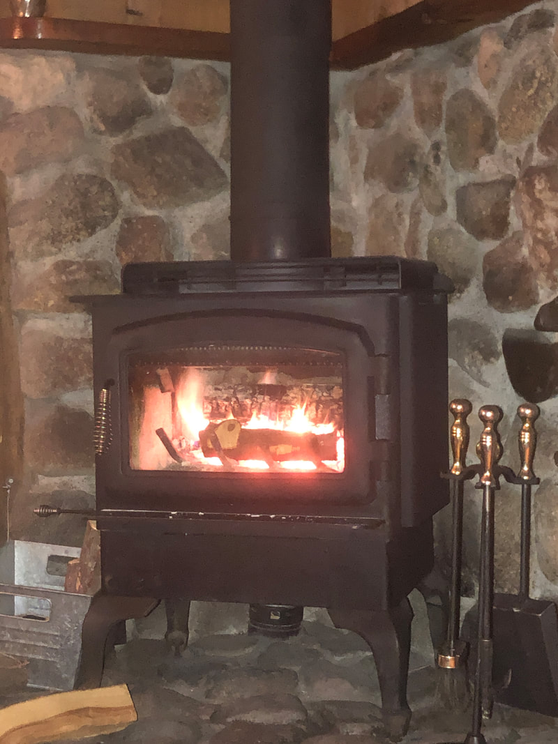 ,,,,a stove fireplace! The cabin came with plenty of wood so I made good use of that. At night....  ....each of the 12 cabins were decorated with Christmas lights. The next day, we drove to the Gila Cliff Dwellings and did some hiking there. More to come.
 Our group of 6 arrive at the top of Sarasota Road to begin a 5 mile hike. We begin our hike and soon hear.... 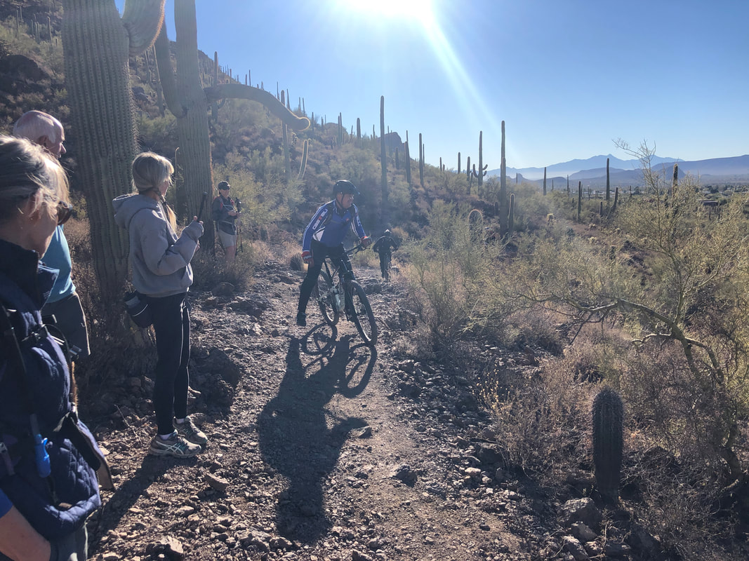 ....a group of mountain bikers behind. Just as they overtake us, one o them has to dismount.....kind of embarrassing for him as the trail wasn't that difficult right there. We continued our hike, climbed to Bobcat Ridge and then.... 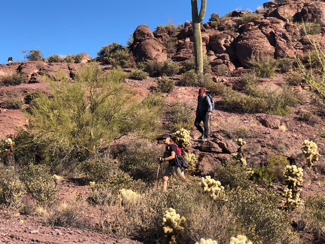 ....began a decent to a saddle between Bobcat and Little Cat Mountain. I managed to pick up the off trail route and soon.... 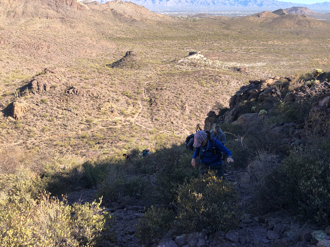 ....we began a very steep hike toward the peak. The group was in good spirits as we closed on the peak and once there..... 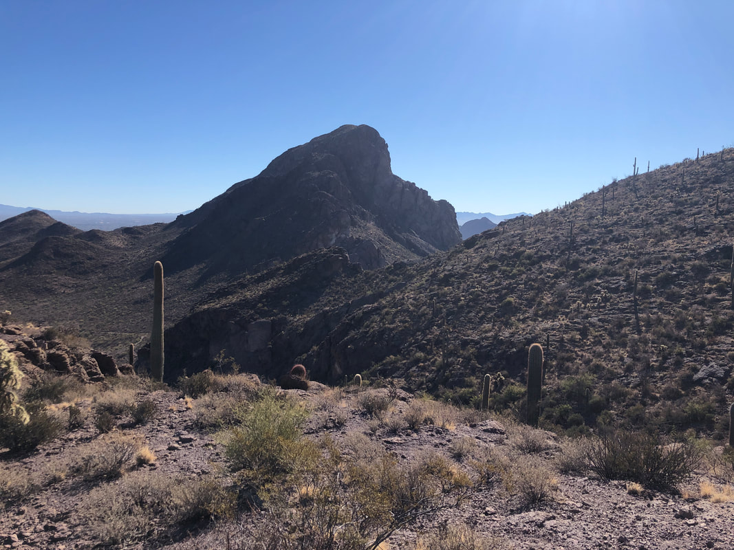 ....enjoyed many good views of our surroundings.  We walked along a ridge and stopped for a snack.... 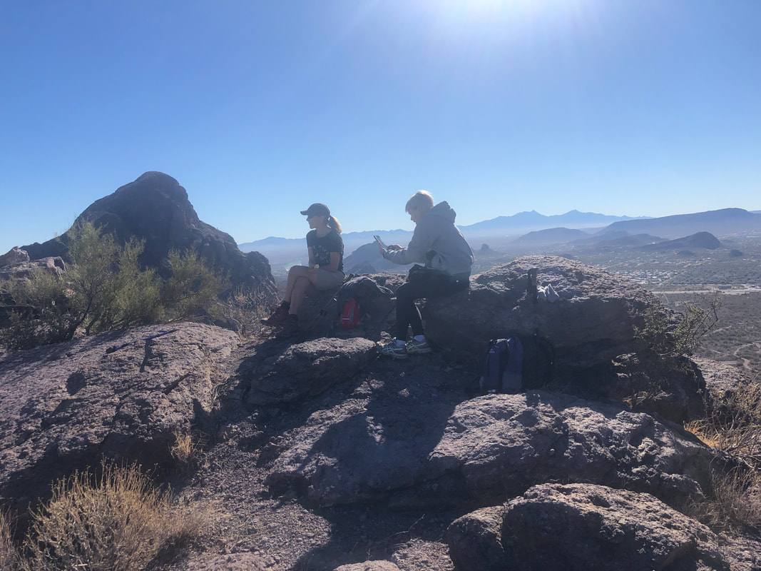 ....while taking plenty of pics. 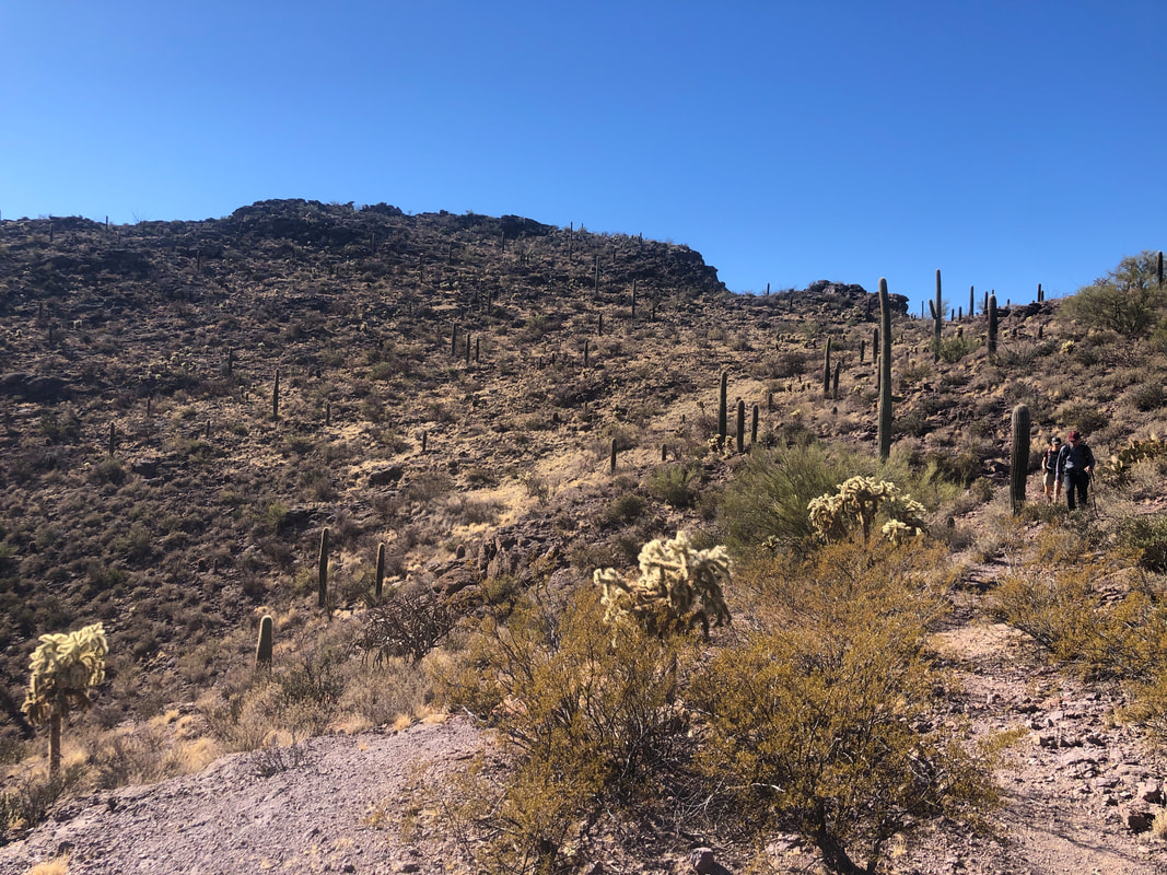 After our break, we begin our descent, moderate at first before a steeper section that averages a 40% grade. Had to be really careful there as plenty of loose rocks.  Back at the parking lot, we took a final look at the summit and congratulated each other as we all had made it to the peak. Finished with 5.1 miles and 1350' of climbing on this awesome, sunny day with temps in the mid 60's.
 An epic hike but with an uninspiring opening act. We park at the end of First Water Road, the last few miles being dirt. Our group of four, Amy, Barry Neil and me get going on time, departing via the Dutchman Trail. Soon, the Dutchman breaks to the right and we get on the Second Water Trail which leads us through "Garden Valley". Alas, this once beautiful section of pleasant hiking has been scorched. 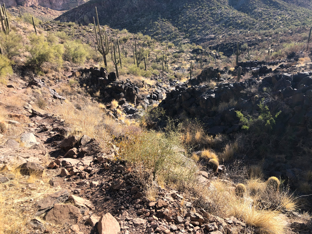 We descend toward Second Spring and then into Boulder Canyon. The trail is very rocky and rough. Over the length of our hike, this walking on let's say, very uneven, sharp pointed cobblestones, really takes a toll. At this point, the hiking has been flat to rolling and our legs and joints are still fresh. 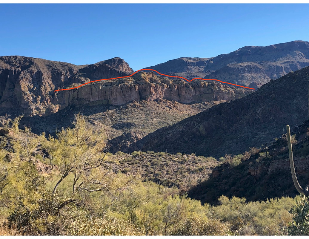 However, prior to our descent, we did get our first look at the mighty Battleship Mountain, which I have outlined. One of our group failed to see the similarity but she may simply lack some imagination, ha, ha. 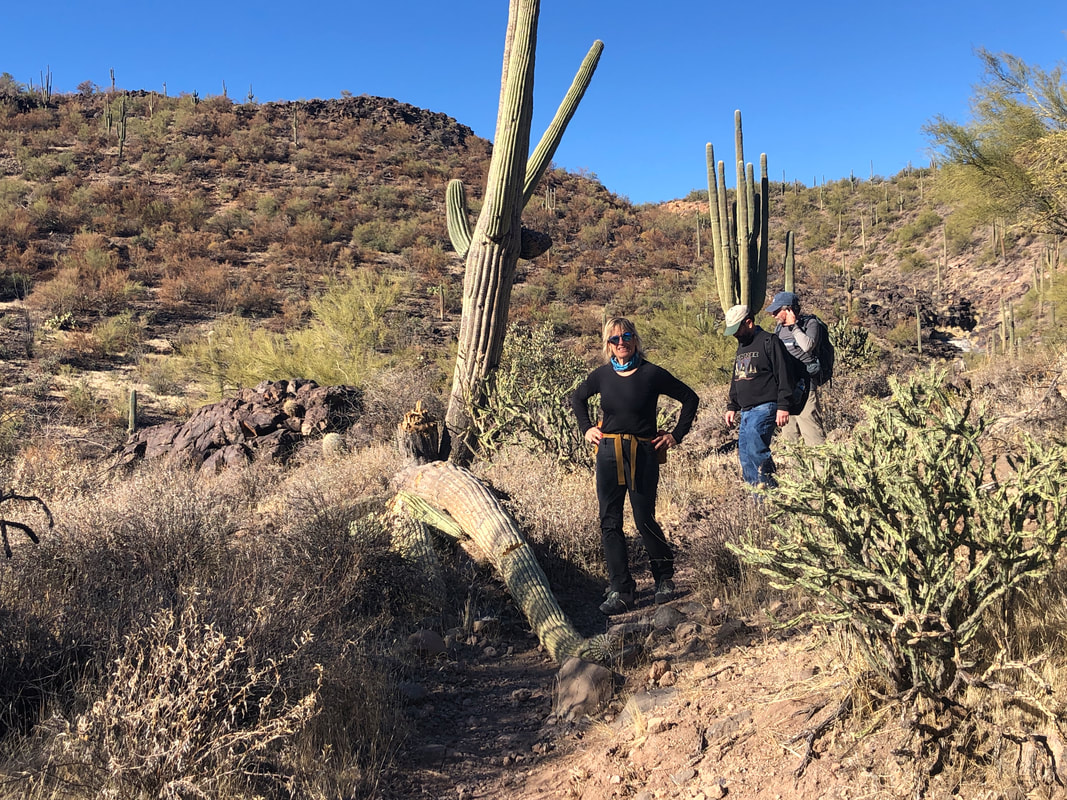 A saguaro has fallen over the trail. I imagine getting hit by one of those could be fatal. 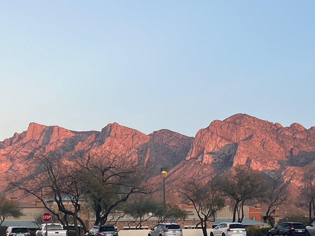 Walking through Second Spring is refreshing with multiple pools of water, mature trees and cooling shade. But then we drop into....  ....Boulder Canyon. Aptly named requiring no imagination to see why. Following a trail, we cross it several times while paralleling the mountain. At last, the fun begins as we climb to..... 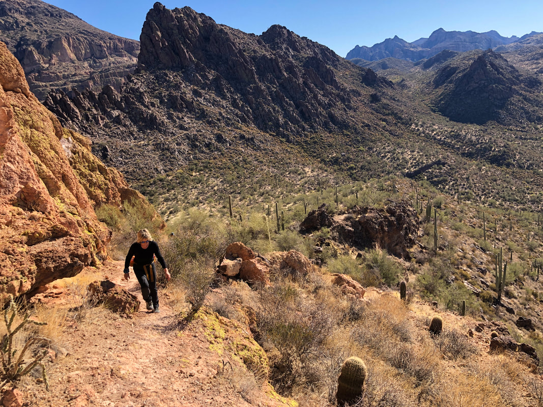 ....the ship's "waterline". We take our first break as we ditch extra water and are passed by a group who..... 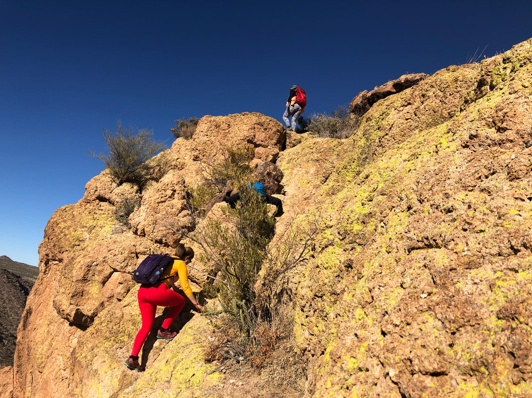 ....climb the ship's stern. What you see above is the easier part of the wall. Beneath it an almost vertical section but with a good gripping surface. I go up first and with little coaching.... 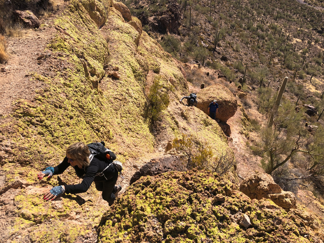 ....so too does Amy and Barry. Neil was comfortable just to hang out at the base, which is not unusual for first time visitors. We group at the top and.... 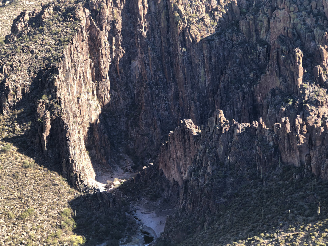 ....admire the views, including a look into Lower La Barge Box Canyon. That too is an amazing destination and one we will visit soon. Entering the narrow canyon, walls soar several hundred feet above. Next though we.... 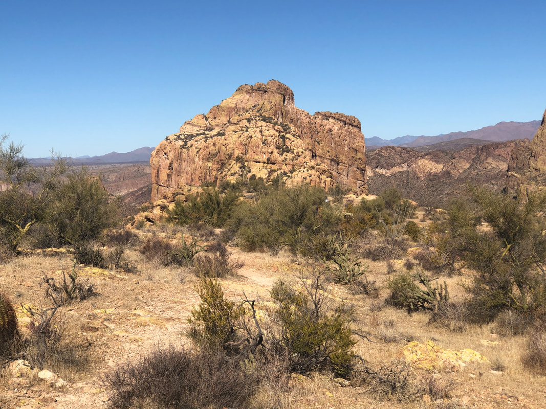 ....look toward our destination, the peak of Battleship. Looking closer then it is, it's still 3/4 mile away and the way forward is a series of route finding challenges coupled with more walls and other obstacles. Just great fun. 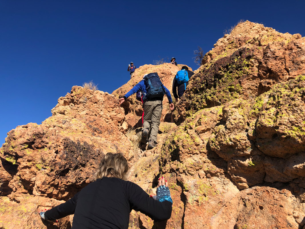 I've visited this mountain probably 6-8 times and am normally the only person or group there but today, wow, probably 20-30 other people as we take turns navigating another climb. Then we reach.... 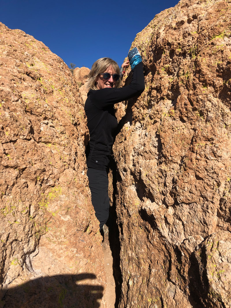 ...Fat Man's Pass! It's a tight fit but there is a workaround to the right and left. 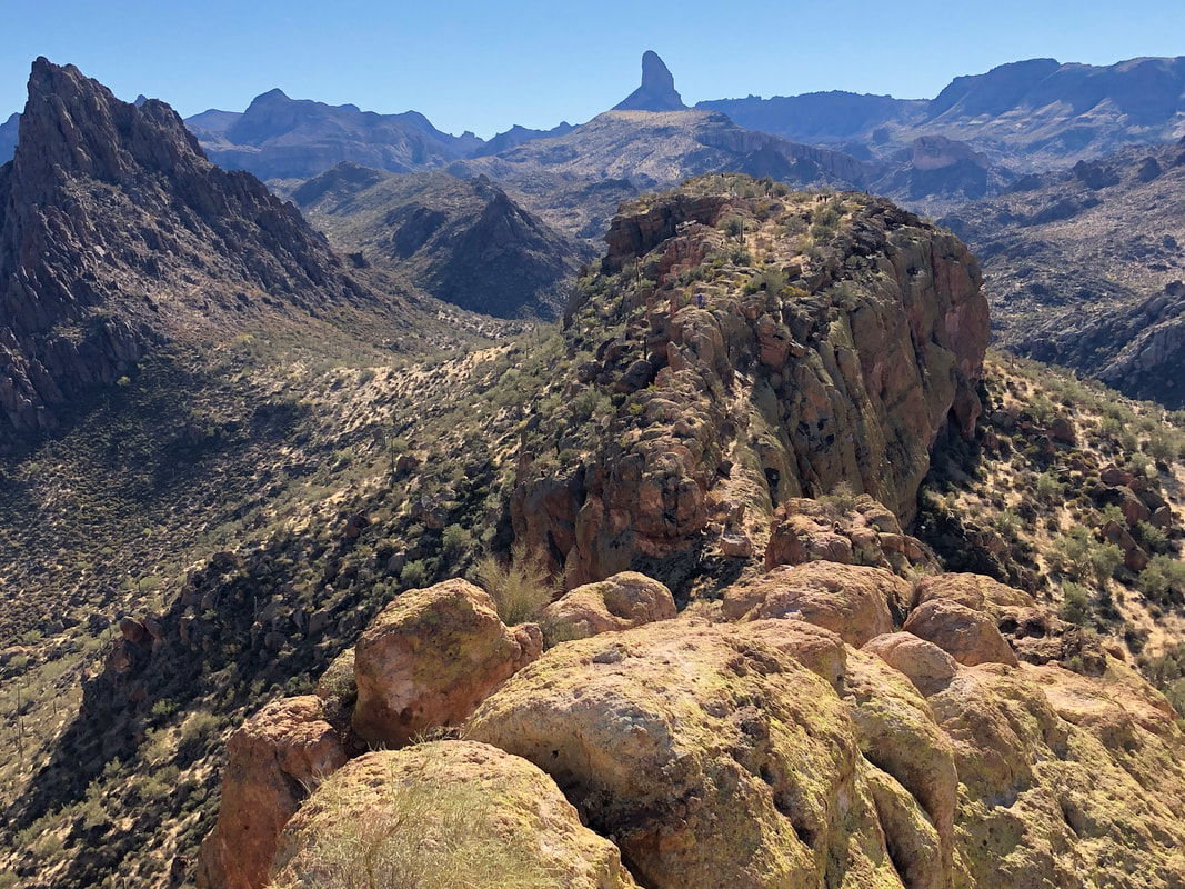 We enjoy the views to the south that include Weaver's Needle in the distance and the boundary of La Barge Canyon on the left. Geronimo Head looms over us off image, to our left. And then..... 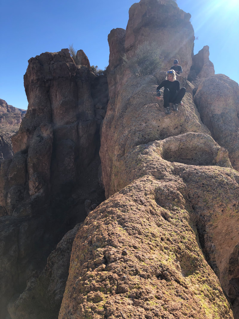 ....we encounter the spine. This narrow piece of rock has death to the right of us and certain broken bones to our left. It is steep enough that butt hiking is the method most choose for the down climb, while not looking much farther than what is directly in front. Up until a few years ago, there was a small barrel cactus growing from the center in a concave area. That made things a little more difficult. 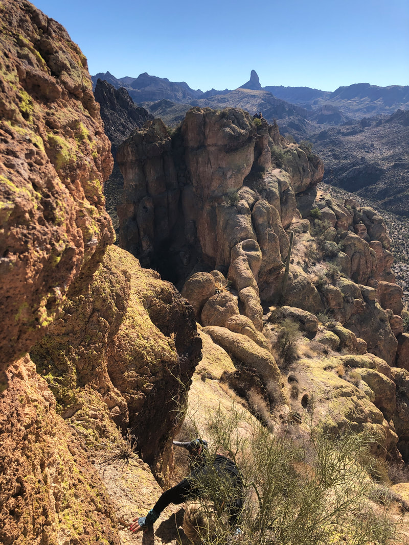 Our threesome met one final wall, probably the most difficult of them all. The advantage of having long arms and legs is huge for this so Amy was able to climb but Barry could not. I probably should have descended and given him a boost up but did not favor the idea of climbing down and up again as I barely made it the first time. Now, down to two, we.... 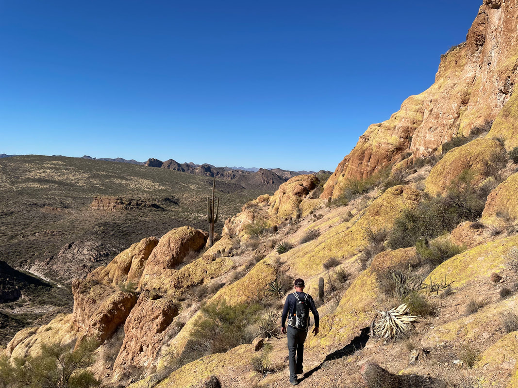 ....went clockwise to the back of the mountain via Ballbearing Slope, climbed some more and.....  ....yeehaw! In the distance, Canyon Lake. There is a good sized marina there, restaurant and close to the touristy town of Tortilla Flats. 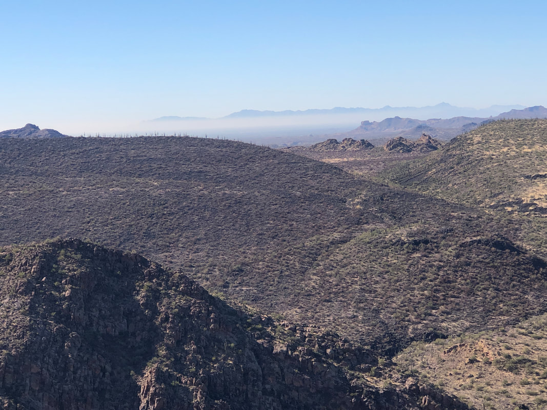 A layer of smog hangs over Phoenix. Mindful that we had left two of our group behind, we did not linger. Navigating some of the obstacles on the return, we then picked up Barry, made it to the first wall.....  ....which we all successfully descended but....no Neil to be found. We weren't too much concerned as assumed he had tired of waiting and there was enough traffic on the trail that he'd probably be ok. Climbing out of Bouldert Canyon, we caught a group and hey! There was Neil so all back together. 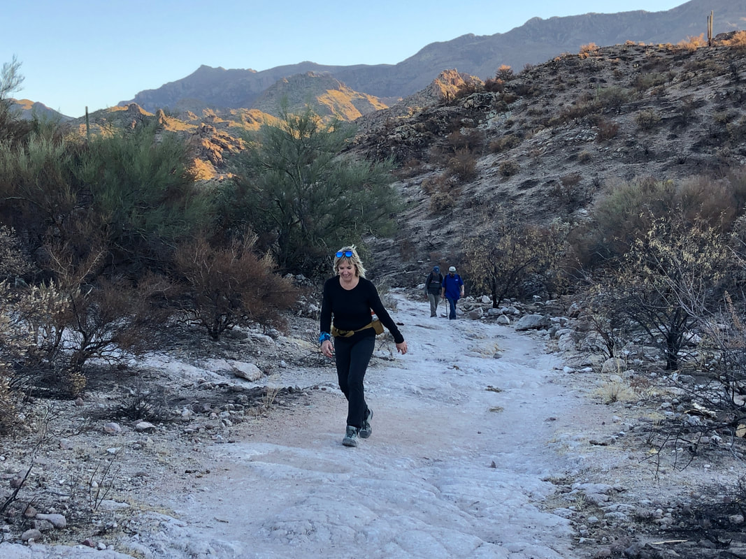 OK, the return was somewhat more painful than normal for most of us. My feet hurt from stomping on all the sharp edged rocks, Neil's legs were fatigued, Amy's joints hurt although Barry still seemed in good condition. All I know is, climbing a slope and seeing the parking lot, I screamed with relief:). It was a long day as we ended the 12 mile hike and....  ....arrived in Oro Valley as the sun was setting.
 Summer's heat kept me out of the Superstitions so I was anxious to return despite having made the 90+ minute drive just last week for a hike. I wanted a longer hike and to explore a part of the Supes not previously visited. I planned to follow the Dutchman, Whiskey Springs, Red Tanks, back onto Dutchman and then Bluff Springs trail for the return. The loop would go around Miner's Needle, about 13 miles.  Hindsight being what it is, I should have had a gps route to follow but assumed all trail junctions would be signed. I followed the Dutchman for 2.8 miles, at first unaffected by this summer's fire, which burned 194,000 acres. Soon though.... 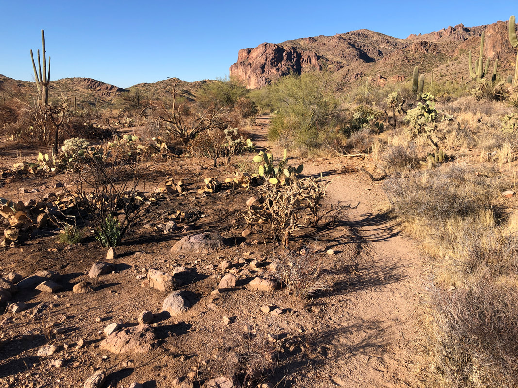 ....I walked into an extended area where the trail had been enough of a fire break that the fire had not crossed to the other side. But soon.....  ....ugh. Saguaros lost forever, thousands of them. Many had already toppled and lay in the surrounding area. These had been standing for 100+ years but no more. 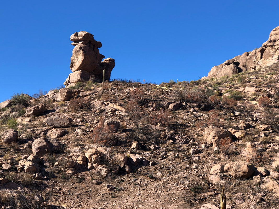 With the ground cover removed, it completely changes the views and so rock formations tend to draw more of my attention. Above, the top of the spire appears to be the head of a lizard or snake. 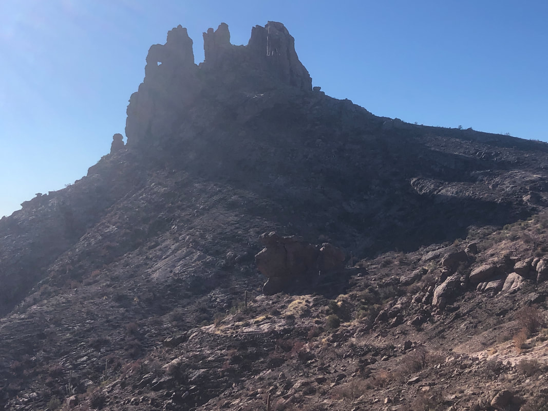 At about mile 1, a 4 mile, moderate climb begins during which Miner's Needle comes into view and is eventually passed. Above left is an arch or the eye of the needle. On a certain day of the year, at a certain time, sun pours through the eye, illuminated a spot on the canyon slope where gold has been buried. A myth almost certainly but many have tried to locate the treasure. That is a fun climb to get as high up as one can go. I continue the climb and.... 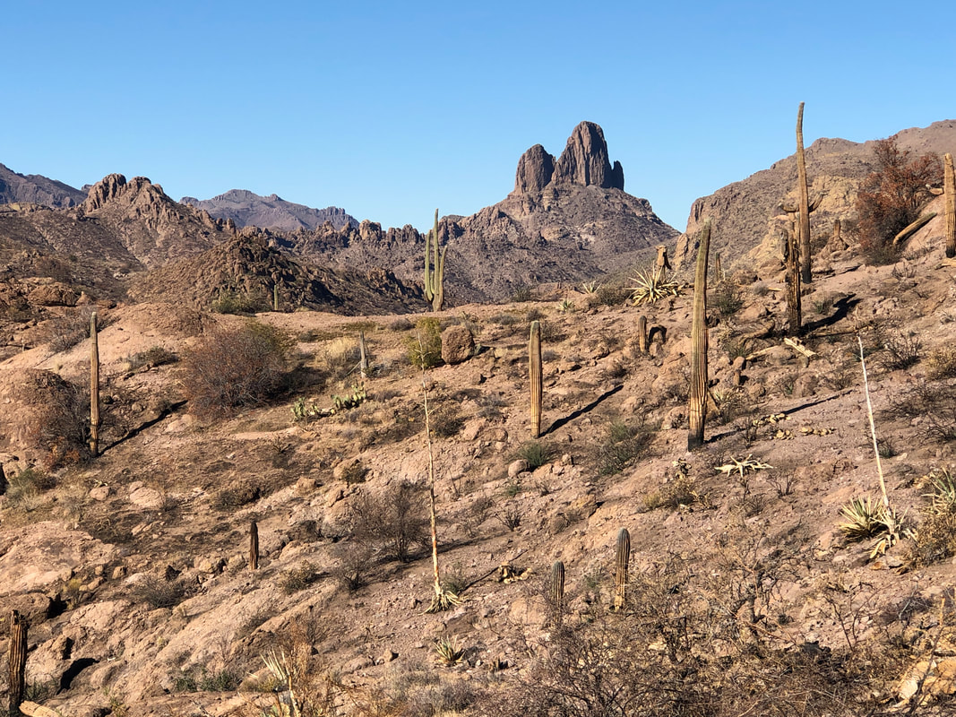 ....hey, there's Weaver's Needle, my destination of last week. Higher I go, looking for the junction with the Whiskey Springs trail and the views.... 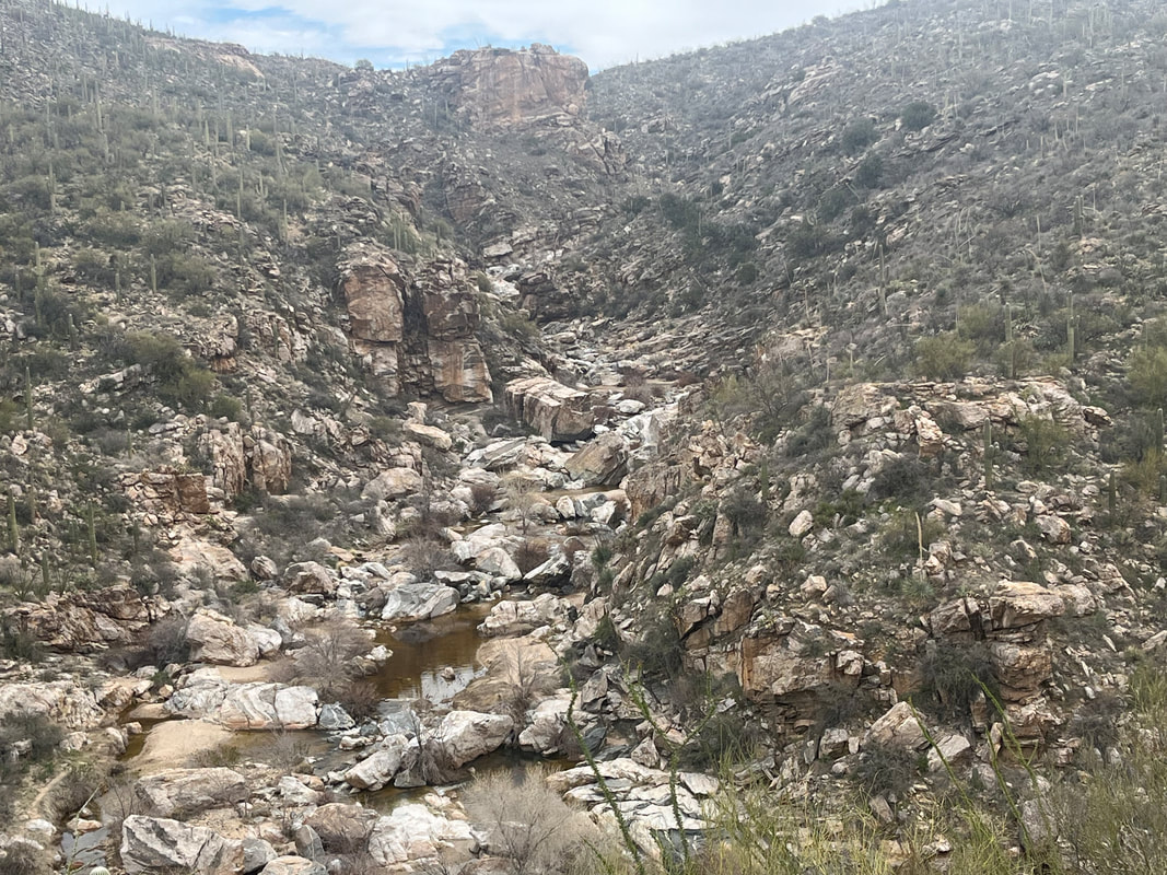 ....stupendous. I am soon rewarded with..... 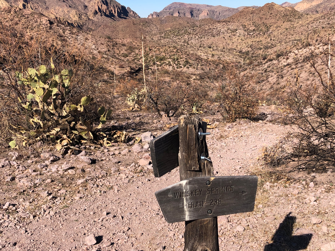 ....signage indicating I should hang a right. Reaching a ridge.... 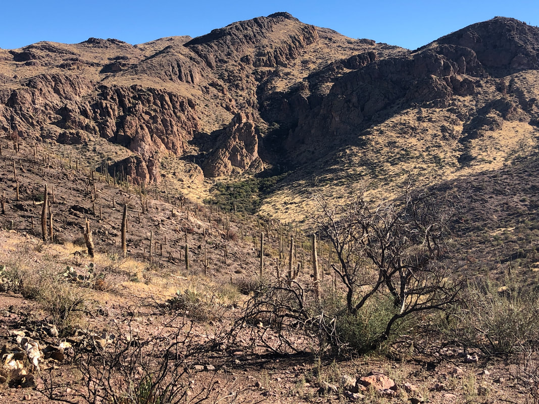 ....I see a ravine in the distance where Whiskey Springs is located. I begin a descent but rather then enter that ravine, the trail breaks to the left and enters a...... 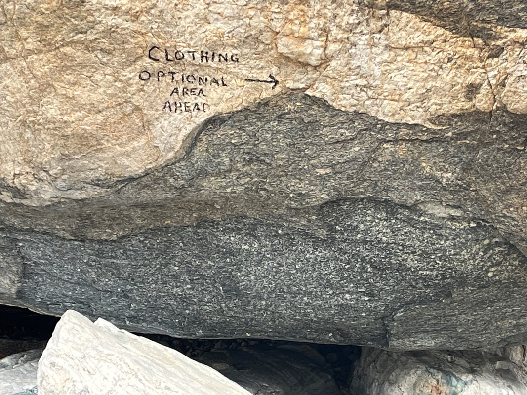 ....brushy wash, it too undamaged by the fire. 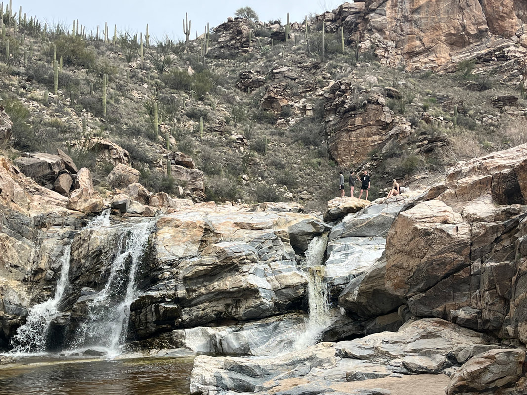 I emerge from the wash and see Upper LaBarge Box to my right. This area is new to me but the Red Tanks Trail comes through the notch and intersects with Whiskey Springs. I was to make a left at this junction but alas, there was no trail sign. I had a map, stood and studied it when I heard a noise and looking, there is a hiker going up a hill I had just descended. I yelled, "Hello". Thus began a strange conversation. He had been sitting on a boulder taking a break as I passed but said nothing to me. It seemed his knowledge of the area was good but as he was giving me advice about a left at the next junction followed by a right there....... I decided to turn around. I knew had I continued I would eventually emerge from this wash at LaBarge Springs and onto the Dutchman Trail but I was 6.5 miles into the hike and some of these trails that snake through washes can be a route finding challenge and slow. Better to not risk it today and again, stupid of me not to have a gps route to follow. 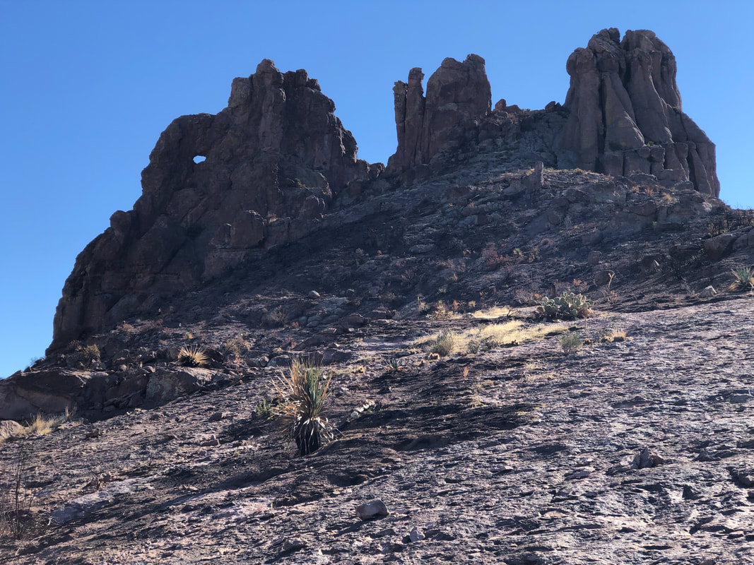 Retracing my route at mile 9, I reach the base of Miner's Needle. Just can't pass that and not do the climb. It's a straightforward climb to a ridge on the right and then make for the notch on the right where..... 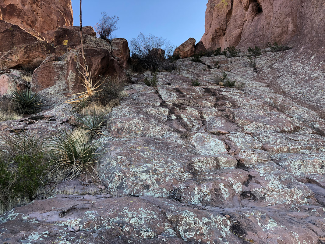 ....you encounter a very steep "wall" but with good hand and foot holds so I scramble up and..... 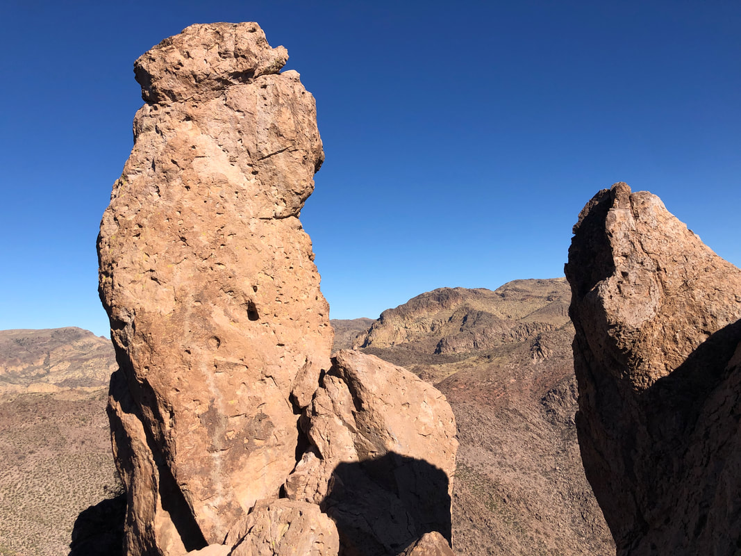 ....actually, the notch is as close as you can get to the Needle and there are spires that go higher but..... 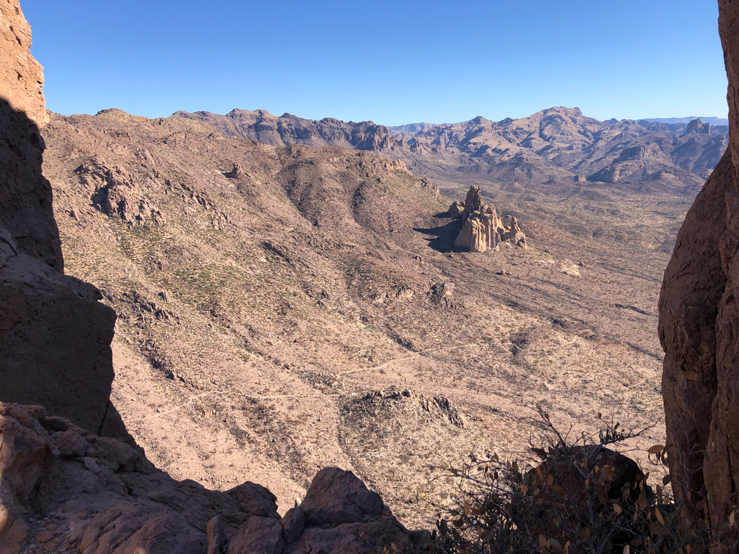 ....it's worth the climb for what one can see. Beyond I can see the Dutchman Trail winding its way down canyon. It's getting late and I have miles to go so I don't take a break here. The descent is kind of sketchy but I regain the trail and continue. 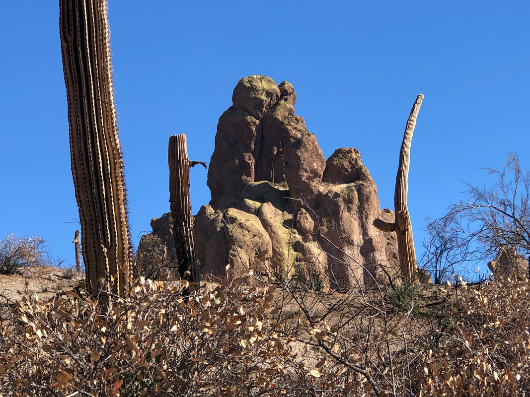 Check out the above rock formation. Unremarkable save for the arch in the middle. Look closely and you'll see a fair sized saguaro growing from the middle of the arch. That gives some scale for the size of the formation. Soon, I pass.... 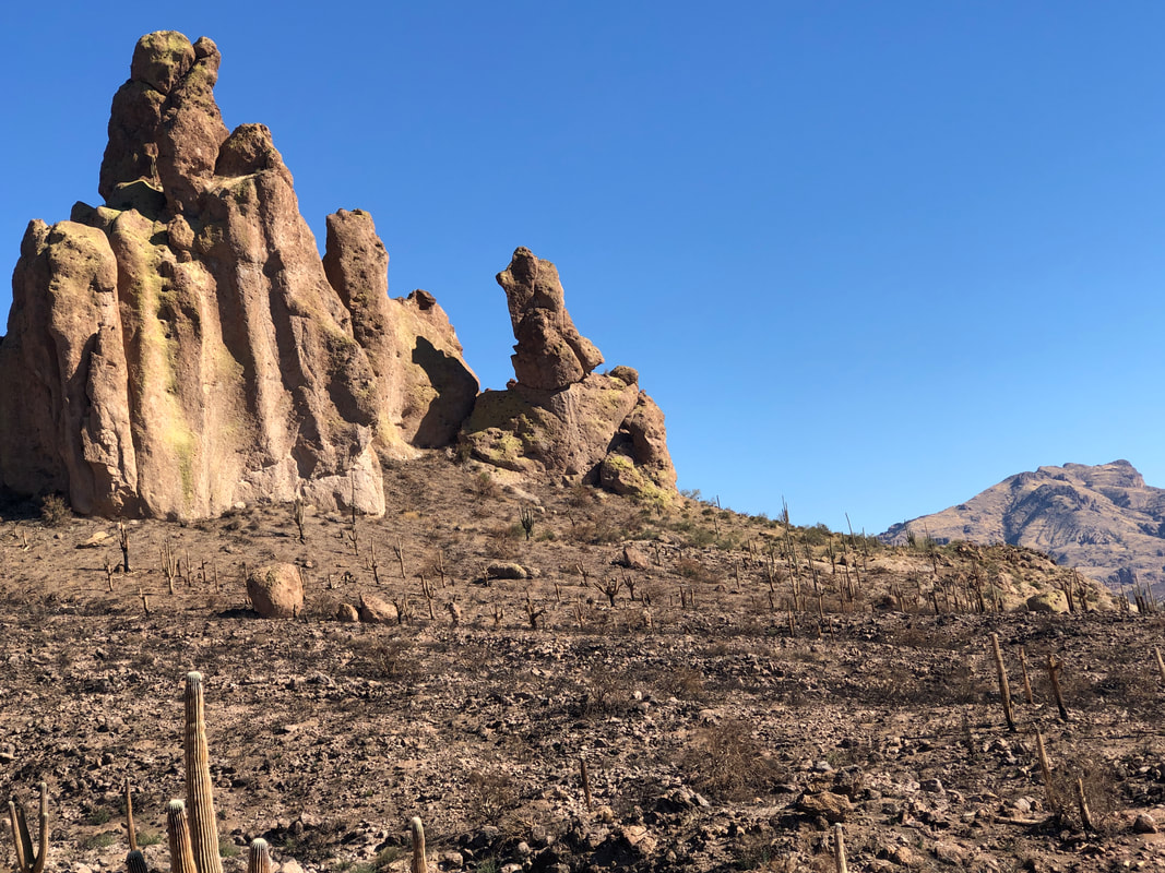 ....another formation. Note the leaning portion. That will topple at some point as erosion will do its work. We received about 1/4" of rain a couple of days ago and I noted there were some pockets of water as I hiked. I had not sat down since beginning my hike so at mile 12, I had to take a break and let my feet take a breather. I chose to take the break prior to the final climb out of the canyon. I was going to hit the climb as fast as I could and maybe catch a Strava KOM. Unfortunately, my app did not restart once I got going and not data was collected for my effort...damn it! I finished with just under 14 miles and 2500' of climbing. Only saw 2 hikers which is fine but I like running into a few more as it is fun to exchange information.
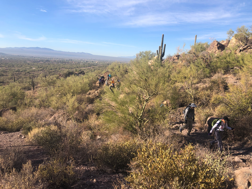 I volunteered to guide a 15 person, "Tucson Hiking Meetup" group to climb to the peak of Big Cat Mountain. Actually the group was set at 10 but there were so many on the waitlist I suggested to hike organizer, Lorna, that we allow 15. All participants arrived and arrived on time! How bout that? As we filed out of the parking lot onto the trail, I looked back and wondered if we would also all make it to the peak. 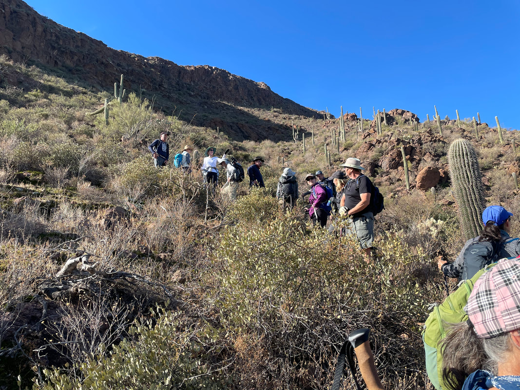 The first 2.1 miles is a gently rolling hike on established trails. I usually walk by the point where one leaves the trail and have to backtrack but not today. Found it on the first try! We began the fairly steep hike, averaging 26% grade. The route is marked by cairns but since it is easy to get off track, I paused to regroup whenever a sizable gap developed in our ranks. 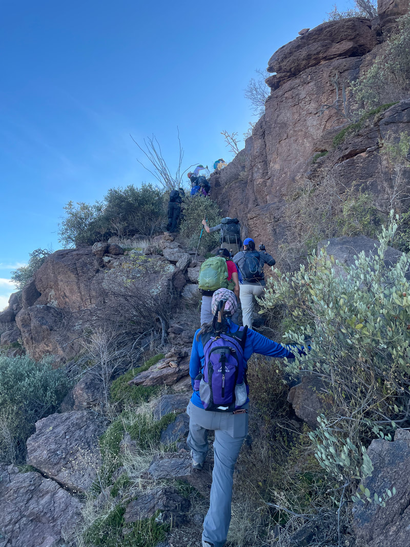 Approaching a deep rock band, from a distance it's hard to imagine how we would climb through but a natural staircase appears and we continue up. 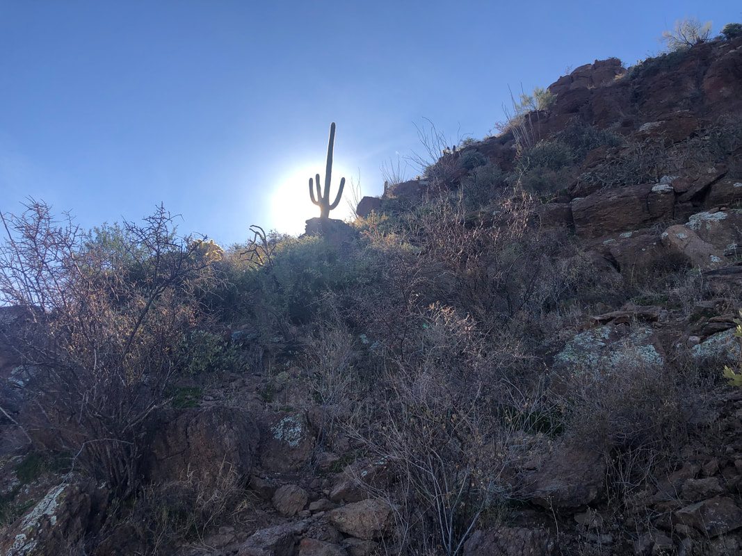 The sun is very low in the sky as I catch it beyond a saguaro. 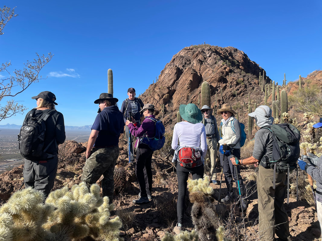 Reaching a saddle, we regroup and take a short break. In the distance, a false summit with several more to come. The views, as always....  ....awesome! 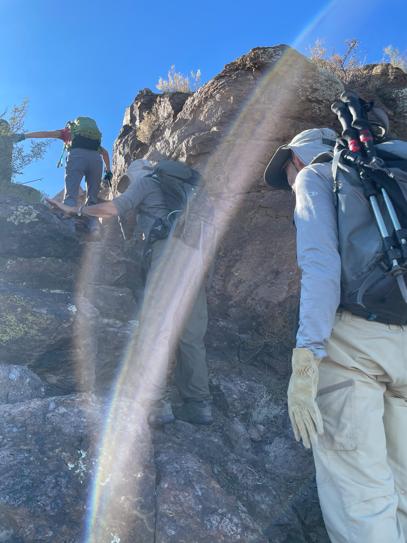 Soon after renewing our trek, we confront a bit of a wall but....  ....there are enough hand and footholds that all make it through. There is some exposure here so I was glad we were all able to continue. 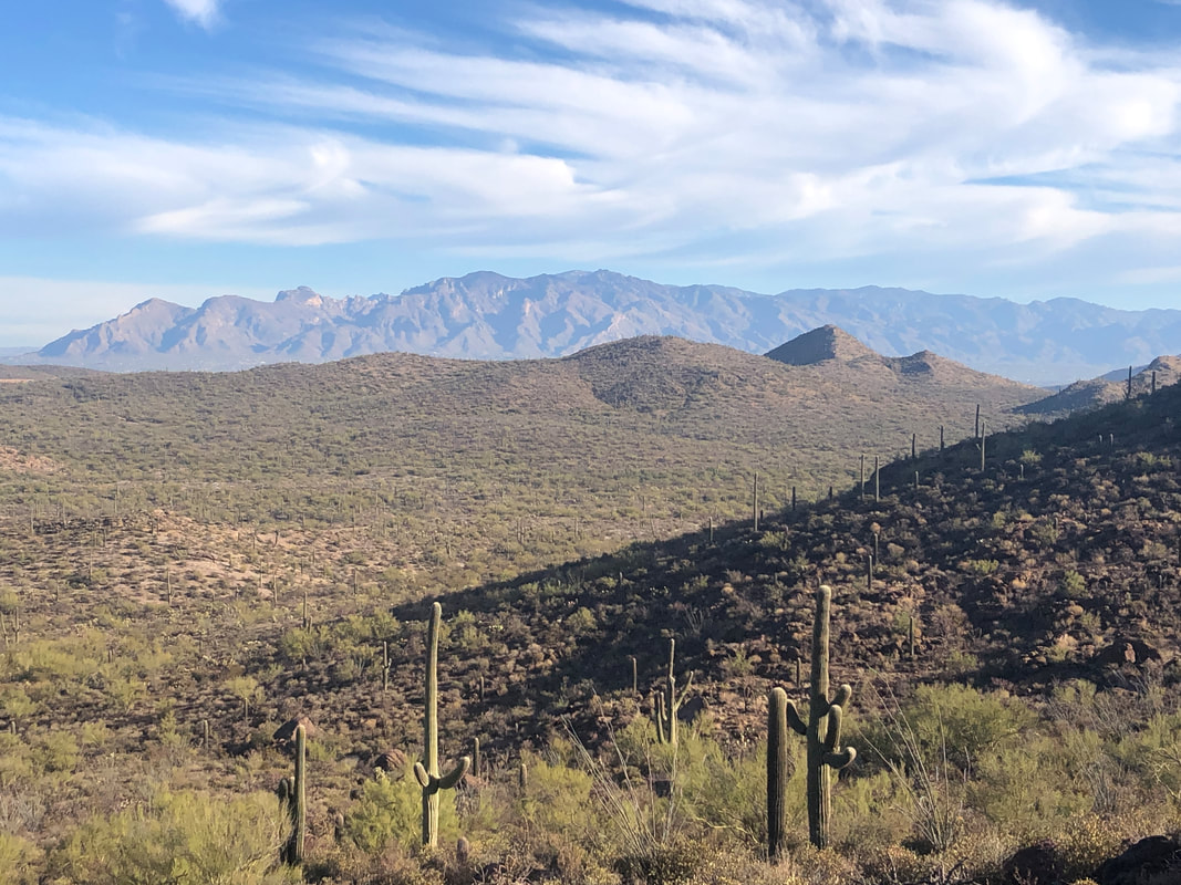 The Catalinas in the distance. We hiked a sometimes narrow ridge with daunting.... 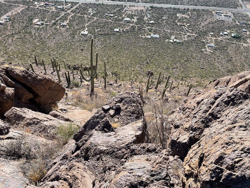 ....drops to the valley floor.  Looking back, the gang continues to make good progress. 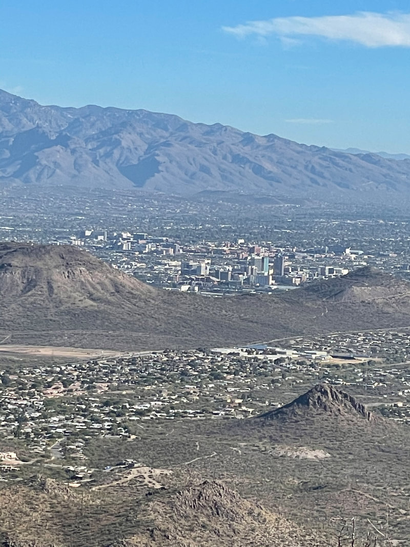 Wow, a great view of downtown Tucson on this day of sun and highs in the mid 60's. 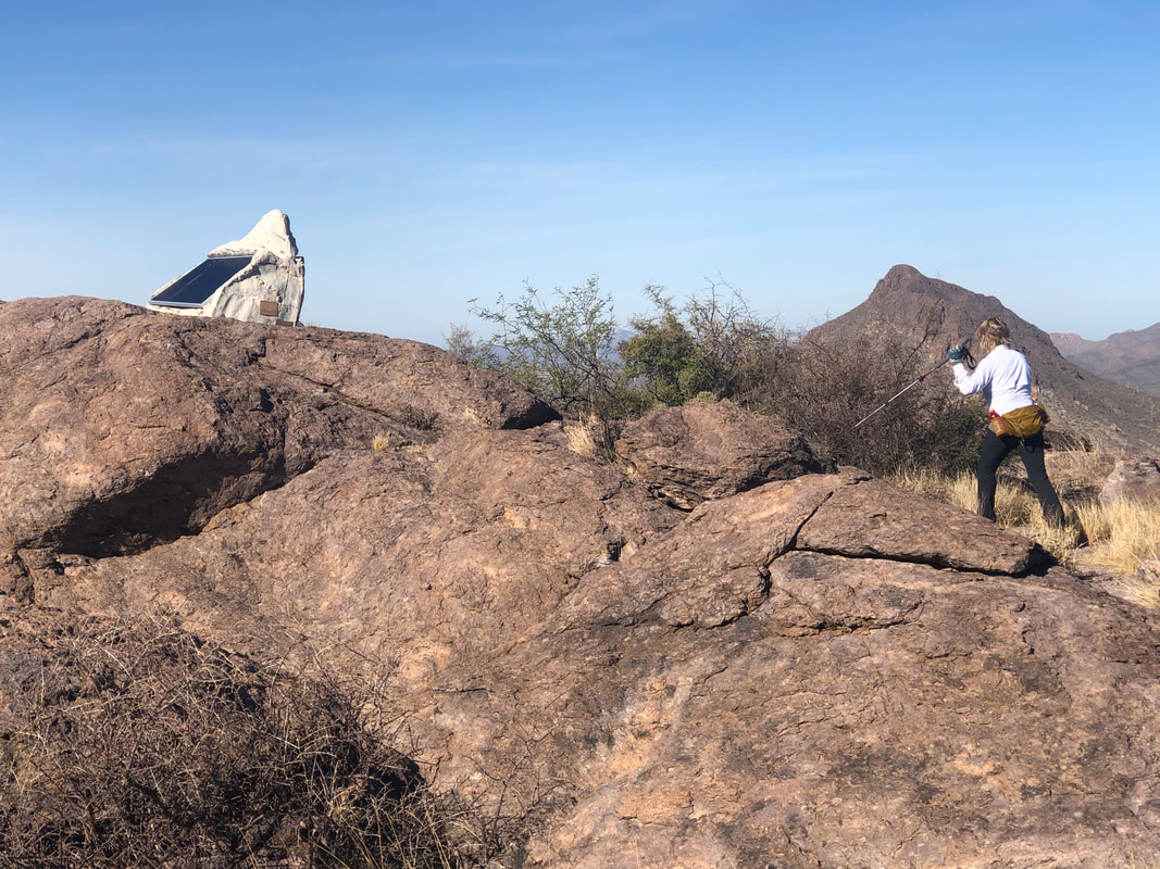 We got spread out on the final sections of the ascent so as I waited, Amy usurped the guide and made it to the peak, first. lol. That is a poorly disguised police transmitter on the left. 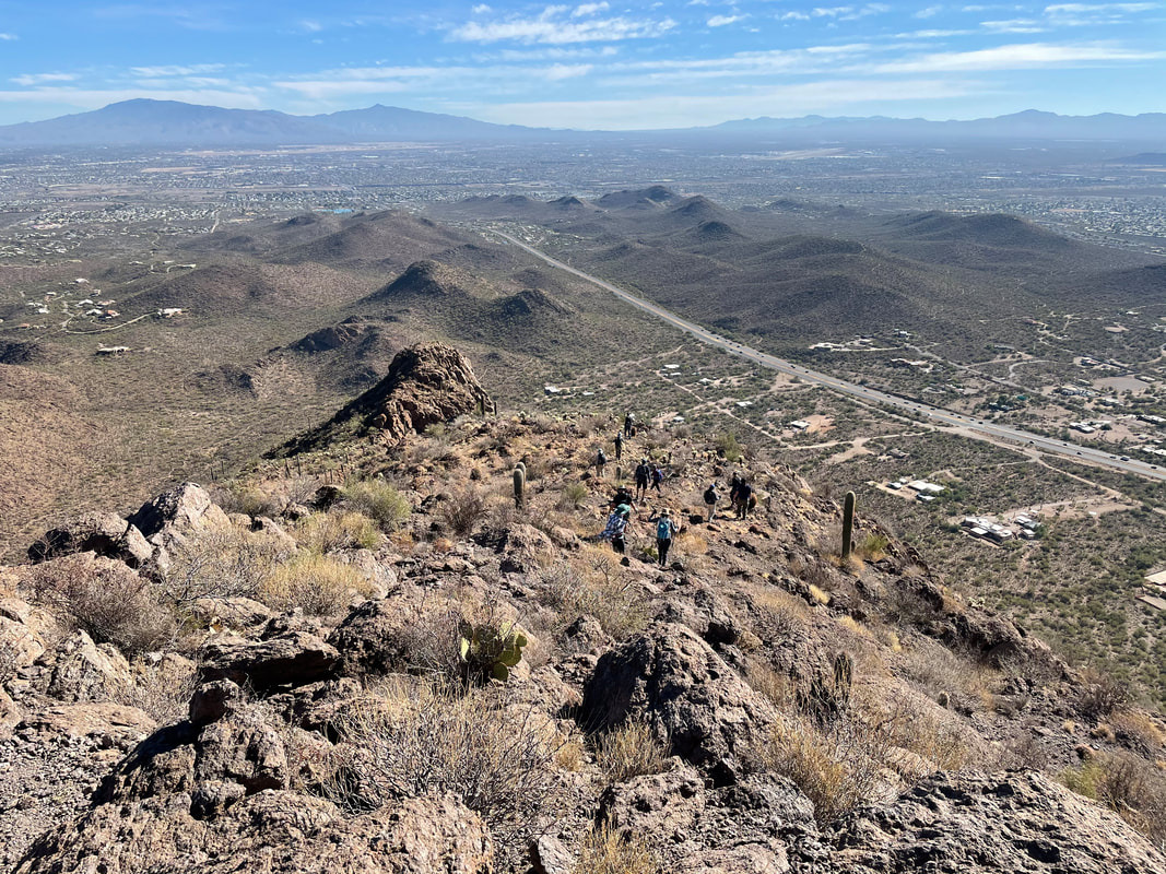 Soon, more of the group arrives as we parallel Ajo Highway in the distance.  We take a well deserved break while admiring the 360 views. 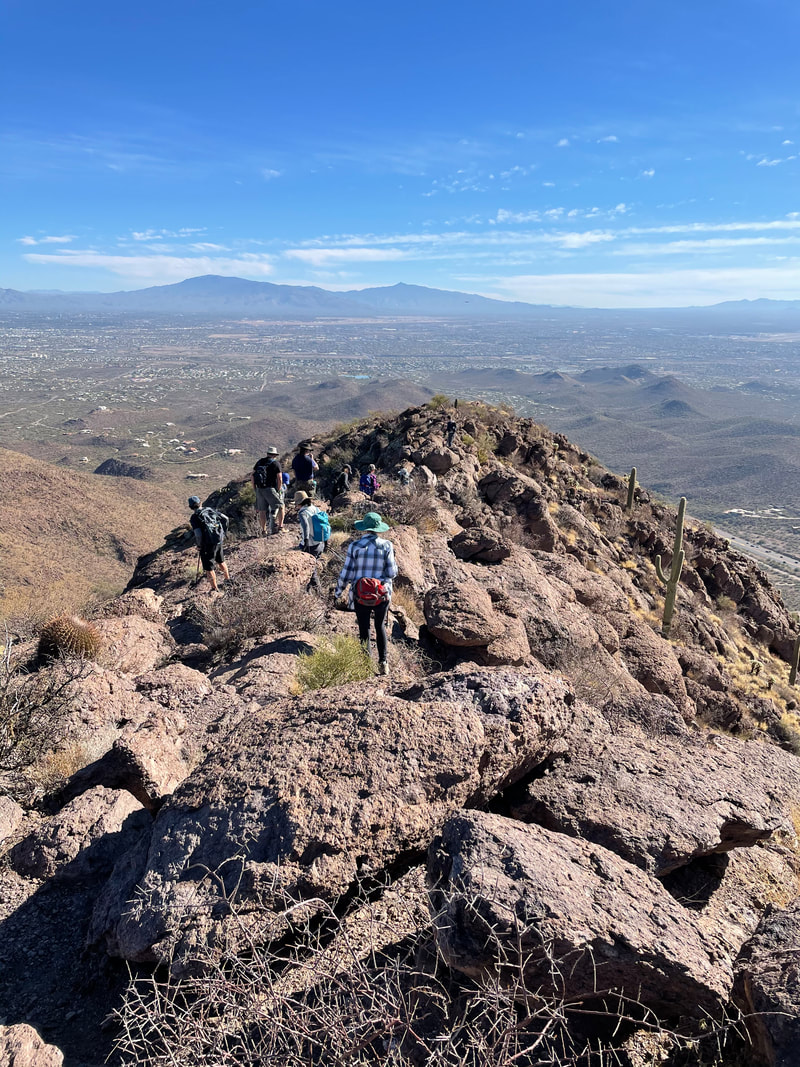 After awhile, we begin the descent. 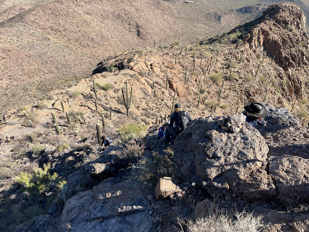 Once again, all make it through that tricky wall feature. We finish in good spirits with 5.5 miles and 1800' of climbing.
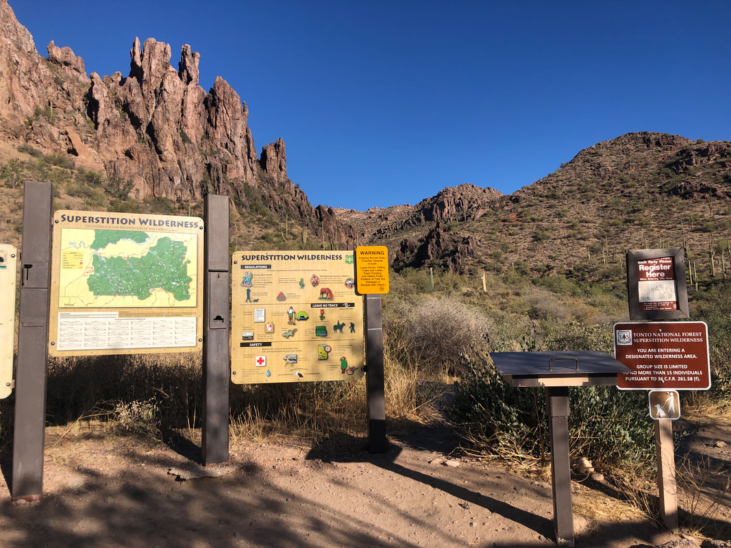 Ahhhh, the Superstitions, home to many great destinations; Flat Iron, Lower Labarge Box Canyon, Geronimo Head, Superstition Peak, Robber's Roost, etc... Now that the temps have finally moderated, it's a worthwhile drive from Oro Valley to revisit a favorite, Weaver's Needle Crosscut. 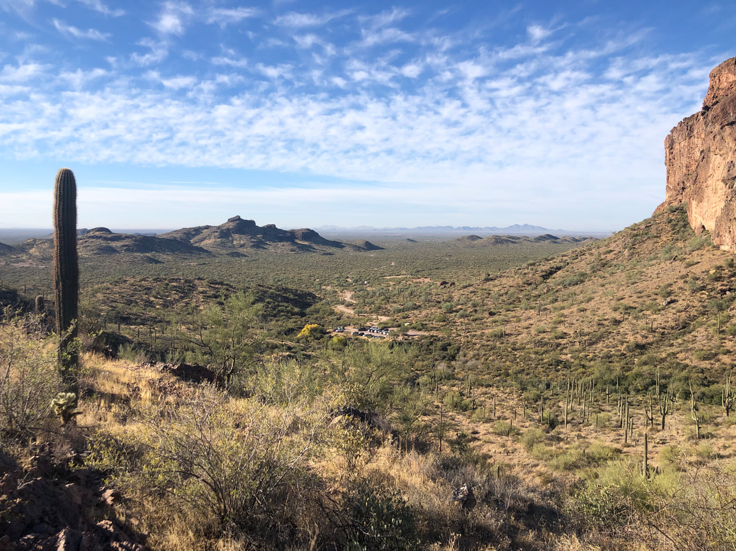 It's a steepish climb from the Peralta trailhead via the Bluff Springs Trail. Awesome views quickly clear the horizon as I climb 500+' in 0.6 miles. At that point, I gain....  ....awesome views into the interior of the Supes. The lack of a monsoon, coupled with ongoing drought has..... 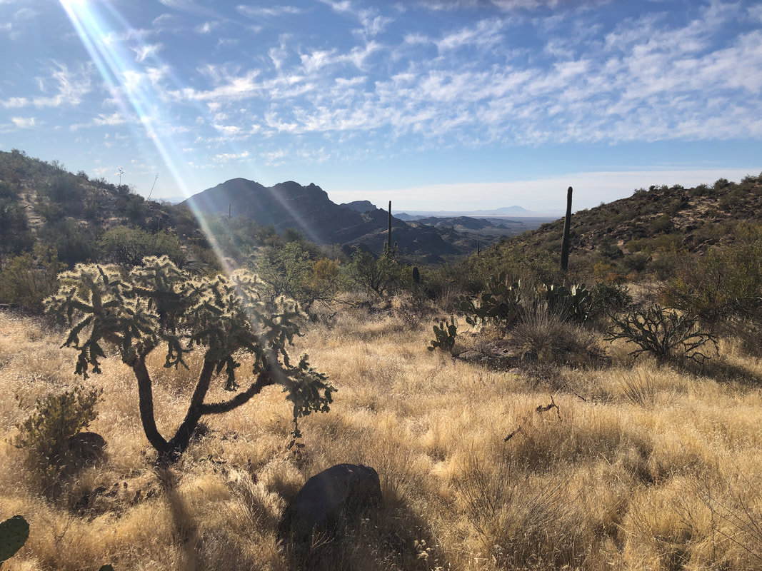 ....left the landscape looking rather dry and brown. But at least this view has vegetation because as I descend into a canyon, evidence of..... 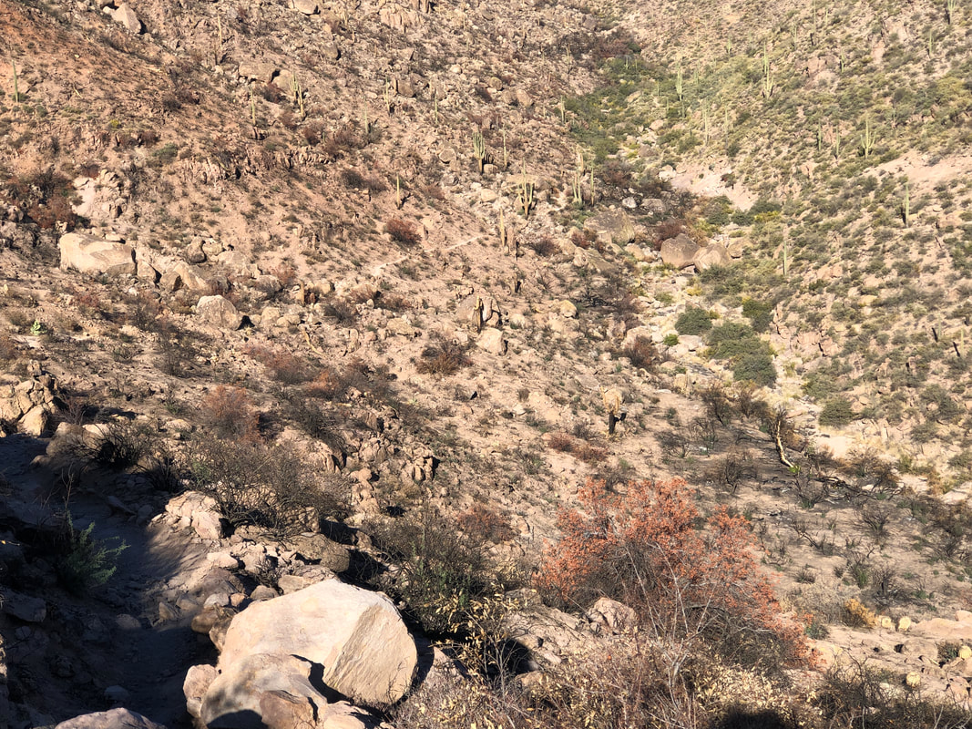 .....this summer's fire, abound. A ranger told me there have been several bighorn sheep sightings as they have lost much of their ground cover. He was hiking near a ravine that still had thick vegetation and heard the growl of a large cat. Probably a mountain lion feeding on something, issuing a warning. 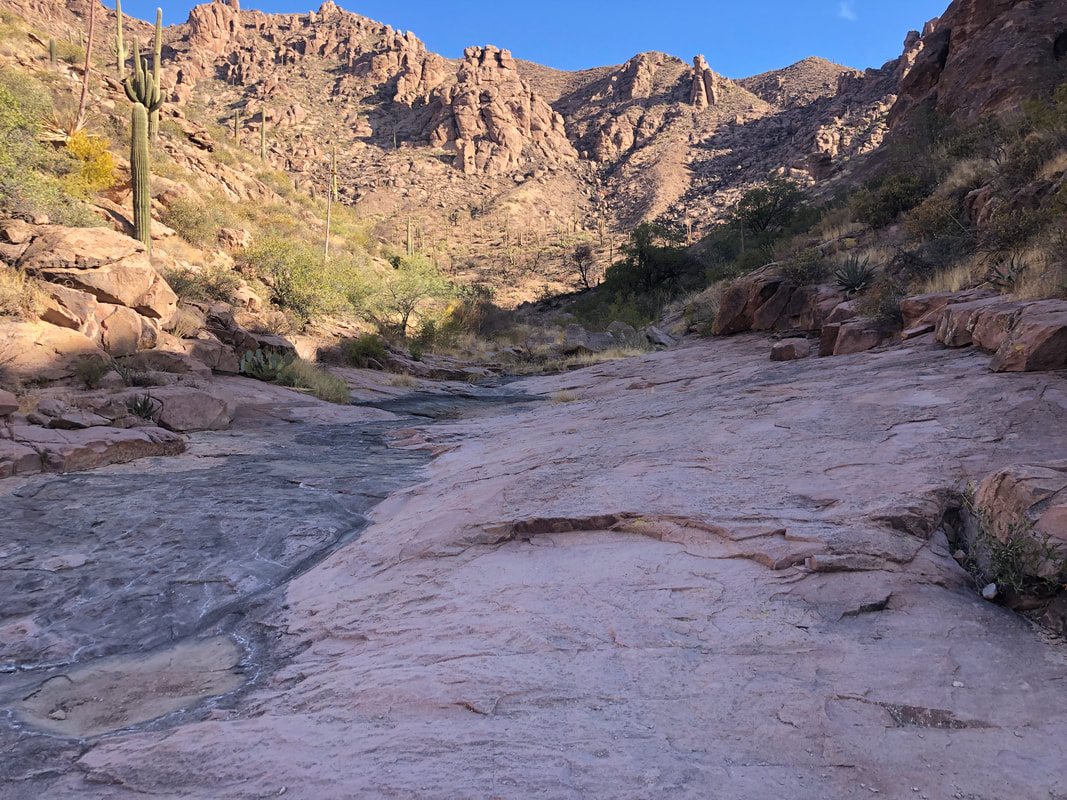 Eventually, I drop into this canyon floor where often, water is found trickling through it. Not today of course but I was surprised to find a small pocket of water and imagined it is visited frequently during the night by all the critters. Soon after exiting this lovely spot, I..... 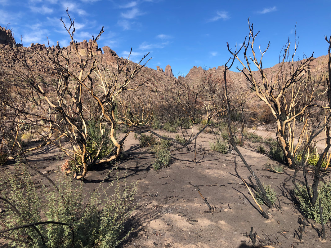 ....encounter more stark examples of the burn. The trail rises to a ridge then falls again and looking..... 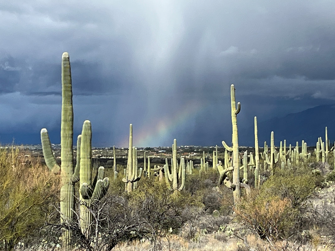 ....back, quite the moonscape appearance. At least the trails are in good shape and easy to follow, so far. 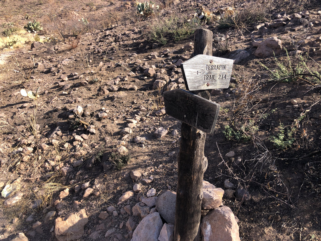 I reach the Terrapin Trail and hang a left here, departing from the Bluff Springs Trail. I see a man with a backpack and dog fairly close off trail but they are upwind on a very windy day so I decide not to shout something. I encountered no one else on the entirety of my hike, until later, when reaching Fremont Saddle. 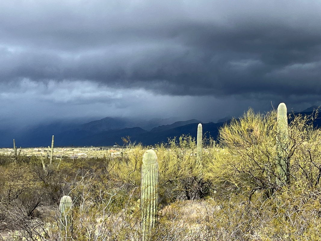 I knew the Crosscut Trail began about 3.1 miles into my hike so made sure not to miss the left branching and pretty obvious, unsigned trail. I climb to a ridge and descend into Needle Canyon. During this hike, I paid a lot more attention to the slopes above me just in case I could spot a four legged animal. I saw none but did see.....  ....the above rock formation. To me it appeared to be a standing lion. Later, I was told in fact it is known as the "Standing Lion" rock formation. The walk through Needle Canyon was a bit eerie. On past visits, it is a beautiful area but today, just so stark and strange. 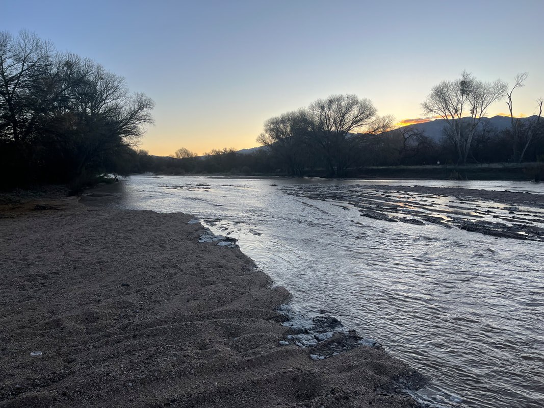 I am headed toward the saddle in the distance, to the left of an emerging, Weaver's Needle. This being my 4th time doing this hike, I relied on memory to see me through but I should have done some research because I ended up..... 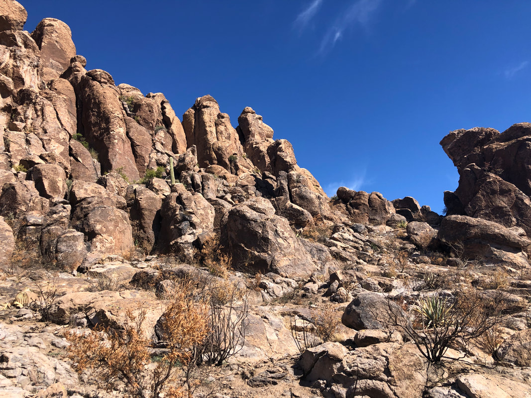 .....one rock formation too far to the south and had no view of the Needle, once I was adjacent to it. I poked around in here and it appeared I could circle around on the right but decided to keep going. I descended into a boulder strewn ravine where.... 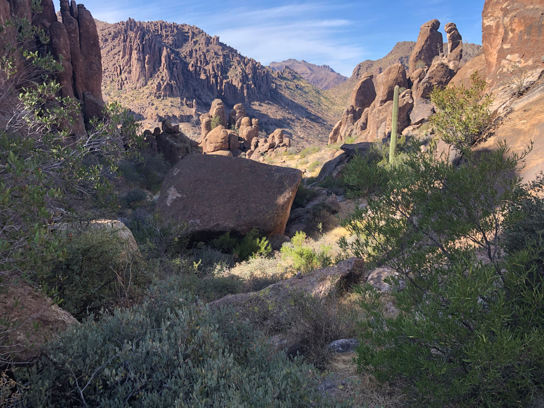 ....it was a refreshing sight to find an unburned area. I encountered a "Y" intersection that I had not previously noticed on past visits. I began to descend the right arm but the trail became faint and I decided the left arm was the usual route. It was as I regained the intersection and began a very fun descent through the boulders. 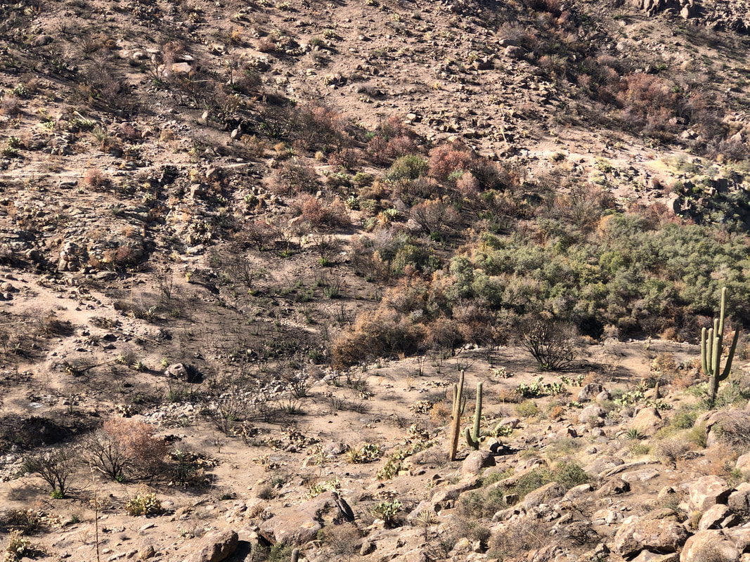 A good view of East Boulder Canyon with an obvious point of demarcation between a burned and unburned section of a ravine. I was kind of relieved to see this because it made access to the Peralta Trail (seen upper part of the image) a whole bunch easier. Looking back....  ....I had navigated through the above. The route is not always obvious so a couple of times I had to stop and evaluate the route options.  Reaching the Peralta Trail, I hung a left and began the gradual ascent toward Fremont Saddle. The views to the northwest are awesome but even more so.....  ....from the saddle, the view of Weaver's Needle. It appears the "lone pine tree" to the right of the Needle survived the fire. That is good news as it is kind of iconic and a great destination.  From the saddle I still have a little over 2 miles to go. Reaching the parking lot, I finish with 8.1 miles and 2100' of climbing. The moderate temps have opened up many hiking options so trying to decide what to choose next.
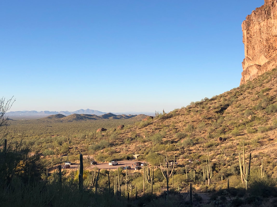
 Our group gathers and begin our hike at 9am. Many of the local hike leaders stopped organizing hikes so there is a vacuum. I decided to organize hikes once a week to give people the opportunity to participate in fun hikes. Kind of giving back I suppose. Today's hike went to the top of Bren Mountain, shown above. We shove off from the David Yetman Trail off Gates Pass Road. 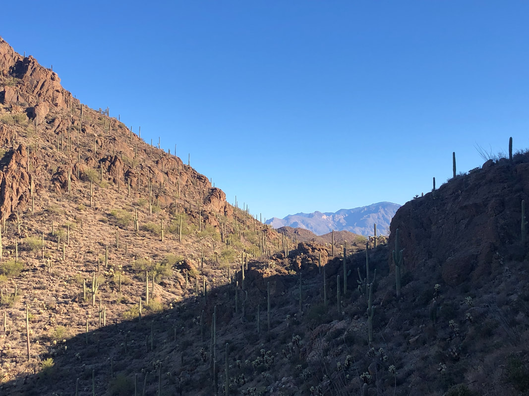 The temperature is kind of chilly, about 55 degrees as we work our way clockwise around the mountain. Approaching a saddle, we get a good view of the Catalinas. 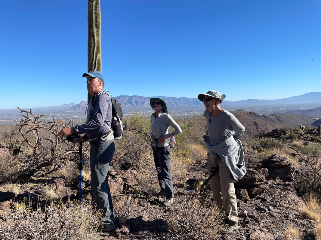 After hiking 1.6 miles on an unmade social trail, I spot a couple of cairns indicating this is where we go off trail and begin our ascent to the peak. Yes, I appear to be confused but not really.  As we climb higher, the views, as always, are wonderful. I lose the route a time or two as we climb a ridge toward the peak but am able to relocate it. 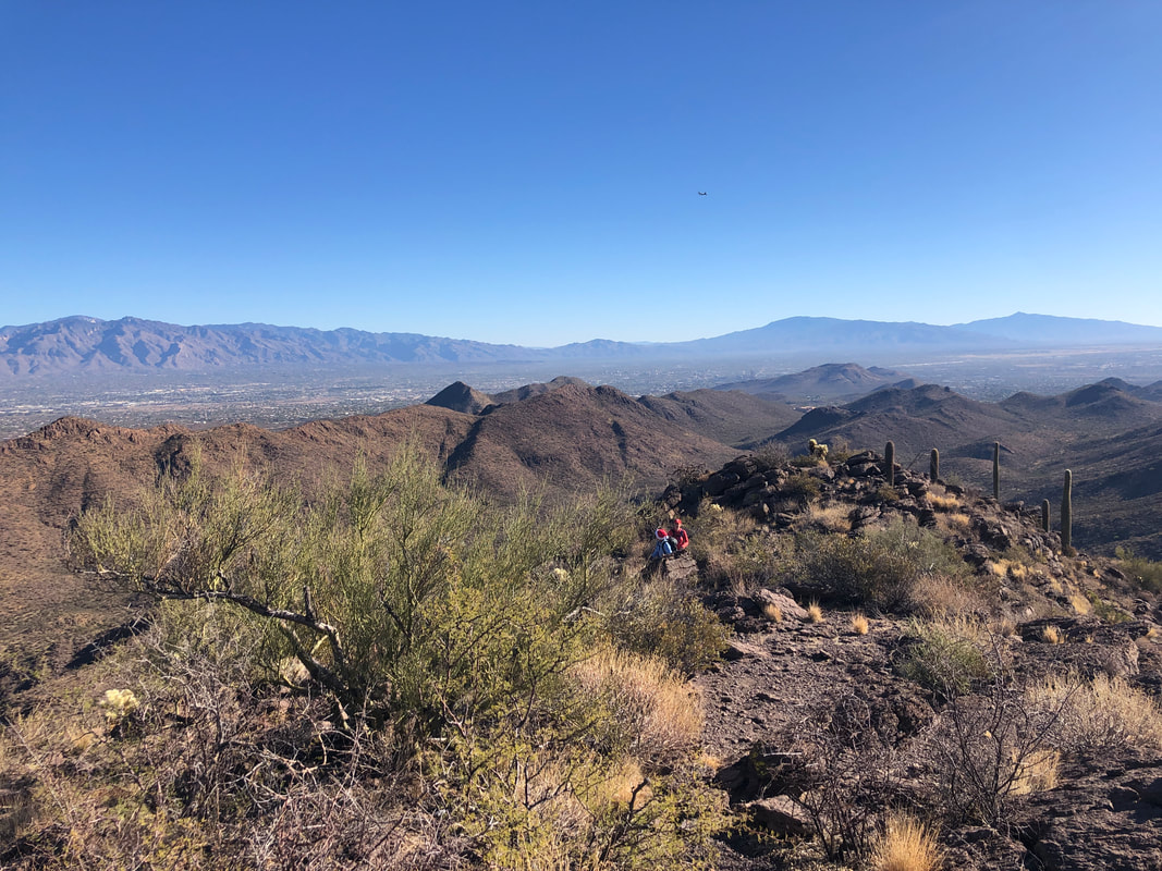 Barely visible are some of my fellow hikers as we continue to admire the panorama view. 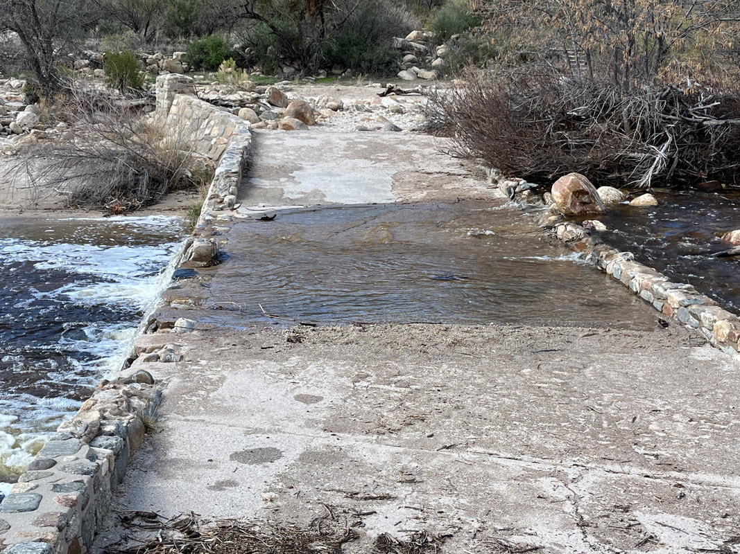 In the distance, I finally see our destination but before reaching it, we have to.... 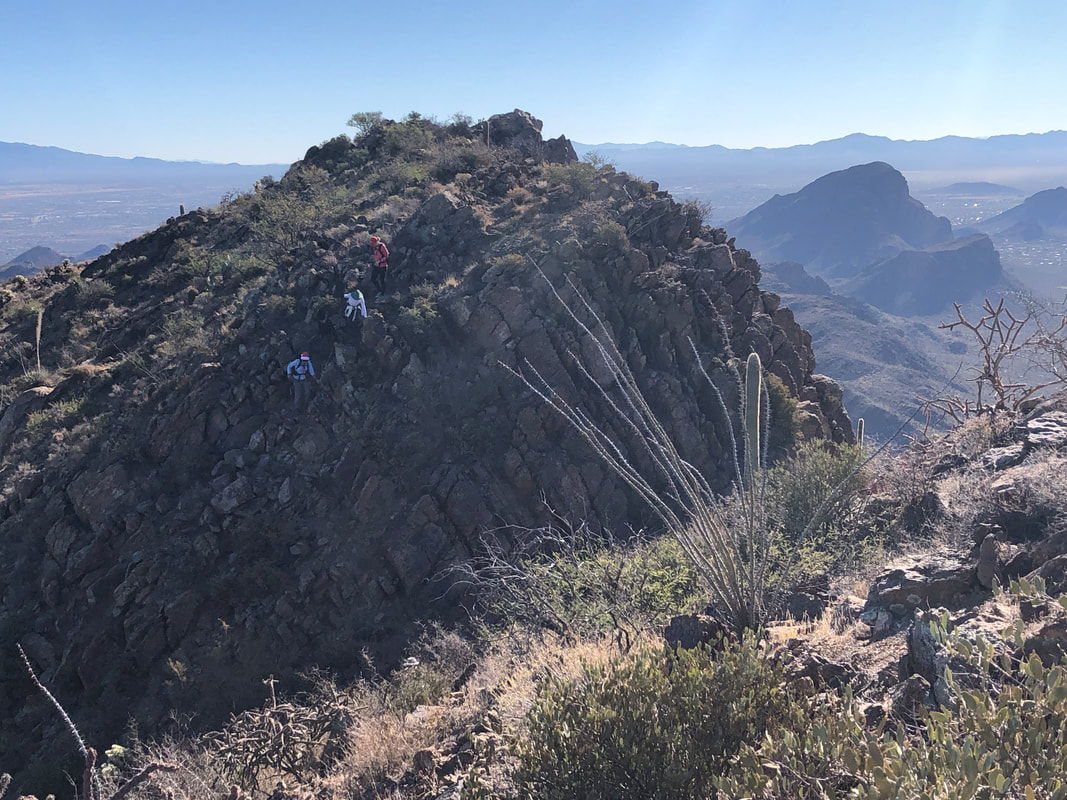 ....descend before climbing to the peak. At the peak, of course..... 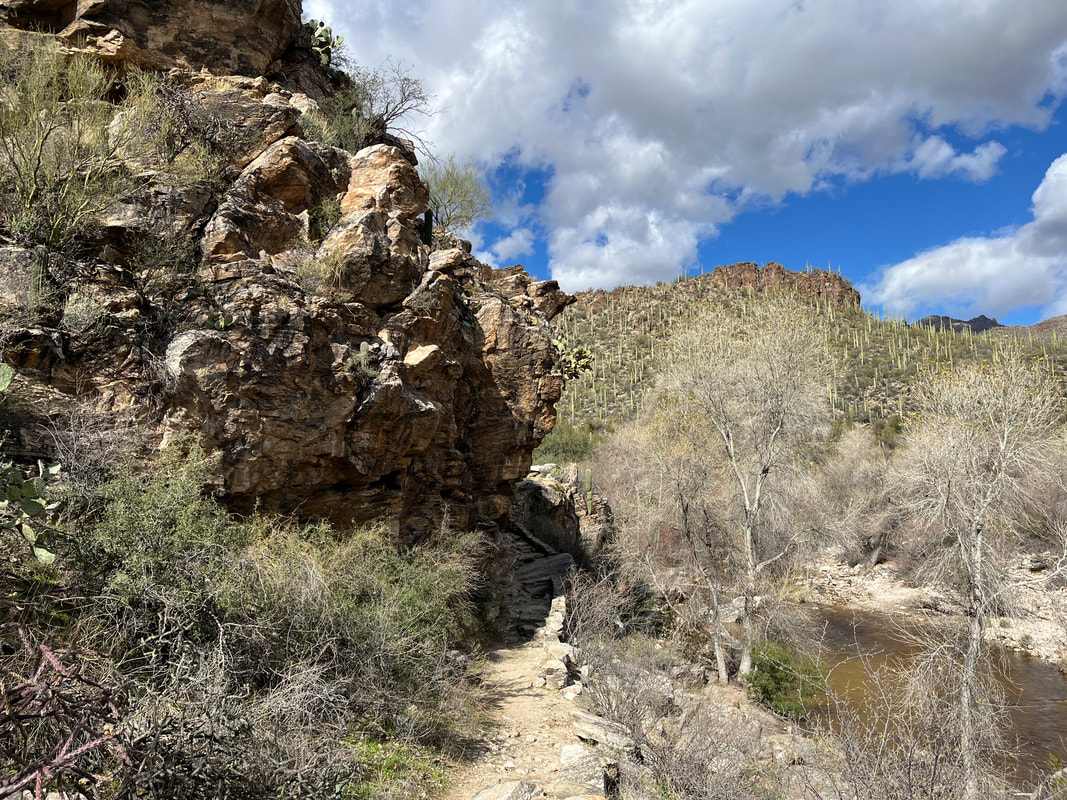 ....all take plenty of pics. A friend asked about the elevation of our hikes. Oro Valley is at 2600' and nearby Tucson is 2500. Some of the peaks around us sky to almost 10,000' but today's destination was a more pedestrian 3000'. 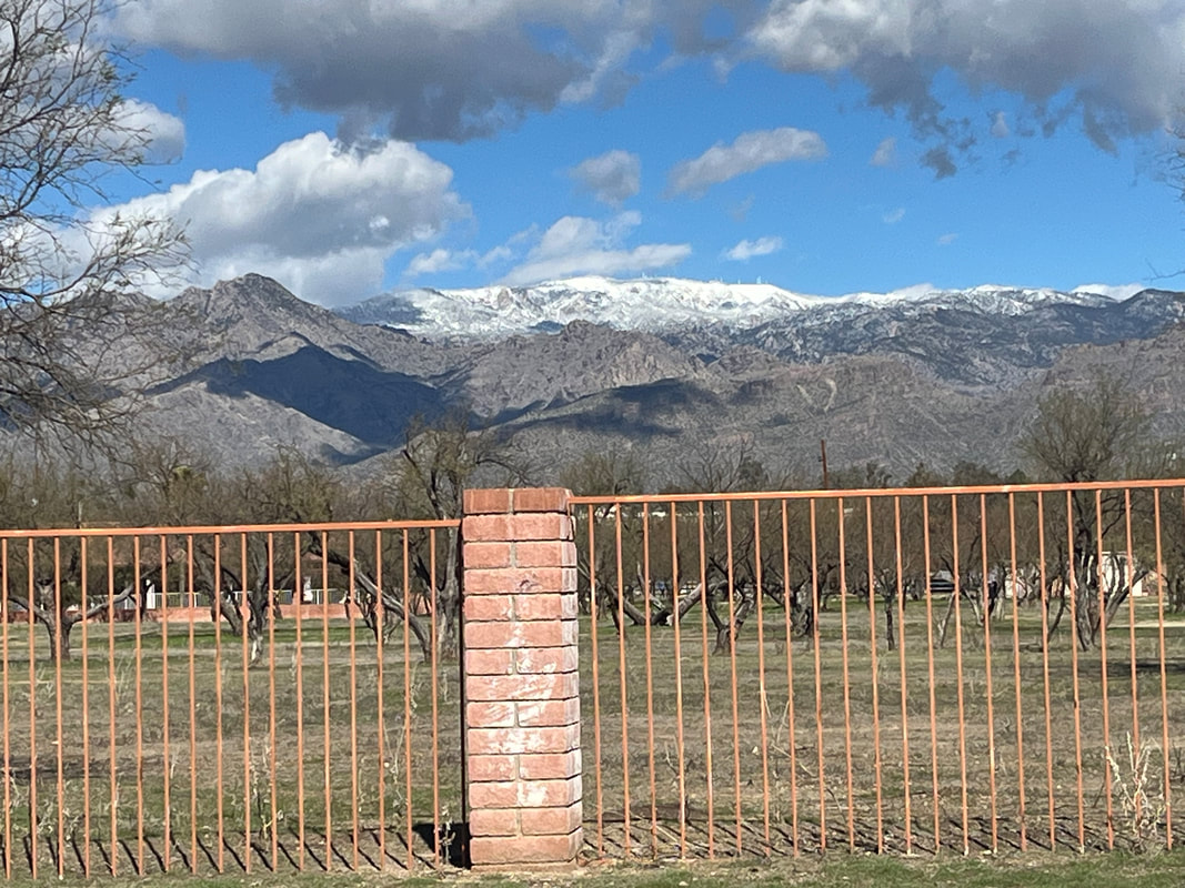 In the distance are some of the 10,000footers. We completed our loop with 5 miles and 1200' of climbing. Everyone finished safely.
 It was a recovery day so I joined a slow moving, frequent break taking group of 12 people at Sabino Canyon. For me, it is important that I have realistic expectations so I don't become frustrated with the slow moving, frequent break taking events. So, I mostly had a good time! 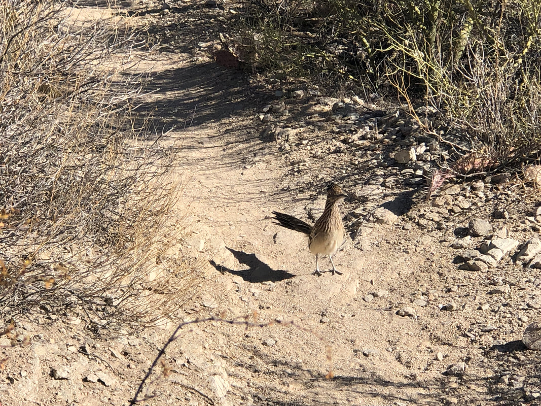 A road runner stopped our group. It eventually headed right and we were able to continue. We were on the Esperero Trail and reached a minor climb.... 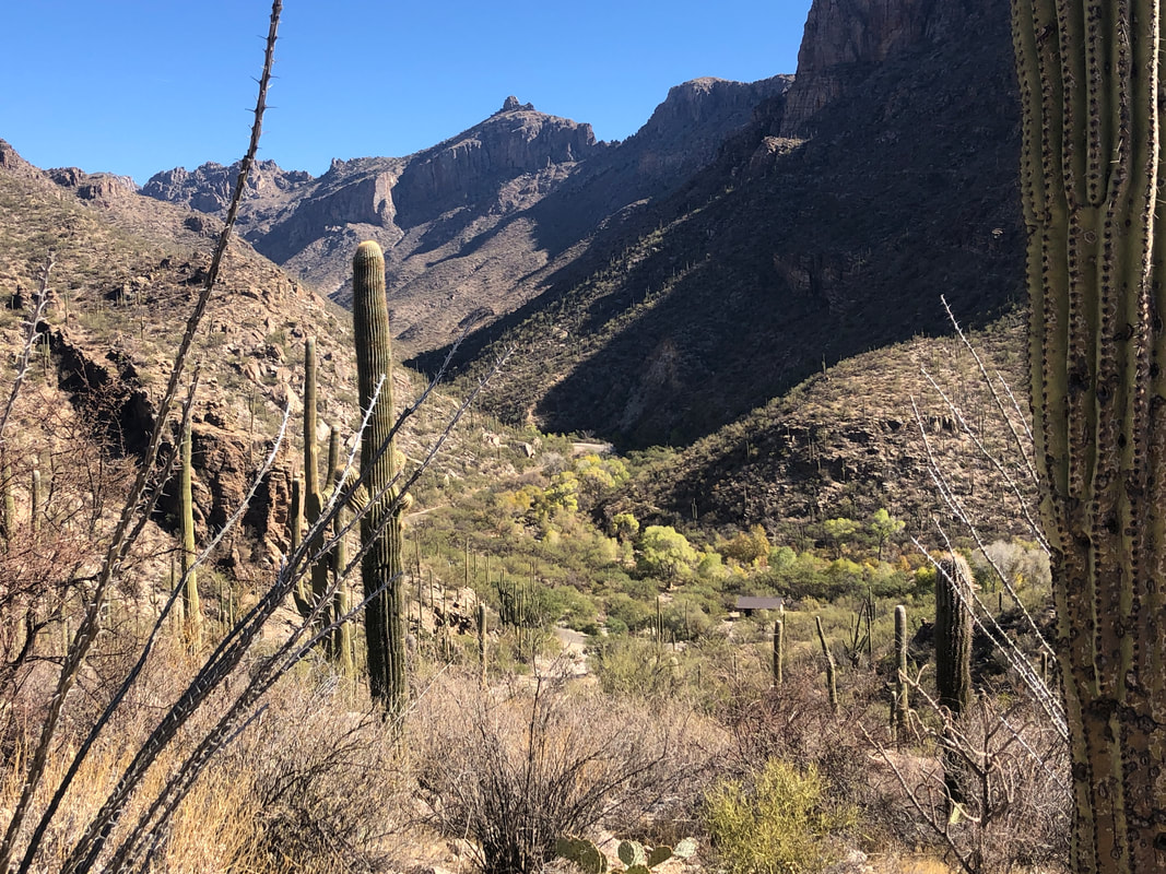 ....the came to an overlook that revealed nice views of the canyon. 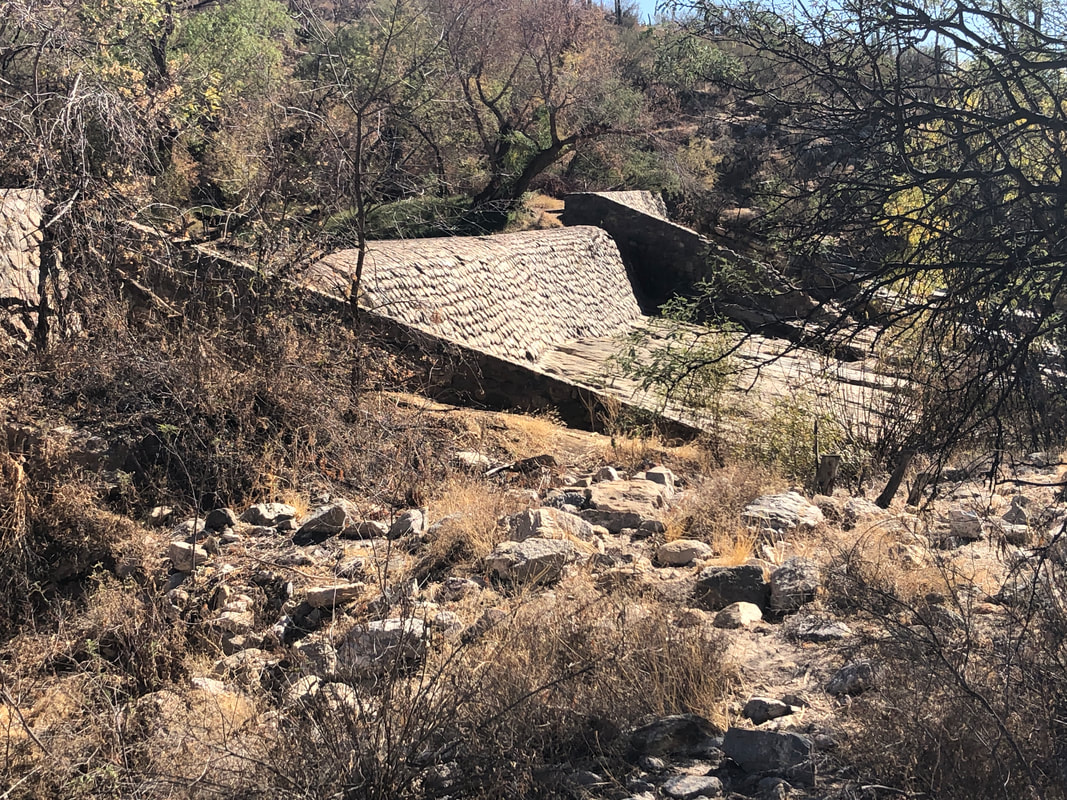 We got into a wash and eventually recrossed Sabino Canyon Road, eventually reaching the dam. But.... 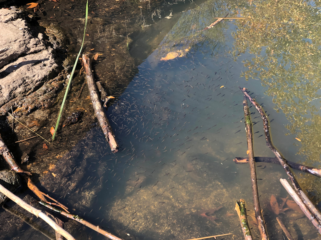 ....despite the drought, there was still some water flowing, feeding a few pools where the small fish were plentiful. finished with 4 miles.
|
