 This unusual March weather pattern continues as yet another cold front moved through, bringing a day of clouds with a high of 70 followed by this day of partly cloudy skies and a high of 59. Actually, some rain moved through this morning but it appeared to be over so I headed to Catalina SP where I began a hike I have wanted to do for awhile. 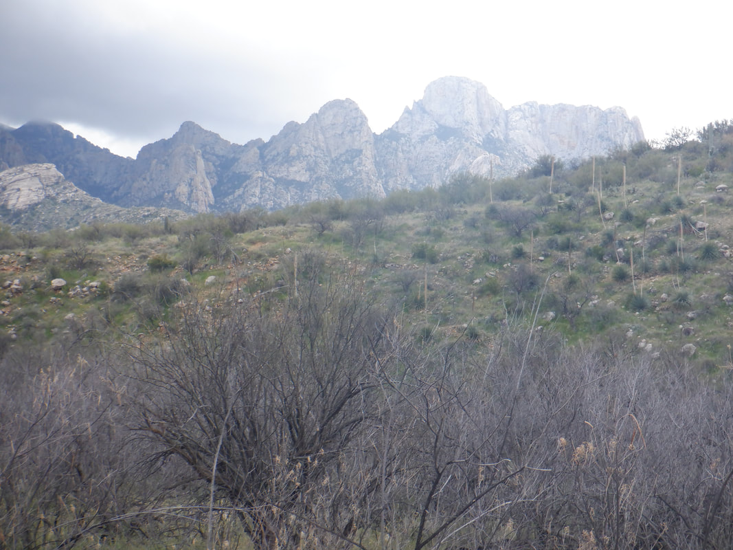 The hike should take me to the base of Table Mountain if what a guy I ran into during a hike gave me accurate info. I head toward Pusch Ridge, cross a couple of dry washes and hike on a social trail parallel to the above ridge. A short climb brings me to the top of that, followed by another short climb and I..... 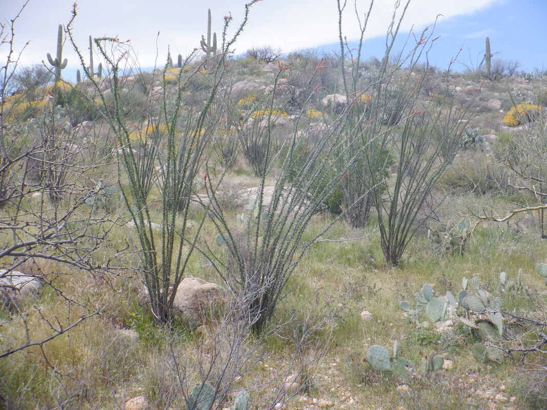 ….am following a rolling trail parallel with the mountains to my left. Lots of plants are blooming. 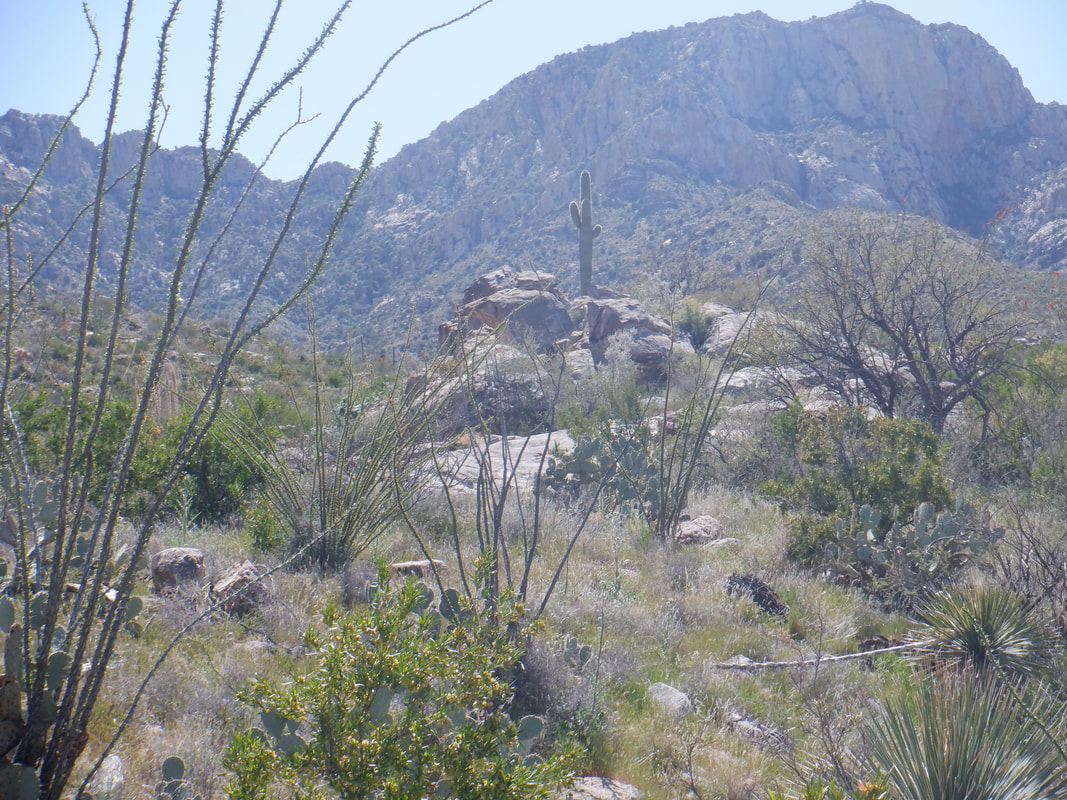 The clouds briefly clear and the surrounding area is awash in sun light. Note the lone saguaro above. 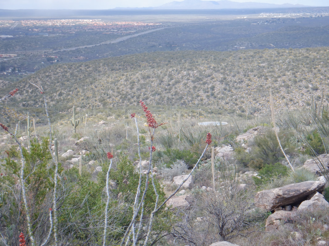 I reach a massive water tank, shown above, center right. I had been this far before but now am in unexplored territory. 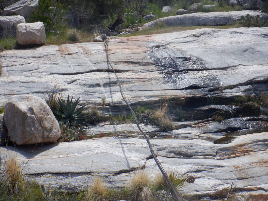 The trail meanders around as it rises toward the mountain now. As I climb, I reach an area of granite and see where the pipe that feeds the tank originates. Nice spot. 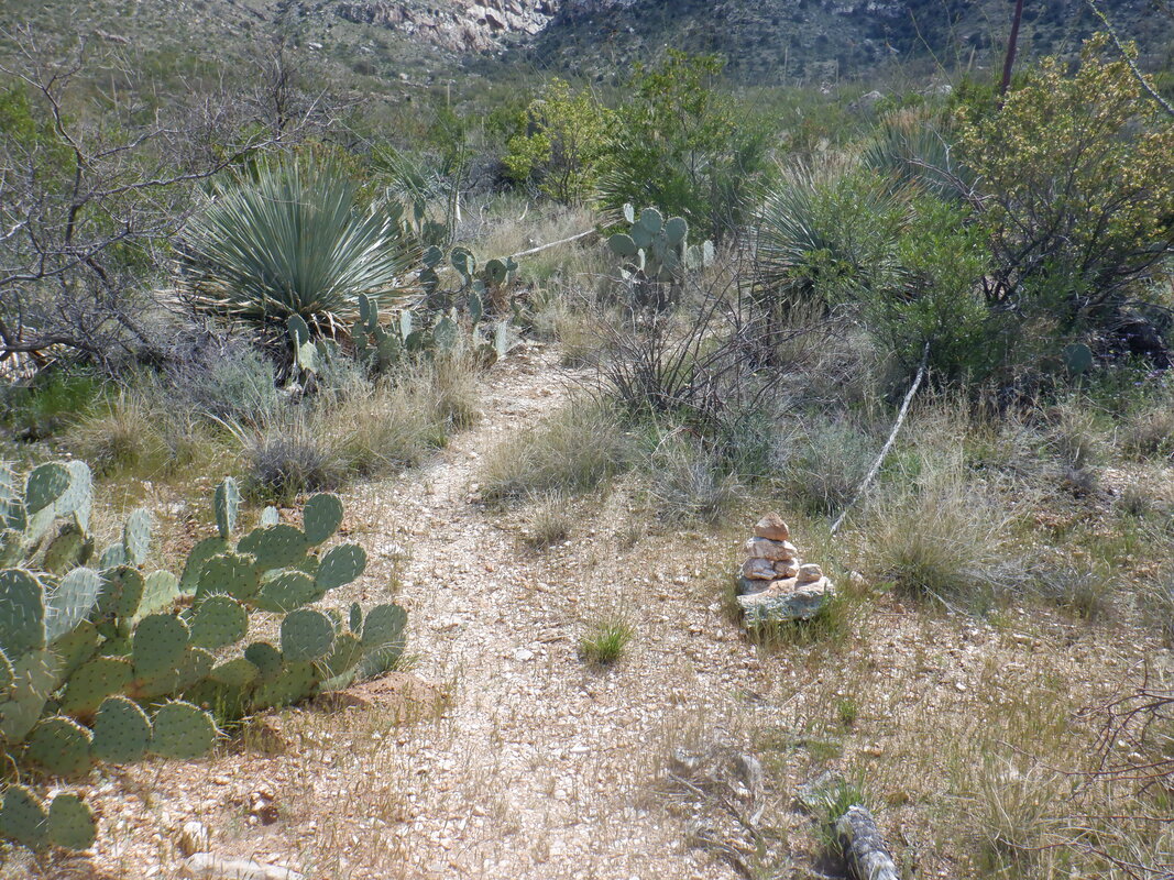 Just prior to reaching the granite, there is a cairn and a much fainter trail branches to the left. Usually there now...... 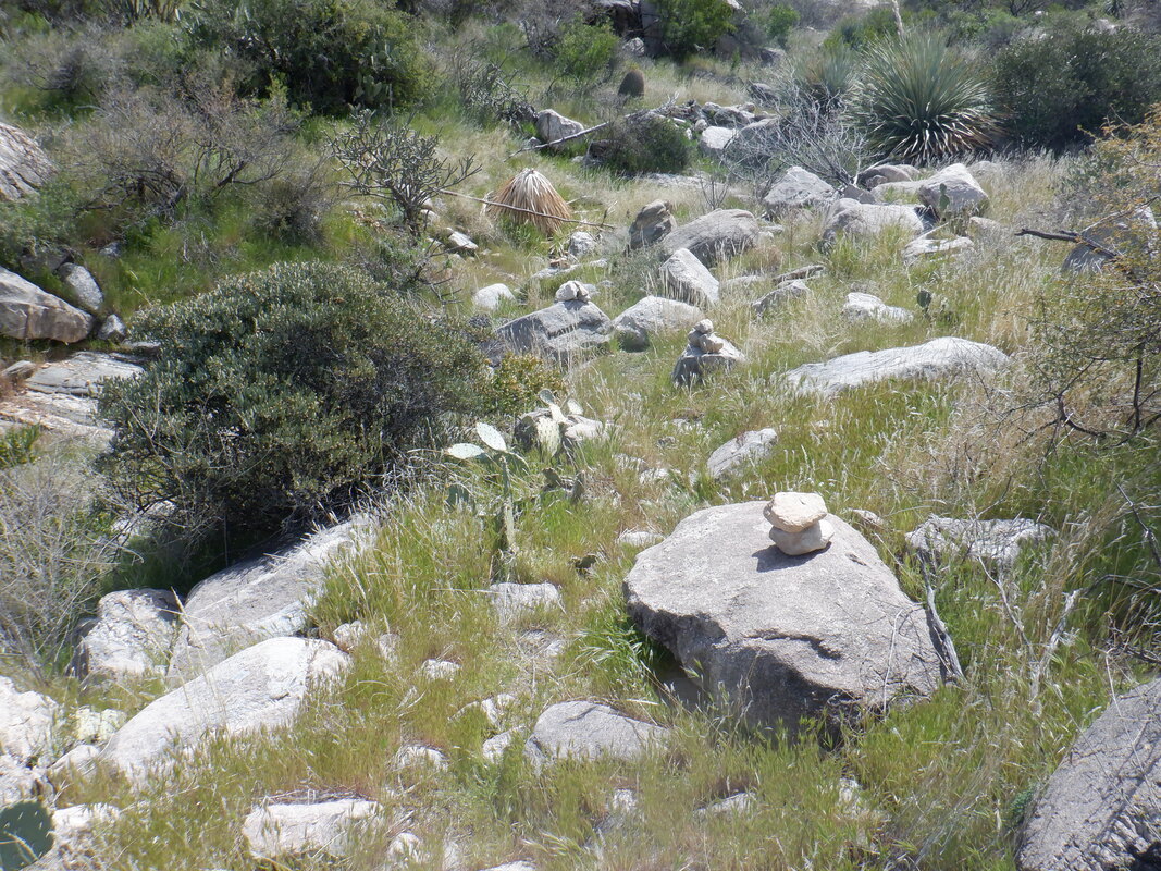 …..is no trail but someone has put a lot of effort into building dozens of cairns that are easy to follow. 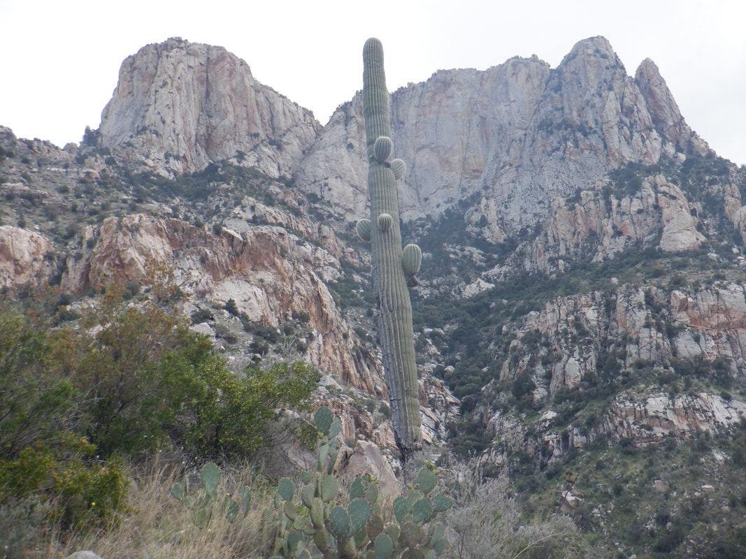 The climbing steepens as I see my destination, a saddle to the left of the base of the granite wall. I've started my hike at 11am so need to be mindful of the time. As I hike, I am curious how the route will evolve. I nervously eye a cliffy section with lots of giant boulders to my left and hope the route does not take me into that but of course....  ….it does. Seems like there are some nice, sheltered areas that could make for a good animal den up there. I pull out my Smith & Wesson, chamber a round and proceed.  Yes, I am super careful while carrying and no, won't shoot myself and no, don't carry when with other hikers. It gets creepy some times when I hike alone and there are examples of hikers surprising a sleeping lion. I forgot my hiking pole so don't have that to bang around and make noise so I carry on a loud conversation with myself.  Way cool! A band of rock that is distinctive from the valley is now at eye level. It appears I could bush whack over, hike over the top and down but no time for that today. 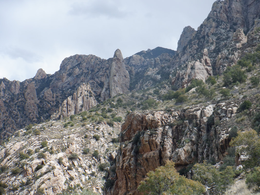 I continue to climb and finally reach a saddle where I find a fire ring and a flat area for a tent. Probably the route builder stayed here for a night. The cairns end at the saddle. I search but cannot find any ahead of me and this kind of is a logical end but there is a last, prominent hill that prevents a view of the entire granite face. The final hill looks climbable and then as I start back down, I find more cairns leading from the south facing slope of the saddle which is kind of counterintuitive. I've also been looking.... 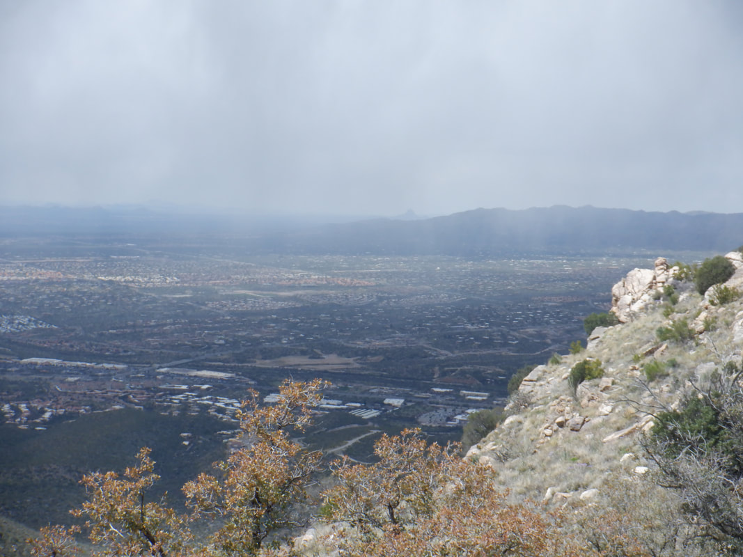 ….to the west and can see several rain shadows approaching. Yeah, getting wet up here would not be good so I start the down climb. Soon, it begins....SNOWING! Lightly to be sure and not for long. At a lower elevation, it begins to rain and the wind is howling. The trail now is runnable so I begin to run. 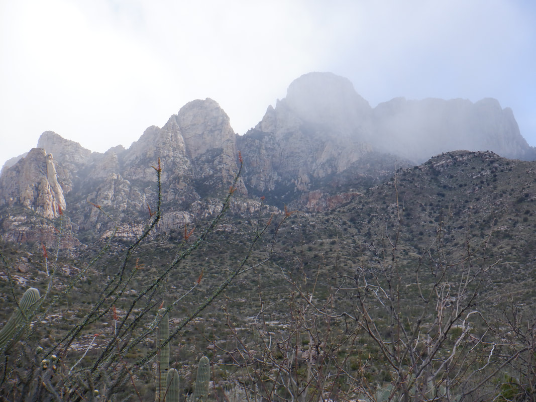 Beautiful as a harder rain is falling exactly where I was standing about an hour ago. Glad I am down here. Finished the hike with 8 miles and 2000' of climbing. A very fun day.
0 Comments
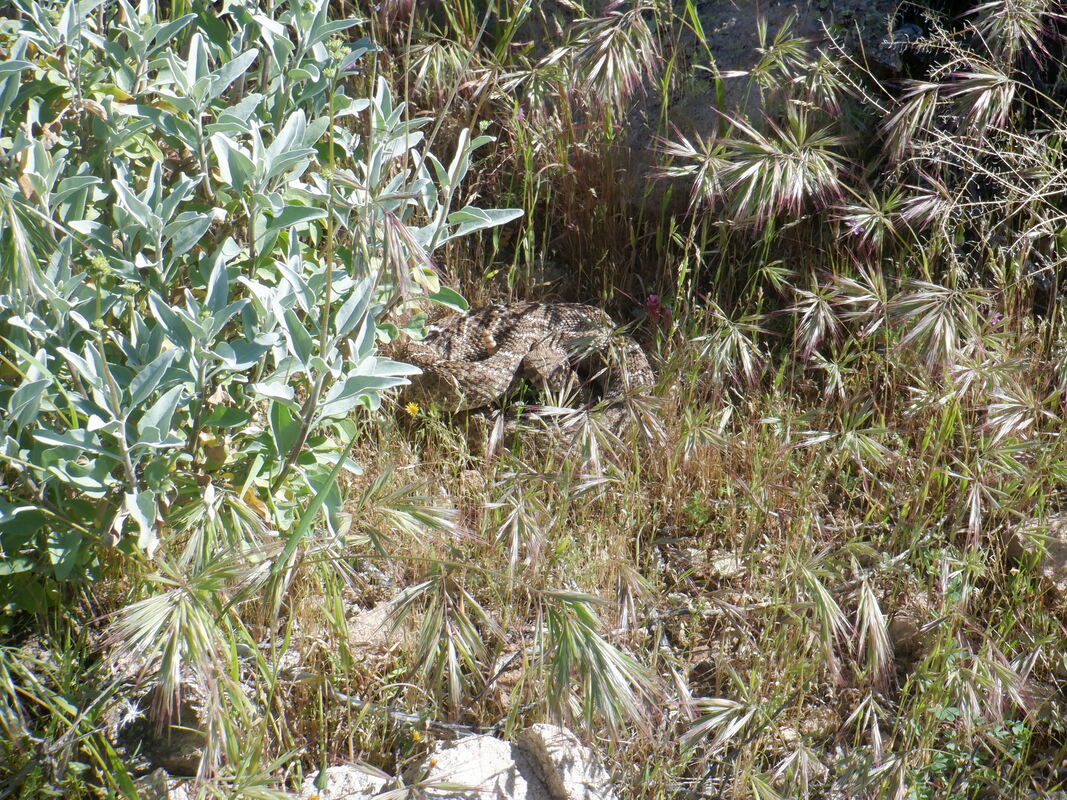 Three of us begin our hike to Picketpost Mountain but a guy walking our way warned us of a rattlesnake and sure enough. There it is, coiled and to be avoided. 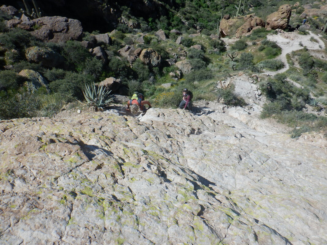 The route to the peak is a wonderful mix of an easy to follow trail then a series of walls and route finding challenges. 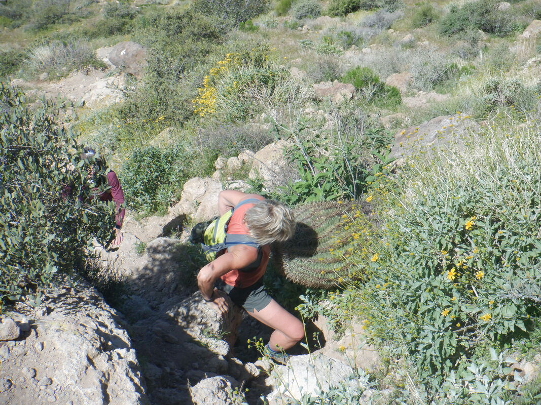 And then there are other things like a Barrel Cactus growing into the route, it too to be avoided. The parking and camping area had a "site host" who had stayed there all winter. She stated the weekend (we hiked on Monday) had been a zoo with swarms of people behaving badly and to not be surprised if access to the area would be denied in the future. In fact, the next day the area was closed. The same with other popular trailheads in the vicinity. 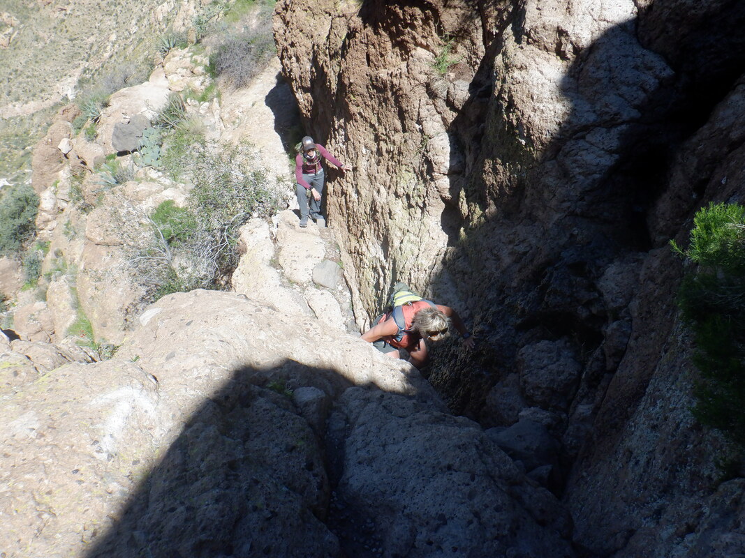 More walls met and climbed and after one particularly nasty section..... 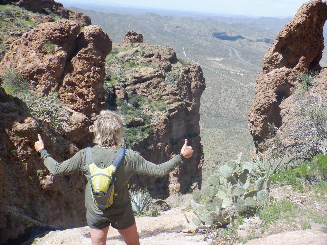 ….Amy had to celebrate both the successful climb and the view. 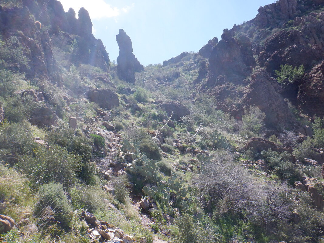 The end is not near as the above gives false hope that the hike is finished. It's not but.... 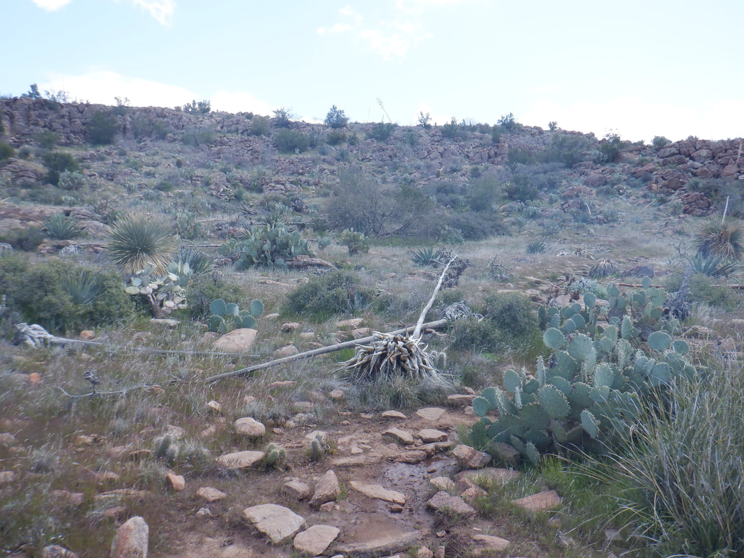 ….it's not but the hiking does become much easier as we approach the peak. 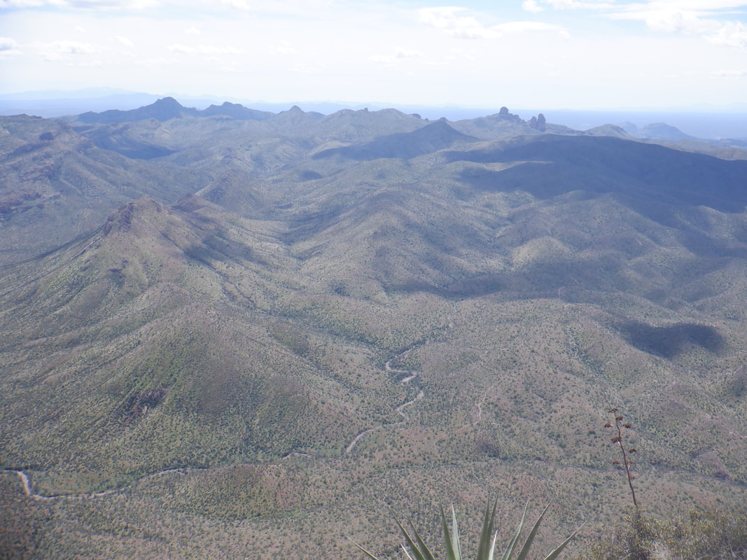 The end of 2.5 miles and 2000' of climbing. Another of those short but hard hikes with awesome views. So many dirt roads going off into the distance and now with a gravel bike, I can explore them. For a long time, a mailbox had been present at the peak but someone store or pitched it over the side. An organization.... 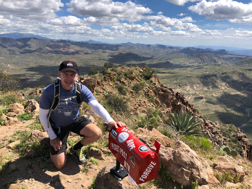 ….installed a new one. Yes, that's me with my OSU hat. The hat causes many fellow Buckeyes to acknowledge they too are fans. A lot of them out here.
 Yet another low pressure system swooped through bringing rain and mountain snow. 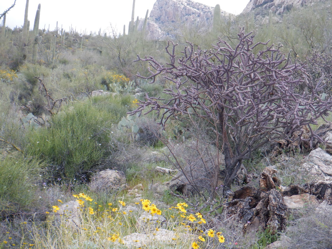 Flowers are abundant as I walked around the Linda Vista Loop on a 2.5 mile trek. Then, warmth returned so I.... 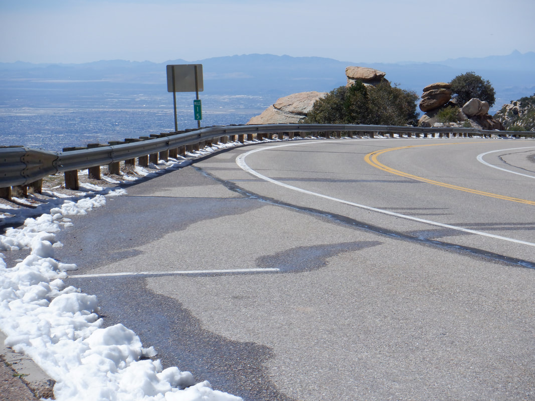 Drove up Mount Lemmon to see where the snow level was as I was planning to ride the dirt road up Mount Hopkins the following day. So, at 6500' the snow began. Too low as the dirt would be mud so I'll give it a couple of days. 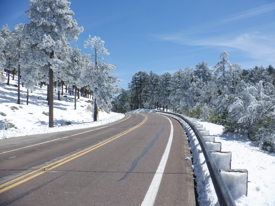 Just above the Pallisades gift shop where the road finally bends downward, I stopped. Beautiful setting. At lower elevations, water is cascading down the rock faces. With a high of 50 degrees for this elevation (around 9000') the snow won't last long. I plan to ride up this on Sunday but.... 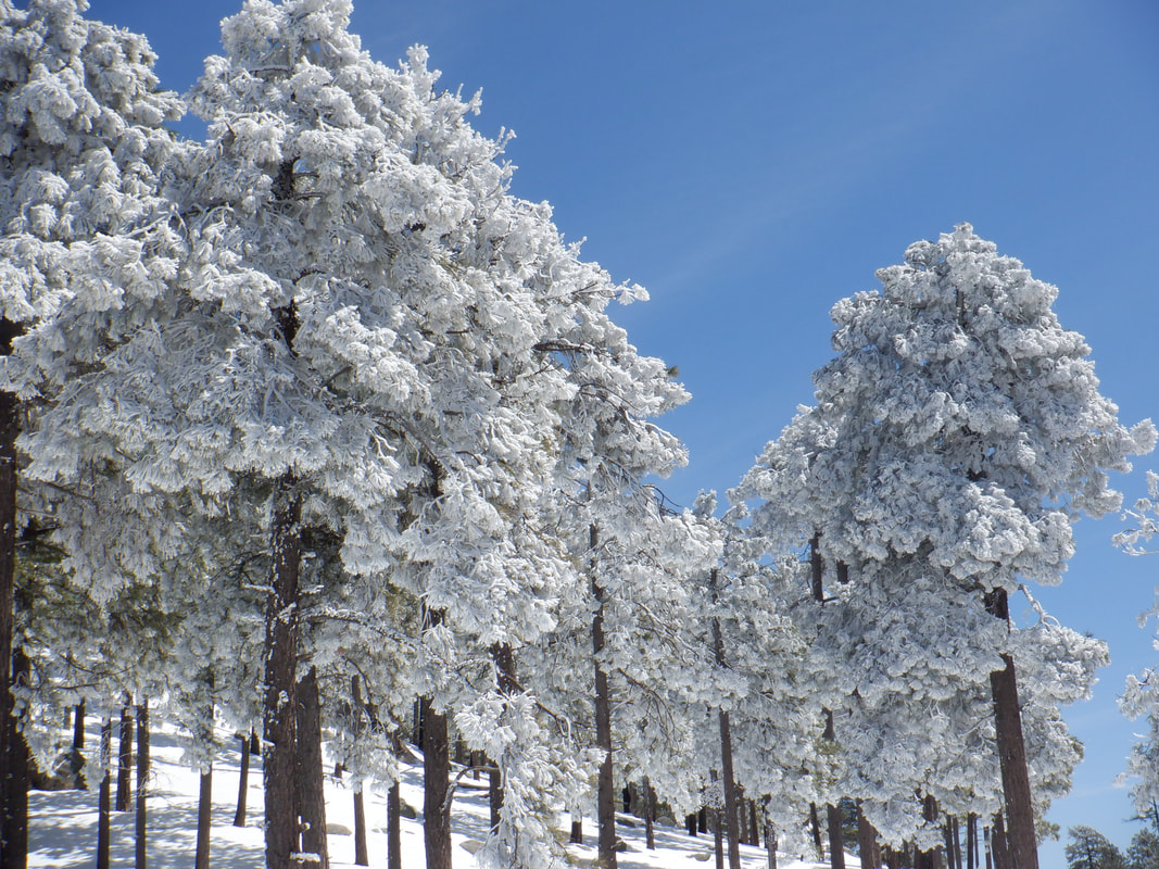 ….need to confirm if I can get water in the village of Summerhaven. Unsure of the store openings/access. Well, while it was beautiful, it was good to be, 30 minutes later, back in the valley with temps in the 70's. Hopped on my bike and got in a 52 mile ride.
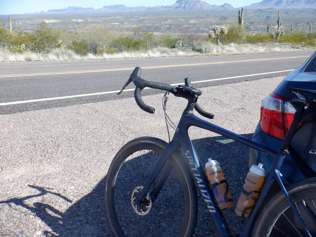
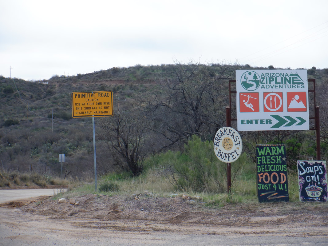 Thinking about riding the Mount Lemmon Gravel Grinder race in October so better check the routes. First up, the 40 mile option. I park along Mount Lemmon Road, just above the town of Oracle. After a few miles, I reach the AZ Zipline business and the end of the pavement. By the way, event info can be found here: https://www.mtlemmongravelgrinder.com/ 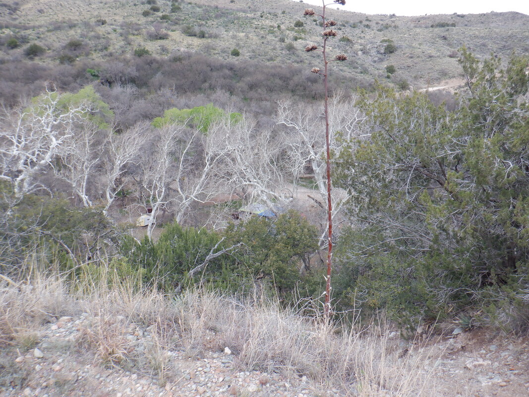 The dirt road is in good shape as I dip down and around Peppersauce Campground, nestled beneath the trees. Some where around here is the Peppersauce cave. 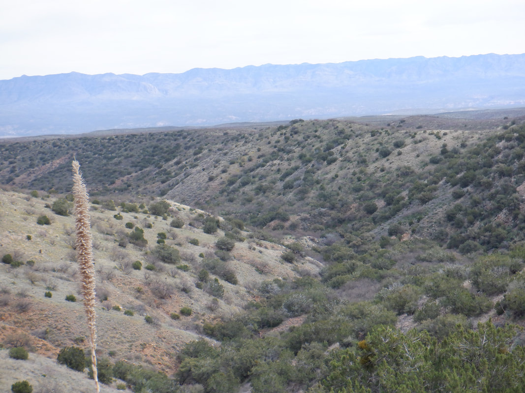 Good views of the Galiuro Mountains. Some where along that ridge is Bassett Peak. One heck of a hike to that beast. Only done it once and should do it again. 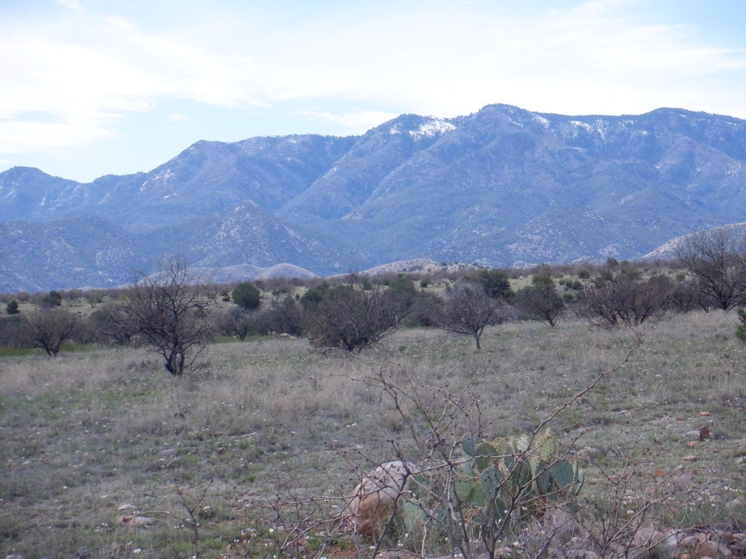 Hey, there is Mount Lemmon and the north facing slope of Ski Valley. Still some snow on a day after taking this pic they received another 12". 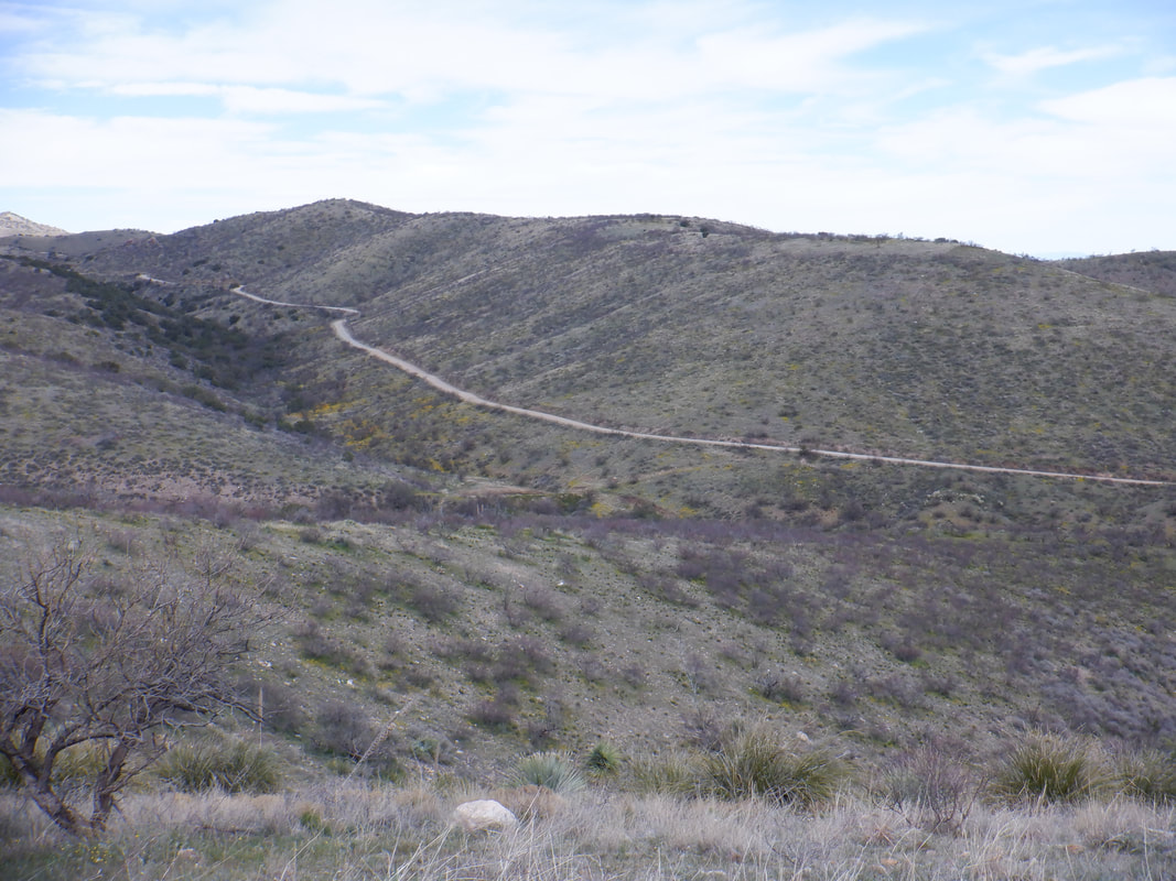 After the first 10 miles I've gained over 1000' but then there is a long descent. I'm passed by a couple of 4-wheelers but otherwise, no traffic. 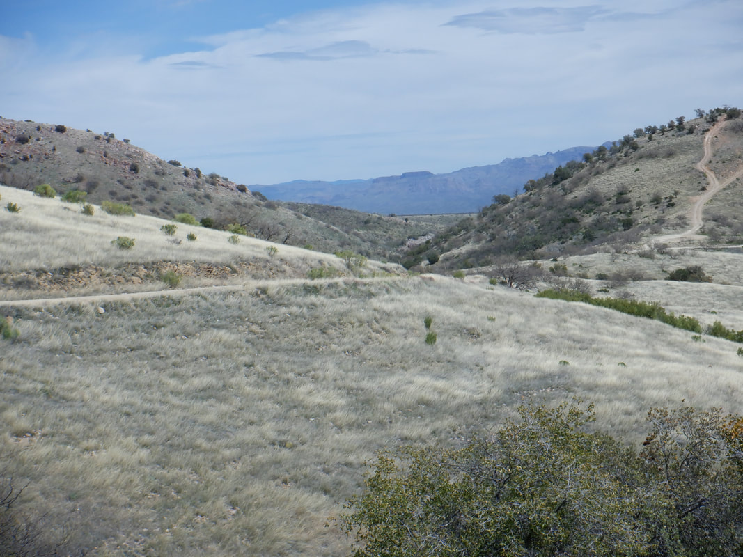 With all the rain, I'm surprised the grasses are so brown but the views continue to be good. 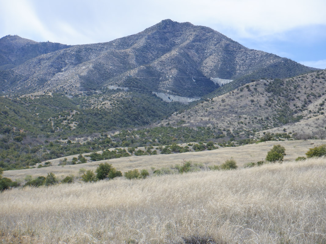 Those grey shapes are mine tailings. Used to be a lot of mining back in the day in these mountains. 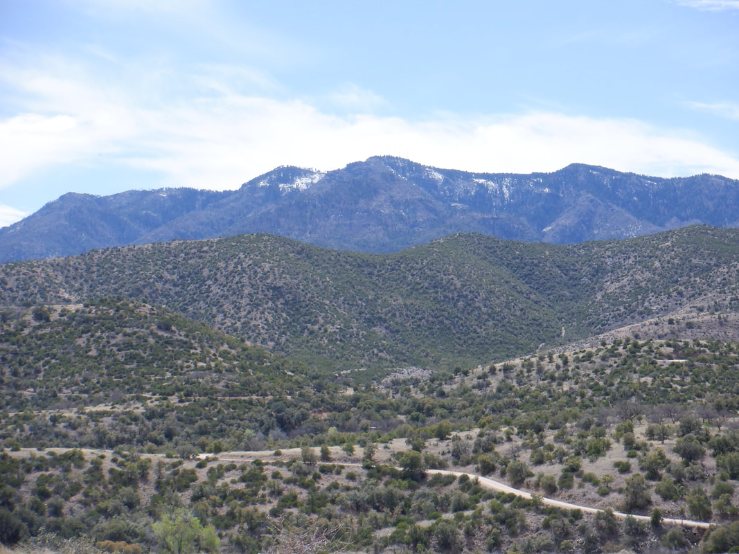 The road continues to wind around but always drawing nearer to Mount Lemmon. Rather than go all the way up, I am looking for Forest Road 4450 where I am to make a left turn. 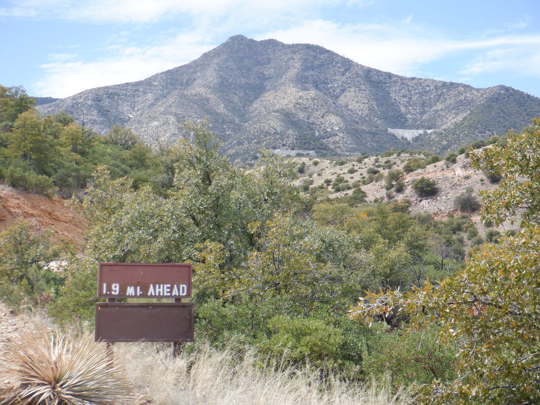 Reaching this sign, I find the road and hang a left. So far, the road condition has been very good for a dirt road but..... 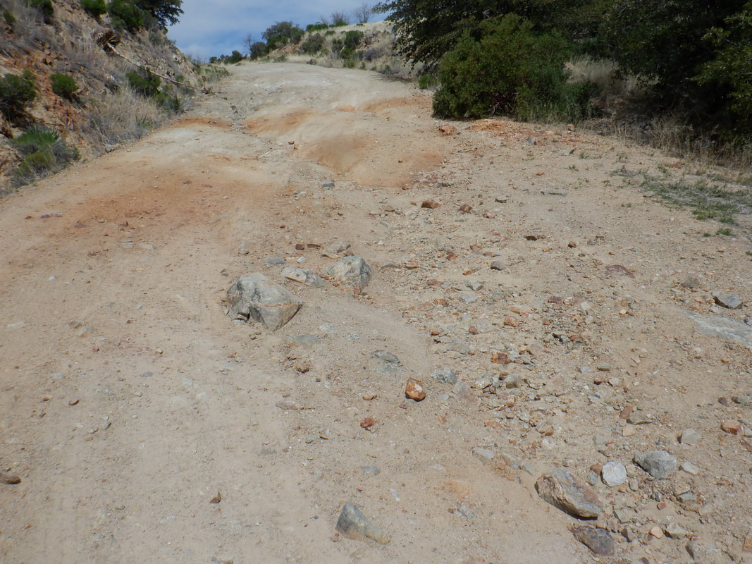 …..people ride gravel bikes down this? Actually, doesn't look bad from the image but it is worse in person. I had to walk the bike through here, remounted, coasted, got off to walk, over and over. Wherever the slope steepened, the road condition worsened. Too bad because it is a beautiful descent and to have to brake and walk so often, kind of sucked. Later, I viewed this down hill segment on Strava and I was tied for last place. lol. I finally reached pavement and..... 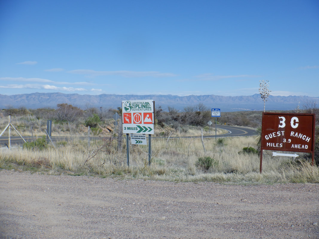 ….rode into the small town of San Manuel. I took a break there before climbing out of it via the 6 mile ascent of Webb Road. Finished with 40 miles and 3600' of climbing. Geesh, I don't have the skill set for that FS4450. Maybe in a few months.
 Rick Miller (right in the image below) and two friends drove to OK to participate in the Mid South 100. For those interested, you can make a double out of it by running a 50k route the day prior to the 100 mile gravel event. The woman, Wendy, standing to the right of Rick, did the double and won the combined female category. Below is Rick's story and a good one it is. 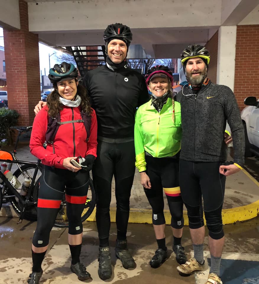 A small group of us returned to Stillwater, Ok to ride the Mid South 100 formerly known as the Land Run 100.
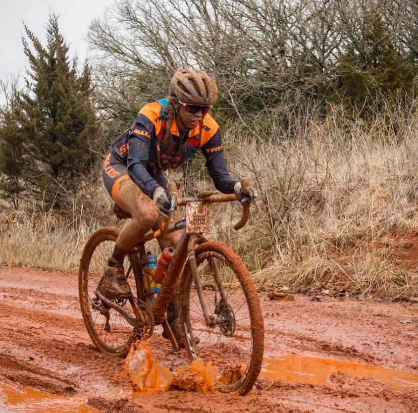
A couple cool notes about the weekend, I was told of a celeb that was going to be staying with us for the weekend, Selene Yeager aka fitchick, funny story how that all came about. You never know what the weather will hold and you have to be mentally prepared for what ever it is. We had premium weather my last 2 years, perfect dry conditions. This year things would be different, the exact opposite of what we have had in the past. This year it was a ride of attrition, the elements were not on the bikers side. The ride is supposed to start at 8am but it was postponed 1/2 an hour due to lighting. Starting temps were 42 ambient which feels 34, with and a cold rain. It had started raining the evening before. Just trying to set the stage for the journey that we were about to embark on. This year I made my way to into the starting corral staging about 2 rows back chatting with the likes of Matt Acker (he finished 8th overall on a single speed). I try to start towards the front, not that I am looking to rub shoulders and think I will be racing the front group but to add separation from the back pack and stay out of harms way. We rolled out of town with the rain coming down. There is no avoiding the tire spray in the tight group, the pavement ended and the gravel started, well the mud started.... once in the sludge, it was pretty funny to watch how quick the peloton splintered. Everyone’s face was quickly covered with the rust colored mud. I ride with my Garmin on the map, just so I am not paying attention to the numbers, just riding my bike and following the course, riding my ride. Maybe around mile 40ish my chain would not stay on the front chainring due to the small grit that filled the inner openings. It required jamming the chain onto the ring to clear the debris, a little water bottle clean and I was off and pedaling again. I won’t lie, I had thoughts of quitting, But I knew that I could not do that, as I had seen the carnage of fallen bikes as I trudged thru. My equipment had not let me down and I needed to see this thru. I was going to finish and see Bobby Wintle all jacked up by each rider coming across the finish line. About 4 miles out from the halfway point, I had a guy tell me this, which is not good when you know you have been riding for a while and thinking you should had been finished already. I made it to the pavement section right before the halfway town of Perkins and felt better about continuing. I reached the SAG stop where I quickly refilled my bottles and headed back out. I am a very consistent rider and normally can keep my pace all day, with out slowing much. Selene (fitchick) was getting ready to head out and asked her if she needed or wanted company. I told her I would try to stay with her, but earlier she had caught me at mile 15 and then had been to Perkins for about 25 minutes before I arrived. She knows people and had a bag of dry clothes to change into. We rolled out together, first hitting the free power washer to remove the first round of mud from the bikes. I guessed right, about 2 miles out of town, she rode off. I kept my pace and just kept moving. It’s always nice to know you are more than half way and on a count down to the finish. I got to the Oasis(Mile 80) and discovered Selene was there. I had half a beer, refilled my bottles one with water one with coke. I polished off a bag of BBQ chips and a coke. We set off and rode the last 24 miles, finishing together. For the people who do events, it’s always nice to have a conversation to make the miles go by quicker. Everyone in our group finished!!  At the base of Mount Lemmon, where Catalina Highway makes a 180 to the right is Hairpin Canyon. It is a fun mix of giant boulders, close in walls and a navigation dream.  Three if us head up canyon where we arrive at a "Y" and take the right fork. Soon..... 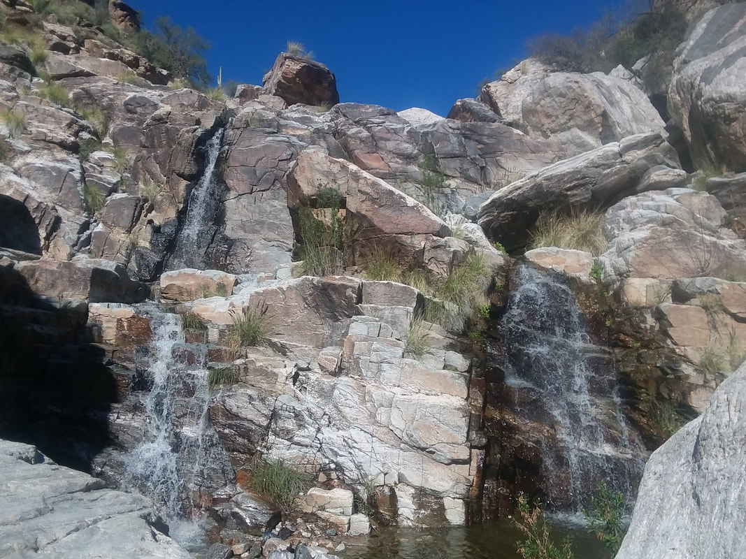 ….we encounter a couple of walls with water cascading down. One wall can be climbed on the left side, the other on the right. Some exposure and a fall would be bad but easily climbed. 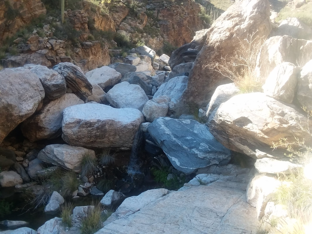 Wouldn't want to be in here when one of these giants let loose from high above. Through that jumble, there is a way as there almost always is in these canyons. We got a late start so after hiking for an hour and one mile, we..... 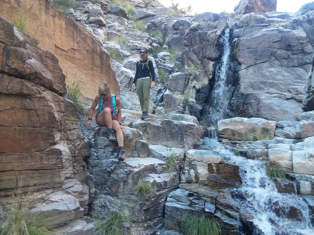 ….turned around and picked our way back down. The surrounding walls are popular for rock climbers so we were..... 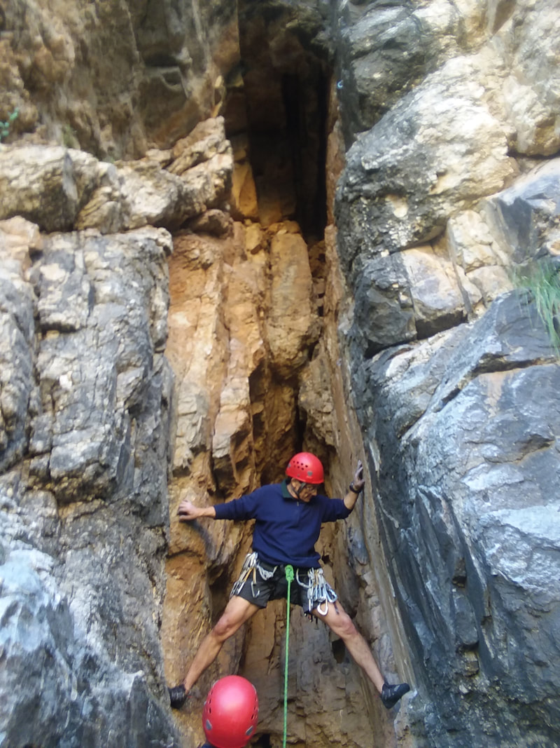 …..rarely out of sight of them. Great fun for a 2 mile hike.
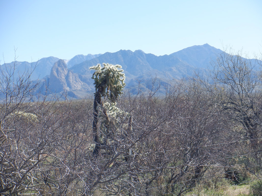
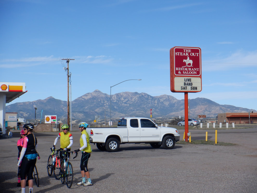 Twenty-one of us gather in Sonoita for a ride around Elgin, home to dozens of area wineries. After doing a loop of 24 miles, we would head southwest to Patagonia for a break prior to returning. 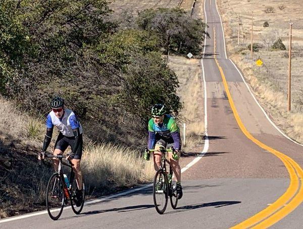 Hey, there I am on the left. I'm not in good cycling shape yet but it should come. Just keep riding, upping the miles and climbing. I'm going to take the gravel bike up the back side of Mount Lemmon in two days. There is a gravel race there in October and I want to check out the route. 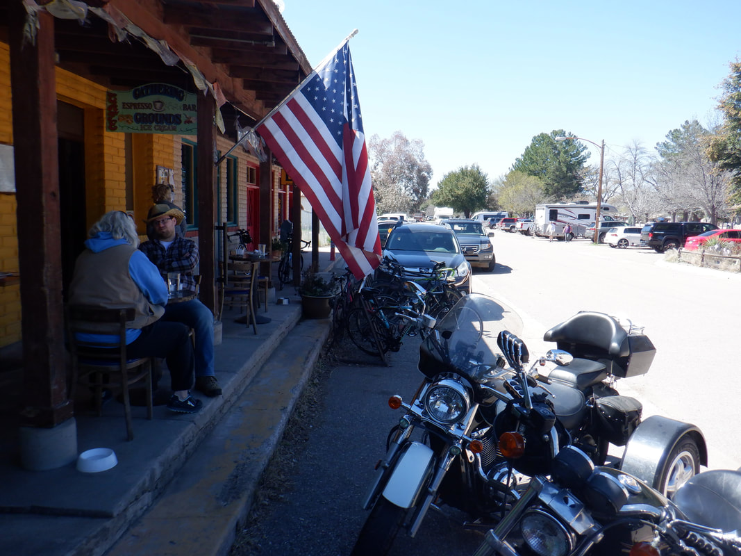 We arrived in Patagonia. Lots of cyclists and bikers have gathered. Lacking brass knuckles and chains, we don't pick any fights. Actually, this area is a combat zone between two rival motorcycle gains. I hear it's about the gun running and drug distribution. 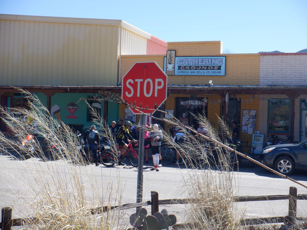 Note the bend of the plants. We had a pretty strong head wind going down hill into Patagonia so I was anxious to get going so we'd have a tail wind for the up hill return. Fortunately, the wind held and we finished with 50 miles and 1800' of climbing. Not yet done for the day, I led a couple of people up Hairpin Canyon. More on that to come.
 Three days of cloudy conditions with some rain, so weird. Anxious to ramp up the cycling miles and work on the climbing so I drove to the base of Kitt Peak. The hour by hour forecast indicated no rain until 2pm so plenty of time to ride the 12 mile climb. Well,,,,, 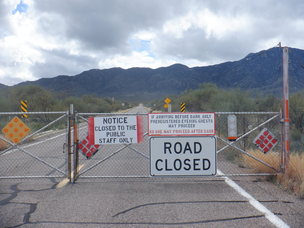 ….this was an unwelcome sight. I assumed this was a draconian step taken by the observatory. Geesh why not have a sign that states the observatory is closed to the public but allow cyclists and drivers to enjoy the 12 mile, fabulous ascent? 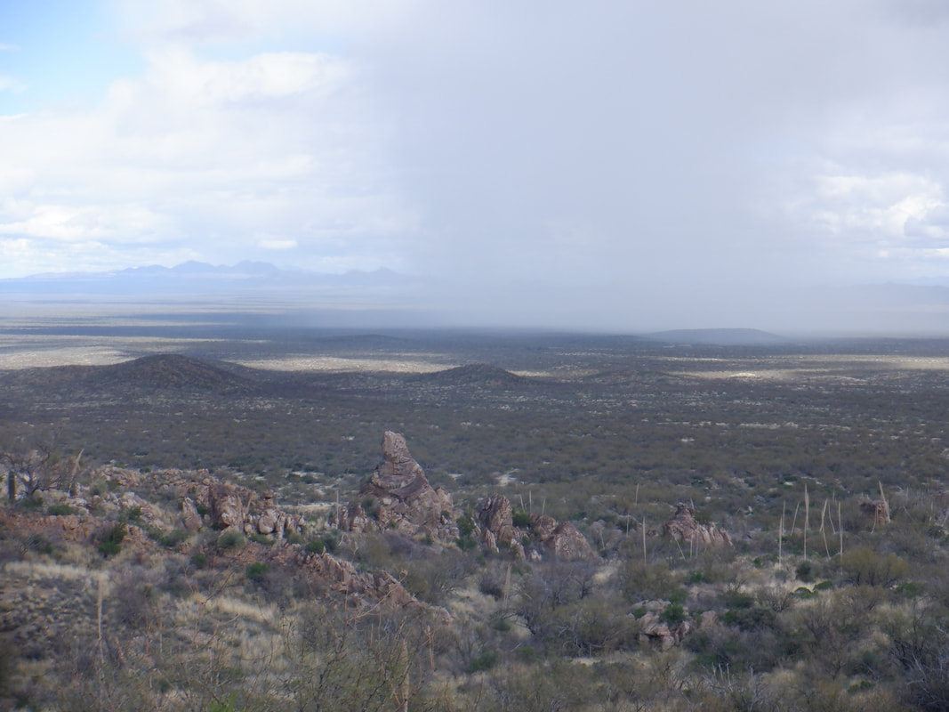 At mile 1, ok, yeah, I placed my bike over the gate and stepped through some barb wire off to the side of the gate, it began to rain, lightly. Above, you can see the rain cloud marching to the northeast. 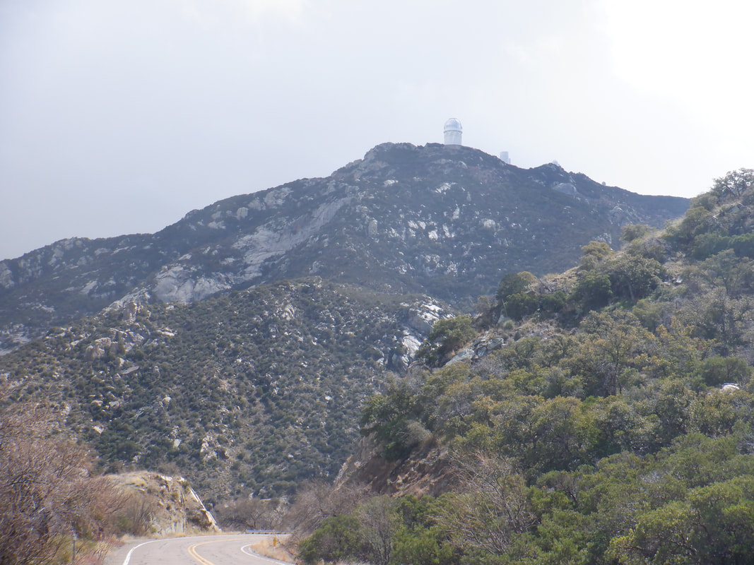 I got to mile 6, half way and a big gust of wind hit and then.... 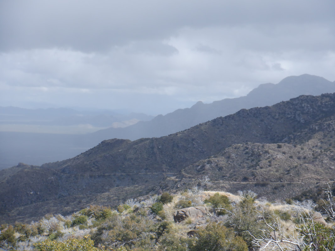 ...more rain. You can see the road winding around the mountain and in the distance, the rain burst again moving to the northeast. 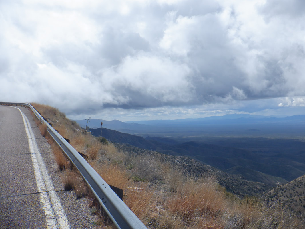 I reach about mile 9 and the clouds are not much higher than am I. I am now on the southwest side of the mountain so I can see what weather is rolling in and I I think I am good to go except..... 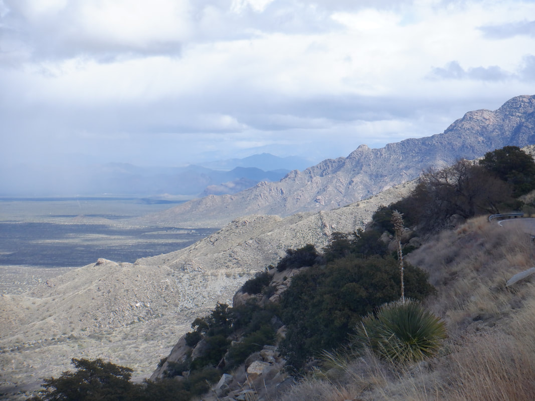 ….just then a van approached, flashing its lights at me so I stop and am told by a dour looking woman that the observatory is closed and I am to turn around. 2000'+ of climbing but only 9 miles. I sensed my midwestern charm would do no good with her so I turned around. Later I sent an email to the head of communications for the observatory and asked why this iconic climb would be denied to cyclists and drivers since they can close the road at the top. They apologized for the draconian step but it is what it is.
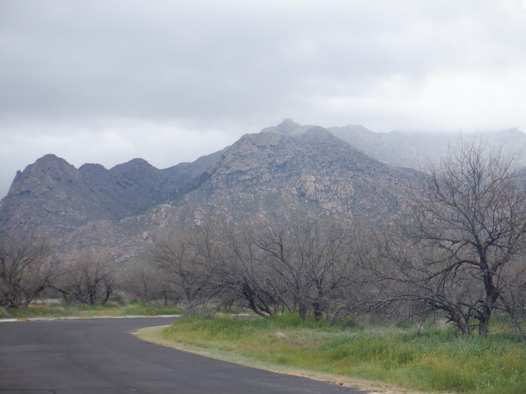
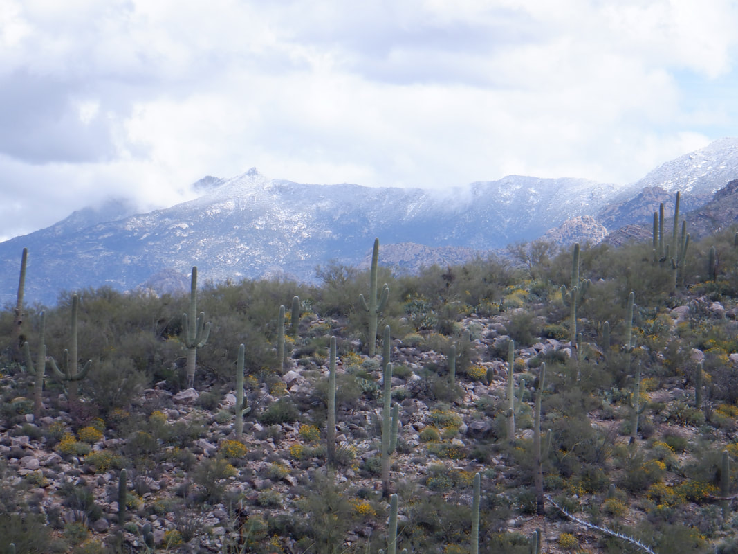
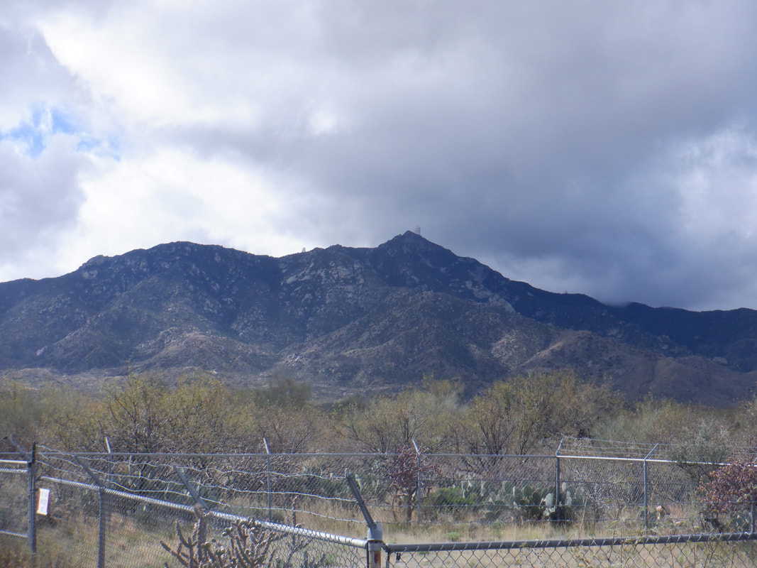
 Traffic to my simple blog has increased lately. I suspect it has something to do with the Coronavirus. Perhaps some of the sites you typically visit have become non stop discussion on the Wu-Flu but of course, that can't happen here. My hiking and cycling activities continue with a week on the coast of CA coming up real soon. Anyway, visited Catalina State Park where I have recently discovered a network of trails that are not on the Park's trail map. The trails lead to some very interesting places. 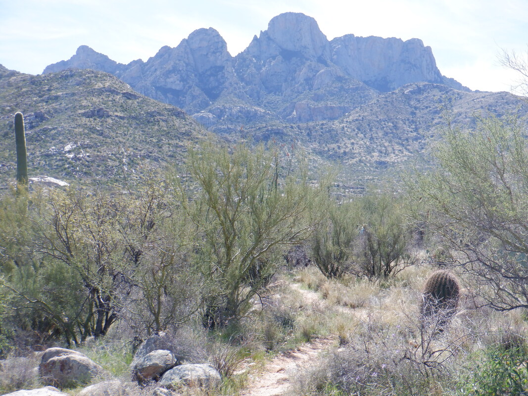 Two of us followed a trail that kind of paralleled Pusch Ridge while making steady progress toward the mountains. We ran into a guy coming the other way that described a route that ended at the base of Table Mountain, above in the center of the image. Oh that would make for a great hike simply to reach the base and look up at the granite wall. Not sure why that appeals to me as much as it does. Sounds like a 12 mile round trip hike. 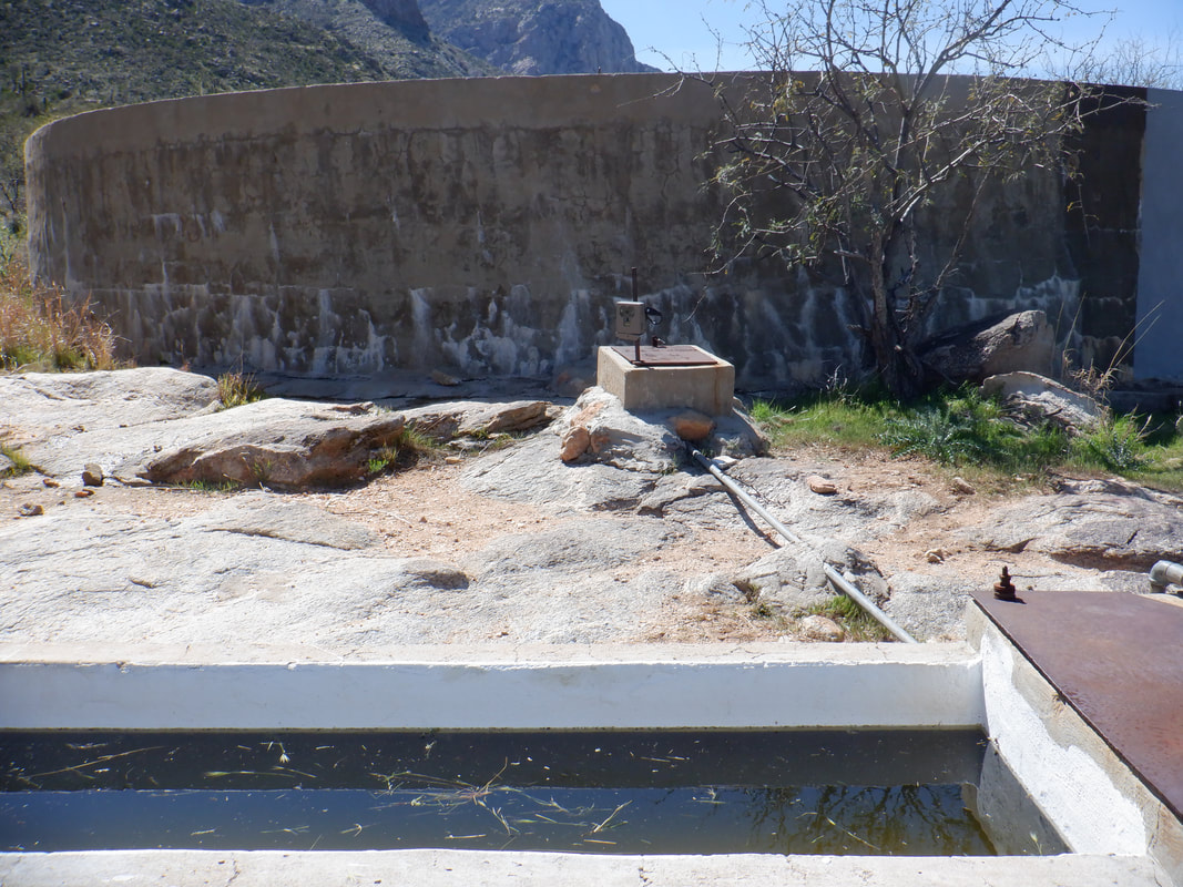 We were under supplied for that undertaking but kept going as the man told us about a huge water tank not too far ahead of us. How bout that!? There is a rectangular cement tank with water and a wild life camera and then an enormous.... 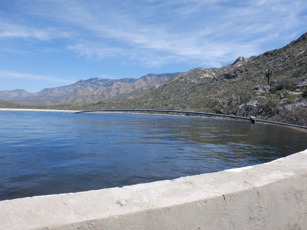 ….round tank filled to the brim. Water was entering it via a pipe and excess was flowing over the side, creating an oasis of green. It was a really neat place. We continued on the trail then hit a side trail marked by a cairn as described by the other hiker. 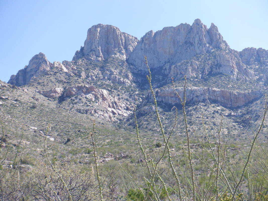 I've always wanted to visit that long, granite wall, above to the right. It is distinctive even from Oracle Road. I think I could make it there and do the Table Mountain wall in one hike. 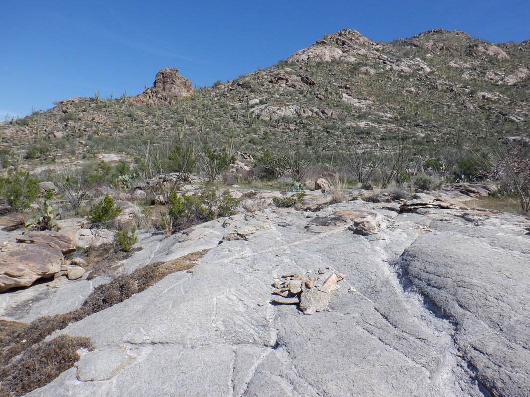 The hiker also described a tilted slab of granite that made for a great lounging area and sure enough we found it. This at mile 3.5ish where we sat, refueled and admired awesome views of the valley.
The weather has been rather strange. I've been coming here since 2011 and a March is predictable with sun all days but 1-2 and temps in the 70's and 80's. Ran into a couple from Belgium who visit here, every March, for 13 years. They've never experienced a March like this one. Rain was forecast for 4 days this week. Never seen more than two. It didn't rain all day but the threat was there and impacted my outdoor activity. My cycling is way behind schedule. I wanted to get out 5-6 days a week but it's been more like 2-3 times a week. Well, headed to Kitt Peak to ride up that today.  I slotted in with a beginner's hike because I just wanted something easier for today. A guy showed up for this 5.5 mile hike totally unprepared. Yep, that's all the water he chose to carry. No pack of any kind to carry other essentials, just a small water bottle. Just have to shake your head. 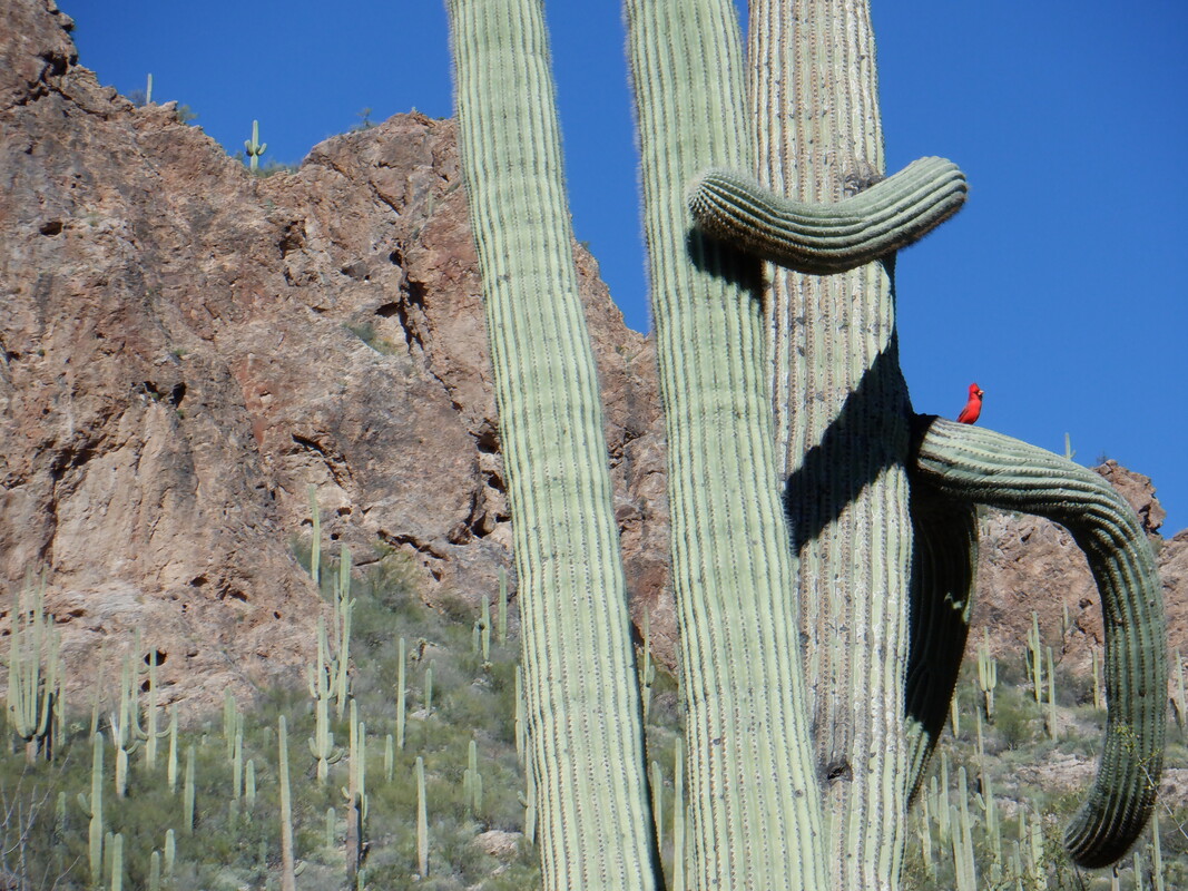 Early, we passed a Saguaro with a redbird standing on an arm. 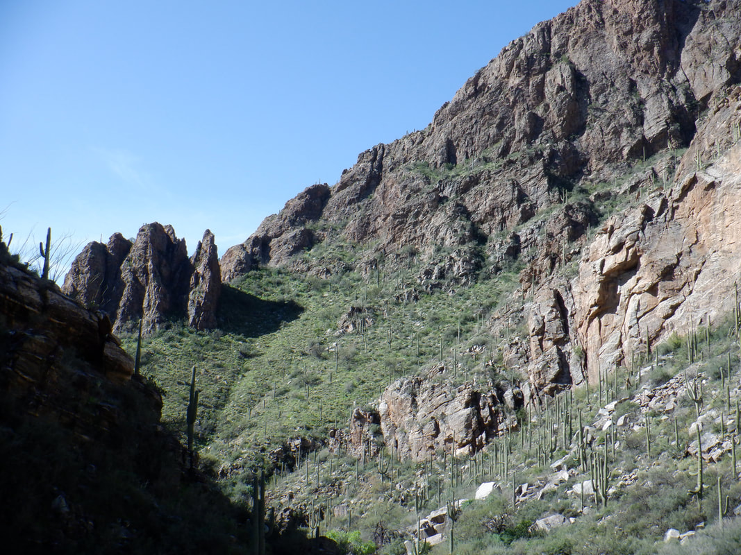 The trail to Maiden Falls is easy to follow and meanders through and along a ravine through Ventana Canyon as the sides have neat rock formations. The unprepared hiker was also really unfit (it was a beginner hike though) and fell far back so the group organizer volunteered to hang with him. 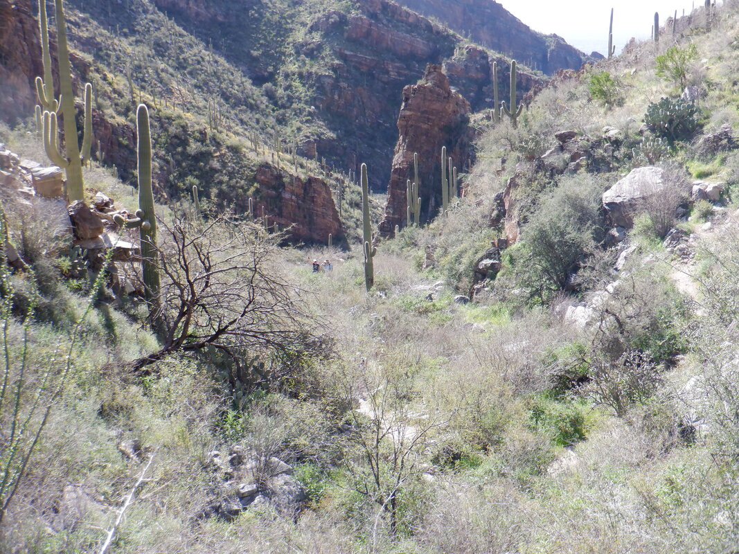 Since I've hiked this trail a few times on my way to the "Window", I said I'd keep the remaining hikers together to the falls. There is a fairly steepish ascent prior to.... 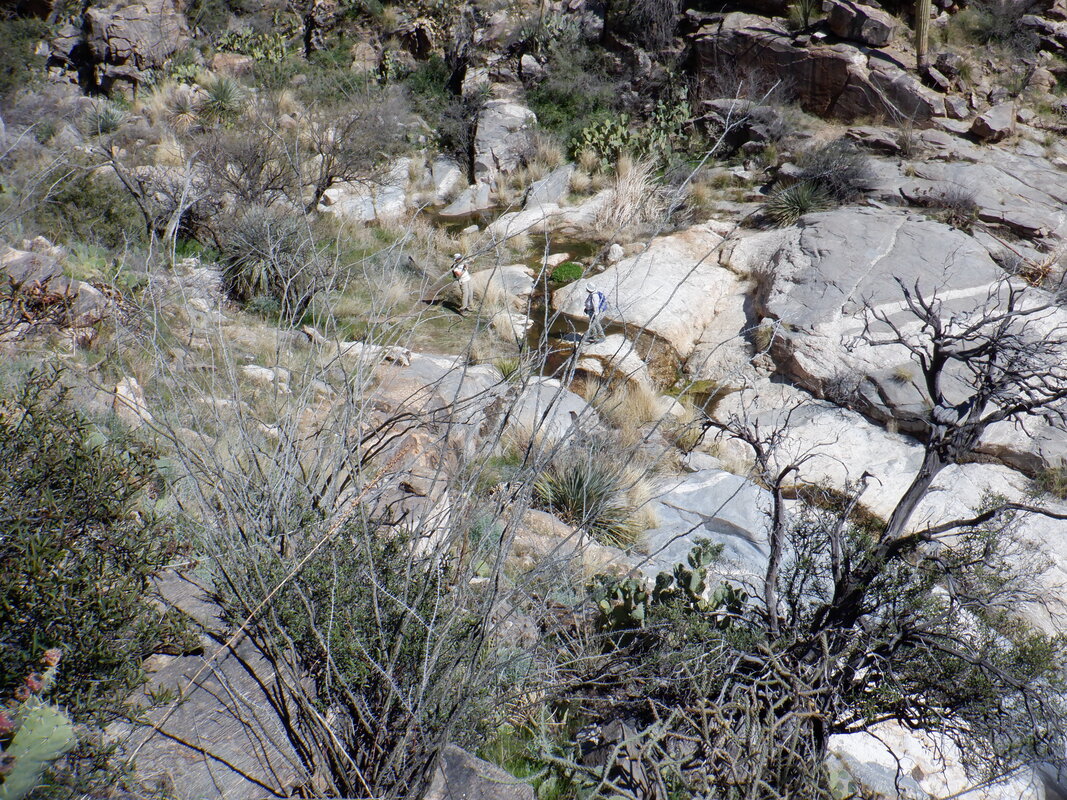 ….the trail dropping to a large swath of granite through which the stream flows. 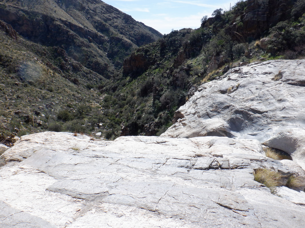 Beautiful spot. I walk to the edge and can see there is a way down to the canyon floor via a very steep slope. Probably should do it climbing up rather than down. Another day. 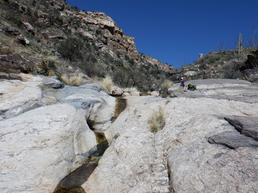 Four of us managed to make it to the stream and pools while others turned back. Too bad as it is a nice area to relax and enjoy the views. 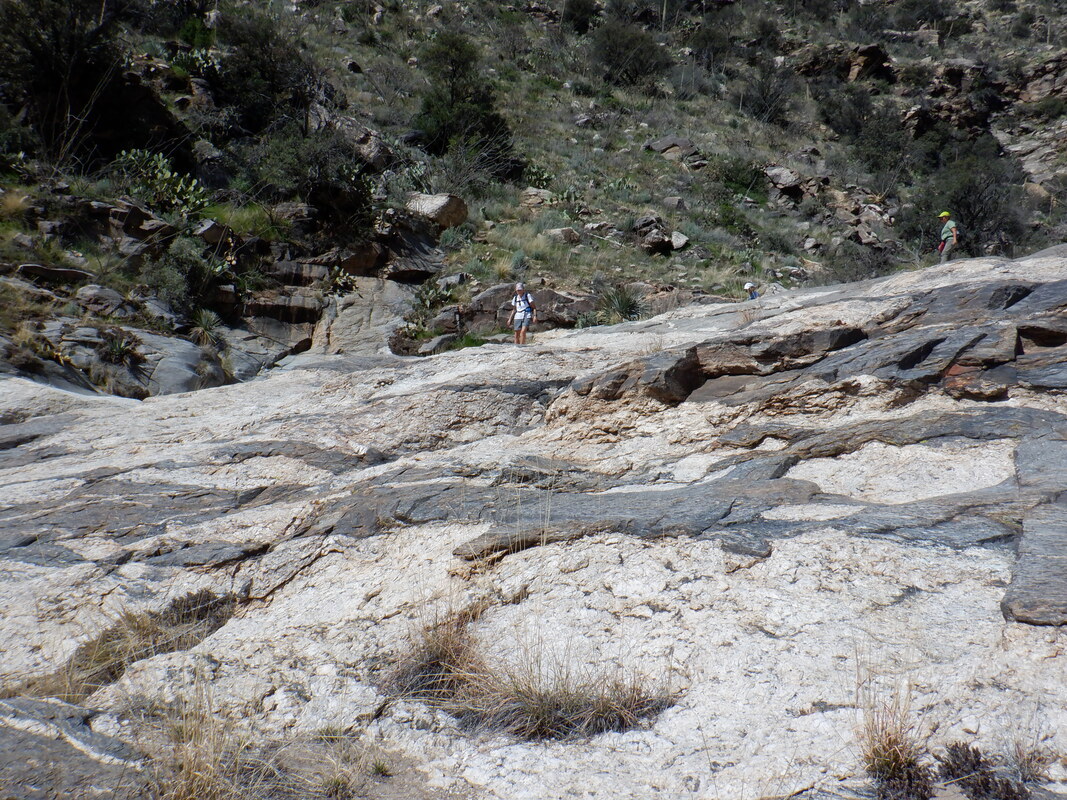 I had to get back so did not linger and took off, confident the others wouldn't have any issue with route finding. Finished with 5.5 miles and 1200' of climbing.
 I parked just off Frontage Road in a gravel parking area on Elephant Head Road. I got on the gravel bike and was soon on Mount Hopkins Road which has great views of Elephant Head on the left and of course, Mount Hopkins on the right where a tiny white dot is the observatory. 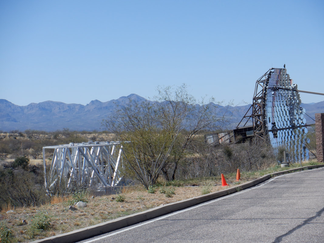 The first 8 miles is on good pavement, all the way to the Whipple Observatory visitor center. The average grade of this portion of the ride is only 3%. Then things become decidedly more difficult for the remaining 8 miles. 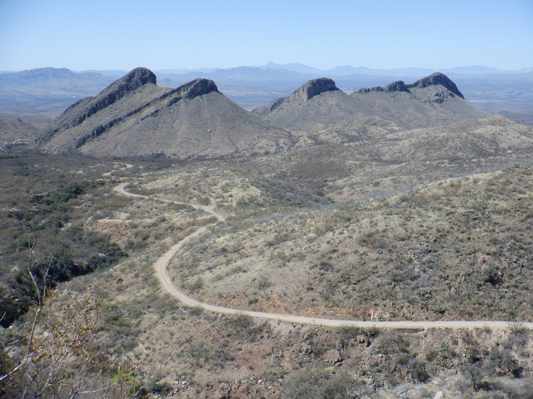 The road becomes dirt for a short section, then rough pavement for about a mile, then back to dirt. This 8 mile section will have an average grade of 7%. Compare that to Lemmon at 5% and Kitt Peak at 5.5%. 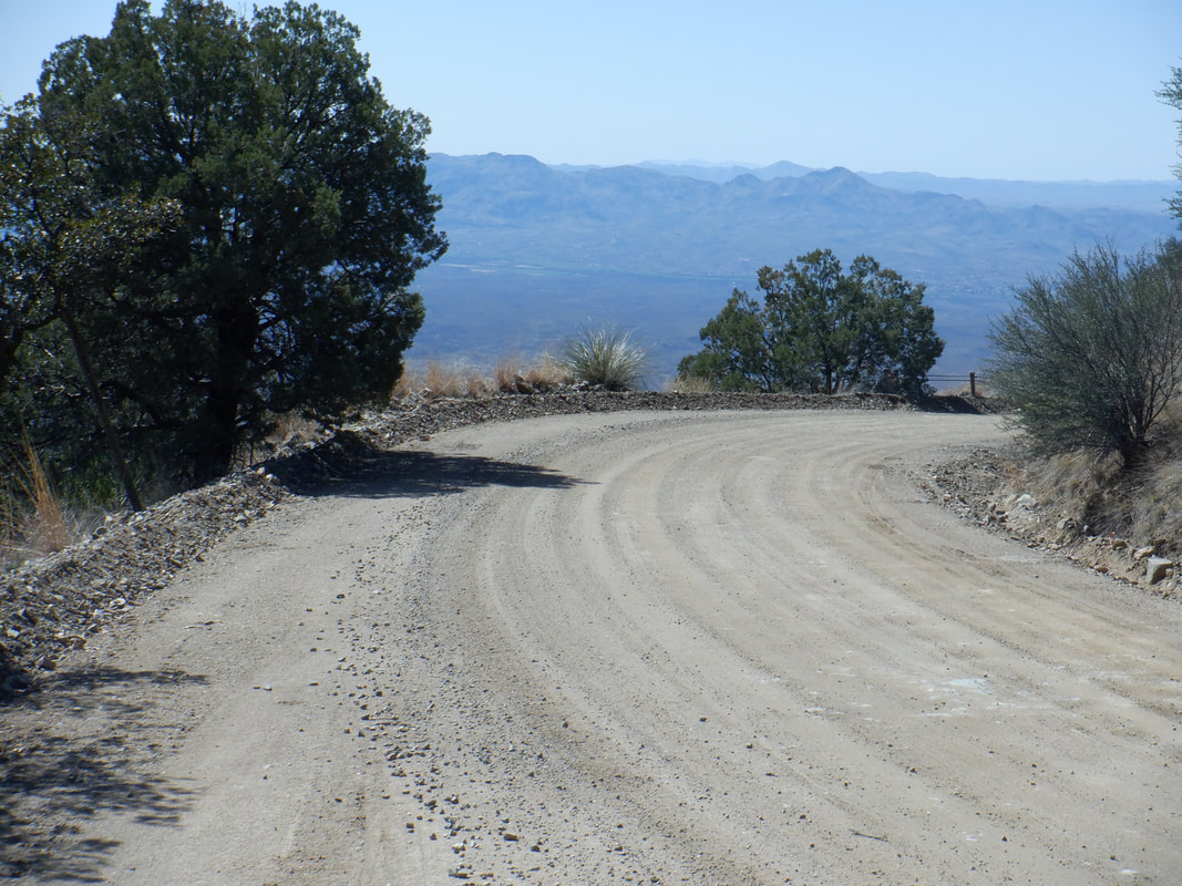 The higher I ascend, the better are the views. Note how well conditioned is the road. Being a newbie gravel rider, it doesn't take much to spook me but the conditions were great. 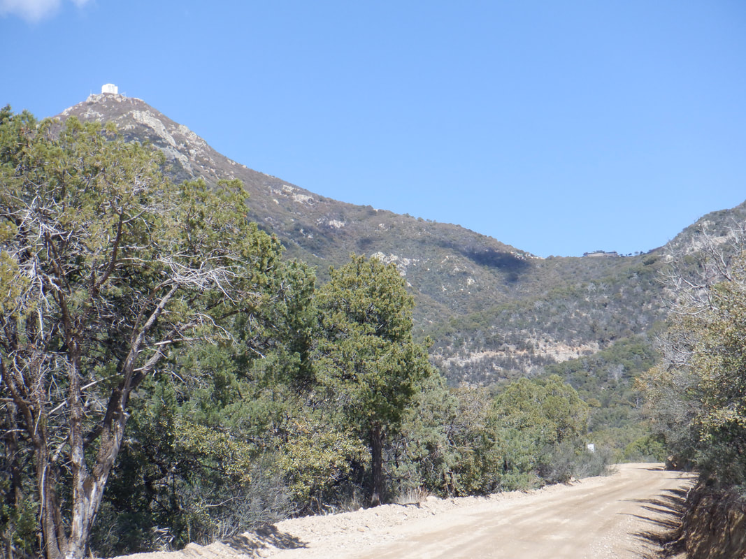 The observatory is of course now, not so distant. Unfortunately, three miles from the peak is a gate. On previous hikes, I emerged on Mount Hopkins Road above the gate and walked to the peak, unaware that there is a sign forbidding entrance. I got on the observatory web site and it states there too that cyclists and hikers are not to go beyond the gate. 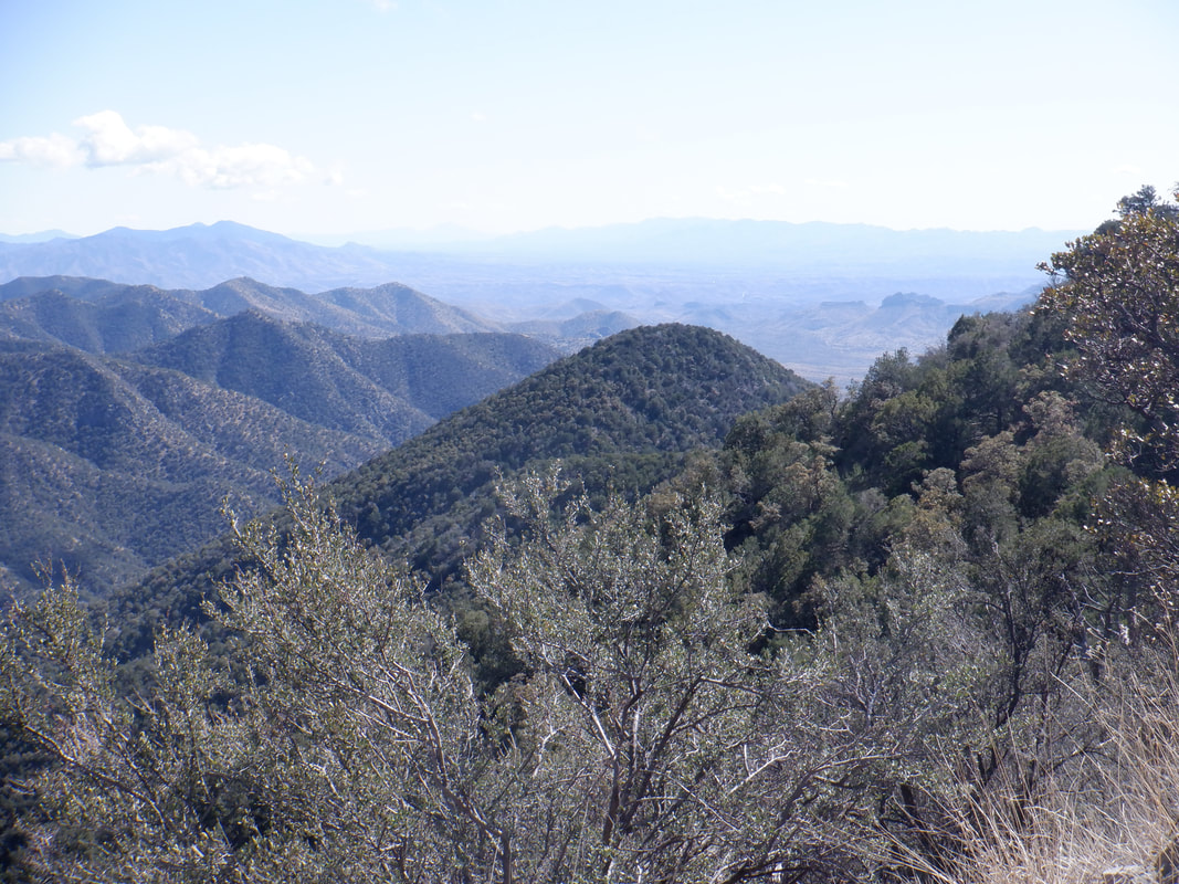 More great views. 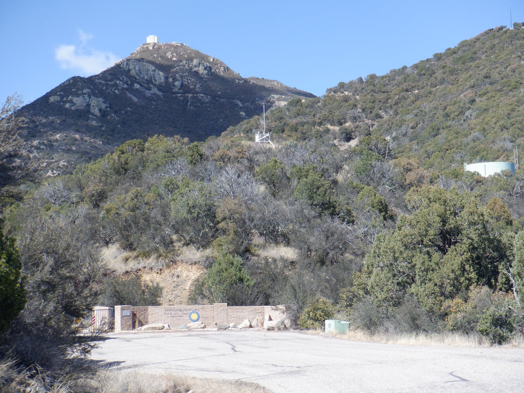 I reach the gate. I'm on an AZ gravel Facebook page and a lively discussion was started about this. People have gone around the gate and summitted, others have been escorted out. Apparently, a road repair excuse keeps the road off limits but that has been for a very long time. It's public land so I think a stink is being made to change. Well, you know how I sometimes post....  ….my Strava results when I set a record time on some hiking climb. To be fair, the above was the less than stellar result of today's climb. This being my first big climb on a bike in almost a year and having to rest my legs about 5 times, I'm confident I'll knock off 30 minutes on my next effort and zoom up the rankings. 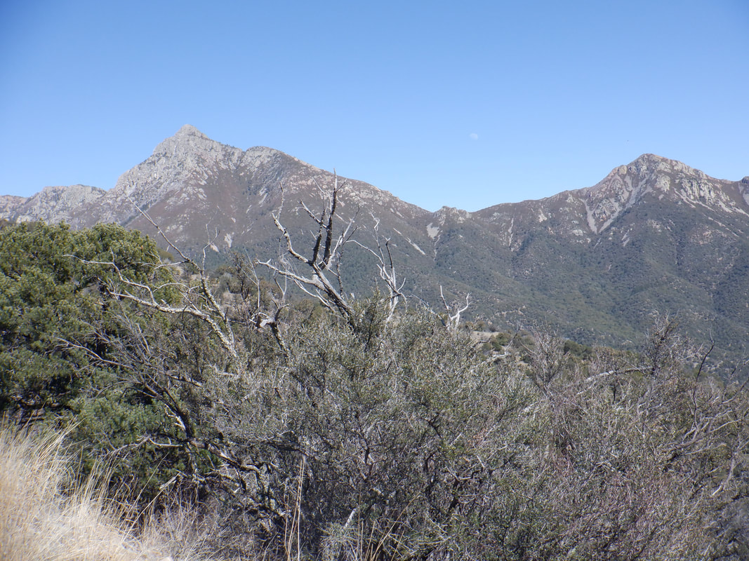 Hey! There is Mount Wrightson on the left. Look closely and to the left of the peak is the moon. What a view.  In the distance are the snow capped Catalinas and Mount Lemmon. On this day with a high in the low 70's, there would be dozens of cyclists going up that but on this road, I saw one cyclist and 3 vehicles.  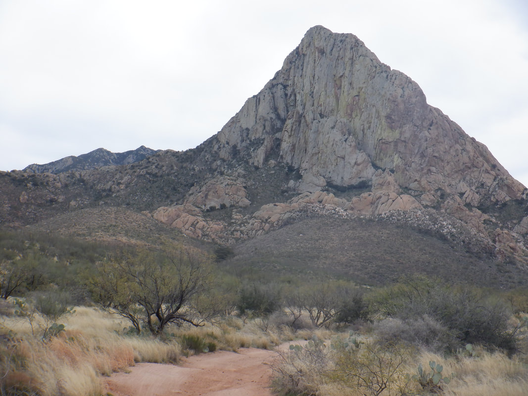 A group was to ascend Elephant Head via from the south on an easy to follow trail and I let them know I'd meet then at the saddle (shown on the left of the "head") to show them how to ascend the neck, which is tricky in spots. I wanted the challenge of climbing from the northwest a rarely done route.  No trail, no cairns just a gps track on my cell phone. I was unable to get my car to the trail head so had to park 2 miles away so that was an unplanned add-on. Following an easy walk on a dirt road, I plunge into the wilderness. I mostly skirt a very thick grove of ocotillos.  While I have the gps track to follow, there really is no reason to obsess about following it exactly. It just represents how one person decided to go, using the same clues I see before me. Looking back I see I needlessly climbed a ridge (doesn't look like much from this vantage point but it was) and would have been better off circling around it by staying in a wash. 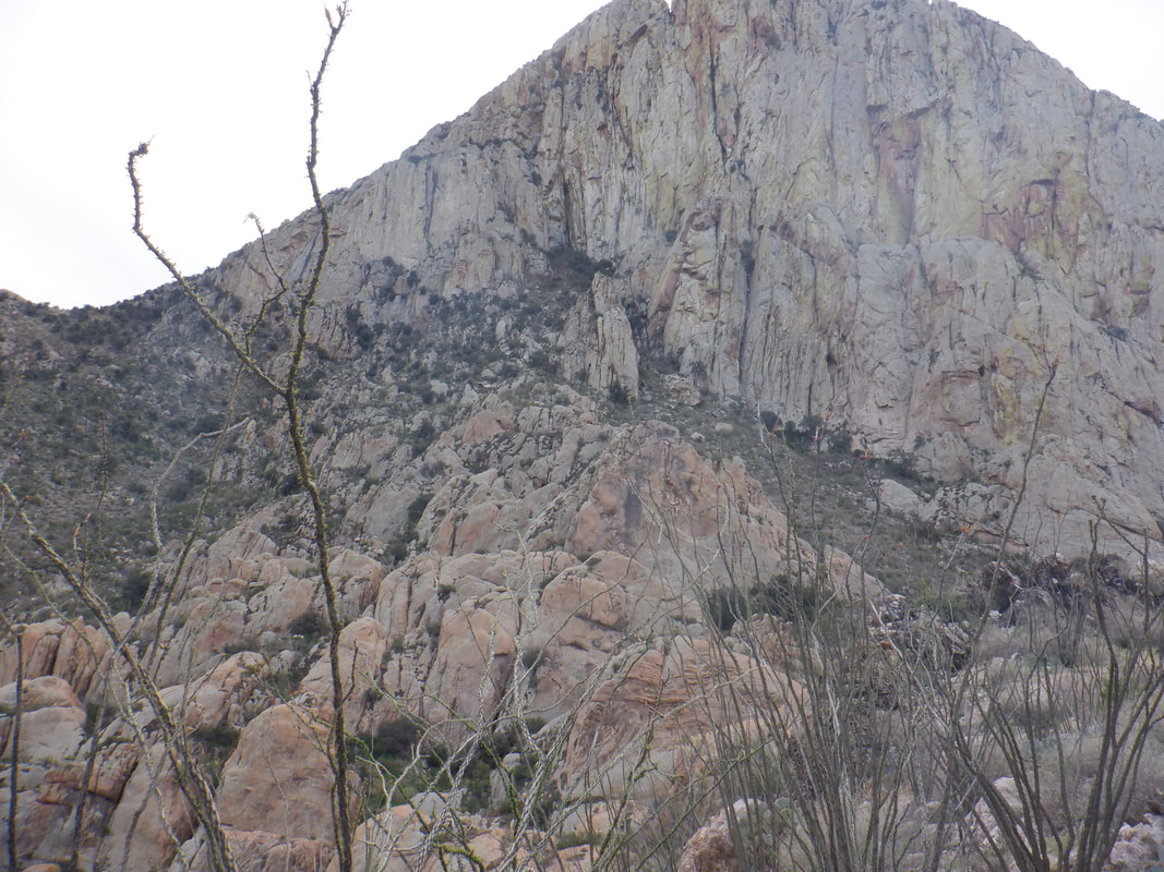 Maybe I should have looked more often at that gps track after all. ha, ha. I look at the base of the Head and it actually looks like I could reach it and then climb toward the saddle where I would meet the group. But, from a distance, sure it looks doable but once in there, who knows what obstacles I would encounter. 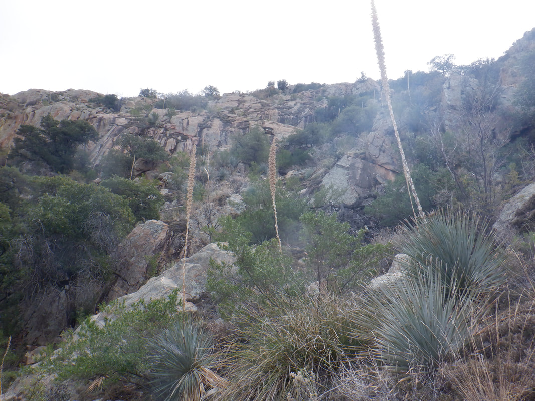 I slowly work my way through a hodge podge of plants, walls, drop offs, etc... I check my watch...ugh. The extra 2 mile hike from my car and the slow route finding....not good. I began to doubt I'd arrive at the ridge before the group. 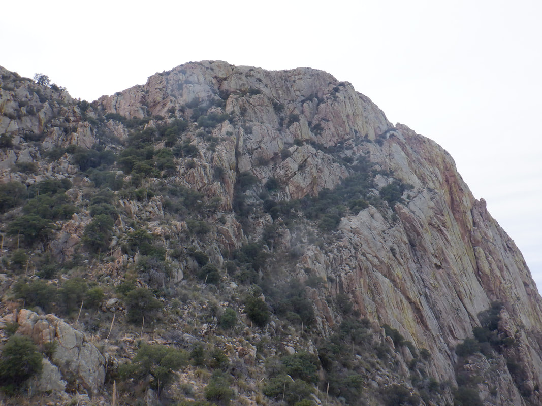 From on high, I hear and can see hikers close to the summit as I pause and..... 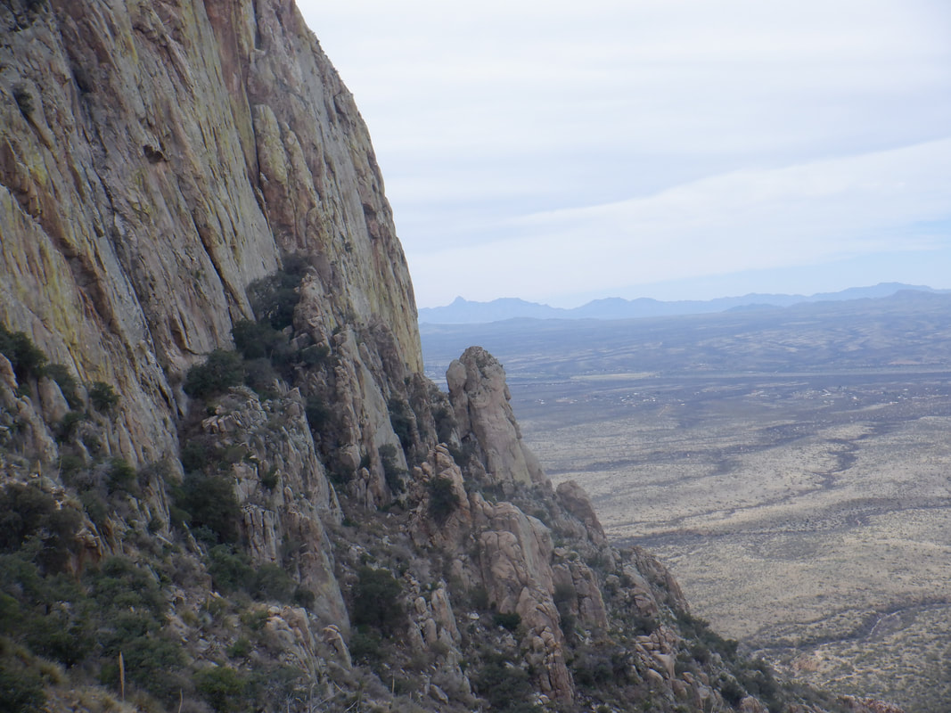 ….marvel at the view. That rock climbing dude who free solos walls would make quick work of this while I continue my slog. It was a little unnerving to smell the distinct odor thrown off my javelinas. Plus, while I was down climbing the ridge I should not have climbed, I worked my way through a rock/cliffy area and rounding one building sized boulder there was a flat area with a bunch of large animal droppings below it. I admit I had a "WTF are you doing out here" thought and I was not carrying on this hike.  Oh, hey, there's the ridge showing the rock area I descended on the left with the wash I should have followed on the right. I made certain I'd get in that wash for the return. I reached another ridge and saw a final chute that looked like I could climb to the back of the elephant head. But, my cell phone battery was waning, upon reaching the neck of the elephant would I still be able to hook up with the group and if so, would I impose on anyone to drive me to my car after I followed them back to their trailhead? I was running late on time too so I.... 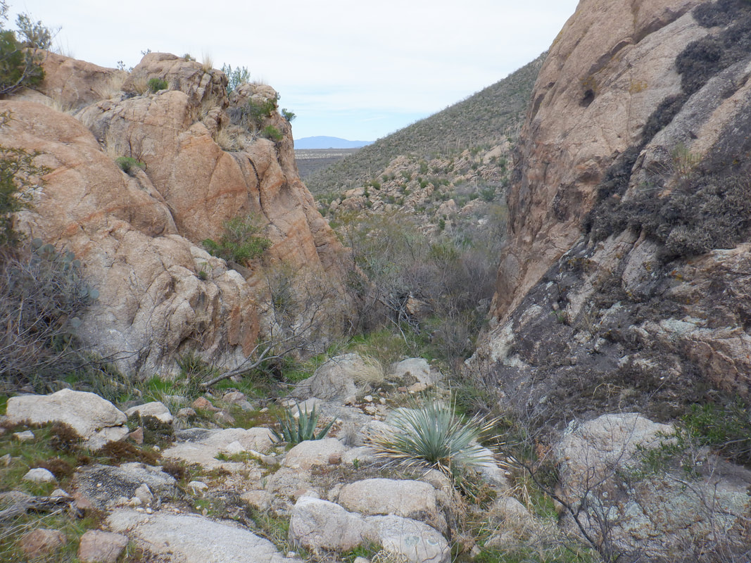 ….decided to live to hike another day and descended. I got into the wash and it proved to be a good choice although I did encounter not one but.....  ….two barbed wire fences. I climbed one and crawled under the other. Soon I.....  ….found the dirt road and returned to my car. I looked back many times. I hate giving up on a hike and not reaching a peak. This will bug me.  And yes, visual proof that it was that type of hike. The pointy plants flourish on the slopes below Elephant Head. Finished with 6.4 miles and 1800' of climbing.
 For a few years, I've made mental note of rides I would do if I acquired a gravel bike. Riding up the back side of Mount Lemmon, up Mount Hopkins, around Mount Lemmon via Redington Road so today, I..... 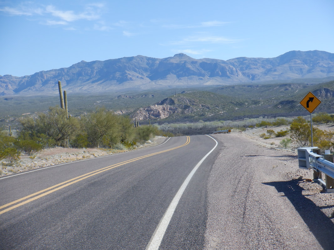 …..drove north through Oracle, down Webb Road to San Manuel and parked along the pavement. The Galiuro Mountains in the distance with the tree lined San Pedro River just above where the road disappears in the above image. 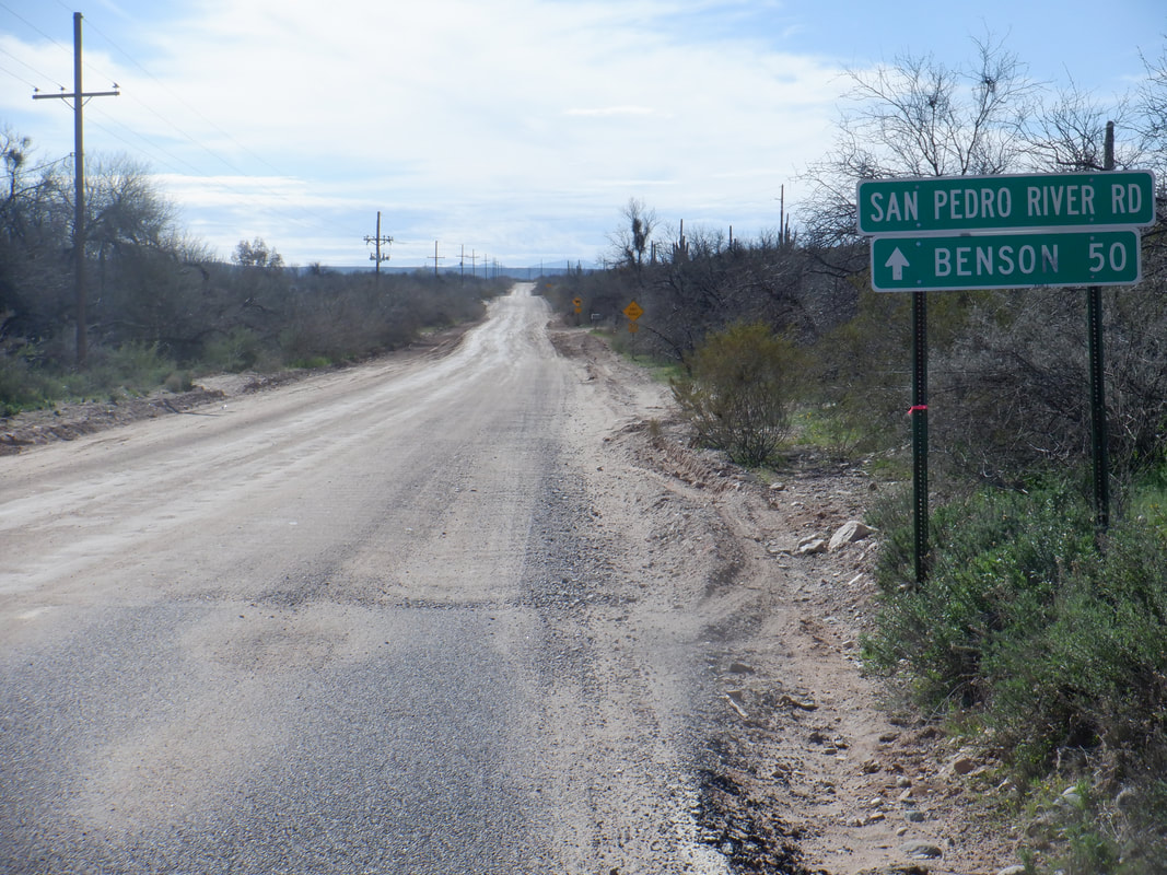 Surprisingly in this kind of remote area, the pavement is excellent until I reach the end of it at mile 6 of my ride. I see a coyote trot across the road just before I take the image. I'm not headed to Benson but instead I take San Pedro River Road until..... 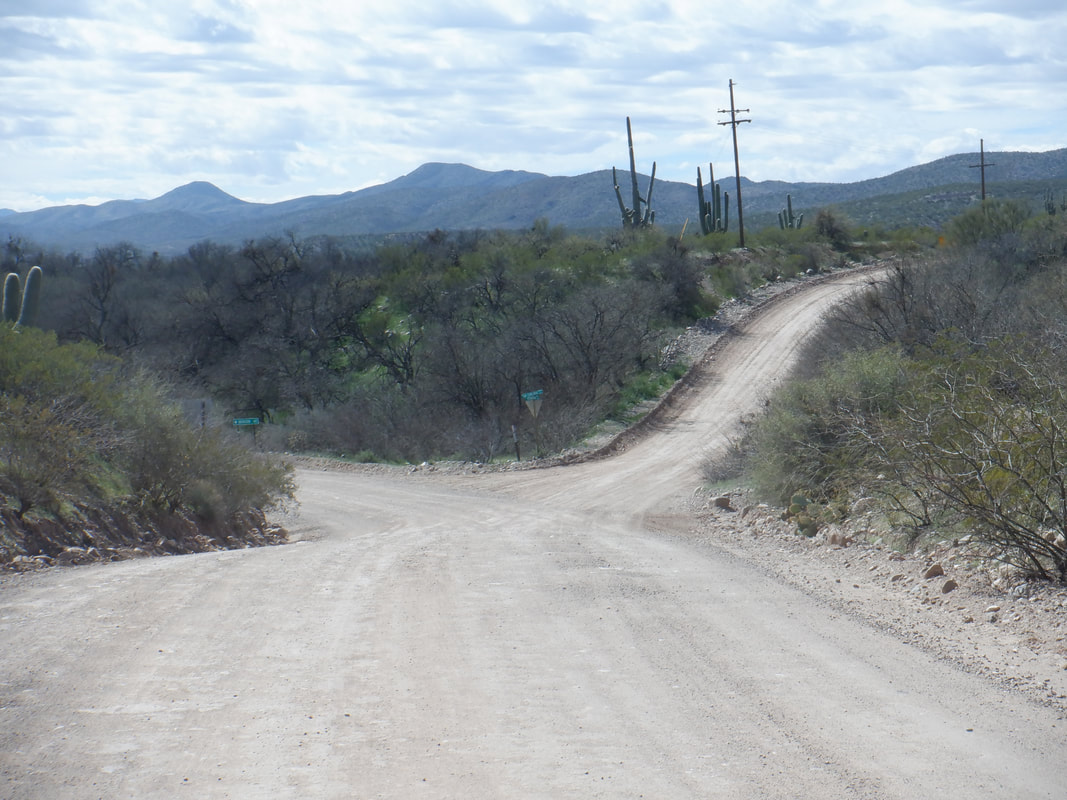 ….it goes to the southeast while I pick up Redington Road. The condition of the road is hard packed dirt with quite a few pot holes and wash boarding. It could use a good scraping but doubt a road grader gets out here very often. 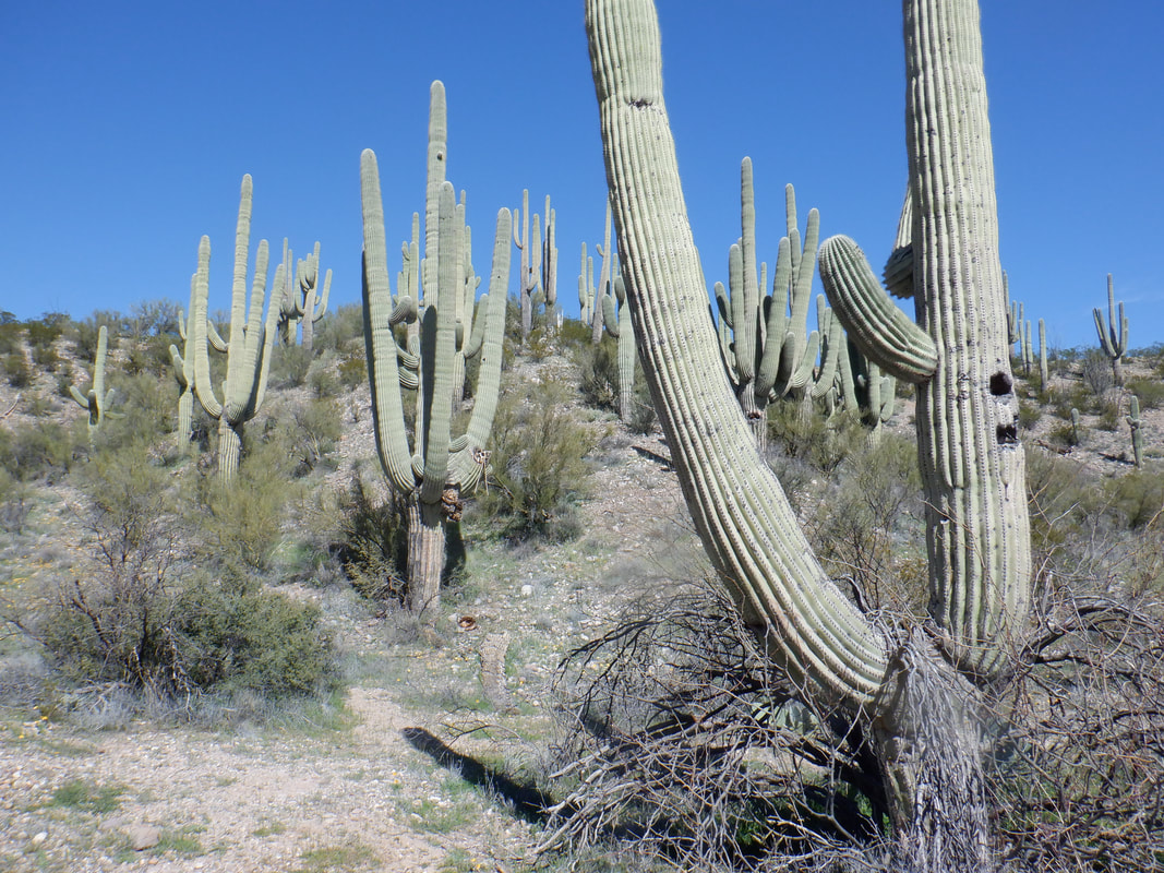 The saguaros are plentiful on the hill sides. I'm disappointed that the foot hills hide Mount Lemmon for much of the ride. Today I don't plan to go around the mountain, just a scouting mission as I build my cycling fitness. Today marks my 3rd consecutive day of riding either the gravel or road bike. 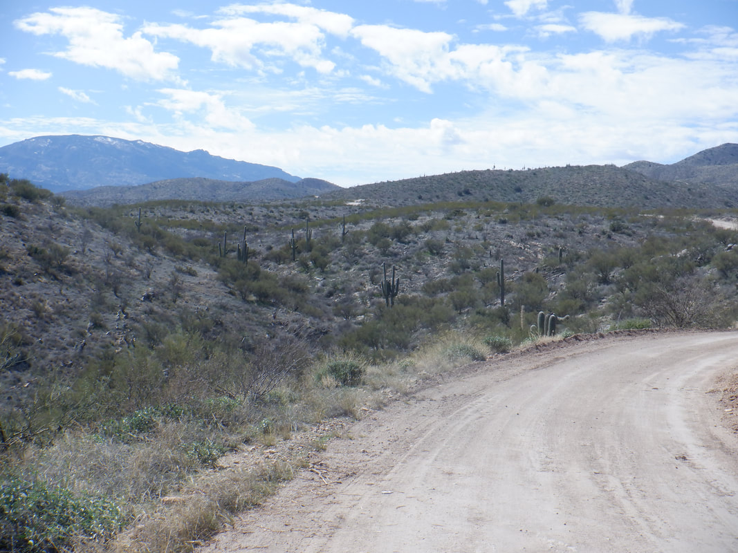 As the road rises toward Redington Pass, the conditions become much better and it is a relatively smooth ride. I've been passed by a couple of 4 wheelers and a truck or two but little traffic on this side of the mountain. From experience, I know on the other side, there is a lot of traffic. 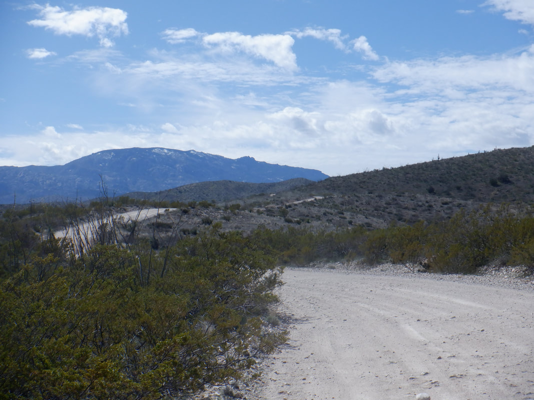 The Rincons rise above the horizon with some snow still present. I stop to chat with the only other cyclist I see during my ride. Damn! He is going up and around the mountain on a 125 mile epic. I asked to take his picture for my blog but he declined, stating he doesn't do the internet thing.  Odd how there are frequent signs stating I am on a dirt road. There is no mistaking it for a paved one. I was sorely tempted to drop down the other side of the mountain, into Tucson and then ride clockwise to Oro Valley but then I'd have to Uber it to my car in San Manuel. Completing the circle would be a 104 mile classic and I may do that eventually but at least I know the ride around about half the mountain can be done and will do that soon. So.....  ….I turn around and return to my car, finishing with 40 miles and 1700' of climbing. My average speed was 12.7mph. One thing I like about gravel riding is you can't interpret the average speed because the conditions are so varied. Lacking skill, I still had to push the bike a couple of times today over rocky sections that an experienced gravel rider would have flown through. Pushing really skews the average speed. Back to a day of hiking next.
|
