 I attended a class in college that covered poetry. My favorite was Frost's, "Stopping by Woods on a Snowy Evening". I think of that often when passing deep, woods. Here, returning from a group ride to Centerburg.  Hoover Reservoir again as I drive home from a 46 mile, group ride. I'm really enjoying the morning rides, to escape the hotter, evening rides. Plus, there are quite a few enjoyable guys with whom to ride. Several are "escapees" from the New Albany Tuesday & Thursday evening rides. I finished with an 18.1 average and that's kinda ok, for me.  Well, ok, got in with another group but then Jimmy L and Tony, both on E assisted bikes, got the better of me at mile 21 so I spit the bit. I know a couple of guys who don't enjoy when the e-bikers use the tech to push at speeds beyond what they otherwise could, but it doesn't bother me. Plus, I may enter the e-bike realm at some point.  Another odd road name. Previously I posted about "Old Maids Road" and here is another. Nothing perfect about this road but nothing imperfect either.  The corn!!! Tassels now showing although this is "field" corn rather than what you buy.  How bout that? Ran into Kinda Janet & Paul at McNamara Park as I readied for a ride. Have not seen my friends in too long so we chatted (they just returned from Italy) and promised to meet for dinner (which we subsequently did). Fun people.  Lot of sail boats this afternoon as I return from another group ride.
0 Comments
 Sorry for the delay in posting. It's been an enjoyable time, as always, in the great state of Ohio. I cross Hoover Reservoir on my way to McNamara Park where I join a morning group. ride. At roughly the half way point....  ....we stop at a market where we all chuckled about how letters were arranged on the back of this Toyota.  I continue to help the children, this time removing a stump. Have to carefully remove the surrounding dirt cause of the chain on the saw touches dirt, it dulls it instantly. A few cuts and than pounding at it with a maul and....  ...gone! I enjoy this work and am glad I can take care of these things.  Almost all of my rides now are group oriented but on a solo ride, I included Old Maids Lane on my itinerary. Would be interesting to know the history behind the name but yes, probably had something to do with older, single women.  What a contrast of colors as the hey waits to be baled. OK, that's it but I'll post more frequently, I promise!
 Yet another prominent road closed, this time Stone Quarry. I checked the bridge on Moots Run and it is still a long way from completion. Of course too is the roundabout being installed on New Burg, also going into Granville.  I drove to Lancaster, parked at Alley Park and followed a 51 mile route that included climbs up Revenge, Tarkiln, Snortin Ridge, Jack Run, 374, Stump Hollow and Beck roads Whoa, been a long time since I did climbs of this steepness and length. I was very apprehensive as I started.....  ....with Tarkiln the first climb. I nearing the top, saw a ramp, immediately thought, "I can't do that!", unclipped and pushed, lol. It was personally embarrassing and I have no idea why I'm sharing that here. Beck was next and ok, made it, then Snortin Ridge, ok, made that, eventually reaching Jack Run where, half way up, I had to unclip. I somehow managed to not fall over while unclipping and putting my plant foot down while moving 1mph. Anyway, enjoyed the ride and scenery.  My son asked me to fill in for his partner again. I was playing well, 2+ through 5 holes. My golf muscles have atrophied of course and while hitting a ball from the rough, I strained a muscle in my arm. Thereafter, it was painful to swing so I had to quit on hole #8. The good news is a day or two later I was fine.  We played at "The Links at Echo Springs" golf course. Nice layout and views. 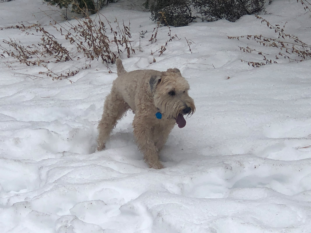 Back to the woods to continue the clearing project. I had someone offer to bring in a tractor and bush hog the woods but I want to be selective about what I remove. I'm having too much fun in here anyway.  This day was quite humid and so after working for 30 minutes, my shirt mostly soaked, I'd have to sit for 20 minutes to cool off. The briars get their revenge occasionally but they are losing, badly.
 The heat and humidity has deterred me from doing many of the evening rides so glad I have the option of getting out in the morning, while enjoying the OH scenery, including these amber waves of grain!  My son asked me to sub in for his partner who bailed on a Thursday evening so I agreed. I left my golf set in AZ so Brettt agreed to provide me with the necessities.  What a funny guy but this is the glove he loaned me. I played ok, not capable of good play having mostly abandoned the game many years ago. For me, at some point, I had an epiphany. After 4-5 hours of golf, I'd had no real exercise so that was that and focused much more on hiking and cycling.  The woods work continues. Love clearing the briars and honeysuckle bushes so turning this impenetrable wall into....  ...something much better.  Meantime, in AZ, Amy sent me this pic of a Colorado River Toad. They are enormous and if a dog licks one, it can become very sick. Also.... 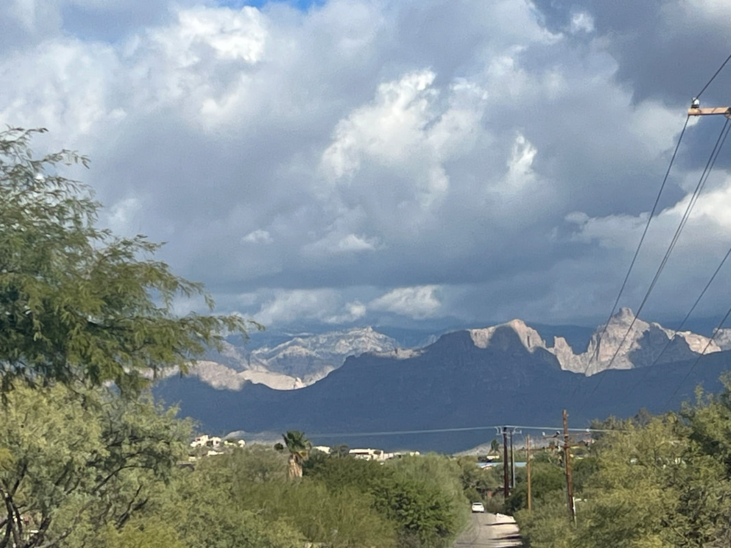 ....this was spotted on the pavement. I really like that I can plunge my hands into any bush or branch and not have to worry about rattlers, scorpions or Colorado River Toads. lol.
 I was late arriving so had no choice but to depart at 6pm but despite rushing to ready myself, had to take a pic of the above bike.  I realize that people had been departing since 5pm but still, so few people were there for a 6pm departure and most chose the short, 37 mile route. Dustin in red/black kit on the left, who I have not seen for many years. Randy L on the right in purple/white kit. I have to acknowledge that the 90 degree temp and high humidity probably dampened attendance but the scene was so muted compared to prior Solstice rides.  Ten of us left in an A/B group. That I survived the climb from Canal to Lithopolis was a surprise so that was good. It was a good group, all working together, taking turns at the front. The stronger cyclists kept their egos in check and we stayed together until the climb up Cedar Hill where we regrouped.  Beautiful scene. One of us had to get off his bike and rest in the shade. Standing there, no wind, we all sweated profusely so it was a relief to get going. We arrived in Amanda for a short break. Walking into the market and experiencing the contrast in temp and humidity was so welcome. I was feeling ok but thought it would probably be a good idea to take it easier on the return so mostly soloed back, finishing with the 37 miles and a 17.1 average. Very few people were in the parking lot but again, given the conditions, why would there be?
 And so....here it is, the famous Summer Solstice route out of Brewdog in Canal Winchester. Official start time is 6pm but given the distance and climbing, lot of people start at 5:45pm. I'm not as plugged in to the Reb camp as I once was so am unaware of start times that have ranged back as early as 5pm. Soooo, having an obligation to my vast audience, yes, I plan to attend and later, comment on the silly things that occur.
https://ridewithgps.com/routes/47159774?fbclid=IwZXh0bgNhZW0CMTAAAR3lKyCVdR9TOP4O76FL3oqzfHHjF4i9zIpMj3Sug1E0rQ8DHI3tslBmPb0_aem_ZmFrZWR1bW15MTZieXRlcw  ....in a town close, close away, there was and is, Canal Winchester. Two distinct groups of cyclists dominated their respective villages. The New Albanyites and the Canal Winchesters. The Canal boys were generally known as.....  ....the Rebs, led by not Robert E. Lee but Ric Noland, owner of the "Cyclist Connection". Ric's fiery personality inspired the cycling Rebs despite the fact....  ....Canal Winchester is a gritty, industrial town, much like Appalachian towns of the 1950's. Once the coal mines closed, most cyclists lost their jobs so having nothing to do but ride, they became fairly proficient with their bikes. Meantime, the New Albany Yankees, they too were jobless but not because they could not find a job, their inherited wealth, passed on over many generations, allowed them too to ride, a lot.  Being the pot stirrer that I am, back in the 2016 era, I helped create a rivalry. Which group in fact was the strongest???? I warned my fellow New Albanyers that were they to make that arduous drive to Reb territory, they better be ready for a culture shock.  I negotiated with Ric Noland to agree that weapons would be left at the houses of the Rebs so my northern friends would feel personally safe. Of course....  ,,,returning from the ride one could expect his car to look like the above so I encouraged carpooling in dump trucks or armored vehicles. Oh, the personalities that went south....  ....Luke Russell, otherwise known as the "Big Diesel" came along with Marty, Jon M....oh an endless list of star cyclists. The ride, about 51 miles with an ascent of the nasty Savage Road....  ....ended with a resounding win for the Yankees. So, all kidding aside, next Tuesday, is Canal's version of their Summer Solstice ride. The surviving Yankees and the new ones, should journey down and participate. I'll post the route soon.
 Gale Road is being repaved from St. Rt. 16 to Granview Rd. Many cyclists use this road as access to Granville, turning left on Granview off Gale. What is surprising is the pavement is already good with no potholes, just sealed cracks. Oh well, hooray for us.
 The year's first cutting of hay is occurring as I take a short spin around the hood.  I arrive in Canal Winchester to participate in the group ride. Hey! There's Paul Stock. I enjoyed catching up with him while about 50 of us.....  ....assembled in front of Brewdog. Unlike my visits to the New Albany group rides, I didn't recognize very many people. Kevin H, aka "Polish Pony" was there, Eric the former Dispatch photographer oh and Claude. Claude used to always ride with a banana in his jersey pocket and then disappeared from the group, maybe 10 years ago. He recently found himself getting fat so decided to ride again.  Oh, Ric Noland, owner of Cyclist Connection was there, giving the pre-ride announcements which included, the Summer Solstice ride will be on the 18th. If you've not previously ridden that route and ride, you owe it to yourself to do so. I'll find the route and post it as it includes going up Revenge Road.  It was kind of strange when Ric announced the "Long A" riders could leave and no one budged. Then "Mid A's" could go...no one. "Long B's" and a decent sized group departed. I went with the "Mid B's" and that turned out to be a mistake. Should have gone with the first group. The pace was slower than I expected but hey! My first group ride where I didn't get dropped. My average was only 17mph.  Ahhhh, life, working in the woods. Having fun, making progress on my project. I've been at it long enough now to realize I won't finish this year but that's ok. To reward myself for all my hard work.....  ....I headed to Brio, which is only about 10 minutes from me. I enjoy calamari but understand I should not eat it too often due to the fat content.
 While I miss, very much, the mountains of southern AZ, a decent stand-in our the many cloud formations that kinda remind me of the mountains.  On a beautiful Saturday morning I went out for a solo ride, passing many fields that were about to be cut and bailed.  An evening soccer game where we had the misfortune of watching while the sun was sitting opposite of us. Brutal viewing conditions and we had to remain on this side of the field as the other is reserved for the coaches and teams.  The saying, "knee high by the 4th of July" but of course, if corn is only that high in early July, it's not growing well. The corn is knee high now and growing rapidly.  I showed up for the title of this post and was surprised to see many former cycling mates there too! Jeff S, Jimmy L, Axel, Miek W & others. Ours was a good pace but having committed to do the Tuesday Canal group ride, I bugged out of the group at mile 12, to take it a little easier. I finished with 42 miles and will for sure make this ride part of my routine.
 I got out for the evening ride and hey! There is Craig R, aka, "Muscle Dude" out too. I had ridden earlier in the day....  .....which included passing over brand new pavement on Jug Street. However, my legs were not that sharp and abandoned the group about 10 miles in, soloing back to the parking lot.  Visited a grandson and we played soccer, basketball, golf and then, I was exhausted.  I enjoy helping my children with their yard projects so volunteered to weed around their back patio. That only took about an hour so....  ....headed to the woods to work. I saw some movement in the dead tree on the left and there was a family of raccoons having taken up residence in the hollow interior. Most days now are pleasant as the battle between the volatile spring and summer has finally been decided.
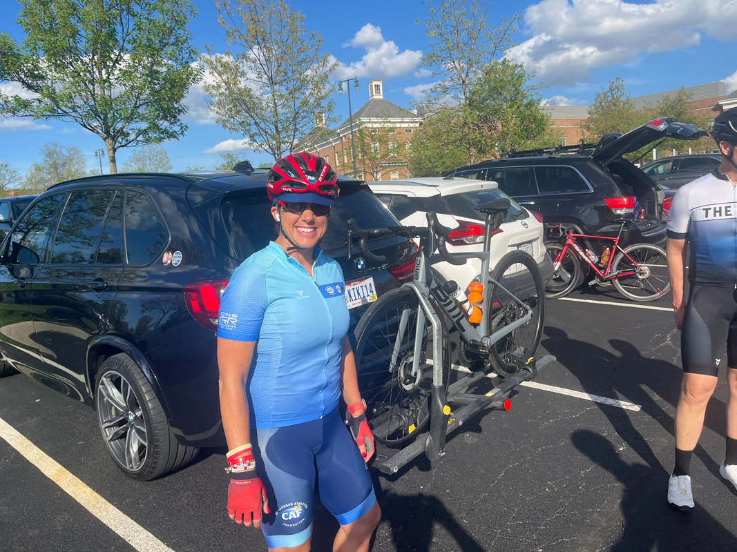
 I use my visits to the woods, to work, as a recovery day. I've noticed that now that I've been increasing my ride distances, standing all day in the woods, isn't allowing my legs to recover. I bought a cheap camp chair so I can sit more often, lol.  I got in a good, 61 mile ride that included the climb on Canyon Road, south of Granville. I also....  ....visited Moots Road just west of Granville to check the progress of the bridge replacement. It doesn't appear any progress has been made since my last visit. Too bad as this is one of our major ways of entering Granville. However...  .....a temporary bridge has been placed across the river so workers can pass. I appears that cyclists could cross too.  The obligatory pic of the bike leaning against a bucket. What a great bike, BH, has been. I'd like to acquire a new one but I'm emotionally attached to this one until it gives me a reason to retire it. It already has Di2 shifting so a new bike would not be an upgrade.  I'm making it a point to visit some of the Columbus Metro Parks so hiked around the Park of Roses. Beautiful!  Having ridden on a wide variety of roads, passing lots of people mowing their rapidly growing grass, I noticed something. No one and I mean no one is using the traditional riding lawn movers. Instead....everyone is using a 0 Turn Radius mower. Having previously used one, I understand why. They fly around the yard!   I got out for a 20 mile ride so I could visit the Intel plant. Wow, a lot of activity, many trucks and adjoining parcels seeing activity too. Part of Intel? Don't know. The other thing I noticed is the quantity of trees being planted, especially along Mink Road. Hundreds.  This being Thursday, after my short morning ride, I headed to the evening group ride where the usual suspects like (R-L) Scott B, Ken B, Nick, Brian & unknown guy in blue jersey. 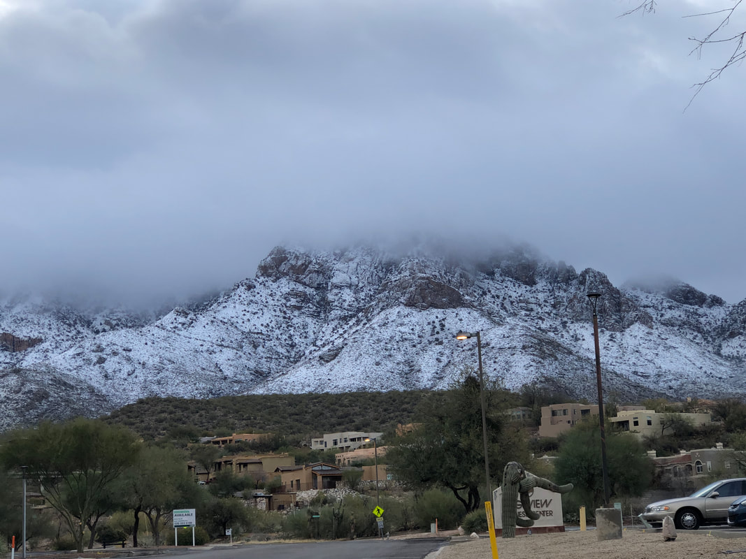 Amanda getting her bike ready after having placed 2nd, in her age division) last weekend in a gravel race. Another of our regular visitors, Peggy C also podiumed. I brought a gravel bike from AZ but now I'm thinking I should sell it. The variety of paved roads is so great here.  Ride organizer, Don N sporting white socks and shoes!  The rivets get called out, than the A group and than the B group, as usual.  I did not intend to do the full route, considering I rode earlier in the day but it was kinda heartening that for once, I did not struggle to keep up prior to departing. Maybe making some progress??? 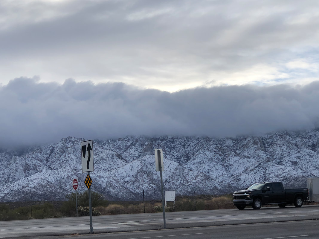 Amazing cloud formations as I headed back to the barn.
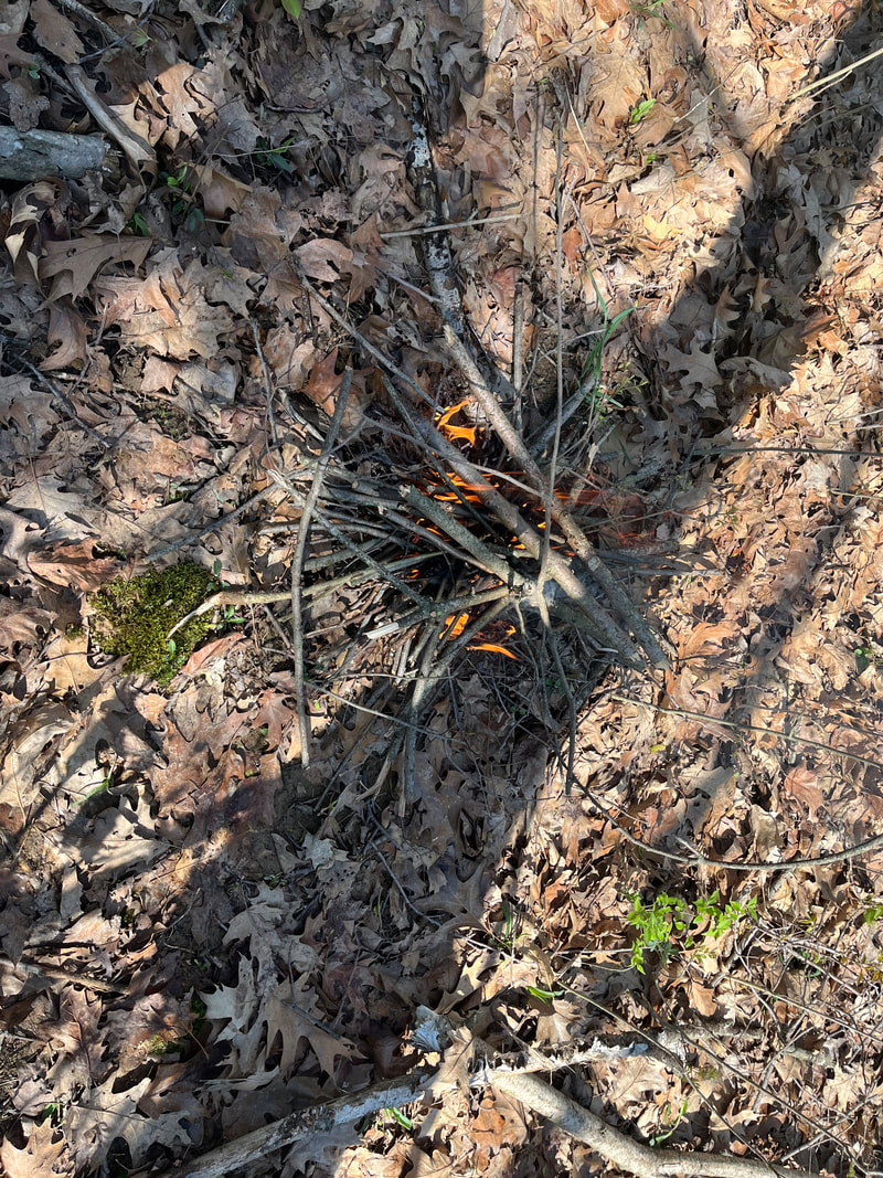
 Best image of the northern lights I have seen with the "OHIO" signal.  Oh, so Sunday was a break from the rain and a beautiful day it was as I rode past the Hoover Reservoir.  Lots of water craft out. I only got in 21 miles because Monday was going to be a glorious day so that afternoon.....  ....I entered my son's creek and began cutting the trees and branches that have accumulated. I love using a chain saw! My only misstep was many years ago when the saw sliced through a pant leg but fortunately, my leg was to the side.  Lots more to cut but enough pieces have accumulated that we'll get a good fire going and dispose of the wood before I cut more.  On Monday, I put in a good, 55 mile ride, having a gentle tailwind going out and then a freshening head wind coming back. Good workout. Of course, two straight days of good weather just has to be followed with rain and so it did. I took my bike to Rick Miller's again for new brake hoods and enjoyed the drive to Utica. It appears the fields are about ready for the season's first cutting.
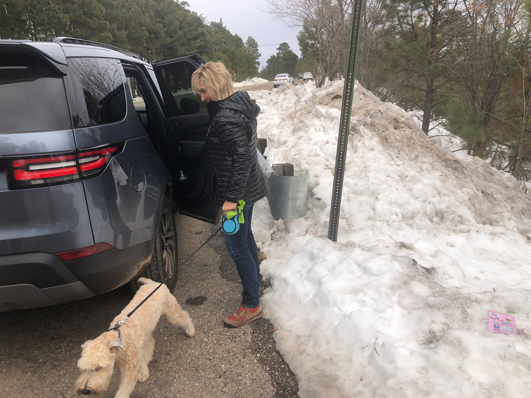
 My mother passed away last year at 103. As executor, my last act was disposing of her 2022 Buick Century, having only 54,000 miles.. I was surprised of the demand once I put it on Craig's List. Sure, the scammers came first (do you accept cryptocurrency and I'm a poor student at Denison U will you accept half price?) but it sold in one day for $4000.  Amy keeps me updated on the comings and goings in southern AZ, including pics of Jack.  Last week, this field was being disced and a week later, green shoots are emerging. Growing conditions were ideal during the week.  Other fields yet to be plowed or maybe laying fallow for this season. That's all folks. Rode Tuesday before the rain, then it rained every day but preparing to go out Sunday morning. It's weird but since I'm in Ohio, I expect this weather so don't get too annoyed.
 While mowing the trails, I pause, confronted by a thick patch of beautiful wildflowers. Nothing to do but keep mowing.  Sunday morning, I went on a 50 mile ride to Utica. Fantastic roads including Reynolds and later, that steep portion, ugh.  I made a loop out of the route so departed Utica via Homer Road and worked my way west and then south. Hardly any traffic and than, hustled to Newark so I could watch....  ....the finals of a soccer tournament in which Anthony was playing. They won, it was thrilling to be there as....  ....he had 3 goals! As an 8 year old in an under 11 league, that's pretty good.  Tuesday arrived and with the evening forecast looking iffy, I did a 40 mile loop. Dang, it is so green. I definitely miss the mountain views of southern AZ but this isn't a bad alternative.
 Near the intersection of Watkins and old 161, a home having signage that says "Pelican" has this odd arrangement of bottles in their front yard.  My beloved "BH" bike needed a tune-up, perhaps its efficiency could be enhanced??? So I visited Rick Miller's shop and had a great time getting caught up. Among other things, he installed a new chain. When telling that to someone later, they asked if it was an "echain", lol. I wish.  I typically arrive about 30 minutes prior to the ride so I can be the parking lot gadfly. Here rolls in Soka! Whoa, I was unaware of teammate Frank's alarming experience when they were in AZ for a training camp. Remarkable he survived the cardiac event.  Larry P and his new bike. I stated it was orange and he claimed it's not. 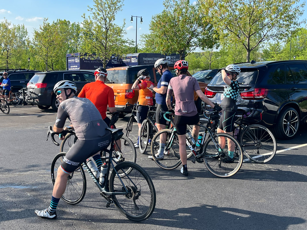 Paul Djupe made an appearance too for the first time this season. It's been great to see people I have not seen for 5 years but some notable absences too. Maybe more "old timers" will come out. 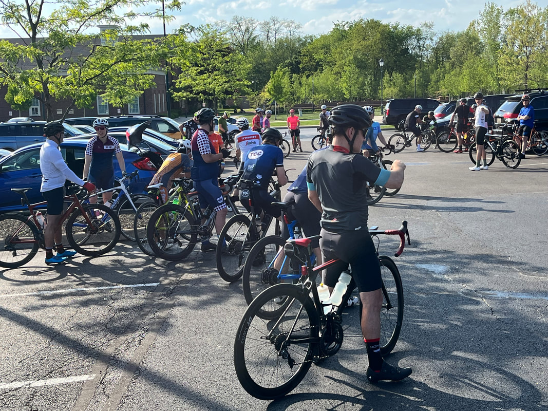 Around 55 people came out which seemed low considering the near perfect weather. 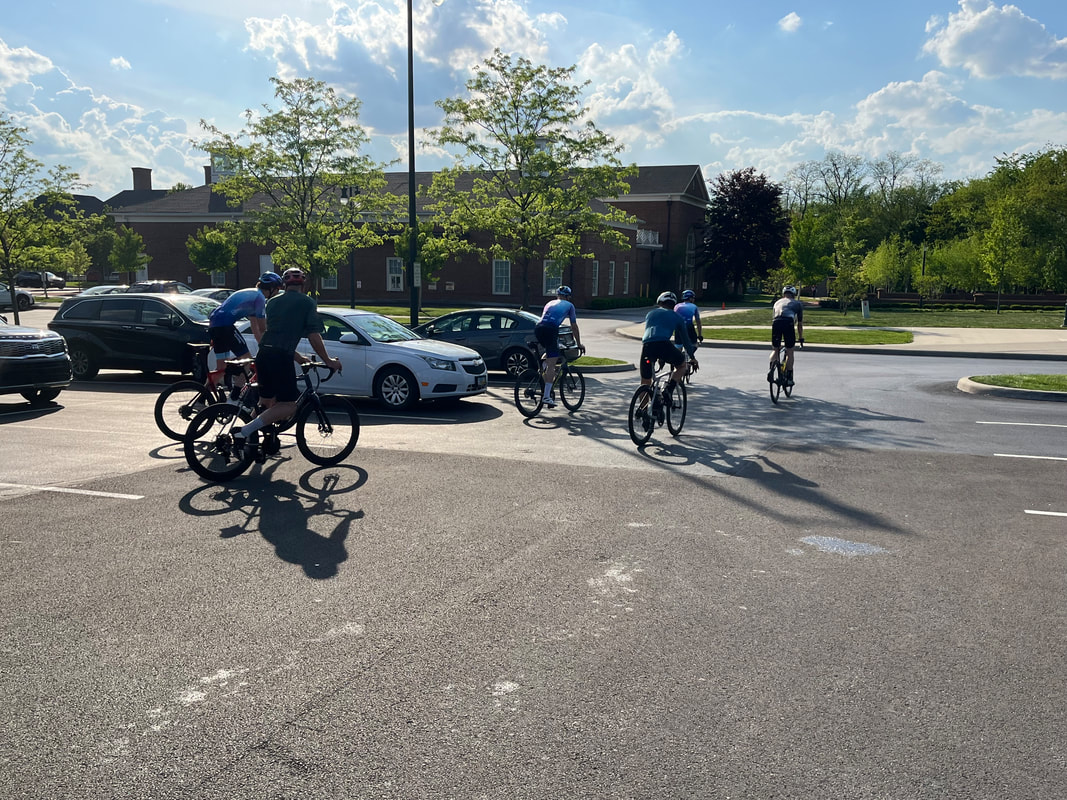 The Rivet group seems a mere shadow of its former greatness, in quantity if not quality. One Riveter, Ken Buddell, rode with the A group as this was his 3rd ride of the day, compiling 167 miles and 10k climbing following the completion of tonights ride....wow!  Mike Weber looks back as we regroup after the Alward Road climb. A friend observed, I didn't lose my cycling fitness overnight and I'm not going to regain it overnight either. I think I have made minor, incremental gains but I'm still one of the last ones to join the regroups.  It was an interesting route of 35 miles which included dismounting at a bridge to lift our bikes over a chain, walk a few feet and again, lift bike over chain and continue on. We continued on the counterclockwise route, reaching the long climb on Jersey Mill Road.  I was ok...almost to the top...slid back a bit...clung to the tail of the group while reaching the regroup point. There, Amanda Orr on the left talking to Andres. Amanda lost 15 pounds and coupled with lots of miles on the bike, is riding very well. Finished the 35 miles with a 19.1 average.
 All is right in our cycling world as Kristie, aka Cookie Lady has returned to the peloton having labored to make and offer us post ride treats. 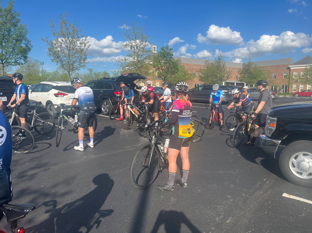 Morning rain gave way to scattered clouds by the time about 40 of us gathered for our "conversational paced" B ride. Sure, lol, sure, quite the conversation one can have when the group average is 20+mph. Not complaining at all as it is the good workout I need. 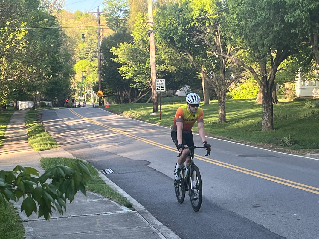 Soooo, it doesn't take a genius to figure out that all the effort required by me to stay with the group for the first half of the ride, can't be sustained yet for 2+ hours. Therefore, as we entered Granville, I took a hard pass on the Jones Road climb and waited for the gang to emerge from that. 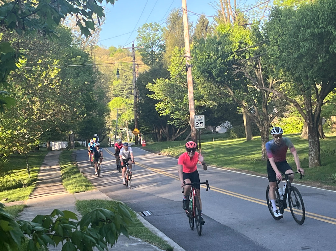 They began filtering in and all took a break with me. Then we sped out of Granville, cutting through the middle school, onto Raccoon Valley Road for the entrance into.... 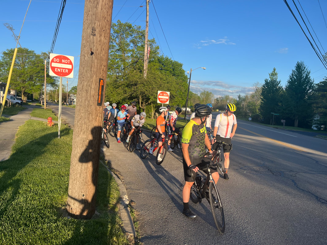 ....Alexandria. I was good to this point in the return but was aware that the long slog up Jug Street was coming soon. I was somewhat less than brimming with confidence that I would hang and.... 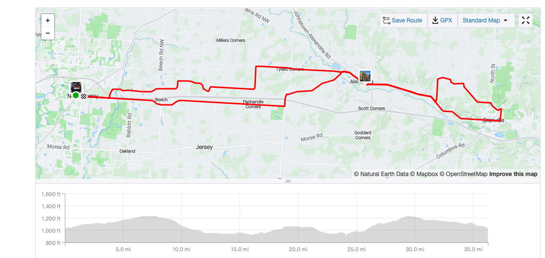 ....I was not to be disappointed in my expectation but of course, disappointed nonetheless. As we approached New Albany, the sun nearly blinding us, I realized I had a shot at posting an average speed above 20 and so I did, at 20.2 for my 36 miles. It's been a very long time since I topped that number and at a conversational pace too, ha, ha.  Sure enough, Kristie threw open her trunk and we dove in. To be clear, these are not run of the mill snickerddoodles but bakery quality treats. Love these evening rides!
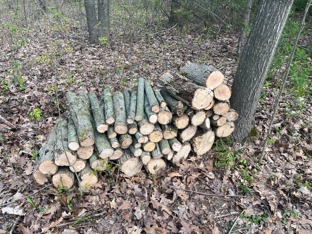 My enjoyable cleanup in the woods continues with still more dead ash trees to cut. Even given 6 months, I don't think I'll finish this project, this year. 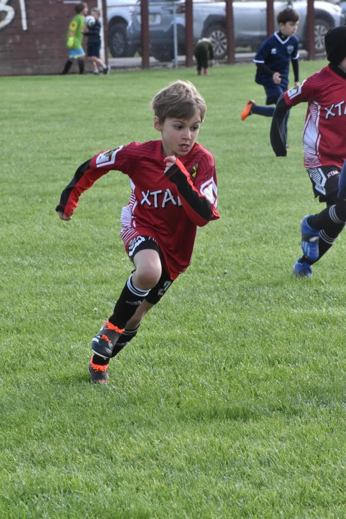 Partly of course cause I'm spending time with the 3 grandsons. I took for granted that I would win a chess match with Ben and almost lost. Then Anthony, above, beat me at badminton. I may have missed a shot or two on purpose but he was thrilled with the outcome. 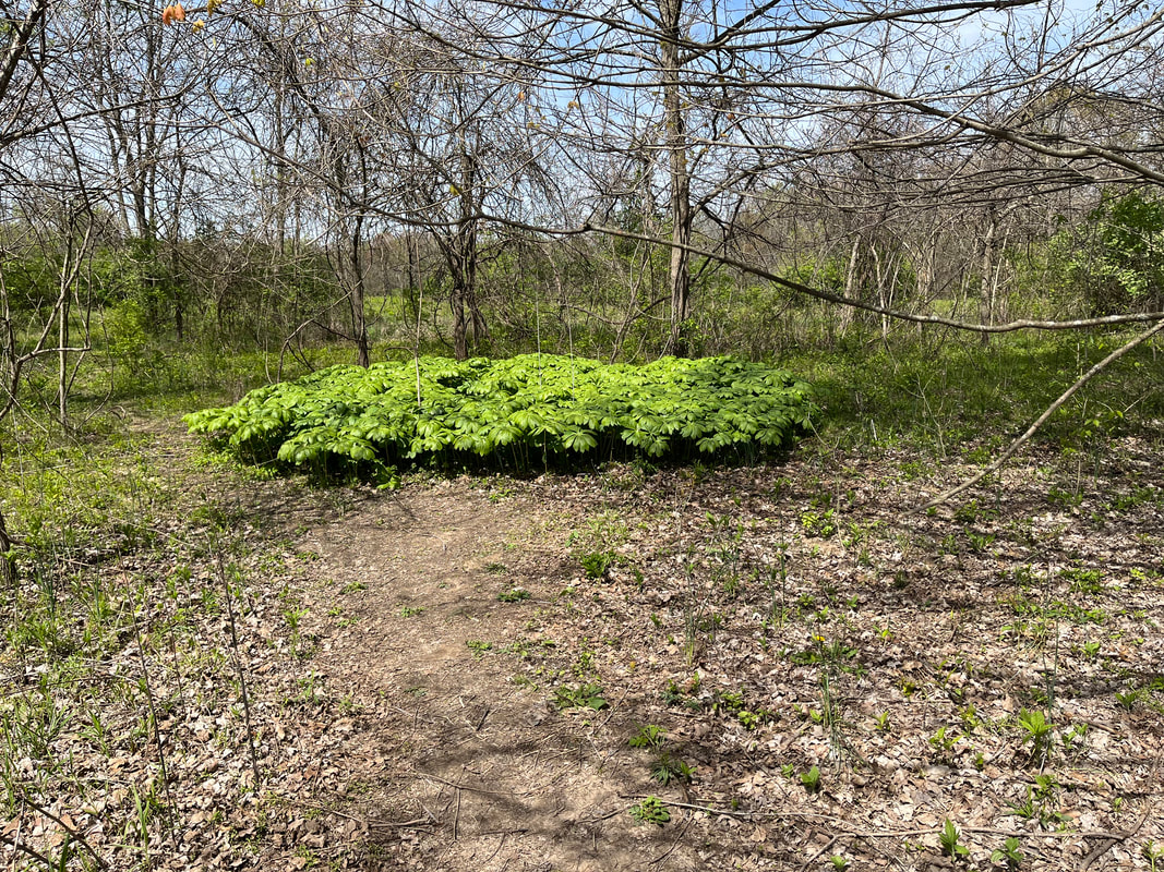 I checked out Highbanks Metro Park and that has a good system of trails. 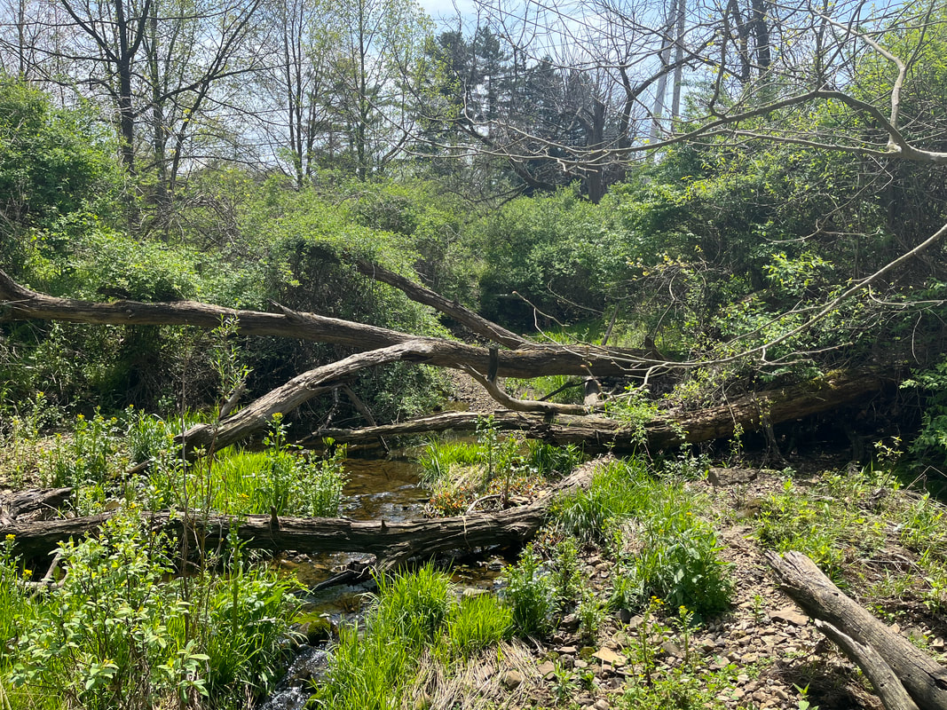 Then, my son asked me to look at the creek behind his house. He wants all this cleared, which doesn't look too difficult but looking the other way.... 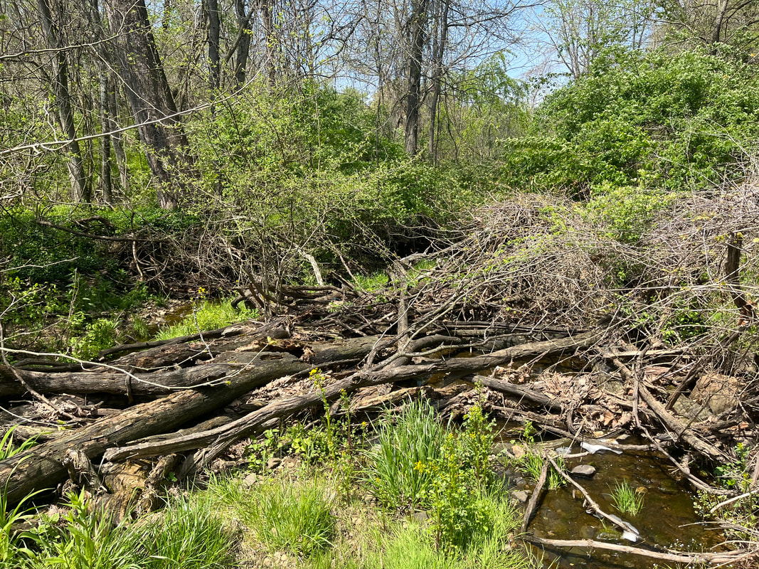 ....yikes! One of my stated reasons for coming back to Ohio was to help with projects and this is a biggie. Looks like fun so I said I'd take care of it. 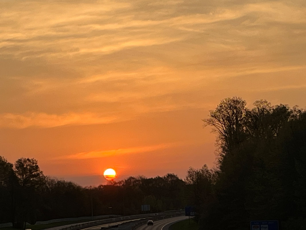 Beautiful sunrise on Sunday where I.... 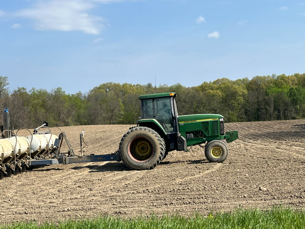 ...headed south for a 41 mile ride to Baltimore. The farmers were out in force on this day, the fields finally dry. Also out in force were winds, gusting over 35mph, from the south. It was a good workout, forcing me to pedal all 20 miles south. Maybe, just maybe I'll experience some minor, incremental gain in fitness. And so, on to the Tuesday group ride!
 I got in a short ride on Wednesday, which included a stop to check out the progress of a bridge replacement project, west of Granville. Hard to say how much longer it will take and all the workers were on their lunch break. 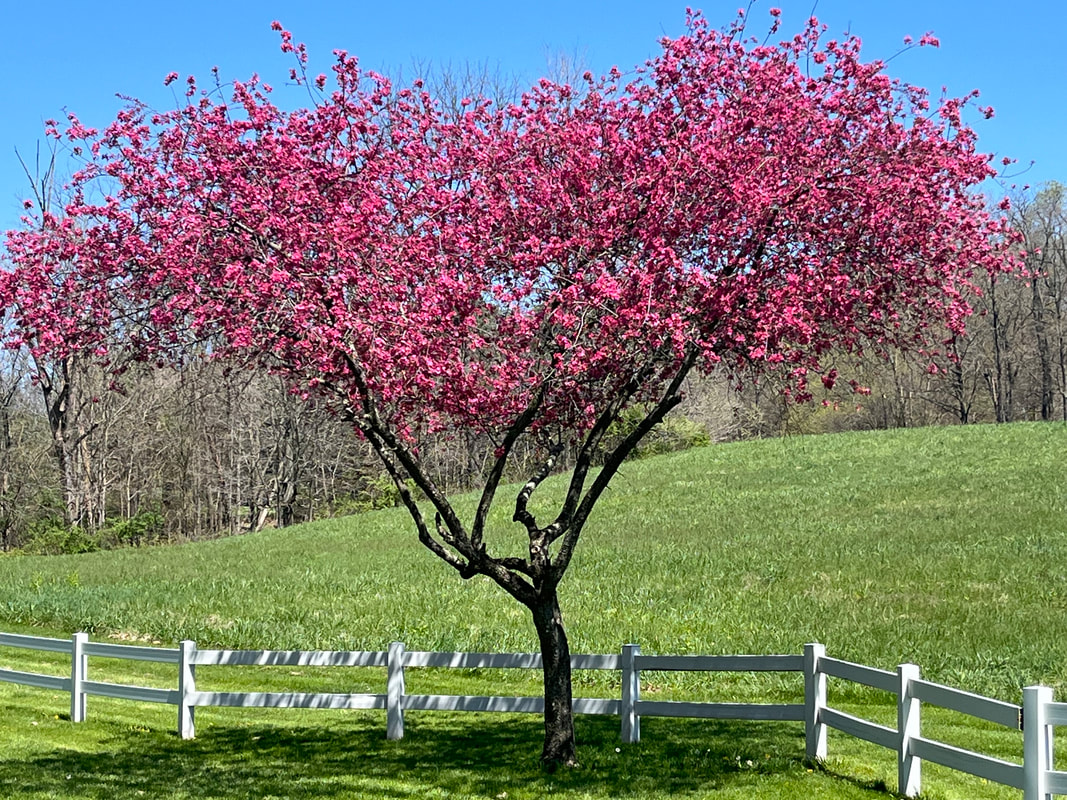 The crabapples, redbuds and other flowering trees have been spectacular this spring. And than, Thursday arrives and....  ....I run into old cycling buddy, Dirty Dan. Typical, he mocks me, good naturally of course, for getting dropped from last week's B group. I assured him it won't be the last but I'll round back into mediocre form eventually and be able to hang. 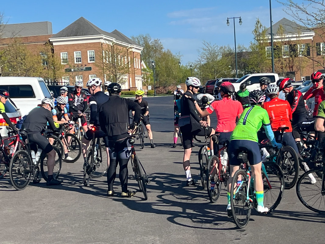 Dan reminded me of a small camera I used to carry so I could take pics during our rides. With my iPhone, it's too awkward for me to pull out and use and besides, I'm always chasing to hang with the group so no time for pics anyway. 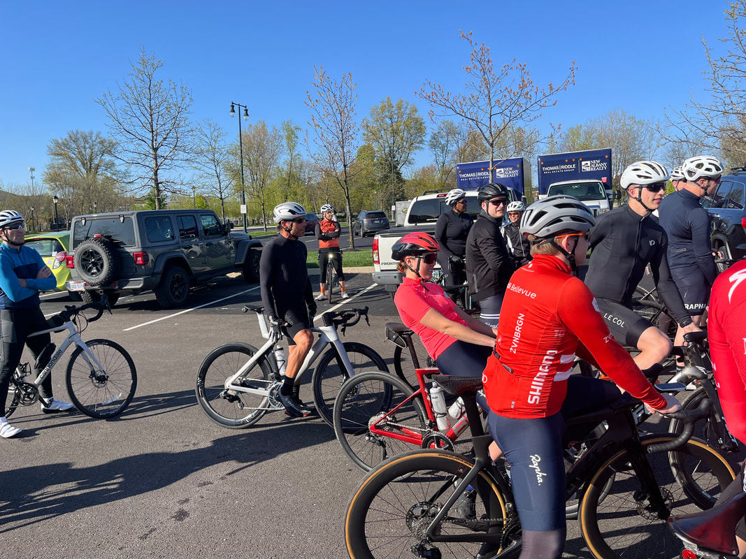 The start temp was 60 degrees for this evenings romp toward Granville. A smaller group than last week's 65, maybe only 50-55. 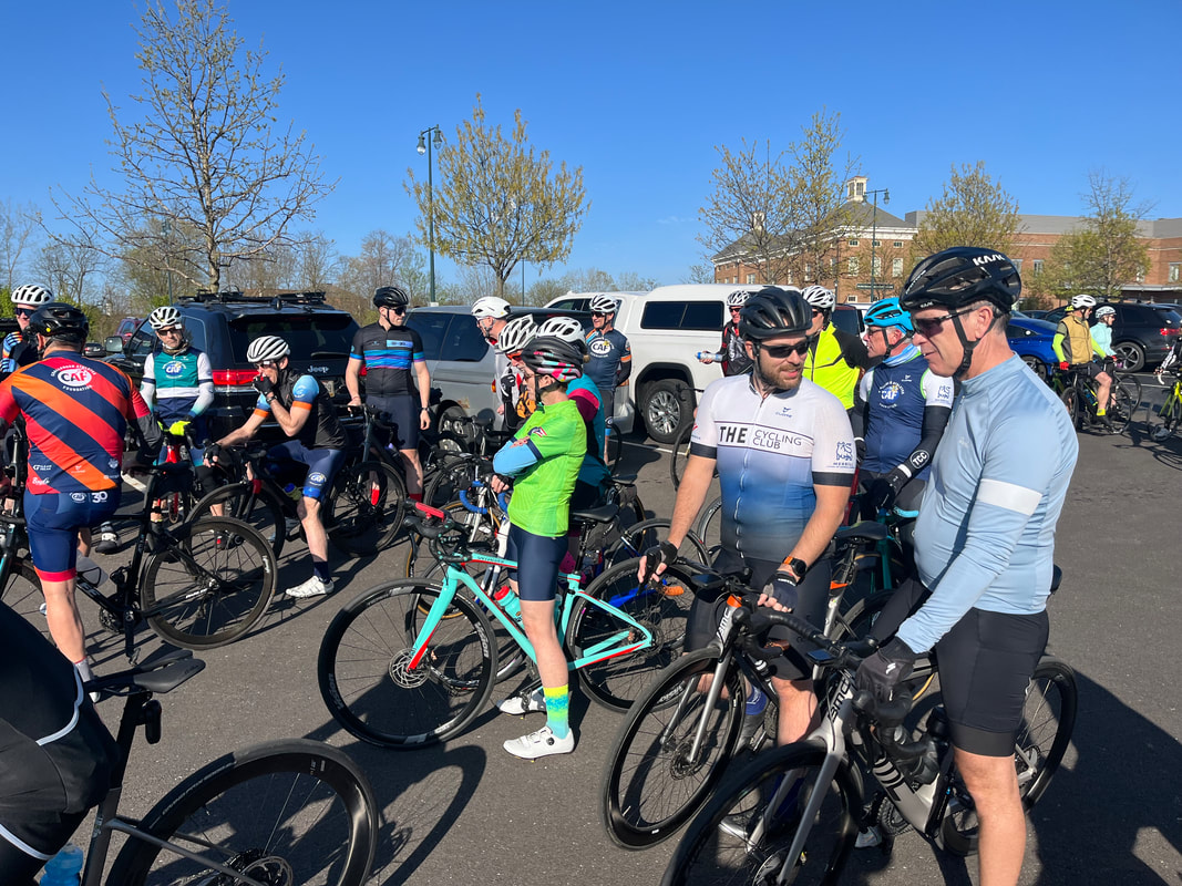 Don N once again gave an inspired pre ride speech. He should enter politics that guy, so gifted is he with talking! OK, so most of you probably visit my silly blog to see if you can see yourself in the group pics so with that out of the way, on to the action report..... 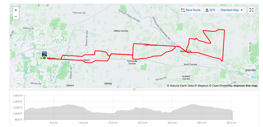 The Rivets took off, then the A group, then the B's were split into two groups so I left with the first. I titled tonight's ride on Strava as "Riding in with the Broom Wagon" so you know where I'm going with this. I was in good shape until I wasn't! I think I fell back on Battee Road but regrouped, than I was hopeless on the Lobdell Rd climb but regrouped, than as I reached the group I stated, "I'm spewing hydraulic fluid" and someone actually looked for it, ha, ha. We got on Jug and I was ok to 310 but then fell back...my endurance sucks, although I wasn't the first to drop back so there! Improvement being made. I and 3 others were strung out but Don N dropped back to form our Broom Wagon and escorted us in as the sun was setting. Finished with 35 miles, 18.8 average and 1400' of climbing. Meantime....  ....check the forecast! Finally.
 Hey gang! Sorry, had internet issues so late with this report. My day began, starting a small fire than soon a raging fire so I could drag more brush onto it and begone!!! Awful, briers and thorny bushes. I've managed to tug and yank on them without slashing my face so that's good. 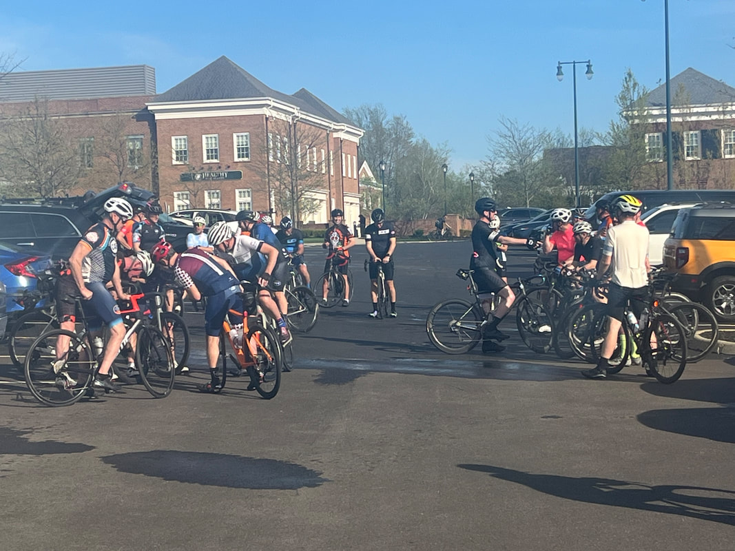 And then...on to the Thursday Cycling Club group ride. Beautiful evening as 65+ show up for a 32 mile ride to the east...well, always to the east cause to the west is Columbus. I've been pretty good about remembering names although I did refer to "Jonathon" as "Carlos" but that's been my only mistake...so far. 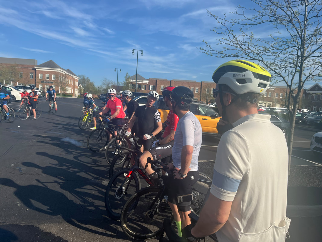 We line up to hear.... 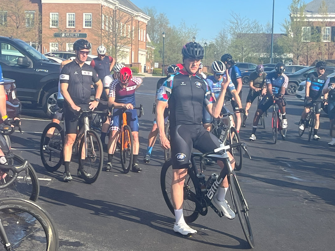 ...Don give the pre ride instructions. Don does a good job, not quite as good as when I assumed the role but almost, lol. Don said some nonsense about everybody taking 1-2 pulls to which I replied, "Not all of us our that ambitious." Ha, ha and so I wasn't, securing my spot, drafting. 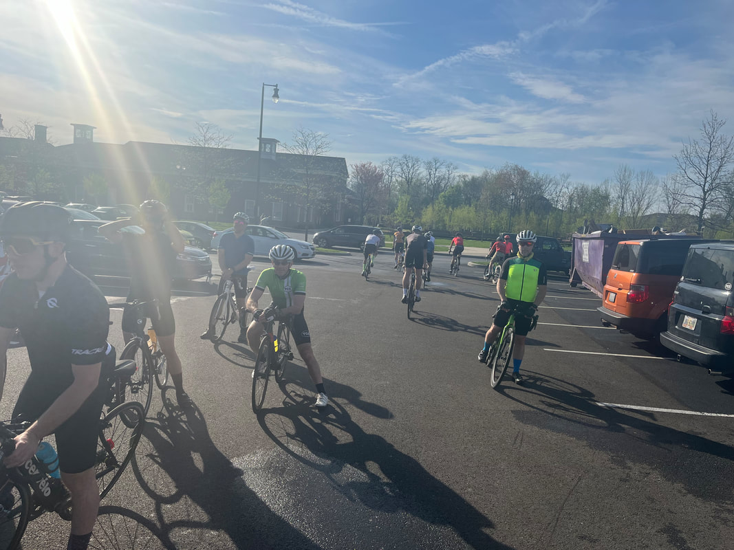 The Rivet group was called to exit. Oh, I remember the days when I too....ok, not ever but I was the person responsible for coming up with the group name of "Rivet". There was a time when several would show up and just destroy the "A" group so I formed a new, faster group and it has lasted. They'll average around 24mph for most of the routes. 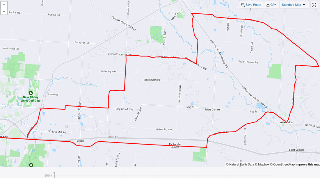 After the Rivet and A groups departed, I slotted in with the first B group. All went well until about mile 18 when during a descent into Alexandria, I drifted back and then could not catch back on. The group paused at the lone Alexandria light but I didn't quite make it and than got in with Steve and some other guy and we waited at the top of Jersey Mill Road for the 2nd B group. Now that was fun as we breezed out 161 and entering New Albany, my average was 19.6 so that was satisfying. Need to add a bunch more miles each week, if only the weather would cooperate, coupled with being a weather weenie. OK, I'll be far more prompt with the reports, promise.
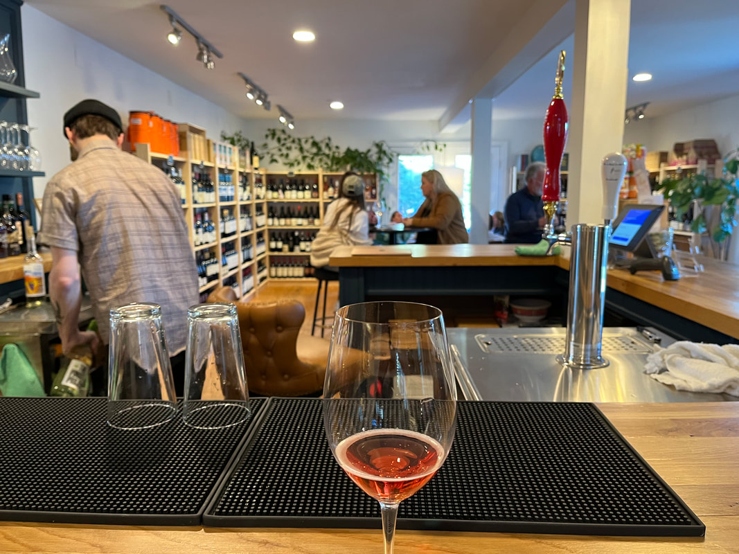 Granville has a new wine bar! I & 2 children enjoyed a glass of wine as I contemplated my first group ride in OH, in 5 years. You would think, a guy coming from southern AZ would be fit as a fiddle but alas no. For a variety of reasons, I struggled to reach 100 miles each week, usually well short. 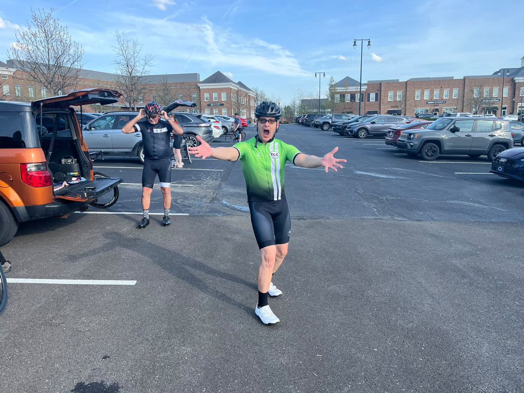 With absolutely no prodding from me, the ride organizer, Don N, allowed his emotions to get the best of him as he greeted me. Truthfully, it was as if I never left and I throughly enjoyed reconnecting with the gang. 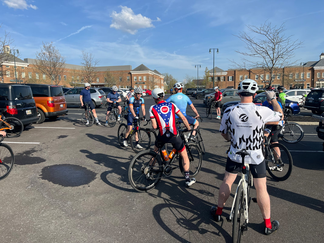 There were 43 of us for tonights journey through rural Ohio. Rather than have 3-4 groups, the Tuesday ride has a main "Conversational B" pace group and a C group. This evening, I'd have no conversation during the ride and as one guy tried to talk to me, all I could say was, "I'm too busy being exhausted"! 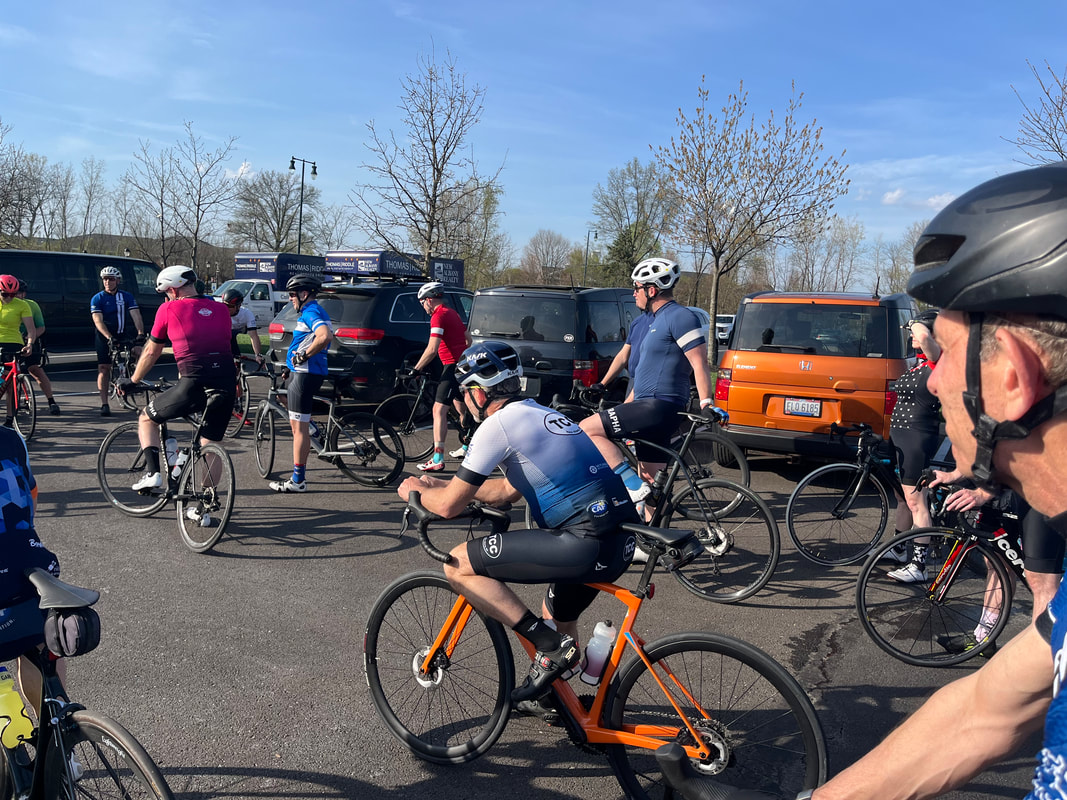 My expectation for my performance wouldn't even register on a highly sensitive Richter scale. But, we headed out "Old 161" and I managed to hang in until we crested the high point, then descended into Alexandria. Hey, much better than I anticipated but then a left turn and the climb on Mounts but heck, I hung in there too. Than a right on Lobbdel and that screaming down hill, on to..... 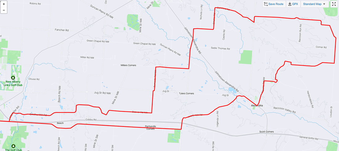 ....the kinda long Battee Road climb where.....I spit the bit. Steve Nelson hung with me so that was nice, even giving encouragement like, "You can't do this!" Nice. 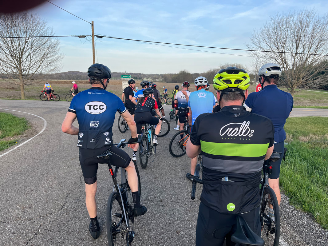 The group eventually regrouped at Loudon, just north of Granville. Looking back.... 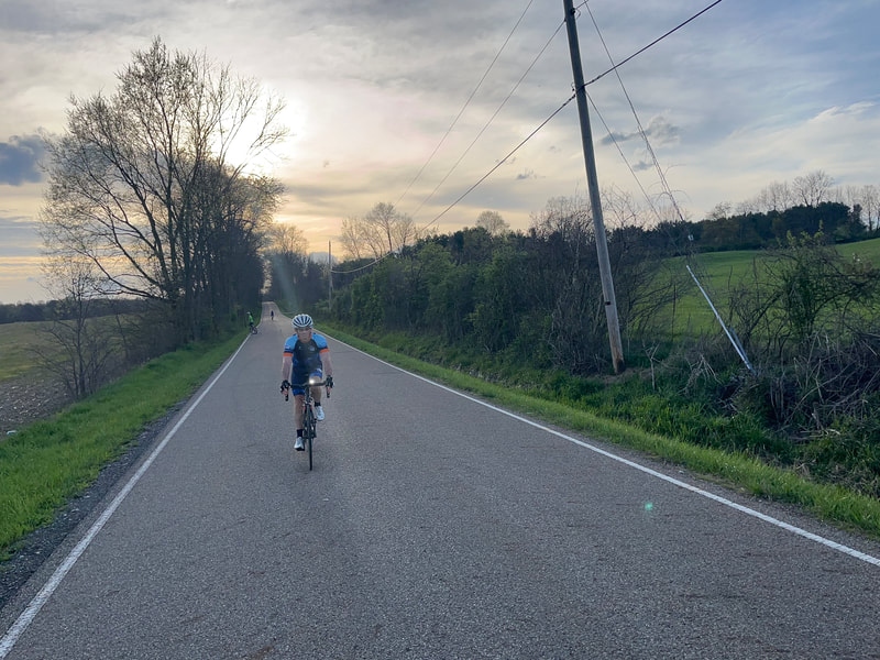 ....I wasn't last but.... 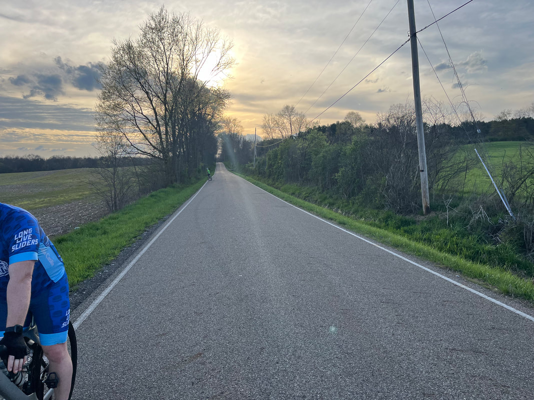 ....also, there weren't a whole lot of cyclists still arriving. I dreaded what was to come, ugh, Stone Quarry Road. I didn't even try to keep up, despatched out the back before the climbs began. There I was, utterly alone in the wilderness between New Albany and Granville where it is rumored.... 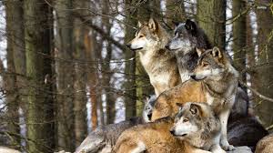 ...packs of wolves roam, looking for wounded antelopes like me but wait!!! What's that ahead???? Good guy Steve Nelson waiting to nurse me along...what a guy! With the hills behind us and some encouragement from others, I stayed with the group, finishing with 36 miles and an 18.6mph average. I was actually kind of encouraged. True, I had to turn myself inside out to stay with the group but given my sad state of fitness, there is no place to go but up, well, hopefully. 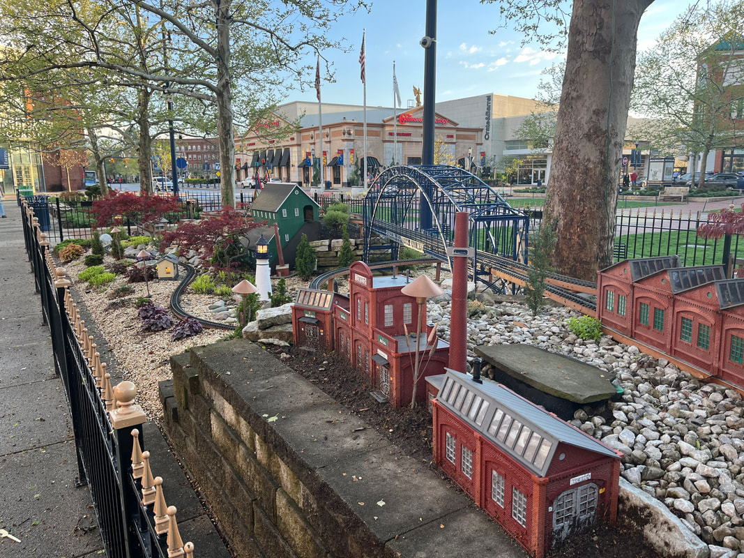 I visited Easton Towne Center. Wow! Very impressed with the selection of restaurants and retail, including this train feature. With that, obviously the Tuesday ride is over and now, the famous Thursday ride on the horizon.
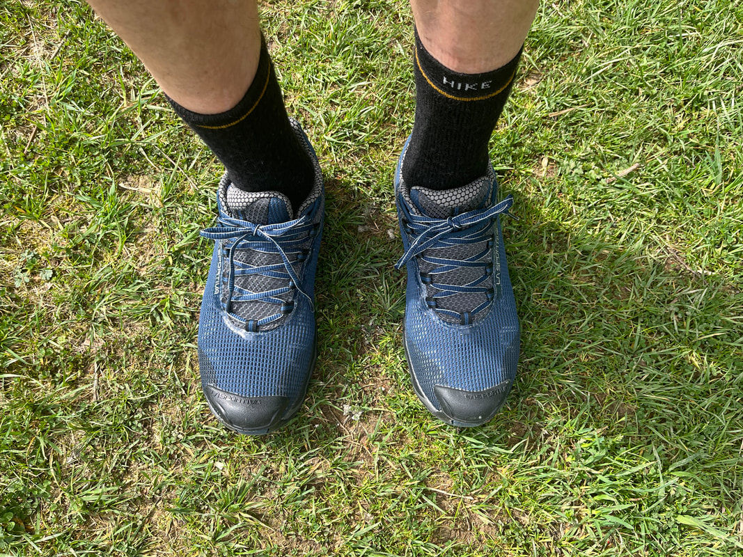 The visits to my silly blog have ticked up and I suspect that a is because the Tuesday group ride has come and gone and a few people are anxious to read about it. Meantime, it was new shoe day at the Denison Bio Reserve. 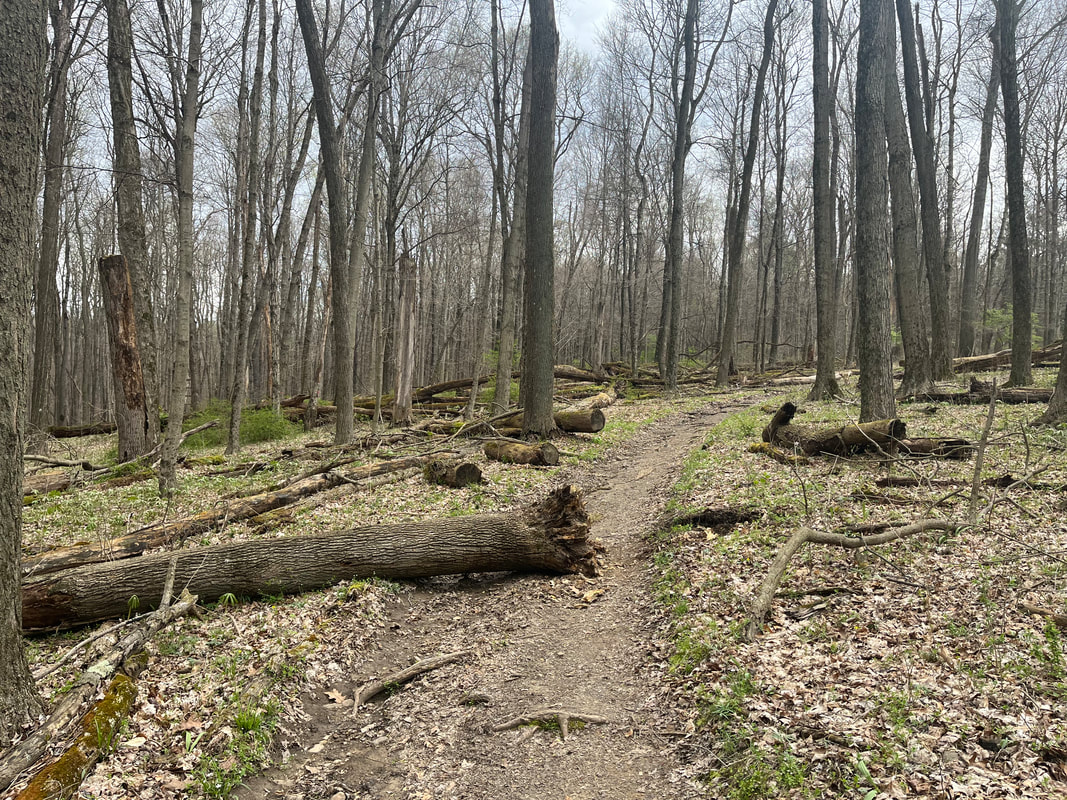 It was great to run on soft dirt trails and leap, awkwardly like a wounded antelope, over streams and logs. Also nice not to worry about a rattlesnake, poised to strike behind the logs. 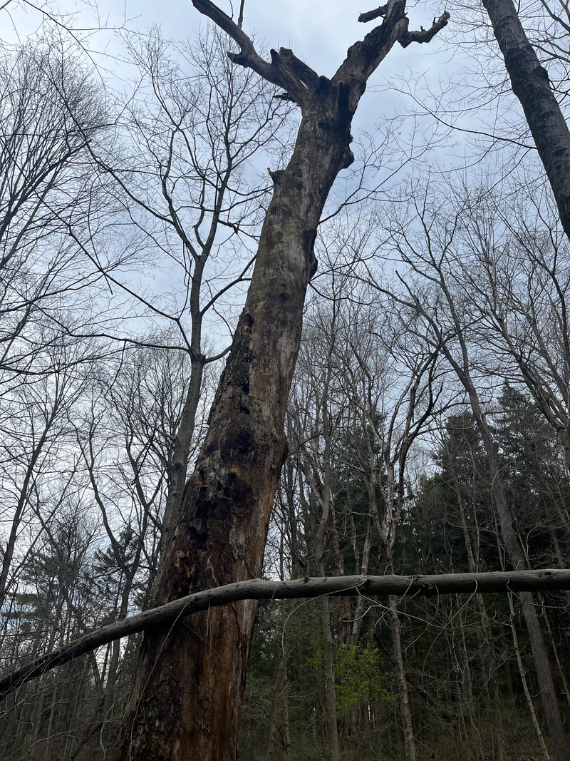 A long dear tree, soon to fall over. 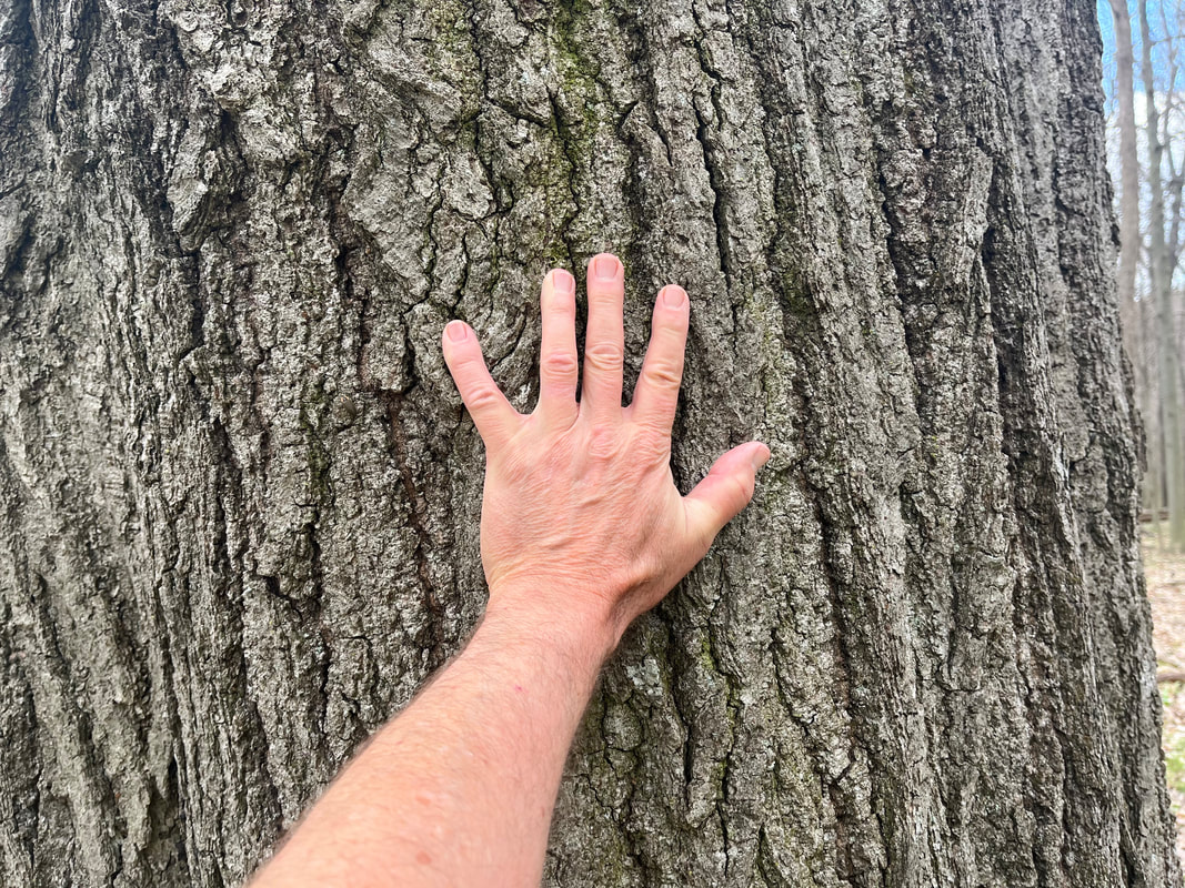 The trees are massive. Some of the most mature examples of oaks, maples and.... 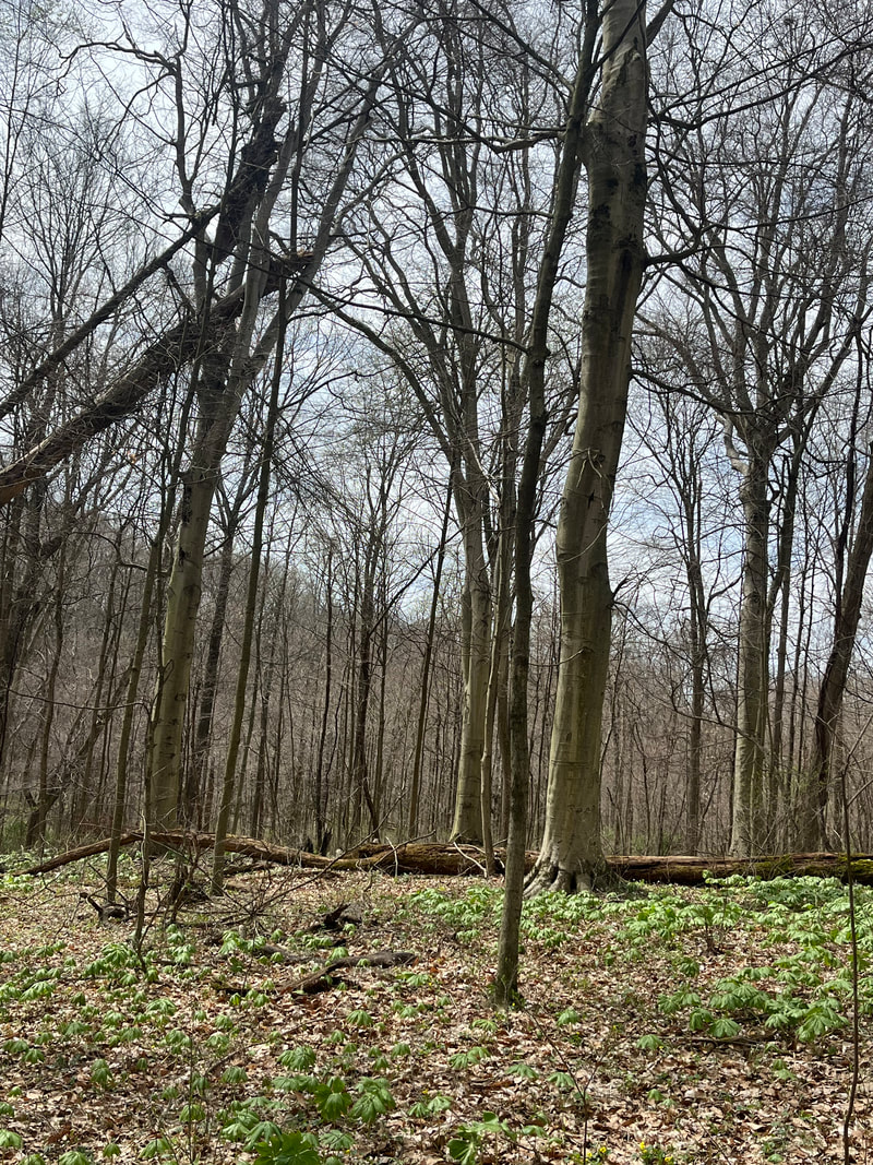 beech. Got in 4.5 miles on this Sunday before.... 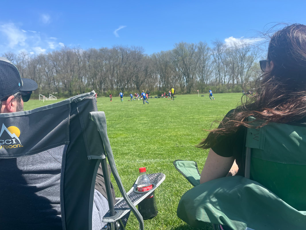 ....watching a soccer game, so crowded I had to sit in the second row, lol. Then.... 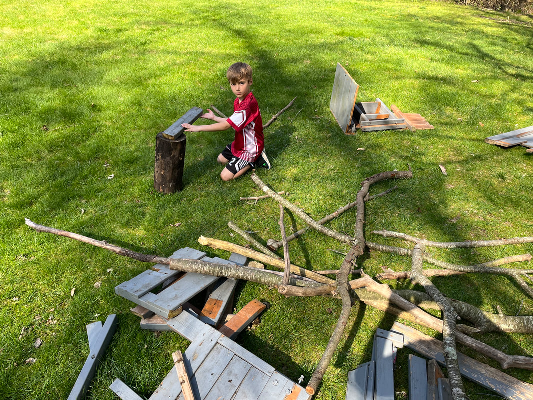 ....to Anthony's to play with him in the backyard. Then out to dinner with family. All is going exactly as hoped and planned. And now, on to the group ride report.
|
